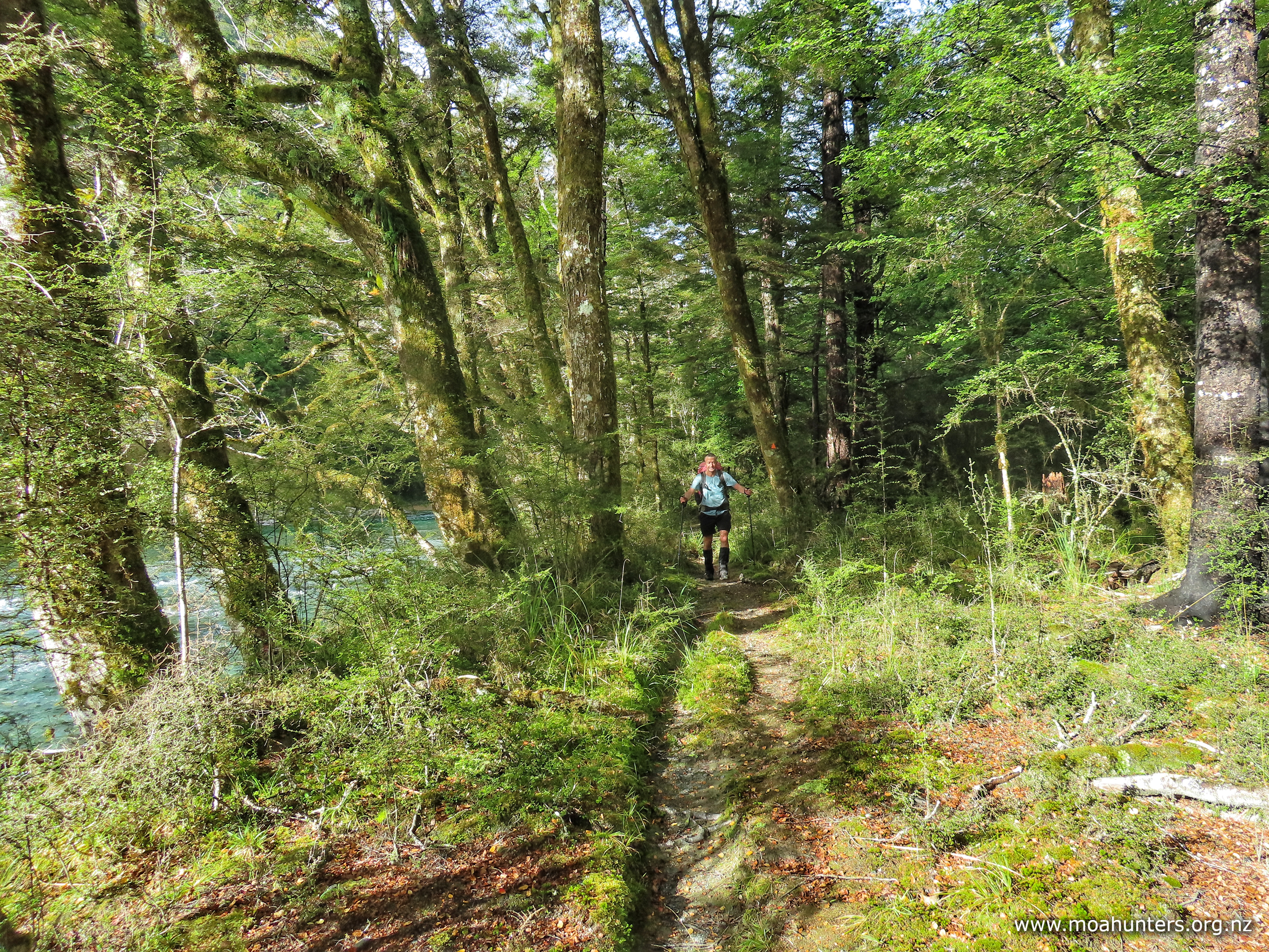
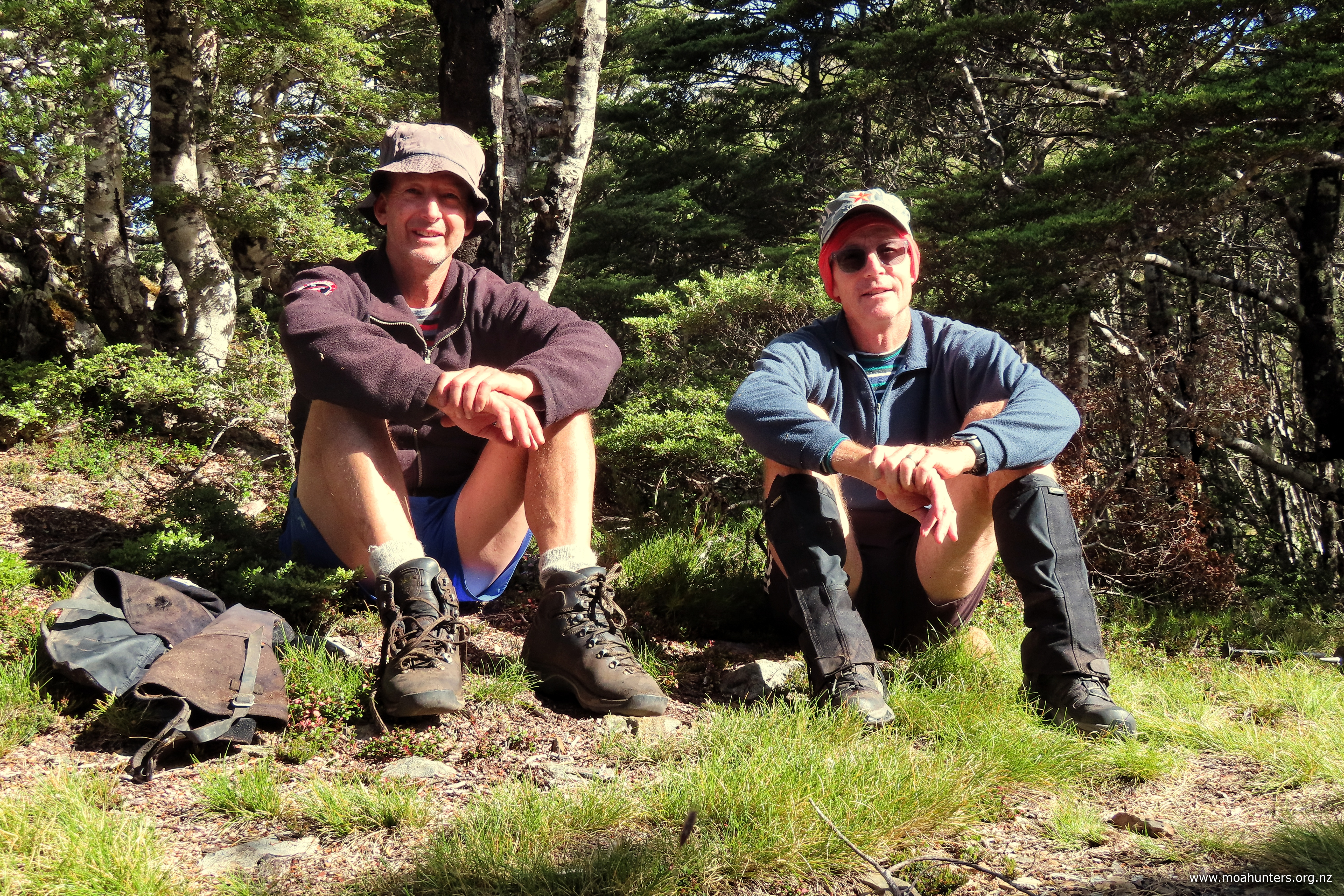
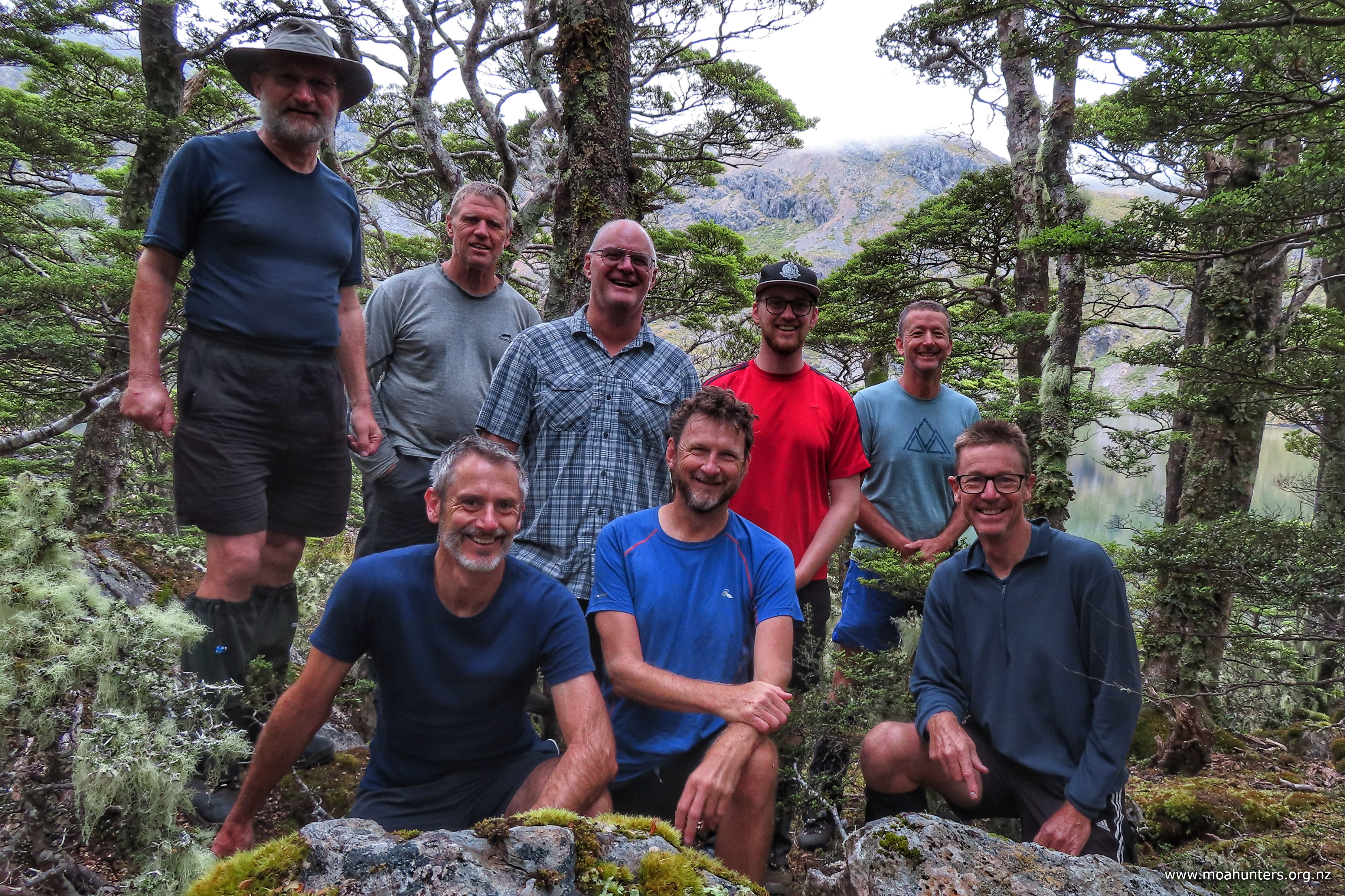
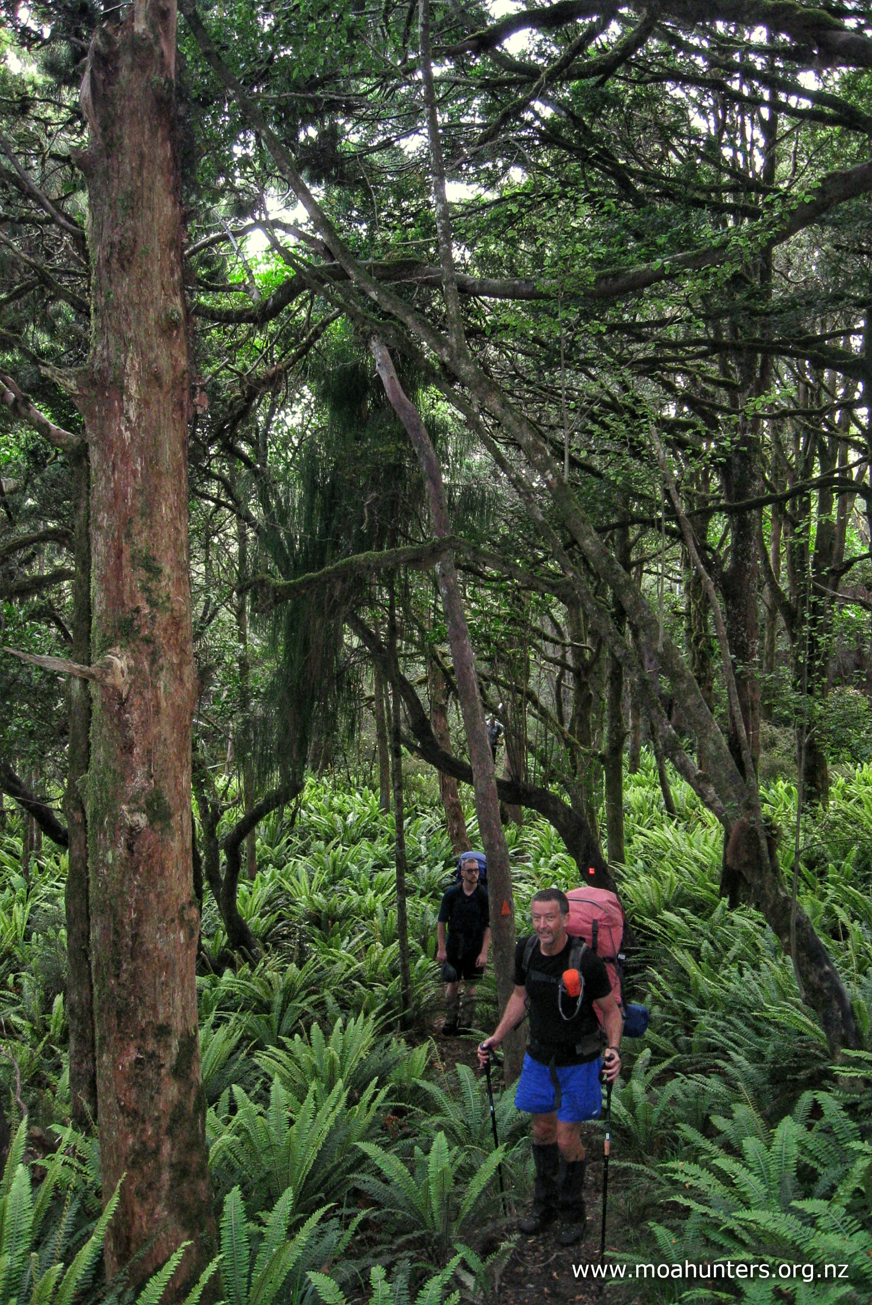
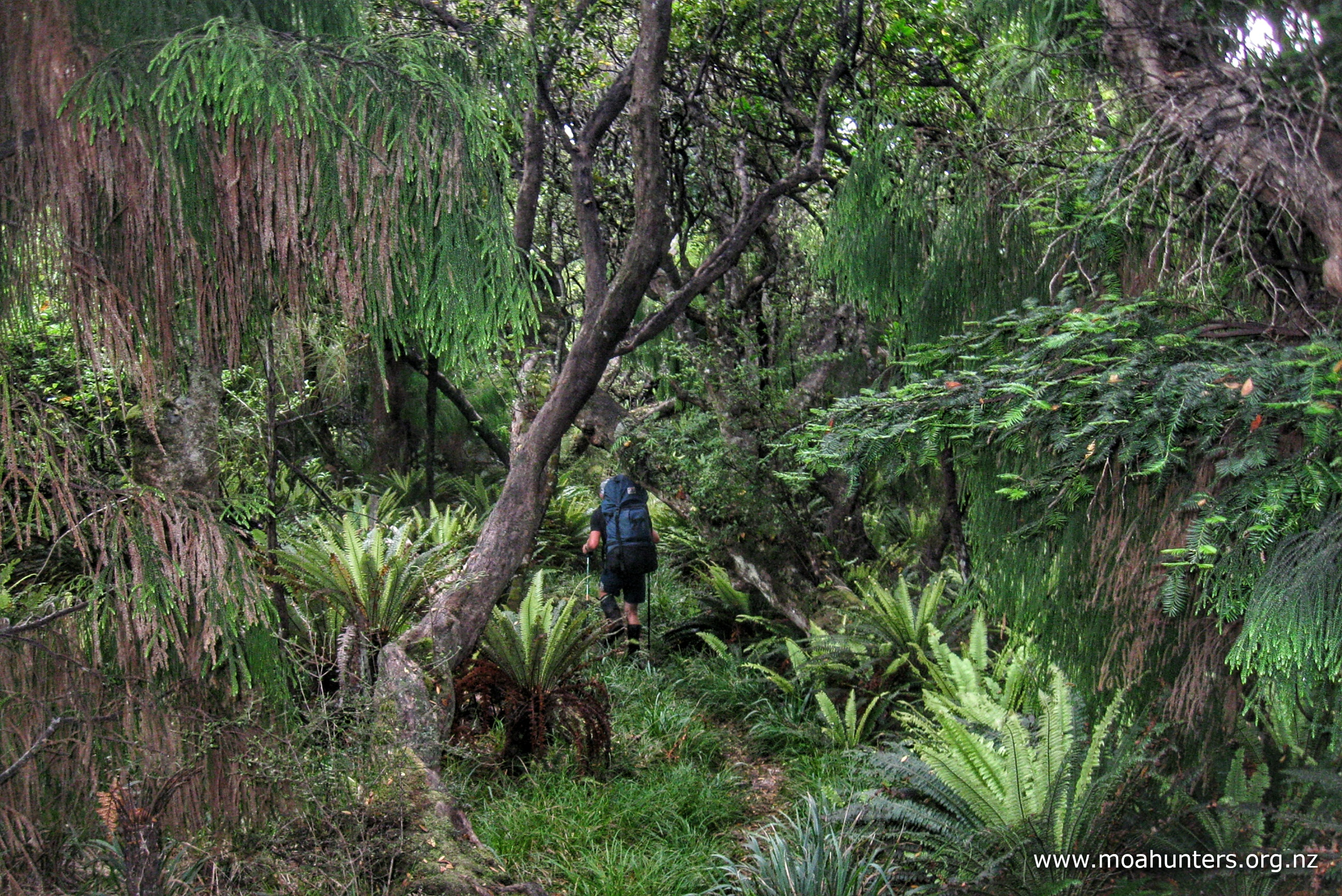
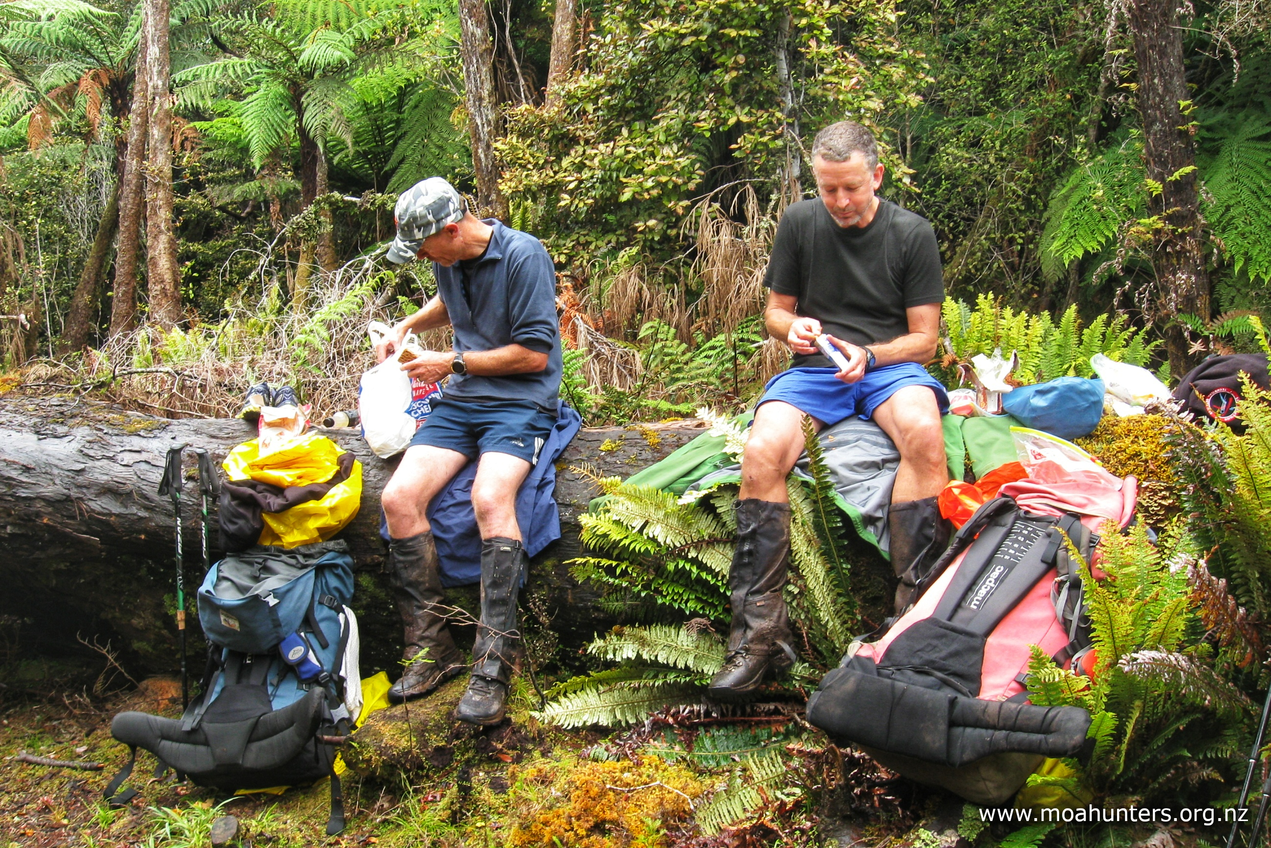
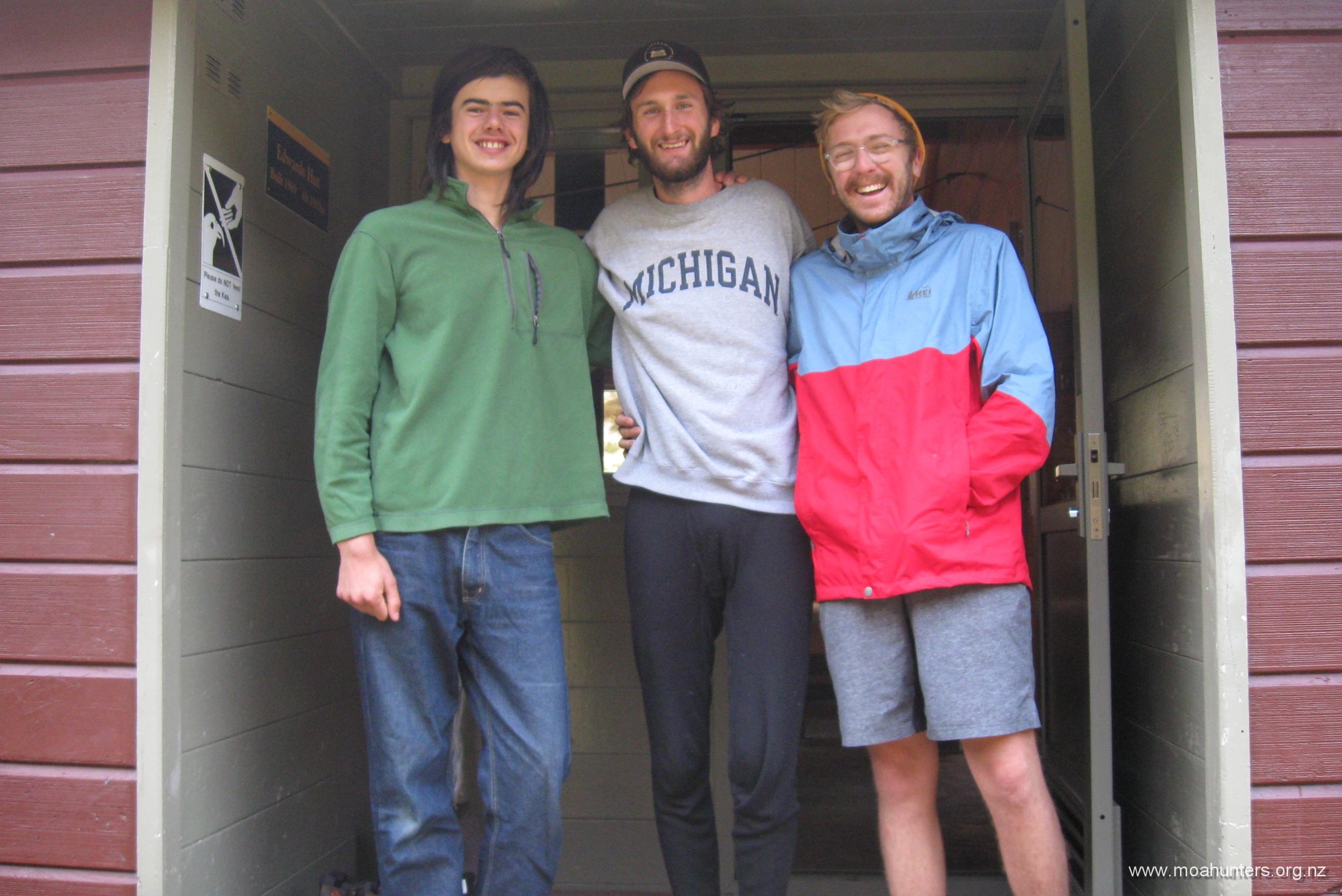
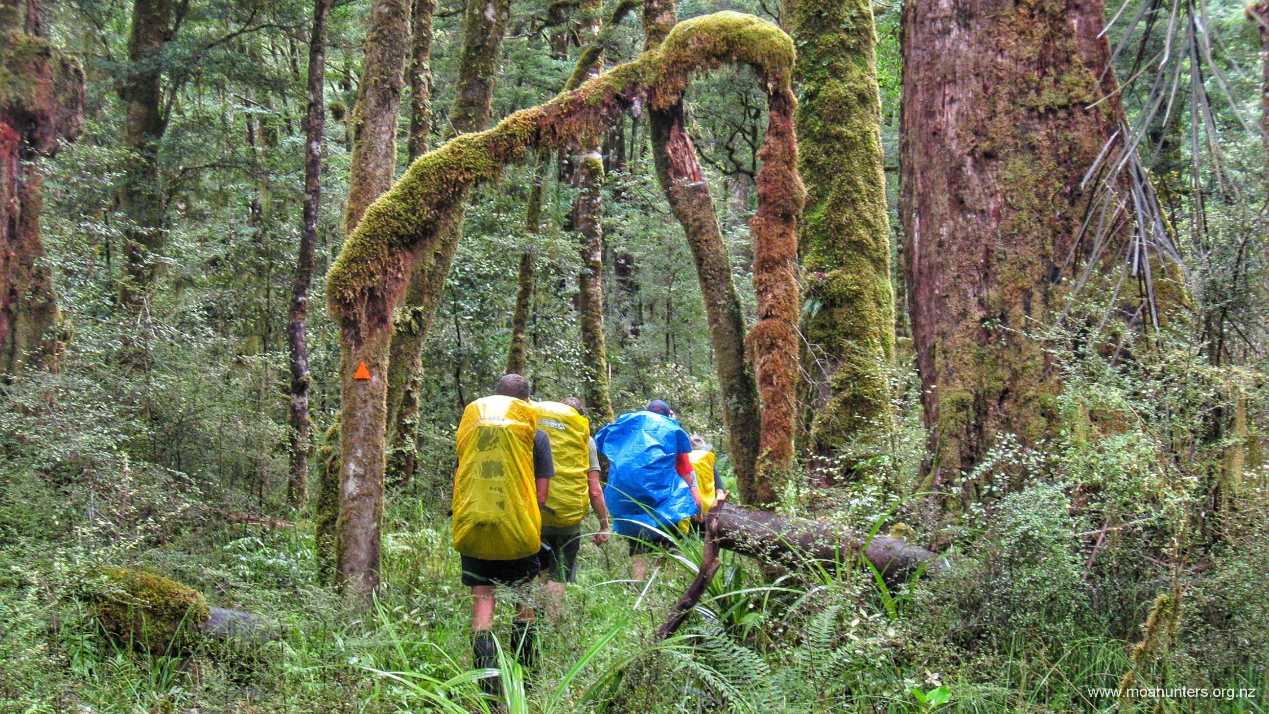
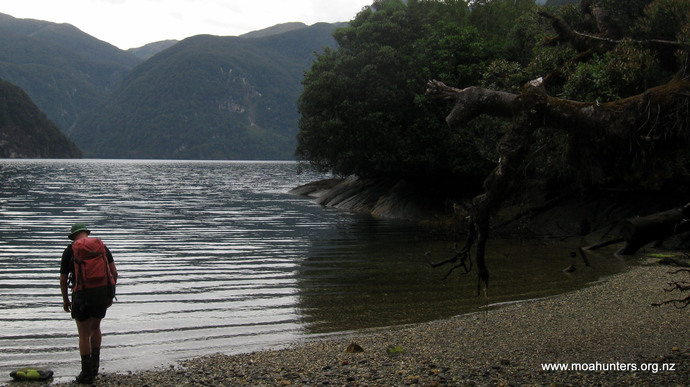
Many years ago, perhaps a few days after the dawn of time, or if not, shortly after the dinosaurs went extinct, Chris, Paul and Richard walked the Three Passes in what is now regarded by historians as the third official Moa Hunt.
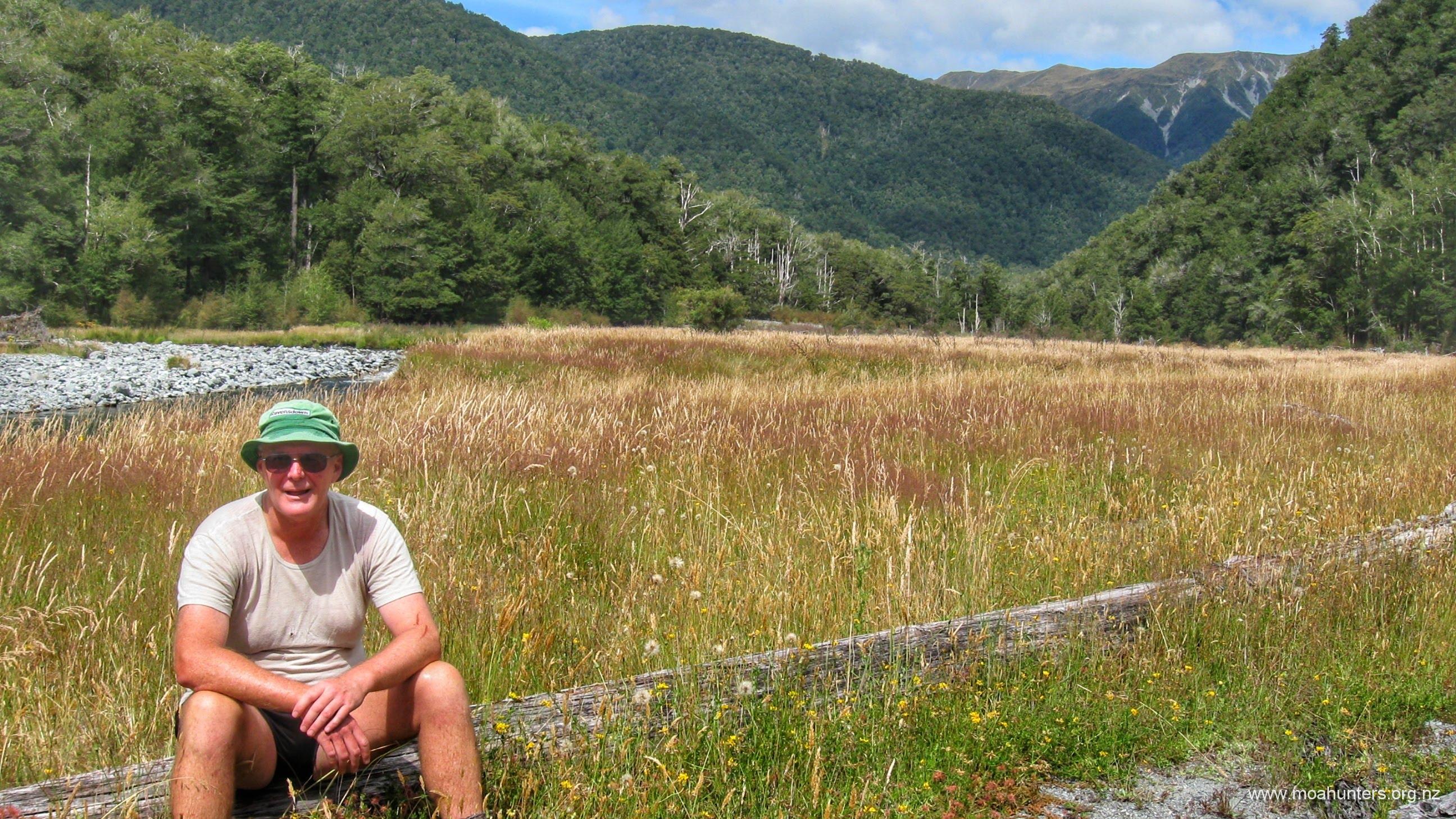
Somewhat more recently, oldish Paul and somewhat younger Luke tackled the Three Passes together. A father and son adventure.
However, rather than walking out to the West Coast, they side-stepped the Arahura and Styx, opting to nip over Pope’s Pass into the Taipo, opening up a multitude of alternative and possibly more convenient exit points.
This little bonus write-up is not a full Moa Hunt article, but nicely covers off what to expect if you choose to follow in their footsteps.
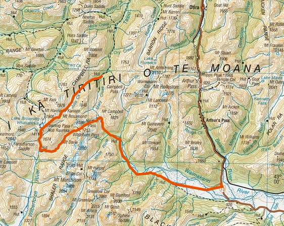
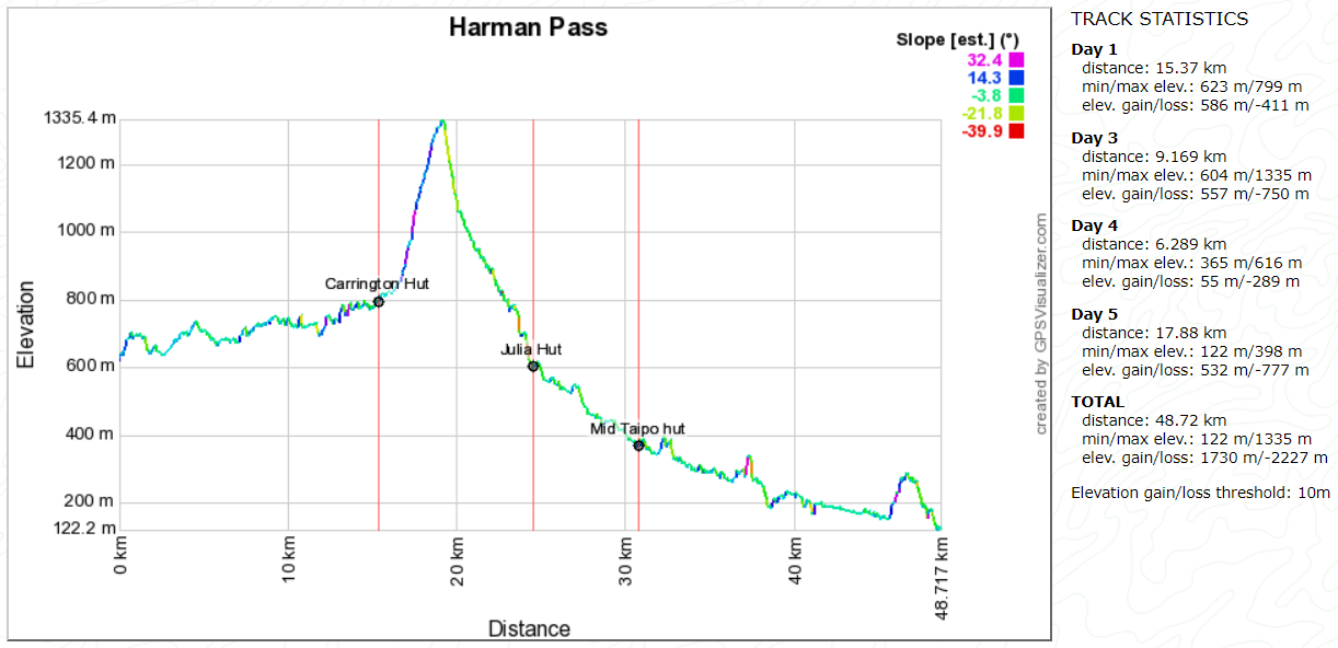
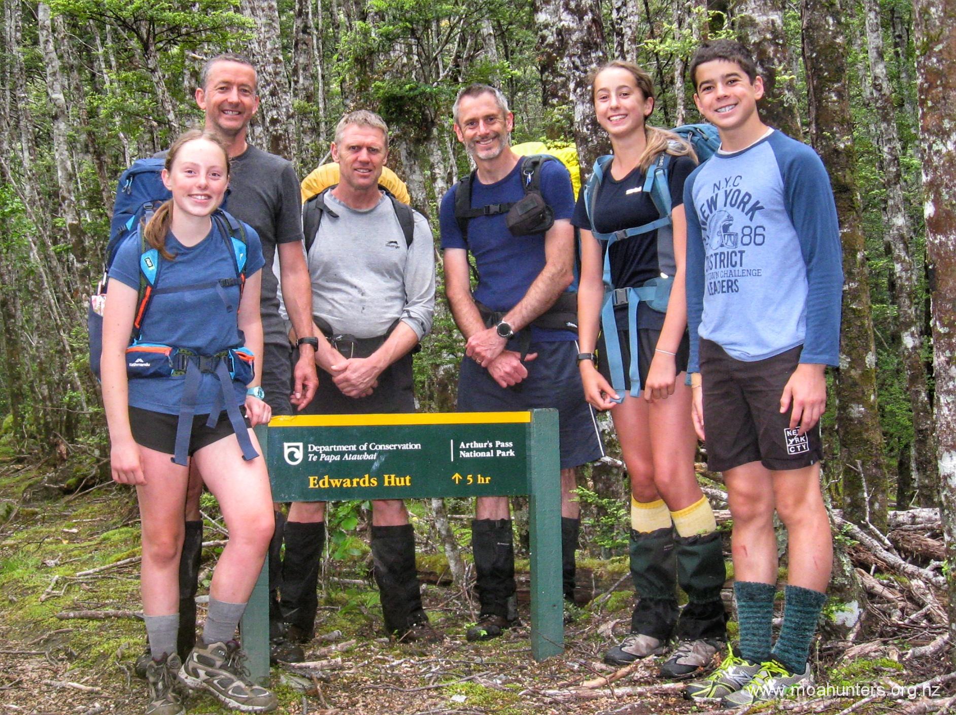
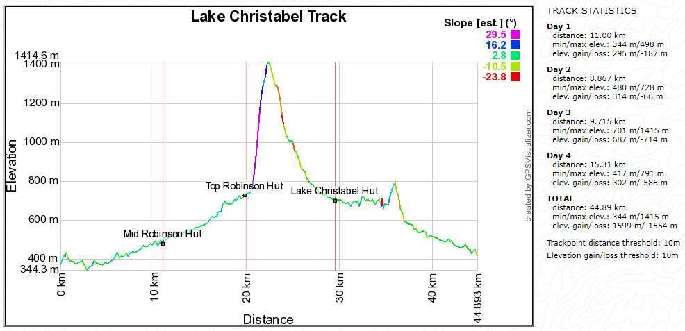
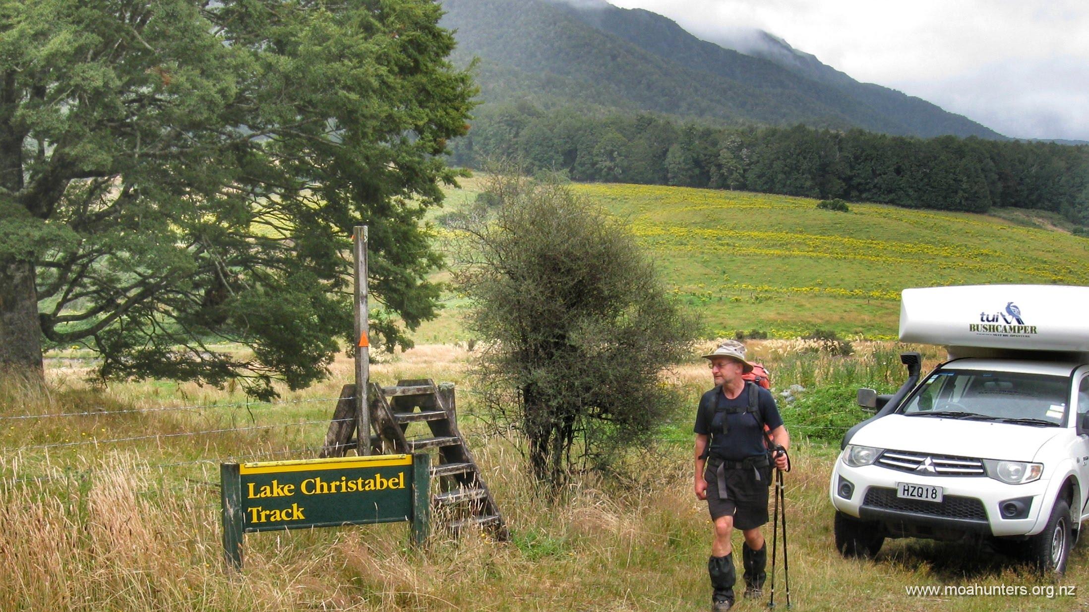
This route makes an interesting variation to the classic 3 Passes trip, with the added bonus feature of being able to return to your vehicle at Klondyke corner, if you choose to return over Harman Pass.
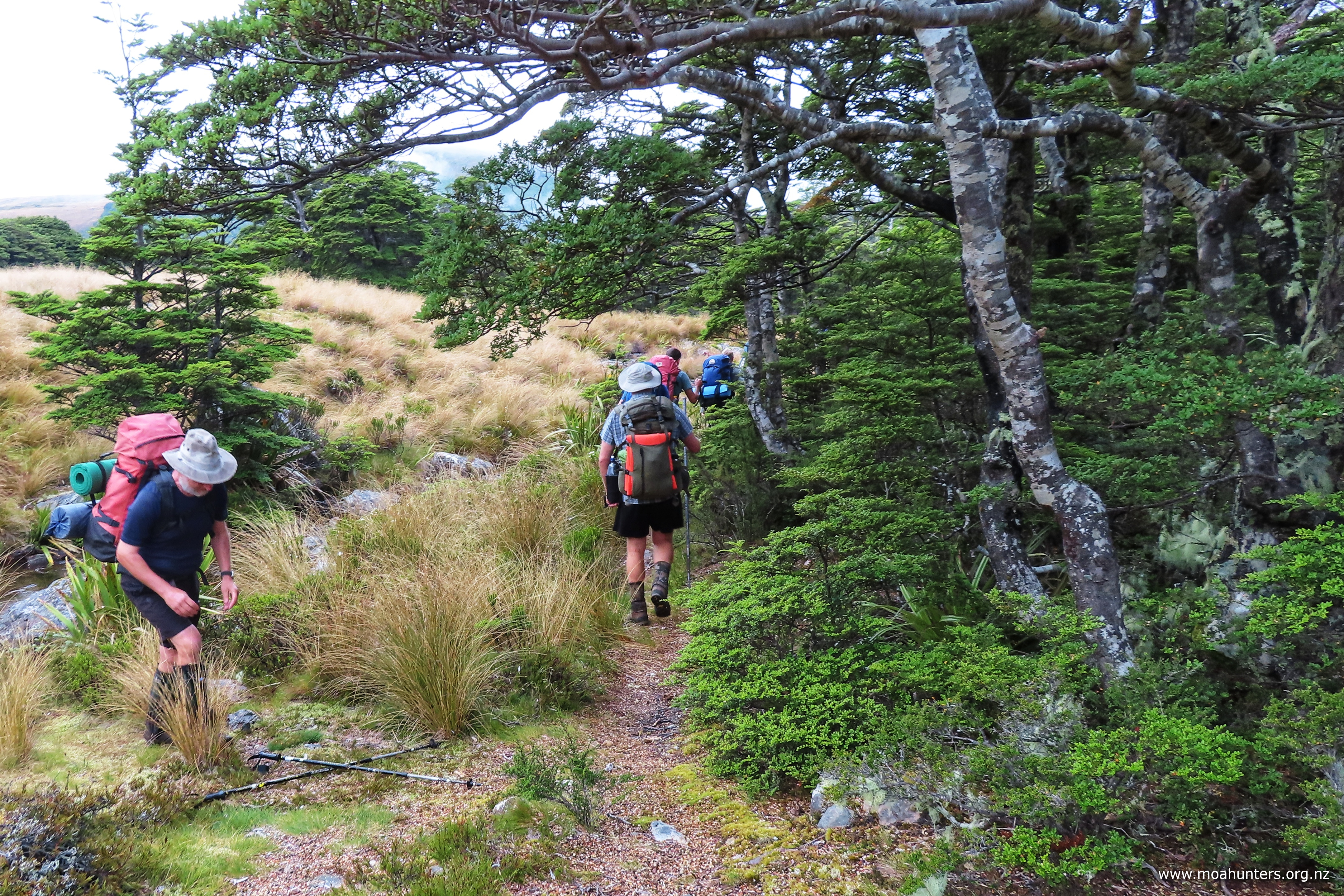
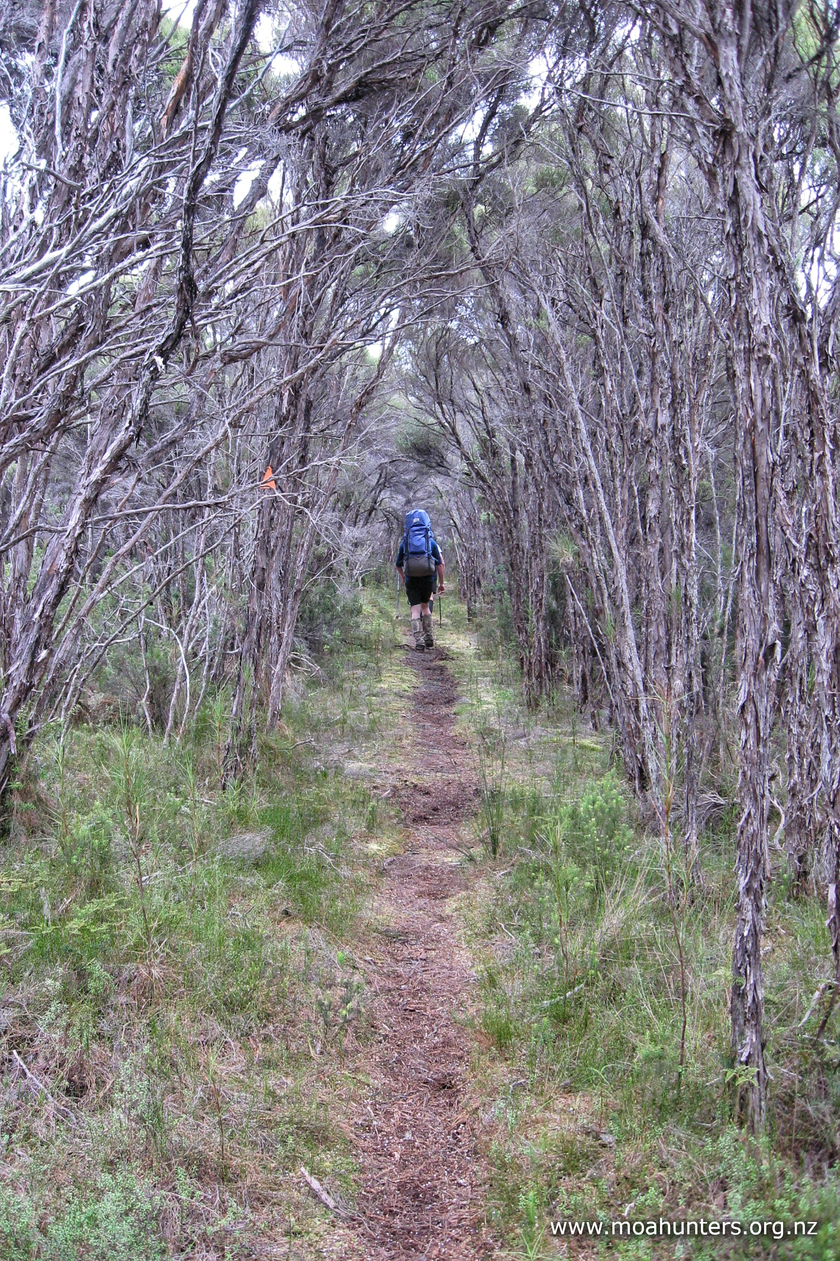
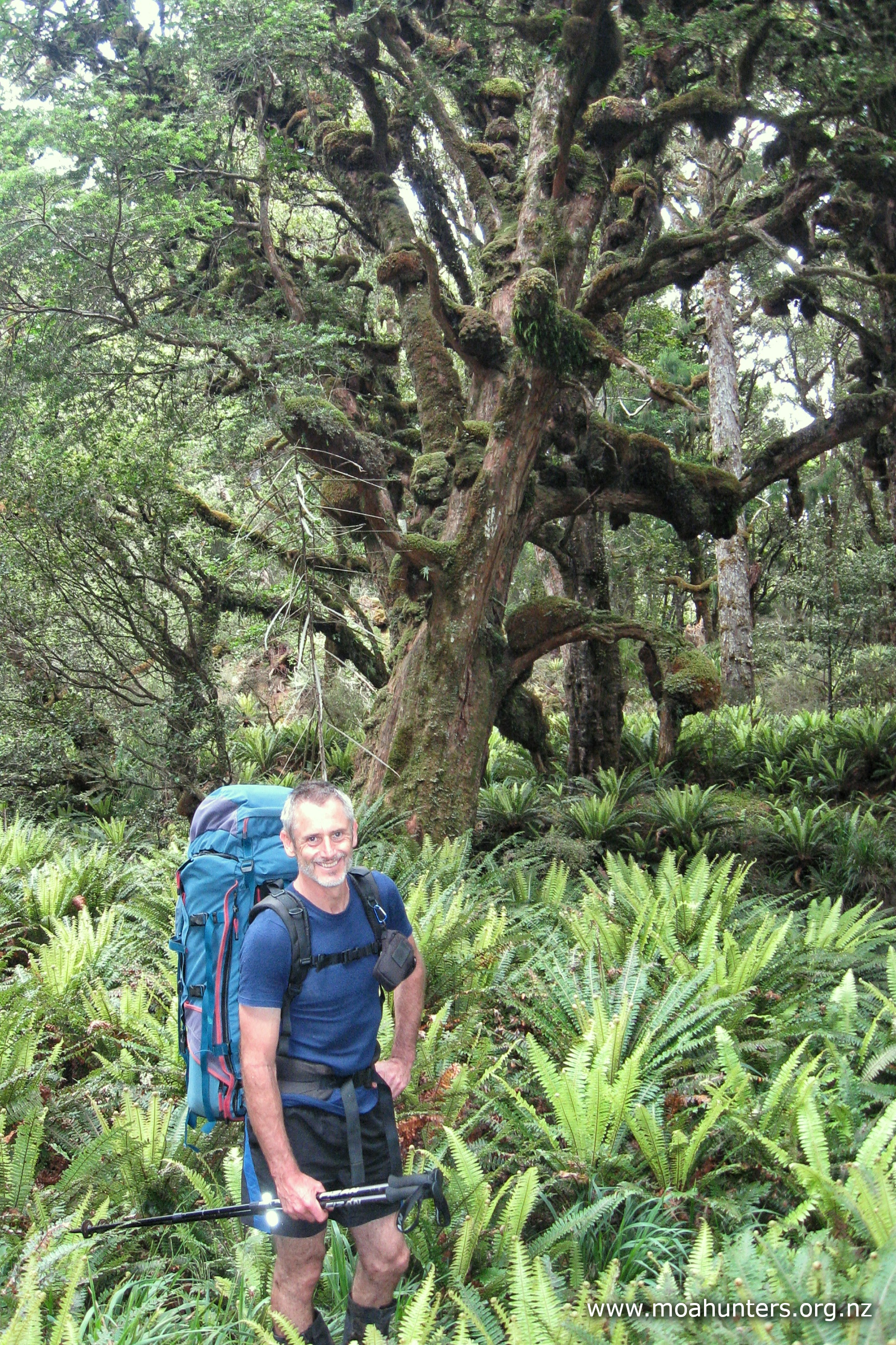
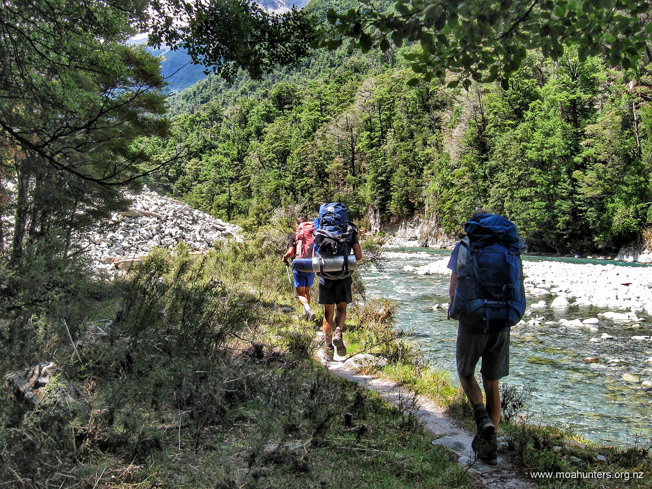
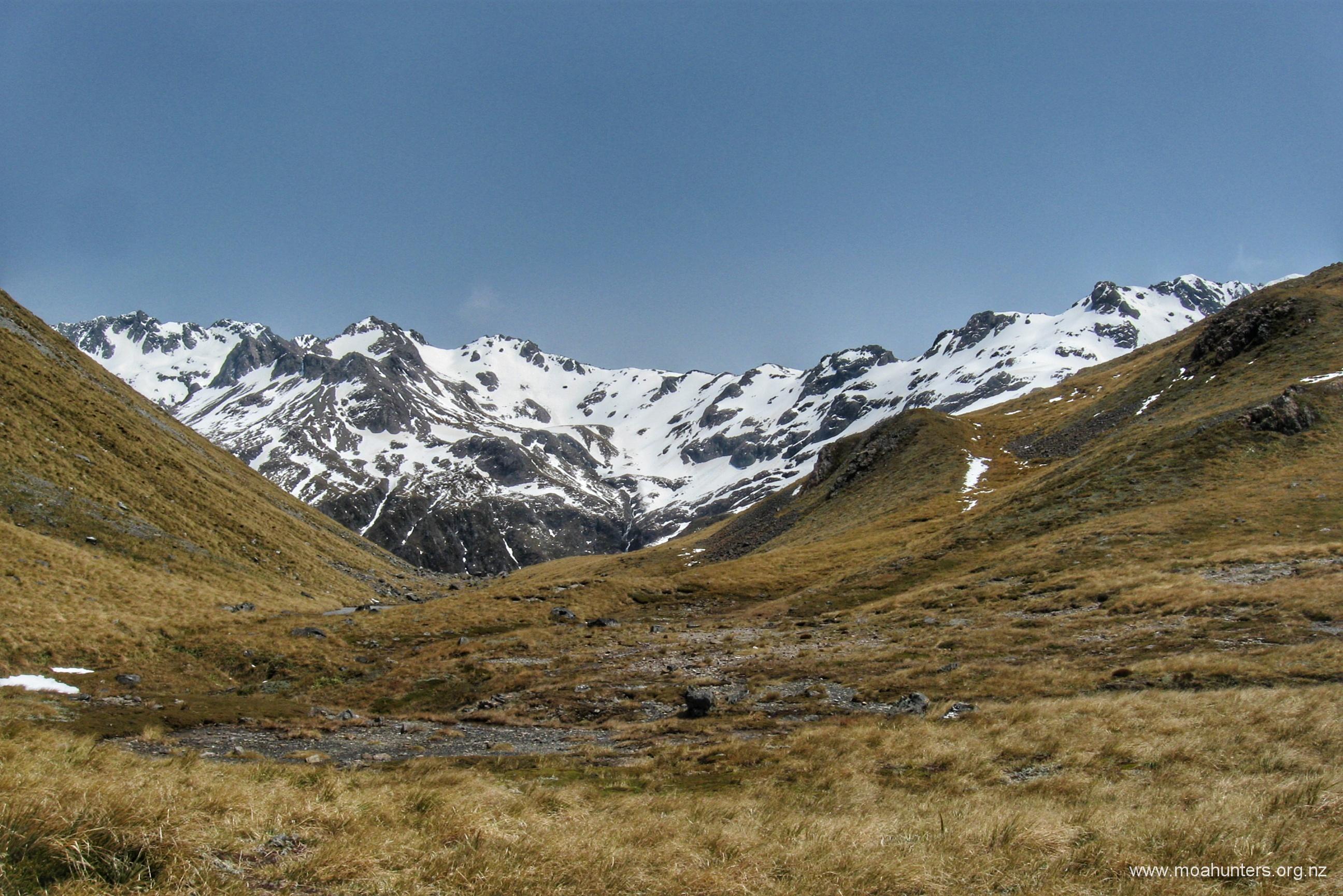
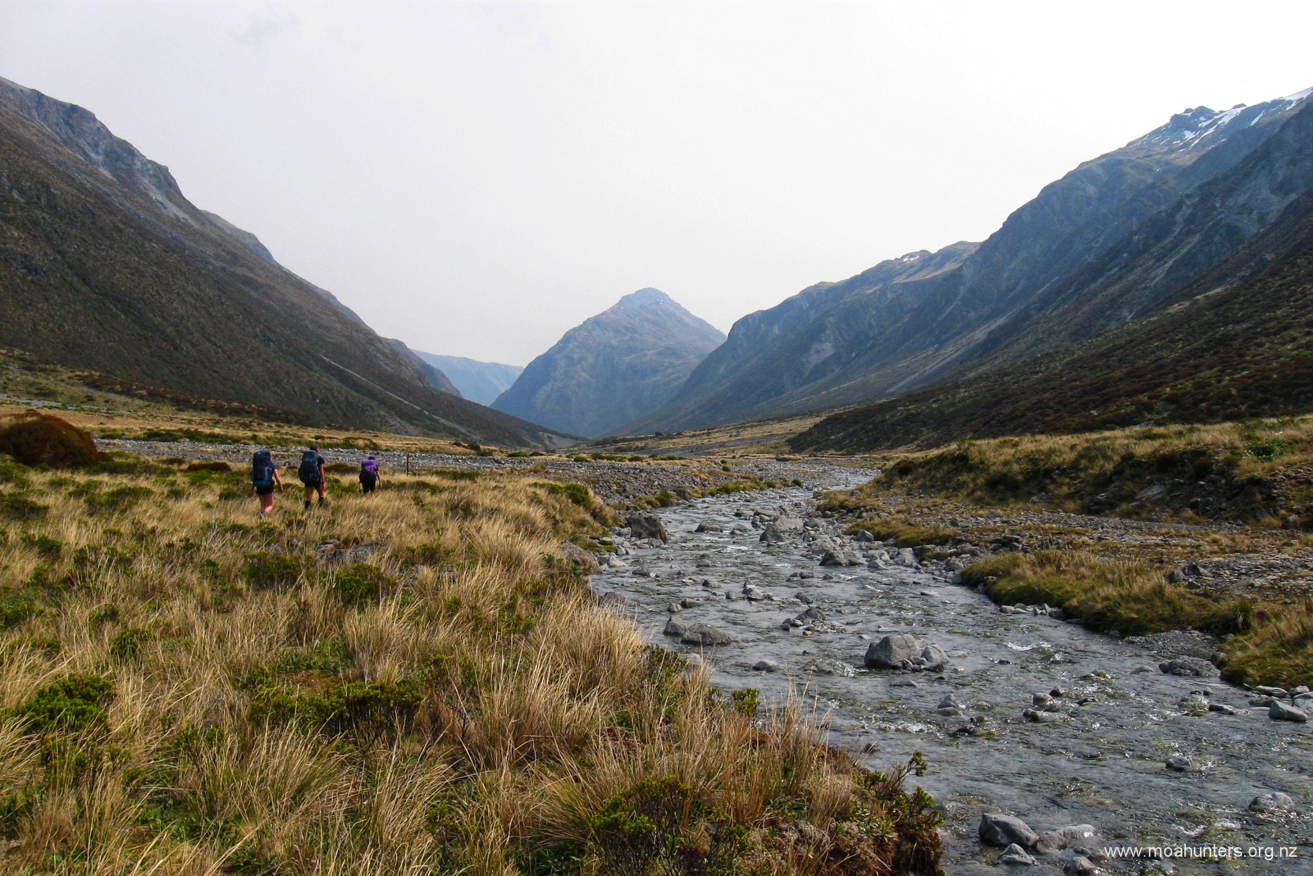
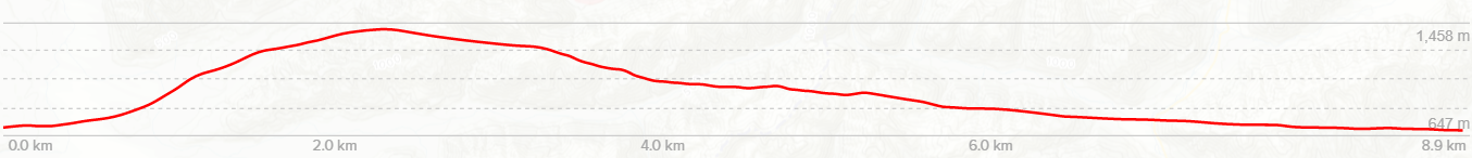
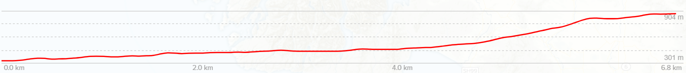
There are many descriptions of the Three Passes trip available, so I won’t add much here, except to say that after dropping off Whitehorn pass into the Cronin Stream, at the point where the valley opens a little, there is a small shelf on the true left, about 10-20 metres above the stream. It is well worth climbing onto this shelf, as there is a well-trodden path that makes the journey down the Cronin considerably faster and more pleasant.
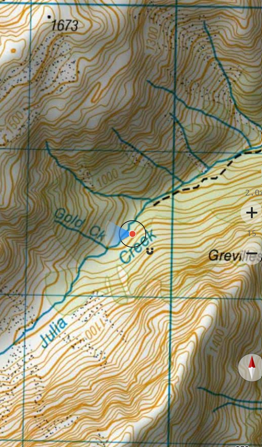
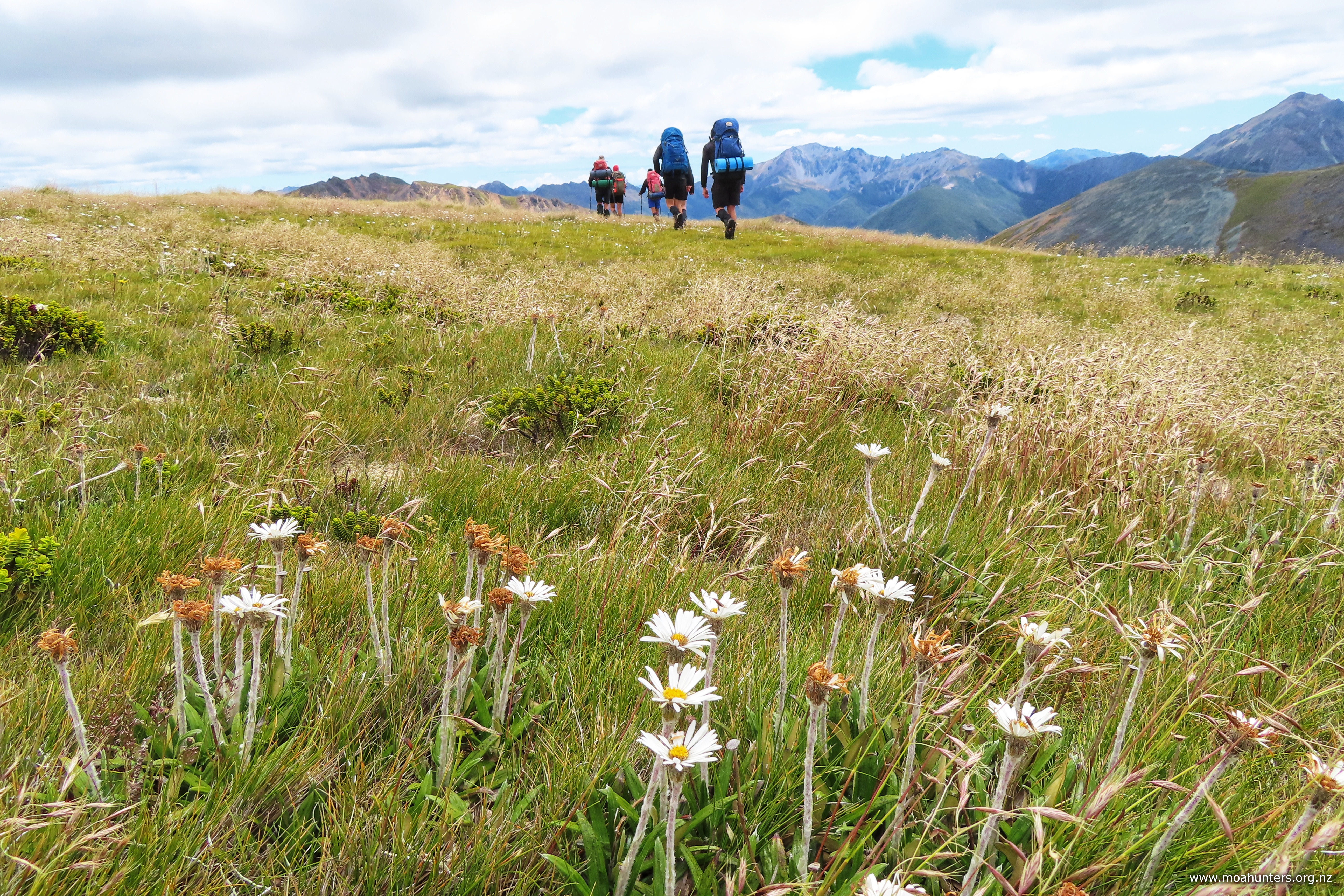
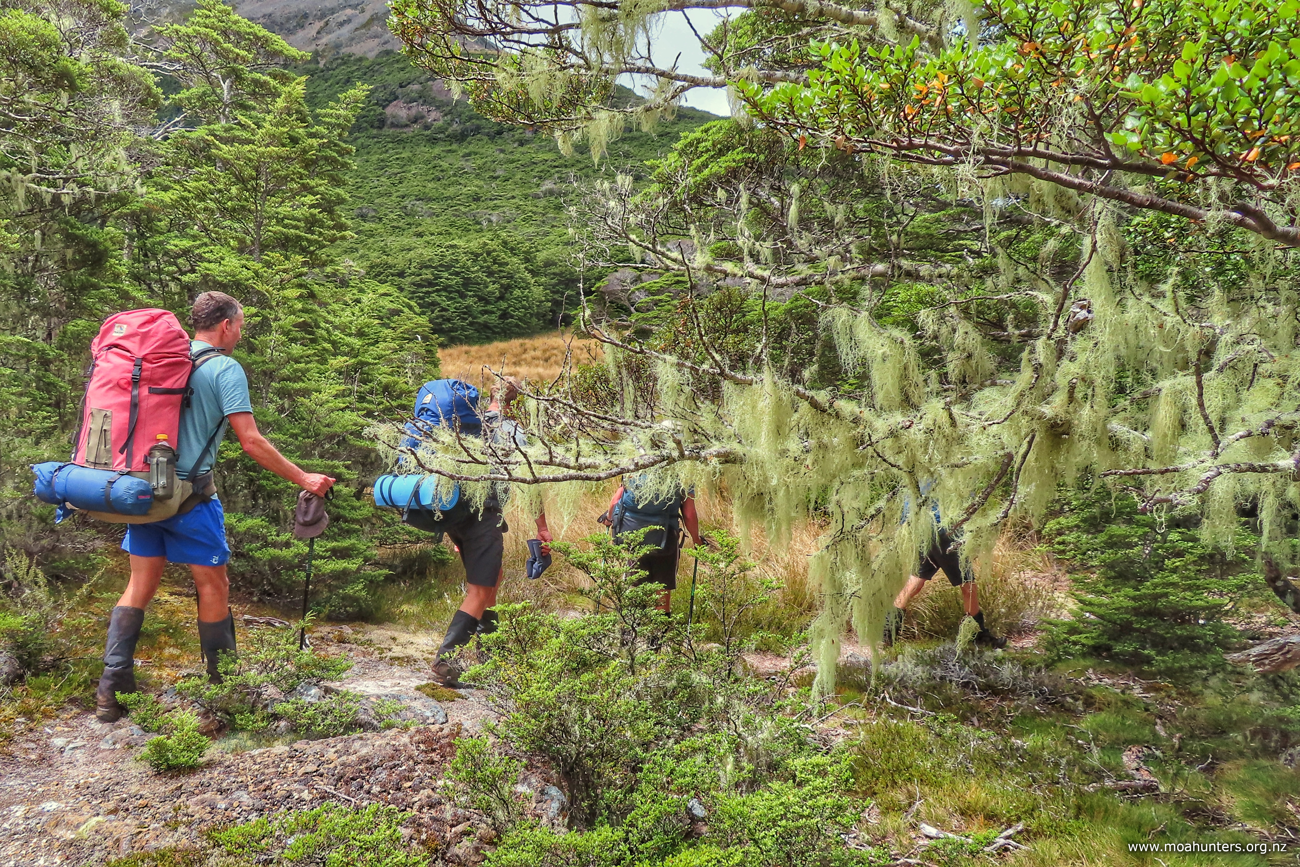
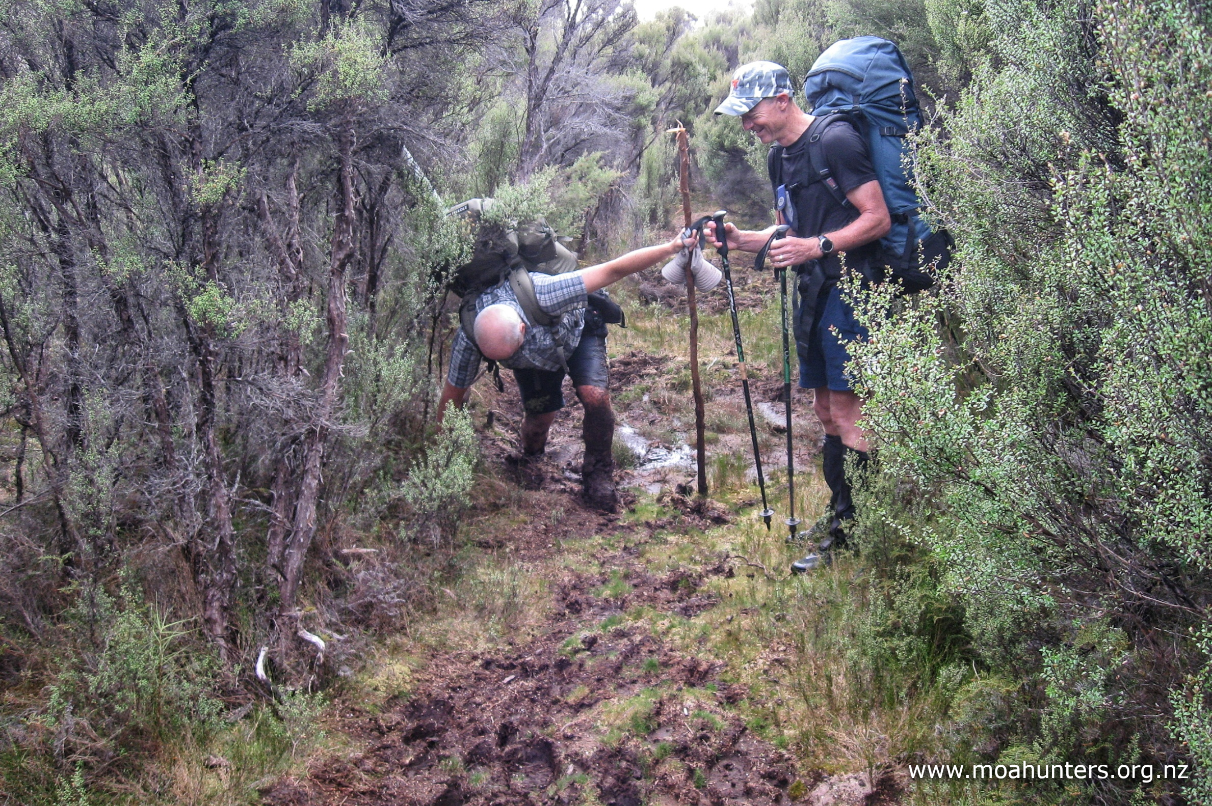
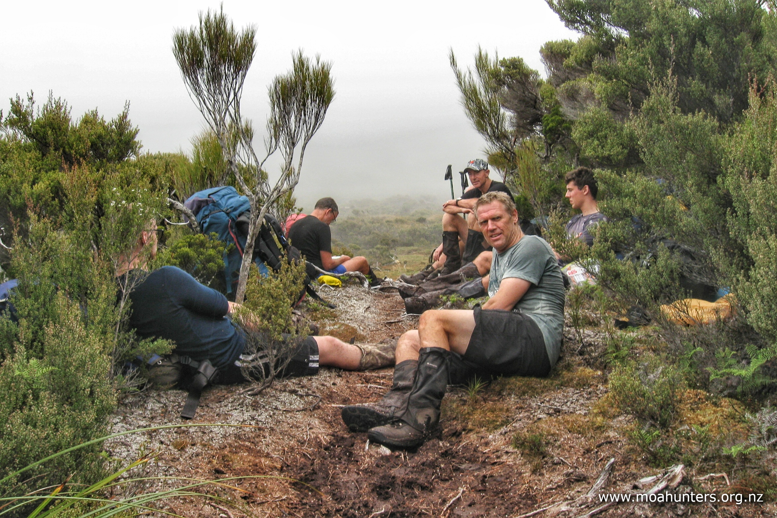
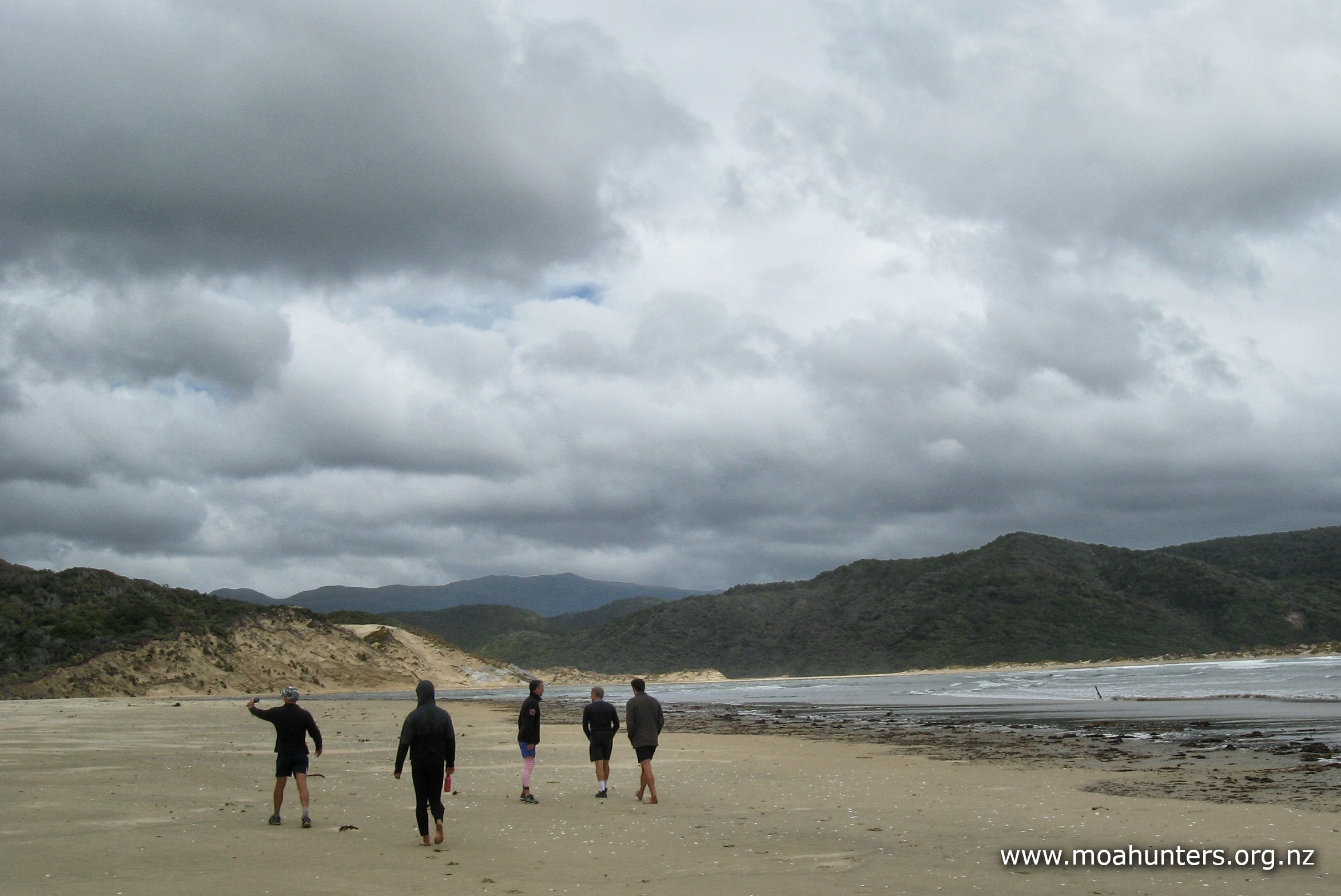
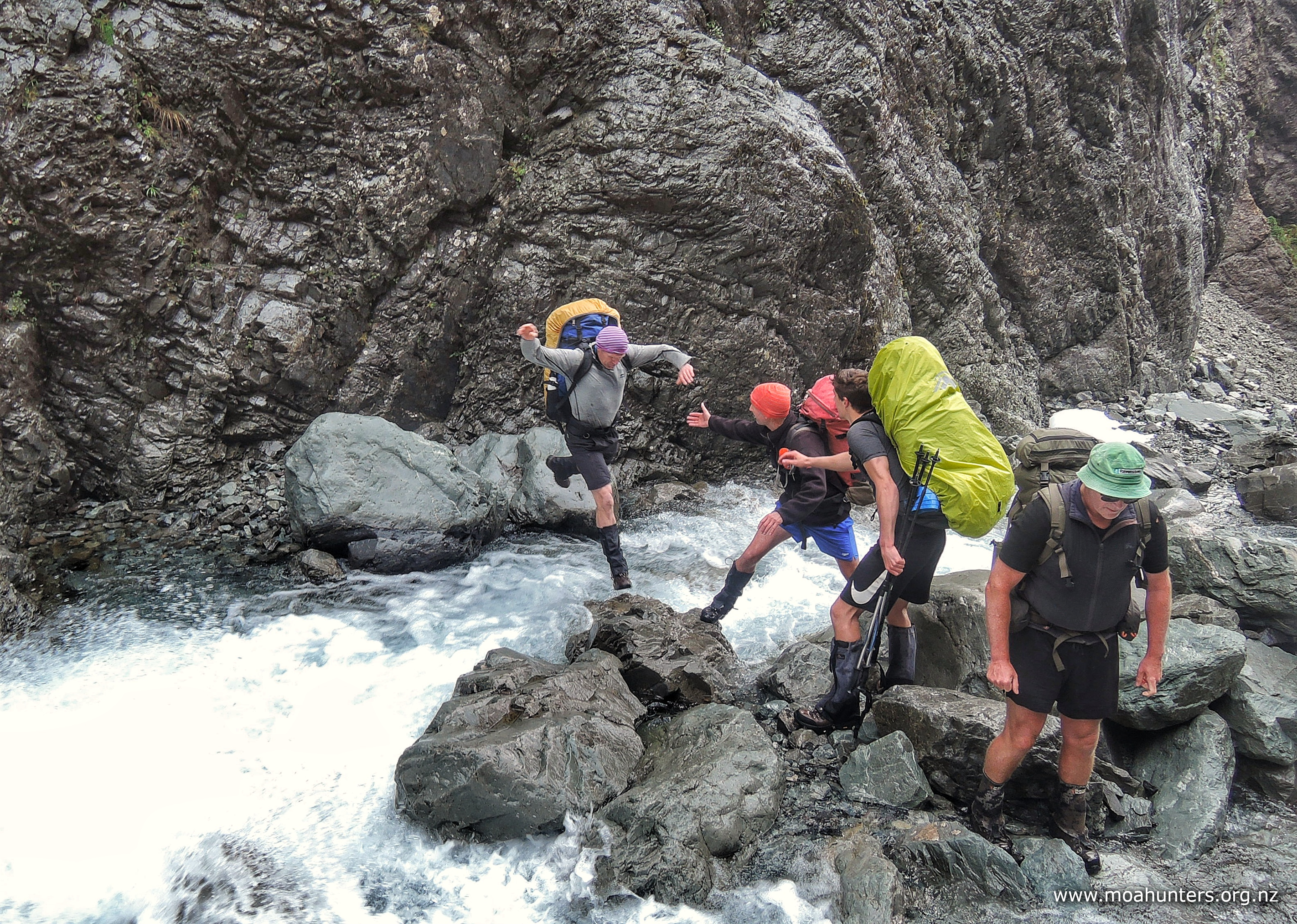
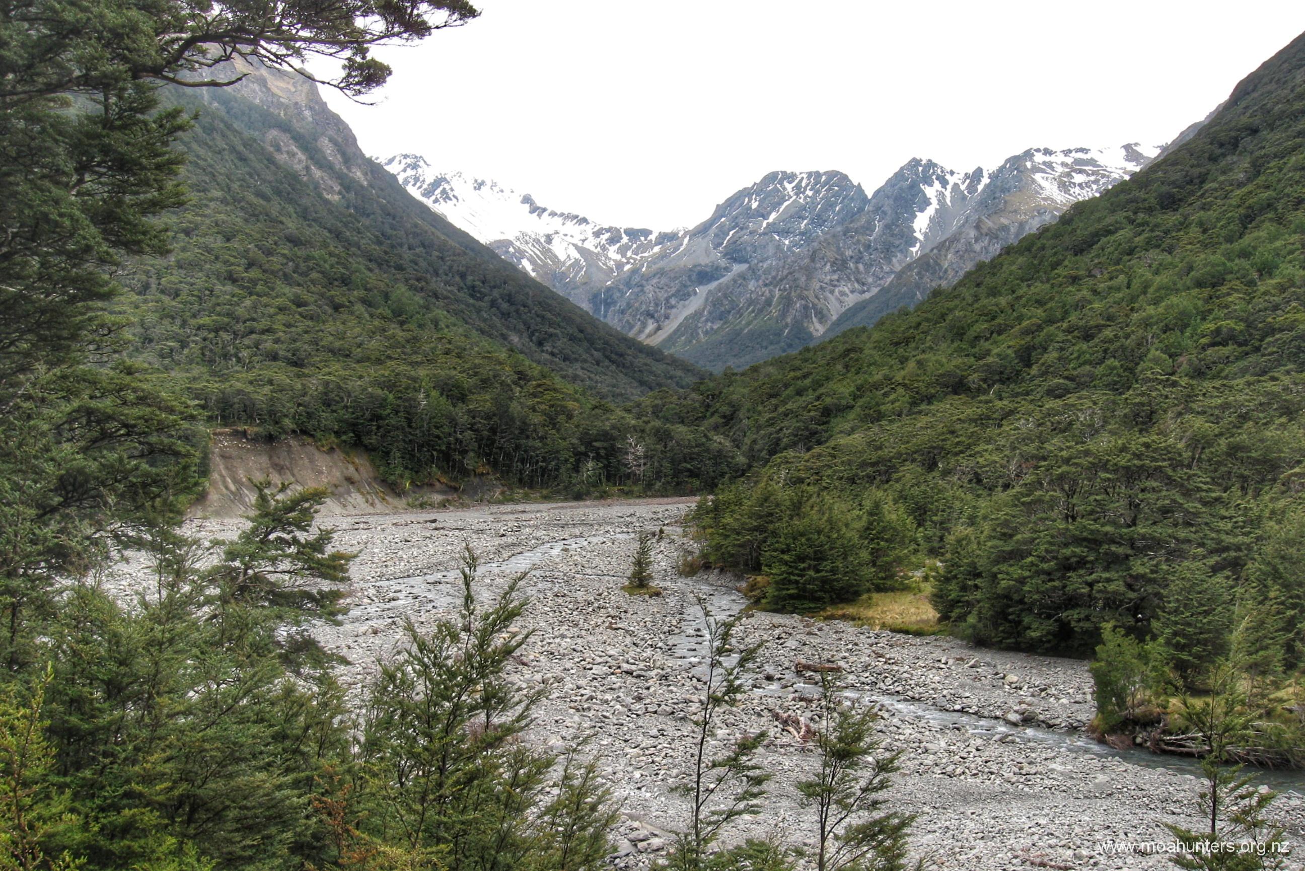
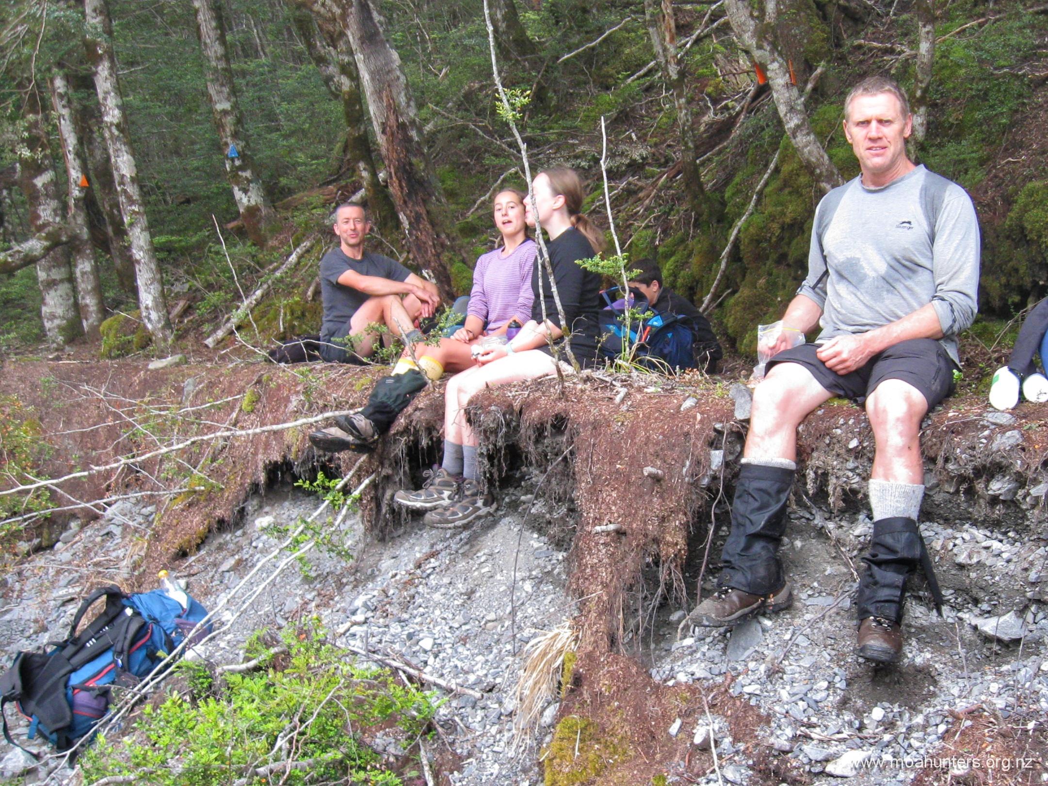
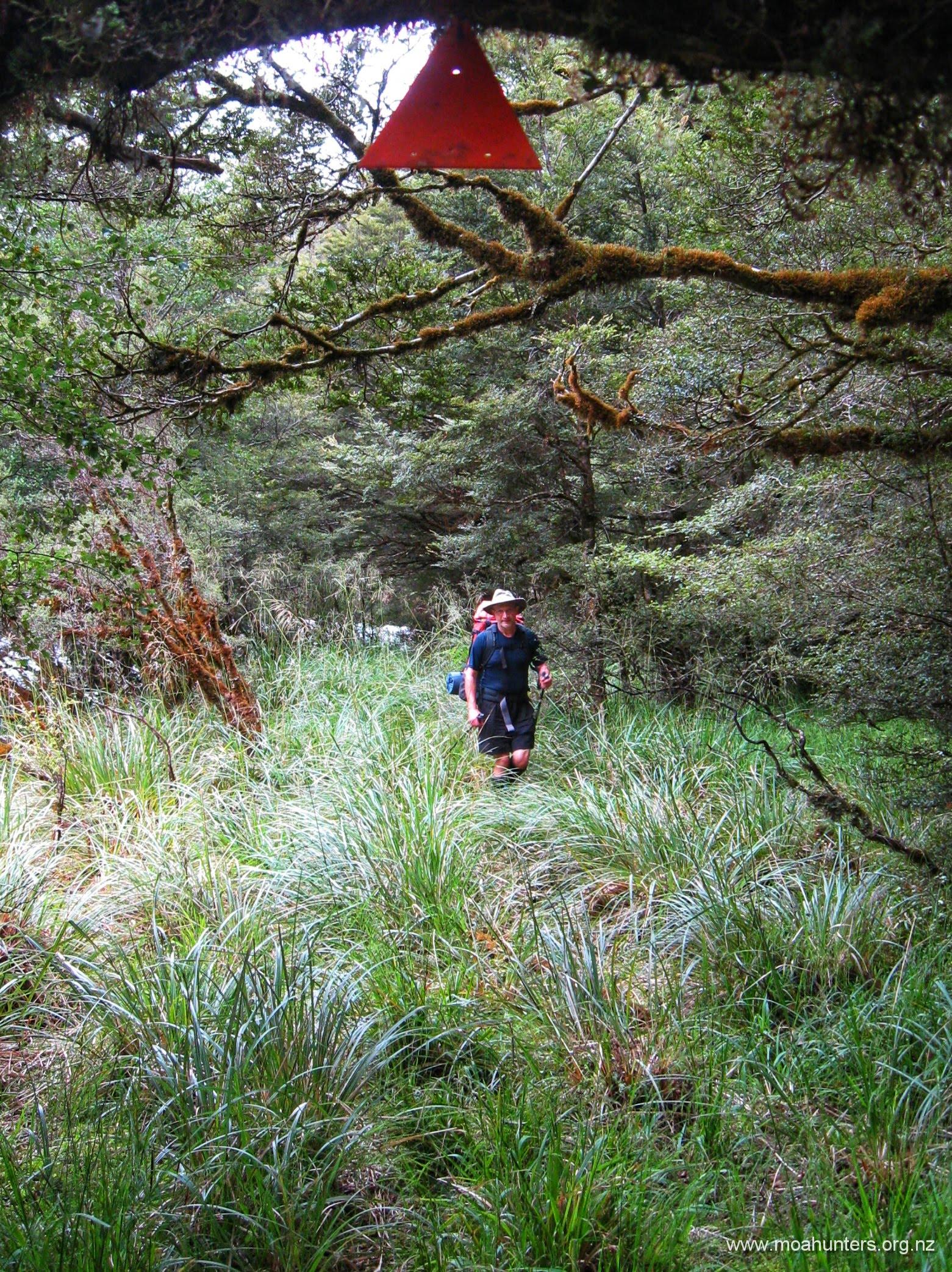
For experienced route trampers, the crossing of Pope’s Pass is not too arduous, however the walk from Lake Browning to Julia Hut is a lengthy day. There are a number of accounts of people arriving at Julia Hut well after dark or, not arriving at all and having to camp is the scrub. So be advised, it is a looong way.
You don’t need to rush, just start early and don’t underestimate how long the Julia river portion takes.
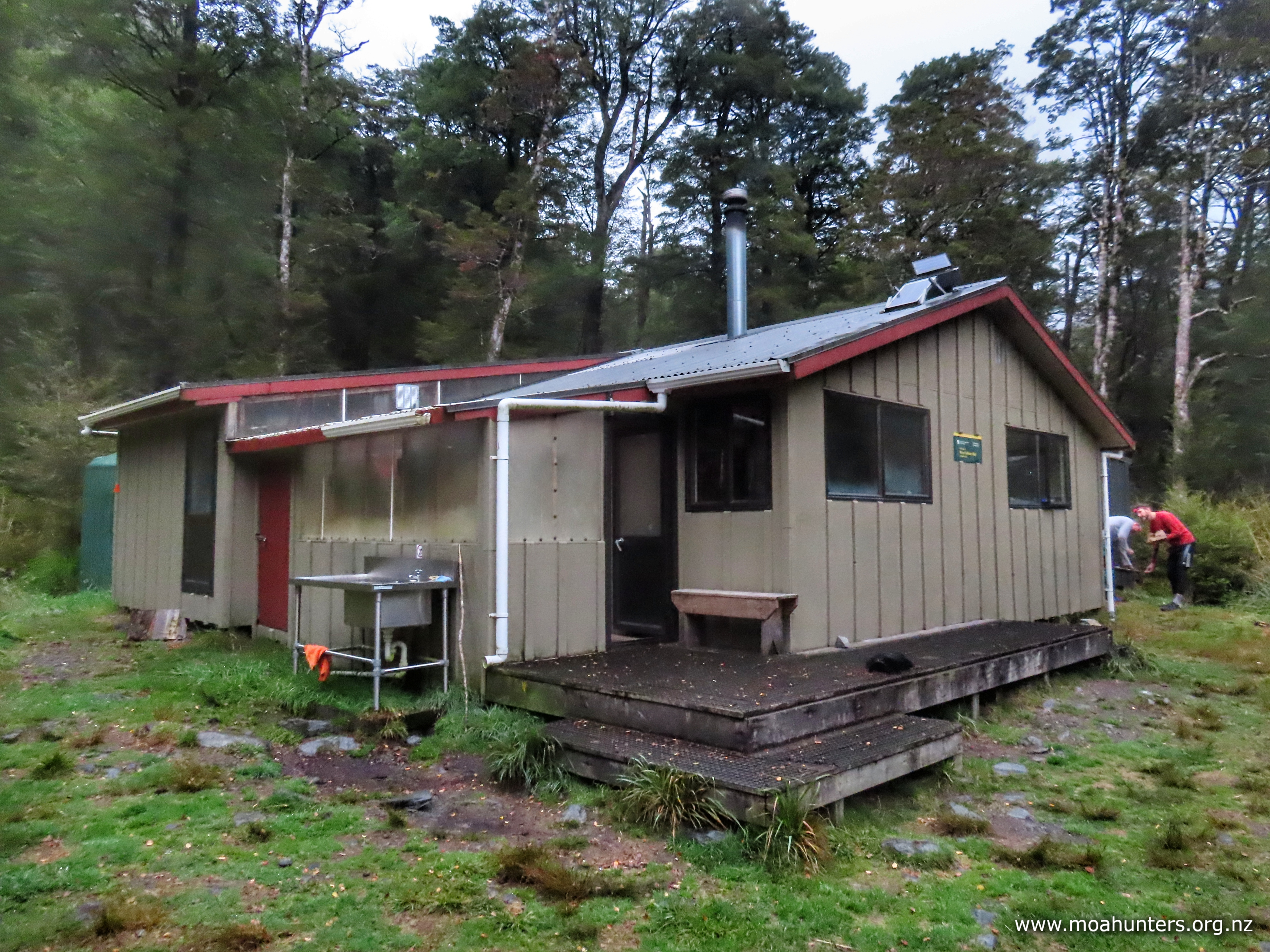
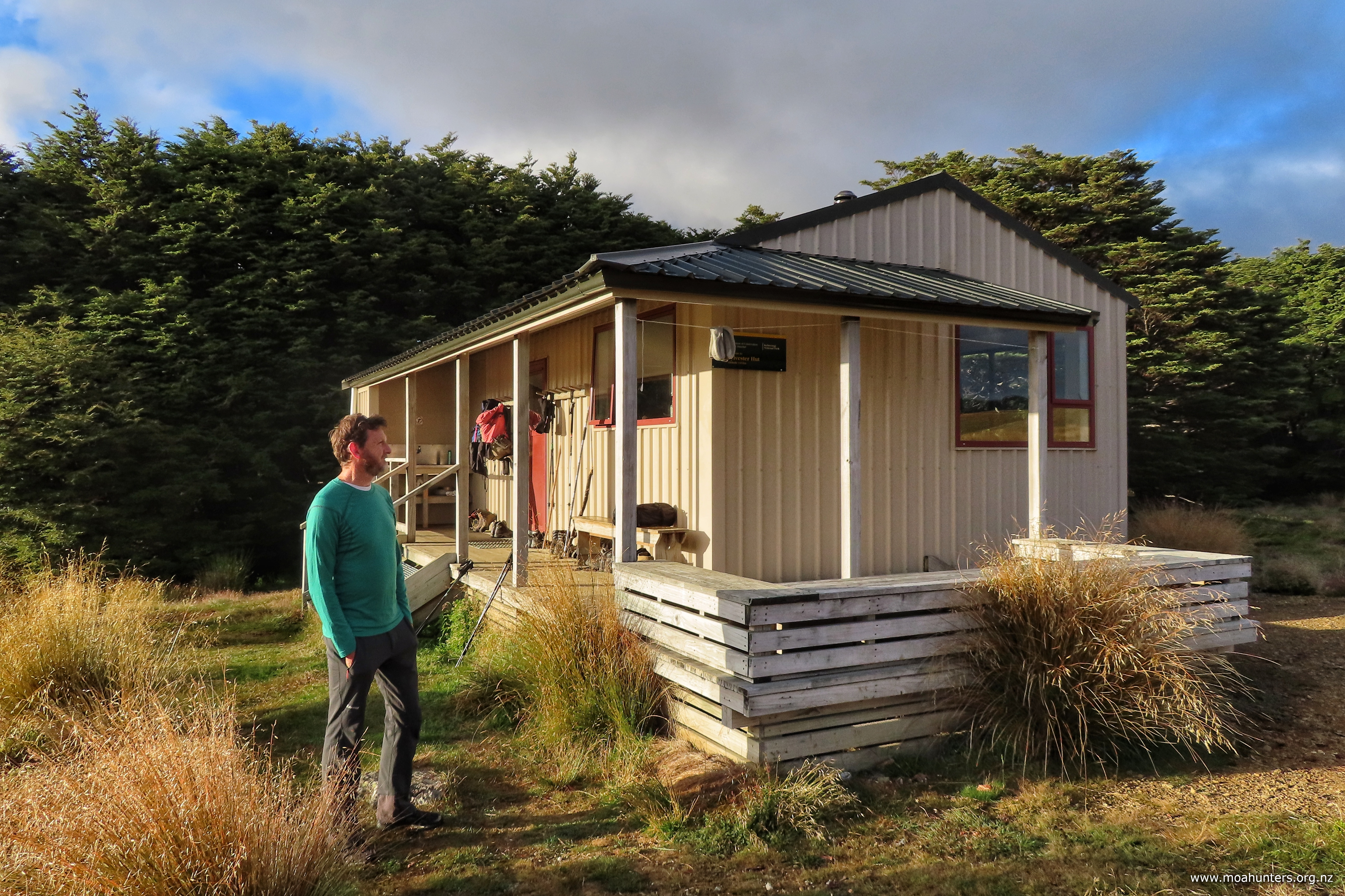
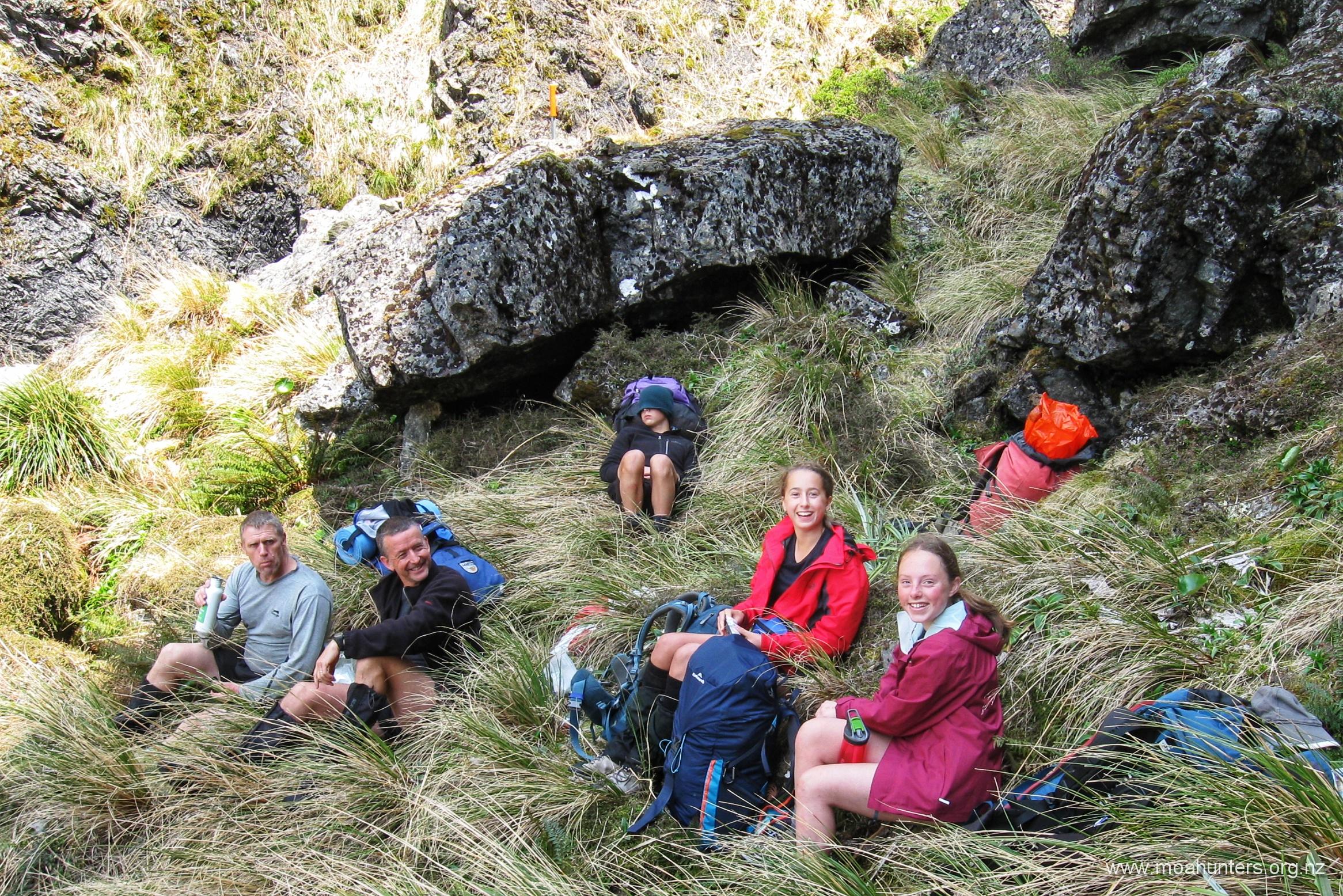
Browning Pass to Julia Hut
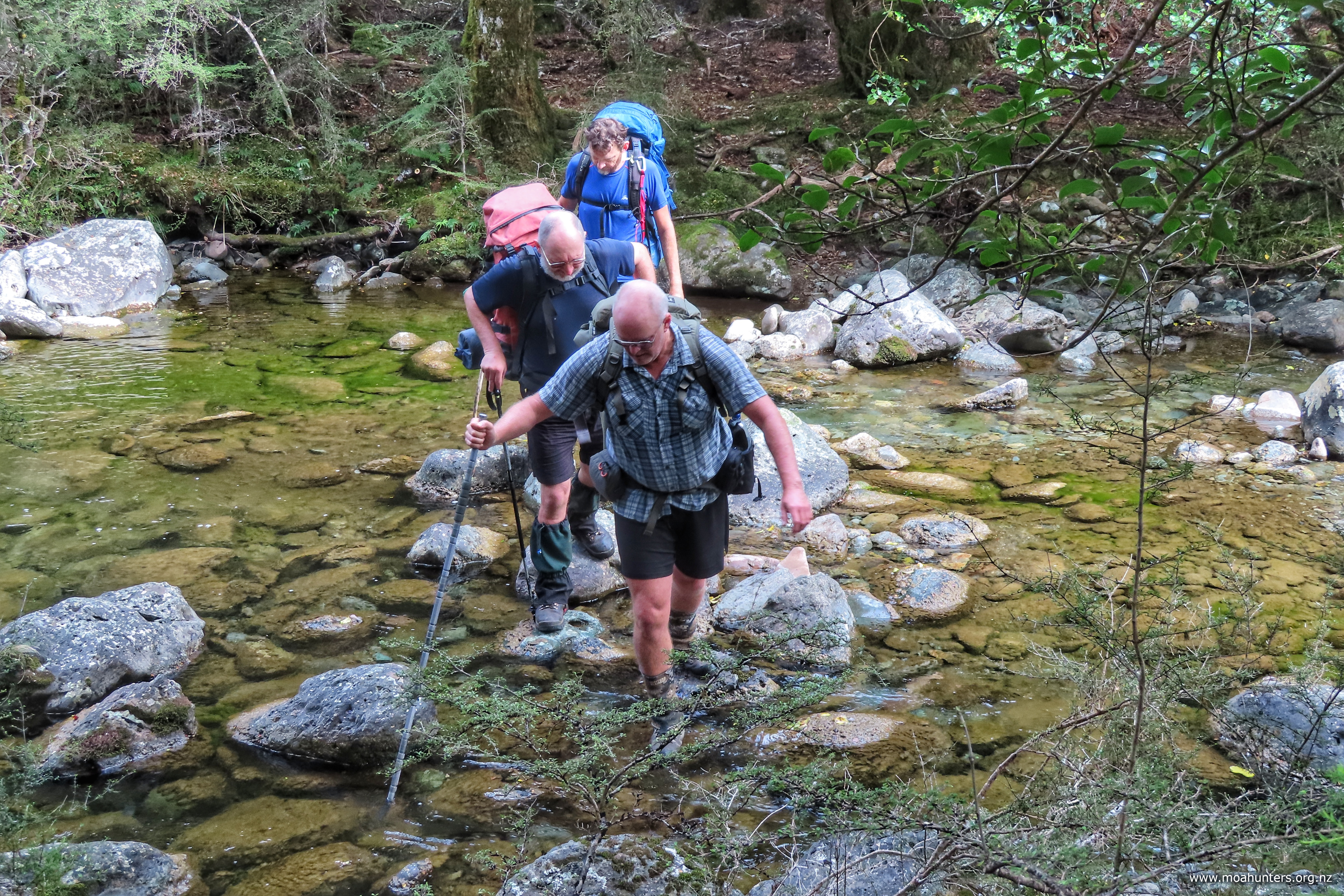
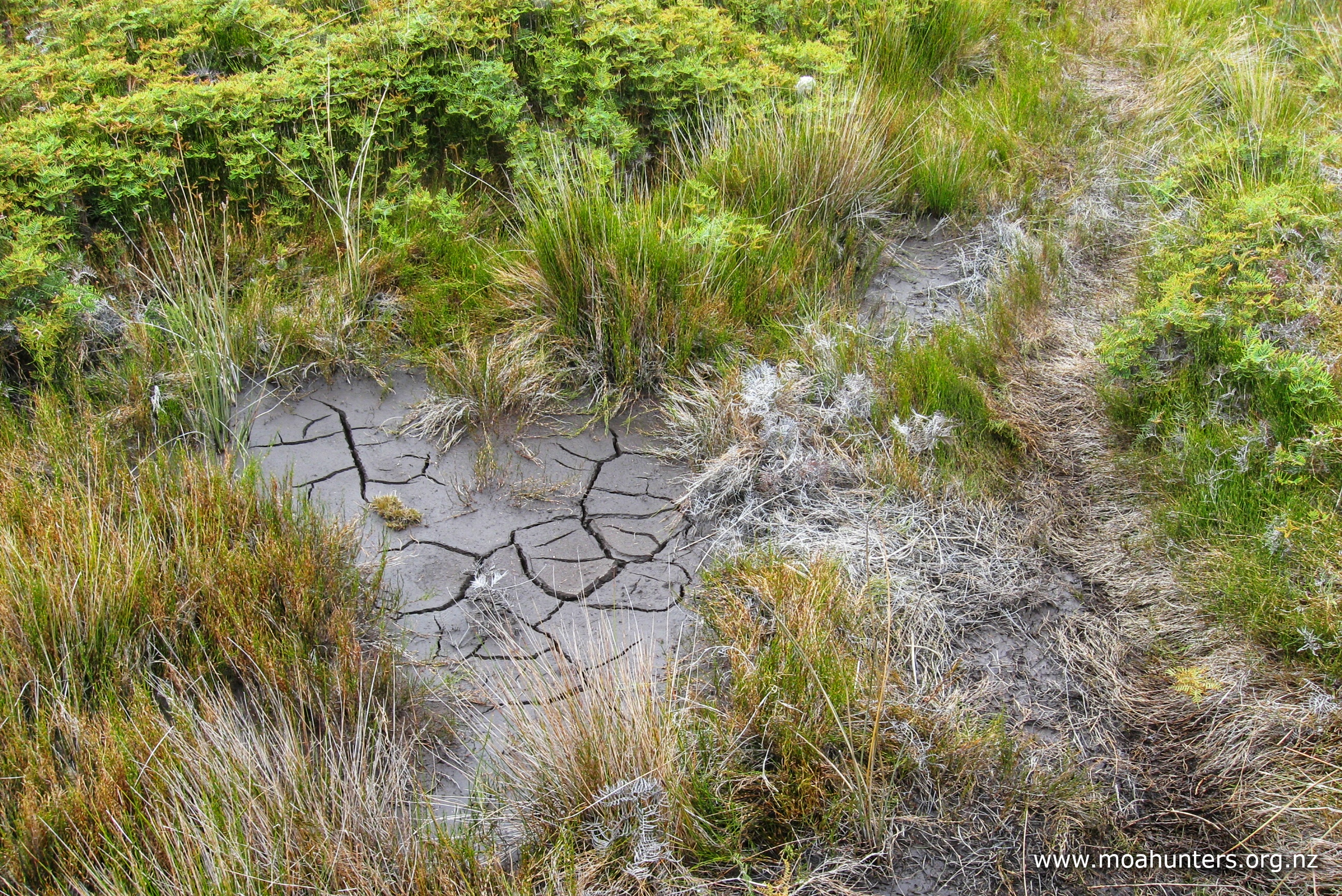
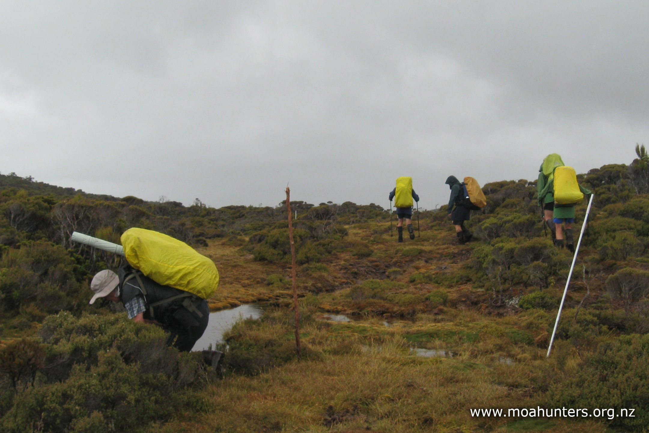
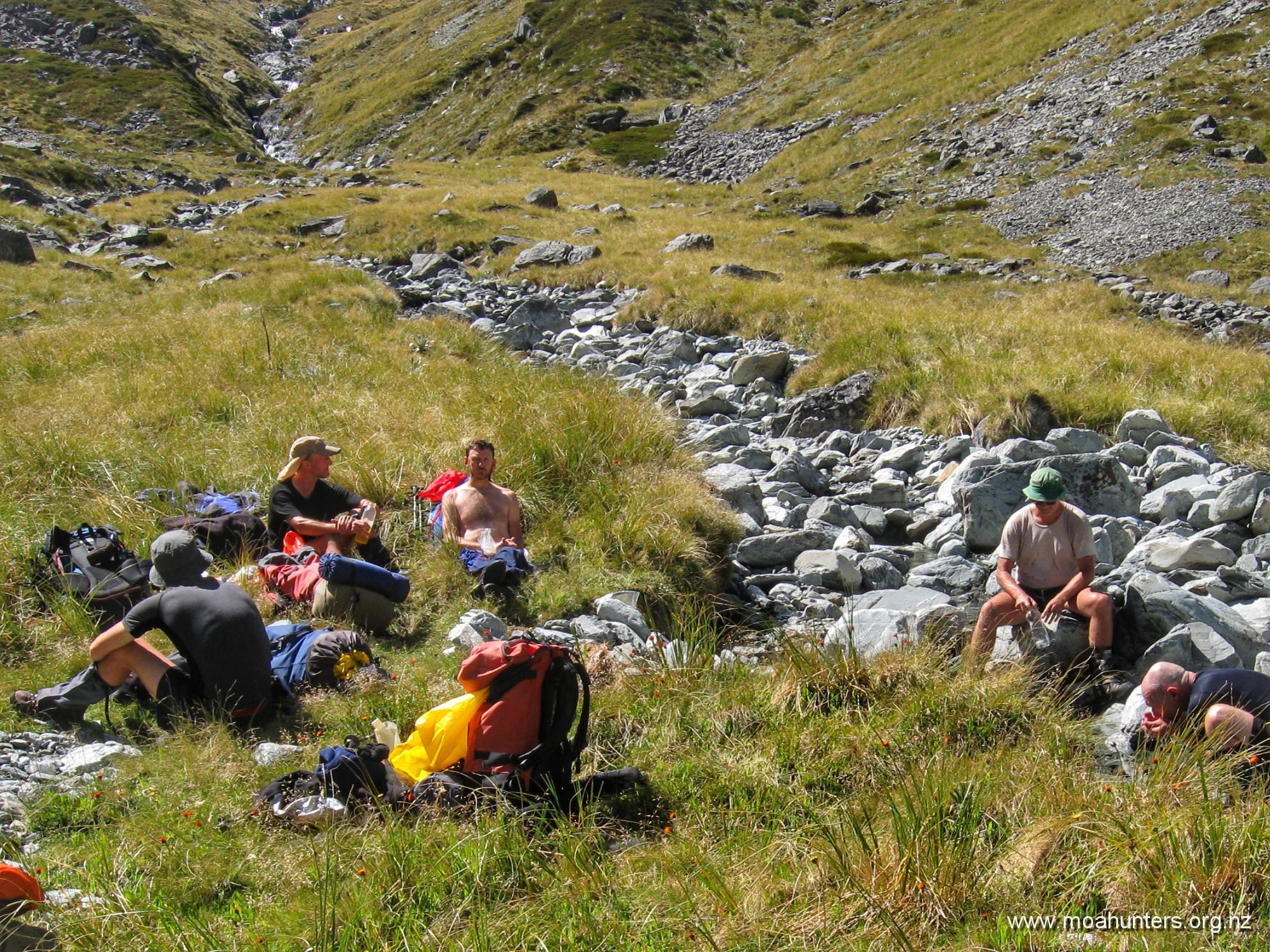
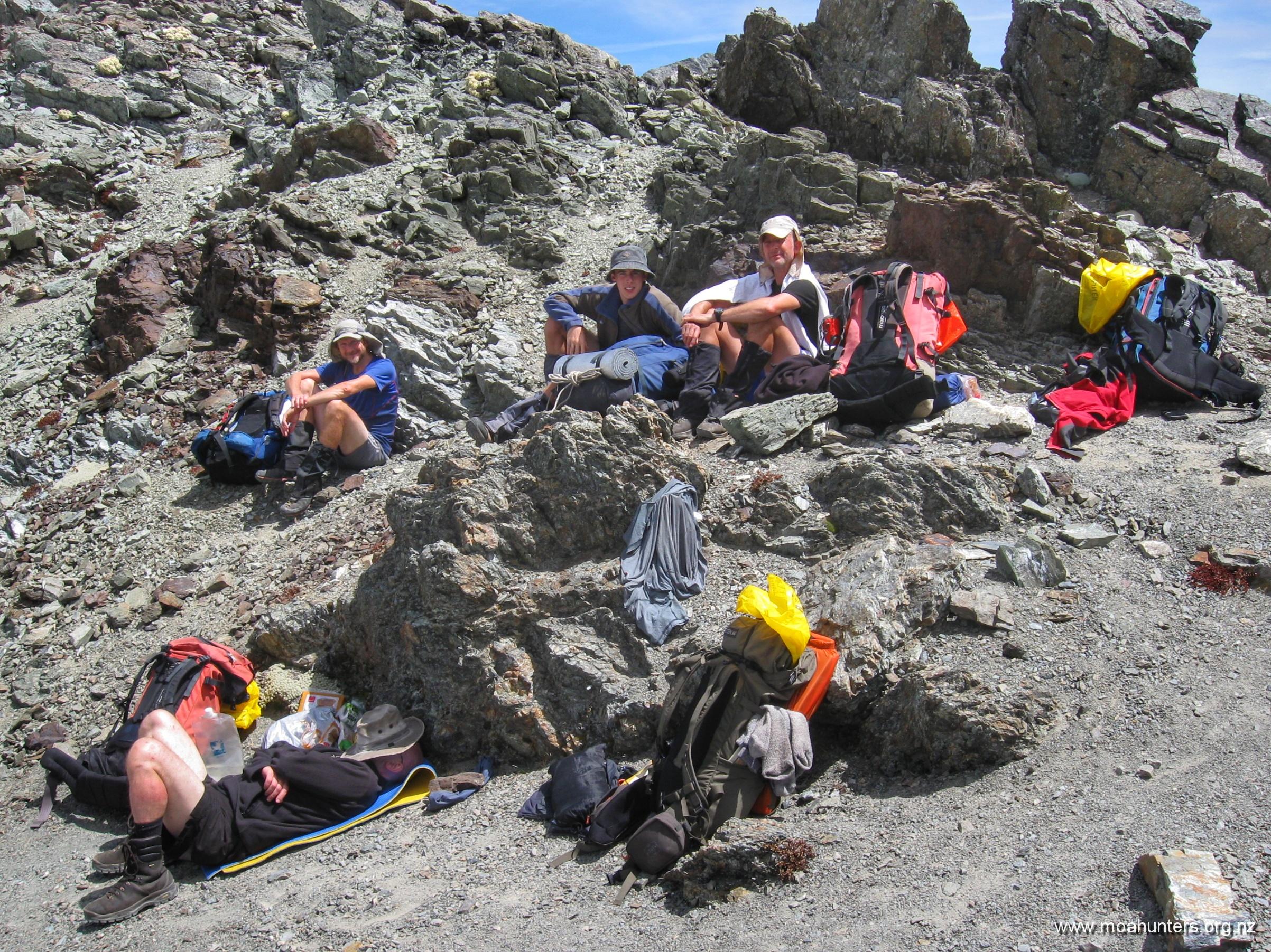
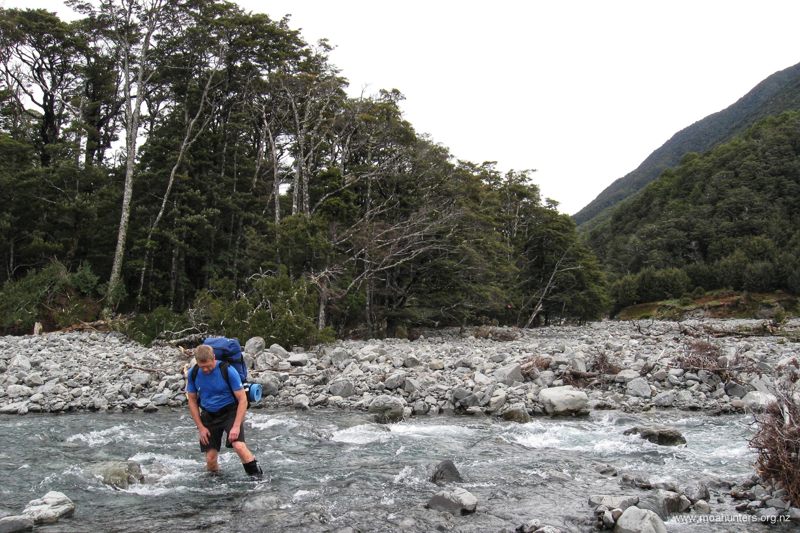
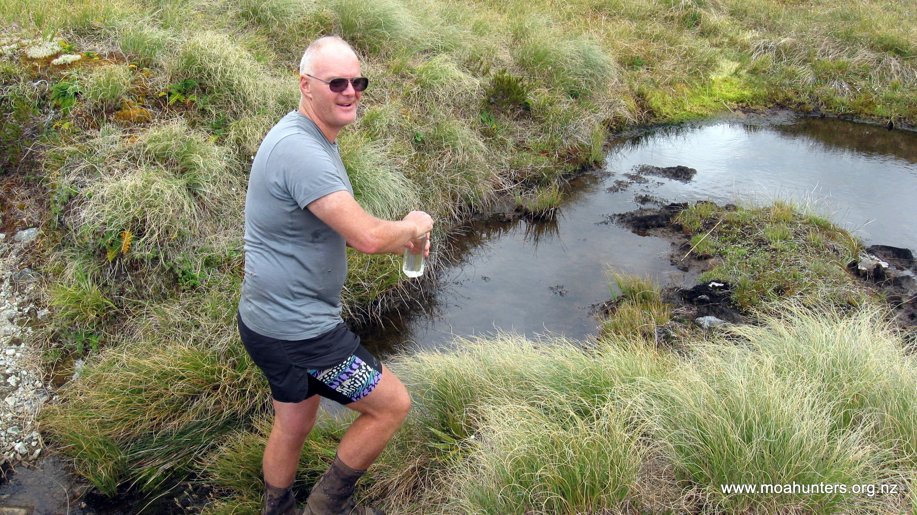
There had been little rain for about 4 days before this account, so streams were low and easy to cross.
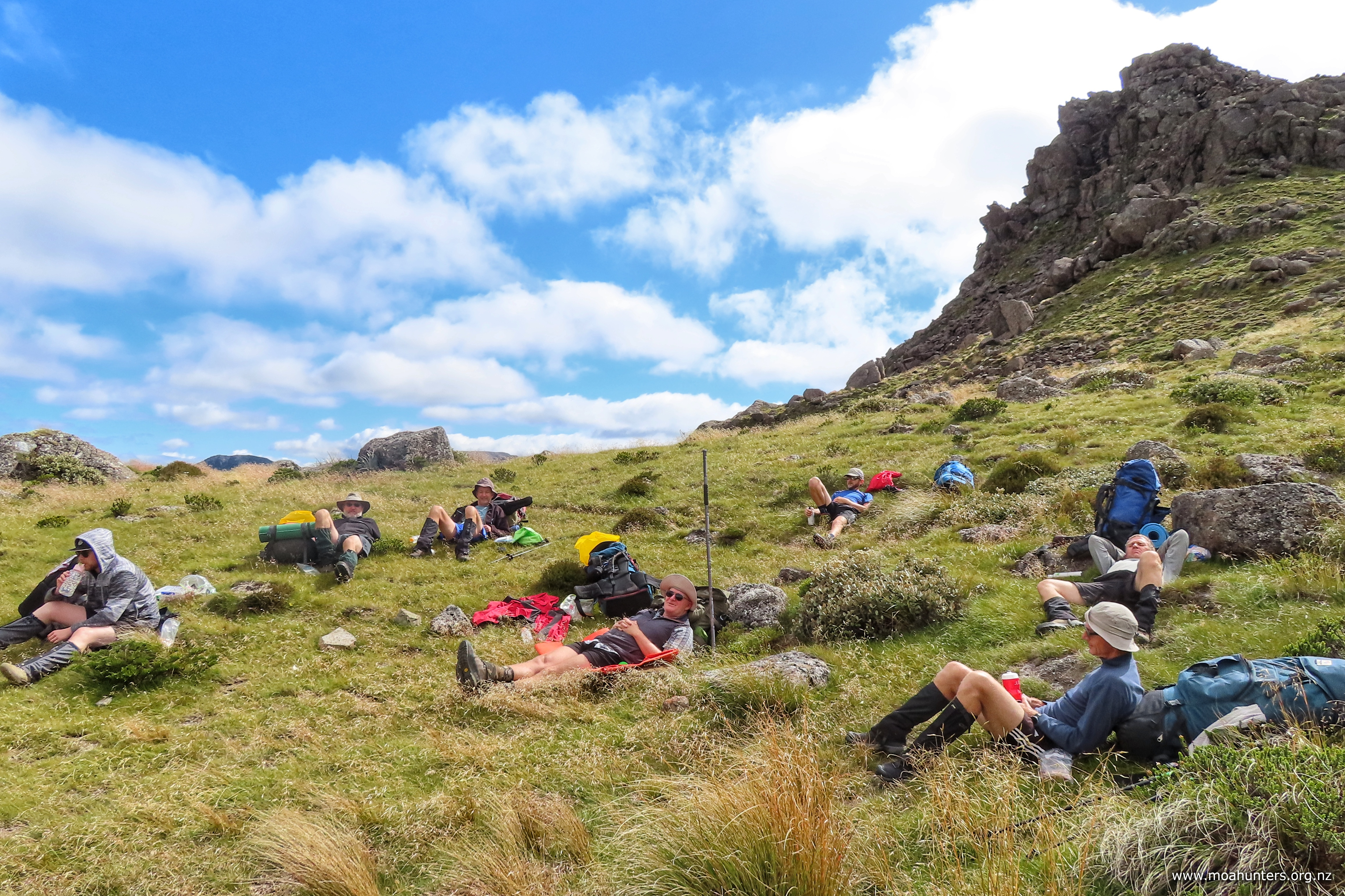
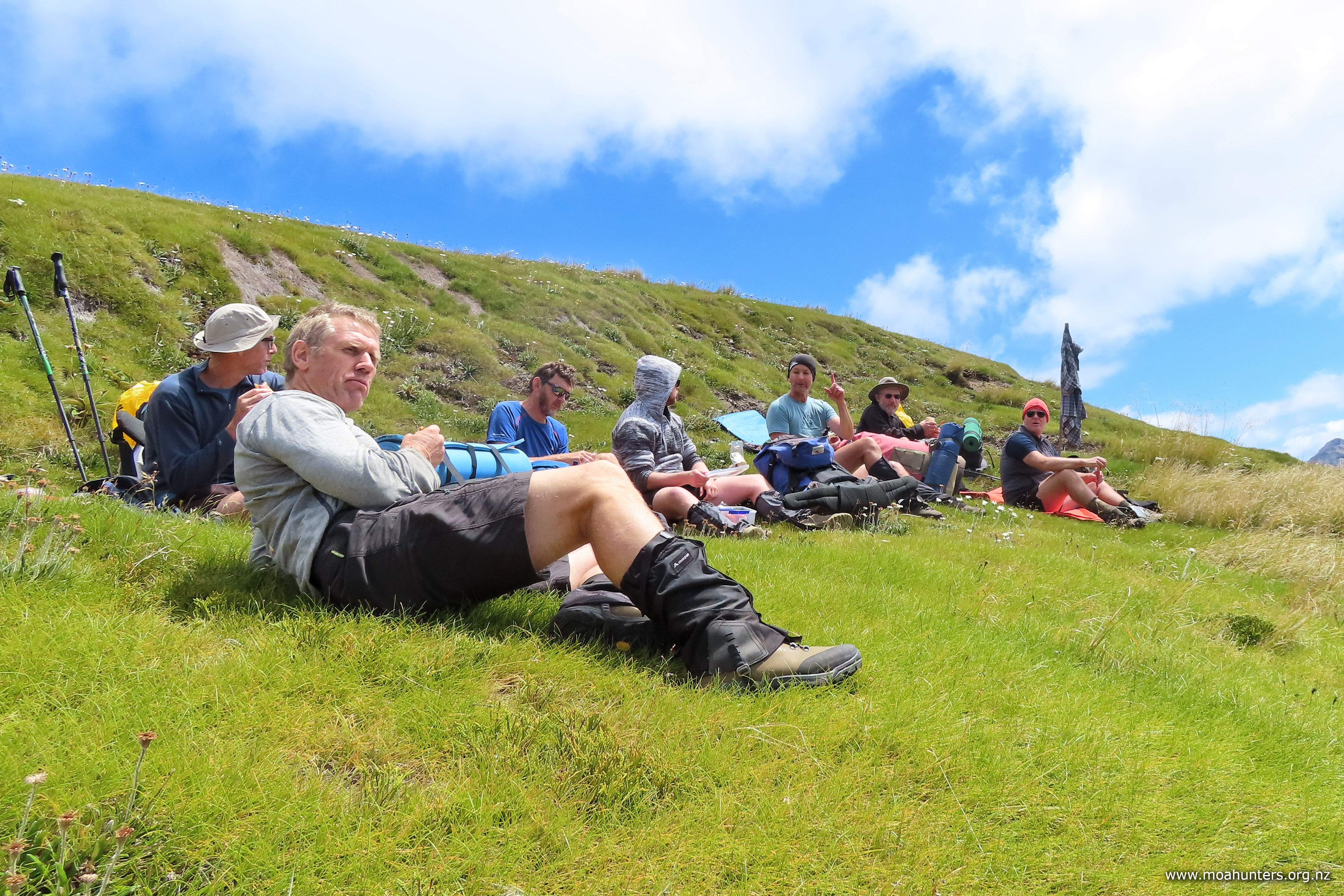
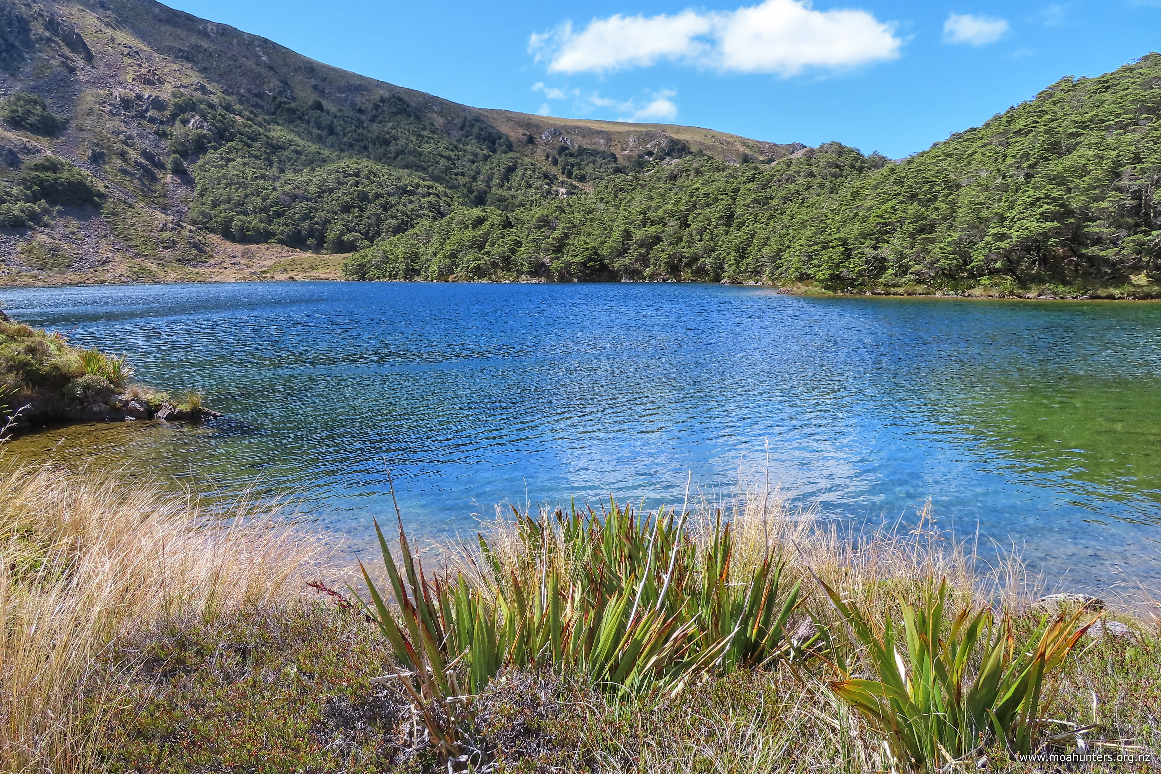
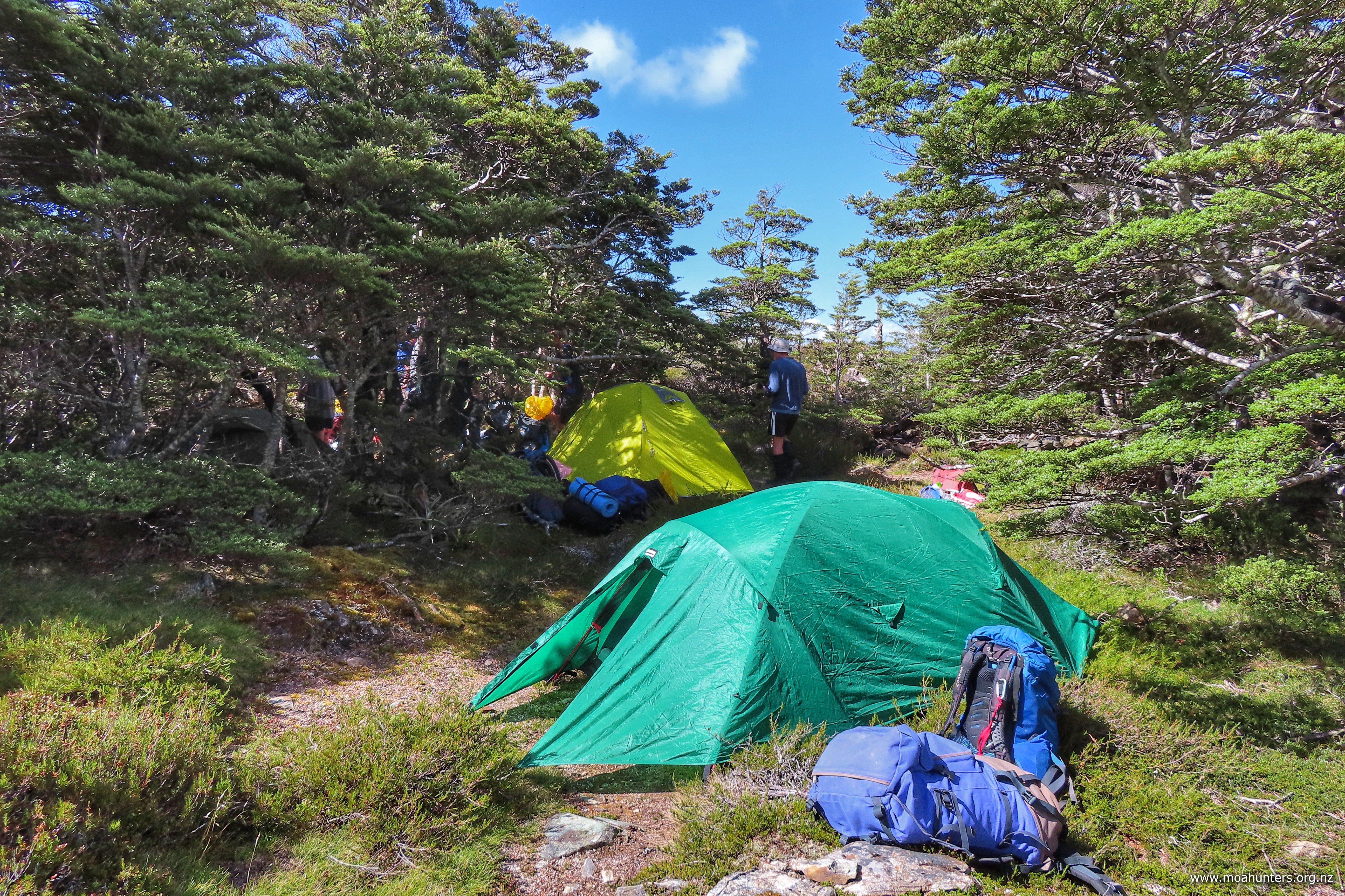
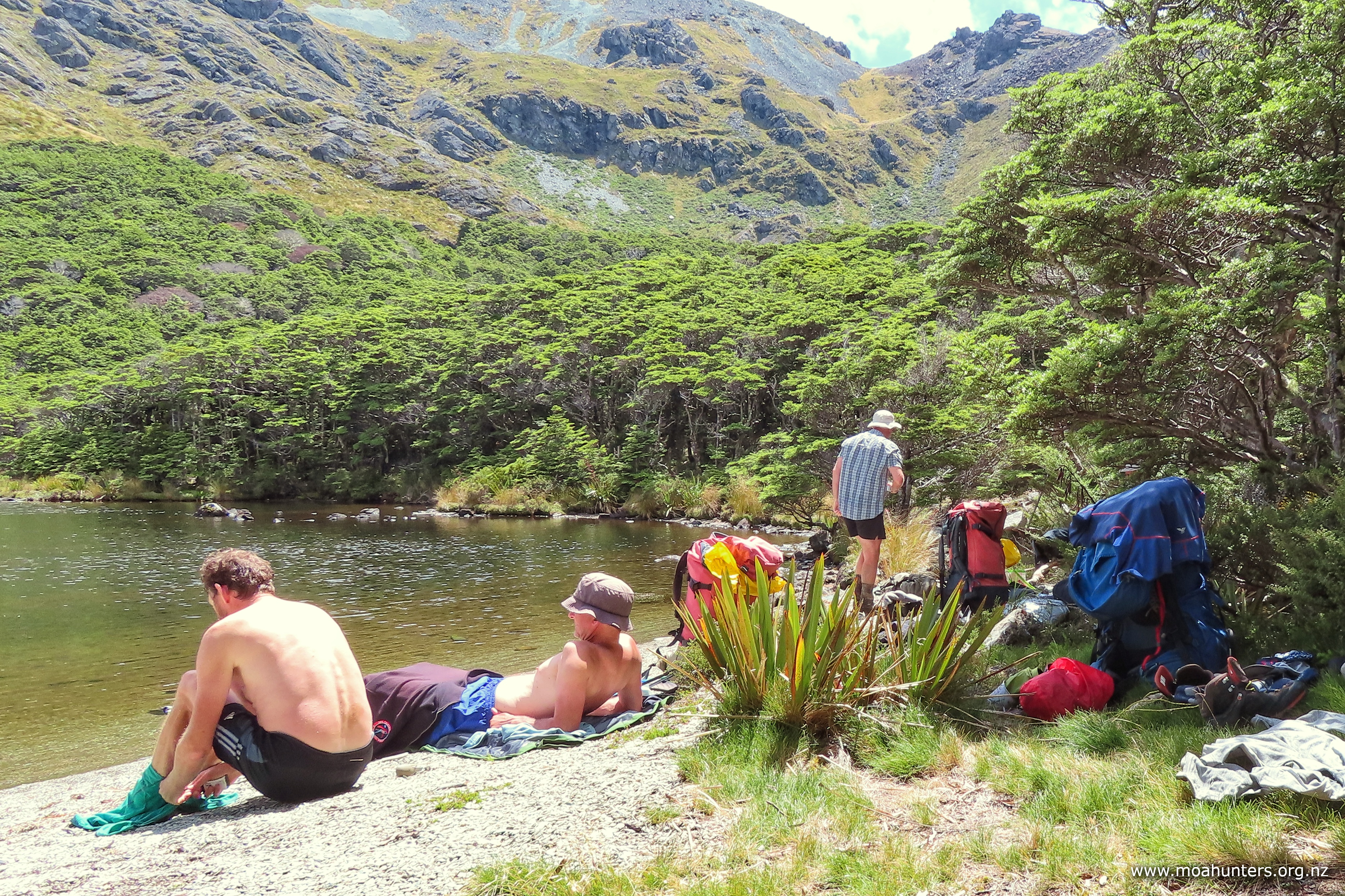
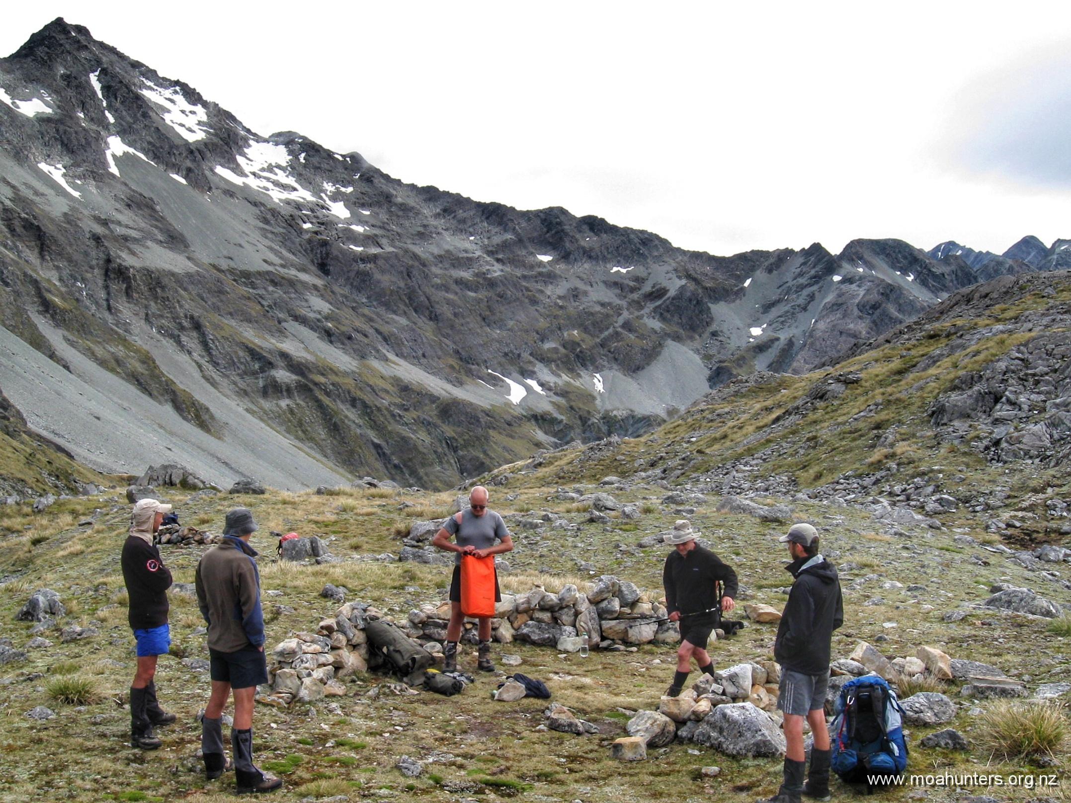
We had a very pleasant night camped at Lake Browning (1360m) where there are plenty of spots to tent. The water in the lake is drinkable and you are high enough that the sandfly concentration is low. Other parties avoid carrying a tent and stay at Park-Morpeth hut, but this adds time and as mentioned before it is a long day already.
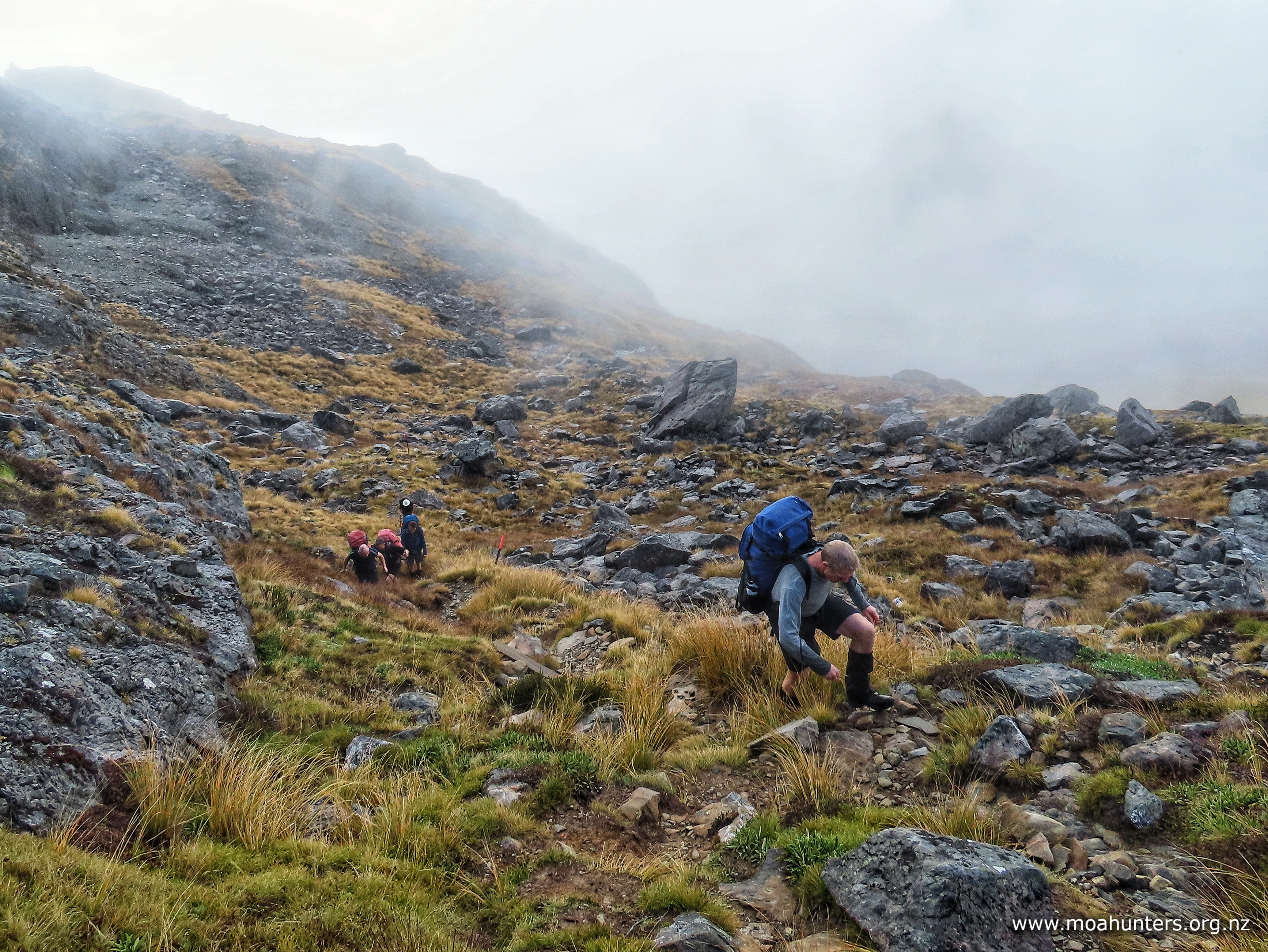
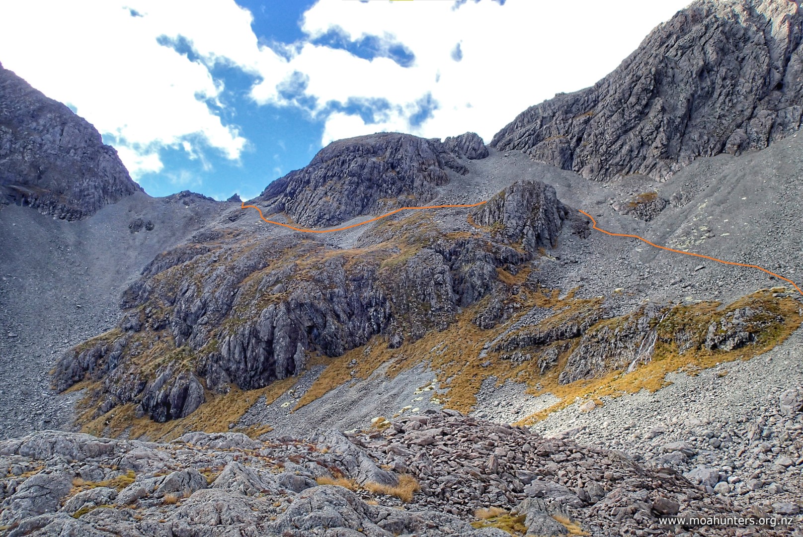
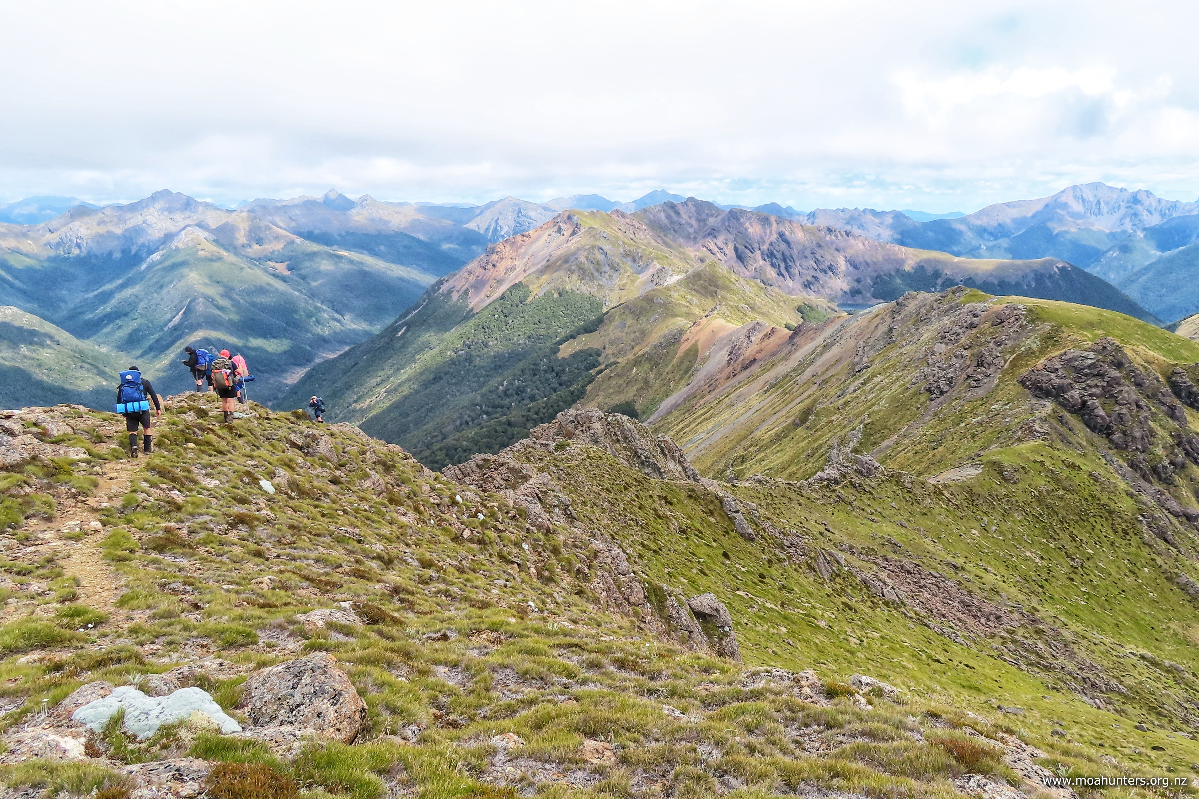
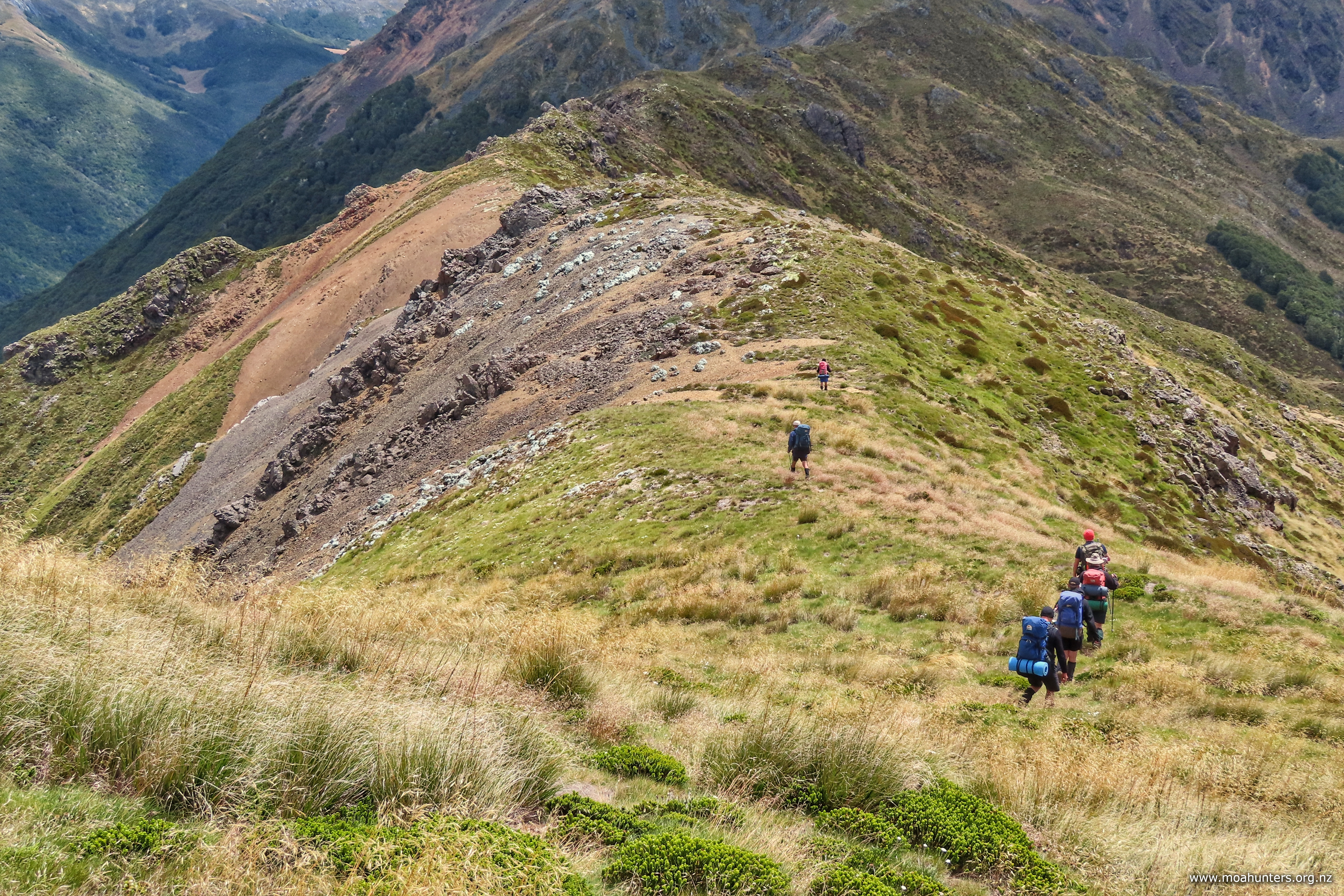
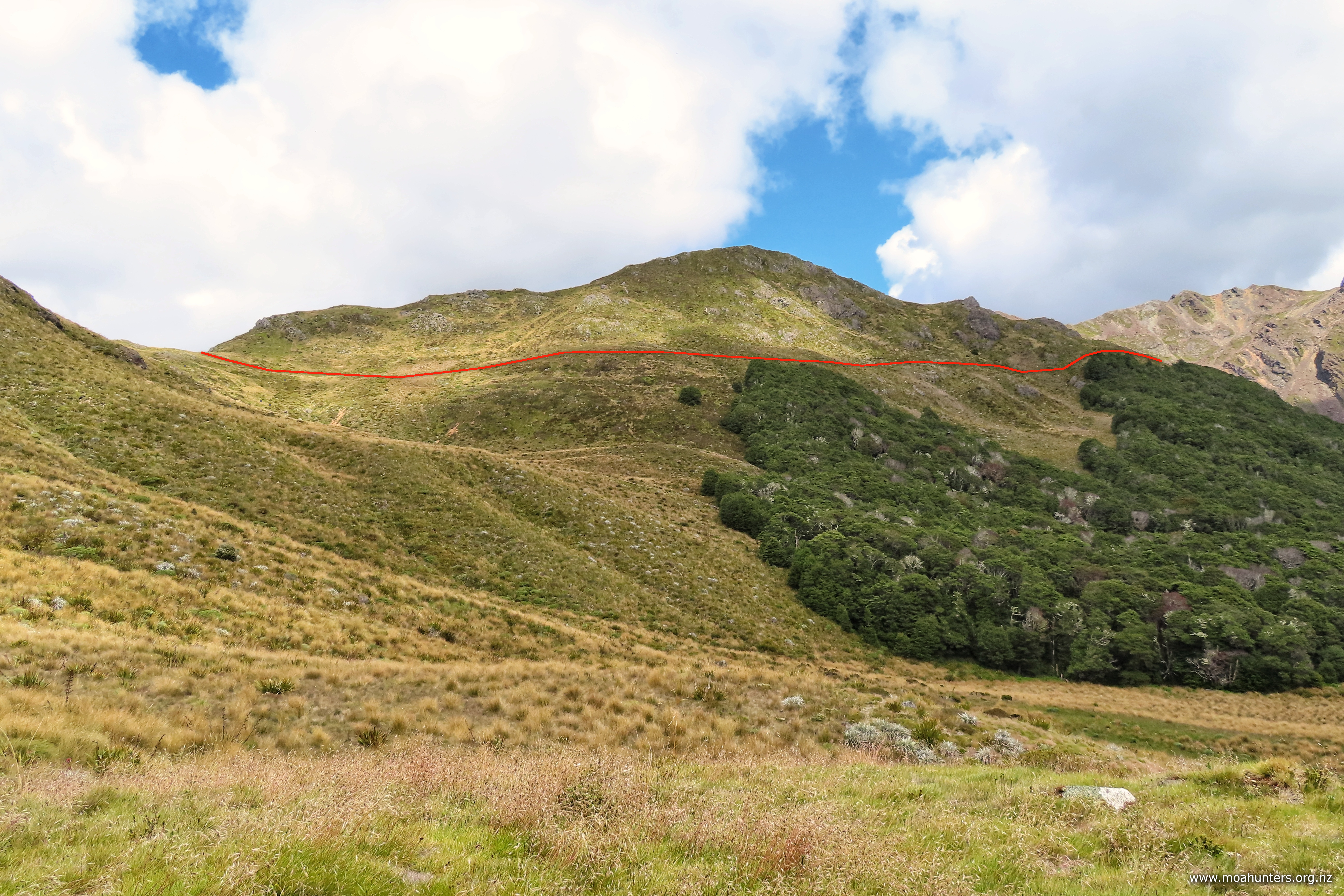
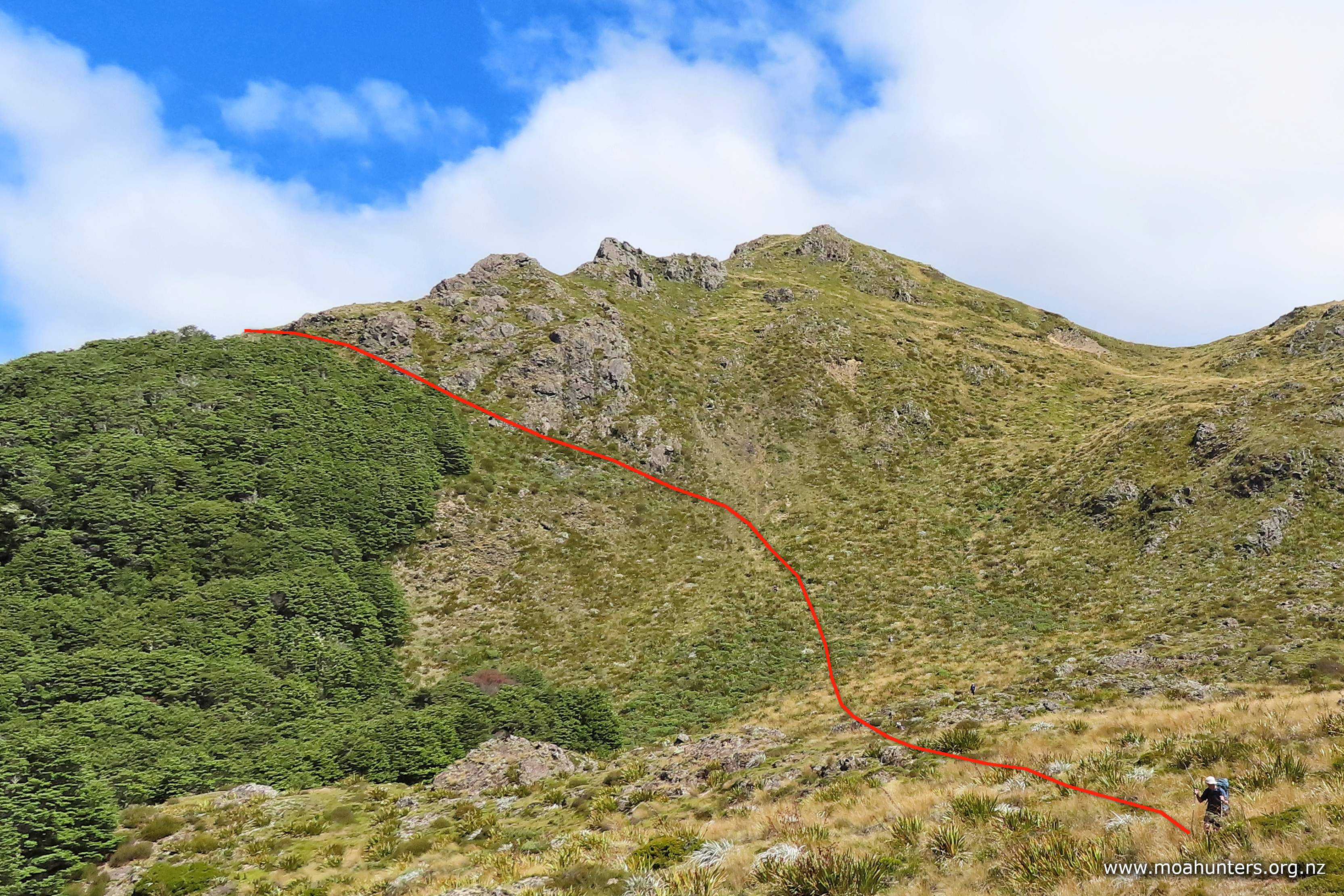
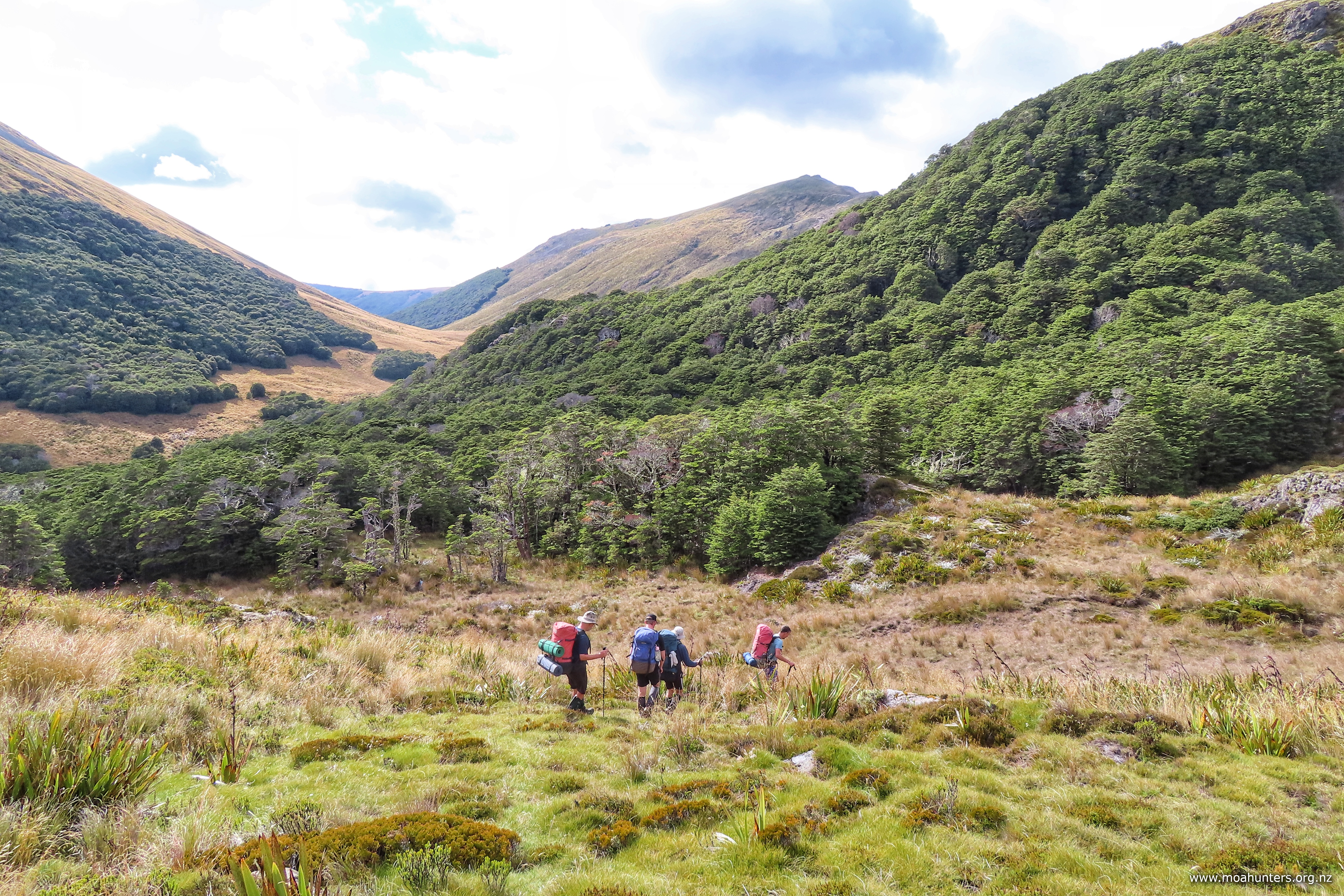
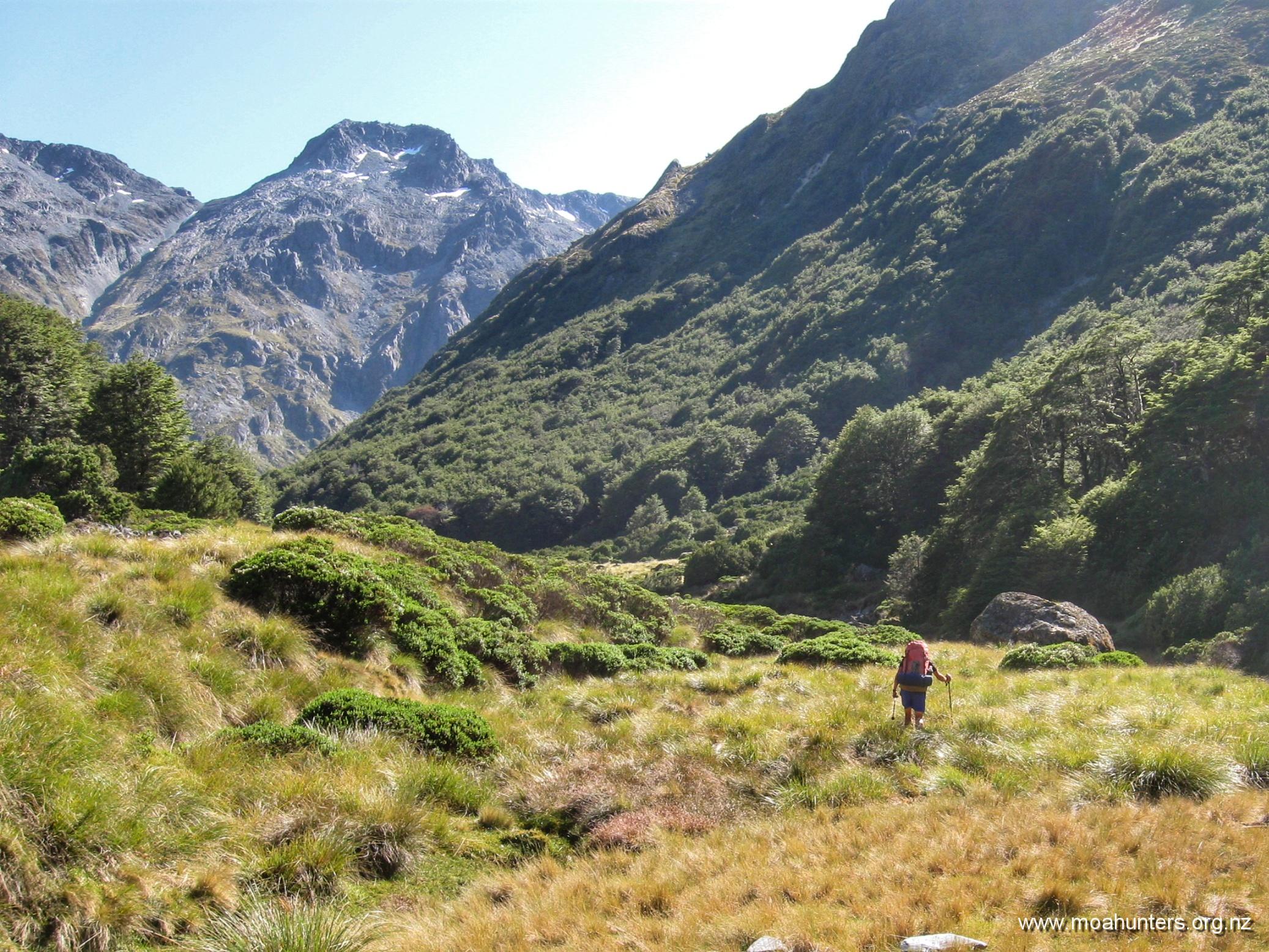
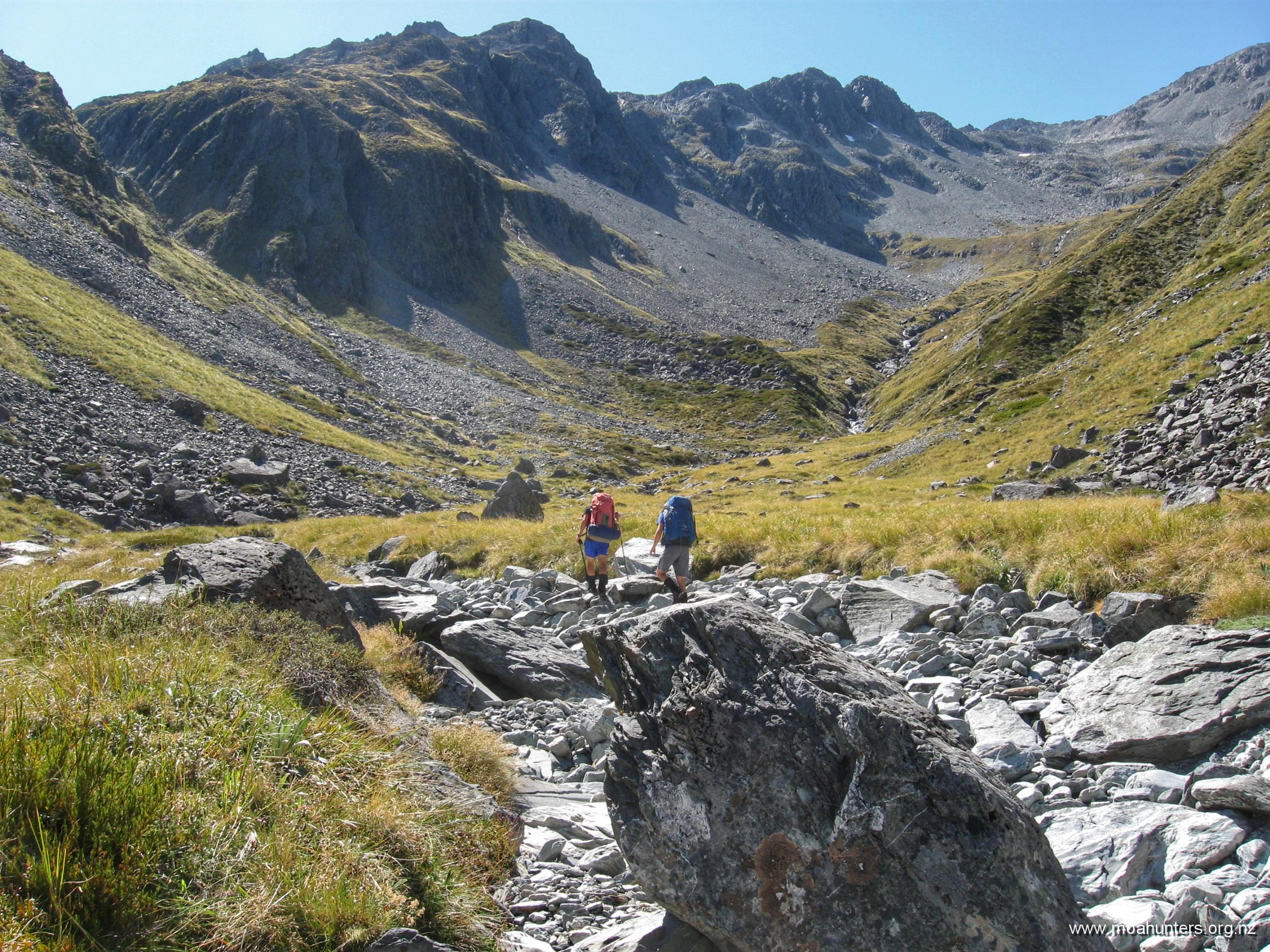
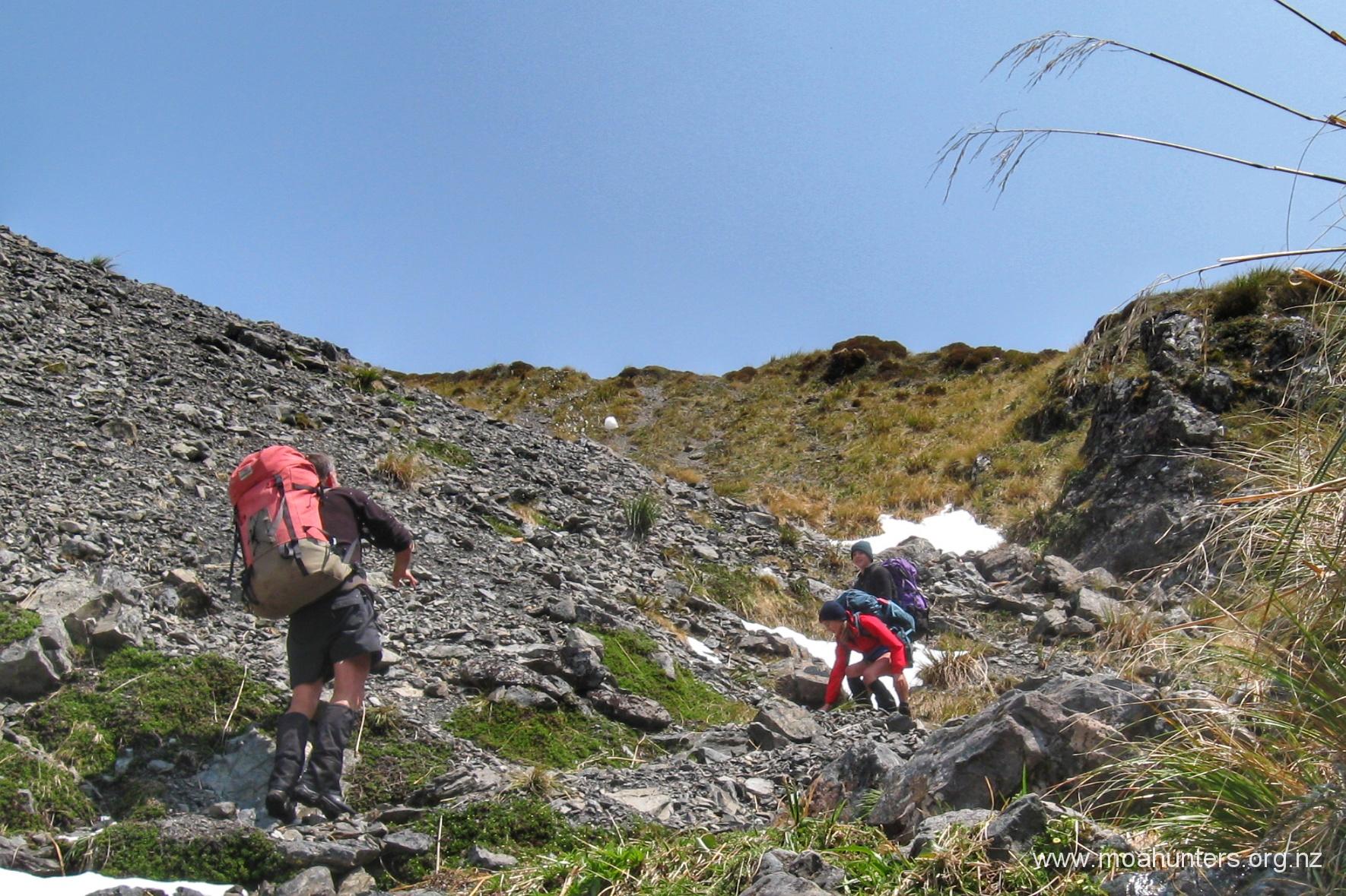
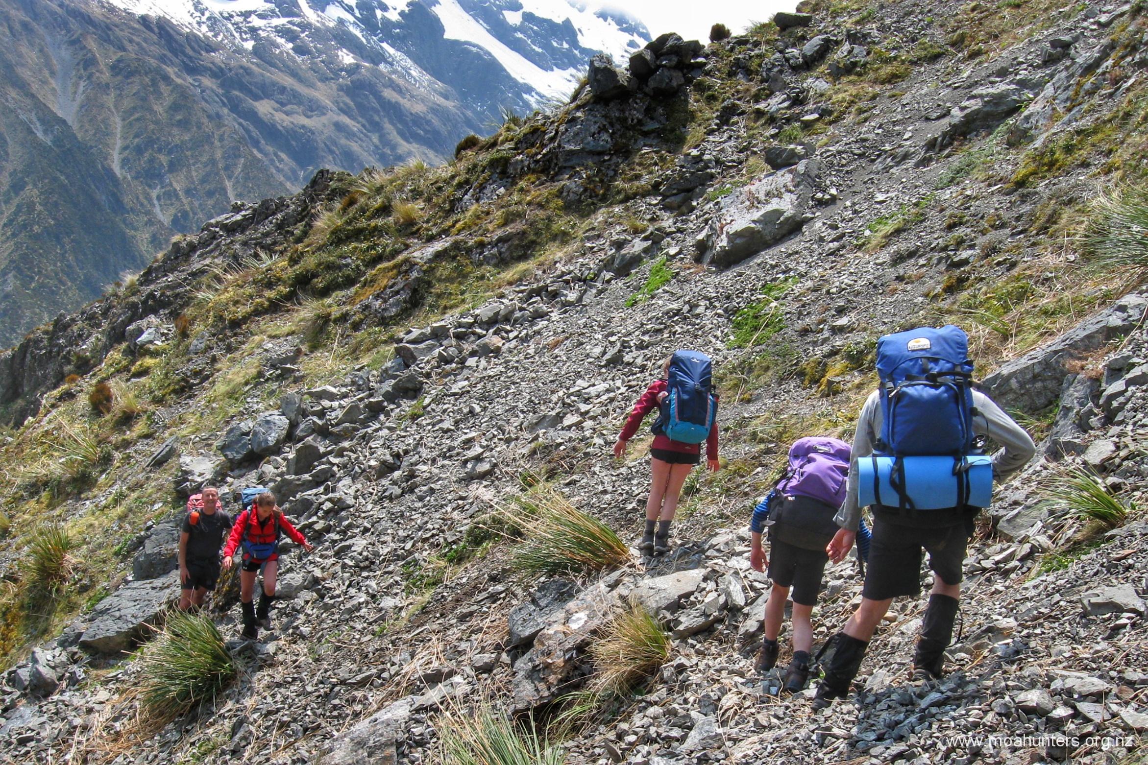
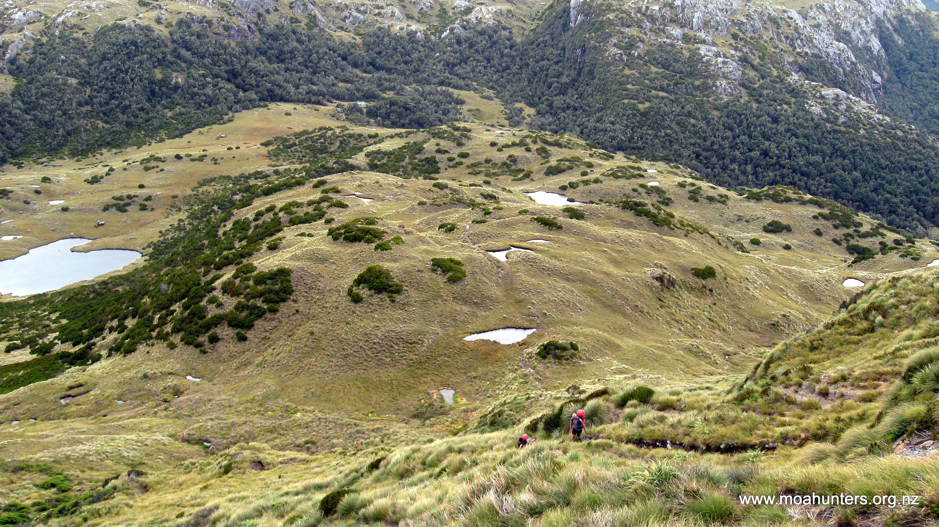
The route takes you approximately 200m above and 500m to the West of Pope’s Pass, as the pass itself is surrounded by steep loose bluffs and cliffs. From Lake Browning travel North-East up the obvious shoulder that leads in the direction of Pope’s Pass and Mt Harman.
Weather conditions were mild with little wind, so travel for us was easy. As you ascend the shoulder a cliff forms and drops away on your right, if you this keep this in sight for the start of your climb you are on the correct path.
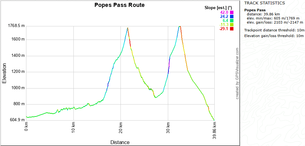
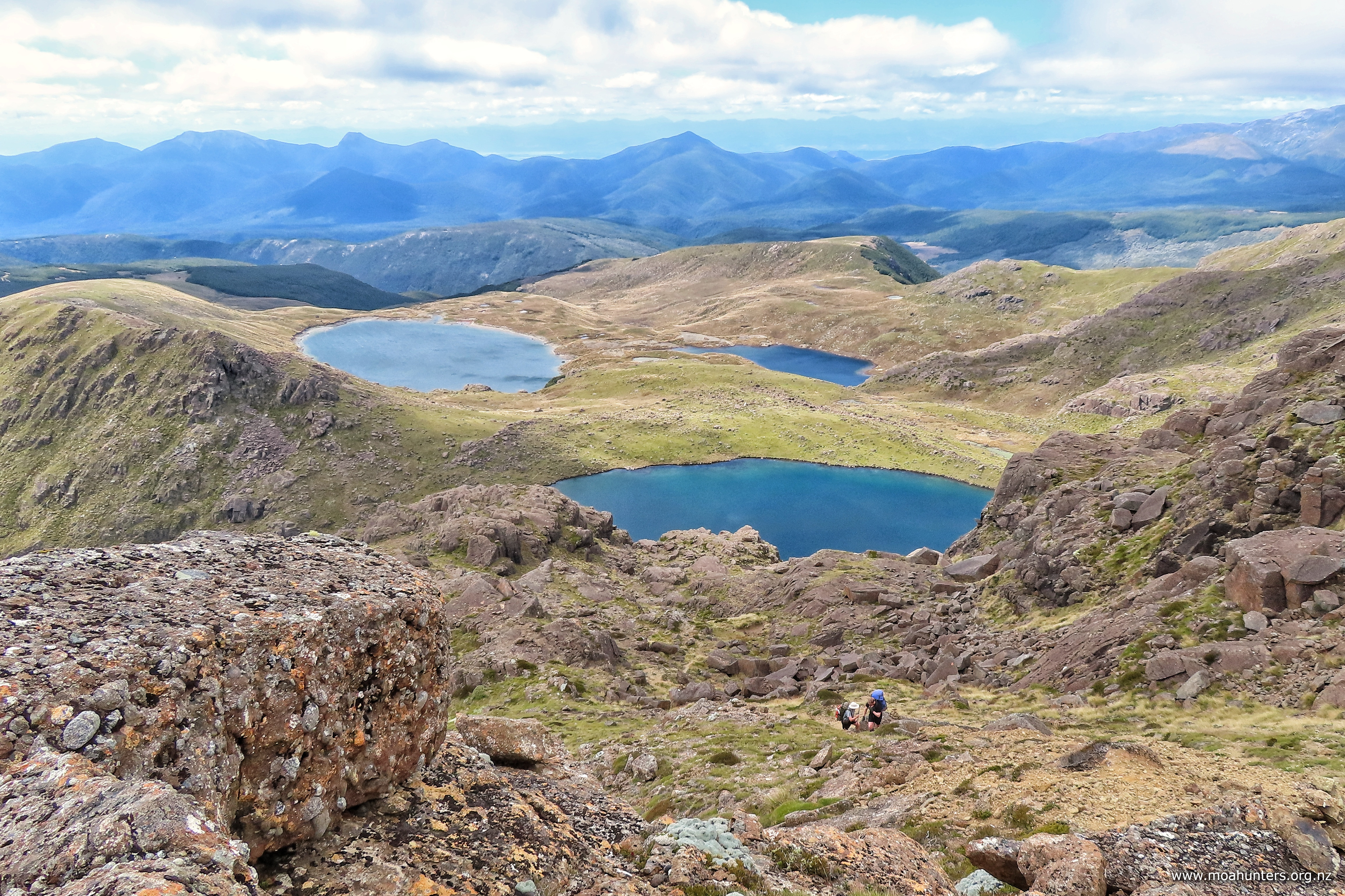
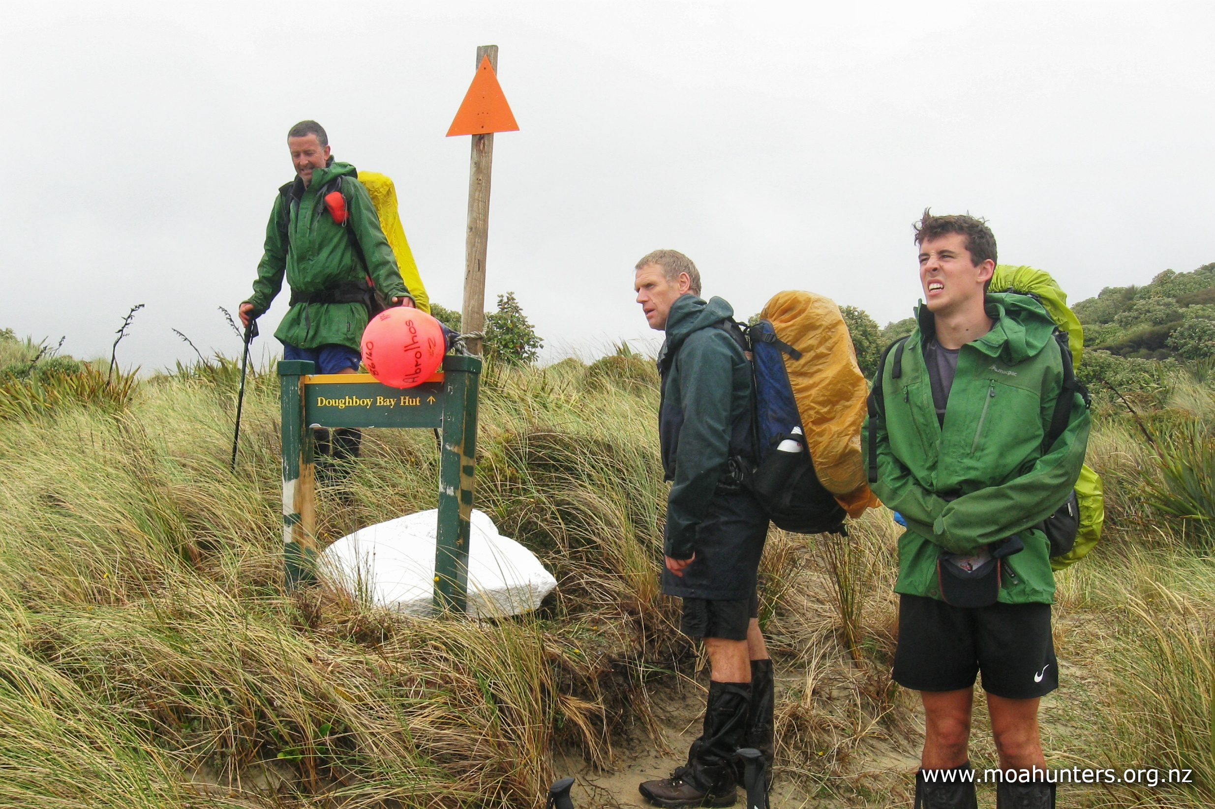
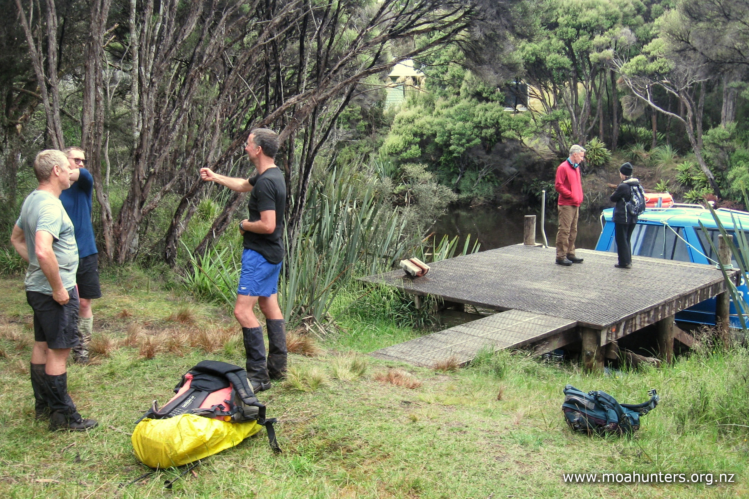
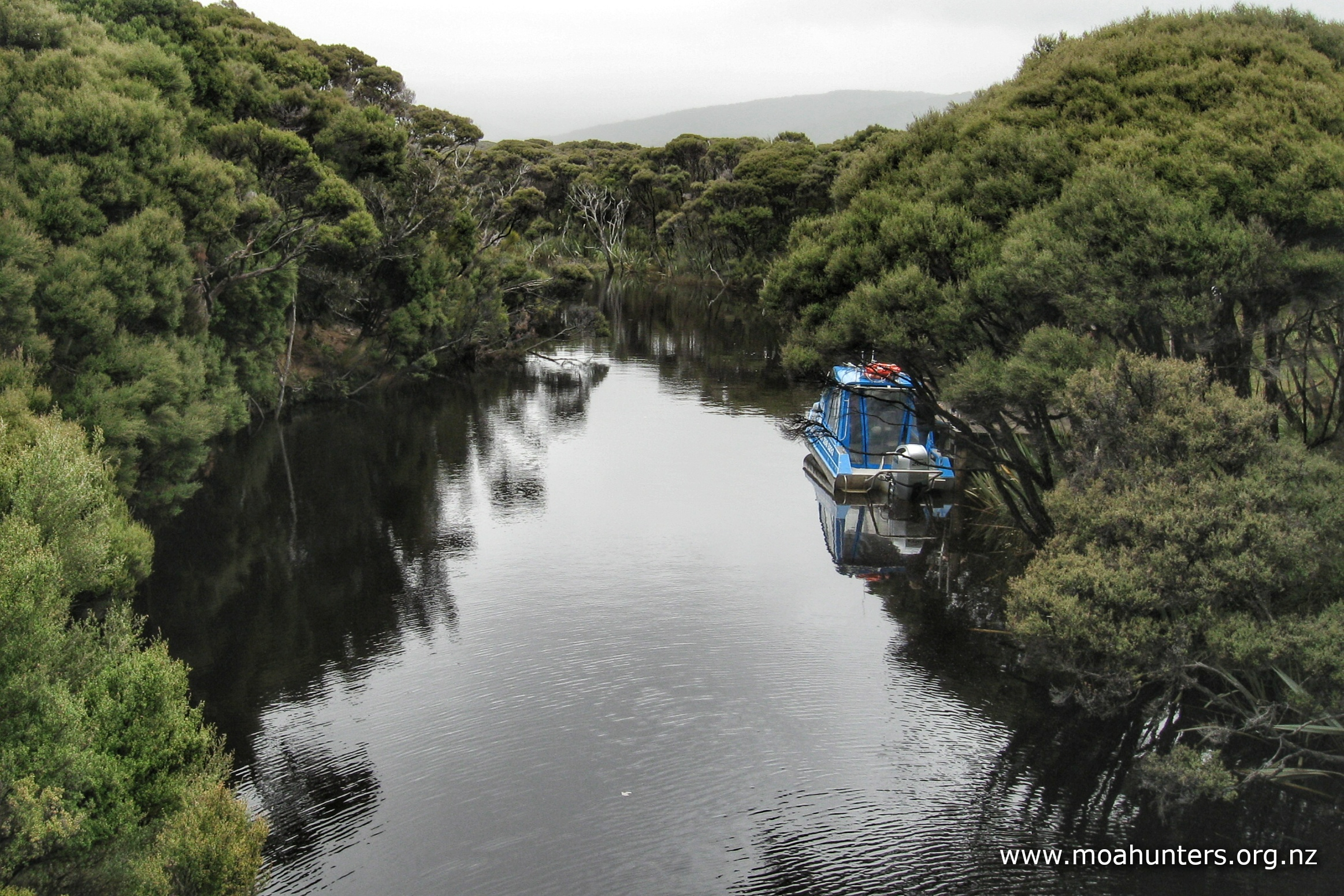
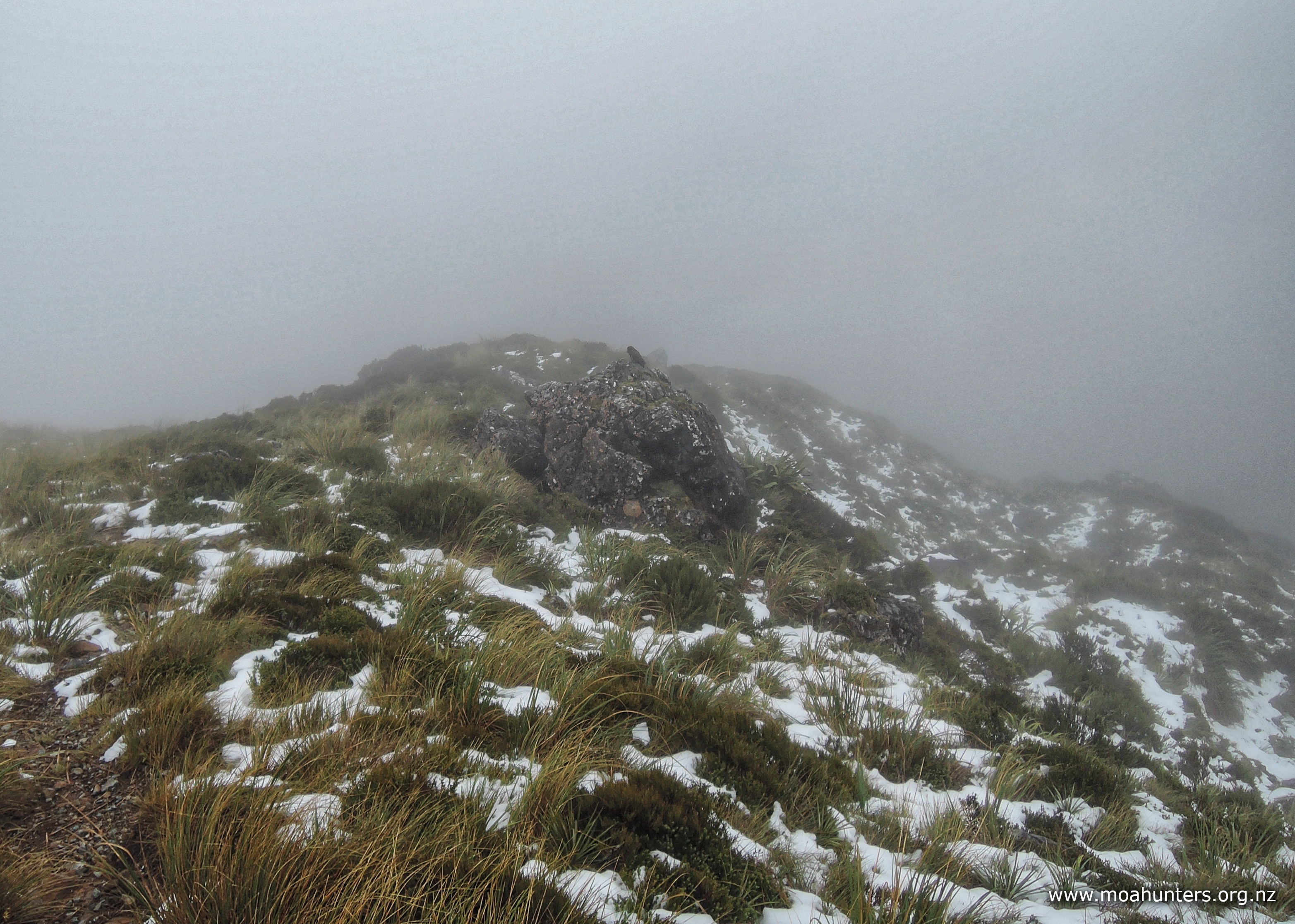
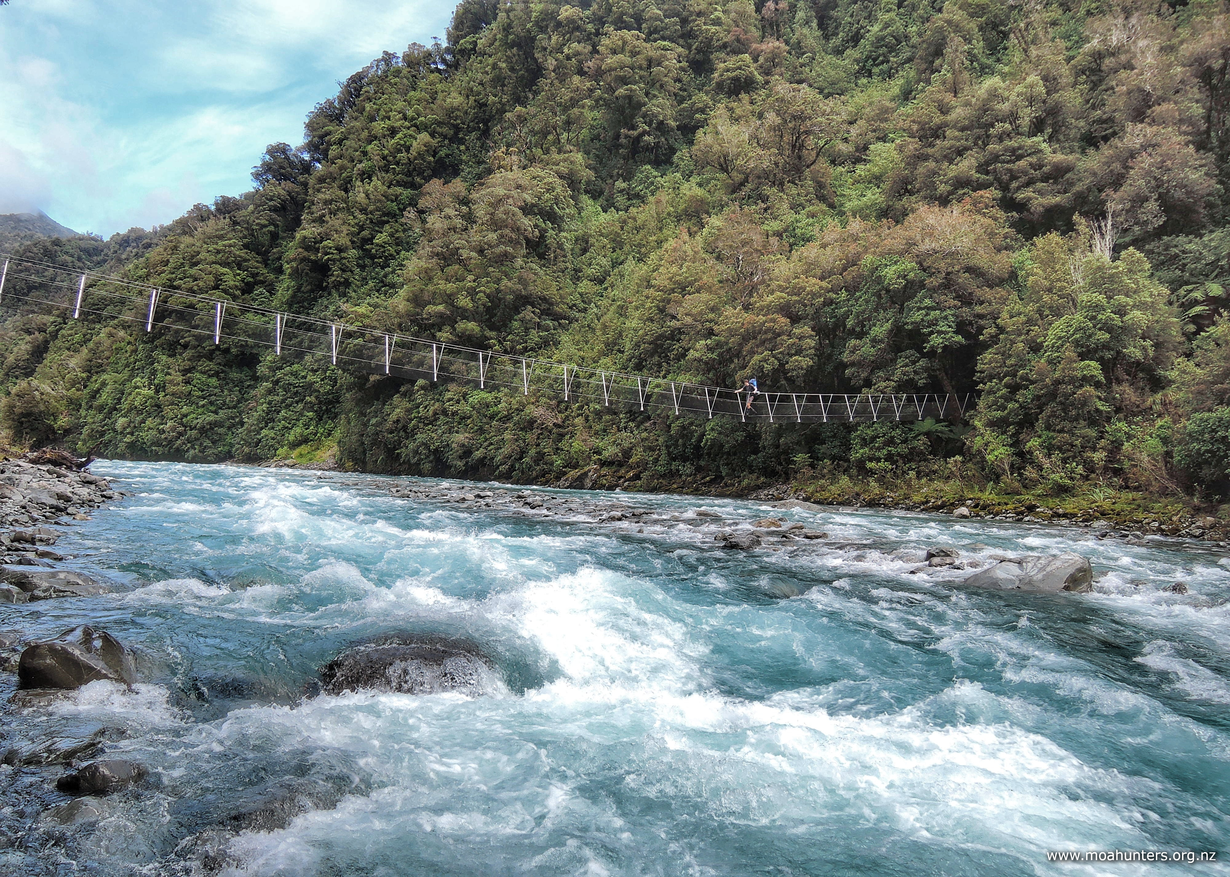
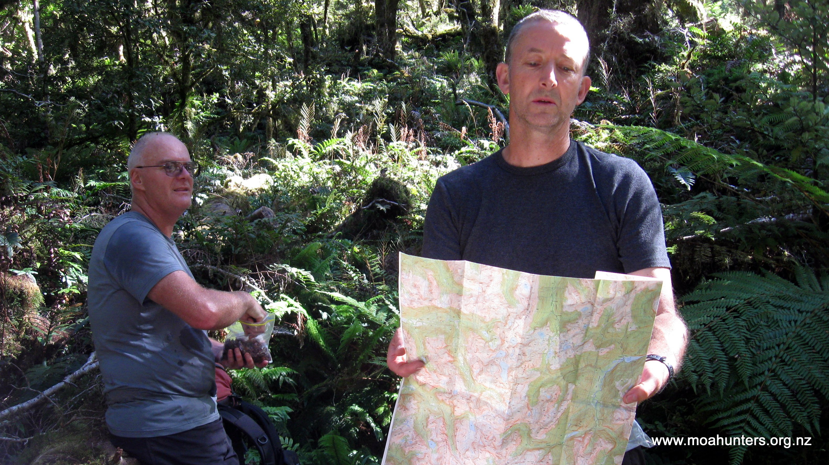
You are headed for this point…
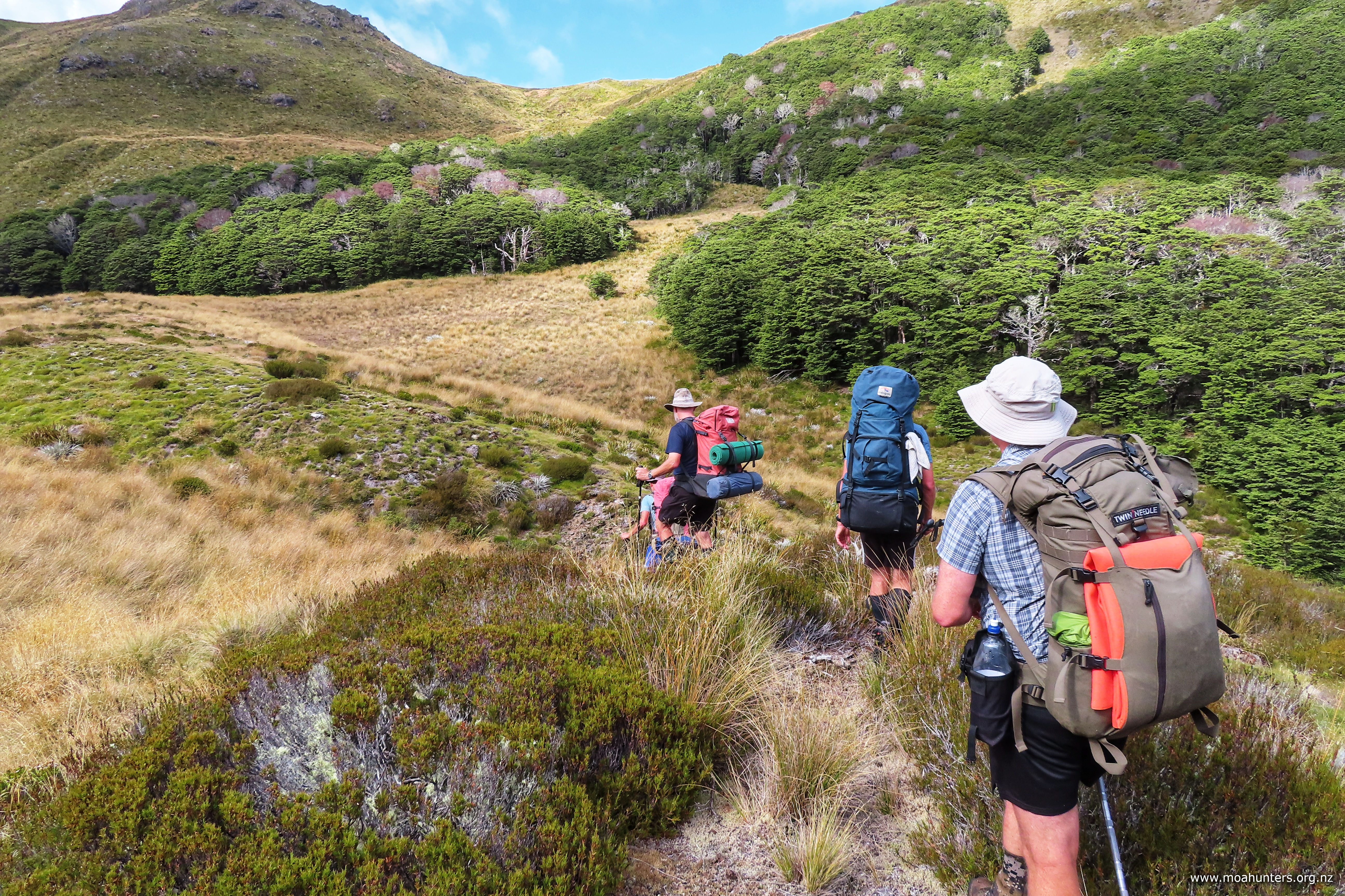
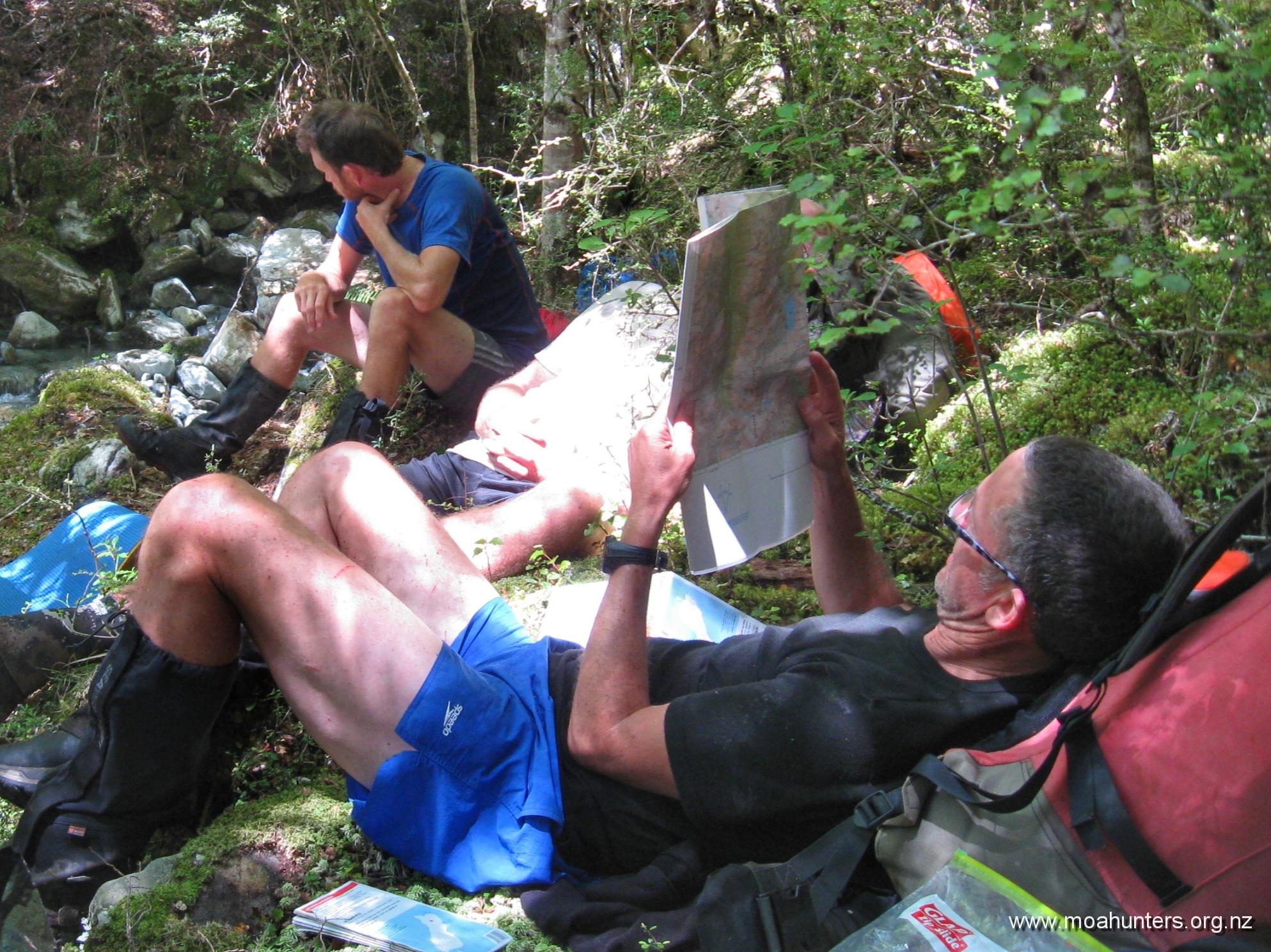
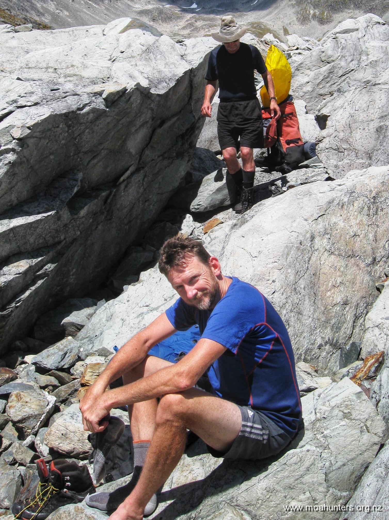
The climb is about 400m from Lake Browning, and if you have had a good sleep and breakfast, it can be completed without undue huffing and puffing. We found a satisfying large cairn just before the highest point of the route, confirming we were on track and removing any doubts we might have had regarding our navigational skills.
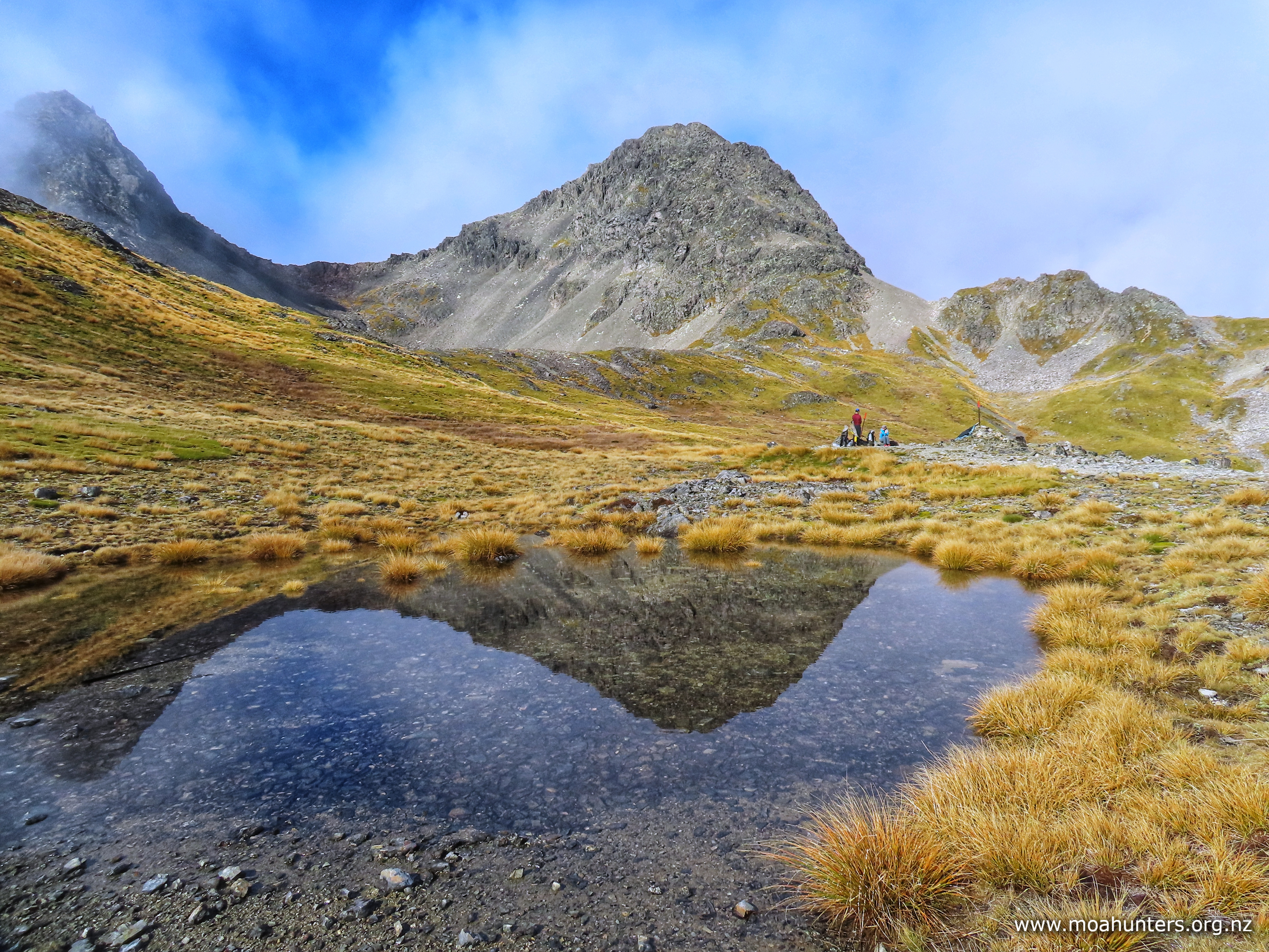
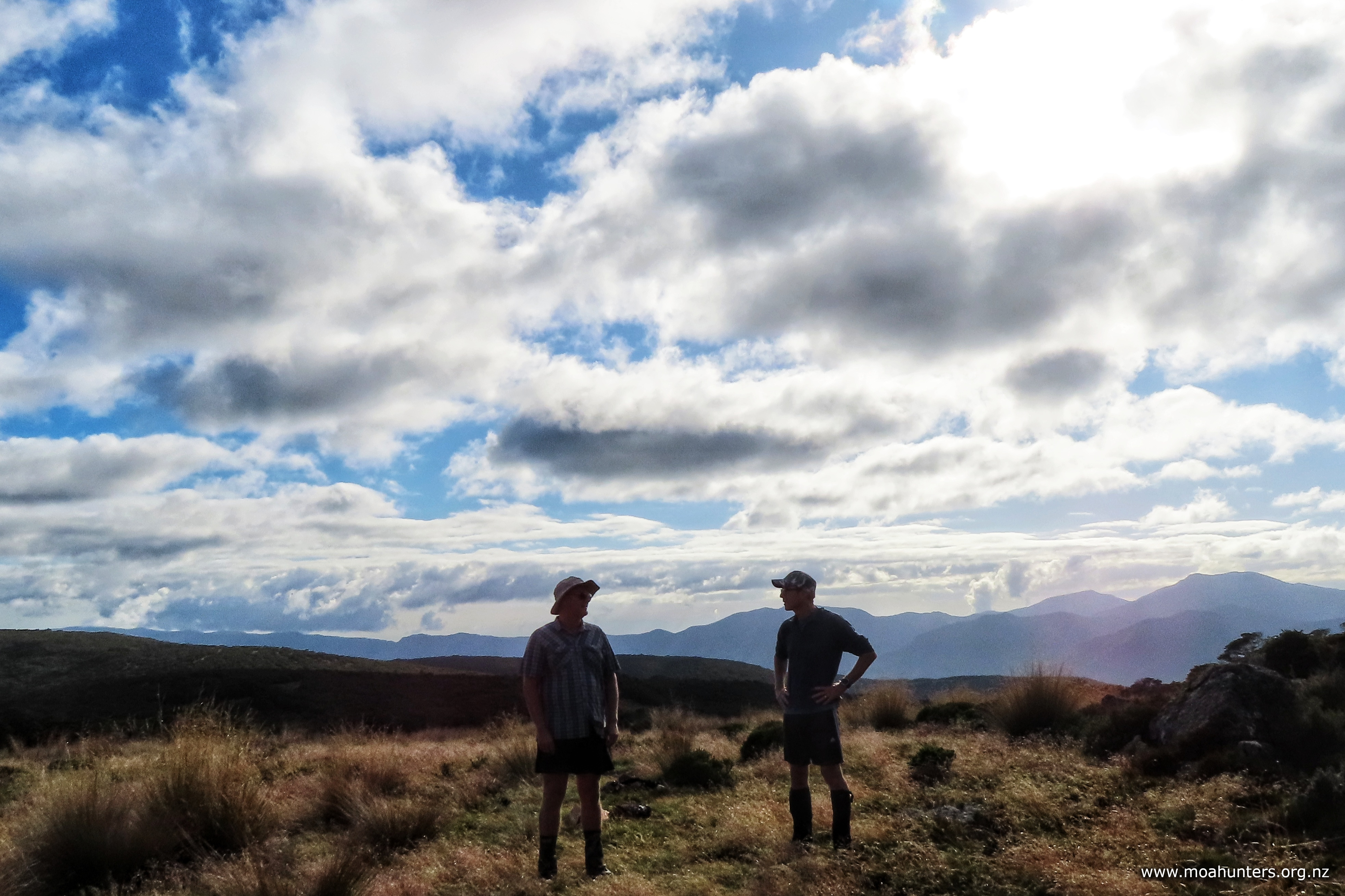
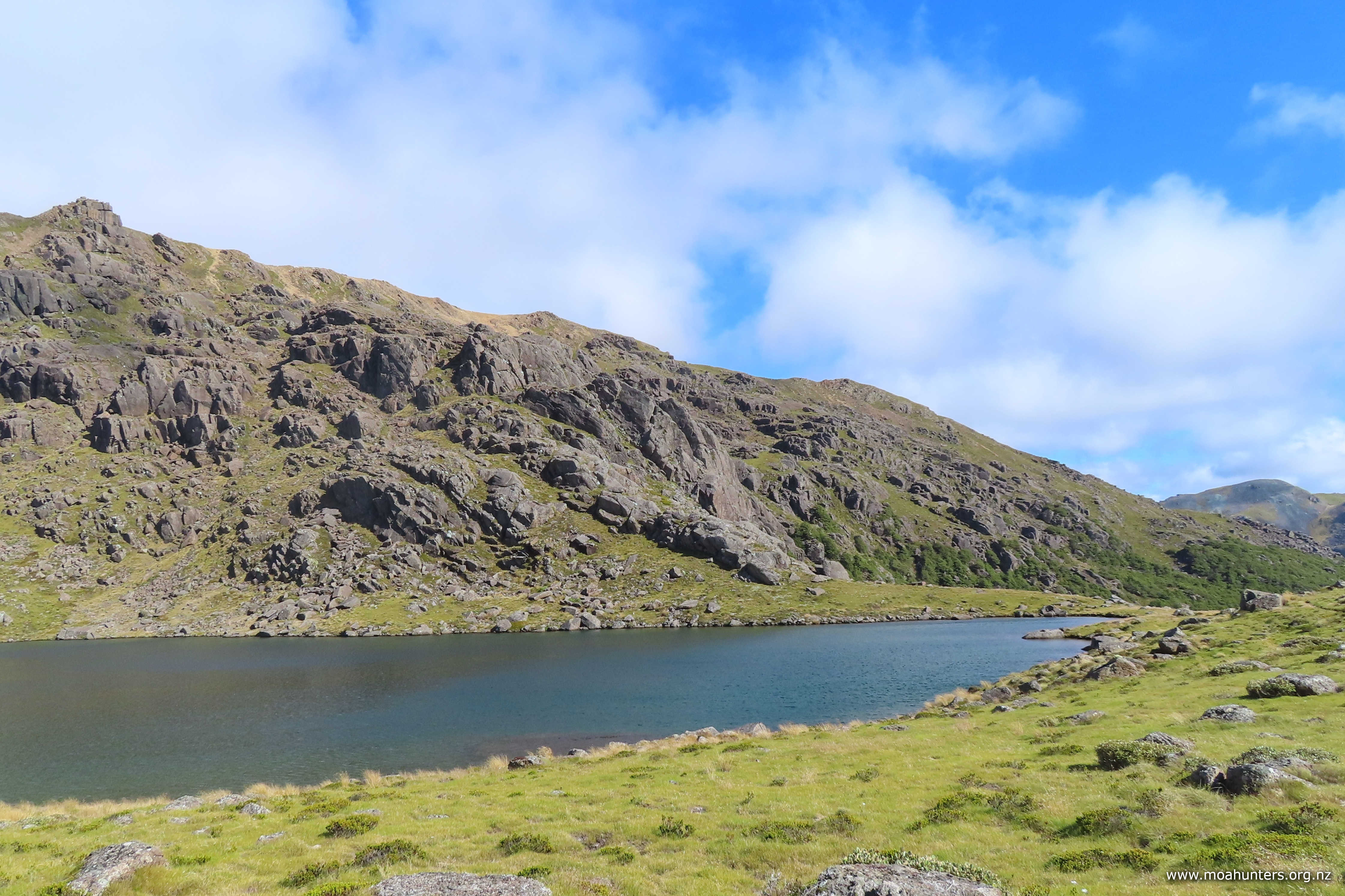
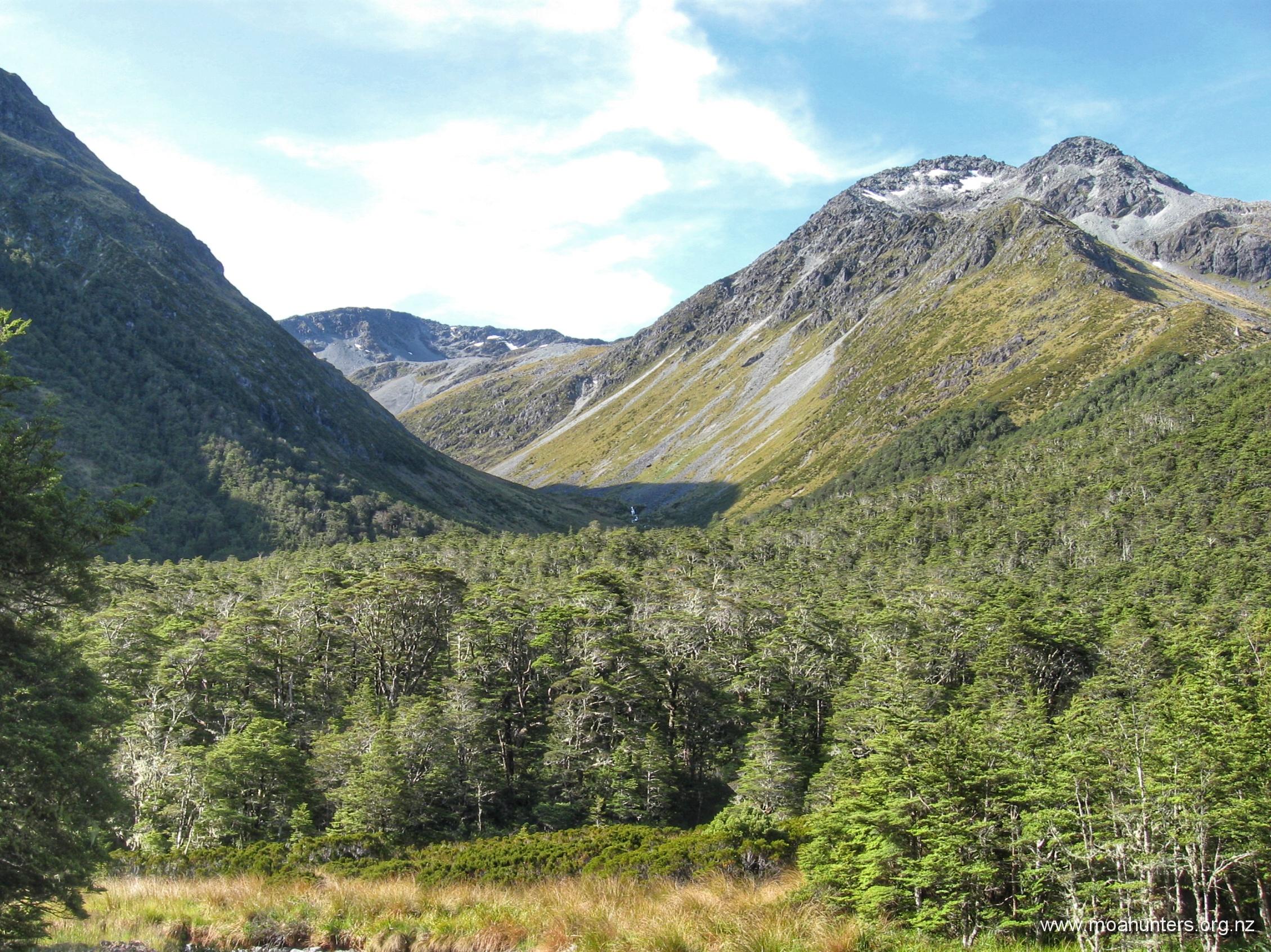
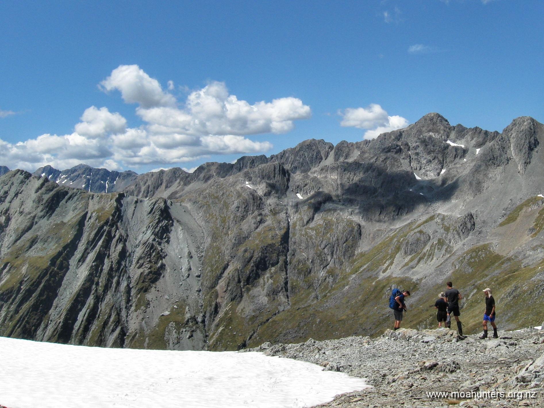
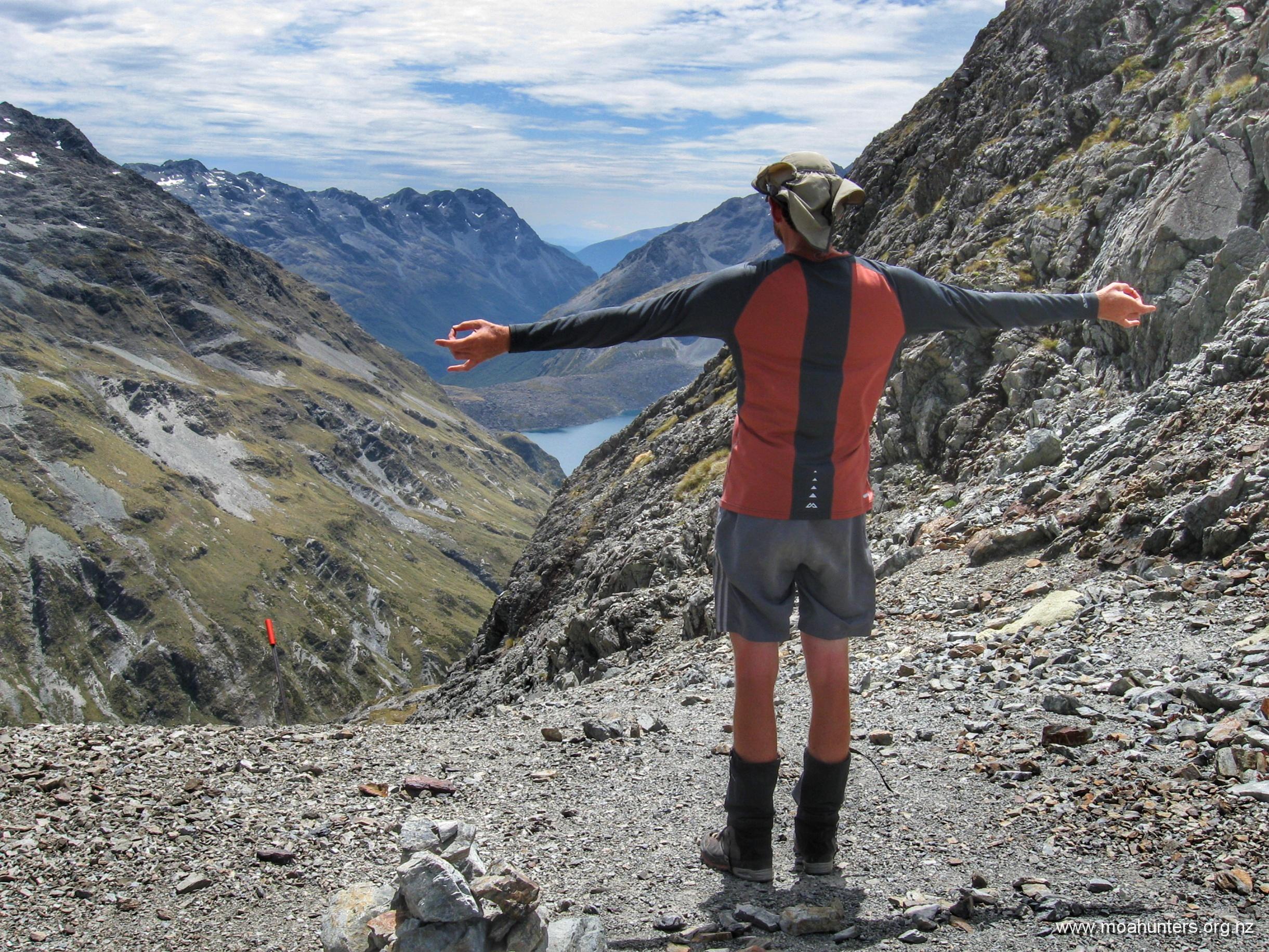
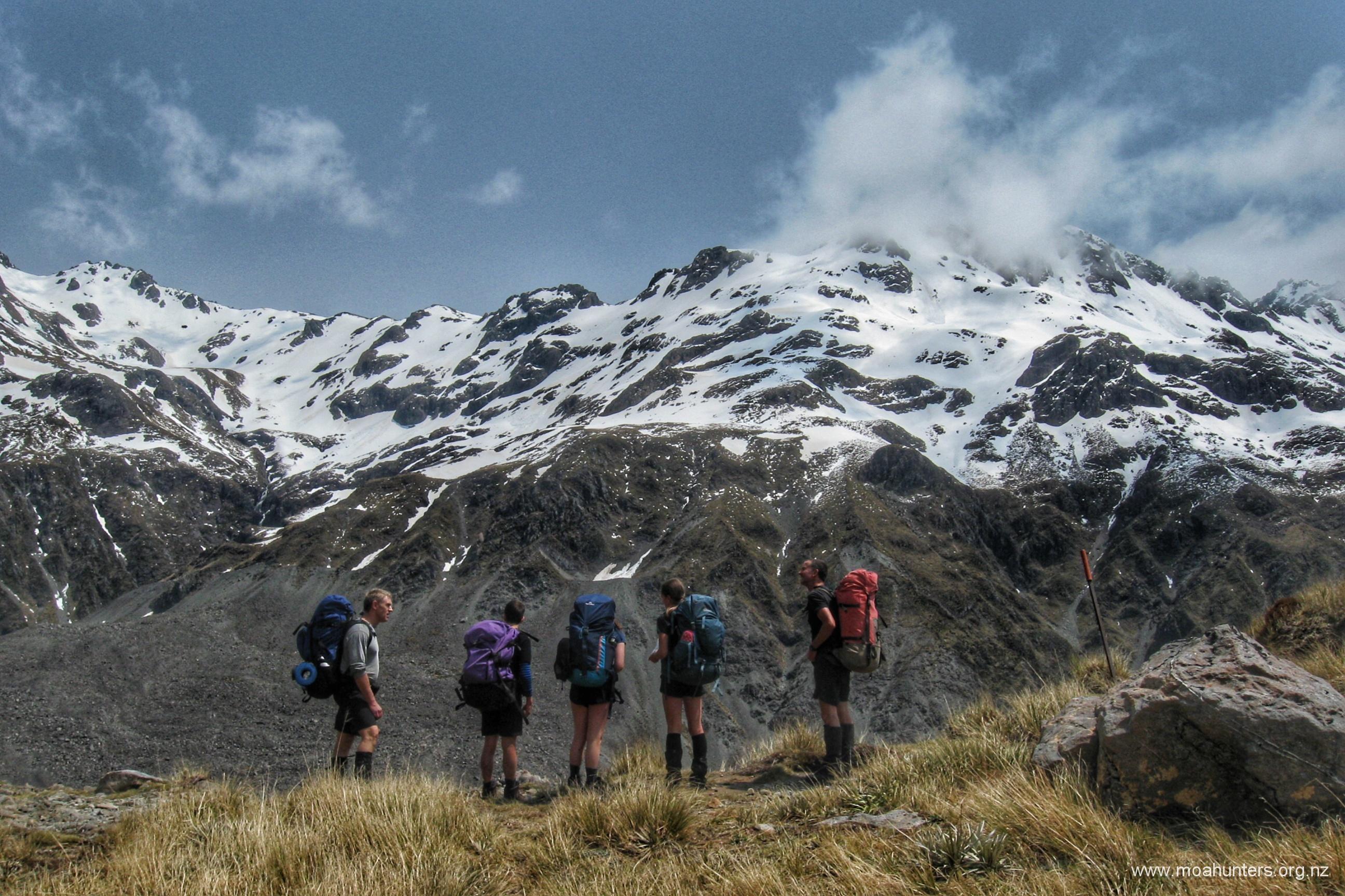
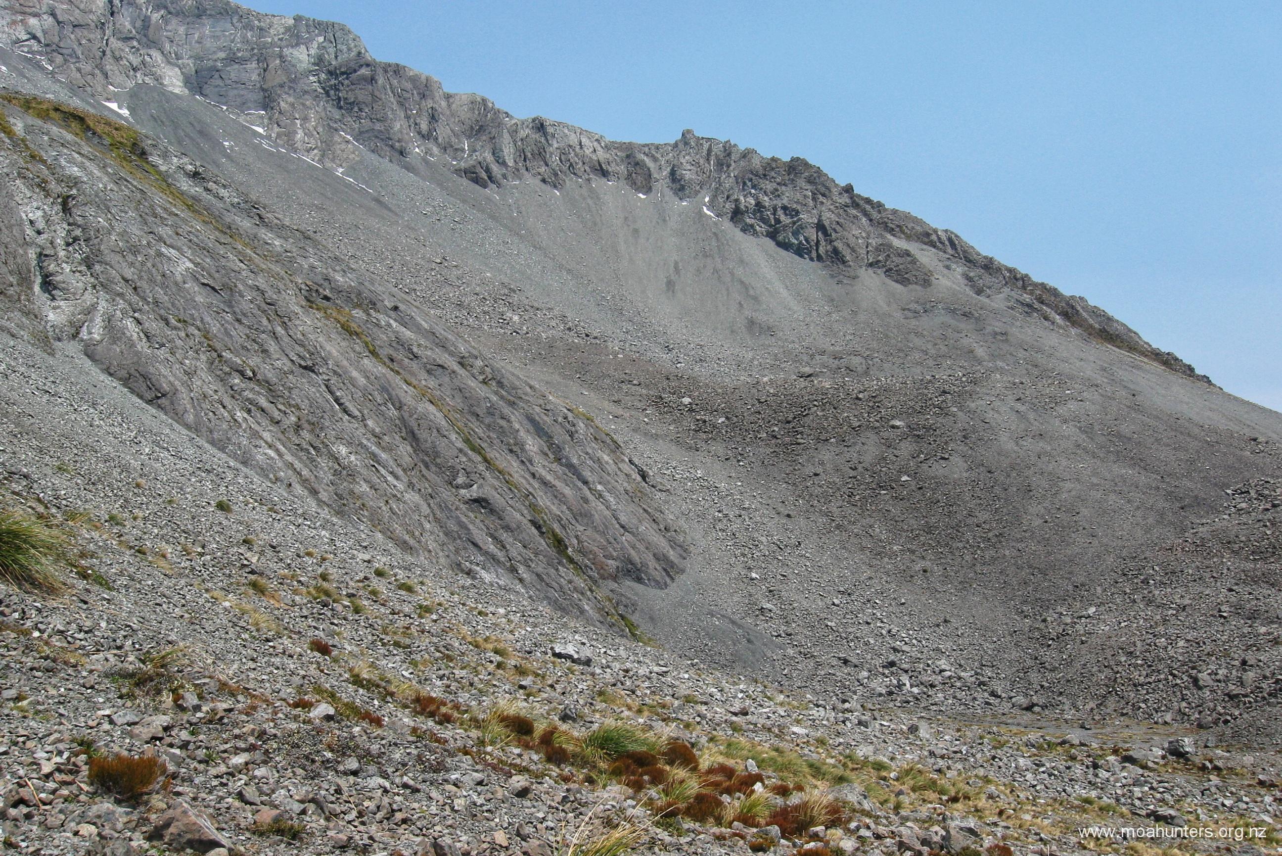
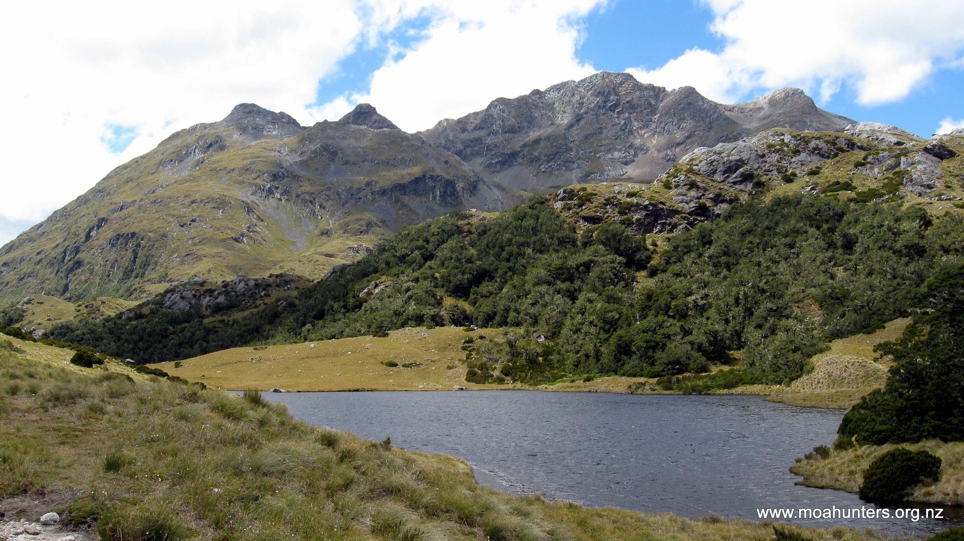
At the highest point you should have Pope’s Pass to your East, a steep, short climb to Mt Harman to the West and a snow cover bench gently descending to the North.
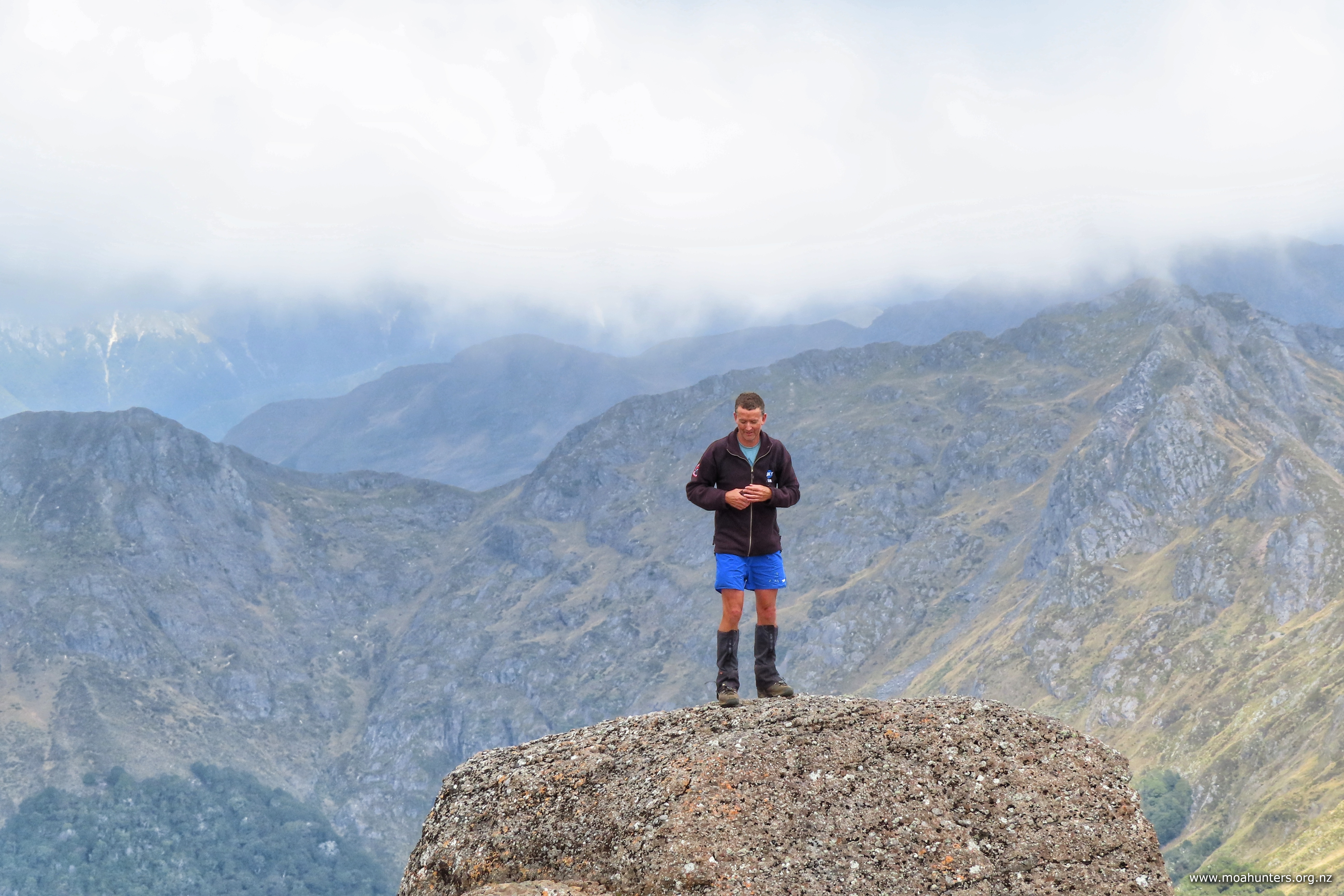
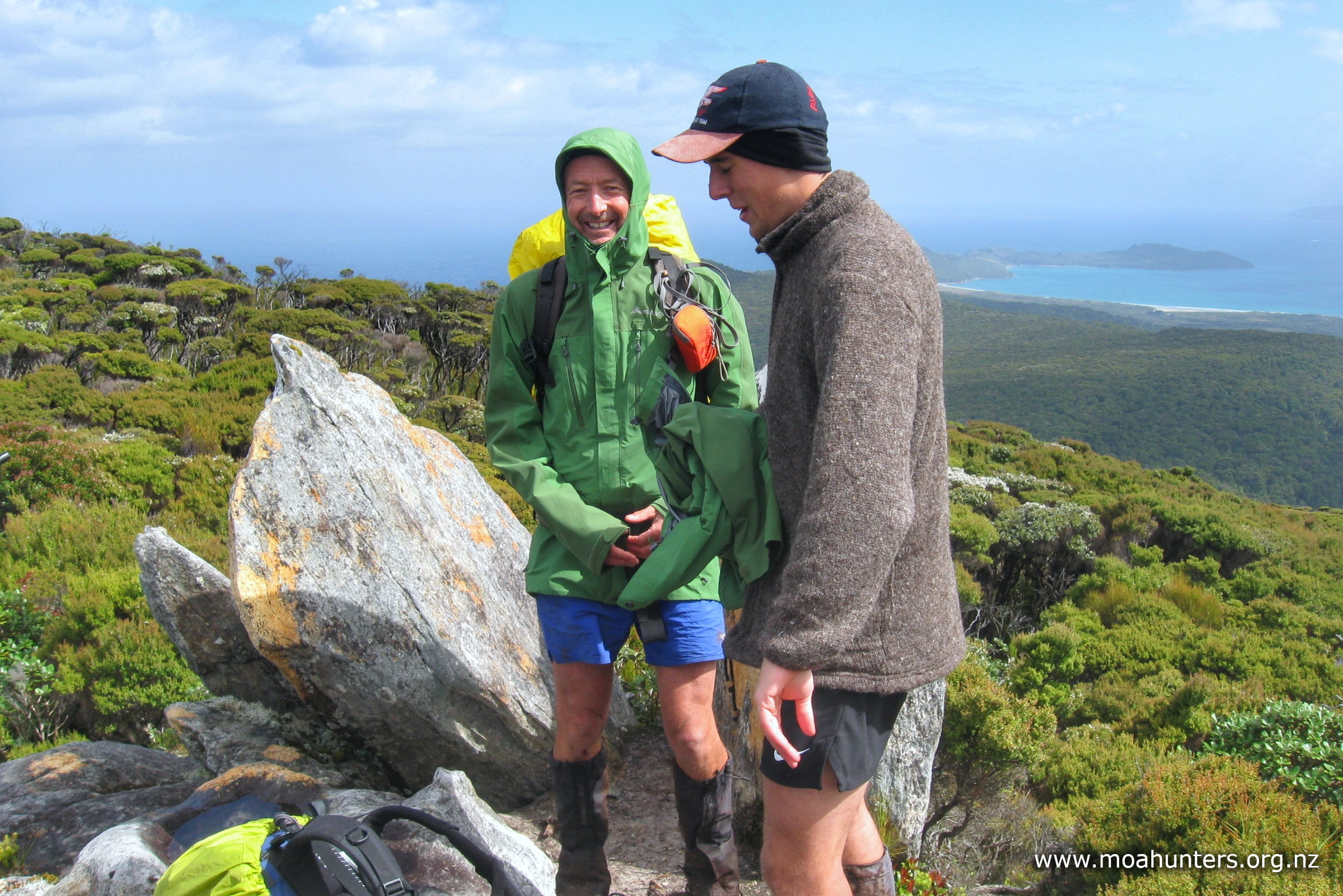
If weather allows, it is worth dropping packs and making the short side trip to the ridge line that leads to Mt Harman. The views are fantastic views and mobile phone coverage there allows a quick call home to reassure the nearest and dearest that you are on track and doing well (and you can get a weather report).
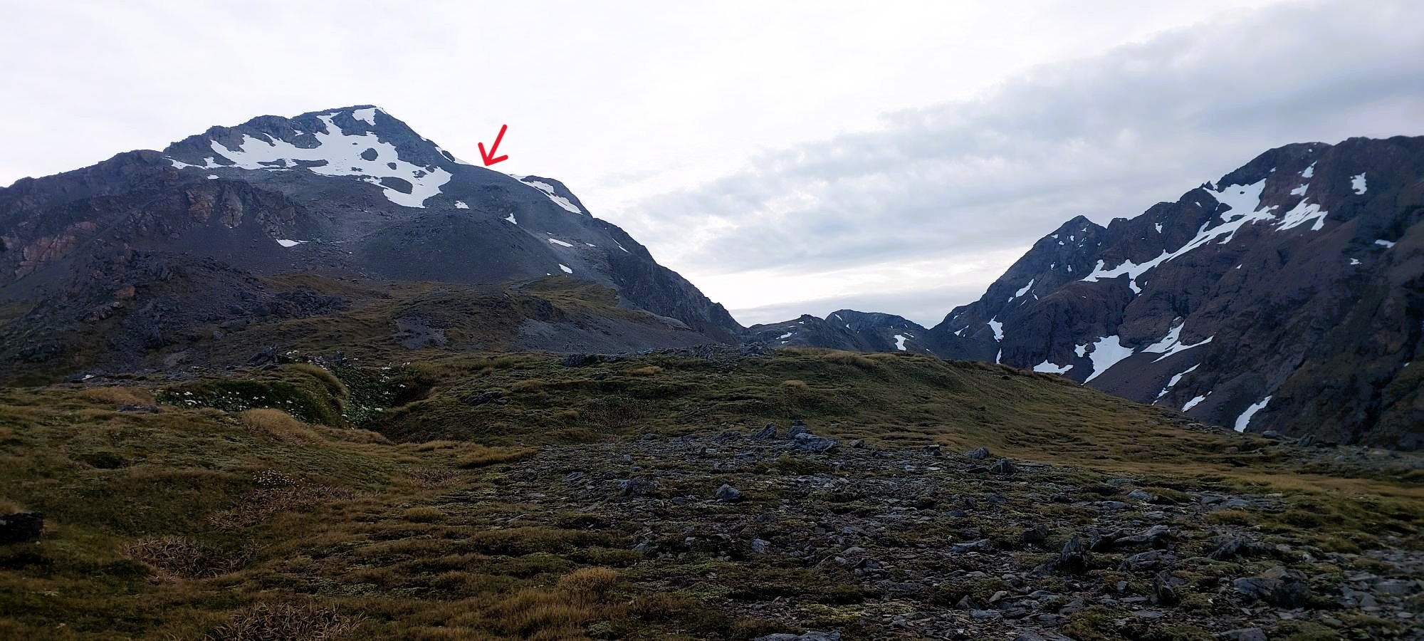
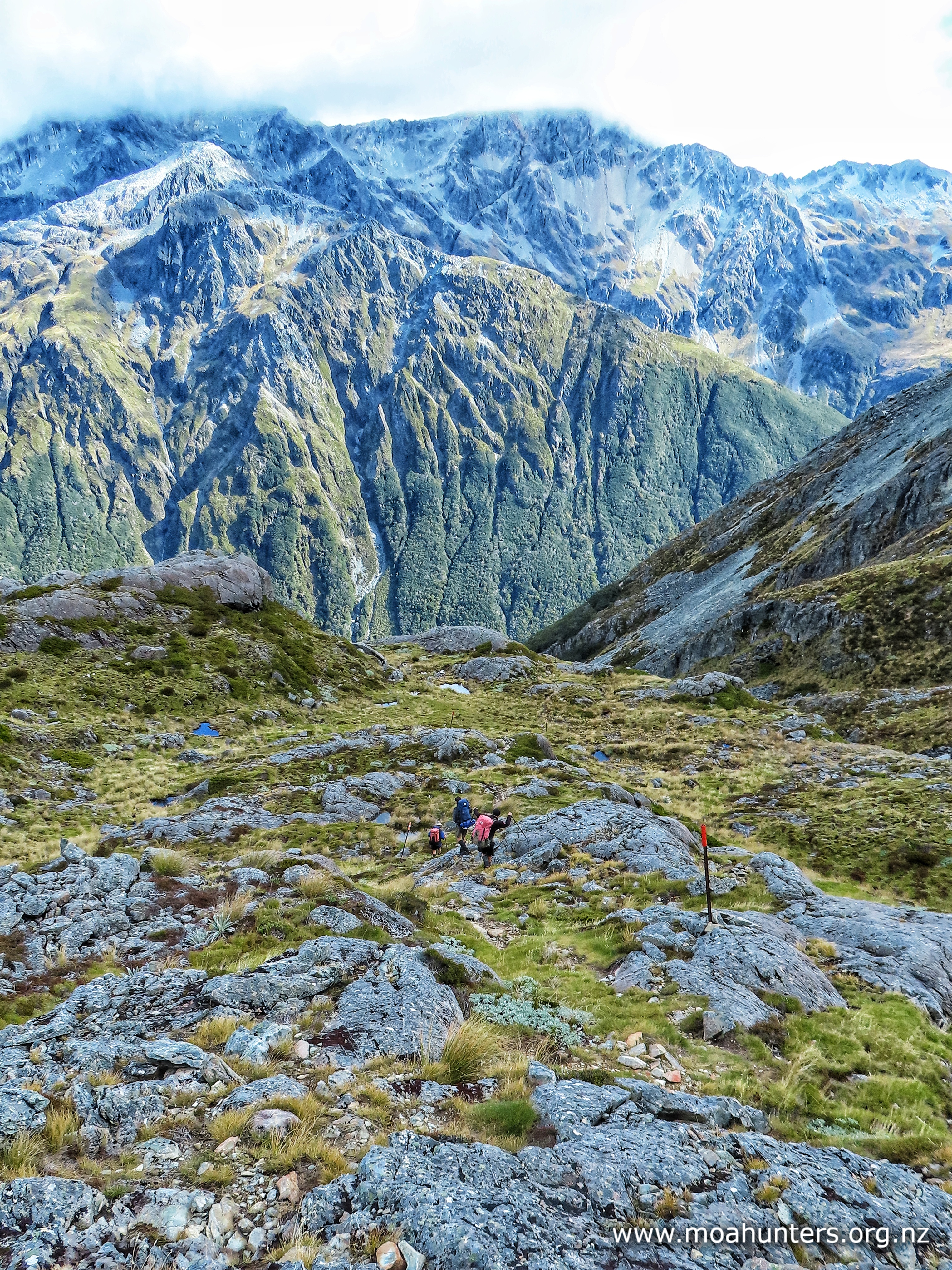
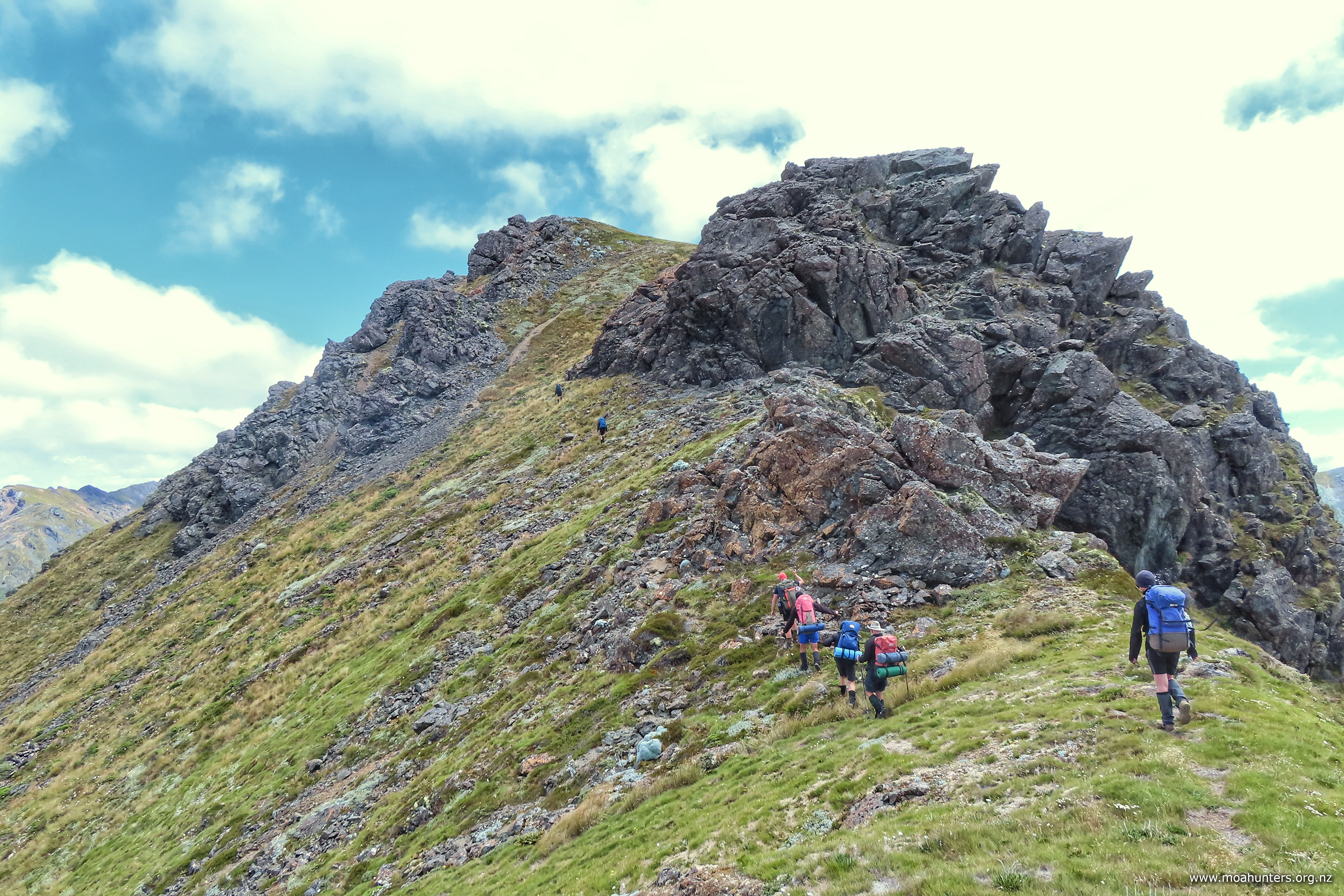
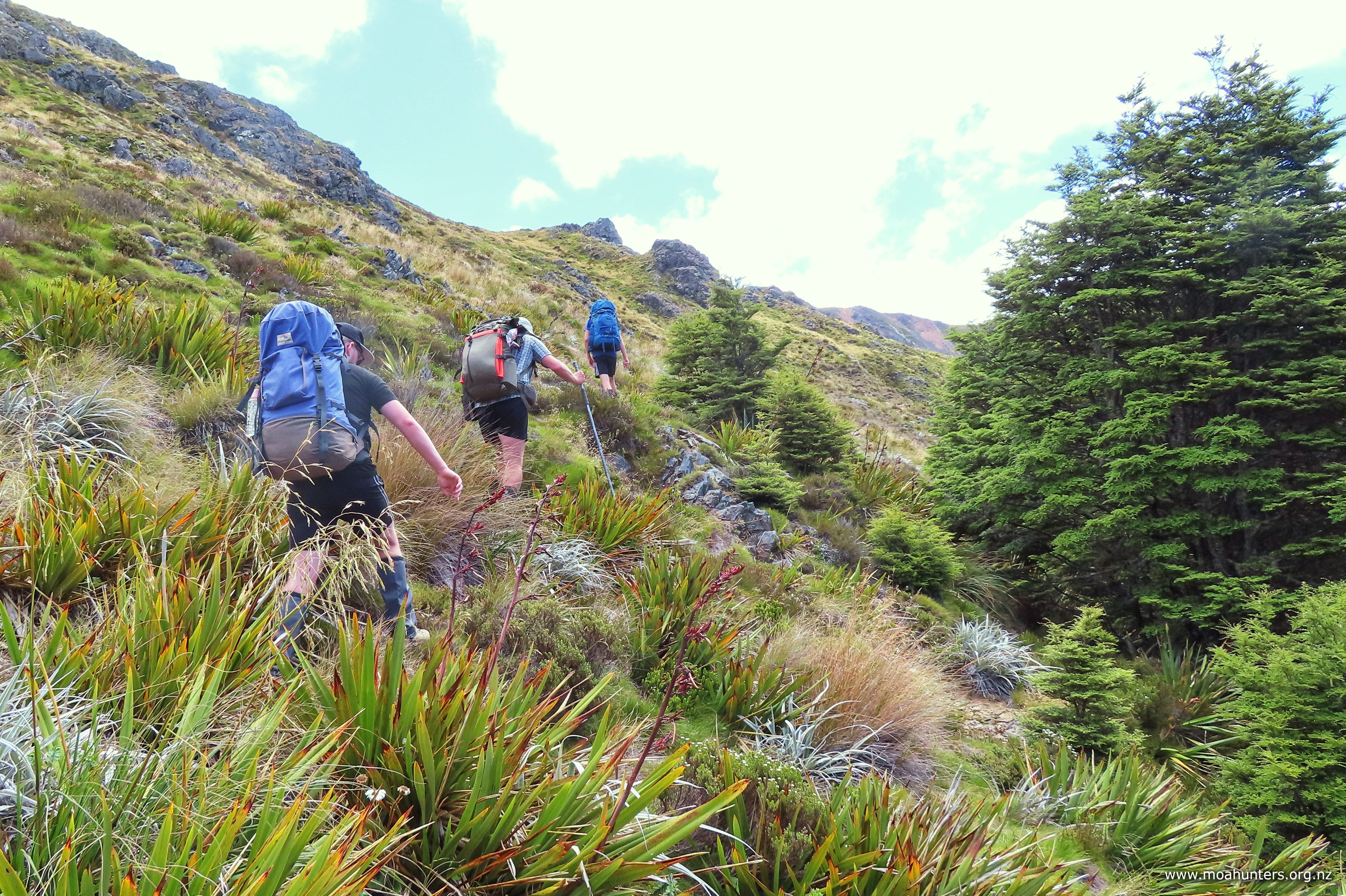
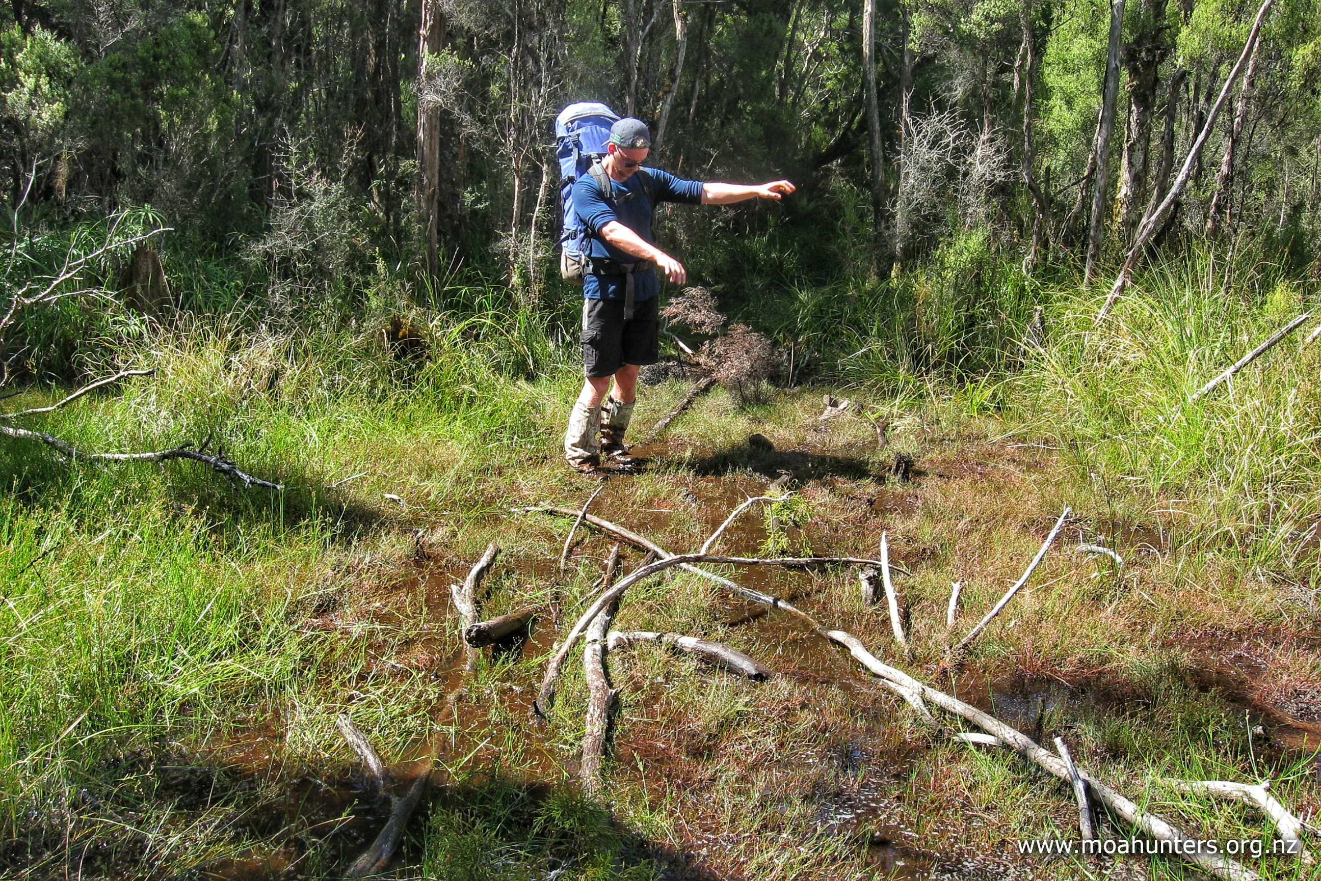
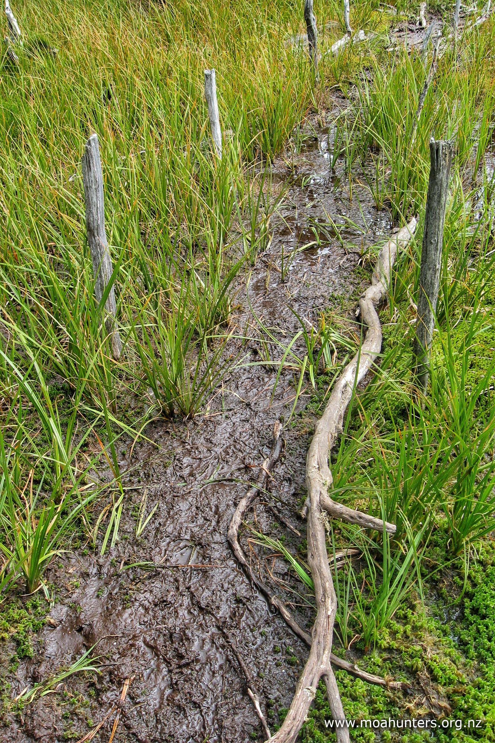
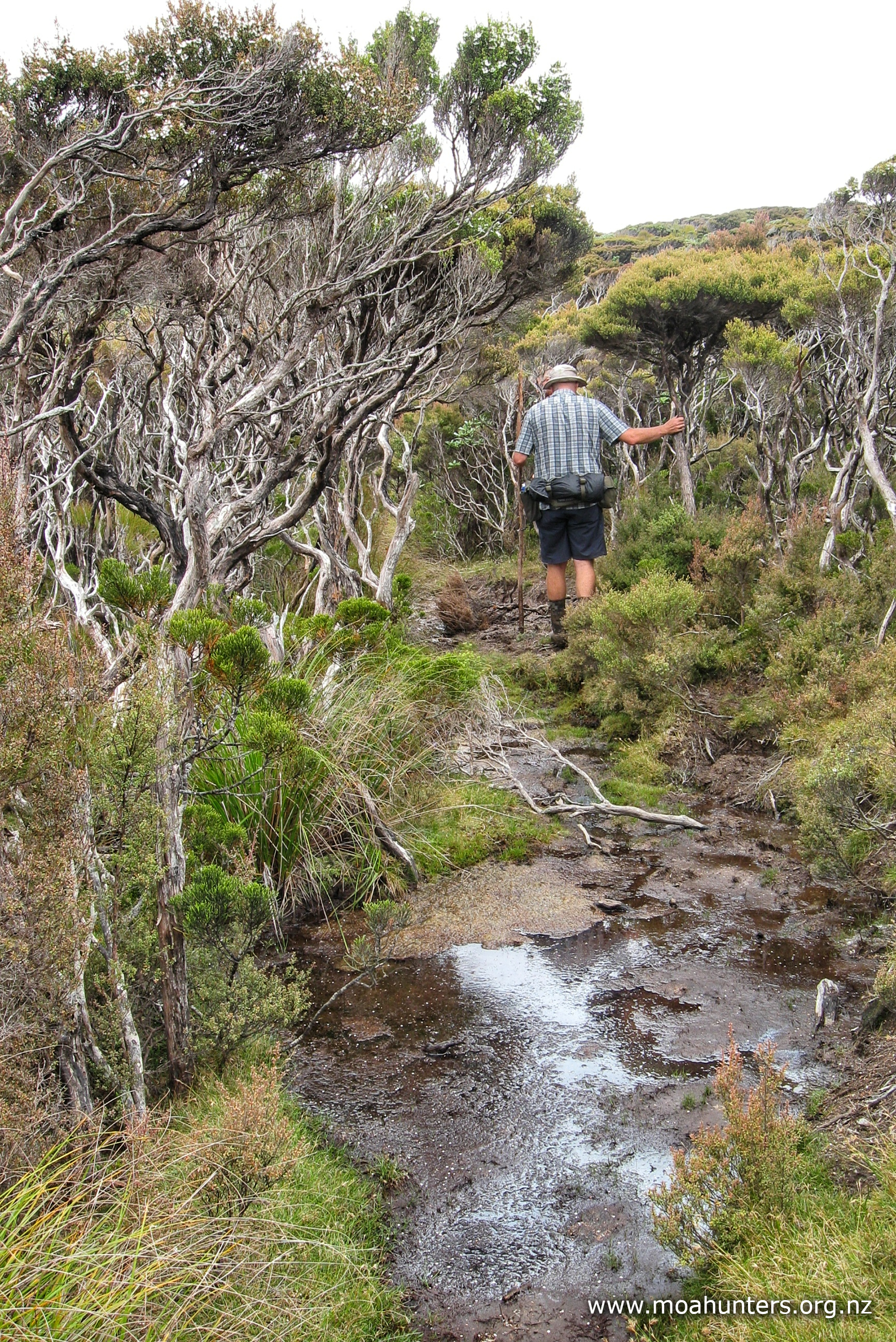
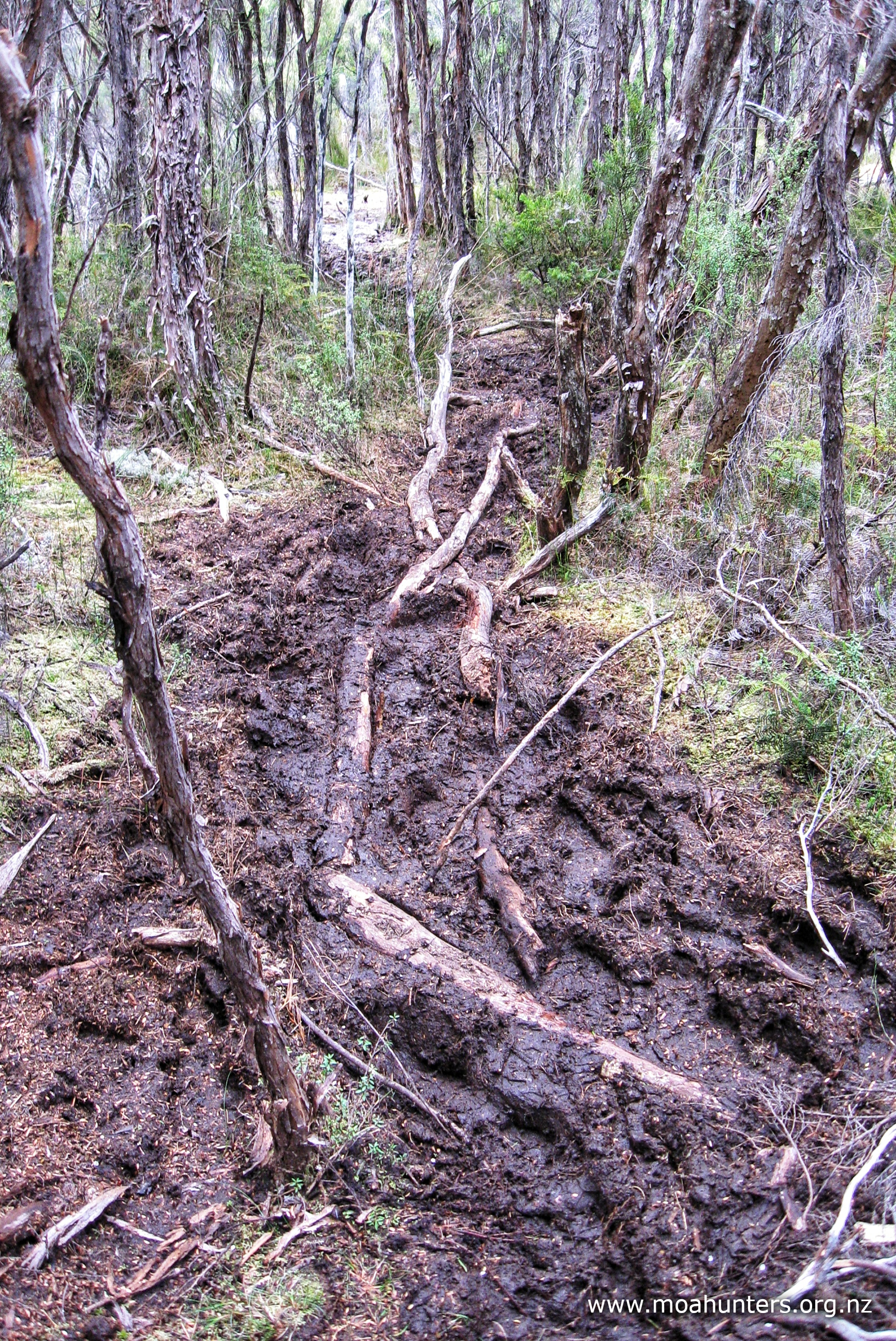
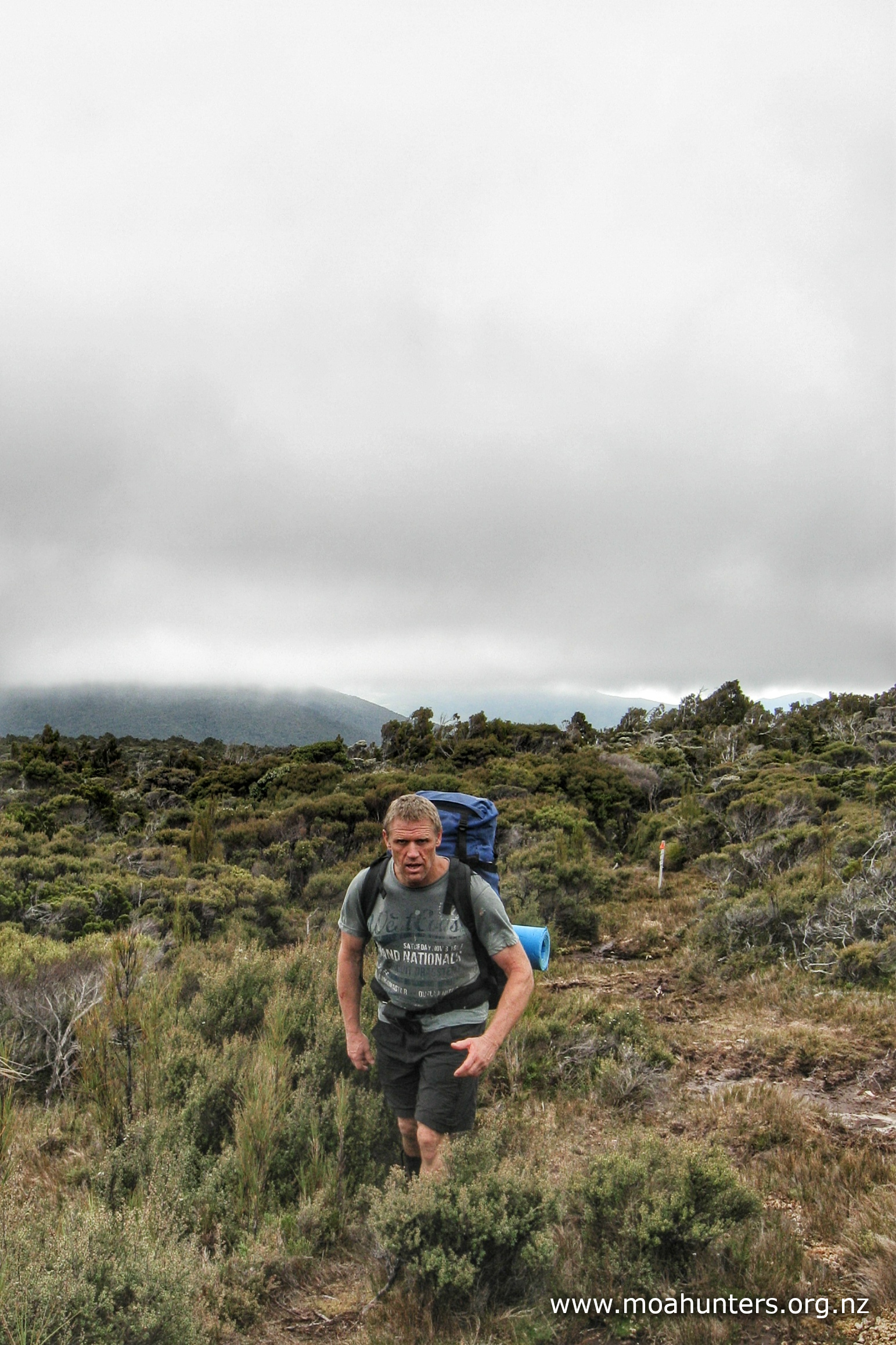
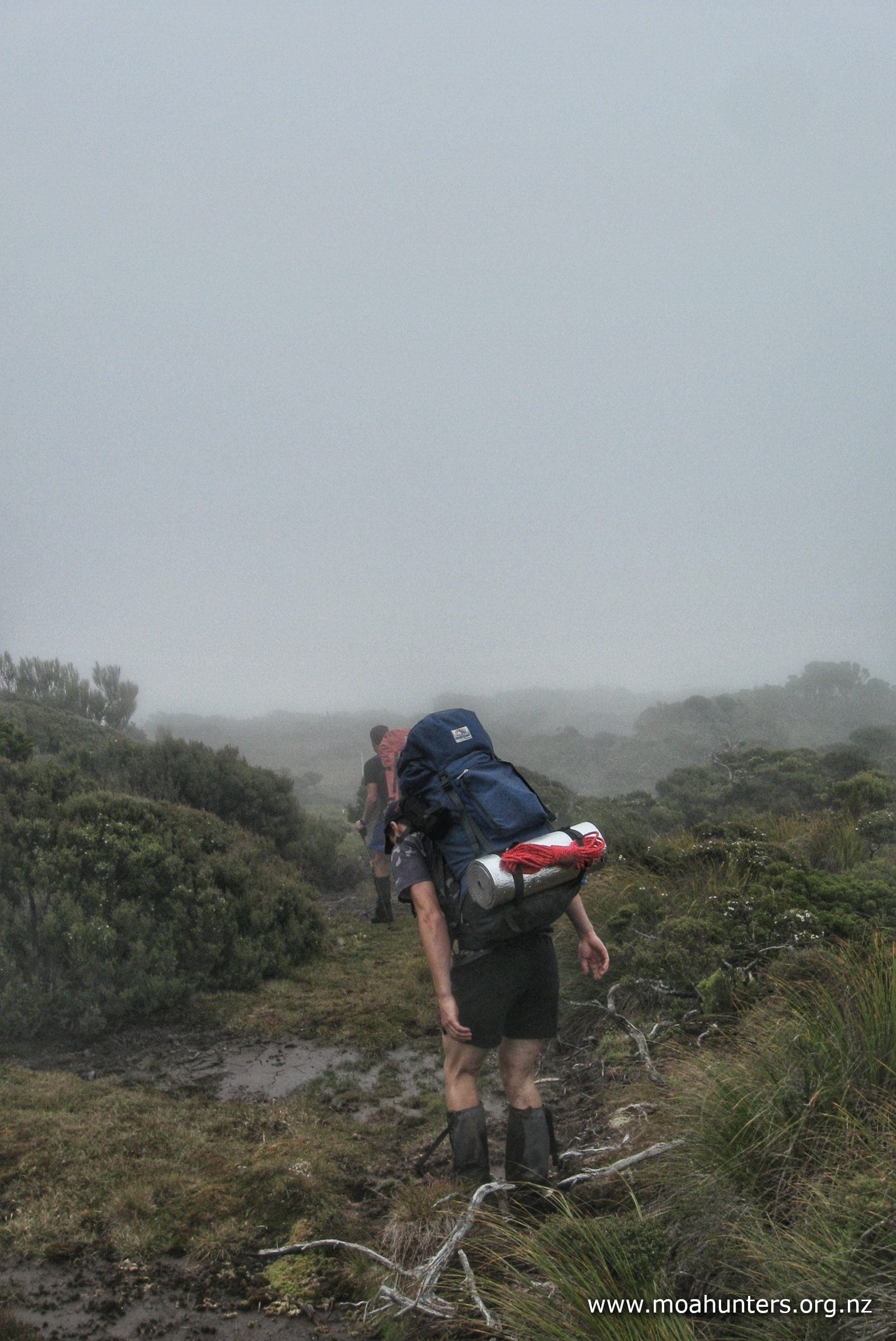
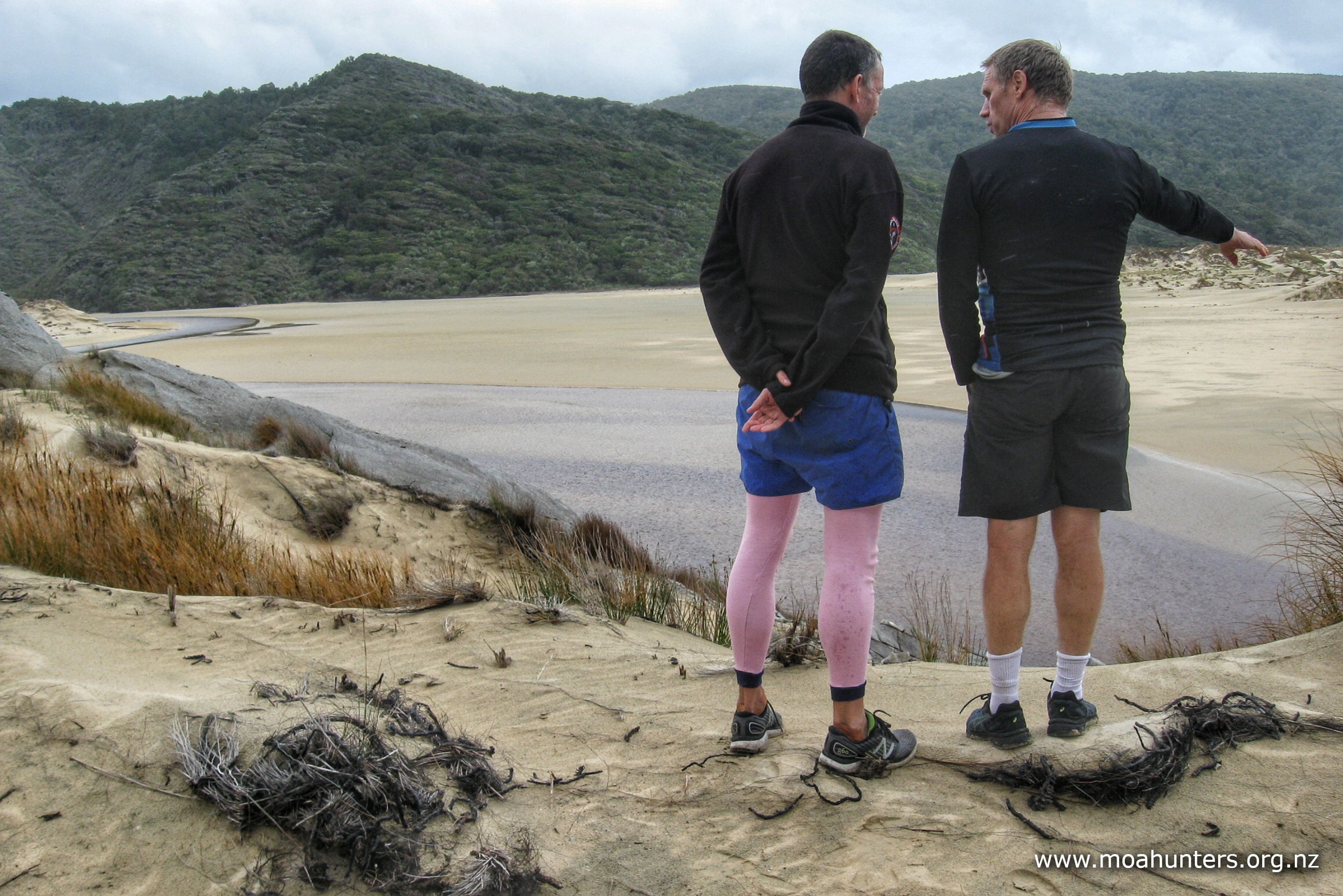
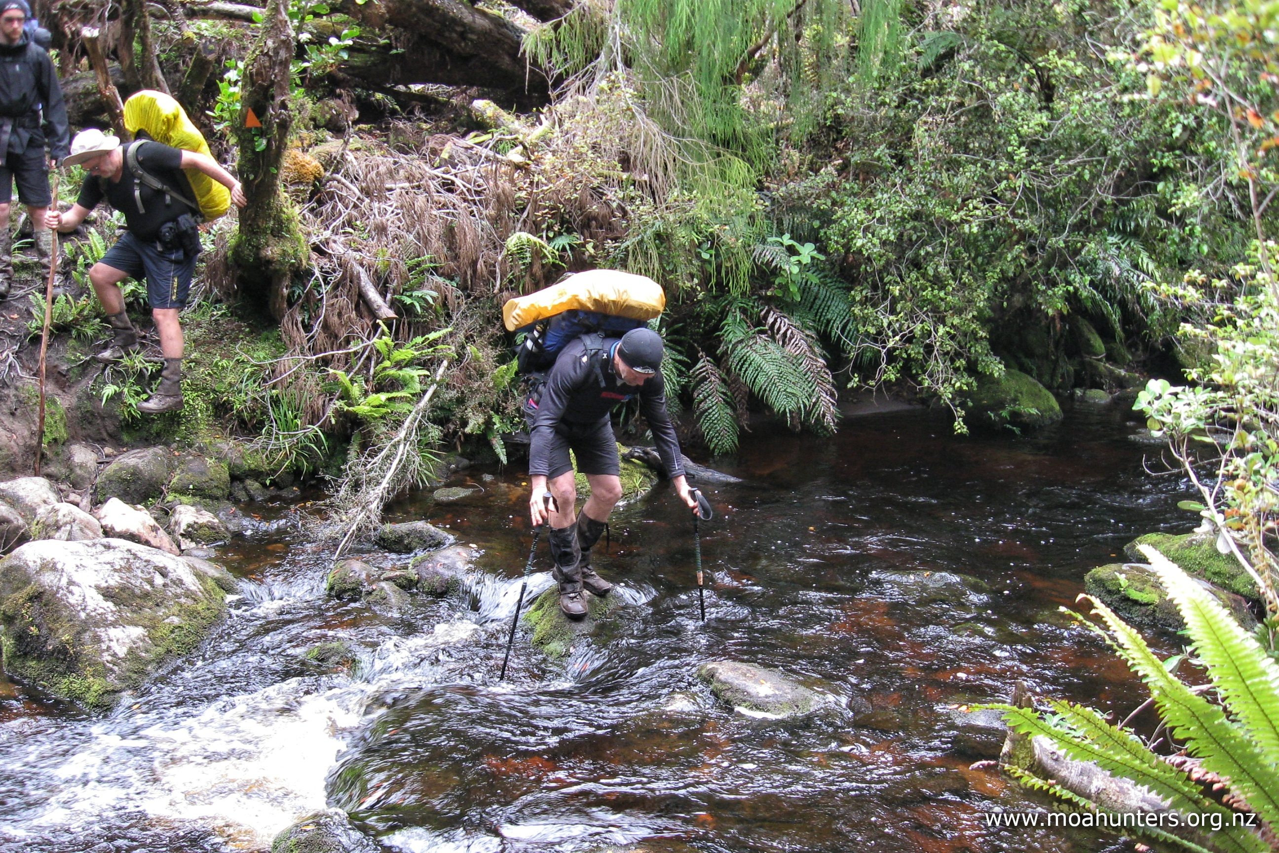
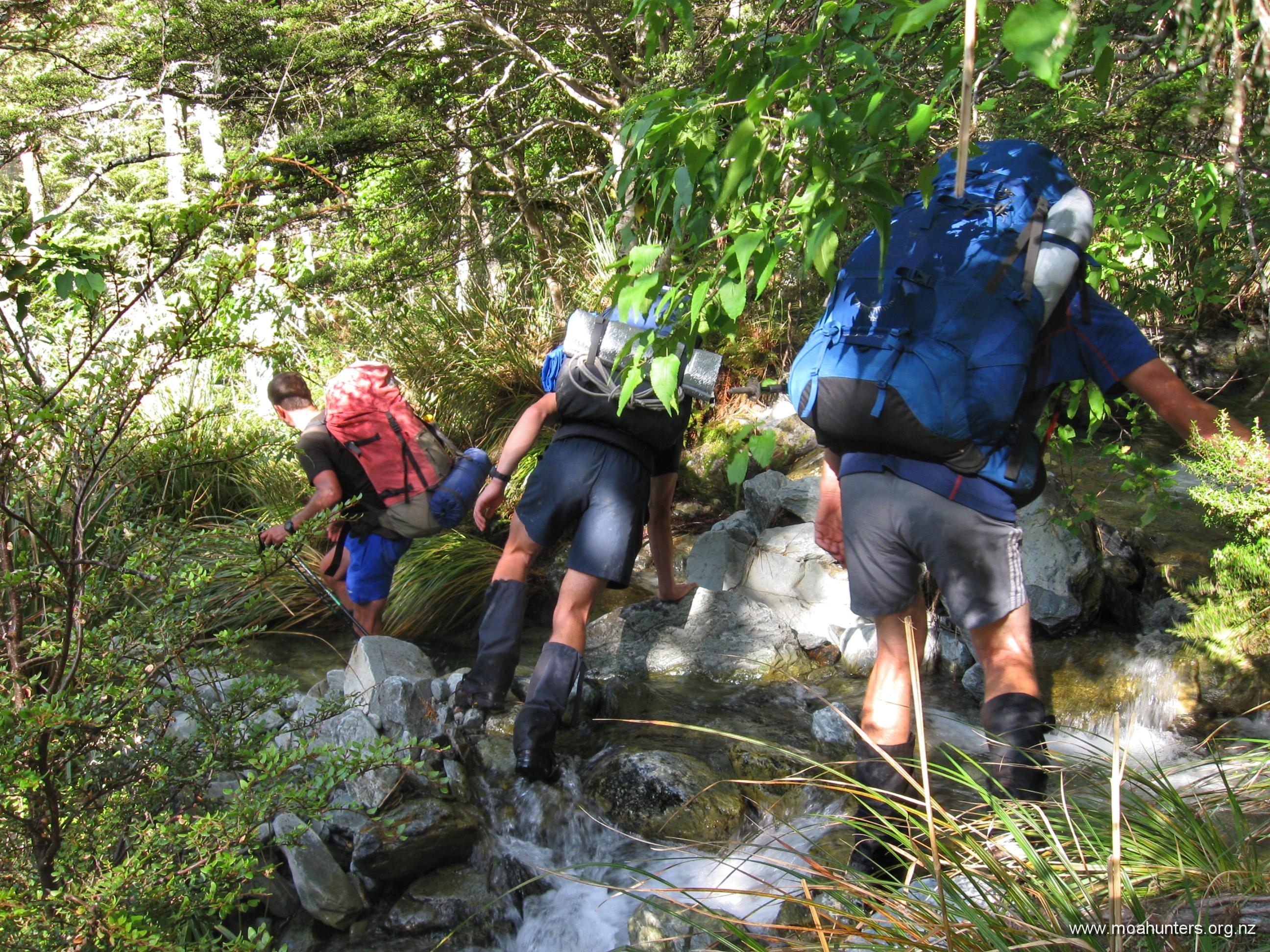
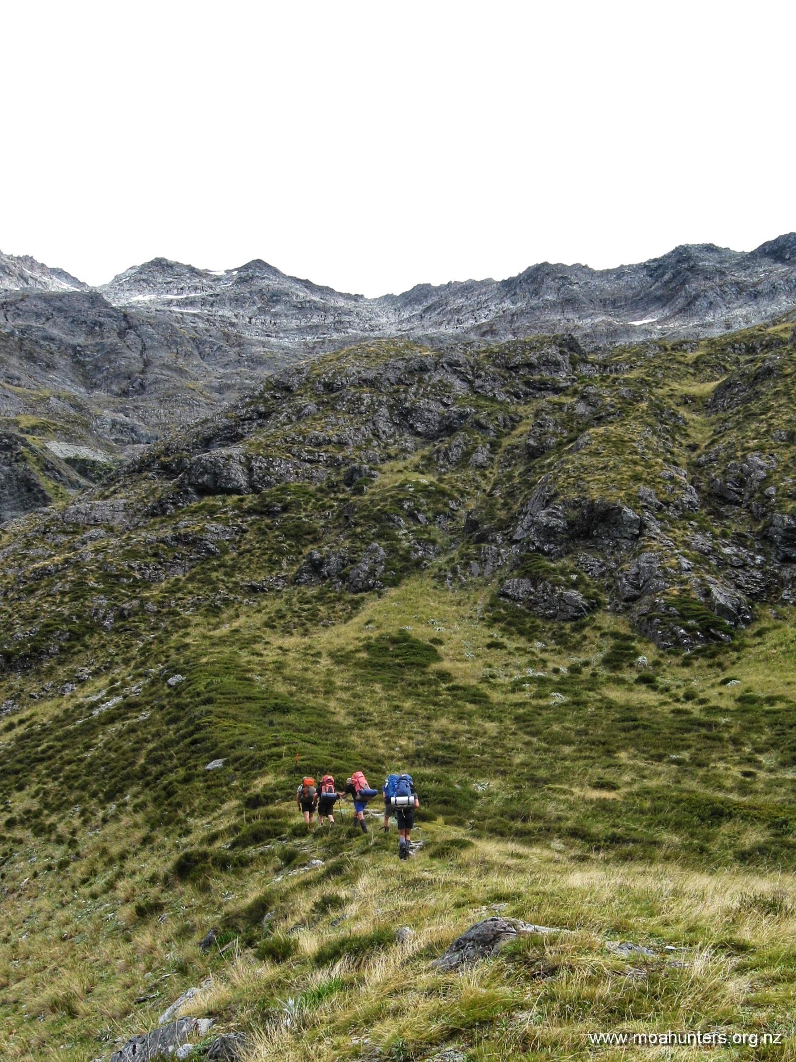
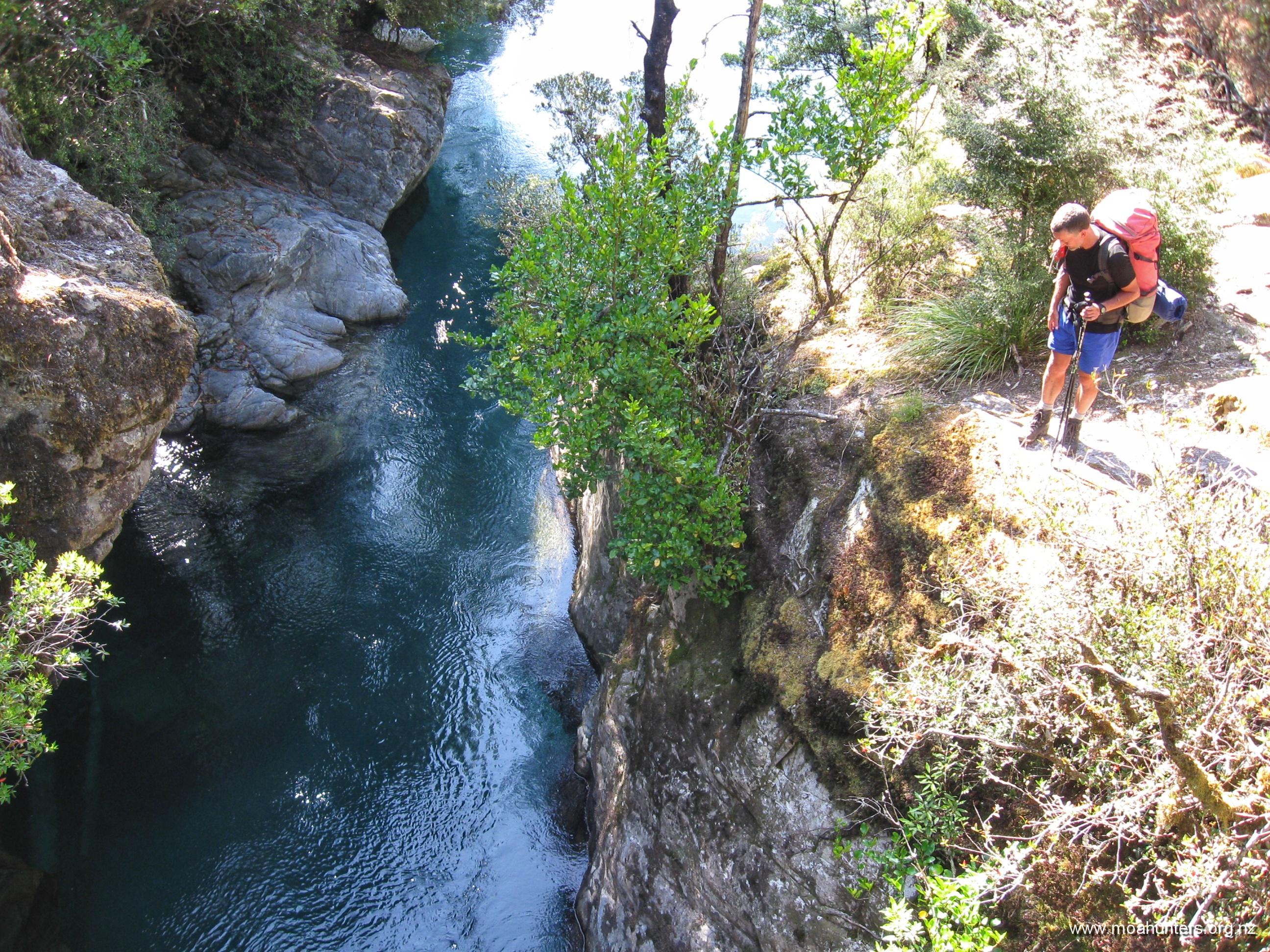
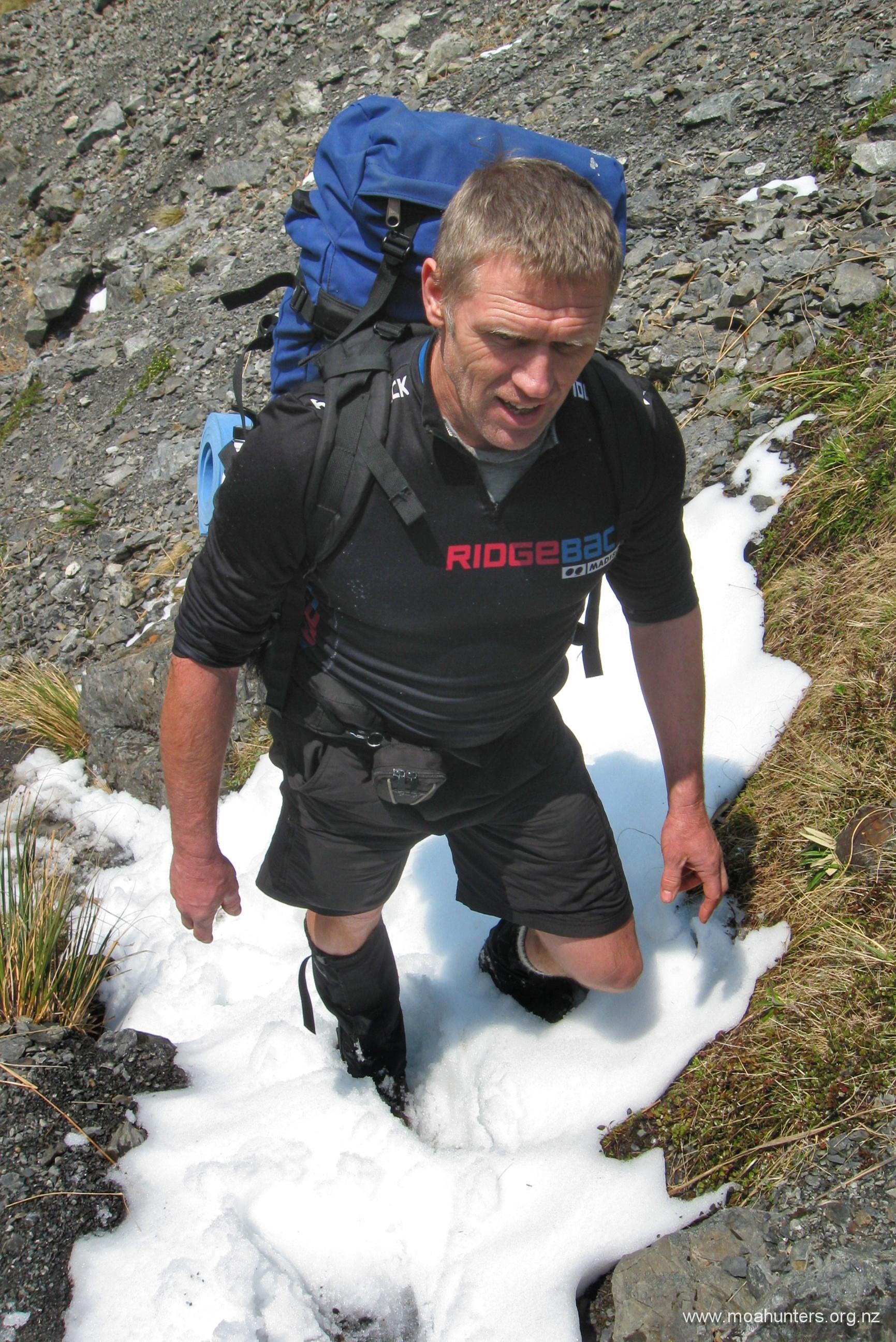
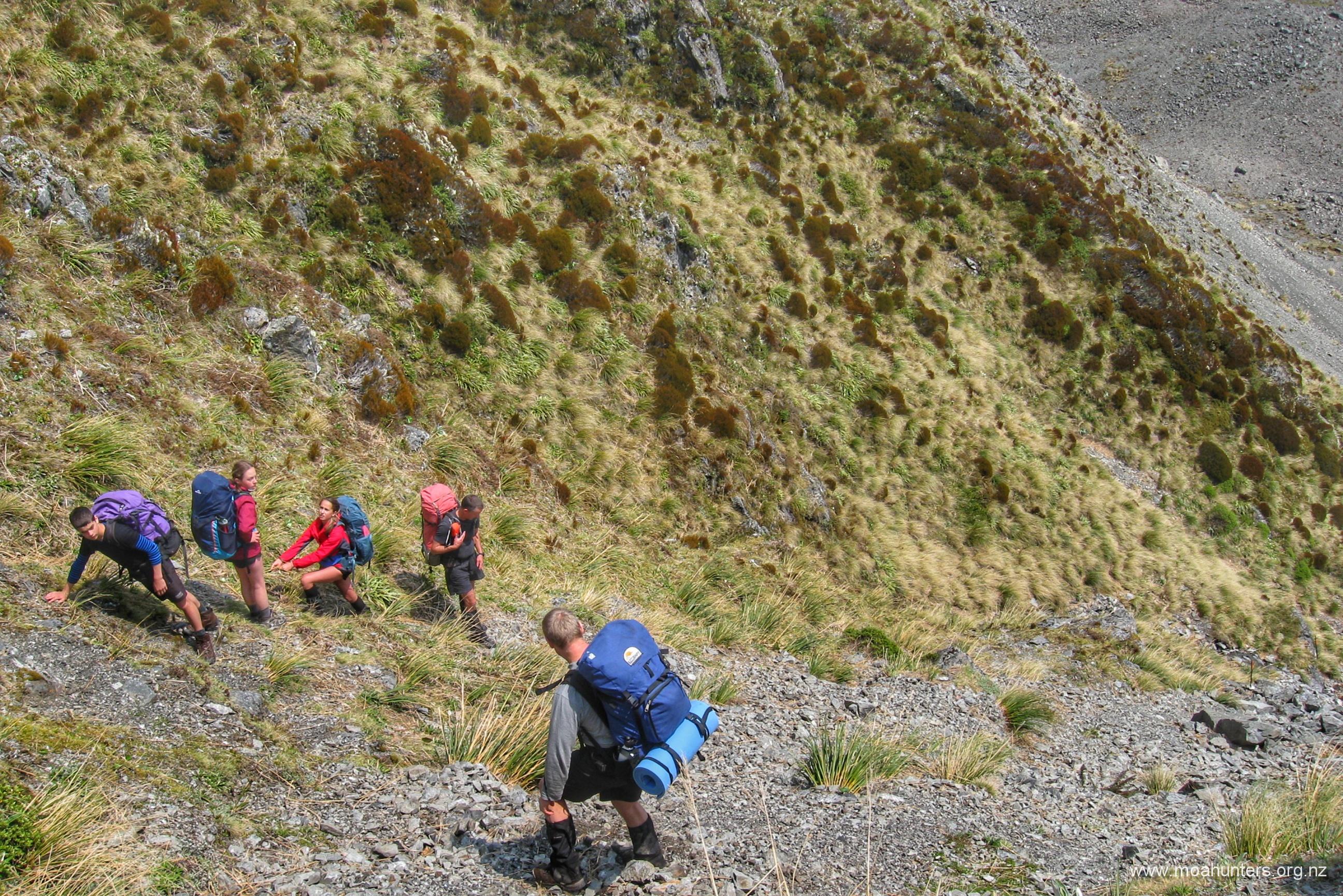
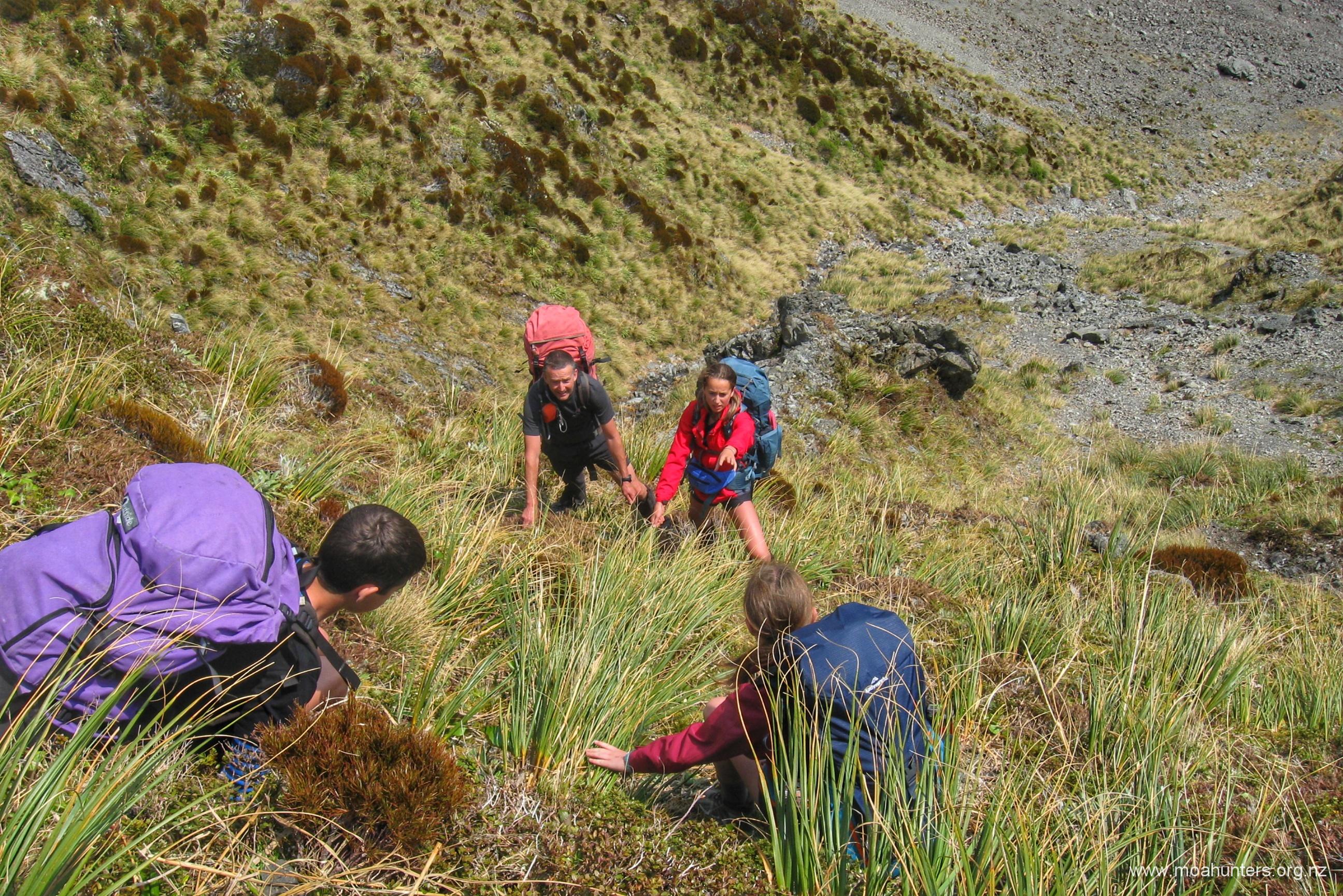
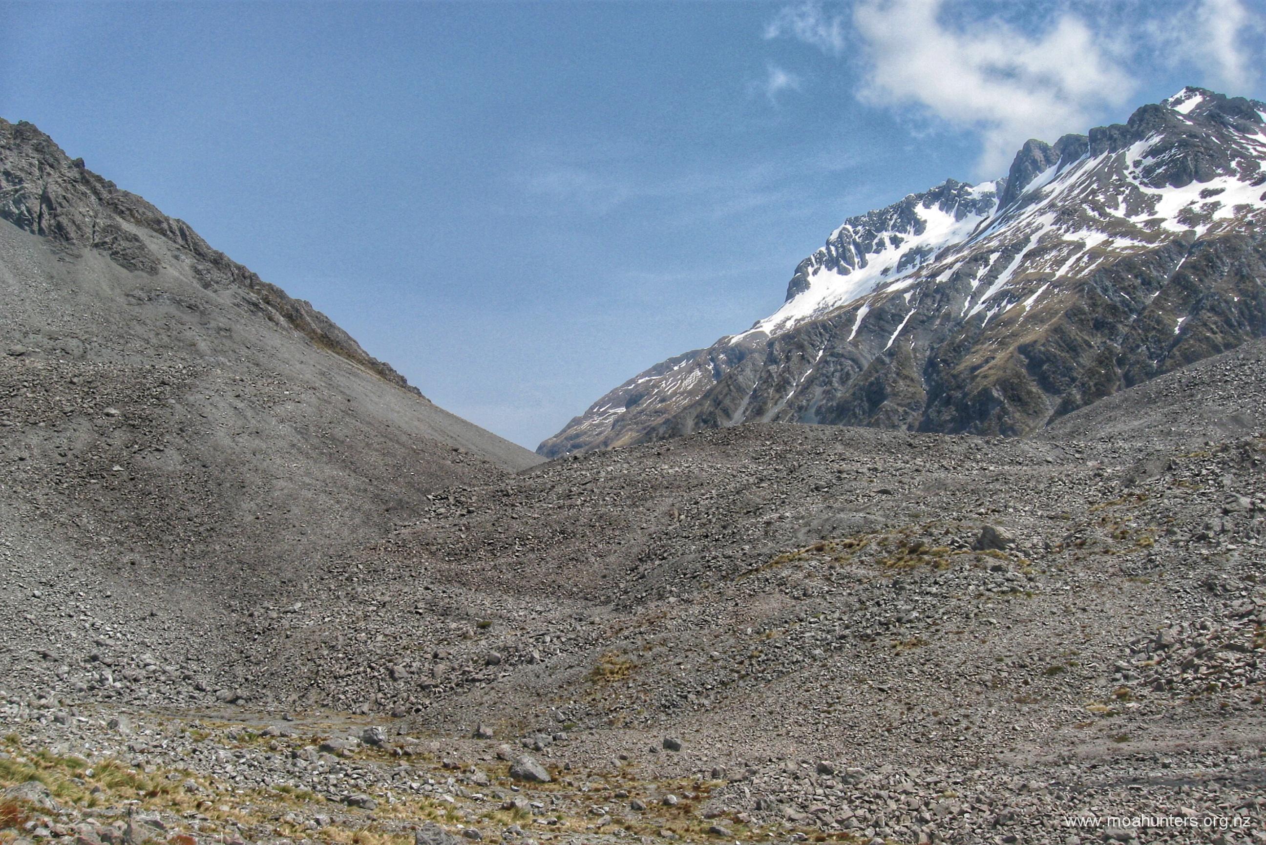
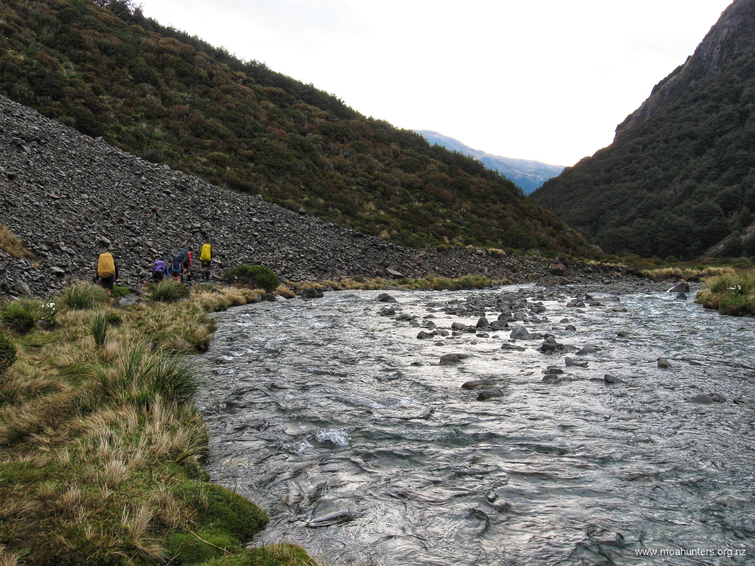
After returning to your Packs, continue almost due North along 400m to the end of the gently descending 50m wide snow bench. The bench takes you above several bluffs that drop to your right into Pope’s pass. Once past the end of the bench turn east and break out your walking poles for the 200m steep descent (it feels like a lot further) down the sparsely covered scree ALL the way to the stream at the end.
Note: there are dark and slightly ominous looking small cliffs rising where the scree ends. Worry not, the stream runs along the base of these cliffs and is relatively easy to follow. When you reach the stream, travel downstream until it makes a significant right turn, at this point, leave the water course and climb north up and over the small bluff, thus avoiding dropping over a waterfall.
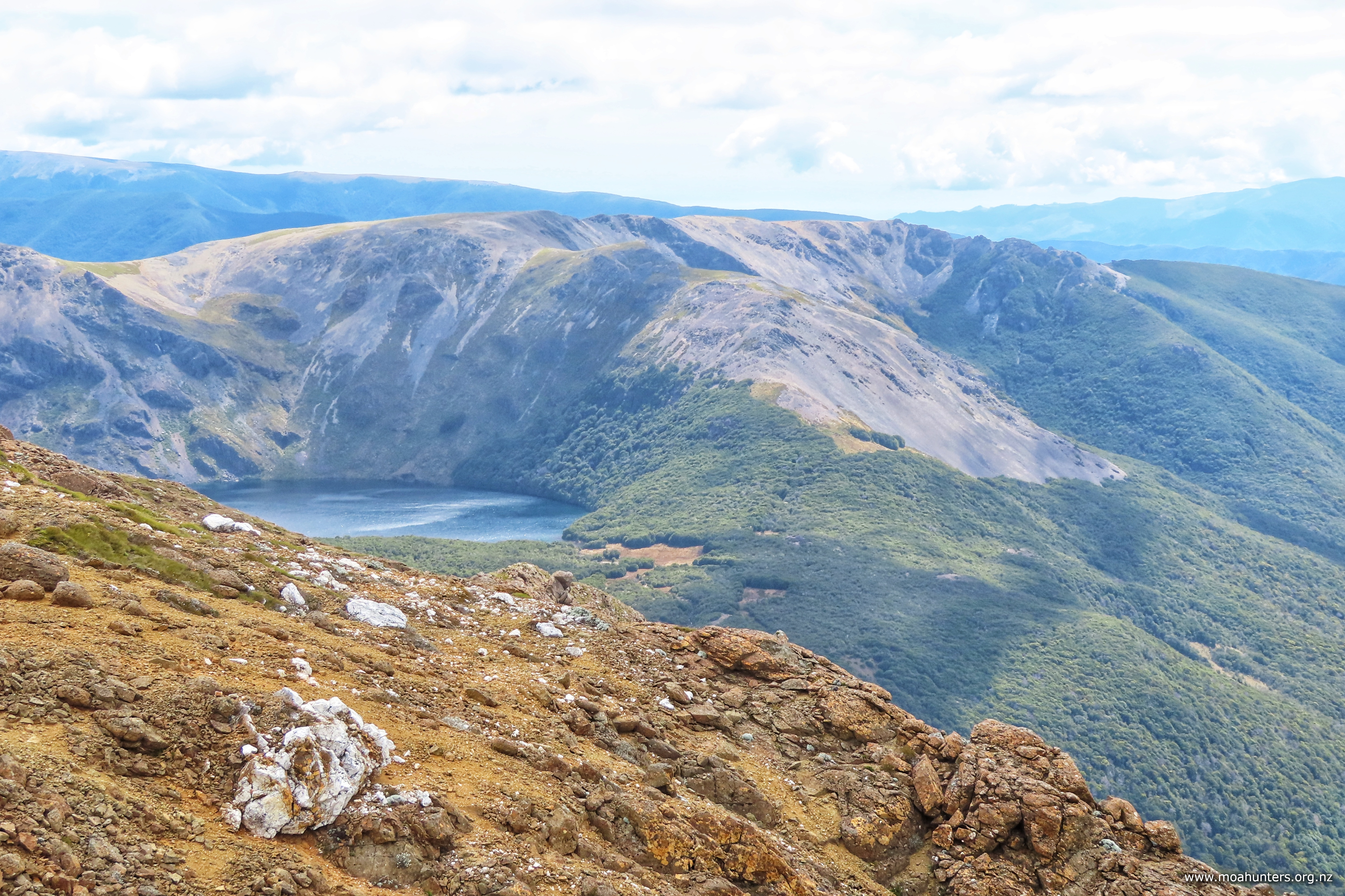
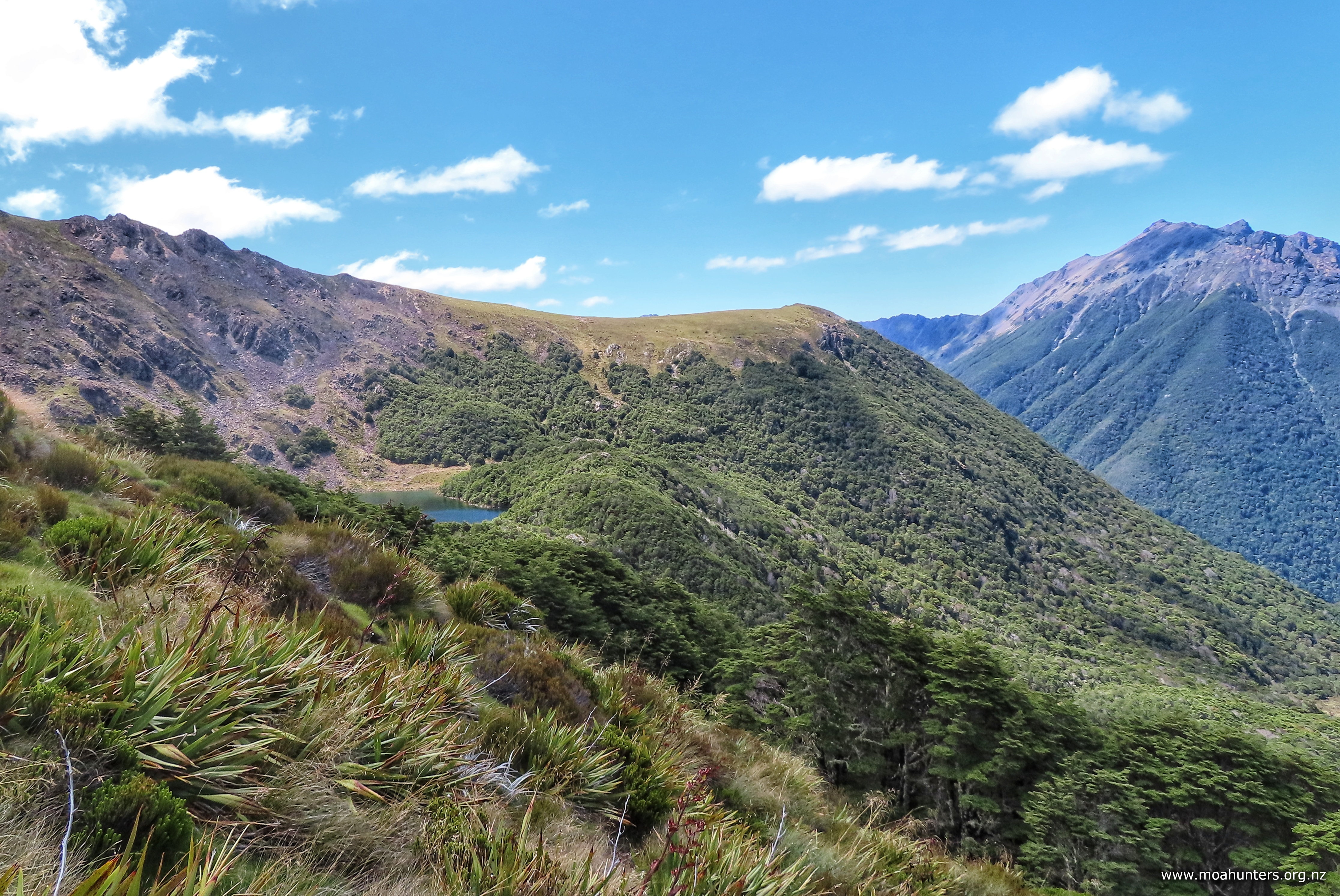
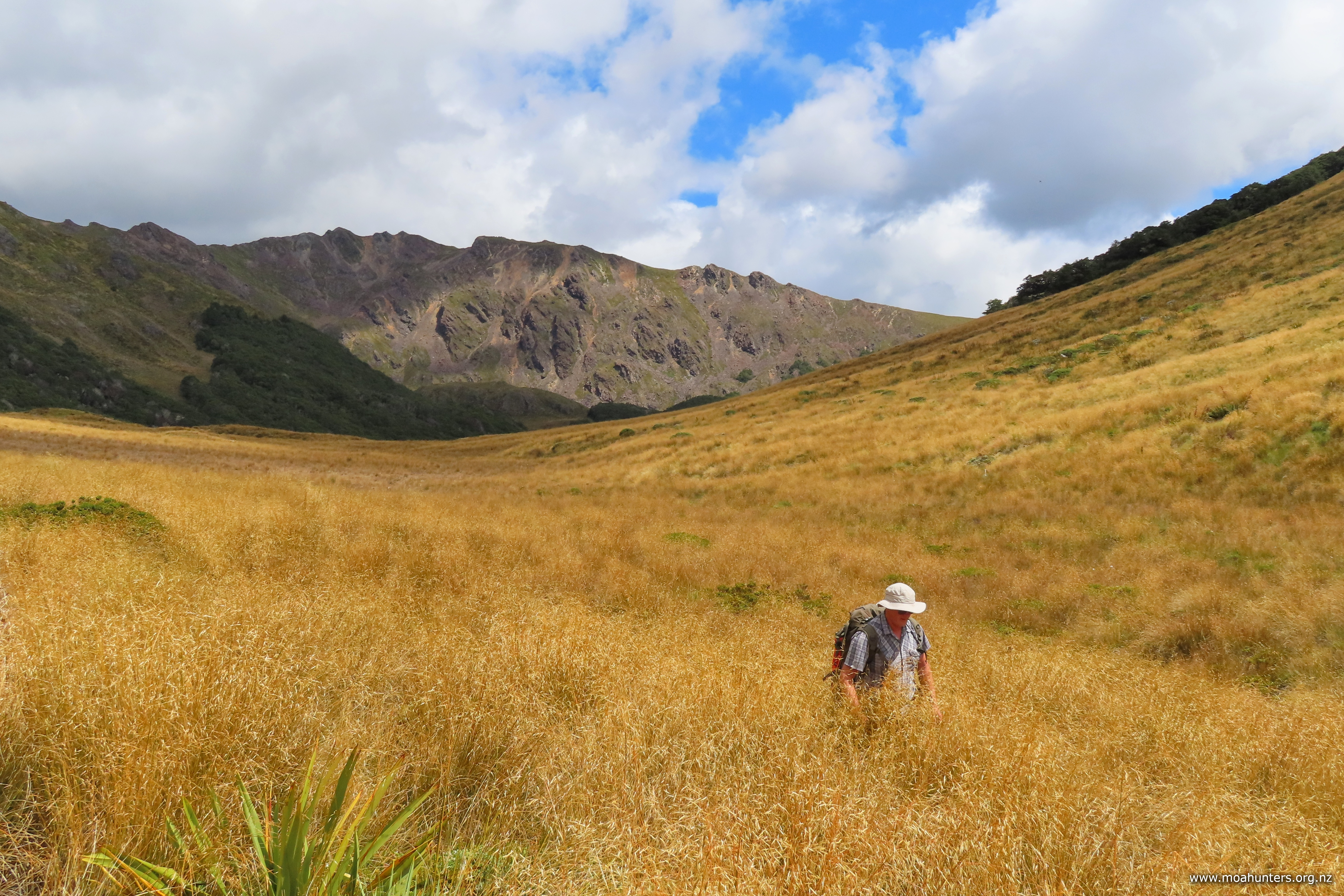
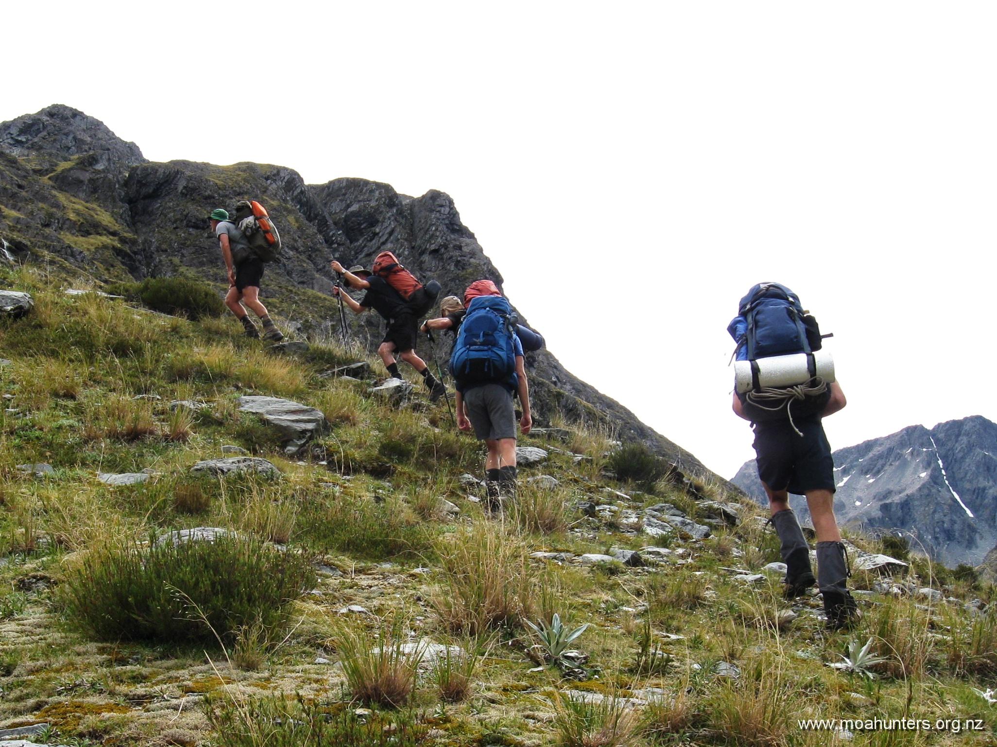
Looking back, to the high point, the snow bench, the steep scree, follow the creek, and the last descent.
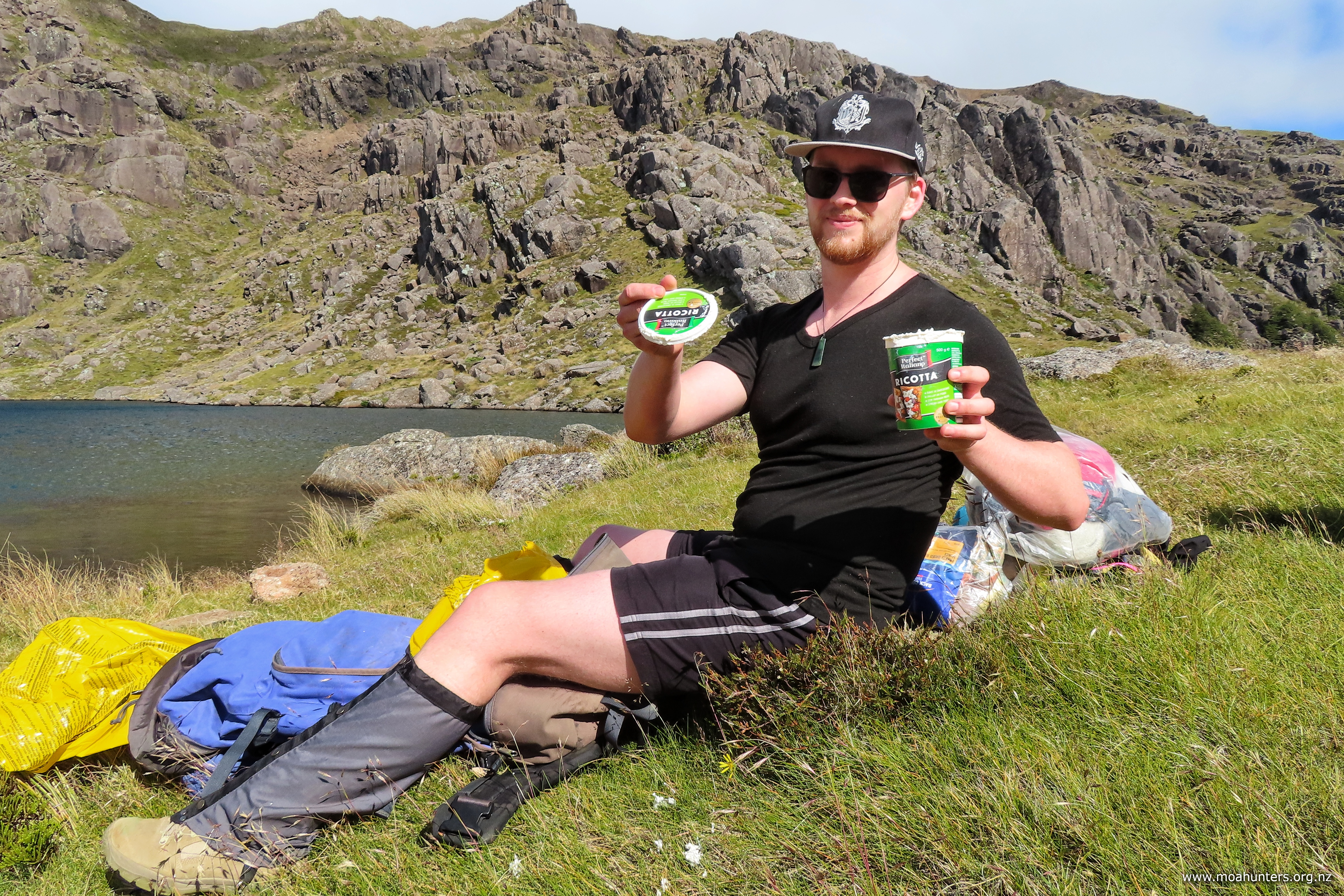
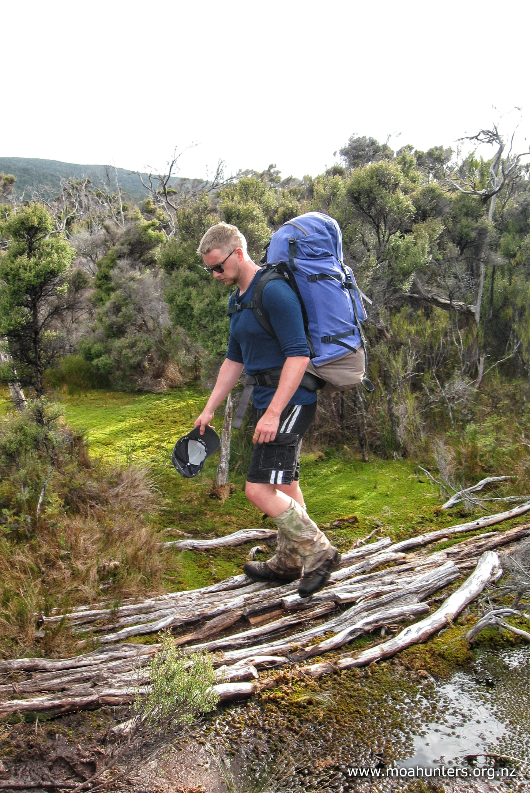
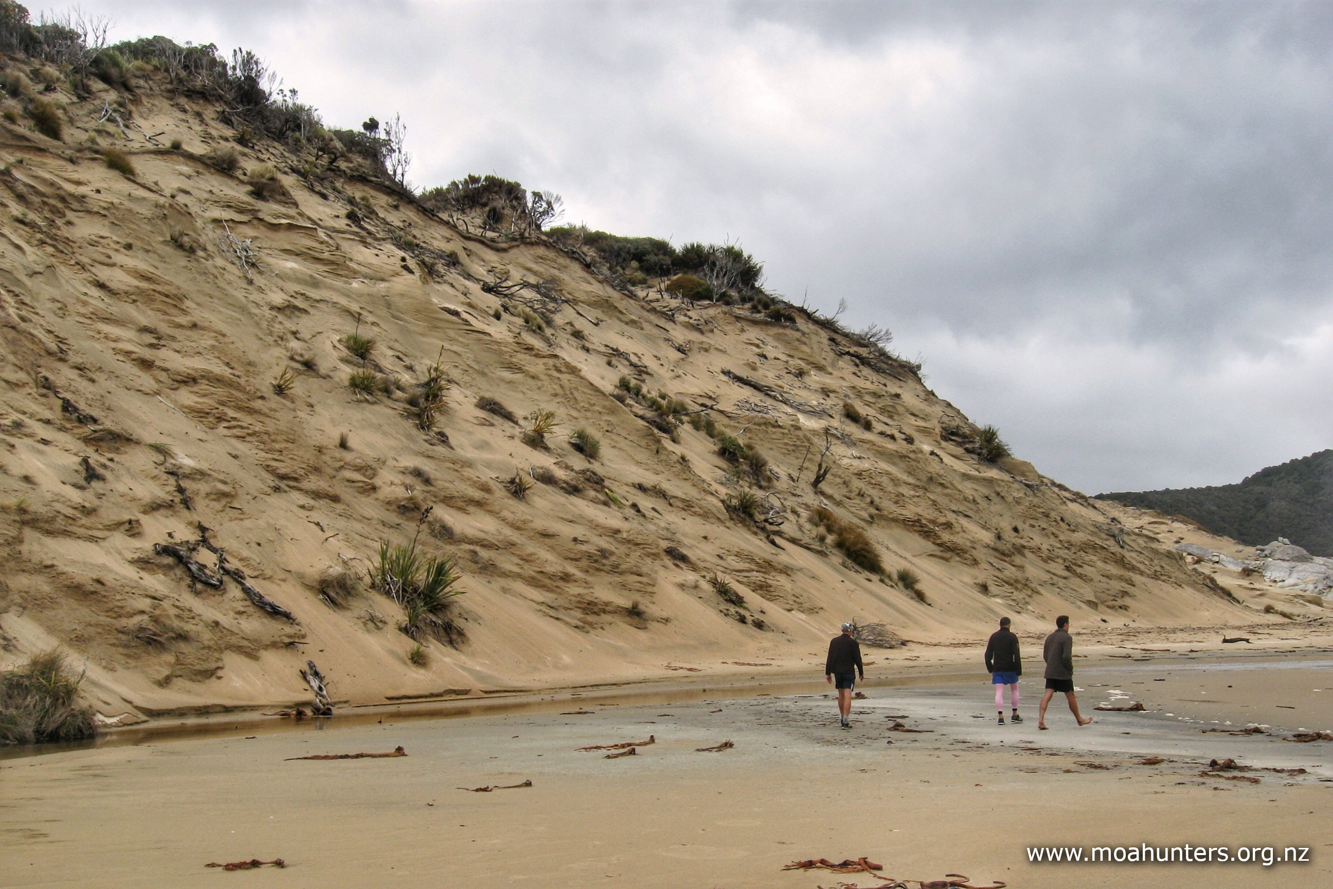
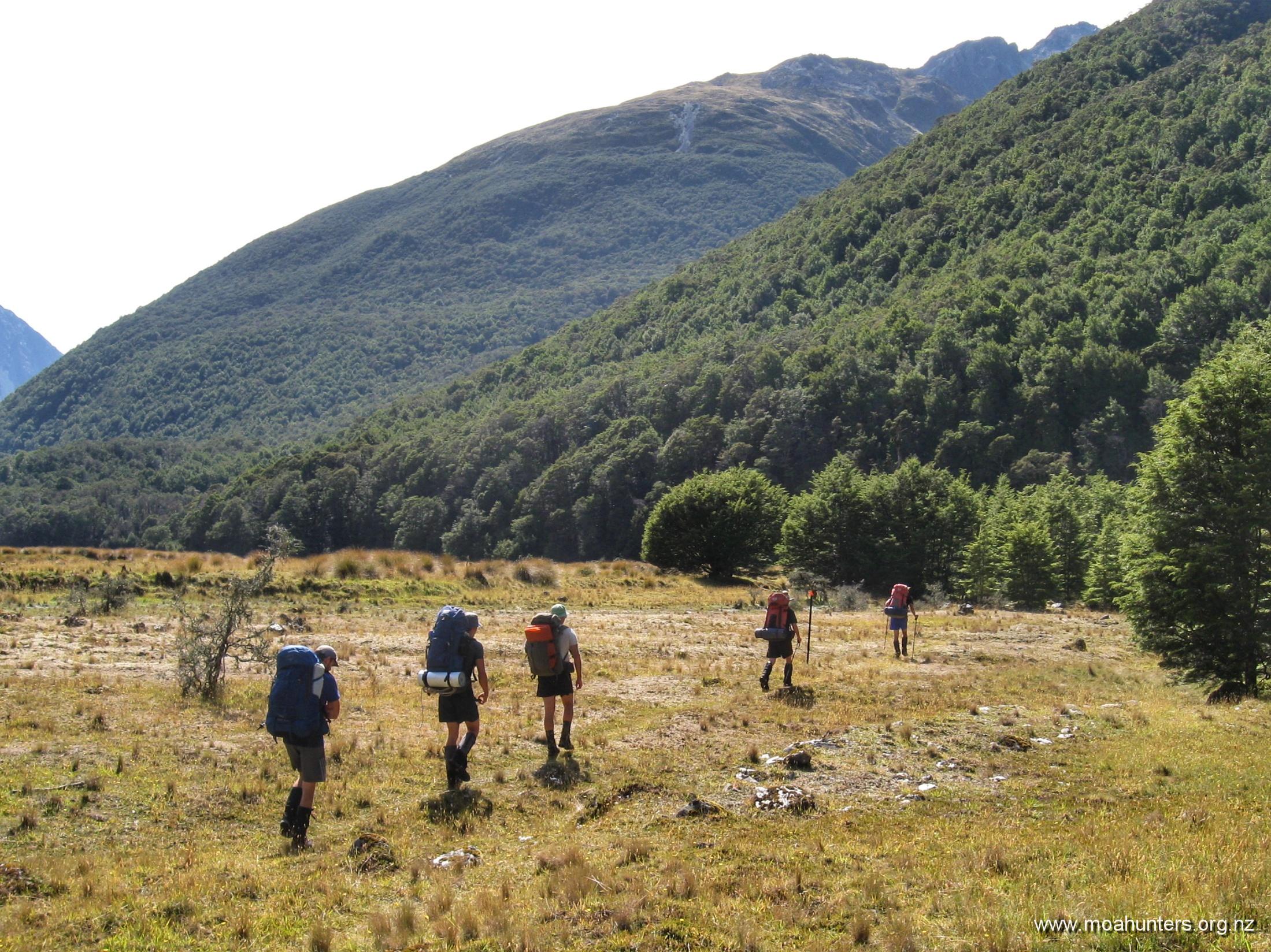
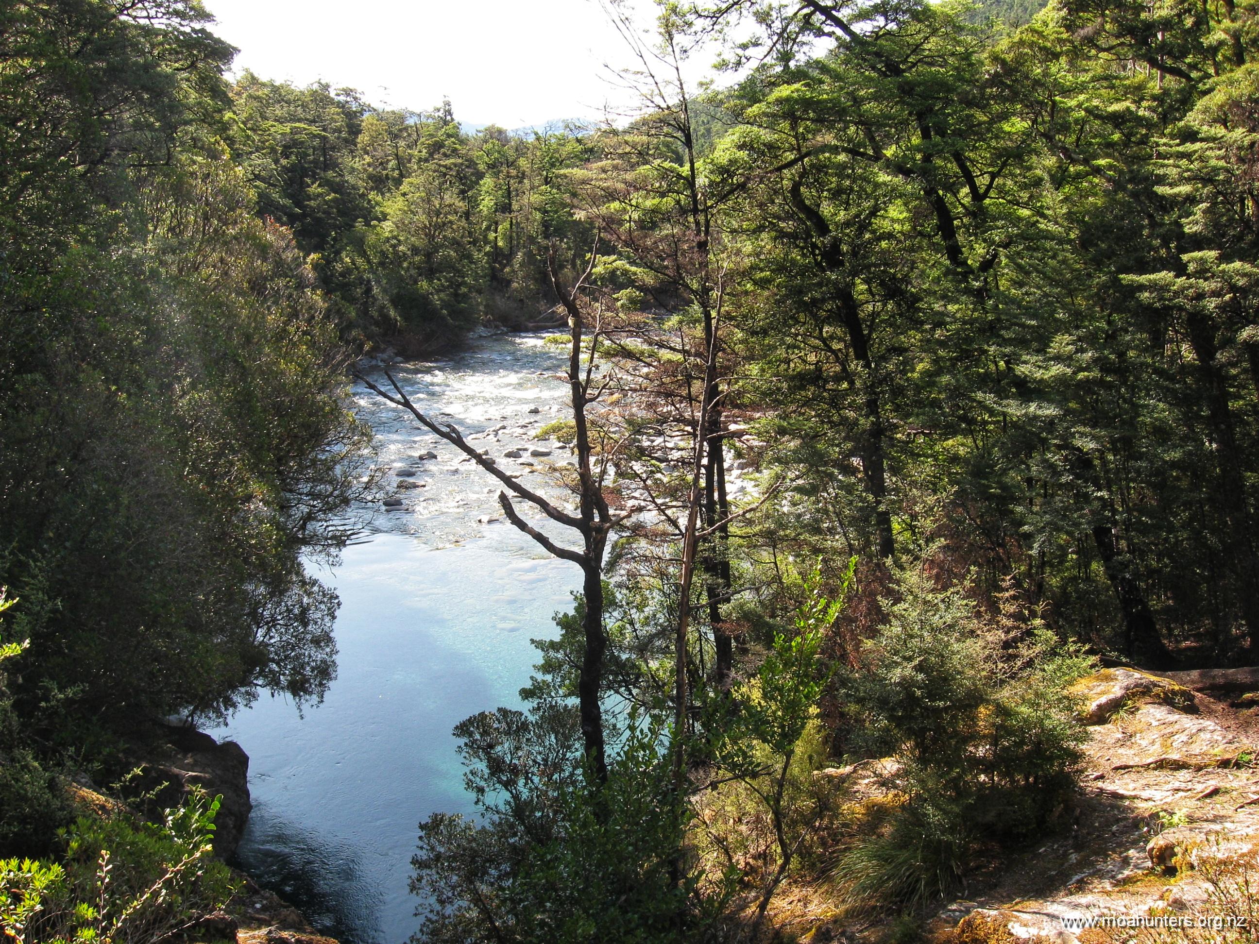
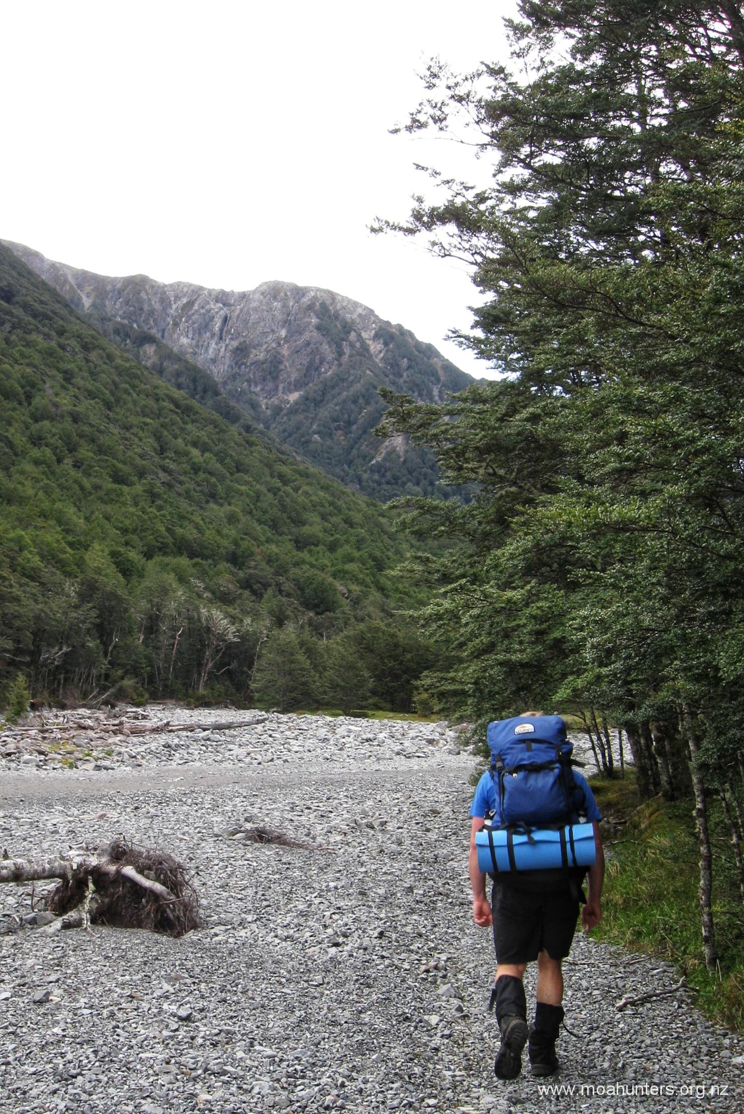
Descend the final steep part from the bluff into the main Julia Creek valley floor. If you are running to time, this is the perfect spot to stop, take the boots off, rest the feet and knees from all the descending and enjoy lunch as the steep section is now complete.
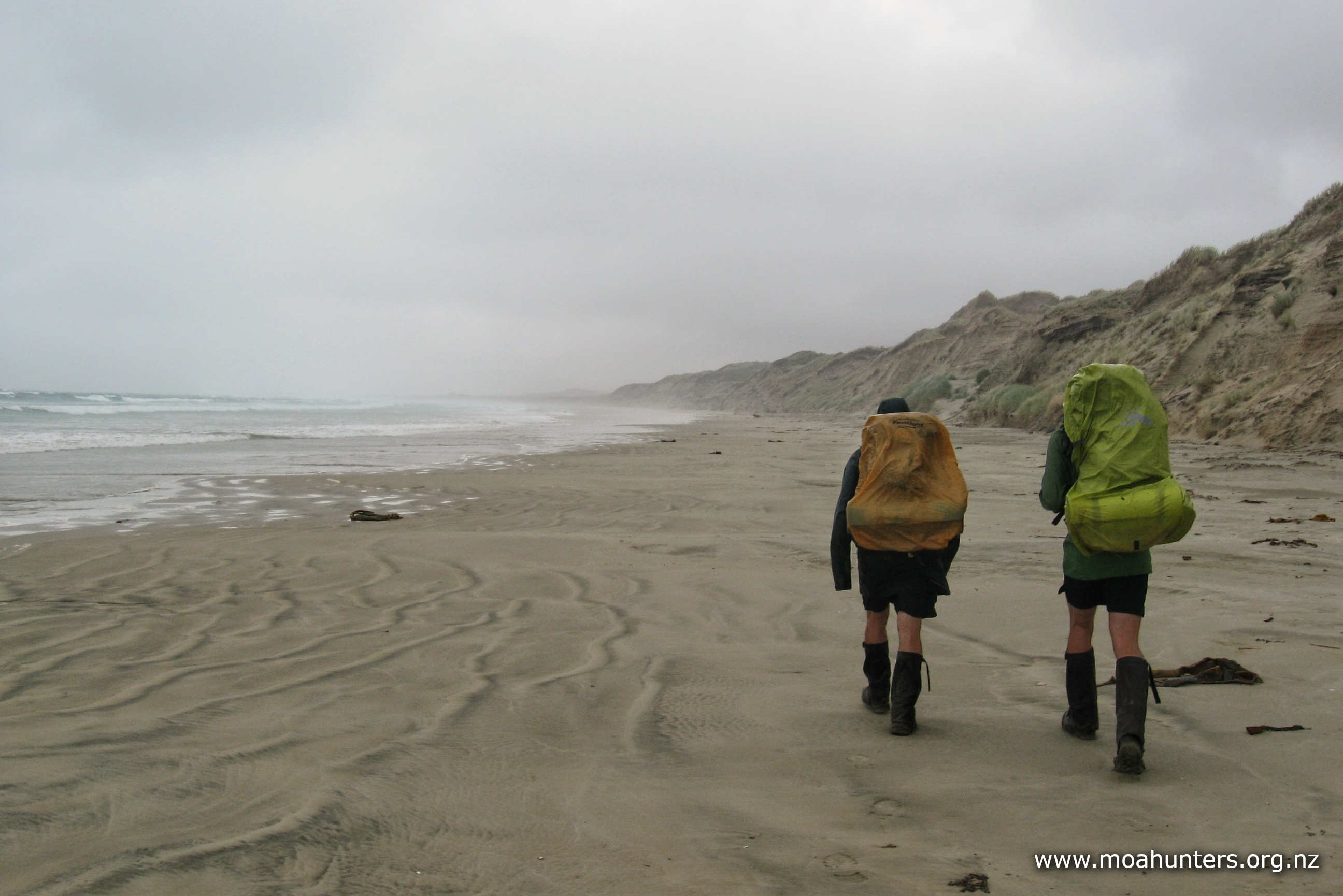
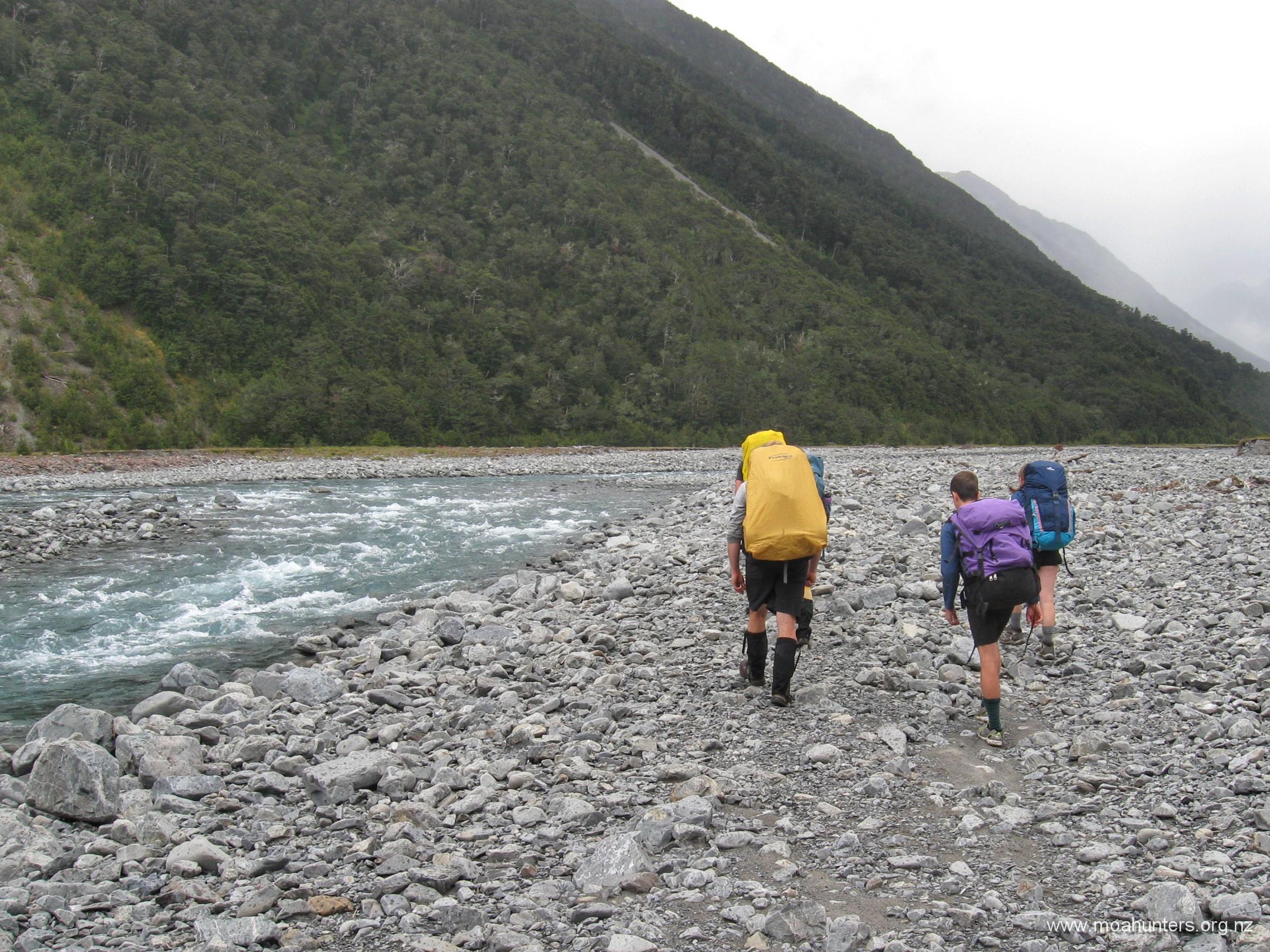
However, the long river bed trek is about to begin…
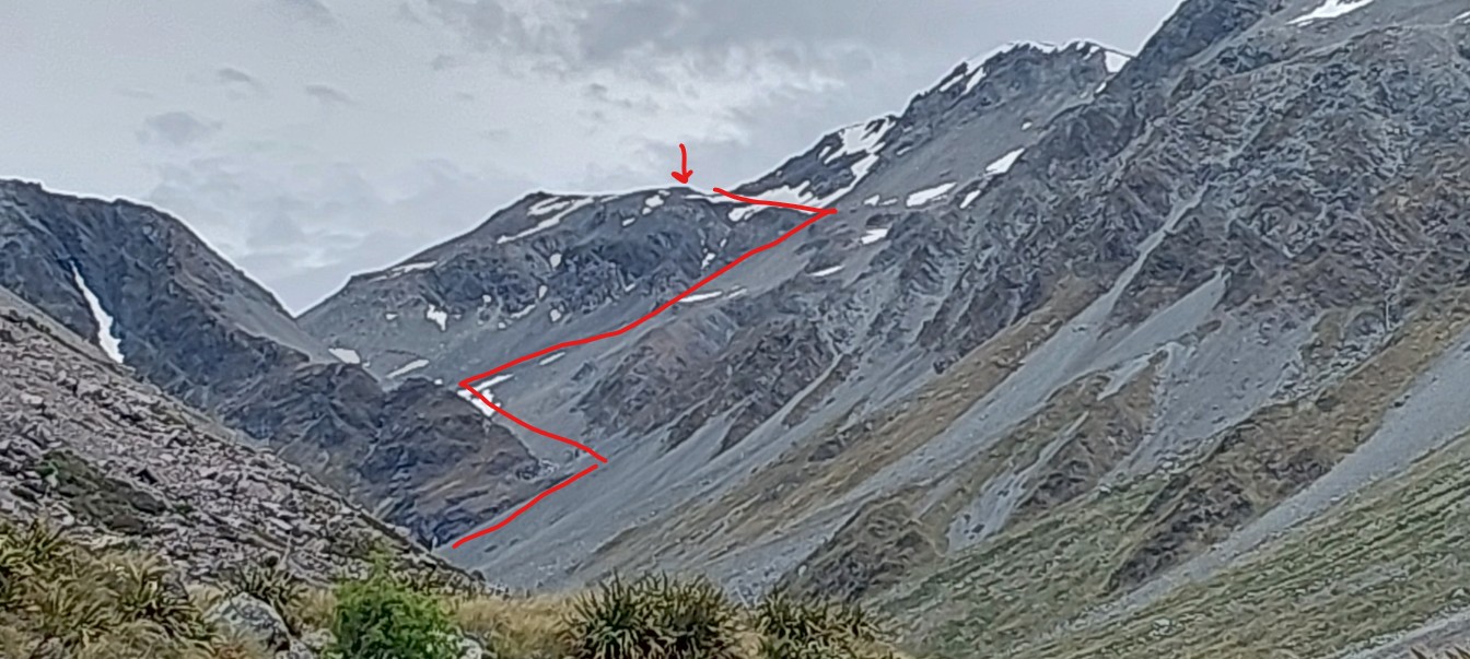
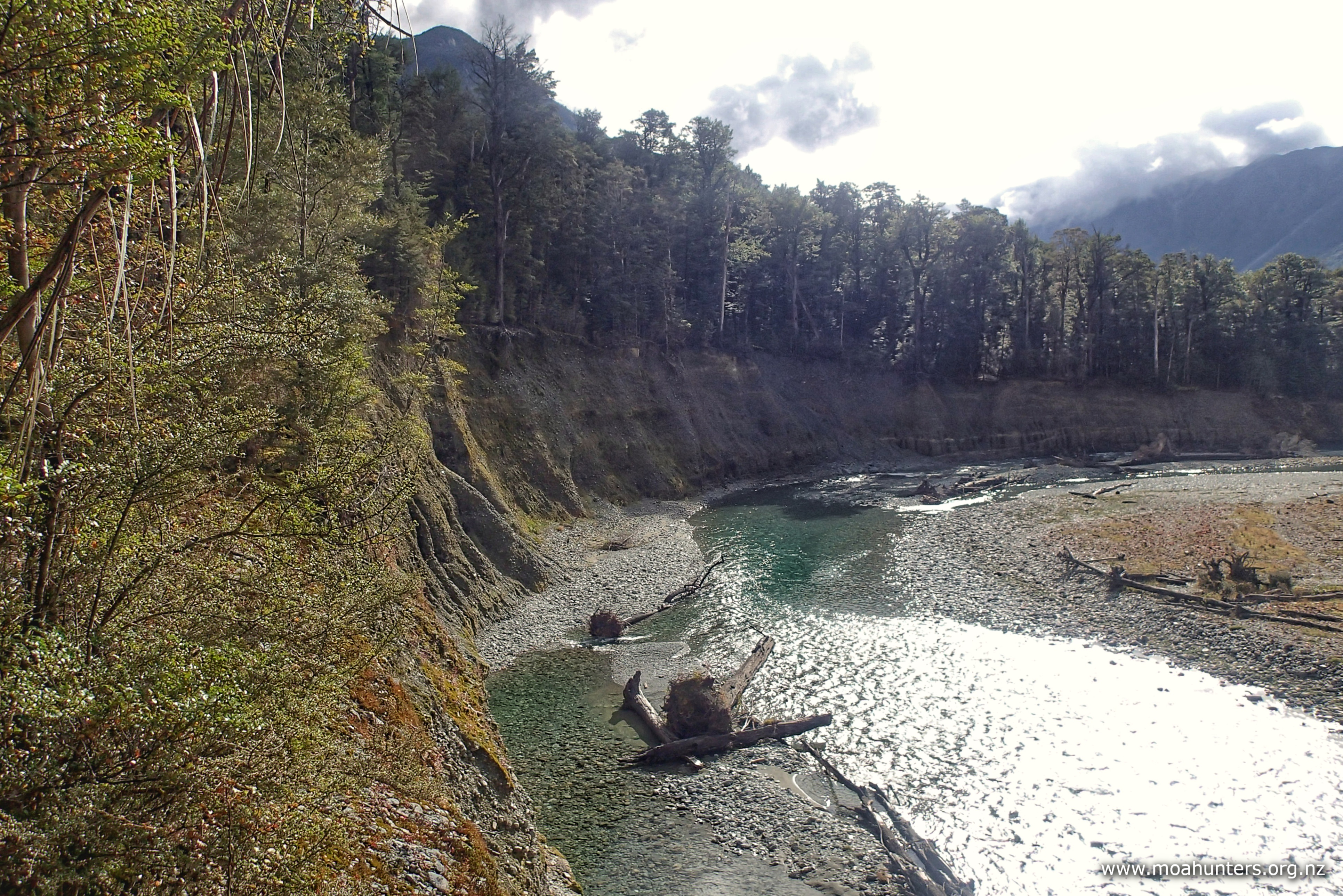
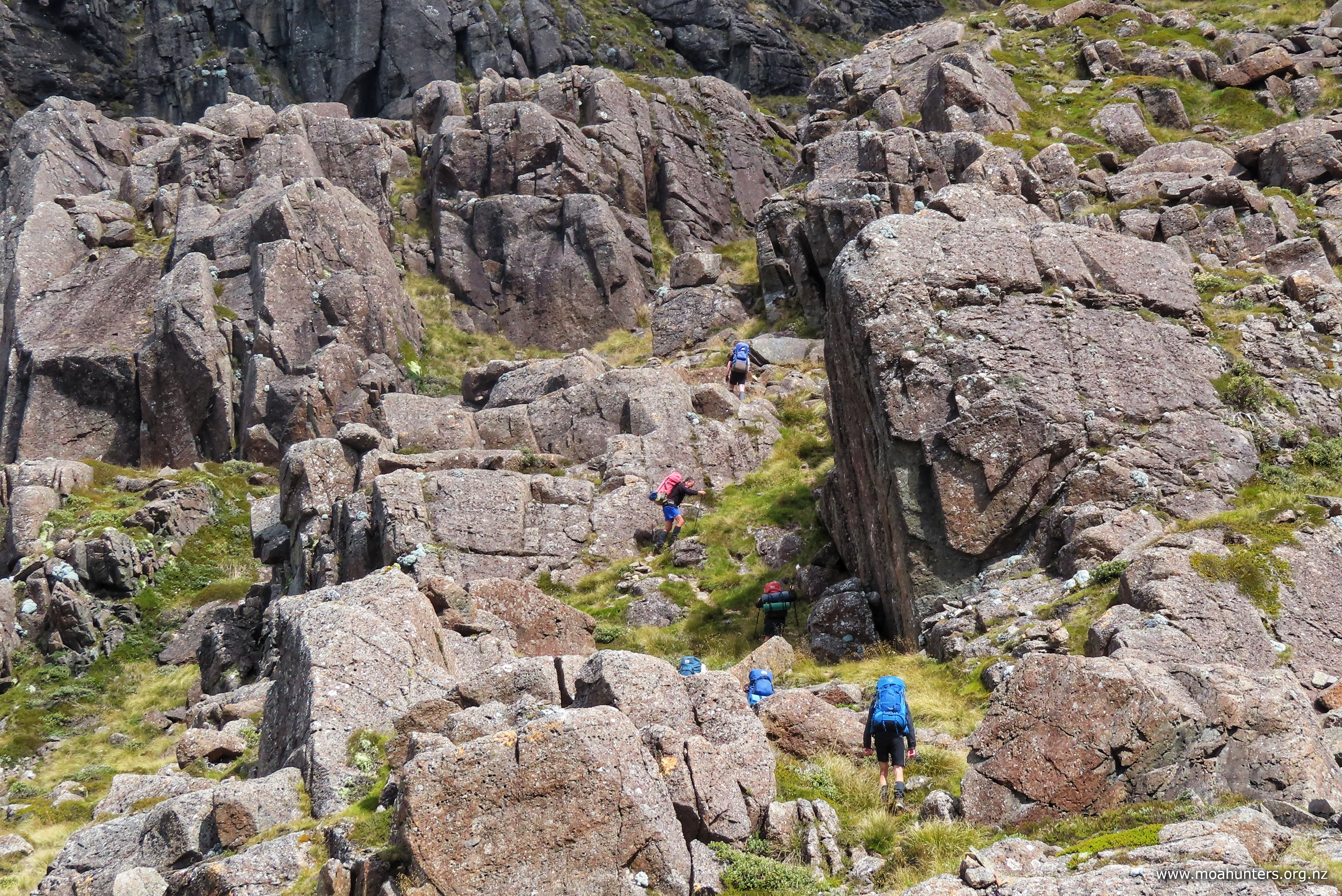
The dry riverbed gets quite rocky
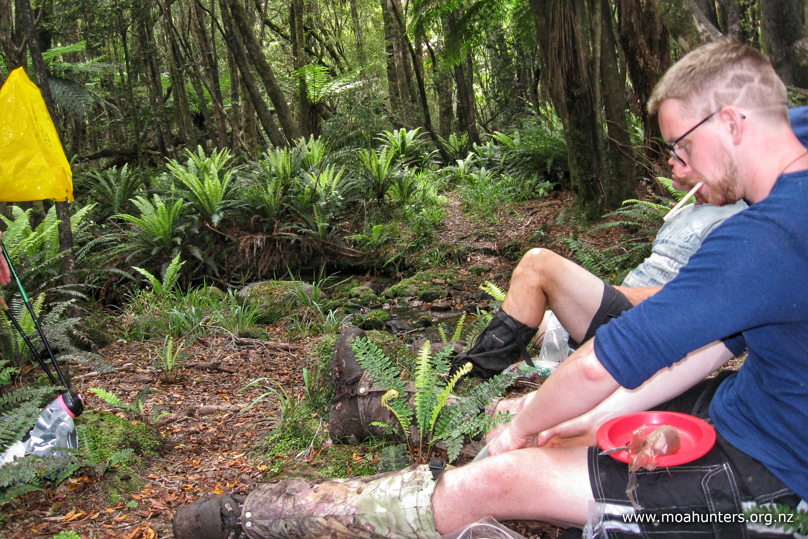
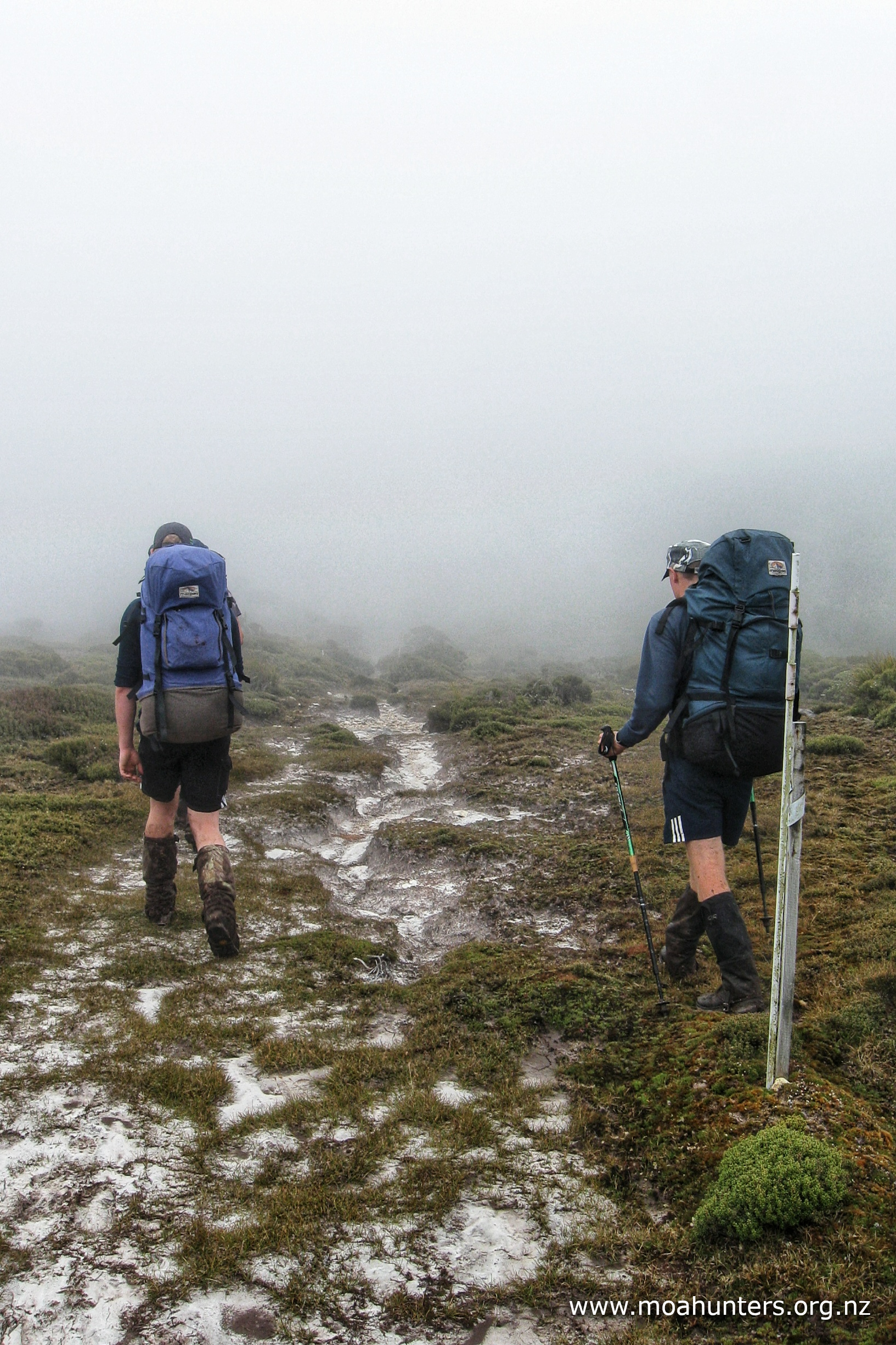
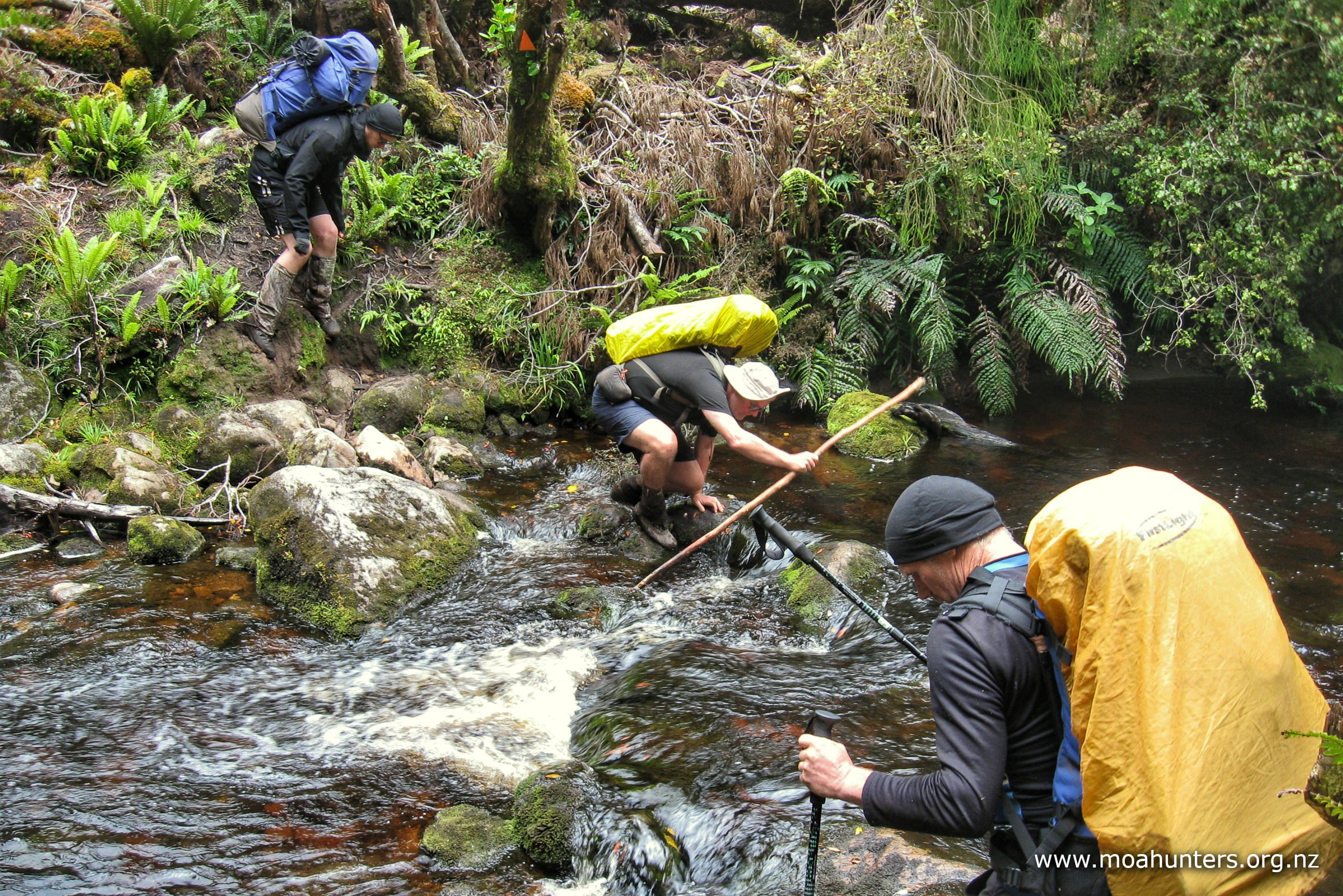
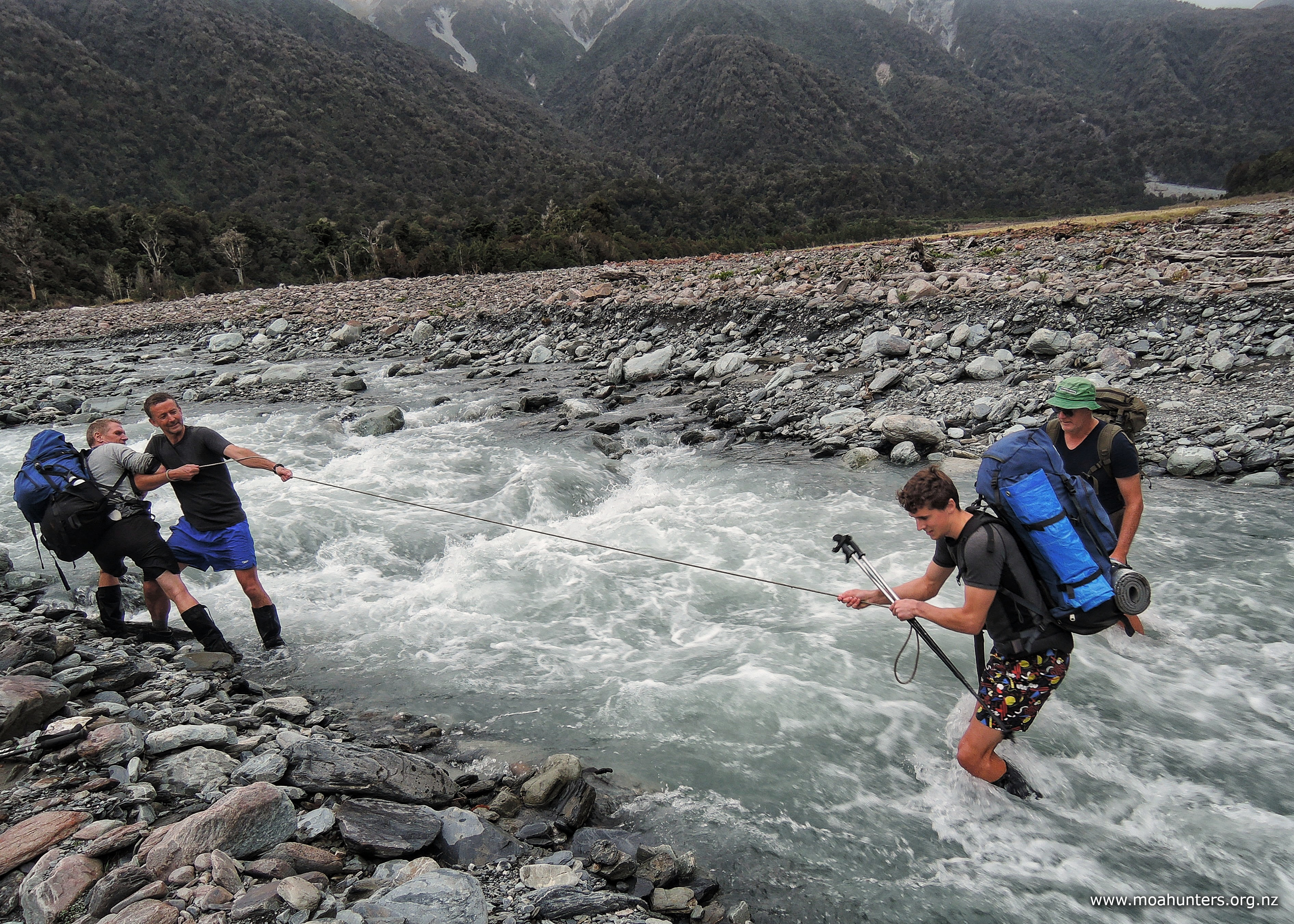
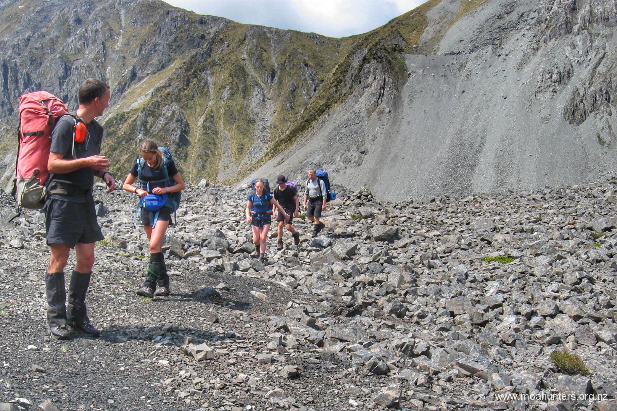
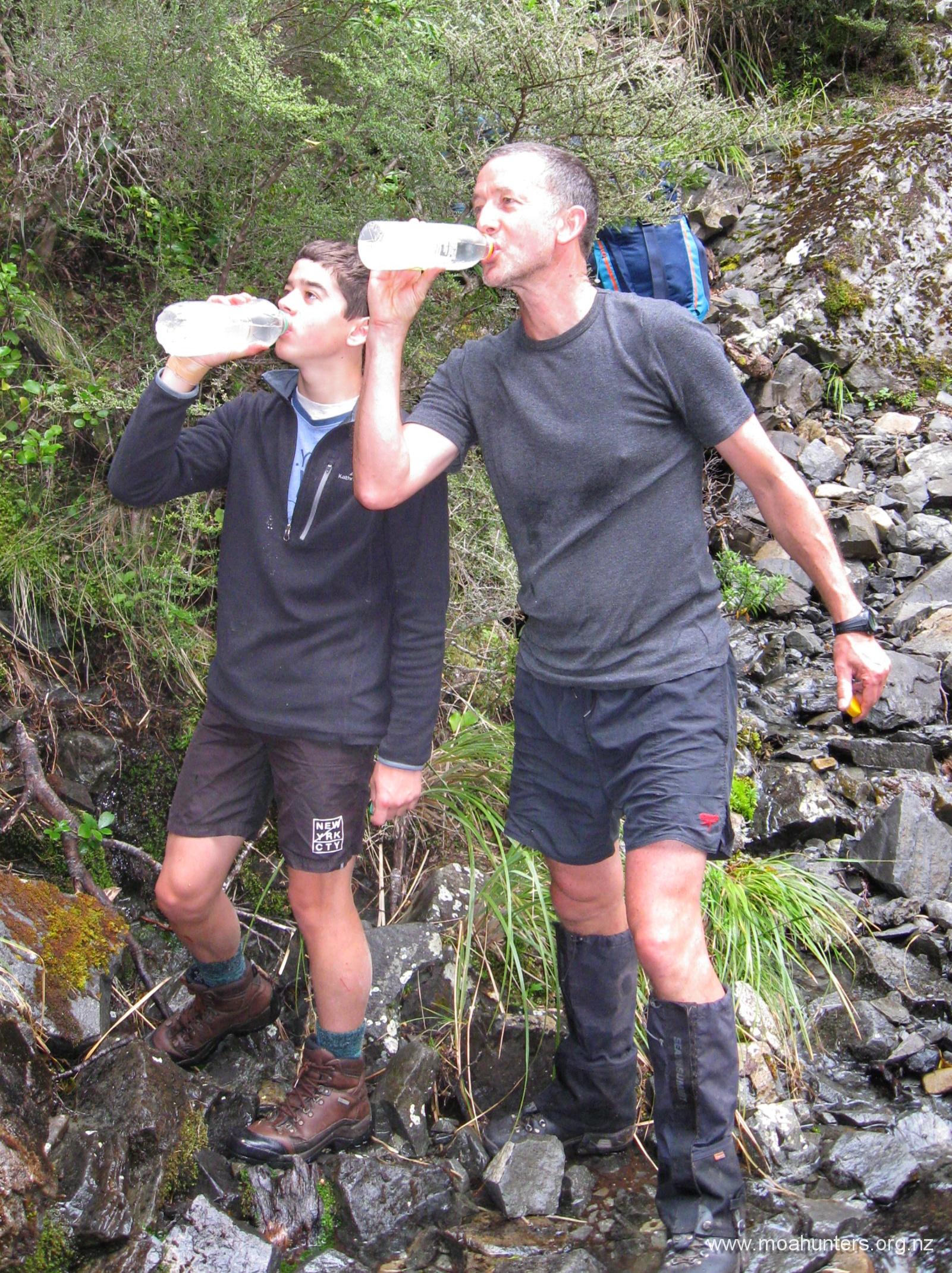
Follow the Julie creek downstream for 2-3 hours. The river regularly disappears for long sections into the rocks of the valley floor, so if the water disappears, back track and fill your water bottles, as it may be sometime before you get another chance.
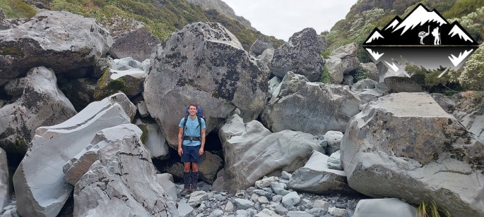
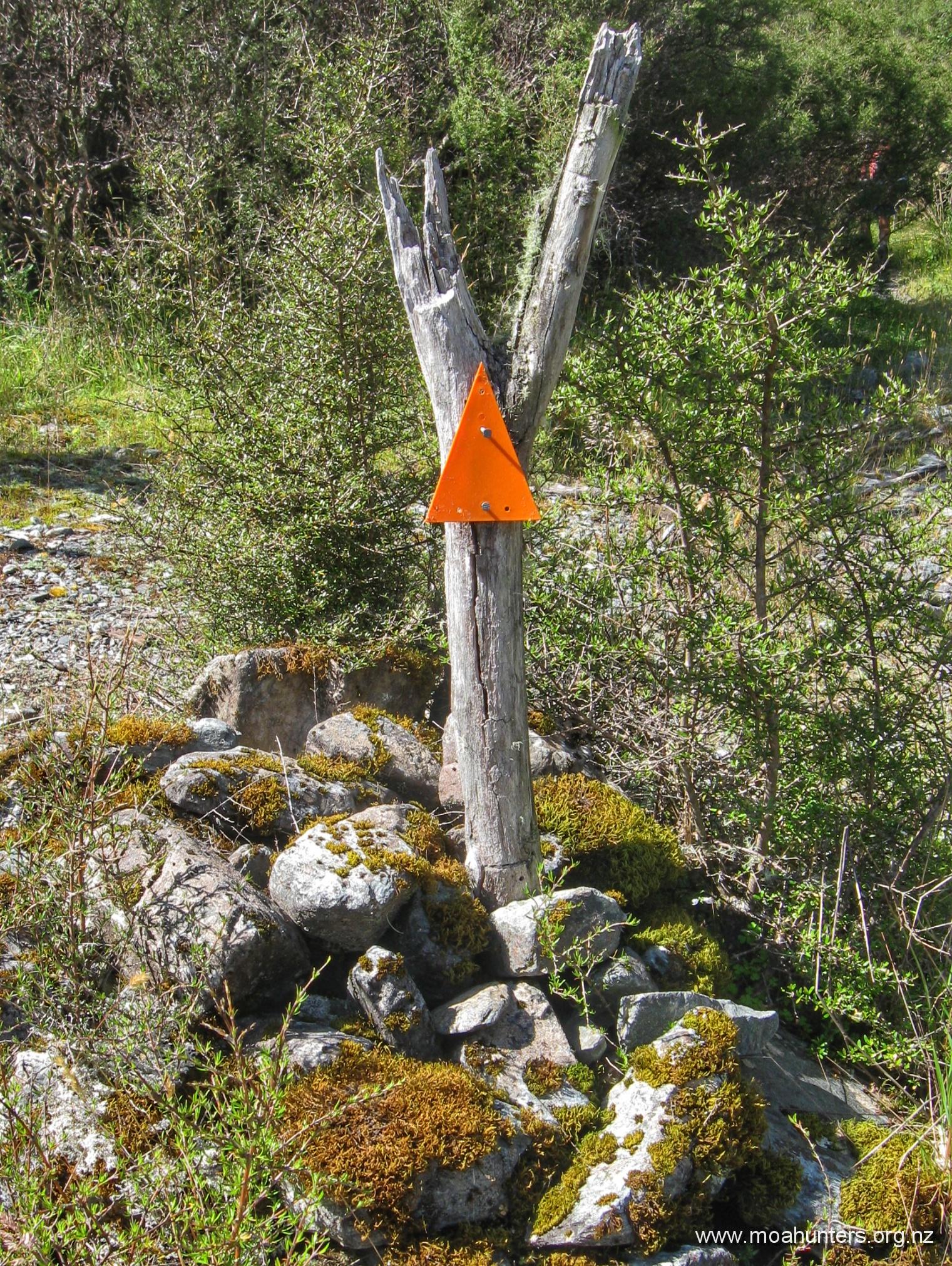
Luke at 190cm very tall, made relatively speedy work of the river-bed boulder hopping and progress was quick until Julia creek permanently re-emerged from the rocks and the surrounding scrub thickened and closed into the banks of the creek. It is at this point you need to keep an eye out on the true right for the marker that indicates the start of the old track to the Julia Hut.
This marks the point just after where the track starts.
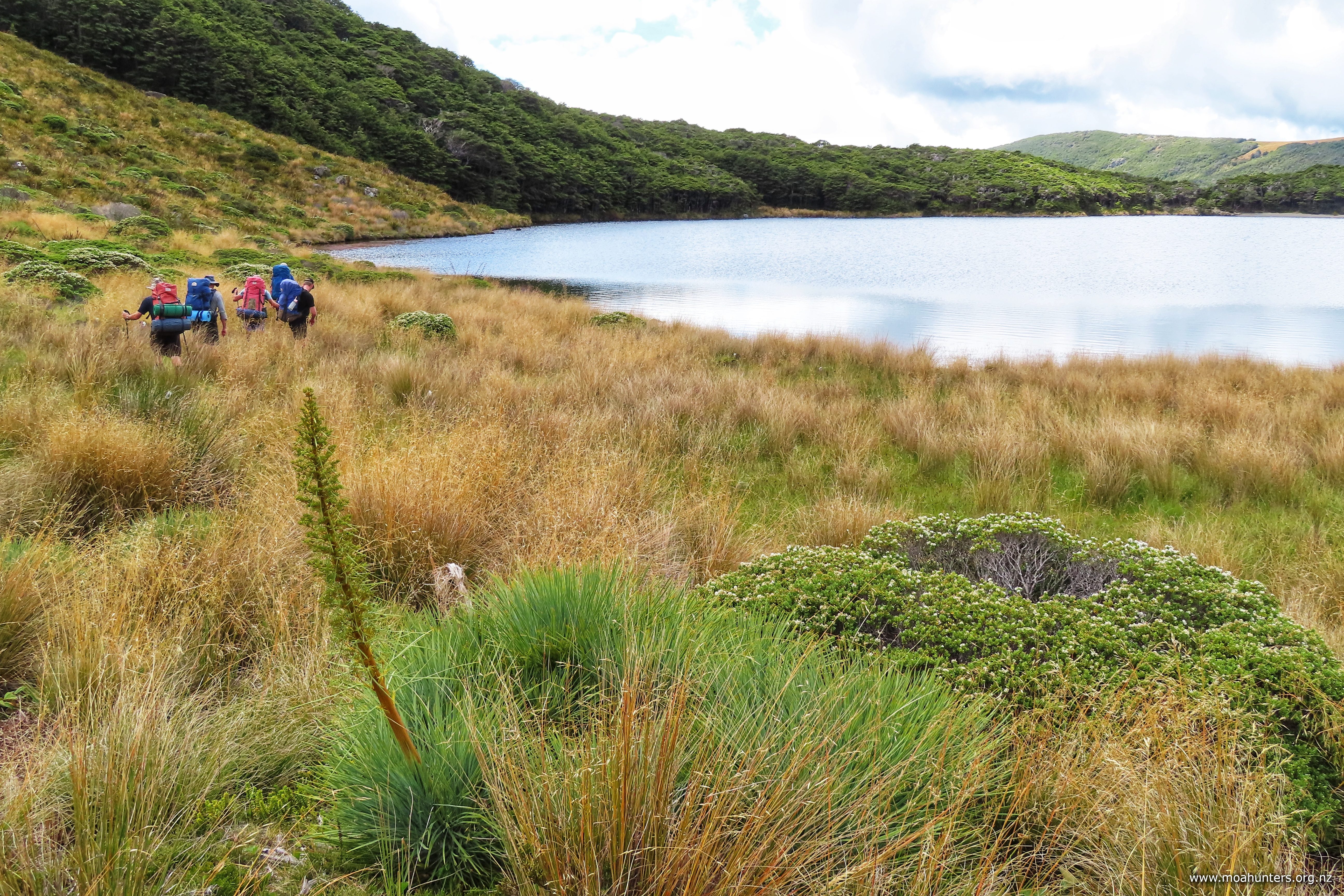
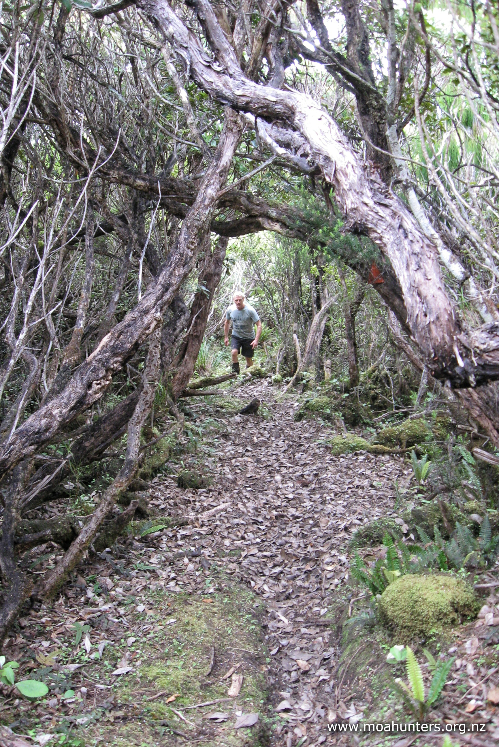
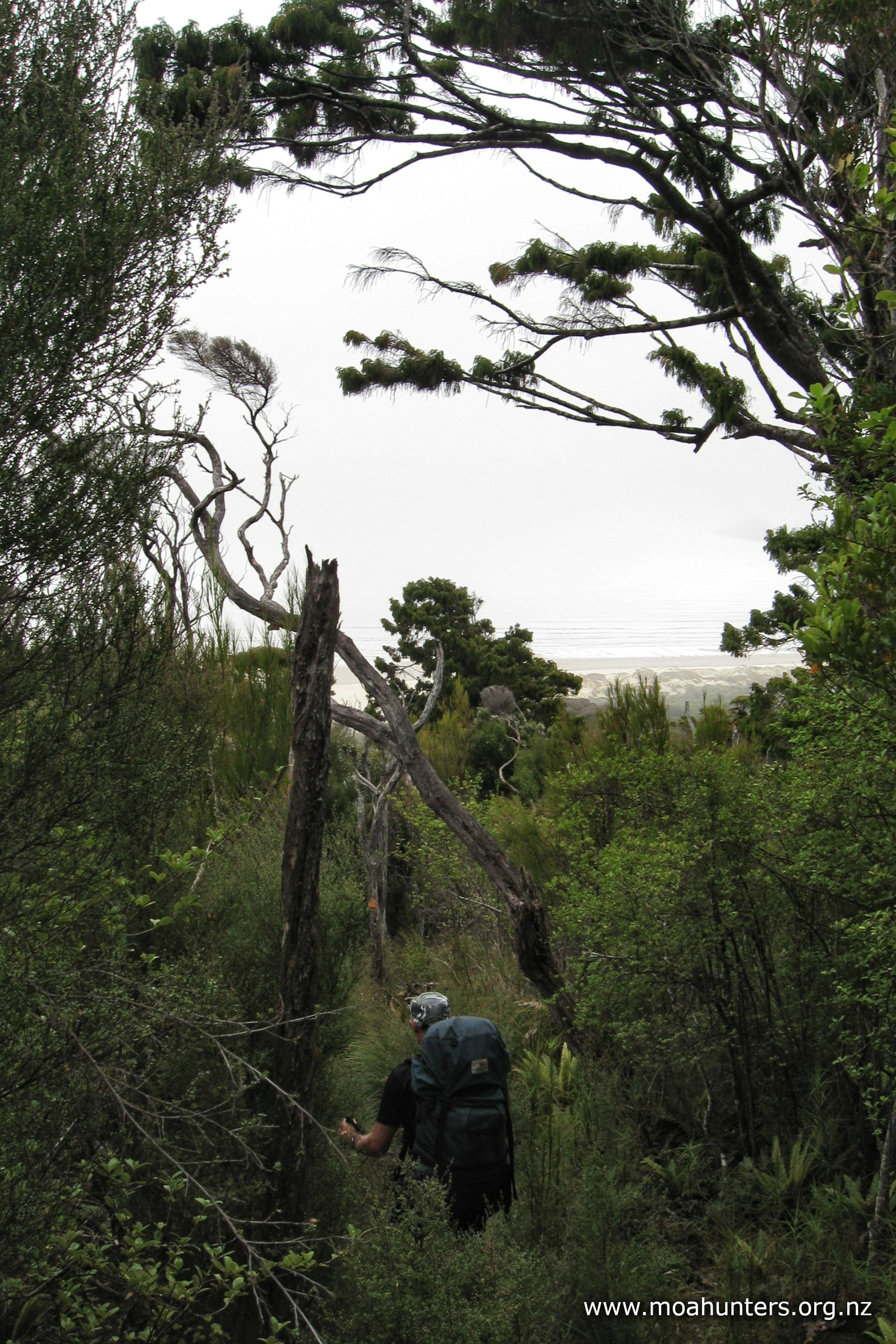
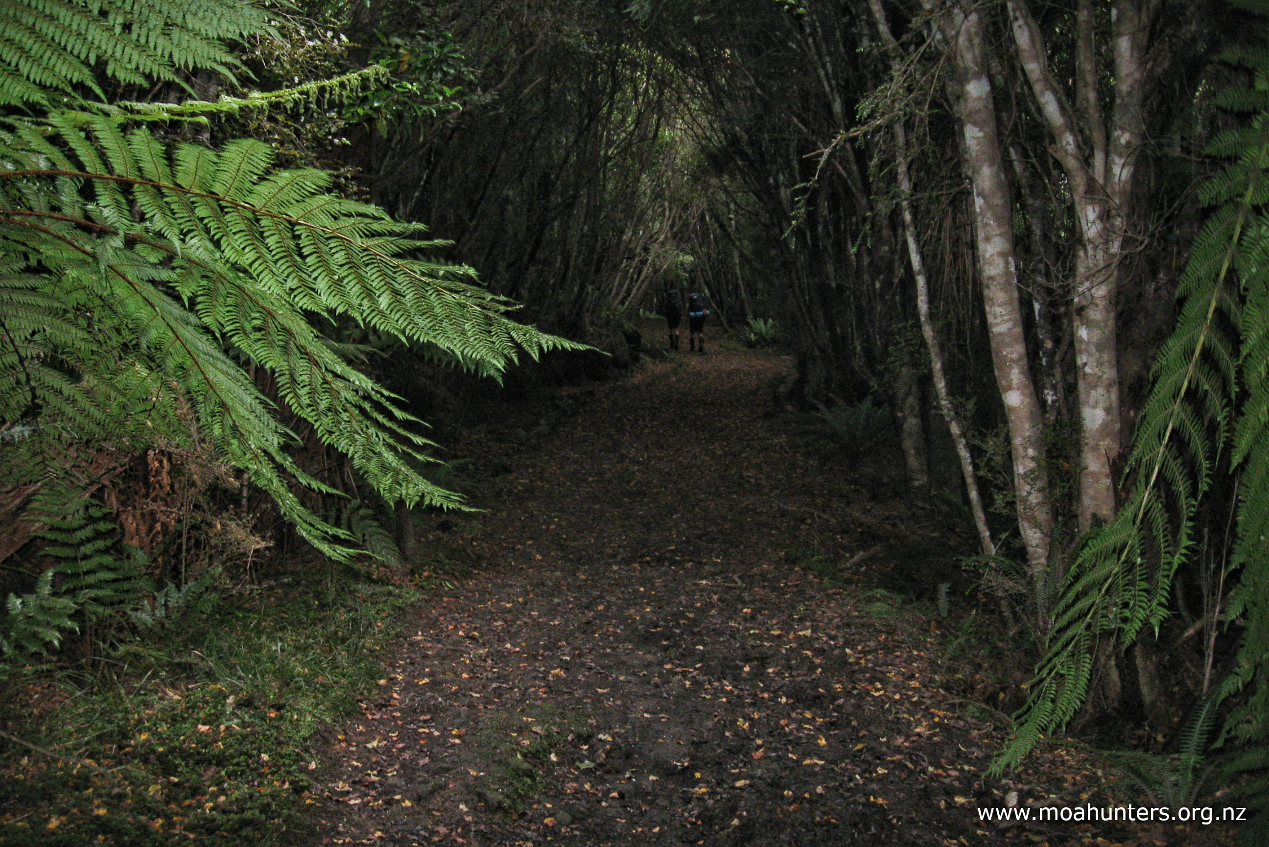
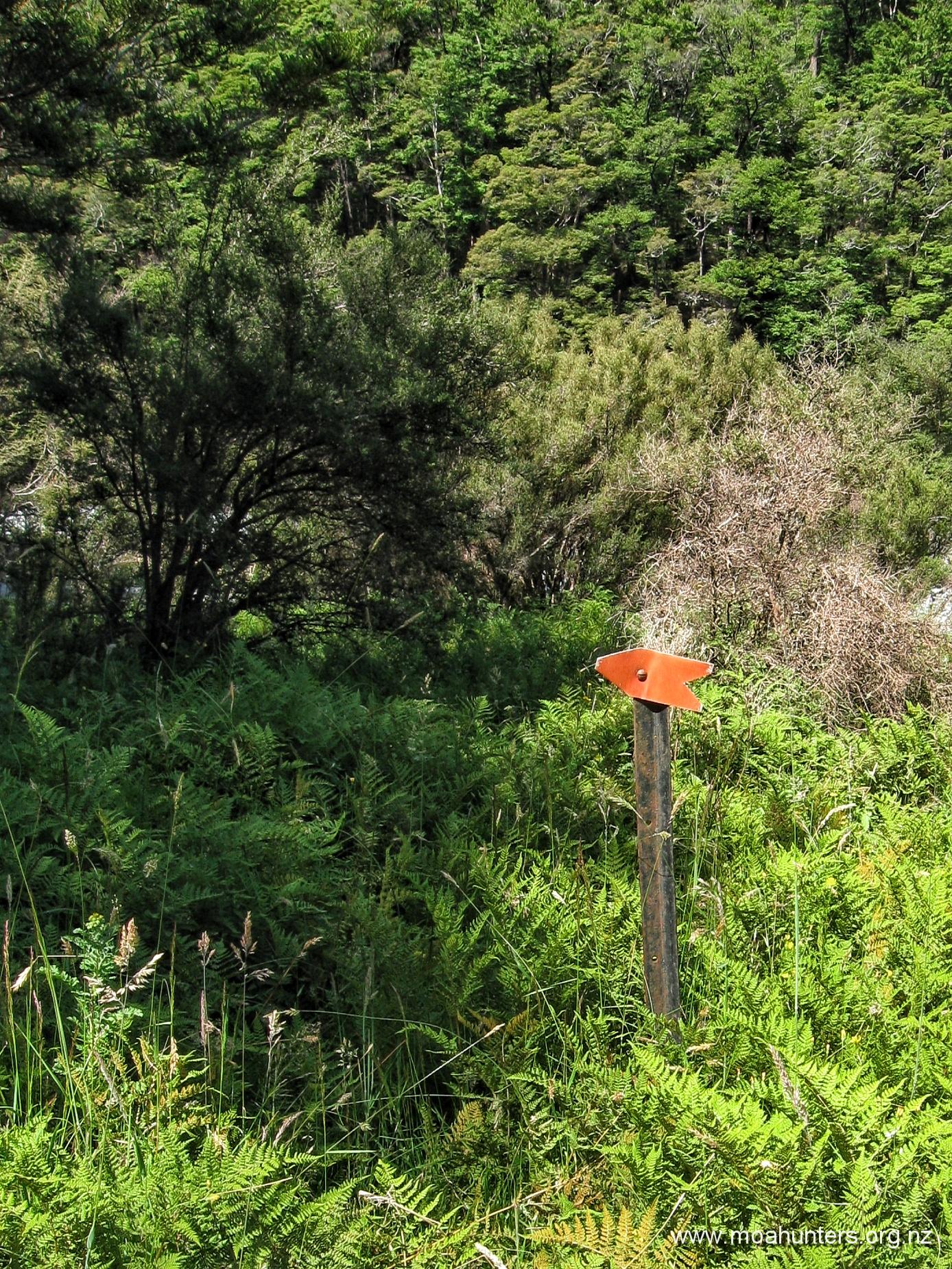
The track may be poorly formed and in need of maintenance, but it is well worth finding as Julia creek eventually fills the riverbed and would make for difficult, slow and wet travel. The track starts up a very mossy overgrown tumble of rocks where a small side stream enters from the true right. Follow the track for about 1.5 hours across old scree, slips and through scrubby vegetation. Often climbing and dropping in short bursts through tangled scrub on the steep slope. Not fast travel, but highly preferable to the now closed in and full Julia creek.
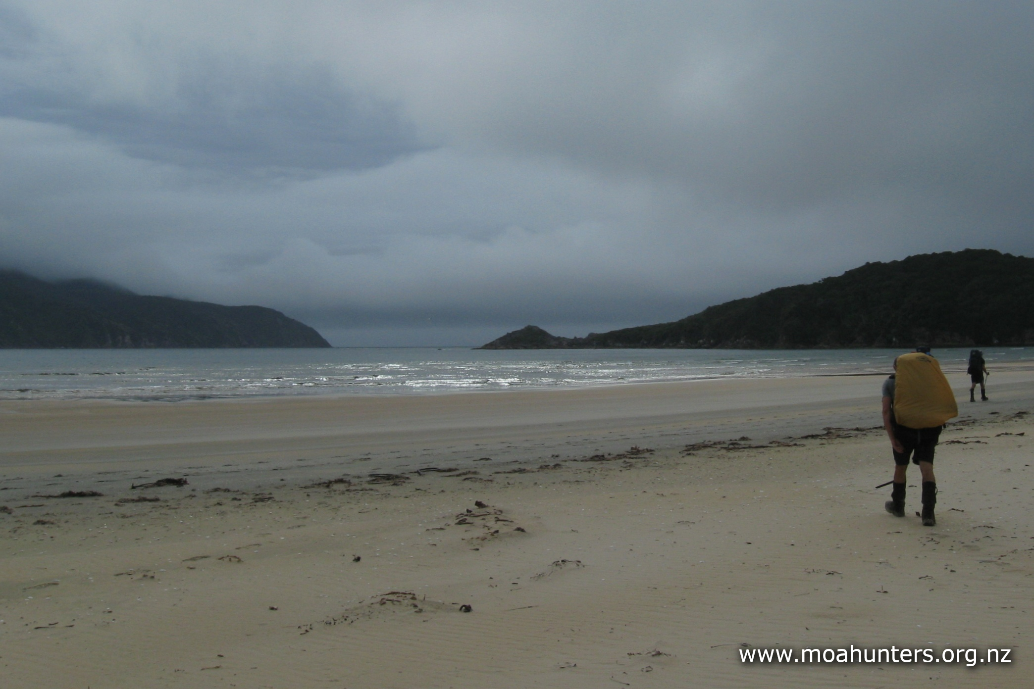
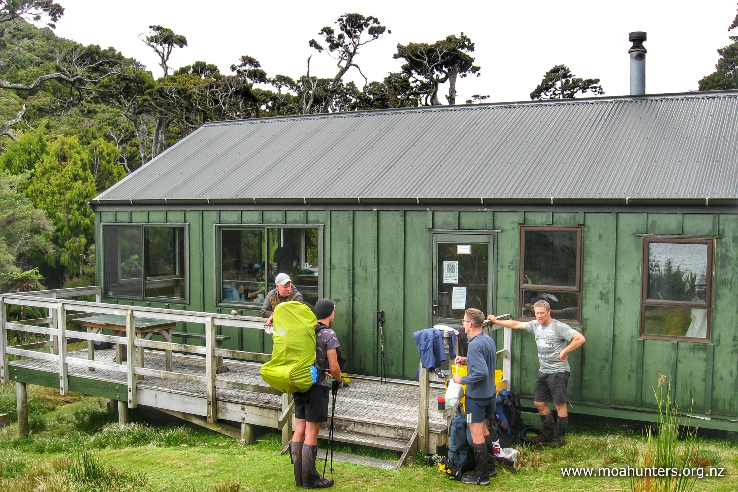
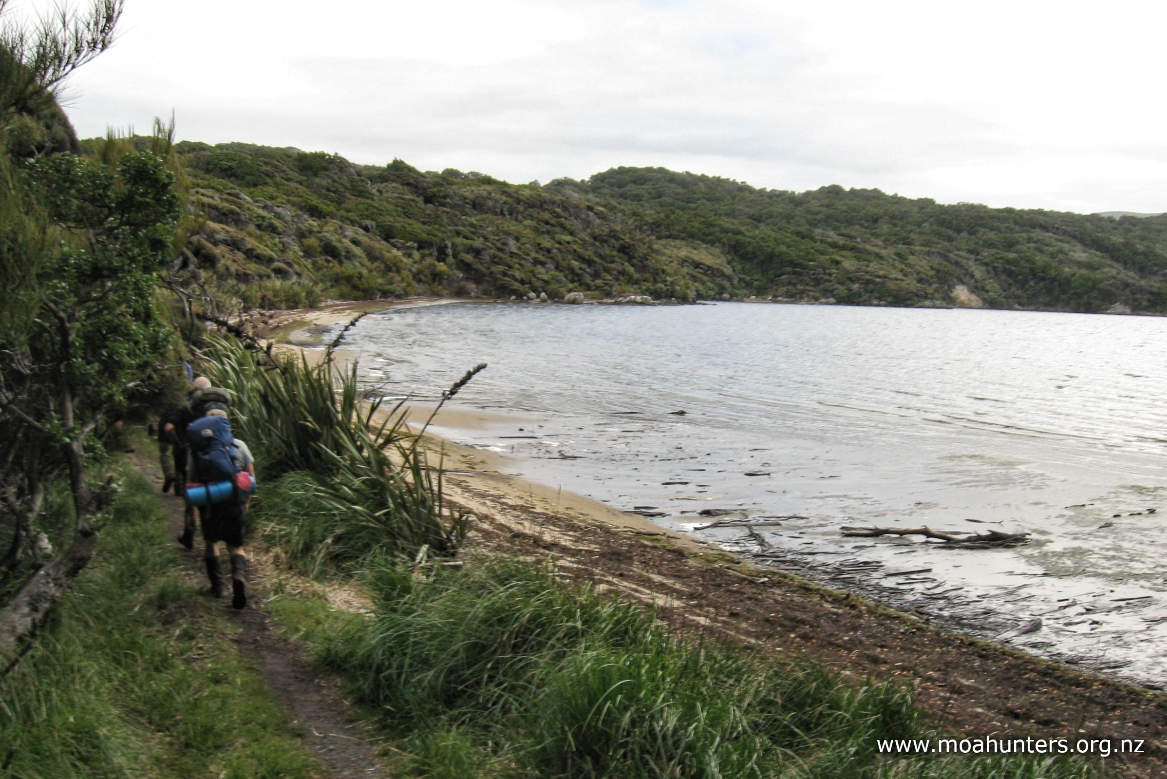
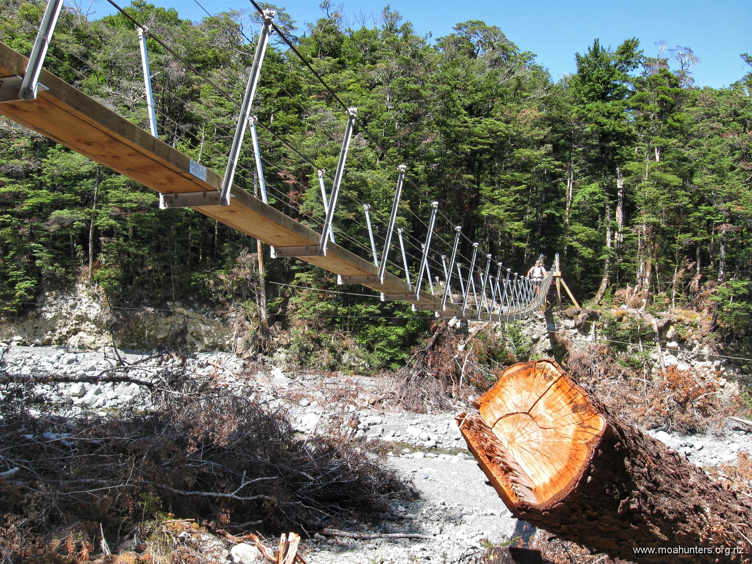
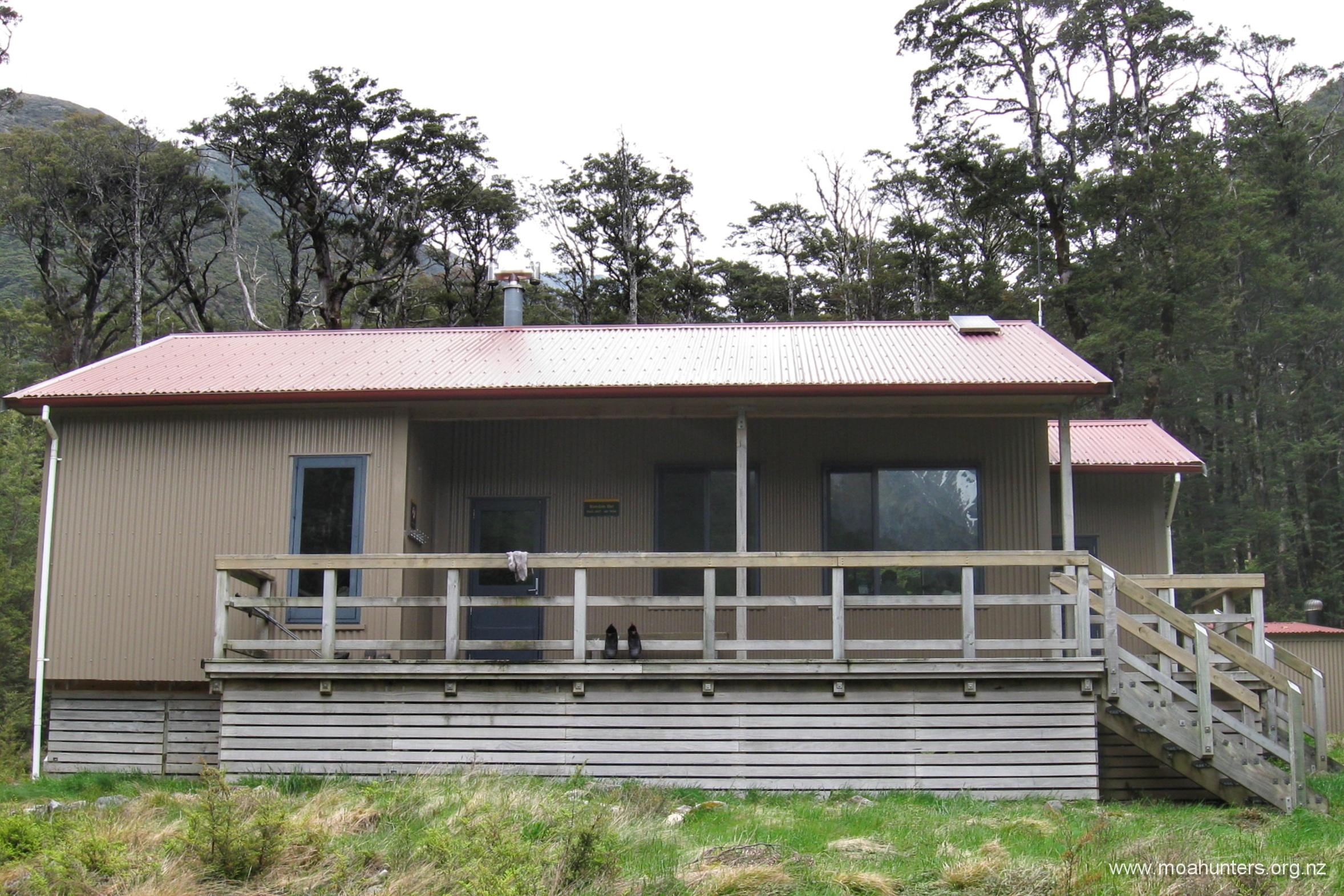
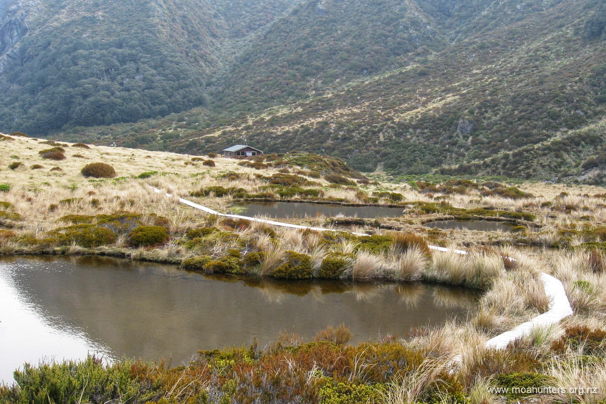
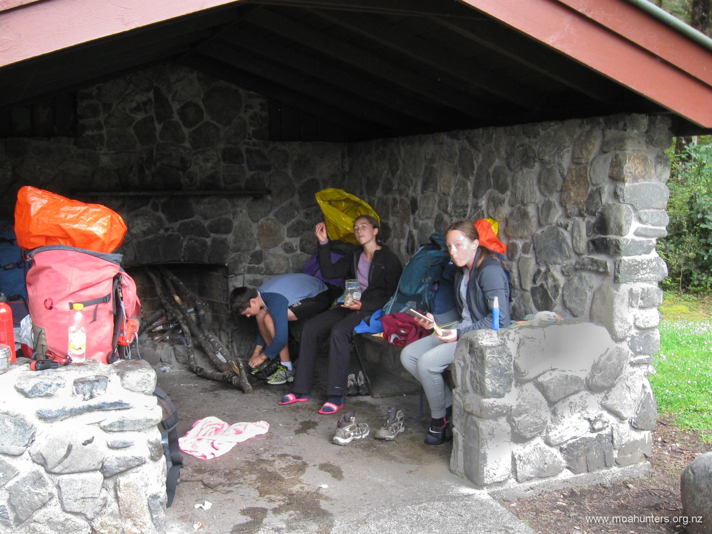
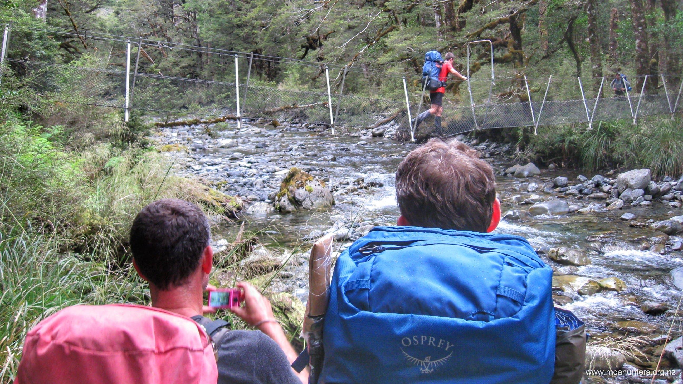
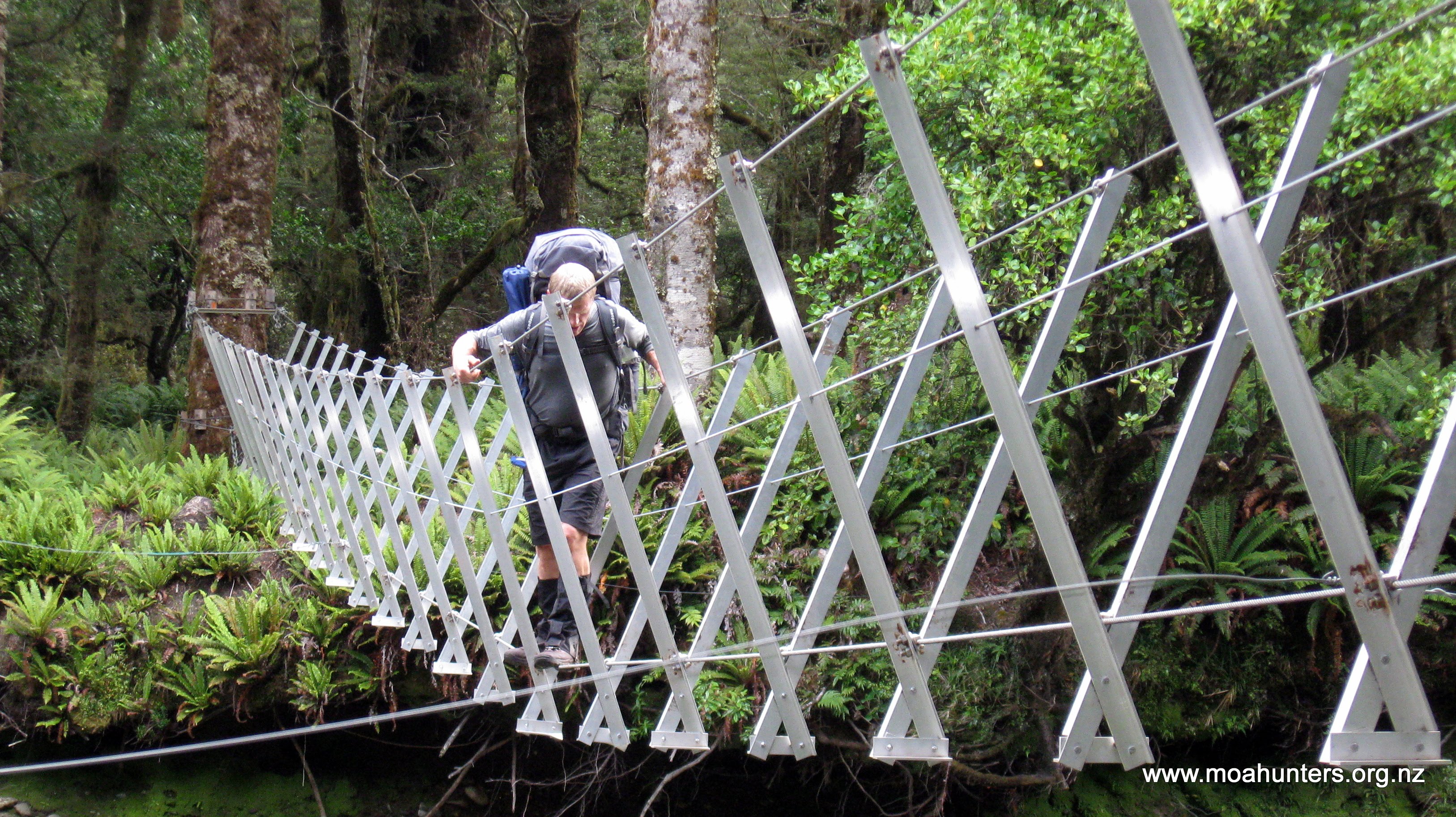
Near the hut the scrub gets taller and full-sized trees appear. The track drops into down into the now wider riverbed for sections. While in the river-bed keep an eye out on the right bank for markers that show the track to the swing bridge over Mary creek, as you will need to use the swing bridge to get across. Once at the swing bridge you are but minutes from the Julia Hut and another 10mins to the soothing hot pools.
SUMMARY
Our trip took nine hours: 07:00 to 16:00.
Top tips:
Walking poles are very useful in the snow at the top and on the steep scree decent.
Wear good strong boots. A party of three arrived at Julia hut at midnight after crossing Pope’s pass behind us. Two of them were wearing trail runners that were by this time pretty much destroyed!
Start early, give your self plenty of hours. Find a pace that covers the distance efficiently without being in a hurry.
From Julia Hut you have multiple options for the next days:
Return over Harman Pass to your Vehicle
All the way down the Taipo to SH73
Follow the Taipo partway, then up to Carroll Hut and down to SH73 closer to Otira. We have had good luck hitching a ride from here back to Klondyke corner.
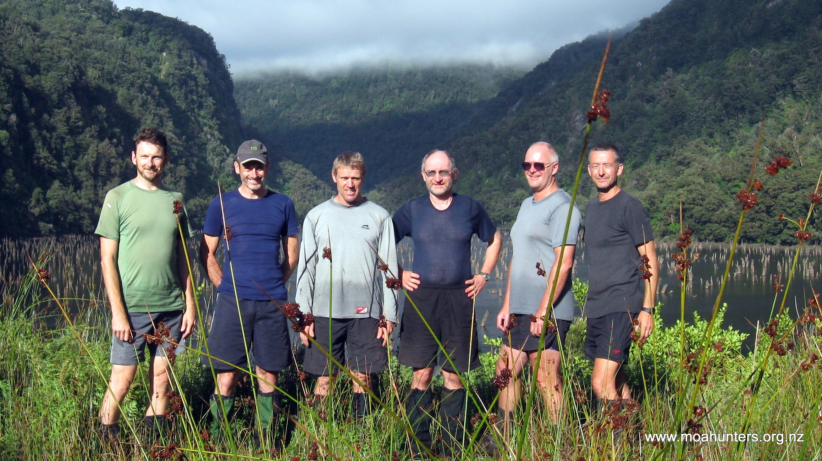
For twenty years the Moa Hunters have wandered the magnificent mountains and valleys of Te Waipounamu the South Island and Rakiura Stewart Island in search of the elusive moa. Undaunted by our total lack of success, this year we quite literally pushed the boat out, floating down the Whanganui river to look for moa.
While we are all at ease wearing boots and backpacks, paddling Canadian canoes stacked with plastic barrels is a nudge out of our collective comfort zones. Many of us felt slightly unsettled, unsure how well we would adjust to the change of pace.
We wondered how would four days on the waters of the Whanganui measure up to our usual tramping adventures?
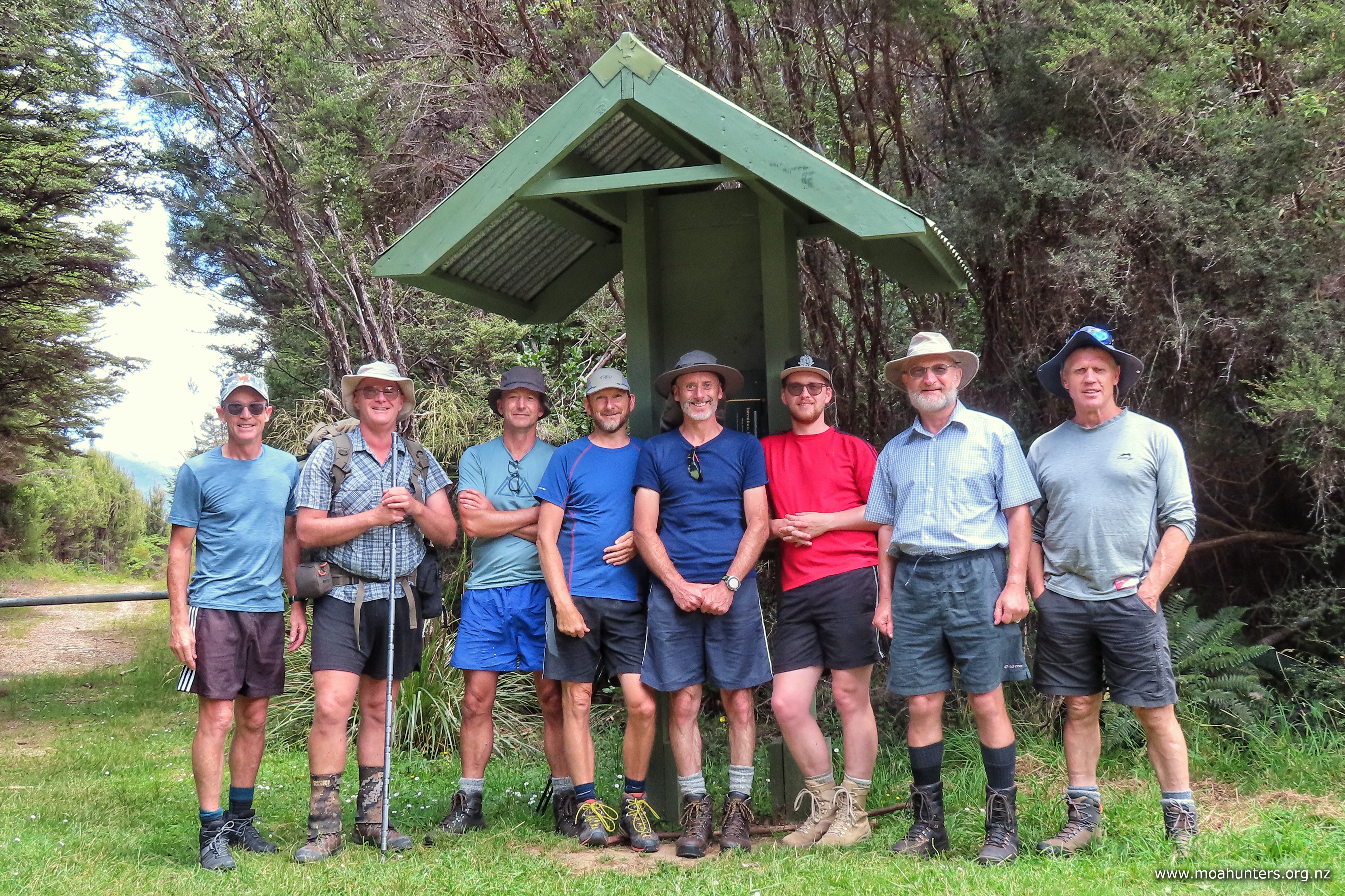
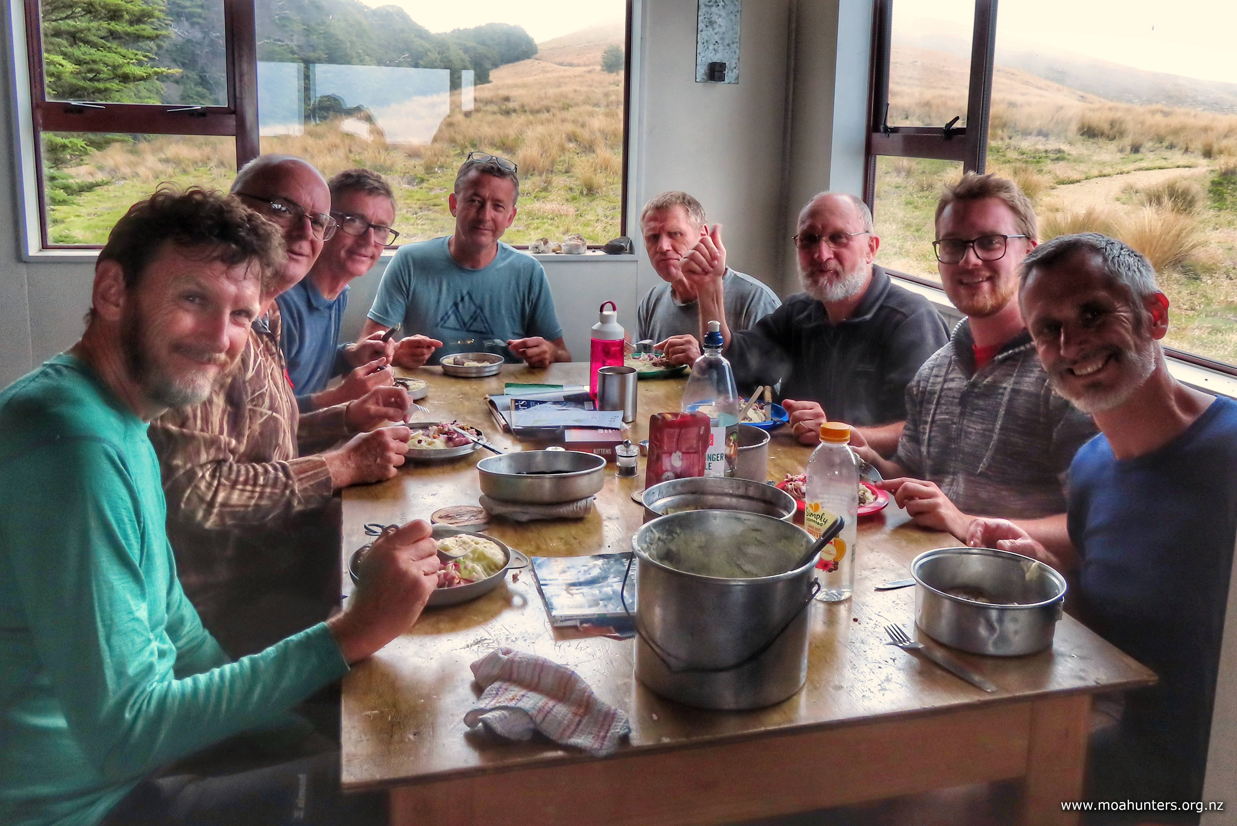
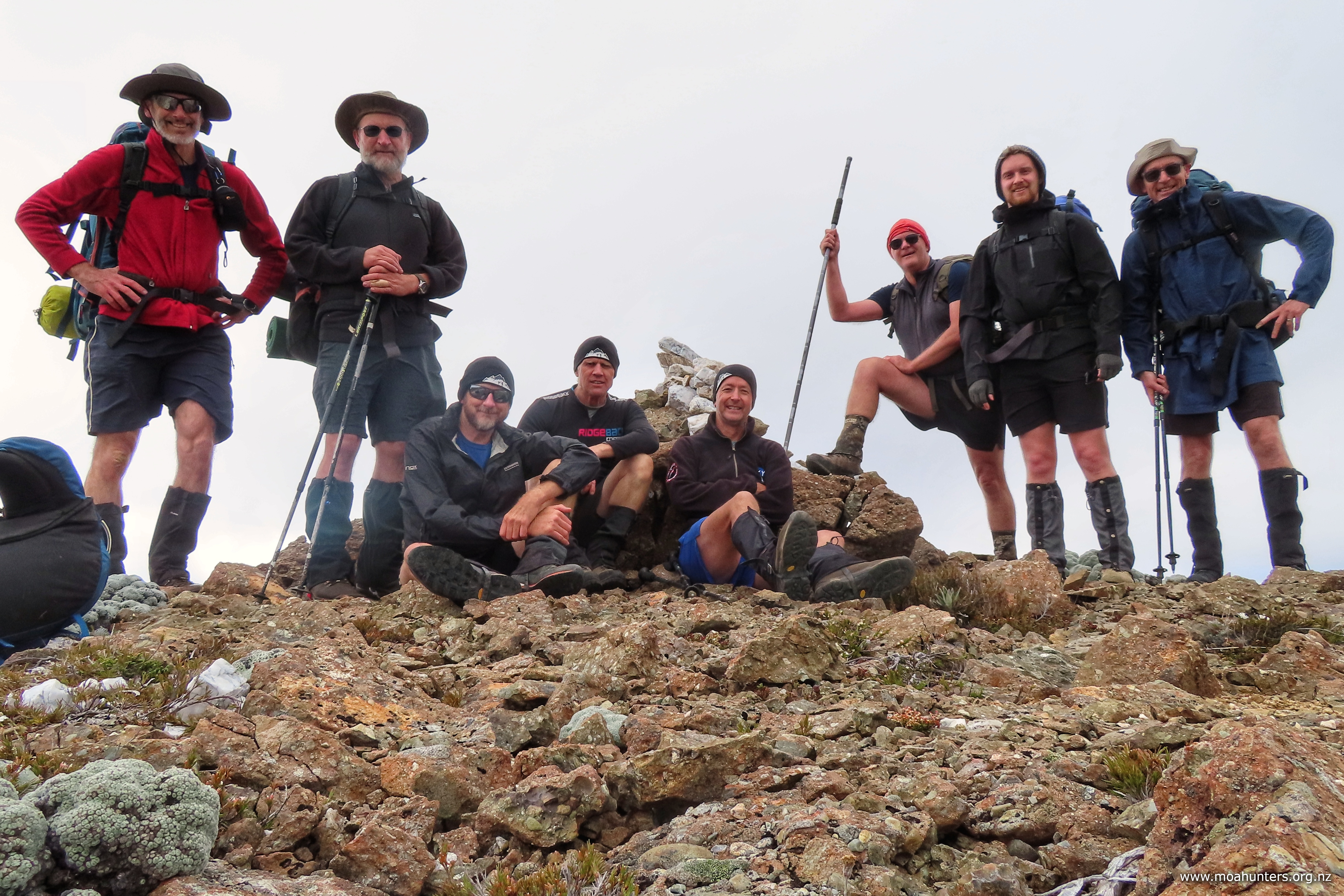
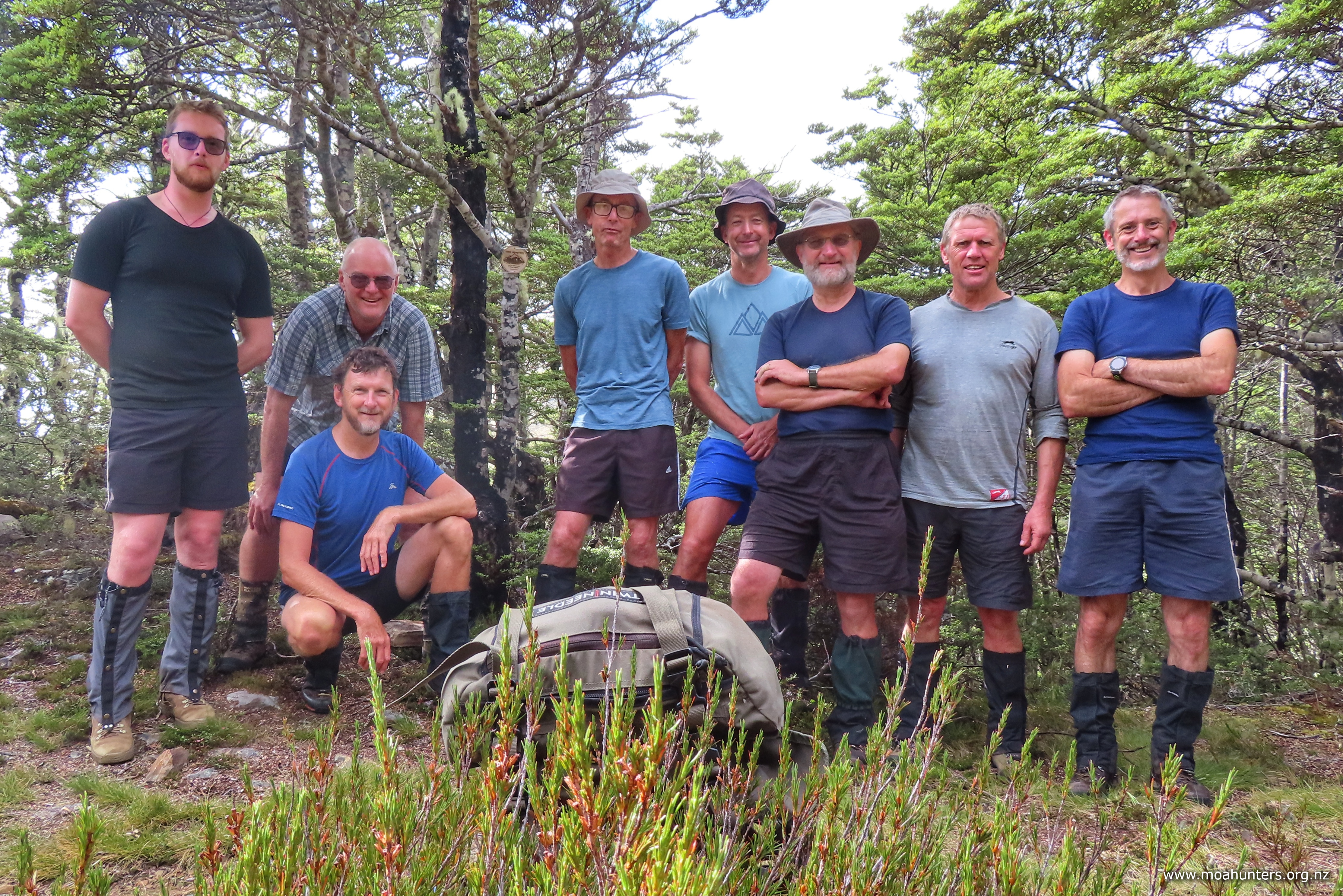
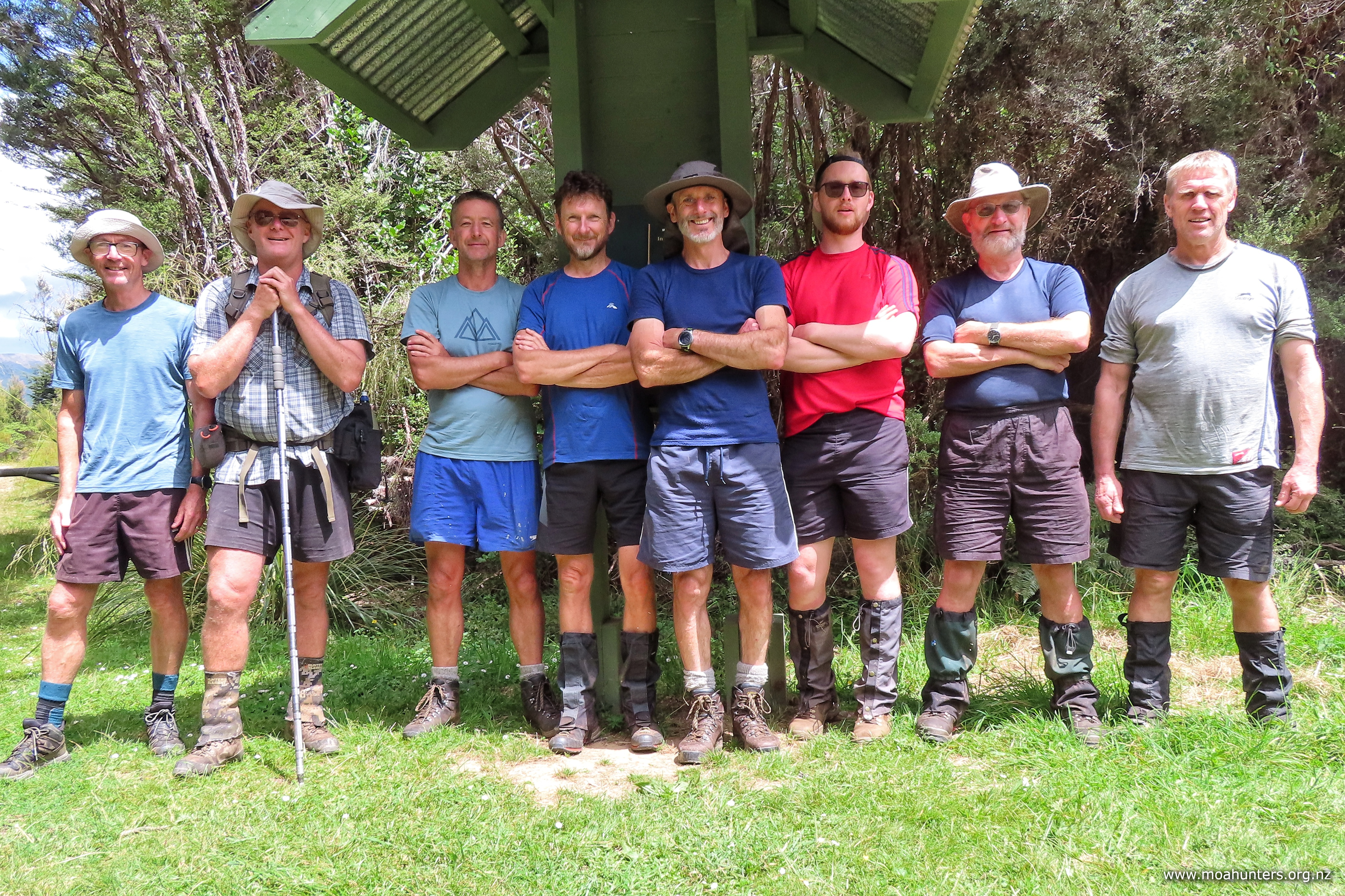
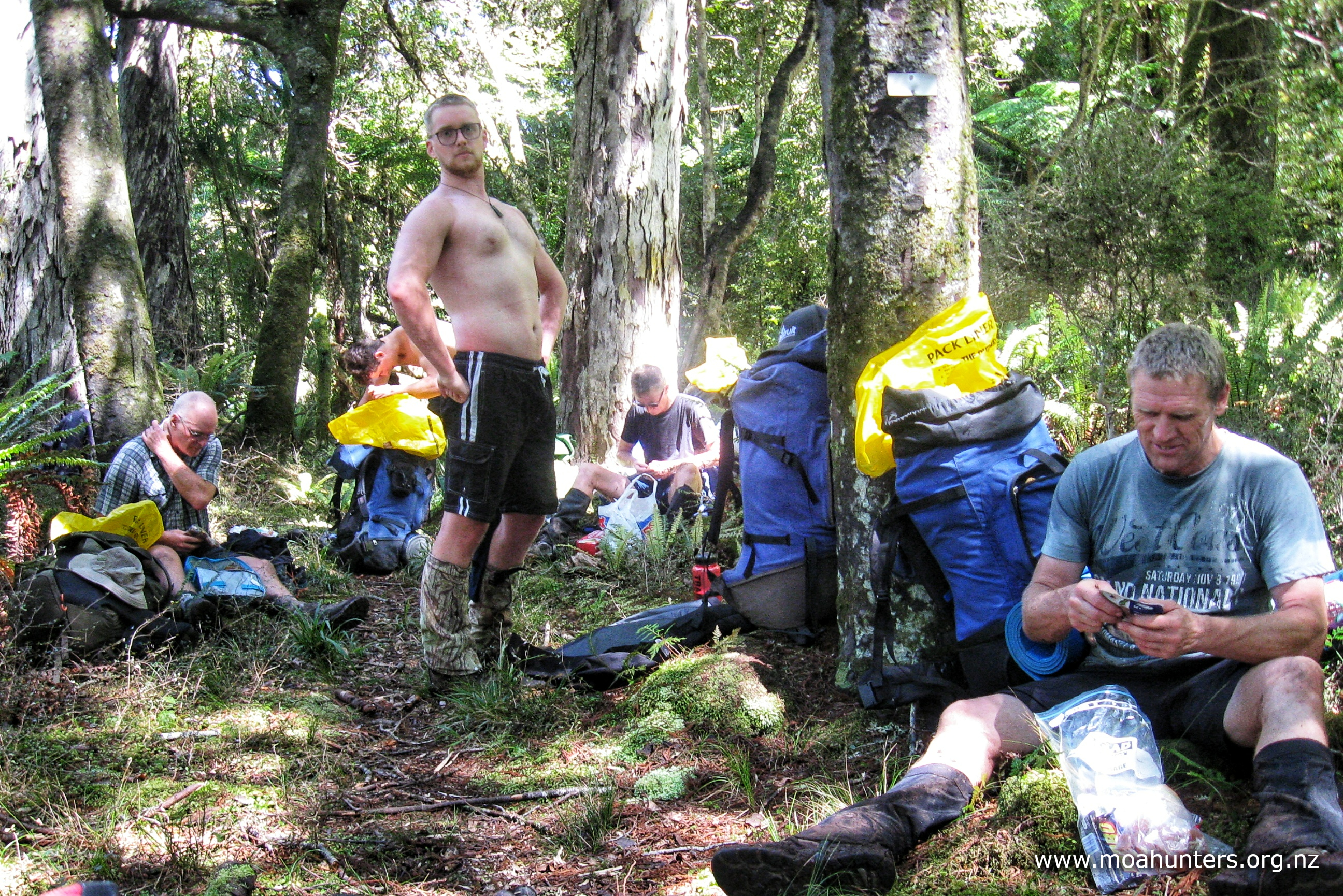
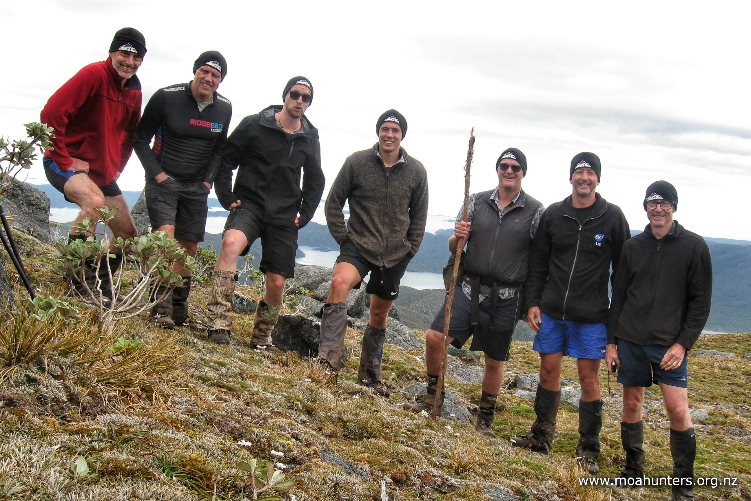
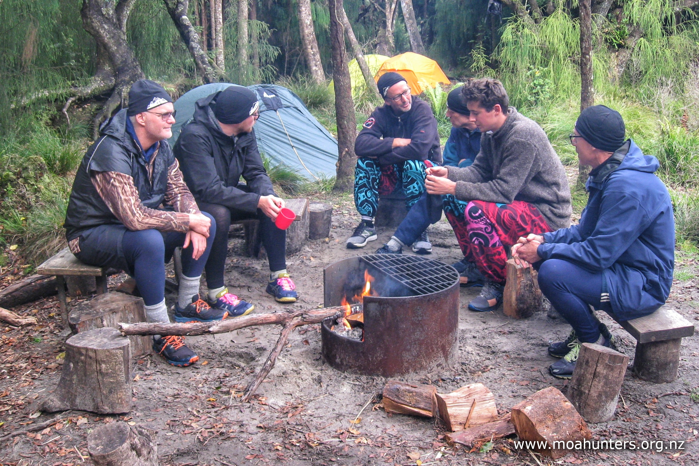
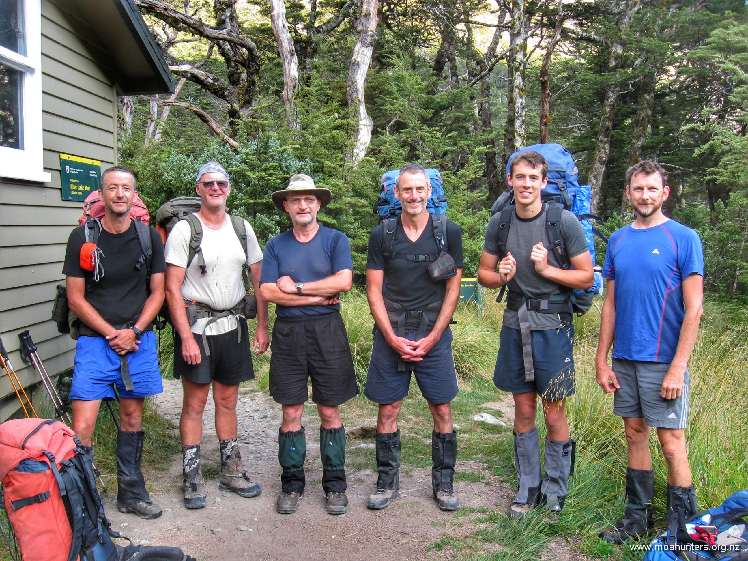
Moa Hunters on this trip: Chris, Lewis, Cooper, John, Adam, Luke, Paul, Richard, Magnus
The Trip:
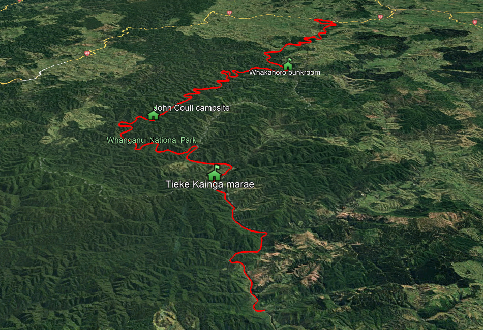
Day 1: Travel to Auckland, mini-van to Taumaranui Day 2: Taumaranui to Ohinepane to Whakahoro (6hrs / 35km) Day 3: Whakahoro to John Coull hut (7hrs / 37.5km) Day 4: John Coull hut to Tieke Kainga marae (5hrs / 29km) Day 5: Tieke Kainga marae to Pipiriki to Taumaranui (4.5hrs / 21.5km)
While Auckland isn’t conveniently located anywhere near Taumaranui, it worked well for us all to converge on the big city and travel as a group from there. Lewis flew in from Paraparaumu and Magnus from Nelson, both in fun little fizz planes.
The South Island crew arrived by jet, but not until seemingly every Air New Zealand staff member at Christchurch airport had sniffed and examined Paul’s camp cooker fuel cannister. Being an honest chap, Paul declared said item to check-in staff as soon as he arrived. Following a dubious sniff and a screwed up nose, the cannister was subsequently walked up and down the terminal, nose to nose, until it finally reached a snout of sufficient seniority to sign it off as “OK to travel”. Paul was less amused than the rest of the Moa Hunter crew…
Richard met us all at Auckland airport where we bundled our bags and bodies into a rental van with an identity crisis. We drove to his residence in Flat Bush, added Cooper and his bags to the mix, then hit the road south-bound for Taumaranui.
Cooper is Richard’s eldest son and he joined us for the first time on this trip, becoming the tenth Moa Hunter! We held high hopes that his sharp young eyes might spot moa that our old ones miss.
Located five minutes drive out of town, their hillside base is in a lovely spot with the Whanganui river meandering directly below it. We parked up outside the large new shed and began inspecting the barrels and boats we would become intimately familiar with over the next four days.
Lewis had booked four double Canadian canoes and a single sit-on-top kayak for our team. We had opted for the additional rigid seat-backs on the canoes on the assumption they would make travel a bit more comfortable for our old backs.
Each person is allocated two 30 litre plastic barrels for their paraphernalia. Snug fitting lids are held in place with ring clamps, making for a “mostly” waterproof seal. With no guarantee of water-tightness, we all pushed our various clothes and other items safely inside a mix of dry bags and plastic bags before stuffing those into the barrels. An additional (not water tight) 60 litre barrel per canoe is also provided for additional gear that doesn’t mind getting wet.
Getting clothes, food and other items into two 30 litre plastic barrels proved an interesting challenge. Each of us can load our backpacks ready for tramping with eyes closed. But the rigid sides and smallish openings of the barrels made for a bit of a challenge getting things fitted in. After a few packs, unpacks, re-packs, muttering and swearing, we each had some sort of system worked out.
With our barrels neatly packed, we promptly unpacked them again as we needed our sleeping bags for our night in the on-site accommodation.
For dinner we drove into town and had a great feed at the Rusty Nail – a no frills friendly kiwi pub in the centre of town. We spotted an interesting sculpture across the road from the pub, and took it as a good omen.
Our plan was to eat, drink, and watch the Super Rugby. However, by 8:00 pm the Crusaders were getting a bit of a lesson from Moana Pasifika, and some of us who had been up since 4:00am were feeling more than a little jaded. We headed back to Taumaranui Canoe Hire for an early bedtime…
Day 2
SunDay 30th March – Taumaranui to Ohinepane to Whakahoro
Our report time up the hill at the Taumaranui Canoe Hire office and briefing room was 8:00am. To be sure we weren’t late, we hauled ourselves out of bed bright and early, well before sunrise. Breakfast was an easy Bircher muesli, then it was back to stuffing our barrels ready to be loaded onto a trailer under our canoes.
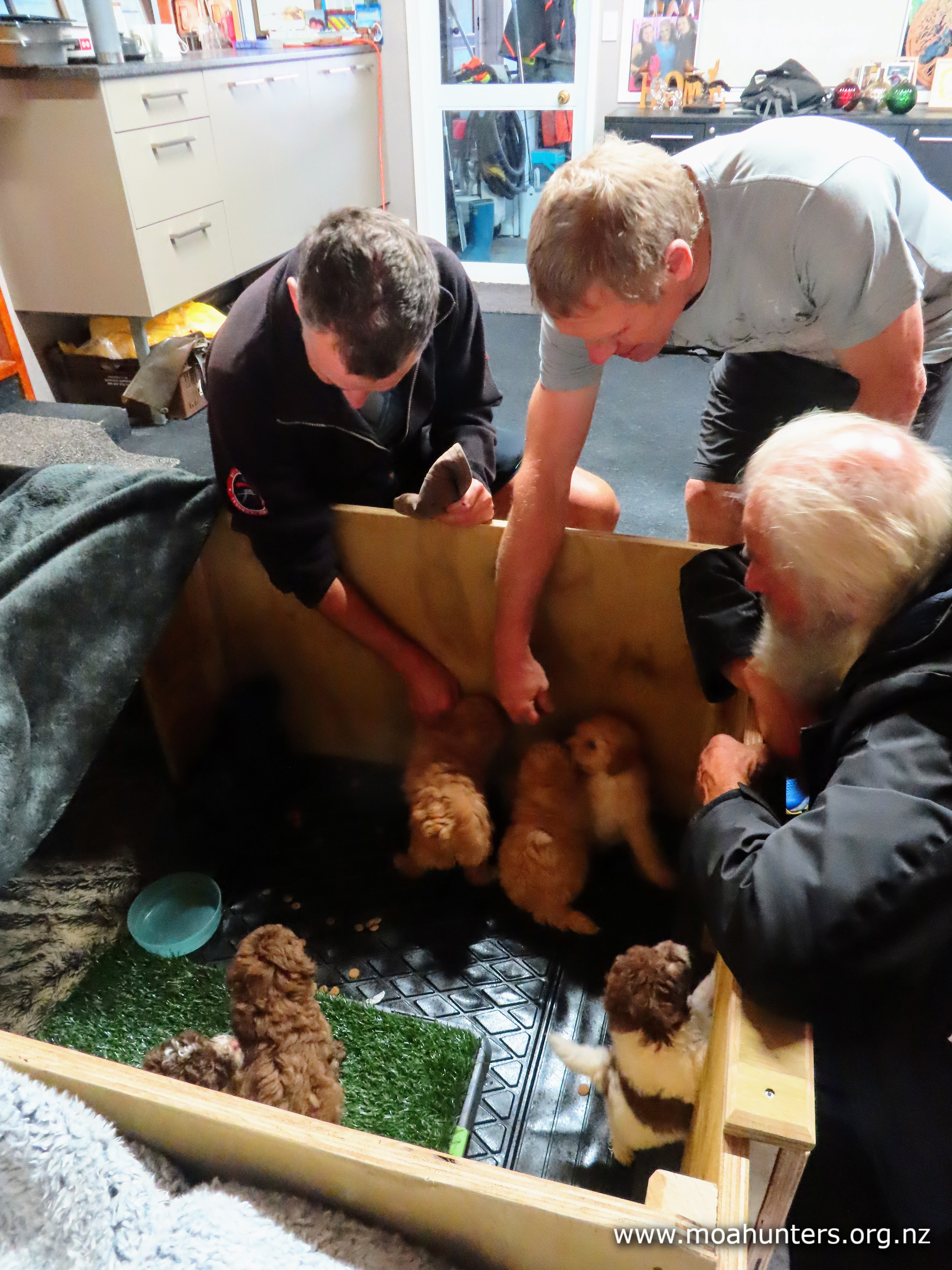
Up the hill at the office, we were greeted by the sound of small yips, yaps and whines from a wooden crate. Puppies!! We were all immediately distracted by their cuteness. Fortunately there was no rush. Barista coffee to start the day is part of the package, and we all gratefully accepted a cup of hot frothy caffeinated goodness.
Once we were all seated in front of a big screen telly in the briefing room, hot slices of bread straight from the oven were offered to us. Yum yum yum.
Jono of Taumaranui Canoe Hire gave us a great 20 minute lesson on the do’s and don’ts of canoeing: How to steer them, where to steer them, and places and situations to avoid. It was an excellent presentation with videos covering off some of the trickier sections of the river, how to tackle rapids, and how not to tackle rapids!
Following that, we piled into the van and were driven twenty minutes down the river to Ohinepane, the start of our adventure.
A further twenty minutes later, we were all set with lifejackets on and barrels securely roped into our canoes. We were raring to go, keen to get on the river and start paddling. Jono suggested we have a bit of a play in the quiet waters before heading downstream. After a few minutes he was happy we were all somewhat competent, and sent us on our way.
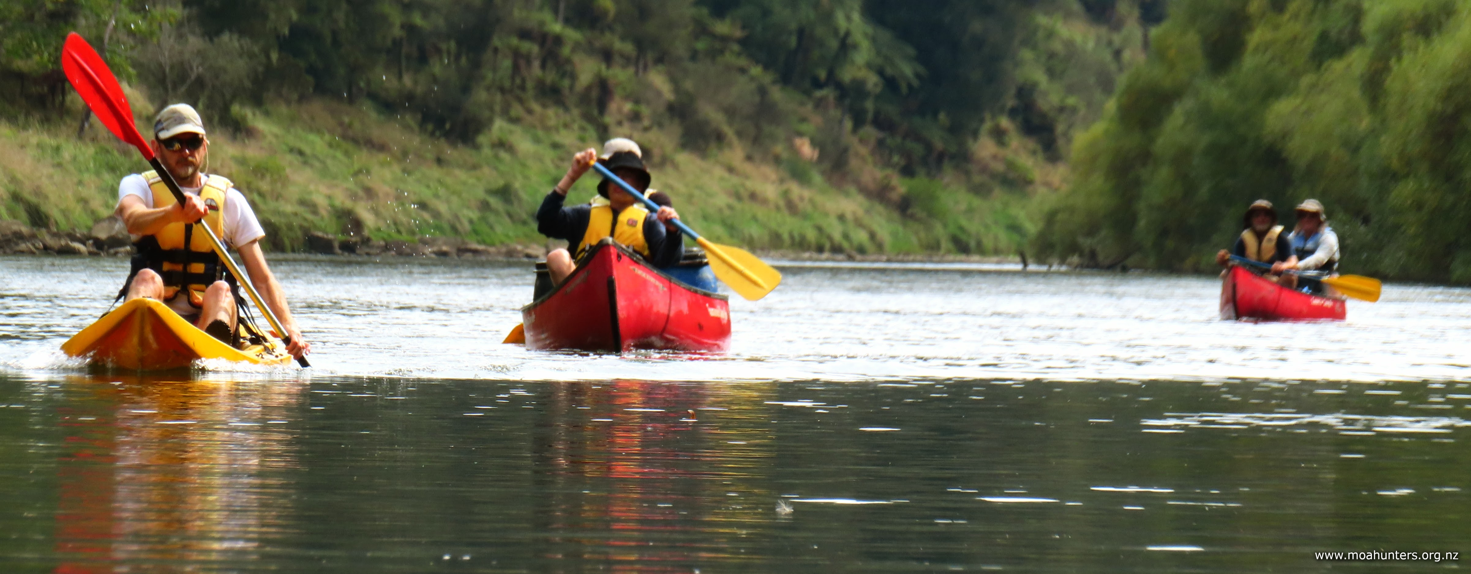
Lewis had volunteered to paddle the kayak on day one, with the rest of us paired up in the canoes.
From Ohinepane you get about five minutes of flat water before the first rapid. Naturally we approached it with a little apprehension. We all knew what to do, but could we do it? Theory is one thing, but what would the real thing actually be like? It turned out to be fairly easy and a lot of fun. Nobody ended up in the drink.
First rule of the rapids: Aim for the ‘V’ The ‘V’ is where water flows in from the left and right ahead of you towards the deepest part of the river. It’s hard to describe, but quite obvious when you are on the river. Entering the rapid down the ‘V’ keeps you in the middle of the flow, reducing the chance of ending up sideways to the current, which is a bad thing.
Second rule of the rapids: Keep paddling While the boat is moving quicker than the water, it is still possible to steer it. If you stop paddling, you are at the mercy of the river. In the rapids we encountered, this is not necessarily catastrophic. In fact, the canoe does tend to find its own way, regardless. But you may hit a rock wall, log or rock along the way!
The rest of the morning was very enjoyable alternating sections of flat water and rapids. Around us was a mix of farmland, bush and introduced trees. We regularly caught glimpses of fences, power lines and farming activity.
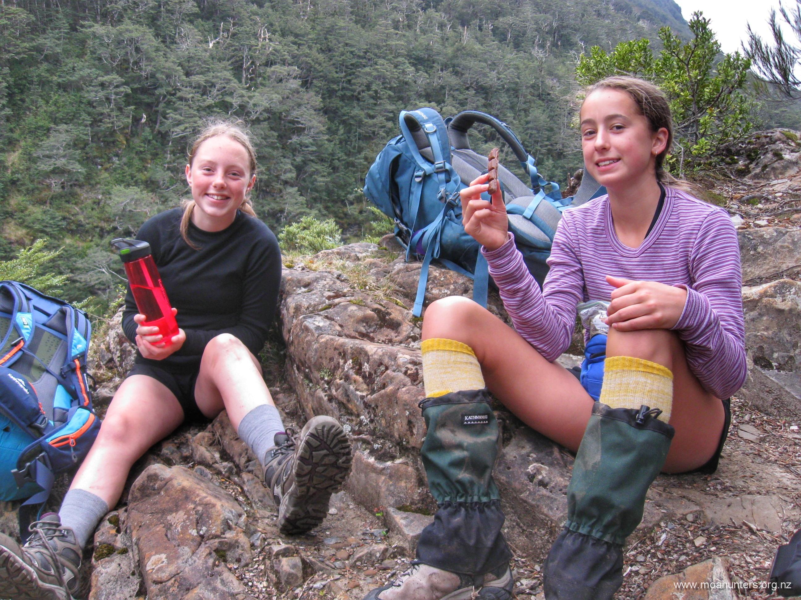
At 11:30 am we stopped for some scroggin and a drink – a moa hunt tradition we were not going to break just because we were on water instead of land.
By this time we had done quite a few rapids and had all glanced off the odd rock or log. We had also learned that a significant quantity of water splashes into the canoes as you bounce through the wave trains. Fortunately, there is a bailer on board to scoop out the worst of the floodwater once back on easy flat stretches.
We reached Poukaria campsite at the perfect time for lunch. During the height of summer we imagine campsites along the Whanganui would be packed with Te Araroa walkers. But this late in the season, Poukaria was deserted and the perfect spot to refuel our bellies. With only bellbird’s breaking the silence (aside from us!) with their chiming song from the bush, and the river flowing silently past in the valley below, it was a lovely spot for our first lunch break on the Whanganui.
It was on this short break that Adam unleashed the Moa Hunter Theme Song on the unsuspecting gang. With a little help from online AI tools, he had created a catchy anthem tune that to everyone’s delight was played through a couple of times.
Beyond Poukaria we started to get the sense we were leaving civilisation. On both sides of the river the surrounding terrain grew steadily steeper. Along the river banks, ferns and thick native bush replaced introduced willows, bush and bracken.
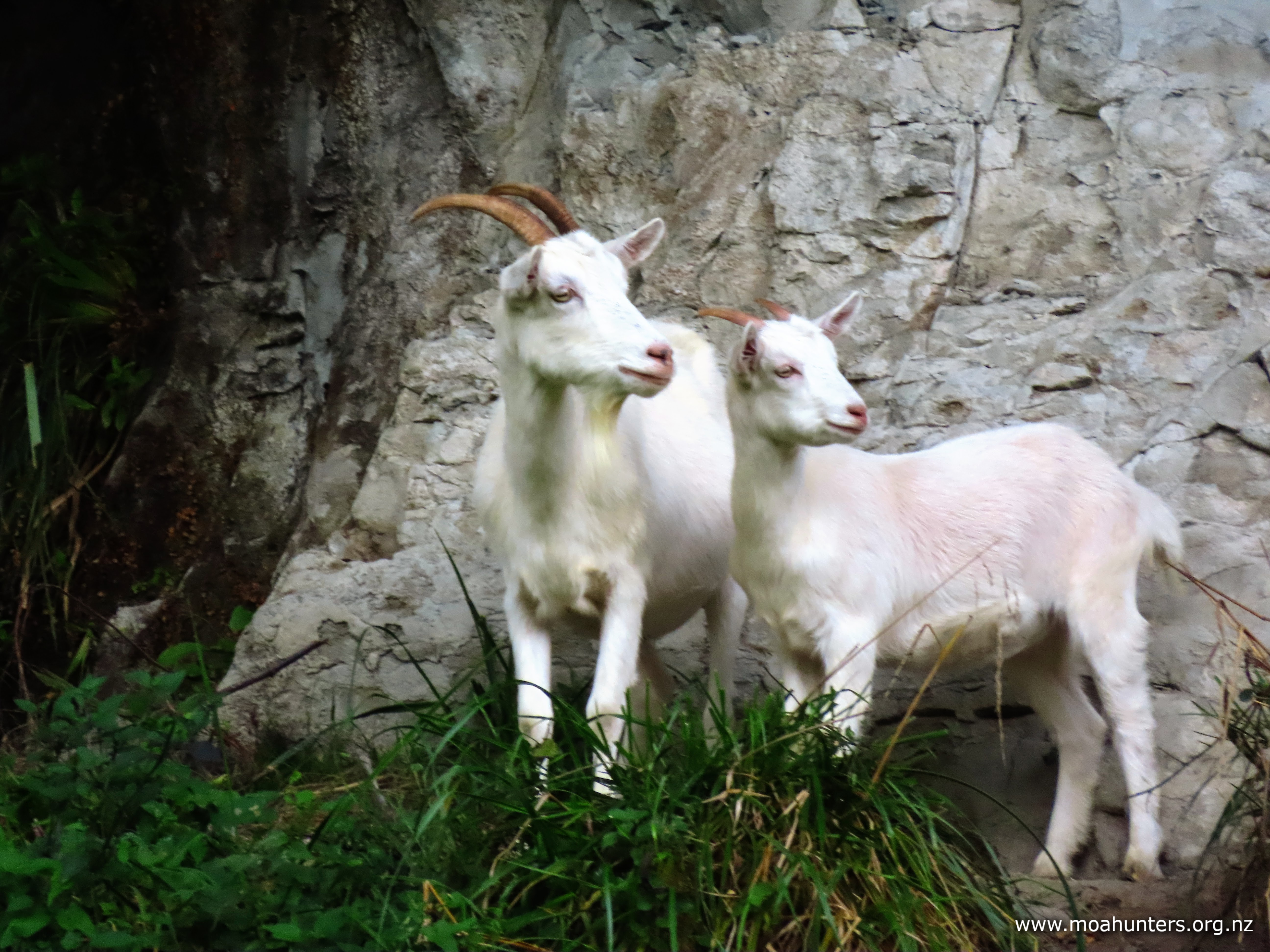
An unexpected introduced inhabitant in these parts (for us southern visitors at least!) were the goats. We regularly spotted them on the banks of the river. Ranging in colour from pure white to fawn to predominantly black, they are a varied and quite pretty pest.
Mostly cloudy skies above us created perfect conditions for paddling. With just a few patches of blue there was a low risk of being burned to a crisp by the still dangerously strong New Zealand sun. That said, we still applied plenty of sunscreen.
There was barely a breath of wind and the sedate waters of the Whanganui were glassy. Paddling these sections was idyllic, each of us enjoying the privilege of being in beautiful surroundings on such a beautiful day.
We stopped again late afternoon to rest our arms and fill our tummies. An interesting rocky flat provided the perfect landing spot to haul the canoes onto. A small side stream here had spent many hundreds, maybe thousands of years weaving interesting patterns of erosion into the rock.
It was 5:30pm when we finally arrived at Whakahoro landing. We were not unhappy to be pulling our vessels out the water for the last time that day. It had been a long time on the river, and we were ready to enjoy terra firma for a while.
We had been warned by Jono that the Whakahoro bunkroom and the campsite was a bit of a slog up the hill from the river. The warning was accurate. Four hundred metres up a reasonably steep hill with a heavy barrel in each hand certainly makes the muscles ache and the arms feel longer!
When we finally had all our gear at the bunkroom, we could ease into the evening.
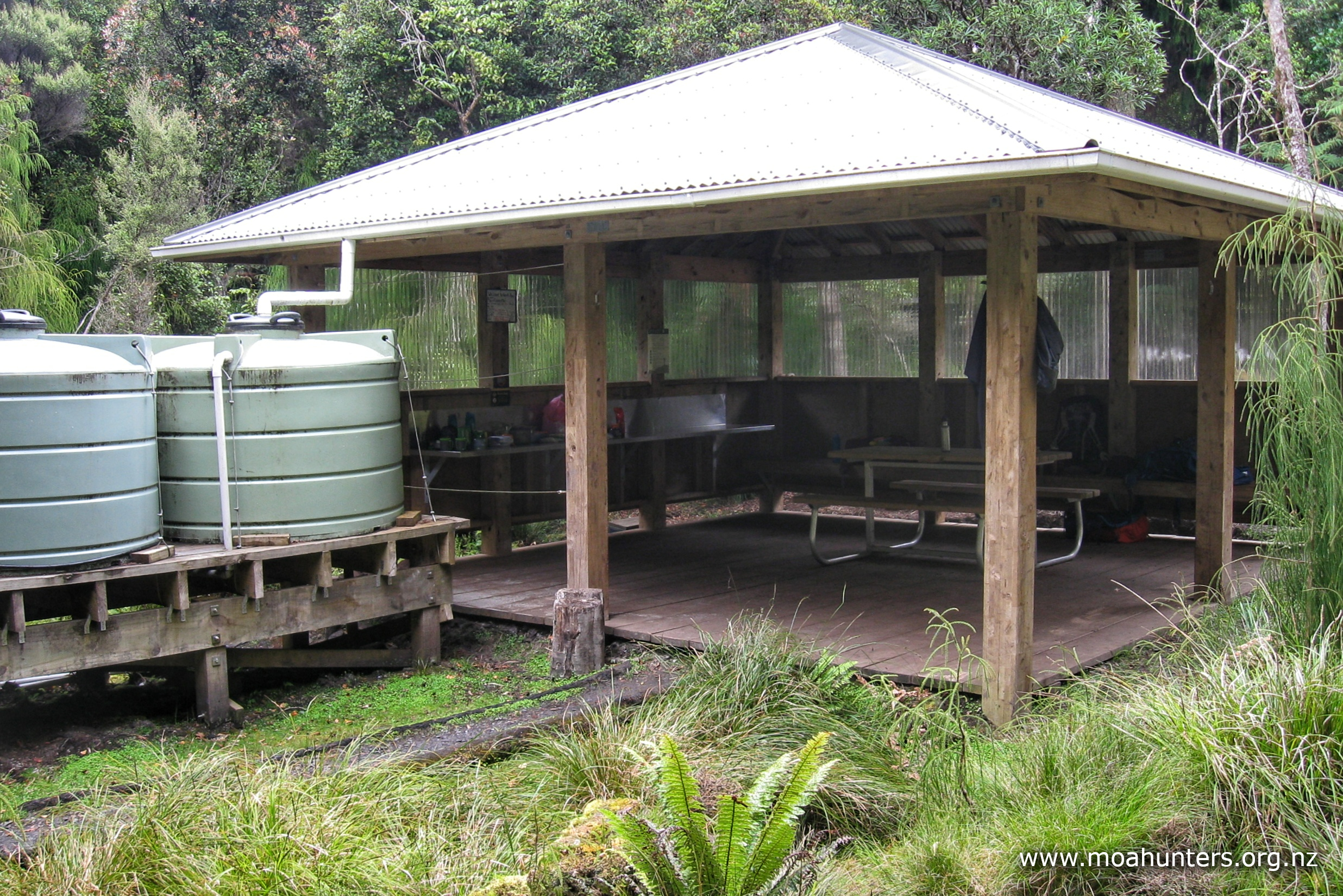
The bunkroom is an interesting design, being a converted 1930’s schoolhouse rather than the purpose-built DOC huts we are accustomed to. The three rows of windows are certainly an unusual feature. Several covered cooking areas beside the camping area are a nice addition. Raised platforms beside each have a sink and running water via a foot pump – a practical waste prevention alternative to the usual taps.
An outdoor education group from Rototuna school in Hamilton were camping nearby. We made a point of saying hello to the teachers and students in the group. After all, we’d be sharing the river with them for the next few days! They were spending the night in tents before their first day on the water tomorrow. We hoped they wouldn’t be too raucous overnight.
It turns out they were much quieter than the heavy snoring produced in the bunkroom…
Day 3
MonDay 31st March – Whakahoro to John Coull hut
One of the translations of ‘whakahoro’ to English is to accelerate, hasten or hurry. It would be fair to say our morning’s activities at Whakahoro could not be accurately described as ‘whakahoro’…
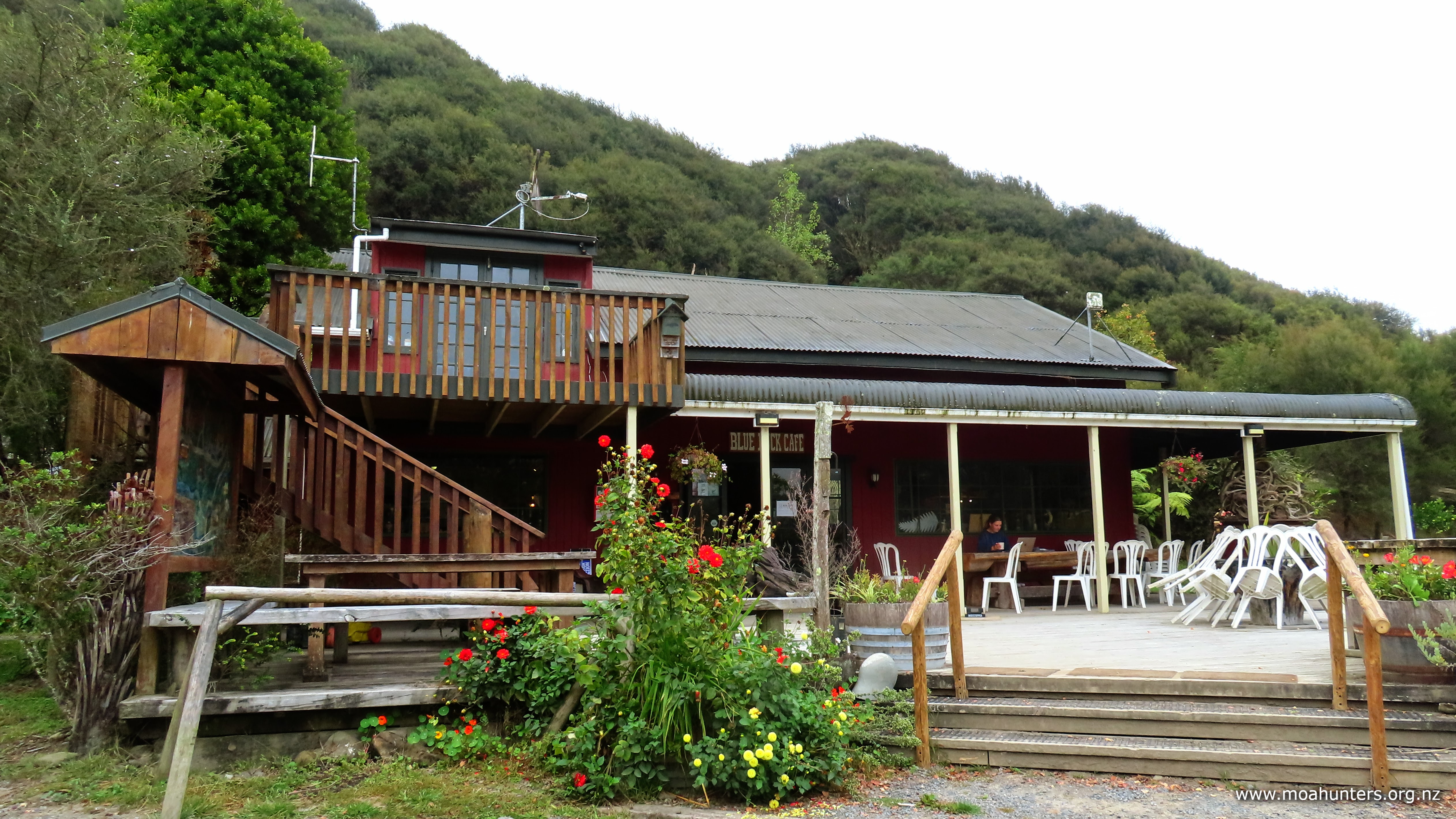
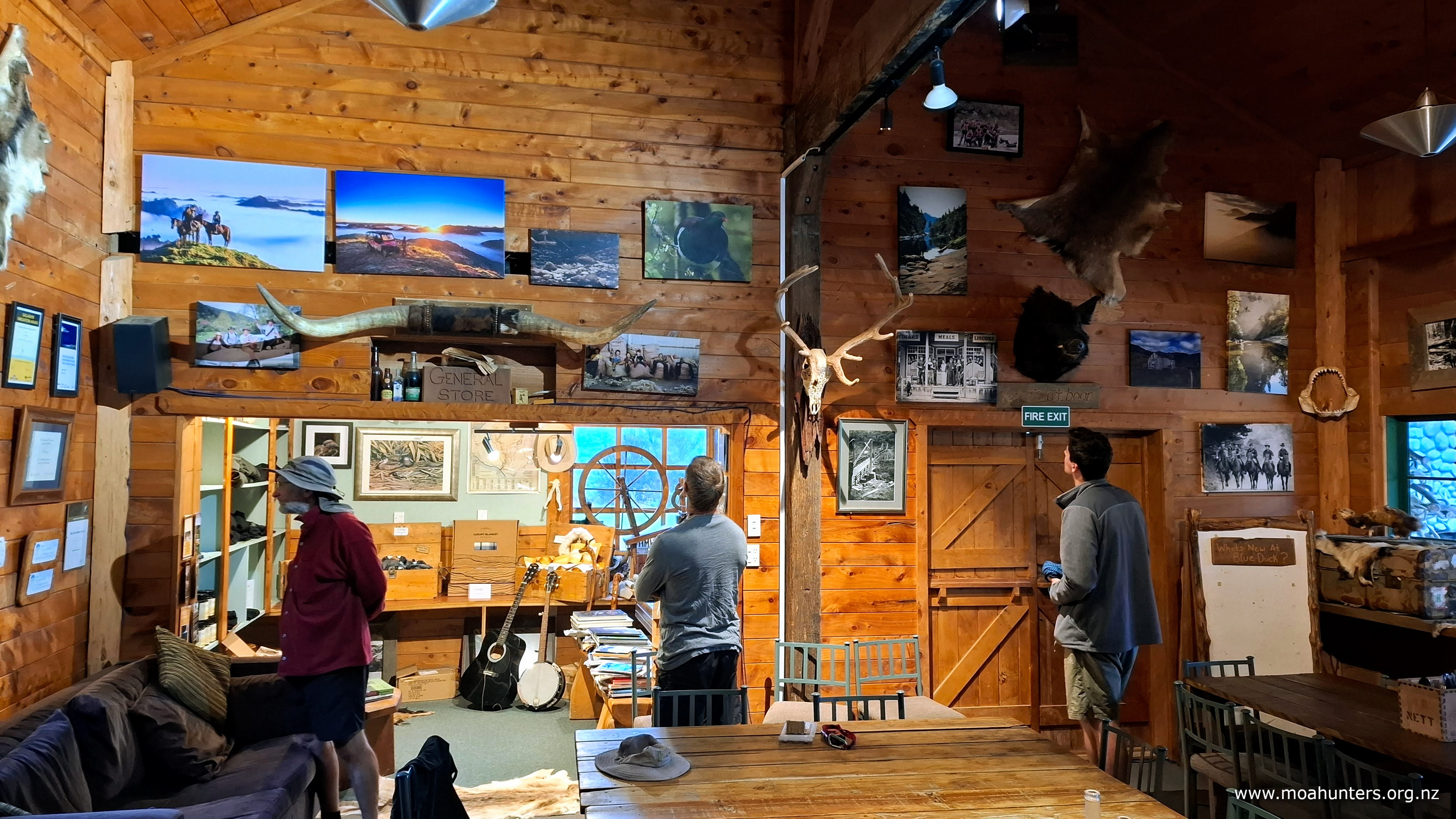
We did get up bright and early and had our barrels repacked and tied into the canoes before 8:00am. But, we were certainly not paddling out onto the river by that time. Instead, we walked a leisurely two minutes from the bunkroom up to the delightfully rustic Blue Duck Station cafe.
We had contacted them via Facebook messenger a couple of days earlier to confirm they would be open and to warn them that nine hungry blokes would be rolling up at 8:00am on Monday.
Note: On the Whanganui Journey you will likely have zero mobile phone reception for a few days. If you plan to do something like book a cafe, get it done before you jump into a canoe!
Breakfast was delicious and definitely worth the diversion from our usual porridgy start to the day. We did feel a little guilty that while on a moa hunt we were were in a cafe eating cooked breakfast and sipping espresso coffee… but only a little.
By 9:00am, our bellies were full of paddling fuel, and we were more than ready to tackle the longest day on the river.
Today Magnus took the helm of the kayak and Lewis joined Chris in a canoe. More maneuverable than the canoes, the kayak does have one disadvantage – a single cylinder engine. Up against the two cylinder canoes, and with a surprisingly un-streamlined hull, the kayak could be hard going at times.
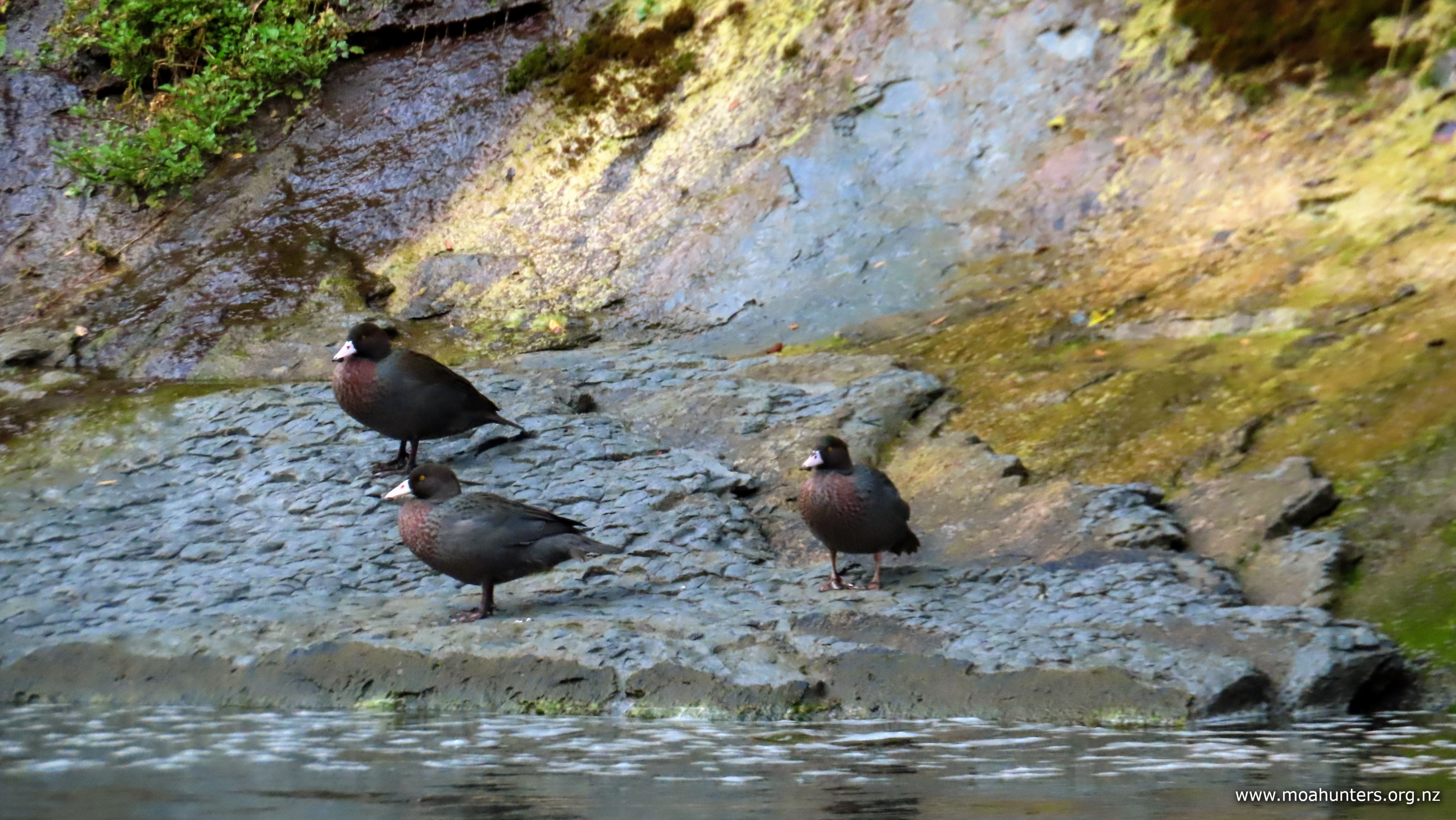
Blue Duck Station was named as such for a very good reason. Less than an hour’s paddling down the river from Whakahoro, we spotted a group of our endangered whio (blue duck) friends standing together on the river bank. As we passed, one of them flapped off, scolding us soundly for so rudely interrupting their morning gossip.
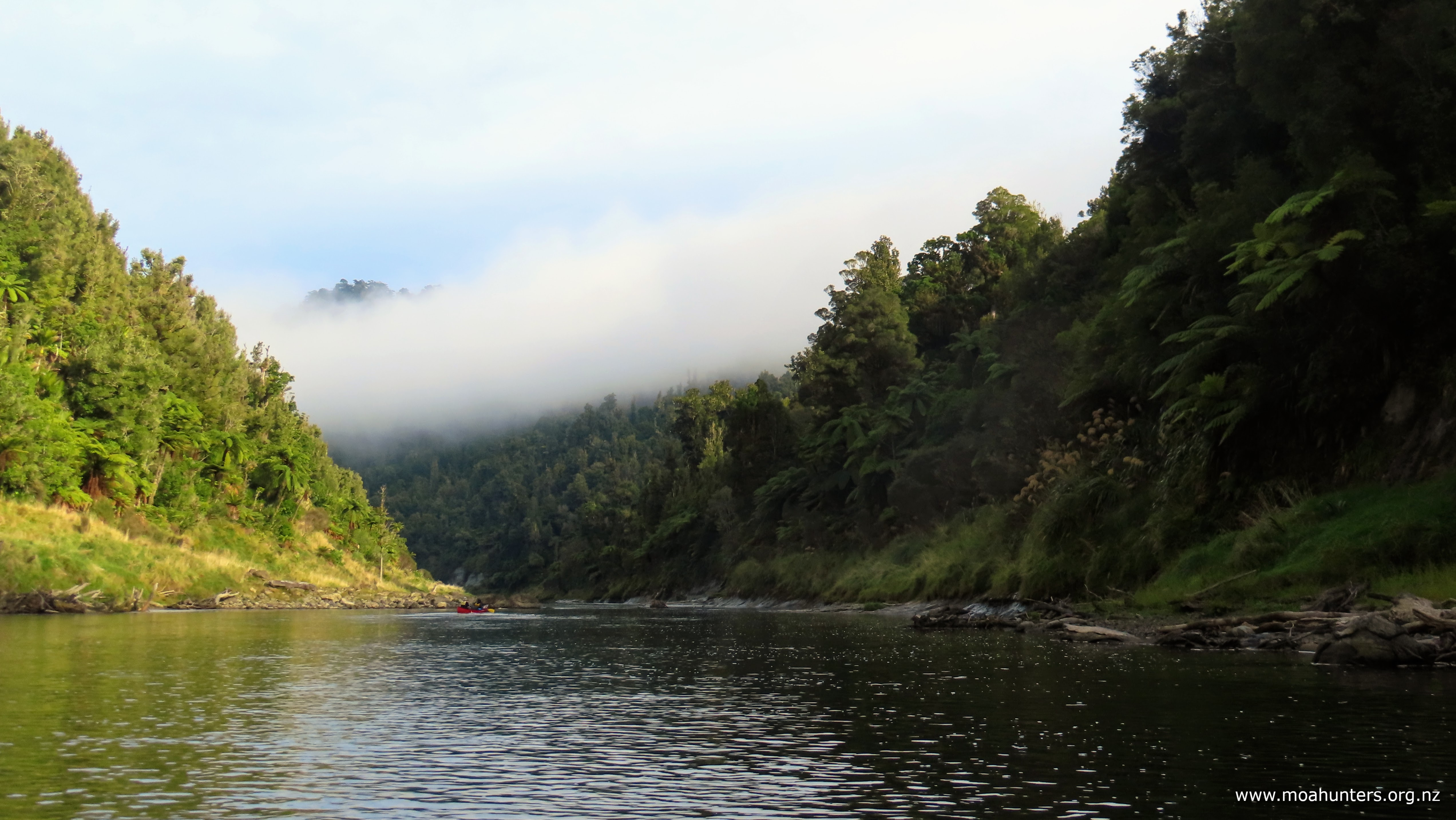
It was a cool, misty and perfectly still morning. We all enjoyed watching the fog slowly lifting off the surrounding hills as we meandered down the river. Being in no particular hurry today, it was surprisingly relaxing and peaceful gently propelling our boats down the Whanganui.
We encountered plenty of interesting rapids throughout the morning session. By now we were all feeling comfortable navigating our way through them. In fact, we enjoyed the challenge and variation they brought to the day, looking forward to the next set.
Third rule of the rapids: Stay straight There’s a very good reason for this: On each side of the wave train (which is often fairly narrow), water swirls back and forms eddies. If the bow (front) of your canoe goes off course into an eddy where the water is static, it will slow down suddenly dragging the front of the canoe sideways. The stern (rear) of the canoe will still be in the fast flowing water, rotating the canoe further sideways as it pushes past the bow. You are now perfectly setup for bad things to happen. If you are lucky, you will simply get spat out into the eddy. If you are unlucky, you may overbalance. Either way, it all happens very quicky!
At 10:30am we came upon a conveniently located shingle beach and slid our canoes up for a scroggin break. By this time the day was pleasantly warm and the mist had dissipated to reveal another overcast sky – perfect conditions.
Scattered logs left by the last flood event provided us with convenient seats, which most of us politely declined as we were glad for some time to be not sitting! With scroggin munched and backs straightened out, fifteen minutes later we bent them up again and slid back into our canoes.
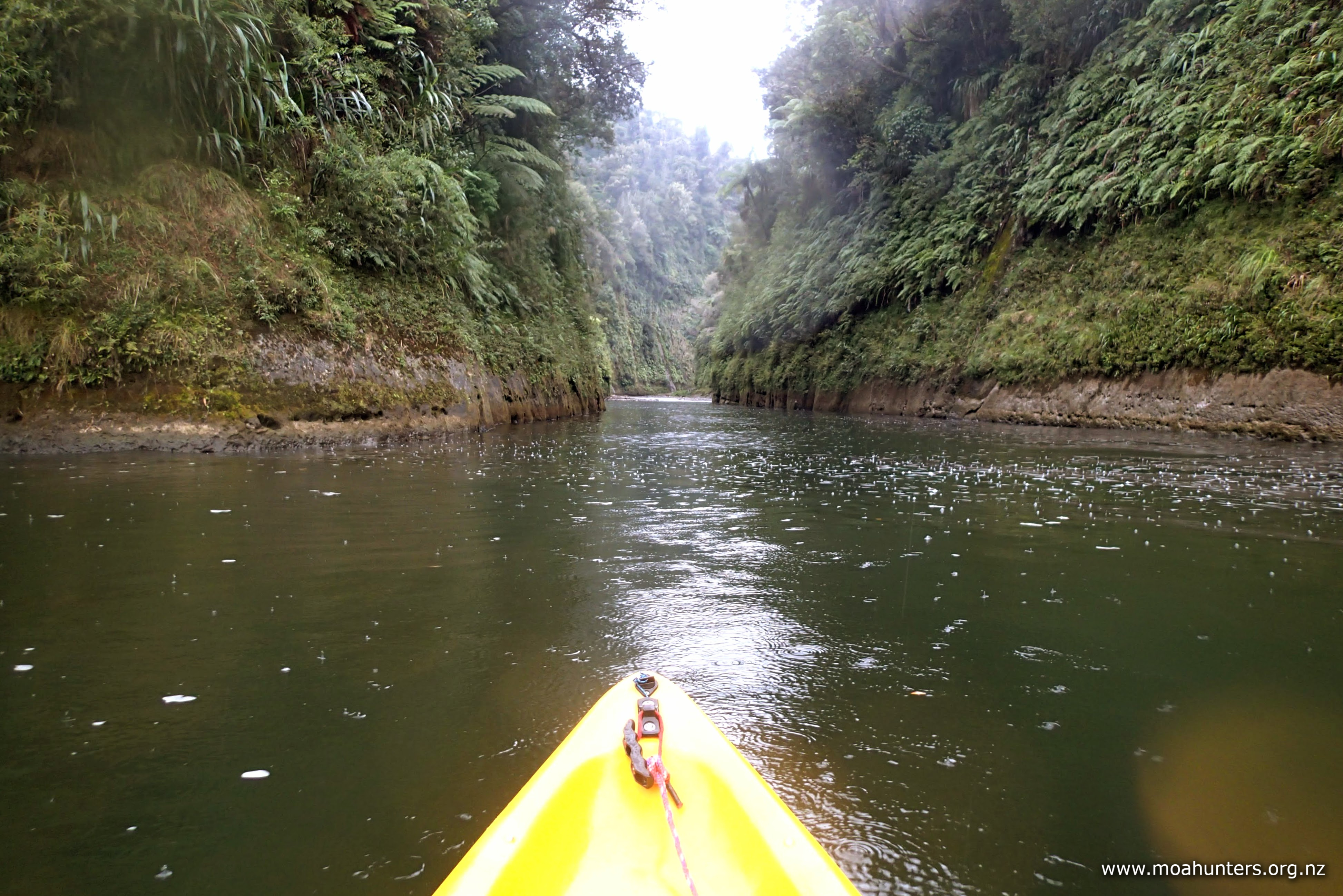
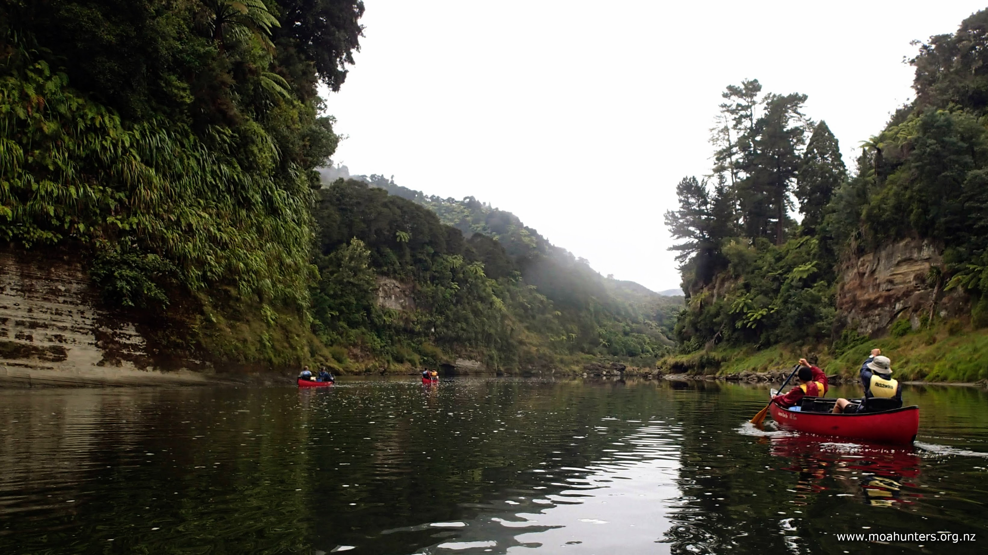
All morning the valley had been getting tighter, and just prior to lunchtime we floated into the jaws of a steep gorged section. On both sides of the river near-vertical bush covered rock faces towered over us. It was a spectacular place to be on a lovely day. Probably less so if the river was rising rapidly! Jono had mentioned in his presentation that we would be paddling past the thickest bush in the country. Looking at it from our canoes, it was hard to argue otherwise.
Lunch was taken on another convenient shingle beach beyond the gorge. As always, we enjoyed the chance to soak up the beautiful surroundings and compare notes on the rapids we had encountered so far. By this time, any doubts in our heads that canoeing might be dull had been silenced. We were all loving the new experience.
Ohauora campsite came into view shortly before 3pm and we took the opportunity for another break. The chance to refill drink bottles from the water tank at the shelter was not to be missed as we were all getting a bit thirsty. It’s surprising how dehydrated you can get sitting down! We were all conscious to keep our fluid intake up.
As we left the Ohauora, Adam took the opportunity to snap a few photos of the troops shooting a small rapid.
As he was taking his pics, the school group rounded the corner, giving a chance to say hello again as they all floated on past. We spent the next half hour paddling our way through their group. We are slightly more persistent paddlers than they were, which made us ever so slightly quicker.
To make life a bit easier on Richard’s arms and shoulders, Chris and Lewis offered them a tow. After a long day yesterday and many hours on the paddle today, Cooper had run out of gas on this long flat section. With a rope between the two canoes, life was much easier. Surprisingly it wasn’t so much being towed that helped – simply being close to the boat in front and taking advantage of the forward moving water it created made for much easier paddling.
By the time we reached John Coull hut (or as we preferred to call it, the Cool John hut) at 4:45pm, the school group were quite some distance behind us. The warden there welcomed us, and outlined the ground rules. In particular, no shoes of any sort to be worn in the hut, which was an easy one to comply with, given the mild conditions and lack of any nasty biting bugs.
There is a lovely verandah outside the hut with plenty of seating and space for lots of barrels, if you happen to have any. Which we did. Inside the hut is spacious, with plenty of bunks and room to spread out. The kitchen has gas hobs and running cold water at the sink.
It had been a long day on the water, but we were all feeling good. I think we expected to have aching arms, shoulders and backs, much like your legs complain and feel beaten up after a hard day tramping up and down mountains. Surprisingly this wasn’t the case. Our upper bodies certainly felt like they’d done a decent days work, but nothing more. The main area of discomfort during the day was aching and numb bums – a result of the hard plastic canoe seats. And a bit of lower back niggle from being seated for long periods.
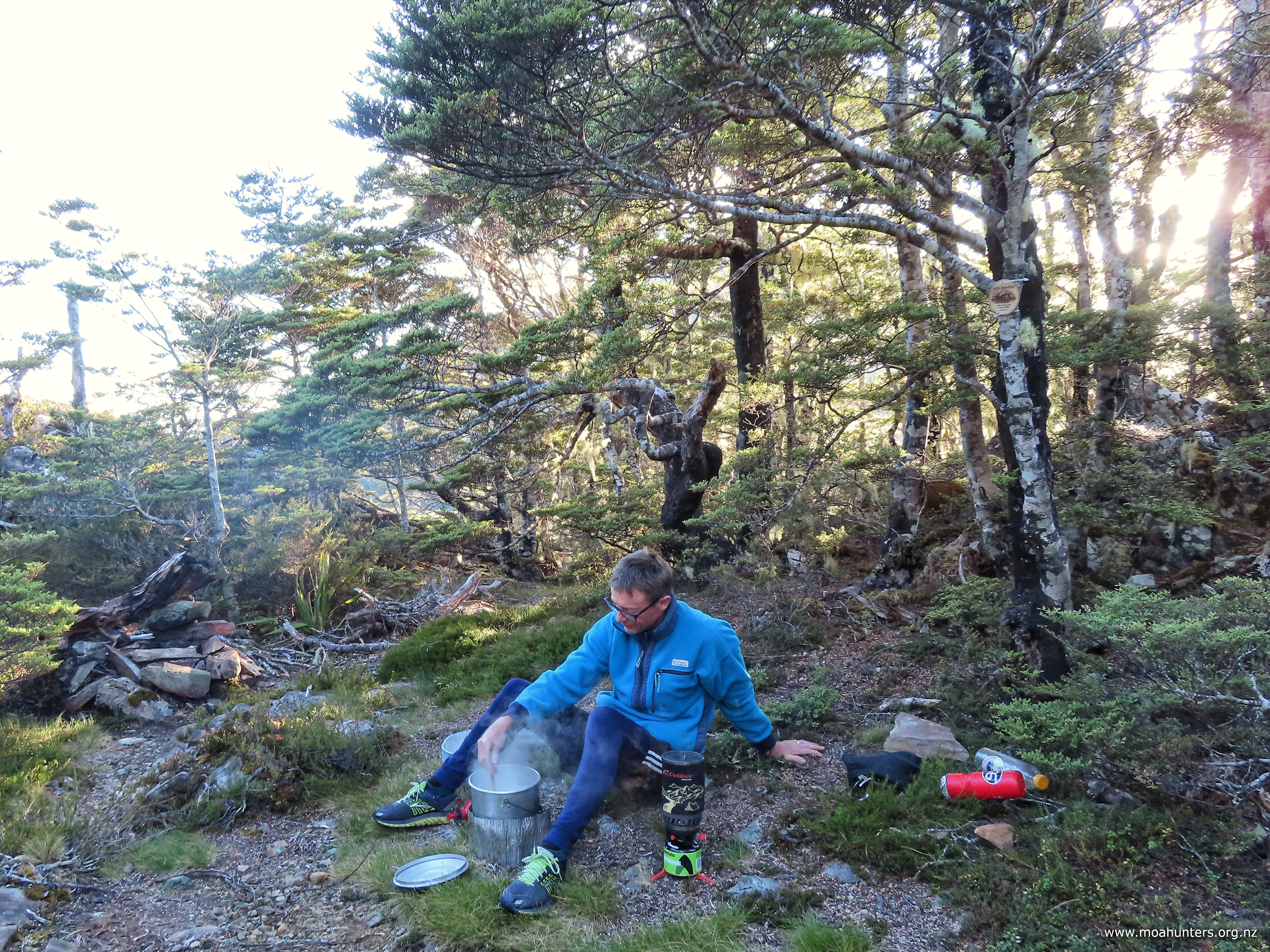
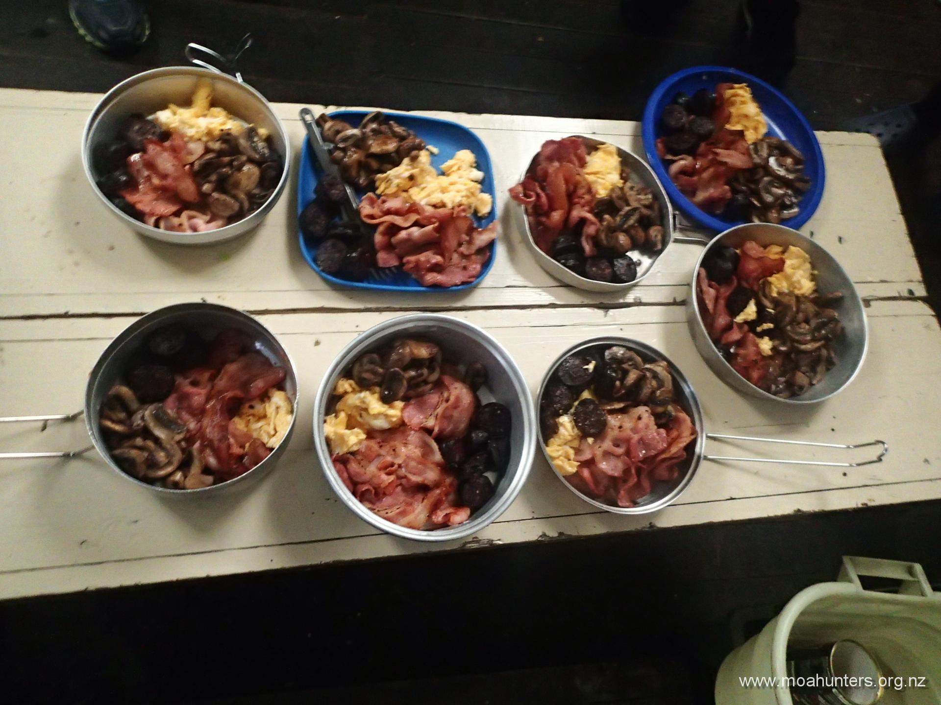
While Magnus prepared hot chocolates for the team, Chris and Paul busied themselves getting dinner going – a traditional Moa Hunter curry, followed by posh instant pudding. (posh because it had crumbled meringue and chocolate in it).
Day 4
TuesDay 1st April – John Coull hut to Tieke Kainga Marae
Tuesday dawned misty and calm, the hills surrounding John Coull hut cloaked in low cloud. The air was cool and fresh, but not overly chilly. After a hearty porridge breakfast, we started the now familiar process of packing barrels. After two days on the river, we each had worked out a system for what to pack in each barrel, and what to keep accessible on top.
For those into photography on their trips, I recommend either a fully waterproof camera, or a really good dry bag. For this trip I bought a high quality 2-litre capacity bag with a shoulder strap. Being able to grab the camera out of it regularly to snap photos was essential, as was having a bag I knew would protect it if we were tipped out of the canoe.
After two seven hour days on the river, today we had just five hours to Tieke Kainga marae. With a planned side trip to the Bridge to Nowhere, we did make sure we were on the river fairly early. It wasn’t too long after 8:30am that we pushed off the shore and continued our journey south.
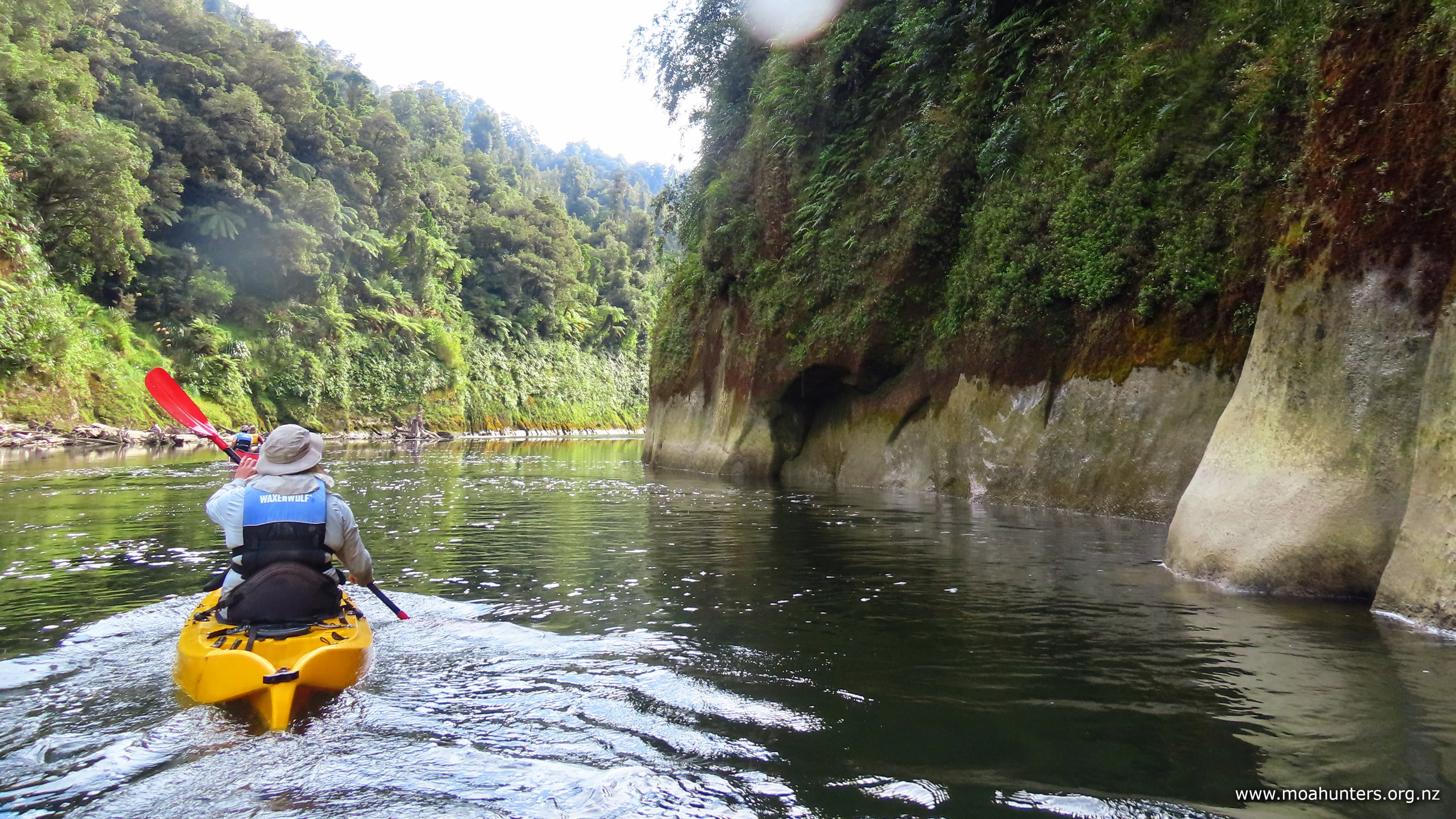
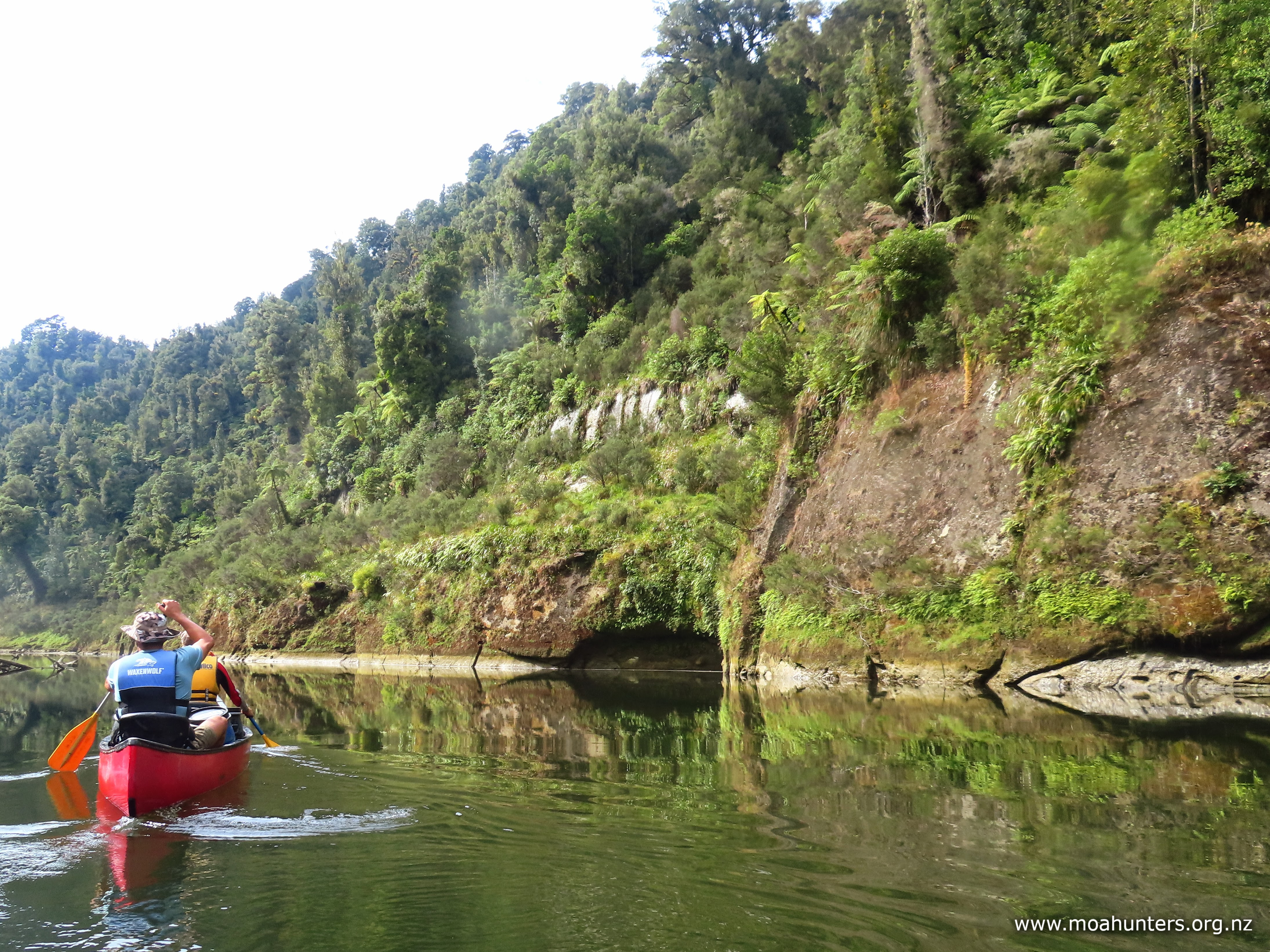
Much of the morning was spent in stunning surroundings. The Whanganui river has sculpted an impressive path through strongly delineated layers of sedimentary rock. Bush-clad vertical rock faces rise up like the walls of an ancient castle.
We judged from the sparse vegetation on the lower rock faces that the river generally runs higher than the days we paddled it. These sections of rock had the appearance of being under water regularly.
Jono had told us during our day one briefing that during heavy rain the river level can rise a metre an hour, and has been known to rise a total of 14 metres during torrential rain events. Scary stuff. Fortunately for us, the weather forecast for our trip was ideal, with very little precipitation expected.
The low river flow on our trip was something of a double-edged sword. On the bright side it creates more fun rapids. On the less bright side, low flow means more paddling effort is required.
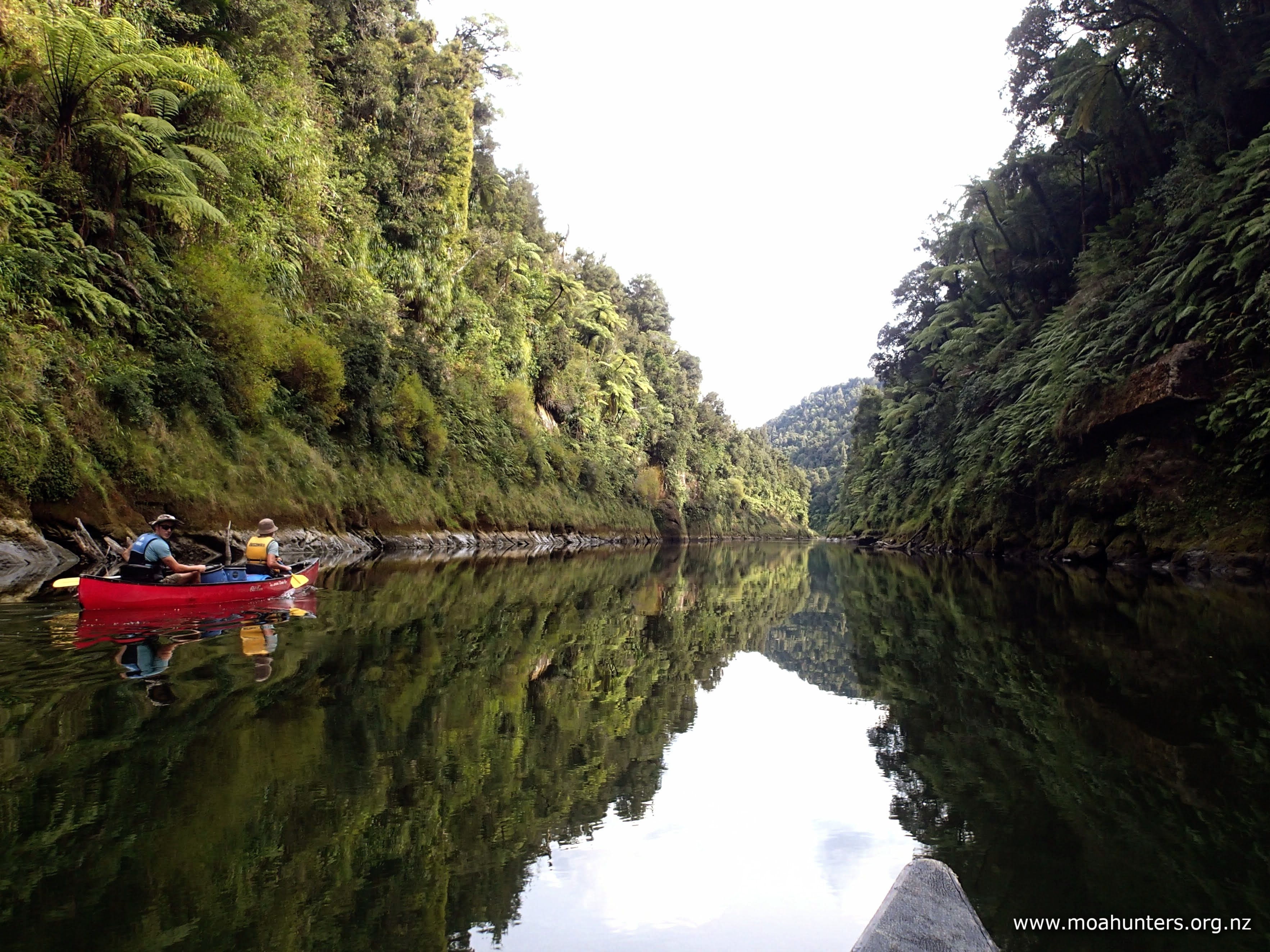
The walls on either side of us were gorgeous. Eroded rock faces with varied green and brown mosses, ferns and algae reflected in the mirror-like water created a beguiling and beautiful kaleidoscope of shape and colour for us to enjoy as we glided down the river.
We arrived at the Bridge to Nowhere landing right on lunchtime. The landing is an awkward slippery steep rock face with greasy footholds. There is a flat terrace above, but organising food and clothing out of barrels from the canoes up to it would not be fun, safe or easy. Fortunately for us, the river has thoughtfully deposited a convenient long pebble beach on the opposite bank – the perfect spot to pull in for lunch and get organised.
With lunch eaten and the world’s political situation dissected, we stowed some clothes and snacks into day packs and paddled across to the landing.
Care needs to be exercised getting out of canoes and climbing up to the terrace. It is steep, slippery, and more than a little treacherous.
With no trees growing conveniently along this bank, lengths of rebar have been hammered into the rock for tying up canoes.
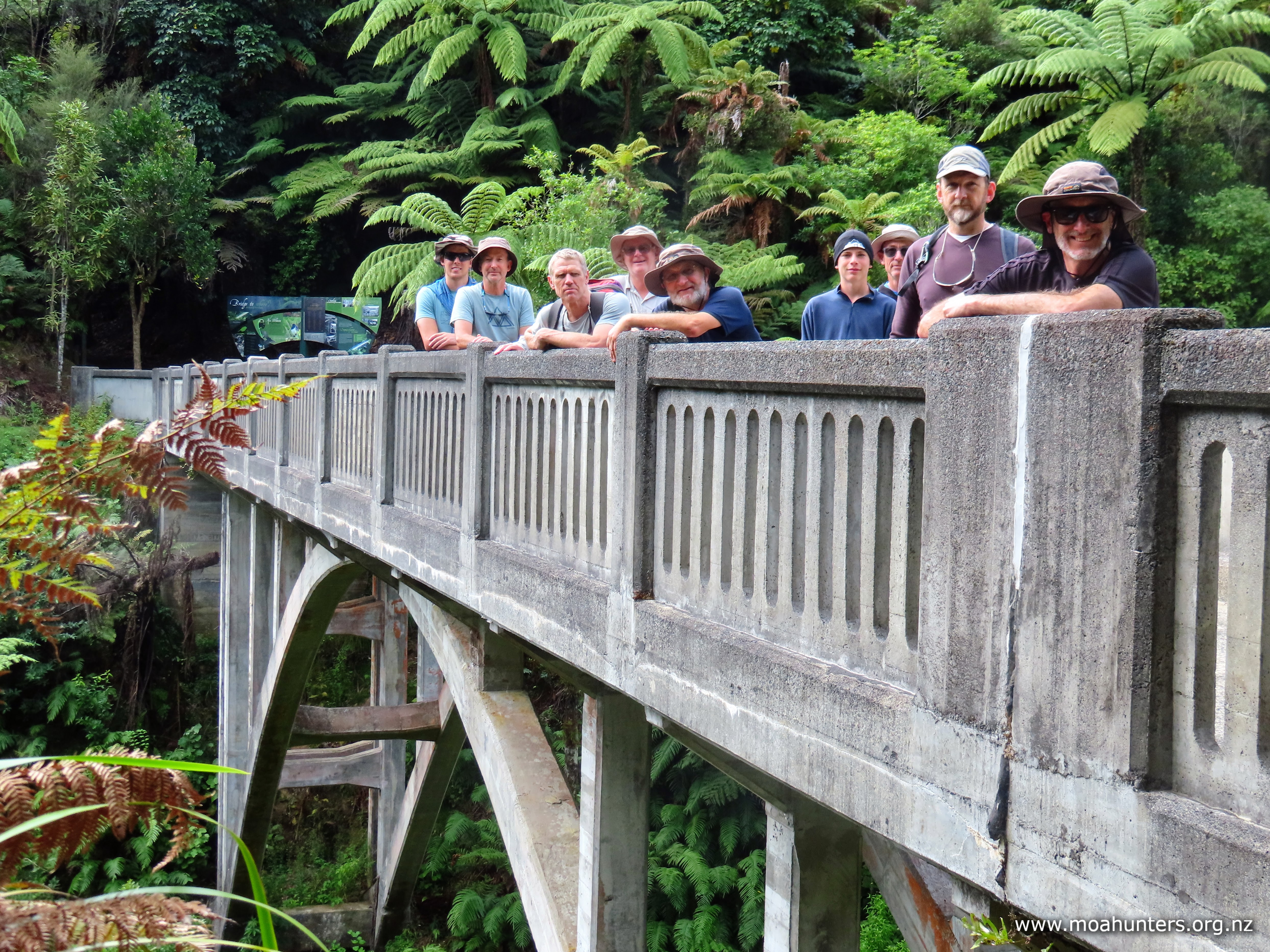
It was a pleasant change to be walking rather than sitting. Signage suggested we would have a 40 minute wander to the bridge. Even with a stop at a small shelter to read information boards, we easily knocked it off in 30 minutes.
Quite unexpectedly, we met a fairly large group of retirees walking in the opposite direction along the well formed track. Having spent the last two days in the river feeling like we were miles from any civilisation, seeing day trippers clutching handbags was a bit of a culture shock! They had arrived by jetboat, and would be leaving in the same manner.
If you are wondering whether the bridge is worth the walk, the merits are easy to weigh; The walk is short and the bridge is spectacular.
Constructed in the 1930’s, it spans the Mangapurua stream and was intended to provide a link to farming allotments for WW1 returned servicemen. However, the advent of World War II and then a realisation that the land beyond the bridge was too remote to be farmed practically led to it being orphaned. Connecting roads were never built, and it was abandoned… a bridge to nowhere.
At 40 metres above the stream, higher than it is long, and surrounded by lush native bush, it is a surreal and beautiful spot that has become the most visited site in the Whanganui National Park.
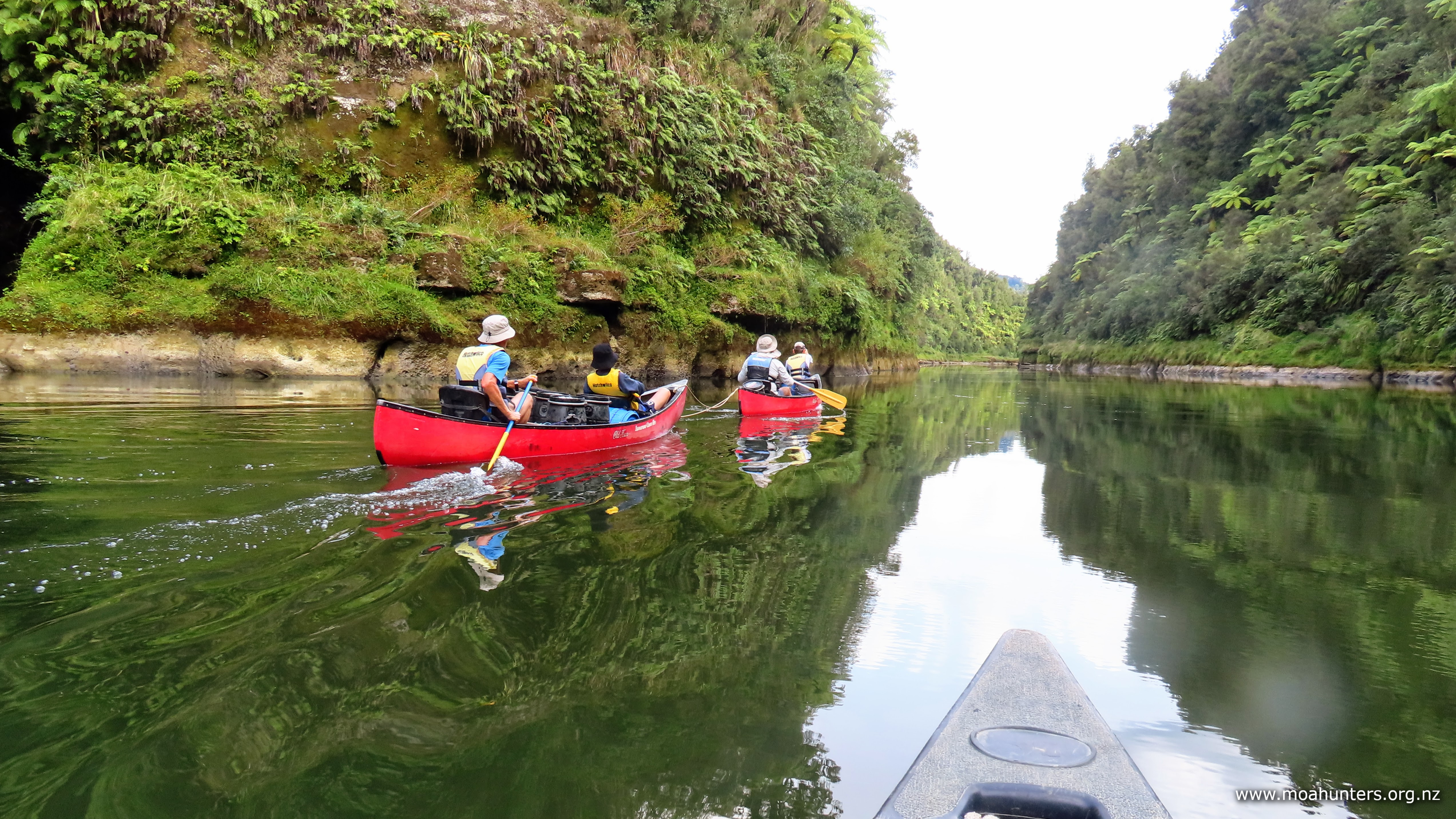
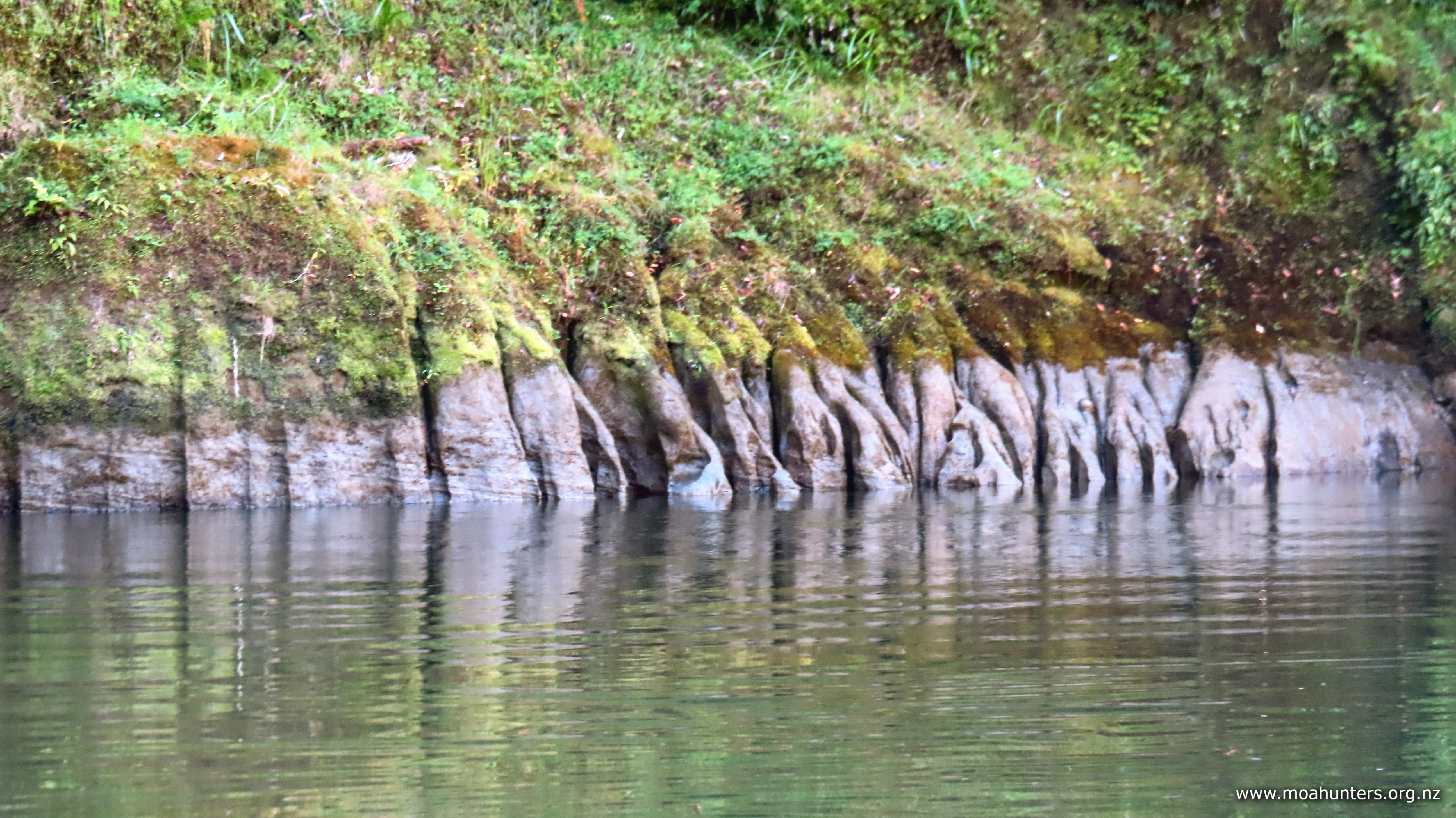
Beyond the bridge, the Whanganui provided us with more beautiful scenery to enjoy. Interesting rocky banks reminded us of photos we have seen of steep sided islands in Thailand. In other places, the eroded river bank looked like the fossilised remains of ancient tree roots disappearing into the rivers depths. It was just as well the river is so pretty in this section, because it is also very flat. There were long periods of paddling with no rough water or rapids to break up the afternoon.
Late afternoon we pulled into the beach below Tieke Kainga marae. Barrels were untied and carried the short walk up to the marae entrance. Aside from the Te Araroa crews that had arrived a little earlier than us, there was nobody about.
We had read that there is sometimes an official welcome with a powhiri, then responses from visitors. With the school party also arriving today, we thought there would be a powhiri. However, when they arrived we discovered that nothing had been arranged. It seemed there would be no welcome, which was slightly disappointing – it would have been a nice thing to experience.
With no-one but us using the accommodation area that night, we made ourselves at home, spreading out across the two bunkrooms. The kitchen is well appointed with gas cookers and indoor sink with foot-pumped cold water. Outside on the large deck two hexagonal picnic tables were a nice place to sit and chat as the afternoon made way for a cooler evening.
After we had eaten dinner, Chris – ever the socialite – popped down to the school camp and invited the three adults from the school group inside to share dessert with us. They happily obliged and enjoyed demolishing the trifle with us while we chatted.
They were a very relaxed team, but had to leave after a short while to check their students were all happily in their tents. Apparently on their first night at Whakahoro, the young’uns had complained about their early 9:30pm bedtime. The following night after seven solid hours paddling the river, when 8:30pm came and they were wearily requesting an early bed time!
Day 5
WednesDay 2nd April – Tieke Kainga Marae to Pipiriki
Waking up at the marae, it felt like our river adventure had flown by. How could it be our last day already?! But weirdly, it also felt like a long time ago that we were all in the mini-van driving to Taumaranui…
The morning was busy down on the rivers edge, with everyone prepping their canoes at the same time. All groups had similar pick-up times at Pipiriki, and nobody wanted to be running late. Our arranged pick-up time was 1:00pm. With 4.5 hours paddling ahead, we wanted to be on the river by 8:00am or shortly after. Needless to say, we all had a fairly early start!
It was great to be back on the river. The beautiful scenery kicked in straight away, with high bush-clad cliffs flanking the river, deep cuts carved in them by small side streams that appeared as pretty little waterfalls along the way.
Over the course of our river journey, we had all independently learned the value of ‘bubbleators’:
Water exiting rapids often forms currents of faster flowing water running along one or both banks of the river. Streams of bubbles carried by these currents are the telltale sign that a liquid travelator is present and ready to be hopped onto. Keeping the canoe tracking down the middle of these ‘bubbleators’ creates a short free ride and noticeably easier paddling.
Around the middle of the morning we had our first change in the weather for the trip. Heavy grey cloud had descended on the hills around us and light rain was falling. We had been on the river for well over an hour and were keeping a watchful eye for suitable spots to pull in for a break. However, we were in steep country and there had been no beaches for quite some time.
When we finally found at a nice spot, the weather decided to join us. Light rain transitioned quickly into a solid downpour. This was no longer a pleasant dribbly shower, forcing us to rummage into the bottom of our barrels for decent jackets.
Interestingly, the rain brought with it a noticeable chill – the first time we had experienced anything but pleasantly balmy temperatures the whole trip. Standing around munching on scroggin, we started feeling a bit cold. Without the need for discussion, we cut the break short and dropped back into our boats to get paddling and warm up.
As you can probably guess, no sooner did we get underway than the rain eased back to light showers again.
This is all a good segue into what clothes you might need if you do this trip. We did our trip in early autumn. Your weather conditions will be different, so keep that in mind:
Clothing The provided life jackets generally keep your torso toasty warm. In the overcast mild conditions we experienced, tee shirts and shorts/togs were all we needed. Choose lightweight fast drying fabrics.
Take a variety of thin thermals you can layer on if the temperature drops. Bulky jackets are too hot and uncomfortable under a lifejacket. A lightweight waterproof anorak is a handy item.
If your hands blister easily, consider fingerless gloves made from a fabric that doesn’t mind getting a bit wet.
Footwear Crocs or old sneakers are equally good choices for footwear in the canoes. Crocs have the advantage that they dry out quickly, but can be a little more sketchy on slippery rocks.
Sun Protection In a canoe you are fully exposed to the sun, so wear a brimmed hat. Remember to get sunblock slapped on before you start paddling. You don’t want to be messing around applying it when out on the water.
Beyond our beach break was a long run of flat water. Having discussed upcoming river conditions with the guide taking the school group, we knew this would be the case. He had told us to expect an extended vanilla section of picturesque but unchallenging river before our arrival at the much anticipated 50/50 rapid.
According to Jono during our day one briefing, all rapids on the Whanganui Journey between Ohinepane and Pipiriki are grade one… except the 50/50 rapid which sneaks in as a grade two. As the name suggests, there’s an even chance the it will tip you out. However, in low river flows, such as when we paddled the river, your odds of getting properly soaked are even higher!
We had all been looking forward to testing ourselves on the rapid. After a couple of hours paddling and with the rapid in sight, we pulled onto a beach to stow away cameras and batten down the hatches.
Adam and John were first to ride the mighty 50/50. They bounced through 80% of it staying nicely on course down the centre of the wave train, but took on too much water. One of the final waves rolled them slightly. The weight of water sloshing to one side of the canoe was unstoppable and capsized them fully into the drink.
Richard and Cooper following behind, triumphantly making it all the way through They then proceeded to (accidentally) run over Adam and John’s canoe, adding some amusing insult to their injury.
Luke and Paul met the same fate as Adam and John. They looked like they had made a successful run through, but sank in the last metres of rapid due to the amount of water taken onboard.
Magnus and Chris also sank, but did so in hilarious fashion still upright and paddling through the waves with their canoe nearly fully submerged below them.
It was all excellent fun and once we had swum our canoes to the bank, we were buzzing with excitement. By this time the school group had arrived and were one by one entering the rapid.
Spoiler alert #1 – If you want to get through the 50/50 rapid and stay dry, simply avoid most of it! It is possible to pull off to the right after the first half dozen large waves. You just need to remember to lean right as you swing out the swift water into the eddy. This is what the school group did – they had obviously been advised to take this approach.
We (perhaps more foolishly!) had agreed that if you’re doing the 50/50, you do the whole thing! In for a penny, in for a pound, as they say…
Spoiler alert #2 – Lighter crews have a better chance of success. The heavier the crew and cargo, the lower the canoe sits in the river, and the more water it will take on as you traverse a rapid, and the greater chance you will sink.
We would have liked to all go through for a second attempt without the barrels onboard, but time was running out. Luke and Paul squeezed in one frenetic high speed attempt that saw them pitched out the canoe in spectacular fashion on the first few waves.
Cooper took a turn on the kayak and paddled through like a champ, making it look very easy.
The last half hour of paddling to Pipiriki saw the surrounding countryside flatten out and farm buildings make an appearance on the rolling hills. We were on the doorstep of civilisation again.
The final landing was easily spotted from up the river, and we were all sliding our canoes up onto the concrete boat ramp right on 1:00pm. We had timed our run perfectly.
Jono was there to meet us with freshly baked chocolate muffins. What a legend, what a service! We changed into dry clothes and helped get the barrels and canoes loaded onto the trailer. With the large school group hard on our heels, we did our best to get out of their way quickly.
The van trip back to Taumaranui from Pipiriki takes an hour and a half. It was mid-afternoon when we finally rolled up to the Taumaranui Canoe Hire base, and our tummies were a tiny bit hungry. Fortunately for them, Jono had convinced us to order wood-fired pizza for lunch on our return. It hadn’t taken much to convince us, and we were not disappointed.
The pizzas are amazing and come highly recommended. It seemed like the whole family was helping out with putting them together. We really enjoyed sitting chatting to our hosts as our late lunch was carefully prepared and cooked.
The dough bases are handmade and fermented over three days, then stretched just before cooking. A special Italian sauce is spread on them, then a spicy pepperoni, topped finally with chunks of mozzarella sourced from Costco Auckland. They are cooked right in front of you in an impressive steel pizza oven. And needless to say, they are absolutely delicious!
Taumaranui Canoe Hire is a family run business, well worth your support (and yeah, nah – we aren’t related and don’t get any kickback for saying so!)
It had been a wonderful four days on the river. The scenery is simply gorgeous, and the paddling experience ticked every box. The tranquility and peacefulness experienced gliding over millpond water flanked by towering bush-clad cliffs are memories we will long cherish. Bookending the sedate sections, the challenging sets of rapids provide pulse-quickening counterpoints that were a ton of fun.
If you are a tramper wondering whether the Whanganui River Journey is a worthwhile diversion from the usual walking in the hills – it most certainly is.
Another year, another failed attempt to find a moa. We are undaunted, and will be back on a track in 2026, looking once more for the elusive big bird…
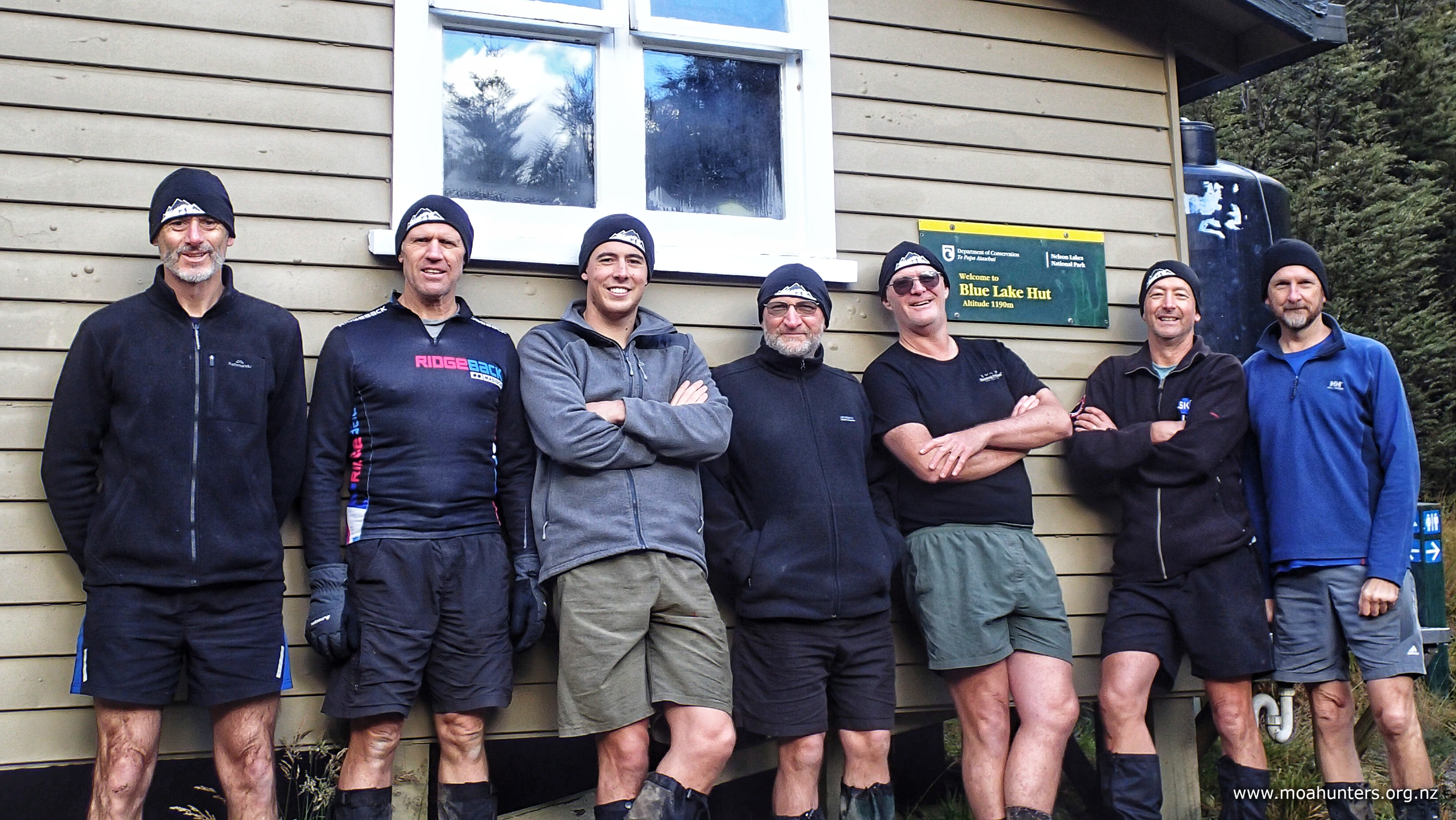
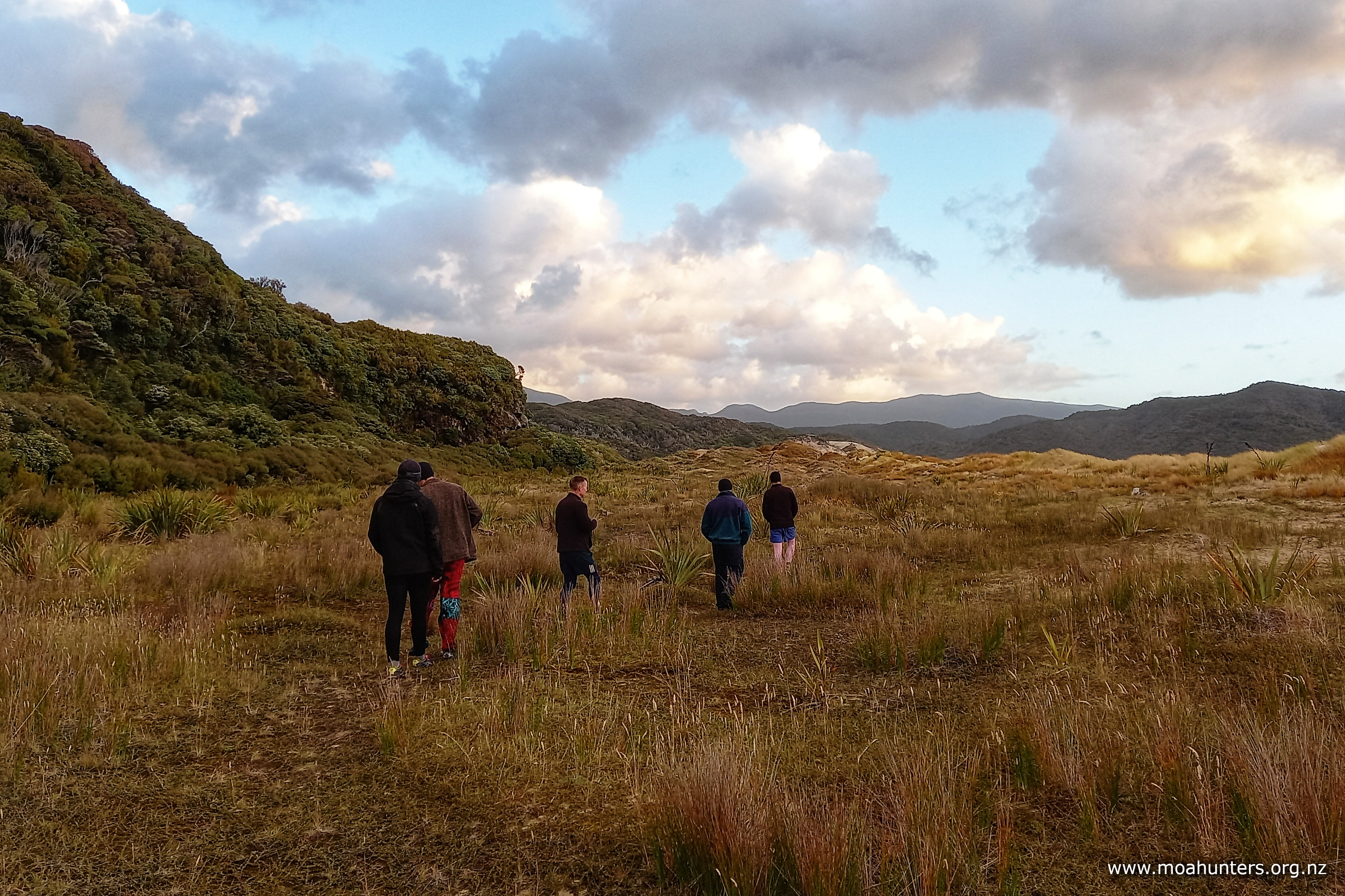
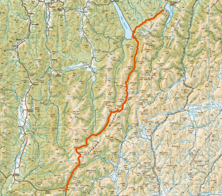
In 2024, for just the second time in Moa Hunting history, we ventured out in April rather than our usual January or February. Hoping moa prefer cooler conditions, we made our way to the beautiful Nelson Lakes to see if we could spot one.
Walking the hills in autumn was predictably a little more damp and cold than we were used to, but also offered up a few nice surprises…
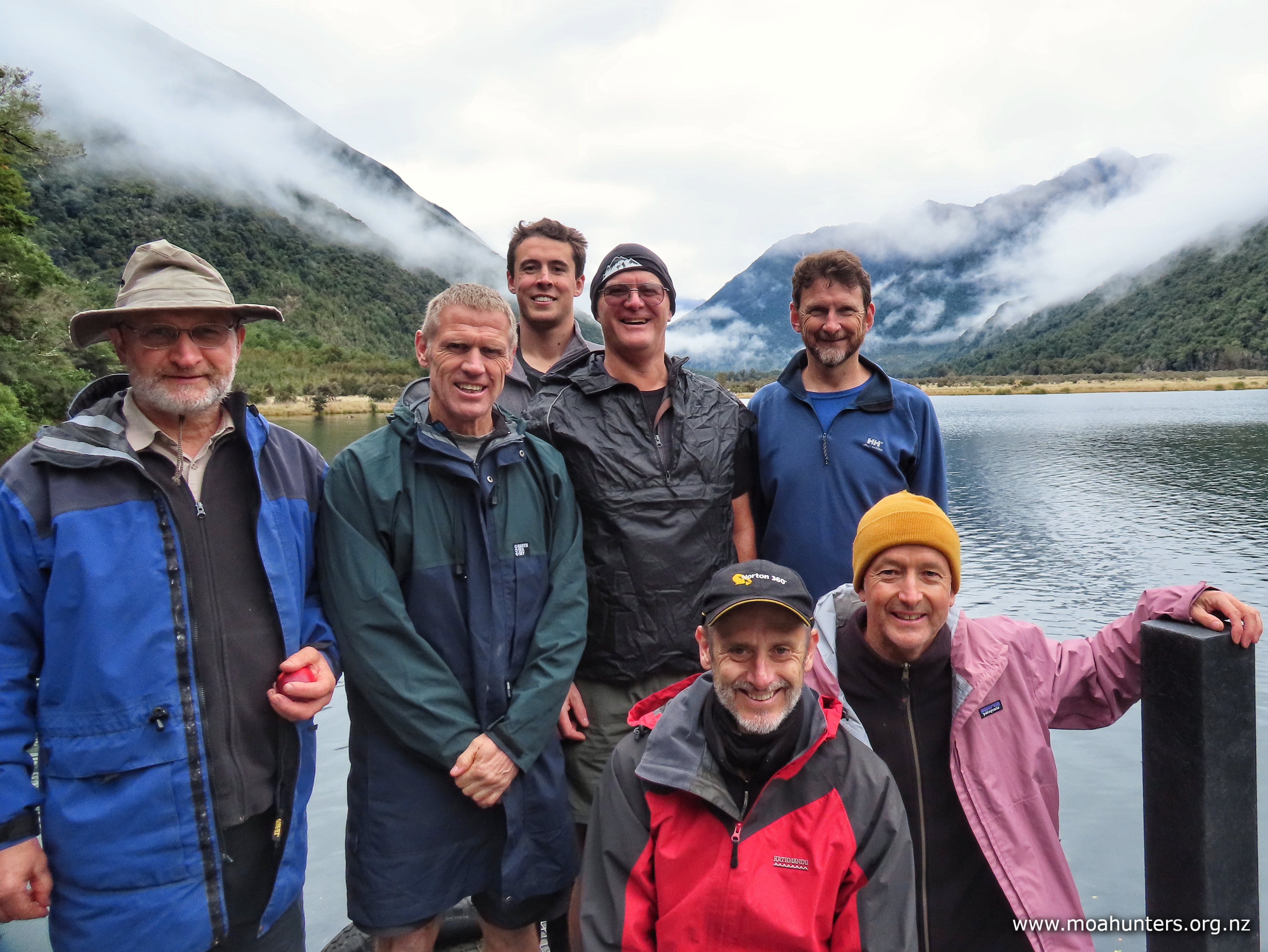
Moa Hunters on this trip: John, Lewis, Luke, Magnus, Paul, Adam, Chris.
The Trip:
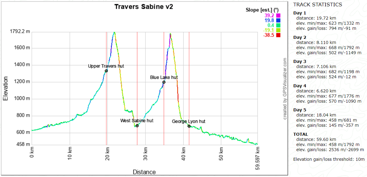
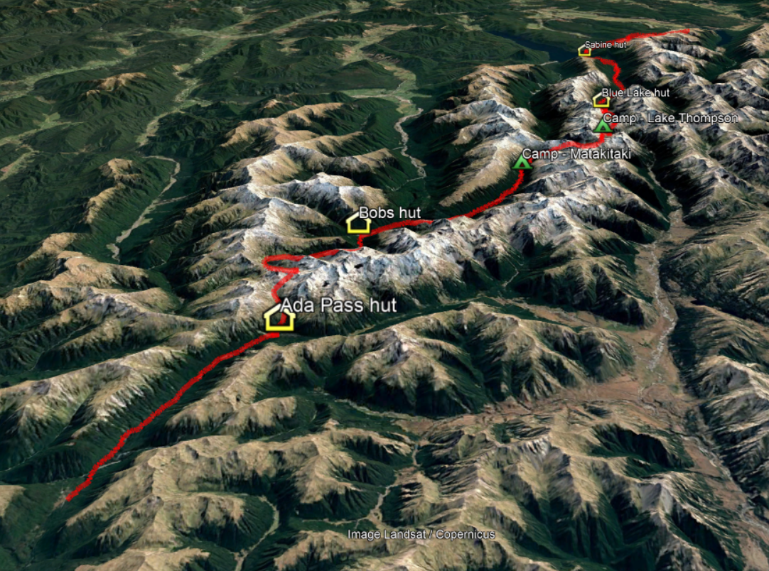
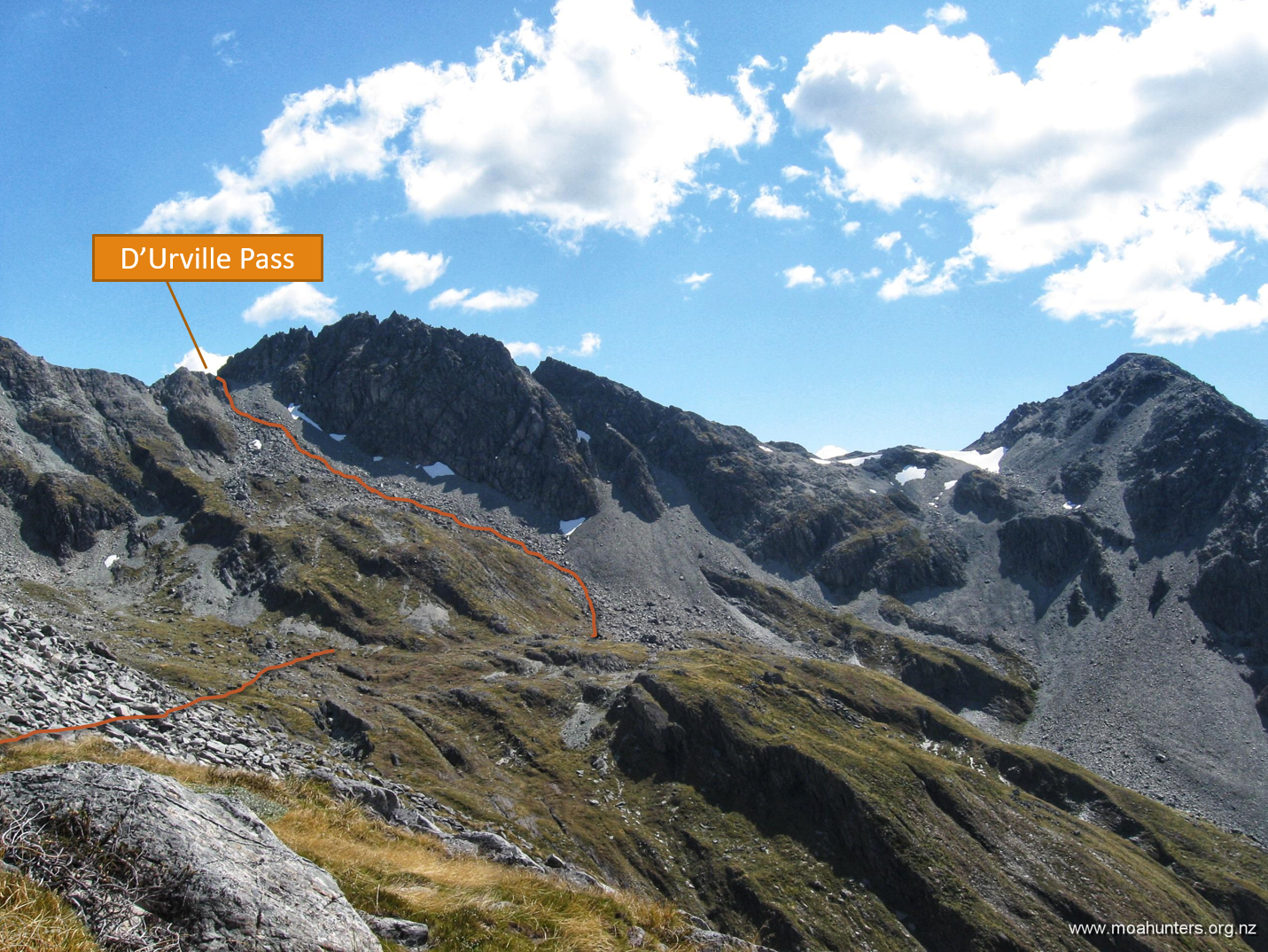
Day 1: Lakehead hut to Upper Travers hut Day 2: Upper Travers hut to West Sabine hut Day 3: West Sabine hut to Blue Lake hut Day 4: Blue Lake hut to George Lyon hut Day 5: George Lyon hut to D’Urville hut
SaturDay 13th April – Lakehead hut to Upper Travers hut
Despite this trip starting and finishing at the southern end of two different lakes, transport logistics were surprisingly straightforward.
Lake Rotoroa Water Taxi have accommodation suitable for large groups snugged in the small settlement at the top of Lake Rotoroa. Six of us had a comfortable stay there on Friday night. Bright and early next morning, we drove the 40 minutes to St Arnaud to meet Magnus for an over-indulgent fry-up breakfast at the Kerr Bay campsite.
With our bellies bulging with way too much deliciousness, we boarded the Lake Rotoiti Water Taxi, bound for Lakehead jetty at the southern end of Rotoiti.
From there we would spend the the next five days walking the Nelson Lakes, our final waypoint being the D’Urville hut jetty, where Dudley from Lake Rotoroa Water Taxi would pick us up. Once back at the north end of the lake, Charlene would shuttlebus us back to St Arnaud. Easy peasy, lemon squeezy!
But hold on! Back up the truck a little…. all that is getting way ahead of ourselves.
Let’s turn back time to Saturday morning, when the affable Hamish from Lake Rotoiti Water Taxi’s welcomed us onto his boat and wedged our seven heavy packs into the luggage area at the bow.
It took just twenty minutes for him to run us down the lake to the Lakehead jetty. We all soaked up the surroundings, enjoying the scenery and Hamish’s commentary along the way.
Standing on the jetty, we all felt the tingle of anticipation. Another moa hunt was beginning. Five days in beautiful back-country Aotearoa awaited us. If you are a regular tramper, you know that feeling.
Weather conditions were cool and overcast. Low cloud clung to the sides of the ranges like stretched lambs wool. Overhead the clouds looked heavy. Rain would not be a surprise, but none of us really cared. It felt great to be standing at the start of a new adventure.
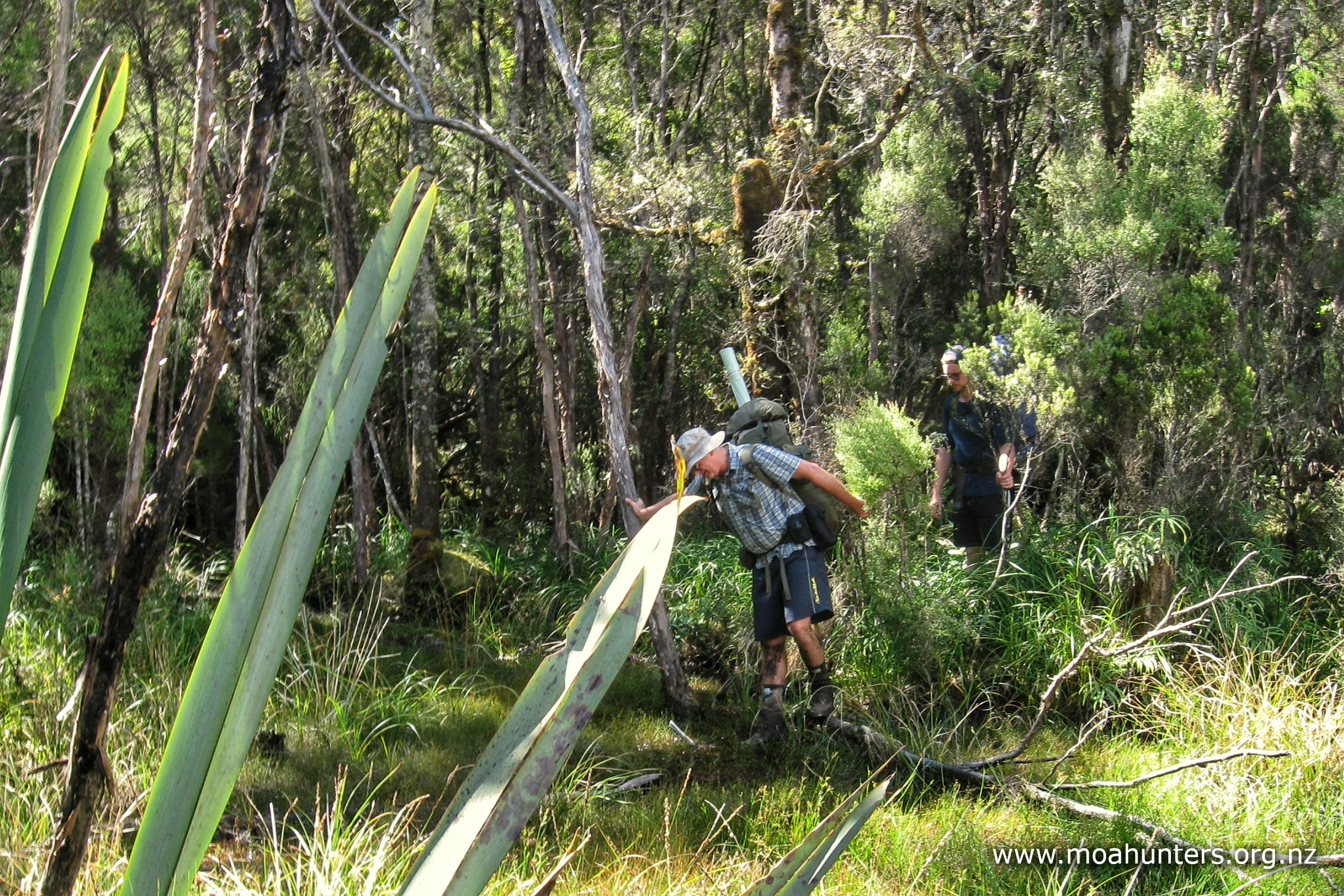
Breathing in the distinctive musty sweet smell of the beech forest, we thanked Hamish, then marched up the track towards Lakehead hut, a mere fifteen minutes away.
Near the lake, Travers valley is wide and flat. The track meanders across open expanses of straw coloured grasses, occasionally ducking into damp beech forest where it is lightly carpeted in fallen leaves, turned golden by autumn’s cool hand.
We anticipated the track may be a bit wet. The Nelson lakes had received very little rain over the summer. But earlier in the week, a low pressure system that drenched the west coast didn’t spare the Nelson / Tasman area. Quite a bit of rain had fallen onto fairly dry ground. We wondered if streams may still be running high. Beside us the Travers river was lively, but not swollen. Perhaps the rain had already washed through to the lake?
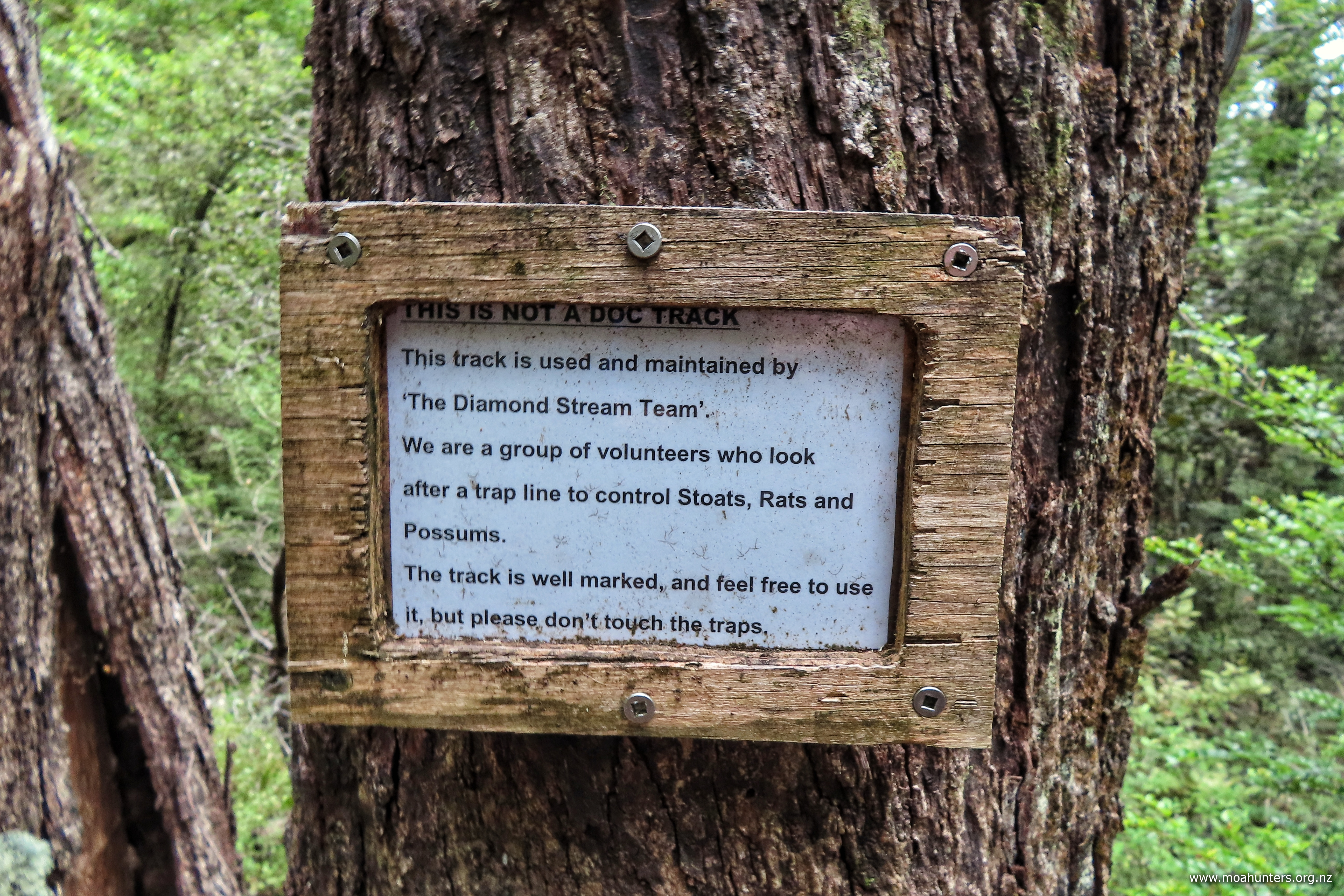
As we walked, the first thing we noticed was the abundant bird life. Bellbird song rang out through the forest from all directions. Fantails looped and dived acrobatically, tweeting excitedly as we passed. South Island robin flitted from branch to branch, deftly shadowing us as we walked the track. A MASSIVE thumbs up to the Friends of Lake Rotoiti and DOC for all their mahi, setting and clearing predator and wasp traps in the area.
We paused briefly at Lakehead hut to check it out, before continuing up the easy track that weaved pleasantly through a mix of grassy flats and damp beech forest.
At these low levels near the lake, damage from wild pigs was quite evident. Significant chunks of grassed areas beside the river had been rooted up and damaged.
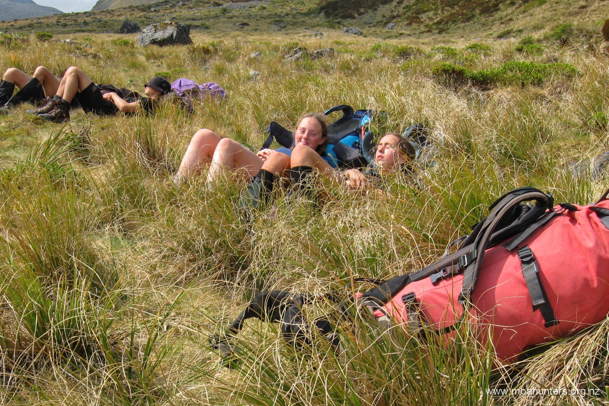
Due to the enormous breakfast enjoyed earlier that morning, we were not especially hungry when we stopped for a break on a convenient grassy terrace beside the Travers river. It was 1:30pm, and just a few mouthfuls of scroggin was all any of us needed to keep going. While we sat there, a light drizzle started falling, which was a little irksome. We hefted our packs and marched onward.
By 3:00pm however, our stomachs finally informed us we had earned a proper feed. The moa men congregated inside the spacious John Tait hut for lunch, enjoying a well earned break.
With three hours walking ahead and daylight hours in short supply, that happy break was sadly not a long one. With our bellies full again, we were quickly back on the track.
There are predator traps placed along the length of the track from Lakehead to Upper Travers hut. Each is labelled with the track section and a number. We worked out they are around 100 metres apart. Trap JT1 is 100 metres from the John Tait hut, and JT24 would be 2.4 kilometres from the hut.
Seeing the trap numbers as we walked was a double edged sword. Sometimes it’s nice to know how much walking you have ahead and how much you had done. Other times, when the number is large, you’d prefer blissful ignorance!
Pushing on from the hut, we followed the Travers river through pleasant beech forest until we came upon a junction. The main track continues steeply uphill to the right. To the left, it snakes down to Travers falls… Given the large amount of rain the area had received in the past week, we knew it would be a travesty to omit the five minute diversion to check out the roar below. We were not disappointed.
Not far up the track from the falls we reached a side stream, which was once bridged. The river in flood has completely destroyed the DOC structure, sweeping the mangled remains aside, mounding tons of mud and shingle on them. Fortunately for us, the stream was easily crossable, despite the recent rain. Given the rust on the remains of the bridge, it had been that way for some time. There is a sign saying a replacement bridge exists upstream about 15 minutes..
Over the next hour, daylight faded. By 6:00pm we had our headlights on, and save for their light, the last hour to Upper Travers hut was walked in darkness.
The track gets a little gnarly before the hut. The valley becomes tight, rocks are large and slippery as the track skirts close to the river. Darkness and fatigue accentuated the trickier conditions, making the last section feel more challenging than it probably was. When we rolled into the hut sometime after 7:00pm, the moa hunters were feeling more than a little bit knackered.
Dinner was prepared as we got to know the other occupants of the hut: Grant and Herbie were there – a pair of similar aged blokes to us, with a similar route plan. The resident warden gave us the increasingly nice weather forecast for the next few days. An American/Aussie couple popped in, but were tenting on the peaceful grassy flats below the hut. Another couple inside seemed to be hut wardens in-training.
Upper Travers hut has two separate sleeping areas – ten bunks each side. Grant and Herbie had suggested to the other occupants that we be allocated the one on the right, with everyone else on the other side.
After a warming Christmas pud dessert, we climbed into our sleeping bags. It was nearly 10:00pm, and were all asleep within minutes. It had been quite a long and tiring day for a bunch of (mostly!) old moa hunters…
Day 2
SunDay 14th April – Upper Travers hut to West Sabine hut
Not too many clicks after 6:00 am, the first moa men were stirring. Paul was busy heating water for coffee. Adam wandered past slightly bleary eyed.
Quite a few of us had experienced leg cramp overnight, particularly in the calves or hamstrings. This was usually when attempting to exit sleeping bags for a nighttime visit to the long-drop. We all agreed extra electrolyte drinks would be on the menu today!
Grant and Herbie were also up bright and early. As Grant walked out the bunk room, he plopped an amazing old relic down on the floor beside the door.
You don’t see many packs with external frames still in service… you see even less with a retrofitted hip belt made from the seat belt of a 1982 Ford Laser, or similar! What an awesome piece of kit. While it is not the world’s most comfortable pack, it is definitely one of the most quirky and unique.
Outside, the weather was a mixed bag. Thick low cloud clung to the surrounding hills, but overhead patches of bright blue sky were evident – enough to sew a pair of pants for a sailor, apparently (ask Chris!).
Paul and Chris awarded Upper Travers hut the auspicious and much sought-after “hut with the best water pressure, ever” accolade. Rather than being fed from a rain-filled tank, water from a stream above is piped directly to the hut, generating a pleasingly strong flow-rate from the taps inside. (Engineers like Paul and Chris are easily pleased)
Shortly after 8:30am, the hut warden gave us an updated weather forecast: Mostly cloudy, occasional drizzle, but steadily improving over the next few days. Still good, and good enough for us!
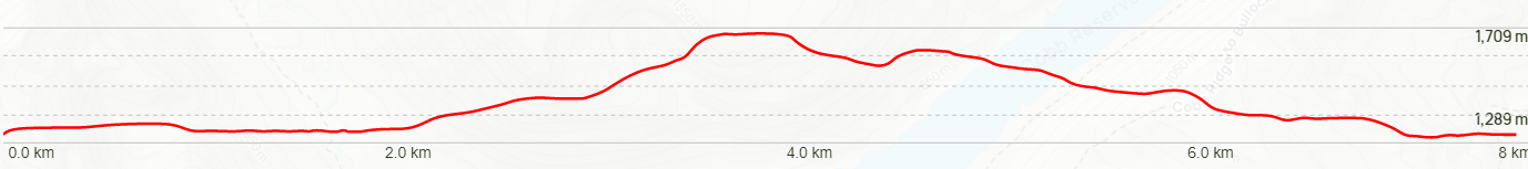
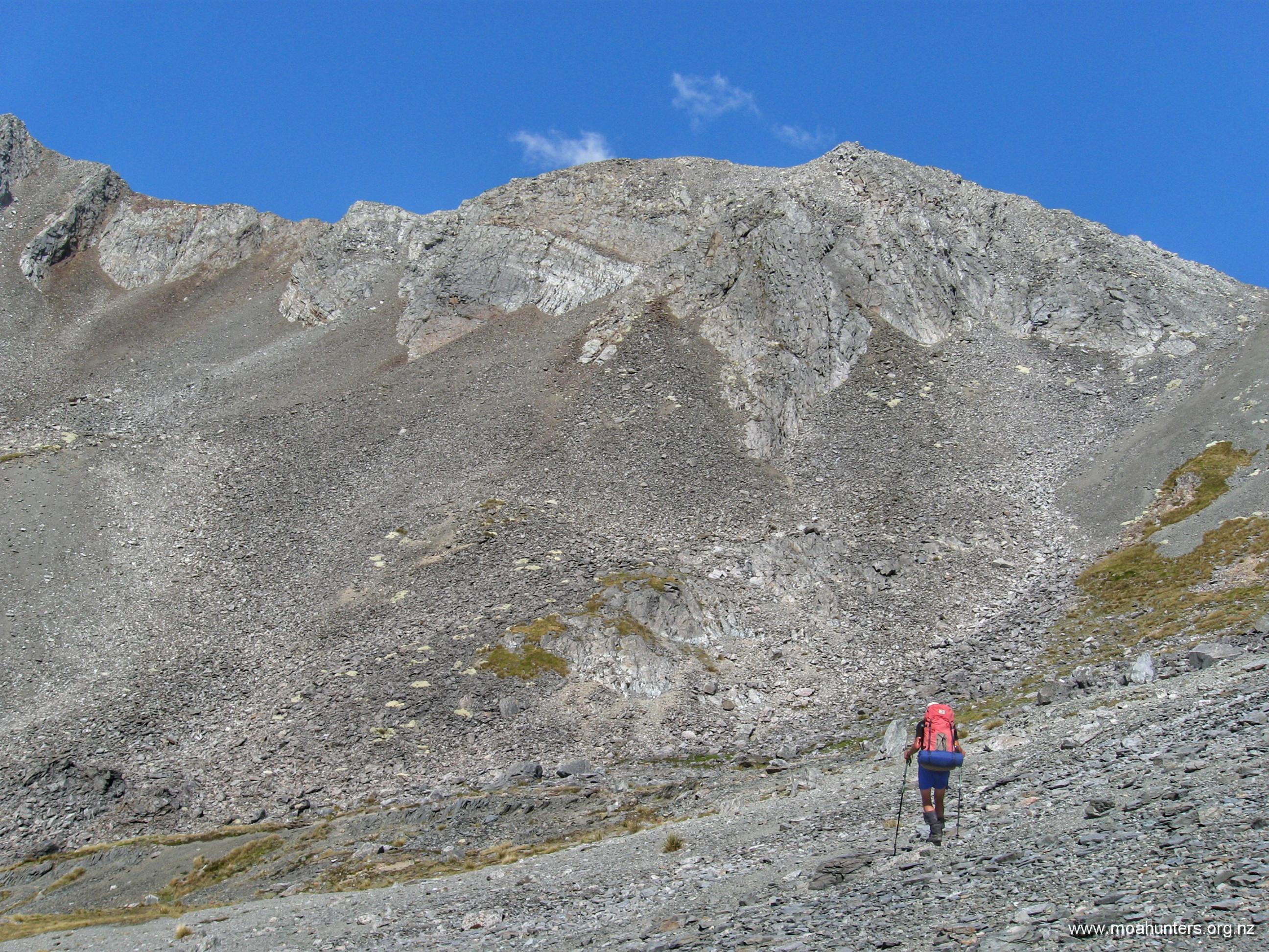
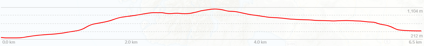
We heaved our still weighty packs onto our backs, and set off from the hut, knowing we had another big day ahead. Above us awaited the 450 vertical metre climb to Travers saddle. Beyond the saddle, we had an 1,100 vertical metre descent into the Sabine valley. My knees hurt just typing that.
Quickly above the bush line, the track led us out onto a lovely dew-soaked alpine meadow environment. Weaving a pleasant path through medium sized rocks, flax-like astelias, tussock, hebe bushes and the occasional spaniard grass, we all enjoyed the start of the climb.
Almost as if scripted, the low cloud played its part perfectly, creating atmospheric drama all morning. Swirling slowly across the hills it obscured the terrain around us, occasionally thinning enough to offer tantalising glimpses of what might lie ahead.
Looking back, we were briefly shown the steep flank of a mountain looming large out of the mist. Some kind of optical illusion made it look impossibly high, the summit hidden by yet more cloud.
At 9:30am we had gained enough altitude to notice the vegetation thinning out, leaving us treading a path through the remaining snowgrass, tussock and low scrub in increasingly rocky terrain.
Half an hour later we were breathing a fair bit harder. We had entered the final steep section of the climb. To be fair, we have grunted up much harder climbs, but this was enough to bead a brow with perspiration despite the cool morning air.
It was 10:15am when we reached Travers saddle – approximately 90 minutes after departing the Upper Travers hut. There was a shallow tarn in a basin just below the saddle. We wondered if in summer it would be nothing more than a dry bowl.
There was no massive panorama to enjoy from the saddle, but it was still a lovely spot to have a nibble of scroggin and take a drink of cool tarn water. Paul and Luke scampered up the rocky knob to the right of the saddle for a higher vantage point.
As we relaxed on the grass, cloud steadily lowered until a damp mist was swirling around us, dropping the temperature quickly and considerably. That signalled time to start our long descent to the Sabine valley below.
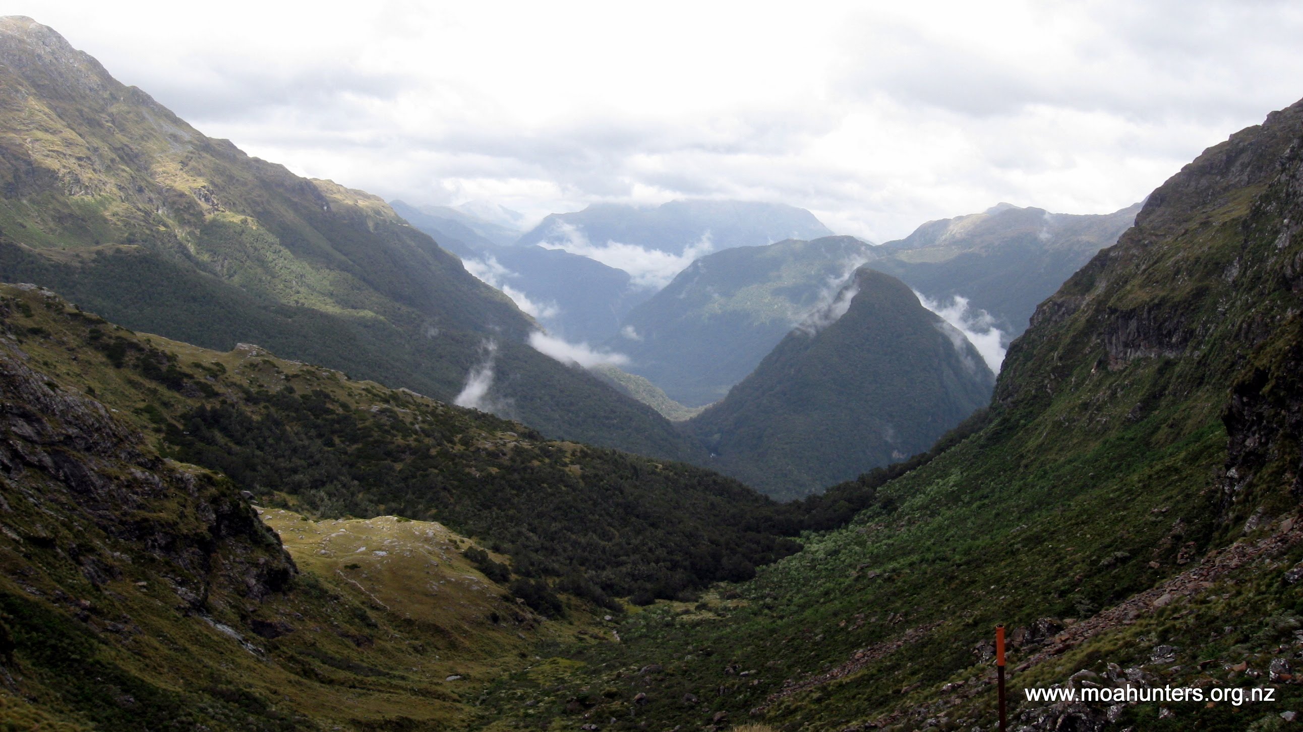
From the saddle, the track drops into a small but interesting valley. One side is completely covered in rocks and rubble that ends in a weirdly uniform curve at the valley floor. It looks for all the world like someone has collected any stray boulders from the valley floor and arranged them tidily.
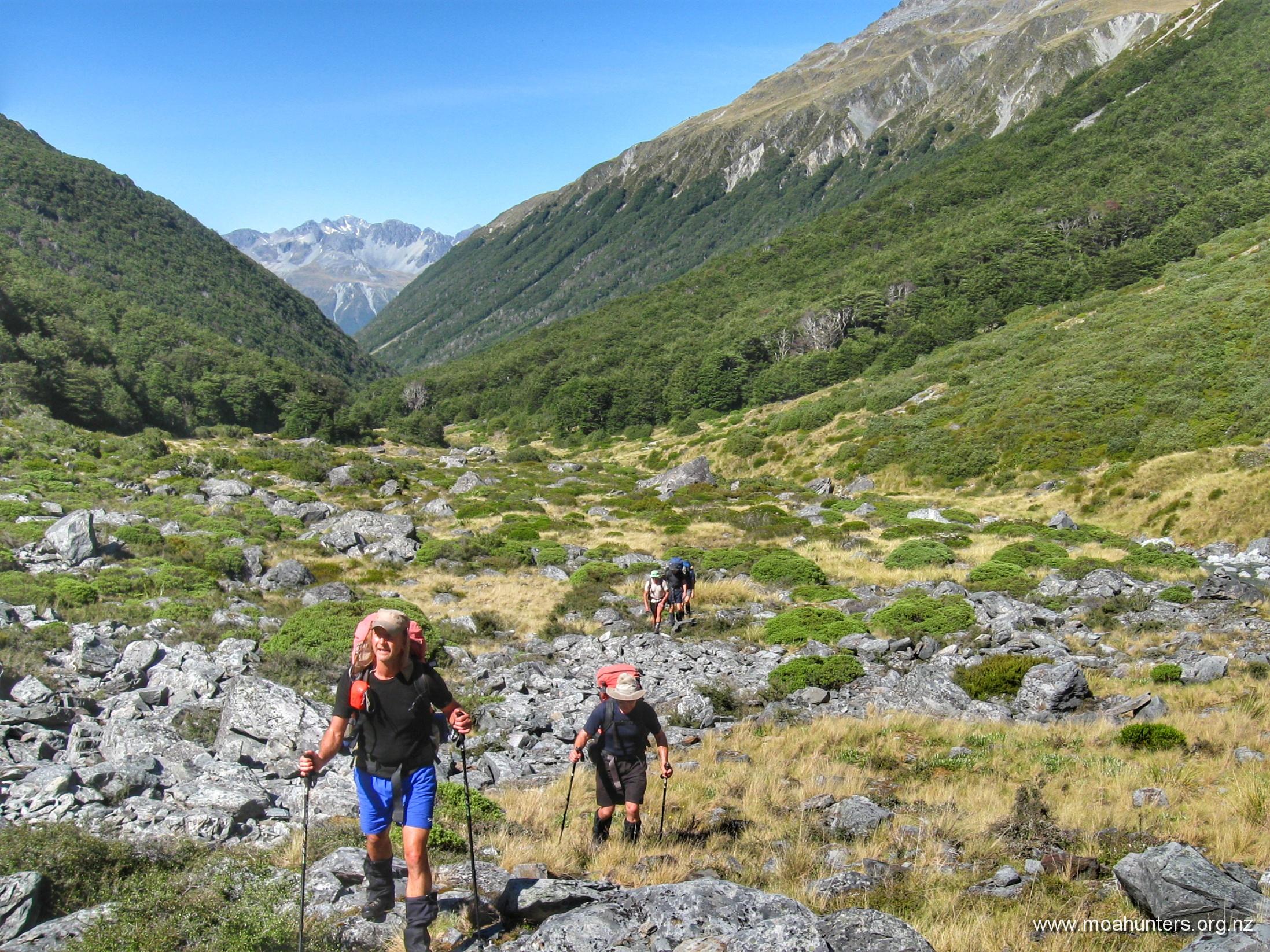
Beyond the boulder slide, a poled route leads down easy grassed slopes onto what becomes a prominent ridge that heads leads into the bush. It was around 11:30am when we entered the beech forest once again, knowing we still had a very long descent ahead of us.
Through misty conditions, Paul and Luke led the way, with the rest of us making our way down at our own pace. The track descends steadily down the sharp ridge through the forest for quite some time. After roughly an hour, it hooks right at a rocky outcrop and drops off the ridge into a much steeper section.
Note that our topo map shows the track following a stream down to the Sabine. This is not the case anymore. The track runs down a ridge some distance to the true-left of the stream, dropping back in the direction of the stream at the rocky outcrop. However, the track doesn’t actually meet the stream, so you should carry some water for this descent in hot conditions.
With the odd spot of drizzle finding its way through the beech canopy, we picked our way down the increasingly gnarly track. Awkwardly long step downs, slippery beech roots, occasional muddy patches and greasy rocks made for slow going. Slipping on a root and ending up firmly on one’s arse was not an uncommon occurrence.
From a branch above us, we received a stern and prolonged scolding from a Bellbird. It was clearly very unhappy with us passing through its territory, and made that displeasure loudly known. Perhaps we had ruined a love-song serenade to a potential partner? Usually these pretty green birds have a delightful resonant song, but this was most definitely an expletive-filled rant!
Sadly, in general we noticed much less bird song on this side of the saddle. Also, no predator traps – almost certainly a link there…
It is a long descent, and after an hour we were all feeling quite fatigued. Far below we could hear the Sabine river. To our right we could discern the distant babbling of a stream. We kept walking in the hope the track would meet it at a pleasant place for lunch break.
Finally at 12:50pm, we gave up on hitting the stream and stopped for a well-earned break. Paul did a quick check to see if the stream was close enough to the track to grab a water bottle refill. Unfortunately, it wasn’t.
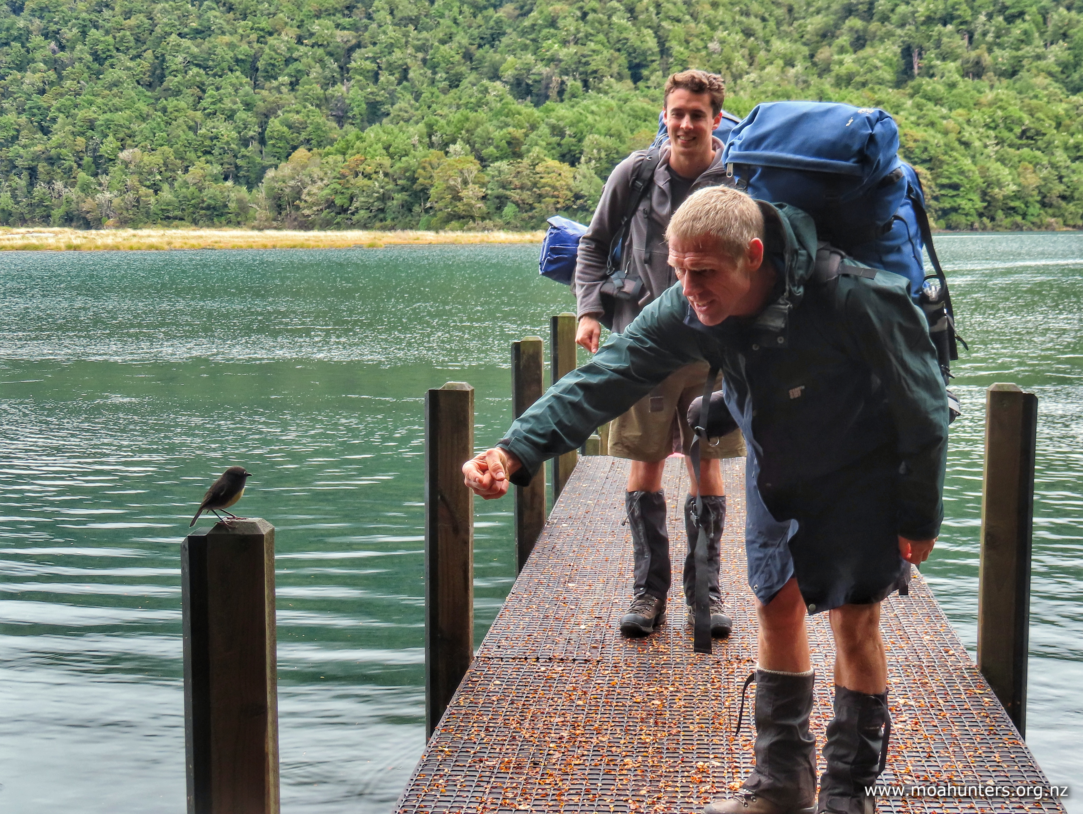
Despite no water, we enjoyed a very pleasant rest and refuel. A South Island Robin came by to say hello. It spent a happy minute hopping on and off the toe of Luke’s boot, before very deliberately pooping on it, then flitting off.
With plenty of time available to get to the hut, we were in no rush to get started again. For those who enjoy tramping in a group, these are cherished times. Resting against the trunk of a tree, sharing the experience of a challenging descent, enjoying every aspect of our surroundings, laughing and chatting about everything and nothing.
From our lunch stop we walked another hour, then took another break. The downhill by now wasn’t overly difficult, but it felt relentless. Old knees do not like big downhills. To combat a building fatigue, we took more regular breaks – tired legs make more mistakes.
Along the way we crossed a short wooden bridge that spans a surprising and impressive chasm. It is not until the middle of the bridge that you realise you are above a narrow and startlingly deep rocky slot with the river quite some distance below.
We rolled up to the West Sabine hut around 4:00pm, very pleased to finally be there. Lewis sparked up the wood stove while Paul set about getting dinner organised. Magnus prepared seven cups of steaming hot chocolate, generously topped up with whisky. Just the tonic after a solid day wandering in the hills…
Chris parked himself at a table and busied himself assembling his famous ‘grog log’: Gingernut and chocolate-chippie biscuits are dipped in whisky, then stuck together with whipped cream. The whole lot is covered in more whipped cream and decorated with crumbled flake chocolate. And if you are wondering, yes it does take quite a lot of effort to hand whip cream!
The West Sabine hut sees plenty of action. Being on the Te Araroa trail, hundreds, possibly thousands of walkers either stop by or stay in it over the warmer months. April is a little late for T.A. walkers to be in the Nelson Lakes, so we didn’t meet any this trip, but the hut book was 3/4 full after just four months use!
Grant and Herbie arrived at the hut around 5:00pm. We offered them some hot water for a cuppa and left them space to get settled in.
West Sabine hut is the “one big space” design. No separate bunkrooms like Upper Travis. We took the large platform of bunks at the rear, leaving Grant and Herbie their own area on the smaller sleeping area. We enjoyed chatting with our two hutmates – a couple of good blokes.
The Aussie-American couple arrived a little later and spent some time in the hut with us before heading out to camp the night in their tent. We enjoyed hearing about their travels and learned about tramping and tenting in Australia. Apparently it is actually possible to do this without being killed by local wildlife…
That evening, John made an interesting observation: “Moa Hunting is a bit like child birth – you forget how much your legs hurt last time, and keep doing it all again!“
With that sage thought still in our heads, and our bellies full of curry and grog log, we pulled ourselves into sleeping bags. The hut went quiet just a tad before 9:00pm.
Day 3
MonDay 15th April – West Sabine hut to Blue Lake hut
According the DOC, the walk from West Sabine hut to Blue Lake hut is just four hours. Given we only had half a day of walking and a full day to knock it off, the moa hunters eased lazily into day three of the Nelson Lakes v2 adventure.
While we enjoyed a hot breakfast seated at one of the large tables in the hut, Grant and Herbie prepared (with quite a bit more urgency than us) to hit the track. Their plan was a ‘there and back’ mission to Blue Lake hut. With lightweight day packs, they said spotya later, and were out the door before the last mouthfuls of moa hunter porridge were gone.
We were in no particular hurry to leave our breakfast table. The world had many problems to solve, and we had some time on our hands…
Comfortable in each others company, even potentially contentious political issues are not off limits. It is nice to be part of a group where all opinions are respected and heard. That said, we all seem to stand mostly on the same side of the political divide.
Having solved climate change, current world conflicts and future energy requirements, we set about solving a more immediate crisis: getting the hut ship-shape and spick and span. Floors were swept, benches wiped, bunks tidied and windowsills cleaned. Many months of dead sandfly accumulation on the sills leads to a nasty pile of mouldy muck. We did our best to leave the hut in great shape for the colder months ahead.
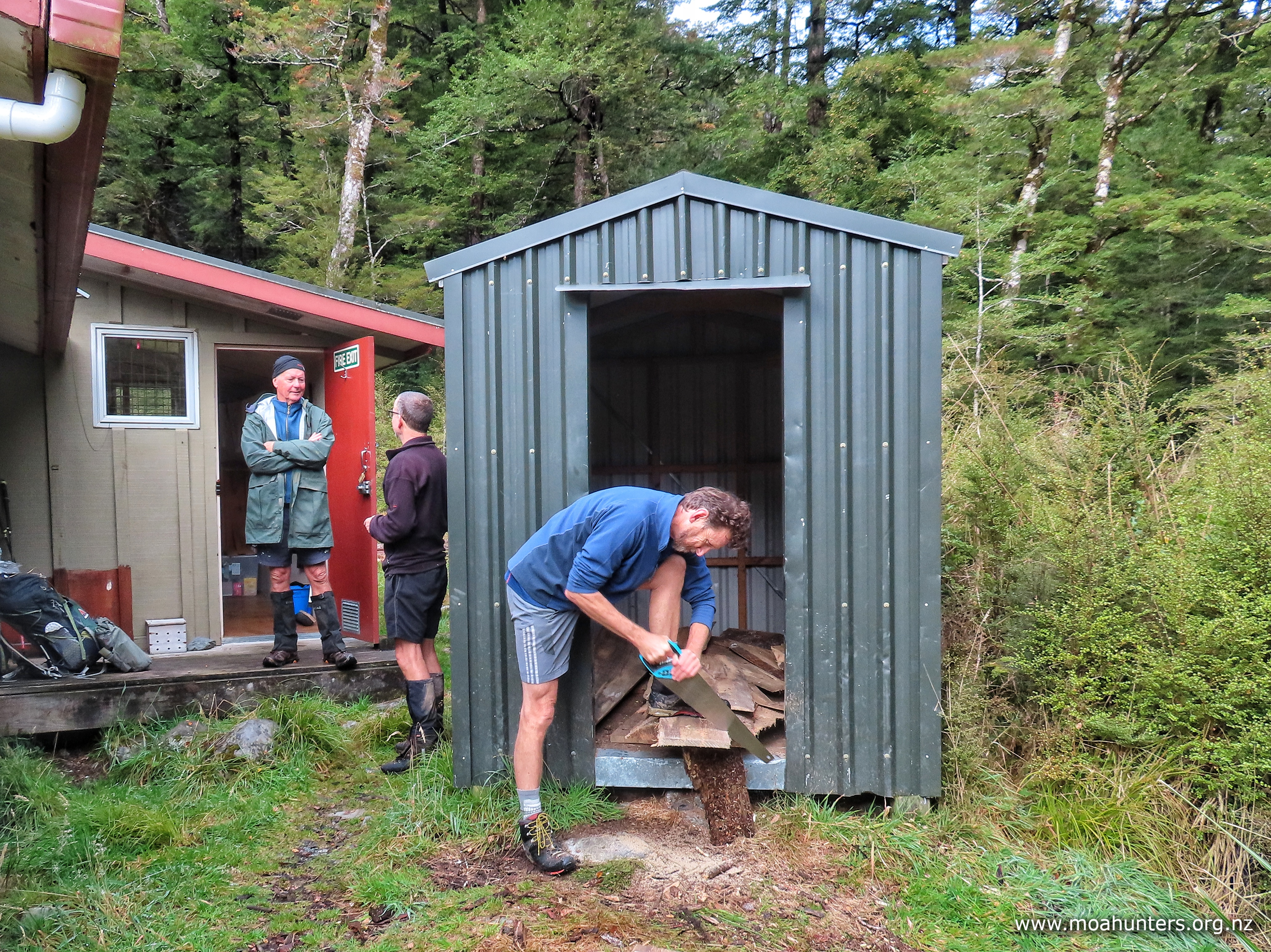
Outside, Chris and Lewis attacked the woodshed. Lengths of wood cut by DOC had been left in the shed, but they were protruding out the door and getting wet. These were cut into burnable lengths and stacked back out of the weather. Back inside, the wood burner was tidied and prepped for future duties.
Being outside West Sabine hut in April is a more pleasant experience than during the summer months, for one specific reason: the lack of sandflies. Where they all go when it gets cold, none of us knew or cared. We were just very pleased to be outside with no repellent on, being hardly bothered by the little biters.
West Sabine is a nice hut, but has an unbalanced design in terms of utility. There is sleeping space for thirty people, but just one stainless steel corner bench. If the hut was packed, which likely happens often in summer, occupants would definitely need to use the wooden tables for food preparation and cooking. Not ideal, really.
Our aim was to depart the hut at precisely mid-morning, and we absolutely nailed it. Shortly after sometime around a bit after ten o’clockish, we were striding through the beech forest, bound for Blue Lake hut.
Unfortunately the day didn’t start well for Chris. Not far from the hut, Adam at the front of the group noticed wasps exiting from between the roots of a large beech beside the track. The wasps noticed Chris, and he received three nasty stings for being in the wrong place at the wrong time.
If there’s any kind of silver lining to wasp stings, the sharp pain does make you forget the other aches you may have. Hmmm – perhaps that’s more of a cheap tin foil lining…
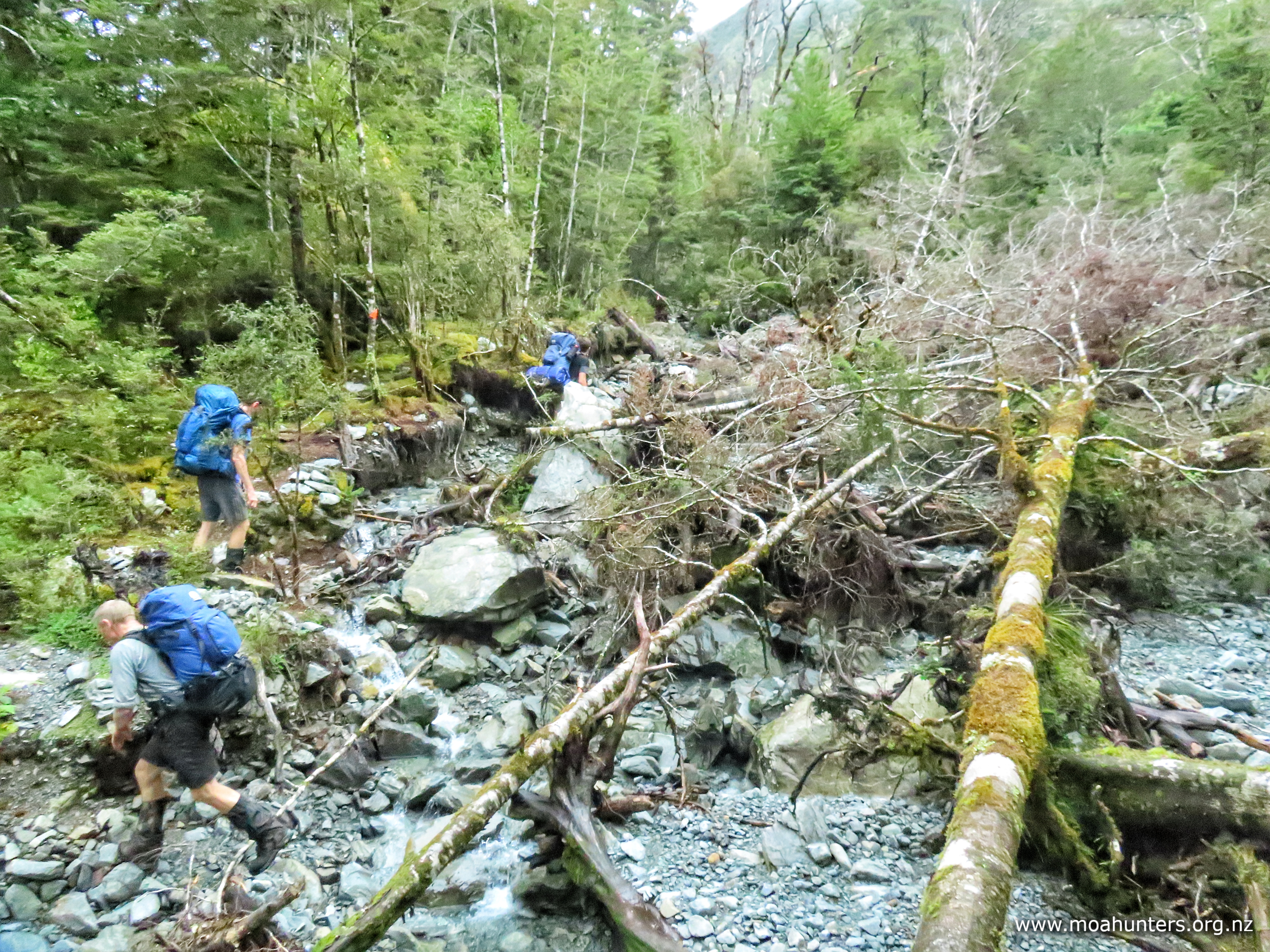
Between the hut and our first scroggin stop an hour later we encountered quite a bit of track damage. Washouts and tree falls made for interesting times along what would usually be a fairly benign section of track.
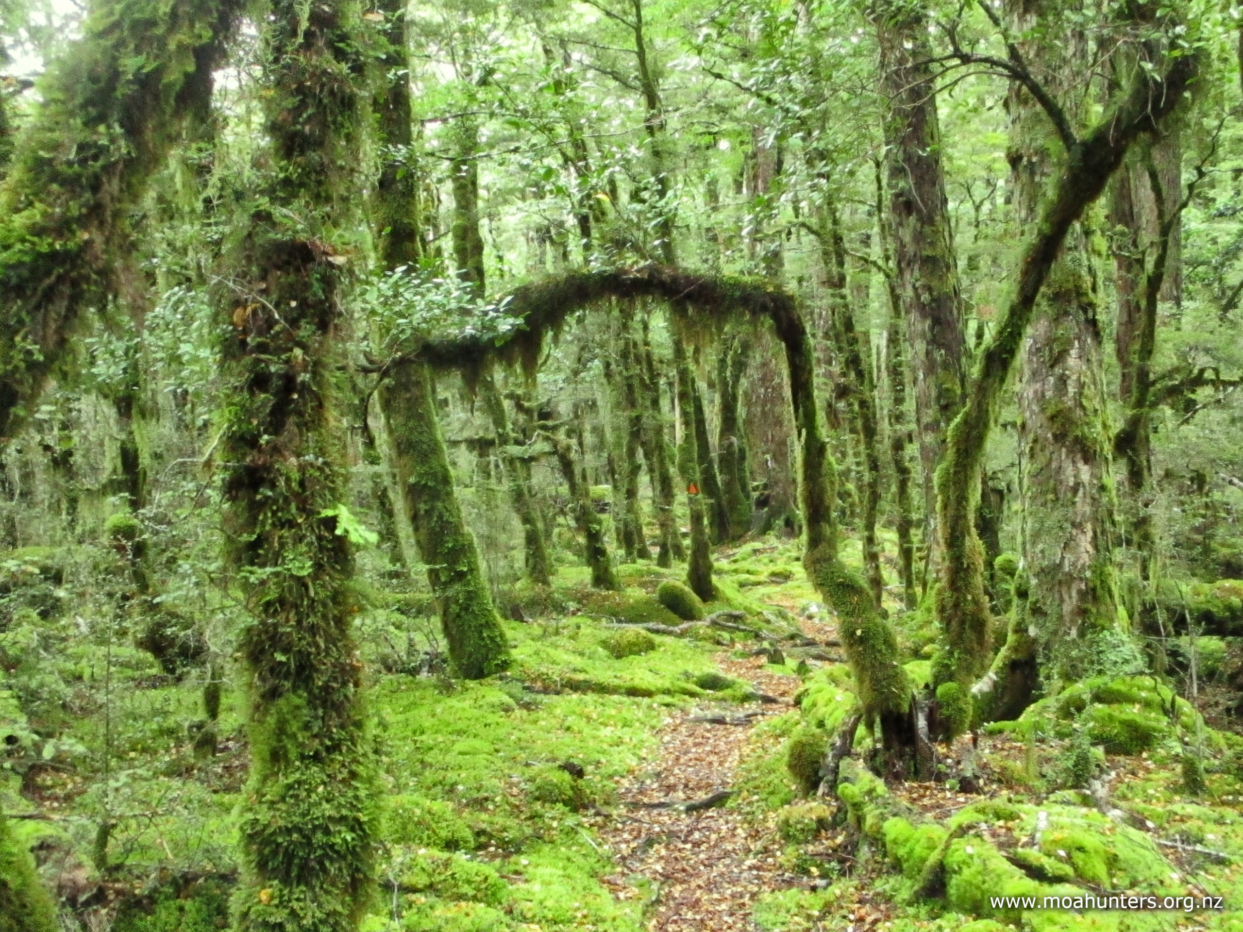
Thick moss covering everything painted our surroundings with a surreal vivid green. Aside from yellow and brown fallen leaves, the forest was a gorgeous fifty shades of green.
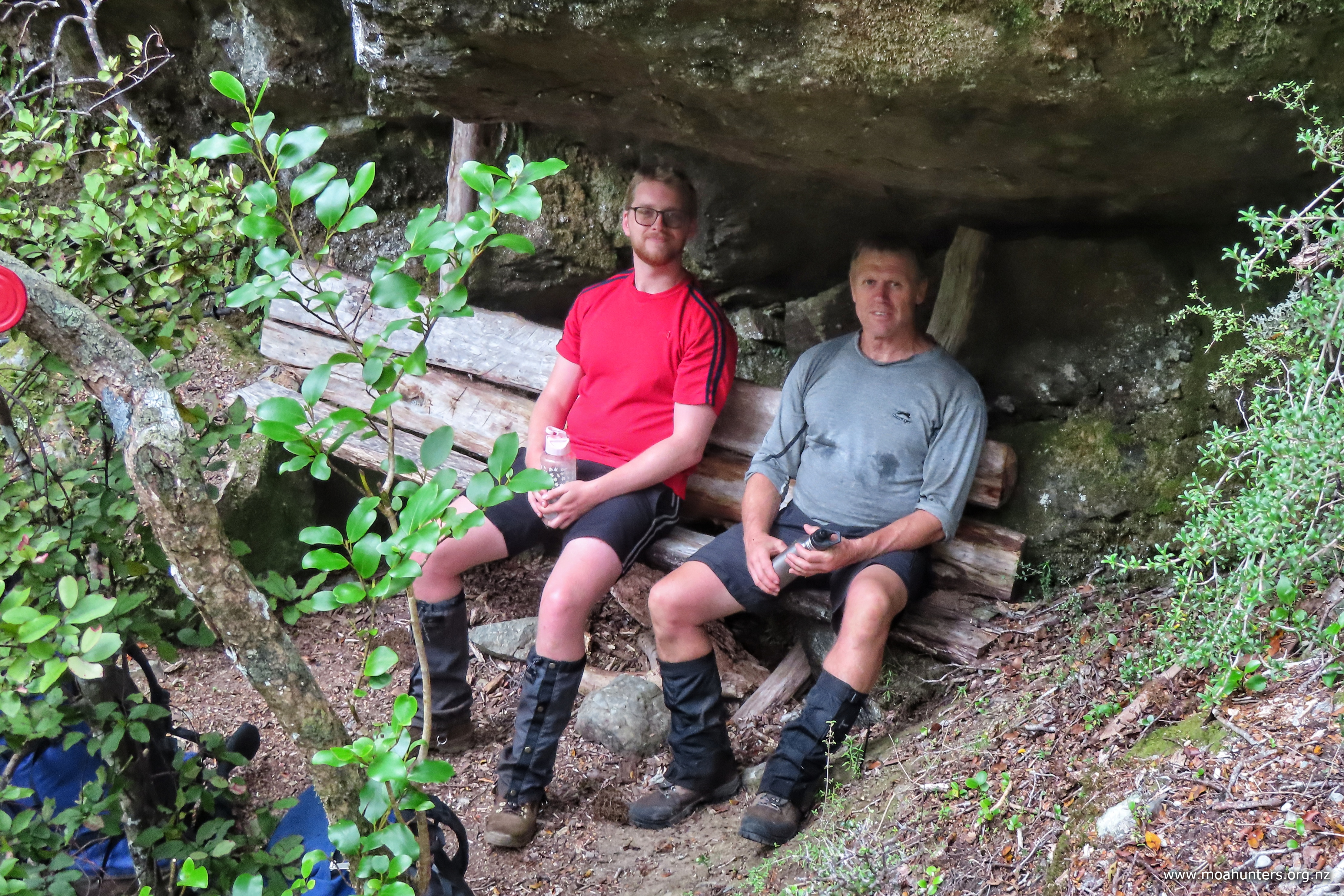
Farther up the track, the valley was filled with enormous rocks. An impressive avalanche had obviously pummelled the area many many years ago. Nature has mostly healed the scars, with moss and vegetation now working hard to cover and hide the rocks completely. It would have been an immense event to have witnessed – but best from quite some distance!
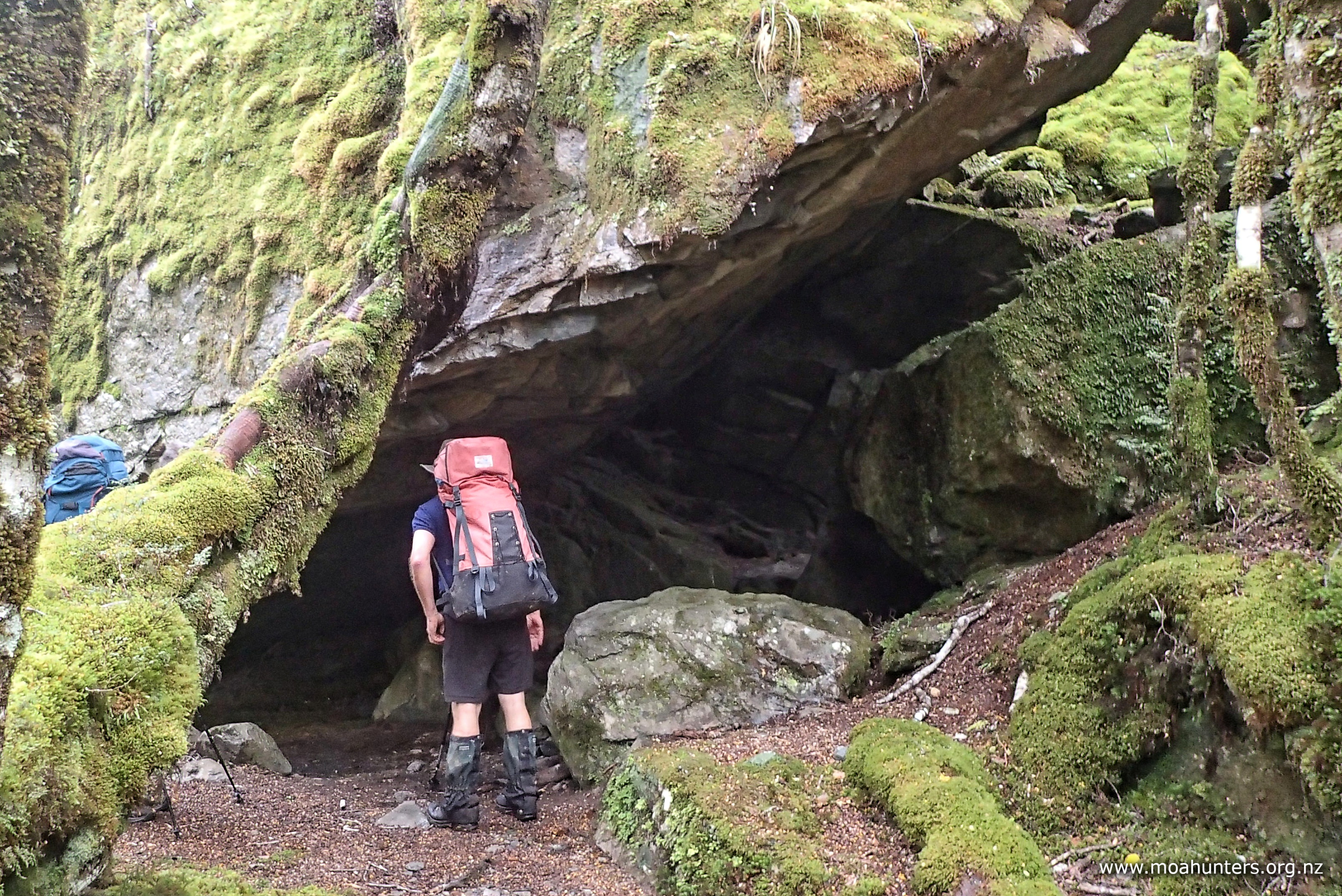
There is also an impressive rock shelter along the track. Impossible to miss and well used, it would make for a nice dry refuge in bad weather. That said, no doubt there are plenty of people have slept under the gigantic rock slab in clear weather just for the experience. We briefly poked our noses in before wandering on. Many of us had previously seen and explored the shelter when we walked this bit of track (in the opposite direction) on our 2020 Lewis Pass to St Arnaud adventure.
Our pre-departure plan was to stop for lunch along the way, preferably at an idyllic spot beside the river, where we would enjoy a long languid lunch. Unfortunately, whoever is in charge of the weather had different and rather irksome ideas. Misty low cloud became light drizzle, deteriorating to heavy and very wetting drizzle. With no discussion or debate necessary, we all walked the track in our own little worlds, knowing lunch would be had at Blue Lake hut.
As the valley narrowed and the hillsides became steeper, a few rock slides had to be traversed. They make a nice change of pace from the beech forest, but the extra exposure to the elements did prompt a few moa hunters to stop and take a moment to fit waterproof pack covers. It felt too warm to wear jackets, but preventing old-school canvas packs getting waterlogged and heavy is always a worthwhile time investment.
Below the lurking mist on the steep hillsides above us, we spotted numerous fairly large waterfalls. Fuelled by previous heavy rain and lightly topped up by recent precipitation, they were impressive despite mischievous swirling cloud doing its best to hide them.
The last 45 minutes before the hut is an intriguing mix of terrain. For a while things get a bit steep. The Sabine river is boisterous through here as it tumbles down the valley, fighting its way past large rocks in its path.
Above the rapids, the track leaves the river. There is a short, sharp, and quite steep climb from there onto some absolutely gorgeous flats beside a now sleepy Sabine. Easy sections of boardwalk spanning sections of boggy ground and spongy sphagnum moss seemed a good indicator the hut was close by.
But don’t be fooled, the hut is not just round the corner… There is a final ten minute climb through the forest to the hut. To be fair, nothing onerous on a very short day. But if I was writing the script, the hut would have been back on those lovely river flats. Just sayin’!
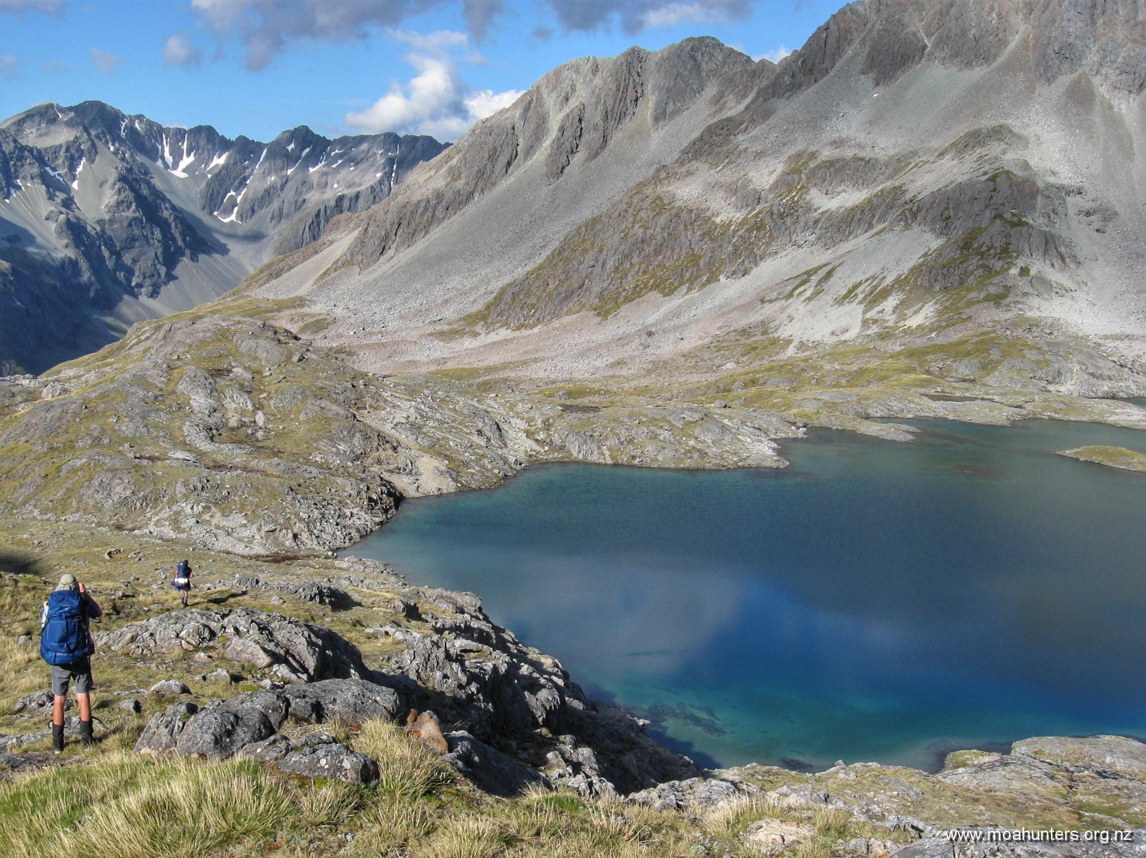
Outside the hut, we dropped packs and began stripping off wet gear, muddy boots and gaiters. A young woman wandered up the track from the direction of Blue Lake.
As is almost always the case with people we meet on the track, she was a friendly like-minded tramper out enjoying the beauty of Aotearoa. That morning she had walked over Moss pass from George Lyon hut in just five and a half hours, and was continuing on to West Sabine hut. Wow. We thanked her for making us old fellas feel even more inadequate than usual, and wished her well for the onward journey!
Grant also showed up from the direction of the lake. He asked if we had passed Herbie as we walked up. We had not, and Grant immediately looked a little concerned. Herbie’s knee had been getting quite sore during the morning, so he wisely elected to turn back rather than push his luck. Somehow we had missed him as he walked back to West Sabine. Grant learned later that Herbie had been sighted close to West Sabine hut. No doubt he was very relieved to have that news as he set off back.
With plenty of the afternoon ahead of us, we enjoyed some leisure time at Blue lake. Lunch was eaten inside.
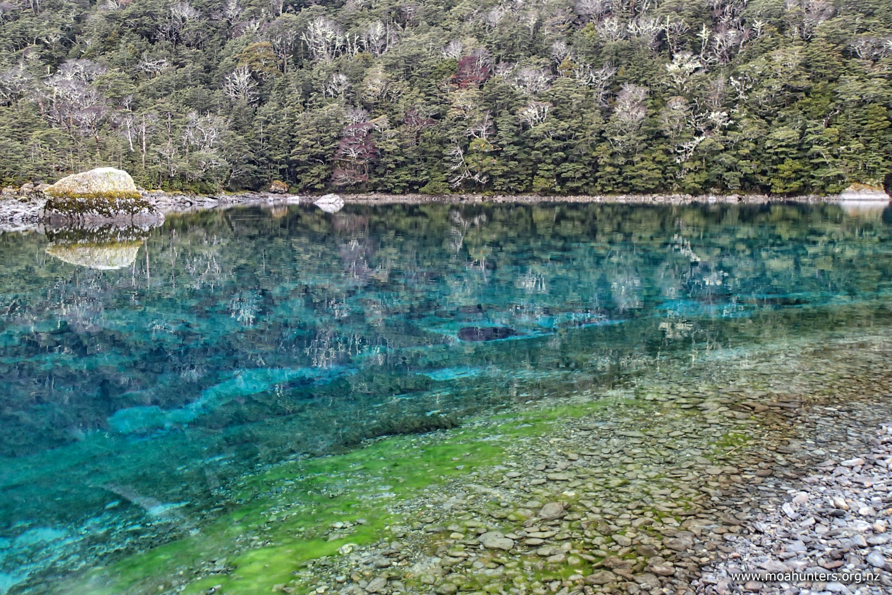
Despite persistent light drizzle, Blue Lake itself was still a surreal place, well worth the wet wander down to take a look.
A game of Pass the Pigs whiled away some time, as did sparking up the log burner and enjoying some idle chitchat or a snooze on a bunk.
Later than afternoon, another solo tramper arrived at the hut. Judging by her accent, Rachel was from the UK. We got the vibe that spending the night in Blue Lake hut with seven moa hunters was probably not her ideal scenario, so we did our best to make her feel as welcome and at ease as possible.
We cleared space for her at the tables and on the drying rack above the logfire. She was also very accommodating, and sat chatting to us in the evening.
Dinner was a three course meal – hooray for Chris! Shiitake mushroom soup followed by a well seasoned cottage pie were headline acts. Sweet Tiramisu dessert drizzled with decadent Glayva was the triumphant finale of a mighty feast. Surprisingly, this extraordinary menu was all dispatched before 7:30pm.
Not many minutes before 8:00pm we were snugged up in our sleeping bags with lights out. Luxury!!
Day 4
Tuesday 16th April – Blue Lake hut to George Lyon hut
We woke to a very cold Blue Lake hut. Outside, there was slightly more than a hint of white frost on sheltered patches of grass, explaining why we could clearly see our breath inside. We all rugged up with plenty of thermal layers. Knowing we had damp firewood and a long lead time before the wood stove would warm the hut (even with dry wood), we decided not to spark it up.
Hot porridge this morning was especially welcome, along with a steaming cuppa. While we understand that many trampers like to travel light, sacrificing heated food and drinks to go ultralight is a step too far in our book!
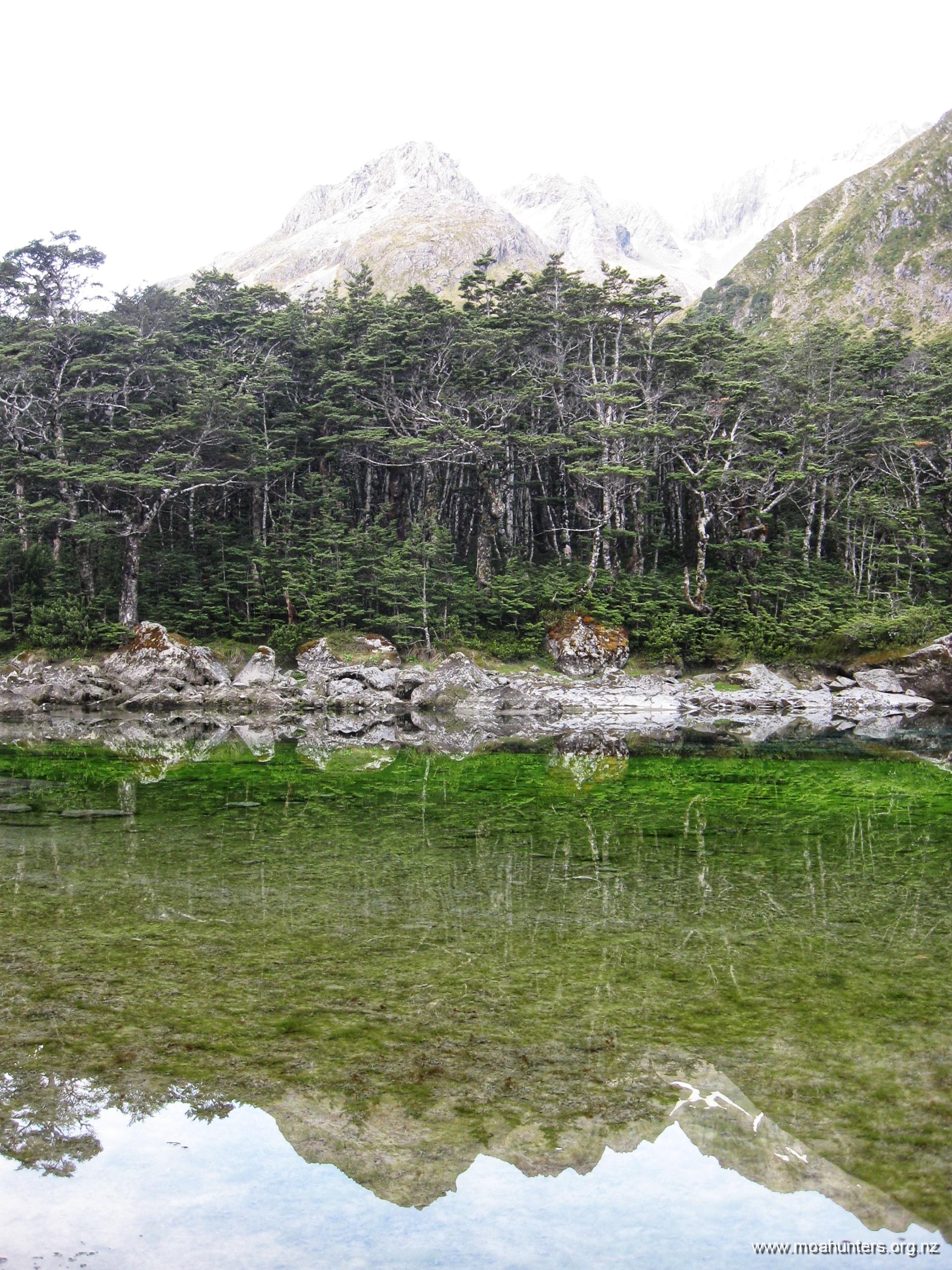
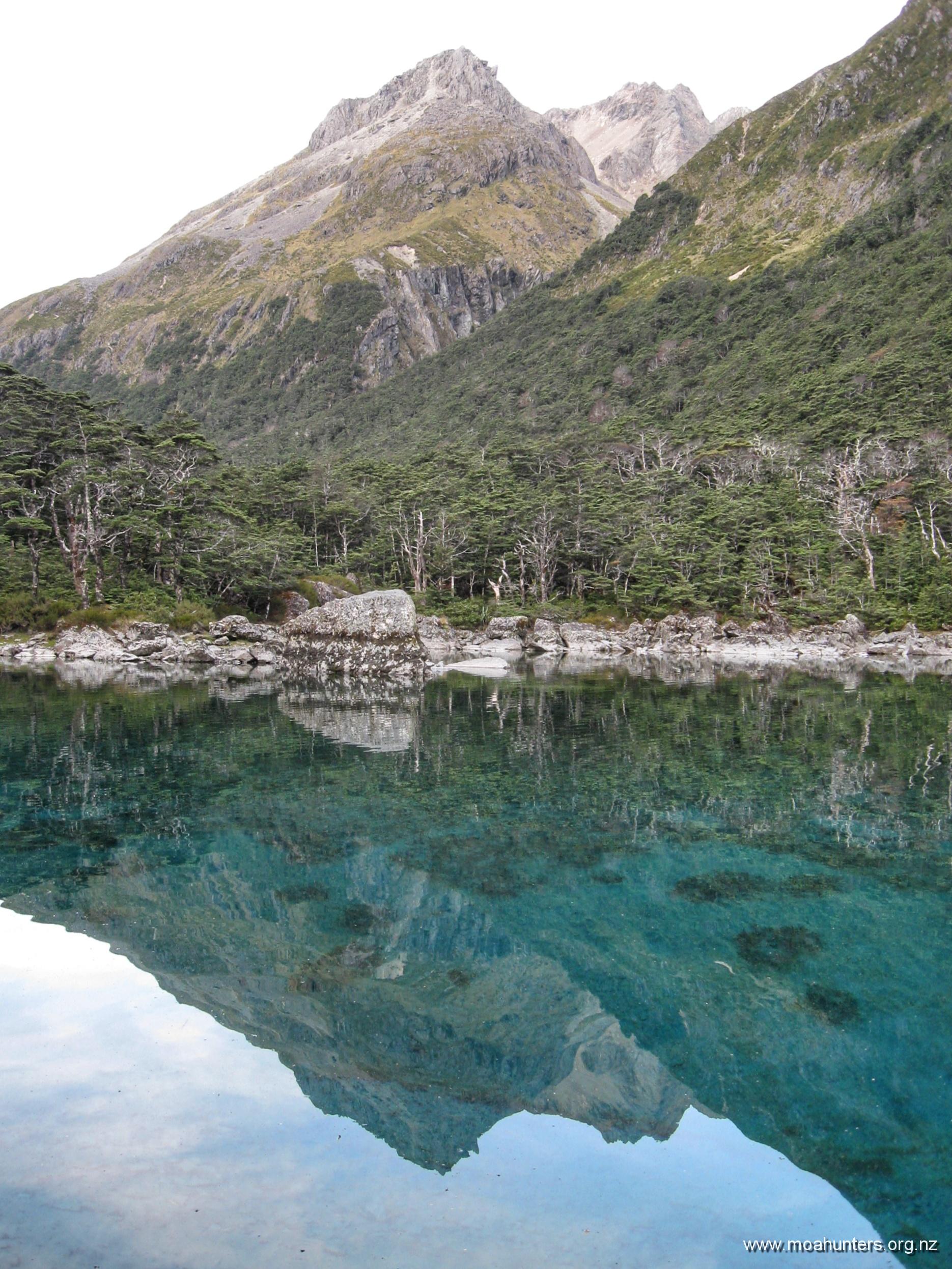
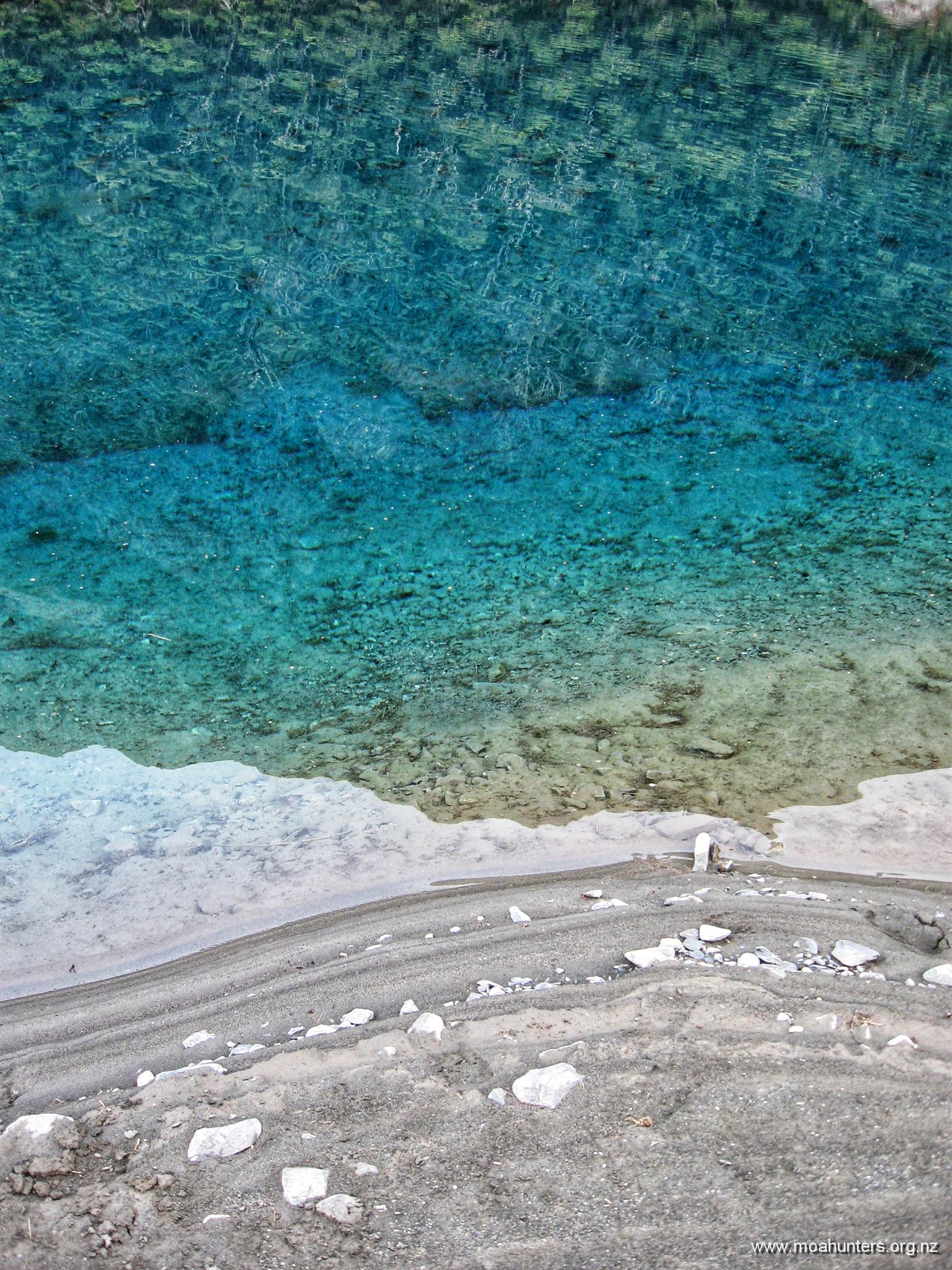
Once we were packed and the hut tidy and swept, we nipped down the track to check out Blue Lake on a better day with no rain falling.
It really is an amazing body of water. Vivid stripes of lake weed and algae create bright bands of colour, visible with amazing clarity through the glassy water. Vivid green in the shallows transforms to gently glowing blue in deeper water.
We wandered up the length of the lake taking plenty of photos we knew would not do it justice.
According to a DOC notice in the hut, some plonkers had been playing Frisbee near the lake, and unsurprisingly an errant throw had landed in the water. To the credit of those involved, they heeded all the signs and stayed out of the water rather than going in to fetch it. DOC must have devised an environmentally and culturally acceptable way to retrieve the Frisbee, because we saw no sign of a plastic disc.
We wondered how much that little rescue mission had cost the taxpayer… Perhaps it’s best we remain ignorant.
From Blue Lake hut, the track enters a short section of beech forest then emerges onto steep open scrubby snowgrass country. The day had not warmed up much, and we were all well rugged up with thermal layers. But twenty minutes of solid ascent had us unzipping polarfleeces and stripping down.
Behind us, increasingly epic views back to Blue Lake opened up. We took plenty of opportunities to pause and enjoy them… and catch a quick breather! Cloud clung to ridges in the valleys well below us, confirming we had indeed been climbing.
Taking in deep breaths of the icy fresh mountain air reminded us we were very much alive. There’s something magic about being on the tops, focusing on your senses one by one to really experience the moment. Inhaling the sharp cool air, feeling its chill in your lungs. Hearing a distant bird and casting your eyes out to the valleys and peaks where it might be… then looking in close, noticing the delicate alpine plants beside your boot.
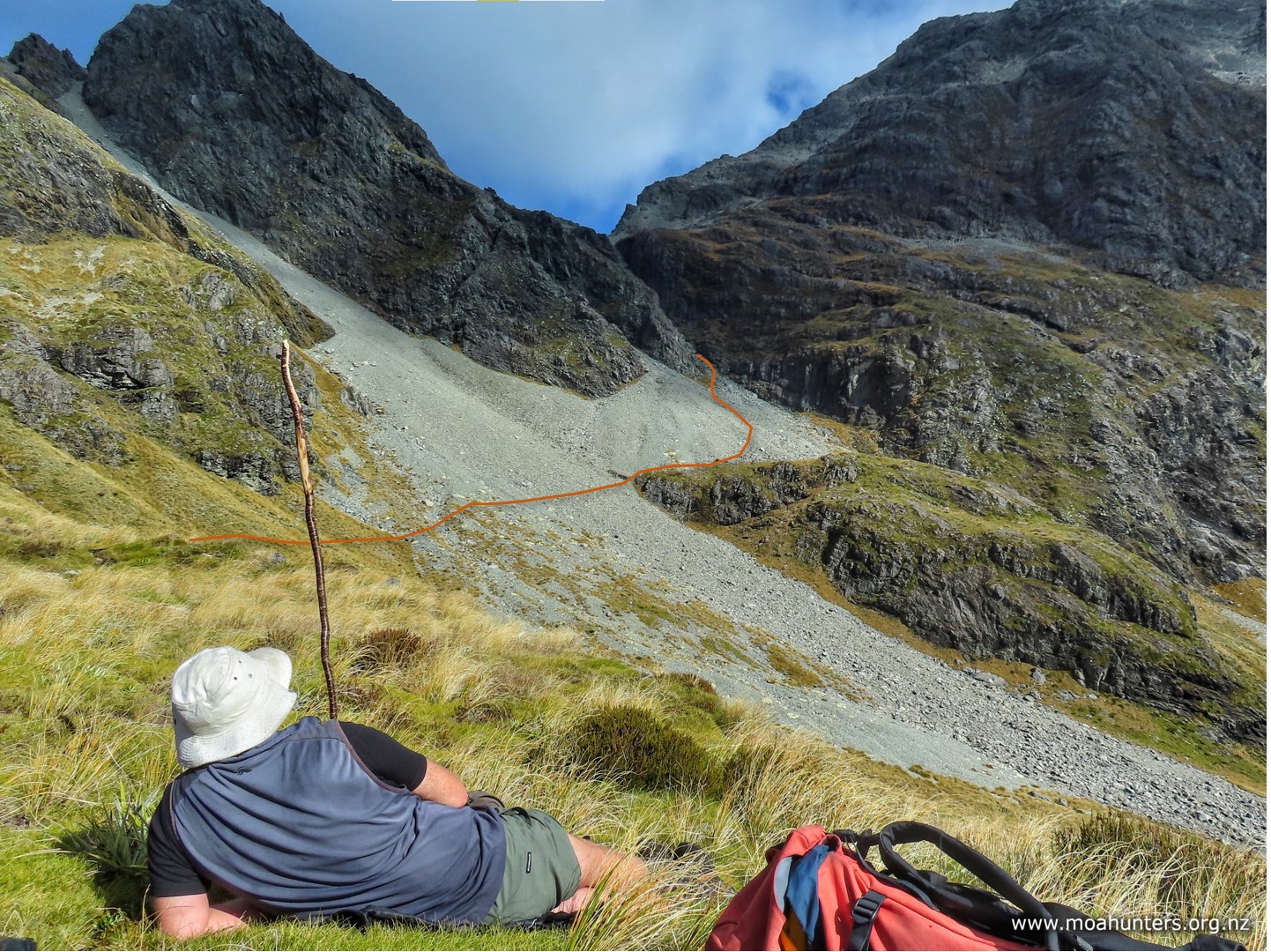
An hour into the climb there are some nice spots to take a break. We dropped our packs at one of these pleasant flats and spent some time checking out the view below and the route above. We could now see rocky Moss Pass awaiting us at the top of a steep shingle strewn climb.
From our scroggin stop we made our way across a shingle fan and onto the upper fringe of a rocky outcrop. There are many marker poles here and choosing a route is not required – we just followed the well walked track.
Beyond the outcrop, the track turns left and the seriously steep section begins. There are lots of photos of the Moss pass rock chute online, and we knew it would be a steep grunt up to the top. We were not disappointed.
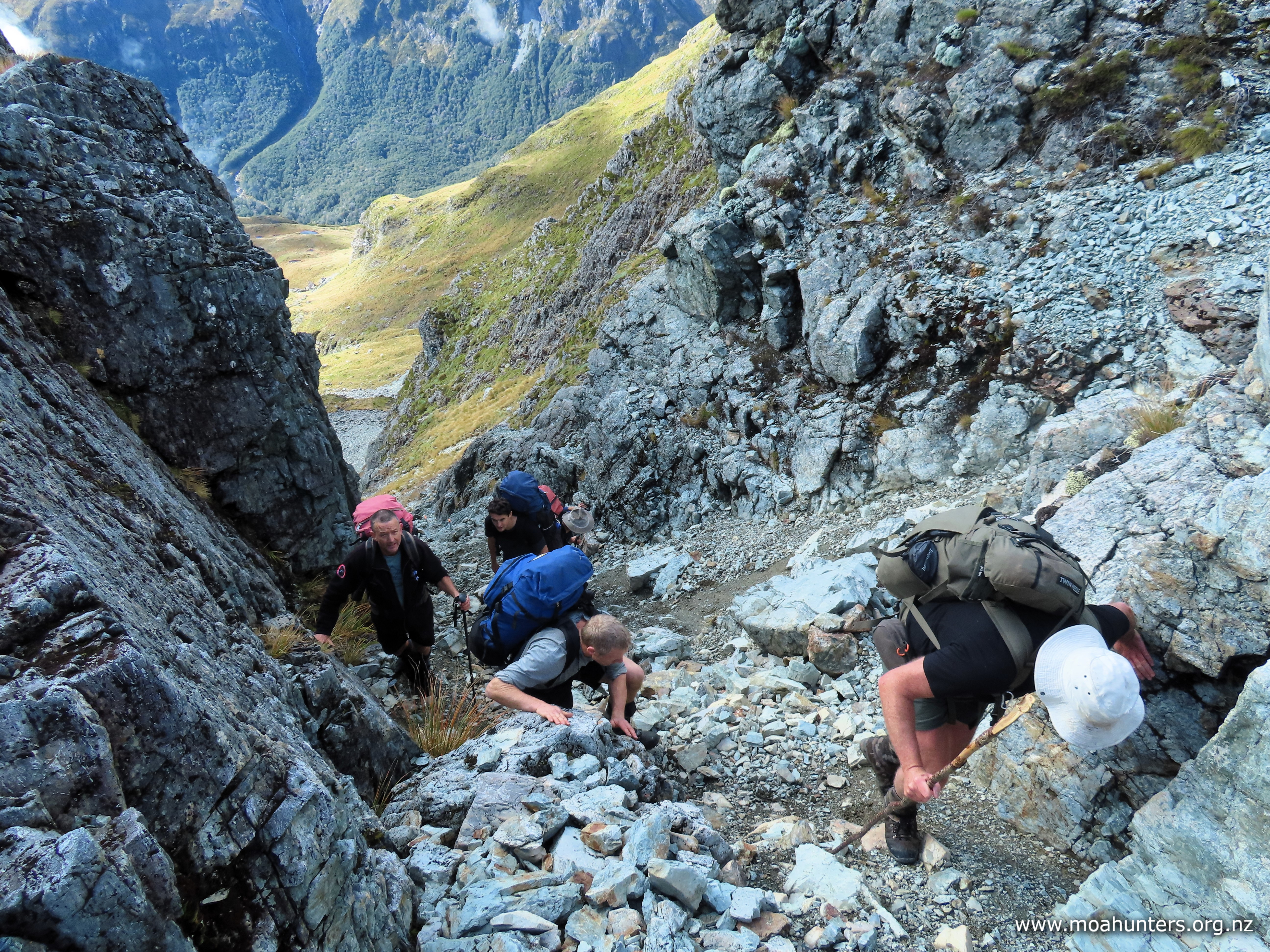
The higher we got, the smaller and less stable the rock debris underfoot became. If you chose the wrong path up, it was one step forward, then slide one step back. Sticking very close to the rock wall on the right of the chute was a winning strategy. Locked on one side against the hard rock face, shingle tended to slide less and footholds were much more stable.
While the climb was tricky and steep, we wouldn’t rate it as particularly dangerous, provided you take your time and follow the well trod route. Walking in a large group, our main concern was accidentally dislodging rocks onto our mates below. To manage that risk, we stayed close as we ascended, maintaining awareness of those above and below at all times.
The rock chute is the highlight of the climb to Moss pass, but it is not the finale. Emerging through a narrow gap the chute leads to a comparatively flat rocky basin. Beyond that is a 10 minute grunt up a moderately steep rock-strewn face to the pass.
Scaling these mountain tops gave us a sense of the massive power of nature. We were picking our way through a landscape of shattered rock. The combined forces of wind, rain, sun and ice inexorably crumble mighty granite peaks to rubble.
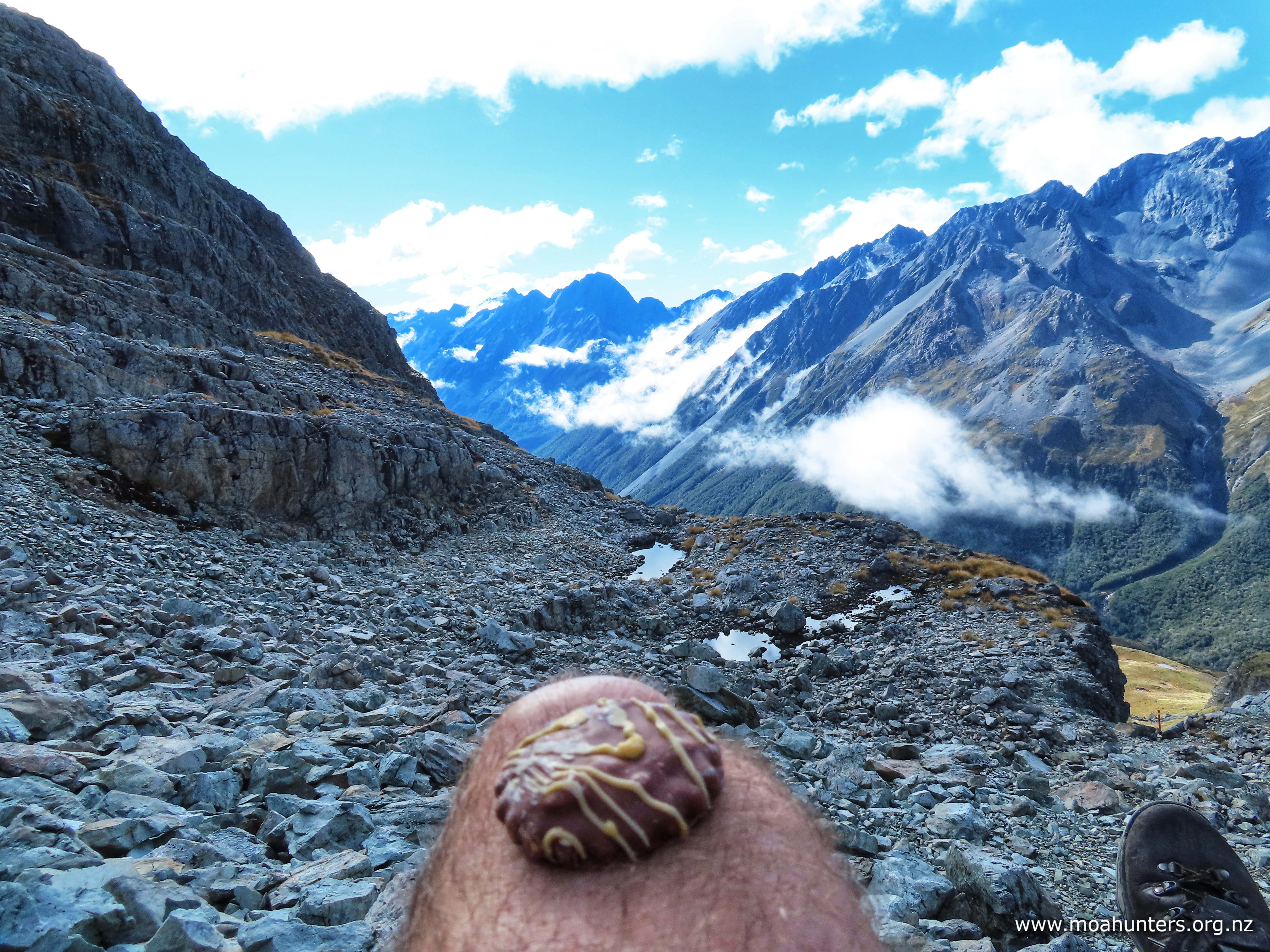
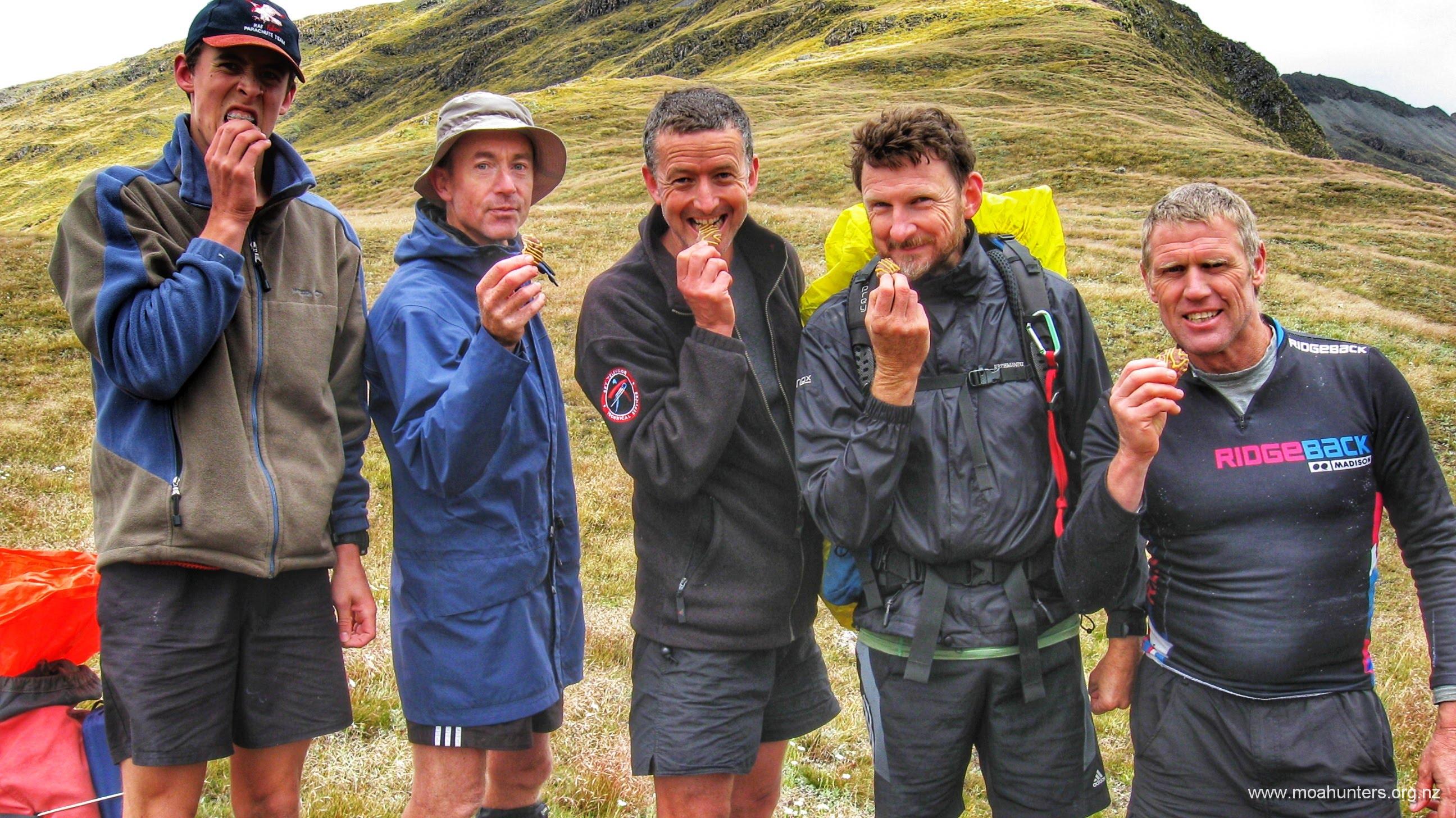
At the top of Moss pass, we took a moment to celebrate. Sitting in a long row on the rocky pass, we all enjoyed the feeling of being on top of the world. A very satisfying feeling indeed, improved immensely by scrummy squiggle top biscuits.
In what has become a very happy “top of the pass” tradition, Luke produced a battle-worn packet from the depths of his backpack, and threw a squiggle to each of us. Bliss…
Fuelled by chocolatey goodness, we dropped off the pass making our way through similar terrain encountered on our ascent – rocks and rubble. However, this soon gave way to flatter country with patches of grassy tussock.
It didn’t take an expert to pick out our ideal lunch spot. Below us lay a good sized tarn, surrounded by large rocks that would provide good shelter from the cool breeze. We made our way down, dropped packs, and settled in for a very enjoyable lunch break.
Looking back, the traverse off Moss Pass appeared more challenging than when we were walking it!
The sun made a few brief but welcome appearances, but in general it was a little cool on the tops. With annoying regularity, the sneaky breeze found ways to swirl around the rocks we had chosen to hide behind, keeping a lid on the temperature.
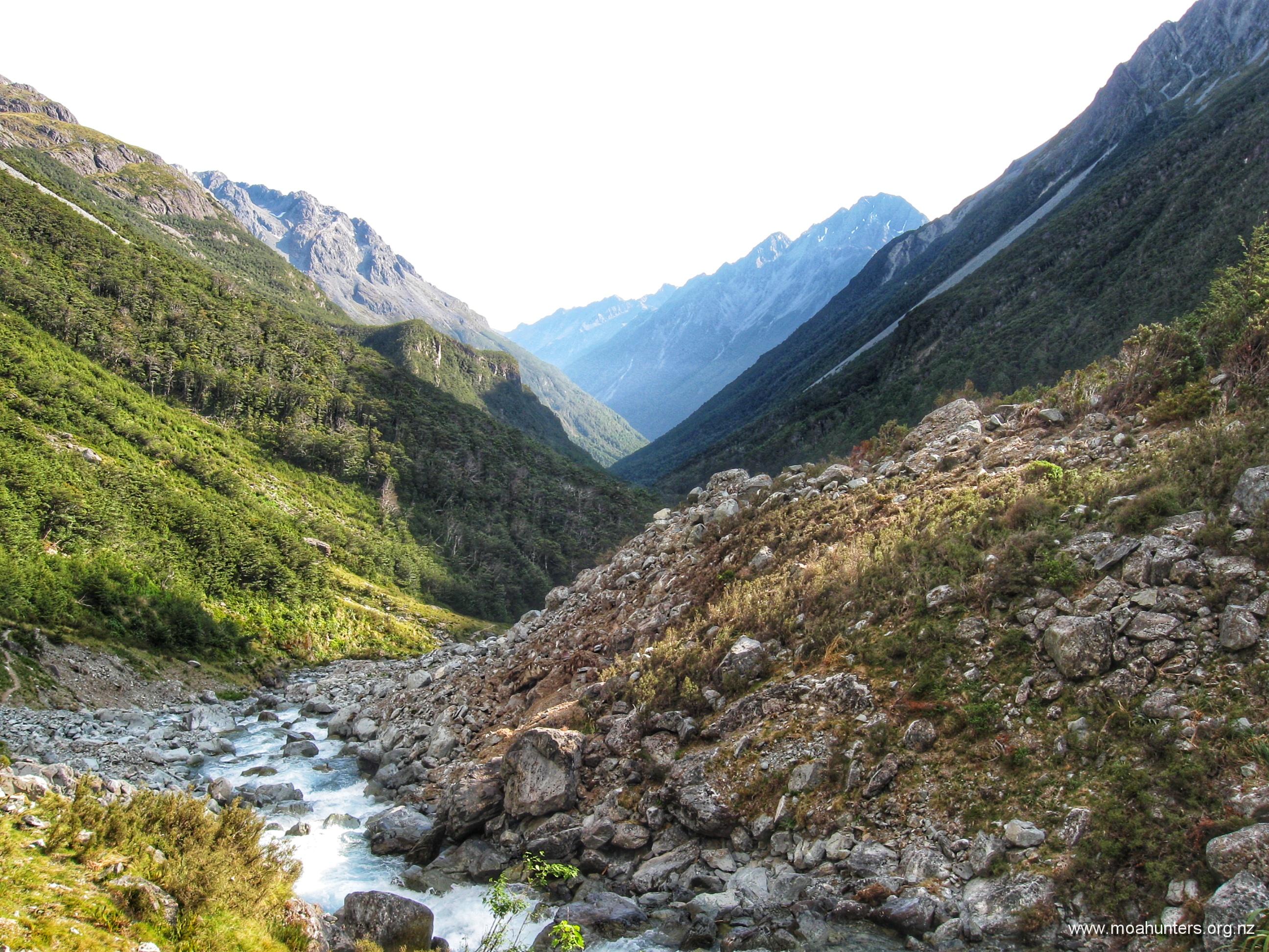
From our lunch spot at the tarns, the track descended fairly steeply down a grassy slope, with views across the valley of an epic, steep, water-sculpted hillside.
At our feet, damp rocks protruding from the dirt were coated with a slightly greasy algae. Alongside the well worn path, tough grasses were slippery and sometimes treacherous on the steep slope. We had to watch our step as we descended off the tops.
When the track heads into the beech forest, it doesn’t ease up. Just as steep as on the tops, we descended the tricky and often slippery track for an hour and a half until it eased out and we reached a stream.
Once off the steep section, the track slides round to the north through gorgeous mossy forest. We enjoyed the easier walking and lovely surroundings, arriving at the bridge over the D’Urville river at 3:30pm – bang on two hours from when we left the lunchtime tarn stop.
Between the bridge and George Lyon hut, there is a fifteen minute section where the valley gets quite tight and the track a bit harder going. Aside from that, it is a pleasant wander to the hut.
When we reached the hut, our legs were telling us we had done a solid day of walking. Not fully trusting what our legs tell us, we consulted the map. Topomap tells us we had made a 580 metre climb followed by an 1100 metre descent. That, my friends, is more than enough downhill for one day.
George Lyon (formerly Ella) hut is an interesting design. Two completely separate spaces are accessed left and right from the small entrance vestibule. Oddly, the two sides are not identical. One side has a small log burner, the other gets a skylight. Or maybe that’s not so odd… Anyhow, if you go there, it is worth reading the story of George Lyon at the hut. He seems to have been an influential and dedicated fella in his day.
Happily, there were almost no sandflies at this hut either, despite being at low altitude and right beside a river. For those who react in an itchy way to their nasty little bites, April is a great time of year to wander the back country.
Something to note if you do walk later in the season is the extra requirement for lighting. You will be using your headlamp and other lighting for longer periods. The sun sets early in April and many huts are gloomy inside at the best of times. Pack a few extra batteries.
The long drop at George Lyon is an interesting relic. For some reason this rickety wood and corrugated iron structure hasn’t been replaced by the modern fibreglass toilets we see at most huts these days. Still attached to a wall inside is an old metal candle holder – a fixture that hints at the venerable age of this small building. Maybe the Historic Places Trust will put a protection order on it!
Day 5
WednesDay 17th April – George Lyon hut to D’Urville hut
They say time flies when you are having fun. That definitely applies when you are out amongst it on a tramping trip. Waking up and realising this was our last day of Moa Hunting seemed unfair. How had four days gone by so fast?
As we had a long day ahead, activity in the hut started early. Not long after 6:00 am, porridge and water were already steaming on the cookers. Hearty Scottish sustenance and life-sustaining coffee are always a priority in the morning.
Our aim was to be on the track no later than 8 o’clock. The DOC sign outside the hut stated 4 hrs walking to Morgan hut, and another 4 hrs after that to D’Urville hut, where we would call our water taxi. We expected/hoped to knock half an hour off the DOC times…
The track to Morgan hut is a bit of a mixed bag. While generally flat and easy, we did encounter a few places where mother nature had other ideas.
Significant bank erosion along one section beside the river had gobbled up the track. New markers and fairly fresh scrub cutting has in parts moved the track away from the dangerously undercut bank. DOC will likely need to move the track quite a bit farther to prevent further washouts.
Unfortunately, about 30 minutes from the hut we ‘found’ another wasp nest. Smack in the middle of the track, it was highly inconvenient. Despite Adam spotting wasps exiting the hole without stepping on the entrance, and those behind following suit, clearly our passing had annoyed the wasps inside. By the time Chris and Magnus arrived, the wasps were seriously pissed off and out looking for trouble. Because they looked like trouble, Chris and Magnus got stung. Chris one sting, and poor Magnus copped four.
We stopped for a scroggin break beside the river, again unbothered by sandflies. Hooray for autumn weather!
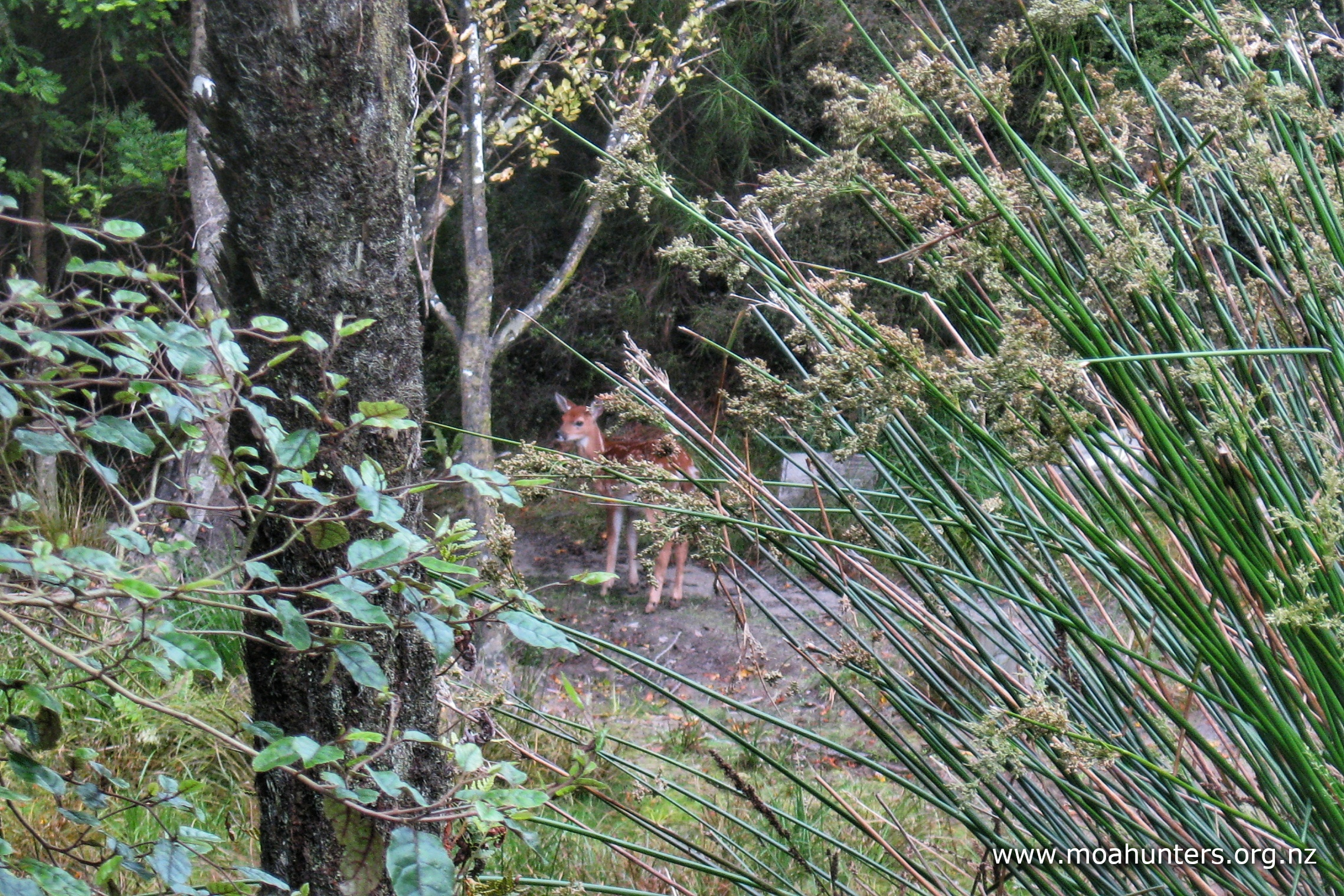
Aside from those effing wasps, the track was very lovely. We enjoyed easy walking across open grassy meadows (with plenty of deer sign), beautiful mossy forest, and easy riverbed sections.
Our pace today was a few notches above the usual Moa Hunter amble. After three hours walking we rolled up to a sun-drenched Morgan hut, and for the first time this trip were welcomed by an enthusiastic team of sandflies.
Those of us who prefer to avoid being bitten retreated into the the hut for an early lunch. The rest sat outside on the deck soaking up the sun while eating their rations.
After half an hour, the outside crew joined the inside crew. Apparently a few local wasps that had been slightly pesky hanging had become persistently pesky. It seems they had got a whiff of salami and biltong, and looking to harvest protein for their nest, had become disconcertingly aggressive.
Morgan hut is frequently used by hunters, and even has a gun rack just inside the door. Shells of various gauges decorate a window sill. With a large and inviting expanse of grassy flats in front of the hut, we wondered if any hunters had been lucky enough to bag an animal from the comfort of the deck.
It was high noon when we left Morgan hut to complete the last leg of our Moa Hunt. Destination D’Urville hut.
Walking across the grassy flats was a very pleasant experience. The sun was shining and winds were light. Inevitably the track did enter the forest, where we were treated to probably the best array of fungi we had seen on the trip.
Being autumn, amazing fungi were growing everywhere. We enjoyed spotting toadstools of all shapes, sizes and colours growing along the track. It was certainly a mycologists paradise.
The track did climb annoying high over a bluff about half an hour away from the hut. Chris and Magnus inadvertently missed a turn in the track and rather pleasingly for them, ended up in the riverbed instead. With flows low, they were able to cross back and forwards across the river braids and avoid the uphill grunt. If flows are low, you could probably walk a fair chunk of the trip between Morgan and D’Urville along the river.
We had a couple of short scroggin stops along the way. One beside a small creek that joined the D’Urville below, and one on a large expanse of shingle river bed.
As the valley opened out, we spent more time walking grassy flats and easy beech forest track. Enjoying the easy walking conditions, our pace picked up a little as we neared Lake Rotoroa.
It was 4:00pm when we arrived at D’Urville hut. Tied up to the jetty were two boats. Lounging back in one was Dudley, our water taxi captain. Anticipating our arrival time, he had motored across the lake to meet us. What an awesome guy, and what a great service. We had expected a thirty minute wait at the hut, but were able to board the boat shortly after arriving.
Dudley pointed the water taxi north and eased forward on the throttle. We all felt the usual mixed emotions. Happiness that we were heading back to see our families, but a little sadness to be leaving a beautiful part of New Zealand. Another Moa Hunt was done and dusted.
Just before we reached the far shore of the lake, the weather gods gave us one last little gift; as we looked back, a shower of rain caught some sun rays creating a pretty goodbye.
Those of us from outside Nelson are jealous our Northern tramping friends having the magnificent Kahurangi National Park right on their doorstep.
Valleys, ridges, and peaks are all highly accessible. It seems you can walk almost anywhere from wherever you are.
Our all too short exploration of the Diamond Lakes area took us through shady beech forests, along gnarly razorback ridges, atop high peaks, and onto the shores of six beautiful alpine lakes…
Moa Hunters on this trip: Magnus, Richard, Adam, Paul, Lewis, Chris, John, Logan
The Trip:
Day 1: Cobb reservoir to Sylvester hut Day 2: Sylvester hut to Ruby Lake Day 3: Ruby Lake to Lake Lockett Day 4: Lake Lockett to Cobb reservoir
SaturDay 21st January – Cobb Reservoir to Sylvester hut
The Cobb valley is a long way from anywhere. In fact, it even looks distant when you are standing in the middle of nowhere.
The closest Moa Hunter to the Cobb valley is Magnus, so we all met at his little slice of paradise on the outskirts of Nelson. Five of us made the five hour drive from Christchurch, while Lewis and Richard flew in from Wellington and Auckland.
By mid-morning Saturday we were all finally in one place and keen to head to the start of the track.
Despite Magnus’s lifestyle block being closest to the Cobb valley, it is still a significant drive. Three hours on the road, with the enormous Takaka hill standing ominously in our path. If you’ve driven the endless winding road that snakes over the Takaka hill, you know what I’m talking about.
With our bellies well full of an amazing cooked breakfast provided by Magnus and Venessa, we squeezed into the cars and rolled out.
We made two stops along the way: One at the historic Cobb power station (kind of mandatory when half the crew are engineer nerds!) And the second at the DOC lookout/shelter which commands a fantastic view down the Cobb reservoir (kind of mandatory for anyone with a camera).
The road into the reservoir is unsealed, but drivable in a standard two wheel drive car. Those with low ground clearance will need to be a little careful, though. The road has become crowned through use and the centre sits quite high in parts. If you aren’t driving with one set of wheels on the high point, your cars belly will scrape the shingle. We did a little road scraping here and there – it was hard to avoid….
The track starts at the northeast end of the reservoir. It was shortly after 2pm when we declared ourselves ready to hit the track. We took the obligatory group photo and were finally on our way.
The track trundles easily along a grassy flat above the reservoir until it hits Galena creek where the climb to Sylvester hut begins. Don’t be scared by the word climb here. The altitude gain is fairly gentle, and the track is wide and well formed. In fact, it is following the old access road built by workers during the construction of the Cobb dam and power station. No need for gaiters walking this section!
It felt good to be back with tramping boots on, wandering among the silver beech trees. Occasional tui swooped past, scolded by bellbirds for being too flashy. A group of rifleman, New Zealand’s tiniest birds even paid us a visit. About the size of golf balls, and just as spherical, they entertained us for a minute, bouncing from tree to tree before disappearing into the forest.
The musty odour of damp leaf litter mingles with the distinctive aroma of honeydew excreted by the aphids that suck the sweet sap of the beech trees. They say the sense of smell evokes memories more strongly than any other. Walking into the forest floated many pleasant tramping memories into our consciousness.
After an hour wandering up the trail, we stopped for a late lunch. Yep, not exactly pushing ourselves on Day 1!
It was almost exactly 4:00pm when we caught our first glimpse of Sylvester hut. Perched on a ridge at the edge of the forest, the hut has a lovely outlook, with views of the rolling hills of the Cobb valley from the deck.
Already settled at the hut were a family of three (two adults and a young fella) and two others who are workmates.
We poked our noses through the door and assured them there was no reason for alarm! To be fair, the sight of eight blokes marching up to what you thought would be a nice quiet hut must strike dread and despair into the hearts of many trampers. Our intention was always to setup a couple of tents and only sleep a few of us in the hut, so as not to overrun the place.
There are two not bad camping spots among the trees right behind the hut. If you prefer away from the hustle and bustle of hut life, there are many other good spots in the trees further away. Our preference is to chat with other trampers and briefly become friends with strangers.
In what is now a Moa Hunter tradition, marinated steak was fried up for dinner. For dessert, Chris put together a large grog-log inspired pud. Cookie time biscuits dipped into whisky were plopped into instant pudding and left to go a little soft. There was a lot, it was delicious, and we shared it with others in the hut.
That evening was spent chatting around a small camp fire. The wind was light and changeable and an eerie mist was descending the hills. Outdoor conditions were very pleasant, however we did have to shuffle positions regularly to escape the lazy curls of smoke drifting off the fire.
By 9:00pm dusk was gathering in and we were feeling a little tired. We called it a night and pulled ourselves into our sleeping bags.
Day 2
SunDay 22nd January – Sylvester hut to Ruby Lake
Sylvester hut catches the morning sun and those inside were up bright and early. Overhead the sky was a mix of brilliant blue and fluffy white clouds. Excellent conditions for being out on the tops.
The previous evening, Paul had put porridge oats in a big billy to soak. Doing this significantly reduces the cooking time required the following morning. With soft lumps of brown sugar on top, hot porridge always hits the spot on a tramping trip. Even Chris, who once upon a time scorned the Scottish staple, now regularly enjoys a second bowlful.
The tenting team of Adam, John, Paul and Lewis had a good night out under the trees. There was no wind, rain or weka attacks through the night. The tents were pulled down early and spread out on the hut deck to dry.
Despite this day being the longest and probably the toughest, there was no great rush to exit the hut. Days are long in late January, and for us, tramping is all about the journey, not the destination. We like to soak up and savour every sight, sound, smell and interaction along the way.
After a ridiculous number of team photos outside the hut, we were ready to stride out into the wilderness.
With the little hand almost on the nine, we were striding manfully up at the track to Lake Sylvester. Its shores are just ten minutes from the hut. The walk there takes in the last scraps of the old 4WD track before it peters out where Little Sylvester Lake reaches an arm out to be close to its big brother.
Camping beside the lakes would be superb on the right night. But with zero shelter from any wind direction, you would need to know the forecast! The low sun sparkled brightly on the lakes surface as we looked back across it toward the Arthur range.
There is a short easy climb from the Sylvester lakes to Iron Lake – another pretty body of water tucked snugly in a rocky tussock-rimmed bowl.
Iron Lake is the gateway to the high traverse. We decided to grab an early scroggin break at the lake edge. Clouds were scudding briskly over the tops, pushed on by a keen breeze. We knew it would be much colder and windier up there. The grassy meadow beside the lake could well be the last pleasant resting spot of the day. It was definitely the last place to grab a drink and fill water bottles for quite some time.
Lying back in the grass, we could make out a well trod route up the rocky slopes opposite. There is an unmistakable path below a distinctive rockface that angles up the slope. With binoculars we made out a couple of cairns higher up. Looking at the climb from a distance, we could see nothing too troubling. While following the well trod path would be easiest, it seemed you could make your way up Iron hill any way you saw fit.
On this trip, Logan had taken a punt on a new food item. A large tub of ricotta cheese. It certainly looked yummy, but the rest of the Moa Hunters were a little concerned about how well it would travel. As it turns out, not well at all when it falls between the pack liner and the pack! Logan did manage to retrieve the poor squished carton with most (not all) of its contents inside. It was very nearly a disastrous mess! Logan as always, met the cheese crisis with plenty of his indomitable good humour.
As we suspected, there were multiple ways to the top of Iron hill. Some a little gnarlier or steeper than others. At times we felt small, like worker ants as we weaved our way through the towering rock formations that protrude imposingly from the hillside.
Below us, Iron Lake sparkled a brilliant turquoise blue. As we climbed, previously hidden features like the small group of tarns that congregate near the Sylvester lakes gradually revealed themselves.
At 1695 metres above sea level, Iron hill is the highest peak in the area. It is 74 metres taller than Mt Lockett to the north, and 34 metres higher than Mt Benson to the northwest. It seemed odd to us that it too didn’t earn the title of “mountain”.
At the summit, the views are understandably epic.
It was 11:30am when we all gathered at the peak, turning round again, and again, trying to take in all of the 360 degree views at once. It is hard for the brain to comprehend the sheer scale of what you see from Iron hill, and even harder to put it into words here. The pictures below do it limited justice, but to fully understand, you will need to pull your boots on and get yourself up there!
Nestled in a deep bowl below its mountain namesake lies Lake Lockett. From Iron hill it is a prominent and spectacular feature, demanding attention. Looking down at its rippled surface from Iron hill, we enjoyed the thought that we would be camped there in just a couple of nights.
As predicted from the lake below, it was rather chilly atop Iron hill. The wind was keen and steadily chilled us down. With many photos taken, we made our way northwest along the ridge.
There is a well worn track to follow along the tops. It leads fairly directly along the slim rocky spines of the mountain ridges, only occasionally dropping below the most dauntingly narrow ones.
Lake Lillie and Diamond Lake didn’t take long to show their faces below us as we made our way along the tops.
All around us the the terrain was magnificent. Giant craggy knobs of sharp rock protruded from the hill, to be skirted around like vast crusty warts. (How’s that for a dreadful metaphor!)
Against all expectations, we found the perfect spot for a lunch break. A lush green meadow below the ridge offered super views, protection from the wind and a comfy spot for a snooze.
We dumped our packs and tucked hungrily into lunch rations. Life felt good. Very good.
Every tramper knows that feeling of privilege when the vast beauty of Aotearoa lies before us, unseen by so many others. Sitting on that grassy slope in the sun, taking in million dollar views, none of us could think of a place we would rather be eating lunch that day.
After a lazy hour (and a bit!) in the sun, we somewhat reluctantly hefted packs and left our emerald green meadow. Weaving through an alpine field of flowering daisies, we continued our traverse of the ridge toward Ruby Lake.
At 2:00pm we had a clear view of our destination, and the likely route to get there. Ruby Lake is not regularly visited. There is no marked route from the ridge to her shores.
We all agreed there was an obvious saddle ahead that would be the best point to drop off the ridge. From there we would stay high and sidle to the top of the first finger of beech forest that pushes up the hill. Once there we would regroup and reassess.
The traverse off the saddle was not as terrible as many we have done. But still had its challenges. Every trampers enemy, spaniard grass was present in good numbers, ready to welcome a poorly placed leg or careless hand with its hypodermic spines.
From the top of the first finger of beech forest, there is another sidle across to the top of the next finger. Beyond that, the nastiest drop-off of the day lay ahead.
It is best to traverse down this steep section at about 45 degrees. This avoids a very steep bluffed section directly below that would be dangerous to attempt. And yes, there’s plenty of spaniard about to keep you honest here too.
Beyond the steep section, the going quickly gets much better. An easy but occasionally boggy slope took us down to the shore of a gorgeously clear Ruby Lake. There are no camping spots right on the lake edge. But to the right as you face the lake, there is an easily found path up into the beech forest.
In the first clearing we found two very good spots for tents. A third was marginal and required a bit of landscaping and pruning to fit a tent. Groups of eight probably don’t visit Ruby Lake very often. Chris erected his fly shelter in the next clearing above us.
There is an established campfire in the clearing, but we chose not to light it that night, despite the freezing wind. Around us the bush and grass in the area felt very dry. An open fire was deemed too risky.
As the sun sank lower, the wind got colder. Freezing cold in fact. Icy fingers pushed through all our layers of clothes, then wickedly whipped away our body heat. Despite wearing our thermals, jackets, beanies and gloves, it felt very cold indeed.
A hot curry and cheesecake dessert warmed us for a short while, but by 8:30pm we were all shivering a little. The lure of a warm sleeping bag was too great, and we all retired to the tents early.
Day 3
MonDay 23rd January – Ruby Lake to Lake Lockett
One by one the Moa Hunters crawled out of their tents and blinking at the brightness. By all accounts everyone had a reasonable sleep. Reasonable by tent standards… but less than average if at home!
The breeze was already warmer than the previous evening. It looked like the day was shaping up to be a balmy and dry one. Bellbirds in the branches above us were calling out to their mates. Or perhaps prospective mates. The odd tui swooped overhead, like Tom Cruise’s Maverick buzzing the tower. The distinctive whoop-whoop of their wing beats alerting us to their passing through.
There was a nice patch of hot morning sun on the trees at one end of the clearing. We hung our tent flies up on those tree branches to dry off any condensation or dew. Tent inners were flipped on their sides to let the footprints dry. It turns out they were not really damp at all.
Given we had a fairly light day on the track, we dawdled along with packing up the campsite. There was no rush to be out of there, and we were all enjoying the pleasant surroundings and usual chatty banter.
Yet another group photo was snapped at 9:15am. With that, we were finally off.
The previous afternoon, Paul and Richard had scoped out an exit strategy. We followed them down the path that leads back down to the lake edge, then round to the left/east and into a clearing that extends a short way into the beech forest.
Travel through the forest was surprisingly pleasant. It was far from dense, with no sneaky supplejack vines waiting to grab at packs or ankles. We made easy progress down the hill, passing an interesting rocky outcrop with a small cave on our right not long after entering the forest.
Keeping the outlet stream within earshot on our left we made it to a tussocky clearing. At this point the ground ahead started to rise and Ruby stream was disappearing away to the north. We left Ruby stream and made our way up the shallow valley. We crossed to the true right of an unnamed stream that flows down to join Ruby stream and from there up onto drier ground.
Above the stream there were wide swathes of demolished ground. Wild pigs rooting for food had torn up significant areas of tussock and grass, leaving quite a mess behind them. On the bright side, those areas were easy to walk through. However, we’d rather have to push through pristine undamaged tussockland and have those pigs sizzling in a frying pan instead.
Walking up the valley, conditions were predominantly dry underfoot. But shortly before reaching the highpoint between Ruby Lake and Diamond Lake we struck a low lying and particularly boggy section. It seemed there were more places to go up to your knees in the red-brown mud than solid ground. Even standing on the tussock, there was an even chance it would wobble and collapse into the muck, taking you with it. Fortunately the bogland was short-lived, and were soon back into tussock, flax, and our favourite enemy, spaniard.
Having maligned poor old spaniard a fair bit in this post, I should cut it a little slack. The plants in this area of Kahurangi are actually quite small and easily dodged. We have walked among far larger and far more vicious spaniard in other parts of the country.
At the highpoint of the valley we stopped for a break. Chris officially named the spot “Bog End Saddle”. Large cumulus clouds covering much of the sky gave us pleasant shady conditions. As we munched on scroggin, the sun would occasionally find a gap, and it was blazingly hot when it did. Sunscreen was applied again, and many of us covered our legs with jackets to avoid being burnt.
From where we lazed in the sun we could see Diamond Lake, living up to its name, sparkling in the sun at the end of the valley. The walk from where we were to the lake looked very much like more of the same. Tall tussock, flax, spaniard, and the odd boggy section.
There were no surprises between Bog End Saddle and the lake. At a convenient spot close to the lake, we crossed to the true left of a small stream that runs into it from the valley.
Reaching the lake edge we turned left, following the bank until we reached a stand of beech trees. There is no path as such through the trees, but they are widely spaced and it is a short easy walk to the shingle beach at the eastern end of the lake.
The sun was shining, the breeze was light, the surroundings idyllic. Not going for a swim would have been an unforgivable travesty.
Lewis and Paul were first in the water, with other Moa Hunters not far behind. For an alpine lake, the water was surprisingly mild. Not quite what you would call warm, but also not bone-achingly cold like many mountain tarns and lakes.
After the refreshing dip, jolly conveniently, it was right on lunch time.
For the second lunch break in a row it was hard not to feel like the luckiest people on the planet. In front of us we had our own private lake glittering in the midday heat. Behind us stood the cool beech forest offering pleasant respite from the hot sun. All the resident sandflies were strangely absent. Perhaps they had all been hauled into one of those inconvenient lunchtime Zoom meetings.
Camping at Diamond Lake would be amazing. There were plenty of excellent spots among the beech trees to put up a tent.
But, alas, we were not staying. With packs on our backs again, we left the beach and followed the lake inlet out through the forest until we found the track – a trapping line that links Diamond Lake to Lake Lockett.
After a couple of days making our own route through unmarked terrain, it felt strange to be following a well trod track again. Evenly spaced red triangular plastic markers nailed to trees made doubly sure the track was easily followed.
We enjoyed the delights of the primordial forest. The air had a cool musty scent. Flat growths of ancient looking silver green lichen massed on tree trunks. Wispy clumps of old man’s beard lichen clung to branches like snagged sheep wool. Fallen logs were smothered with rich green moss.
Bright red flowers fallen on the track alerted us to something unusual. Attached high on a large beech tree that overhung the track was a New Zealand mistletoe. These semi-parasitic plants are endangered in parts of the country, being a favourite snack for possums.
Along the easy track through to Lake Lockett we noticed several numbered wooden traps, likely targeting rats or stoats.
Shortly after 2:30pm we were standing on the shore of Lake Lockett. A fairly short day on the track by anyone’s standards, but also very pleasant. We were not complaining.
Heavier cloud cover had cooled the afternoon noticeably. We were very pleased to have taken the opportunity for a swim at Diamond Lake. The overcast conditions made a dive into Lake Lockett less alluring. Instead we dropped our packs in the first clearing and had a wander, checking out the best camping spots.
It turned out the best area was occupied, but only temporarily. A nice fella named Jonathan was enjoying the lake from a clearing just a minutes walk through the trees. He had obviously read the intentions book at the start of the track. “You must be the Moa Hunters” was how he greeted us.
We wandered back to our packs and sat down for a while until Jonathan wandered on. We didn’t want to be rude and setup camp all about him while he was enjoying the solitude.
A friendly weka joined us while we chatted, darting in and out of the trees to inspect our packs. We all knew the friendliness was a cunning deception. The weka’s beady eye was furtive, always looking for unattended food or other carelessly placed goodies. We kept a close eye on our sneaky little mate.
An hour or so later, Jonathan strode through and bade us farewell. We took that as a signal to setup camp, and carried our bags to the clearing he had vacated.
It was a lovely spot, with a nice campfire at one end, complete with a beech log seat. We easily found four good tent sites in the large space and had them erected in short order.
Lake Lockett is a beautiful setting. The largest of the six lakes visited on our trip, it is flanked by steep rocky hills. Reddish coloured scree paints stripes between grassy patches and the bulging protrusions of rock that punctuate the slopes. Patches of beech forest add contrast to the scene. Closer in, flax and beech saplings dot the shore looking like they were carefully planted by a landscape gardener with an eye for a good photo.
Come dinner time, we were gathered around a small campfire handing a bottle of yummy Glayva around. Another beech log seat was added beside the campfire, creating a few extra spots to sit and enjoy watching the flames.
With the fire crackling warmly and much milder temperatures than at Ruby Lake, we stayed up longer this evening. Even when there was no conversation, staring at the mesmerising flames of the fire and listening to the murmur of the forest was extremely pleasant. Lazy curls of mist were rolling in over the hilltops as dusk fell. Frequent trips were made to the lake edge to survey the ever-changing view.
Day 4
TuesDay 24th January – Lake Lockett to Cobb Reservoir
We awoke early to a clear fresh morning. It had rained lightly overnight, but the morning held no threat of any further precipitation. The sheltered ground under the beech trees was barely wet.
Wisps of mist rising off the lake were gently swirling and twisting, pushed like ethereal ballerinas across the glassy water by an almost imperceptible breeze. Watching on was an enchanting and beautiful way to start our last day.
As if that visual feast wasn’t enough, the bellbirds were in full song, chiming across the lake with some of the more intricate and complex calls I have heard.
The aim was to be packed up quickly on this day. Lewis and Richard had flights out of Nelson to catch, and the Christchurch crew had eight hours driving between them and their homes. Breakfast was eaten by 7:00am and then the camp became a flurry of packing up action. Damp tents were rolled up as they were. They would be dried properly after the tramp. The campfire was stirred again and thoroughly soaked to make sure we didn’t leave a disaster behind.
At 8:15am Logan led us away from the campsite, back onto the track we walked in on. Leading out was a decision he would quickly regret… The long grasses that leaned across the track were very wet from the overnight showers. On these damp mornings, last place in the line is where the real winner is found.
Less than five minutes from the lake is a junction in the track. We deviated to the left and began the four hour walk back to the carpark.
The first section of track makes its way up and down a couple of steepish sections. The beech trees were more stunted as we gained a little altitude. We passed through an outlier patch of Mountain Neinei. Less than a dozen trees clustered together on a particularly steep piece of the track. Strangely it was the only large Dracophyllum we saw the entire walk. Chris likes to call them Truffula trees. Dr Seuss fans will get the reference.
We grabbed our first scroggin break a little before 9:20am. It seemed odd to be having a rest at the time we had been setting off from camp on previous days!
Half an hour after the break we faced the only river crossing of any consequence on the trip. The flow was very low and there were plenty of rocks to hop across. The entire Moa Hunter team were happy to keep their toes dry.
Once across the river, the valley broadens and flattens, making for much quicker pace. We maintained a brisk walk, keen to make good time while still enjoying our surroundings.
Roughly halfway between the lake and the carpark is a wooden seat, neatly constructed under a large rock overhang. It would have been rude not to make use of it after all the work that went into making it. We called in another scroggin break and tested the seat for comfort.
Beyond the seat we saw the first beech trees with a lot of sooty fungus on them. We wondered why there would be more here than elsewhere on our trip. Sooty fungus is a sign there are aphids excreting honeydew on the trees. Unfortunately with the sweet honeydew come wicked wasps…
We stumbled on our first wasp nest not too far from the seat. John called back to say he had just been stung. Within a few seconds, Adam also had a painful sting on his calf. We quickly put some distance between us and the nest, which was inconveniently right in the middle of the track.
Another nest was disturbed a little further up the trail. Again it was located right where people tend to tread, just beside a root on the track. This time we were luckier and didn’t earn any stings.
We acknowledge that wasps didn’t ask to be introduced into New Zealand, and that they simply defending their nests from threats. But… it’s still hard not to despise the vicious little bastards.
At this point, we must tip our hats to the Diamond Stream Team and the Friends of the Cobb Valley, who work very hard setting traps to preserve the Cobb valley area. You guys and gals are awesome.
Just prior to high noon we popped out of the bush into a clearing just above an old quarry site. We were within a stones throw of the cars, but the grassy clearing with nice shade from the trees was a perfect spot to grab a quick bite of lunch.
From the quarry, it is perhaps fifteen minutes to the carpark. Maybe twenty. Whichever, it seemed that after lunch we were there in no time. Packs and poles were loaded into cars and we began the long trip home.
Another Moa Hunt was over. It would have been nice to have spent longer exploring the Diamond Lakes area. There are so many possibilities there, and it is such a beautiful area. So many valleys to drift down. Endless ridges to traverse. I’m sure we will be back there one day.
Rakiura Stewart Island is the home of New Zealand’s southernmost Department of Conservation hut. Nestled just below latitude 47° south, the Doughboy hut is as close as it gets to the south pole when walking DOC tracks. We were all excited to visit Doughboy, not only because it is a looong way south, but also due to its stunning looking location and intriguing name…
Moa Hunters on this trip: Adam, John, Paul, Luke, Chris, Logan, Richard
The Trip:
Day 1: Christchurch to Fred’s Camp hut Day 2: Fred’s Camp hut to Rakeahua hut Day 3: Side trip: Mt Rakeahua Day 4: Rakeahua hut to Doughboy hut Day 5: Exploring Doughboy bay Day 6: Doughboy hut to Mason Bay hut Day 7: Mason Bay hut to Freshwater hut Day 8: Freshwater hut to North Arm campsite Day 9: North Arm campsite to Oban to Christchurch
Google Earth flyover of the approximate Rakiura Southern circuit route
Day 1
SATURDay 15th JANUARY – CHRISTCHURCH to Fred’s CAMP hut
Quite a bit of planning and logistics work went into getting us to this day. More than the usual, and much of it taking place months in advance. Early morning transport to Christchurch airport, flights, shuttlebus transfers, ferry bookings, gear storage, food and equipment drop-offs and water taxi rides were all arranged well ahead of time. Some taking many e-mails and phone calls back and forwards.
We will assume you are all familiar with the blah-de-blah of flights, buses and ferries, and fast-forward you to Oban – the largest, smallest, and only town on Rakiura Stewart Island.
Just ahead of 2:45pm Saturday afternoon, our ginger-bearded and slightly wild ferry captain (who must have Viking ancestry) expertly nudged the Foveaux Express alongside the Oban wharf and ferry terminal, announcing briskly that we had arrived. The trip from Bluff had been a relatively smooth one, which was a relief to us all given the rather formidable reputation of Foveaux Strait.
We bought some supplies at the Oban 4 Square store, then wandered up Main Street to the Rakiura Charters and Water Taxi office and dropped off two boxes of additional goodies and supplies. These would be taken out to Freshwater hut on day seven of our walk, saving us unnecessary work carrying tents and other heavy gear around the Southern circuit to that point. Moa Hunters hate unnecessary work.
Walking to Golden Bay from Oban gave our legs an early preview of the days to come. Loaded with shared food, lunches and scroggin, our packs felt heavy. Unaccustomed to the extra weight, our quad and calf muscles soon let us know the small hill between Oban and Golden Bay is quite steep.
The sky above was clear blue. Rakiura was on display at it’s magnificent best. The late-afternoon sun shone through the crystal clear water of Golden Bay revealing every detail of the sea floor for us to enjoy. Boisterous tui called to each other as they flitted from one flowering flax to another. It really felt like we had arrived in paradise.
The water taxi ride across Paterson Inlet to Fred’s camp at the head of southwest arm takes a bit over twenty minutes. As we eased into the small jetty we could see a couple of hunters on shore. We had been told there were hunters already based at the hut, so it was no surprise. They had fishing gear on the jetty and some camp chairs parked in a sunny spot near the hut. Hunters are always very well setup with gear on their trips.
We hefted our packs up onto the jetty, thanked Chris the water taxi captain, and made our way towards the hut. Our three hunter friends were Alan, Allan and Leathen. They had been at the hut a few days and were planning a mix of deer stalking and fishing to fill their time. It was Leathen’s first trip to Rakiura and we could tell Alan and Allan were keen to ensure he enjoyed his time there. The two older men had been to the Island many times before and knew this area well.
We felt a bit guilty as we piled all our gear into the ten bunk hut, squeezing poor Alan, Allan and Leathen down to the far end as we set about cooking our dinner. Especially when they were so generous offering the use of their kettle, cooker and other items. We got on well with the three men and enjoyed hearing tales of their previous trips to Rakiura.
It was at dinner time that Chris unveiled his new tramping innovation – a hunting ammo pouch converted into a spice rack. No tramping trip should be without one – brilliant!
After downing our mashed spud and marinated steak, we joined the hunters for a spot of fishing off the jetty. It seems the only fish in the area are aggressive little wrasse that are adept at removing bait from hooks. We caught a couple, but mainly fattened the rest of the greedy population with free feeds of bait. All good fun.
Day 2
SUNDay 16th January – Fred’s Camp hut to Rakeahua hut
Despite having a fairly leisurely day ahead with no significant climbs, we were all up fairly bright and early. The sky was clear and the air cool. Looking down from the hut, the jetty was just a silhouette against the sea and brightening sky. A few of us wandered down to savour the start of the day. It was a lovely moment watching the first sunrays of the day flash out across the water as the sun peeked over the bush-clad hill to our east. A light breeze stirred, being generated almost immediately by the sun’s power as it began to warm the bay.
The sandflies were particularly active at sunrise – a constant annoyance on the jetty. However, as the morning warmed, they thinned out and skulked off back into the cooler bush.
Our breakfast was an elaborate and massively over-catered affair. Bacon, black pudding, eggs, mushrooms, tomatoes and hash browns were all on the menu. It was all too much food, and Paul was definitely over cooking it! We left the hash browns for the three hunters, and opted to carry the mushrooms and tomato on to the next hut.
By 9:30am our dishes were washed and gear had been jammed back into very full packs. We were ready to hit the track to Rakeahua. Allan, Alan and Leathen cheerfully accepted their roles as official Moa Hunter photographers and snapped some photos of us outside the hut.
We said our goodbyes to the friendly hunter trio and filed off down the track towards Rakeahua.
It felt good to be out in the bush on Rakiura again. Somehow the place feels like an old friend, with lots of fond memories for those who were here back in 2015 doing the Northwest Circuit. Walking under the tall rimu and the other mighty podocarps, knowing there may be busy kiwi fossicking among the ferns just metres away is a special feeling. One that you don’t experience anywhere else in New Zealand.
It didn’t take long for us to break into a sweat on the track. The sun was shining brightly through the canopy above. With not a whisper of wind, the air around us felt hot and close, leaving us wishing for a cool breeze. We drank plenty of water whenever we could.
The track follows the coast for the most part, offering regular glimpses of southwest arm through the thick bush, before ducking into another tight gully. We encountered nothing too tricky, but with heavy packs in hot conditions, the walk felt more tiring than it should have. On the bright side, an advantage of the recent dry weather was less mud and less slipping and sliding.
At our morning scroggin stop, Paul managed to find a particularly pungent and nasty turd to sit on. Whatever the animal that deposited it there, it did not look good, and most definitely did not smell good. Adding to his woes, Paul’s so-called Moa Hunter friends were rolling about laughing and making generally unhelpful suggestions. It would be fair to say Paul was in no danger of drowning in their sympathy!
The track frequently ran close to the coast, and we briefly wondered whether walking the beach would be faster and easier. The tide was out and it seemed like a possibility. We decided not to bother. As they say, the grass always looks greener on the other side, and the track we were travelling wasn’t bad.
As we walked, we kept an eye on the how distant the far side of southwest arm seemed. Knowing the arm narrows steadily as the track gets closer to the Rakeahua river, we used this as a bit of a gauge for where we were.
We stopped for a long languid lunch not long after 12:30pm. It was very pleasant nestled down amongst the ferns, transferring some weight from our packs to our stomachs. With no reason to rush, we settled in for a very enjoyable hour of chatting and snoozing in the afternoon heat.
Beyond our lunch stop the track continued much the same as it had prior, winding its way through beautiful podocarp forest.
It wasn’t until after our mid-afternoon scroggin stop that track conditions began to change. We had reached the flats near the Rakeahua river mouth and underfoot was getting a lot more boggy. Areas of mud and swamp with helpful branches thrown down on them by other trampers became common. The last third of our day was spent on alternating flat easy sections and messy boglands.
We were able to pick our way around some patches. Others required good balance and a bit of luck. We all misplaced a foot at some stage, ending up in deep mud swamp water or gloop. It’s all part of the Rakiura experience and we enjoyed the challenge.
The “walk of faith” was a particularly awesome swamp crossing. A rare section of boardwalk, now totally submerged in muddy water has been marked by trampers with manuka poles on either side. The only option here is to walk between the poles with butt cheeks clenched tight, trusting the marked path, and hoping you don’t step off the side and go for a swim!
At one point Adam partially lost his balance, leaning out on his walking pole to regain himself. The pole was no help at all. It disappeared straight down into the swamp until he was up to his wrist in gloop. The pole had been completely swallowed into the depths of the swamp, with Adam still clutching it. He somehow recovered the situation without going in headfirst, but that experience let us all know just how deep the Rakiura bogs can get…
We arrived at Rakeahua hut just after 5:00pm. It had been a good day on the track. We dropped our packs and went for a quick nosey down a short track to see “The Landing” – a spot that water taxis occasionally motor up to on the river.
The hut is snugged in beside a stand of large mature macrocarpa trees. They are impressive, but somewhat out of place amongst the native bush.
We wondered if they are relics of one of the many failed farming attempts that happened around the island. Rakiura soil is quite acidic and wet, making it generally unsuitable for pasture or crop farming.
Another notable feature of the hut is a large and overly-friendly bumblebee population. Inside and outside the hut, they made a nuisance of themselves buzzing round our faces and clothes. Given they are not aggressive by nature, we weren’t overly concerned by this behaviour. It was just irritating to be continually pestered by them.
Dinner was a delicious Moa Hunter curry which we all wolfed down. Our colossal breakfast was now a distant memory as we downed an equally colossal meal, followed by ambrosia for dessert.
After dessert, John was heard swearing to himself. It seemed he had left his headlight hanging on a nail above his bunk back at Fred’s camp hut. Shortly after, Adam discovered that he too had left his headlight at the hut, plus a small hut light he’d bought for the trip. And finally, Richard realised he had left his silk liner there too.
What a bunch of plonkers.
We assumed Alan, Allan and Leathen would have found our forgotten items by now. No doubt they would all be wondering how the hell we manage these long trips, when we can’t even keep track of basic gear!
It was at this hut that Luke and Paul presented John with a flag they had made. Before coming to Rakiura, Luke had been pondering just how deep the mud might be, and had decided that our shortest member should have a flag to carry. His thought was that if they dropped into mud over head height, the flag could be waved to show their position! John accepted the flag-bearer honour in very good humour.
That evening, Chris decided to head out again with his hunting longbow. He had brought the weapon on this trip to see if he could get himself a whitetail deer. His previous effort at Fred’s camp on our first night had not been successful. However, he had seen one there, which gave him hope. Unfortunately on this evening, he did not see or hear anything.
As the hut is a classic six bunk model and there were seven of us, Adam slept on air mattresses on the floor.
It was an uncomfortable night for all. Plagued by sandflies and mozzies, finding the right balance of being covered and protected from the little biters, but not overheating, was hard to achieve!
Day 3
MONDay 17th JANUARY – Mt Rakeahua
After a less than average night’s sleep, we were greeted by pleasantly overcast conditions at Rakeahua hut. High cloud providing some respite from the full heat of the sun was ideal for our planned wander up Mt Rakeahua.
Breakfast was coconutty porridge and a round of coffees. Richard had brought along his Aeropress coffee gadget – a wonderful lightweight espresso coffee machine, perfect for trampers who like to start their day with a caffeinated kick in the pants.
We were all feeling relaxed and in good spirits, looking forward to a leisurely day walking without our packs on. We chatted about everything and nothing as we waved away bumblebees and gathered up the food and gear we wanted to take up the maunga.
Just after 9:00am we set out from the hut for Mt Rakeahua. With us we had a couple of light bags containing food, jackets and some warm layers. We agreed to take turns carrying them.
Weaving through low bracken and occasional muddy areas, the track is flat and easy for the first ten minutes or so. It had been so dry on Rakiura this past week that some of the mud had dried out completely.
Leaving the flats, the track climbs gently and steadily through beautiful podocarp forest. There were large rimu in all directions, their tall straight trunks conspicuous and grand. Below them, the next generation of spindly saplings were pushing upwards for their chance at a place in the canopy.
On the forest floor we noticed a lot of signs of kiwi activity. Distinctive cone shaped bore holes in the mud were everywhere, marking the places where busy kiwi had been burrowing in with their beaks, chasing grubs, worms and other tasty morsels.
There is a stream about 30 minutes walk from the hut that is suitable for collecting drinking water from. We also filled our bottles at a large clear tarn about 50 minutes from the summit. In wet weather there would likely be other small streams full enough to collect water from. If you don’t mind stream or tarn water, there’s no need to carry water on this day trip.
As we gained altitude, the forest around us abruptly changed its nature. The large rimu disappeared in the space of a few steps, and we found ourselves walking through tunnels of gnarled manuka. The verdant sea of mosses, grasses and ferns evaporated, replaced by tangled scrubby brush.
The last half hour to the summit is above the bushline, with increasingly expansive views of Rakiura Stewart Island opening up. A note in the hut book had said there is a cold breeze atop the mount. That seemed hard to believe in the warm conditions back in the forest. But as we progressed up the exposed slopes, an icy chill on the breeze reminded us this wind had recently blown across the frigid southern ocean!
We were surprised to still find signs of kiwi activity at this altitude, exposed and well beyond the cover of the thicker bush. The small clumps of scrub must provide sufficient hiding spots for them to confidently venture this high.
There is a communications tower close to the summit, with a couple of tall rocky knobs to clamber up on and take in the 360° views.
Standing on the summit in clear conditions we were treated to views of Paterson Inlet with all its intricate bays and islands. To the west, Mason bay’s majestic sweep of white sand is easily spotted, as is Rakiura’s tallest peak, Mt Anglem in the north. Looking south into wilder and less travelled territory, we could see the misty Tin range.
Standing about 50 metres below the summit looking south we could also make out the distant cluster of macrocarpa trees marking the location of the hut.
We all took photographs in every direction, knowing they would never do the views full justice. There’s always more to a spectacular view than just what your eyes see. There’s the feelings of euphoria and privilege as you take it all in… the cool freshness of the mountain air filling your lungs as you take a deep breath. It all adds up to something more than can be conveyed by a photo. It’s the reason we put on packs and actually walk to these places.
It had taken us 2 hours 45 minutes to reach the summit. We had plenty of time to enjoy Mt Rakeahua, so we found ourselves a comfy spot on the sheltered side of a rocky outcrop. We pulled out our food and settled down to enjoy lunch at the café with a ten million dollar view. Out of the breeze and pleasantly warm, some of us took the opportunity to close our eyes and enjoy a sneaky snooze.
The walk back down to the hut seemed to be over very quickly. We all enjoyed the easy conditions, unencumbered by heavy packs.
Spaghetti Bolognese for dinner was expertly prepared by Paul and Chris. A mushroom and black pudding entrée was also served. Luxury!
As we sat outside eating and shooing bumblebees away, a fit looking young fella called Matt walked up from the Doughboy bay track. He had just smashed it out in five hours! Most impressive for a 6-7 hour DOC track time on that section. Having finished the Te Araroa trail (South Island leg only) a week ago, he had decided he might as well do Rakiura as well. Well, why not…
We shared some food with him and offered to make space in the hut. He contemplated that for a minute or two, but decided that he would push on the Fred’s camp, we assumed hoping it would be less crowded! Fair call.
Day 4
TUESDay 18th JANUARY – Rakeahua hut to Doughboy hut
For reasons unknown, the sandflies and mozzies had decided to stay away overnight. We didn’t care what party they had headed off to, it was just nice to not have them buzzing our heads overnight.
We had all slept a little better in cooler conditions than the previous night, and were feeling fresh and ready to get going. Breakfast was porridge, and we were packed and ready to step out onto the track by 8:30am. Before leaving we swept the hut, then checked, double checked, and triple checked we hadn’t left anything inside!
As seems to be the usual on DOC walks, the first ten minutes from the hut was very pleasant, the track meandering through fairly dense manuka with little mud or sticky conditions.
And as seems usual for Rakiura, the lack of mud did not last long! We soon found ourselves involved in a fairly long section of increasingly boggy mess. Initially this was mud patches that could be skirted round via alternate “side tracks” weaving amongst the manuka. But as the terrain got flatter, conditions got swampier and we often found ourselves looking for fallen branches to create safe crossings with.
Stepping into the mud in these areas often releases a waft of pungent sulphurous odour. Years and years of slowly decaying plant material in the mud makes some patches of gloop rather aromatic. These are definitely the mud pits to very specifically avoid falling into!
Chris, however, did manage to find himself a particularly deep and sticky mud pie to drop into. Getting his leg out and making sure he still had a boot on the end of it proved to be a short but very entertaining challenge.
With all the diverting around bogs, we did briefly find ourselves geographically embarrassed, suddenly left scratching our heads in open territory without a track or any track markers.
We had been following a well walked path that skirted to the right of a particularly boggy area. The path entered an open marsh area and quietly faded away to nothing. Unable to spot any friendly triangular orange markers in any direction, we knew we were in the wrong place. We fanned out and hunted for the right place. It wasn’t long before Chris gave a shout. He had located the track over a bank to our left, in far less swampy terrain.
After slopping through the messy bogs for almost an hour, we were pleased to see the track moving up onto higher ground away from the river. This was the start of a lovely sidle through tall forest with a carpet of ferns below. With very little mud to negotiate, we all took the time to enjoy the delights of the forest, keeping an ever watchful eye out for kiwi amongst the ferns. It’s amazing how many mossy shapes in the undergrowth look just like a kiwi when you really want to see one!
Beyond the sidle, we popped out of the forest again and onto scrubby lowlands, but this time with much less mud. The few messy areas we encountered were easily skirted round, or in many cases, simply walked across.
Due to a lack of accessible streams in the area, our lunch break was a little later than usual. It was quite a warm and humid morning, and we were keen to take the break beside some cool drinking water. This didn’t eventuate until a bit after 1:00pm when the track finally crossed a stream large enough to fill our drink bottles. We were all getting quite hungry by this time.
Logan sporting his special Moa Hunt Mountains haircut. Tidy!
Moa Hunter packed lunches were all very similar on this trip. Salami, crackers, tuna pockets, cheese slices and muesli bars were a recurring theme …except for Chris, who slightly bizarrely had gingernuts in place of crackers. To be fair, the rest of us struggled with his gingernut, cheese and salami combo. Equally, the gingernut and marmite ensemble would only be contemplated in an emergency.
Walking on from our lunch spot, we began the slow but steady climb towards Doughboy hill. Conditions today were not sunny overhead, but it was hot on the track with barely a breath of wind down in the forest. It was not long before we were all perspiring heavily again.
By mid afternoon we were on a steeper section of track, following up a rough ridge. Very quickly the forest canopy dropped away and left us once again surrounded by tangled manuka and scrub. It was almost like a switch had been flicked eliminating the taller podocarp forest, it happened so sharply.
The stunted manuka wasn’t with us long either. By 3:00pm we were effectively above the bushline. Misty low cloud was blowing across the tops, pushed along at good pace by a chilly breeze. We found ourselves a spot sheltered from the wind to nestle down in and munch some scroggin. No longer feeling too hot, some of us pulled on polarfleece tops or jackets.
Ahead we could see a high point that we assumed and hoped was the the top of Doughboy hill.
It turns out the high point ahead of us was not the top. Nor was the one after that. Or the one after that… In fact, it was another solid hour of walking the tops before we came to what was clearly the peak of Doughboy hill.
That hour was spent on messy, but remarkable terrain. We picked our way up steep muddy sections that climbed through what we all agreed resembled bone fields. Broken, twisted and sun bleached branches littered the track in huge quantities, looking for all the world like the bones of dinosaurs, scattered about after some cataclysmic extinction event.
Between the bone fields were wide bogs and marshes that required skirting. Getting from A to B was often a circuitous and very indirect route!
After a seemingly endless lineup of false peaks, we were all relieved to be standing on the highest point of Doughboy and ready for a descent. Unfortunately any possibility of enjoying the view from there was obliterated by the cold damp misty conditions. We did not linger at the top, choosing instead to scamper down for the shelter of the bush below.
Much as the climb onto the tops had been, the first half hour of the descent was just a little bit nasty – steep and muddy, with plenty of slippery tangled roots. Picking our way down was a bit faster than the ascent, but no less demanding.
Beyond the nasty stuff, the track levels out into podocarp forest again, through which we could hear the sound of waves breaking at Doughboy bay below. Before long we also caught some glimpses of sandy beach through the trees.
It was after 5:30pm when we finally stepped out onto the bay. Following quite an array of boot prints across the sand, we wandered down the beach enjoying the lovely surroundings.
At the top of the bay we came to a couple of tents and a shelter setup on the edge of the bush. We said hello to the family who were sitting comfortably around a campfire. They had flown into Doughboy on a hunting expedition and would be walking out in a couple of days.
They had caught blue cod off the rocks the day before which was good news. We hoped to be able to do the same! Hunter-bloke Steve and his partner Esther had four boys with them ranging from 7 to 16 years old. They were certainly a keen family, and we admired them for camping in such a remote place.
We asked where the hut was, and were told we had walked right past it! Clearly the buoys hung on poles in the dunes five minutes back should have been more obvious to us. It had been a long day and we were tired. That’s our excuse, and we’re sticking to it.
It had been nine and a half hours on the track, so dropping our packs outside Doughboy Bay pack hut felt particularly good. We ate a very nice Thai style curry rice dish for dinner, enjoying some chill time in the hut, knowing we had a lazy day tomorrow to enjoy the bay.
After eating, we went for a wander back down the beach towards the track exit, keeping an eye out for a big cave we knew was hiding in the bush. We found it quite easily, and had a snoop around inside. You could certainly shelter in it comfortably for quite some time. It is huge!
On our way back we saw three trampers walking across the beach towards the hut. It was 9:30pm by this time and just going dusk. They had left their arrival quite late! At the hut we introduced ourselves to Xander, Zoe and Alba. As all trampers tend to be, they were a really great bunch, genuinely friendly, and insisted we didn’t need to vacate any bunk space for them. Xander and Alba setup a tent out on the sand in the dunes, and Zoe bravely chose to endure Moa Hunter snoring, sleeping on the floor of the hut.
We all climbed into our sleeping bags and nodded off, only to be woken a couple of hours later by voices and movement in the hut. It had started raining quite hard, and unfortunately Xander and Alba’s tent was proving less than waterproof. They were as quietly as possible setting up mattresses in the tight space beside Zoe on the hut floor.
Day 5
WednesDay 19th January – Doughboy Bay
There had been quite a bit of rain through the night, but happily we awoke to a very pleasant Rakiura morning. There was the odd light shower blowing through, but it didn’t look too threatening outside. Clearly the predicted southerly wind change had arrived, and with it came cooler breezes and some rain. This matched the forecast we had seen just before arriving on the island, which predicted a couple of wet days mid-week, then clearing.
As we ate our breakfast and discussed the days plans, the weather steadily improved. We agreed that a fishing expedition would be excellent use of the sunny morning. Fishing tackle, jackets and a few snacks were gathered up. We left the hut just after 10:30am. Under a glorious clear blue sky, we made our way across the golden sands of Doughboy bay.
We had been told by the hunters that the best place to fish was a rocky point known as fisherman’s rocks. Who would have thought?! It is accessed via a track marked by a buoy at the north end of the bay.
There was a dead shark on the beach near the start of the track. It had been dead long enough to smell atrocious, and we lost no time scampering up into the bush away from the powerful stink.
The track to fisherman’s rocks is well walked and easily followed, with ribbons tied to trees at regular intervals making it very obvious which way to go. The only possibly wrong turn is a place where the track drops to the left and appears to head down to the coast. This is a road to nowhere – the track stays high for another five minutes or so before heading out to the rocky knob.
It takes a solid twenty minutes to walk to the rocks. During that short time we were in the bush, the weather had turned. Grey cloud had rolled in and the wind was picking up. It seemed the southerly may have some unfinished business with us.
The sheltered southern side of the rocks has large thick kelp swirling and twisting in the swell. It didn’t look ideal for retrieving fish from. John had checked out the more exposed northern side and reported it was kelpy and even less welcoming, with a large swell smashing into the rocks.
Adam decided to give the sheltered side a go, and set about rigging a softbait to his telescopic rod. Before he had finished, a large swell splashed over the rock beside him sending him scurrying backwards. A second larger swell poured more water over the spot he had been standing. This was followed by a third and largest swell that surged powerfully over the rocks completely swamping the area.
That was more than enough of a warning from the sea gods. Too many people die around New Zealand after being swept off rocks while fishing. The Moa Hunters decided fishing and paua hunting would have to wait for another adventure.
While John and Adam had been assessing fishing spots, Luke and Richard spotted a Fiordland Crested penguin nesting amongst the rocks. Snugged down in a rock crevice, it peered back out at them as they quietly snapped a couple of photos before moving on and leaving it in peace.
After some more exploring, we made our way back down the track to the hut for some lunch.
Apparently Doughboy bay was named by an American sailor, Eber Bunker, Master of the sealing ship “Pegasus”. In 1808 as the boat sailed past the bay, Bunker noted the large rounded rocks at the north head, and thought they looked like doughboys – the American name for dumplings. He named the bay after them, and the quirky moniker has stuck.
At the hut, we enjoyed a little downtime, laying back on the bunk mattresses and generally talking bollocks. Doughboy hut has an efficient four up, four down bunk platform arrangement with the usual table, bench seats and logburner in the main space. Slightly less usual is the covered entrance area with lots of space for packs, boots, jackets and other items that usually clutter the inside of a hut. More huts should have this addition, although the sealion-proof gate is probably optional in most cases!
Following lunch, we decided to explore the south end of the bay. In cloudy and cool conditions, we strolled down the beach, enjoying the palpable remoteness of the bay.
Close to the hut, the dunes that keep the often wild sea at bay are typical of Rakiura: gold coloured loose sand, held in place by hardy grasses and spindly horizontal growing creepers. This all changes at the southern end of the bay at Doughboy creek. Here the dunes are steep, streaked with colour and lined with cracks and ridges, they look more like sculpted rock than sand.
We clambered up the side of one, seeking out a higher vantage point to enjoy the sweep of the bay. Underlying sandstone rocks push their backs up to the surface of the dunes forming abrasive rocky ridges in the sand for us to walk across. Below us the Doughboy creek snakes out of the dunes, forming a sort of inky lagoon before sliding out to sea.
It is well worth the short walk to stand up on those dunes. Even in the grey overhead conditions, the varied sands of the bay made for a beautiful tapestry of colours at our feet.
On the walk back, we took the time to pick up items of plastic rubbish from the beach. It was slightly depressing to see that even on one of New Zealand’s most remote beaches, waste from boats and the mainland was being swept onto the otherwise pristine sand by the tides and wind. We collected plastic bottle tops, sections of fishing net, pottles, margarine tubs and other broken containers. The rubbish was added to a large sack of previously collected plastic that sits in the dunes not far from the hut.
After dinner, which included a delicious entree of freshly baked bread and thinly sliced paua in a garlic white sauce, we went kiwi spotting.
Despite our chosen vantage points on the dunes being surrounded by kiwi prints and having excellent views of the bush they would likely emerge from, we were not rewarded. I guess the Tokoeka were all off doing something else that evening…
About an hour was spent lying on the sand in the dunes until the weather started to look sketchy. Dark clouds were gathering at the head of the bay. Some Moa Hunters made the dash back to the hut in time. Others got rather wet on their return as a squally and heavy downpour swept into the bay.
During the night poor Xander and Alba had to abandon their tent yet again as heavy rain set in. This time we got up to help them, shifting the table and bench seats away to make more space for them on the floor.
Day 6
THURSDay 20th January – Doughboy hut to MAson Bay hut
Xander, Alba and Zoe were up bright and early, keen to be on the track in good time. No doubt not wanting to repeat their late hut arrival time on this leg to Rakeahua hut. They waved goodbye and were off around 7am.
We were somewhat slower, finally wandering out onto the beach under a heavy overcast sky just before 9.00am.
We stopped for a chat with the hunter family at the top of the bay. They would be walking to Mason bay today as well, but clearly wouldn’t be leaving for a while. Their teenage son was still asleep in his tent. Having flown into Doughboy, they were a little concerned about how much they would be carrying out! We wished them luck, and they wished us the same as we headed off up the track.
The climb out of Doughboy bay is not steep initially as it follows a small stream up a gully. A wire across it makes the crossing to the true right an easy couple of steps. No doubt it would be a little trickier if the flow was higher than the day we crossed.
Beyond the crossing, the track gets steadily steeper and a lot messier. What was a relatively well formed trail degenerated quickly. We found ourselves battling muddy pools, slippery roots and awkward rocks. Progress slowed considerably.
We did have a moment of excitement on the ascent as Logan spotted a kiwi. It was a fleeting glimpse as it dashed off into the ferns, but a sighting nonetheless!
As we neared the top of Adam’s hill, the canopy height lowered and we became aware that weather conditions were not getting any better. Passing drizzle and showers kept things damp, and a strengthening southwest wind carried with it a keen chill.
We stopped for a scroggin break in a relatively sheltered spot where low manuka and scrub offered some protection from the elements.
Across the tops, conditions were sometimes boggy and occasionally messy, but not especially unpleasant. We were easily able to find ways to skirt the worst of the wet areas. On a better day it would have been quite an enjoyable section.
Like Doughboy, Adam’s hill has a couple of false summits before you reach the actual peak, which has a distinctive group of large rocks. Climbing up to these is worth the short diversion. From this spot you get the best views back towards Doughboy bay, and ahead to Ernest islands and the huge sweep of Mason bay disappearing into distant misty rain. While our view was a little obscured by cloudy conditions, we still enjoyed the vista. Somehow the wild weather is befitting of Rakiura Stewart Island – we certainly did not begrudge it. However, the very cold breeze meant we did not linger long either!
Dropping off Adam’s hill was equally as nasty as the Doughboy hill descent two days earlier. For the first half hour we battled down steep, slippery, muddy and awkward conditions. Large rocks, slippery roots and vertical drops seemed to go on and on.
Beyond that nastiness, our surroundings changed, and for the better. Initially dropping back into low podocarp forest, we were soon surrounded by towering ancient rimu and a rich green understory of ferns and moss-covered fallen logs. It felt so nice to walk freely again in such beautiful forest.
It was about 12:45pm when we found ourselves a good spot to grab some lunch. Unfortunately, as we settled down and began eating, light rain began to fall. Moa Hunters love their lunch breaks, and we all found the change in weather irksome. Slightly grumpily we quickly ate the remains of our lunches and packed up to avoid the possibility of getting very wet if the weather got worse.
Beyond our lunch spot the track meandered through what looked like prime kiwi country. We saw lots of telltale beak drill holes, but again no actual kiwi.
Not long after 2.00pm we got our first look at Mason bay. We had noticed sandy banks in the forest some time earlier and had guessed we couldn’t be far from the coast.
Rather than heading straight for the sand, the track takes a surprising turn about 100 metres off the beach. It turns parallel to the coast and weaves through the bush for a good twenty minutes. On the day we were there, this was a good thing as this kept us out of the worst of the weather for a bit longer. Possibly the beach directly below where the track would logically exit is inaccessible at high tide, hence the diversion farther up to where the beach is much wider.
Out on the sand, the weather was rough, but at the same time kind of exhilarating. The southwest wind was whipping fiercely down the beach, bringing with it alternating squalls of drizzle and heavy rain. Fortunately the wind was at our backs. Walking into it would have been exceptionally unpleasant.
We knew we had a long walk ahead of us on the sand. With a strong tail wind, we marched along at good pace. The sou’wester whipped and tugged at our jackets, and regular heavy showers pelted furiously at our backs. The bay looked wild and impressive. The sea was being whipped up by the frenzied wind while dark clouds roiled overhead. It was easy to enjoy the surroundings despite the atrocious weather.
It took us an hour and three quarters on the beach to reach Mason bay hut. This despite an accidental diversion up a track to a hunters hut that we mistook for the Mason bay track. We were pleased to reach the actual track in, and follow the marker buoys in through the dunes.
There were six others at the hut. We quickly got chatting to Guy, Clare, Marianne and Will. Guy and Clare are regular visitors from the UK who have walked many of the tracks we have, and many we have not! Coincidentally they had been looking at our website just a couple of weeks earlier. They were quite surprised to actually bump into us!
Young Will became a benefactor of our “grog log” dessert that night. He seemed very pleased to share some with us.
That evening Adam, Richard and John went out kiwi spotting. Following advice from Evan, a regular at Mason Bay, they walked twenty minutes up Freshwater hut track. No kiwi were spotted on the way, but coming back a kiwi camouflaged at the edge of the track was accidentally spooked. It careered out from beside Adam, barely avoiding crashing into Richards legs before dashing into the bush. They really are hilarious looking when they run!
Day 7
FriDay 21st January – Mason Bay hut to Freshwater hut
The Moa Hunters were firmly locked in first gear for most of the morning. We had a very easy walk out of Mason Bay in pretty reasonable conditions. We were in no hurry, and had an enjoyable morning chatting to our new friends at Mason Bay hut.
Looking back through the DOC hut intentions book is always an interesting read. Aside from giving some insights into what might lie ahead on the track, they also have some funny stories. Or in the case of the Mason Bay book, some amazing if slightly disturbing art works!
At the edge of the lawn in front of the hut, a twisted old cabbage tree has been decorated with shipping buoys that have washed ashore. It’s a cheerful, almost Christmassy sight that even on a dull day brightens up the view from the hut.
After eating too much porridge, drinking too much coffee, and waiting too long for Paul to realise he was trying to put both gaiters on the same leg, we were finally ready for action. A quick team photo outside the hut was snapped, and we were on our way just after 11:00am.
Some of the Moa Hunters had walked this section of track back in 2015 on Day 2 of our trip round the NorthWest Circuit. It is essentially flat and doesn’t take much more than a few hours.
Wandering down the track that Adam, Richard and John and gone kiwi spotting on the night before, this time we got properly lucky. A rustling in the bush to our right gave away one of the elusive Rakiura Tokoeka looking for its morning tea. We all enjoyed a wonderful two or three minutes watching it busily rooting about in the undergrowth. It was the perfect start to the day and put big grins on all our faces.
The track runs past historic Island Hill homestead. The old buildings, still in use today, were built in the early 1900’s to manage and develop a sheep run down the low flats to Freshwater river. Attempts to graze sheep in this area started in 1874 when settlers from Scotland first arrived on Rakiura Stewart Island looking to start a new life. Theirs, and all subsequent efforts ended in failure. Some sooner than others. The boggy unproductive soils of Rakiura provide low quality grazing for sheep, supporting little more than subsistence living at best.
From the old homestead the track cuts between dunes through sandy land covered by a dense bed of flax, scrub and tussock. Battling through that mess would have been a challenge for early settlers.
Beyond the dunes is a huge flat basin. This is the area early sheep farmers were targeting for pasture. Long drainage canals were dug through to the Freshwater river. The goal was to drain the swamp, slash and burn the scrub, transforming the area into arable farmland. The track follows the old canals that still flow straight as an arrow across the flats.
A lazy lunch was taken in the long manuka corridor between the drains. As we lay back munching on our rations, we spotted a lone figure coming towards us down the trail.
As he got closer, we recognised Steve the hunter from Doughboy bay. He looked to be carrying a very heavy pack, and slightly bizarrely, was wearing sandals. Puffing a bit, he stopped to talk, telling us that he was on a mission! The family had underestimated how hard the walk out of Doughboy would be, and had camped the night at the top of Mason bay. Steve’s boots had disintegrated on the walk, and he had to resort to wearing sandals and lots of tape on his feet.
Today, they needed to get to Freshwater hut for a 4:30pm water taxi, and were running tight on time! He was racing ahead of his family with a lot of gear, planning to drop it at the hut, then leg it back and help them make better time. We offered to take some weight off him. He hesitated for about a second, before taking us up on it. We each took a kg or more of his gear. His pack was still bloody heavy even after unloading 8kg in our direction! Steve is one fit fella carrying that lot.
With our hunter friend slowly disappearing down the track ahead of us, we hefted packs and made our way down the boardwalks towards Freshwater. Along this section, the track varies a little… but not a lot. The easy walking gave us lots of time to chat, or contemplate the world quietly, as we wandered along in easy conditions.
Between five and ten minutes from the hut, we met Steve who was now racing back up the track on the return leg towards his family. We wished him luck, all wondering how much chance he had of pulling off his rescue mission and getting back for the water taxi.
At the jetty, we dropped our packs, loaded Steve’s gear back into his, and said some hellos to the people waiting there for water taxis. Evan from Mason Bay was there, and he agreed to take a box of of gear and rubbish onto the water taxi with him for us. If our plan came together, we would receive our two boxes of supplies delivered by the 5:00pm water taxi. We would quickly empty one and then fill it with a pile of no longer needed gear, and he’d take it out. He told us he could leave it in the shed beside the Stewart Island Air booking office. Awesome. Evan is a legend!
When the 4:30pm water taxi arrived, we told the captain that the hunter family were on their way, but running desperately late. He was happy to wait until after 5:00pm for them. None of his other passengers were in a hurry, and the tide would hold in until then.
Shortly after 5:00pm we could hear the family approaching. From the other side of the river we cheered and applauded as they broke out of the track and onto the jetty! They had big smiles of thanks and relief on their faces.
They had generously given us delicious paua for our dinner at Doughboy, and a day later we had the opportunity to return the kindness when they really needed it. That’s what the spirit of tramping is all about.
Day 8
SaturDay 22nd January – Freshwater hut to North Arm Camp
Breakfast today was a big treat! Our supplies delivery the previous afternoon included tins of fruit, pancake mix, maple syrup and eggs. We feasted happily on scrambled egg expertly made by Logan, and pancakes, equally expertly flipped by Chris. There was more than enough to go round!
Despite the large breakfast extravaganza, we were all ready to hit the track by 9:00am. Not a bad effort for the Moa Hunters. We snapped a team photo in damp conditions outside the hut, all of us opting for a pack cover, but not a jacket. Temperatures were still mild despite the now persistent splotchy rain.
In flood conditions Freshwater river can rise dramatically. In 2014, the river inundated Freshwater hut, completely covering the bottom bunks, leaving the occupants stranded on the top bunks. They were rescued by an Oban resident who came up the river in a boat, checking all was OK at the hut. Looking at how far below the hut the river usually runs, that would have been a lot of extra water!
We had heard that the walk today would be particularly nasty. When we enquired on our water taxi ride to Fred’s camp exactly how nasty it actually is, the water taxi captain had said he wouldn’t contemplate walking it. Other accounts we had seen told a similar tale. Allegedly Thomson ridge is a messy muddy scramble, and not at all pleasant. We all had this in the backs of our minds as we left the dry comfort of the hut.
From the hut the track began sedately, weaving a gentle meandering path through the forest. There was nothing too muddy or awkward, and the terrain was generally flat until the first stream crossing. From that point the climb up the side of Thomson ridge starts.
The ascent begins gently, allowing time to ease into it before we reached some steeper sections. We did come to the odd tricky scramble, but nothing too nasty. Our main surprise was encountering board-walked sections across boggy areas and logs with wire mesh on them in others. These were luxuries not seen on Doughboy or Adam’s hill.
As the track nears the top of the ridge it does get quite steep, but no worse than anywhere else on the Southern circuit.
Over the crest, the initial descent was similarly steep, with some fairly large drops at times that were more than a comfortable step down. But there was no deep mud and conditions were not especially slippery.
Around every corner we had been anticipating the nightmare nasty track conditions to arrive. And they never did. Thomson ridge, it turns out, is a relatively tame beast. A friendly lap cat in comparison to the nasty growling feral animals we battled over Doughboy and Adams.
It was close to midday when we became aware of the sound of a stream running below us. We had been walking a pleasant ridge down for quite some time, and were relieved that lunchtime would not be far off. Or so we thought… it turns out that sound carried a surprisingly long way, and it was thirty further minutes before we reached a suitable lunch spot near the steam.
It seemed that no sooner had we pulled food out of our packs and settled in for some serious lunch munching than a light rain again began to fall. The weather Gods were obviously having a laugh at our expense. It wasn’t enough to make us pack up lunch immediately, but it did hurry us along again. Moa Men hate having to hurry their lunch.
Our lunch spot was right at the spot where a bridge once spanned the stream. We presumed a tree had destroyed it. This was mainly due to the fact there was a very large recently fallen tree right where the bridge once was. From what we have read, DOC have no plans to reinstate the bridge.
Crossing the stream without getting wet feet was certainly a lot easier for those with walking poles. Slippery rocks made progress precarious. Those with poles threw them back to those without.
From our lunch spot, the track meandered in and out gullies as it tracked up the coast to North Arm hut. It felt like civilisation was just around the corner.
When we reached North Arm hut, that feeling was confirmed! It was chock full of trampers. Packs were stacked all about on the deck, and the place was bustling with activity and noise. Despite the hubbub, a white tail deer was brazenly grazing just metres from the hut… That deer was clearly aware it was standing very safe in a no hunting zone!
Paul ventured inside the hut to prep us all a hot drink on the handy benches, thinking we could make use of the comfy tables on the deck outside for a brew.
Meanwhile, Adam and John dropped packs and headed up to the campsite for a reconnaissance mission. They were back in short order reporting the campsite had an excellent shelter with benches and tables. Hot drink operations were quickly relocated to the impressive and well equipped North Arm campsite.
The campsite definitely rates five Moa Hunter stars. The large shelter is a solidly built six metre square structure with a bench area along one side, seating along another, and a picnic table in the centre. Fresh drinking water is easily obtained from the rainwater collection tanks. There is even a sink at the end of the tanks for dish washing. Luxury!
We setup three tents and a shelter in different spots around the campsite. We were not the only group in residence, so had to spread ourselves about to take advantage of the best remaining flat spots.
The family group had started a nice bonfire in a designated fireplace which we took advantage of when they were not using it. Sitting round a crackling open fire, adding firewood from time to time, and generally talking nonsense is a very pleasant way to spend an evening with good tramping friends.
With the prospect of an early start the following morning, seven Moa Men were all tucked into in their sleeping bags by 9pm.
Day 9
SunDay 23rd January – North Arm Camp to Oban
The final day of the 2022 Moa Hunt started early for Adam and Paul. During the wee small hours they were both startled awake by the sound of a billy clattering onto the ground.
Crawling out of a tent in the dark and cold to investigate strange sounds is never fun. Adam wearing just his underwear and a headlight found a slightly better dressed Paul at the shelter. He had just shoo’d a cheeky possum off the bench and was assessing the damage. A scroggin bag lying on the ground had been decimated, with just a few errant peanuts and raisins left. Other items lay strewn about where the possum had knocked them.
Paul and Adam tidied the area, securing any food items from further attacks. Once happy that the place was relatively possum-proof, they both headed back to bed.
At 6am the Moa Hunters were all out of bed. Tents were dropped, rolled and packed. Our aim was to be on the track ASAP. Ferry check-in time was 11:45am and we didn’t want to miss it.
Brekkie was a bircher muesli eaten out a single big billy for easy clean-up. Bircher muesli is an excellent alternative to a cooked porridge. Made the night before, vanilla instant pudding is mixed with porridge oats as a substitute for the more traditional yoghurt to create a rich, sweet creamy muesli. A few handfuls of dried fruit and nuts complete the recipe.
With our bellies full and packs on our backs, we set off for Oban.
The last day of a Moa Hunt always holds mixed emotions. There is the slight sadness that the trip we had all been looking forward to for so long is almost over. But that is tempered with the prospect of seeing family, friends and loved ones again. Walking down the final section of track, you feel like you want to somehow commit every detail of the adventure into permanent memory, with no fading over time.
Being part of the Rakiura great walk, this final leg to Oban is well maintained and easy. Boardwalks and wooden steps abound. With very few obstacles ahead and a fair bit of match fitness from the previous week’s exertions, we smashed the kilometres out very quickly.
Strangely, there were a few quite muddy areas along the way. Not many, but they stood out in stark contrast to the rest of the board-walked, nicely graded and shingled highway we had been enjoying. Maybe it is not so much neglect, but a deliberate decision by DOC to ensure those doing the Great Walk get to experience some of the legendary Rakiura mud…
We stopped for a scroggin break at the historic site of one of the many sawmills that once operated in this area. In the late 1800’s there was a dam and a waterwheel here that powered a mill that converted massive logs into timber for building. Milled timber was shipped out of Kaipipi bay and Prices inlet to Oban and from there to mainland New Zealand and Australia. Now, all that remains of the dam that helped power this mill are some large logs lying in the streambed. At the time we arrived it looked like DOC were renovating the area, adding boardwalks and information panels for visitors.
Beyond the old dam site, the track climbs steadily but easily away from the coast into lovely forest once more. After briefly flirting with the coastline again a short while later, the final section leading out to Oban gets steadily wider, to the point that vehicles could easily drive it. Thinking about it, this probably was once the case. It would have been an old road to the mill. Certainly it looked to have been paved at some stage.
We reached the official end of the track 3 hours after leaving North Arm campsite. All of us were a little footsore. Walking fast on the flat in tramping boots is never a happy place for feet. From the track end we followed 2km of shingle road that eventually joined the sealed Main Rd leading into the centre of Oban.
We stopped at the DOC information centre and retrieved clothes bags we had stashed in lockers a week earlier. Making use of their toilets we changed into slightly more respectable, slightly less stinky attire. We figured we owed that much to our fellow ferry and plane passengers later that day.
There was just enough time for a coffee at the South Sea Hotel before we boarded the Bluff ferry, homeward bound.
The Southern circuit had been another memorable, challenging, but extremely enjoyable Moa hunt. While we had spotted a distant cousin of the Moa – the kiwi, we had again failed to find a Moa. We will just have to head out again next year. Until we find a Moa, we keep walking…
The 2021 Moa Hunt was a short one, designed for some of our more compromised members!
The route was a conservative 4.2 days walking in Arthurs Pass National Park, with extra time thrown in for those unknown factors often encountered in the back country – and boy did we need it!
The original plan for the Moa Hunt this year was to start at Klondyke Corner, strolling in to Carrington hut for a good lunch after cooling the feet in the gentle upper reaches of the Waimakariri river, arriving relatively fresh and ready to tackle Harman Pass the following day.
Beyond there, the hot pool near Julia hut beckoned, followed by a day crisscrossing the Taipo river to Dillon Homestead hut. And on the final day, a climb to Carroll hut, just a stone’s throw from Otira.
Well, sometimes best laid plans…………are best forgotten!
Moa Hunters on this trip: Paul, Luke, John, Chris, Richard, Magnus
The Trip:
Day 1: Waimakariri Bridge to Carrington hut Day 2: Carrington Hut to… Carrington hut Day 3: Carrington hut to Julia hut Day 4: Julia hut to… Mid Taipo hut Day 5: Mid Taipo hut to Road end
Google Earth flyover of the approximate Harman Pass route
Day 1
WEDNESDay 12th January – WaimakAriri Bridge to Carrington hut
The first stop of the morning was a 9.45am assembly at Paul’s place. Being fairly central it was the ideal location to get gear sorted and underway.
Chris as usual had all main meals sorted and these were distributed fairly amongst the team, taking into account other essential goods being carried! Chris and Magnus hit the road ahead of the rest of the crew as they had a detour to pick up John.
The next stop for us all was the famous Springfield Pie shop. Hot pies packed with delicious gravy and meat are essential energy food for river flat walking with a full pack!
The weather forecast at this point was decidedly sketchy, with strong winds and heavy rain expected on and off for the next few days. Current conditions where we parked at the Waimakariri bridge were strong westerlies, or should that be wet-at-Bealey! It was rather damp.
There, we had a quick confab and decided to go for it on the high river route along the true right of the Waimakariri, reconvening at the Anti-crow hut. The usual 15-minute pack organising and re-organising ensued in the car park just off the Waimakariri bridge.
With the obligatory group photos taken, we hit the high-water trail – a track not many of us have done before – at about 1pm.
With rain at some stage looking certain, we all had pack covers on from the start, some regretting not waterproofing this item!
The high-water track proved to be a reasonably well sorted trail up off the river flat giving us all chance to get into our stride. The rain at this point was sparse, but looked troublesome upriver where low cloud obscured the mountains ahead. We all soon warmed up as we meandered up and down the well-cut trail.
Reaching Turkey Flat, the track pointed us straight across at a reasonably high level. About midway through this fairly exposed section we crossed a fast-flowing dirty small river. With difficult footing, this little traverse kept us on our toes and ensured our feet were fully wet!
On the far side of Turkey flat, we picked up the trail again. Beyond the flat were two options: the riverbed or a high trail to the Anti-Crow hut. At this juncture, we split into two groups as some Moa Hunters with dodgy knees are averse to climbing!
Down in the river-bed there were some fierce wind gusts which could turn the odd pack around if you were not careful. It was just a little bit nasty at times.
Arriving at the Anti-crow we quickly retreated inside for a snack and discussion on progress. The sound of rain on the roof kept us company while we ate. Those of us wearing glasses battled them constantly fogging in the hut – it’s a bugger getting old!
It was decided to continue to the Carrington Hut, which would be doable even with high water in the river.
The trail from the Anti-Crow hut heads back to the Waimakariri, skirting close to the river. This proved difficult where the river cut in close to the true right bank forcing us up into scrub.
Scrambling over or pushing through a lot of tree fall onto animal tracks was difficult going. These “tracks” were not that suitable for pack wearing humans! We bashed on zig-zagging in and out from the river through deep swampy water to eventually drop out onto the rivers edge and into walkable space.
The Waimakariri certainly wasn’t looking a river to trifle with at this point! We found a place where a faint trail was visible on the true right of the river where it moved away from the bank. From there it was relatively easy walking, made less comfortable by a stiff head wind and sleety rain.
Some of us at this point, especially those with walking poles, had very cold and numb hands. Notably Luke, who struggled to re-tie a boot lace that had come loose. Paul did them for him – I bet he hasn’t done that for a while!
As we neared the section of track that turns away from the riverbed towards Carrington Hut, wind-driven sleet got heavier, becoming rather painful on our faces. We were grateful to escape the exposed riverbed and enter the relative shelter provided by beech trees.
You can’t see the sleet in this shot, but I can still feel it!
We entered the Carrington hut at 6.30pm, three hours on the trail from the Anti-Crow hut. That’s fairly slow progress, but satisfactory in the conditions encountered.
The hut is extensive, sleeping 36 at max capacity, and we were the sole occupants. Bottom bunks for all!
The Carrington hut has two separate living spaces and we chose the left hand option, being the only side with a fire! We quickly managed to explode assorted gear from our packs, covering all surfaces in the Moa hunt tradition!
In the cold hut, it was a case of first things first: Get a billy on the burner for a cuppa, and get the fire lit! In true Aucklander style, Richard managed to surprise even himself by getting the fire going in very damp conditions! Magnus served delightfully warming hot chocolates as the hut temperature and humidity slowly rose.
The now traditional first night feed of marinated steak did not disappoint. Served with mashed spud and cheese sauce, it was delicious. Wolfing down the hot meal in the hut while hearing the drumming of a solid downpour on the roof made it even better. Without all that steak to carry, Paul will enjoy a somewhat lighter pack on day two.
It was still raining hard at 9.30pm with snow just visible on the tops. Conversation had shifted to tomorrows plans. There was general agreement the jaunt over the Harper pass may be in jeopardy. However, we were all tired, the weather can’t be changed, so we hit the sack!
Day 2
Thursday 21st JanUARY 2021 – Carrington Hut
There are some naturally early risers within the Moa Hunters group. Well, one in particular! You can set your watch by the sound of Paul lighting the stove to cook the porridge.
Despite the fact it was still raining hard, we were all up early and had bellies full of delicious warm breakfast by 7am. The fire had enough embers to kick into life with ease.
Outside there was snow fairly low on the surrounding mountains. The rain had not really abated, and outside looked generally unpleasant. Staying put for the day was clearly the best, safest and obvious option.
We spent the morning gathering fuel for the fire and generally chewing the fat!
After lunch the weather had cleared significantly. We took the opportunity to amble along the river to check out the Clough cableway and confirm it was in working order. From this point we could also look at the conditions up Harman pass and see what we might be in for the following day.
There was the odd light rain shower blowing through, providing some spectacular rainbows in the valley. The cable way seemed in fine working order, although a little in need of some oil!
Looking at the surrounding mountains, we felt sure we would encounter snow up on Harman pass tomorrow!
Firewood cutting on our “day off”
We headed back to the Carrington for a late afternoon tea. It’s hard to not nibble on scroggin all day when not walking!!
John put together a spaghetti bolognaise for dinner in a now toasty warm hut. The fire now roaring and well fueled, courtesy of Paul and Luke’s efforts with the axe.
Dessert was a new Moa Hunt innovation – the grog log!
The recipe is simple: sandwich a packet of gingernuts together with whipped cream into a log shape, soak them with whisky, then coat the whole lot with more cream and decorate with crumbled flake chocolate. Chill it all for a few hours until the gingernuts are soft and the log is “spoon-able”. Quite delightful. I blame this dessert for the deep conversation after dinner. We didn’t solve any world problems, but we hopefully improved our own states of mind!
The “Grog Log” – Rocket fuel!
For me, these evenings with no connection to the “real” world are a tramping highlight. The conversation bounces around with meandering thoughts and ideas, not interrupted by the clamour and demands of the online world we normally live in.
Day 3
Friday 22nd Jan 2021 – Carrington to Julia Hut
Following a day of light activity, we all awoke bright and early, feeling well rested.
Paul made a fab coconut milk porridge, which brightened up the traditional porridge morning fare, reducing the need for such a large covering of brown sugar on top!
Outside the weather looked fairly calm. Fog and misty clung to the valleys, while overhead the sky was grey and cloudy. The air temperature was fairly cold, but it looked like we would be able to tackle Harman Pass.
We were packed up very early by Moa Hunter standards, and were ready to hit the track by 7.40am. A minor record we think.
A cold breeze had kicked up by this time, so it was an invigorating walk to the Clough cableway. We agreed it would be prudent to take advantage of the cableway and keep our feet dry for as long as possible up the Harmon Pass.
A cableway is a slow but spectacular method of crossing a river, made a little faster through teamwork on the pulley handles. But they are generally awkward to use, for both the winders and the passenger, whose entry and exit is made all the more more difficult by a bulky backpack. Unhooking the rope while sitting in the cable car takes a bit of work!
Once across the White river we settled into the climb up the Taipoiti river. This section starts out relatively open, but narrows quickly into a gully. This necessitates crossing and re-crossing the river numerous times. A river which on this day had significantly more water in it than any of us had seen before!
We all tried to maintain dry feet as long as possible, which lead to some sketchy jumps over fast flowing water. No one came unstuck thankfully, but eventually most of us gave in to wet feet in favour of safety!
As we neared the mid-point of the climb, we encountered small patches of snow which quickly increased in size to a solid sheet of snow. The weather was intermittent claggy cloud with patches of very light drizzle.
The sidle became steadily more difficult and slow due to the ever-increasing snow which had drifted to pole depth in places.
The expected views at the top of Harman pass were non-existent due to the cloudy cold conditions which fogged glasses severely. Chris tried without glasses but found this to be the poorer option to staring through condensation!
Plenty of snow on the pass forced us to entertain ourselves with a bit of fun, pulling handstands and falling to snow angels, as you do!
Luckily there is a signpost on the pass pointing to the various onward options. Without this in the murky conditions a map and compass might have been required to find the correct track down to Mary stream.
The descent proved to be very slow initially, with slippery underfoot conditions accounting for a number of unplanned sit-downs.
The murky clag wasn’t going away either, substantially reducing visibility. Half a minute was often spent just searching for the next marker as we slowly picked out way down the icy slope. It is amazing how hard they are to spot in the fog. We often found ourselves peering into the distance for a marker pole only to spot it much closer in the foreground! Once spotted, you can’t “unsee” it, and wonder why it was so difficult to spot in the first place!
About fifteen minutes into the descent, we spotted through the gloom what looked like a kea sitting on a rock. Or was it a kea shaped rock? It didn’t move, but as we approached the the rock it became obvious there was indeed a kea atop it. As we arrived the kea’s partner flew down to say hello also. In the murky conditions it seemed we were the only excitement of the day for them!
Following Mary stream down, we eventually dropped out of the murk and gloom. When we reached the valley floor, it was decided lunch was in order while the weather was looking better. It was 12.30pm when we found a suitable spot for a well-earned feed.
Inquisitive kea visited us here in the vain hope of an easy feed, but disappointingly, we were hungry and not sharing. They were entertaining companions, trying to sneak up on Chris and getting fairly close.
Hungry kea vs Hungry Chris? No chance, kea!
The view up the valley was spectacular, with white snow lacing the tops. Not a bad lunch spot!
We didn’t linger however, as it was fairly cool staying in one spot. At 1.00pm we hit the track again, following the poles alongside an ever-increasing river. We knew we would end up on the true left when we hit the bush, but found ourselves on the right, all the while knowing the river was not getting easier to cross.
The valley cleared and opened out and we made the crossing to the true left, one of us with long legs keeping his feet dry! The crossing made us happy, only to be immediately disappointed around the next bend to be guided back to the right side again. This time there were no dry feet!
After a few more crossings we settled on the left side, scrambling along following poles until we reached the bush line. There were signs of the trail clearing up until that point, and now we settled into the fully cleared bush trail. The track immediately proceeded to climb 100m to avoid a gorge, only to then drop 150m down a slippery nasty moss-ridden, knee-hammering descent
The rain had been slowly increasing as we descended the trail. At this point we realized we were truly over the main divide and on the West Coast!
The slippery slimy mossy track dropped us at the relatively new Mary creek 3 wire bridge. Beyond that, it was a gentle two minute walk to Julia hut, which we reached at the very civilized 4.00pm. This despite the walk taking longer than expected due to the snow and clag.
The hut is a beauty… A little six bunk setup with a very cute and efficient log burner. The resident local weka fossicked its way past and said hello. The lawns had even been mowed, leaving us nothing to do but head to the hot pools before dinner! The way is signposted at the bottom of the hut garden.
The lawns are beautifully mowed around the Julia hut garden path.
It was a rather damp ten minute walk in the rain to the hot pool. Walking mostly beside, but sometimes in the Taipo river, we came to a large rock where our noses detected a faint sulphur smell, indicating we were in the right place!
On the large rock just past the pool there was a spade and pinch bar ready for action. The river was in high flow, so it was difficult to create a pool large enough for us all. After about 20 minutes of digging, with Paul and Luke doing the bulk of the rock moving, we had a reasonable pool of warm water.
Once in, we found there to be large variations in water temperature around the pool. Some of the rocks on the bottom were extremely hot! There were a few spots which required one to “hover” lest one’s tender bottom get scorched! This was less relaxing than anticipated, but with regular rotations, we all had a great soak in the rain beside a very fast flowing Taipo river.
We all left the hot pool feeling extremely relaxed, detouring briefly to look at the very quaint old Julia hut. This lovely old place is filled with awesome old timbers, oozing character and a sense of history and uniqueness that the new huts lack.
Old Julia HutThe old hut floor – naturally non-slip!
Tonight’s delectable dinner was the Moa Hunter curry mix, followed by cheesecake with ant sprinkles for dessert!
The tiny log burner kept the hut toasty and the rain on the roof proved soporific.
Day 4
Saturday 23rd JanUARY 2021 – Julia Hut to Dillon Hut
The day dawned damp. Very damp indeed. Outside conditions looked like they would provide a solid test of Chris’s new PVC shorty jacket! We would most definitely be heading to Dillon Hut today in a slippery clag-cloaked downpour!
Paul had the porridge bubbling and thickening by 6.35am. It was devoured soon after!
According to the photo times, we embarked onto the track at 8.40am. We exited Julia hut then backtracked slightly, passing by the Old Julia hut and then staying on the true right well above the Taipo river. It was a very well maintained track which made for easy walking.
Time to leave – a spot of weather about!
The rain wasn’t especially heavy, but it didn’t really let up. By the time we got to the Taipo river three wire bridge, we all looked very wet and bedraggled. We reached the Mid Taipo hut for an early lunch bang on 11.30am. The hut was welcome shelter at a time the ‘wet’ coast was living up to its rain-drenched reputation.
Chris – soaked, but happy.
During lunch, Paul studied the topomap and made the comment the next river (the Hura) looked like it had a large catchment and might be a difficult crossing in this weather. Noted!
We departed the hut with our bellies sated, said goodbye to the resident weka, and strode out onto a gentle grass trail that descended slowly down to the Hura, where it dropped abruptly four metres to a raging torrent.
In typical Kiwi Fashion, we searched up and down the river 100m either way for a crossing before we said “yeah, nah!”
Technically it might have been doable, but beyond the Hura there were other potentially tricky rivers to cross. Looking back, we had a nice hut ten minutes walk away, and it was still raining hard. We took the safe smart option, and turned back.
On route back to the Mid Taipo hut, the lovely grass trail passed close to a braid of the Taipo. At this point we observed a large easily seen light-coloured rock just below the water line. We took a photo as a baseline (great idea, Chris!). This proved to be an easily checked and valuable indicator of what the river levels were doing over the next nine hours…
Back at the Mid Taipo hut just after 1.00pm we had to deal with a wet floor cause by the previous occupants! We lit the fire again, then cranked it right up. Given the persistent rain, we built a lean-to tarpaulin shelter so water vessels could be filled and dishes washed in a sheltered spot beside the rainwater collection tank.
Coffee and hot chocolate were prepared. We settled in and listened again to the rain, which was particularly loud this wet afternoon. We now had no real idea how long the rain was going to continue, so we reassessed our food stocks just in case we were forced to stay in the back country for another two days.
At 3.00pm we checked our indicator rock. It had 100mm of water flowing over it. More than our previous assessment, and unsurprising given the downpour we were experiencing! By 6.00pm there was about 120mm flowing over the top and it was hard to see that a rock was even there. The Taipo river at this point was quite a spectacular torrent.
When we made our 7.00pm assessment there was no change in the river level, but the downpour had most definitely slackened. The rain continued to abate through the early evening. By last light, the rock had become a little more visible, but still had good flow over the top. Never has a rock in the Taipo been more scrutinised!
Back at the hut we discussed our next move. A night at Carroll hut had gone out the window with the extra day spent at the Carrington. We agreed our best option from here was to bypass Dillon hut and head straight to state highway 73 just west of Jacksons. From there hitch a ride back to the cars. This was of course all dependent on the rivers levels! Richard knew his 6.30pm flight on Sunday 24th was never going to be caught.
Dinner was a scaled down affair as we were now unsure if we would be able to make it out tomorrow. We went with ½ rice, 1 mince, 1 Thai curry sachet and ½ dried vegetables. This left enough for one more meal of the same. Adding in left over lunch food would make for plenty of food.
The afternoon stretched out with constant monitoring of the weather and conversation. There was even a bit of hut bench pressing to pass the time! As the day cooled into evening, John put on some track pants, but feeling they didn’t fit well, was convinced he had someone else’s. We all looked at each other. None of us were missing ours, nor were any his size! Then the penny dropped… John was wearing were his own pants, but inside out! Much mirth ensued.
The last thing we heard that night as we dropped off to sleep was yet more rain drumming on the roof…
Day 5
Sunday 24th JanUARY 2021 – Mid TaIpo hut to Road ENd
We all woke early, wondering what the day would bring. The roof was quiet and outside the rain was holding off. A quick check of our favourite rock confirmed the water level had dropped significantly overnight.
We quickly (for Moa hunters) had breakfast washed up, packed, cleaned and swept the hut. We were able to scoot out the door at 7.40am (again!).
Mid Taipo hut had been an unplanned, but great little stay. I now know why a half-day hut was placed on the track at this point. It’s easier than building bridges!
We found the Hura river much less intimidating today, but still went downstream toward the Taipo river to cross, linking arms in pairs to ensure a safe crossing.
Beyond the crossing point, the trail meandered on the true left of the Taipo river, sometimes venturing into the tranquil low-density bush and grass areas away from the main river.
When we came to the Dunn river, it was still pumping a fair bit of water, requiring extra care when crossing. Shortly after crossing we startled a well-fed looking deer, which stayed ahead of us all the way to the end of the river flats.
The walk was now easy going on the wide river flats, divided by small streams that we could wander beside following deer prints in the sand. Unfortunately the pleasant terrain never lasts. The flat area gradually narrows down and the river finally gorges through a tight rocky gap. This is the start of a tight steep track that climbs 100m. It is a mossy and damp ascent that had been relatively recently diverted to avoid a large slip.
At the top of the climb there is a brief traverse before a severe drop down to the Taipo river and an awesome three-wire bridge. The bridge is a spectacular and essential crossing, right at a point where fording the Taipo would be impossible!
Directly off the bridge there is a high-water track, which wasn’t required this day, although it was tight at times alongside the mighty Taipo. From there the track takes a short amble away from the river onto grass flats. Large puddles in this area attract some quite interesting insects which flew up as we passed and disturbed them.
We arrived at the Department of Conservation Dillon hut at 11.30am, just in time for an early lunch!
We decided to avoid the sandflies by retreating into the hut, which felt a bit sterile after the Mid Taipo, but was roomy. We cranked up the billy for fresh coffee as we were making good time!
After downing our lunch provisions we hit the trail again at 12.30pm, only to stop again five minutes later at the original Dillon Homestead hut.
Dillon Homestead hut – not short of character!
This is a larger rambling affair, with heaps of character, including ‘electric’ lights and a hot water cylinder out back with a chippie to heat it. The hut looked to be in the process of being done up with lining stacked up. There was a lot of old newspapers lining the main space, some describing the Dillon family. Armchairs surround a large open fireplace. We would have loved to stay a night here!
From the Homestead hut our original plan was to turn east over the Kelly range to stay at Carroll Hut. But as it was Sunday lunchtime already, we opted to continue down the Taipo valley to the road and hitch back to the cars at the Waimakariri river. By far the quicker walking option.
Beyond the hut the track is a 4-wheel drive trail that now, due to erosion, drops vertically between two and three metres straight into the river. Not as drivable as it had been in the past!
The river is actually Seven Mile creek which is spread very wide with a very fast flowing narrow-ish water channel. Standing on the bank it looked tricky crossing from sheer water pace! Hoping for a better alternative we wandered down toward the Taipo looking for a likely safe crossing point.
Running out of river, we decided to give the rope pendulum crossing method a go. While not really necessary, it was worth practicing in a relatively safe place with fast water. As our rope was a little short, we required a central rope catcher in a place where the flow was slower. Chris was the ideal person for this job! Paul who is strong on his feet took the rope, crossed first with Chris anchoring. Then it was a matter of each of us making our way to Chris taking the rope, pendulum off Paul downstream to the far bank. Then throw the rope end back to Chris. Paul takes most of the load in this process, but we just use the rope to steady ourselves rather than loading heavily off it.
Across Seven Mile creek there are two track options: high and low. Luke took the high track which sounded the most interesting as he reported coming across several vehicles up there. The trail at this point was drivable, so this made sense.
Further on downstream the trail vanishes into a channeled boulder strewn river, with no way passable for vehicles. Obviously any vehicles in this area are here to stay.
The vehicle trail eventually deteriorated into a narrow single track that came up against a stream, then followed that down towards the Taipo. Farther down we crossed a small stream and followed a narrow track up and down the right bank of the Taipo. A sometimes slippery and steep exercise. If the water were lower, we could and would have walked along the river flats.
Eventually we reached the farm track end with a sign here saying the four-wheel drive track leading back where we had come from was closed. Was it ever!
We had a quick snack then quick marched along the farm track past old machinery through a closed gate toward State Highway 73. Arriving at the road, Chris and Richard immediately started walking toward Arthurs Pass with thumbs out, leaving the rest to chat with the resident sandflies!
After about fifteen minutes walk they were picked up by a great couple who loved tramping and knew what it was like to try a hitch back to your car! They were heading back to Christchurch, so took us right through to our cars near Bealey. Awesome! From there it was a matter of driving back over Arthurs pass to pick up the team.
We all readily agreed that swinging into the Bealey pub for a Moa Hunt review, food and and a well earned ale was next on the agenda.
The Julia hut route was a real surprise. Although it was a “small” Moa Hunt, it packed a punch! It certainly felt we were in the wilderness. Not meeting anyone for the entire trip and dealing with very wet conditions helped with that feeling of isolation! But in a way the weather conditions made it very enjoyable, adding to the drama of the trip.
The huts were at easy spacings, nights were comfortable, and there were options to shorten up the trip when required. You don’t have to be super strong and fit to experience New Zealand’s mountains and get away from it all!
As we walked this route, we debated just how many passes we could claim to have conquered. Ada pass, Three Tarn pass, D’Urville pass, Thompson pass, Waiau pass. We all agree the last four are legitimate passes. But Ada pass barely even raises a sweat. So lets call this trip “four and a bit passes”. or “Five…ish”, for the optimists out there.
Moa Hunters on this trip: Magnus, Adam, Paul, Lewis, Chris, Luke
The Trip:
Day 1: St James walkway carpark to Ada Pass hut Day 2: Ada Pass hut to Bob’s hut Day 3: Bob’s hut to East Matakitaki campsite Day 4: East Matakitaki campsite to Lake Thompson Day 5: Lake Thompson to Blue Lake hut Day 6: Blue Lake hut to Sabine hut Day 7: Sabine hut to road end
Saturday 18th January – St James walkway carpark to Ada Pass hut
Day one of this trip was technically day two for Paul and Chris. They left Christchurch together on Friday afternoon to perform some convoluted car shenanigans that are far too complicated to explain here. The summary of it all is that with the help of Magnus and his wife Vanessa, and Paul’s mother-in-law Eleanor, they conspired to leave a car at the St Arnaud end of the track and then get to the Lewis Pass end for high noon on Saturday.
And that’s where and when the rest of the Moa Hunters met them. It was a hot sunny afternoon with only a light breeze drifting in from the north. The carpark was very warm indeed. Even the local sandflies seemed listless and lacking full commitment in the afternoon heat. While we apportioned food and equipment evenly into our six backpacks, lunch-on-the-run including delicious homemade sausage rolls and scones was eagerly consumed. Thanks Eleanor!! We all knew that the next seven days meals would not include quite such yummy treats.
By 1pm we had all eaten more than we should, and with rather heavy packs on our backs we were ready to make a start. Lewis had weighed them with his little portable scale, and we all clocked in around 19-20 kg. Luke topped the scales at 22 kg.
The track away from the carpark leads past a pretty pond surrounded by grasses and low vegetation. Sweeping picturesque views of the valley open up ahead. It all looked very beautiful and inviting in the clear conditions. Occasional boardwalks across boggy sections remind us we are on the St James walkway at this point, a well walked and well maintained piece of track.
After half an hour easy walking, we are well into the beech forest and reached the first swing bridge across the river – a strongly constructed one with a solid deck and healthy bounce as we crossed it in pairs. It’s not often you find a back country bridge that takes more than one person at a time.
We did find a couple of places where the track was washed out near the river, but well-worn diversions were easily followed round these and back to the main track.
There are plenty of lovely spots to stop beside the main river or side streams along the way. We took the opportunity to drink plenty of cool fresh water from them roughly every hour. With sunset not until 9:00 PM, there was plenty of time to reach Ada Pass hut. The afternoon heat and heavy packs were certainly causing us to lose a lot of fluids to perspiration. Keeping well hydrated and enjoying the surroundings was one aim of our first days walking.
We reached Cannibal Gorge hut at 4pm. Almost exactly three hours walking the easy track, and right on the DOC time. It is a fantastic place, and quite unlike most back country huts you will come across. Built taller and grander than the average hut, it dominates the end of a flat grassy meadow that has somehow kept the beech forest pushed aside. We stopped for a short break to grab some scroggin and take a sneaky peek inside. Chris remembered the last time he walked this park of the track the hut was still being built. I will make no comment here on whether that makes the hut quite young, or Chris quite old!
Keeping cool was our main difficulty as we walked the last hour to Ada Pass hut. With no cloud to temper the blazing sun’s heat, and an almost complete lack of breeze in the beech forest, we were walking in extremely hot conditions. Fortunately this was a short day on the track. We all hoped for cooler conditions in the days to follow, but knew the forecast was for the clear sunny weather to stick around for quite some time.
We reached Ada Pass hut at 5pm. Only one person was inside, with everyone else enjoying the lovely afternoon sitting on the deck, or in a shady area under some trees below the hut. Once we got our packs and boots off, we were able to cool off a bit and do the same.
The hut has fantastic views up to Three Tarn pass, our major obstacle for the next day. We chose to cook outside and take the opportunity to enjoy the vista. There were a few keen sandflies about, but not enough to drive anyone inside. Magnus commented that they are somewhat like the New Zealand hospitality industry – bleeding the tourists for everything they can get!
The late afternoon was changing from hot to mild, and it was all extremely pleasant.
There were seven others at the hut that evening. A father and two teenage girls we guessed were his daughters, and a group of two young women and two young men. To be fair, almost everyone we see on the track seem “young” these days!
Looking up the valley towards Three Tarn pass from Ada Pass hut
We made conversation with the other trampers, and quizzed two in particular who had run up to the pass that afternoon. They had done it in two hours, but had badly scratched legs from bush bashing to show for it. They said it is was not especially hard to find a way to the top, but it is steep. Granted they only wore daypacks, but two hours was impressive – and certainly not a time we expected to get remotely close to!
After downing a well-earned meal of marinated steak (thanks Paul!!), we listened to the latest bedtime story from Richard. Unfortunately he was unable to join us this year due to a slight mishap involving a training walk, a pothole, and a broken ankle. Richard had recorded a kiddies story for us before we left, which Paul played on his phone. It was a worthy sequel to the Wonky Donkey classic he recorded for us prior to the Dusky track Moa hunt.
Day 2
Sunday 19th January – Ada Pass hut to Bob’s hut
With a long day ahead of us, we were up bright and early, with the aim of reaching Three Tarn pass by lunchtime, before the full heat of the afternoon kicked in. With others still sleeping in the hut, we did our best to be as quiet as possible. We ate breakfast outside, then packed ready for the days walking.
It was 7:55 AM when we set off back down the track we had walked up the previous day. It was a short five minutes back to a wooden bridge over the Maruia river. From here we would head off the main track up the valley to Three Tarn pass. It would be the end of following any kind of maintained track for the next few days.
Just ahead was the terrain Paul had borrowed Richard’s walking poles for… His knees had been complaining a little during his training runs, and he had decided walking poles were good insurance for a week on the trail.
Over the bridge, we turned hard right and pushed through a thin stand of Manuka and began walking up the true right of the stream that would lead us most of the way to Three Tarn pass. There is a lightly trod track of sorts to follow, but a little bush bashing is required.
Big dragonflies buzzed up and down the river, darting quickly from left to right, going about whatever their important business was. With their twin sets of wings and chunky bodies, they are amazingly prehistoric looking creatures.
After following the main stream for approximately 100 metres, a side-stream cuts in from the left. At this point the bush ahead on the main stream gets very thick and nasty. Don’t try and go through it. Follow the side stream up for 100-150 metres, keeping an eye out for where the bush opens out on the true left. There are a few cairns up this moderately steep climb, and in parts it is obvious where others have walked before. When the bush opens out on the TL, traverse across an open grassy meadow and rejoin the main stream.
Back on the main stream we entered some fairly thick and at times messy beech forest. The route through here is for the most part fairly easy to follow, but does involve a bit of scrambling under and over fallen logs and branches. We met a man and woman through this section who we had seen go past Ada Pass hut the previous day. They were tracking Kea. The woman had a large aerial on her pack which we presumed was to locate signals from collars on the birds.
As we ascended, the forest thinned out and by 9:00 AM we were well out of the bush and into low scrub, snowgrass and tussock. It was still early, but the sun was already feeling hot, so we stopped to apply a layer of sunblock.
Picking a way through this section was not hard, and we all enjoyed the surroundings which were becoming increasing pretty as the valley tightened. There was little wind, with just the occasional blowfly buzzing past. Well ahead of us we could thee the rubble-strewn peaks surrounding Three Tarn pass. They still looked a long way off.
Climbing higher, we entered a nasty section with lots of Spaniard grass. No matter how carefully we attempted to dodge these vicious plants, we all received some painful stabs on our hands, arms and legs. Ahead of us we spotted two figures making their way down the valley towards us.
Andrew and Matai
Ten minutes later, we were saying hello to Andrew and his son Matai. They had camped on the other side of Three Tarn pass that night, and were heading out today. Andrew assured us there was less Spaniard higher up, and gave us some excellent information on our route ahead. He also mentioned there was “some wind throw” on the track through to Bob’s hut.
Some?! We beg to differ, Andrew! But more on that later…
We had a great chat, and were just about to part company when Paul mentioned the Moa Hunter website… Andrew took a step backwards and said, “wait… are you guys the Moa Hunters?”. He was excited to find out that we were indeed the Moa Hunters. It turns out he had read quite a few of our trips on the website.
After getting photos of each other, we parted company. Because Andrew and Matai were so friendly and gave us such good info, we agreed they should be officially bestowed the title of “Associate Moa Hunters”.
At the top of a steepish section, we stopped for scroggin. It was now about 9:45 AM and ahead of us we could see the vegetation thinning out. Beyond that is the start of the rubble and scree that signal a much steeper and tougher ascent.
Energised by our short break, we pushed on into the messy rubble below the pass. The rocks here are amazing. Large slabs of varying colours and textures are strewn all about. Red, green, silver, brown, blue. Some glitter, others have unusual patterns and markings.
There are a number of options when ascending the steep rubble. Most of us took an “up the guts” approach, trudging up what looked like the most direct route. Chris chose to head off to the right and avoid the more unstable sections of rubble. In hindsight this is probably the best option. Going straight up the loose rock was a real grind. Chris followed up the true left of the valley to a small spur between two streams, then at a knob, traversed left.
The sun beat relentlessly down on us from a cloudless sky. Occasional breezes wafted up the valley, briefly refreshing, but not enough to properly cool us. We were all sweating profusely as we slogged up the steep and tricky terrain, weighed down by our still rather heavy packs.
After a hard climb, we reached a basin which holds two cool clear tarns. It was 11:30 AM, but we decided this was a good spot for an early lunch. We still had a significant climb ahead to Three Tarn pass, and we were in no hurry to battle up it. We dropped our packs next to the smaller of the two tarns and stretched out to enjoy some lunch. Boots came off to let hot feet recover and cool off a little.
Adam and Lewis took the opportunity for a quick dip in the tarn. The water was cold, but not freezing cold, and it was deliciously refreshing. Sunblock was again applied liberally. There was no natural shade to escape the intense sun in this terrain. At this altitude the sky seemed incredibly blue and clear. Some of us draped jackets over our arms or legs to shelter from the burning UV rays.
It was 12:45 PM when we somewhat reluctantly hefted our packs on to begin our final ascent to the pass.
Just like the climb we had battled up to the basin, this last section up to the pass was brutally steep and quickly had us grunting and dripping sweat again. It took us 45 minutes to reach Three Tarn pass from the basin. We passed some small pockets of snow on the way up. It seemed amazing the snow could persist so long in such warm temperatures.
The drop off from the pass to the three tarns below is a short steep scramble down scree into another wide rubble filled basin. We each chose different routes to slide our way down. Once in the basin we wandered over to the tarns, took a few photos and enjoyed the feeling we had knocked off our first big climb of the trip.
From Three Tarn pass, the route descends a rather steep valley beside a stream that will eventually grow into the Matakitaki river. Initially we found the best walking was not in the streambed itself, but up on grassy ridges that ran down the valley at an angle beside it.
However, as we lost altitude, the snowgrass and spaniard got bigger and nastier. The grassy ridges became less and less desirable and more and more prickly. We were forced to spend our time close to the river, which was fine. Occasional boulder hopping was all that was required.
The descent is a long one, and the skies were still brilliant blue and clear. The sun was beating down on us mercilessly. When we stopped for a scroggin break at 3:30 PM it was very warm indeed, with just an occasional light breeze wafting past to cool us.
Prior to this break, Lewis had stepped into a rut hidden by snowgrass and went over heavily on his ankle. We gathered around him, quite worried as he lay on the ground rubbing it and wincing. It didn’t look good and he didn’t look happy. After spending some time to gather himself, he was able to stand and take weight on it, albeit gingerly. He took a few paces back and forwards, and gave a little nod. It seemed he would be able to continue. A Voltaren and ibuprofen were swallowed with water as a little insurance. Adam offered Lewis the use of his walking poles, which he took up.
It was mid afternoon when we reached a sweeping right hand bend in the valley and came upon a remarkable sight. A very large area of ground on the true left of the river was churned up like a massive herd of bison had charged across it, pulverising it with their hooves.
Standing amongst the carnage, we worked out the cause of the destruction. A massive quantity of snow and ice had avalanched off the mountains above and crashed down into the valley. Much of the ground we were standing on was in fact thick ice covered in debris. The avalanche must have initially dammed the river, which had by now eroded a path through it. It was a fascinating and awe inspiring sight.
We took lots of photos before wandering on down the valley again. We still had a long walk to Bob’s hut ahead of us.
It was 4:40 PM when we reached the first scraps of forest. It felt like we had been in the grassy river valley forever, and it was nice to have a change of scenery. The bush also signaled a significant flattening out of the terrain, and we soon found ourselves in a pleasant wide valley with much easier walking ahead.
Four and a half hours walking from the top of the pass and nine hours since we left Ada Pass hut, we reached a big friendly triangular orange marker on a tree. The start of the final section of track that leads to Bob’s hut. Unfortunately this marker lead nowhere. A stream had washed out the track, and we couldn’t find where it continued beyond. We did however spot a second marker 200 metres further up the river and walked to that one instead.
From the second marker we had about two and a half kilometres of walking through beech forest to Bob’s hut. This was the section Andrew had warned us had some wind throw. Well holy hell, we reckon there were large areas where there were more trees blown over than left standing!
It was a real mess and quite hard going. Frustrating awkward stuff. Endlessly climbing over, under and around large quantities of large logs was tiring and slow going. At the start of the day it would have been easier, but our energy levels were certainly at a low ebb after nine hours walking to this point.
We had estimated two hours to Bob’s hut from the start of the track, but it was a solid three. We lost the track countless times as we grovelled through that hideous messy section.
It was just ticking past 8pm when we walked the last few hundred metres up a side stream on the true left of the Matakitaki to the hut. We were all feeling pretty buggered. A curry was hastily prepared, as was a cheesecake. Uncharacteristically, we didn’t finish the curry and nobody felt like eating the cheesecake. Fatigue had killed our appetites. More than anything, we all just wanted to go to sleep.
We climbed into our sleeping bags and were soon snoring.
Soon… but not for long! Mice, bloody mice, everywhere! Adam and Paul were woken by them noisily getting into food bags. They each wearily crawled out of their sleeping bags. Adam more than once. Food items were all stuffed randomly into packs which were closed tight. A rubbish bucket was put outside the door. The cheesecake was covered with a plate.
After a series of mouse-proofing exercises we could finally get some well earned shut eye.
Day 3
Monday 20th January – Bobs hut to East Matakitaki campsite
It was nice to have a leisurely start to day three of our Moa Hunt. We had agreed the night before that there was no rush to get out of the hut in the morning. The plan was to start walking mid morning and get to the East Matakitaki hut mid afternoon. After dinner, we would walk on and camp up the valley.
Paul was first up, making porridge, and making the most of being in “Bob’s hut”. Before the trip he had said that he liked the name of the hut, and wanted to spend a night there. Just because it has an odd name. It is definitely a quirky and unusual name for a hut. None of us know the background of it. There is a mock grave outside with a cross on it. We presumed this is perhaps in honour of “Bob”.
After our exertions the day before, and a light dinner, our appetites had returned. We were all very ready for breakfast. A large billy of porridge was gobbled up in short order, and the uneaten cheesecake was dispatched equally quickly for morning tea.
It was extremely pleasant spending time together in the hut that morning, chatting about everything and nothing. Solving the world’s biggest and smallest problems. These times are what make our trips so special. We could have spent hours there. Actually we did! But the time had come to leave. Shortly after 10:00 AM we were outside the hut with our packs on ready to hit the trail.
From Bob’s hut, we followed an easy track on grassy flats up the Matakitaki river. A large orange DOC orange triangle on the edge of the beech forest was spotted, marking the start of a well trod track through the trees. Adam and Lewis also saw what they thought was a Tui flitting about high on the branches above the triangle. The flash of a white tuft on its breast confirmed it was indeed a Tui. A somewhat rare and exciting treat.
We didn’t encounter anything especially difficult in terms of terrain that morning. There was some wind throw here and there, but not on the scale that we had encountered the day before.
Shortly before midday we came to a wire bridge that appeared to have been recently renovated. It was perhaps a little slack and had a bit more wobble and sway than was entirely comfortable. But not a problem for the mighty Moa Men.
Shaded by the forest, we were sheltered from the full power of the sun. But the warm air temperature and lack of breeze still left us overheated at times.
We stopped for lunch in the forest beside a small stream. Leaning back against a tree or mossy bank was a wonderfully relaxing. The sun was shining brightly on the beech canopy above us, illuminating it a brilliant verdant green.
This deep in the forest, sandflies were few and far between, as were the wasps. In fact, we had seen very few at wasps at all thus far, which was pleasing. We did however expect there would be more farther north.
Following lunch, we were back on the track again. There were some boggy patches along the way, which we either skirted around, or carefully picked our way through, hoping not to step in any deep muddy spots. Often these sludgy sections were immediately followed by bone dry ground, literally a few steps over a rise.
Occasionally the track popped out of the forest onto grassy flats beside the river, keeping the scenery interesting and making for a very pleasant day walking.
We reached East Matakitaki hut at 3:15pm. Situated on a grassy terrace right beside the river, it was copping the full intensity of the afternoon sun. With a metal walls and roof, it was just like a great big oven. Inside the hut it felt well over 30 degrees. We pulled the bench seats outside and sheltered from the sun on the shady side of the hut.
As we had some extra time on our hands, walking tops and socks received a wash in the hut’s nice new stainless steel bucket. We even had some laundry powder and liquid with us! They were hung on a wire on the sunny side of the hut and rapidly began to dry in the afternoon heat.
A dinner of spaghetti bolognese was prepared, substituting rice for spaghetti. It was very good indeed.
As we sat together in the shade finishing our meals, a figure appeared out of the forest on the track we had walked in on. She was a German woman, walking alone. We all said a friendly hello and she introduced herself as Grit. We asked where she was heading, and she said she was planning to follow basically the same route as us – over D’Urville, Thompson and Waiau passes. She looked quite fit and judging by her tan, had spent plenty of time walking in the great outdoors. We suspected she might pass us in the next day or two!
Unfortunately we didn’t get much time to chat as our plan was to get walking again. We guessed Grit would have been a little pleased we were going as this meant she didn’t have to squeeze into a six bunk hut with six smelly Moa Hunters! But, she would also not get to talk with anyone that evening, which may have been a slight disappointment.
We slung our packs onto our backs and said goodbye and see you later to Grit. It was likely we would see her again.
Following up the river, we were able for the most part to stay on an old track up the valley. While quite overgrown, it was easiest to spot if we looked at the ground rather than the vegetation, where the once well worn track was still visible. It did require regular pushing through brush, but was surprisingly quick going all the same. Note that the track, if you happen to be following it, switches sides of the river a couple of times.
Pretty much bang on an hour and a half from the hut we came upon an open grassy spot that looked perfect for camping. A large flat-topped rock would make a perfect cooking bench, and there was plenty of flat ground for shelter and sleeping. We discovered the next day as we walked further up the valley that this was virtually the last decent camping spot aside from a marginal grassy area an hour farther on.
It didn’t take long for approximately one million sandflies to find us. We quickly applied dimp and/or covered up with long sleeved tops and long-johns to limit the damage!
With shelters pitched, Magnus set about making us his famous hot chocolate recipe while Chris made dessert. It was a creme brulee instant dessert, cooled in the river. With both those delicious treats in our bellies, and twilight descending on us, we were ready for bed and crawled into our three shelters.
Day 4
Tuesday 21st January – East Matakitaki campsite to Lake Thompson
It was sandflies buzzing about of faces that woke us in the morning. We crawled out of damp sleeping bags onto wet grass. It had been a heavy dew overnight, and the air temperature was quite cool. Beanies and polarfleeces were pulled on. After so much hot weather, it was kind of nice to wear the thermals. At least it justified carrying them this far!
After breakfast and a lovely hot cup of coffee, we took down our shelters, shaking as much water as we could off them. Quite a lot of fairly wet gear was stowed into packs, adding some unwanted additional weight.
Today promised to be a very interesting one. Ahead was another tough climb up to D’Urville pass. From there a tricky looking traverse to Thompson pass before dropping to Lake Thompson. There was an air of anticipation about our camp. Perhaps mixed with a little nervousness. We all knew the traverse in particular could be quite a challenging one…
Shortly before 8:30 AM we were on our way up the river again. Much like the evening before, the way ahead was a real mix of varied terrain. Lush grassy flats beside the river lead us into darker tracts of beech forest or scrub. Occasional river crossings were required, or sloshing through the rocky shallows along a bank.
Our first hour of walking was all in the shade, with the sun still below the high ridges to the east. When we dropped out of the forest to a sun drenched bank beside the river at 9:45am, we accepted natures invitation to take a break. Wet and damp gear was spread out to dry. Even at this early hour, the intensity of the sun was enough to visibly dry them in just a few minutes.
Twenty minutes later and with our now crisp dry gear re-packed, we struck out up the valley again. As we gained altitude, the bush was thinning, offering us unobstructed views of David Saddle, a distinctive angled gut up the mountain ahead. It looked nasty, but we had read that while steep and challenging, it isn’t as bad as first impressions are from the valley.
The valley swings round to the east under David Saddle, and from there the Matakitaki river gradually dwindles to a small stream before abruptly disappearing completely under the rocks. Initially we were a little concerned. We didn’t want to tackle the climb over D’Urville pass without a decent drink of water in our bellies. Far ahead we could see the river above ground. We took a punt that it would be accessible from where we would start our ascent of the pass, and carried on walking.
Just over three hours since we left our campsite, we dropped packs at the foot of D’Urville pass. As luck would have it, the river was still flowing above ground here. We all enjoyed the cold refreshing crystal clear mountain water.
At Bob’s hut we had seen a possible route up the pass drawn on a map. It matched what we were looking at from our spot beside the river. The drawn route zig-zagged from right, to left, and then right again. The right hand edge of the scree above us was just that shape.
After muching down some scroggin, we took the chance to wet our hats and walking tops in the river. This had become a regular activity to combat the heat. Pulling on a wet top just before grunting up a steep slope definitely helps keep the body cool. That said, it was surprising how quick the wet hat and top dried in the sun.
We struck out up the slope shortly after 11:30 AM. Again we were under clear blue skies, and the sun was relentless. We were just halfway through our walk, but worryingly, well over halfway through our sunblock! Some of us had applied almost all we had. Even with heavy use of sunscreen, we all were showing some signs of sunburn in various places.
The initial 300 vertical metre climb felt steeper than Three Tarn pass, but the rubble was generally more stable. The late morning heat was brutal. There were a few stray fluffy white clouds about, but they rarely drifted across the sun to create any welcome respite from its full force.
Above the scree/rubble face, the terrain got a little easier. A rocky ridge provided stable walking at a slightly less demanding angle of attack. This was a relief as it had been a steep grunt to that point. As we approached a basin with a tarn at its centre, the rubble was replaced by rocks that quickly grew from large to very large. We picked our way through the maze of granite to the tarn, and gratefully dropped our packs at its edge.
A few of us were feeling quite shattered. Probably all of us, to be fair… A combination of the heat and pushing too hard too fast up the hill left Adam and Chris in particular feeling a bit under the weather. Despite the clock saying it was lunchtime, neither felt particularly hungry. But knowing you can’t run an engine without fuel, they both ate as much as they could.
There were very few places to escape the sun at the tarn, which was by now almost directly overhead, meaning even the largest rocks offered little shade. Lewis again took the chance for a cool dip in the tarn, but no-one else felt motivated or energetic enough to strip down for a swim.
As we were eating our lunch, we spotted a lone figure across the tarn. It was Grit, and she gave us a friendly wave. As expected she had overtaken us. After a much shorter lunch break than ours, she started the steep climb to the pass. We watched her increasingly distant figure became smaller and smaller as she steadily picked her way up the 200 vertical metres to the top. It took her forty minutes.
The route up to Three Tarn pass
The top of the pass wasn’t getting any closer while we were sitting by the tarn… We pushed our remaining lunches and other gear back into our packs and started the final ascent. As with the climb up to the tarn, getting up to the pass was a steep grunt. Slow and steady wins the race, and this time we all paced ourselves a bit better. The route up is fairly obvious, aiming for a prominent rocky outcrop below the pass, swinging up and to right on top of it, then up the last scree to the lowest visible brow above.
A quick check of Paul’s watch at the top confirmed we had made the climb at the same pace as Grit – 40 minutes.
We spent a bit of time at the top assessing where to next… Prior to the trip we had done a fair bit of research on potential routes that traverse from D’Urville pass to Thompson pass. But hadn’t considered how to drop off D’Urville pass and begin that sidle. We had assumed it would be obvious, and it wasn’t. We could see Grit in the distance skirting round a small tarn, but didn’t know the path she had taken to get there.
Eventually we agreed that the safest descent that was least likely to end in an impassable bluff was down a chute some distance to the left as we looked down – away from Thompson Pass. Once low enough and clear of potential bluffs, we could cut back right towards the distant tarn. It turned out to be the correct choice. The slide down the chute was very manageable, and there were rocky bluffs farther to the right that would have been awkward..
Travel to the tarn was bumpy to say the least. Large boulders and rocks fallen from the peaks above fill the flatter terrain below. Where we could, we walked across grassy flats, but these were few and far between. A lot of boulder hopping was required. It was tough on the boots.
From the tarn, the route ahead was a bit clearer. We would need to traverse across a rubble slope, aiming fairly high to a grassed area just under a rocky outcrop. From there a more challenging looking scree slope would await. This would require us to gain some altitude as we picked our way across to the top of another rocky outcrop. Possibly not easy on loose material. From there we could sidle evenly over what looked like less unstable terrain to an unusual rust coloured scree slope.
Looking ahead, planning a possible route to Thompson Pass.
Our assessment again proved correct. The scree slope beyond the rock outcrop was indeed the tricky. In fact, it was the most demanding section of the whole traverse. We each kicked out flat footholds for the next Moa Hunter, hopefully making life easier for them. Again, slow and steady was the winner here. Only fools rush in.
Crossing the rust coloured rubble was easier than the fine scree, but we did need to remain conscious of altitude. Ahead was an obvious rock outcrop which we needed to go over. We each took care to push up the slope as we trudged across the interesting red-brown feature.
Above the rocky outcrop, travel got a bit easier. Despite being unable to escape the full intensity of the sun, continuing to carefully ration what sunblock we had left, we enjoyed the magnificence of the surroundings. We were in rugged, unforgiving country. Few people get here, standing in wonder as we did, at the massive scale and rugged beauty of the towering craggy mountains and the majestic sweep of the plunging valleys below. It is massive country. This is what Moa Hunting is all about…
Beyond the first small outcrop we traversed up and across to a gravel chute that lead up the right hand side of a very large rocky feature to a little pocket of snow. It’s possible some people may choose to sidle carefully below it. But the route across the top is easy and flat, and most definitely less dangerous than below. A large cairn at a high point of this outcrop confirmed we were on the right path. Lewis found some antlers nearby, and added them to the rock pile.
We dropped off the rocky bluff, across more rubble, then up and over another large outcrop of rock. From this we chose to skirt across to a very climbable looking rockface which would take us up and over a final bluff and onto Thompson pass. Lewis scampered up it like a mountain goat, with the rest of us a little farther back. From the top of the rockface it was mostly grassy, with an awkwardly steep descent down to the pass.
It was a little before 6:00 PM when we all stood atop the pass. It had taken the best part of three hours to traverse from D’Urville pass to Thompson pass. It had been a challenging section, but very rewarding both in terms of the views and the satisfaction of knocking it off.
We dropped off the pass into a narrow valley. As soon as we had cleared the end of the knob on the true right, we climbed up and out onto a grassy plateau that sloped down to the shore of Lake Thompson. It was a beautiful view, reminiscent of Lake Angelus in many ways. If it was more accessible, a big hut would certainly attract a lot of visitors, given the gorgeous aspect of the lake.
We spotted Grit’s green tent already erected some way round the lake, well beyond what was clearly a well used camping area ahead of us. There were two stone walls that had been put up for shelter from the wind, and what looked like a couple of flat spots for tents or shelters.
Chris and Magnus put up their shelter inside the stone walls. Paul and Luke grabbed a spot down the slope a little. Lewis and Adam, after much to-ing and fro-ing, finally decided on a spot that was no better or worse than anywhere else. From above the camp area looked flat, but at close quarters, it was dotted with lots of rocks and lumpy ground.
Dinner was prepared and devoured, hot chocolate fortified with whisky was downed, and we were all feeling pleased with ourselves after a very good day in the hills. It had been another long day, with a lot of ground covered. Very satisfying.
As the sun disappeared behind the surrounding peaks, the air chilled down rapidly. The thought of tackling yet another steep pass tomorrow encouraged us to grab an early night to recharge our batteries as much as possible.
As 9:00 PM ticked past, low cloud started to blow over the pass behind us, dropping steadily lower into the lake basin. We decided we would rather be tucked into our sleeping bags when the cold misty cloud finally arrived.
We said our goodnights and slid into sleeping bags, anticipating we may be waking up to damp conditions again the next day…
Day 5
Wednesday 22nd January – Lake Thompson to Blue Lake hut
We awoke to an unexpectedly dry morning. A light breeze through the night had prevented any dew from forming. The low foggy cloud was gone, but high cloud was building. Given the amount of sun we had been exposed to over the past few days, this was a welcome change.
As we ate breakfast, we debated our exit strategy. A valley right in front of us was one obvious option, although there looked to be a steep section with a waterfall to get round. Farther round the lake where Grit was camping a second valley follows the stream that drains the lake, and that could also be taken.
Just as we were thinking the second option seemed best, Grit appeared over a rocky rise and wandered down. She was using a route planner GPS for her journey, and was following option 1, the valley below us. The planner showed a route that leaves the river to follow a terrace above the true left of the river. We wished her all the best for the days walking, and watched her head down the valley as we finished packing our gear.
We decided to go with the valley below. It was 8:50 AM when we headed off down the valley. The terrace arrived a little sooner than we expected, and we had to make a short but steep climb up to it, having missed an easier walk onto it back up the valley.
Once on the terrace, walking was very pleasant. Particularly lower down as we were treated to sweeping views down the valley. To our right the river had left an impressive sculpted wall of rock. Distinct vertical grooves an indication of the massive tectonic forces that have been thrusting and distorting these rocks. There were some steep snow grass sections on the terrace that would not be fun at all in slippery wet conditions. We were thankful for another fine day.
As we dropped off the terrace into the river valley again, we could see another option for the descent would have been to follow the spur down the true right of the river. Given the steep cliffs dropping away into the river, you wouldn’t want to attempt it in low visibility, but it looked no better or worse than the terrace on a good day.
Once in the valley, it didn’t take us long to swing round the corner to the foot of Waiau Pass. It had taken us an hour to walk here from Lake Thompson. Luke’s eagle eye spotted the orange top of a snow pole high up to our left. We walked up the river little more to a good spot for a break, before heading up to the pole.
From where sat munching on scroggin, the ascent ahead looked steep, but not brutal. The track obviously headed up left, then back right onto a rocky bluff. But after that, we weren’t sure. We couldn’t see enough of the higher terrain from the riverbed.
Our sitting assessment of the initial climb was correct. It was certainly steep. But not viciously steep. And because the pass sees plenty of traffic, it has well worn steps making the climb easier. Waiau pass is part of the Te Araroa trail, an increasingly popular 3000 km walk from the top of North Island to the bottom of the south. In the summer of 2018/2019, it is estimated 1200 people walked the trail. Most of them would have crossed Waiau pass.
There is a stream that flows over the top of the bluff and it is possible to fill water bottles at this point. We took the opportunity to take a drink and replenish ours. From the bluff, the track follows a narrow grassy ridge to a steeper increasingly rocky climb. On this section, grass and soil rapidly disappear and the walking is pretty much all on rock. Very grippy and abrasive rock. Your boots certainly grip them well, but their sandpaper-like surface is hard on the hands when climbing steep sections.
It was at the bottom of one of the first steep rocky climbs that we met the first of many walkers we would see that day. Three women heading down stopped briefly to say hello. They had obviously started their day very early indeed, and were headed to Waiau hut. No doubt there would be many more heading that way, and they were keen to score a bunk each!
Climbing the steep rocky sections was straightforward in the dry conditions. Even in the rain the rocks would likely be very grippy, but we were pleased to be walking in lovely conditions again. High cloud was taking the edge off the sun’s power, but it was still fairly warm.
Bent, buckled and broken snow poles were testament to just how much snow and ice accumulates in the pass over winter.
Beyond the steep rocky section, the track levels out and the last 700 metres to the top of the pass is across an scree slope. By this time we had passed a few more Te Araroa walkers, and we could see there were three more people sitting at the pass. They were two young American women, and another who wasn’t with them as such, and didn’t say a word! They were very pleased to be atop the pass, which is possibly the hardest climb of the whole Te Araroa trail. Although Stag Saddle further south would likely be on a par…
We dropped our packs and got our lunches out. It was just a shade after 1pm and we were rather peckish. The views from the pass were spectacular, and for the first time on our journey, we were exposed to a strong breeze. Sitting in the sun with rocks at our back was lovely and hot, and standing on the pass in the path of the breeze was bracingly cool. A nice contrast.
Lake Constance was visible to the North, and to the South we had big views of the rugged towering ranges of mountains we had weaved a path through over the past days. Lake Thompson was also easily spotted, nestled in a basin among the peaks.. We were clearly at a much higher altitude here on the pass.
From the pass, the descent is quick and fairly easy. It is almost all loose scree. Sliding our way down, we were happy to be doing the pass in the direction we did. Climbing up this loose material would be a tough exercise, and down-climbing backwards down the steep rock sections we had ascended on the other side would not be especially fun with a heavy pack on.
Scampering down we passed a lone English woman heading up the pass, and at the bottom another two Te Araroa walkers just about to take on the pass. All in all we said hello to 13 people on the track that day.
While the descent was easy, it was also loooong. There were fabulous views of a brilliant blue Lake Constance as we descended, but we were certainly pleased to finally be on flat ground next to the small stream at the bottom. It had taken an hour to get down, and that’s more than enough steep descent in any old Moa Hunter’s books!
The walk to Lake Constance was lovely, meandering through grasses and flowering shrubs across flat terrain. Following the shore of the lake was just as idyllic. It is an absolutely lovely lake, surrounded by steep grassy slopes rising into rugged rocky mountain peaks.
Near the head of the lake, the track detours inland and climbs a couple of hundred metres to skirt around the back of a bluff that extends into the lake. We hoped that the low lake level would mean we could get around the bluff and avoid the climb. But no such luck.
At the end of a fairly tough day, this diversion seemed overly long and overly high. But in hindsight it wasn’t particularly nasty. It did climb steeply at times, and continued to climb higher and higher for what seemed like a fair while. But at the start of a day it would be a doddle.
We finally reached the point in the track where it descended off the bluff. Below we could see the track winding across a grassy flat that sits behind an enormous mass of rock and rubble that spans the valley. Apparently the rock dam is the result of a massive rockfall which dammed the river and created Lake Constance. Not a glacial moraine as we originally surmised.
As we started down, we spotted a group of three trampers walking across the flats. We met them just before we reached the flat. They had not long left Blue lake hut, planning on walking to Lake Constance and finding somewhere to camp. We told them there were plenty of good camping spots, particularly at the far end of the lake.
We wandered on, weaving across the grassy flat. It is dotted with large rocks, and we chose a spot beside a particularly large one just above the bushline to stop next to for a break. While the rock was indeed a nice rock, the real reason for our stop were some excellent views of Blue Lake below us. We snapped some photos and nibbled on some snacks, enjoying the beautiful late afternoon conditions, and the knowledge that we were almost at the hut.
From our snack spot, the walk down through the scrub that led us into beech forest was easy and very pleasant. This close to the hut, the track was very well worn by the many feet that walk it every day.
It was 6:30 PM when we rolled up to a busy hut. There were seven bunks free, so we claimed six of them quickly. It was very likely quite a few more people would arrive before dark, or after! Inside was a hive of activity and conversation. People of all ages and walks of life were standing, sitting, lying, enjoying discussion about their day, and the days to come. We got talking to a number of them, and made friends with the hut warden, Bruce… Always a good thing to do!
The Te Araroa walkers were almost all headed south, and at this point were approximately 2/3 of the way through their long journey. Blue Lake hut is about 2000 km from their start point, and most had been travelling for about 90 days. They tended to fit two demographics. Either young, with no responsibilities, or old with no responsibilities. So, an interesting mix of twenty-somethings and retirees. Each walking the trail independently, but also making life long friendships along the way through their shared experience. Most of them chatted familiarly with each other. But others, more introverted, sat off to one side, listening and enjoying the energy, but choosing to not actively participate.
Dinner was a big stodgy (in a good way!) curry followed by chocolate instant pudding.
We all took the opportunity to walk down to the lake and wonder at the incredible clarity of the water. It is allegedly the clearest water in the World, and that claim is not hard to believe when you stand on its shore. Every detail on the lake bottom is visible is stark detail through the crystal clear water. It would be wonderful to dive in and experience that clarity from below the surface, but the lake is tapu (sacred) to maori, and doing so would be offensive. It would also introduce unwanted impurities to the water and spoil what is an incredible natural phenomenon.
Lewis and Adam popped into the camping area and said hello to Grit. Her tent was tucked neatly into the corner of one of the flat designated camping areas. Adam asked her what other trips she had done in New Zealand. As we had guessed, she is an experienced tramper. She had recently been down to Gillespie pass and Rabbit pass. Rabbit pass is not a climb for the faint hearted!
Adam also got talking to a friendly American chap who was clearly a keen photographer, given he was carrying a large SLR camera the length of Aotearoa. He said that when he read about the Te Araroa back in the States, he decided he had to do it. So he quit his job, flew to New Zealand, and started walking! If you are interested in walking the Te Araroa trail, he has an awesome photo blog which will give you a preview of what to expect
By the time we climbed into our sleeping bags, Blue Lake hut was more than full. Two walkers were sleeping on mattresses on the floor, thanks to Bruce for digging out a couple of spares. The camping areas outside were also pretty much full.
Day 6
Thursday 23rd January – Blue Lake hut to Sabine hut
Blue Lake hut was a busy place on Thursday morning. Some Te Araroa walkers had risen and left very early, but most were hauling themselves out of sleeping bags about the same time we were. It was a hubbub of noise and activity. Breakfasts being made, bags being packed, tall tales being told.
One of the most notable and unusual features of the hut is a massively over-engineered exterior door handle. About a foot long and weighing at least a kilogram, the enormous handle wouldn’t look out of place in a nuclear submarine… We certainly found it quite amusing, and wondered what madman had decided it would be an appropriate installation on a remote back country hut.
After a quick photo outside the hut, we were on our way at 8:30 AM. Our expectations of the day were that the track would be generally good. There had been washouts due to very heavy raid in December 2019, but conversations with others in the hut reassured us the track had been re-routed around the messy areas and was now well walked and easy going.
Between Blue Lake hut and West Sabine hut the track was indeed in very good condition. It was a pleasant change to be on an easily followed track again. There had been some mention of bush bashing being required, but this didn’t eventuate. The worst it got was walking a little closer to saplings and scrub than was usual.
Along the way we passed some enormous boulders the size of small houses in the river valley. One in particular formed a fantastic natural shelter under it, which had obviously been used by many walkers in the past.
We also noted that a new orange track marker was in use by DOC. Numerous sections of the track are prone to avalanches and the start of each has a sign warning trampers not to stop along them when there is significant snow. The orange triangle markers that mark these sections of track have a large black exclamation mark on them to emphasise the risk.
There was about 1km of track that had been washed out by the Sabine river. It must have been a scary sight when the river was in flood. It had scoured out a wide path, dumping shingle and rocks well into the forest. Very large trees had been ripped out the ground and were piled up in tangles of broken branches and logs.
Along this section we did have to climb over some fallen trees and weave through generally messy terrain. But it was no where near as bad as the wind throw near Bob’s hut.
The thick cloud we had hoped would keep the day cool had evaporated as the morning wore on, and by the time we reached a swing bridge to the West Sabine hut just on 11:30 AM, the skies above were clear and hot.
We had been hearing chainsaw noise for quite a while as we walked down the valley. The source of the noise was half a dozen DOC workers at the West Sabine hut. In very hot conditions indeed, they were working hard cutting up fallen trees and logs around the hut. We waved hello and gave them a thumbs up and thanks for their fantastic work clearing the track, then ducked inside the hut for an early lunch.
West Sabine hut
There were already a few trampers inside, and quite a few more arrived while we were there eating our days lunch rations. The Te Araroa trail descends to the West Sabine hut from Travers saddle. The walkers arriving from that direction were looking hot and tired having already done a nearly 400 metre climb followed by a steep descent that morning.
Shortly before 1:00 PM we were on the track again. There were a few lovely waterfalls viewable from the track below West Sabine hut. The farther we got from the hut, the flatter and wider the valley became. Walking was very pleasant. The beech forest here seemed exceptionally lush, with a vivid green canopy almost glowing as the sun shone through the leaves.
As we got closer to the Sabine hut, we became aware of the first wasps. Unfortunately the Travers Sabine area is a bit notorious for these nasty insects. We weren’t bothered by them, but did take extra care to stay on the track and watch where we put our hands on trees.
All in all, it is an easy amble between the two Sabine huts. We did feel the last climb over a bluff which dropped us gently down onto flat land before the hut was unreasonably high. But perhaps we were getting a little lazy with such easy track before it.
We stopped to take some photos from a swing bridge that crosses the Sabine not too far from the hut. Below it the river gorges spectacularly, with inviting jumps off rocks into very deep water. None of us were keen to give it a go, but likely many people have.
Apart from the sandflies and wasps, Sabine hut is lovely. Situated on the lake edge, the windows offer beautiful views of the lake. If you can see past the million sandflies that throng outside on the glass!
Some of us did brave them to take a dip in the lake. Jumping off the jetty into pleasantly warm water was bliss. Two days sweat and toil were washed off and we felt refreshed and invigorated after our splash.
Lake Rotoroa
After dinner, we asked Grit and the other trampers at the hut if they would like to join us feeding eels out on the jetty. They looked a little puzzled, but agrees to come along. We had some leftover salami and figured it would probably attract some hungry eels. Before long we had at least twenty of them snaking around in the clear water under the jetty. It was a lovely time. Watching the eels in the fading evening twilight was hypnotic. Their effortless serpentine gliding through the clear water to catch the slowly falling salami chunks delighted us all. Some of the trampers had not seen eels before and absolutely loved the experience.
Sabine hut at dusk
We went to bed with smiles on our faces. It had been a thoroughly pleasant day on the track, capped off with a mesmerising eel feeding on the jetty.
Day 7
Friday 24th January – Sabine hut to Mt Robert carpark
Our final day of the Moa Hunt dawned sunny and clear. Lake Rotoroa was sparkling in the morning sun. Billions of sandflies thronged outside the window, awaiting our exit from the hut.
Beyond the sandfly cloud, wasps were flying back and forwards from the ventilation chimneys of both long drop toilets. Harvesting protein in the form of you-know-what from the toilets for their hives, they were a nasty blight on an otherwise magic place. None of us fancied sitting on either toilet seat with wasps with spiked bottoms just below our bare bottoms. An email was sent to DOC after the trip asking them to replenish the bait stations around the hut.
We said goodbye to Sabine hut at 8:30 AM and set out along the track, which initially meanders along a few metres from the lake edge. Black swans were gliding across the silky surface of the lake, undisturbed by any wind at this early(ish) hour. The fishermen in our group would have loved to have spent some time angling from the shore.
The track is still lovely after it leaves the lake. Weaving through sparse beech forest, gentle ferns and soft moss covered logs and rocks, it isn’t steep and presents no awkward challenges. We all enjoyed the chance to chat as we walked. Our backs and shoulders had been hardened by much heavier weights on the first days of the trip. By day seven our packs now felt light and comfortable.
We walked for an hour and a half before stopping for a break in the dappled shade of the beech forest. The air temperature was warm, but not hot… yet! We all knew it was shaping to be yet another scorcher on the trail. A South Island Robin dropped in to say hello. They are delightful friendly birds, always interested in a chance tasty insect stirred up by passing humans.
Walking on from our stop we came to a very new bridge. Built to a higher specification than DOC bridges of old, this one spanned a now much wider side stream that had removed the previous bridge during flood conditions.
Our lunch stop farther up the trail was at the site of another former bridge across a side stream. This one was yet to be replaced, but fortunately for us, the stream it once crossed was non-existent due to recent dry conditions. No doubt DOC have plans for a fancy new one at that point too. Very little evidence of the bridge remained. It must have been a mighty surge of water that swept it away.
Beyond our lunch spot, the track climbed lazily up through the thinning beech forest. We encountered more wind throw along this section. But nothing as nasty as near Bob’s hut. The sun was now high overhead and just as intense as previous days. We had mentioned more than once on this trip how lucky we had been with the weather. For seven days barely a cloud had blotted the sky and the chance of bad weather thwarting our plans had remained firmly at 0%.
There is a long section of boardwalk that takes the track up to a flat plateau at the track high point. It extends for at least a kilometre – the longest boardwalk we have seen anywhere outside Rakiura Stewart Island. It was a little awkward heading up so many evenly spaced steps, but fast going. We barreled up the hill to the impressive plateau.
The view from the plateau on a clear day was spectacular. Beyond the stunted beech trees, range after range of mountains stretched out to the horizon, each one a lighter shade than the previous. It was so vivid we felt we were looking out into a vast oil painting.
We left the plateau and walked yet another lovely section of track to Speargrass hut. Meandering through mostly flat beech forest, it was idyllic and a very enjoyable walk. Out of the sun it wasn’t scorching hot, and with no difficult obstacles to tackle, we chatted about everything and nothing. Time passed quickly and just before 2:00 PM we popped out of the forest onto a grassy flat with Speargrass hut sitting in the middle.
We stopped for a scroggin break in the shade of the huts large covered deck. The hut was familiar to the Moa Hunters who had stayed here on the final night of our Travers Sabine walk in 2014.
Speargrass hut
From Speargrass hut, we had less than two hours walking ahead of us. Much like the walking to this point, it was lovely and posed no challenges.
At 5pm we were all in the Roberts carpark, loading packs into Paul’s car. We drove the short gravel road to St Arnaud and stopped at the shop/cafe for some much needed junk food – fizzy drink and bags of chips all round! Inside the shop we bumped into Grit. After sharing the track with her for the past few days, and finally getting to chat properly at Sabine hut, we now seemed like friends. We all gave her a hug and agreed to sit outside and share an iceblock and talk about our adventures. We were going to be home late, so what difference an extra half hour!
Moa Hunters on this trip: Paul, Adam, John Mini Moa Hunters on this trip: Sian, Cole, Emma
While not an “official” Moa Hunt, this weekend wander in the hills does feature three Moa Men, and three 15 year old Moa Hunters in training. We figured this is enough to earn a place on the website!
The trip had two goals: A training walk for the Moa men, leading up to what looks to be an ambitious January 2020 Moa Hunt. And a chance to show just how rewarding and fun tramping can be to three keen young Moa Hunter trainees.
Our itinerary:
Day 1: Hawdon shelter to Hawdon hut Day 2: Hawdon hut to Edwards hut via Tarn col Day 3: Edwards hut to Greyney’s shelter
Due to work commitments and not wanting a late night, it was agreed that Paul and the three young trampers would head to the Hawdon hut early on Friday, aiming to get there with plenty of daylight ahead of them. Adam and John would wander in later that day and arrive mid evening, hopefully with some lingering daylight.
The Hawdon valley starts out flat and wide
The walk up the Hawdon river is straightforward. While there’s no strict right or wrong route as such, sticking mainly to the true right of the valley certainly works well. The track starts on the true left of the Hawdon river, with a crossing to the true right required fairly early to sidestep an electric fence that extends across the river.
Once across the river, progress up the valley is a mix of open riverbed walking with many pleasant opportunities to enjoy sections of grassy meadow and low bush, or taller beech tree stands. Keeping your left shoulder close to the valley edge will ensure you spot these sections and have some time off the rock strewn riverbed.
Keep an eye out for grassy flats to walk along
On occasion we needed to splash across a river braid, but there was certainly nothing worrisome in any of the crossings. With feet already wet from the first time across the Hawdon, additional wading was done without hesitation.
One of numerous crossings en-route to Hawdon hut
As the valley narrows, marker poles start to appear. While following these is certainly not a requirement, it does make for easier walking. Sticking to the poles means you get to follow a well walked trail that avoids awkward bush and rocky riverbed. However, if you choose not to, it would be extremely difficult to get lost in such a simple valley.
If you are thinking of walking to the Hawdon hut, here’s a good time guide. Paul did the trip with three 15 year old’s, not hurrying at all, in three and a half hours. The eight fellas we met there followed a track that traversed fairly high in the bush above the valley and took closer to four hours. Adam and John walked briskly and hit the hut in two and a half hours. Three hours is definitely a good benchmark in reasonable conditions if you stay down on the flat. If the river is high, you might consider the high track, but it does add quite a climb, and quite some time.
Hawdon Hut is a relatively new twenty bunk building, with lovely views up the Hawdon valley to be had out its large windows. The current structure was built in the early 2000’s after the original was destroyed by fire. We passed burnt remains of wooden piles that supported the original hut about fifteen minutes walk from the new hut.
Hawdon hutThe view from Hawdon hut
Inside the hut, Paul was tending to his bread dough, which was raising inside a billy ready for into crusty bread in the morning. John and Adam set about preparing their dinner of tuna and noodles, followed by an instant pudding dessert. Some dried fruit thrown into the dessert lifted it from nice to very nice.
With a fairly big day of walking ahead, we left the eight friendly fellas we shared the hut with playing cards, and slipped into our sleeping bags fairly early.
Day 2
Saturday 23rd November – Hawdon hut to Edwards hut
Paul, being a good keen man was up bright and early preparing breakfast. The hut was filled with the delicious nutty aroma of fresh baked bread when most of us opened an eye and rolled out of bed. Emma, Sian and Cole reported hearing quite a bit of snoring through the night, while Adam, John and Paul reported less. No surprises there!
Cole, Emma and Sian enjoying breakfast
With bellies full of bread and porridge, we had our packs on and were outside the hut and ready to hit the track a bit after 8:30am. Conditions were perfect for walking, with little wind, overcast conditions and no real threat of rain in the air. We had an exciting days walking ahead. Sian, Cole and Emma certainly looked keen and up for the challenge.
From the hut the track briefly meanders through tall beech forest alongside the river, but quickly becomes steep with the bush thinning and becoming more stunted as the 900 metre contour is approached.
It didn’t take long to get very warm, and any extra layers that had been put on at the hut were soon removed. By 9am we had gained quite a bit of altitude and were treated to some nice views behind us of the Hawdon river’s snaking course through the mountains. Fifteen minutes later we were effectively above the bushline and had a good look at the rather flatter approach to Walker pass ahead of us.
Following a short sharp descent, we took a break on the edge of Twin Fall stream at 9:30am, having made excellent progress. The steepest climb of the day was behind us and we were all enjoying the varied scenery.
Keeping the feet dry…
From our comfy spot beside the stream, we spotted some of the group of eight men from the Hawdon hut on the high point of the track before it drops to the stream some way behind us. They waved and we heard a few shouts. Not sure whether they were just saying hello, we sat and waved back.
Unexpectedly, a few minutes later one of them came clattering round the track, very hot, and carrying a bag of rattly items. It turns out silly Adam had left his gas cooker and billies back at the hut. These good fellows had come after us to return them! A huge thank you to the wonderful men from a Rolleston church for going above and beyond in getting those items back to us. They jogged/ran an hour along the track to get them back in our hands. Legends.
Apart from having to splash through Twin Fall stream a ridiculous number of times as it meandered from side to side back and forwards across the valley, the walk up to Walker Pass was beautiful. Native bush of varying textures and shades of green painted the valley floor, highlighted by occasional pretty white flowers.
We passed the tarn just below Walker Pass shortly after 10am. Even under an overcast sky, the green algae growing in it seemed to glow an almost iridescent green. We rounded the tarn and progressed up the grassy slope over Walker pass and down to the East branch of the Otehake river.
An eerily green tarn
After a leisurely scroggin break we continued up the increasingly tight valley that would lead us to a sharp left turn and the climb to Tarn col. The ascent here isn’t steep, but it is steady.
With small pockets of snow visible in shady spots far up the valley ahead of us, we called a break. A cosy grassy area between some large rocks looked perfect for lunch. It was 12:30, and the valley here was nicely sheltering us from the cool breeze. Not far beyond our lunch spot, spectacular vertical cliffs tower above the right hand side of the track.
Sian, Cole and Emma had put in an impressive morning of walking. We had battled up some fairly steep track, and covered plenty of ground. It’s great to see fit motivated young people enjoying the outdoors.
Cole found himself a comfy spot and had a little nap in the pleasant conditions. John followed suit in another natural bed nestled in amongst the snowgrass. Emma and Sian chatted, enjoying the break. We had covered quite a bit of terrain that morning, and the legs were feeling a little tired.
Lunch break below Taruahuna passSnowball fight!
It took us twenty minutes from our lunch spot to reach the snow and start lobbing snowballs up and down at each other. Great fun! Thirty minutes on from there, we had passed the tarn and were standing atop Tarn col.
We stopped to take some photos of the broken craggy peaks of the southern alps that surrounded us. We also took some time to assess the best route down what is a fairly steep descent from the col. Paul dropped his pack and picked his way twenty or so metres down to choose a good path to take.
With a route decided, we all started the descent. Taking our time and staying close together, we were soon all standing at the bottom. A zig-zag route proved to be the winner, with care taken to ensure we didn’t have anyone down the slope from others in our group, where they could be hit by dislodged rocks.
Taruahuna passThe view back from Taruahuna passA steep descent from the passIt’s a team effort tackling the steepest sections
Ahead of us was the remarkable almost lunar landscape created by Falling mountain. In 1929 a magnitude 7.1 earthquake caused a massive landslide, carving a huge chunk off the side of the mountain and sending it smashing down into the valley below. Ninety years on, it still looked like the slip happened yesterday. A few hardy plants have found places for their roots in the dark rubble, but for the most part it is devoid of vegetation.
Falling MountainThe top of the mountain, now in the valley
Despite the lack of vegetation, numerous large grey grasshoppers surprised us with their powerful jumps as they sprang out of our way. We thought perhaps they might be in the area looking for things other than food…
It pays to find and follow a fairly well trodden trail that heads up and initially to the right. This skirts round some of the nastier areas filled with very large rocks, keeping you on the easiest terrain. There are cairns along the way to mark your route, but these can be hard to spot given they are just piles of rocks in amongst piles of rocks.
Picking our way across the rubble field
The tarn on the far side of Taruahuna pass is very deep and spectacularly clear. In fact, crystal clear the day we were there. If the weather had been warmer, we would certainly have been tempted to drop packs and dive in for a refreshing splash.
Fifty minutes after cresting Taruahuna pass, we had descended into the lush grasses of the Edwards valley and were taking an afternoon scroggin stop. The sun was warm and with just the distant sound of the river and a few buzzing insects nearby, we were all guilty of sneaking in a few minutes snoozing. At this point we had been on the trail for seven hours and were now all looking forward to reaching Edwards hut.
Bliss….Its a long walk down to the hut when the valley opens up…
Back in the valley, red topped DOC marker poles make a reappearance and we were able to follow a well marked trail to the hut. Walking down the Edwards river is certainly pleasant enough, and not especially demanding. But we did find the last hour and a half walking a little long. We were certainly pleased to finally see the boardwalks leading to the hut at 5:20pm.
Edwards hut
Emma and Sian
Already at the hut were two young fellows from the Unites States, and their friend from Patagonia. The two Americans, originally from Chicago had quit their jobs and were spending a year enjoying all that New Zealand has to offer. While here, they bumped into the like-minded South American, and together they had been exploring the South Island in a Toyota Hiace van.
We got on well with them, and enjoyed their free-spirited attitude to life. They choose their next adventure almost randomly, taking suggestions from anyone they met on their travels. We discussed everything from electric vehicles to the relative merits of imperial vs metric units with them.
Judging by the nameplate on its door, Edwards hut has just celebrated its 50th birthday, in whatever manner huts do that! While much of the building feels unchanged since 1969, the original windows and door have all been replaced with aluminium joinery. A nice upgrade. There are two bunk rooms and a spacious communal area with a wood burner for those colder days and nights.
Day 3
Sunday 24th November – Edwards hut to Greyney’s shelter
We had been keeping a watchful eye on weather conditions. Our last couple of river crossings would rely on the Edwards and Bealey flow levels being relatively low. Provided we didn’t get significant nor’west rain blow-over into the catchments, we would be OK. However, there had been some rain through the night, and the morning sky was dark and stormy looking, threatening further precipitation.
It was agreed that the sooner we got going the better. We expected to make good time on the well walked track back to the road. Not long after 8am we were ready to make a start. We grabbed some team photos at the door of the hut, and were soon on our way.
Our friendly hutmates
For the first kilometre down from the hut, the track flits back and forth between the river and the beech forest, making for varied and interesting travel. Then as the valley narrows quickly, there is a short climb, and from this point the track stays relatively high above the river.
Following the Edwards river
Synchronised slurping
Emma, Sian and Cole showed no signs they had walked nine hours the previous day before, and were setting a cracking pace up front. Us older fella’s just looked on with plenty of admiration as they confidently scampered up and down difficult sections. We never once heard a complaint or saw any sign of discontent from any of them.
After just over an hour of pleasant walking, we stopped for a scroggin break. Overhead conditions had brightened and the threat of heavy rain seemed greatly diminished. There was still a strong wind blowing through the tops, and we knew that the nor’wester could strengthen more and potentially bring rain.
We continued along the track, which was a mix of dropping in and out of gullies, some very dry sections along ridges, and some surprisingly wet and muddy areas.
Not long after 10am we had dropped back down to the Edwards again. From here we found that sticking close to the true left of the valley is the easiest walking. Not that walking close to the river would be especially hard. But it was at the valley edge that we found plenty of flat grassy or packed shingle areas to walk, which were much nicer than the loose rubble near the river.
A few spots of rain were blowing over the tops as we stopped for another scroggin break on a natural seat created by the river when it was in flood. A number of mice scuttled around among the sticks and stones below our dangling feet. We had seen a lot of them on this trip. This is due to the beech trees seeding heavily in what is called a mast year. They seemed relatively unafraid of us, and were taking a significant risk being out and about in full daylight we thought. Perhaps the seed bounty was running short leaving them a little desperate for food.
It was 11:45am when we reached the end of the “official” track, marked by a friendly green and yellow DOC sign. We had made pretty good time, knocking off the trip in less than four hours.
From here we just had a couple of obstacles left. Two river crossings. Any anxiety we had about these was quickly dispelled. The water was definitely cold, and did come to the tops of the legs on Adam, John and Paul, and higher on Cole, Sian and Emma. But it wasn’t swift. Crossing in pairs, holding the straps of each others packs for mutual support, we all got across both rivers very easily.
Lining up the first crossing – the Edwards…
Once over the rivers, it is just a short hop skip and a jump to a rail underpass which leads to the road and Greyney’s shelter. We were at the shelter by 12:30pm and gratefully taking off very wet boots and socks in exchange for warm dry stuff. The local sandflies had set up a strong welcoming committee and we quickly dug out the repellent sprays.
Paul and John were preparing for a jog down the road, hoping they would manage to hitch a ride with not too much running required. But this turned out to not be required. Adam got chatting to an American tourist couple who had driven to the shelter to escape torrential rain in Greymouth. They were initially intending to drive back in that direction, but when they heard we were looking for a ride to the Hawdon track, they very generously offered to take John and Paul. This was a lovely thing to do, and we were very grateful. Paul repaid them with lots of local knowledge on the geology, geography and history of the area as they drove to the Hawdon.
Greyney’s shelter
45 minutes later, John and Paul were back in the cars, and we were headed back to Christchurch. Well done to all of us, but especially our three young Moa Hunter trainees for tackling every inch of the track with enthusiasm and energy!
The Hawdon Edwards circuit is a really wonderful walk, and very underrated. You see a fabulous range of diverse scenery, face some challenging terrain, and will likely meet some really nice people along the way.
Given it is not much more than a stones throw from both Maruia Springs and Springs Junction, surprisingly few people seem to have heard of the Lake Christabel circuit. Certainly it seemed DOC had all but abandoned any maintenance of the track a few years ago, which may have contributed to its relative obscurity. The good news is the track looks to be getting some love from DOC again, and the circuit is no longer in danger of being consumed by the bush.
Moa Hunters on this trip: Magnus, Adam, Paul, Richard, Lewis, Chris, John, Luke
The Trip:
Day 1: Drive to Newcombes. Walk to Mid Robinson hut. Day 2: Mid Robinson hut to Top Robinson hut Day 3: Top Robinson hut to Lake Christabel hut Day 4: Lake Christabel hut to Road end
With seven of us heading for Springs Junction from Christchurch, two vehicles were required for all the gear and Moa hunters. Given the reports we had read regarding the often dubious condition of the unsealed access road to the track, we were very happy one of them was a Nissan ute, generously loaned to us by Paul’s dad for the weekend. According to other blog posts we had read, attempting the road in a standard 2wd vehicle after any kind of rain is unwise due to the large number of fords that need to be crossed.
Eight superbly fit Moa Men in magnificent condition
The timing of our arrival in Springs Junction just after 12:15pm was almost perfect. We arrived just 5 minutes after Magnus, who had travelled down from Nelson.
With Magnus’s gear loaded into the ute, we set off along SH7 looking for Palmers Road, which would take us to the start of the track. We found it easily and followed the remarkably smooth road in both vehicles until we reached the north end of the track, where we would exit the bush in a few days time.
Feeding the sandflies…
At this point we parked Chris’s little Honda Jazz out of the way under a tree. Paul continued up the road in the ute with half the Moa Hunters on board, leaving the rest of us fighting off an enthusiatic squadron of sandflies while we changed into our boots and walking gear.
After about 20 minutes, Paul was back with an empty ute ready to ferry the rest of us to the other end of the track. As there had been no recent rain, the fords we crossed were either completely dry, or barely running. There were certainly no concerns that day. But it was clear from the amount of scouring and erosion around some of the crossings that they could become ferocious and impassable in bad weather.
It was probably around 1:30pm by the time we were all standing with packs on ready to hit the track. Despite being mostly cloudy, conditions were very warm. Whenever it found a gap in the clouds, the sun shone strongly down on us, adding more heat to the day.
Lush grass at the start of the track
The first section of track skirts the edge of farmland, following a deer fence through open country. December had been a wet month, and consequently the grass we walked through was long and lush, bent at the tops by heavy seed heads.
Heading into the Robinson valley
New orange markers along the track were actually quite good. Regularly spaced and clearly visible, they were easily spotted as we left the fence line and began following the Robinson river. However, given the pleasant conditions and easy walking along the river, we did tend to ignore them for much of the first couple of hours. We simply ambled along the river following the most inviting looking terrain as it presented itself. Occasional river crossings were required, but these were more a pleasant cooling of the feet than an obstacle.
Our lunch was more of an early afternoon tea. Or “second lunch” perhaps, if you are a Hobbit. We perched ourselves along the grassy banks of a trickle of a stream and munched our lunches in the pleasant afternoon heat. Small insects, flies and bees busily flew back and forwards past us, enjoying the abundant nectar available on the masses of flowers in the tall grass.
Richard was very happy to be with us. He had worked hard for many many months to get what is essentially a fairly buggered knee into fit condition for another Moa Hunt. Lots of low impact swimming, spinning, walking and numerous supplements and magic potions seemed to have done the trick. He wandered along, seemingly untroubled by the knee. It was certainly great to have him back Moa Hunting with us after his forced absence from the Dusky in 2018.
Walking up the Robinson river valley is lovely in late summer. The terrain is easy and the gentle flats either side of the river can be walked without a care. Flanking each side of the river flat, beech covered mountains provide drama and contrast to the scene.
Chris enjoying the mid afternoon sun in the Robinson valley
It’s amazing how varied and colourful this type of country can be. Low plants and grasses created a tapestry of colour along the river, contrasting with the shades of green and grey of the surrounding peaks.
There were occasional tricky spots as we progressed up the Robinson. The higher we got, the narrower the valley became. In places, recent flooding events had scoured out the banks on either side leaving piles of river rubble and fallen trees in our path.
Fallen trees create both obstacles and assistance
It was close to 6:30pm when we came upon the swingbridge which crosses to the true left of the Robinson to within a stones throw of Mid Robinson hut. Most of us used the bridge, despite the river being low enough to walk across with relative ease. I for one like the idea of pulling on relatively dry and warm boots in the morning… It was for that reason I was more than happy to wait my turn to cross the swingbridge.
If you were to design a hut for maximum summer sun, you couldn’t go past Mid Robinson as a perfect example. It was 7:45pm before trees and hills obstructed the warming rays of yellow sunlight that shone brightly straight through the doorway of the hut all evening. The hut is a cosy little forestry service one, with 6 bunk beds, a good size bench and barely enough space for eight Moa Hunters to move about!
Paul and Richard keeping eyes and noses close to the sizzling steaks
Wonderfully tasty and tender marinated steak was fried, filling the hut with mouthwatering aromas of garlic and red wine. When it came time for dessert, Chris surprised and amazed us all with a stunning piece of tramping ingenuity. Prior to the tramp he had cleverly fashioned a cunningly insulated container from snow foam and insulating sprayfoam. At the hut he pulled from it a litre of still frozen Kapiti gingernut ice-cream to complement our dessert. It was a fantastic treat…. and there was more to come, courtesy of Magnus!
Over the next few hours we were educated on the German ritual of the Feuerzangenbowle, or German Fire Punch. Three litres of mulled spiced red wine was gently heated over a cooker. Then a cone of sugar suspended above the wine on a metal frame, drizzled generously with dangerously potent over-proof rum, was spectacularly set alight. As it burned with a blue and red flame, more rum was carefully added to the flaming cone, creating wonderful bursts of orange flame. All the while, burning drops of caramelised sugar melted off the cone and dripped into the wine below.
Soaking the sugar cone in over-proof rumFiery conflagration, Magnus-style!
When the fire display was over, we lay on the bunks drinking the rich beverage while watching a black and white German movie projected onto a bedsheet screen supended between tramping poles high on the hut wall.
Magnus introduces the German film
We all agreed the “fire punch” was like a liquid Christmas Cake. The spices, red wine and citrus juice and zest had a rich flavour. Drinking the ferociously warming mulled wine while watching a quirky 1940s German subtitled movie and getting slowly sozzled was a strangely surreal and unforgettable night!
Paul estimates we consumed 8kg of food and beverage that night. Those who didn’t have to carry it in their packs the next day were no doubt extremely grateful!
Adam and Luke dossed down on the floor with an array of bedrolls and self-inflating mattressed under them for comfort. The rest of the team slipped into their sleeping bags on bunks and we were all soon sound asleep.
Day 2
Saturday 19th January – Mid Robinson hut to Top Robinson hut
Saturday morning dawned overcast and cool, with some of us feeling perhaps a little jaded from the late night before… or was it perhaps due to the somewhat higher alcohol consumption than is usual for a Moa Hunt?!
It was a leasurely 9am by the time we had eaten, tidied the hut and were balancing cameras on packs outside the hut for our traditional team photo. Judging by the map, our day ahead looked to be a fairly short one, with a couple of hundred metres altitude gain over the 9km between us and Top Robinson hut.
Eight well preserved Moa Men…
In contrast to day one, which had been spent in the open river valley, the track to Top Robinson hut winds through dense beech forest and thick vegetation. Our old friend hook grass was also out in force, its nasty little seeds keen to snag the hairs of our legs and hitch a ride.
We encountered the odd muddy patch, crossed many side streams, but generally found the track to be in good condition. If more people walked the circuit, it would be excellent. But the lack of traffic does leave the track in danger of being overgrown in parts. Grasses and ferns were quite thick, obscuring the path below.
Overgrown, but well marked
However, despite the enthusiatic vegetation growth, DOC have definitely been working hard to improve the track. Shiny new orange markers were dotted evenly between the huts, and the worst tree falls had been cleared.
The ascent throughout the day was steady, with the odd short grunt up and over a steep section, or round a gully, but nothing too onerous.
Knowing it was to be a short day, we grabbed ourselves an early lunch near a stream in amongst the beech forest. Leaning up against a comfy tree or backpack, we discussed everything and nothing, enjoying being away from the usual routines of real life.
By this time, we were feeling the occasional drop of rain, and the cloud had thickened noticeably. We were keen to get to the hut before any serious precipitation set in, so didn’t indulge in a long languid lunch this day.
Following our lunch break, the track did get a bit messier. The valley gets a little tighter, and we did find ourselves battling through trickier terrain. While it was a bit more demanding, it certainly wasn’t anywhere near as nasty as some days we have experienced.
Slippery rocks make crossing a sidestream tricky
The track does depart the river for about 45 minutes, staying quite high to avoid a steep gorged area below. The ascent is a steady climb, a short relatively flat section, then another easy climb. Friendly Robins flitted along beside us from time to time, and Lewis very briefly spotted a deer while we walked this section. He has a good keen eye for wildlife!
The benefit of climbing higher is the lack of hook grass. While hook grass does no real harm, and inflicts no injury, it is a bloody irritating and annoying plant! Having said that, we’d all prefer pushing through hook grass than being perforated by wicked spear (Spaniard) grass!
We arrived at Top Robinson hut at 2:30pm. There is a swingbridge about 500 metres before the hut, which is nestled snugly in the bush just above the river. Despite being listed as an 8 bunk hut, Top Robinson would comfortably sleep ten people. There was more than enough space for eight Moa Hunters to move about and get a large dinner and dessert prepared.
A lazy afternoon was spent snoozing, solving the World’s political problems and preparing the evening meal.
The remains of the bottle of very strong rum was polished off. Moa Hunter opinions on the drinkability of the liquor varied from “not bad, I quite like it“, to “it’s disgusting… a bit like petrol… I’ll have another swig, thanks“.
Day 3
Sunday 20th January – Top Robinson hut to Lake Christabel hut
Breakfast took nearly an hour to prepare. Fried bacon, mushrooms and black pudding with a side of scrambled eggs were generously loaded onto plates. Some experimental home-built hash browns were abandonded. They just refused to crisp up and cook properly. The mighty breakfast was excellent preparation for the only day of the trip that would involve significant altitude gain.
Saturday breakfast – a mere snack….
We left the hut at 9:15am and enjoyed the gentle first 15 minutes of track which led to another swingbridge, which crosses the Robinson river for the last time before the track leads up a ridge to the open tops.
Outside Top Robinson hut
Aside from some fairly brackish tarns on the tops, the swingbridge just past the hut is the last point to grab clean clear water for quite some time. We filled our bellies and bottles with cool water before starting up the ridge.
Plodding our way up the hill was warm work. Sheltered from any cool breeze in the thick beech forest, we found ourselves perspiring and blowing despite the grey overhead conditions and occasional drizzle. The track is evenly stepped and in good condition, the only challenge being the steady and at times steep climb.
Grunting our way up to the saddle
We stopped regularly to catch our breath and cool off a little. The higher we climbed, the more the bush around us thinned out. Beech trees gave way to lower trees and more sparse vegetation, eventually opening out completely, offering wonderful views back down the Robinson valley.
Above the bushline, the track levels out somewhat, becoming an easily followed poled route across the tops.
Clear of the bush and exposed to a strong cold wind that rapidly chilled us, we didn’t dilly dally. Despite the marvellous views around us, we kept up a sharp pace to ensure we spent as little time as possible in that unpleasant wind and the odd spot of rain.
The view back down the Robinson valleyand still climbing…Reward! Squiggletop biscuits for reaching the tops…
We reached the saddle at lunchtime with the chill wind still blowing relentlessly into our backs. Just over the lee side we found a relatively sheltered spot. We each nestled into a comfy hollow between tussock grasses and got stuck into our lunches, enjoying being out of reach of the wind’s cold fingers.
The descent ahead…
Eyeing up the afternoons descent from our lunch spot, we could see the track dropping quite quickly into the river valley below us. The markers looked to traverse through scrubby vegetation angling down to reach the river fairly quickly, rather than taking a long sidle.
With our lunch bags tucked back into our packs, we started picking our way down the valley slopes sometime around 1:30pm. The descent to the river was no worse than it appeared from the saddle. Occasionally steep, sometimes boggy and with the odd painful grove of spaniard grass to avoid, we made steady progress down to the river.
Spaniard grass…. A Moa Man’s least favourite plant.
Beyond the first patch of beech forest, things got a bit more interesting. A wide rocky slip needs to be crossed here. It’s not immediately obvious where to head for on the far side of it. There are no orange markers visible in the distance. If you read this before making the trip, make a note to drop to the river.
Traversing the slip
Beyond the slip, the track briefly follows the river for about 50 metres, then turns abruptly left and climbs sharply to a plateau above. In the long grass and scrub it is very easy to miss this 90 degree switch to the left. So many people have now missed the turn and carried on straight that there is now an initially well defined track continuing to follow the river. It carries on for a short while, then confusingly fades to nothing. Take your time and look carefully for markers through this section to stay on the track.
This section is scrubby, messy, a little overgrown and slow going. However, the good news is it doesn’t last too long, and eventually leads into beech forest which is a far more pleasant walking experience. The final descent to the flats of the valley below didn’t take long. At 2:45pm we were dropping packs and digging out our scroggin for an afternoon break beside the river.
Between our scroggin stop and a swingbridge there were a couple of places where the river in flood had scoured away its bank and the track with it. We either skirted around these places, or dropped down into them and out again. In some places, large trees had fallen into the river, and shingle piling up against them had created new islands. With nowehere else to go, the water now surges either side of them, creating new channels and washing away existing river banks. And with them, significant sections of the track.
We reached Lake Christabel hut at 5:15pm – a solid 8 hour day on the track. The hut is an equally comfortable identical twin of Top Robinson. As was expected, we had the hut to ourselves again. A big feed of curried mince was prepared as the wind outside picked up, and heavy rain started to drum on the roof.
Inside the hut we found some interesting treasures, including what looked to be a genuine 1954 National Geographic in fairly good condition. It’s probably still there if you want to read it…
Day 4
Monday 21st January – Lake Christabel hut to Road End
Our final day of Moa Hunting dawned murky and overcast. Peering out the windows of the huts, the skies above looked heavy and threatening, but it wasn’t raining. However, the possibility of getting wet seemed high. On the bright side, it wasn’t cold.
Porridge was heated, dished up, liberally smothered in brown sugar, and enthusiastically consumed.
Waterproof pack covers were stretched over our packs in anticipation of likely precipitation, and by 8:45am we set off down the track. After three days walking to get to this point, we were eager to see Lake Christabel.
Preparing for a potential precipitation possibility….
It didn’t take long to tick that box. By 9:15am we were at the head of the lake and had some nice views across the grey waters. The cloud had lifted a little by this time and the peaks surrounding the lake were mostly clear of the mist that was lurking about not long before.
Our first glimpse of Lake Christabel
At our first scroggin stop, the weather was looking a bit more ominous again. Luke set about making a pack cover from a small tarpaulin he had brought. It was clear to all that he had inherited plenty of his father’s practicality and cleverness as he roped the tarp to his pack. Well done Luke, and well done Paul!
The track skirts around the edge of the lake, offering surprisingly few unobstructed views of the lake, and equally few chances to stand on the lake edge. That said, the times that the lake is accessible are particularly worthwhile. Perhaps it is because those opportunities to stand on the shore are few and far between that makes them all the more special when they happen…
Or was it the particularly flat and satisfyingly skimmable stones on the lake shore that made it special? The first beach we came upon was littered with such stones. Regardless of whether they added to the specialness of the lake, the Moa Men proceeded to skip them across the lake with great enthusiasm. All Moa Men can skip a stone, but Richard with his tennis toughened right arm is the undisputed champion. His stones bounced across the lake further and faster than anyone elses.
Serene Lake Christabel
Richard skips a stone into the far distance…
Worried we might completely fill the lake with stones, we hefted our packs and continued our walk around the lake. A lunch break was called at 12:15pm, not far from the point the track leaves the lake edge and climbs out of the basin to find the Blue Grey river.
Boys will be boys
The track leaves the lake a short walk from where it drains into the Blue Grey River via an underground channel. If we had a little more time and the weather was a little less threatening, we might have made a side trip down to investigate. As it was, we followed the track up a roughly 100 metre climb to a flattish plateau and the final stretch to the road.
Under and then over.
We found this section to be fairly overgrown, as much of the previous walking had been, but not hard to navigate. Long grasses and ferns hung wet leaves across the track and moss laden beech trees created interesting structures above us.
Wonderful, moss covered everything.
As we got closer to the road, the beech forest inevitably thinned out. We were able to make out the clear area around the road some time before we reached it. We spotted a few fishermen in black waders and green tops trying their luck near the bridge that takes the road over the Blue Grey.
Popping out of the bush around 4pm, we were right on time for meeting Magnus’s better half at Springs Junction, provided the fords were still passable in Chris’s little Honda Jazz. Fortunately they were, and Chris, Paul and Luke were able to drive to the far end of the track and return in the ute and the Jazz without incident.
Magnus ponders the end of another Moa Hunt
While this was not a typical Moa Hunt, it was a most enjoyable wander in the hills. Each of the days showcased very different scenery. From luxuriant river valleys on day one, to dense beech forest, then wind-blown open tops, and finally a serene lakeside, this track has it all.
The Dusky Track is a route with a reputation for stunning views, magnificent solitude, challenging terrain and lots of mud. For many years it has been on the Moa Hunters’ must-do list of tramping tracks. After over ten years of walking mountains and valleys across the rest of the South Island, finally we got our ducks lined up for the Dusky!
Moa Hunters on this trip: Magnus, Adam, Paul, Lewis, Chris, John
The Trip:
Day 1: Fly to Invercargill. Mini bus transfer to Clifden. Boat trip up Lake Hauroko. Walk to Halfway hut Day 2: Halfway hut to Lake Roe hut Day 3: Lake Roe hut to Loch Maree hut Day 4: Loch Maree hut to Supper Cove hut Day 5: Supper Cove hut to Loch Maree hut Day 6: Loch Maree hut to Kintail hut Day 7: Kintail hut to Upper Spey hut Day 8: Upper Spey hut to West Arm hut Day 9: Boat trip to Manapouri, ride to Invercargill, fly home.
After a week of the usual preparations, six Moa Hunters met at Christchurch airport. In the days leading up to the start of our Fiordland adventure, lists had been checked, re-checked and anxiously checked again. The Dusky is a long walk, and none of us wanted to be “that guy” – the one who forgot something vital.
We all felt a growing feeling of excitement. At last the departure day was here. With our final farewells made, we hefted our packs onto the Air New Zealand bag drop, and soon after, boarded the turbo-prop ATR-72 bound for Invercargill.
For those interested, our packs all weighed in at around the 19kg mark. With some ruthless cutting back on luxury items, we could possibly all have carried a bit less. We certainly wouldn’t have wanted to carry much more!
Invercargill here we come!
While we milled about at Invercargill Airport, Paul came to a horrible realisation, which was confirmed by a call to his wife, Maria. He had left his legendary Moa Hunt curry mix in the fridge at home. As this was to provide the flavour that would make three of our freeze-dried meals palatable, we agreed that an emergency dash to a Supermarket for some alternatives was necessary. Thanks heaps to Paul’s cousin Trevor and his wife Lynn for the ride!
Our trip from the Airport to Clifden in the Humpridge Track bus was more than pleasant. Under a wonderfully clear sky blue sunny day we were driven across the lazy plains of Southland. It was yet another cracker of a day in what was a record-breaking summer in the South.
Historic Magnus and historic John in front of historic Clifden Bridge.
We climbed out the bus at the historic Clifden Suspension Bridge and stood in the shade of a big tree while Johan opened up his mighty old Land Rover which would take us to Lake Hauroko.
Stunning conditions in Southland
The Southern end of Lake Hauroko was surprisingly busy. Utes with boat trailers lined the edge of a large parking area near a boat ramp, and a group of lads were busy loading slabs of beer onto a boat for what looked sure to be a very big night indeed.
Hauroko is a hidden gem – a really beautiful lake. Where we stood, golden sand left dry by the hot summer is quickly met by green beech forest, and further round the lake, lush bush pushes out to the lake edge. A wooden jetty extends out into calm dark waters of the lake. Johan expertly reversed up beside it, and launches his boat “Namu” – our ride to the northern reaches of the lake.
The many colours of Lake Hauroko
Chris enjoying our blast across the lake
Powering across the lake, it felt like our adventure had truly begun. Following a short and slightly tongue-in-cheek safety briefing from Johan, we were left to soak up the constantly changing view. We did so with relish, taking in every moment. Lake Hauroko is prone to strong winds that can create an unpleasant chop. But not so on the day we crossed it. In delightfully smooth conditions, we thoroughly enjoyed every view New Zealand’s deepest lake offered us. The 45 minute ride was worth every penny.
As we unloaded our packs at the northern shore of the lake and the start of the track, Johan commented on the lack of sandflies. He seemed somewhat bemused… Maybe it was the weather? Maybe some other factor? He had no explanation. Whatever the reason, there were very few of the miserable little bloodsuckers to form a welcoming party. And we were very happy about that.
At 2pm we took our first steps onto the Dusky track.
Six fresh and fit Moa Hunters ready to conquer the Dusky…
The first hour in the bush gave us a strong indication of what was to come; Very warm conditions, little breeze and high humidity, all made for some very sweaty Moa Men. From the first step, the track is beautiful. Flanked by countless varieties of ferns which fill every available space at the feet of moss-covered silver beech trees, it quickly led us into deepest darkest Fiordland.
Areas that would in “normal” Fiordland weather have been muddy bogs, were relatively dry. Consequently, we made good progress on what is a mainly flat and easy section of the track. Our first three-wire bridge crossing was done and dusted just before 5pm. Varying foot placement techniques were employed by members of the group. While the bridges aren’t particularly hard to cross, the consequence of a mistake is high, so we all took care and didn’t rush our crossings.
An upmarket wire bridge – 5 wires instead of 3
Shortly after 7pm we were at Halfway hut. Given how remote the Dusky track is, we were surprised to find five other trampers inside. No doubt they had some misgivings when six blokes somewhat noisily rolled on in, disturbing their evening! As it turned out, three of them were up for a chat, which is always good. Melanie from Devon, UK, Hayden from NZ, and Konrad from Germany were excellent company.
In fact, Hayden had even read a Moa Hunter website post or two: “Oh, so you are those old fellas!” sums up the moment he realised who we were…
Public Service Announcement at Halfway hut…
As is a first-night-on-the-track tradition now, Paul cooked up a tasty steak and veg dinner. It was a very warm night and sleeping bags remained unzipped throughout.
Day 2
Sunday 14th January – Halfway hut to Lake Roe hut
One of the many things that makes tramping an addictive drug is standing outside the hut on a clear crisp morning, inhaling cool air so clean and so fresh it seems nobody before you could have breathed it.
“Dolly Parton” Peaks
High above the hut, “Dolly Parton” peaks (as we dubbed them) were tanning in the early morning sun. It was going to be another lovely day. Creamy porridge liberally covered in brown sugar would provide us with energy for the first couple of hours of the day. And a steaming cup of coffee, your choice of Hazelnut Latte and Salted Caramel, provided by Magnus.
By 8:30am we were packed up and ready for the obligatory team photos. Hayden “volunteered” to take them for us, and hopped barefoot across the damp grass to snap a few shots on our many cameras. Justifiably, he wondered why we needed so many photos… There’s no reason, it’s just tradition!
Konrad, Hayden and Melanie
Our packs still felt like they were full of lead and stones as we said our goodbyes and left Halfway hut. The track climbs gently up the Hauroko Burn valley, and we were mostly untroubled by bog or awkward terrain.
Dehydrated mud. Our favourite kind!
We were standing at the first swing bridge by 9:30am. Crossing this one was made doubly interesting due to its drunken nature. The upper-left cable is not as taut as its partner on the right, causing the whole rig to lean awkwardly to the left. With 19Kg on our backs, crossing it was an interesting off-kilter exercise…
Lewis employs the “duck feet” wire bridge walking technique…
Around midday we rolled up to the second wire bridge. Regular boggy patches along the way had been easily hopped across or skirted. The odd steep drop into a gully and similarly tight climb out the other side kept things interesting. Generally we found the terrain in this section easy going and quite pleasant.
Our only “complaint” was the heat. Our expectation was that we would get very wet on the Dusky, notorious for the metres of rain that Mother Nature dumps on it every year. We had not expected our shirts would be soaked with sweat in place of that regular precipitation. At times the heat and humidity were oppressive. With no relief even in the shade, our bodies struggled to maintain temperature. We all drank plenty of water at every opportunity to maintain fluid levels. John used his sweat to create romantic art on his walking top.
John’s prize-winning entry in the Dusky sweat art competition
The stream here was so low here we didn’t bother with the wire bridge, and just rock-hopped across. On the other bank we dropped packs and had lunch. A few sandflies hovered about listlessly, but perhaps they also found the heat tiring. They lacked commitment, and didn’t live up to their fearsome relentless bloodsucking reputation.
Paul perused his topomap and reminded us all that the next section would get steeper. Not horribly steep, but a good workout.
Paul’s arms are just long enough for him to read a topomap without optical assistance…
From the wire bridge the track follows the true right of the stream. Below Lake Laffy the valley narrows considerably, and the track gets noticeably steeper with numerous rocky sections. Progress slowed, and the heat of the day increased. The bush above our heads thinned and the sun made its presence felt, adding fire to the already oppressive mid-afternoon heat.
Tricky downhill conditions in the summer heat
Breaking out of the bushline we almost immediately encountered boggy conditions. Perhaps this is due to the lack of large vegetation to soak up the moisture. While the ground underfoot was heavy and at times spludgy, crossing this area onto higher and drier ground wasn’t too arduous.
Looking dark and almost syrupy, Lake Laffy sits below Lake Roe hut. Adam wondered why the hut is named after a Lake you can’t even see from it. Lake Roe is significantly larger, and is a short walk over the low hills behind of the hut. Maybe it got hut naming rights because it is the big brother.
Lake Laffy
It was almost bang on 2pm when we spotted Lake Roe hut across Lake Laffy. Our short day on the track would give us some time to explore the interesting looking terrain behind the hut.
We had been told at Halfway hut that Lake Roe hut was being used by two DOC staff for a Rock Wren monitoring programme. So finding the hut full of supplies came as no surprise. They had all sorts of goodies like fresh lettuce and tomatoes. Having a chopper bring in your gear allows for some luxuries. However, the two staff were nowhere to be seen at this time.
Mighty muscly Moa Men
After a pleasant break soaking up the warm afternoon sun on the porch, we organised ourselves for a foray over the low hills that hide Lake Roe behind the hut.
Without our heavy packs, and wearing light footwear, we scampered up the slopes in no time at all. The short walk is well worth the time. The strange array of tarns that punctuate the grassy flats around Lake Roe are quite unique. Cameras were pulled out and many photos taken.
Magnus takes in the view of Lake Roe
Below us, one of the DOC staff strode into view, carrying a mid-size day-pack. We gave her a cheery wave, and she waved back. No doubt we would say a proper hello later at the hut.
A patchwork quilt of tarns beside Lake Roe
Hoping to catch a view of distant Centre Pass, Chris, Paul, Lewis and Magnus decided to walk across to the opposite peaks for a view. Later when we met back at the hut, they reported nice views, but were nowhere near high enough to get a glimpse of Centre Pass. That would have to wait a few days now!
Our evening at the hut was a very interesting one. Crystal and Louise explained the DOC Rock Wren programme to us all. Pointing to various marked locations on a topmap, they gave us a fascinating insight into the daily life of this tiny native bird. The passion they have for their work, and love for the Rock Wren was impressive. So much so, when we mentioned seeing Kiwi on Stewart Island, they were almost dismissive. Kiwi are nowhere near as exciting as Rock Wren in their books!
In return, we entertained them with tall tales of our Moa Hunts.
Crystal and Louise – our lovely DOC Rock Wren enthusiasts
Sadly, Richard had to pull out of this year’s trip due to a dodgy knee. Because we would be missing his frequent renditions of children’s songs, Paul had recorded him singing “Wonky Donkey” on his phone. He played it to us all, including the slightly bemused DOC gals… Hearing Richard recite the entire Wonky Donkey song certainly brought a smile to all our faces and was a fitting end to a really enjoyable day on the Dusky.
Day 3
Monday 15th January – Lake Roe hut to Loch Maree hut
Monday morning looked good. High cloud meant we would be spared the full force of the sun as we traversed the tops of the Pleasant Range. We were also hopeful it would remain clear of the higher peaks and allow us some great views. An increasingly enthusiastic nor’westerly breeze would keep things interesting.
All six Moa Hunters were out of their sleeping bags before 7am, and a mere hour and a half later, we were ready to start our days walk. After the obligatory photos and goodbyes to Louise and Crystal, we were off.
Moa Men ready for action
In dry conditions the climb out from Lake Roe is a straightforward exercise. Steep sections are well stepped, and where the going is less tough, the track meanders its way up the slopes. Climbing is steady, and we all got quickly into our stride, with a welcome breeze keeping us cool.
Some parts were a definite grunt, with some blowing and panting. The spectacular views back to Lake Roe hut behind us provided plenty of excuses to stop for a breather, and take in the wonderful scenery.
Looking back at Lake Laffy. It’s a steep climb from Lake Roe hut to here…
Lake Horizon sits just above 1000m. The track follows a narrowish grassy strip that runs between it and Lake Ursula, undulating over small lumps, or winding its way between them.
Lake Horizon
Leaving the Lakes, our next leg was across the open tops of the Pleasant Range. Chris and Paul noted on the map that there are quite a number of tarns along the way. Conscious that once we hit the bushline later in the afternoon there would be no more water until Loch Maree. We planned to fill out bottles at one of the last tarns that we would pass.
Surrounded by range after range after range of granite mountain peaks, we enjoyed every angle of the 360 degree panorama that swept around us. This is a special part of New Zealand, and we were all determined to make the most of the spectacular scenery that was on show.
Shortly after 11am we stopped at a clean and clear looking tarn. Chris hopped down and sure enough, the water he filled his bottle with looked clear and very drinkable. Bottles and bellies were filled with cool refreshing water.
Yummy tarn water… Actually, it wasn’t bad at all for tarn water.
Reaching a high point shortly after, we were finally rewarded with absolutely stunning views of Dusky Sound. After half an hour of being teased with tantalising glimpses of the distant ocean, it now lay majestically in front of us. Despite the cool breeze, we stood there for quite some time, rewarding ourselves and feeling privileged.
Distant Dusky Sound from the Pleasant Range
Below us we could see the track disappearing into the bush. We agreed that lunch should be taken at a spot out of the bush, out of the wind, with views of the Sounds. We walked on down, and just after midday found just such a spot.
Cushioned by the long grass and sheltered from the breeze, with the World at our feet, it was all too comfortable and pleasant. We were in no rush to start the brutal descent to Loch Maree, and spent over an hour in that place, chatting, snoozing, and nibbling away at our lunches.
Magnus enjoying a tussock bed, high in the Pleasant Range
From the tops, the track drops away steeply. And that would be a fair summary of the entire 900 vertical metre drop to the Seaforth River below.
A beautiful view, but a brutal descent…
Initially relatively dry and clear, the track quickly becomes trickier with plenty of beech roots and short vertical climbs. Out of the breeze and working very hard, we quickly got very warm indeed. Aware that we had only the water we were carrying until the bottom, we rationed ourselves. This took some willpower in the stifling heat.
Steep… steep… steep!
Only Lewis enjoyed the long descent. While the rest of us puffed, grunted and grumbled, he cheerfully hopped and skipped his way down. What a bastard.
We had numerous stops during the two hours of arduous downhill. Any flat place with a hint of a breeze was a welcome respite. Imagining what the Dusky might be like, none of us had envisaged this. In my mind I pictured myself with a jacket on, frequent heavy rain, mist, mud and sandflies. I certainly hadn’t anticipated the heat, humidity, sweat and sunshine we were experiencing.
Dropping our packs beside the Jane Burn was a welcome relief. Two hours on that hill had been more than enough, and we were feeling generally buggered. The cold clear water of the stream was heavenly. It’s amazing how good water can taste. Just drinking from Jane Burn was not enough for Lewis, who took the opportunity to cool his entire body in the water.
Does water get any more sparkling crystal clear than this?
The short stretch of track from Jane Burn to the wire bridge over the Seaforth River is magnificently flat. We filed across the bridge and just a few minutes later were at Loch Maree hut, after a short climb up the rocky knob it sits atop.
A proper 3-wire bridge
We were the only trampers at the hut, but not for long. Shortly after our arrival, two men rolled in, followed by a group of four internationals who had been to Supper Cove. The two older Kiwi blokes had come in from Kintail Hut. We dubbed the younger group “The United Nations”. Ulysse from France, Marlene from Norway, Lukas from Germany and Harry from Scotland all met at Auckland University and were spending their summer break walking the best tracks in the South Island.
After a hot day on the track, the cool waters of Loch Maree and the Seaforth River looked inviting. John, Magnus and Adam strolled down for a dip. The initial intention was to plop straight into cool waters of the Loch. However, the sandy bank is extremely soft and drops steeply into very deep dark water. Getting out again could be an issue. As we pondered this, a very large eel slowly swam past, sealing the deal. We instead bravely (not!) opted for a splash in the shallow waters of the Seaforth where it flowed into the Loch.
It was how big?
Loch Maree was created by a landslide that was triggered by a large earthquake on the Alpine Fault in 1826. The landslide dammed the Seaforth river creating this lake in the valley behind. The trees in the valley were all drowned. It is amazing that nearly 200 years later, their stumps still remain, the cold water of the lake protecting them from insects and fungus attack. They now form a handy gauge for trampers. If you can’t see the stumps, you can’t get to Supper cove. The rivers will be impassable. If you can see half a metre of stumps, you are good to go.
Seeing all the spider webs on the hut, each festooned with dead sandflies got Magnus thinking… He made the comment that in Fiordland, we lowly humans are the bottom of the food chain.
“Sandflies feed on us. They are then eaten by spiders, which are finally eaten by birds…”
That evening, a hearty Spaghetti Bolognese followed by Panna Cotta dessert filled our capacious Moa Men bellies. Hot chocolate fortified with whisky capped off a deliciously tasty trio.
We enjoyed chatting to the other hut residents, and watching The United Nations play a fascinatingly complicated card game. Before bed, we played Richard’s rendition of Wonky Donkey for everyone, which was enjoyed particularly by our young tramping friends.
The “United Nations” are suitably bemused by Wonky Donkey….
Day 4
Tuesday 16th January – Loch Maree hut to Supper Cove hut
Looking down at Loch Maree from the hut window, the waters seemed even lower than the previous evening. Perhaps it was our imaginations, but the dead trunks seemed more exposed on this slightly overcast but pleasantly warm morning.
Loch Maree… Eerie and unique.
We spent the morning doing deciding what equipment and food we could leave at the hut. Our aim was to carry to Supper Cove only what we needed. The rest could stay in bags in a cupboard at Loch Maree until we returned.
Leaving the hut at 10am is late even by Moa Hunter standards, but with walking conditions very good, we were not concerned about the leisurely start.
Did we find a Moa skull?
The first section of track follows the north bank of Loch Maree fairly closely, with regular climbs to skirt boggy areas and gullies. Progress along here is steady and we made good time to the west end of the lake. At times it was clear were on the remains of an old miner’s track that was cut through this area in the early 1900’s. In particular when we walked past an old blacksmith’s anvil on a rusting iron frame.
Beyond a section that skirts high above the narrow gorge at the tail of the lake where a huge landslide blocked the river a few hundred years ago, the tracks drop into the Seaforth valley again.
We stopped for lunch at a lovely spot on the bank of the Seaforth. Leaning up against moss covered rocks, munching on our lunches while watching the river flow slowly past was a peaceful and incredibly pleasant experience.
Lunch at the most remote and peaceful cafe in the World
After an hour we somewhat reluctantly pulled our packs onto our backs and continued on. Shortly after our lunch break we came to a ladder up a steep rocky face. This is a fairly unusual find on tramping tracks. Clearly, heading into the bush to find a way around this feature proved too nasty when the track was being formed, and the ladder was put in place instead.
Shortly after crossing a three wire bridge, the track opens out into a flat super flat super easy section, akin to a great walk. After the earlier slightly awkward sections, unimpeded walking was a welcome change.
We stopped beside the river at a deep and inviting looking swimming hole. Lewis and Paul were keen for a quick refreshing dip. Dropping packs, they were in the water in no time, enjoying the clear water of the Seaforth.
7/10 for artistic impression, 8/10 for technical merit…
Marking the end of this Fiordland highway is a set of three walkwires which cross Henry burn and another unnamed river that crosses the track. Conditions around these bridges were boggy even when we were there. Chris did have to excavate one of his legs by hand from a particularly deep and sticky mudpool. After rain you can expect to encounter some serious gloop and spludge in this area!
A short walk from the trio of bridges, we stopped for afternoon tea in a clearing with a beautiful waterfall. Two blue ducks were standing on a rock between us and the fall. Clearly they owned the place. We took lots of photos and enjoyed the serenity of that place. A skilled painter couldn’t have come up with a better composition. Because it was such a lovely spot, we spent longer there than our usual afternoon rest. We arrived about 3:30pm and didn’t leave until an hour later. But it was worth it.
The ridiculously photogenic Dusky…
Beyond the waterfall, the track gets rougher. In fact, it gets particularly unpleasant and grovelly. There is an option to avoid this section if the tide is out, and walk across the sand to Supper cove hut. This wasn’t an option we were able to avail ourselves of. So we spent the next hour and twenty minutes scrambling up and down awkward, slippery, nasty terrain. After the easy section that preceded it, this seemed like a particular hardship.
Our tired bodies were very happy to drop out of the bush into a small inlet with an old boatshed nestled up in the trees. Paul had arrived a few minutes before us, and comically greeted us at this point carrying an umbrella he had grabbed from the hut.
How may I be of assistance, good sir’s?
We wandered up the last gentle climb to the hut and gratefully dumped our packs for the day. After marvelling at the sweeping spectacular views of Dusky sound from the deck, a few of us headed back to the little inlet for a quick swim to wash off the day’s sweat.
Supper Cove…
Our plan was always to catch and eat fish for dinner this night. So, we rigged up our lines and headed down to some rocks below the hut to try our luck. As it turned out, not catching fish was harder than getting them! A short throw of a hand line from the rocks invariably came back with a fish on the hook. In just over an hour we caught over a dozen good sized fish, including blue cod, terakihi, red cod, parrotfish, stargazers and spotties. We kept the best eaters, and put the rest back.
A word of warning – the large rocks are very good to fish off, but are also extremely slippery. Magnus very nearly took an unscheduled swim before John grabbed his collar and prevented him sliding into the drink. Normally slipping into the sea wouldn’t be of much concern, but the large sharks that were regularly cruising by made us rather cautious about falling in!
Our fish bounty caught at Supper Cove
It would be fair to say we overindulged on fish that night! The rather unique combination of terakihi, ghee, seasoning and wasabi peas was actually rather good! We piled so much pan-fried fish and couscous into our bellies that it was agreed a dessert wasn’t required. A rare decision for the Moa Hunters!
Day 5
Wednesday 17th January – Supper Cove hut to Loch Maree hut
Breakfast consisted of left-over couscous and rice pudding. Not a traditional offering, and probably not one that we will repeat. But it did put some fuel in our tummies for the morning’s walking.
Overnight we had the first significant rainfall of our trip. By morning low cloud was still shrouding the hills that flank Supper Cove, and light drizzle was falling. Hearing the heavy rain during the night had raised some concerns that crossing some of the low-lying sections back to Loch Maree could become tricky. But those fears proved unfounded.
Mist and drizzle finally feels like Fiordland!
As we packed up our belongings and tidied the hut, drizzle and rain alternated outside. Knowing that a 10am departure would be plenty of time to get to Loch Maree, we had another lazy start to the day, with plenty of tall tales and laughter around the breakfast table.
We all loved Supper Cove. It is a special place that not many people get to experience. Describing it in words or even photos doesn’t come close to doing justice to the pristine beauty. To understand how lovely it is, you will need to get your tramping boots on and see for yourself. Fun fact: Dusky Sound is the first place that beer was brewed in New Zealand. Hooray! In 1770, James Cook had his crew make spruce beer here, using molasses, Rimu tips and Manuka as the primary ingredients.
After a protracted photo session, we bade goodbye to Supper Cove at 10:10am and walked back down the track towards Loch Maree.
Low tide was 7am, which meant that by the time we reached the first streams that flow into Supper Cove, the tide was well on its way in. The incoming tide is very effective at blocking the stream water flowing into the cove, causing them to back up and get very deep. Crossings that we strode through with dry feet the day before were now a metre deep in water. We were forced to make two or three long diversions up these creeks to find suitable places to cross them without swimming! In one case we had to walk quite some distance before finding a perfect bridge formed by a large fallen tree across the stream.
Chris, comfortable in his natural habitat
Aside from occasional refreshing drizzle, our day was very much the previous one except in reverse. We did take the opportunity to walk the lake edge for the last couple of km to the hut rather than stick to the track. The sand was fairly puggy and soft, so the change of route didn’t save any time, but was a nice change from the track through the forest.
We reached Loch Maree hut at 5:30pm to find just one occupant – a young French fella called Johann. He was a friendly and quiet dread-locked dude – a proper hippy loner who was cycle-touring and tramping his way round the South Island. We gave him some of our unused soft baits for fishing with, and rags to make sinkers from. (Putting a stone in a scrap of material and tying it to your fishing line makes a perfect sinker, and rags are much lighter to carry in your backpack than lead sinkers!)
Loch Maree turning on the special effects for our return
Dinner that night was nachos punctuated with what we christened “bullet beans” in it. Partially rehydrated, they were rather solid, but actually quite good. Dessert was ambrosia pudding, and was a brilliant success, and a debut for that recipe on a Moa Hunt. Chris was particularly pleased to have finally produced a properly set yoghurt on a tramping trip, which was used for the ambrosia. Johann was also pleased, because he got to share some of it!
Sleepy Moa Men with Johann after consuming lots of ambrosia…
Shortly after 10pm we were all in our sleeping bags snoring contentedly.
Day 6
Thursday 18th January – Loch Maree hut to Kintail Hut
Low cloud quickly gave way to clear patches and soon a sun was shining warm and bright on Loch Maree. Our packs were loaded up with all the extra gear we had left behind while at Supper Cove, and certainly felt heavier this morning.
New Zealand’s most ineligible non-bachelors…
The track from Loch Maree starts with a rough and at times awkward sidle above the Seaforth River.
Almost exactly an hour’s walking from the hut we came to a short solid construction bridge over a stream. From there the track stays low beside the river. For much of the next two hours, the track isn’t much of a track at all. The river valley is wide flat and quite boggy. Rather than looking for an obvious trail, the best course was to choose the least muddy and wet looking route to the next orange marker, if there was one.
In many places, even finding the next marker was a challenge. If you are on the Dusky and walk more than 20 metres without seeing an orange track marker, you are likely not on the track any more. The track is not always well formed, but it is very well marked. If you aren’t seeing regular orange markers, backtrack to the last marker you passed and have a better look around for the next one. While the track may appear to carry on straight, oftentimes the next marker is to your left or right.
A blue duck keeping a watchful eye on John…
We reached the first wire bridge right on 12:30pm, and once all safely on the other side, we dropped packs for a lunch break. A blue duck preening itself on a rock nearby provided some light entertainment as we sat back and enjoyed hot sunny conditions next to the river. Enjoying the lovely day, we didn’t pull our packs on until 1:45pm.
Beyond the wire bridge the tracks begins to climb towards a tight valley at the base of Tripod Hill. After 30 minutes walking, light rain started to fall. We put our pack covers on, but didn’t bother with rain jackets. The day was still very warm, and wearing another layer would have been extremely hot and sweaty even in the rainy conditions.
Just after 3pm we had our first glimpse of Gair Loch. What looks easy on the topomap proved not to be so in real life. We lost the track numerous times around the lake, and had to traverse a large slip full of boulders and trees that had swept down with all the earth.
Drizzly Gair Loch
Beyond the lake, the last section of track to the hut is much easier to follow and we reached Kintail hut at 4pm. The rain had now stopped and we hung out wet pack covers outside the hut to dry. It was something of a relief that the rain had stopped. A note in the Loch Maree hut book warned trampers that the wire bridge east of Kintail hut across the Seaforth River had been destroyed by a tree fall. If the Seaforth was in high flow, crossing could be problematic or impossible.
Och aye… Not far to the hut, laddie.
Magnus brewed up a very welcome hot chocolate, which was fortified with the last of our whisky. Dinner was an Indian curry and naan bread. The naan was a particularly delicious success. Dessert was less of a success, but equally tasty. What was supposed to be a self-saucing chocolate pudding ended up as chocolate slops due to too much liquid and no baking powder.
Yummy curry not far away…
A perfect naan bread ready for frying
Kintail hut is a good one – larger than the others we had stayed in on this trip, with low sandfly numbers. Any hut with few resident sandflies is a good one! For the first time on our Moa Hut, we came to a hut with no other occupants.
Lewis and Chris amused themselves that evening repairing Chris’s boots, which had started to fall apart. The sole and leather upper had clearly had a disagreement, and had decided to part company. A combination of wire and strapping tape was used to resolve the dispute.
Good as new!
Day 7: Friday 19th January – Kintail Hut to Upper Spey hut
The United Nations left us a wonky note. They are awesome!
Clear skies greeted us as we went through our usual morning routine of porridge, fart-arsing about, tidying up, fart-arsing about, cleaning, fart-arsing about and a team photo.
Despite the fart-arsing about, we were out the door and on the track by 9am. Knowing we had a fairly big day ahead, with a solid 600 vertical metre climb to Centre pass, we were keen to get going earlier than our more recent starts.
With the wire bridge smashed, we wandered upstream from its remains to find a suitable crossing. This was found almost immediately. The Seaforth was running very low, and could be crossed easily almost anywhere.
The remains of the wire bridge near Kintail Hut
Beyond the river crossing, the track launches into a steep sidle followed by a steep climb through the bush. Steep became a bit of a theme for the day.
The first wire bridge was reached in 50 minutes. From this point, things get very steep, and with no streams marked on our map for quite some distance, we took the opportunity to fill our drink bottles. The best spot to get water here is five minutes’ walk up from the wire bridge, then a short clamber down a slope to the stream below. We dropped down at a DOC post marker with an arrow on it.
From here we slogged uphill for an hour and fifty minutes. Twenty minutes of that was particularly steep. As it looked like the bushline was not far ahead, we stopped in the shade for some scroggin and a break.
Our break was well timed. After just ten minutes more walking we emerged from the bush and could see Centre pass looming high ahead of us. It took us an hour and a half to reach the pass. Walking through the tussock and alpine herb fields was a pleasant change from the bush.
We had been hoping for a clear day, and it looked like we would get out wish. While there was scattered cloud about, it was high, and we would get good views from the top of the pass.
Looking back towards Tripod Hill and beyond from the pass is a spectacular sight. Standing up there certainly gave us an appreciation of the just how vast, rugged and isolated Fiordland is. You don’t get to see views like that very often, so we made the most of it with a long leisurely lunch. Lying in the tussock just below the pass we were out of the keen wind. John may have even fallen asleep. Briefly. Again.
Looking back past Tripod Hill from Centre Pass.
Magnus shaded by his well-walked customary tramping hat.
Having filled our bellies with lunch, and our eyes with the views, we proceeded over the pass for Upper Spey hut. It is just ten minutes from the top to Warren burn and the bushline on the north side.
We were lucky to reach the bush at a time when the trees were flowering. The sweet perfume scent of the blossoms was almost intoxicating and very unexpected. We were not sure what the trees were – Plagianthus perhaps?
Beyond the flowering trees we descended into an eerie goblin forest. Massive old gnarled trees draped in thick trailing moss would make for a great Lord of the Rings movie set. From the goblin forest and flowering trees, we had roughly half an hour of relatively pleasant descent, followed by an hour of solid, somewhat steeper, and slightly less pleasant descent.
When you reach a waterfall on the left side of the track, you are twenty minutes from the hut.
Ten minutes from the waterfall you are down on the flats, which rather amusingly have boardwalks across them to the hut. Having walked through far nastier looking bogs, this seemed a little unnecessary, but also a welcome luxury.
Our arrival time at the hut was 4pm, which gave us time to relax and enjoy the surroundings. Upper Spey hut sits at the base of Mount Memphis and is surrounded by spectacular peaks. Walking a short distance down from the hut to what looks like a wooden helicopter pad affords some lovely views of the surrounding mountains. While enjoying the place, we indulged in a few old man leg muscle stretches, which always seem more painful than the actual walking. But they do seem to reduce stiffness the next day.
Day 8
Saturday 20th January – Upper Spey hut to West Arm hut
We heard some rain on the iron roof of the hut at various times through the night. Our Saturday morning was overcast, but still very mild. A few showers passed by, but nothing too ominous.
Upper Spey hut sits nestled in the bush under the watchful eye of Mt Memphis
Six mighty Moa Men, still looking powerful and manly.
By 9am we had the hut tidy, and were ready for our last day on the track.
It seemed like time had flown by and the end had come too soon, but at the same time, our trip across Lake Hauroko seemed a lifetime ago.
We set out across the boardwalks from the hut and onto the track at the far and of the clearing. From here the track descends moderately steeply down to the flatter Spey River valley. It took just 45 minutes to reach the pair of two wire bridges at Waterfall creek.
The track meanders at a generally even height above the true left of the Spey River, deviating around frequent areas of windfall. There must have been a strong wind through this area in recent times, as there were a lot of trees down. The men and women from DOC hadn’t been through with their chainsaws to clear them yet, so regular scrambling up or down was required to pass these messy areas.
An interesting pink cabbage-like fungus
Skirting round the windfall did mean we regularly lost the track. But it really didn’t matter. The vegetation below the trees was relatively sparse, and you can make your way forward fairly comfortably whether you are on the track or not. It was always just a matter of time before we stumbled upon the “real” track again.
We stopped at the walkwire over Bypass Stream for lunch. Little fish watched us munch through our food from the stream that trickled by. The stream was so low that we didn’t bother with the walkwire, opting to walk under it instead.
“Come on in, the water is lovely and warm”
At 1:50pm we rather suddenly exited the bush and found ourselves standing on Wilmot Pass road, a shingle road that links Manapouri Power Station to Deep Cove. Within five minutes we had watched five coaches full of tourists roll past. Eight days of seeing almost nobody, then as soon as you hit a road, 150 people rumble past in a matter of minutes!
The Dusky. Done and dusted…
The walk to West Arm hut from the end of the track takes half an hour or so. At 2:20pm we pushed open the door of the hut, and were relieved to find it unoccupied. Being a snug six bunk hut, we were going to need the whole thing!
After dropping our bags and scoping the place and resting our hot feet, we wandered down to the wharf at Manapouri Power Station wearing more comfortable shoes. Boots are not nice to walk long distances on hard hard roads. The visitor centre was still open. Inside we chatted to the Real Journey’s staff member about ferry times. Our original plan was to catch the 11am boat next day, but after some discussion, we agreed to grab the 8:45am one instead, and have brekkie at Manapouri township. Porridge on the track is very nice, but a big fry-up instead sounded irresistable!
Wandering down to the Power Station.
Manapouri Power Station
Back at the hut we had a dinner which consisted of any leftovers we could find. Salami and all sorts of other bits and bobs combined for a tasty meal. Dessert was crème brulee topped with brown sugar and Glayva. Not quite traditional, but a damn fine twist on the recipe!
Creme Brulee on Day 8 – not a bad effort!
The sandflies were particularly brutal at West Arm hut. We all grabbed a quick splash bath outside using water from the tap at the base of the hut water tank. It was fantastic and invigorating to feel clean again, even if sandflies were being swatted at throughout the whole process!
Day 9: Sunday 21st January – Manapouri to Home
After an early start, we made our way down to the wharf where we enjoyed some very pleasant views through the clouds of sandflies that swarm around the lake edge.
Our ride, berthed at Manapouri township
The boat trip was a lovely finale to the trip. We all enjoyed the views on both sides of the boat as we powered across the glassy flat surface of Lake Manapouri. At Manapouri township we walked a short distance into the centre and found what we were looking for – cooked breakfast! Initially John was going to have something healthier, but he quickly folded to peer pressure and ordered a big cooked feed like the rest of us. A decision he did not regret.