The 2021 Moa Hunt was a short one, designed for some of our more compromised members!
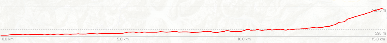
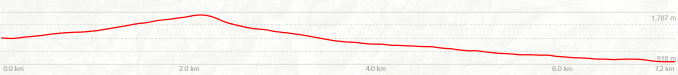
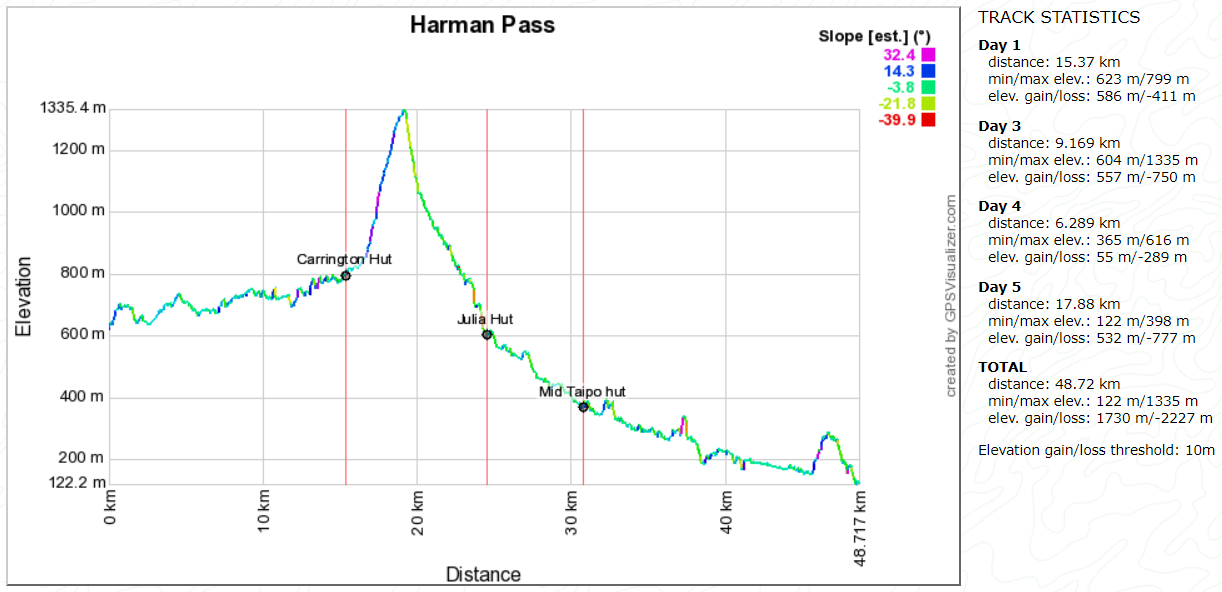
The route was a conservative 4.2 days walking in Arthurs Pass National Park, with extra time thrown in for those unknown factors often encountered in the back country – and boy did we need it!
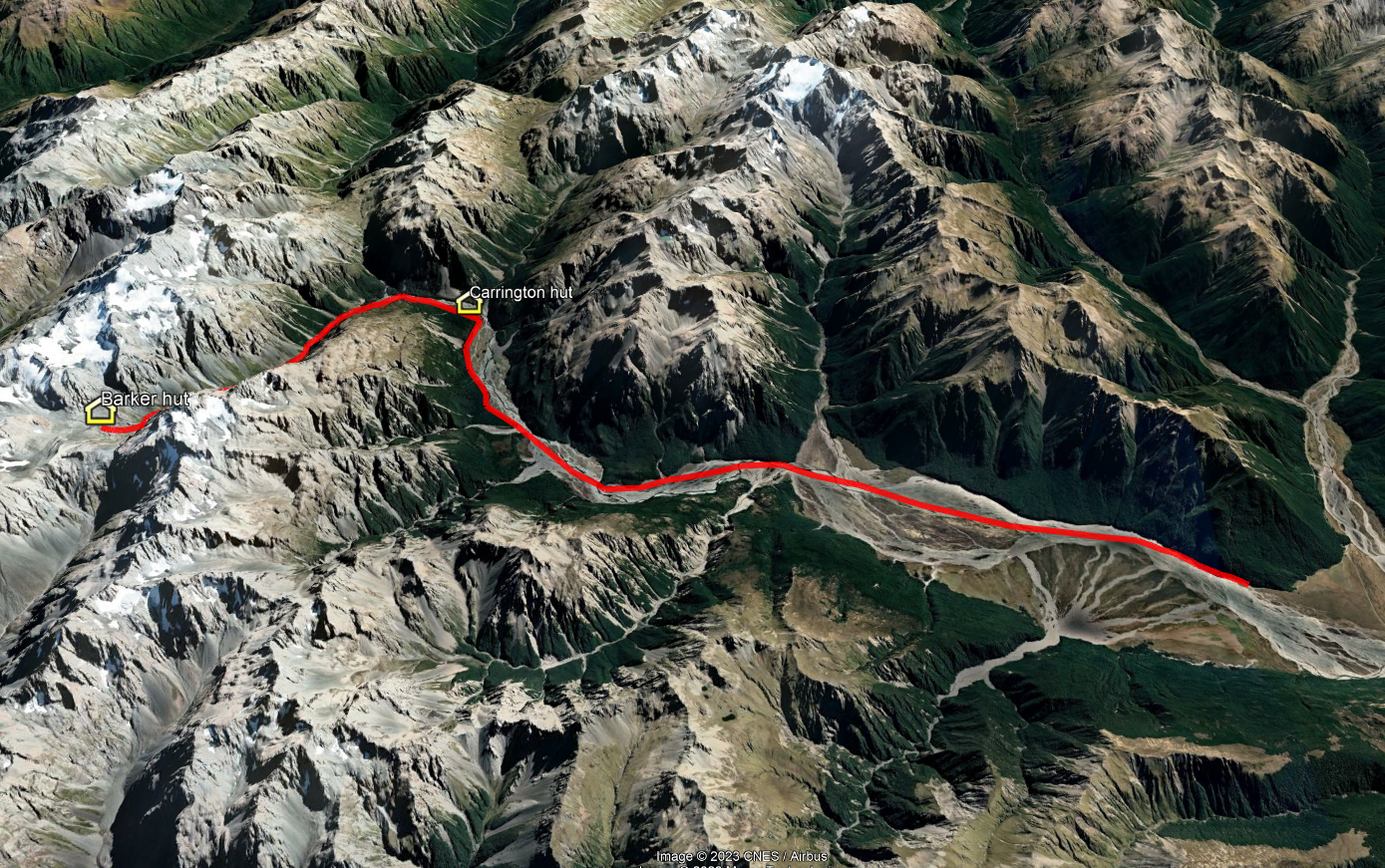
The original plan for the Moa Hunt this year was to start at Klondyke Corner, strolling in to Carrington hut for a good lunch after cooling the feet in the gentle upper reaches of the Waimakariri river, arriving relatively fresh and ready to tackle Harman Pass the following day.
Beyond there, the hot pool near Julia hut beckoned, followed by a day crisscrossing the Taipo river to Dillon Homestead hut. And on the final day, a climb to Carroll hut, just a stone’s throw from Otira.
Well, sometimes best laid plans…………are best forgotten!
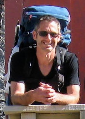
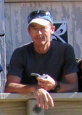
Moa Hunters on this trip: Paul, Luke, John, Chris, Richard, Magnus


The Trip:
Day 1: Waimakariri Bridge to Carrington hut
Day 2: Carrington Hut to… Carrington hut
Day 3: Carrington hut to Julia hut
Day 4: Julia hut to… Mid Taipo hut
Day 5: Mid Taipo hut to Road end


Day 1
WEDNESDay 12th January – WaimakAriri Bridge to Carrington hut

The first stop of the morning was a 9.45am assembly at Paul’s place. Being fairly central it was the ideal location to get gear sorted and underway.
Chris as usual had all main meals sorted and these were distributed fairly amongst the team, taking into account other essential goods being carried! Chris and Magnus hit the road ahead of the rest of the crew as they had a detour to pick up John.
The next stop for us all was the famous Springfield Pie shop. Hot pies packed with delicious gravy and meat are essential energy food for river flat walking with a full pack!
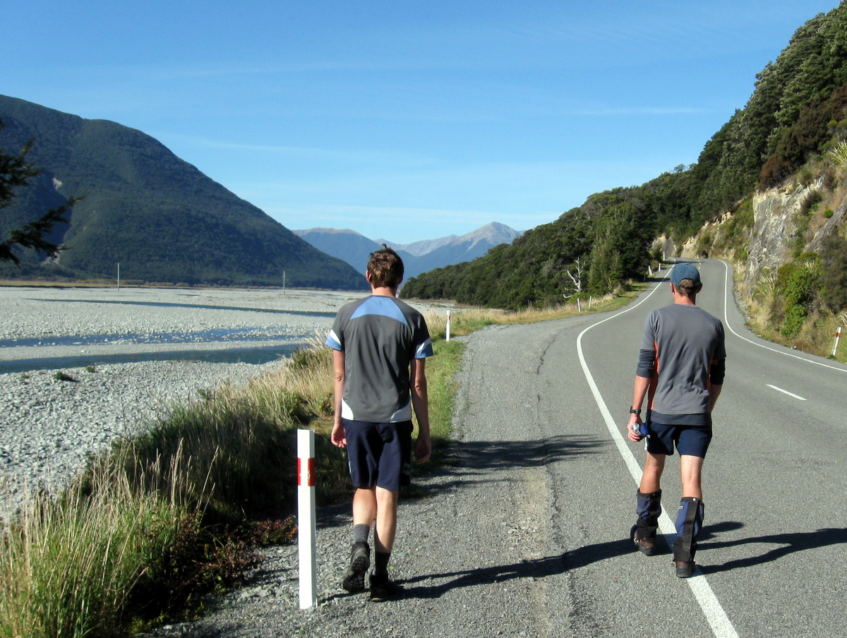
The weather forecast at this point was decidedly sketchy, with strong winds and heavy rain expected on and off for the next few days. Current conditions where we parked at the Waimakariri bridge were strong westerlies, or should that be wet-at-Bealey! It was rather damp.
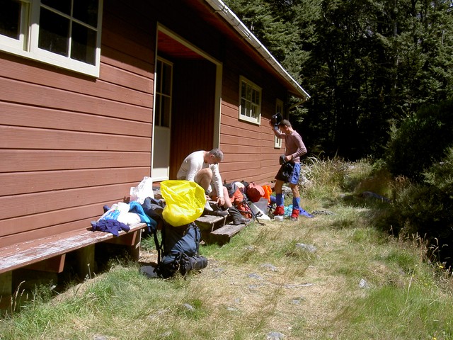
There, we had a quick confab and decided to go for it on the high river route along the true right of the Waimakariri, reconvening at the Anti-crow hut. The usual 15-minute pack organising and re-organising ensued in the car park just off the Waimakariri bridge.
With the obligatory group photos taken, we hit the high-water trail – a track not many of us have done before – at about 1pm.

With rain at some stage looking certain, we all had pack covers on from the start, some regretting not waterproofing this item!
The high-water track proved to be a reasonably well sorted trail up off the river flat giving us all chance to get into our stride. The rain at this point was sparse, but looked troublesome upriver where low cloud obscured the mountains ahead. We all soon warmed up as we meandered up and down the well-cut trail.
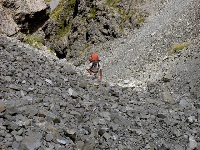
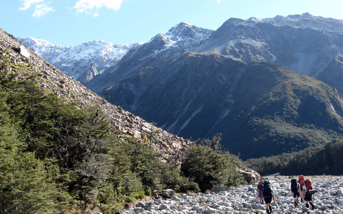
Reaching Turkey Flat, the track pointed us straight across at a reasonably high level. About midway through this fairly exposed section we crossed a fast-flowing dirty small river. With difficult footing, this little traverse kept us on our toes and ensured our feet were fully wet!

On the far side of Turkey flat, we picked up the trail again. Beyond the flat were two options: the riverbed or a high trail to the Anti-Crow hut. At this juncture, we split into two groups as some Moa Hunters with dodgy knees are averse to climbing!
Down in the river-bed there were some fierce wind gusts which could turn the odd pack around if you were not careful. It was just a little bit nasty at times.
Arriving at the Anti-crow we quickly retreated inside for a snack and discussion on progress. The sound of rain on the roof kept us company while we ate. Those of us wearing glasses battled them constantly fogging in the hut – it’s a bugger getting old!
It was decided to continue to the Carrington Hut, which would be doable even with high water in the river.
The trail from the Anti-Crow hut heads back to the Waimakariri, skirting close to the river. This proved difficult where the river cut in close to the true right bank forcing us up into scrub.
Scrambling over or pushing through a lot of tree fall onto animal tracks was difficult going. These “tracks” were not that suitable for pack wearing humans! We bashed on zig-zagging in and out from the river through deep swampy water to eventually drop out onto the rivers edge and into walkable space.
The Waimakariri certainly wasn’t looking a river to trifle with at this point! We found a place where a faint trail was visible on the true right of the river where it moved away from the bank. From there it was relatively easy walking, made less comfortable by a stiff head wind and sleety rain.
Some of us at this point, especially those with walking poles, had very cold and numb hands. Notably Luke, who struggled to re-tie a boot lace that had come loose. Paul did them for him – I bet he hasn’t done that for a while!
As we neared the section of track that turns away from the riverbed towards Carrington Hut, wind-driven sleet got heavier, becoming rather painful on our faces. We were grateful to escape the exposed riverbed and enter the relative shelter provided by beech trees.

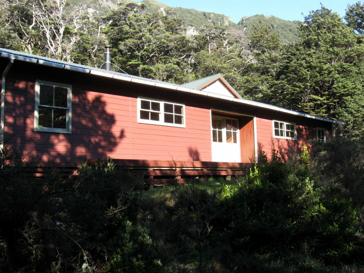
We entered the Carrington hut at 6.30pm, three hours on the trail from the Anti-Crow hut. That’s fairly slow progress, but satisfactory in the conditions encountered.
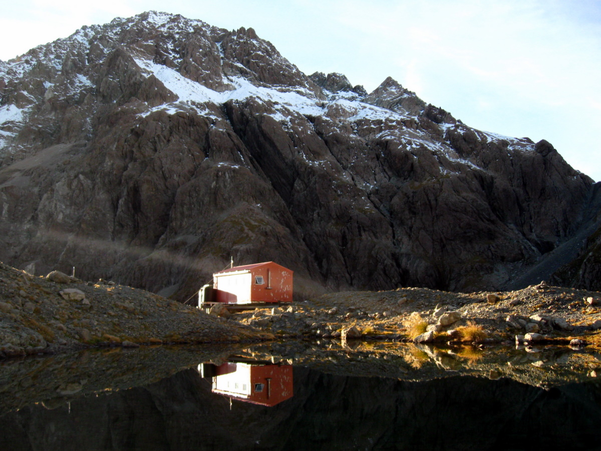
The hut is extensive, sleeping 36 at max capacity, and we were the sole occupants. Bottom bunks for all!
The Carrington hut has two separate living spaces and we chose the left hand option, being the only side with a fire! We quickly managed to explode assorted gear from our packs, covering all surfaces in the Moa hunt tradition!
In the cold hut, it was a case of first things first: Get a billy on the burner for a cuppa, and get the fire lit! In true Aucklander style, Richard managed to surprise even himself by getting the fire going in very damp conditions! Magnus served delightfully warming hot chocolates as the hut temperature and humidity slowly rose.
The now traditional first night feed of marinated steak did not disappoint. Served with mashed spud and cheese sauce, it was delicious. Wolfing down the hot meal in the hut while hearing the drumming of a solid downpour on the roof made it even better. Without all that steak to carry, Paul will enjoy a somewhat lighter pack on day two.
It was still raining hard at 9.30pm with snow just visible on the tops. Conversation had shifted to tomorrows plans. There was general agreement the jaunt over the Harper pass may be in jeopardy. However, we were all tired, the weather can’t be changed, so we hit the sack!
Day 2
Thursday 21st JanUARY 2021 – Carrington Hut
There are some naturally early risers within the Moa Hunters group. Well, one in particular! You can set your watch by the sound of Paul lighting the stove to cook the porridge.
Despite the fact it was still raining hard, we were all up early and had bellies full of delicious warm breakfast by 7am. The fire had enough embers to kick into life with ease.
Outside there was snow fairly low on the surrounding mountains. The rain had not really abated, and outside looked generally unpleasant. Staying put for the day was clearly the best, safest and obvious option.
We spent the morning gathering fuel for the fire and generally chewing the fat!
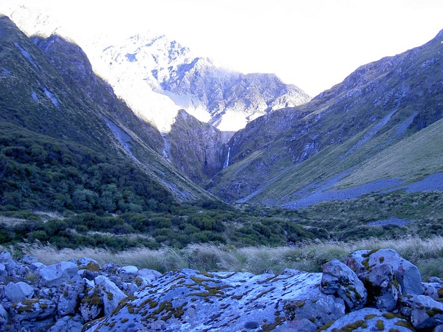
After lunch the weather had cleared significantly. We took the opportunity to amble along the river to check out the Clough cableway and confirm it was in working order. From this point we could also look at the conditions up Harman pass and see what we might be in for the following day.

There was the odd light rain shower blowing through, providing some spectacular rainbows in the valley. The cable way seemed in fine working order, although a little in need of some oil!
Looking at the surrounding mountains, we felt sure we would encounter snow up on Harman pass tomorrow!
We headed back to the Carrington for a late afternoon tea. It’s hard to not nibble on scroggin all day when not walking!!
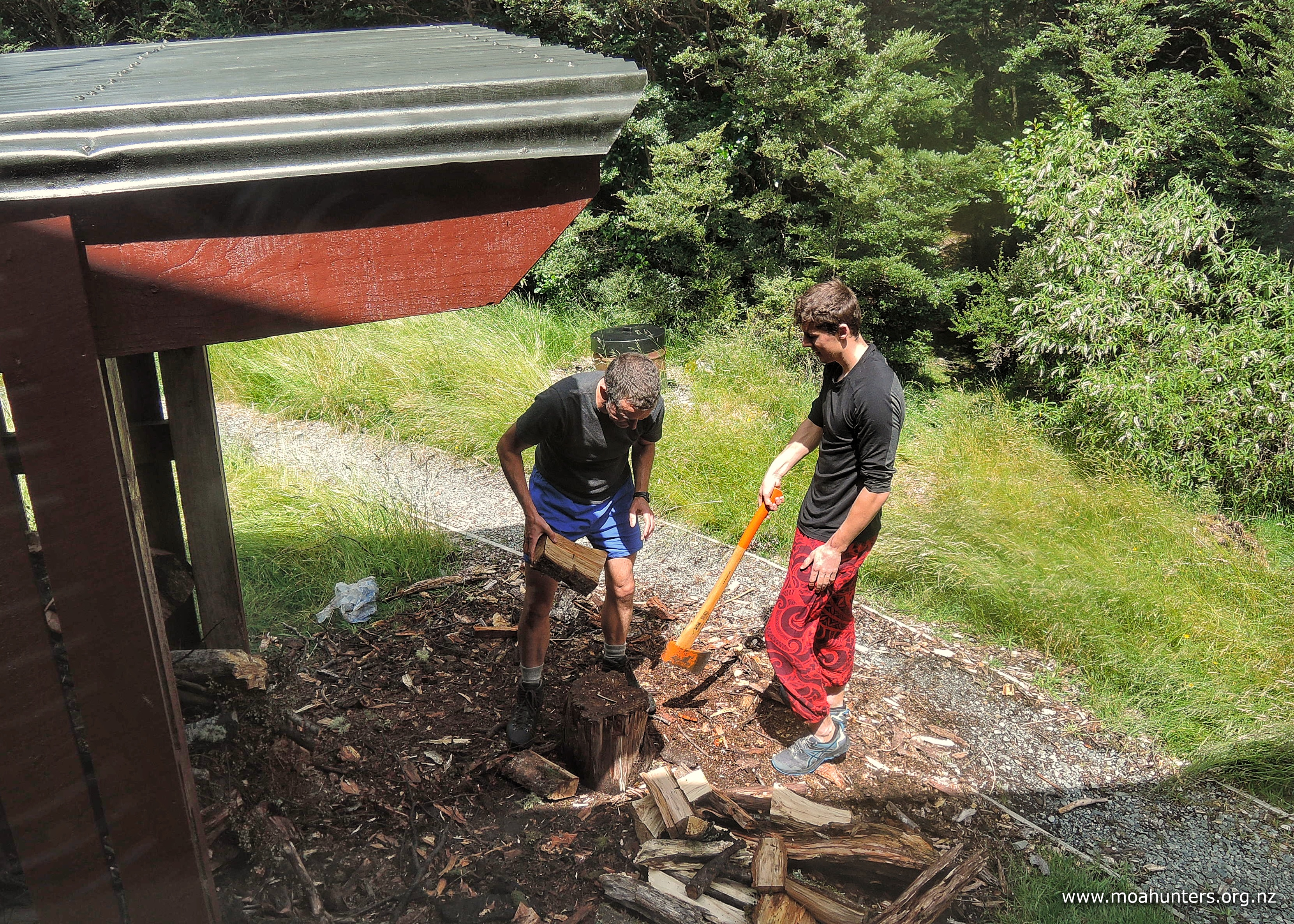
John put together a spaghetti bolognaise for dinner in a now toasty warm hut. The fire now roaring and well fueled, courtesy of Paul and Luke’s efforts with the axe.
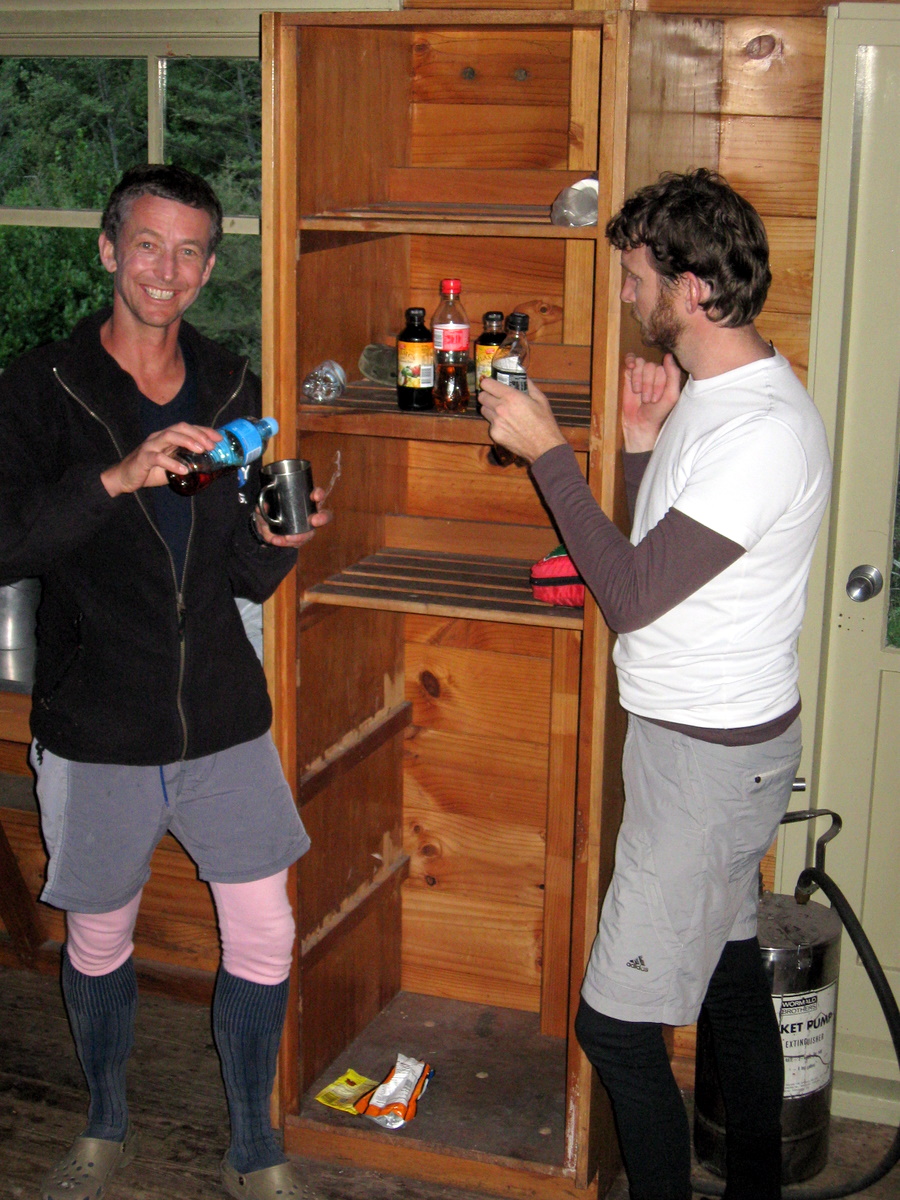
Dessert was a new Moa Hunt innovation – the grog log!
The recipe is simple: sandwich a packet of gingernuts together with whipped cream into a log shape, soak them with whisky, then coat the whole lot with more cream and decorate with crumbled flake chocolate. Chill it all for a few hours until the gingernuts are soft and the log is “spoon-able”. Quite delightful. I blame this dessert for the deep conversation after dinner. We didn’t solve any world problems, but we hopefully improved our own states of mind!

For me, these evenings with no connection to the “real” world are a tramping highlight.
The conversation bounces around with meandering thoughts and ideas, not interrupted by the clamour and demands of the online world we normally live in.
Day 3
Friday 22nd Jan 2021 – Carrington to Julia Hut
Following a day of light activity, we all awoke bright and early, feeling well rested.
Paul made a fab coconut milk porridge, which brightened up the traditional porridge morning fare, reducing the need for such a large covering of brown sugar on top!
Outside the weather looked fairly calm. Fog and misty clung to the valleys, while overhead the sky was grey and cloudy. The air temperature was fairly cold, but it looked like we would be able to tackle Harman Pass.

We were packed up very early by Moa Hunter standards, and were ready to hit the track by 7.40am. A minor record we think.
A cold breeze had kicked up by this time, so it was an invigorating walk to the Clough cableway. We agreed it would be prudent to take advantage of the cableway and keep our feet dry for as long as possible up the Harmon Pass.
A cableway is a slow but spectacular method of crossing a river, made a little faster through teamwork on the pulley handles. But they are generally awkward to use, for both the winders and the passenger, whose entry and exit is made all the more more difficult by a bulky backpack. Unhooking the rope while sitting in the cable car takes a bit of work!

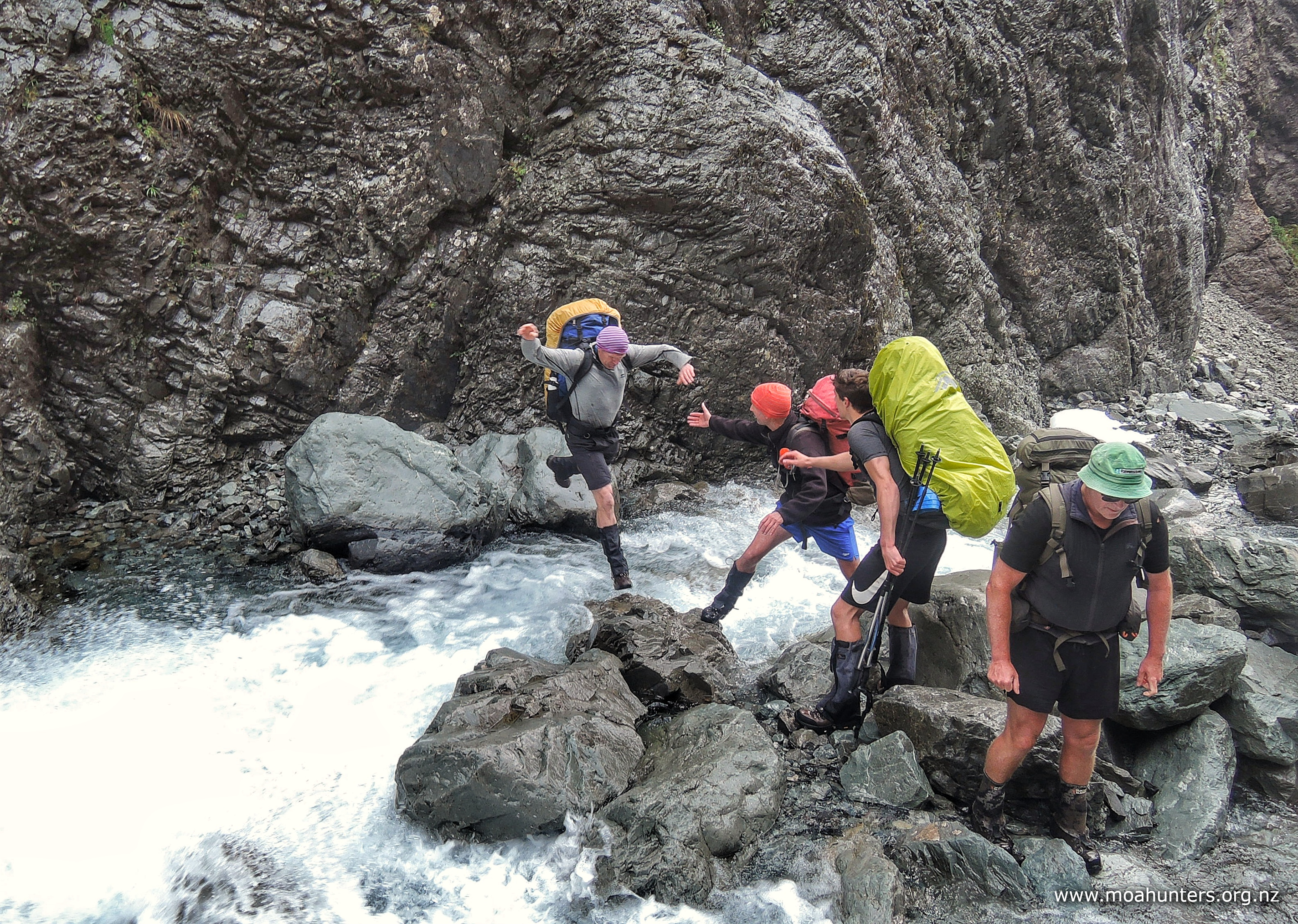
Once across the White river we settled into the climb up the Taipoiti river. This section starts out relatively open, but narrows quickly into a gully. This necessitates crossing and re-crossing the river numerous times. A river which on this day had significantly more water in it than any of us had seen before!
We all tried to maintain dry feet as long as possible, which lead to some sketchy jumps over fast flowing water. No one came unstuck thankfully, but eventually most of us gave in to wet feet in favour of safety!
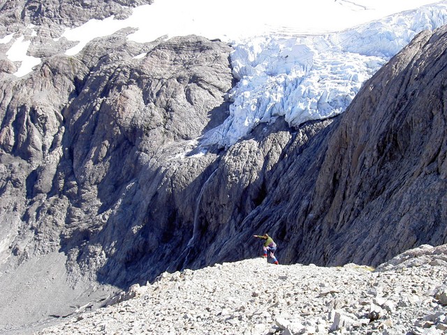
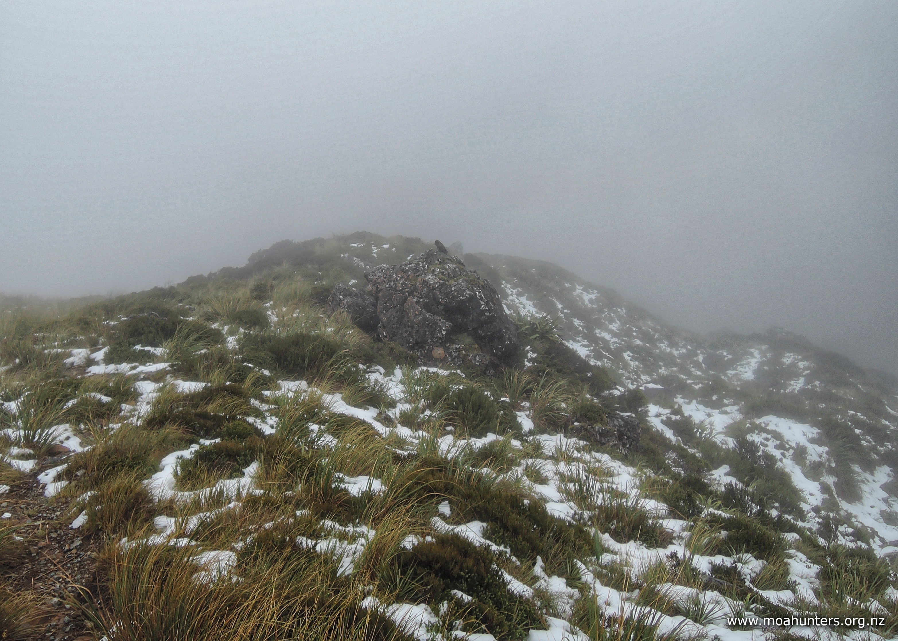
As we neared the mid-point of the climb, we encountered small patches of snow which quickly increased in size to a solid sheet of snow. The weather was intermittent claggy cloud with patches of very light drizzle.
The sidle became steadily more difficult and slow due to the ever-increasing snow which had drifted to pole depth in places.

The expected views at the top of Harman pass were non-existent due to the cloudy cold conditions which fogged glasses severely. Chris tried without glasses but found this to be the poorer option to staring through condensation!
Plenty of snow on the pass forced us to entertain ourselves with a bit of fun, pulling handstands and falling to snow angels, as you do!

Luckily there is a signpost on the pass pointing to the various onward options. Without this in the murky conditions a map and compass might have been required to find the correct track down to Mary stream.
The descent proved to be very slow initially, with slippery underfoot conditions accounting for a number of unplanned sit-downs.
The murky clag wasn’t going away either, substantially reducing visibility. Half a minute was often spent just searching for the next marker as we slowly picked out way down the icy slope. It is amazing how hard they are to spot in the fog. We often found ourselves peering into the distance for a marker pole only to spot it much closer in the foreground! Once spotted, you can’t “unsee” it, and wonder why it was so difficult to spot in the first place!
About fifteen minutes into the descent, we spotted through the gloom what looked like a kea sitting on a rock. Or was it a kea shaped rock? It didn’t move, but as we approached the the rock it became obvious there was indeed a kea atop it. As we arrived the kea’s partner flew down to say hello also. In the murky conditions it seemed we were the only excitement of the day for them!

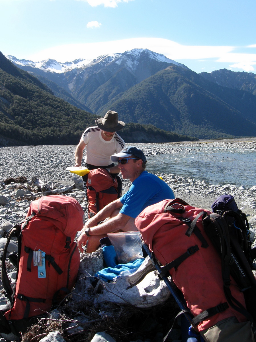
Following Mary stream down, we eventually dropped out of the murk and gloom. When we reached the valley floor, it was decided lunch was in order while the weather was looking better. It was 12.30pm when we found a suitable spot for a well-earned feed.
Inquisitive kea visited us here in the vain hope of an easy feed, but disappointingly, we were hungry and not sharing. They were entertaining companions, trying to sneak up on Chris and getting fairly close.

The view up the valley was spectacular, with white snow lacing the tops. Not a bad lunch spot!
We didn’t linger however, as it was fairly cool staying in one spot. At 1.00pm we hit the track again, following the poles alongside an ever-increasing river. We knew we would end up on the true left when we hit the bush, but found ourselves on the right, all the while knowing the river was not getting easier to cross.
The valley cleared and opened out and we made the crossing to the true left, one of us with long legs keeping his feet dry! The crossing made us happy, only to be immediately disappointed around the next bend to be guided back to the right side again. This time there were no dry feet!
After a few more crossings we settled on the left side, scrambling along following poles until we reached the bush line. There were signs of the trail clearing up until that point, and now we settled into the fully cleared bush trail. The track immediately proceeded to climb 100m to avoid a gorge, only to then drop 150m down a slippery nasty moss-ridden, knee-hammering descent
The rain had been slowly increasing as we descended the trail. At this point we realized we were truly over the main divide and on the West Coast!

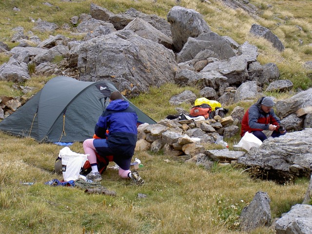
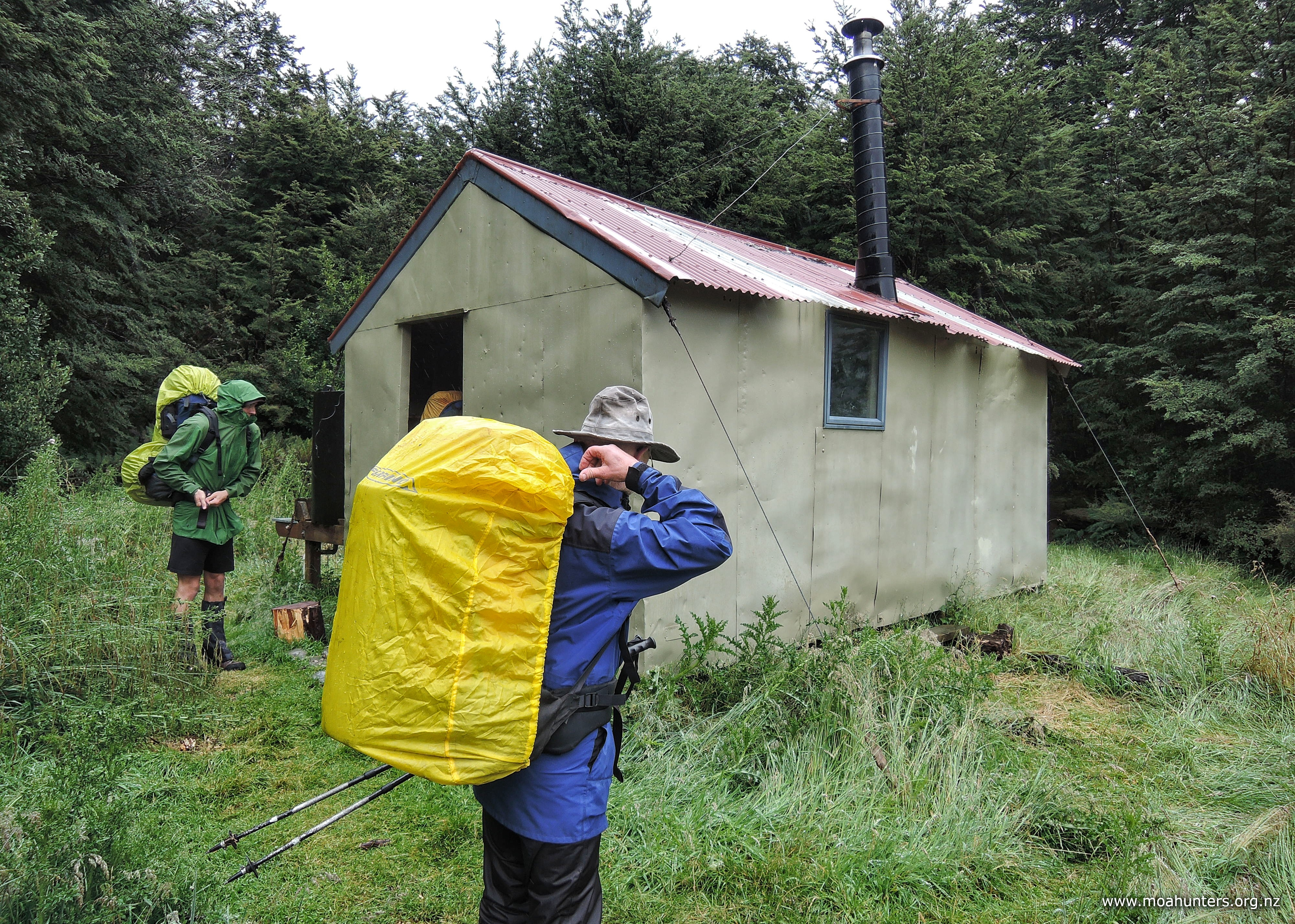
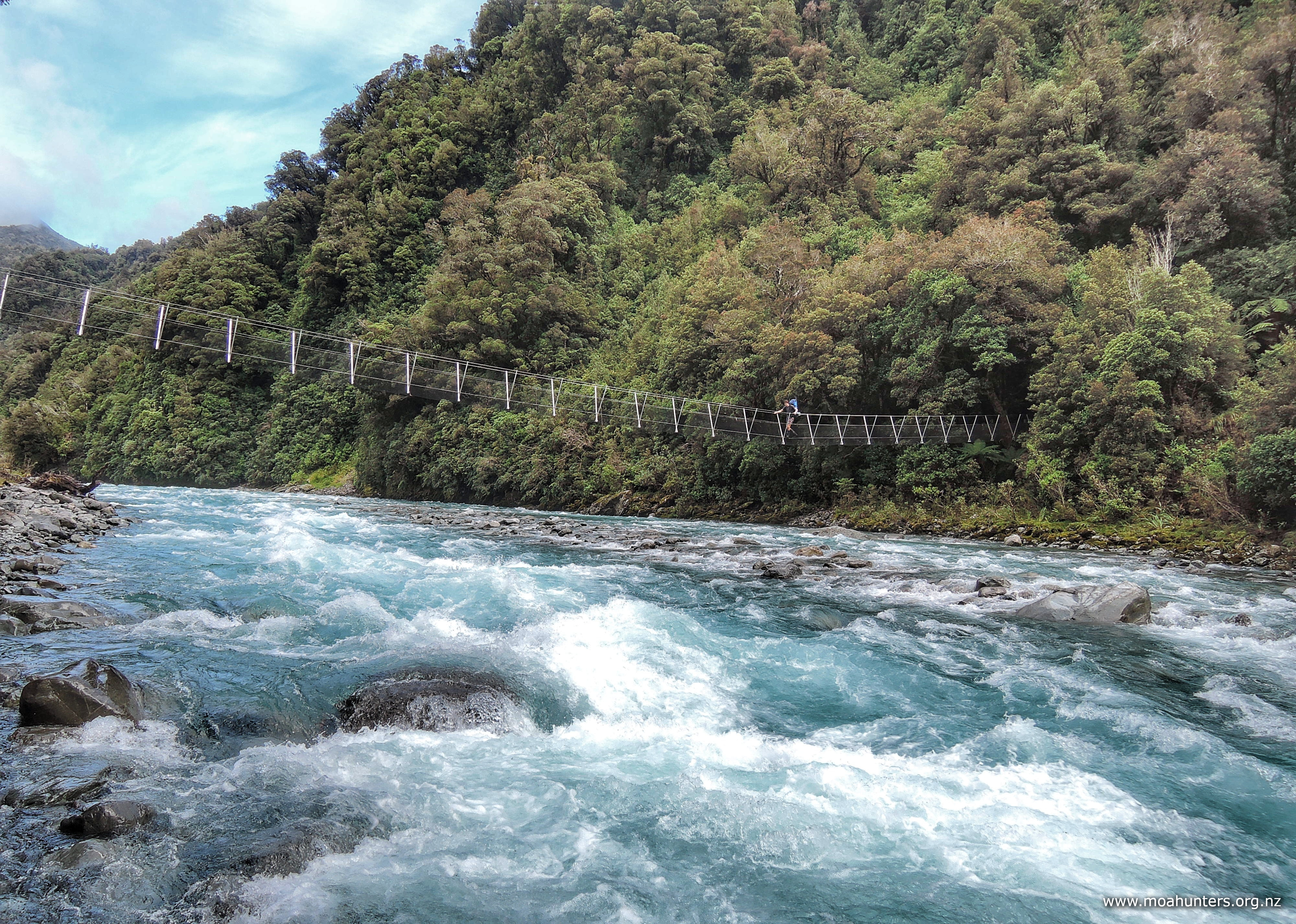
The slippery slimy mossy track dropped us at the relatively new Mary creek 3 wire bridge. Beyond that, it was a gentle two minute walk to Julia hut, which we reached at the very civilized 4.00pm. This despite the walk taking longer than expected due to the snow and clag.
The hut is a beauty… A little six bunk setup with a very cute and efficient log burner. The resident local weka fossicked its way past and said hello. The lawns had even been mowed, leaving us nothing to do but head to the hot pools before dinner! The way is signposted at the bottom of the hut garden.

It was a rather damp ten minute walk in the rain to the hot pool. Walking mostly beside, but sometimes in the Taipo river, we came to a large rock where our noses detected a faint sulphur smell, indicating we were in the right place!
On the large rock just past the pool there was a spade and pinch bar ready for action. The river was in high flow, so it was difficult to create a pool large enough for us all. After about 20 minutes of digging, with Paul and Luke doing the bulk of the rock moving, we had a reasonable pool of warm water.

Once in, we found there to be large variations in water temperature around the pool. Some of the rocks on the bottom were extremely hot! There were a few spots which required one to “hover” lest one’s tender bottom get scorched! This was less relaxing than anticipated, but with regular rotations, we all had a great soak in the rain beside a very fast flowing Taipo river.

We all left the hot pool feeling extremely relaxed, detouring briefly to look at the very quaint old Julia hut. This lovely old place is filled with awesome old timbers, oozing character and a sense of history and uniqueness that the new huts lack.


Tonight’s delectable dinner was the Moa Hunter curry mix, followed by cheesecake with ant sprinkles for dessert!
The tiny log burner kept the hut toasty and the rain on the roof proved soporific.
Day 4
Saturday 23rd JanUARY 2021 – Julia Hut to Dillon Hut

The day dawned damp. Very damp indeed. Outside conditions looked like they would provide a solid test of Chris’s new PVC shorty jacket! We would most definitely be heading to Dillon Hut today in a slippery clag-cloaked downpour!
Paul had the porridge bubbling and thickening by 6.35am. It was devoured soon after!
According to the photo times, we embarked onto the track at 8.40am. We exited Julia hut then backtracked slightly, passing by the Old Julia hut and then staying on the true right well above the Taipo river. It was a very well maintained track which made for easy walking.

The rain wasn’t especially heavy, but it didn’t really let up. By the time we got to the Taipo river three wire bridge, we all looked very wet and bedraggled. We reached the Mid Taipo hut for an early lunch bang on 11.30am. The hut was welcome shelter at a time the ‘wet’ coast was living up to its rain-drenched reputation.

During lunch, Paul studied the topomap and made the comment the next river (the Hura) looked like it had a large catchment and might be a difficult crossing in this weather. Noted!
We departed the hut with our bellies sated, said goodbye to the resident weka, and strode out onto a gentle grass trail that descended slowly down to the Hura, where it dropped abruptly four metres to a raging torrent.

In typical Kiwi Fashion, we searched up and down the river 100m either way for a crossing before we said “yeah, nah!”
Technically it might have been doable, but beyond the Hura there were other potentially tricky rivers to cross. Looking back, we had a nice hut ten minutes walk away, and it was still raining hard. We took the safe smart option, and turned back.
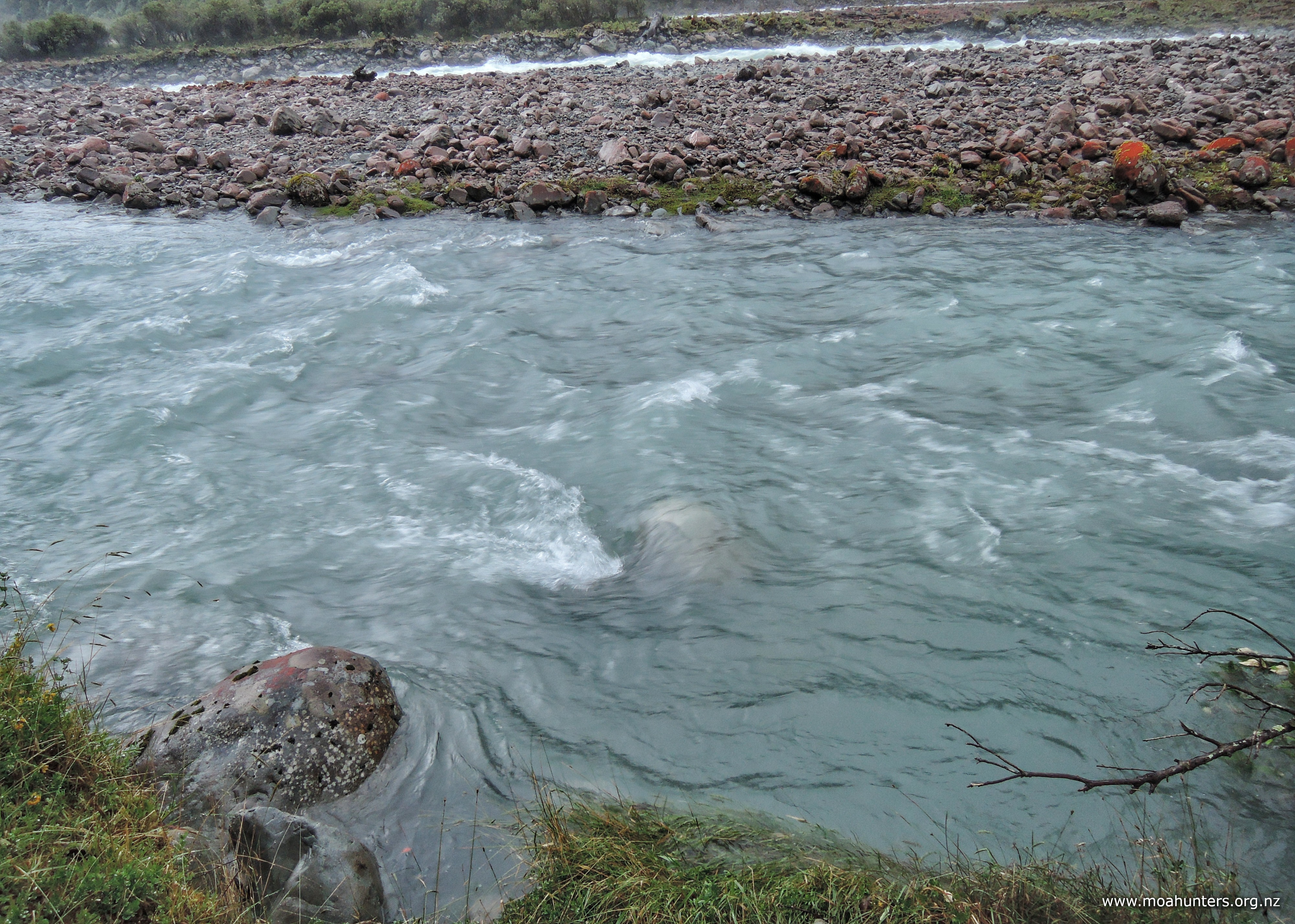
On route back to the Mid Taipo hut, the lovely grass trail passed close to a braid of the Taipo. At this point we observed a large easily seen light-coloured rock just below the water line. We took a photo as a baseline (great idea, Chris!). This proved to be an easily checked and valuable indicator of what the river levels were doing over the next nine hours…

Back at the Mid Taipo hut just after 1.00pm we had to deal with a wet floor cause by the previous occupants! We lit the fire again, then cranked it right up. Given the persistent rain, we built a lean-to tarpaulin shelter so water vessels could be filled and dishes washed in a sheltered spot beside the rainwater collection tank.
Coffee and hot chocolate were prepared. We settled in and listened again to the rain, which was particularly loud this wet afternoon. We now had no real idea how long the rain was going to continue, so we reassessed our food stocks just in case we were forced to stay in the back country for another two days.
At 3.00pm we checked our indicator rock. It had 100mm of water flowing over it. More than our previous assessment, and unsurprising given the downpour we were experiencing! By 6.00pm there was about 120mm flowing over the top and it was hard to see that a rock was even there. The Taipo river at this point was quite a spectacular torrent.
When we made our 7.00pm assessment there was no change in the river level, but the downpour had most definitely slackened. The rain continued to abate through the early evening. By last light, the rock had become a little more visible, but still had good flow over the top. Never has a rock in the Taipo been more scrutinised!
Back at the hut we discussed our next move. A night at Carroll hut had gone out the window with the extra day spent at the Carrington. We agreed our best option from here was to bypass Dillon hut and head straight to state highway 73 just west of Jacksons. From there hitch a ride back to the cars. This was of course all dependent on the rivers levels! Richard knew his 6.30pm flight on Sunday 24th was never going to be caught.

Dinner was a scaled down affair as we were now unsure if we would be able to make it out tomorrow. We went with ½ rice, 1 mince, 1 Thai curry sachet and ½ dried vegetables. This left enough for one more meal of the same. Adding in left over lunch food would make for plenty of food.
The afternoon stretched out with constant monitoring of the weather and conversation. There was even a bit of hut bench pressing to pass the time! As the day cooled into evening, John put on some track pants, but feeling they didn’t fit well, was convinced he had someone else’s. We all looked at each other. None of us were missing ours, nor were any his size! Then the penny dropped… John was wearing were his own pants, but inside out! Much mirth ensued.
The last thing we heard that night as we dropped off to sleep was yet more rain drumming on the roof…
Day 5
Sunday 24th JanUARY 2021 – Mid TaIpo hut to Road ENd

We all woke early, wondering what the day would bring. The roof was quiet and outside the rain was holding off. A quick check of our favourite rock confirmed the water level had dropped significantly overnight.

We quickly (for Moa hunters) had breakfast washed up, packed, cleaned and swept the hut. We were able to scoot out the door at 7.40am (again!).
Mid Taipo hut had been an unplanned, but great little stay. I now know why a half-day hut was placed on the track at this point. It’s easier than building bridges!
We found the Hura river much less intimidating today, but still went downstream toward the Taipo river to cross, linking arms in pairs to ensure a safe crossing.
Beyond the crossing point, the trail meandered on the true left of the Taipo river, sometimes venturing into the tranquil low-density bush and grass areas away from the main river.
When we came to the Dunn river, it was still pumping a fair bit of water, requiring extra care when crossing. Shortly after crossing we startled a well-fed looking deer, which stayed ahead of us all the way to the end of the river flats.

The walk was now easy going on the wide river flats, divided by small streams that we could wander beside following deer prints in the sand. Unfortunately the pleasant terrain never lasts. The flat area gradually narrows down and the river finally gorges through a tight rocky gap. This is the start of a tight steep track that climbs 100m. It is a mossy and damp ascent that had been relatively recently diverted to avoid a large slip.
At the top of the climb there is a brief traverse before a severe drop down to the Taipo river and an awesome three-wire bridge. The bridge is a spectacular and essential crossing, right at a point where fording the Taipo would be impossible!
Directly off the bridge there is a high-water track, which wasn’t required this day, although it was tight at times alongside the mighty Taipo. From there the track takes a short amble away from the river onto grass flats. Large puddles in this area attract some quite interesting insects which flew up as we passed and disturbed them.
We arrived at the Department of Conservation Dillon hut at 11.30am, just in time for an early lunch!
We decided to avoid the sandflies by retreating into the hut, which felt a bit sterile after the Mid Taipo, but was roomy. We cranked up the billy for fresh coffee as we were making good time!
After downing our lunch provisions we hit the trail again at 12.30pm, only to stop again five minutes later at the original Dillon Homestead hut.

This is a larger rambling affair, with heaps of character, including ‘electric’ lights and a hot water cylinder out back with a chippie to heat it. The hut looked to be in the process of being done up with lining stacked up. There was a lot of old newspapers lining the main space, some describing the Dillon family. Armchairs surround a large open fireplace. We would have loved to stay a night here!
From the Homestead hut our original plan was to turn east over the Kelly range to stay at Carroll Hut. But as it was Sunday lunchtime already, we opted to continue down the Taipo valley to the road and hitch back to the cars at the Waimakariri river. By far the quicker walking option.
Beyond the hut the track is a 4-wheel drive trail that now, due to erosion, drops vertically between two and three metres straight into the river. Not as drivable as it had been in the past!
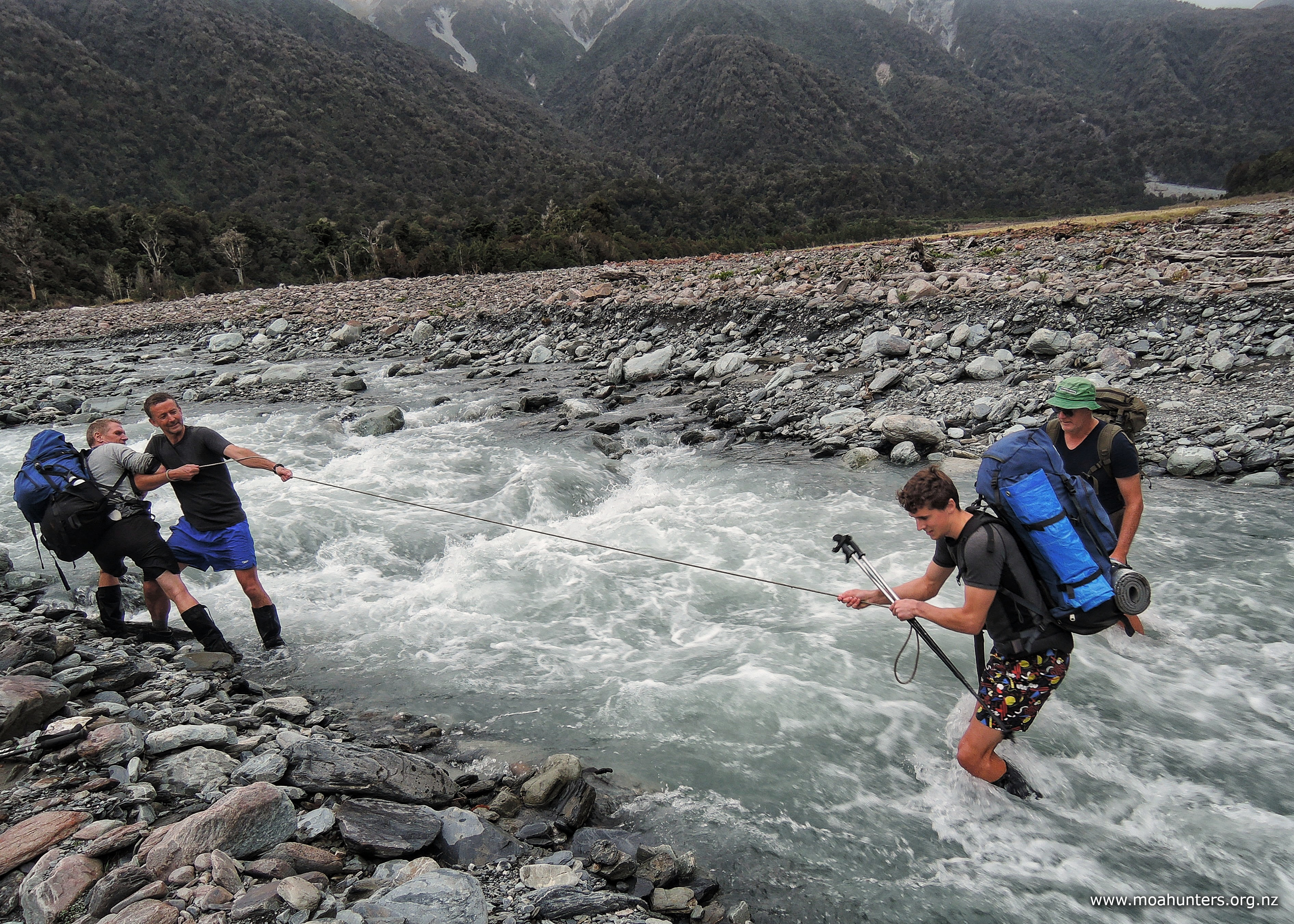
The river is actually Seven Mile creek which is spread very wide with a very fast flowing narrow-ish water channel. Standing on the bank it looked tricky crossing from sheer water pace! Hoping for a better alternative we wandered down toward the Taipo looking for a likely safe crossing point.
Running out of river, we decided to give the rope pendulum crossing method a go. While not really necessary, it was worth practicing in a relatively safe place with fast water. As our rope was a little short, we required a central rope catcher in a place where the flow was slower. Chris was the ideal person for this job! Paul who is strong on his feet took the rope, crossed first with Chris anchoring. Then it was a matter of each of us making our way to Chris taking the rope, pendulum off Paul downstream to the far bank. Then throw the rope end back to Chris. Paul takes most of the load in this process, but we just use the rope to steady ourselves rather than loading heavily off it.
Across Seven Mile creek there are two track options: high and low. Luke took the high track which sounded the most interesting as he reported coming across several vehicles up there. The trail at this point was drivable, so this made sense.
Further on downstream the trail vanishes into a channeled boulder strewn river, with no way passable for vehicles. Obviously any vehicles in this area are here to stay.
The vehicle trail eventually deteriorated into a narrow single track that came up against a stream, then followed that down towards the Taipo. Farther down we crossed a small stream and followed a narrow track up and down the right bank of the Taipo. A sometimes slippery and steep exercise. If the water were lower, we could and would have walked along the river flats.
Eventually we reached the farm track end with a sign here saying the four-wheel drive track leading back where we had come from was closed. Was it ever!
We had a quick snack then quick marched along the farm track past old machinery through a closed gate toward State Highway 73. Arriving at the road, Chris and Richard immediately started walking toward Arthurs Pass with thumbs out, leaving the rest to chat with the resident sandflies!
After about fifteen minutes walk they were picked up by a great couple who loved tramping and knew what it was like to try a hitch back to your car! They were heading back to Christchurch, so took us right through to our cars near Bealey. Awesome! From there it was a matter of driving back over Arthurs pass to pick up the team.
We all readily agreed that swinging into the Bealey pub for a Moa Hunt review, food and and a well earned ale was next on the agenda.
The Julia hut route was a real surprise. Although it was a “small” Moa Hunt, it packed a punch! It certainly felt we were in the wilderness. Not meeting anyone for the entire trip and dealing with very wet conditions helped with that feeling of isolation! But in a way the weather conditions made it very enjoyable, adding to the drama of the trip.
The huts were at easy spacings, nights were comfortable, and there were options to shorten up the trip when required. You don’t have to be super strong and fit to experience New Zealand’s mountains and get away from it all!