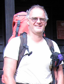
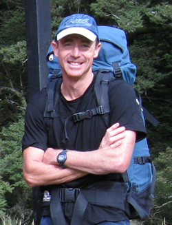
Moa Hunters on this trip: Chris, Paul, Richard

Itinerary:
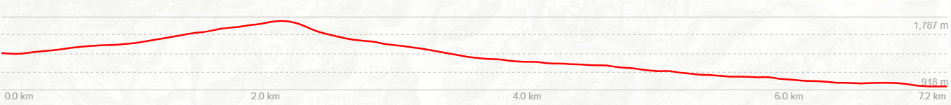
Day 1: Klondyke Corner – Carrington Hut – Harman Pass (Ariel’s Tarns)
Day 2: Harman Pass – Whitehorn Pass – Park-Morpeth Hut
Day 3: Park Morpeth Hut – Browning Pass – Grassy Flats Hut
Day 4: Grassy Flats Hut – Road End
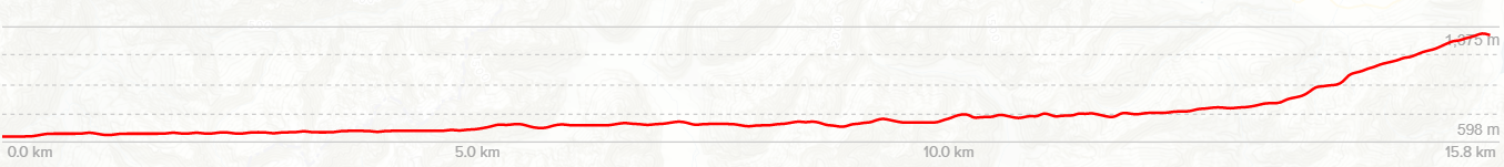
See our route on topomap.co.nz


This was to be the third Moa Hunt, and after the two excursions to Mt Tapuaenuku, the team were looking forward to a different destination this time.
The regular February tramp had now been elevated to a required item on each of the Moa Men’s calendars and was eagerly anticipated.

This year it was time to try out a true classic trip – “The Three Passes”: Harman, Whitehorn and Browning Passes, crossing the main divide thrice. Taking in the headwaters of the Waimakariri, Taramakau, Rakaia and Hokitika Rivers in just 4 days.
Paul suggested the route this year, heartily agreed upon by Chris and Richard.
Day 1
Klondyke Corner to Carrington Hut
An 5:30am start was achieved from Chris’s place, with Paul’s very obliging father Alan, providing transport to the start line at Klondyke Corner. Alan also provided a stomach lining, artery hardening, breakfast from a BBQ perched on the tailgate of his 4WD.
Breakfast consisted of eggs, bacon, tomatoes, sausages and lamb’s liver all well fried and served on toast. Alan had heard of healthy, fibre filled breakfasts and didn’t put much faith in them when it came to kick-starting and 4 day tramp. (Many thanks Alan)
Powered by the high calorie breakfast, the stoney stroll up the Waimakariri Riverbed to the Carrington Hut was soon dispatched, in just under 4 hours.
An early lunch at Carrington Hut also seemed somewhat unnecessary with the breakfast still sustaining all of us, even Chris a true food lover only managed a light nibble.
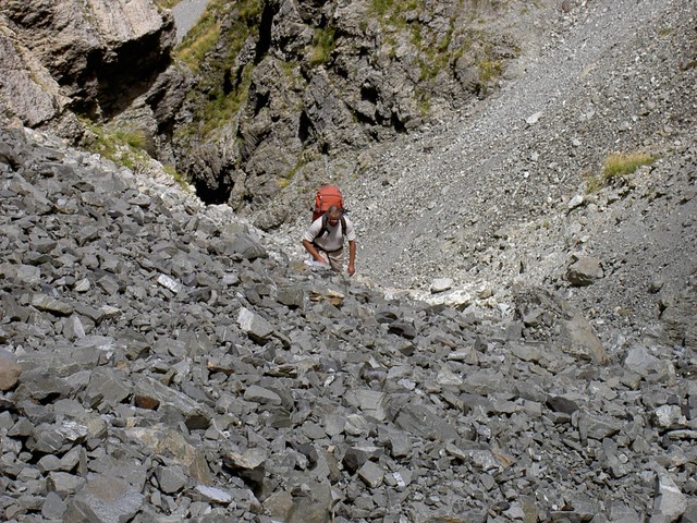
The day remained dry but clouded over as we crossed the White River and ascended Harman Creek to Harman Pass, the first of the 3 Passes.
While climbing we met several small parties on day return trips from Carrington Hut to the pass, all enjoying the rugged beauty of the Harman River.
The Harman creek is a narrow waterway of average steepness with very little vegetation. Chris and Paul had traveled the same route many years before, during a Labour weekend trip to the Julia Hut Hot Pools. Conditions on this trip were noticeably lacking the 10 feet of packed avalanche snow filling the narrow ‘V’ of the valley that we had last time. It is debatable if the ascent is easier on firm snow or broken rock streambed.
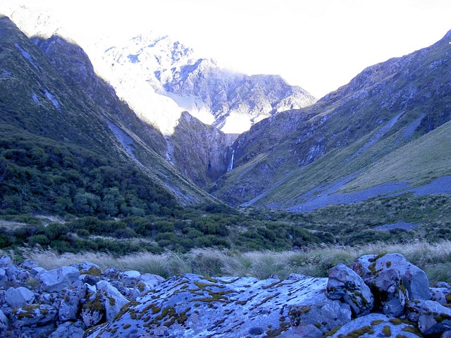
Harman Pass was reached about 3:30pm and Ariel’s tarns soon after, with a glimpse or two obtained, between the hills, of tomorrow’s route up the valley leading to the Whitehorn Pass. Camp was pitched in a picturesque location on the edge of the largest tarn. The tent was positioned in the lee of a pile of rocks constructed by previous tramping parties. Ariel’s tarns are sparsely surrounded by a quite a number of rock monoliths, the tallest of which are about 4m tall, this creates a strangely prehistoric landscape that is well worth the visit.
The water in the large tarn is drinkable and not the mud flavoured offering found in many other smaller tarns in the mountains, so drinking and cooking water is conveniently handy.
The climb up to the Harman Pass had proven strenuous and we were all glad to climb into our sleeping bags that night. The weather forecast for the following day was for the clouds to close in and light rain to infiltrate the mountains around the main divide. Unfortunately this prediction was uncannily accurate.
During the night the wind and rain started and the temperature dropped. Paul and Richard found themselves “snuggling” back to back to keep warm (I would like to stress here that both were still in their separate sleeping bags, no ‘Broke Back Mountain’ for the Moa Hunters!)


Day 2
Harman Pass – Whitehorn Pass – Park-Morpeth Hut
Morning dawned with drizzle and thick cloud down to ground level, creating an otherworldly, barely discernible landscape through the murk. The large tarn was no longer completely visible and the rock monoliths loomed ominously out of the low cloud, often disappearing completely as pockets of thicker cloud swirled and obscured them. Traveling up the valley to the Whitehorn Pass in the disconcertingly thick cloud proved to be a very challenging navigational experience. With visibility down to 20m at best, all three of us were soon totally disorientated and forced to rely completely on the map and compass. All of us found that our internal direction finders were thoroughly scrambled and would have had us traveling in the wrong direction. This was, needless to say, very disturbing and had us quite worried about whether we were making a sensible decision to keep going. Thank goodness for the compass!!

After a couple of anxious hours in the clouds, we emerged out of the clag onto the lower reaches of the Whitehorn Glacier (right on track). Guide books and DOC at Arthur’s Pass had advised that ice axes, crampons and possibly rope could be required on the Whitehorn Glacier. We found the snowy slope to be gentle and benign and another hour without the use of any specialist equipment had us basking in full sun on Whitehorn Pass and lunch was soon spread about on convenient rocks. The Cronin Glacier provided the mid-day entertainment with regular chunks of ice breaking off the terminal face and crashing 100’s of meters into the valley below.
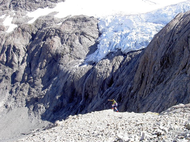
The descent off Whitehorn Pass into the valley is long, steep and rocky, do not attempt it unless you have good knees and at least reasonable visibility to see safely ahead, as some of the scree paths finish abruptly in bluffs. Our advice is to traverse uphill towards the Cronin glacier for a few hundred metres until you could see safely to the river at the bottom.
From the pass it took a good 3 hours to reach the Park-Morpeth Hut, which was bathed in warm sunshine. We were all glad to spread our sleeping mats on the grass and soak up the sun’s rays, a pleasant end to a day that had started with a fair sized serving of navigational unease in the clouds at Ariel’s Tarns.

We were soon joined by 2 hunters from Ashburton, who later went out for an evening shoot. They returned with some reasonable photos of deer, but had not actually fired a shot, as their freezers at home were already full and they were after trophy heads.
Day 3
Park Morpeth Hut – Browning Pass – Grassy Flats Hut

Next morning dawned cool and cloudy and the ascent of Browning Pass began. The hunters had said it was about 2 hours from the hut to the top of the Pass, the 500m climb took us 2 ½.
The track over Browning pass was originally surveyed in the late 1800’s as an alternative to the Arthur’s Pass route. Considerable effort has been invested in the distant past to build a 1 metre high by 2 meters wide stone path that zig-zags through several switch backs while ascending the slope towards Browning Pass. We were somewhat perplexed by the massive effort invested to construct this wall by hand, as the obvious destination is the near cliff-like final climb to Browning Pass, where no road or track could ever be formed and certainly no cart or horse could ever travel.
The last 50 meters or so to the top of Browning Pass is very steep and requires considerable care. Do not rush this bit! It was at this stage that Chris and Richard decided they were outside their comfort zone and renamed the pass Brown-Trousers pass.

Reaching the top of Browning Pass sees a spectacular change in terrain from a steep almost cliff-like scramble in a rock chute, to the large, level vista that is Lake Browning and the tussock meadow that surrounds it. We had read that many summer parties have a quick dip in the lake, but today the overcast sky and strong cool wind put pay to any temptation for a quick splash.

The rest of the day passed uneventfully and pleasantly, descending to the Arahura River, passing by the Harman Hut, crossing the lofty swing-bride over the Harman River, then through the Styx Saddle to the new Grassy Flats Hut. The only tricky bit is the chest high tussock in the Styx saddle which completely obscures your foot placements and therefore often has you stumbling. A turned ankle at this stage, on the easy going low lands would not be a good way to end the trip.

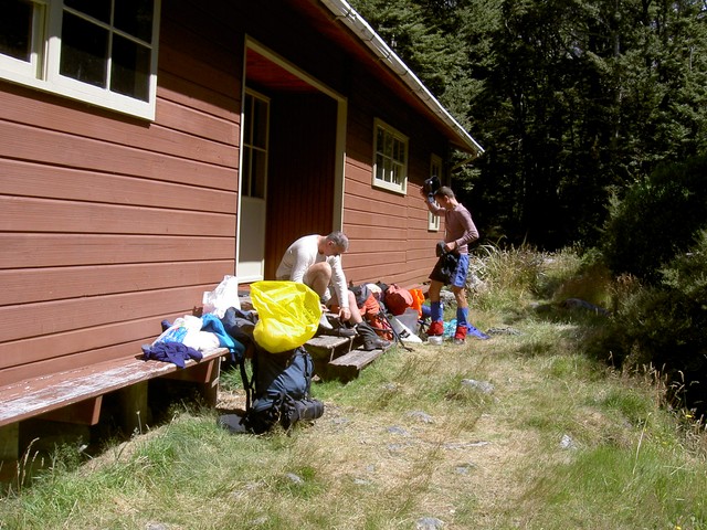
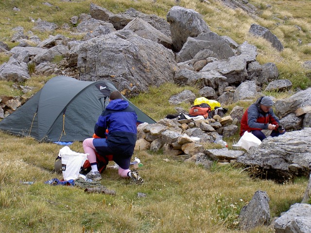
We joined 2 other trampers at the Grassy Flats Hut. The day had been about 9 hours walking and the 3 of us were glad to get the boots off and get a hot cup of Milo in hand. The Milo was of course liberally spiked with whiskey, this medicinal additive soon helped numb the sore feet and stiff shoulders. The new Grassy Flats Hut is well constructed and well sealed against sand-fly penetration (thank goodness).
Day 4
Grassy Flats Hut – Road End

An early start the next day had us comfortably through the easy 12kms to the end of the track by noon, hampered only by about 1 million hook grass seeds attaching themselves to the hair on each of our legs. Luckily at the road end we found a couple of car loads of kayakers waiting for the rain promised later that day, to bring the river level up. One of these kayakers was happy to give Paul a lift to a local farm to phone cousin Raymond in Hokitika, who had been pre-arranged to pick us up.

Raymond soon arrived and whisked us away to Hokitika, where with time-honoured West Coast hospitality, he laid on large steaks, beer and a shower for each of us. (God-bless the Coasters)
Check out our Pope’s Pass bonus article for additional exit options from Browning Pass.

One thought on “The Three Passes 2006: Pea Soup and Brown Trousers”