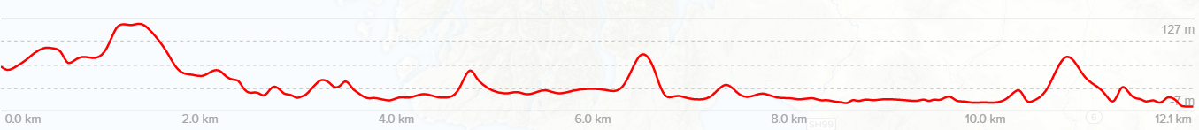
The Dusky Track is a route with a reputation for stunning views, magnificent solitude, challenging terrain and lots of mud. For many years it has been on the Moa Hunters’ must-do list of tramping tracks. After over ten years of walking mountains and valleys across the rest of the South Island, finally we got our ducks lined up for the Dusky!
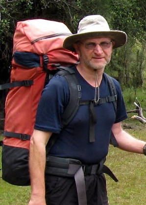
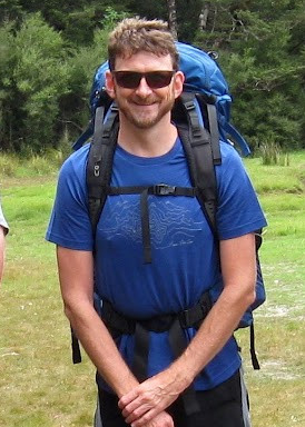
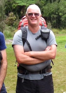
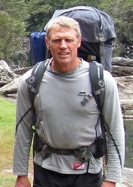
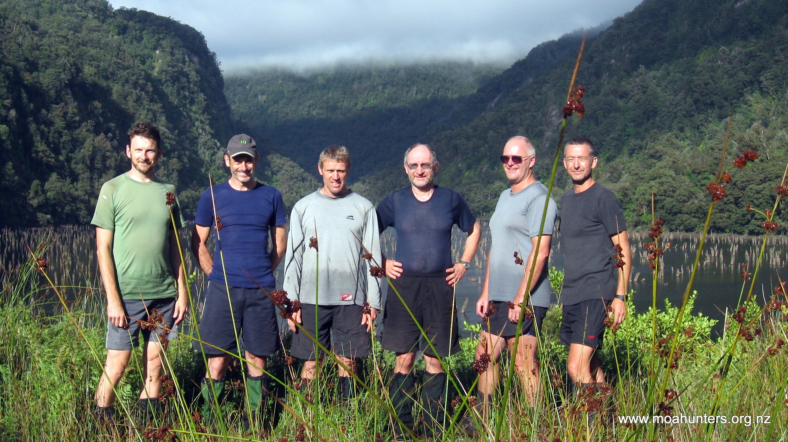
Moa Hunters on this trip: Magnus, Adam, Paul, Lewis, Chris, John


The Trip:
Day 1: Fly to Invercargill. Mini bus transfer to Clifden. Boat trip up Lake Hauroko. Walk to Halfway hut
Day 2: Halfway hut to Lake Roe hut
Day 3: Lake Roe hut to Loch Maree hut
Day 4: Loch Maree hut to Supper Cove hut
Day 5: Supper Cove hut to Loch Maree hut
Day 6: Loch Maree hut to Kintail hut
Day 7: Kintail hut to Upper Spey hut
Day 8: Upper Spey hut to West Arm hut
Day 9: Boat trip to Manapouri, ride to Invercargill, fly home.


Day 1
Saturday 13th January – Start to Halfway hut

After a week of the usual preparations, six Moa Hunters met at Christchurch airport. In the days leading up to the start of our Fiordland adventure, lists had been checked, re-checked and anxiously checked again. The Dusky is a long walk, and none of us wanted to be “that guy” – the one who forgot something vital.
We all felt a growing feeling of excitement. At last the departure day was here. With our final farewells made, we hefted our packs onto the Air New Zealand bag drop, and soon after, boarded the turbo-prop ATR-72 bound for Invercargill.
For those interested, our packs all weighed in at around the 19kg mark. With some ruthless cutting back on luxury items, we could possibly all have carried a bit less. We certainly wouldn’t have wanted to carry much more!

While we milled about at Invercargill Airport, Paul came to a horrible realisation, which was confirmed by a call to his wife, Maria. He had left his legendary Moa Hunt curry mix in the fridge at home. As this was to provide the flavour that would make three of our freeze-dried meals palatable, we agreed that an emergency dash to a Supermarket for some alternatives was necessary. Thanks heaps to Paul’s cousin Trevor and his wife Lynn for the ride!
Our trip from the Airport to Clifden in the Humpridge Track bus was more than pleasant. Under a wonderfully clear sky blue sunny day we were driven across the lazy plains of Southland. It was yet another cracker of a day in what was a record-breaking summer in the South.

We climbed out the bus at the historic Clifden Suspension Bridge and stood in the shade of a big tree while Johan opened up his mighty old Land Rover which would take us to Lake Hauroko.

The Southern end of Lake Hauroko was surprisingly busy. Utes with boat trailers lined the edge of a large parking area near a boat ramp, and a group of lads were busy loading slabs of beer onto a boat for what looked sure to be a very big night indeed.
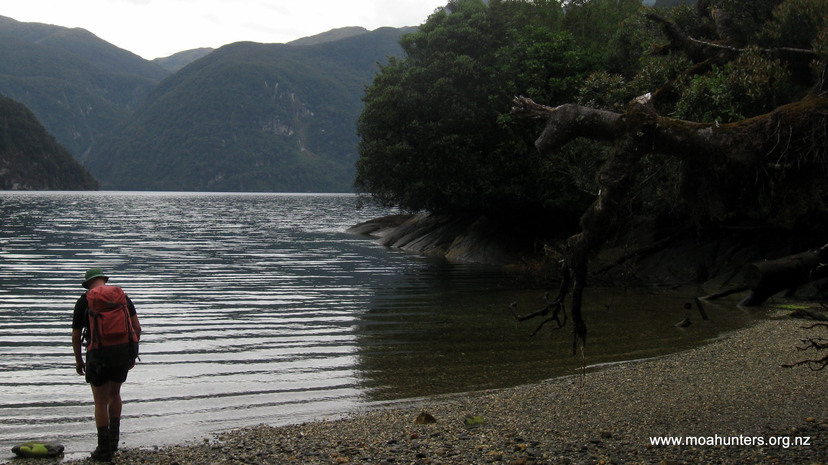
Hauroko is a hidden gem – a really beautiful lake. Where we stood, golden sand left dry by the hot summer is quickly met by green beech forest, and further round the lake, lush bush pushes out to the lake edge. A wooden jetty extends out into calm dark waters of the lake. Johan expertly reversed up beside it, and launches his boat “Namu” – our ride to the northern reaches of the lake.


Powering across the lake, it felt like our adventure had truly begun. Following a short and slightly tongue-in-cheek safety briefing from Johan, we were left to soak up the constantly changing view. We did so with relish, taking in every moment. Lake Hauroko is prone to strong winds that can create an unpleasant chop. But not so on the day we crossed it. In delightfully smooth conditions, we thoroughly enjoyed every view New Zealand’s deepest lake offered us. The 45 minute ride was worth every penny.
As we unloaded our packs at the northern shore of the lake and the start of the track, Johan commented on the lack of sandflies. He seemed somewhat bemused… Maybe it was the weather? Maybe some other factor? He had no explanation. Whatever the reason, there were very few of the miserable little bloodsuckers to form a welcoming party. And we were very happy about that.
At 2pm we took our first steps onto the Dusky track.

The first hour in the bush gave us a strong indication of what was to come; Very warm conditions, little breeze and high humidity, all made for some very sweaty Moa Men. From the first step, the track is beautiful. Flanked by countless varieties of ferns which fill every available space at the feet of moss-covered silver beech trees, it quickly led us into deepest darkest Fiordland.
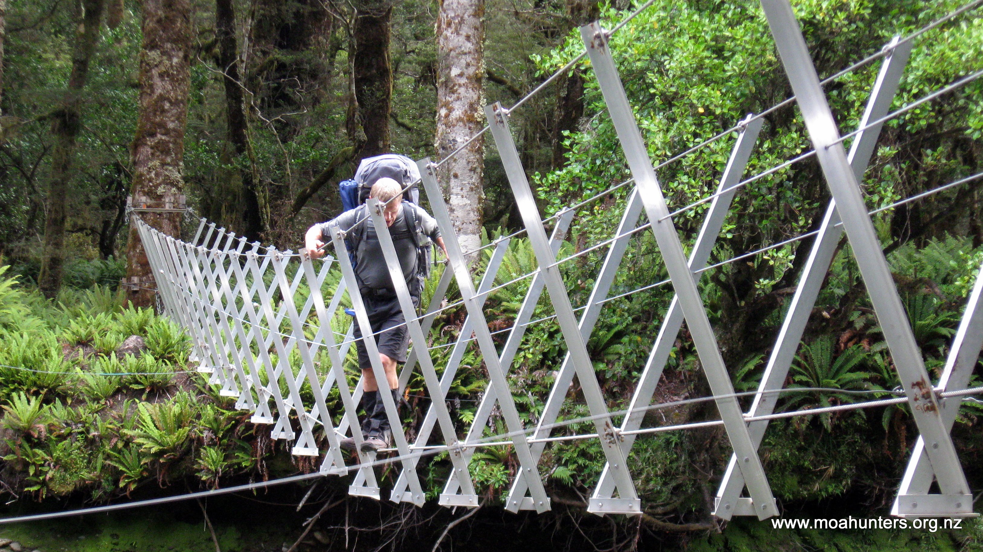
Areas that would in “normal” Fiordland weather have been muddy bogs, were relatively dry. Consequently, we made good progress on what is a mainly flat and easy section of the track. Our first three-wire bridge crossing was done and dusted just before 5pm. Varying foot placement techniques were employed by members of the group. While the bridges aren’t particularly hard to cross, the consequence of a mistake is high, so we all took care and didn’t rush our crossings.
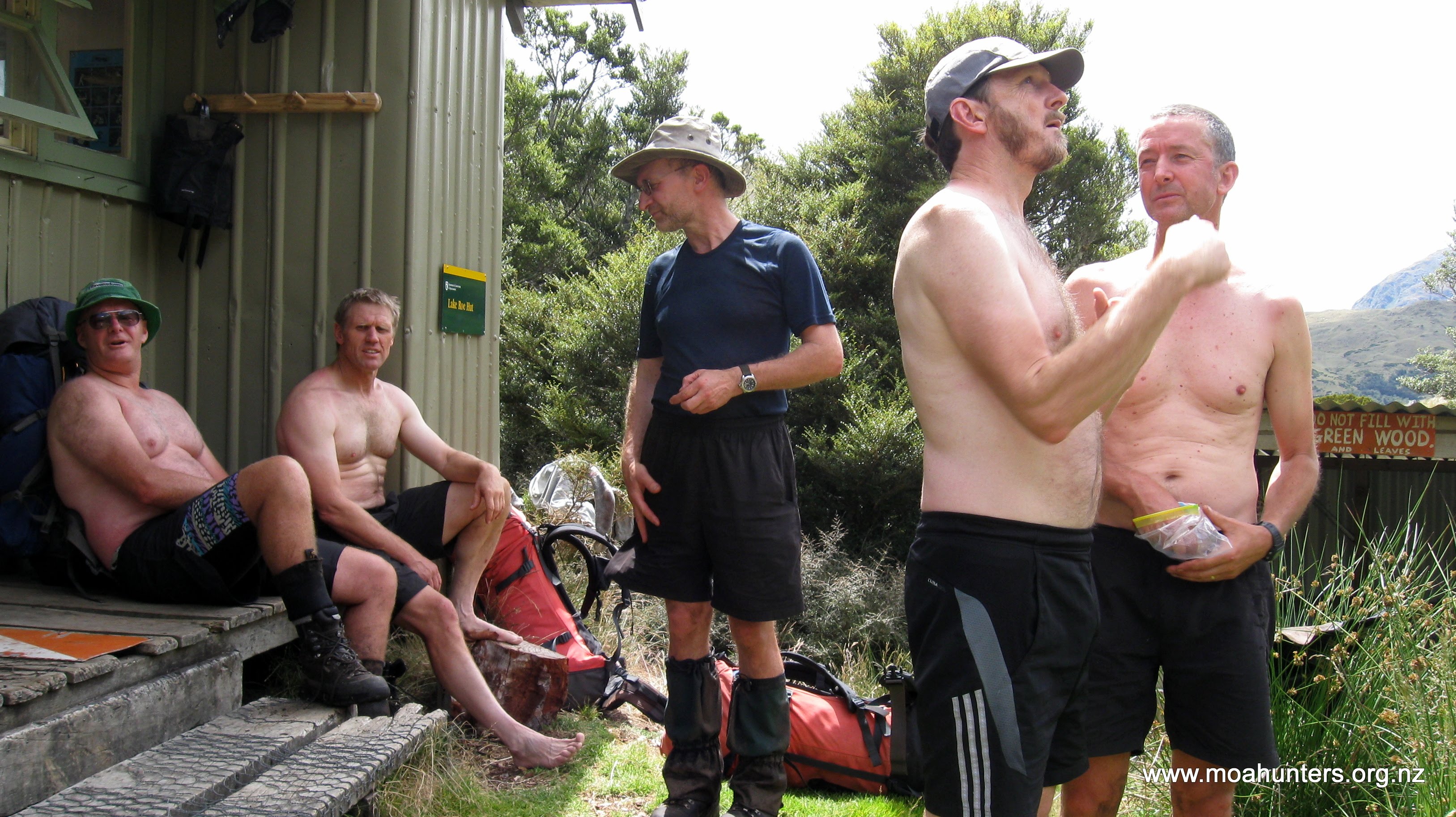
Shortly after 7pm we were at Halfway hut. Given how remote the Dusky track is, we were surprised to find five other trampers inside. No doubt they had some misgivings when six blokes somewhat noisily rolled on in, disturbing their evening! As it turned out, three of them were up for a chat, which is always good. Melanie from Devon, UK, Hayden from NZ, and Konrad from Germany were excellent company.
In fact, Hayden had even read a Moa Hunter website post or two: “Oh, so you are those old fellas!” sums up the moment he realised who we were…

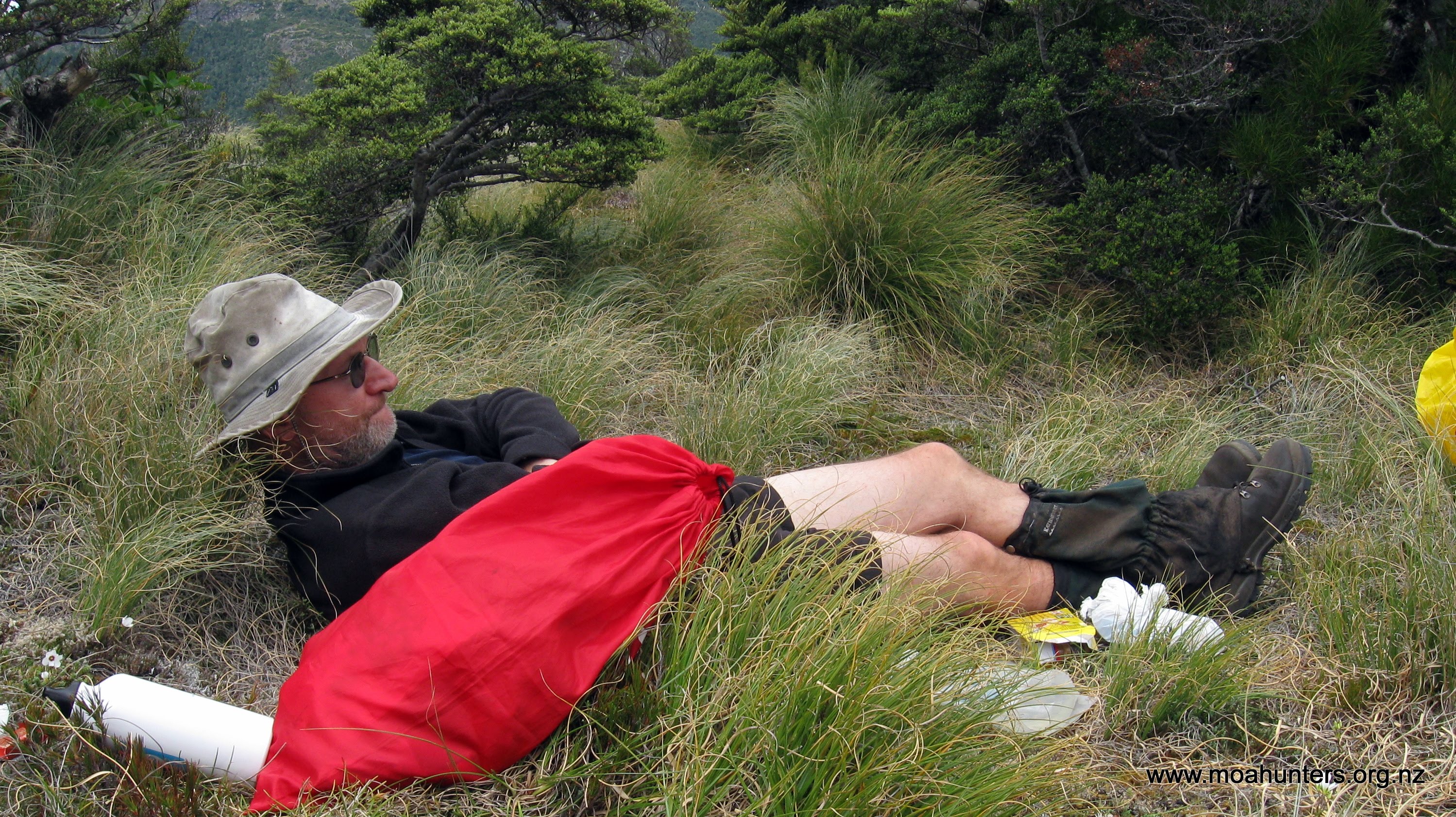
As is a first-night-on-the-track tradition now, Paul cooked up a tasty steak and veg dinner. It was a very warm night and sleeping bags remained unzipped throughout.
Day 2
Sunday 14th January – Halfway hut to Lake Roe hut
One of the many things that makes tramping an addictive drug is standing outside the hut on a clear crisp morning, inhaling cool air so clean and so fresh it seems nobody before you could have breathed it.

High above the hut, “Dolly Parton” peaks (as we dubbed them) were tanning in the early morning sun. It was going to be another lovely day. Creamy porridge liberally covered in brown sugar would provide us with energy for the first couple of hours of the day. And a steaming cup of coffee, your choice of Hazelnut Latte and Salted Caramel, provided by Magnus.
By 8:30am we were packed up and ready for the obligatory team photos. Hayden “volunteered” to take them for us, and hopped barefoot across the damp grass to snap a few shots on our many cameras. Justifiably, he wondered why we needed so many photos… There’s no reason, it’s just tradition!

Our packs still felt like they were full of lead and stones as we said our goodbyes and left Halfway hut. The track climbs gently up the Hauroko Burn valley, and we were mostly untroubled by bog or awkward terrain.

We were standing at the first swing bridge by 9:30am. Crossing this one was made doubly interesting due to its drunken nature. The upper-left cable is not as taut as its partner on the right, causing the whole rig to lean awkwardly to the left. With 19Kg on our backs, crossing it was an interesting off-kilter exercise…

Around midday we rolled up to the second wire bridge. Regular boggy patches along the way had been easily hopped across or skirted. The odd steep drop into a gully and similarly tight climb out the other side kept things interesting. Generally we found the terrain in this section easy going and quite pleasant.
Our only “complaint” was the heat. Our expectation was that we would get very wet on the Dusky, notorious for the metres of rain that Mother Nature dumps on it every year. We had not expected our shirts would be soaked with sweat in place of that regular precipitation. At times the heat and humidity were oppressive. With no relief even in the shade, our bodies struggled to maintain temperature. We all drank plenty of water at every opportunity to maintain fluid levels. John used his sweat to create romantic art on his walking top.

The stream here was so low here we didn’t bother with the wire bridge, and just rock-hopped across. On the other bank we dropped packs and had lunch. A few sandflies hovered about listlessly, but perhaps they also found the heat tiring. They lacked commitment, and didn’t live up to their fearsome relentless bloodsucking reputation.
Paul perused his topomap and reminded us all that the next section would get steeper. Not horribly steep, but a good workout.
From the wire bridge the track follows the true right of the stream. Below Lake Laffy the valley narrows considerably, and the track gets noticeably steeper with numerous rocky sections. Progress slowed, and the heat of the day increased. The bush above our heads thinned and the sun made its presence felt, adding fire to the already oppressive mid-afternoon heat.

Breaking out of the bushline we almost immediately encountered boggy conditions. Perhaps this is due to the lack of large vegetation to soak up the moisture. While the ground underfoot was heavy and at times spludgy, crossing this area onto higher and drier ground wasn’t too arduous.
Looking dark and almost syrupy, Lake Laffy sits below Lake Roe hut. Adam wondered why the hut is named after a Lake you can’t even see from it. Lake Roe is significantly larger, and is a short walk over the low hills behind of the hut. Maybe it got hut naming rights because it is the big brother.
It was almost bang on 2pm when we spotted Lake Roe hut across Lake Laffy. Our short day on the track would give us some time to explore the interesting looking terrain behind the hut.
We had been told at Halfway hut that Lake Roe hut was being used by two DOC staff for a Rock Wren monitoring programme. So finding the hut full of supplies came as no surprise. They had all sorts of goodies like fresh lettuce and tomatoes. Having a chopper bring in your gear allows for some luxuries. However, the two staff were nowhere to be seen at this time.
After a pleasant break soaking up the warm afternoon sun on the porch, we organised ourselves for a foray over the low hills that hide Lake Roe behind the hut.
Without our heavy packs, and wearing light footwear, we scampered up the slopes in no time at all. The short walk is well worth the time. The strange array of tarns that punctuate the grassy flats around Lake Roe are quite unique. Cameras were pulled out and many photos taken.

Below us, one of the DOC staff strode into view, carrying a mid-size day-pack. We gave her a cheery wave, and she waved back. No doubt we would say a proper hello later at the hut.

Hoping to catch a view of distant Centre Pass, Chris, Paul, Lewis and Magnus decided to walk across to the opposite peaks for a view. Later when we met back at the hut, they reported nice views, but were nowhere near high enough to get a glimpse of Centre Pass. That would have to wait a few days now!
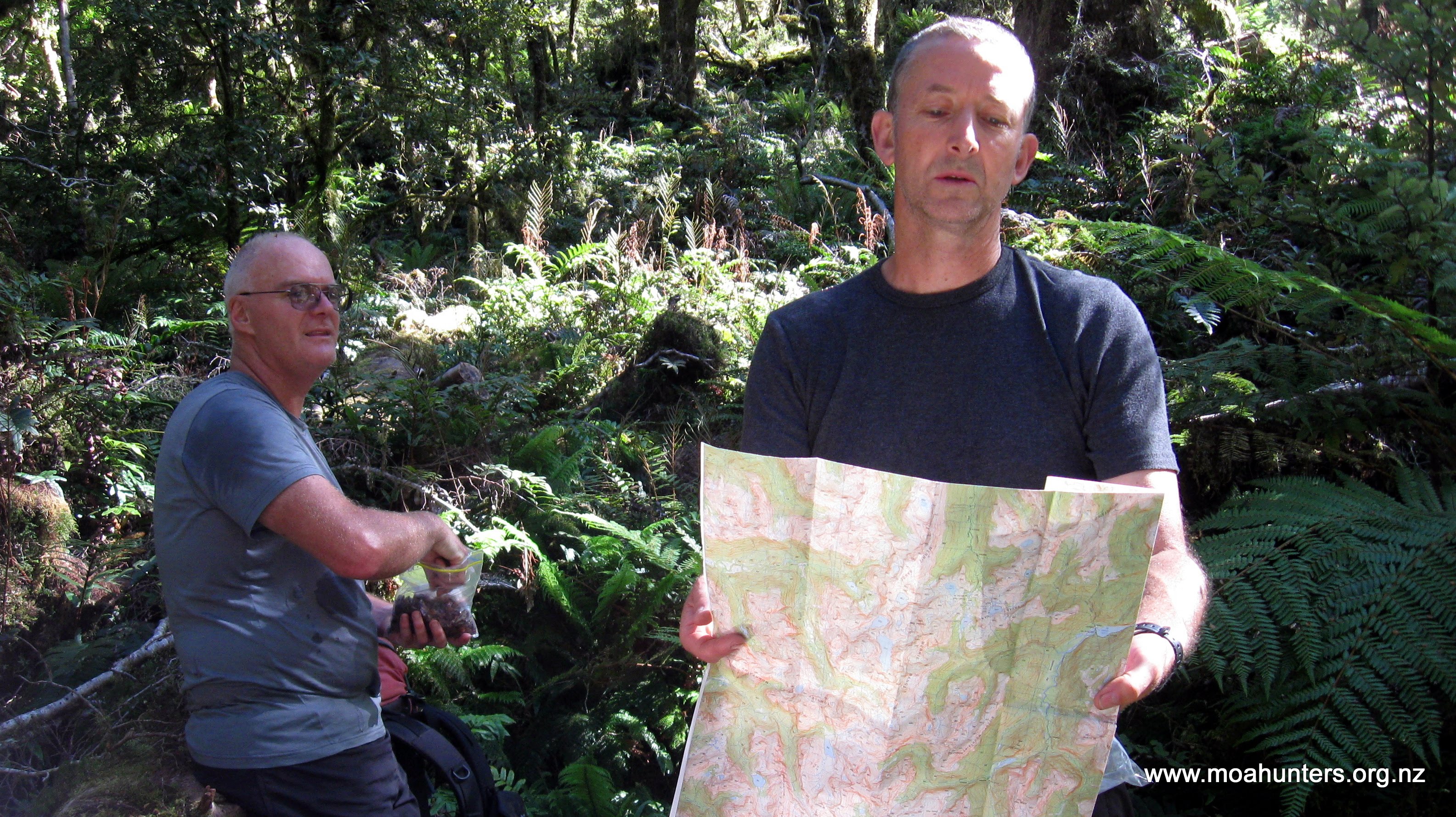
Our evening at the hut was a very interesting one. Crystal and Louise explained the DOC Rock Wren programme to us all. Pointing to various marked locations on a topmap, they gave us a fascinating insight into the daily life of this tiny native bird. The passion they have for their work, and love for the Rock Wren was impressive. So much so, when we mentioned seeing Kiwi on Stewart Island, they were almost dismissive. Kiwi are nowhere near as exciting as Rock Wren in their books!
In return, we entertained them with tall tales of our Moa Hunts.

Sadly, Richard had to pull out of this year’s trip due to a dodgy knee. Because we would be missing his frequent renditions of children’s songs, Paul had recorded him singing “Wonky Donkey” on his phone. He played it to us all, including the slightly bemused DOC gals… Hearing Richard recite the entire Wonky Donkey song certainly brought a smile to all our faces and was a fitting end to a really enjoyable day on the Dusky.
Day 3
Monday 15th January – Lake Roe hut to Loch Maree hut
Monday morning looked good. High cloud meant we would be spared the full force of the sun as we traversed the tops of the Pleasant Range. We were also hopeful it would remain clear of the higher peaks and allow us some great views. An increasingly enthusiastic nor’westerly breeze would keep things interesting.
All six Moa Hunters were out of their sleeping bags before 7am, and a mere hour and a half later, we were ready to start our days walk. After the obligatory photos and goodbyes to Louise and Crystal, we were off.

In dry conditions the climb out from Lake Roe is a straightforward exercise. Steep sections are well stepped, and where the going is less tough, the track meanders its way up the slopes. Climbing is steady, and we all got quickly into our stride, with a welcome breeze keeping us cool.
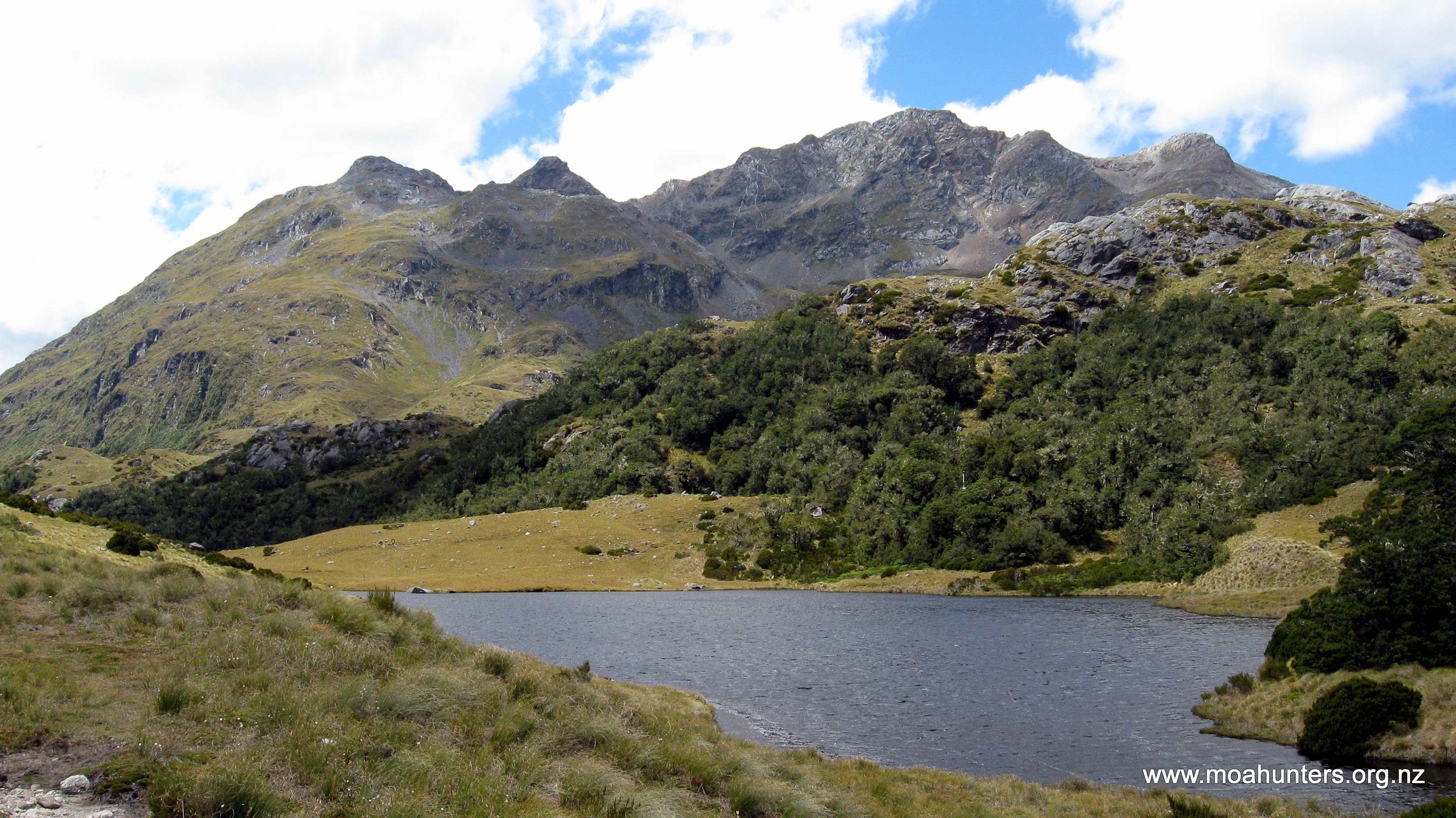
Some parts were a definite grunt, with some blowing and panting. The spectacular views back to Lake Roe hut behind us provided plenty of excuses to stop for a breather, and take in the wonderful scenery.
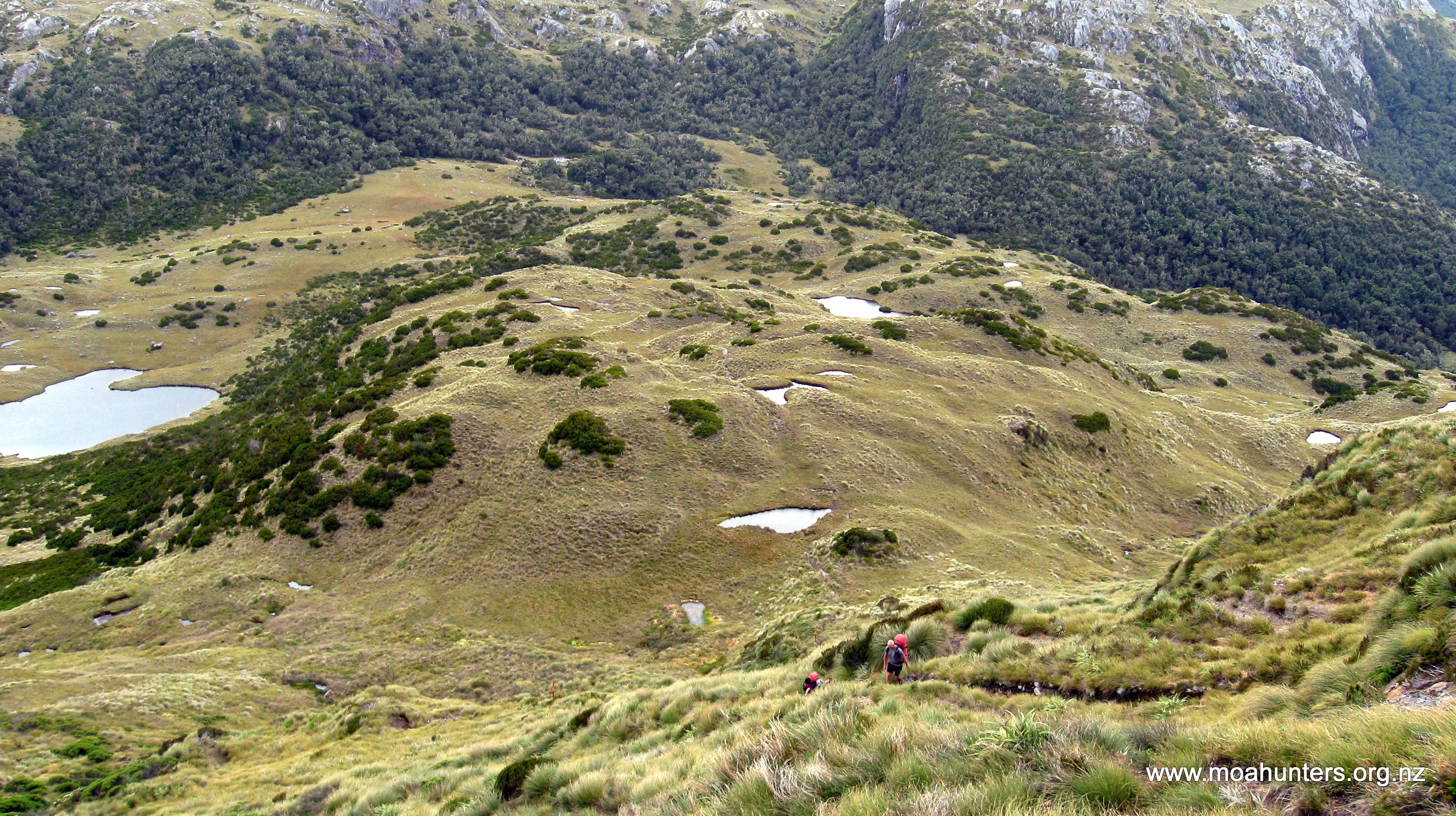
Lake Horizon sits just above 1000m. The track follows a narrowish grassy strip that runs between it and Lake Ursula, undulating over small lumps, or winding its way between them.

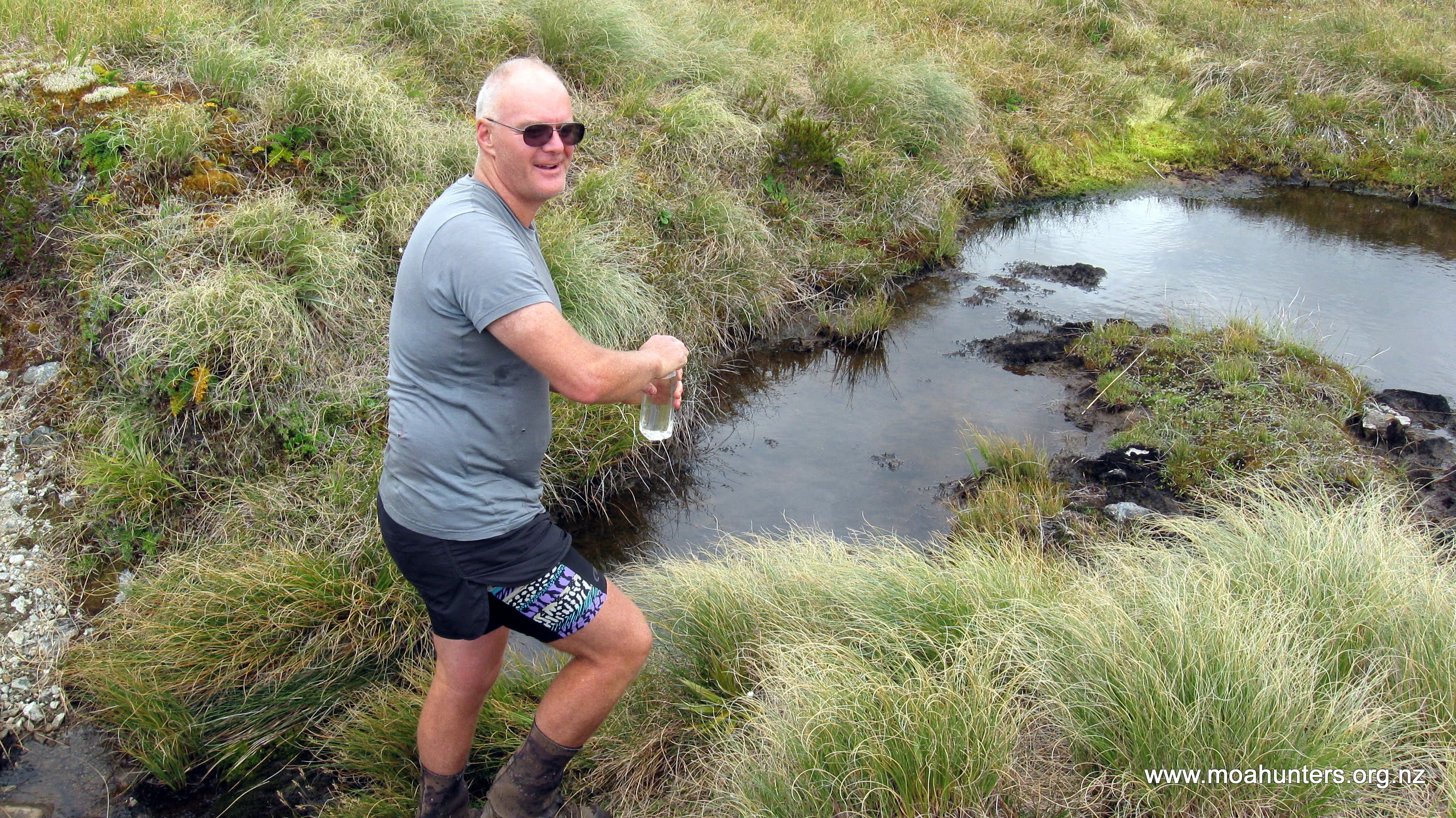
Leaving the Lakes, our next leg was across the open tops of the Pleasant Range. Chris and Paul noted on the map that there are quite a number of tarns along the way. Conscious that once we hit the bushline later in the afternoon there would be no more water until Loch Maree. We planned to fill out bottles at one of the last tarns that we would pass.
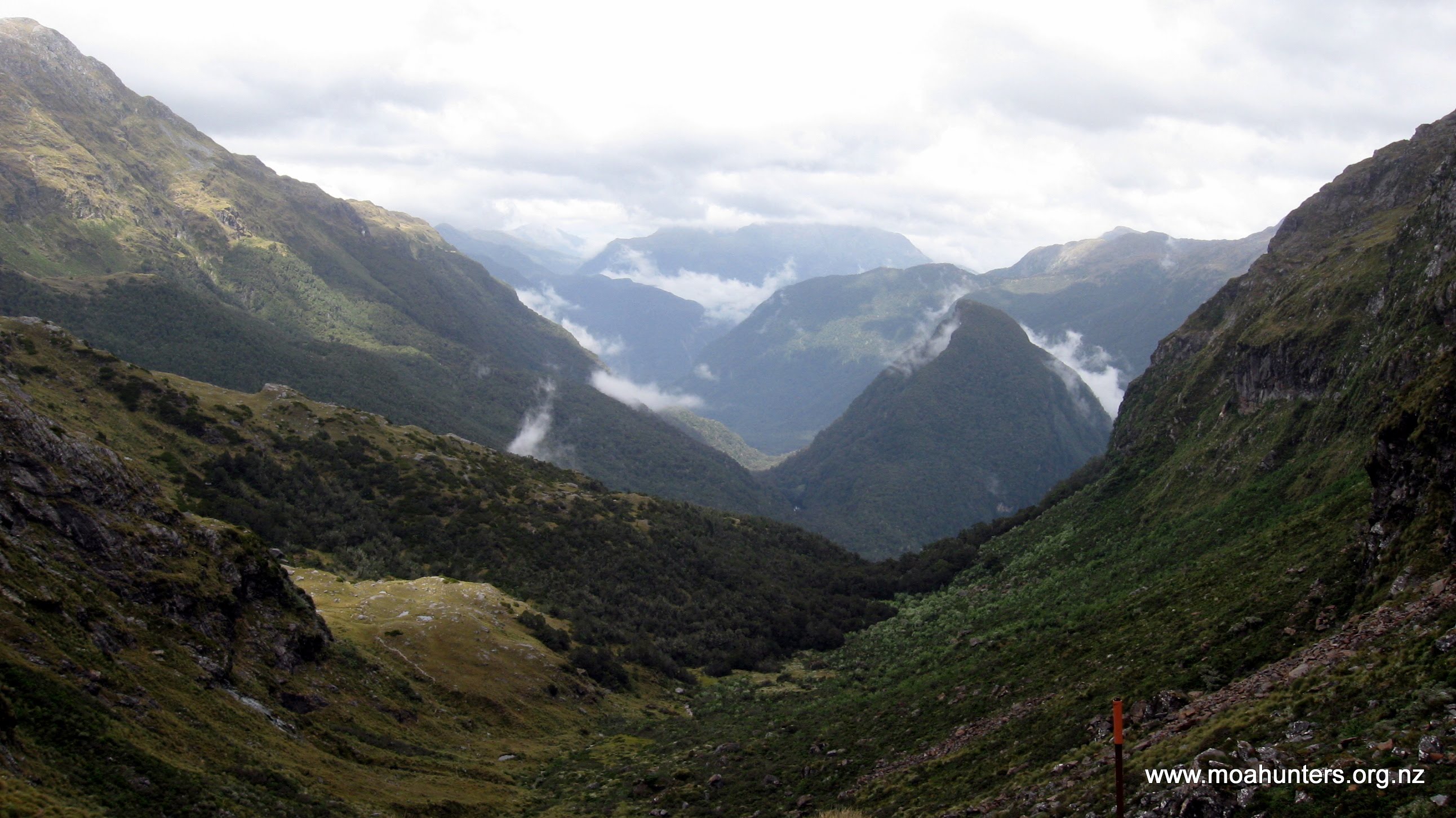
Surrounded by range after range after range of granite mountain peaks, we enjoyed every angle of the 360 degree panorama that swept around us. This is a special part of New Zealand, and we were all determined to make the most of the spectacular scenery that was on show.
Shortly after 11am we stopped at a clean and clear looking tarn. Chris hopped down and sure enough, the water he filled his bottle with looked clear and very drinkable. Bottles and bellies were filled with cool refreshing water.
Reaching a high point shortly after, we were finally rewarded with absolutely stunning views of Dusky Sound. After half an hour of being teased with tantalising glimpses of the distant ocean, it now lay majestically in front of us. Despite the cool breeze, we stood there for quite some time, rewarding ourselves and feeling privileged.

Below us we could see the track disappearing into the bush. We agreed that lunch should be taken at a spot out of the bush, out of the wind, with views of the Sounds. We walked on down, and just after midday found just such a spot.
Cushioned by the long grass and sheltered from the breeze, with the World at our feet, it was all too comfortable and pleasant. We were in no rush to start the brutal descent to Loch Maree, and spent over an hour in that place, chatting, snoozing, and nibbling away at our lunches.
From the tops, the track drops away steeply. And that would be a fair summary of the entire 900 vertical metre drop to the Seaforth River below.
Initially relatively dry and clear, the track quickly becomes trickier with plenty of beech roots and short vertical climbs. Out of the breeze and working very hard, we quickly got very warm indeed. Aware that we had only the water we were carrying until the bottom, we rationed ourselves. This took some willpower in the stifling heat.

Only Lewis enjoyed the long descent. While the rest of us puffed, grunted and grumbled, he cheerfully hopped and skipped his way down. What a bastard.
We had numerous stops during the two hours of arduous downhill. Any flat place with a hint of a breeze was a welcome respite. Imagining what the Dusky might be like, none of us had envisaged this. In my mind I pictured myself with a jacket on, frequent heavy rain, mist, mud and sandflies. I certainly hadn’t anticipated the heat, humidity, sweat and sunshine we were experiencing.
Dropping our packs beside the Jane Burn was a welcome relief. Two hours on that hill had been more than enough, and we were feeling generally buggered. The cold clear water of the stream was heavenly. It’s amazing how good water can taste. Just drinking from Jane Burn was not enough for Lewis, who took the opportunity to cool his entire body in the water.
The short stretch of track from Jane Burn to the wire bridge over the Seaforth River is magnificently flat. We filed across the bridge and just a few minutes later were at Loch Maree hut, after a short climb up the rocky knob it sits atop.

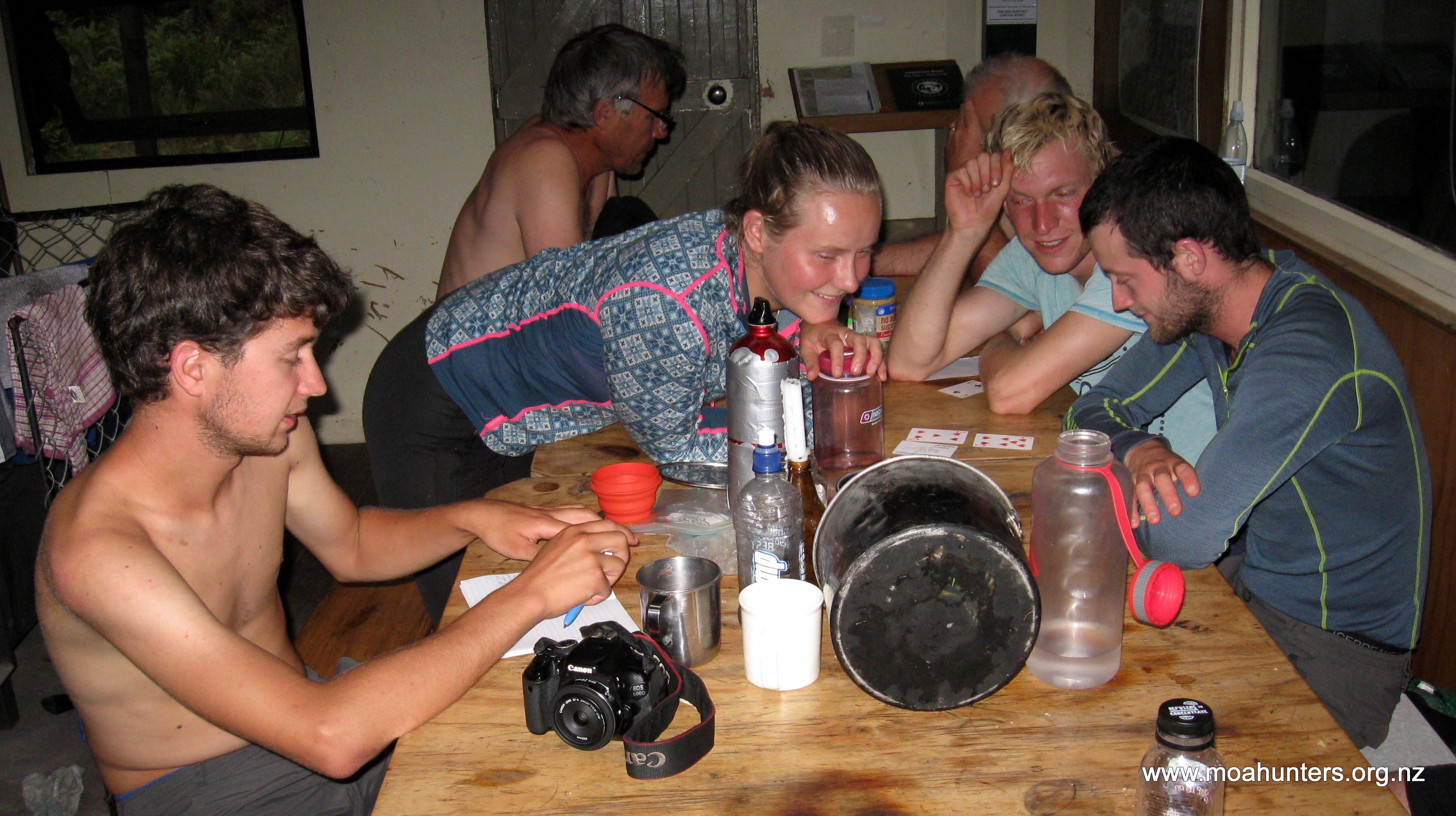
We were the only trampers at the hut, but not for long. Shortly after our arrival, two men rolled in, followed by a group of four internationals who had been to Supper Cove. The two older Kiwi blokes had come in from Kintail Hut. We dubbed the younger group “The United Nations”. Ulysse from France, Marlene from Norway, Lukas from Germany and Harry from Scotland all met at Auckland University and were spending their summer break walking the best tracks in the South Island.
After a hot day on the track, the cool waters of Loch Maree and the Seaforth River looked inviting. John, Magnus and Adam strolled down for a dip. The initial intention was to plop straight into cool waters of the Loch. However, the sandy bank is extremely soft and drops steeply into very deep dark water. Getting out again could be an issue. As we pondered this, a very large eel slowly swam past, sealing the deal. We instead bravely (not!) opted for a splash in the shallow waters of the Seaforth where it flowed into the Loch.

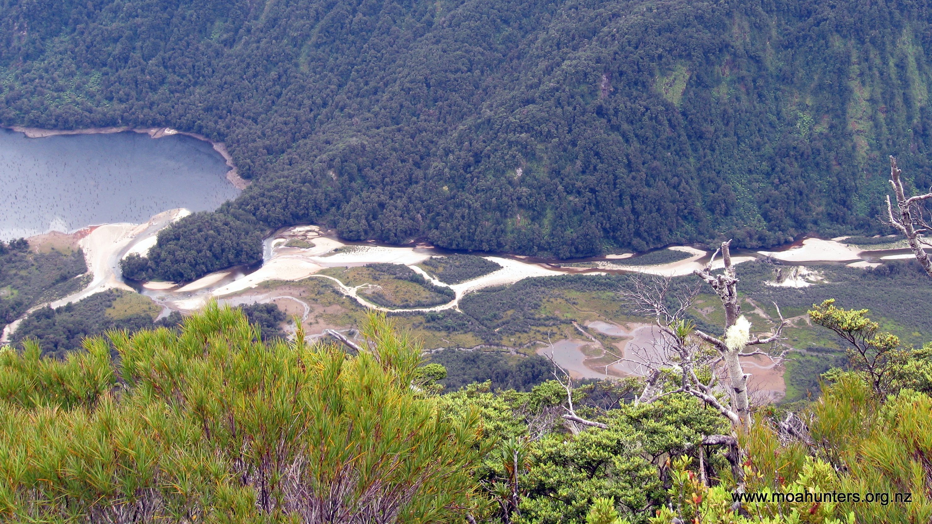
Loch Maree was created by a landslide that was triggered by a large earthquake on the Alpine Fault in 1826. The landslide dammed the Seaforth river creating this lake in the valley behind. The trees in the valley were all drowned. It is amazing that nearly 200 years later, their stumps still remain, the cold water of the lake protecting them from insects and fungus attack. They now form a handy gauge for trampers. If you can’t see the stumps, you can’t get to Supper cove. The rivers will be impassable. If you can see half a metre of stumps, you are good to go.
Seeing all the spider webs on the hut, each festooned with dead sandflies got Magnus thinking… He made the comment that in Fiordland, we lowly humans are the bottom of the food chain.
“Sandflies feed on us. They are then eaten by spiders, which are finally eaten by birds…”
That evening, a hearty Spaghetti Bolognese followed by Panna Cotta dessert filled our capacious Moa Men bellies. Hot chocolate fortified with whisky capped off a deliciously tasty trio.
We enjoyed chatting to the other hut residents, and watching The United Nations play a fascinatingly complicated card game. Before bed, we played Richard’s rendition of Wonky Donkey for everyone, which was enjoyed particularly by our young tramping friends.
Day 4
Tuesday 16th January – Loch Maree hut to Supper Cove hut
Looking down at Loch Maree from the hut window, the waters seemed even lower than the previous evening. Perhaps it was our imaginations, but the dead trunks seemed more exposed on this slightly overcast but pleasantly warm morning.

We spent the morning doing deciding what equipment and food we could leave at the hut. Our aim was to carry to Supper Cove only what we needed. The rest could stay in bags in a cupboard at Loch Maree until we returned.
Leaving the hut at 10am is late even by Moa Hunter standards, but with walking conditions very good, we were not concerned about the leisurely start.

The first section of track follows the north bank of Loch Maree fairly closely, with regular climbs to skirt boggy areas and gullies. Progress along here is steady and we made good time to the west end of the lake. At times it was clear were on the remains of an old miner’s track that was cut through this area in the early 1900’s. In particular when we walked past an old blacksmith’s anvil on a rusting iron frame.
Beyond a section that skirts high above the narrow gorge at the tail of the lake where a huge landslide blocked the river a few hundred years ago, the tracks drop into the Seaforth valley again.
We stopped for lunch at a lovely spot on the bank of the Seaforth. Leaning up against moss covered rocks, munching on our lunches while watching the river flow slowly past was a peaceful and incredibly pleasant experience.

After an hour we somewhat reluctantly pulled our packs onto our backs and continued on. Shortly after our lunch break we came to a ladder up a steep rocky face. This is a fairly unusual find on tramping tracks. Clearly, heading into the bush to find a way around this feature proved too nasty when the track was being formed, and the ladder was put in place instead.
Shortly after crossing a three wire bridge, the track opens out into a flat super flat super easy section, akin to a great walk. After the earlier slightly awkward sections, unimpeded walking was a welcome change.
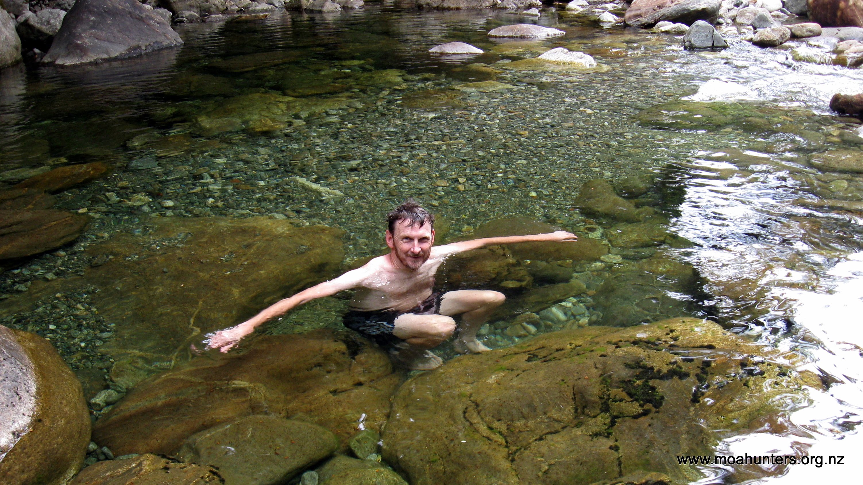
We stopped beside the river at a deep and inviting looking swimming hole. Lewis and Paul were keen for a quick refreshing dip. Dropping packs, they were in the water in no time, enjoying the clear water of the Seaforth.

Marking the end of this Fiordland highway is a set of three walkwires which cross Henry burn and another unnamed river that crosses the track. Conditions around these bridges were boggy even when we were there. Chris did have to excavate one of his legs by hand from a particularly deep and sticky mudpool. After rain you can expect to encounter some serious gloop and spludge in this area!
A short walk from the trio of bridges, we stopped for afternoon tea in a clearing with a beautiful waterfall. Two blue ducks were standing on a rock between us and the fall. Clearly they owned the place. We took lots of photos and enjoyed the serenity of that place. A skilled painter couldn’t have come up with a better composition. Because it was such a lovely spot, we spent longer there than our usual afternoon rest. We arrived about 3:30pm and didn’t leave until an hour later. But it was worth it.

Beyond the waterfall, the track gets rougher. In fact, it gets particularly unpleasant and grovelly. There is an option to avoid this section if the tide is out, and walk across the sand to Supper cove hut. This wasn’t an option we were able to avail ourselves of. So we spent the next hour and twenty minutes scrambling up and down awkward, slippery, nasty terrain. After the easy section that preceded it, this seemed like a particular hardship.
Our tired bodies were very happy to drop out of the bush into a small inlet with an old boatshed nestled up in the trees. Paul had arrived a few minutes before us, and comically greeted us at this point carrying an umbrella he had grabbed from the hut.

We wandered up the last gentle climb to the hut and gratefully dumped our packs for the day. After marvelling at the sweeping spectacular views of Dusky sound from the deck, a few of us headed back to the little inlet for a quick swim to wash off the day’s sweat.
Our plan was always to catch and eat fish for dinner this night. So, we rigged up our lines and headed down to some rocks below the hut to try our luck. As it turned out, not catching fish was harder than getting them! A short throw of a hand line from the rocks invariably came back with a fish on the hook. In just over an hour we caught over a dozen good sized fish, including blue cod, terakihi, red cod, parrotfish, stargazers and spotties. We kept the best eaters, and put the rest back.
A word of warning – the large rocks are very good to fish off, but are also extremely slippery. Magnus very nearly took an unscheduled swim before John grabbed his collar and prevented him sliding into the drink. Normally slipping into the sea wouldn’t be of much concern, but the large sharks that were regularly cruising by made us rather cautious about falling in!
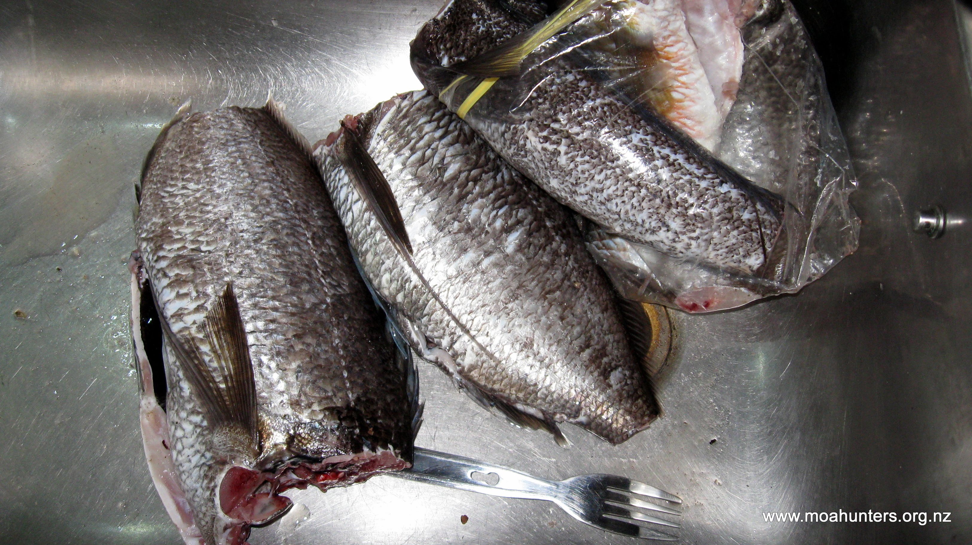
It would be fair to say we overindulged on fish that night! The rather unique combination of terakihi, ghee, seasoning and wasabi peas was actually rather good! We piled so much pan-fried fish and couscous into our bellies that it was agreed a dessert wasn’t required. A rare decision for the Moa Hunters!
Day 5
Wednesday 17th January – Supper Cove hut to Loch Maree hut

Breakfast consisted of left-over couscous and rice pudding. Not a traditional offering, and probably not one that we will repeat. But it did put some fuel in our tummies for the morning’s walking.
Overnight we had the first significant rainfall of our trip. By morning low cloud was still shrouding the hills that flank Supper Cove, and light drizzle was falling. Hearing the heavy rain during the night had raised some concerns that crossing some of the low-lying sections back to Loch Maree could become tricky. But those fears proved unfounded.

As we packed up our belongings and tidied the hut, drizzle and rain alternated outside. Knowing that a 10am departure would be plenty of time to get to Loch Maree, we had another lazy start to the day, with plenty of tall tales and laughter around the breakfast table.
We all loved Supper Cove. It is a special place that not many people get to experience. Describing it in words or even photos doesn’t come close to doing justice to the pristine beauty. To understand how lovely it is, you will need to get your tramping boots on and see for yourself. Fun fact: Dusky Sound is the first place that beer was brewed in New Zealand. Hooray! In 1770, James Cook had his crew make spruce beer here, using molasses, Rimu tips and Manuka as the primary ingredients.
After a protracted photo session, we bade goodbye to Supper Cove at 10:10am and walked back down the track towards Loch Maree.
Low tide was 7am, which meant that by the time we reached the first streams that flow into Supper Cove, the tide was well on its way in. The incoming tide is very effective at blocking the stream water flowing into the cove, causing them to back up and get very deep. Crossings that we strode through with dry feet the day before were now a metre deep in water. We were forced to make two or three long diversions up these creeks to find suitable places to cross them without swimming! In one case we had to walk quite some distance before finding a perfect bridge formed by a large fallen tree across the stream.

Aside from occasional refreshing drizzle, our day was very much the previous one except in reverse. We did take the opportunity to walk the lake edge for the last couple of km to the hut rather than stick to the track. The sand was fairly puggy and soft, so the change of route didn’t save any time, but was a nice change from the track through the forest.
We reached Loch Maree hut at 5:30pm to find just one occupant – a young French fella called Johann. He was a friendly and quiet dread-locked dude – a proper hippy loner who was cycle-touring and tramping his way round the South Island. We gave him some of our unused soft baits for fishing with, and rags to make sinkers from. (Putting a stone in a scrap of material and tying it to your fishing line makes a perfect sinker, and rags are much lighter to carry in your backpack than lead sinkers!)

Dinner that night was nachos punctuated with what we christened “bullet beans” in it. Partially rehydrated, they were rather solid, but actually quite good. Dessert was ambrosia pudding, and was a brilliant success, and a debut for that recipe on a Moa Hunt. Chris was particularly pleased to have finally produced a properly set yoghurt on a tramping trip, which was used for the ambrosia. Johann was also pleased, because he got to share some of it!

Shortly after 10pm we were all in our sleeping bags snoring contentedly.
Day 6
Thursday 18th January – Loch Maree hut to Kintail Hut

Low cloud quickly gave way to clear patches and soon a sun was shining warm and bright on Loch Maree. Our packs were loaded up with all the extra gear we had left behind while at Supper Cove, and certainly felt heavier this morning.
The track from Loch Maree starts with a rough and at times awkward sidle above the Seaforth River.
Almost exactly an hour’s walking from the hut we came to a short solid construction bridge over a stream. From there the track stays low beside the river. For much of the next two hours, the track isn’t much of a track at all. The river valley is wide flat and quite boggy. Rather than looking for an obvious trail, the best course was to choose the least muddy and wet looking route to the next orange marker, if there was one.
In many places, even finding the next marker was a challenge. If you are on the Dusky and walk more than 20 metres without seeing an orange track marker, you are likely not on the track any more. The track is not always well formed, but it is very well marked. If you aren’t seeing regular orange markers, backtrack to the last marker you passed and have a better look around for the next one. While the track may appear to carry on straight, oftentimes the next marker is to your left or right.

We reached the first wire bridge right on 12:30pm, and once all safely on the other side, we dropped packs for a lunch break. A blue duck preening itself on a rock nearby provided some light entertainment as we sat back and enjoyed hot sunny conditions next to the river. Enjoying the lovely day, we didn’t pull our packs on until 1:45pm.
Beyond the wire bridge the tracks begins to climb towards a tight valley at the base of Tripod Hill. After 30 minutes walking, light rain started to fall. We put our pack covers on, but didn’t bother with rain jackets. The day was still very warm, and wearing another layer would have been extremely hot and sweaty even in the rainy conditions.
Just after 3pm we had our first glimpse of Gair Loch. What looks easy on the topomap proved not to be so in real life. We lost the track numerous times around the lake, and had to traverse a large slip full of boulders and trees that had swept down with all the earth.

Beyond the lake, the last section of track to the hut is much easier to follow and we reached Kintail hut at 4pm. The rain had now stopped and we hung out wet pack covers outside the hut to dry. It was something of a relief that the rain had stopped. A note in the Loch Maree hut book warned trampers that the wire bridge east of Kintail hut across the Seaforth River had been destroyed by a tree fall. If the Seaforth was in high flow, crossing could be problematic or impossible.

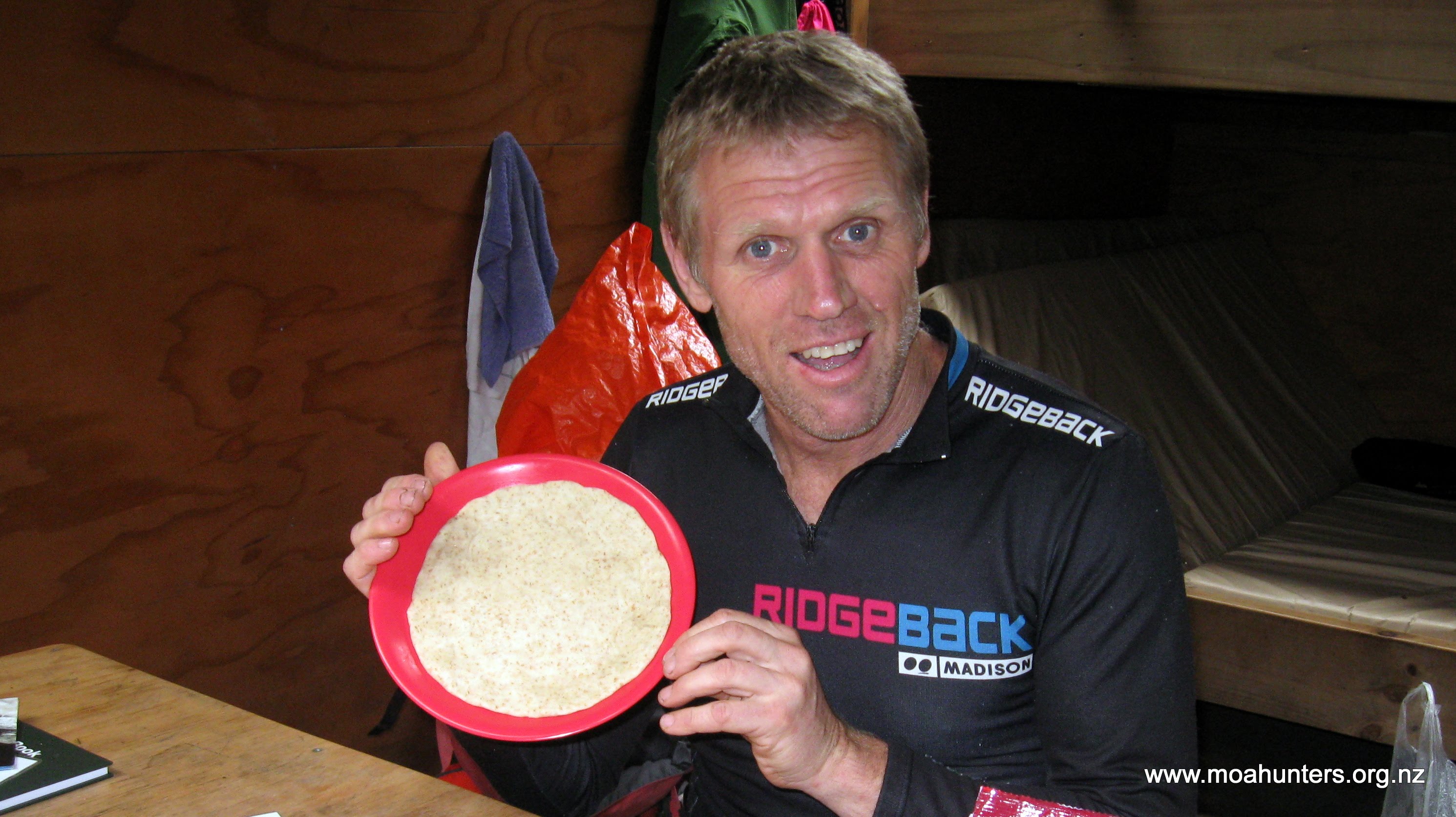
Magnus brewed up a very welcome hot chocolate, which was fortified with the last of our whisky. Dinner was an Indian curry and naan bread. The naan was a particularly delicious success. Dessert was less of a success, but equally tasty. What was supposed to be a self-saucing chocolate pudding ended up as chocolate slops due to too much liquid and no baking powder.
Kintail hut is a good one – larger than the others we had stayed in on this trip, with low sandfly numbers. Any hut with few resident sandflies is a good one! For the first time on our Moa Hut, we came to a hut with no other occupants.
Lewis and Chris amused themselves that evening repairing Chris’s boots, which had started to fall apart. The sole and leather upper had clearly had a disagreement, and had decided to part company. A combination of wire and strapping tape was used to resolve the dispute.

Day 7: Friday 19th January – Kintail Hut to Upper Spey hut
Clear skies greeted us as we went through our usual morning routine of porridge, fart-arsing about, tidying up, fart-arsing about, cleaning, fart-arsing about and a team photo.
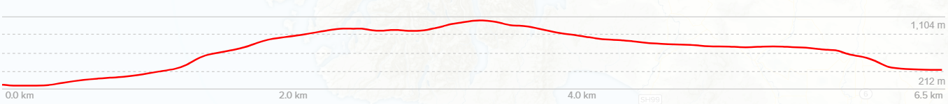
Despite the fart-arsing about, we were out the door and on the track by 9am. Knowing we had a fairly big day ahead, with a solid 600 vertical metre climb to Centre pass, we were keen to get going earlier than our more recent starts.
With the wire bridge smashed, we wandered upstream from its remains to find a suitable crossing. This was found almost immediately. The Seaforth was running very low, and could be crossed easily almost anywhere.

Beyond the river crossing, the track launches into a steep sidle followed by a steep climb through the bush. Steep became a bit of a theme for the day.
The first wire bridge was reached in 50 minutes. From this point, things get very steep, and with no streams marked on our map for quite some distance, we took the opportunity to fill our drink bottles. The best spot to get water here is five minutes’ walk up from the wire bridge, then a short clamber down a slope to the stream below. We dropped down at a DOC post marker with an arrow on it.

From here we slogged uphill for an hour and fifty minutes. Twenty minutes of that was particularly steep. As it looked like the bushline was not far ahead, we stopped in the shade for some scroggin and a break.
Our break was well timed. After just ten minutes more walking we emerged from the bush and could see Centre pass looming high ahead of us. It took us an hour and a half to reach the pass. Walking through the tussock and alpine herb fields was a pleasant change from the bush.
We had been hoping for a clear day, and it looked like we would get out wish. While there was scattered cloud about, it was high, and we would get good views from the top of the pass.
Looking back towards Tripod Hill and beyond from the pass is a spectacular sight. Standing up there certainly gave us an appreciation of the just how vast, rugged and isolated Fiordland is. You don’t get to see views like that very often, so we made the most of it with a long leisurely lunch. Lying in the tussock just below the pass we were out of the keen wind. John may have even fallen asleep. Briefly. Again.

Having filled our bellies with lunch, and our eyes with the views, we proceeded over the pass for Upper Spey hut. It is just ten minutes from the top to Warren burn and the bushline on the north side.
We were lucky to reach the bush at a time when the trees were flowering. The sweet perfume scent of the blossoms was almost intoxicating and very unexpected. We were not sure what the trees were – Plagianthus perhaps?
Beyond the flowering trees we descended into an eerie goblin forest. Massive old gnarled trees draped in thick trailing moss would make for a great Lord of the Rings movie set. From the goblin forest and flowering trees, we had roughly half an hour of relatively pleasant descent, followed by an hour of solid, somewhat steeper, and slightly less pleasant descent.

When you reach a waterfall on the left side of the track, you are twenty minutes from the hut.

Ten minutes from the waterfall you are down on the flats, which rather amusingly have boardwalks across them to the hut. Having walked through far nastier looking bogs, this seemed a little unnecessary, but also a welcome luxury.
Our arrival time at the hut was 4pm, which gave us time to relax and enjoy the surroundings. Upper Spey hut sits at the base of Mount Memphis and is surrounded by spectacular peaks. Walking a short distance down from the hut to what looks like a wooden helicopter pad affords some lovely views of the surrounding mountains. While enjoying the place, we indulged in a few old man leg muscle stretches, which always seem more painful than the actual walking. But they do seem to reduce stiffness the next day.
Day 8
Saturday 20th January – Upper Spey hut to West Arm hut

We heard some rain on the iron roof of the hut at various times through the night. Our Saturday morning was overcast, but still very mild. A few showers passed by, but nothing too ominous.


By 9am we had the hut tidy, and were ready for our last day on the track.
It seemed like time had flown by and the end had come too soon, but at the same time, our trip across Lake Hauroko seemed a lifetime ago.
We set out across the boardwalks from the hut and onto the track at the far and of the clearing. From here the track descends moderately steeply down to the flatter Spey River valley. It took just 45 minutes to reach the pair of two wire bridges at Waterfall creek.
The track meanders at a generally even height above the true left of the Spey River, deviating around frequent areas of windfall. There must have been a strong wind through this area in recent times, as there were a lot of trees down. The men and women from DOC hadn’t been through with their chainsaws to clear them yet, so regular scrambling up or down was required to pass these messy areas.
Skirting round the windfall did mean we regularly lost the track. But it really didn’t matter. The vegetation below the trees was relatively sparse, and you can make your way forward fairly comfortably whether you are on the track or not. It was always just a matter of time before we stumbled upon the “real” track again.
We stopped at the walkwire over Bypass Stream for lunch. Little fish watched us munch through our food from the stream that trickled by. The stream was so low that we didn’t bother with the walkwire, opting to walk under it instead.

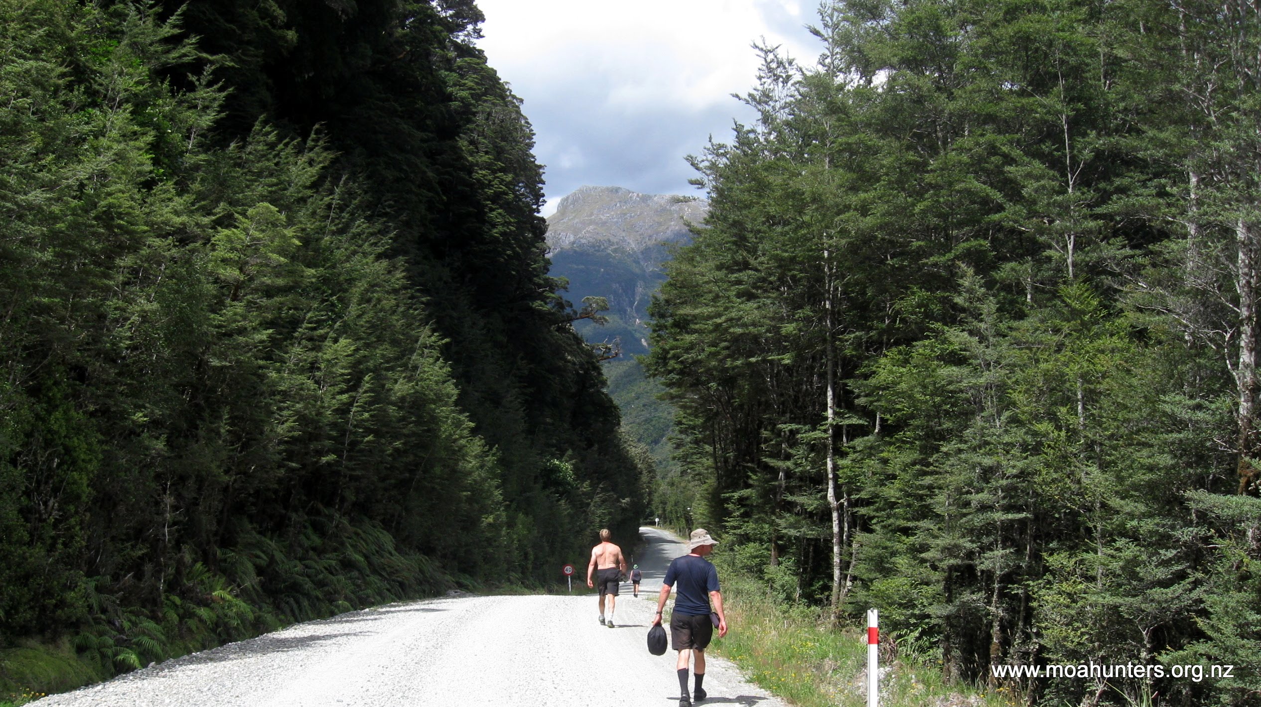
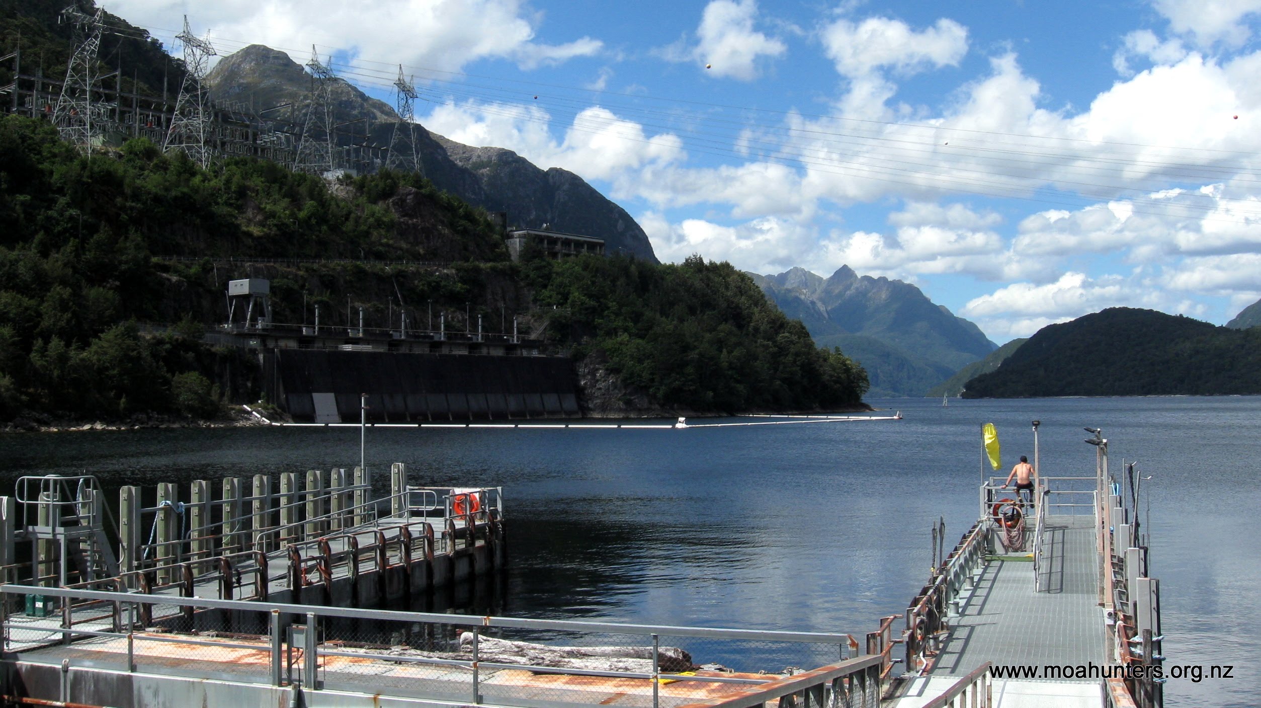
At 1:50pm we rather suddenly exited the bush and found ourselves standing on Wilmot Pass road, a shingle road that links Manapouri Power Station to Deep Cove. Within five minutes we had watched five coaches full of tourists roll past. Eight days of seeing almost nobody, then as soon as you hit a road, 150 people rumble past in a matter of minutes!

The walk to West Arm hut from the end of the track takes half an hour or so. At 2:20pm we pushed open the door of the hut, and were relieved to find it unoccupied. Being a snug six bunk hut, we were going to need the whole thing!
After dropping our bags and scoping the place and resting our hot feet, we wandered down to the wharf at Manapouri Power Station wearing more comfortable shoes. Boots are not nice to walk long distances on hard hard roads. The visitor centre was still open. Inside we chatted to the Real Journey’s staff member about ferry times. Our original plan was to catch the 11am boat next day, but after some discussion, we agreed to grab the 8:45am one instead, and have brekkie at Manapouri township. Porridge on the track is very nice, but a big fry-up instead sounded irresistable!
Back at the hut we had a dinner which consisted of any leftovers we could find. Salami and all sorts of other bits and bobs combined for a tasty meal. Dessert was crème brulee topped with brown sugar and Glayva. Not quite traditional, but a damn fine twist on the recipe!

The sandflies were particularly brutal at West Arm hut. We all grabbed a quick splash bath outside using water from the tap at the base of the hut water tank. It was fantastic and invigorating to feel clean again, even if sandflies were being swatted at throughout the whole process!
Day 9: Sunday 21st January – Manapouri to Home
After an early start, we made our way down to the wharf where we enjoyed some very pleasant views through the clouds of sandflies that swarm around the lake edge.
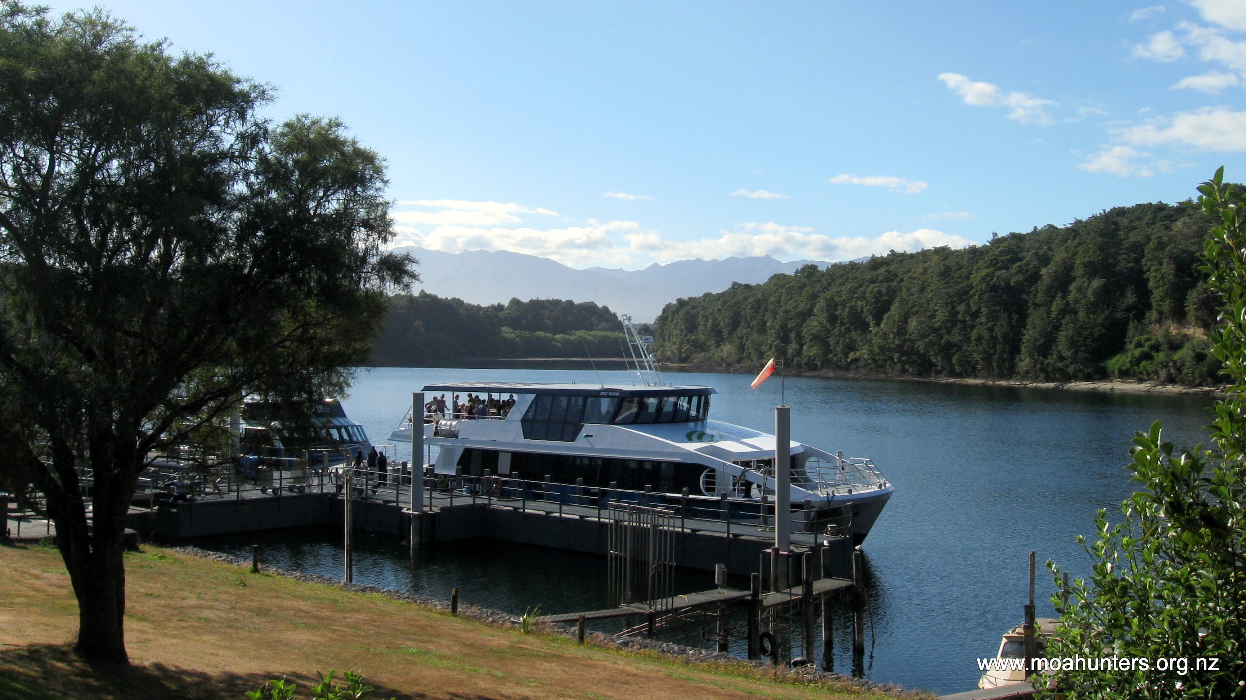
The boat trip was a lovely finale to the trip. We all enjoyed the views on both sides of the boat as we powered across the glassy flat surface of Lake Manapouri. At Manapouri township we walked a short distance into the centre and found what we were looking for – cooked breakfast! Initially John was going to have something healthier, but he quickly folded to peer pressure and ordered a big cooked feed like the rest of us. A decision he did not regret.

