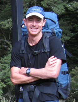
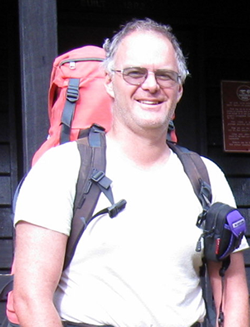
Moa Hunters on this trip: Paul, Richard, Chris

The Trip:
The second attempt to summit Mt Tapuae-o-Uenuku
Prep: Drive to Seddon.
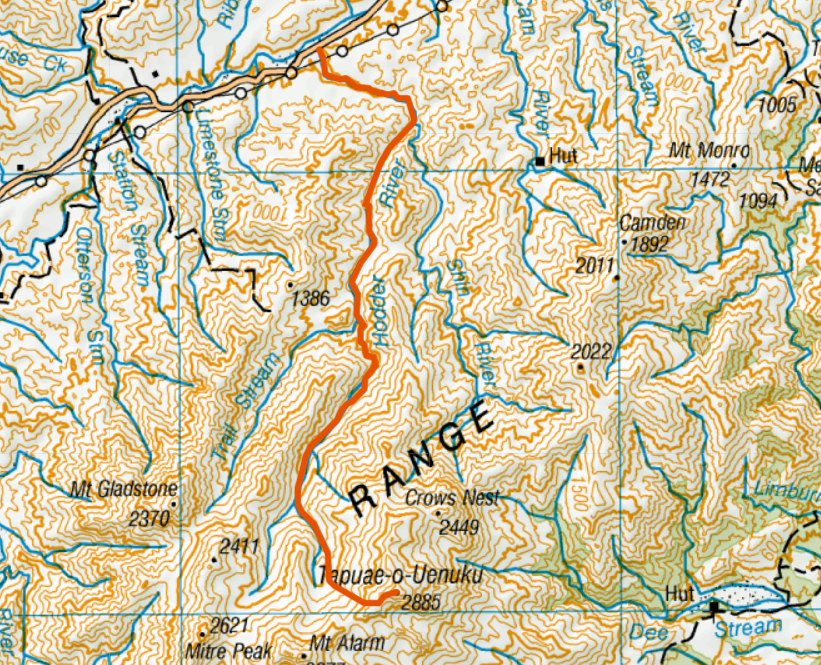
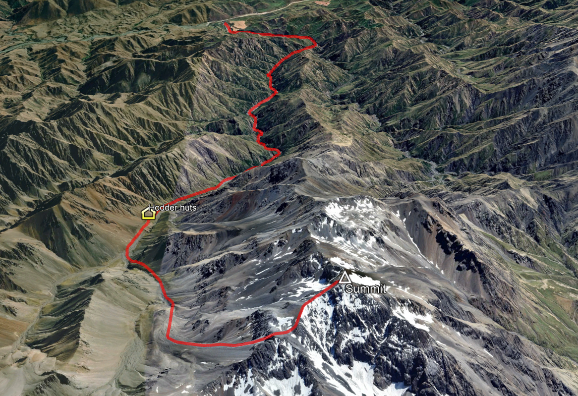
Day 1: Gladstone Downs to Hodder huts
Day 2: Hodder Huts to Summit, and out
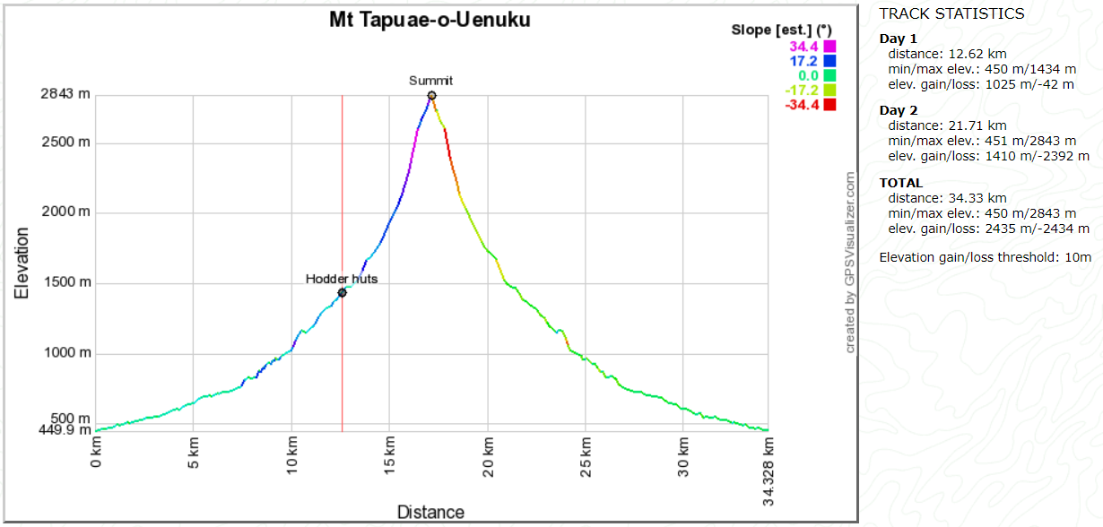
February 2005 was the Moa Hunters second attempt to ascend the 2885m Mt Tapuae-o-Uenuku, after being foiled in 2004 by inclement weather.
Mt Tapuae-o-Uenuku is the highest point in the Kaikoura Ranges. It is also 80m higher than any North Island peak. As it is a “walking” climb with well travelled routes, we decided visiting Moa may find the view worthwhile and thought why not take a look?
We started with the usual long drive up the Coast, with Chris taking a different route to be met in Seddon in the evening. His pre-packed pack was dropped off to travel with us. All went well with Chris joining us at Seddon and then the long winding trip up the Awatere Valley to shearing quarters near the Hodder River.
After extensive searching Chris finally came to the red-faced conclusion that he had left his sleeping bag out of his pack! When we had finally stopped laughing, we started to comprehend the gravity of the omission. The Hodder River huts are at over 4000 feet and being without a sleeping bag would not be an option.
A quick trip to Gladstone Downs to inform them of our trip yielded a borrowed sleeping bag for Chris. Lucky boy! We will not forget this incident!
Day 1
Gladstone Downs to Hodder huts
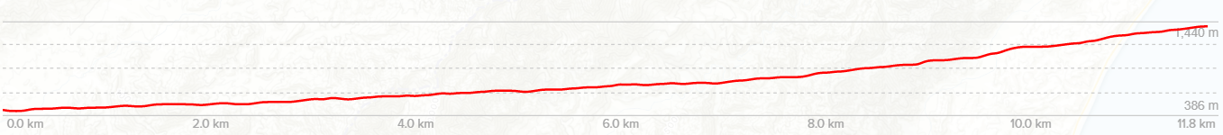
The day was gorgeous. Bright blue and sunny. Perfect for the required 68 crossings of the Hodder river. Gladstone downs informed us of two parties ahead of us.

The first was a couple. Him the spitting image of Rod Stuart, and her, similar to Yoko Ono. As we passed pleasantries we noticed he also sounded exactly like Rod. Interesting. Further up stream we encounter three blokes with ancient packs and long beards walking out. These two very similar to ZZ Top… Clearly it was going to be a good trip! (It is a bugger didn’t get a picture. but in our minds eye they were definitely ZZ top!)
We passed the 2nd party who planned on going in further up, with teenagers in tow. This was excellent as it meant we were going to get the choice of huts! We had the usual rocky walk up the Hodder in excellent sunblock-required conditions, enjoying the water crossings to cool off hot feet. Goats were the ever present “smell before you see them” companions that seem to thrive in the Kaikoura’s seemingly barren landscape.
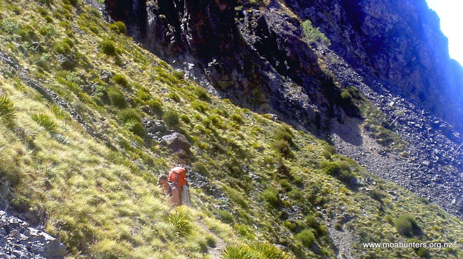
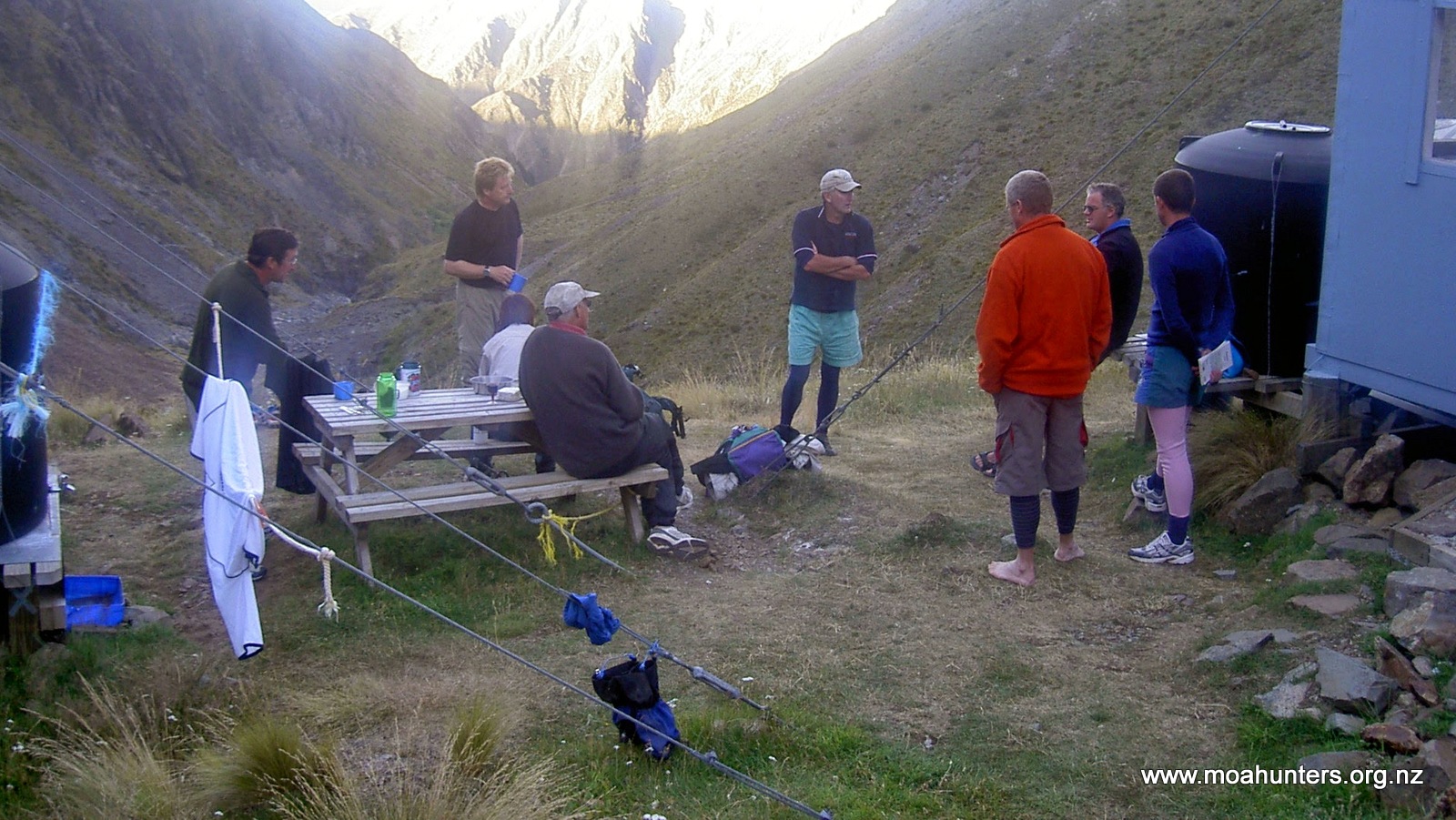
There is a spear grass infestation on the route, around the nearly impassable gorge that made for some painful scrambling. We made the huts in around 7 hours including the trudge up to the bluff, always tough. We chose the older smaller hut as we were a party of three, leaving the larger hut for the youngsters. The two warm and well constructed huts are wired down within 10m of each other. Obviously it gets fairly breezy at times!
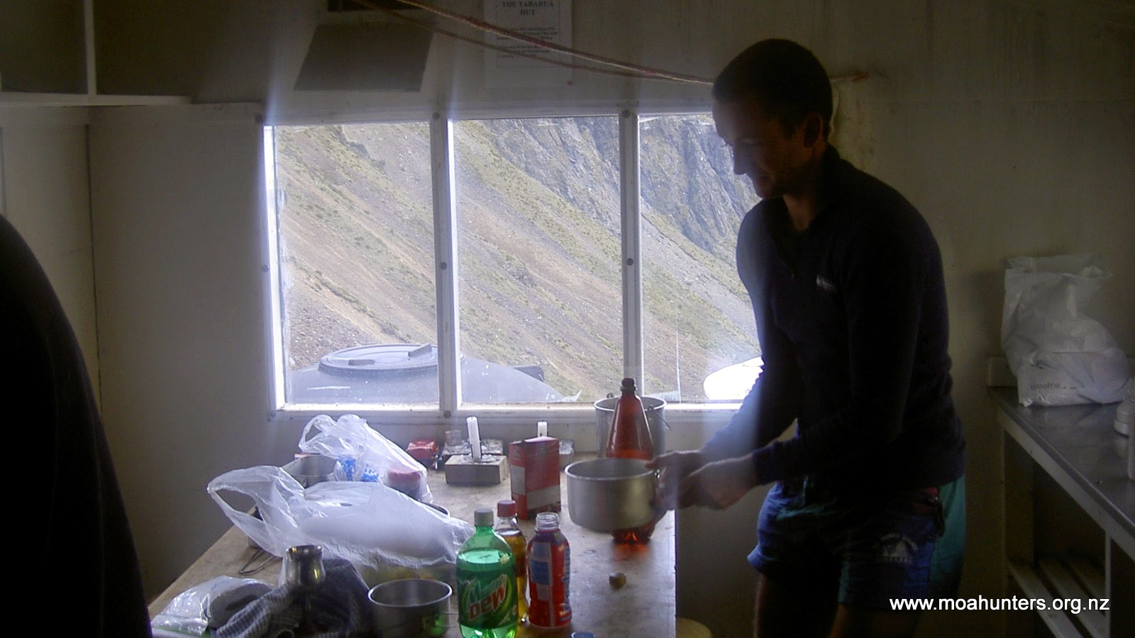
We setup camp drying socks and boots for the impending climb tomorrow. News paper in boots and a stiff breeze made for good drying weather, although the temperature drops fairly quickly as the sun goes down at these altitudes. The larger group were not far behind and setup in the larger hut. Rod and Yoko appeared on the track below traveling very slowly late in the day. She was struggling, and obviously worn out, devastated by the impending climb to the hut. So off we went, down the steep slope. One person on each arm and relieved her of her pack. We had “Yoko” up to the hut in a jiffy and a revived with a hot cuppa to get her back on her feet! She didn’t look pleased to be there though! Oh well the view down the valley was awesome, with the sea just visible in the distance. Great end to the day.
Day 2
Hodder Huts to Summit, and out
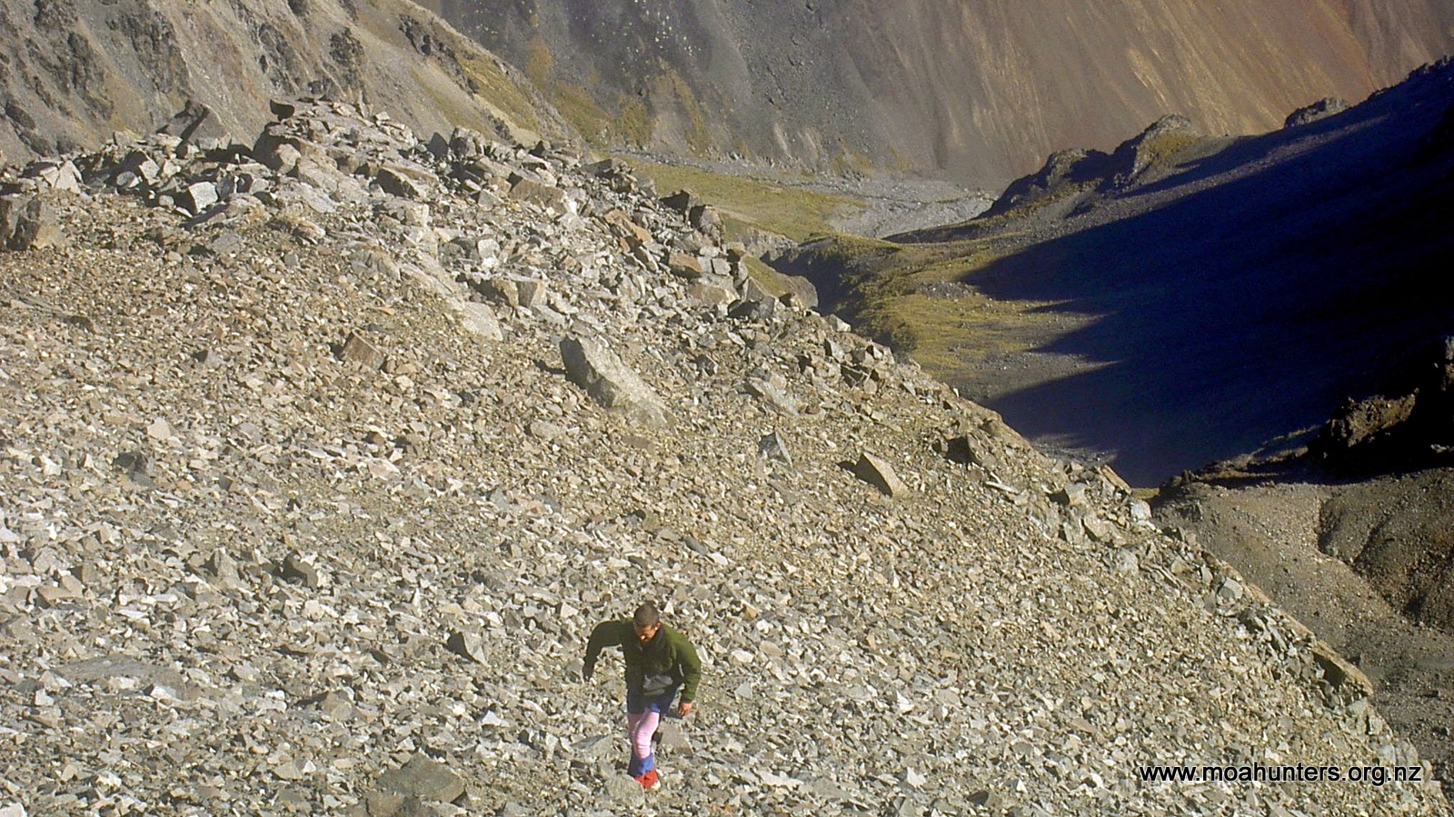
The next day looked good to make the summit. Paul decided that runners were the climbing footwear of choice due to a sore toe. We lightened our packs to just lunch and warm clothes. So, with dry feet we set off across the Hodder to climb the never ending scree. There was a rough track initially on the true right of a stream and then Zig zag up scree/rocks. As we passed our maximum height from the year before we realised we were a long way off the top on the last attempt! Cloud had restricted our view.
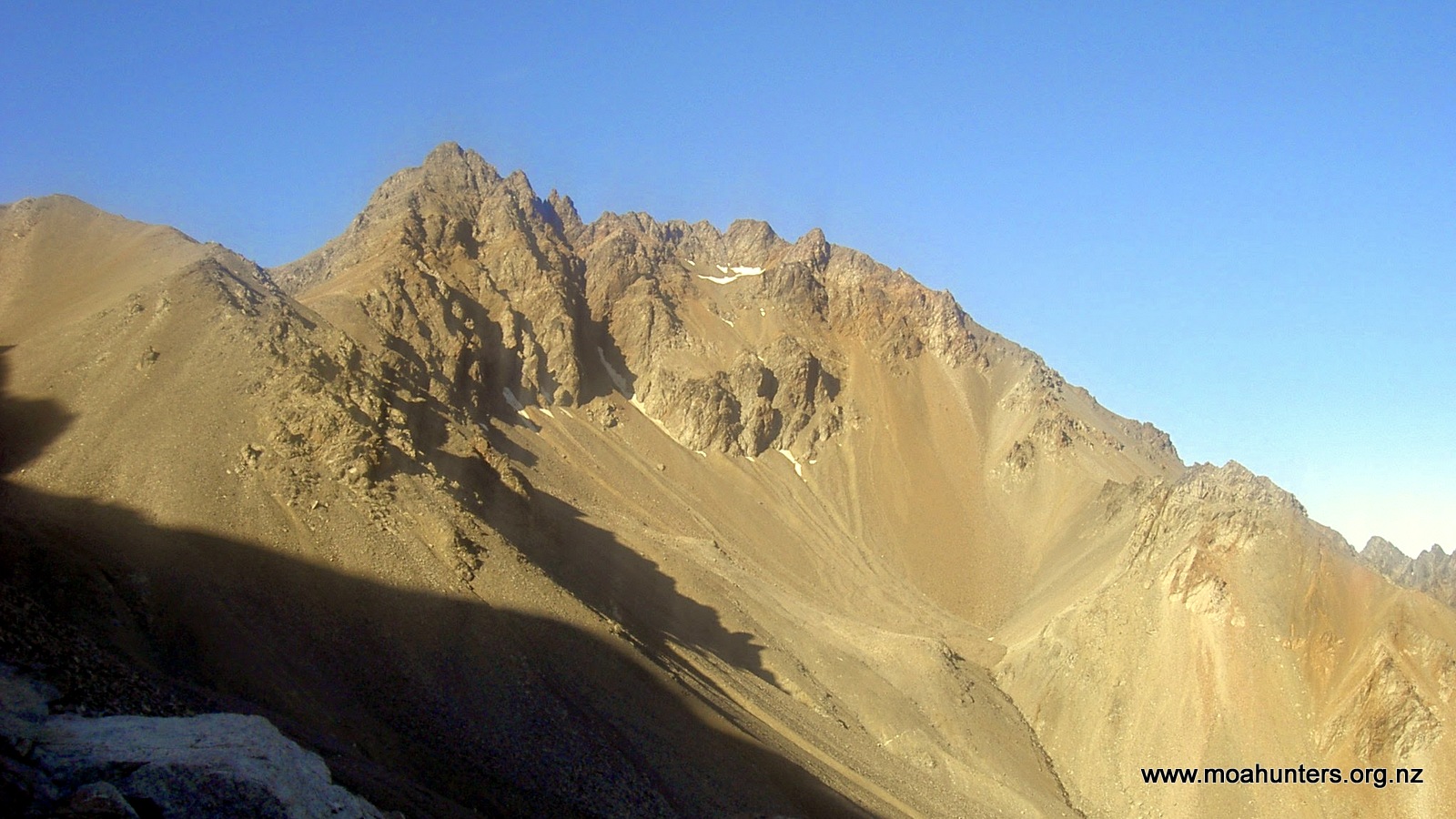
The steady sidle to the right passed a stream where we topped up our bottles. We then came across the same stream when sidling left above the bluffs we were skirting. The water appeared out of the rocks on the slope and was noticeably colder. Fresh melt out of the mountain. Lovely stuff!
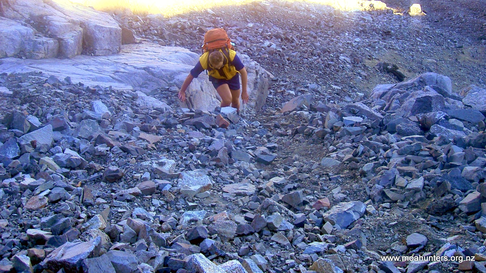
As is normal in a long climb, we separated when each of us took slightly different routes. There were mini bluffs to work around, loose areas to avoid. Chris managed to give himself a scare when he dislodged a large rock at head height which narrowly missed him. He looked a little pale and shaken but okay. The steep slopes slope tested our sphincter muscles at times during the ascent. The last part of the climb was 3 steps breathe, breathe some more and repeat.
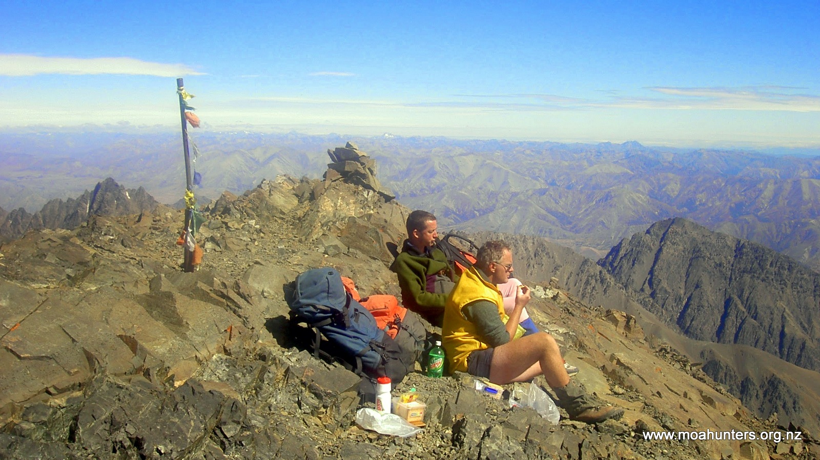
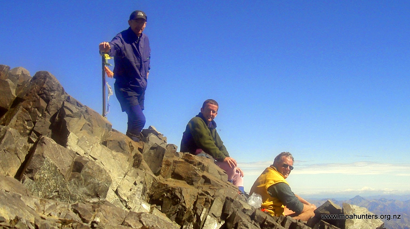
The summit in my mind felt like a Himalayan mountain top, with little flags blowing in the breeze and huge views from Banks Peninsula to Wellington Harbour entrance. Once we had stopped breathing, we started cool down. It was a great place to have lunch and watch the other group make their way to the top and take in the views.

We made a few phone calls to release the euphoria of making the top and generally show off! I was amazed to see blow flies cruising around up there. You just can’t escape them!
The descent was a relatively fast boot destroying scree run that went on forever. That was followed by uneventful walk out, by the end of which we were totally used to wet feet. But walking down was much easier to deal with. It did drag on towards the end. The bareness of the Kaikoura mountain is a bit unrelenting. Finally we reached the bottom and made a quick stop at Gladstone Downs to return the SLEEPING BAG (not forgotten!) and let them know we were out.
Mt Tapuae-o-Uenuku conquered. A fantastic Blast in the hills.

Would u be able to share your email route to taps summit? I failed last week to make top
Hi Stephen,
You are challenging the memories of the Moa Men with that one! It’s a fair few years since that trip.
Here’s what Richard remembers:
“We approached Mt Tapi up the Hodder river. I seem to recall you drop to the river above the Hodder huts, cross and head straight up the guts near a stream. Bear right to avoid some rocky bluffs, then left above the bluffs you re-meet the small stream that comes out of the mountain. This is the last fill of the water bottles. It’s then a steady climb until you find yourself on a rocky ridge that forces you left (very good views to the coast between rocks in ridge).
Keep going until you can climb no more! Mount Alarm is behind as you climb and not much shorter than Tapi. (it is south west of Tapi)”
That’s the best we have, sorry. Good luck with attempt number two!