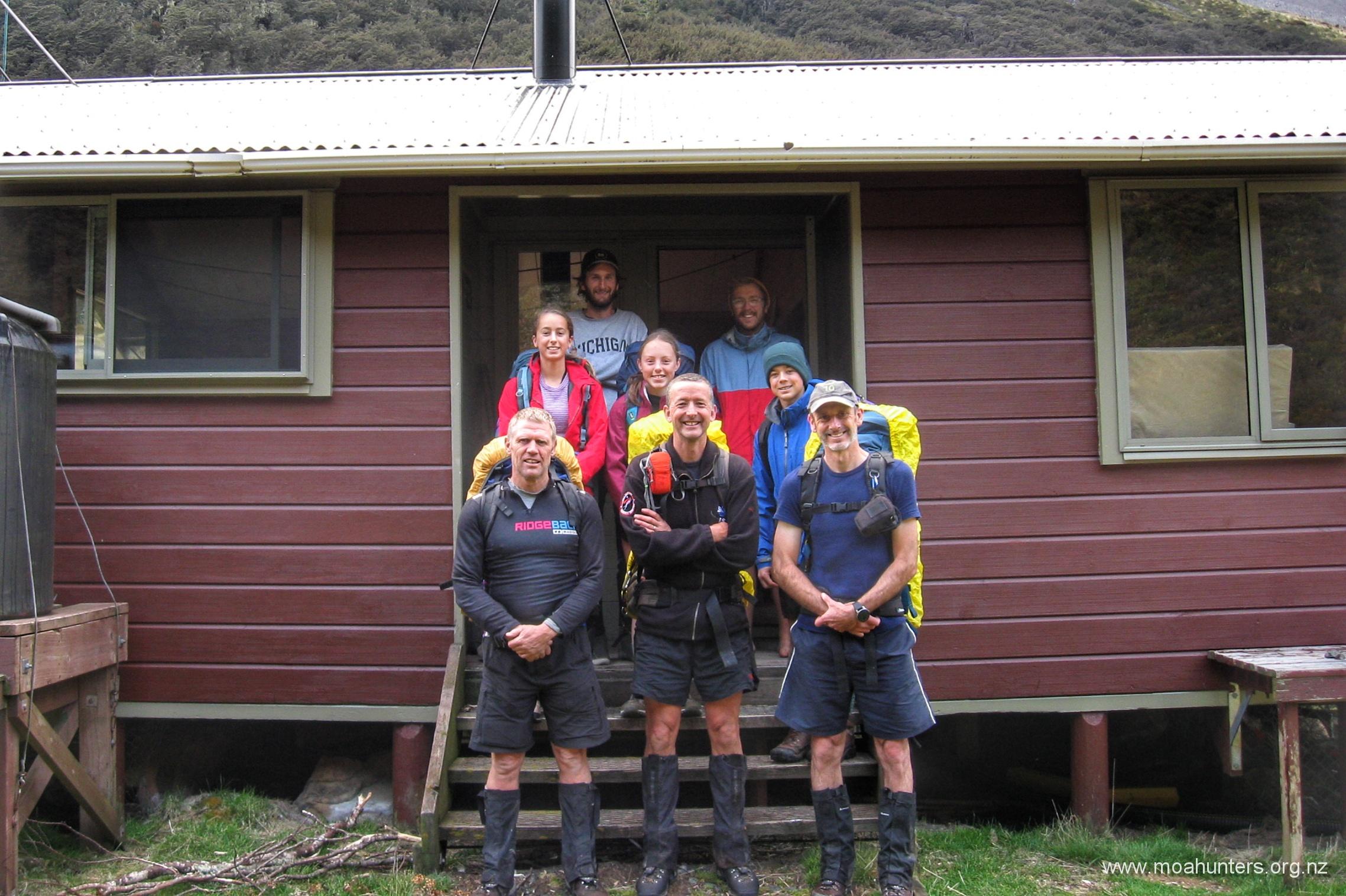
Moa Hunters on this trip: Paul, Adam, John
Mini Moa Hunters on this trip: Sian, Cole, Emma
While not an “official” Moa Hunt, this weekend wander in the hills does feature three Moa Men, and three 15 year old Moa Hunters in training.
We figured this is enough to earn a place on the website!
The trip had two goals: A training walk for the Moa men, leading up to what looks to be an ambitious January 2020 Moa Hunt. And a chance to show just how rewarding and fun tramping can be to three keen young Moa Hunter trainees.
Our itinerary:
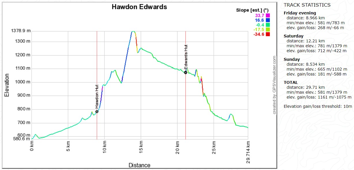
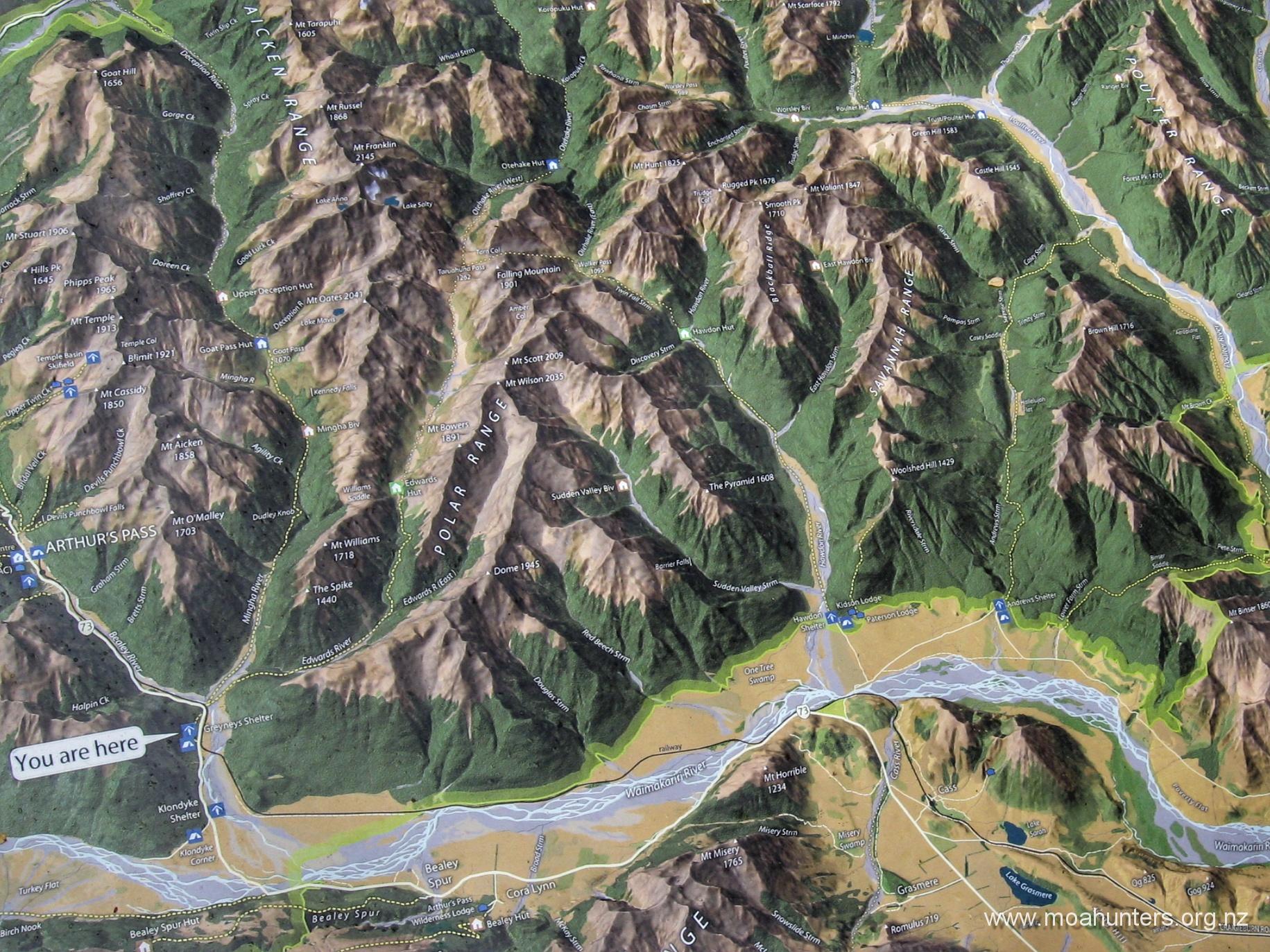
Day 1: Hawdon shelter to Hawdon hut
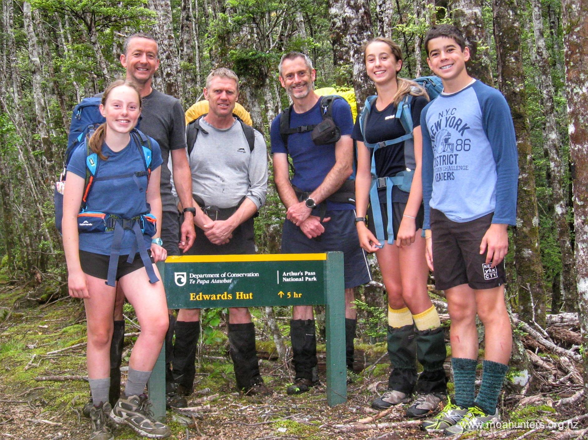
Day 2: Hawdon hut to Edwards hut via Tarn col
Day 3: Edwards hut to Greyney’s shelter
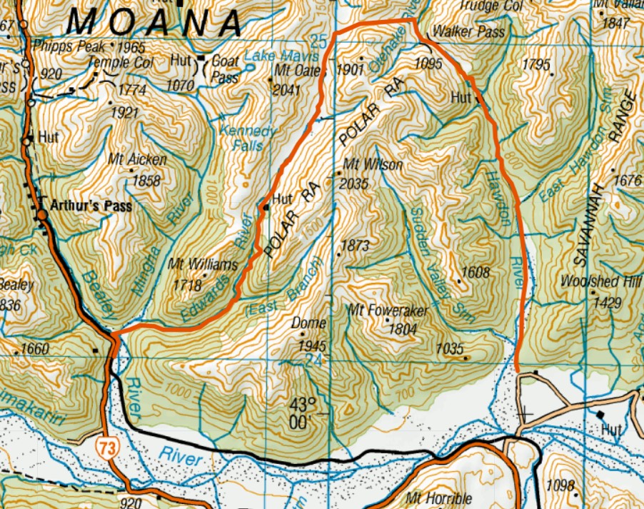
See our route on topomap.co.nz
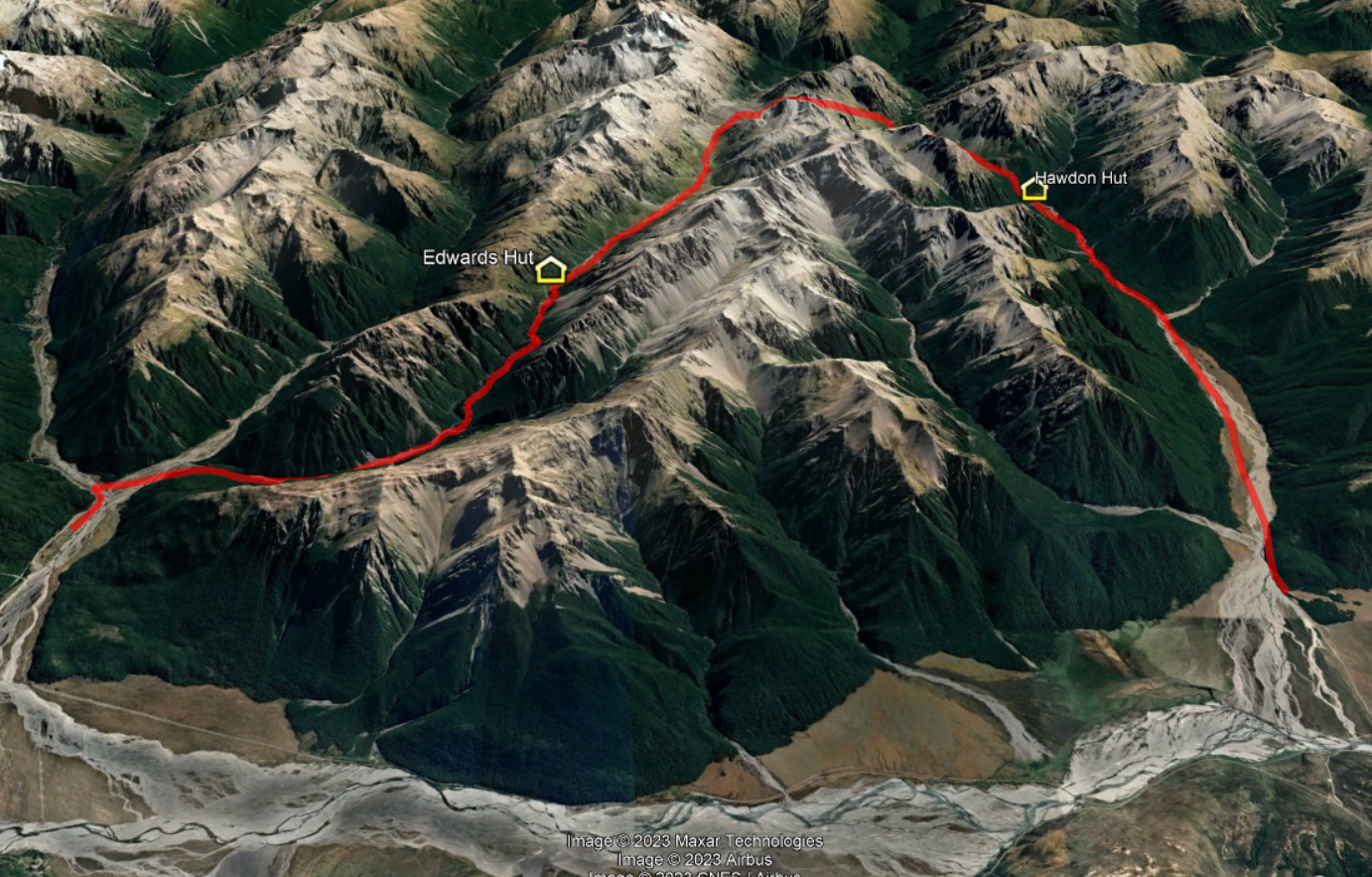
See our route on Google Maps
Day 1
Friday 22nd November – Start to Hawdon hut
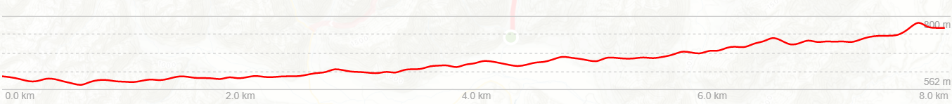
Due to work commitments and not wanting a late night, it was agreed that Paul and the three young trampers would head to the Hawdon hut early on Friday, aiming to get there with plenty of daylight ahead of them. Adam and John would wander in later that day and arrive mid evening, hopefully with some lingering daylight.
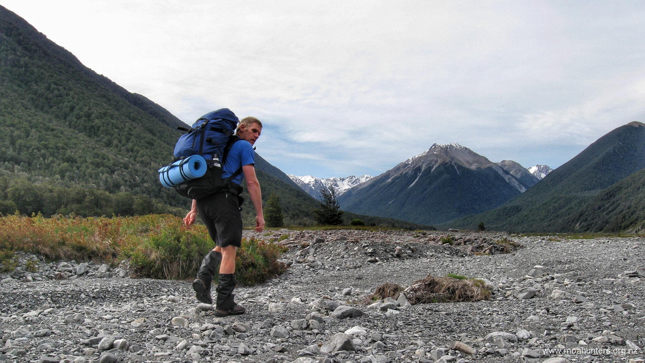
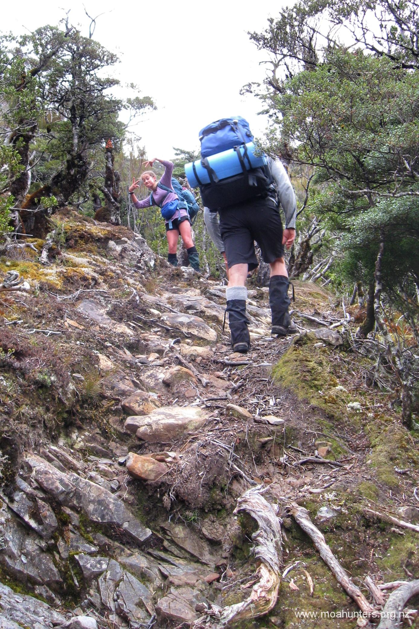
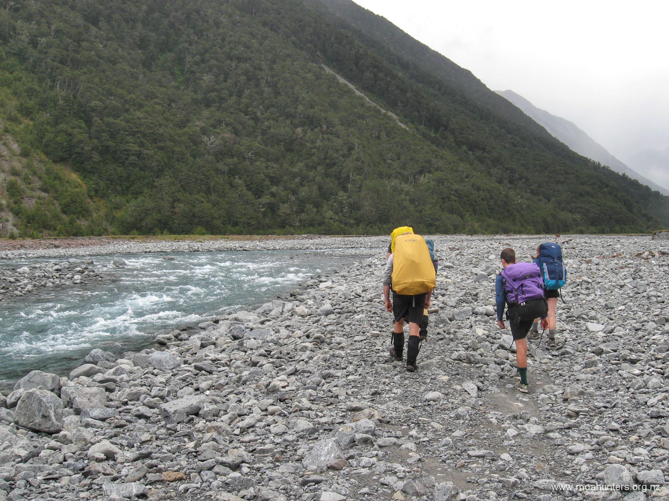
The walk up the Hawdon river is straightforward. While there’s no strict right or wrong route as such, sticking mainly to the true right of the valley certainly works well. The track starts on the true left of the Hawdon river, with a crossing to the true right required fairly early to sidestep an electric fence that extends across the river.
Once across the river, progress up the valley is a mix of open riverbed walking with many pleasant opportunities to enjoy sections of grassy meadow and low bush, or taller beech tree stands. Keeping your left shoulder close to the valley edge will ensure you spot these sections and have some time off the rock strewn riverbed.
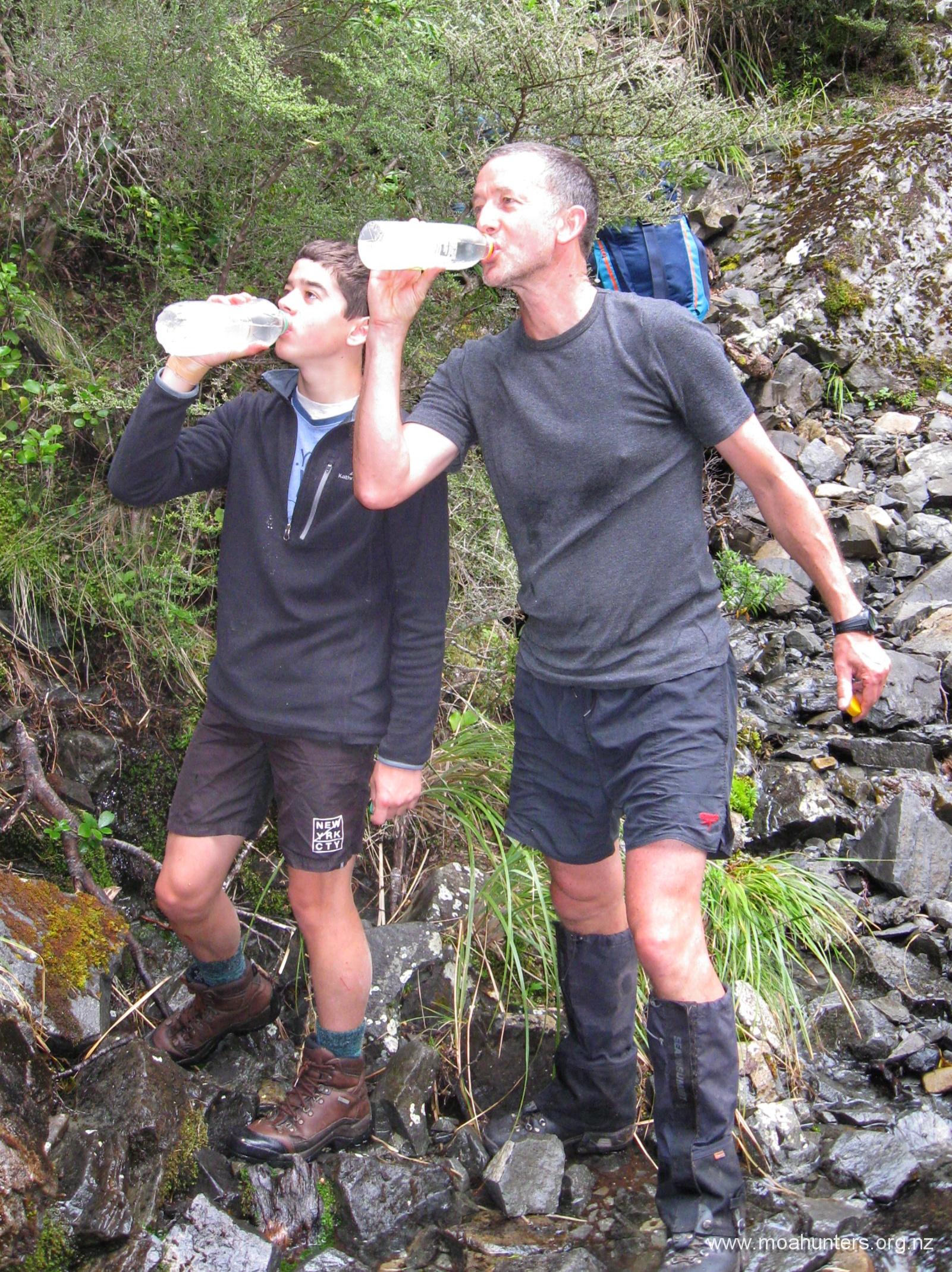
On occasion we needed to splash across a river braid, but there was certainly nothing worrisome in any of the crossings. With feet already wet from the first time across the Hawdon, additional wading was done without hesitation.
As the valley narrows, marker poles start to appear. While following these is certainly not a requirement, it does make for easier walking. Sticking to the poles means you get to follow a well walked trail that avoids awkward bush and rocky riverbed. However, if you choose not to, it would be extremely difficult to get lost in such a simple valley.
If you are thinking of walking to the Hawdon hut, here’s a good time guide. Paul did the trip with three 15 year old’s, not hurrying at all, in three and a half hours. The eight fellas we met there followed a track that traversed fairly high in the bush above the valley and took closer to four hours. Adam and John walked briskly and hit the hut in two and a half hours. Three hours is definitely a good benchmark in reasonable conditions if you stay down on the flat. If the river is high, you might consider the high track, but it does add quite a climb, and quite some time.
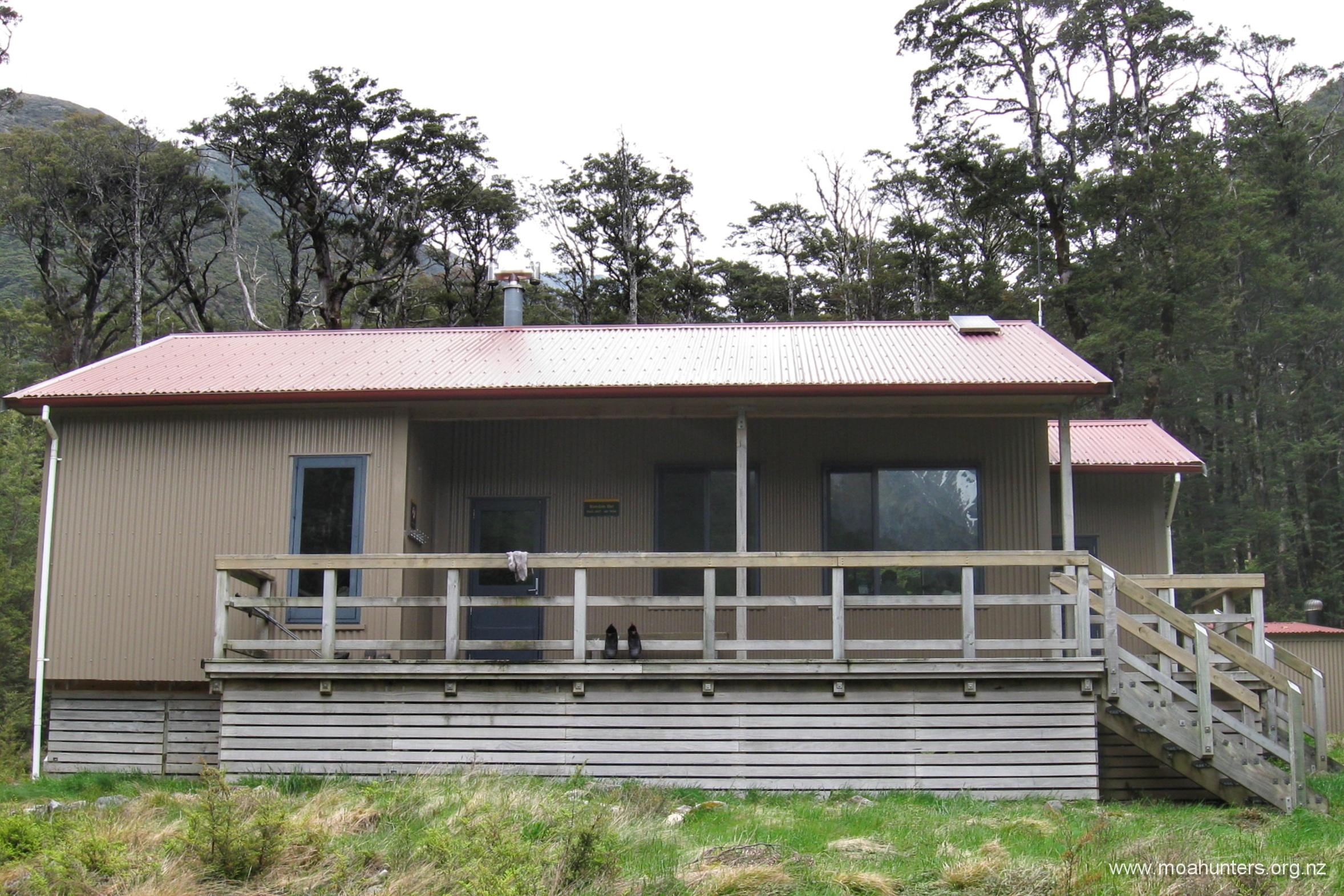
Hawdon Hut is a relatively new twenty bunk building, with lovely views up the Hawdon valley to be had out its large windows. The current structure was built in the early 2000’s after the original was destroyed by fire. We passed burnt remains of wooden piles that supported the original hut about fifteen minutes walk from the new hut.
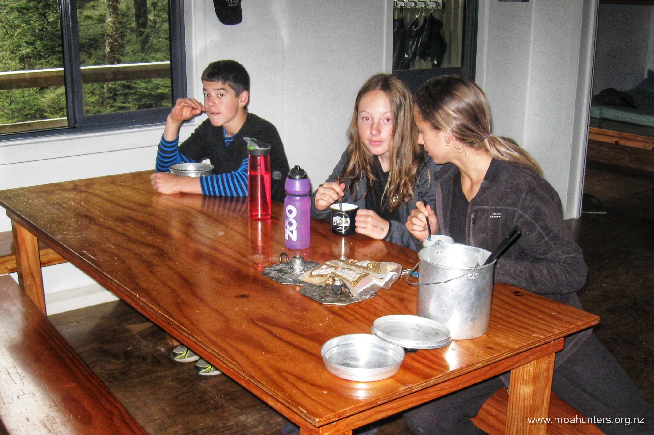
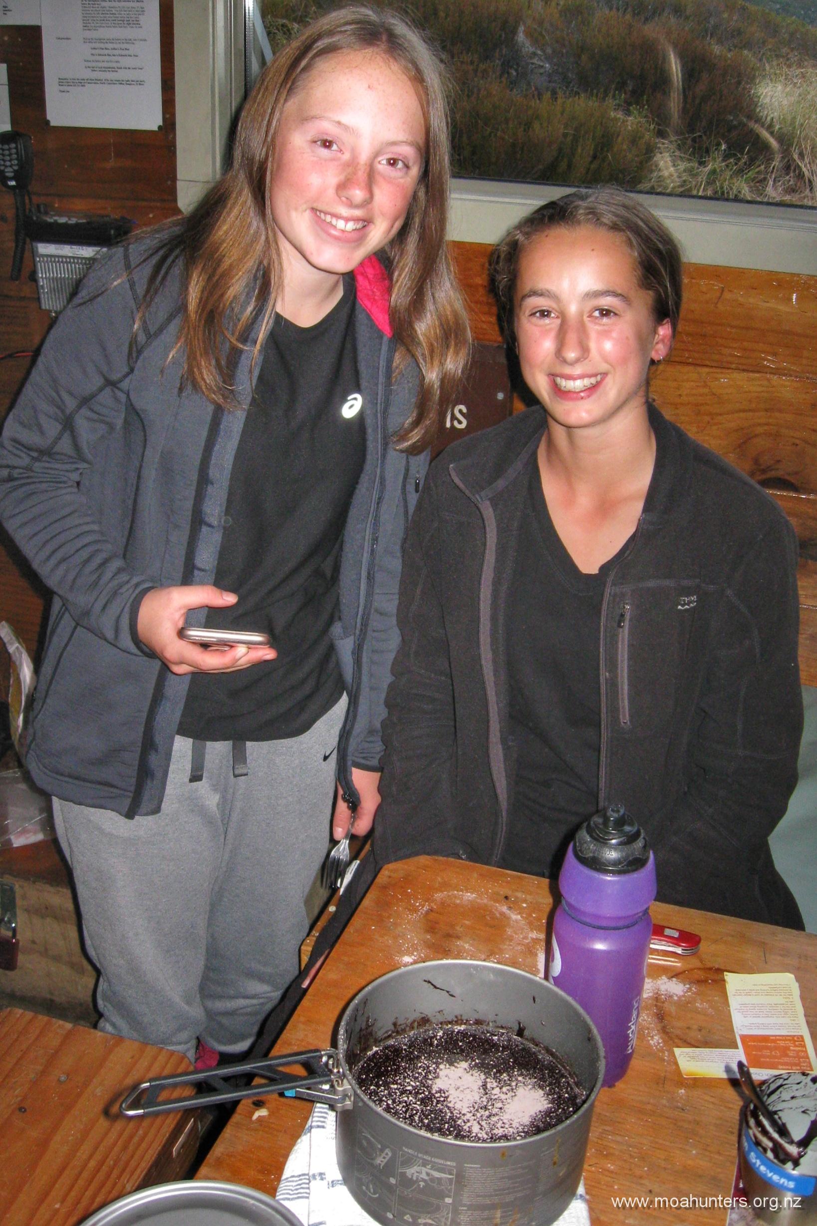
Inside the hut, Paul was tending to his bread dough, which was raising inside a billy ready for into crusty bread in the morning. John and Adam set about preparing their dinner of tuna and noodles, followed by an instant pudding dessert. Some dried fruit thrown into the dessert lifted it from nice to very nice.

With a fairly big day of walking ahead, we left the eight friendly fellas we shared the hut with playing cards, and slipped into our sleeping bags fairly early.
Day 2
Saturday 23rd November – Hawdon hut to Edwards hut
Paul, being a good keen man was up bright and early preparing breakfast. The hut was filled with the delicious nutty aroma of fresh baked bread when most of us opened an eye and rolled out of bed. Emma, Sian and Cole reported hearing quite a bit of snoring through the night, while Adam, John and Paul reported less. No surprises there!
With bellies full of bread and porridge, we had our packs on and were outside the hut and ready to hit the track a bit after 8:30am. Conditions were perfect for walking, with little wind, overcast conditions and no real threat of rain in the air. We had an exciting days walking ahead. Sian, Cole and Emma certainly looked keen and up for the challenge.
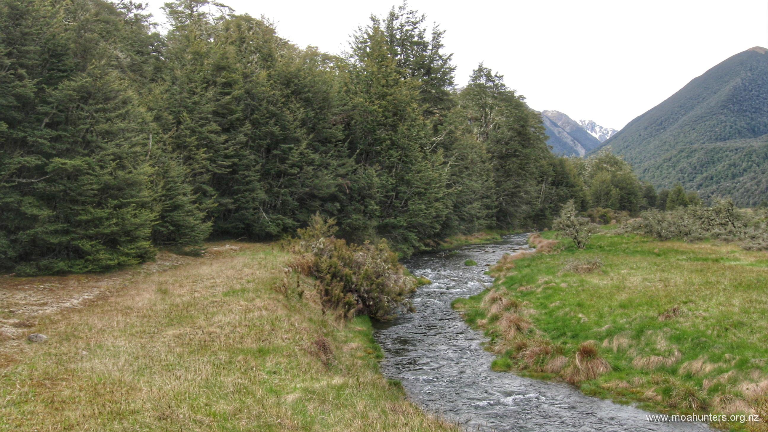
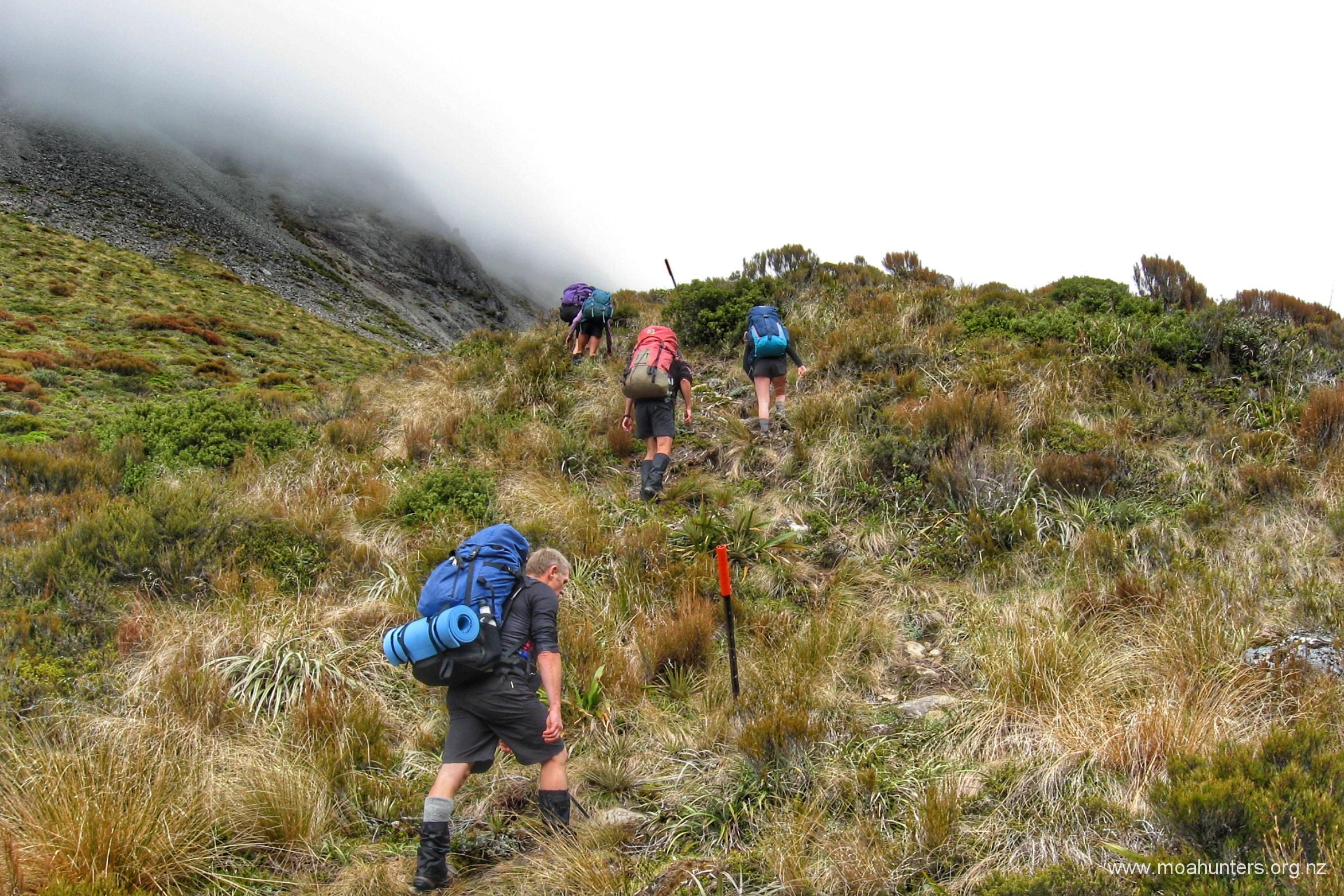
From the hut the track briefly meanders through tall beech forest alongside the river, but quickly becomes steep with the bush thinning and becoming more stunted as the 900 metre contour is approached.
It didn’t take long to get very warm, and any extra layers that had been put on at the hut were soon removed. By 9am we had gained quite a bit of altitude and were treated to some nice views behind us of the Hawdon river’s snaking course through the mountains. Fifteen minutes later we were effectively above the bushline and had a good look at the rather flatter approach to Walker pass ahead of us.
Following a short sharp descent, we took a break on the edge of Twin Fall stream at 9:30am, having made excellent progress. The steepest climb of the day was behind us and we were all enjoying the varied scenery.
From our comfy spot beside the stream, we spotted some of the group of eight men from the Hawdon hut on the high point of the track before it drops to the stream some way behind us. They waved and we heard a few shouts. Not sure whether they were just saying hello, we sat and waved back.
Unexpectedly, a few minutes later one of them came clattering round the track, very hot, and carrying a bag of rattly items. It turns out silly Adam had left his gas cooker and billies back at the hut. These good fellows had come after us to return them! A huge thank you to the wonderful men from a Rolleston church for going above and beyond in getting those items back to us. They jogged/ran an hour along the track to get them back in our hands. Legends.
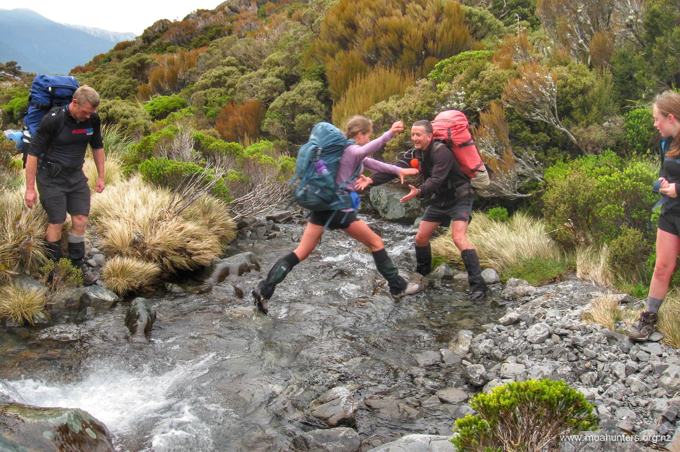
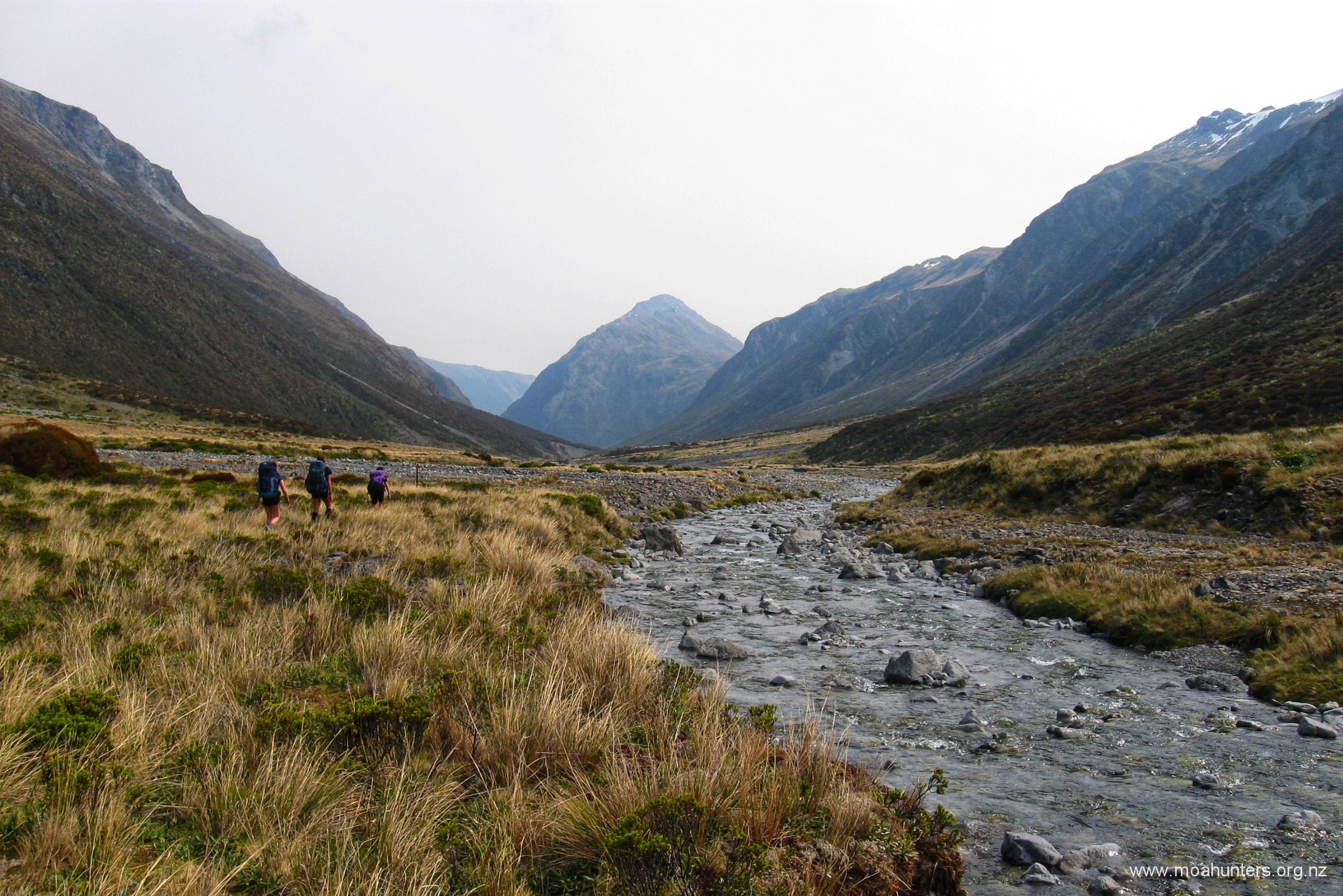
Apart from having to splash through Twin Fall stream a ridiculous number of times as it meandered from side to side back and forwards across the valley, the walk up to Walker Pass was beautiful. Native bush of varying textures and shades of green painted the valley floor, highlighted by occasional pretty white flowers.
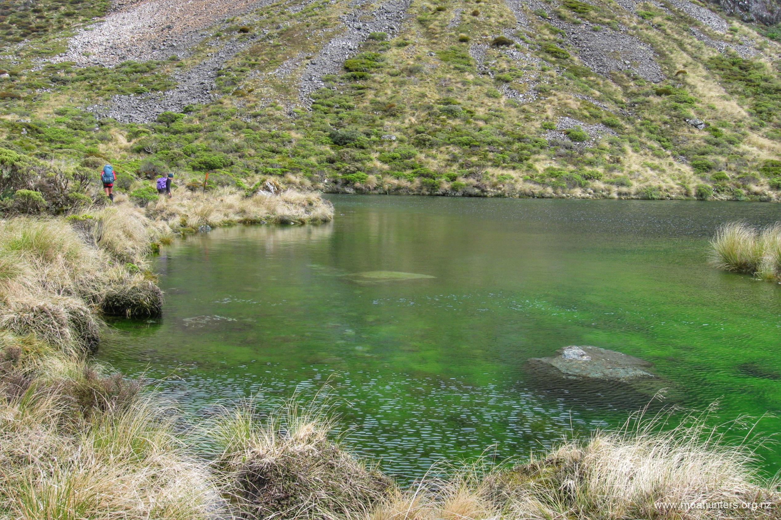
We passed the tarn just below Walker Pass shortly after 10am. Even under an overcast sky, the green algae growing in it seemed to glow an almost iridescent green. We rounded the tarn and progressed up the grassy slope over Walker pass and down to the East branch of the Otehake river.
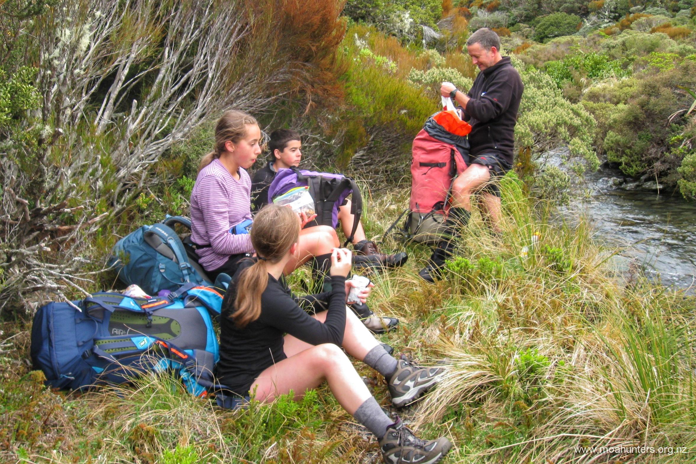
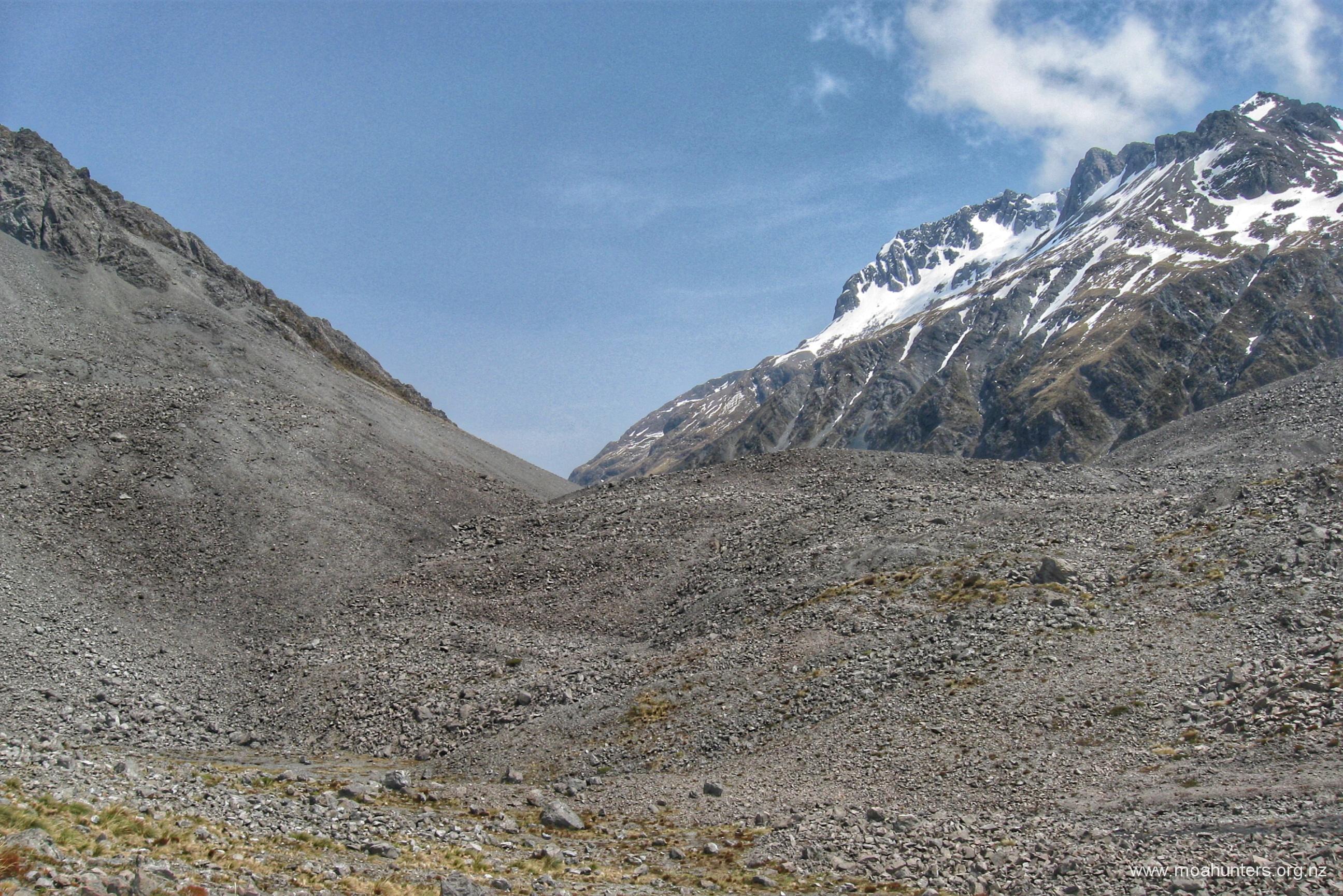
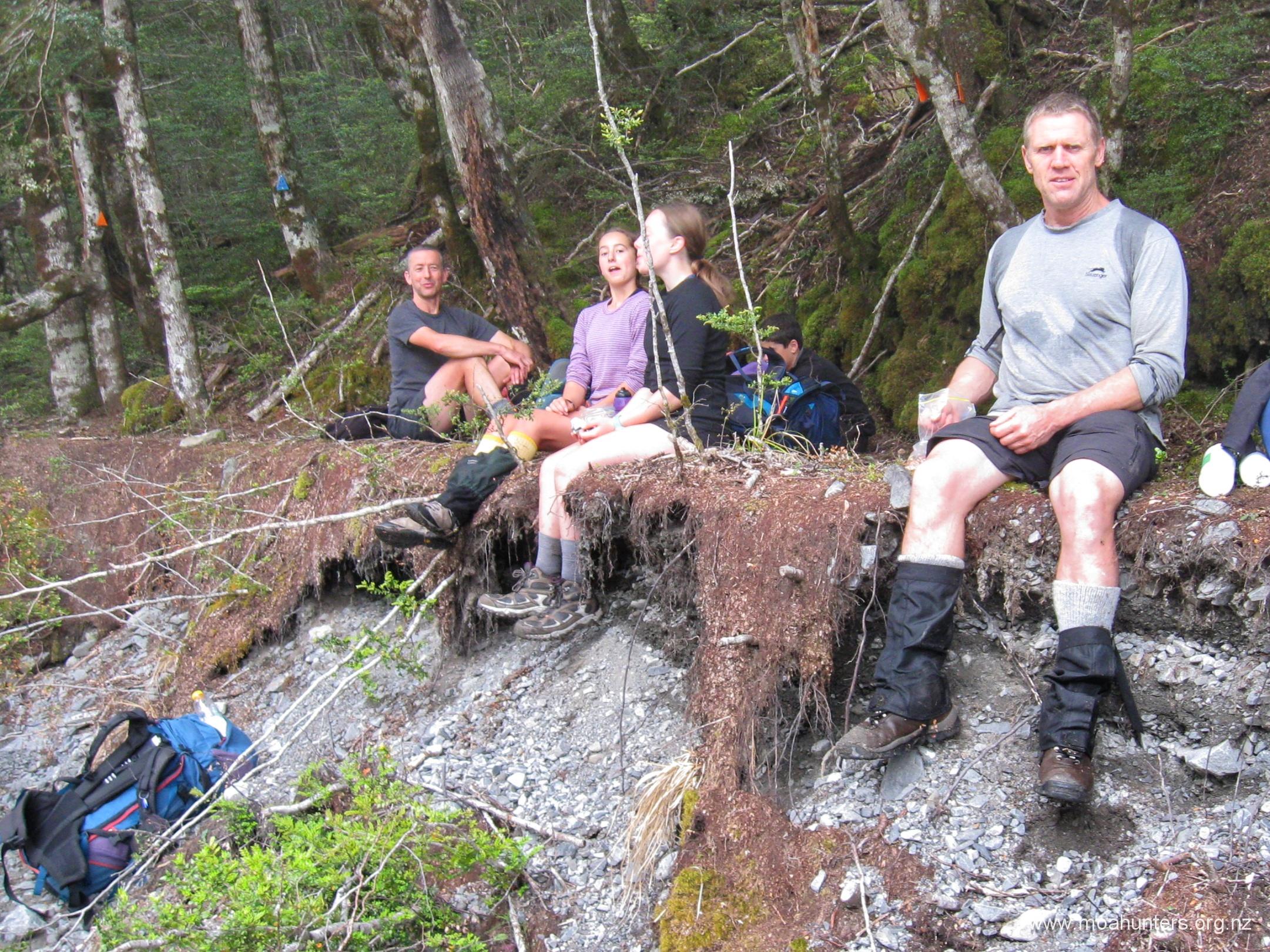
After a leisurely scroggin break we continued up the increasingly tight valley that would lead us to a sharp left turn and the climb to Tarn col. The ascent here isn’t steep, but it is steady.
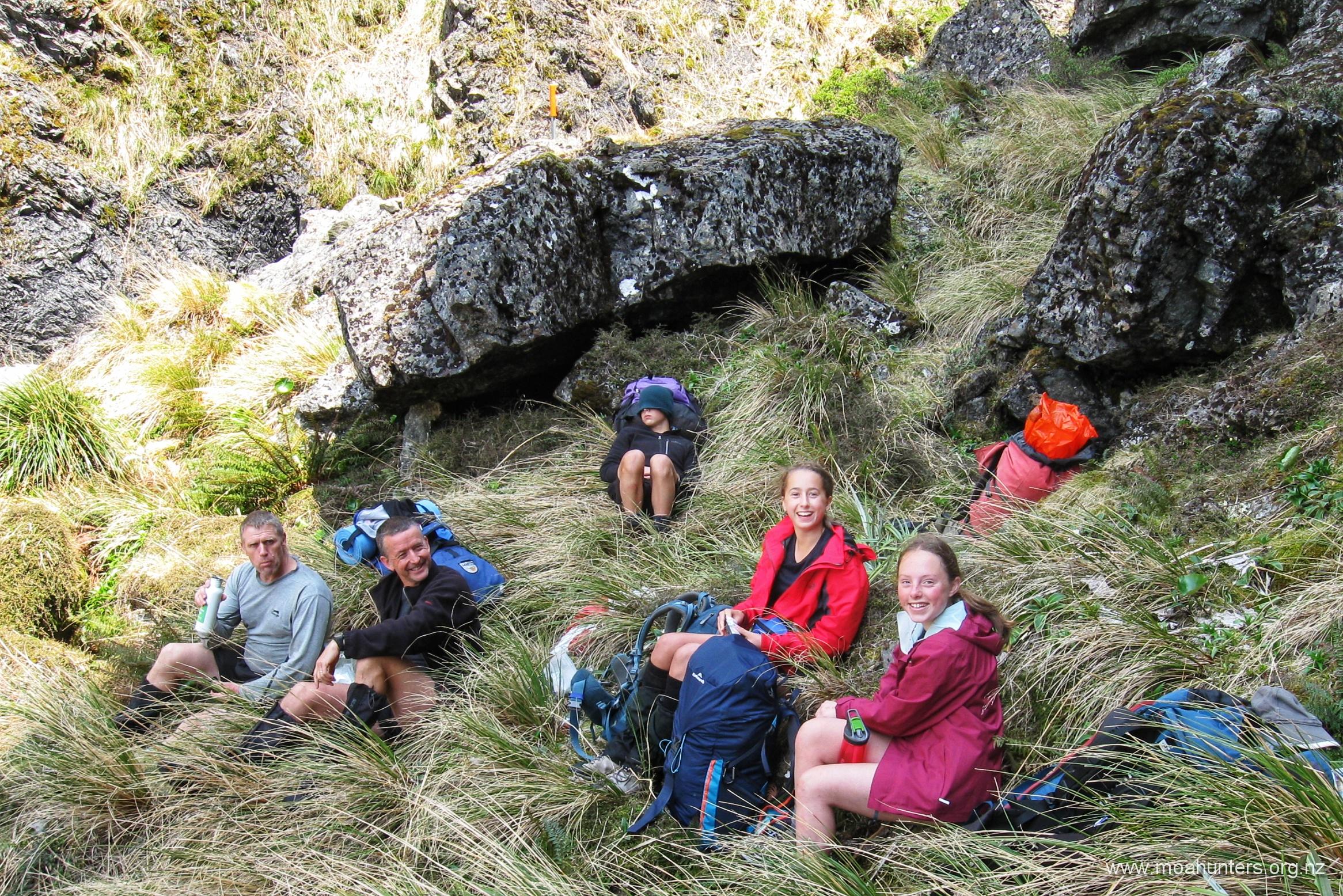
With small pockets of snow visible in shady spots far up the valley ahead of us, we called a break. A cosy grassy area between some large rocks looked perfect for lunch. It was 12:30, and the valley here was nicely sheltering us from the cool breeze. Not far beyond our lunch spot, spectacular vertical cliffs tower above the right hand side of the track.
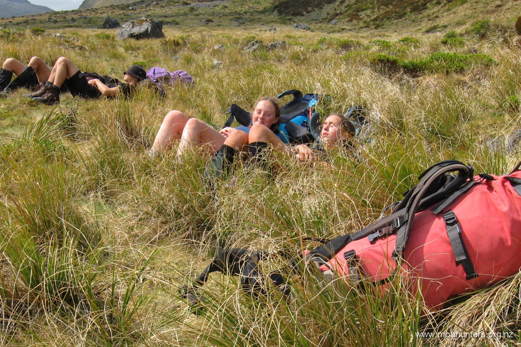
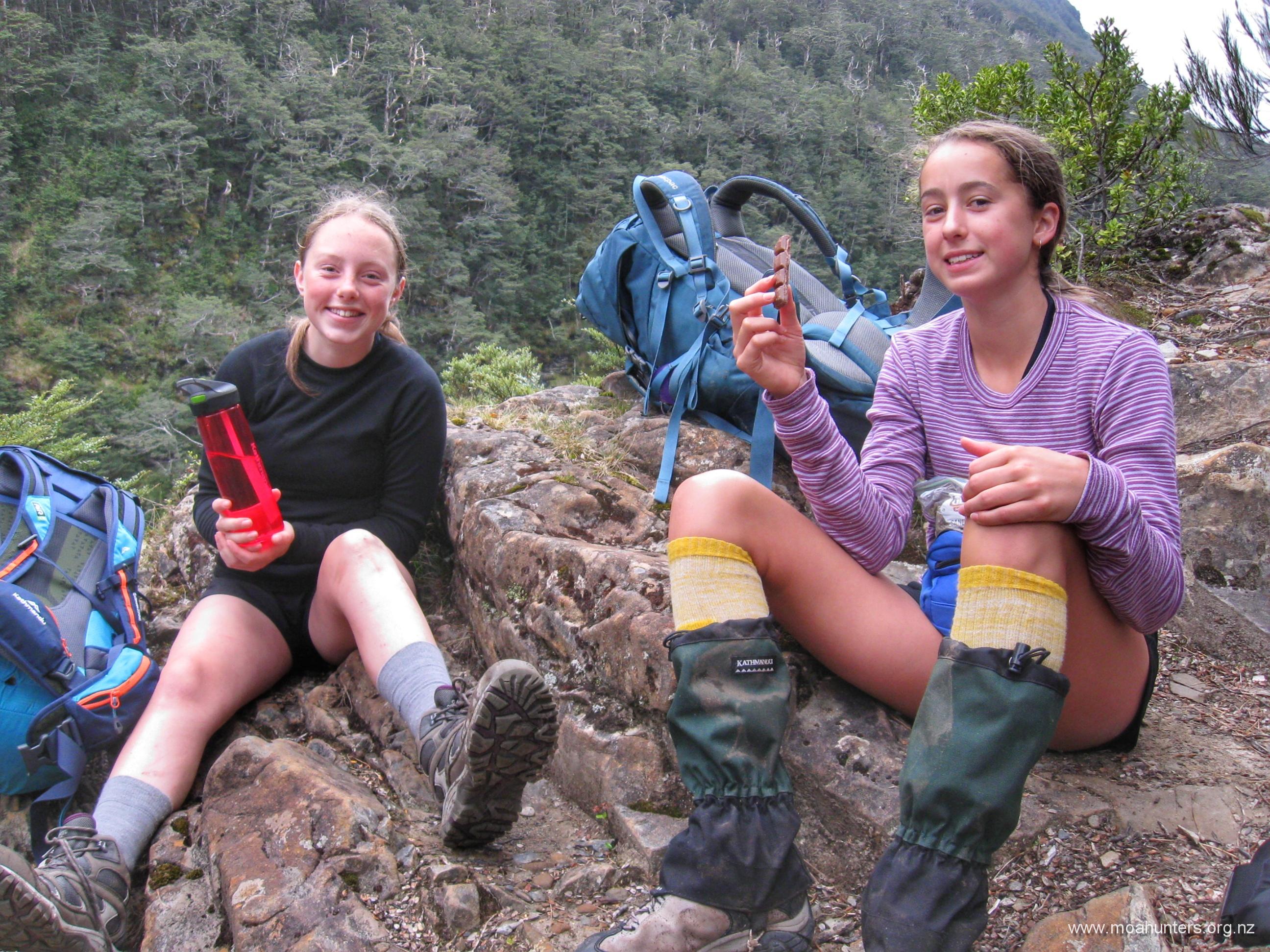
Sian, Cole and Emma had put in an impressive morning of walking. We had battled up some fairly steep track, and covered plenty of ground. It’s great to see fit motivated young people enjoying the outdoors.
Cole found himself a comfy spot and had a little nap in the pleasant conditions. John followed suit in another natural bed nestled in amongst the snowgrass. Emma and Sian chatted, enjoying the break. We had covered quite a bit of terrain that morning, and the legs were feeling a little tired.
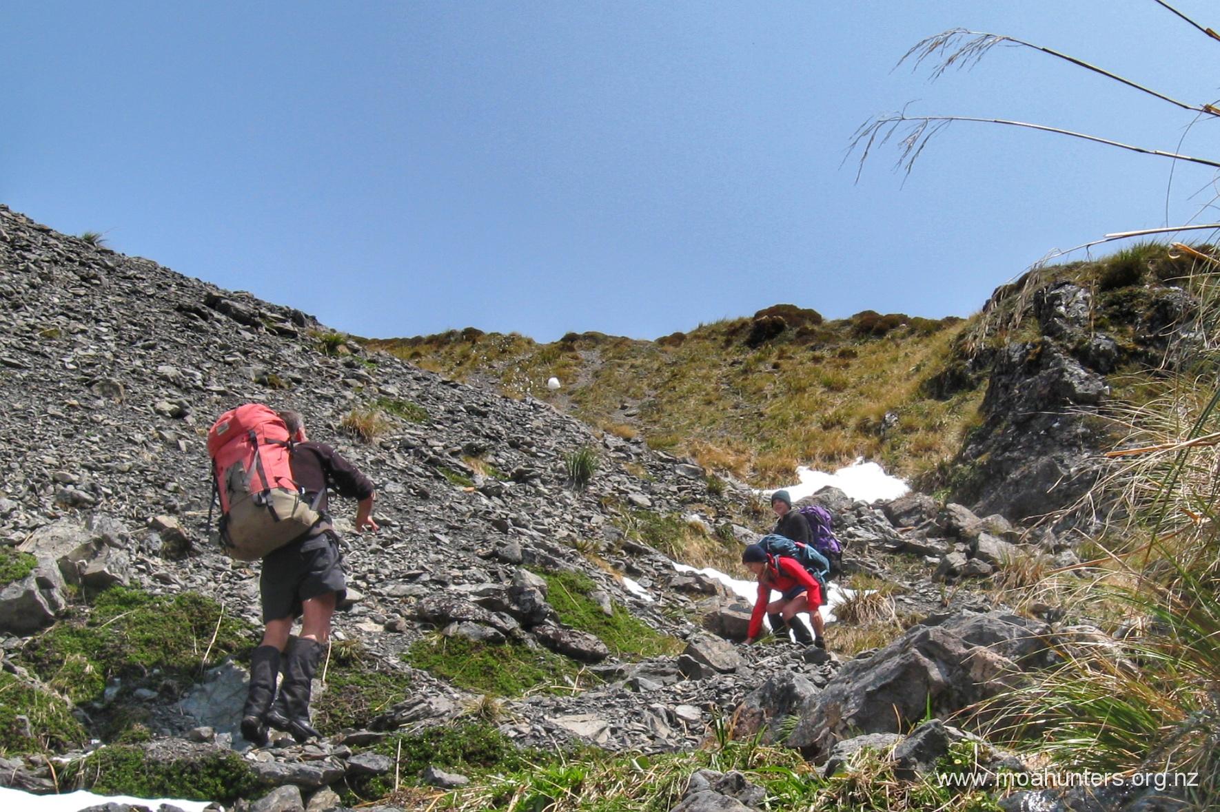
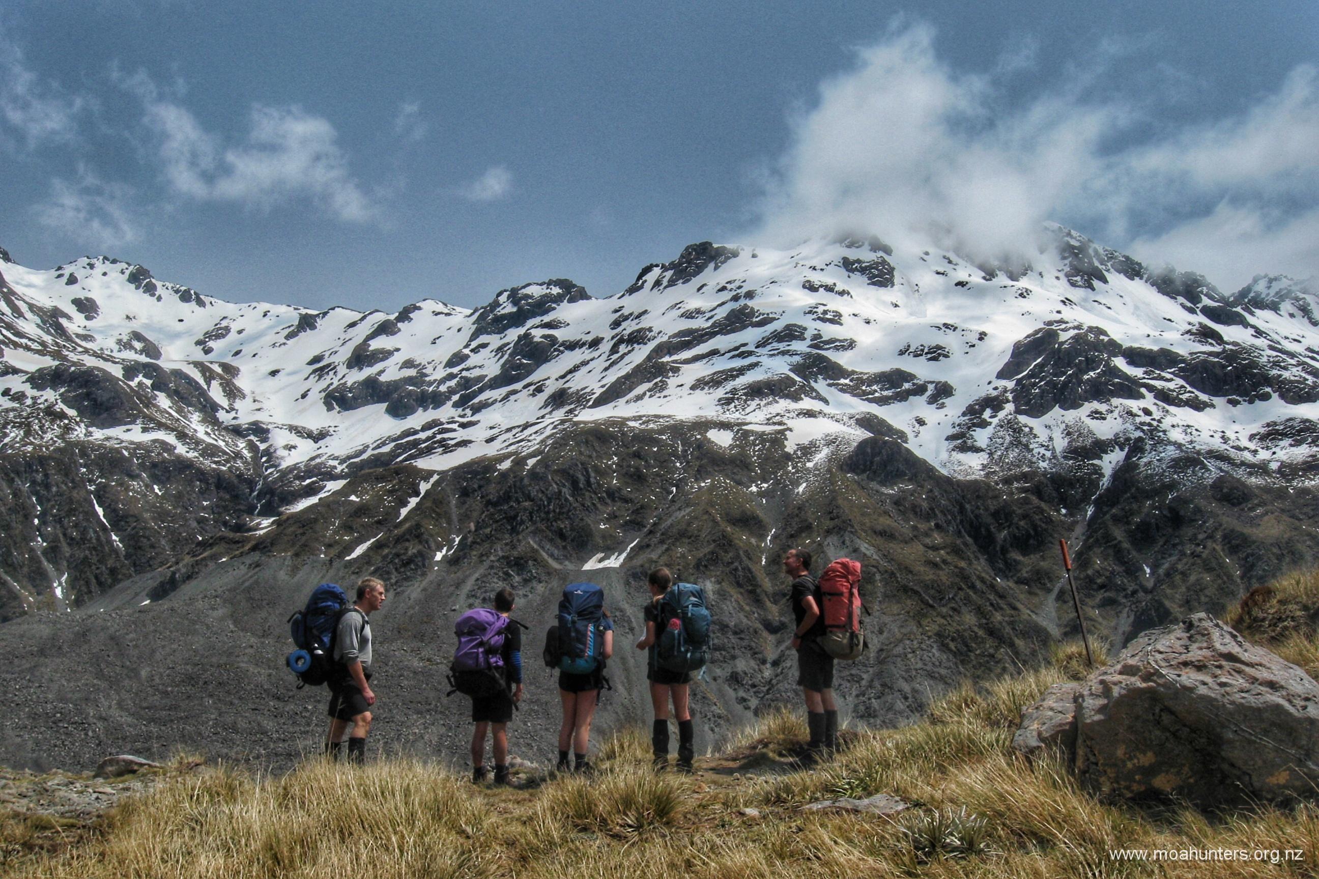
It took us twenty minutes from our lunch spot to reach the snow and start lobbing snowballs up and down at each other. Great fun! Thirty minutes on from there, we had passed the tarn and were standing atop Tarn col.
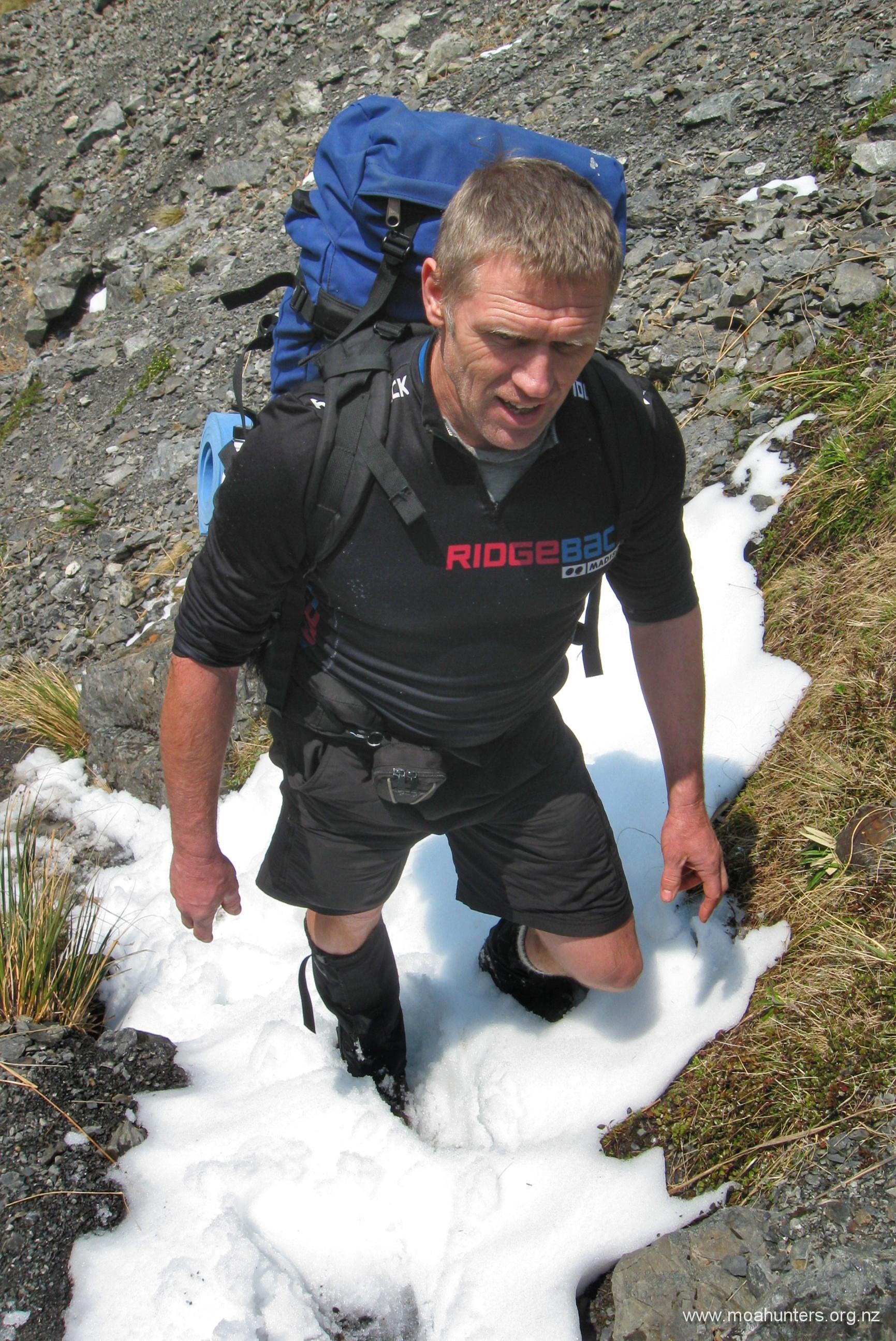
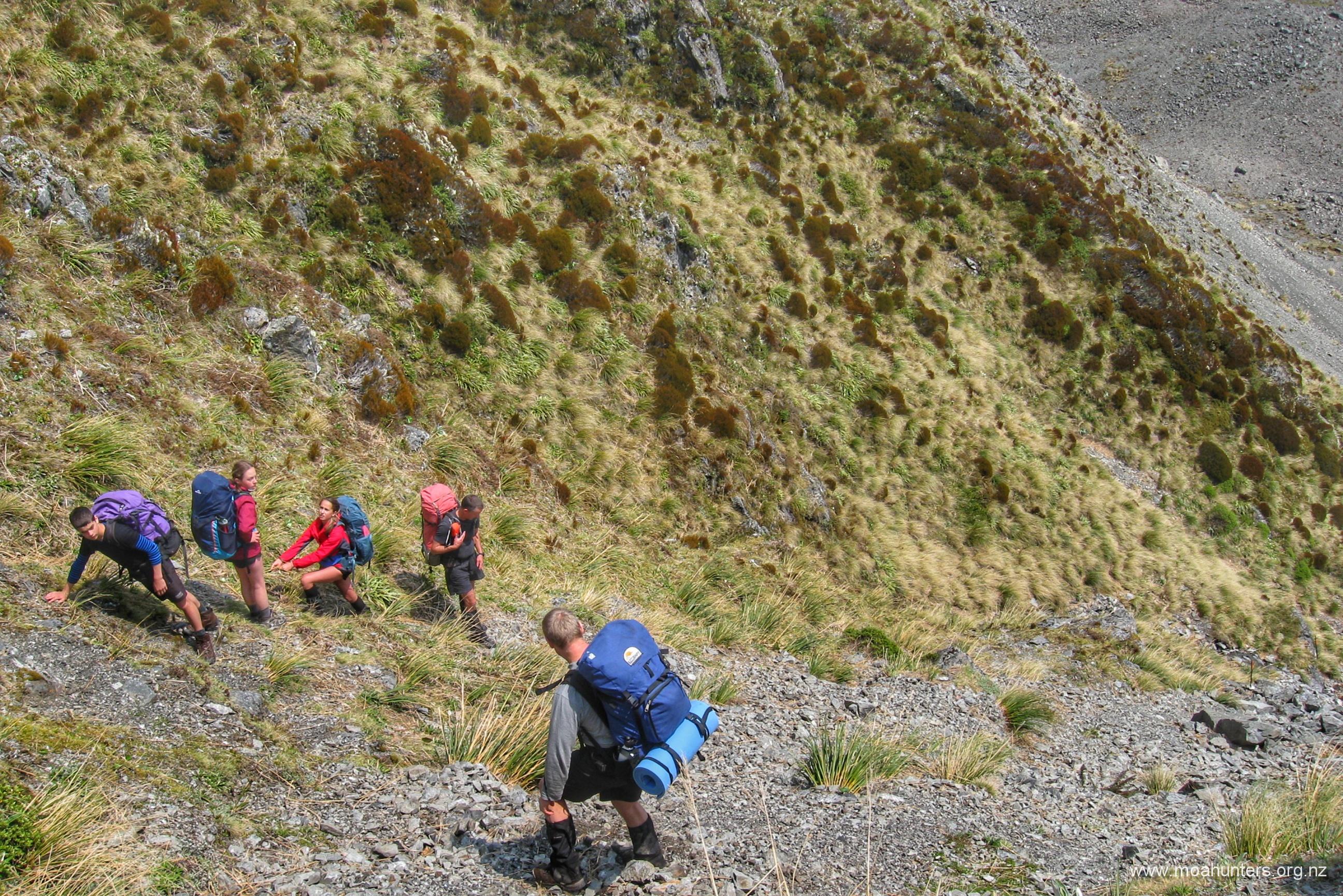
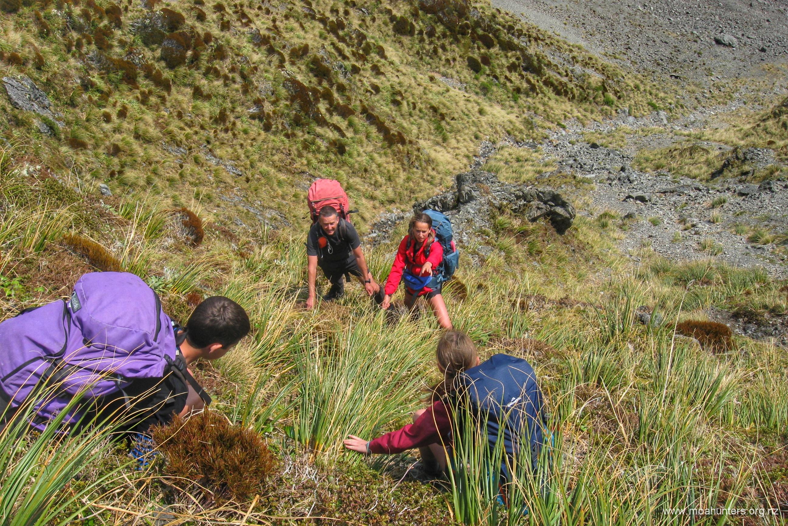
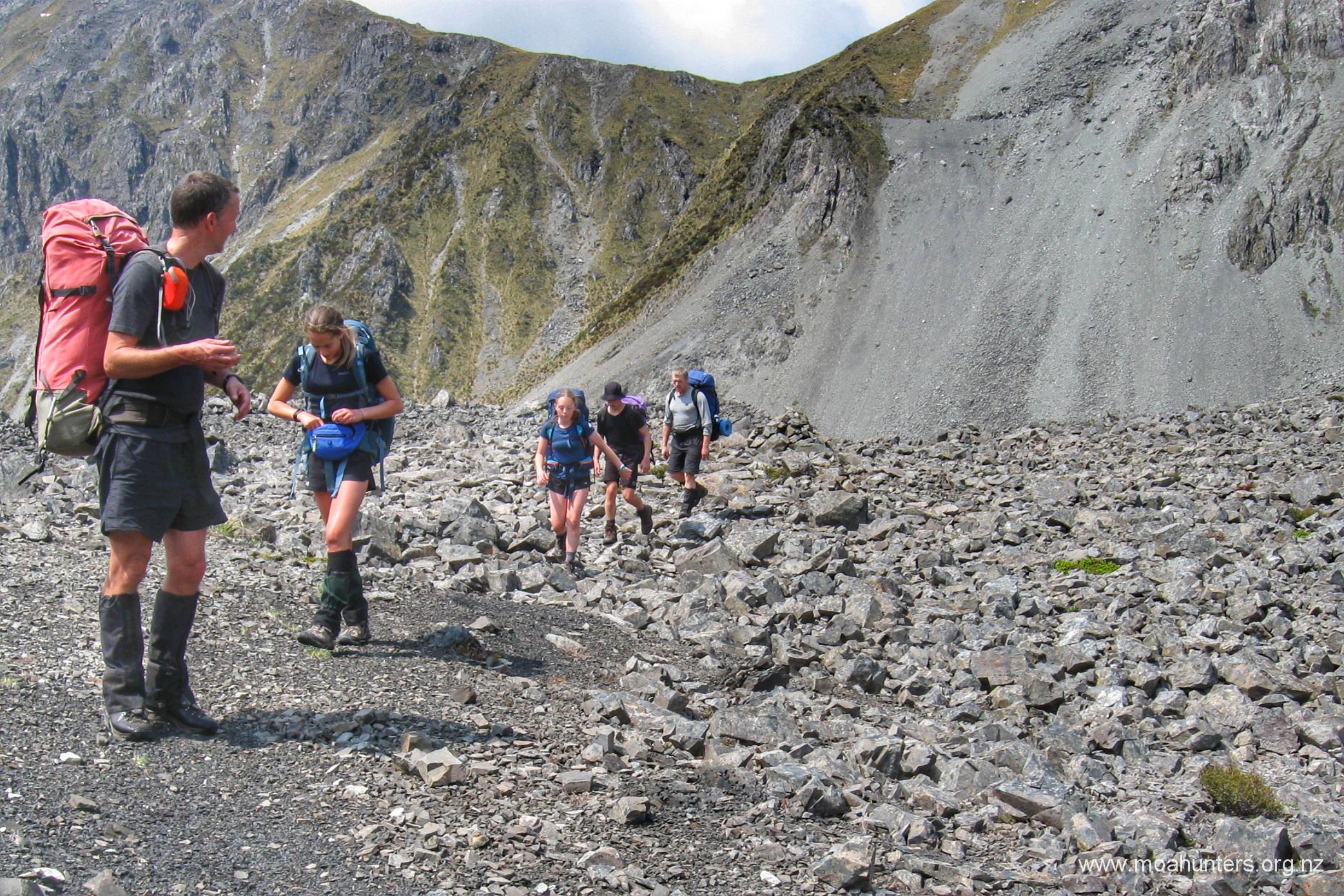
We stopped to take some photos of the broken craggy peaks of the southern alps that surrounded us. We also took some time to assess the best route down what is a fairly steep descent from the col. Paul dropped his pack and picked his way twenty or so metres down to choose a good path to take.
With a route decided, we all started the descent. Taking our time and staying close together, we were soon all standing at the bottom. A zig-zag route proved to be the winner, with care taken to ensure we didn’t have anyone down the slope from others in our group, where they could be hit by dislodged rocks.
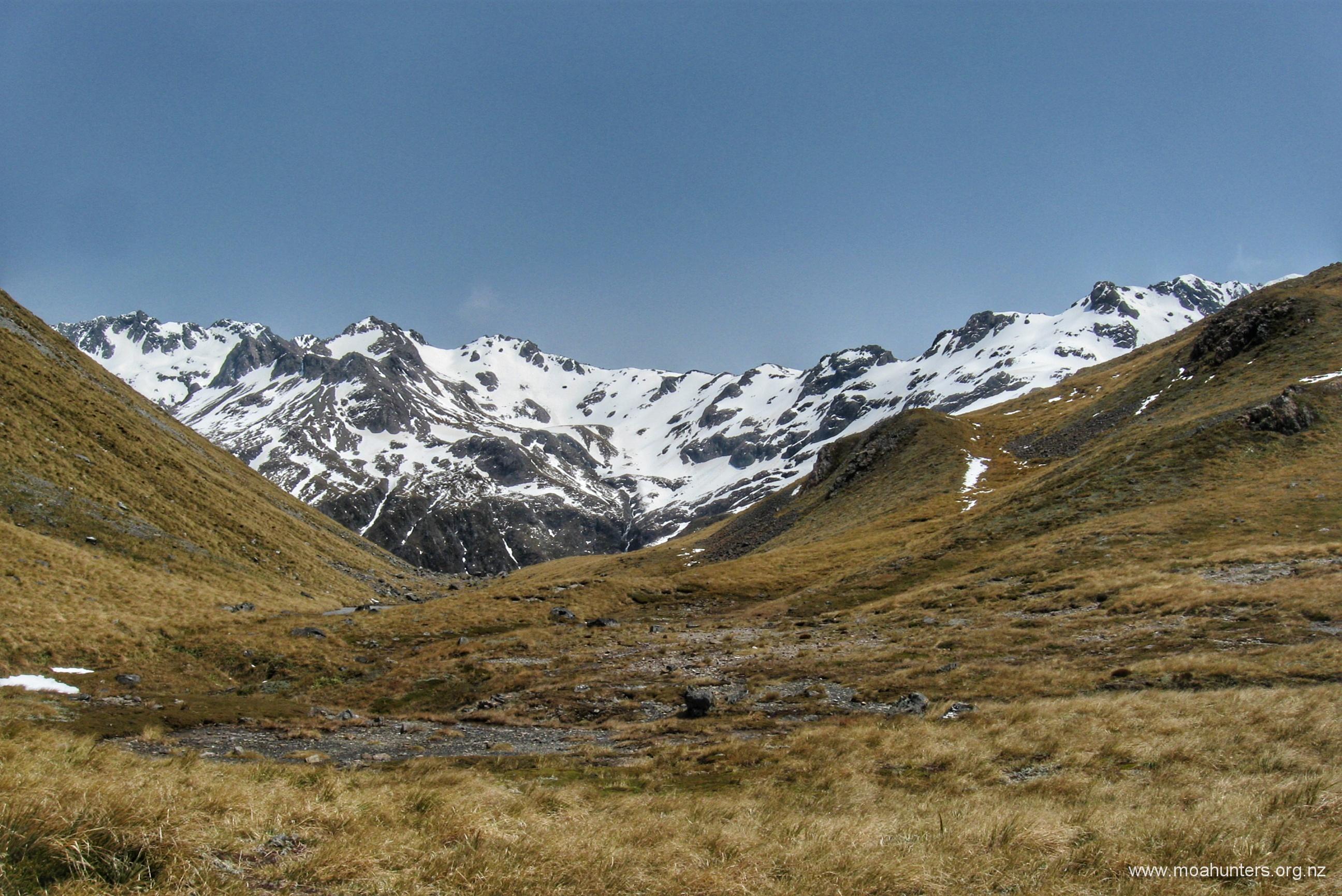
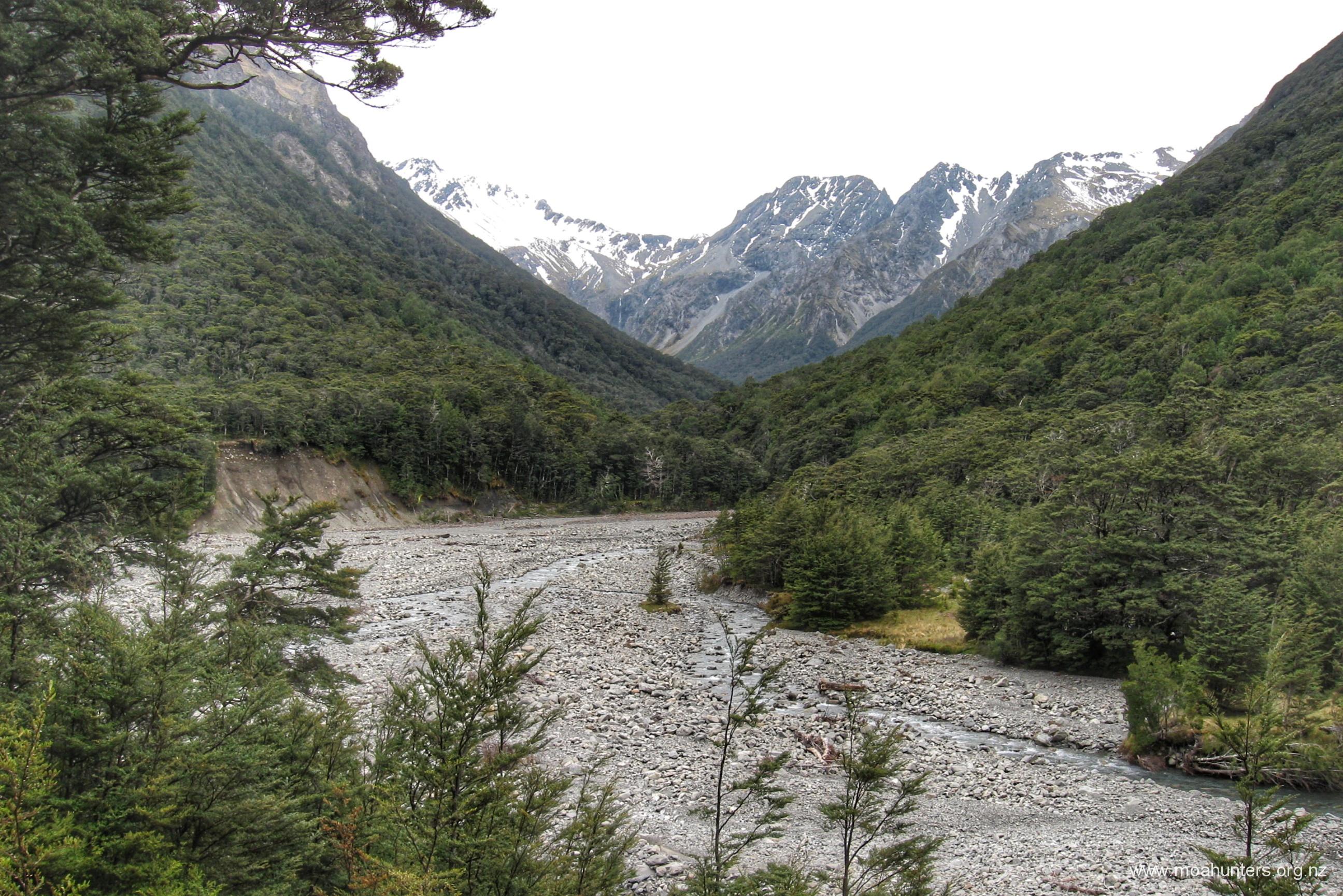
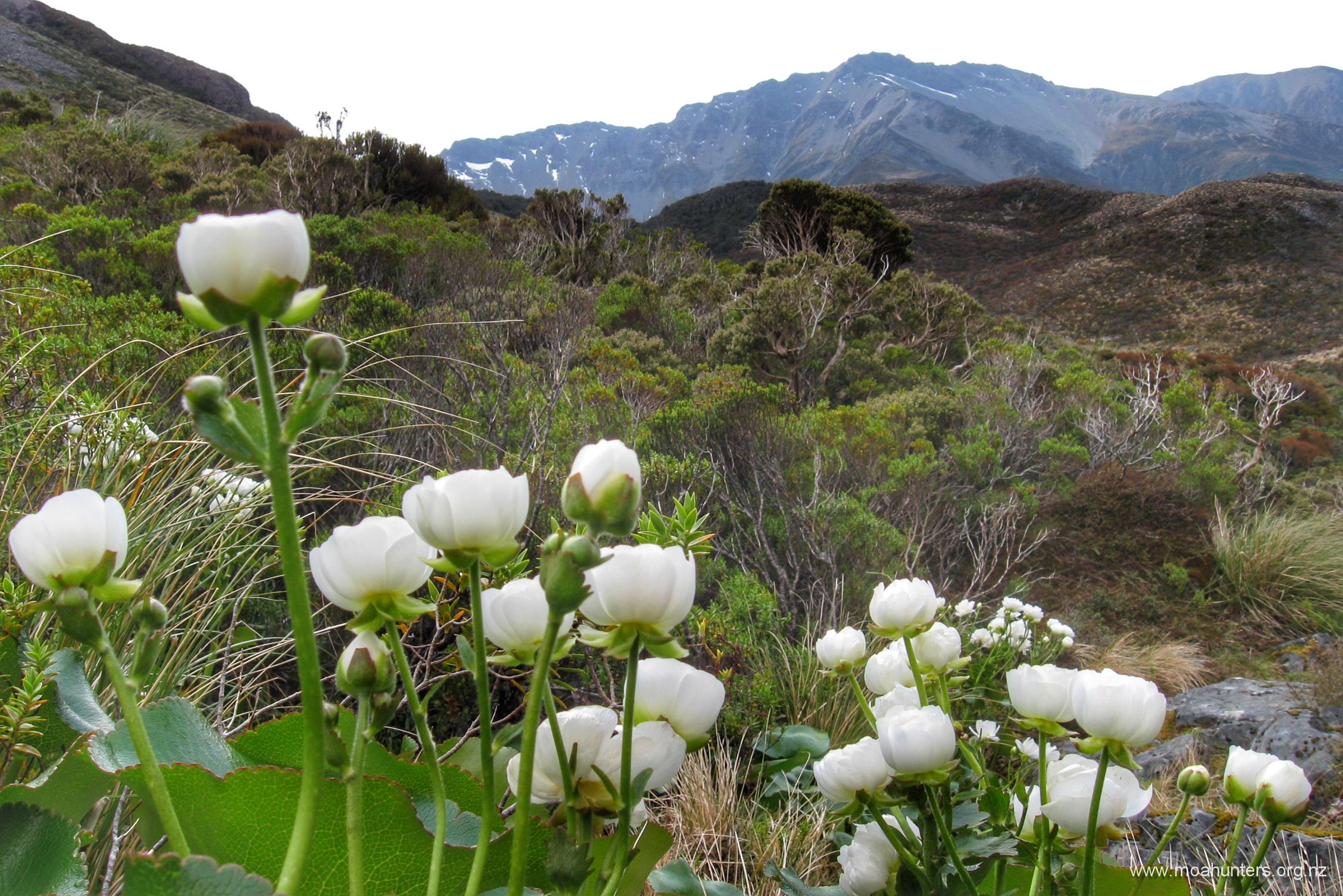
Ahead of us was the remarkable almost lunar landscape created by Falling mountain. In 1929 a magnitude 7.1 earthquake caused a massive landslide, carving a huge chunk off the side of the mountain and sending it smashing down into the valley below. Ninety years on, it still looked like the slip happened yesterday. A few hardy plants have found places for their roots in the dark rubble, but for the most part it is devoid of vegetation.
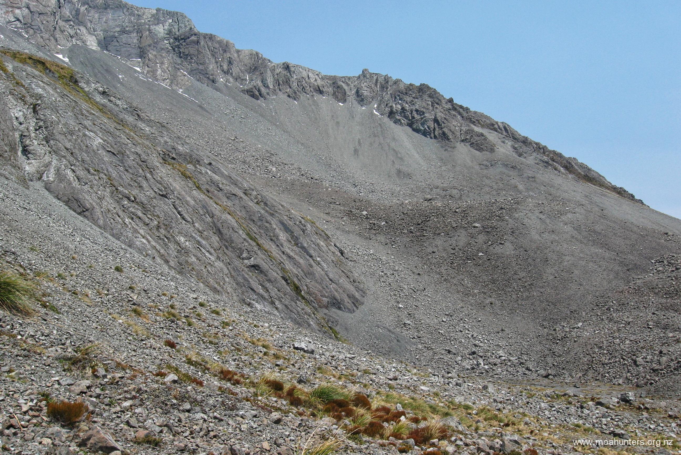
Despite the lack of vegetation, numerous large grey grasshoppers surprised us with their powerful jumps as they sprang out of our way. We thought perhaps they might be in the area looking for things other than food…
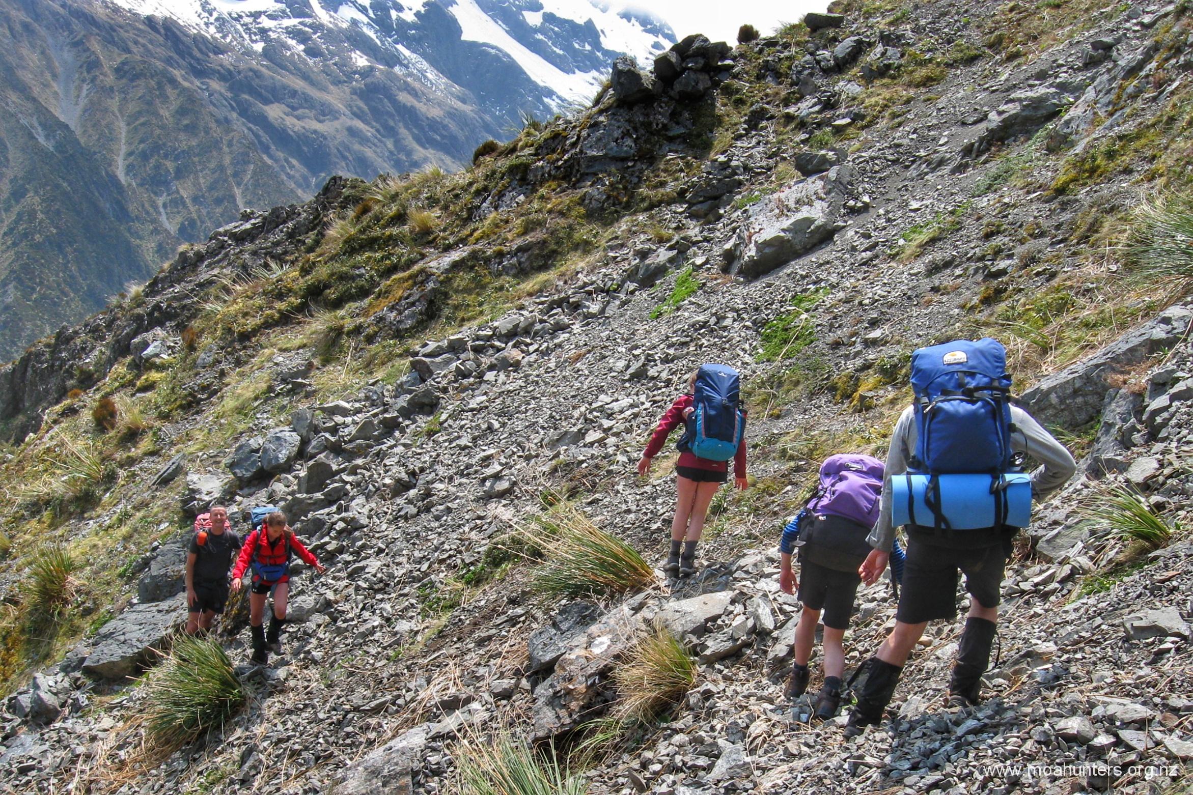
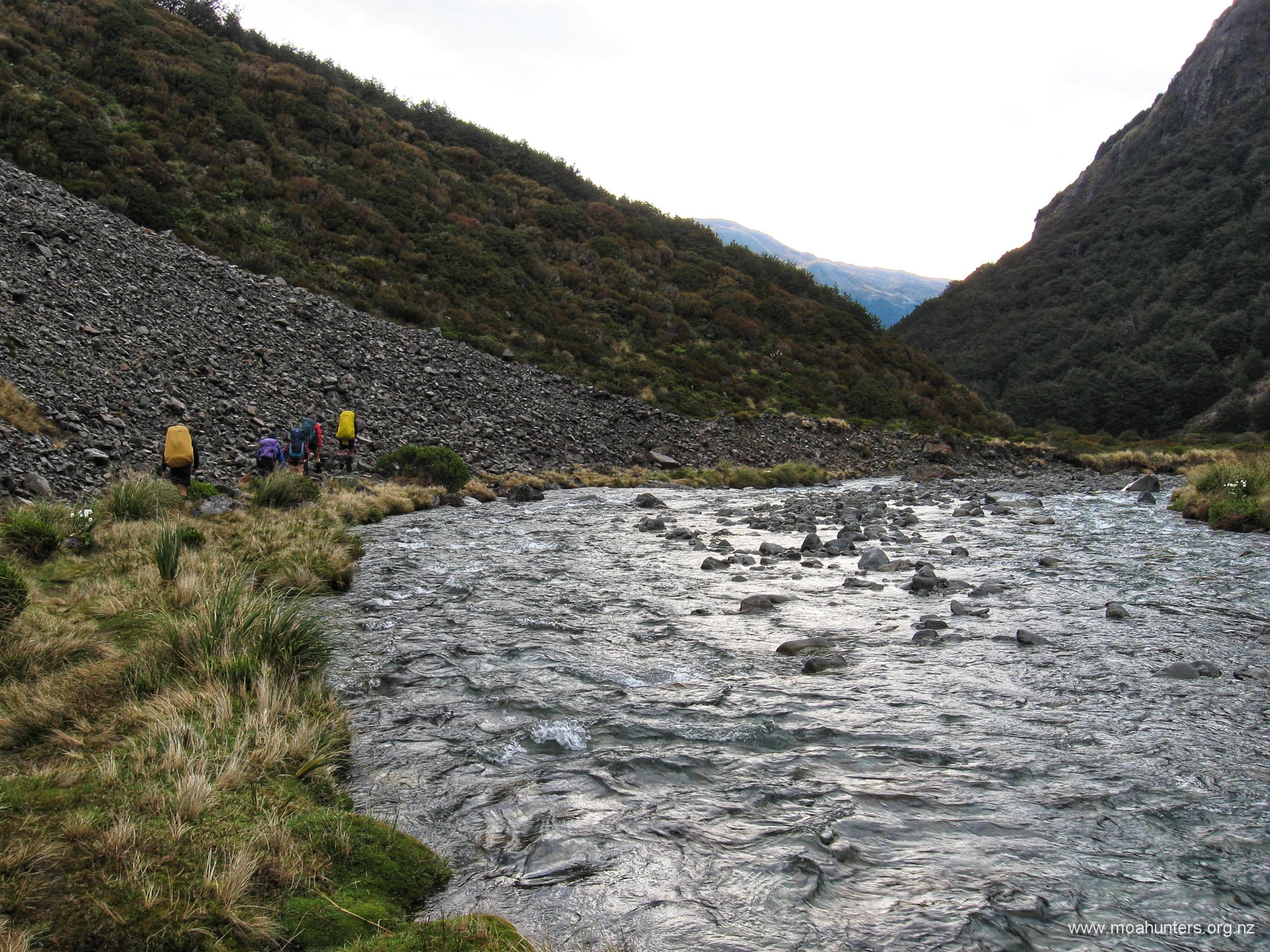
It pays to find and follow a fairly well trodden trail that heads up and initially to the right. This skirts round some of the nastier areas filled with very large rocks, keeping you on the easiest terrain. There are cairns along the way to mark your route, but these can be hard to spot given they are just piles of rocks in amongst piles of rocks.
The tarn on the far side of Taruahuna pass is very deep and spectacularly clear. In fact, crystal clear the day we were there. If the weather had been warmer, we would certainly have been tempted to drop packs and dive in for a refreshing splash.
Fifty minutes after cresting Taruahuna pass, we had descended into the lush grasses of the Edwards valley and were taking an afternoon scroggin stop. The sun was warm and with just the distant sound of the river and a few buzzing insects nearby, we were all guilty of sneaking in a few minutes snoozing. At this point we had been on the trail for seven hours and were now all looking forward to reaching Edwards hut.
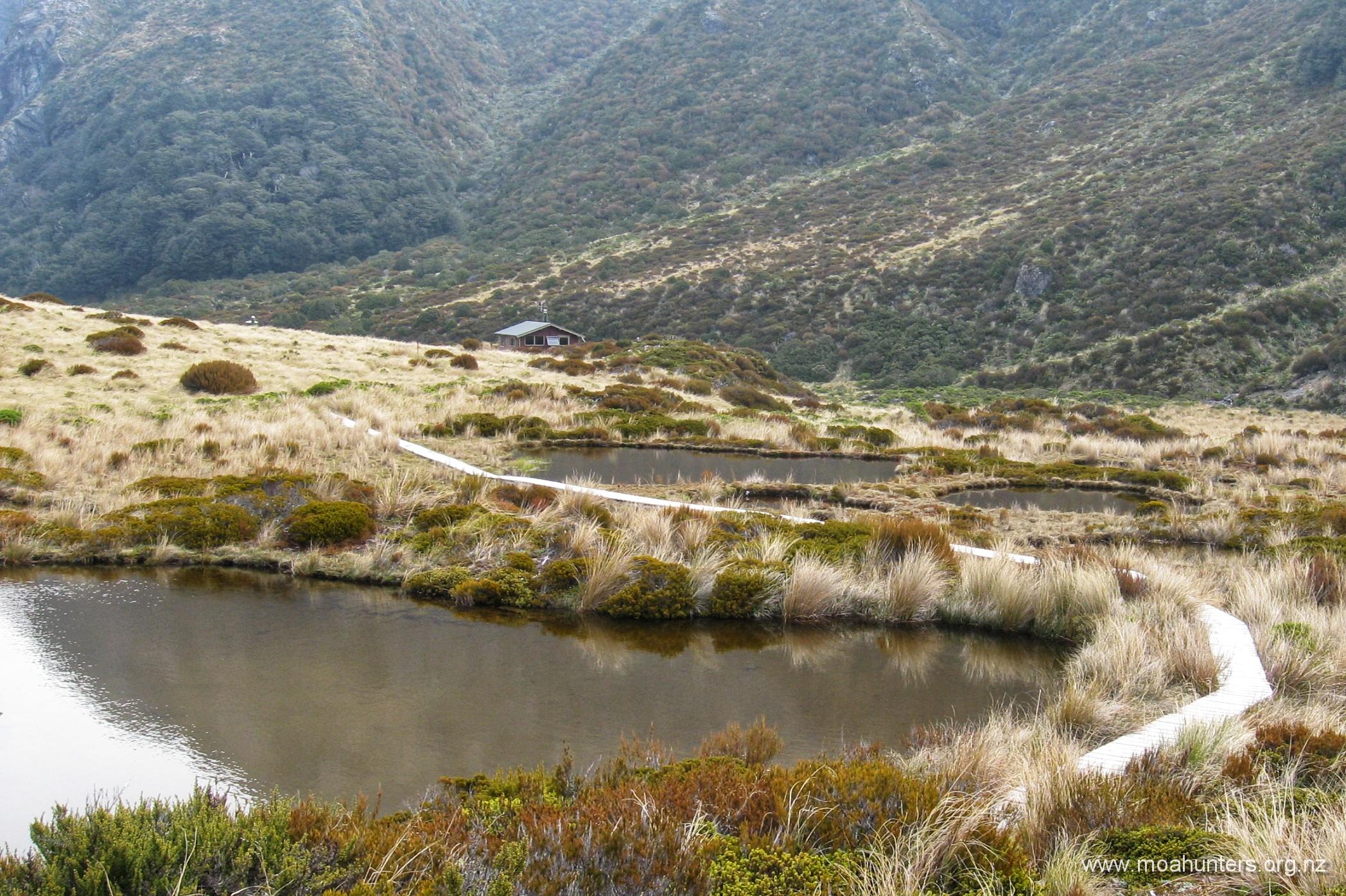
Back in the valley, red topped DOC marker poles make a reappearance and we were able to follow a well marked trail to the hut. Walking down the Edwards river is certainly pleasant enough, and not especially demanding. But we did find the last hour and a half walking a little long. We were certainly pleased to finally see the boardwalks leading to the hut at 5:20pm.
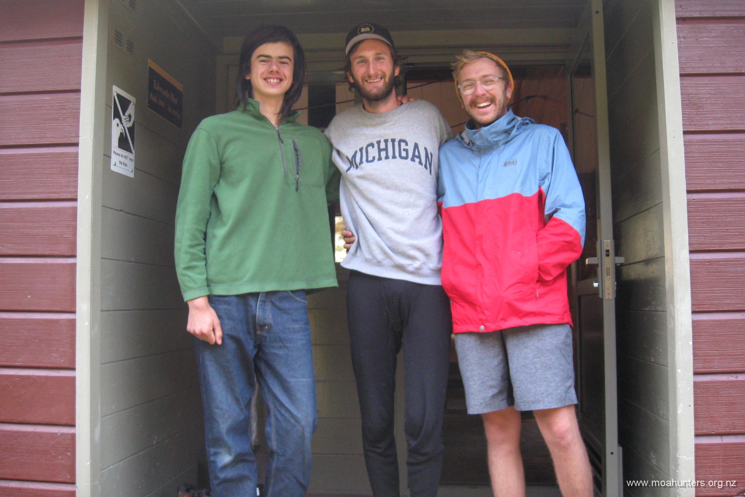
Already at the hut were two young fellows from the Unites States, and their friend from Patagonia. The two Americans, originally from Chicago had quit their jobs and were spending a year enjoying all that New Zealand has to offer. While here, they bumped into the like-minded South American, and together they had been exploring the South Island in a Toyota Hiace van.
We got on well with them, and enjoyed their free-spirited attitude to life. They choose their next adventure almost randomly, taking suggestions from anyone they met on their travels. We discussed everything from electric vehicles to the relative merits of imperial vs metric units with them.
Judging by the nameplate on its door, Edwards hut has just celebrated its 50th birthday, in whatever manner huts do that! While much of the building feels unchanged since 1969, the original windows and door have all been replaced with aluminium joinery. A nice upgrade. There are two bunk rooms and a spacious communal area with a wood burner for those colder days and nights.
Day 3
Sunday 24th November – Edwards hut to Greyney’s shelter

We had been keeping a watchful eye on weather conditions. Our last couple of river crossings would rely on the Edwards and Bealey flow levels being relatively low. Provided we didn’t get significant nor’west rain blow-over into the catchments, we would be OK. However, there had been some rain through the night, and the morning sky was dark and stormy looking, threatening further precipitation.
It was agreed that the sooner we got going the better. We expected to make good time on the well walked track back to the road. Not long after 8am we were ready to make a start. We grabbed some team photos at the door of the hut, and were soon on our way.
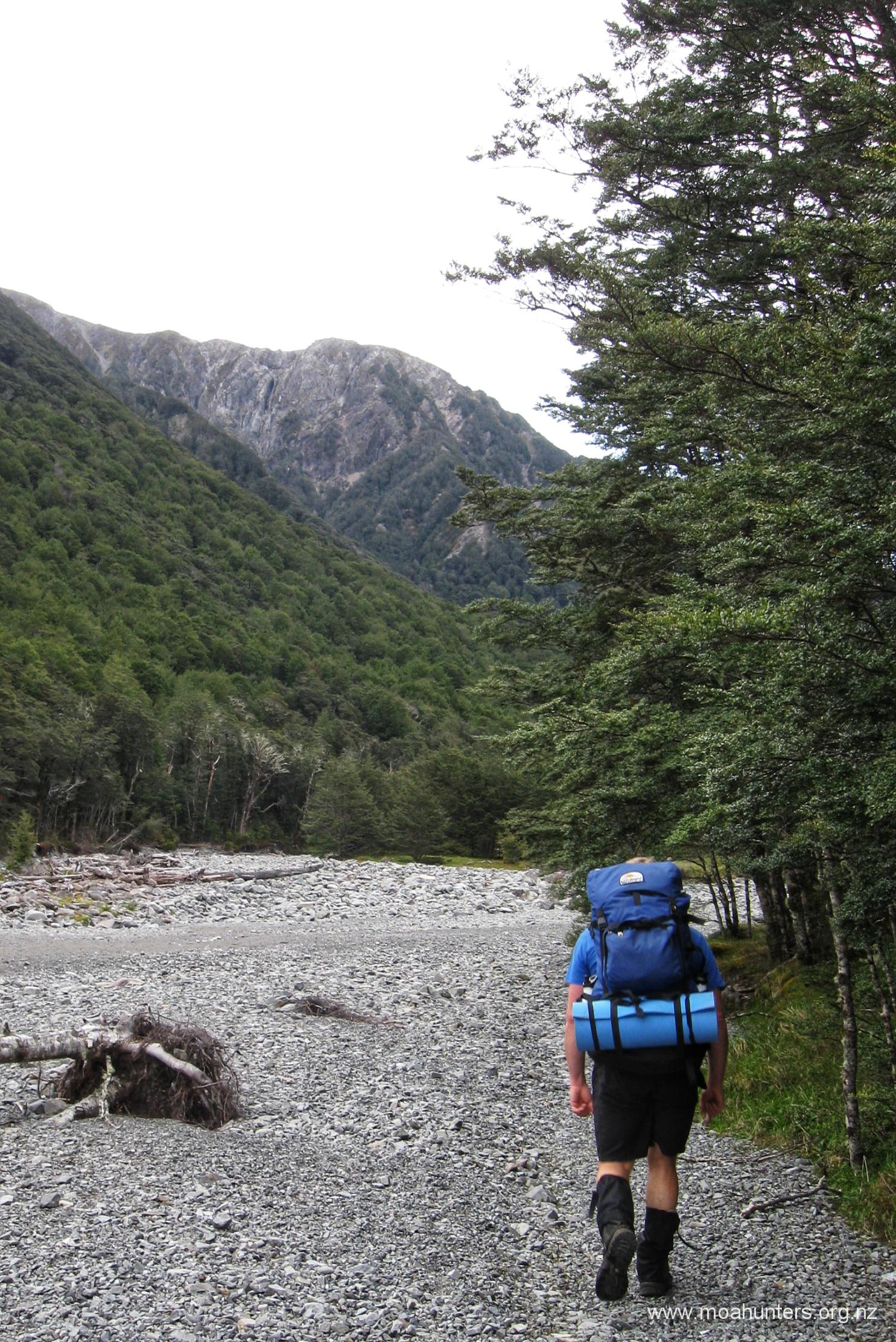
For the first kilometre down from the hut, the track flits back and forth between the river and the beech forest, making for varied and interesting travel. Then as the valley narrows quickly, there is a short climb, and from this point the track stays relatively high above the river.

Emma, Sian and Cole showed no signs they had walked nine hours the previous day before, and were setting a cracking pace up front. Us older fella’s just looked on with plenty of admiration as they confidently scampered up and down difficult sections. We never once heard a complaint or saw any sign of discontent from any of them.
After just over an hour of pleasant walking, we stopped for a scroggin break. Overhead conditions had brightened and the threat of heavy rain seemed greatly diminished. There was still a strong wind blowing through the tops, and we knew that the nor’wester could strengthen more and potentially bring rain.
We continued along the track, which was a mix of dropping in and out of gullies, some very dry sections along ridges, and some surprisingly wet and muddy areas.
Not long after 10am we had dropped back down to the Edwards again. From here we found that sticking close to the true left of the valley is the easiest walking. Not that walking close to the river would be especially hard. But it was at the valley edge that we found plenty of flat grassy or packed shingle areas to walk, which were much nicer than the loose rubble near the river.
A few spots of rain were blowing over the tops as we stopped for another scroggin break on a natural seat created by the river when it was in flood. A number of mice scuttled around among the sticks and stones below our dangling feet. We had seen a lot of them on this trip. This is due to the beech trees seeding heavily in what is called a mast year. They seemed relatively unafraid of us, and were taking a significant risk being out and about in full daylight we thought. Perhaps the seed bounty was running short leaving them a little desperate for food.
It was 11:45am when we reached the end of the “official” track, marked by a friendly green and yellow DOC sign. We had made pretty good time, knocking off the trip in less than four hours.
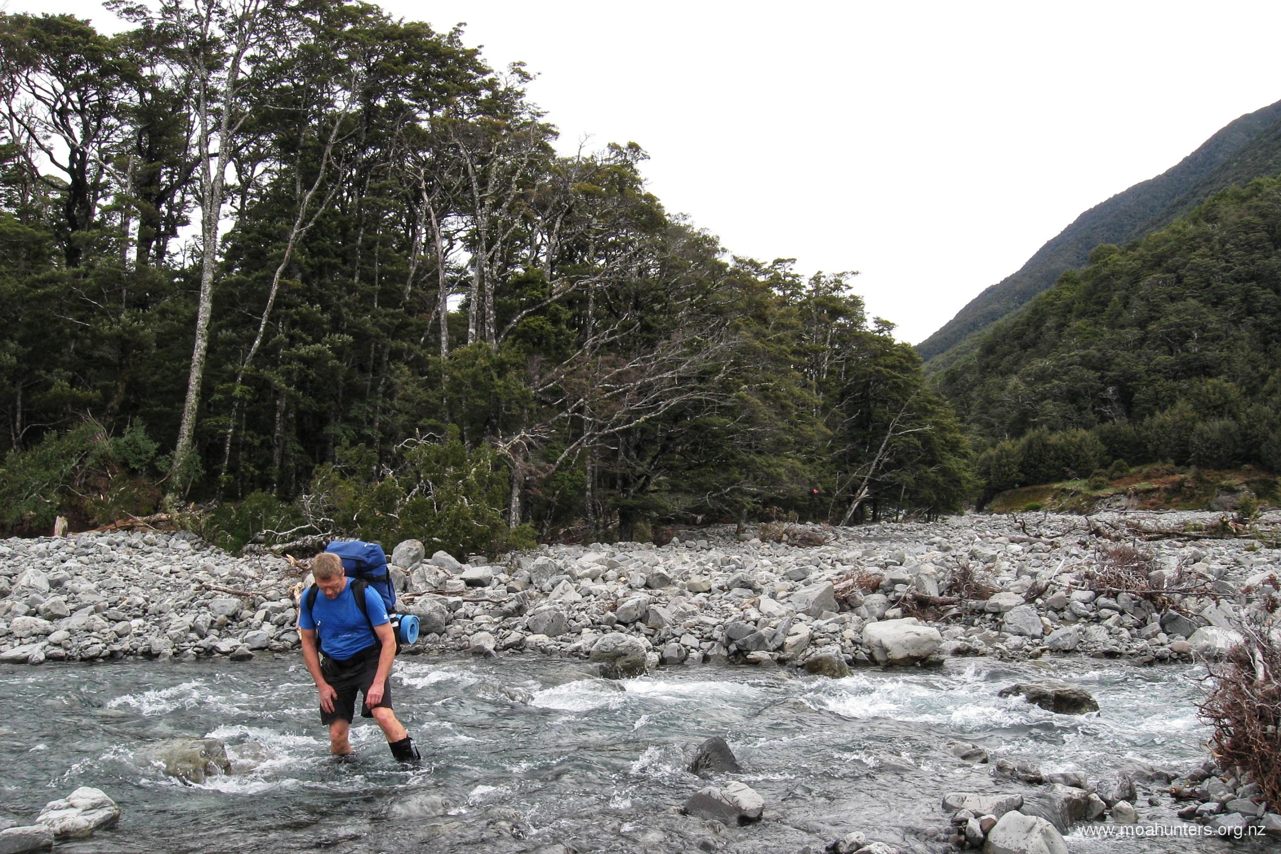
From here we just had a couple of obstacles left. Two river crossings. Any anxiety we had about these was quickly dispelled. The water was definitely cold, and did come to the tops of the legs on Adam, John and Paul, and higher on Cole, Sian and Emma. But it wasn’t swift. Crossing in pairs, holding the straps of each others packs for mutual support, we all got across both rivers very easily.
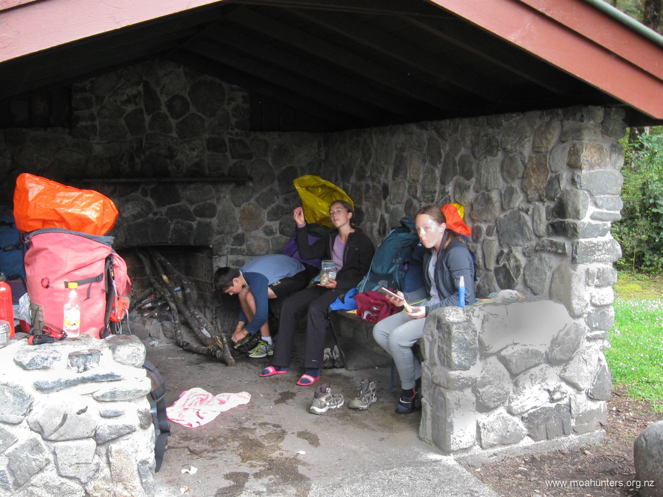
Once over the rivers, it is just a short hop skip and a jump to a rail underpass which leads to the road and Greyney’s shelter. We were at the shelter by 12:30pm and gratefully taking off very wet boots and socks in exchange for warm dry stuff. The local sandflies had set up a strong welcoming committee and we quickly dug out the repellent sprays.
Paul and John were preparing for a jog down the road, hoping they would manage to hitch a ride with not too much running required. But this turned out to not be required. Adam got chatting to an American tourist couple who had driven to the shelter to escape torrential rain in Greymouth. They were initially intending to drive back in that direction, but when they heard we were looking for a ride to the Hawdon track, they very generously offered to take John and Paul. This was a lovely thing to do, and we were very grateful. Paul repaid them with lots of local knowledge on the geology, geography and history of the area as they drove to the Hawdon.
45 minutes later, John and Paul were back in the cars, and we were headed back to Christchurch. Well done to all of us, but especially our three young Moa Hunter trainees for tackling every inch of the track with enthusiasm and energy!
The Hawdon Edwards circuit is a really wonderful walk, and very underrated. You see a fabulous range of diverse scenery, face some challenging terrain, and will likely meet some really nice people along the way.

Loved reeading this thank you
Thanks very much, Hailey. We always enjoy getting feedback on our website – especially positive feedback!
Appreciate the info! Scoping this track out and hoping to do it in February. Greetings from Canada.
Gidday and greetings to you too, Chase.
We’re very happy to hear that our online ramblings are useful, even as far away as Canada. The Hawdon Edwards is a really nice circuit – one of many similar loops you can do in the Arthur’s Pass area. Hopefully you get some nice sunny February weather for your trip. Shout out if you have any questions or would like more info on anything. We’re always keen to help out our fellow hikers.
Cheers, Adam and the Moa Hunters.