Given it is not much more than a stones throw from both Maruia Springs and Springs Junction, surprisingly few people seem to have heard of the Lake Christabel circuit. Certainly it seemed DOC had all but abandoned any maintenance of the track a few years ago, which may have contributed to its relative obscurity. The good news is the track looks to be getting some love from DOC again, and the circuit is no longer in danger of being consumed by the bush.
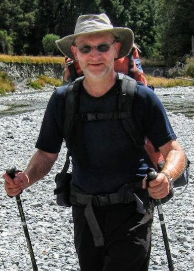
Moa Hunters on this trip: Magnus, Adam, Paul, Richard, Lewis, Chris, John, Luke


The Trip:


Day 1
Friday 18th January – Start to Mid Robinson hut

With seven of us heading for Springs Junction from Christchurch, two vehicles were required for all the gear and Moa hunters. Given the reports we had read regarding the often dubious condition of the unsealed access road to the track, we were very happy one of them was a Nissan ute, generously loaned to us by Paul’s dad for the weekend. According to other blog posts we had read, attempting the road in a standard 2wd vehicle after any kind of rain is unwise due to the large number of fords that need to be crossed.

The timing of our arrival in Springs Junction just after 12:15pm was almost perfect. We arrived just 5 minutes after Magnus, who had travelled down from Nelson.
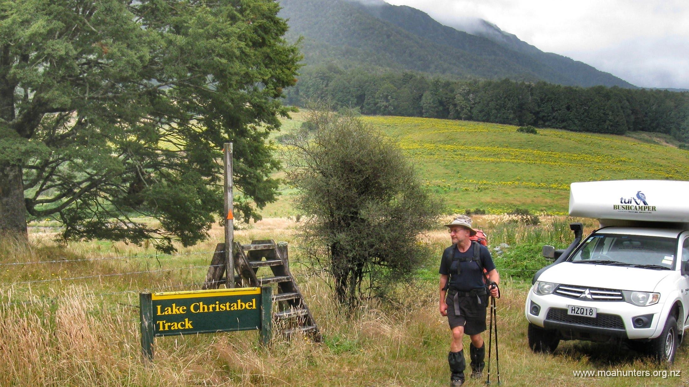
With Magnus’s gear loaded into the ute, we set off along SH7 looking for Palmers Road, which would take us to the start of the track. We found it easily and followed the remarkably smooth road in both vehicles until we reached the north end of the track, where we would exit the bush in a few days time.

At this point we parked Chris’s little Honda Jazz out of the way under a tree. Paul continued up the road in the ute with half the Moa Hunters on board, leaving the rest of us fighting off an enthusiatic squadron of sandflies while we changed into our boots and walking gear.
After about 20 minutes, Paul was back with an empty ute ready to ferry the rest of us to the other end of the track. As there had been no recent rain, the fords we crossed were either completely dry, or barely running. There were certainly no concerns that day. But it was clear from the amount of scouring and erosion around some of the crossings that they could become ferocious and impassable in bad weather.
It was probably around 1:30pm by the time we were all standing with packs on ready to hit the track. Despite being mostly cloudy, conditions were very warm. Whenever it found a gap in the clouds, the sun shone strongly down on us, adding more heat to the day.
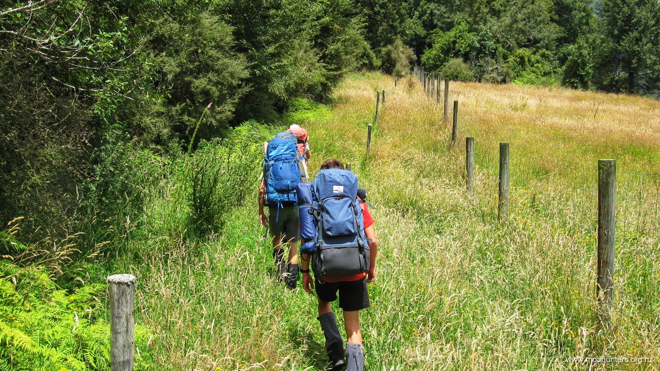
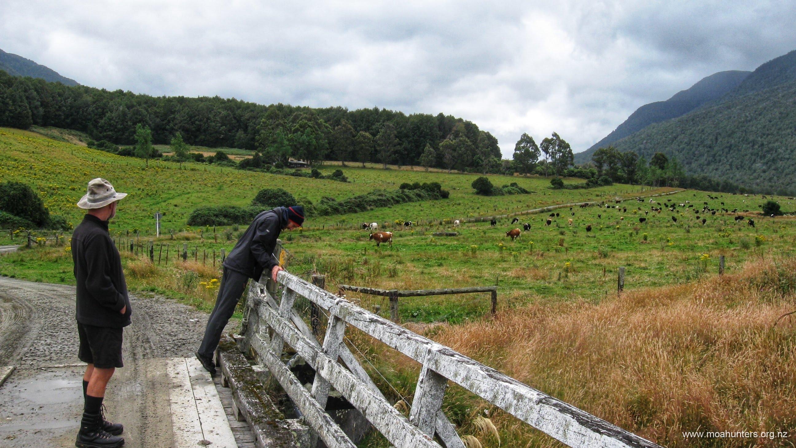
The first section of track skirts the edge of farmland, following a deer fence through open country. December had been a wet month, and consequently the grass we walked through was long and lush, bent at the tops by heavy seed heads.

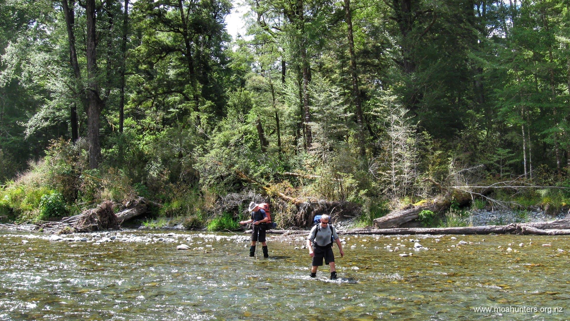
New orange markers along the track were actually quite good. Regularly spaced and clearly visible, they were easily spotted as we left the fence line and began following the Robinson river. However, given the pleasant conditions and easy walking along the river, we did tend to ignore them for much of the first couple of hours. We simply ambled along the river following the most inviting looking terrain as it presented itself. Occasional river crossings were required, but these were more a pleasant cooling of the feet than an obstacle.
Our lunch was more of an early afternoon tea. Or “second lunch” perhaps, if you are a Hobbit. We perched ourselves along the grassy banks of a trickle of a stream and munched our lunches in the pleasant afternoon heat. Small insects, flies and bees busily flew back and forwards past us, enjoying the abundant nectar available on the masses of flowers in the tall grass.
Richard was very happy to be with us. He had worked hard for many many months to get what is essentially a fairly buggered knee into fit condition for another Moa Hunt. Lots of low impact swimming, spinning, walking and numerous supplements and magic potions seemed to have done the trick. He wandered along, seemingly untroubled by the knee. It was certainly great to have him back Moa Hunting with us after his forced absence from the Dusky in 2018.
Walking up the Robinson river valley is lovely in late summer. The terrain is easy and the gentle flats either side of the river can be walked without a care. Flanking each side of the river flat, beech covered mountains provide drama and contrast to the scene.
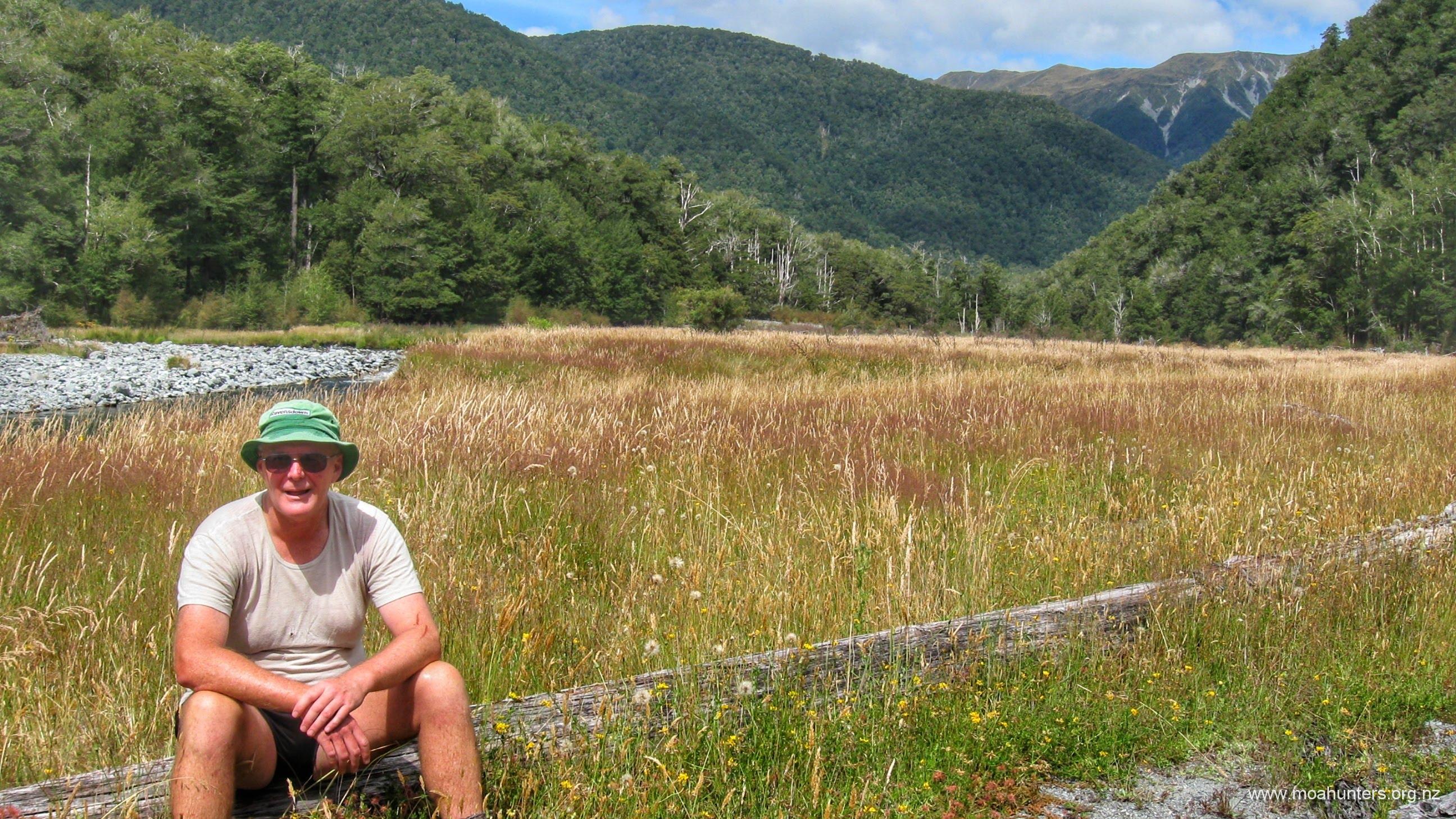
It’s amazing how varied and colourful this type of country can be. Low plants and grasses created a tapestry of colour along the river, contrasting with the shades of green and grey of the surrounding peaks.
There were occasional tricky spots as we progressed up the Robinson. The higher we got, the narrower the valley became. In places, recent flooding events had scoured out the banks on either side leaving piles of river rubble and fallen trees in our path.

It was close to 6:30pm when we came upon the swingbridge which crosses to the true left of the Robinson to within a stones throw of Mid Robinson hut. Most of us used the bridge, despite the river being low enough to walk across with relative ease. I for one like the idea of pulling on relatively dry and warm boots in the morning… It was for that reason I was more than happy to wait my turn to cross the swingbridge.

If you were to design a hut for maximum summer sun, you couldn’t go past Mid Robinson as a perfect example. It was 7:45pm before trees and hills obstructed the warming rays of yellow sunlight that shone brightly straight through the doorway of the hut all evening. The hut is a cosy little forestry service one, with 6 bunk beds, a good size bench and barely enough space for eight Moa Hunters to move about!


Wonderfully tasty and tender marinated steak was fried, filling the hut with mouthwatering aromas of garlic and red wine. When it came time for dessert, Chris surprised and amazed us all with a stunning piece of tramping ingenuity. Prior to the tramp he had cleverly fashioned a cunningly insulated container from snow foam and insulating sprayfoam. At the hut he pulled from it a litre of still frozen Kapiti gingernut ice-cream to complement our dessert. It was a fantastic treat…. and there was more to come, courtesy of Magnus!
Over the next few hours we were educated on the German ritual of the Feuerzangenbowle, or German Fire Punch. Three litres of mulled spiced red wine was gently heated over a cooker. Then a cone of sugar suspended above the wine on a metal frame, drizzled generously with dangerously potent over-proof rum, was spectacularly set alight. As it burned with a blue and red flame, more rum was carefully added to the flaming cone, creating wonderful bursts of orange flame. All the while, burning drops of caramelised sugar melted off the cone and dripped into the wine below.


When the fire display was over, we lay on the bunks drinking the rich beverage while watching a black and white German movie projected onto a bedsheet screen supended between tramping poles high on the hut wall.

We all agreed the “fire punch” was like a liquid Christmas Cake. The spices, red wine and citrus juice and zest had a rich flavour. Drinking the ferociously warming mulled wine while watching a quirky 1940s German subtitled movie and getting slowly sozzled was a strangely surreal and unforgettable night!
Paul estimates we consumed 8kg of food and beverage that night. Those who didn’t have to carry it in their packs the next day were no doubt extremely grateful!
Adam and Luke dossed down on the floor with an array of bedrolls and self-inflating mattressed under them for comfort. The rest of the team slipped into their sleeping bags on bunks and we were all soon sound asleep.
Day 2
Saturday 19th January – Mid Robinson hut to Top Robinson hut

Saturday morning dawned overcast and cool, with some of us feeling perhaps a little jaded from the late night before… or was it perhaps due to the somewhat higher alcohol consumption than is usual for a Moa Hunt?!
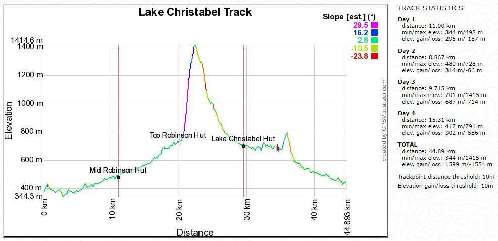
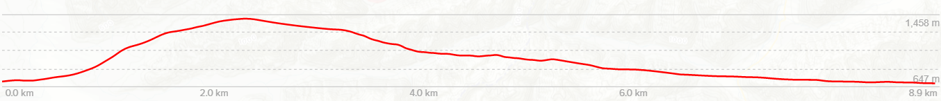
It was a leasurely 9am by the time we had eaten, tidied the hut and were balancing cameras on packs outside the hut for our traditional team photo. Judging by the map, our day ahead looked to be a fairly short one, with a couple of hundred metres altitude gain over the 9km between us and Top Robinson hut.

In contrast to day one, which had been spent in the open river valley, the track to Top Robinson hut winds through dense beech forest and thick vegetation. Our old friend hook grass was also out in force, its nasty little seeds keen to snag the hairs of our legs and hitch a ride.
We encountered the odd muddy patch, crossed many side streams, but generally found the track to be in good condition. If more people walked the circuit, it would be excellent. But the lack of traffic does leave the track in danger of being overgrown in parts. Grasses and ferns were quite thick, obscuring the path below.
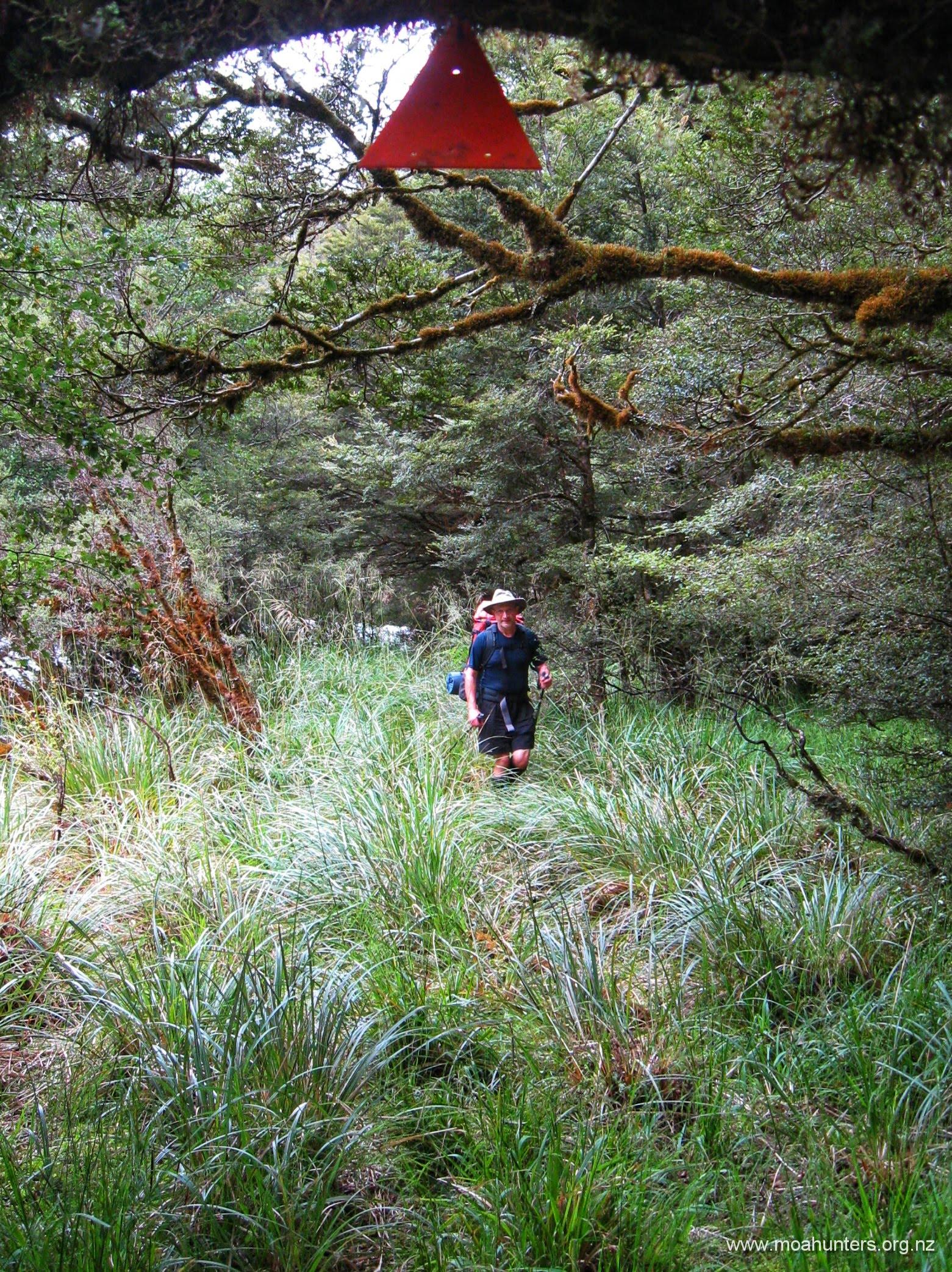
However, despite the enthusiatic vegetation growth, DOC have definitely been working hard to improve the track. Shiny new orange markers were dotted evenly between the huts, and the worst tree falls had been cleared.
The ascent throughout the day was steady, with the odd short grunt up and over a steep section, or round a gully, but nothing too onerous.
Knowing it was to be a short day, we grabbed ourselves an early lunch near a stream in amongst the beech forest. Leaning up against a comfy tree or backpack, we discussed everything and nothing, enjoying being away from the usual routines of real life.
By this time, we were feeling the occasional drop of rain, and the cloud had thickened noticeably. We were keen to get to the hut before any serious precipitation set in, so didn’t indulge in a long languid lunch this day.
Following our lunch break, the track did get a bit messier. The valley gets a little tighter, and we did find ourselves battling through trickier terrain. While it was a bit more demanding, it certainly wasn’t anywhere near as nasty as some days we have experienced.

The track does depart the river for about 45 minutes, staying quite high to avoid a steep gorged area below. The ascent is a steady climb, a short relatively flat section, then another easy climb. Friendly Robins flitted along beside us from time to time, and Lewis very briefly spotted a deer while we walked this section. He has a good keen eye for wildlife!
The benefit of climbing higher is the lack of hook grass. While hook grass does no real harm, and inflicts no injury, it is a bloody irritating and annoying plant! Having said that, we’d all prefer pushing through hook grass than being perforated by wicked spear (Spaniard) grass!
We arrived at Top Robinson hut at 2:30pm. There is a swingbridge about 500 metres before the hut, which is nestled snugly in the bush just above the river. Despite being listed as an 8 bunk hut, Top Robinson would comfortably sleep ten people. There was more than enough space for eight Moa Hunters to move about and get a large dinner and dessert prepared.
A lazy afternoon was spent snoozing, solving the World’s political problems and preparing the evening meal.
The remains of the bottle of very strong rum was polished off. Moa Hunter opinions on the drinkability of the liquor varied from “not bad, I quite like it“, to “it’s disgusting… a bit like petrol… I’ll have another swig, thanks“.
Day 3
Sunday 20th January – Top Robinson hut to Lake Christabel hut
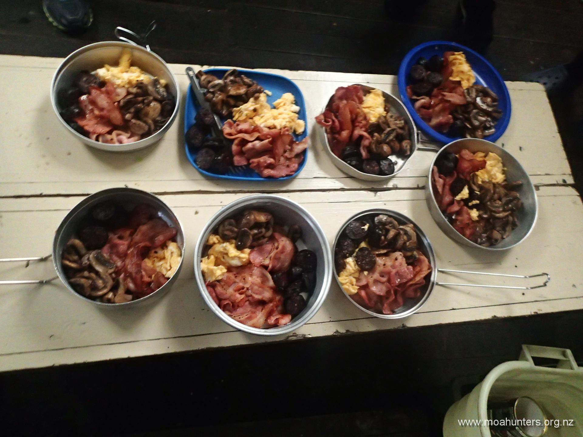
Breakfast took nearly an hour to prepare. Fried bacon, mushrooms and black pudding with a side of scrambled eggs were generously loaded onto plates. Some experimental home-built hash browns were abandonded. They just refused to crisp up and cook properly. The mighty breakfast was excellent preparation for the only day of the trip that would involve significant altitude gain.
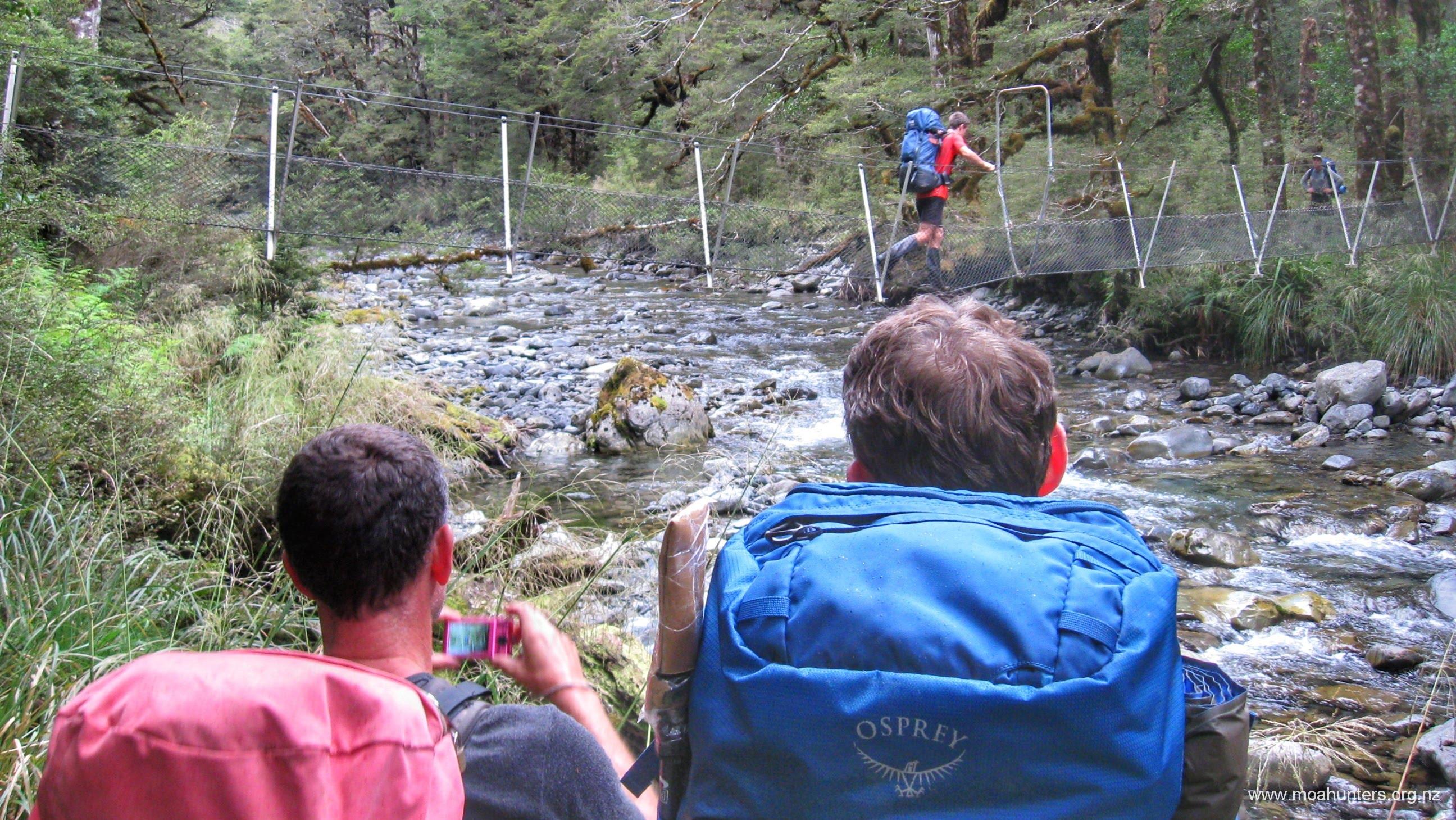
We left the hut at 9:15am and enjoyed the gentle first 15 minutes of track which led to another swingbridge, which crosses the Robinson river for the last time before the track leads up a ridge to the open tops.

Aside from some fairly brackish tarns on the tops, the swingbridge just past the hut is the last point to grab clean clear water for quite some time. We filled our bellies and bottles with cool water before starting up the ridge.
Plodding our way up the hill was warm work. Sheltered from any cool breeze in the thick beech forest, we found ourselves perspiring and blowing despite the grey overhead conditions and occasional drizzle. The track is evenly stepped and in good condition, the only challenge being the steady and at times steep climb.

We stopped regularly to catch our breath and cool off a little. The higher we climbed, the more the bush around us thinned out. Beech trees gave way to lower trees and more sparse vegetation, eventually opening out completely, offering wonderful views back down the Robinson valley.
Above the bushline, the track levels out somewhat, becoming an easily followed poled route across the tops.
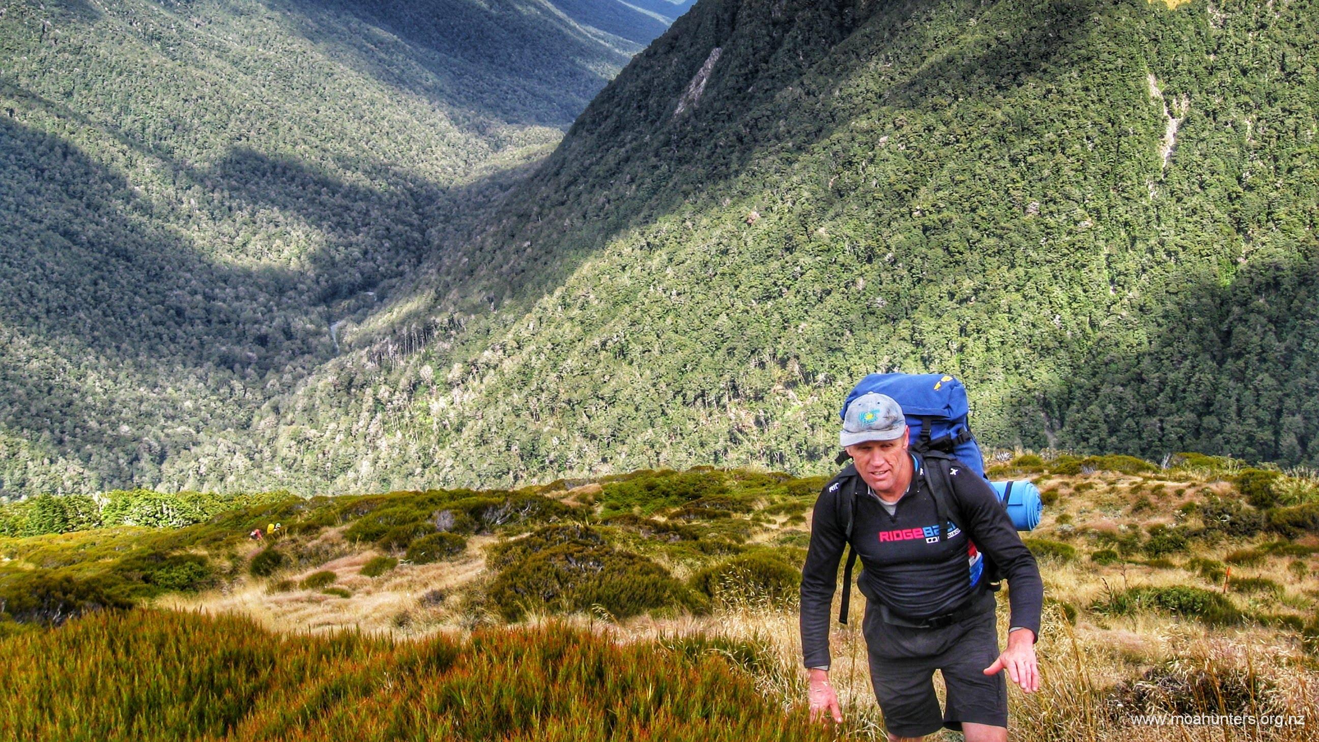
Clear of the bush and exposed to a strong cold wind that rapidly chilled us, we didn’t dilly dally. Despite the marvellous views around us, we kept up a sharp pace to ensure we spent as little time as possible in that unpleasant wind and the odd spot of rain.

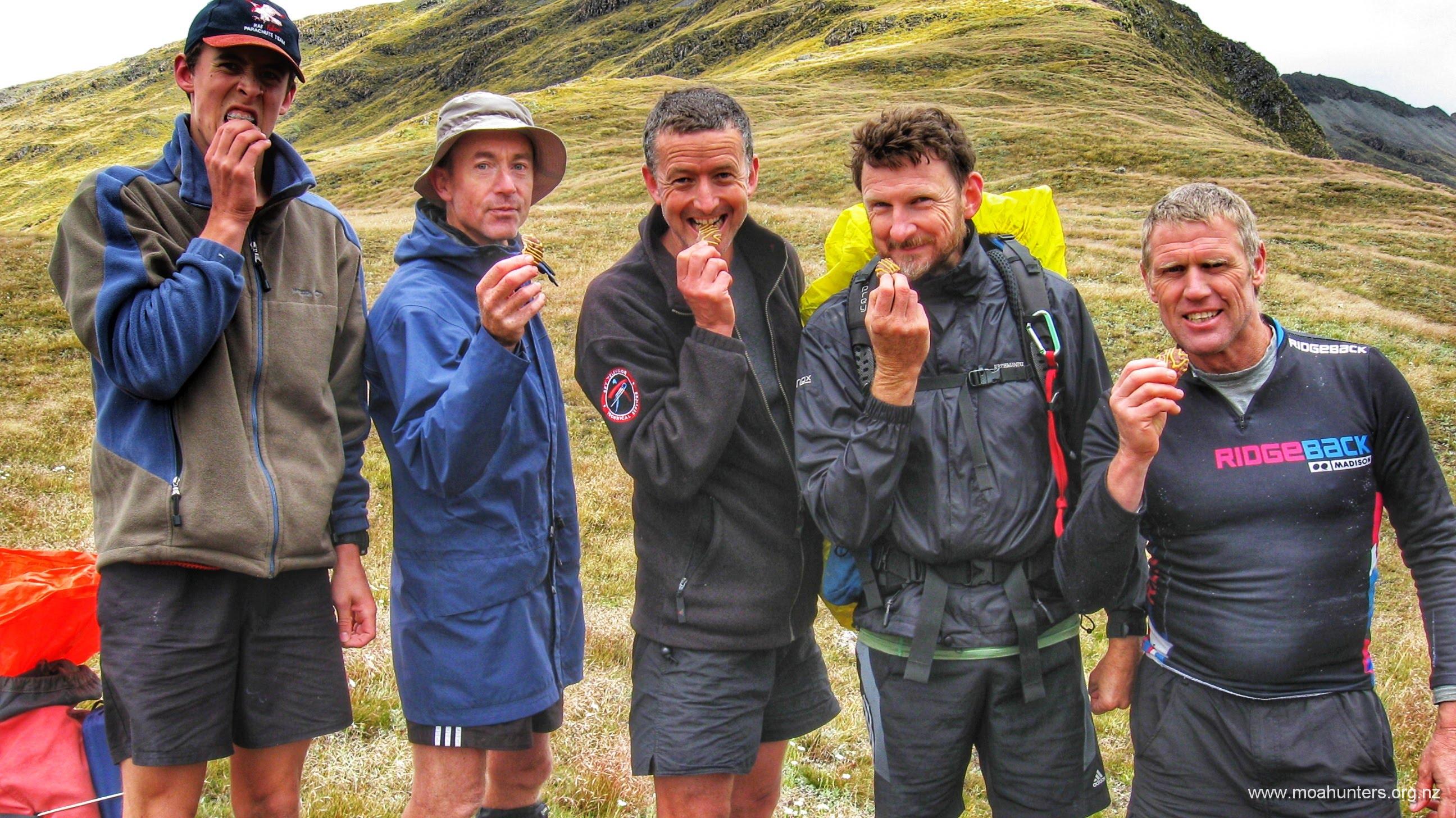
We reached the saddle at lunchtime with the chill wind still blowing relentlessly into our backs. Just over the lee side we found a relatively sheltered spot. We each nestled into a comfy hollow between tussock grasses and got stuck into our lunches, enjoying being out of reach of the wind’s cold fingers.

Eyeing up the afternoons descent from our lunch spot, we could see the track dropping quite quickly into the river valley below us. The markers looked to traverse through scrubby vegetation angling down to reach the river fairly quickly, rather than taking a long sidle.
With our lunch bags tucked back into our packs, we started picking our way down the valley slopes sometime around 1:30pm. The descent to the river was no worse than it appeared from the saddle. Occasionally steep, sometimes boggy and with the odd painful grove of spaniard grass to avoid, we made steady progress down to the river.
Beyond the first patch of beech forest, things got a bit more interesting. A wide rocky slip needs to be crossed here. It’s not immediately obvious where to head for on the far side of it. There are no orange markers visible in the distance. If you read this before making the trip, make a note to drop to the river.

Beyond the slip, the track briefly follows the river for about 50 metres, then turns abruptly left and climbs sharply to a plateau above. In the long grass and scrub it is very easy to miss this 90 degree switch to the left. So many people have now missed the turn and carried on straight that there is now an initially well defined track continuing to follow the river. It carries on for a short while, then confusingly fades to nothing. Take your time and look carefully for markers through this section to stay on the track.
This section is scrubby, messy, a little overgrown and slow going. However, the good news is it doesn’t last too long, and eventually leads into beech forest which is a far more pleasant walking experience. The final descent to the flats of the valley below didn’t take long. At 2:45pm we were dropping packs and digging out our scroggin for an afternoon break beside the river.

Between our scroggin stop and a swingbridge there were a couple of places where the river in flood had scoured away its bank and the track with it. We either skirted around these places, or dropped down into them and out again. In some places, large trees had fallen into the river, and shingle piling up against them had created new islands. With nowehere else to go, the water now surges either side of them, creating new channels and washing away existing river banks. And with them, significant sections of the track.
We reached Lake Christabel hut at 5:15pm – a solid 8 hour day on the track. The hut is an equally comfortable identical twin of Top Robinson. As was expected, we had the hut to ourselves again. A big feed of curried mince was prepared as the wind outside picked up, and heavy rain started to drum on the roof.
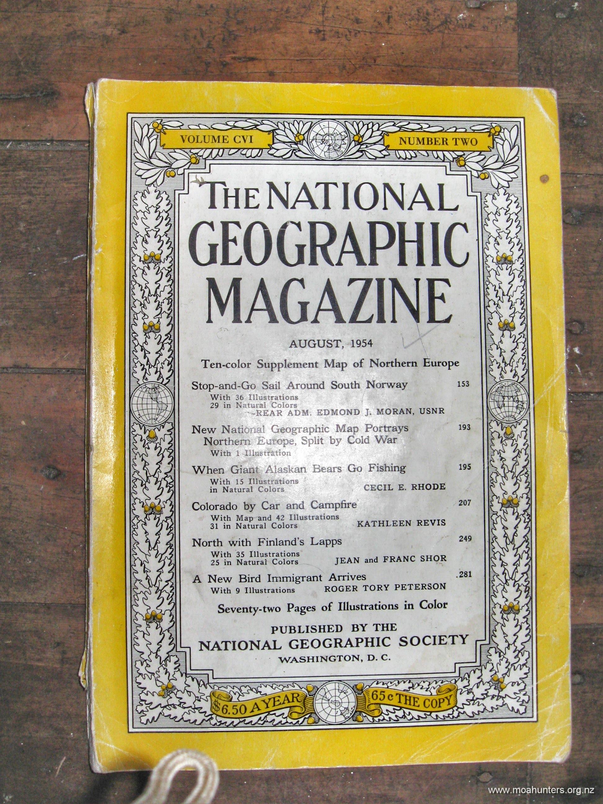
Inside the hut we found some interesting treasures, including what looked to be a genuine 1954 National Geographic in fairly good condition. It’s probably still there if you want to read it…
Day 4
Monday 21st January – Lake Christabel hut to Road End
Our final day of Moa Hunting dawned murky and overcast. Peering out the windows of the huts, the skies above looked heavy and threatening, but it wasn’t raining. However, the possibility of getting wet seemed high. On the bright side, it wasn’t cold.
Porridge was heated, dished up, liberally smothered in brown sugar, and enthusiastically consumed.
Waterproof pack covers were stretched over our packs in anticipation of likely precipitation, and by 8:45am we set off down the track. After three days walking to get to this point, we were eager to see Lake Christabel.

It didn’t take long to tick that box. By 9:15am we were at the head of the lake and had some nice views across the grey waters. The cloud had lifted a little by this time and the peaks surrounding the lake were mostly clear of the mist that was lurking about not long before.

At our first scroggin stop, the weather was looking a bit more ominous again. Luke set about making a pack cover from a small tarpaulin he had brought. It was clear to all that he had inherited plenty of his father’s practicality and cleverness as he roped the tarp to his pack. Well done Luke, and well done Paul!
The track skirts around the edge of the lake, offering surprisingly few unobstructed views of the lake, and equally few chances to stand on the lake edge. That said, the times that the lake is accessible are particularly worthwhile. Perhaps it is because those opportunities to stand on the shore are few and far between that makes them all the more special when they happen…
Or was it the particularly flat and satisfyingly skimmable stones on the lake shore that made it special? The first beach we came upon was littered with such stones. Regardless of whether they added to the specialness of the lake, the Moa Men proceeded to skip them across the lake with great enthusiasm. All Moa Men can skip a stone, but Richard with his tennis toughened right arm is the undisputed champion. His stones bounced across the lake further and faster than anyone elses.


Worried we might completely fill the lake with stones, we hefted our packs and continued our walk around the lake. A lunch break was called at 12:15pm, not far from the point the track leaves the lake edge and climbs out of the basin to find the Blue Grey river.
The track leaves the lake a short walk from where it drains into the Blue Grey River via an underground channel. If we had a little more time and the weather was a little less threatening, we might have made a side trip down to investigate. As it was, we followed the track up a roughly 100 metre climb to a flattish plateau and the final stretch to the road.
We found this section to be fairly overgrown, as much of the previous walking had been, but not hard to navigate. Long grasses and ferns hung wet leaves across the track and moss laden beech trees created interesting structures above us.
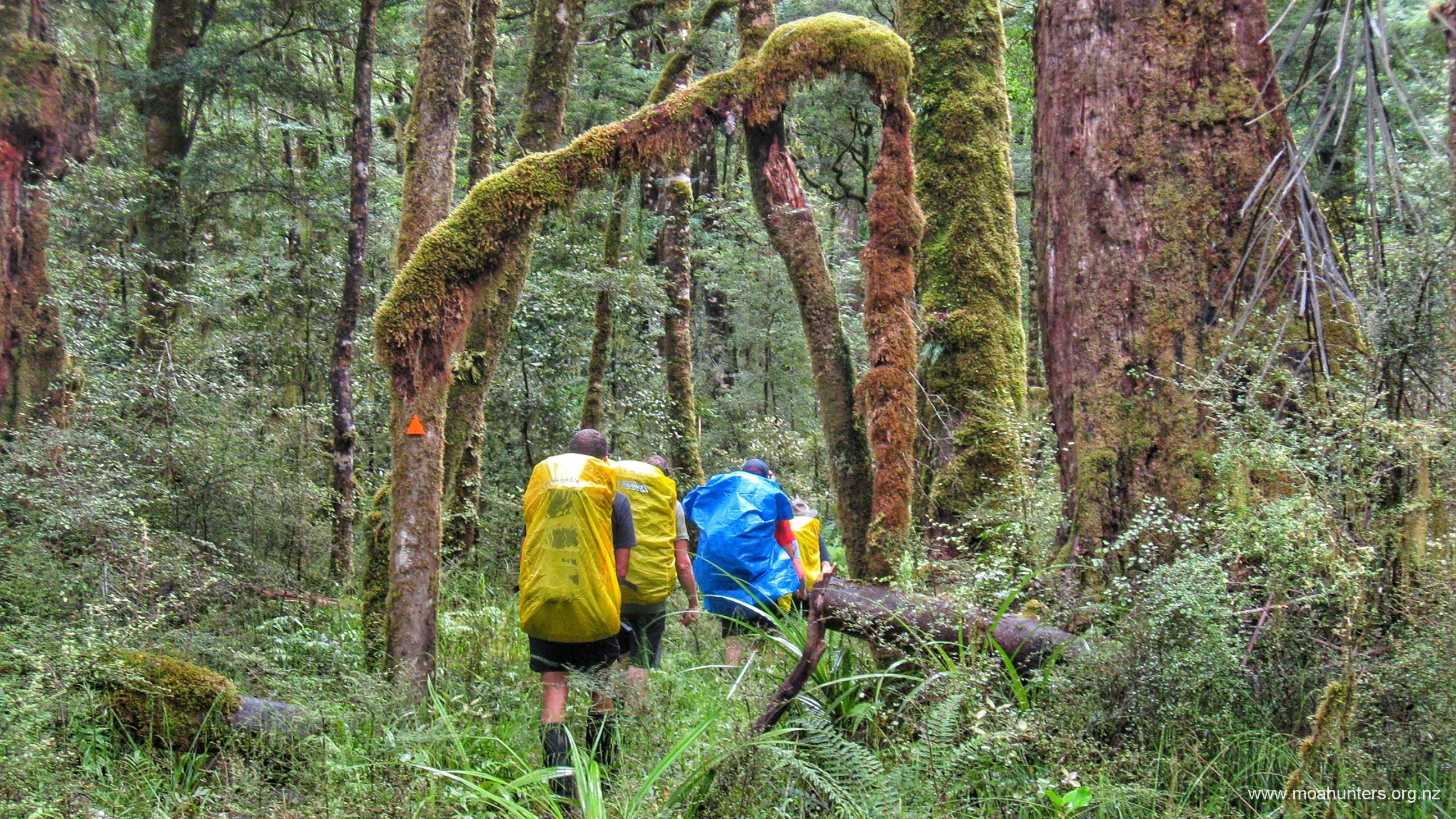
As we got closer to the road, the beech forest inevitably thinned out. We were able to make out the clear area around the road some time before we reached it. We spotted a few fishermen in black waders and green tops trying their luck near the bridge that takes the road over the Blue Grey.
Popping out of the bush around 4pm, we were right on time for meeting Magnus’s better half at Springs Junction, provided the fords were still passable in Chris’s little Honda Jazz. Fortunately they were, and Chris, Paul and Luke were able to drive to the far end of the track and return in the ute and the Jazz without incident.
While this was not a typical Moa Hunt, it was a most enjoyable wander in the hills. Each of the days showcased very different scenery. From luxuriant river valleys on day one, to dense beech forest, then wind-blown open tops, and finally a serene lakeside, this track has it all.