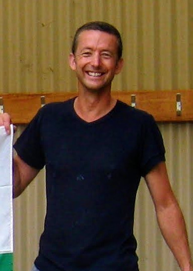
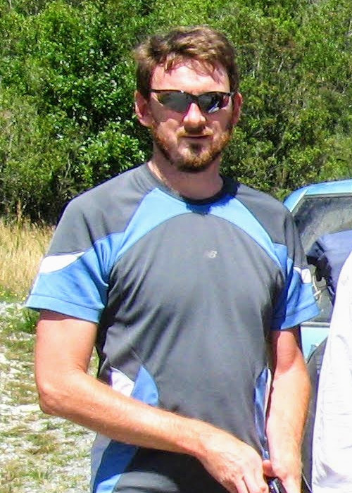
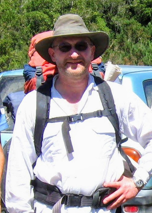
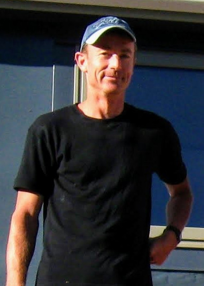
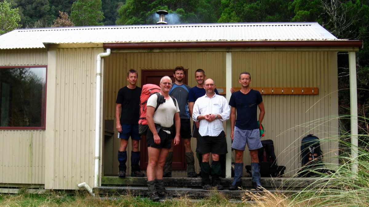
Moa Hunters on this trip: Paul, Magnus, Adam, Lewis, Richard, Chris
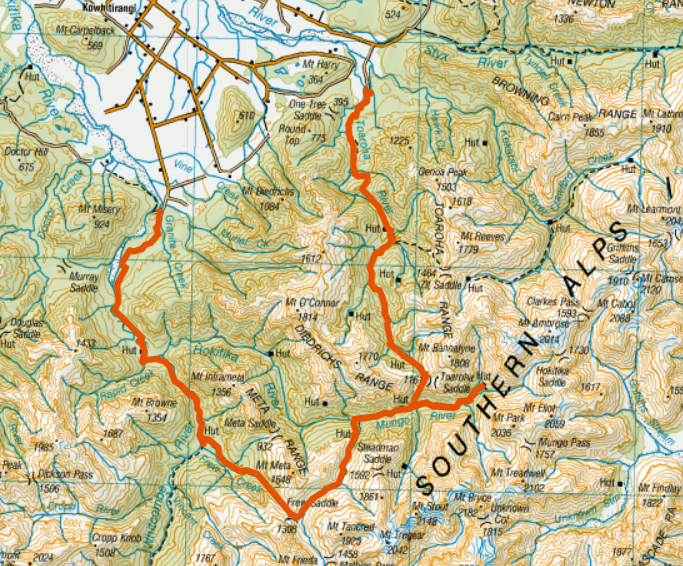
The trip
Day 1: Hokitika Gorge to Frew hut
Day 2: Frew hut to Bluff hut
Day 3: Bluff hut to Mungo hut
Day 4: Mungo hut to Top Toaroha hut
Day 5: Top Toaroha hut to Road end
For this adventure, the Toaroha – Whitcombe circuit, six Moa Hunters converged on Hokitika from all four corners of the country. Chris and Lewis came from Dunedin and Wellington respectively and joined the Christchurch crew for a Thursday evening road trip to Hokitika. Richard had flights booked from Auckland to Hokitika via Christchurch, scheduled to arrive 9.30am Friday.
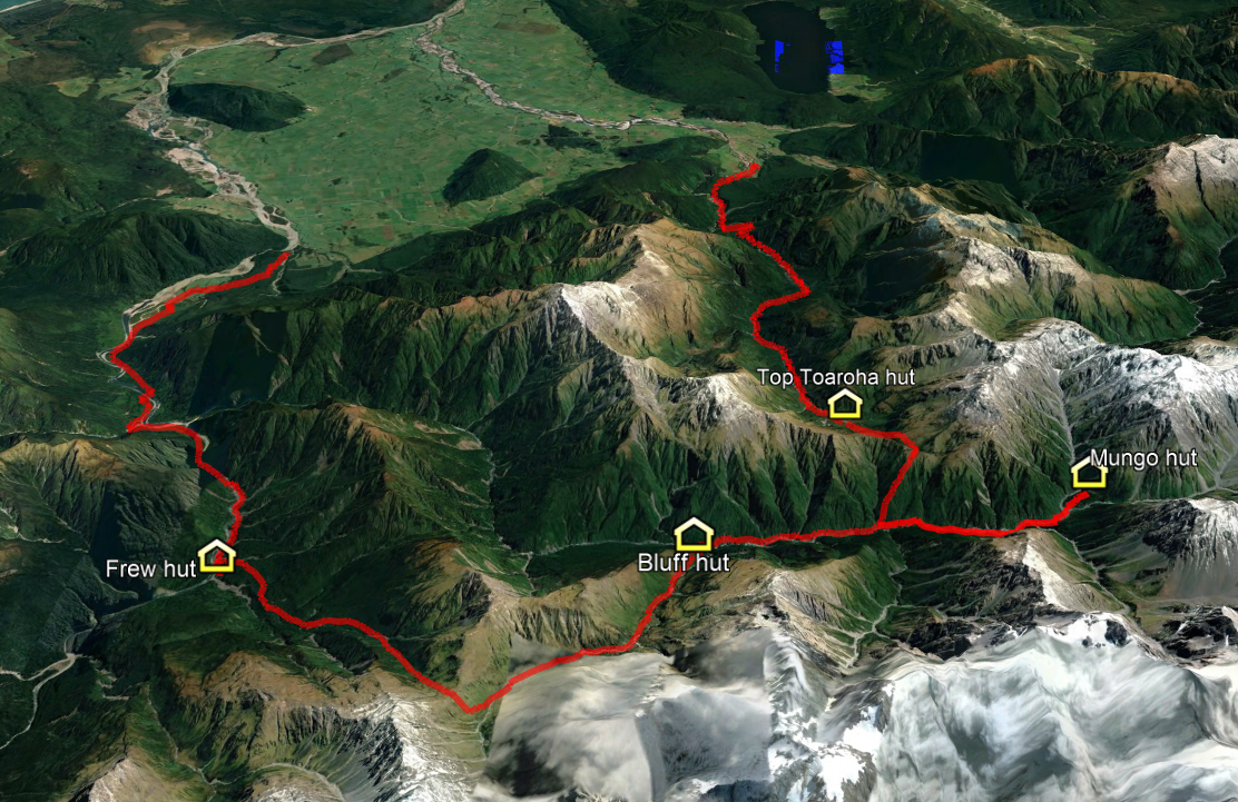
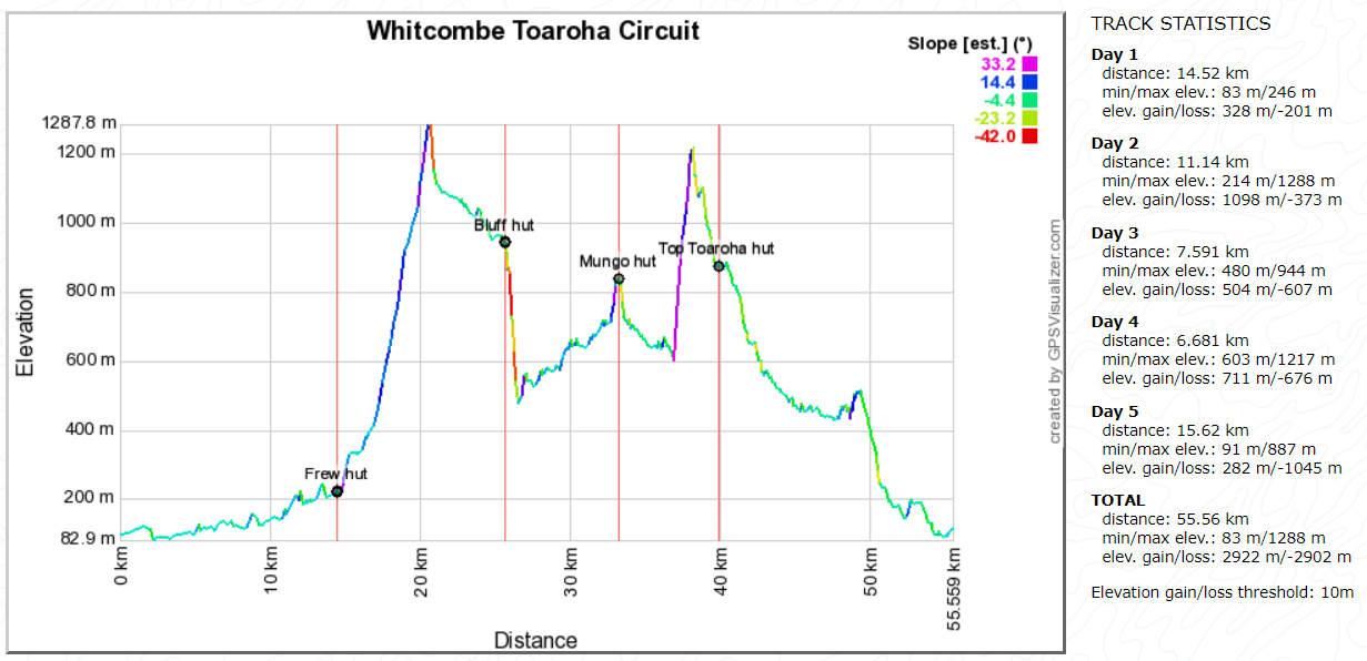
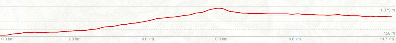
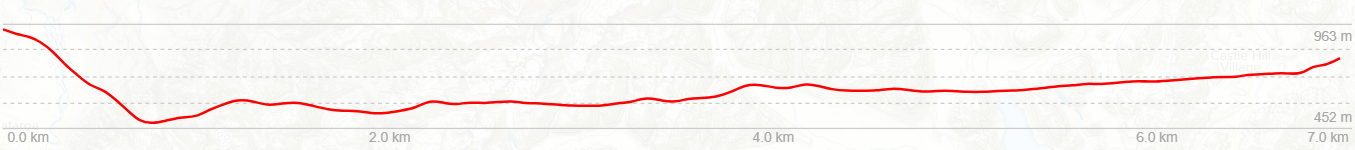
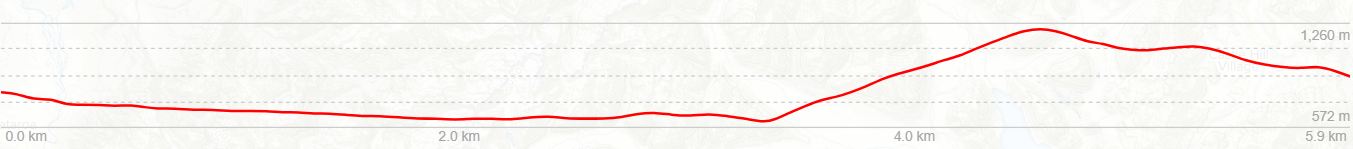
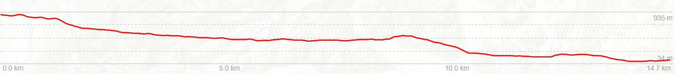
Above is an altitude profile of this route. Click to enlarge. Note: The horizontal scale divisions are roughly 1km. The transition from green to brown does not accurately represent the bushline. The horizontal scale to vertical scale is not 1:1
Day 1
Friday 22nd February – Hokitika Gorge to Frew Hut
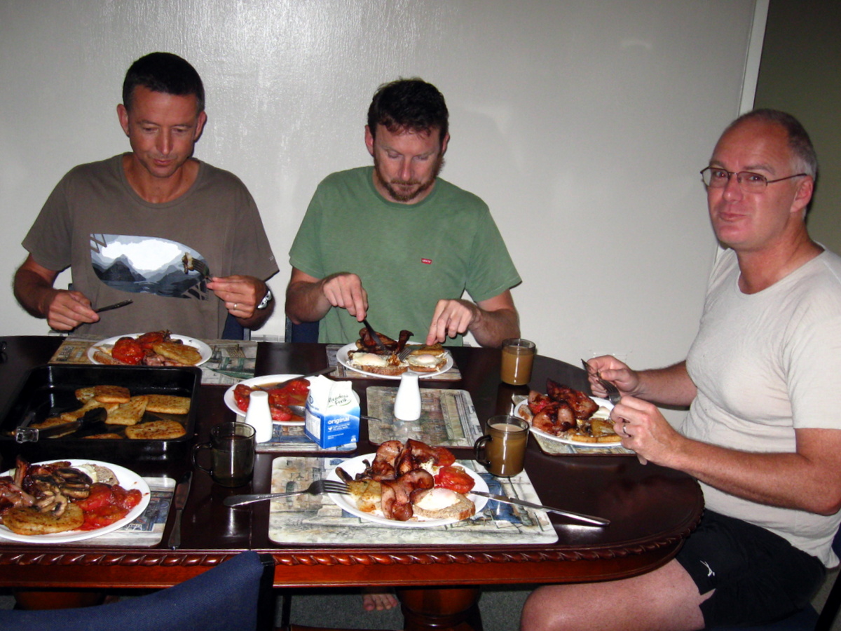
Inside our cosy motel unit in Hokitika, the now ritual Moa Hunter enormous and extremely delicious breakfast of bacon, eggs, hash browns and mushrooms was expertly fried up. We did feel a little guilty that the room would likely smell strongly of that delicious fry up for some days to come. But it was worth it.
Looking out the window, we could see the day had dawned quite foggy in Hokitika. A text from Richard confirmed our fears that this might be a problem. His connecting flight from Christchurch had been delayed until Hokitika airport cleared. Bugger. Later that morning, worse news. Another text from Richard informed us that the flight had finally been cancelled.
Luckily he had sweet talked his way into sharing a ride with two West Coasters in a hire car. He would arrive in Hokitika just before lunchtime.
While not catastrophic, the delay meant we would have to walk fairly briskly to make the Frew hut before dark.
So, after whiling away an hour or two on a now brilliantly sun-drenched Hokitika beach and in a nearby park, Richard was collected and we were all finally together and ready to start the Moa Hunt proper.
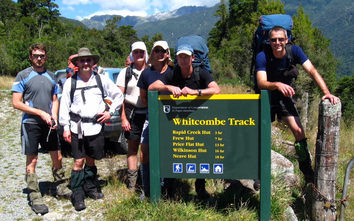
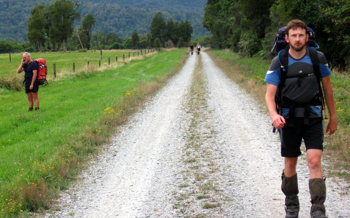
Shortly before 1pm we were standing at the head of the Whitcombe track. The DOC sign listed Frew hut a mere 7 hours walk away. On the bright side, the weather looked great and the day didn’t involve any big climbs.
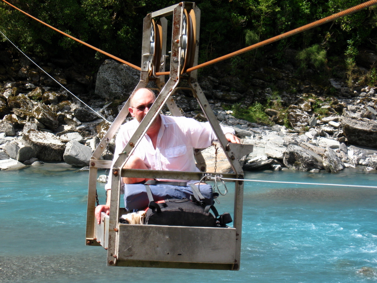
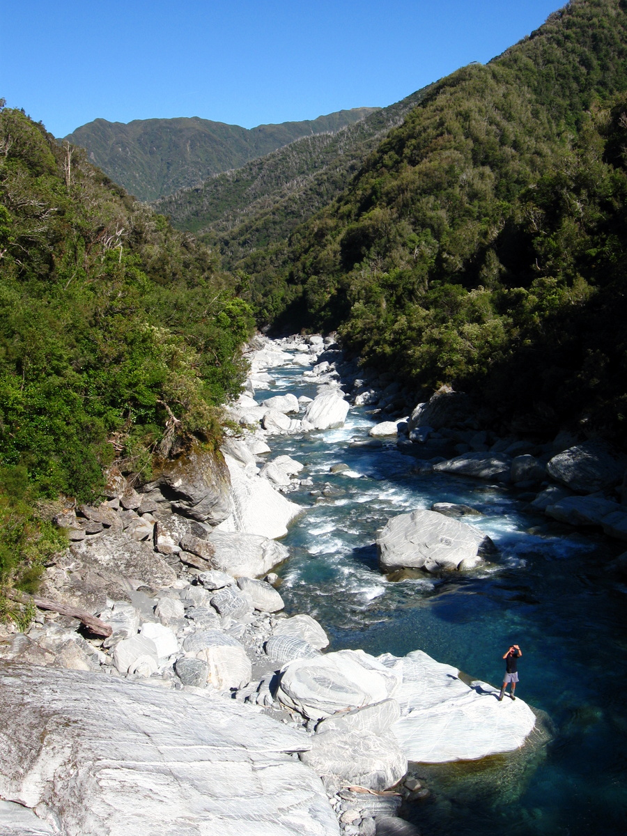
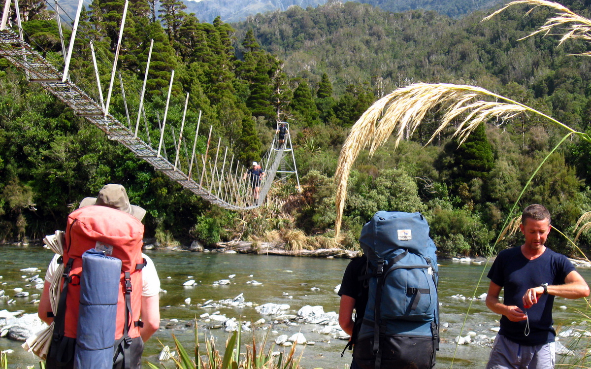
The initial section was an easy mix of grassy flats and rock hopping. By 2.30pm we had reached the cableway over the Hokitika River. One by one we were hand winched over the cold looking but strikingly sky blue water of the river in the little cablecar. Quite a fun diversion from walking.
From the cableway, the track fairly lazily follows the relatively open flats on the true left of the Whitcombe River, until it rounds a bluff and leads into the much steeper terrain that forms Collier Gorge. It turned out that the Gorge was a bit of a bastard.
Following the track as it cut its way through the tall trees and ferns, we suddenly hit what appeared to be a dead end. Behind us everything seemed well formed and well walked, but in front there appeared to be no obvious path. We quickly fanned out, pushing deeper into dense tangled vegetation looking for signs of the missing track. Looped fern roots grabbed and snagged our legs and packs making progress awkward and frustrating.
After half an hour of fruitless and fairly exhausting bush bashing, we all agreed this was no way to proceed, and backtracked. Walking back along the track we each found a way down to the river and from there rock hopped our way up the gorge until we met the track again some way further upstream. From our riverbed vantage point it was clear the reason the track had disappeared was the bank it was on had been scoured away by the river during recent heavy rains.
The Collier gorge track continued on the true left of the Whitcombe river snaking incessantly up and down through the short bush on the steep slope. As mentioned earlier it’s a bit of a bastard. Nevertheless, not long after 5pm we had reached a swing bridge across the Whitcombe, signaling the end of the gorge and the start of more open terrain.
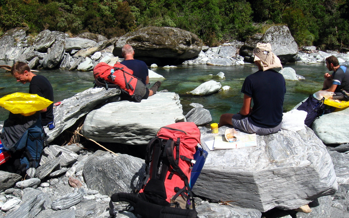
A stop to catch our breath and nibble a few peanuts was rapidly cut short by the incredible swarms of sand-flies. Note: at the end of a long warm summers day, on the West Coast of NZ, next to a river, while lower than 500m, do not stop for longer than 2 minutes, no matter how tired you are, or how beautiful the spot, you will get eaten alive.
Less than an hour later we reached the large and relatively modern 10 bunk Frew hut, which meant we had completed the 7 hour section in just over 5 hours. We tip-toed in quietly as it appeared the hut might already be occupied by someone already tucked up for the night – however it was just a sleeping bag and gear left by a local possum hunter who had left his kit behind.
On paper, the day’s walk was an easy one. But the extra hour spent battling the bush through Collier Gorge had turned it into a long and difficult one. Conscious we had to make good time, we had pushed the pace a bit and only taken short breaks along the way.
Upon reaching the hut, it would be fair to say we were all pretty damn tired. Naturally we all blamed Richard for being late. Richard had been gracious enough to compensate for his late arrival by carrying an extra 1.5kgs of fruit cake that had been added to the trips food cache by Magnus’s good friend Johanna from Kowhitirangi. The fruit cake and steak that Paul had marinated and frozen 2 weeks prior were scoffed with great appreciation at the end of a good first day.
Day 2
Saturday 23nd February – Frew Hut to Bluff Hut
Frew hut is nestled in against the base of a hill where Frew creek flows into the Whitcombe River. We awoke there to an overcast day, but the cloud cover wasn’t threatening and we were all looking forward to a big day on the trail.
After downing a traditional Moa Hunter porridge breakfast, complete with the remnants of the fruit cake as a tasty condiment, we tidied the hut and were on the track by 8.30am. Not our earliest start, but not the latest either!
Since being deluged by rain in January, the West Coast had been in the grip of a “drought”. By their standards the land was parched, with barely any rain for a month or so. The effect of the drought was obvious on the track. Our previous experiences on the West Coast were of greasy rocks, slippery roots and generally demanding conditions. Well not so in 2013. Most places were quite dry and finding reliable footing was easy.
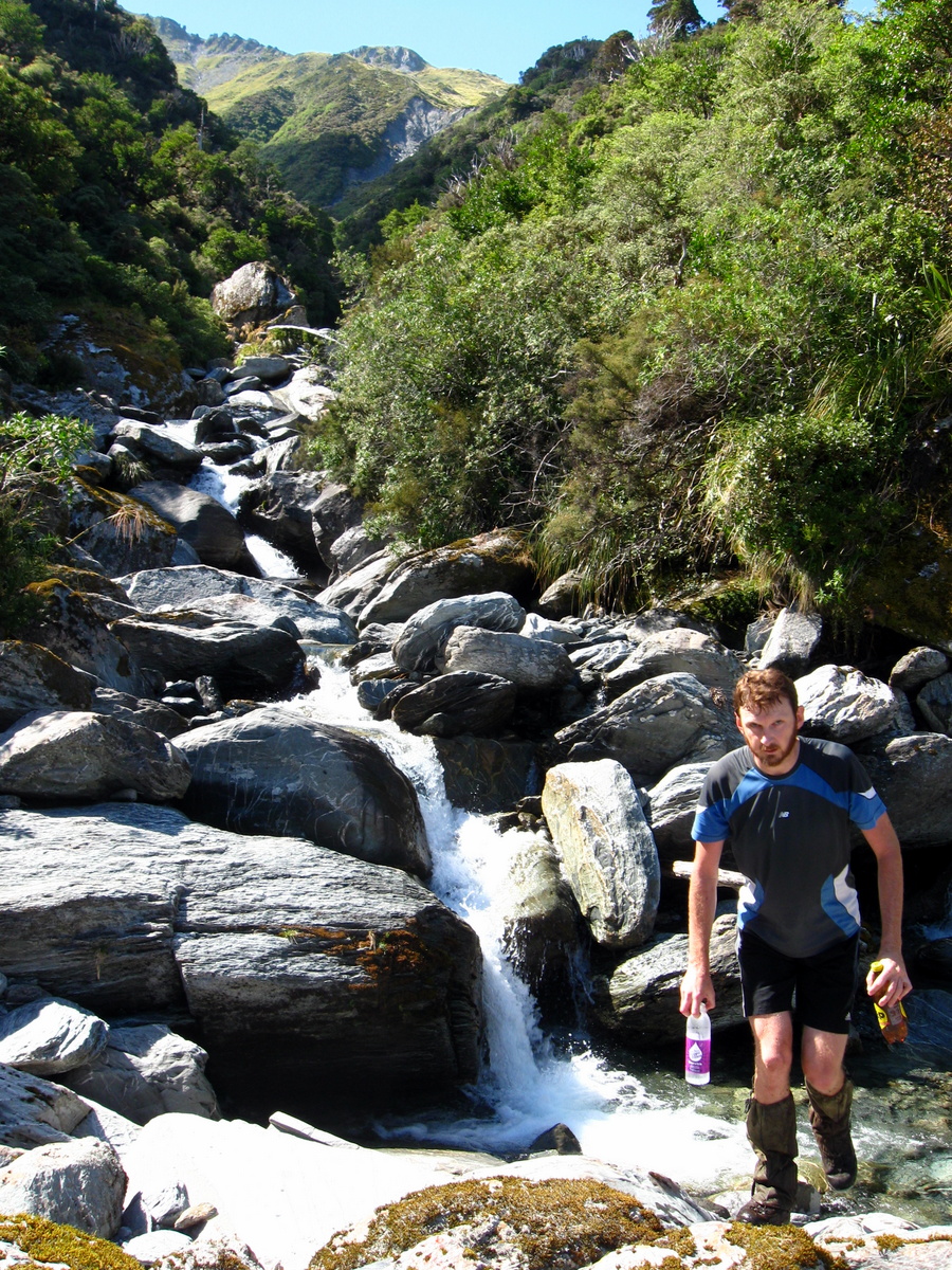
Consequently, we made pretty good progress on the first section of the track, which sidles along above Frew creek on the true right. The first 4km of the track gains altitude steadily, but not viciously. From the first footbridge the slope is increasing, and at the second, the track gets decidedly steeper as it follows the creek up a deep valley.
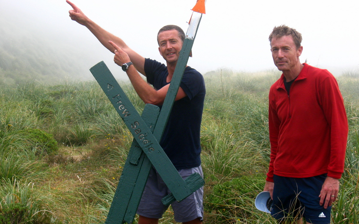
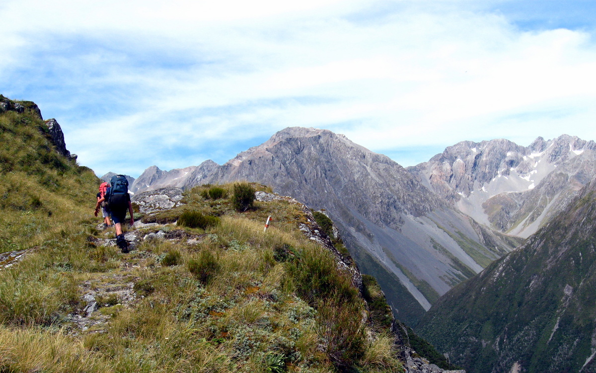
By 12.30pm the sun was shining brightly and we were just getting our noses out of the bushline, close to the final grunt which would take us to Frew Saddle and a well earned lunch break. The final ascent is a poled route through snowgrass, tussocks and our favourite grass of all, Spaniard (spear) grass.
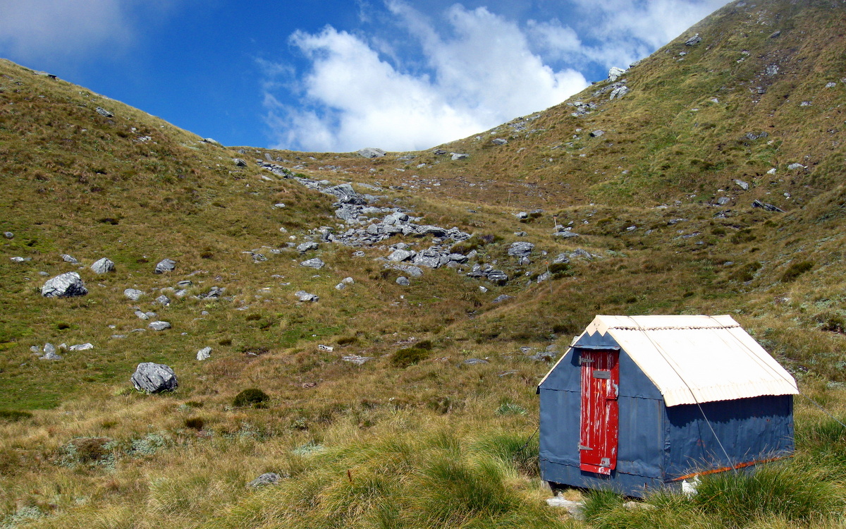
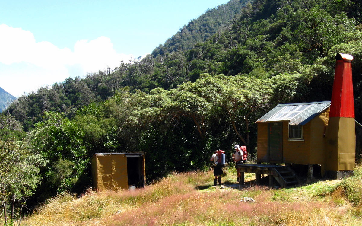
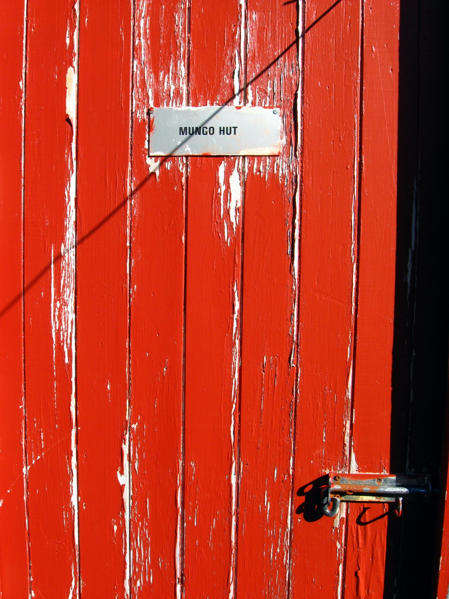
Just below the saddle sits the Frew Biv, with a cheerful red door. Wired to the ground, it has two bunks and looks like a handy shelter to spend the night in if you got caught on the tops.
The saddle itself has fantastic views back down the Frew valley we had walked up, and in the other direction across the Hokitika river to Mount Tancred. We had a nice long lunch, after the 1200m climb, taking in the splendid vista. While we enjoyed the view, it was obvious to all that the track down to the Hokitika river looked brutally steep.
And it was. Not only was the way down steep, it was also fiendishly difficult to stay on the regularly walked paths as they were overgrown with tussock. This meant frequent wandering off the beaten trail, regular plunging into erosion holes hidden by tussock and painful encounters with Spaniard grass.
With the 200 vertical metre descent behind us we headed off in fairly murky conditions down the Hokitika river. Low cloud became mist, which wasn’t unpleasant, but did limit our enjoyment of the view a little.
The track follows the river for a bit over 3km where it leaves the riverbed. This marks the start of a fairly long sidle which climbs gently, but rapidly leaves the river which drops away below as it flows down the valley. Plenty of awkward roots and the ever present spaniard grass made this section a little more demanding than the earlier rock hop.
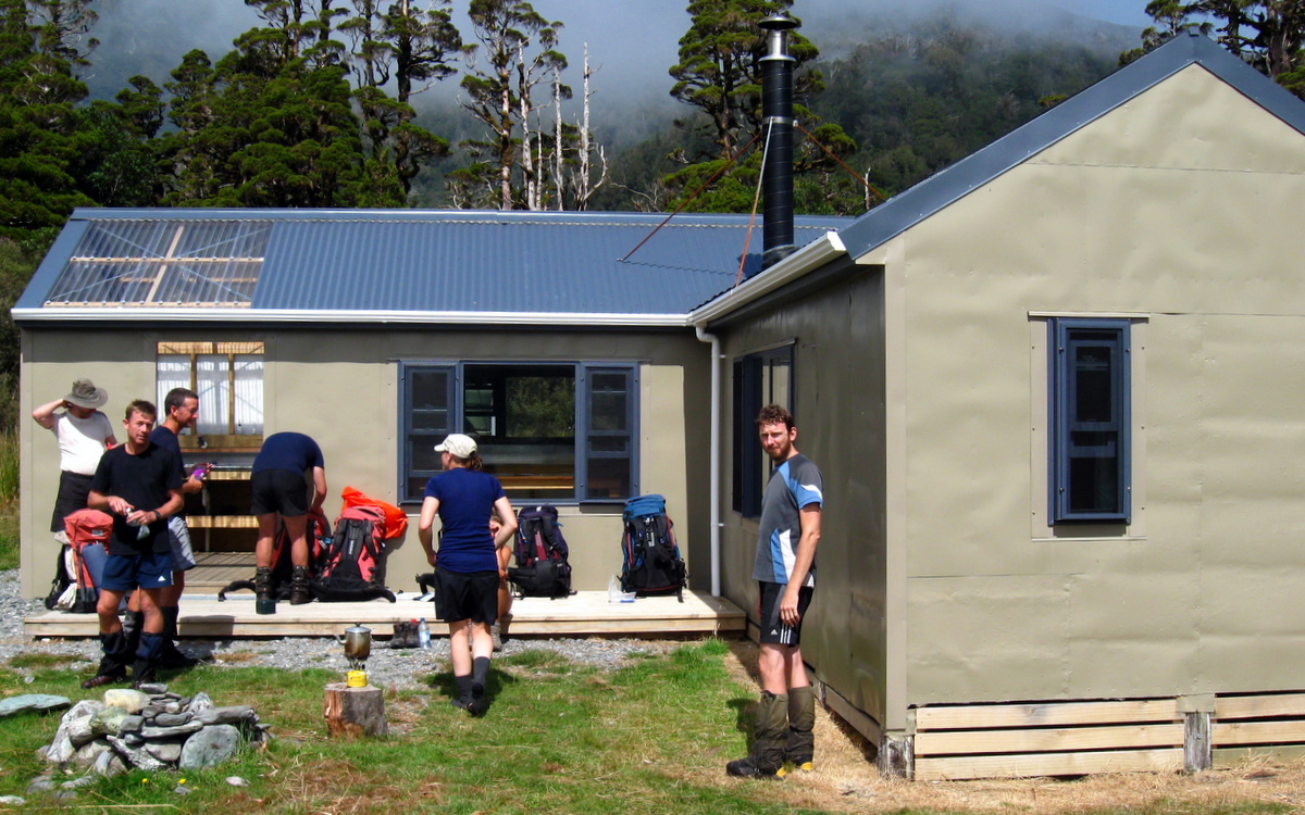
The final kilometre to Bluff hut is less of a sidle and follows a now very open track through sparse vegetation until the hut itself comes into view, perched impressively on a large rocky bluff with huge views in all directions. No surprises there really. But what a magic setting for a hut! And high enough to be above the sand-flys. Another bonus for Bluff hut is the location of the privy, whose open door faces unnervingly, directly across a gorge in the Hokitika river.
With an arrival time of 5.30pm, it had been a good solid days walk again, but we were all feeling in slightly better nick than the night before. A good number of generous stops during the day had kept our energy levels higher and allowed us to enjoy the day immensely.

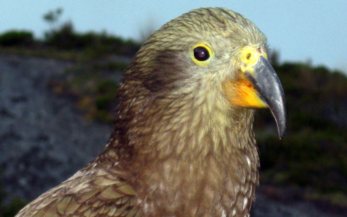
Sitting on the deck in the late afternoon sun, we enjoyed the company of a troop of cheeky Kea that had swooped in to investigate the new arrivals. We were intrigued at their fearlessness as they hopped up and pecked at our boots and clothes, assessing them for vandalism opportunities. This would definitely not be a hut to leave items outside overnight!
Day 3
Sunday 23nd February – Bluff Hut to Mungo Hut
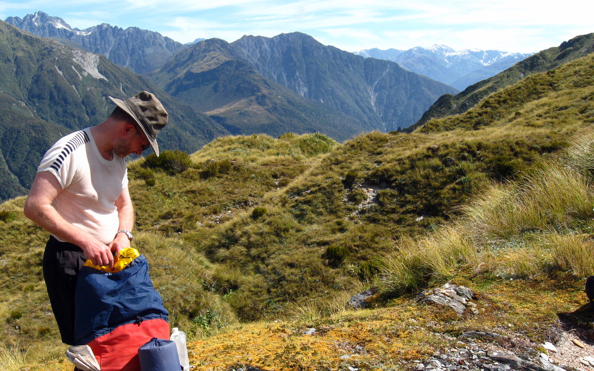
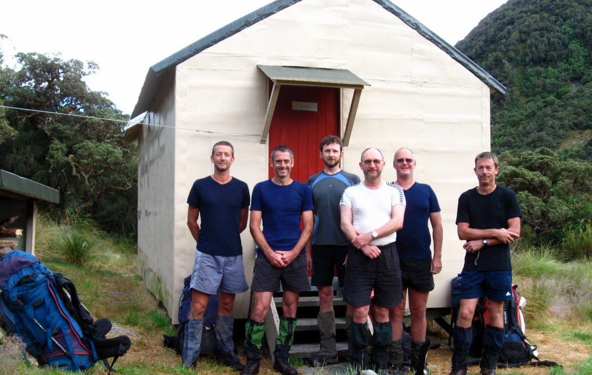
Sunday dawned beautifully sunny, with perfect views in all directions. We were ready to hit the trail a little earlier than usual at 8am. On such a lovely morning it was very tempting to just sit in the sun and soak it all in. But the Upper Mungo and its fabled hot springs was calling us. After the obligatory group photo outside the hut, we hefted our packs onto our backs and set off.

Fellow trampers with similarly dodgy knees will know that steep downhill sections with a heavy pack are no fun. Especially first thing in the morning when the old joints are a bit cold. Unfortunately that is how Day 3 started for the Moa Hunters.
After just a few minutes of easy walking, the track plummeted straight down a very steep hillside to the Bluff swing bridge some 500 vertical metres below where it spans the Hokitika river. Fortunately the way down wasn’t too slippery and there were plenty of available branches to use as handholds / brakes. Needless to say we made it down the 500 metres significantly quicker than we would have going up it! (We did note in the Hut visitors book that a group of over 60’s had come up that way. Hats off to them… impressive effort!)
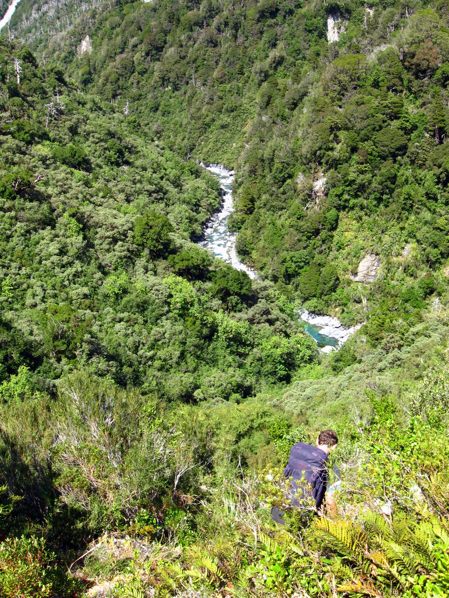
From the swing bridge the track winds along on the true right of the Mungo River, dipping in and out of gullies where small streams come down and cut across the track. Cutting between two fairly high peaks, this section is fairly shaded and probably quite wet under normal conditions.
Our pace along the fairly easy 2.5 km stretch to Poet hut was perfect, and we arrived right on 12.30pm. Lunchtime! Like Bluff before it, Poet is in a magic setting. Nestled in a grassy clearing protected by surrounding trees, and just a stones throw from the river, it is an idyllic spot. Lunch was eaten sunning ourselves in front of the hut, enjoying the pleasant day. Again it would have been very easy to have stayed longer, but still the Mungo called us on.
Continuing from Poet hut, the track was much as before, skirting along the hillside further and further into deepest darkest Mungo. Once past the junction of the track that drops from Top Toaroha hut, the track climbs steadily, before dropping again quite steeply into the Mungo riverbed. What goes up must come down!
From here we clambered up the true right of the Mungo before crossing where the river cuts in against some bluffs. Then continued up the true left, regularly inhaling promising sulphurous smells in the air, no doubt venting from hidden hot springs along the river. The directions we had found online referred to the best hot springs being both above and below the confluence of the Brunswick Creek, on the true left of the Mungo, so we soldiered on.
Luckily it didn’t take us long to locate the fabled springs. We found them about 100m below the Brunswick and approximate 300m upstream from a large slip on the true left of the Mungo. From our experience the easiest way to find them is to walk along the river bed close to the edge of the bush, the best spring was found flowing out beside a large rock, right on the bush edge. The spring left tell-tale yellow-white sulphur deposit on the rocks. We also noted large mats of rubbery green algae growing in the hot sand and on the rocks. Without thinking it over too much, we downed packs and started an attempt to dig ourselves a bath where it flowed out of the bush.
We quickly discovered that keeping any of the hot water contained was going to be very difficult. It just soaked away into the coarse sand. Even our tarpaulin looked an unlikely solution.
Fortunately Lewis found the answer. He wandered down to the rivers edge and discovered that the hot water which was disappearing into the sand higher up the bank where we were digging was re-emerging next to the river. The perfect spot to make a bath. Hot and cold water readily available!
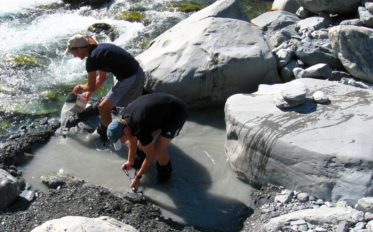
Half an hour later we had dug out a large bath area, walled it with rocks, and were blissfully soaking our weary carcasses in the hot rejuvinating waters of the Mungo… New Zealand’s (allegedly) most remote hot springs had been found again. Mission accomplished.
For the third time that day we were tempted to stay in one place longer than was wise. Reluctantly we left our hot bath and headed up the Mungo towards the confluence of with the Brunwick
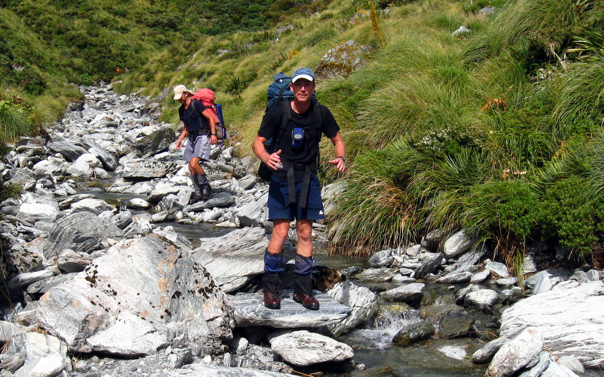
Brunswick Stream can be difficult to cross, even in good weather, but we were fortunate. The lack of any real rainfall for weeks meant it was running relatively low. While still swift, the deepest point wasn’t much above knee height and not especially dodgy to cross.
A second much smaller hot pool was found a few tens of meters above the Bruswick, we were glad we had put the time and effort into the civil engineering works to develop the lower pools.
Soon after the Brunswick it is necessary to cross the Mungo again then Park Stream and storm the final climb up to Mungo hut.
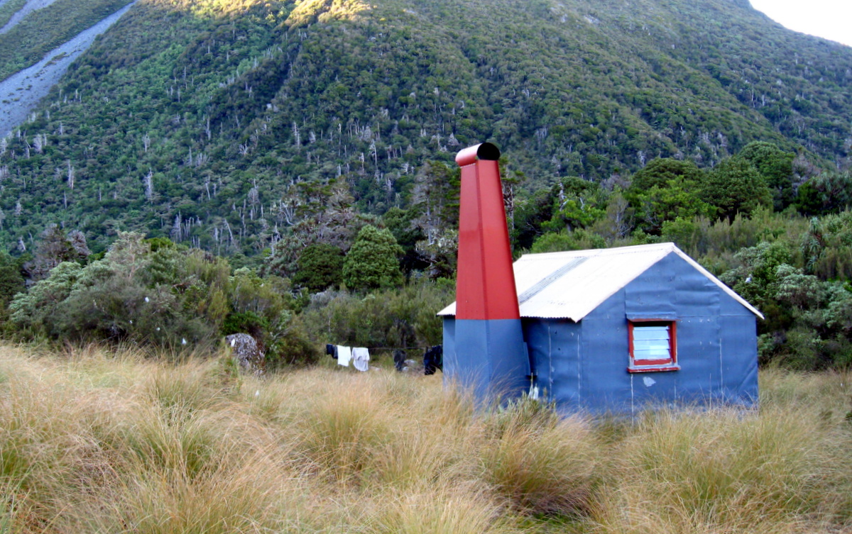
That last push turned out to be fairly steep and something of a late afternoon grunt, but we made the hut by 6pm where we were more than happy to dump our packs and set about preparing a mighty Moa Hunter meal.
Day 4
Monday 24th February – Mungo Hut to Top Toaroha Hut
From the Mungo hut we had a few options. The boldest involved heading straight up Park stream into a difficult looking rocky fan, picking the correct gut and climbing out between Mt Bannatyne and Mt Chamberlain.
From the pleasant grassy doorstep of the Mungo Hut, it was difficult to assess exactly how difficult that route would be. At best it would be tricky. At worst, treacherous and fraught with hazards for a group of six, on what appeared to be a loose and frost shattered rocky slope.
Somewhat tempted as we were, in the end and after some debate, we opted for the more conservative option of backtracking down the Mungo and climbing to the Toaroha saddle and up to the Top Toaroha hut.
Saying a last goodbye to the awesome Mungo hut, we set off down the steep slope back to the Mungo River. Paul asked if anyone had signed the visitors book. No. We hadn’t….
Mungo hut is visited by a half a dozen groups per year at best. It was unthinkable to leave without adding our names to that list. Richard volunteered to run back up to the hut. The rest of us headed on down, carrying his pack for him as we went.
Regrouping at the river we filed off back to the start of the climb to Toaroha Saddle. And some climb it was. While never excessively steep, it never let up either.
For the first time in many days we passed some other travellers heading down the track. We said some hello’s and swapped a few tips about the tracks ahead.
Conditions were good and the track well and recently maintained. We made pretty good progress up through the varying bush towards the saddle, stopping part way up for a bite of lunch.
The last few hundred metres to the top are in open country with splendid views of the surrounding ranges, until the biv and its surrounding tarns is reached.
At the top we dropped packs and ploppped onto the grassy saddle to enjoy the views. Paul, with a sly smile on his face, reached into his pack and produced a pack of toffee pops chocolate biscuits. Wow! After a hard climb of 600 vertical metres, they were an unexpected treat. We polished them off in short order! Paul is a great guy.
From the saddle, the track follows the Toaroha river down a valley until it reaches the relative flats where the Toaroha hut is situated. We made a simple mistake and charged down the river following the orange DOC markers, enjoying the relative ease of downhill rock hopping river bed travel. What we didn’t pay attention to was where the track actually went.
Soon enough we were entering awkward and seemingly untravelled sections of the river, filled with very large boulders, difficult drops and unlikely looking squeezes.
We stopped. It didn’t seem right.
Finally, Magnus noticed a bright orange DOC track marker well above us on the true right of the stream we were standing in. Some way behind us we had missed a marker where the track left the river. Backtracking we found the deviation and followed the trail along a much higher route well above the steeply descending and increasingly narrow stream below.
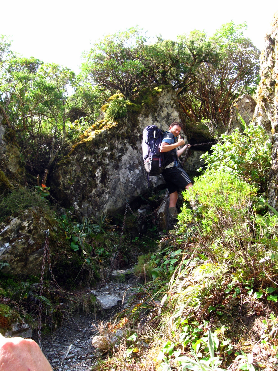
From there the track followed much easier terrain for a while, before dropping fairly steeply in parts. In some of those places DOC have attached chains for handholds to help travellers down some particularly gnarly sections.
Finally the track opened out into the boggy flats which precede Top Toaroha hut. We wandered across them feeling like we were greeting an old friend, having stayed at this hut on our previous attempt at the circuit in 2012.
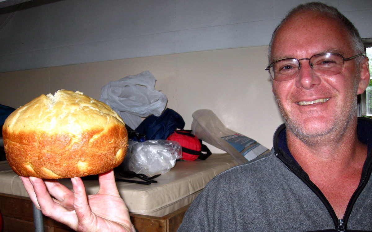
As is becoming a bit of a Moa Hunt custom, Chris excelled himself in the cooking department again and produced a superb loaf of bread. A day spent carrying the raising dough in a billy was well worth the effort. Well the rest of us thought so anyway!
Day 5
Monday 24th February – Top Toaroha Hut to Road End
For our final day on the track we were up and organised in record time. With a fairly long but not overly arduous day ahead of us, followed by a drive back to Christchurch, we didn’t want to muck about. By 8.05am we were on the track. Not exactly the break of dawn, but not bad for a bunch of creaky old Moa Hunters.
Having walked the stretch of track between Top Toaroha hut and Cedar Flat huts previously, we thought knew what to expect. And this time round conditions would be noticeably easier due to the dry track conditions.
An unexpected hurdle was locating the track out from the hut. We had frequently come across weather damage along the circuit, caused by the torrential rains in January. Large scars on the landscape carved by what would normally be small creeks had cut massive washouts down hillsides, scouring them deep and wide, leaving debris and rocks strewn everywhere.
The grassy track we had previously followed ten minutes out from the hut was gone. In its place was a very wide stretch of battle scarred riverbed, mostly shingle, but littered with large rocks, broken branches and logs. It was almost unrecognisable from three years previous.
After a frustrating ten minutes search, we located the track right at the bottom end of the bush on the opposite bank. To find it, follow the bushline down the slope until you locate the DOC marker. Perhaps by now a few more cairns have been left by other trampers.
Following the true right of the Toaroha river down the valley, the track was generally relatively easy going and we made good time to the turnoff to Crystal Biv. We continued on a little farther before calling a break. Knowing it was going to be a long day, like hobbits, we stopped beside the river for “second breakfast” at 11.30am. Sitting in the sun was more than pleasant.
Beyond our lunch stop, the track was very much more of the same until at 1.30pm we reached the open grassy flats where the Cedar Flats huts are located.
The newest of the two huts there had undergone something of a transformation. Now ‘L’ shaped, it had twice as many bunks as before and a separate kitchen area. Obviously the popularity of the hot pools here warranted a bit of investment in the facilities since our previous visit in 2010. We settled in for a third breakfast. Or was it a second lunch?
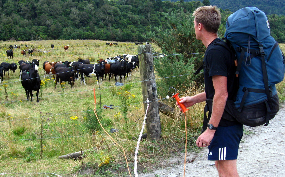
Keen to get home, we blasted down the last section of riverbed and track. By 5.30pm we had emerged from the bush and were walking across grassy meadow towards the Kokatahi river. As on our last trip, we would cross the river, nip across some farmland and phone to be picked up.
As we approached the river, we were greeted by a German couple looking wet and slightly flustered. They appeared to have dressed rapidly and recently after a likely skinny dipping session. Good on them! After advising them that walking off into the Toaroha valley with their scant supplies and poor footwear was ill advised that late in the day, we said goodbye and forded the river.
When we reached the opposite bank, two problems arose. Mobile phone reception was almost non-existent, and the sandflies had found us. Not wanting to hang around and be eaten alive, we marched across the farm and out onto Lake Arthur road. There after quite a walk, we finally found both reliable mobile phone reception and the phone number for our transport. A few mouthfuls of wild blackberries later, we were picked up by the lovely Johanna and whisked back to her house.
We all agreed the trip was one of the best, if not the best Moa Hunt yet. Every day was tough, but rewarding. The weather had been magic, the scenery stunning, (the company reasonably tolerable) and we had finally pulled it off. New Zealand’s most remote hot pools had been ticked off the list!

Thanks guys for your great trip description and pics. We were inspired to do the trip in reverse in April 2014 as we only had five days including travel to / from ChCh. Got four days fine weather which made the trip satisfiying but challenging instead of probably really hard yacker and an abort. Cheers