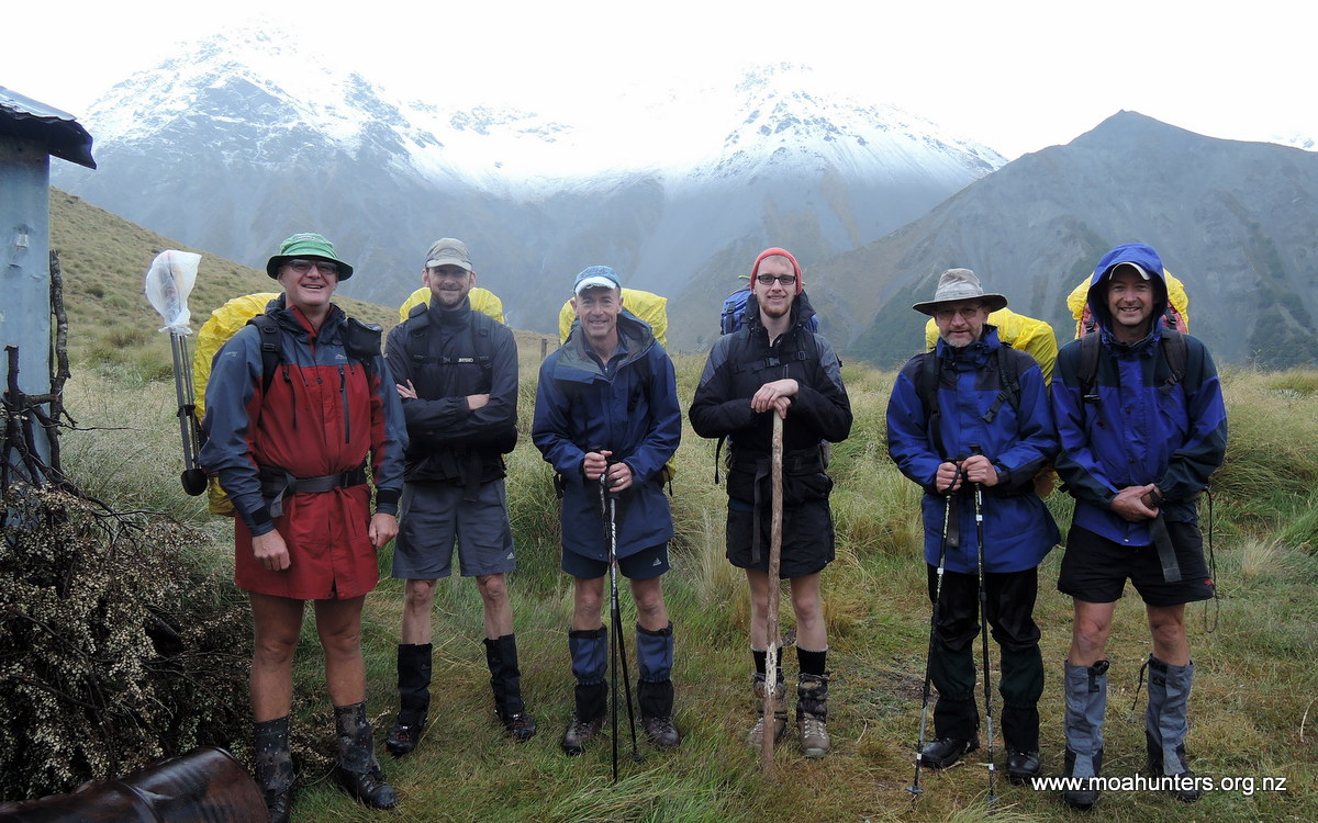
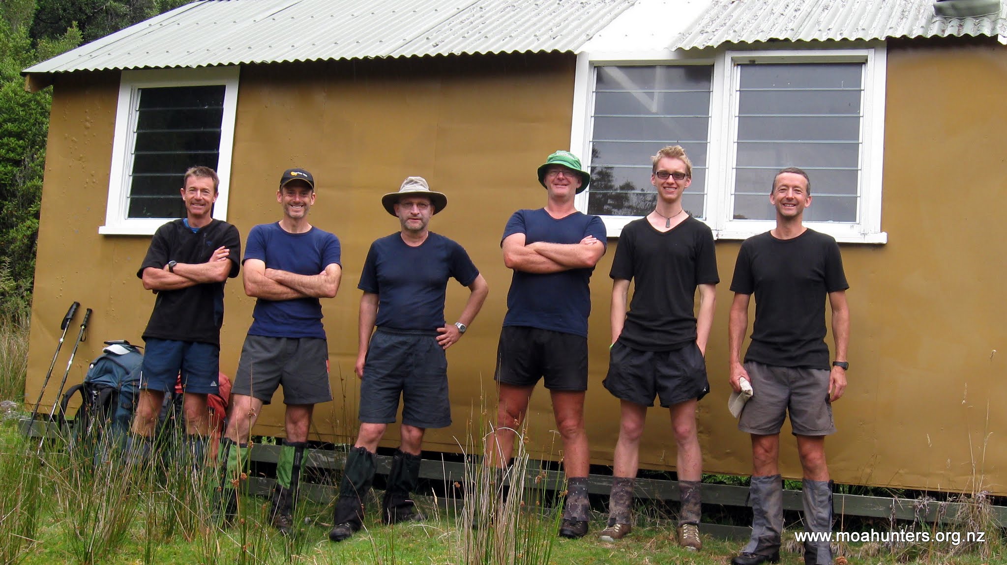
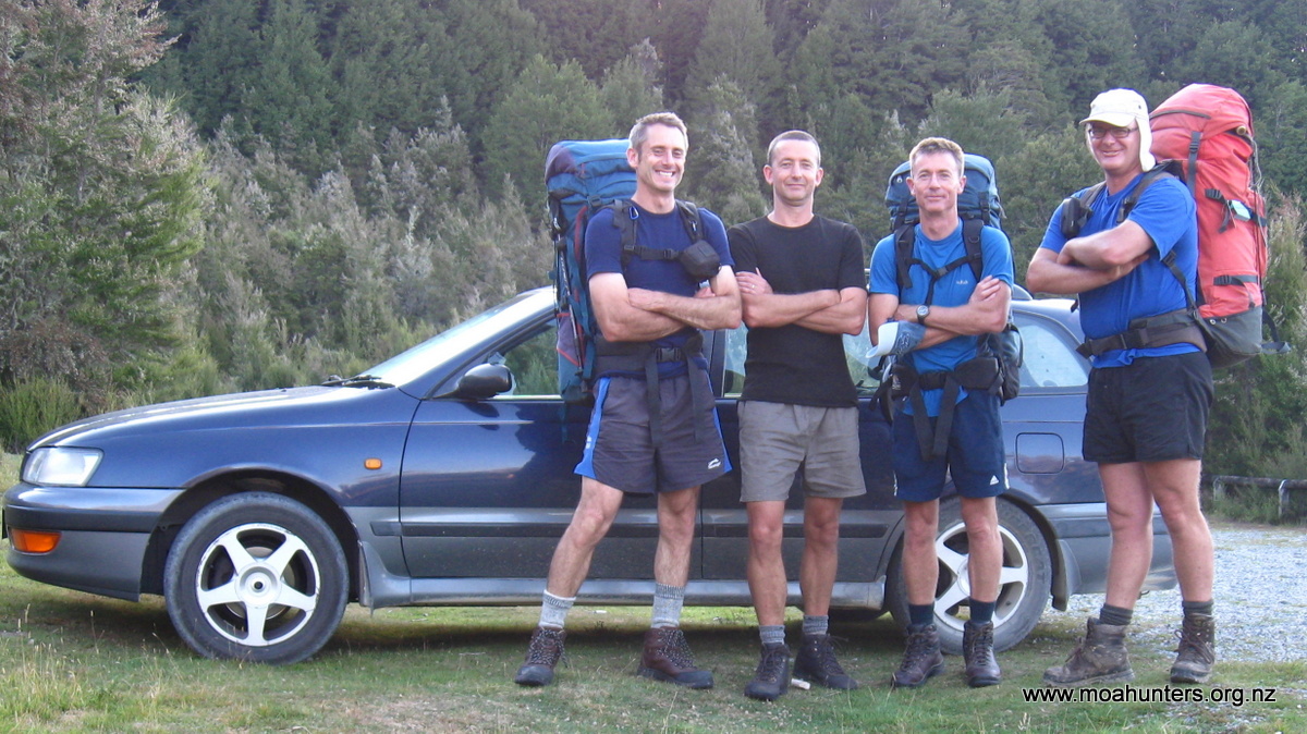
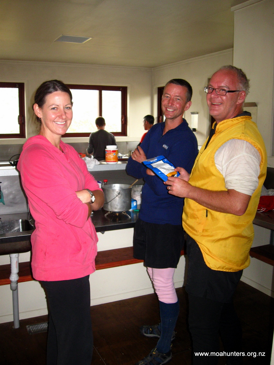
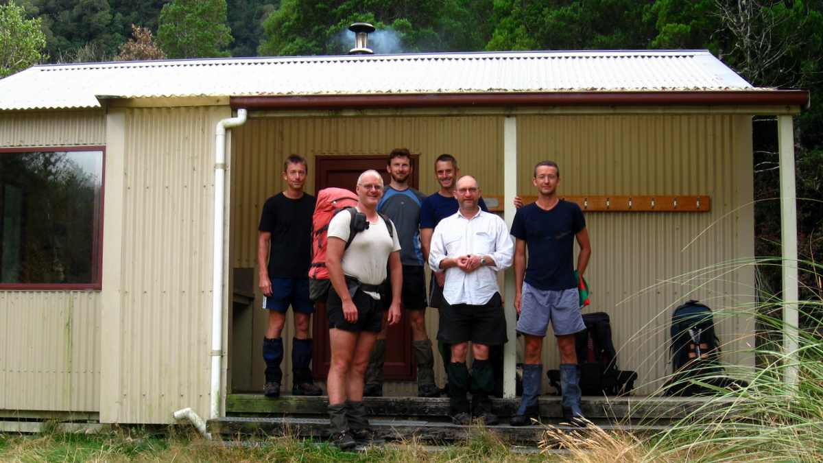
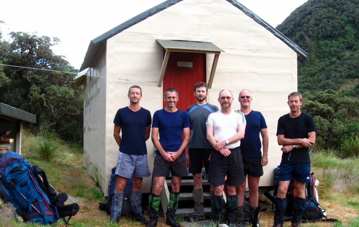
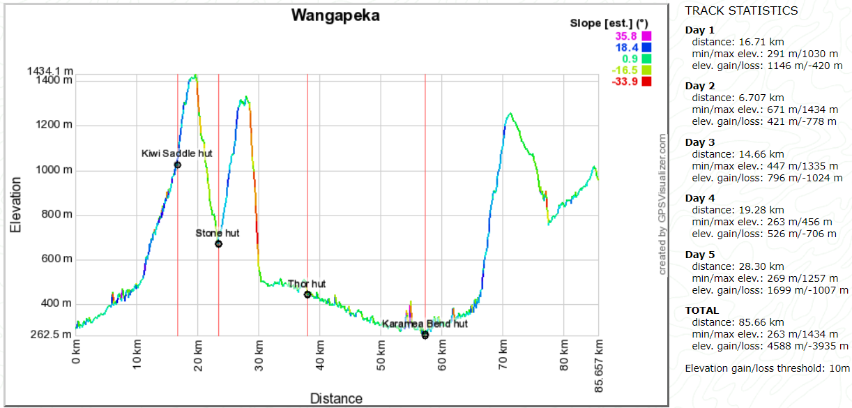
Moa Hunters on this trip: Paul, Magnus, Richard, Chris, Lewis, Logan
This year a more benign trip this year was scheduled, mainly due to time constraints, and foundation Moa Hunt member Adam being absent due to a ruptured Achilles. His quick wit was missed, but this did not detract from the overall enjoyment of the trip.
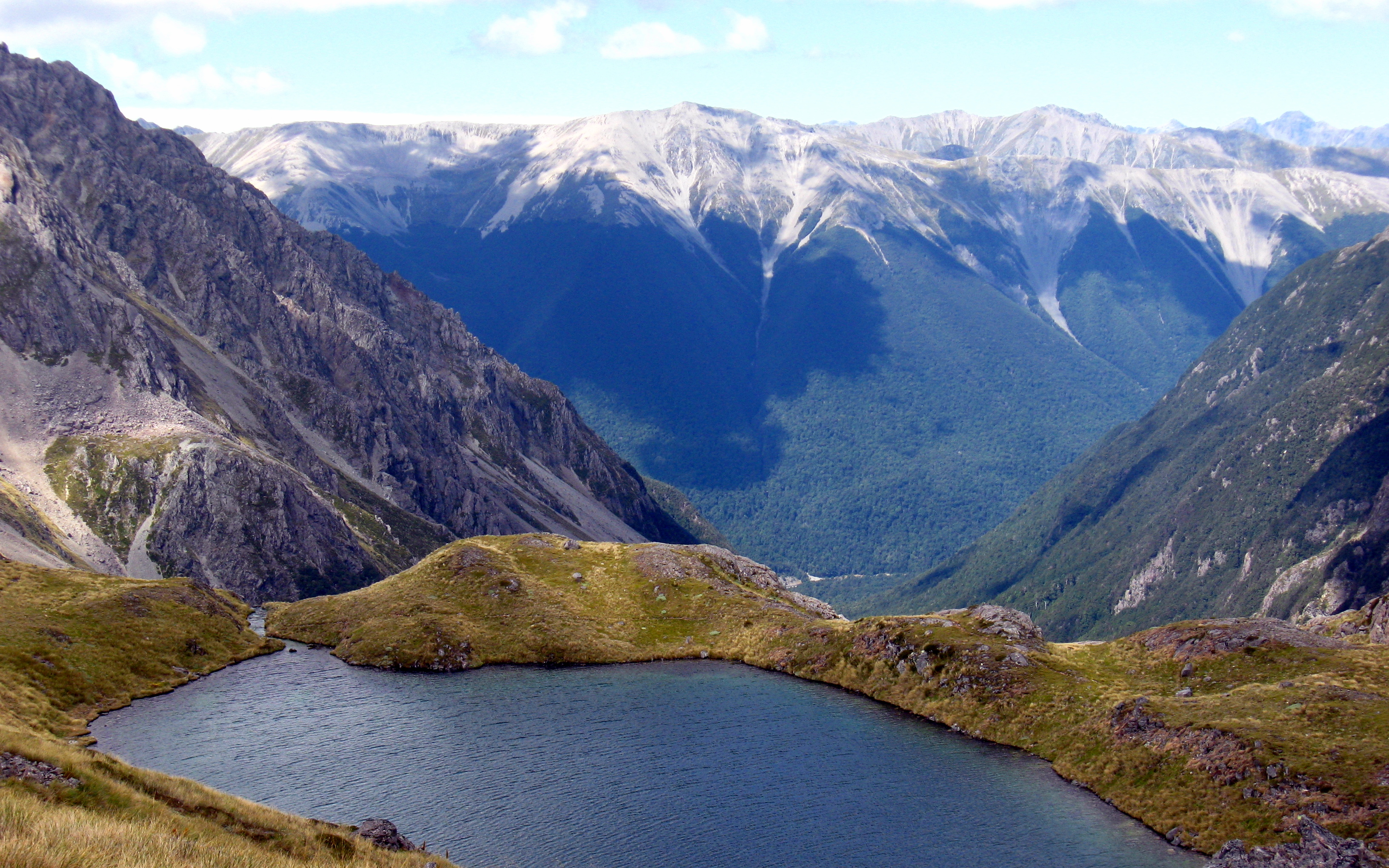
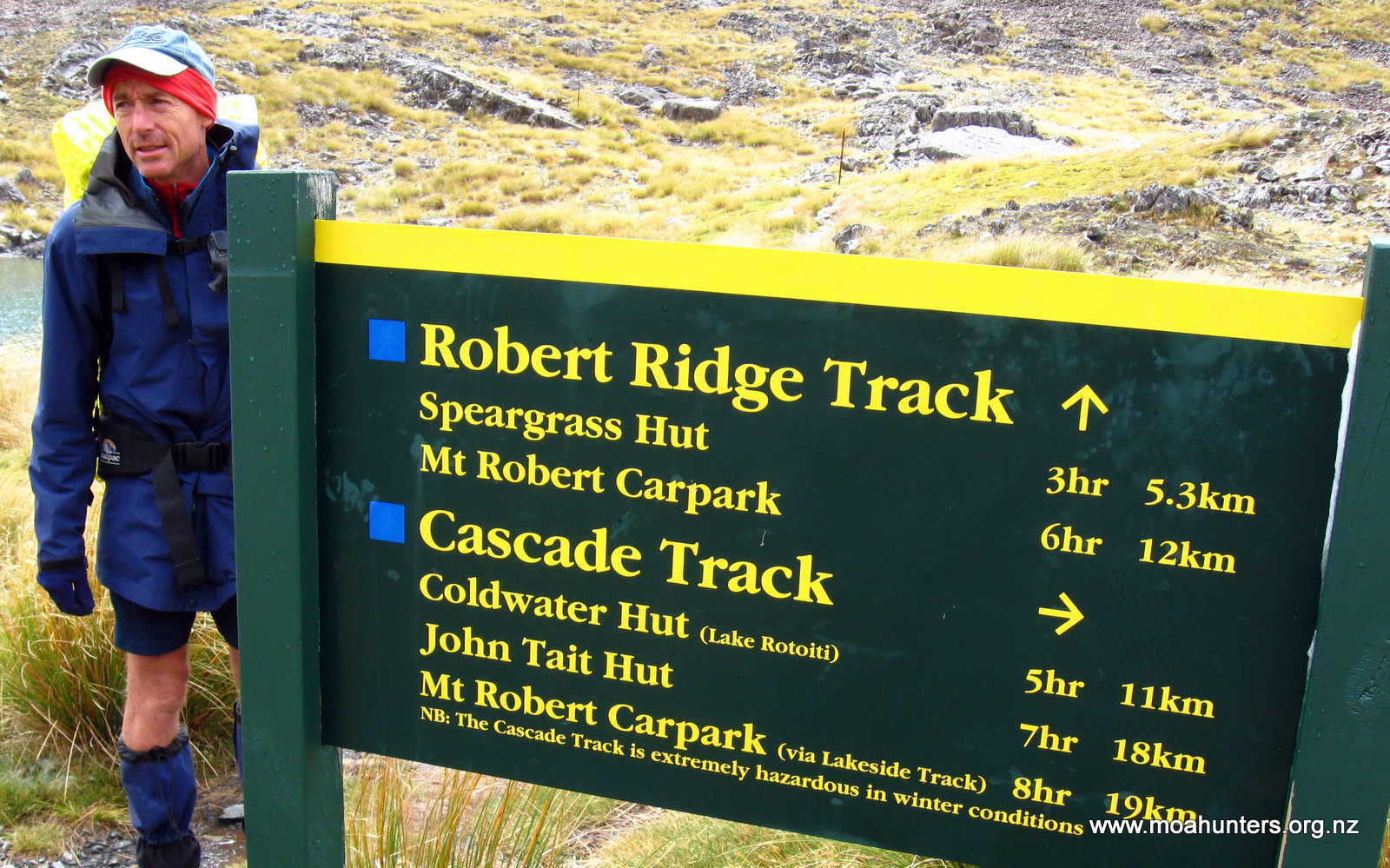
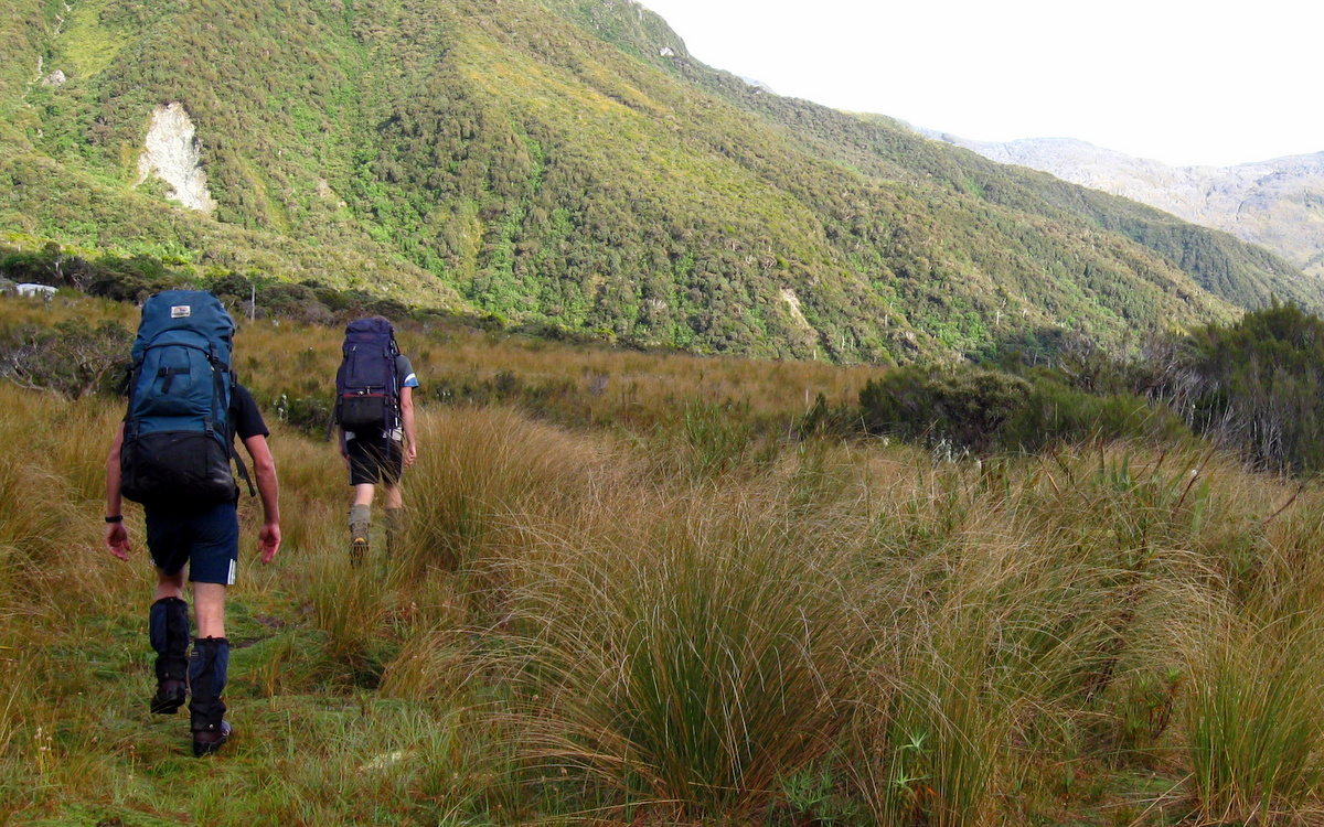
The Two Thumb track is a small portion of the increasingly popular Te Araroa trail, so we expected to enjoy the camaraderie of more tourists and trampers than in previous Moa Hunts.
The plan was fairly straight forward:
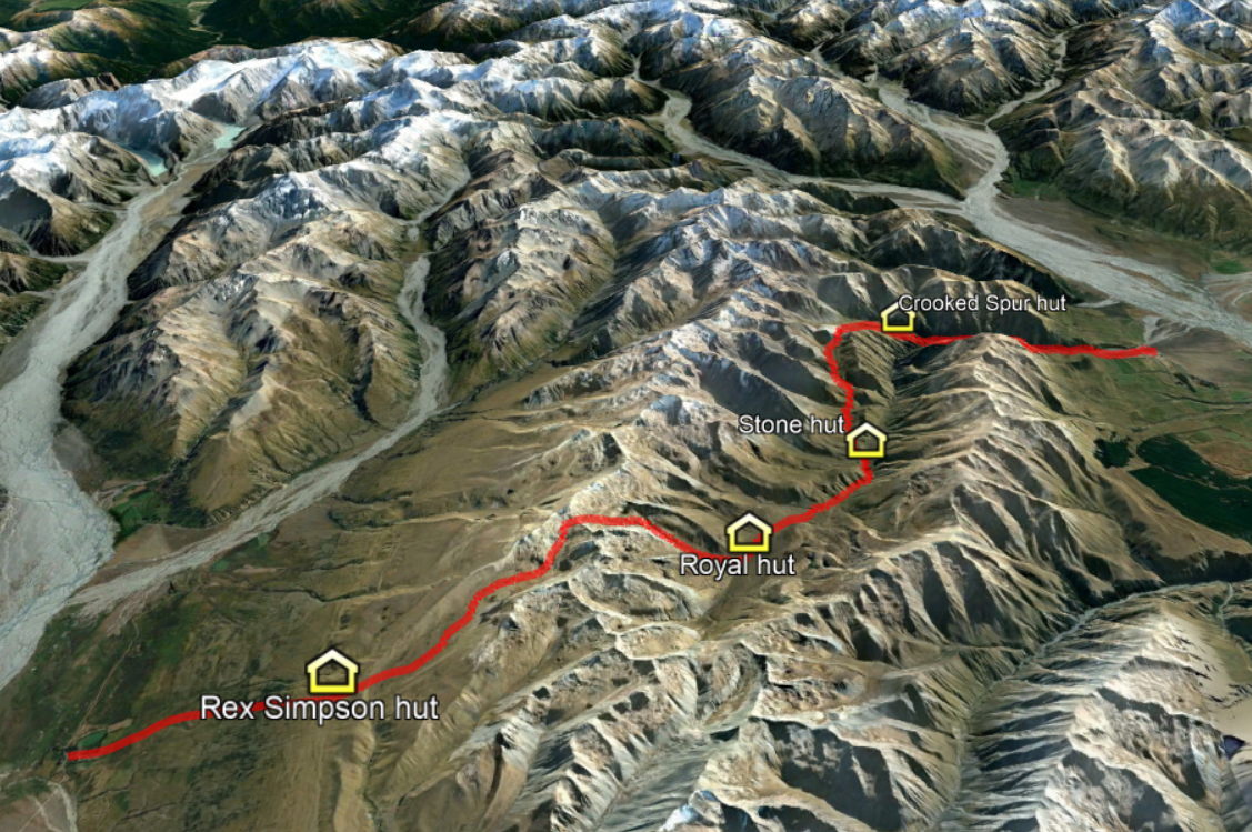
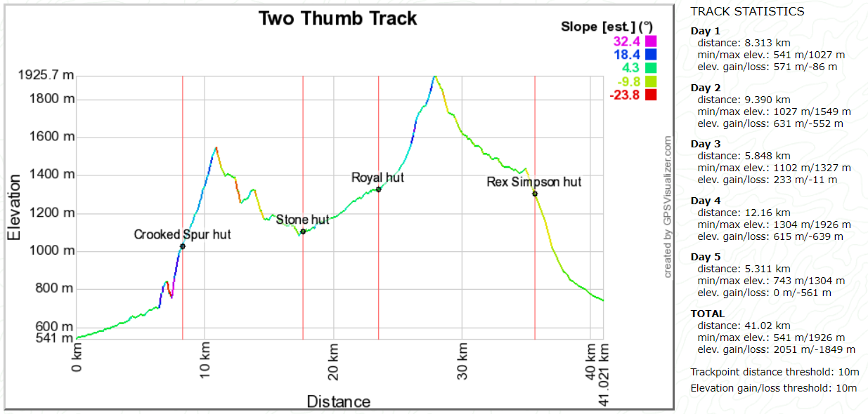
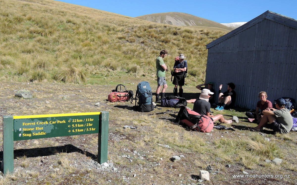
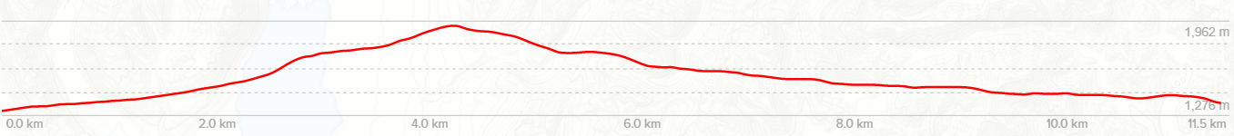
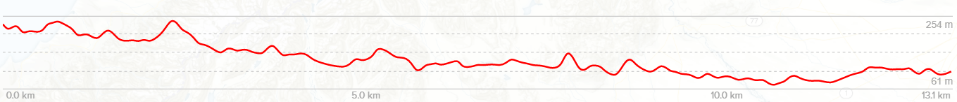
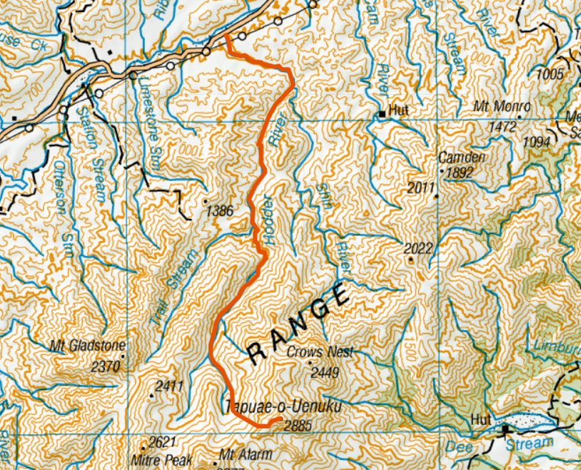
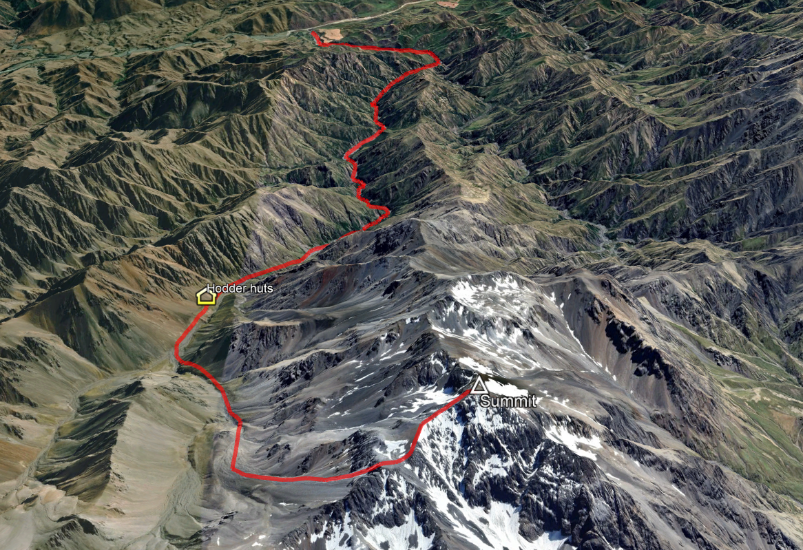
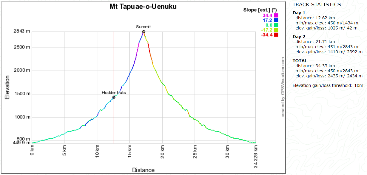
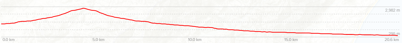
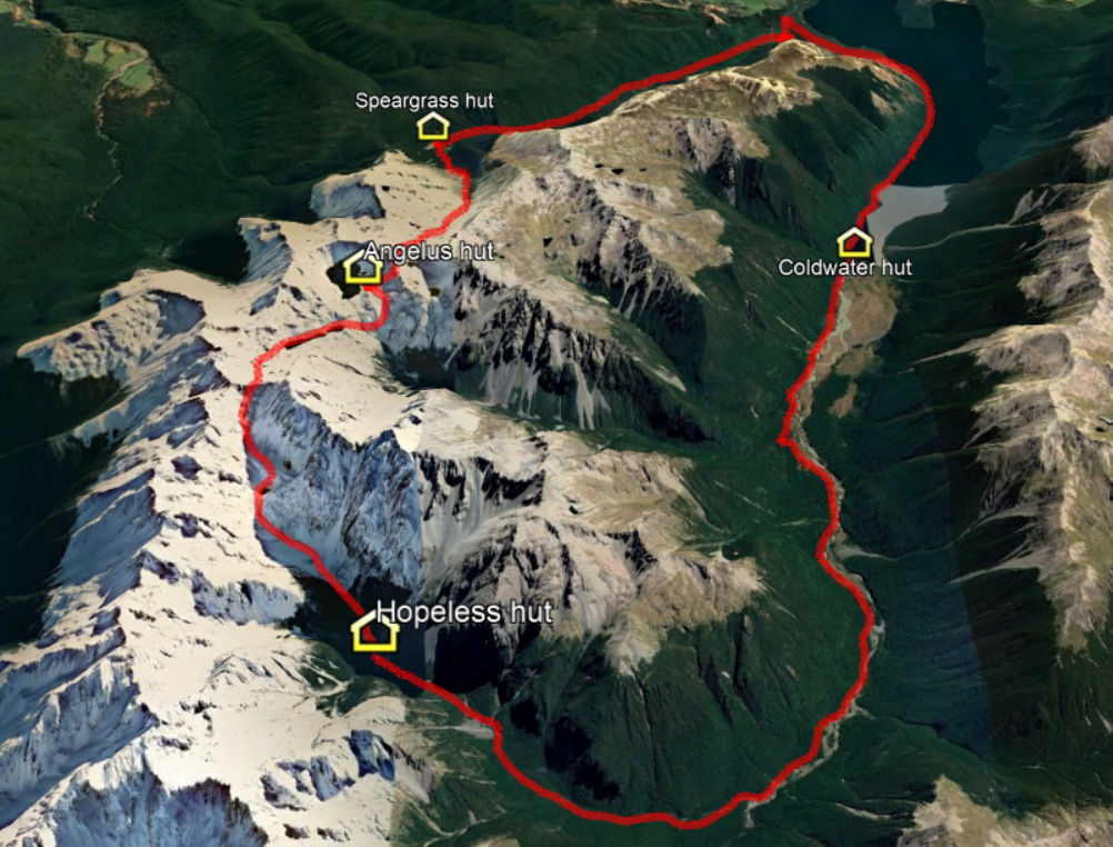
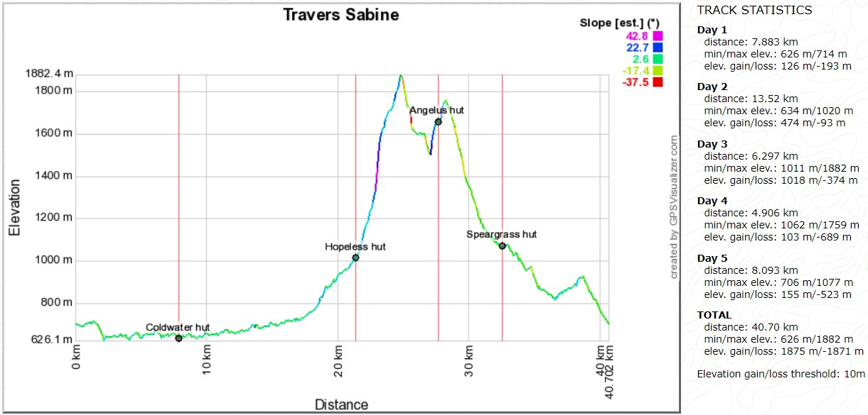
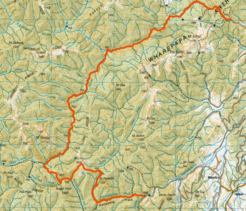
Day 1: Road trip to Mesopotamia, walk to Crooked spur Hut. 9km / 4hr Day 2: Crooked spur hut to Stone hut. 9.5km / 5hr Day 3: Morning Hunting, Stone Hut to Royal Hut in afternoon. 6km / 2hr Day 4: Royal hut to Rex Simpson Hut. 14km / 6hr Day 5: Rex Simpson hut to Road and home
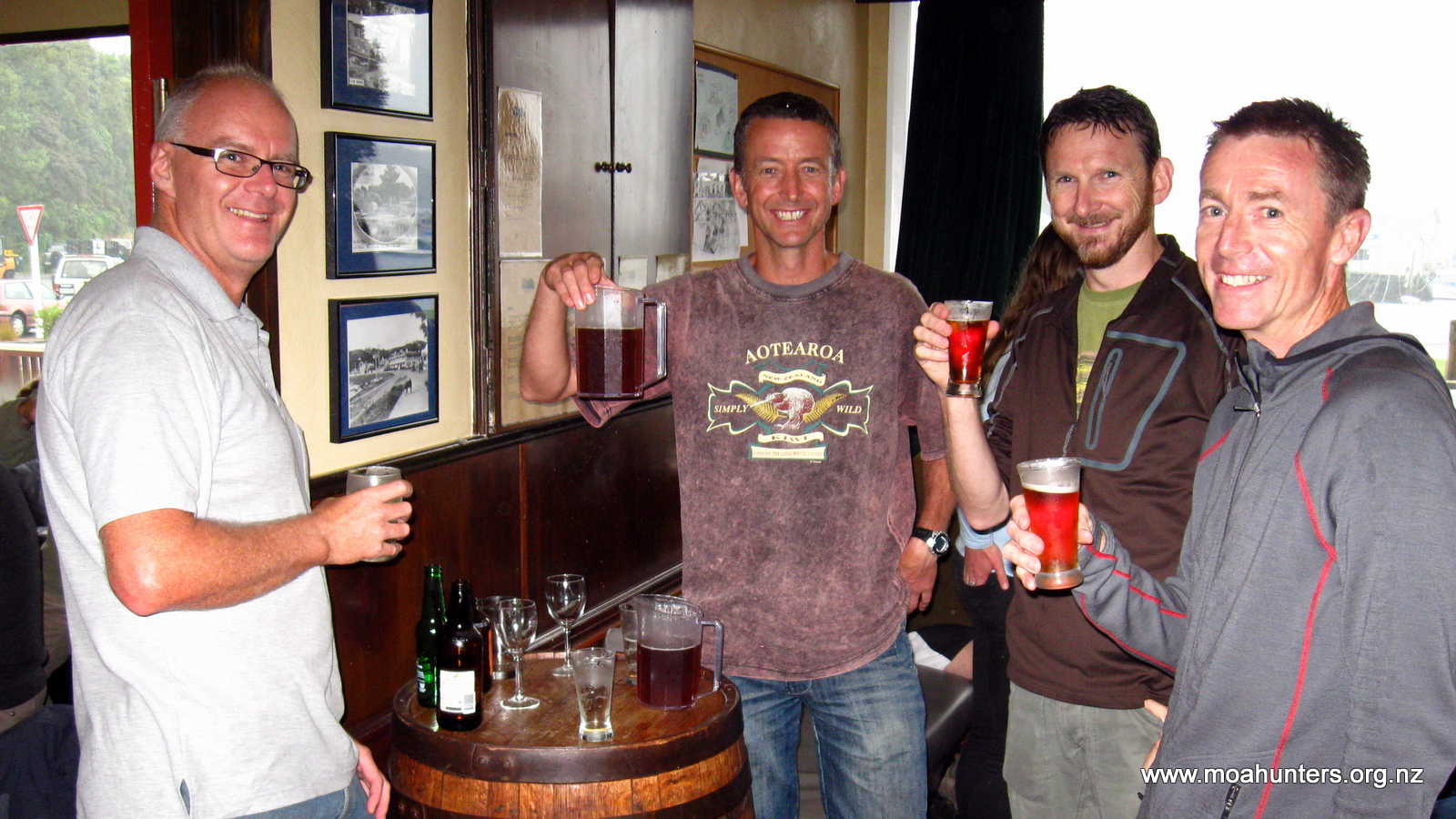
For this adventure, we all converged in Christchurch on Friday 20th January, a whole month ahead of the standard Moa Hunting schedule, as our main food man Chris could not make the usual March Schedule. Everyone knows a good Moa hunt marches on its stomach!
To negate any weather holdups, Richard, Lewis and Magnus had all flown in on the Friday afternoon. Sampling the local brews, and devouring “shark and tatie” in the name of carbo-loading helped to fill in the time before departure the next morning.
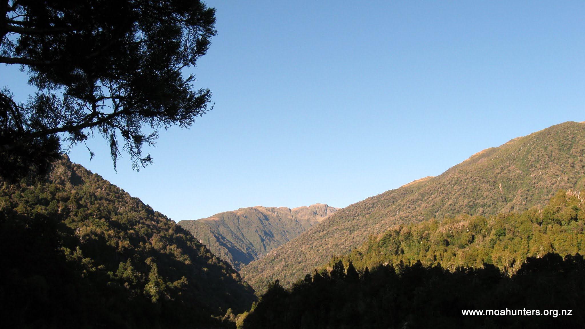
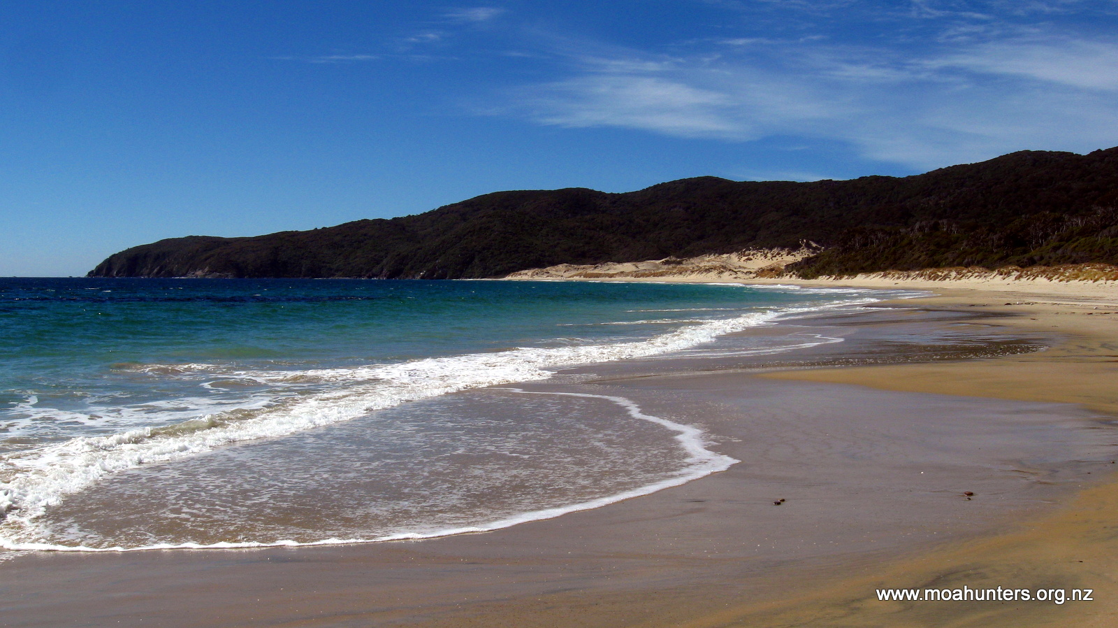
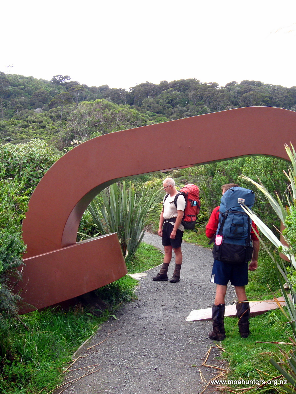
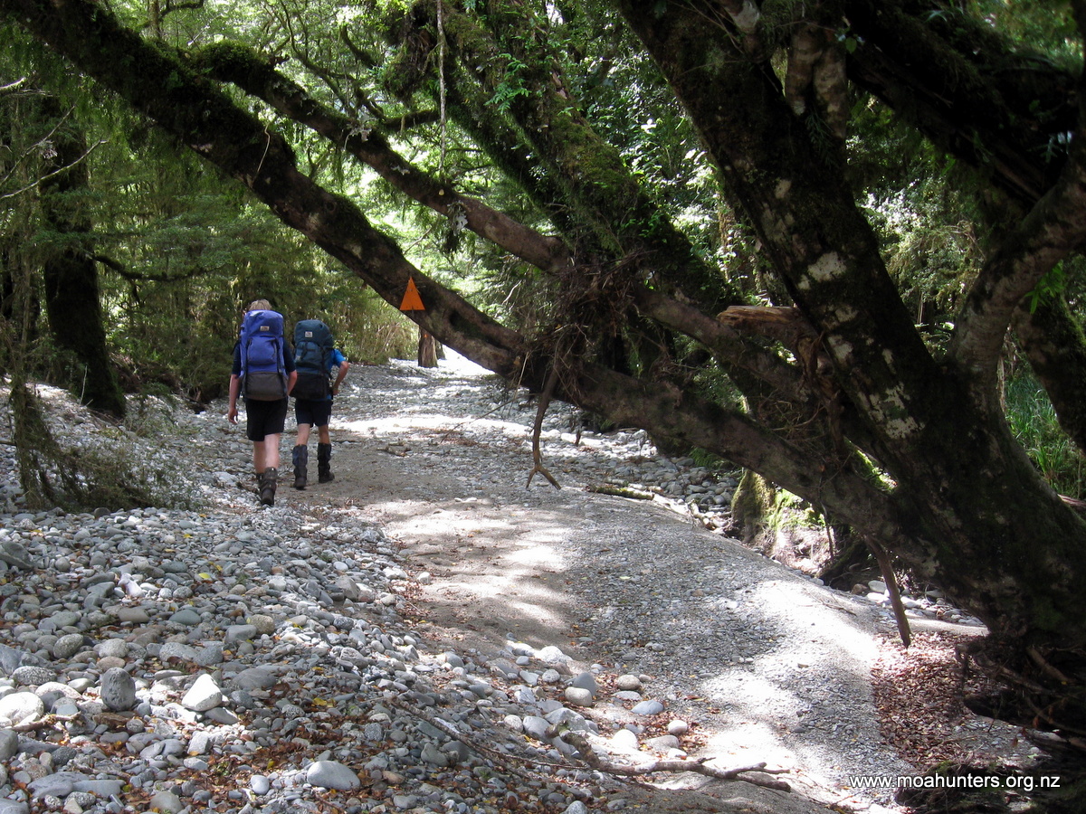
Day 1
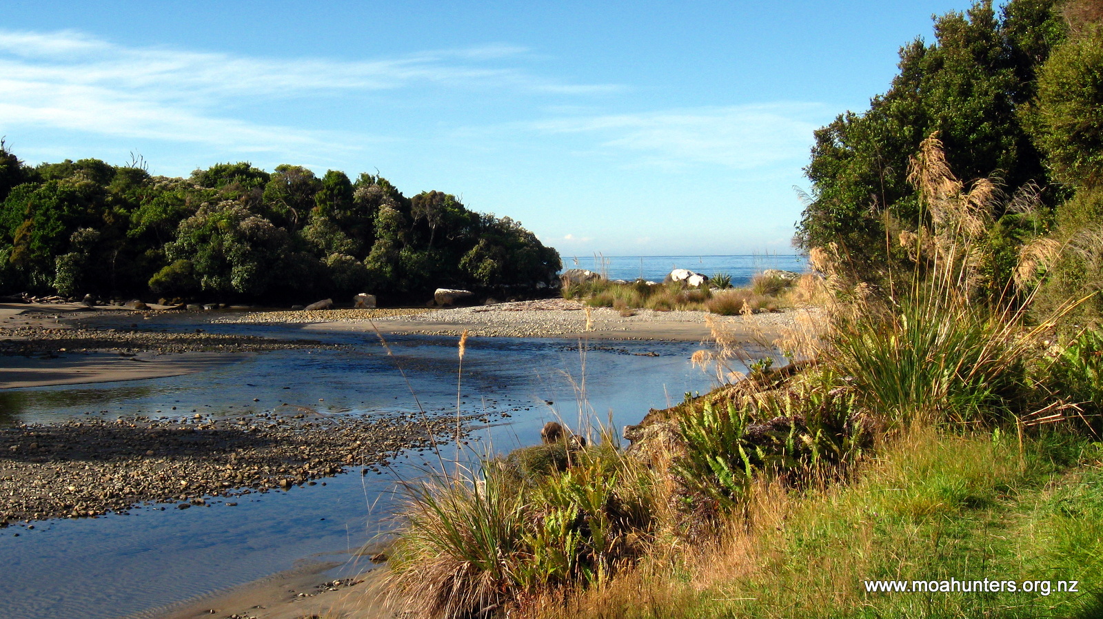
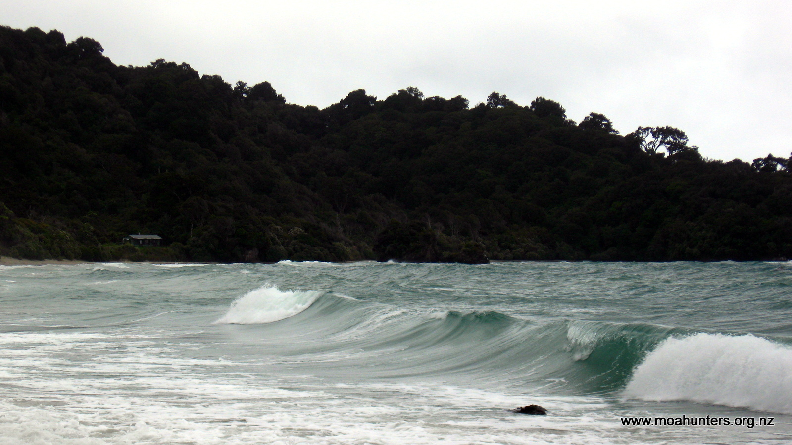
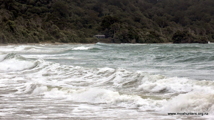
Saturday 21st January – Mesopotamia to Crooked Spur hut
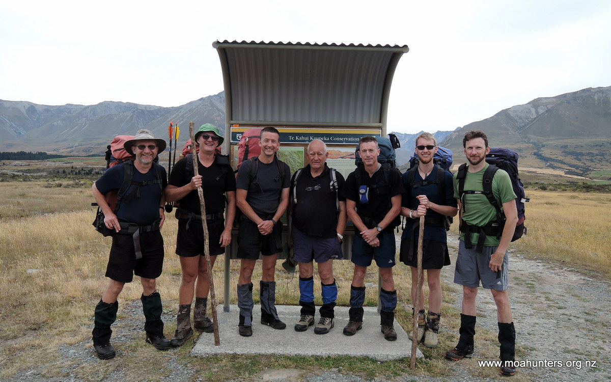
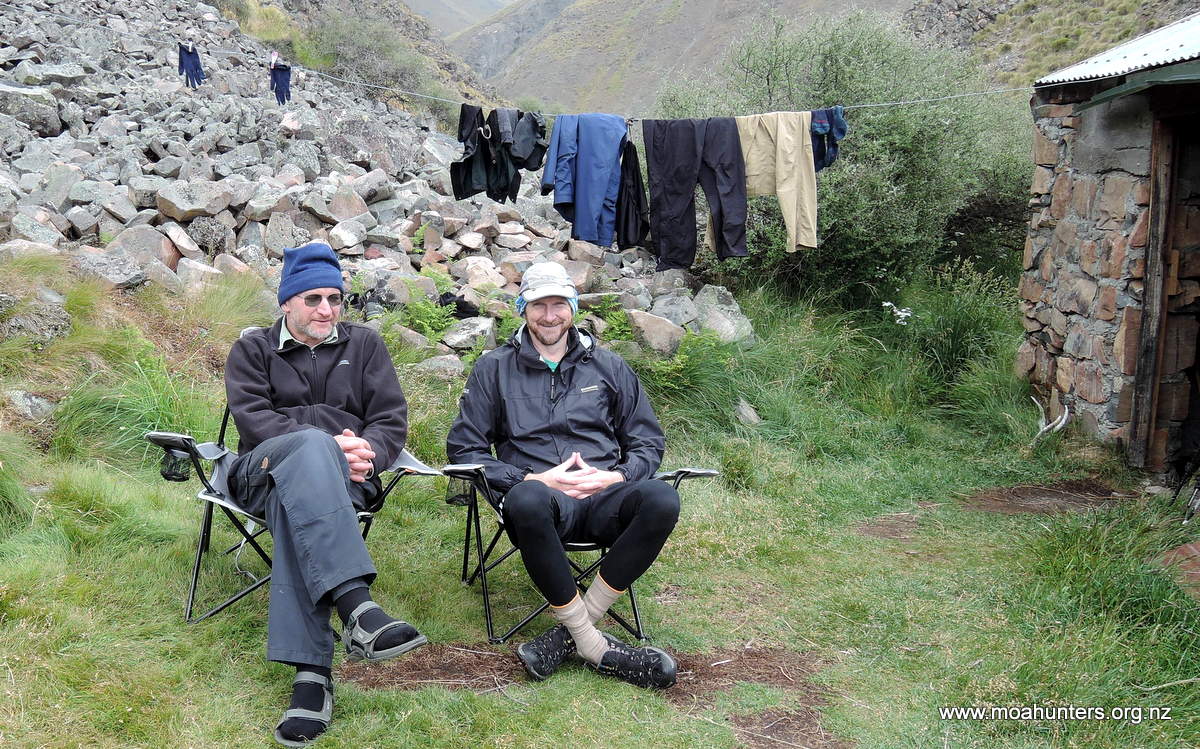
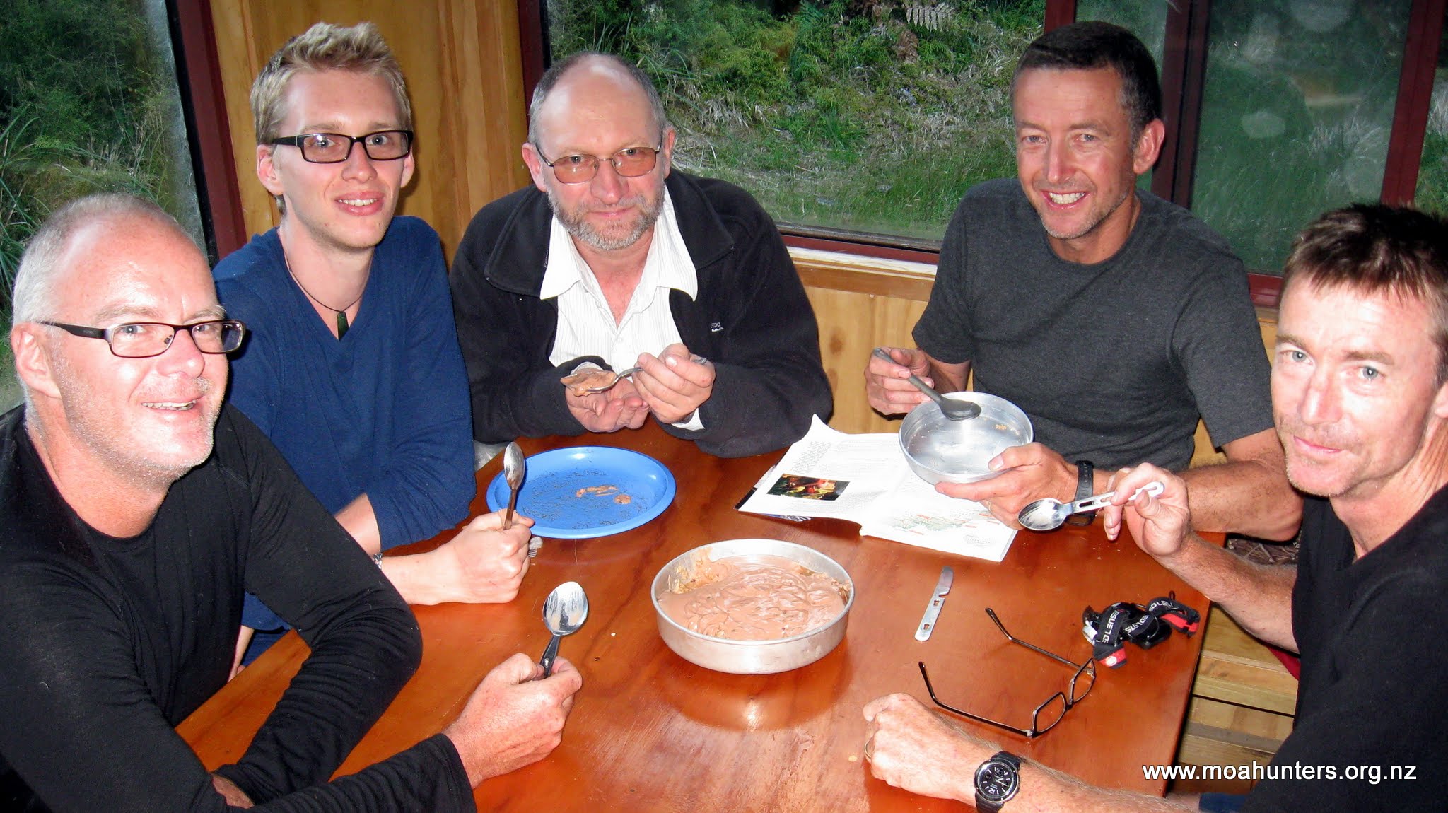
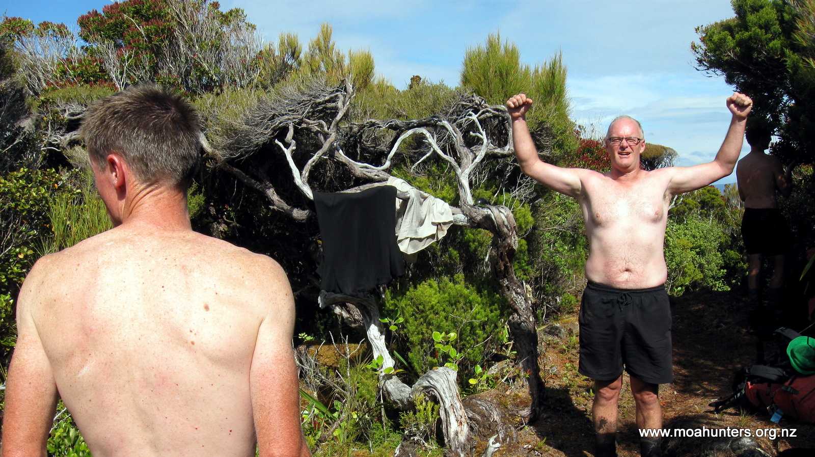
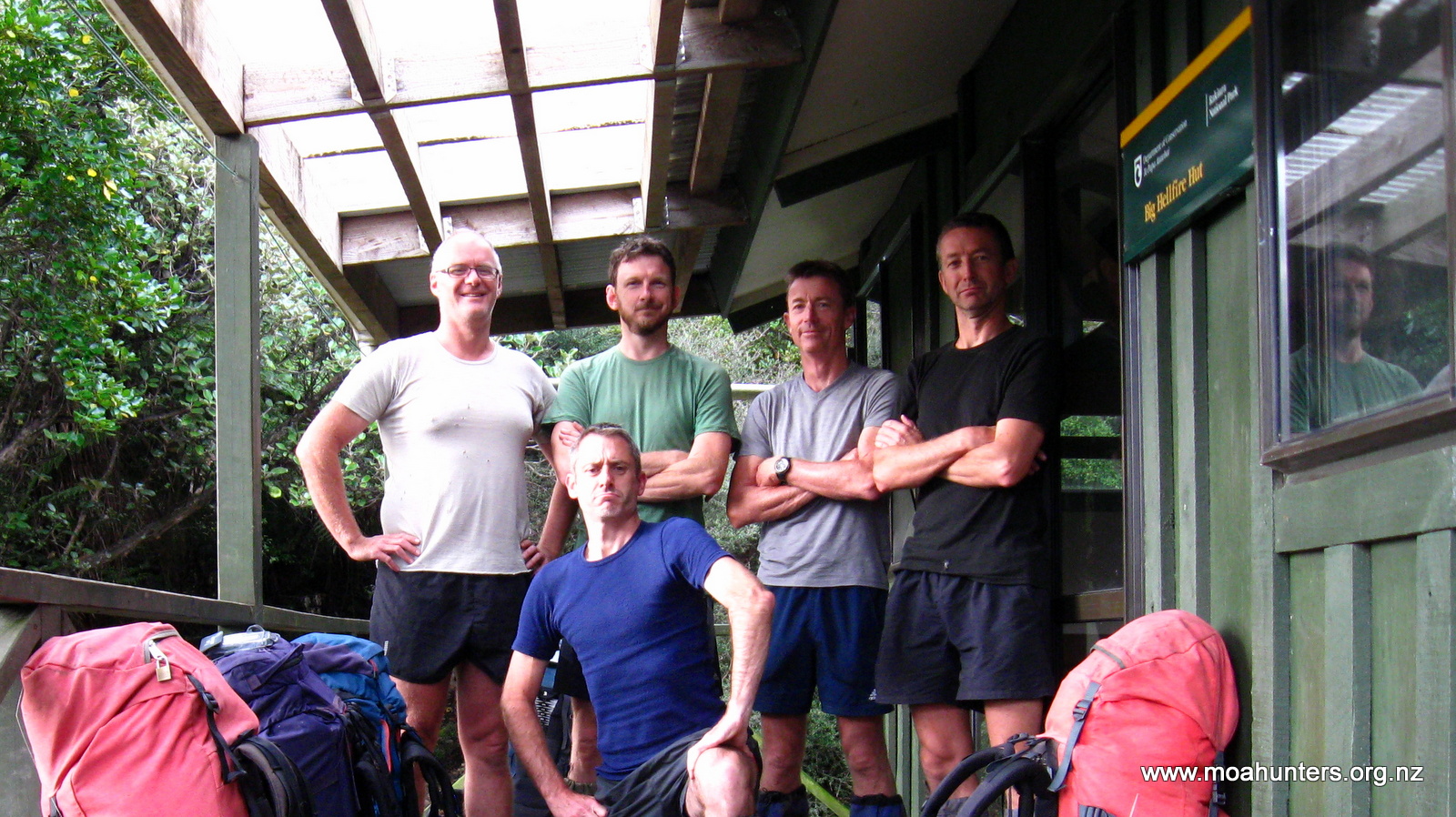
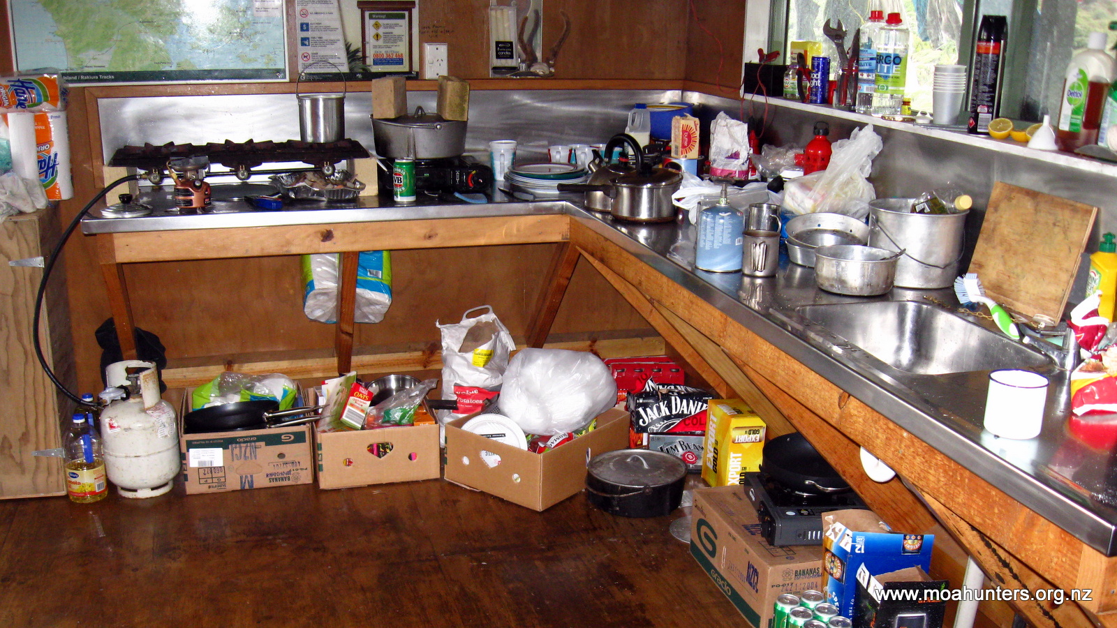
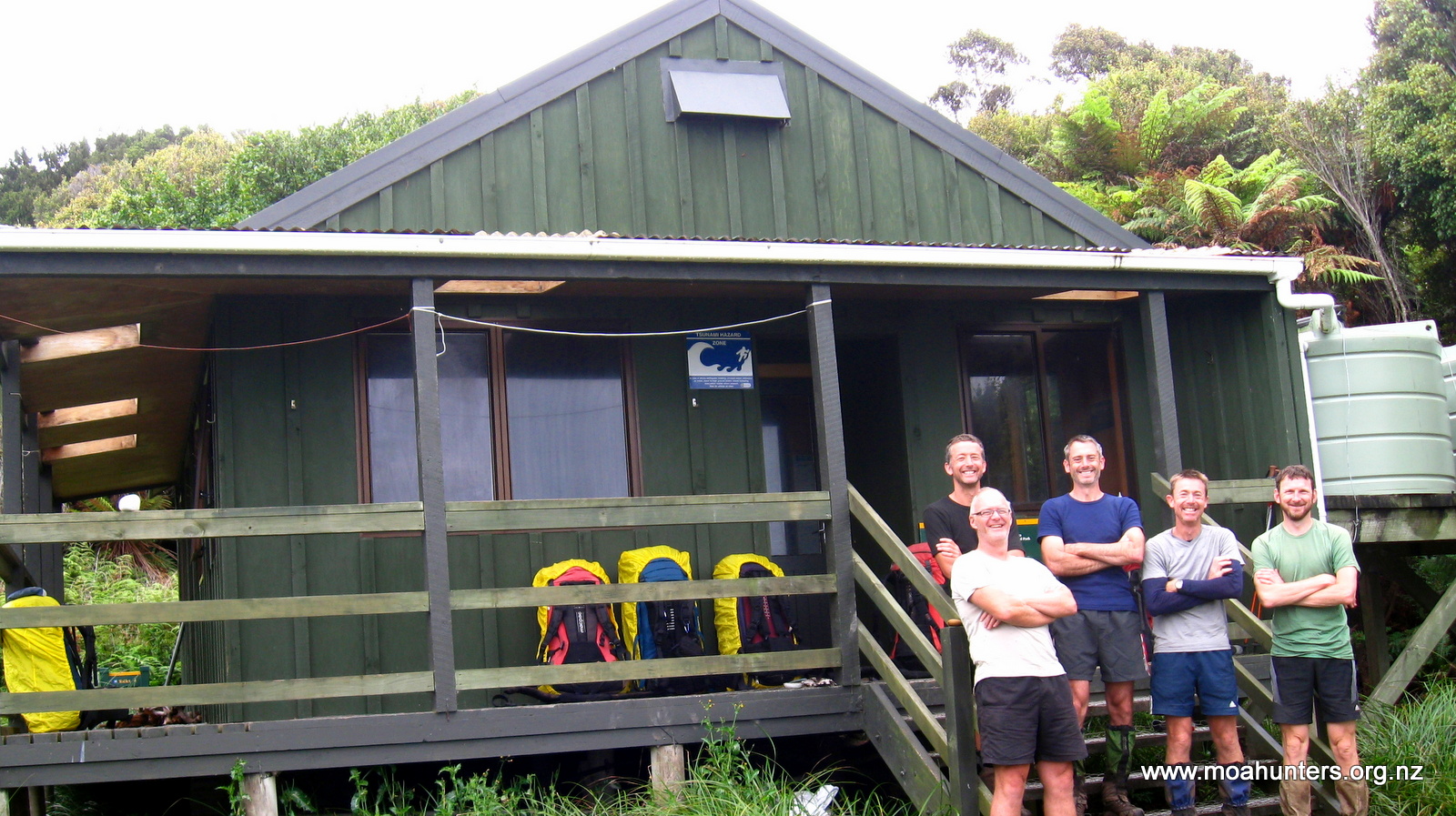
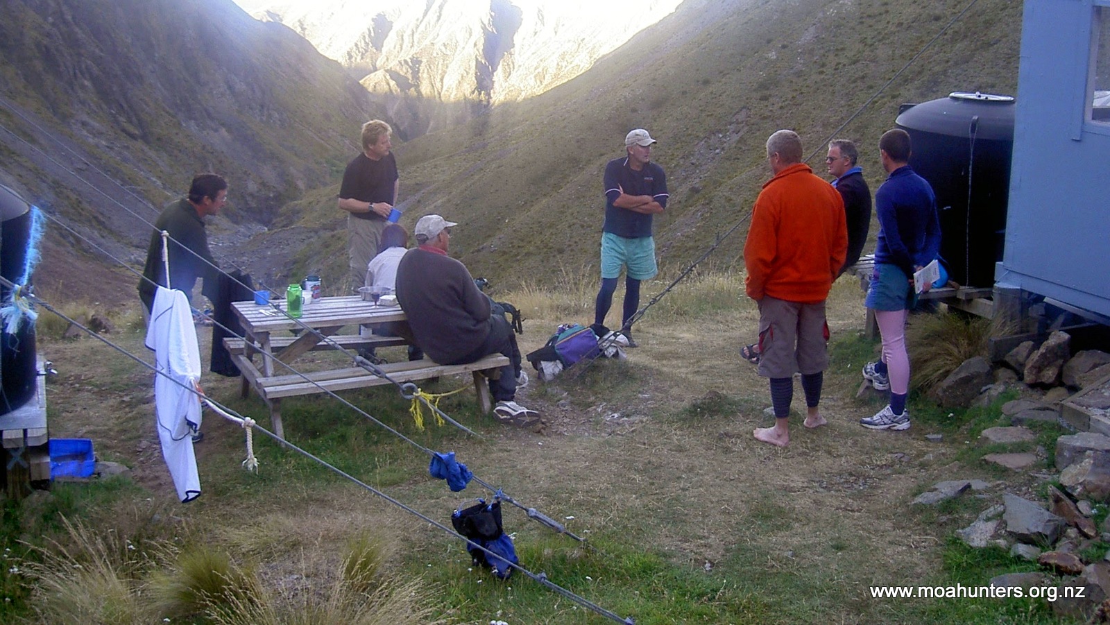
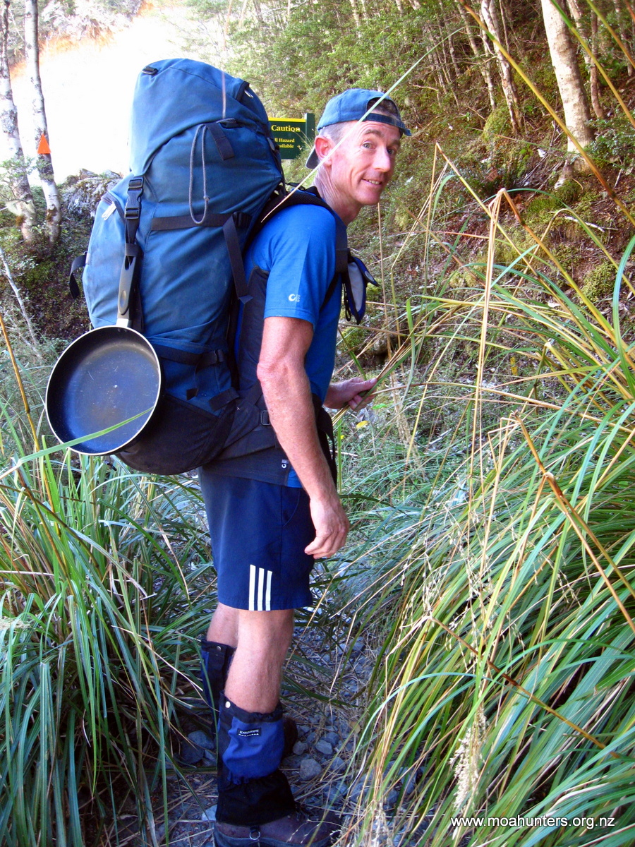
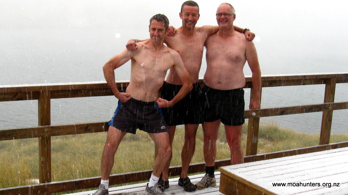
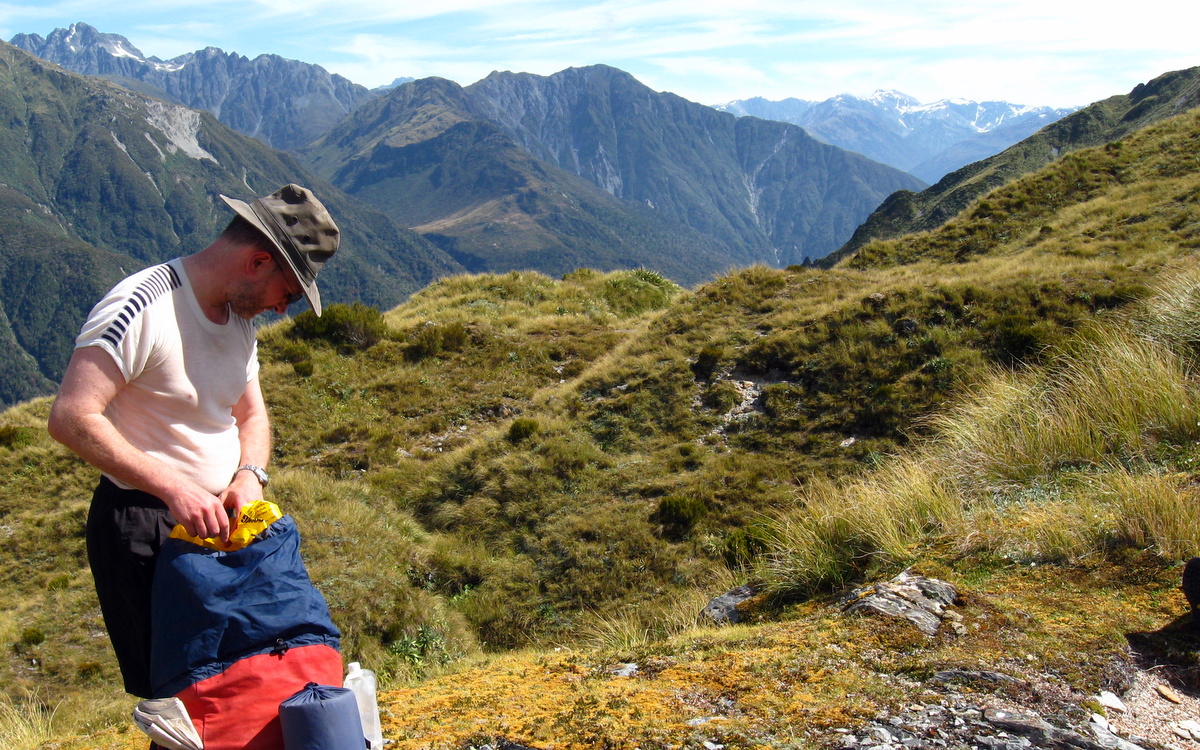
Nice spread, where’s your head at?
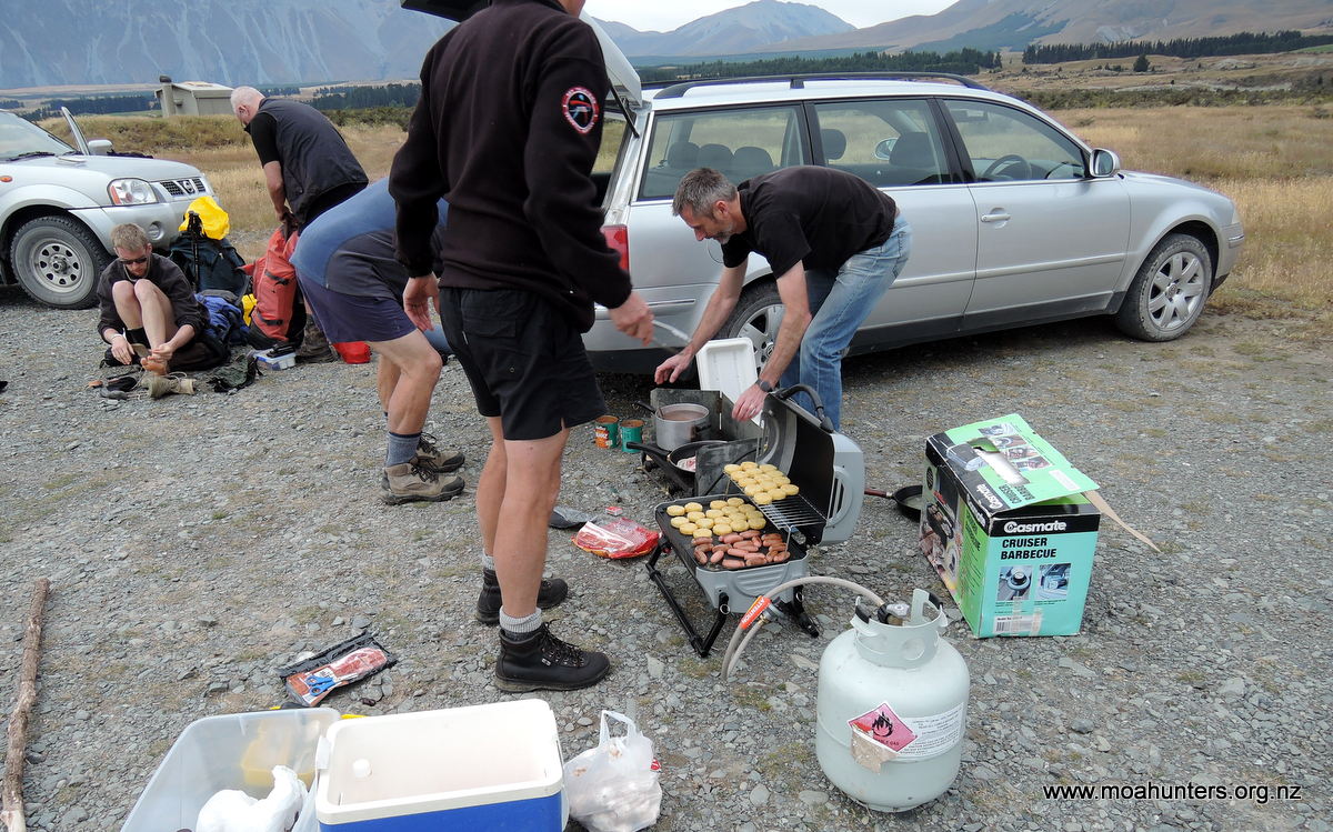
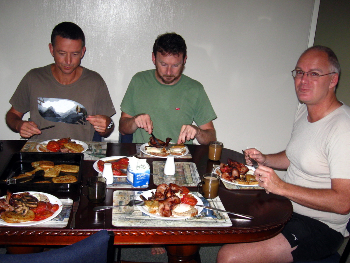
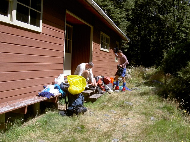
All on time, we converged at Adams place, as he had generously given his time to help transport us to the start of the track this year. As there were 6 of us, Paul’s dad Alan also helped with transport. Without further ado we packed and drove to Mesopotamia station, where breakfast number two (for some) was prepared. The ritual Moa Hunter enormous, gourmet breakfast of bacon, eggs, hash browns and lots of mushrooms was expertly fried up by Paul and Adam.
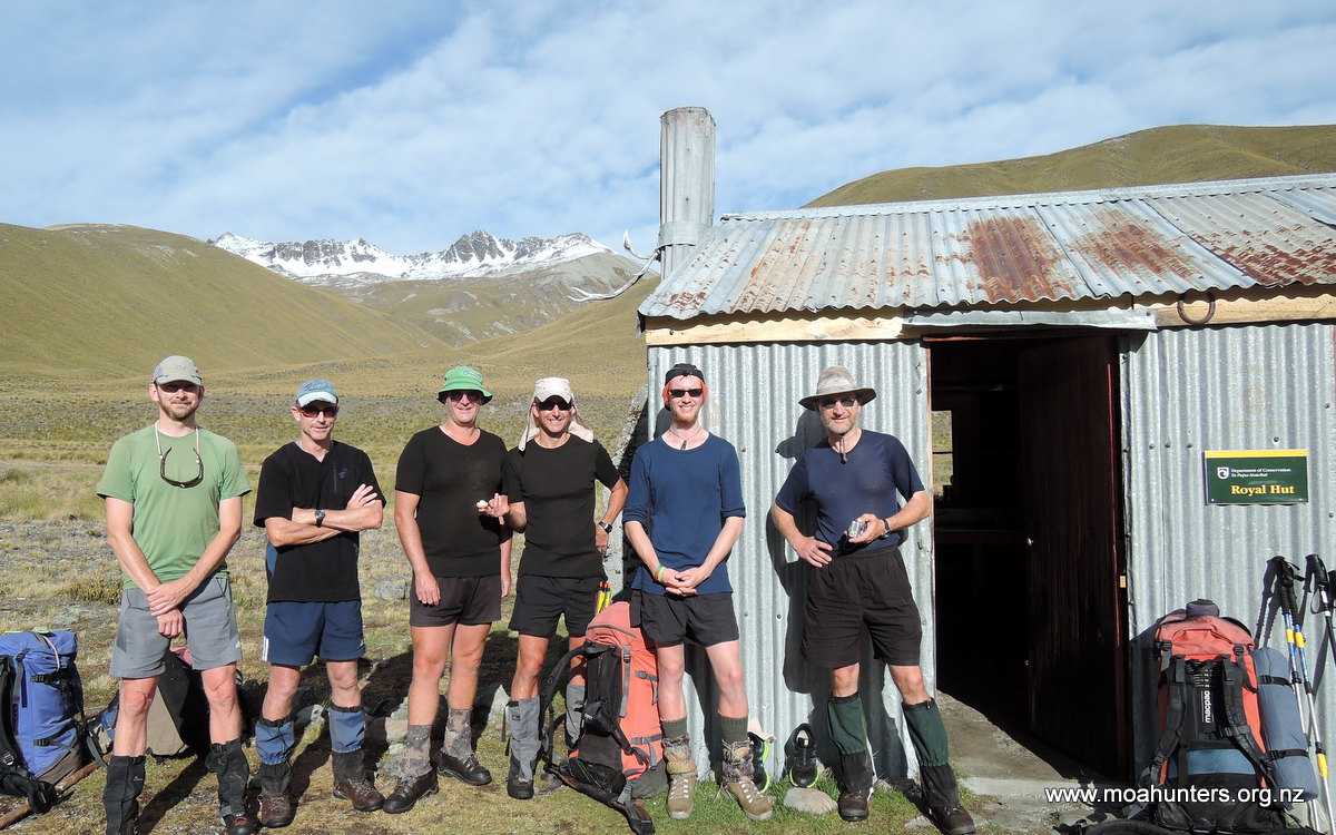
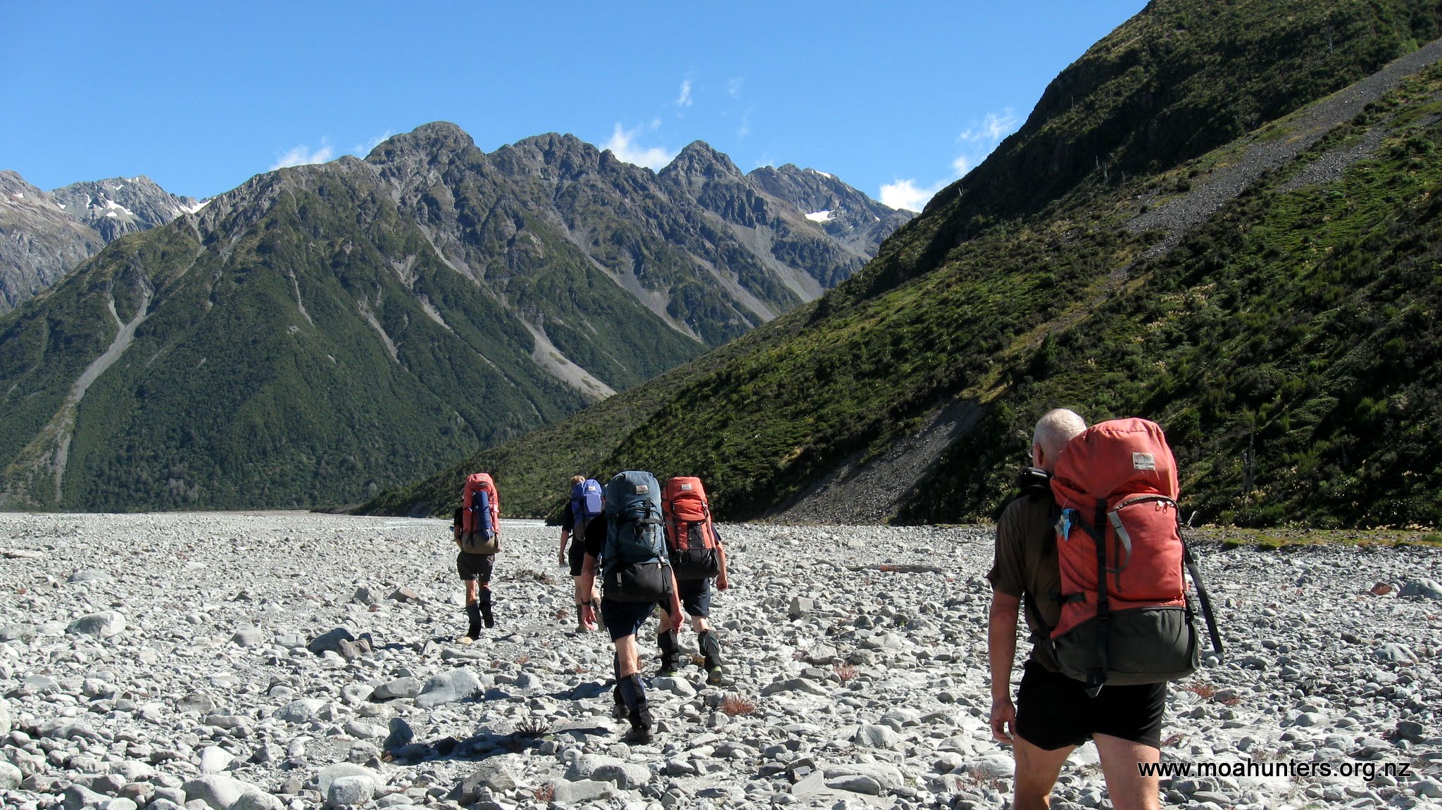
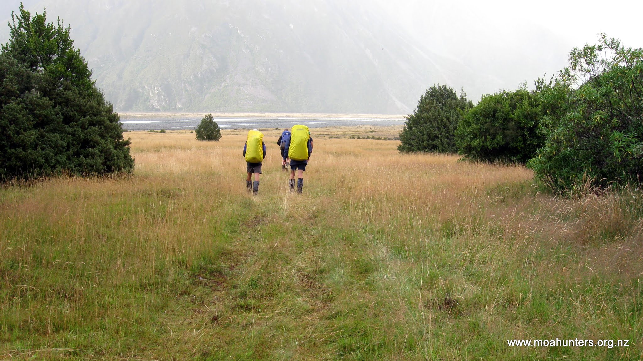
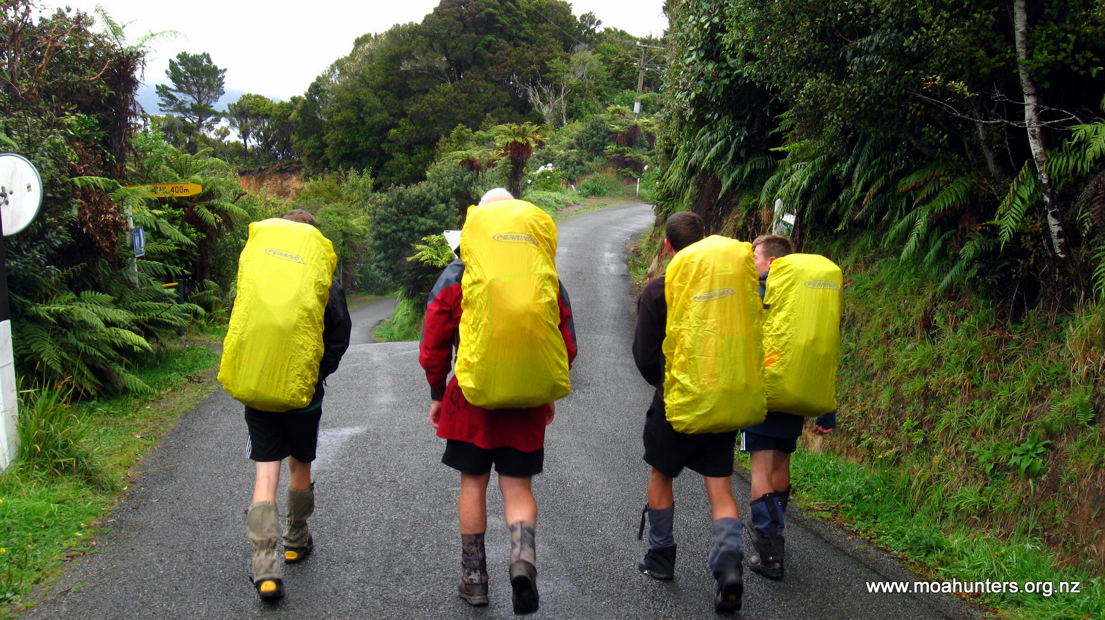
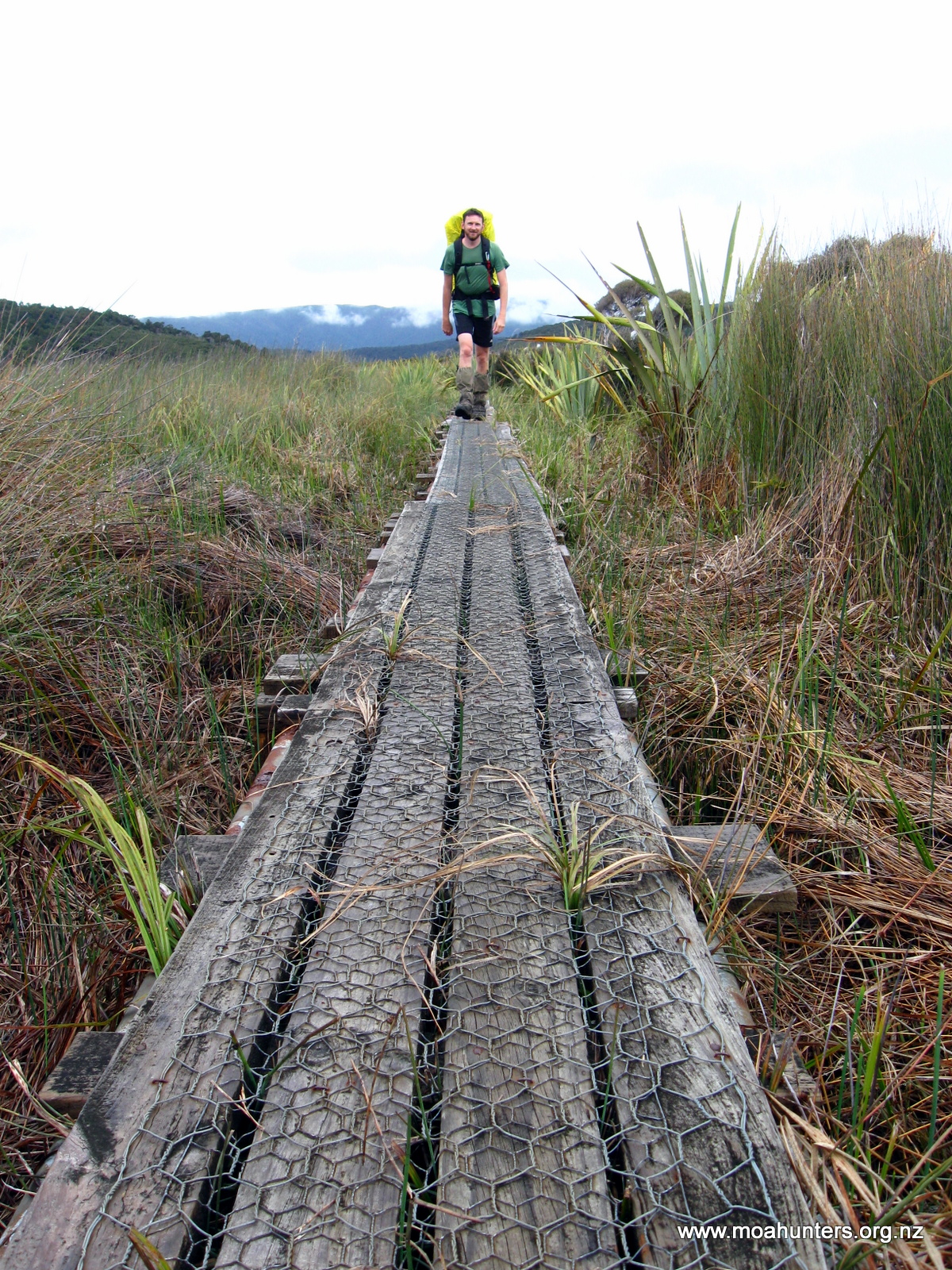
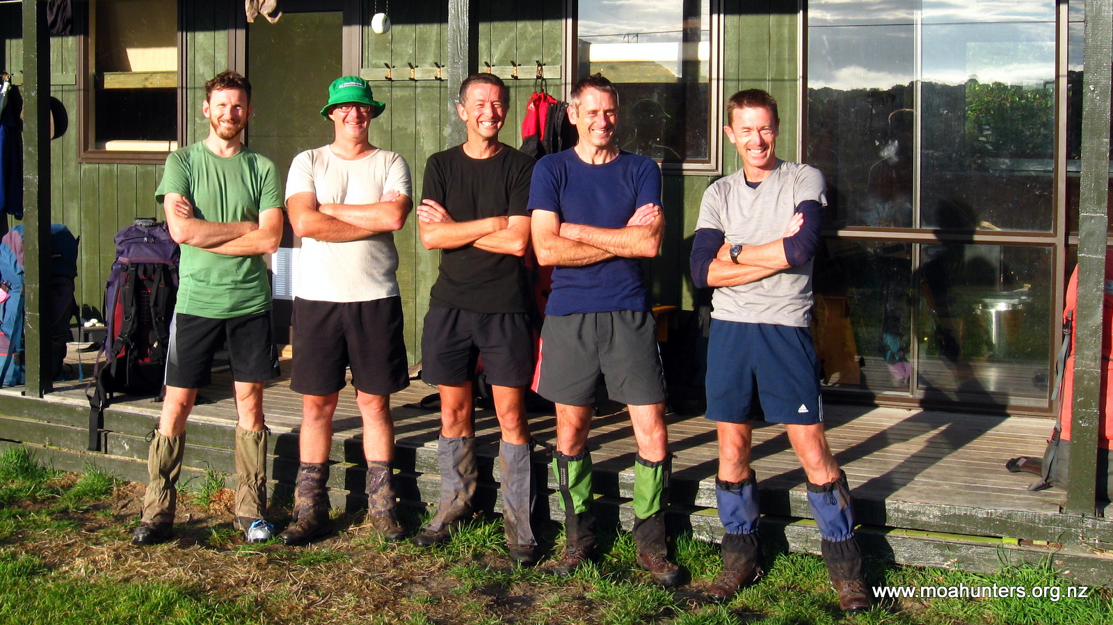
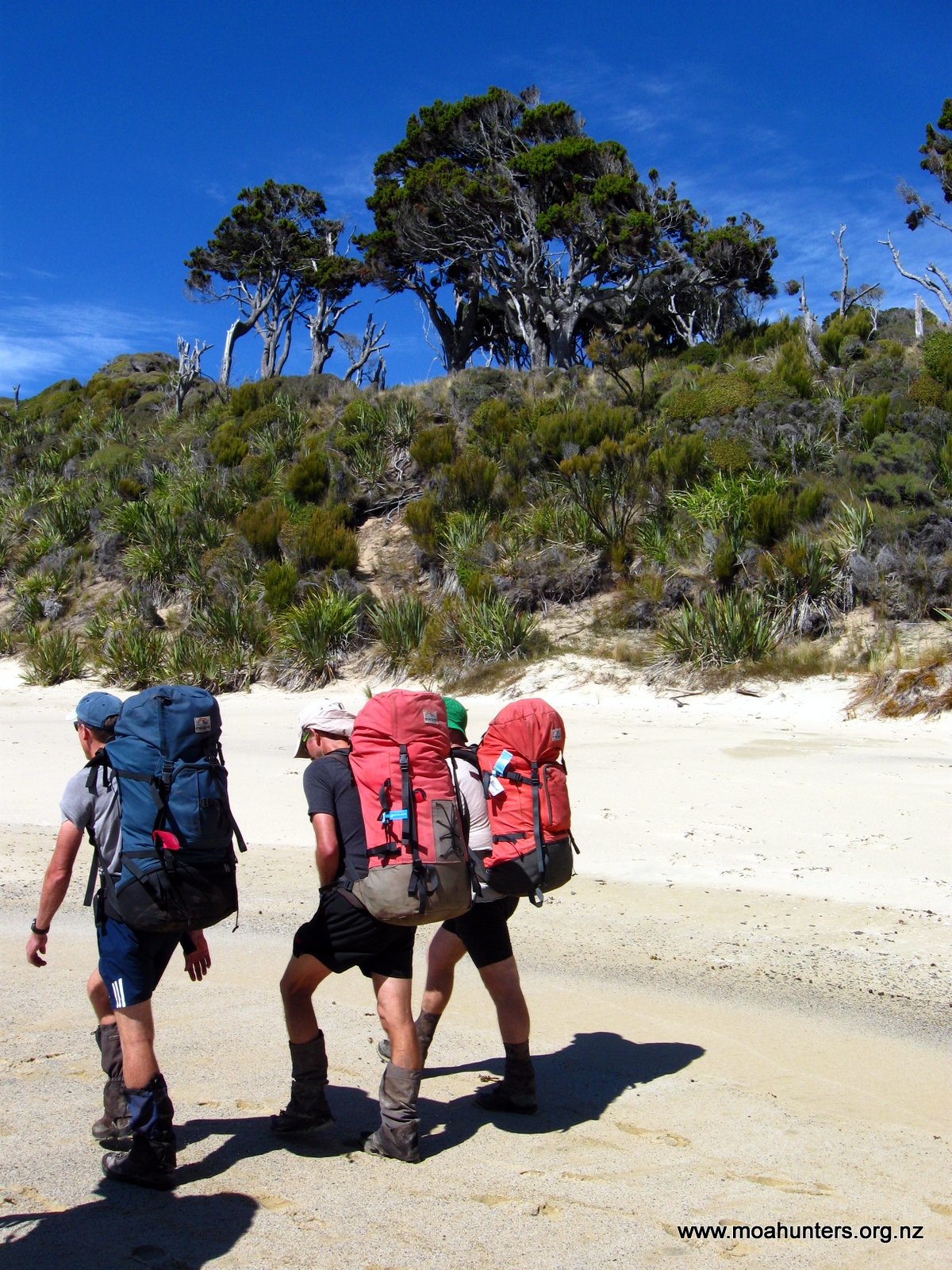
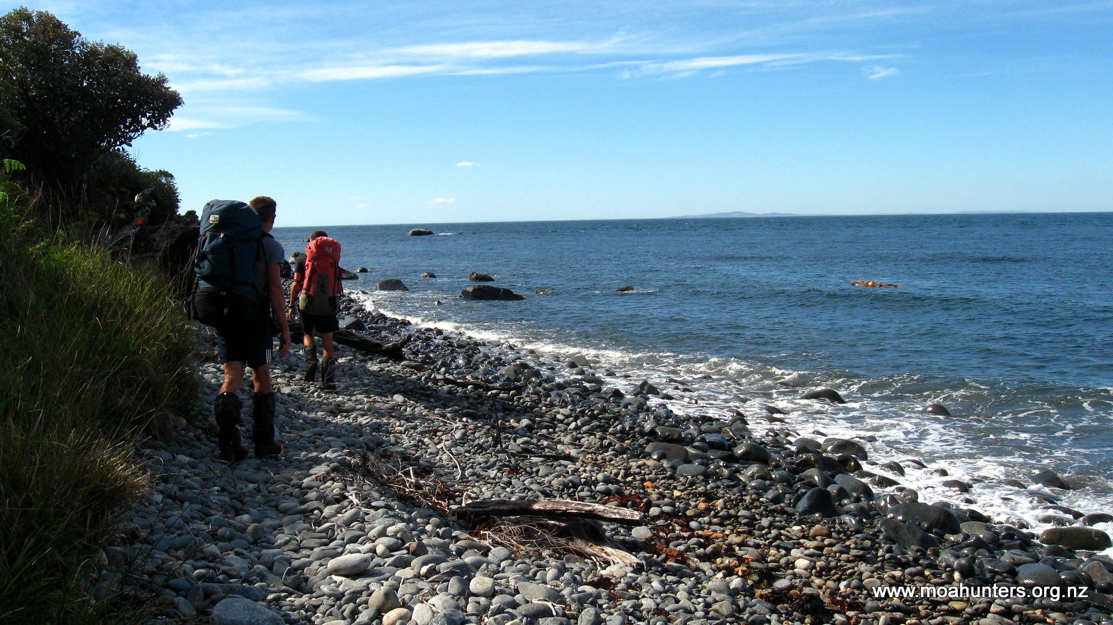
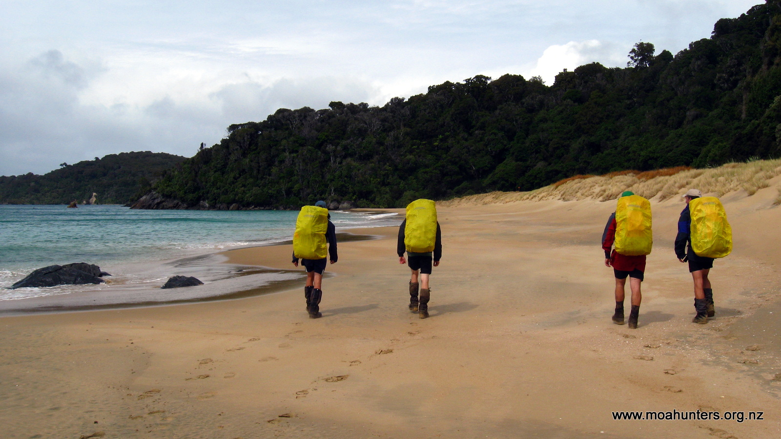
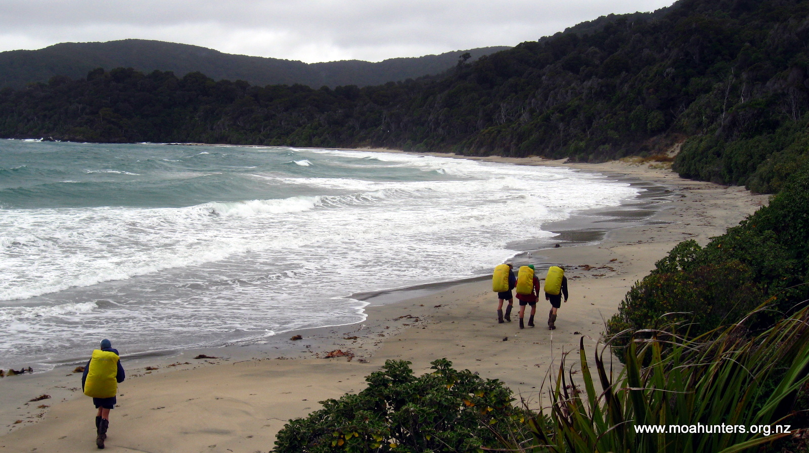
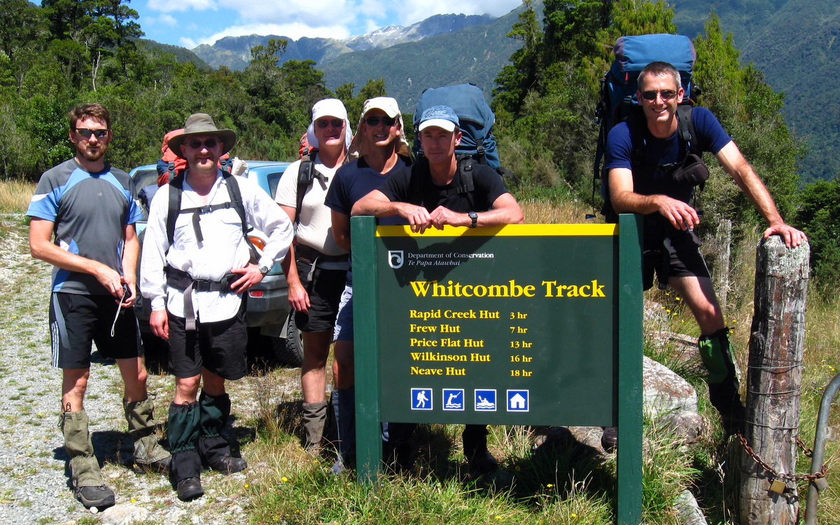
We start out as seven…
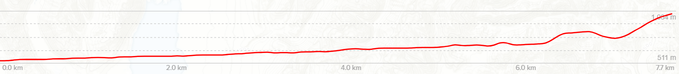
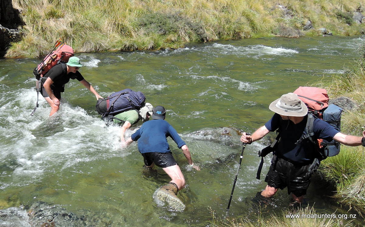
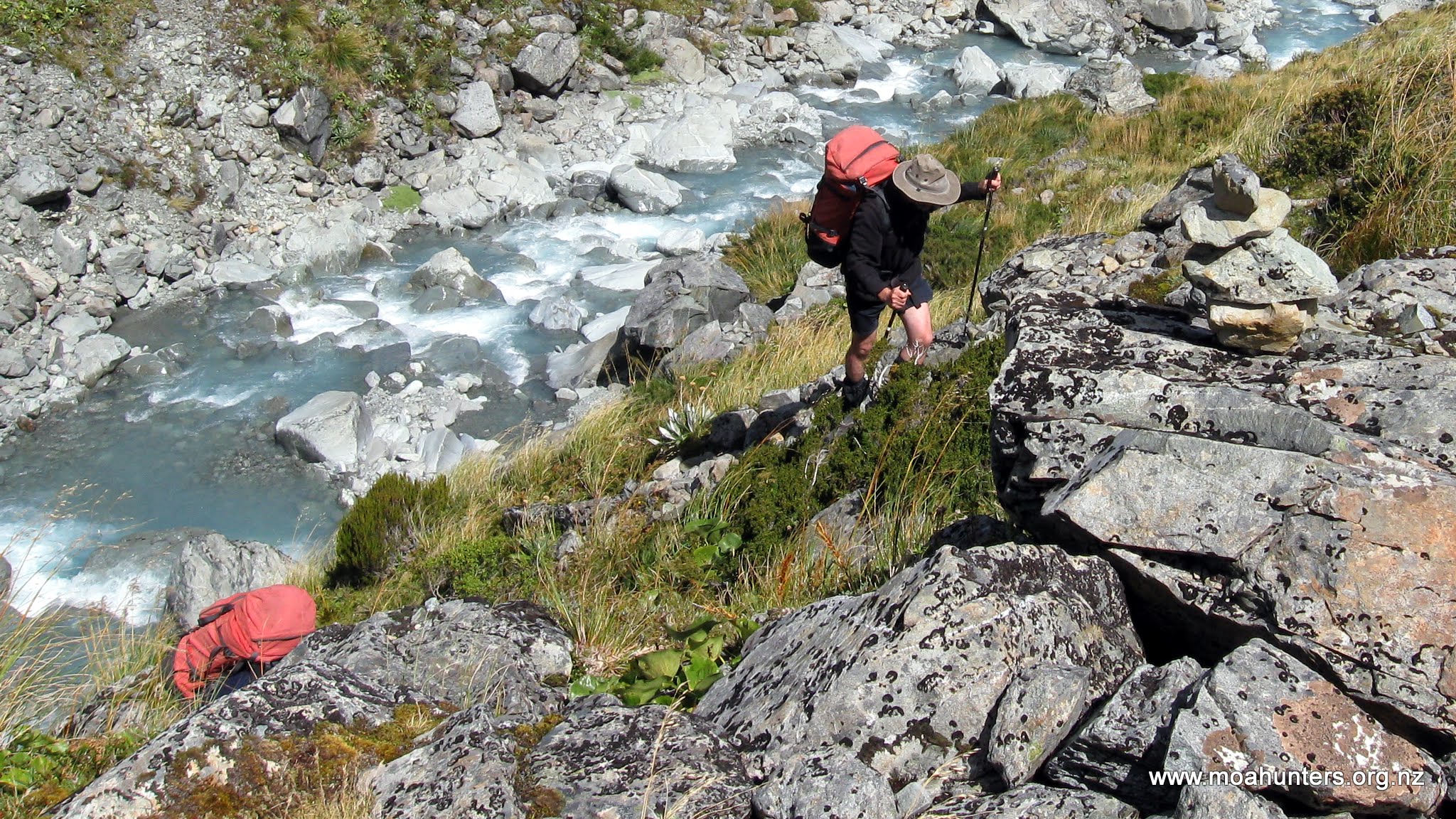
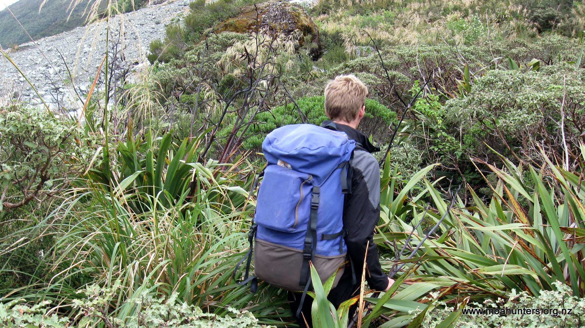
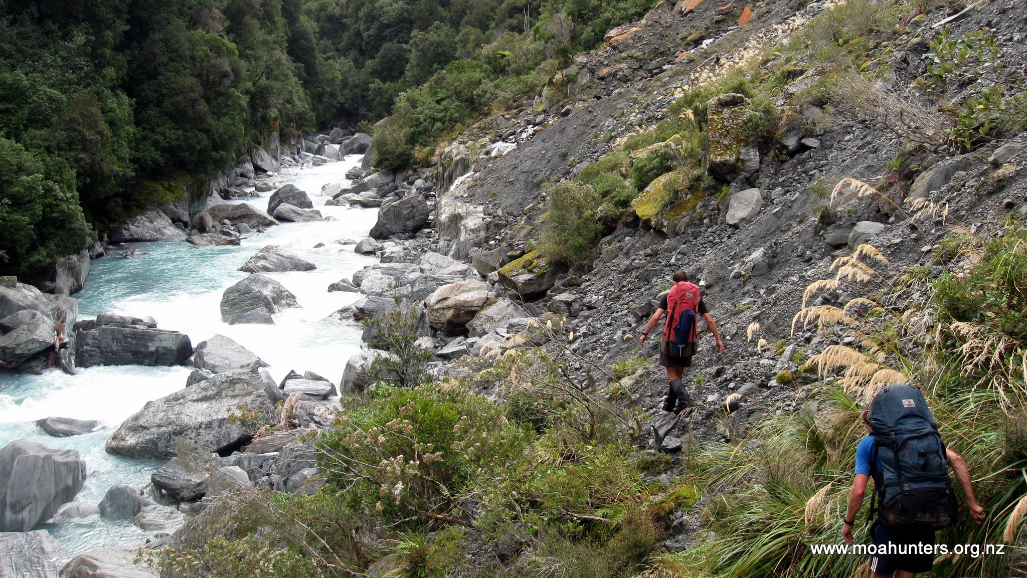
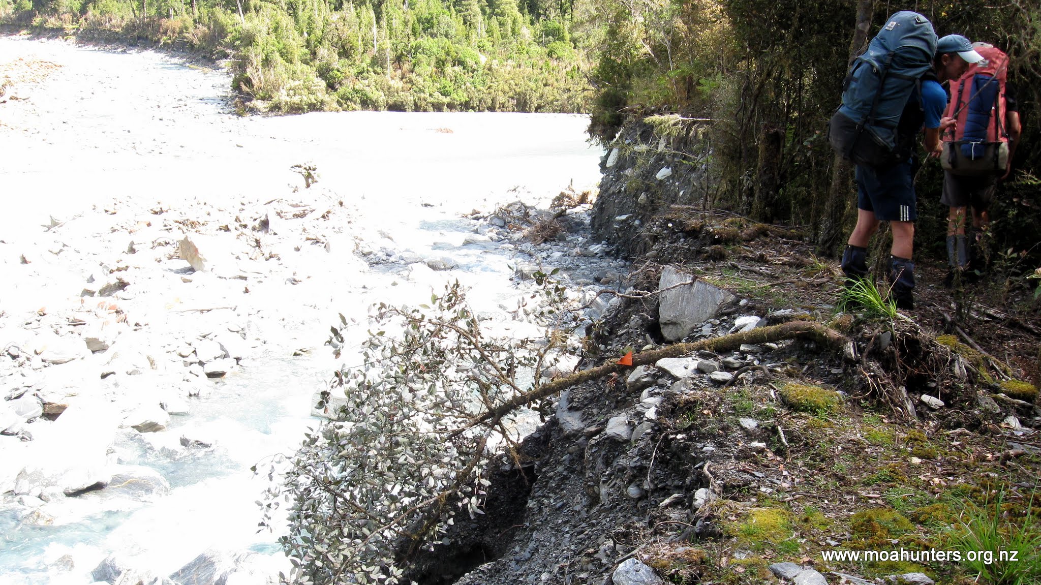
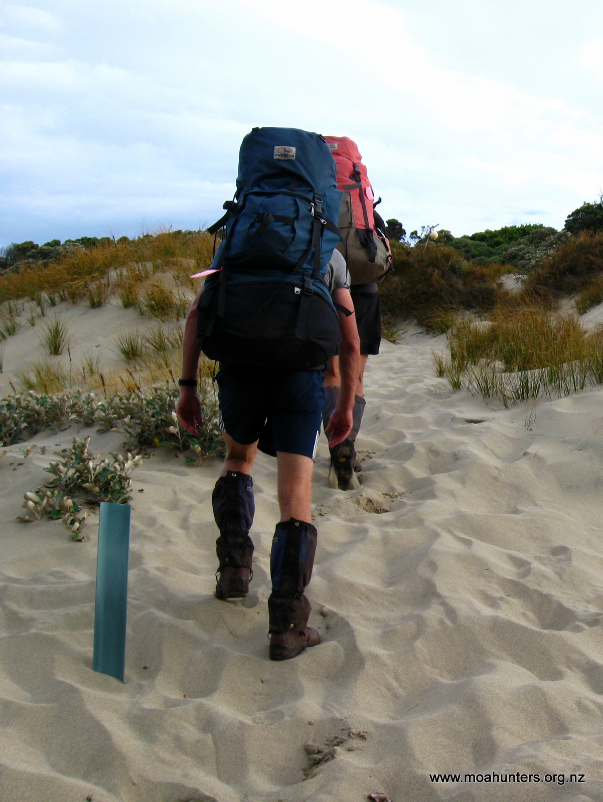
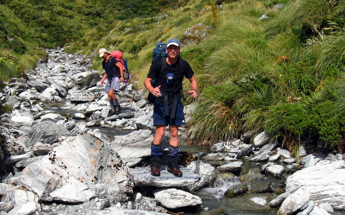
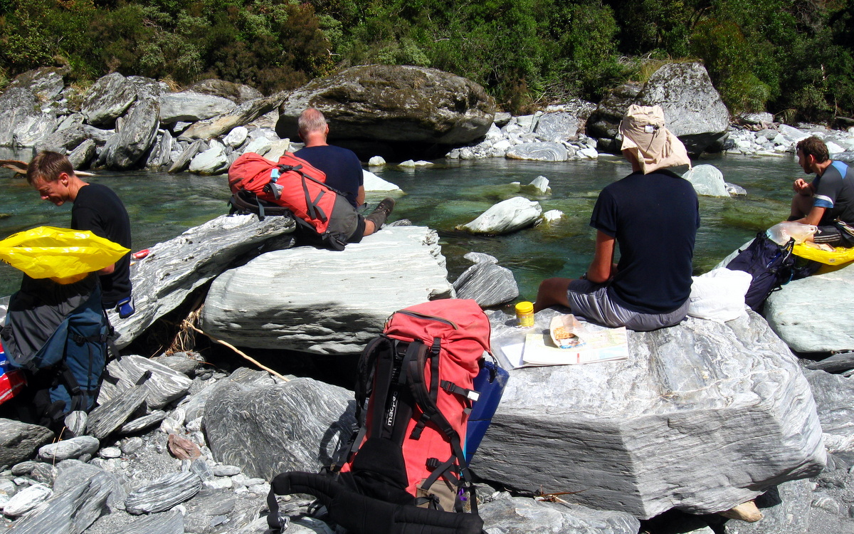
Once we had all got our gear sorted, we had an obligatory group photo, then set off in overcast, calm conditions. The track started on a scrubby river terrace across a road into Bush stream river valley, all fairly innocuous stuff. The first river crossing arrived about 40 minutes in – always the tester as it will be the deepest after recent rains. It turned out to be swift but manageably shallow, keeping the ‘tackle’ dry – thankfully!
As we were progressing up stream, the expectation was that the flow would reduce… This proved correct with relatively easy crossings for the rest of the day. The second crossing was just over an hour in. Paul’s father Alan (who had joined us for the first part of the trip) decided this was his turning point, but not before crossing for a snack! Good effort and thanks for the company, Alan. We’ll see you in four days on the far side!
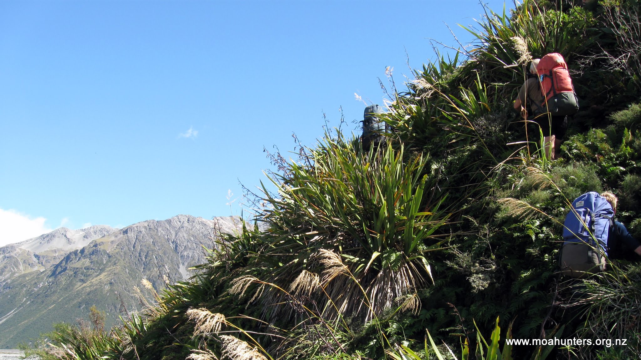
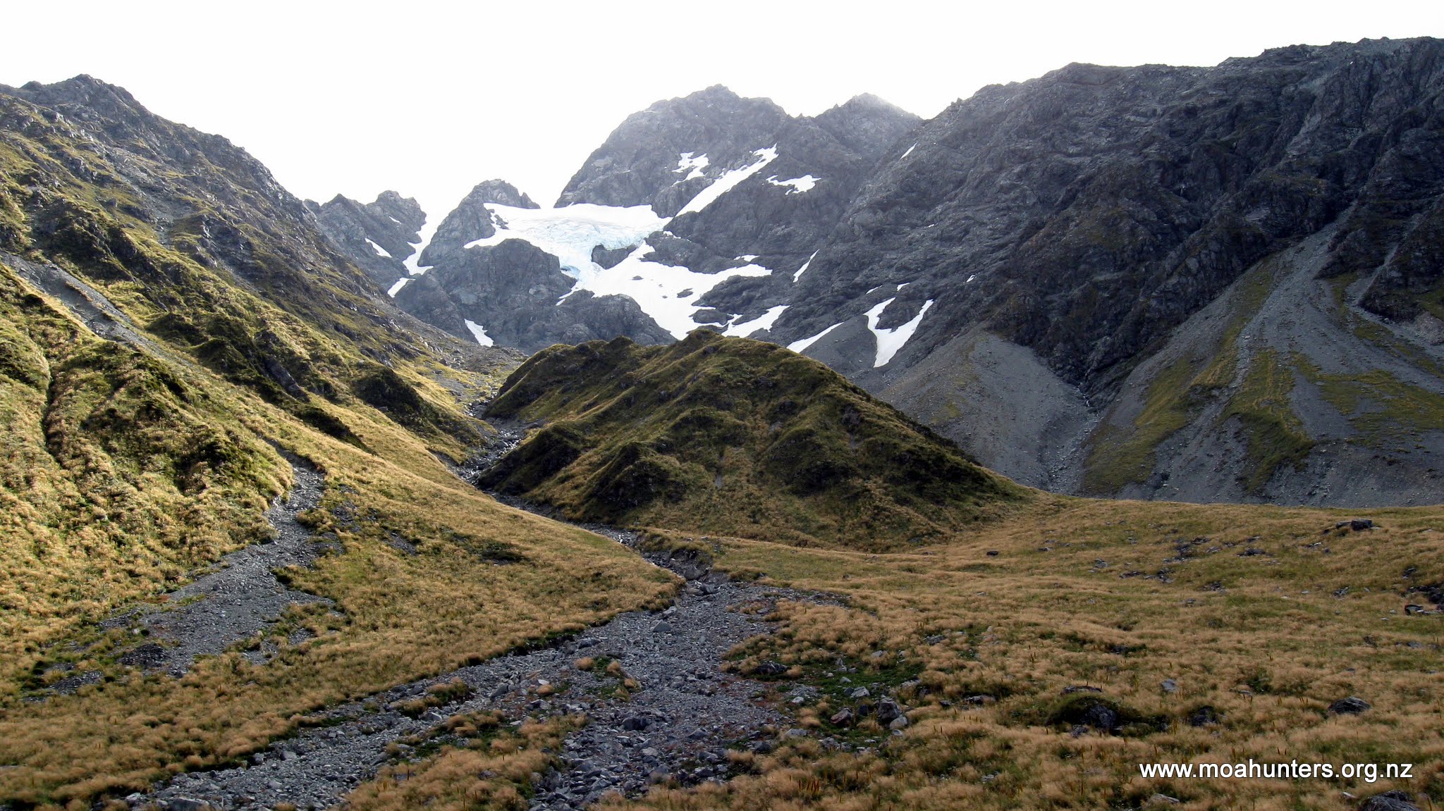
We continued on, following Bush stream until the track rose abruptly to avoid a gorge over a small saddle, in a short but well formed grunt uphill.
First grunt! Nice track…
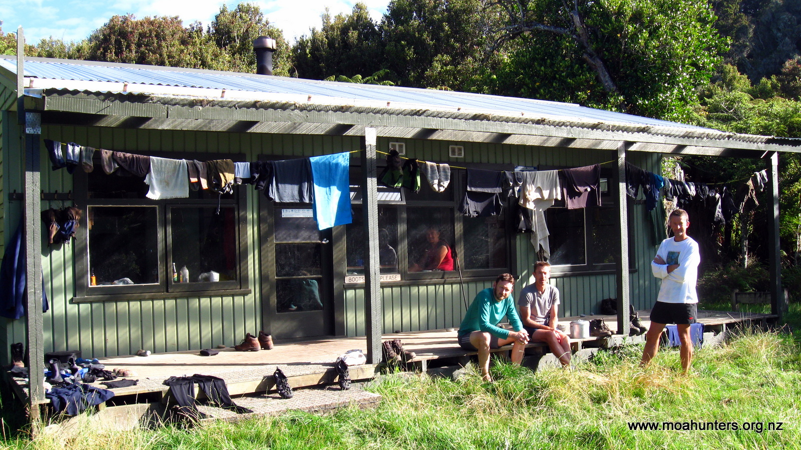
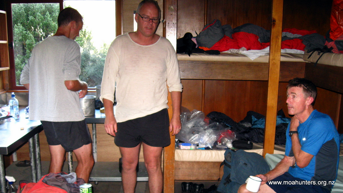
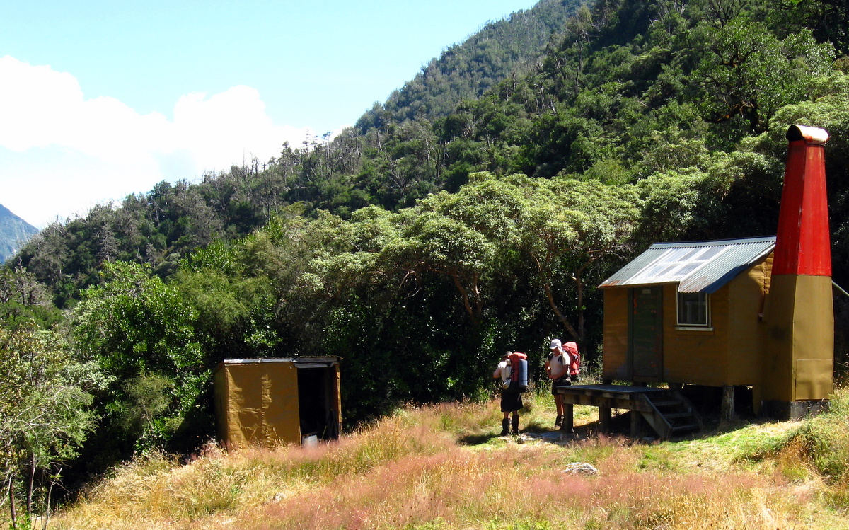
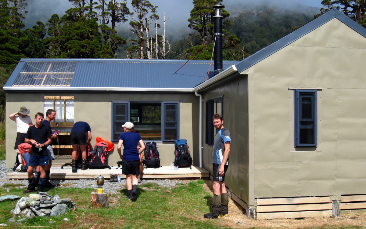
We arrived at Crooked Spur hut about 3pm, taking little over the posted 4 hours and still feeling pretty fresh. Despite the light day we all were looking forward to the traditional first up steak dinner, which Paul gladly prepared, pleased to not have to carry it any further!
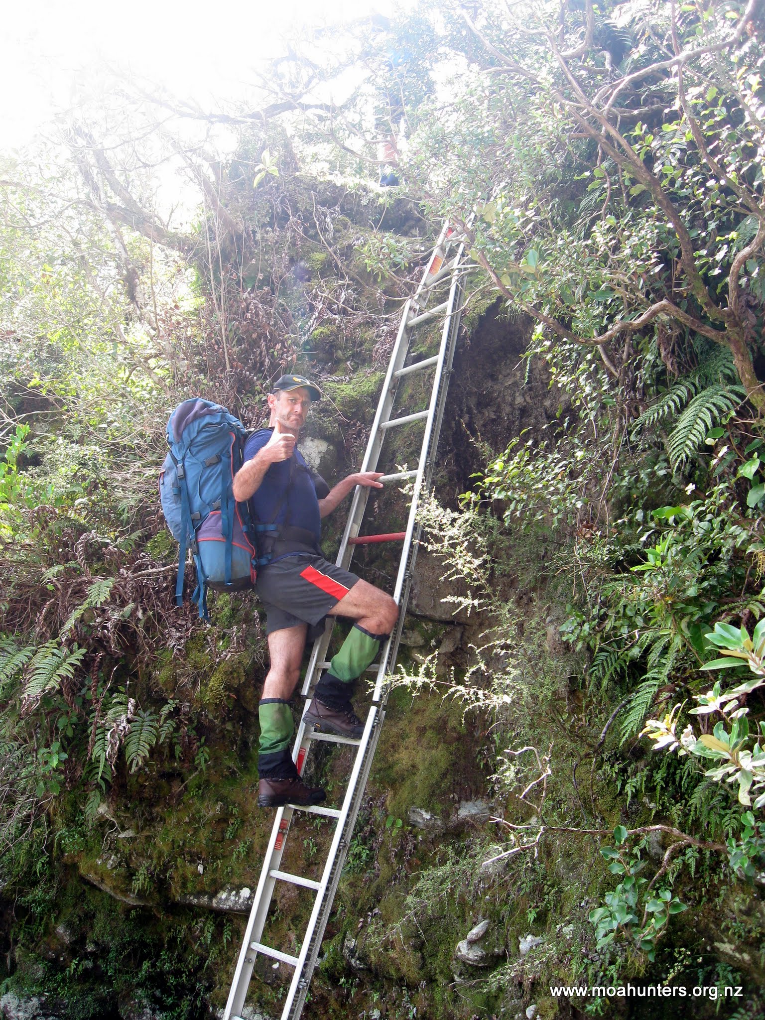
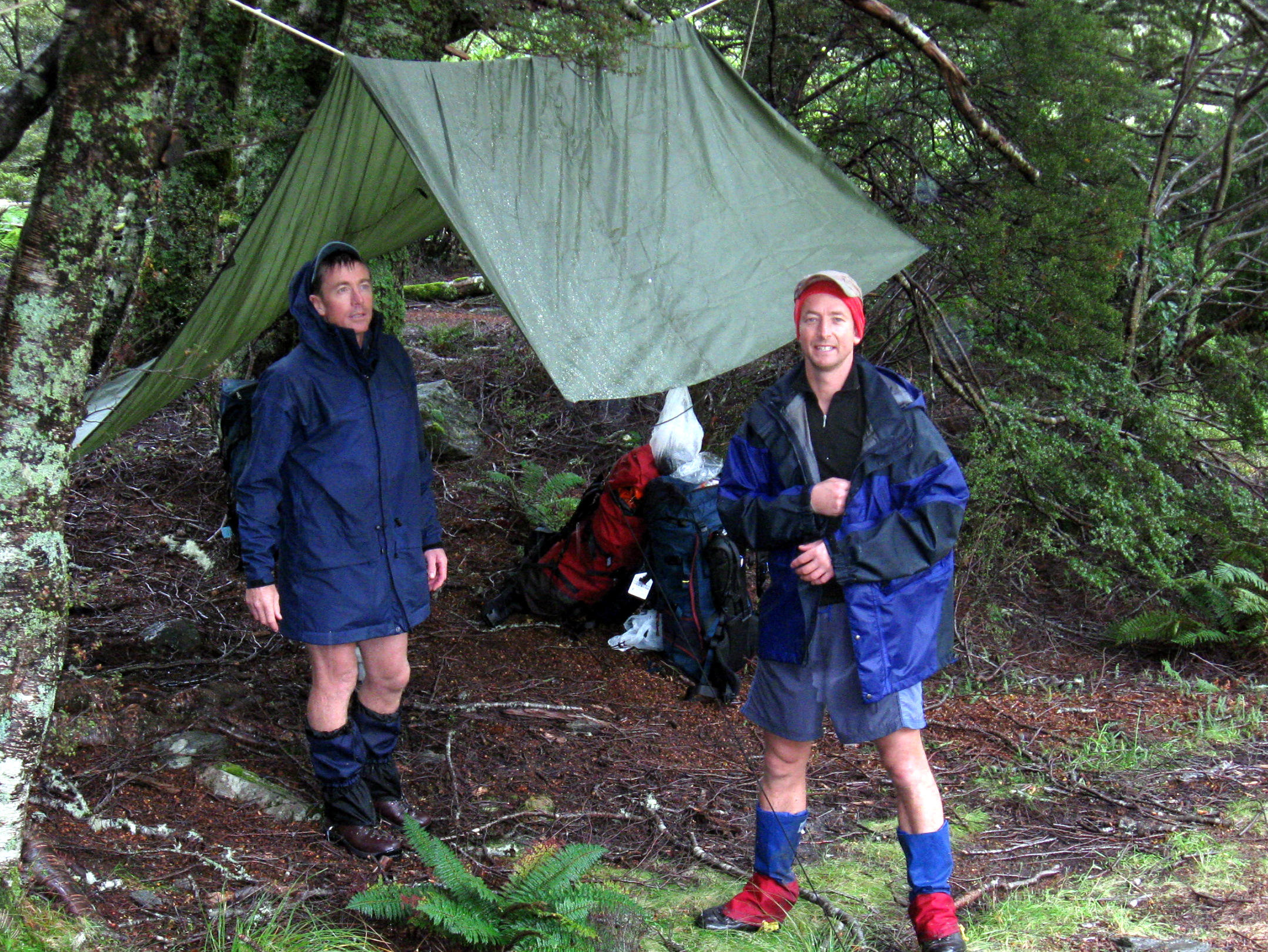
Crooked hut is a delightfully rustic musterers hut with rough-sawn timber framing seemingly being held up by the bunk frames, clad in 3rd hand corrugated iron peppered with nail holes. It is in a magic spot, with a great view down the valley through one small grimy window. The floor is a very rough concrete, and not pleasant on bare feet.
Crooked Spur Hut
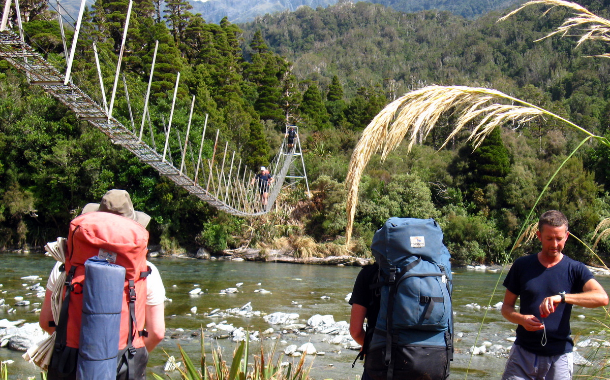
Around 4pmish, two very fast Te Araroa walkers motored into view. Blair was lucky to stop without overshooting, Marten was hot on his heels. Blair was on his 84th day on the trail, with very few rest days since departing Cape Reinga! They made Crooked Spur in 2 hours 20 minutes and weren’t sticking around. Traveling light, with poles they swore by, they looked in peak fitness. A quick yarn uncovered they had stocked up earlier that day and were heading to either Stone or Royal hut that night. We checked out their gear and setup, compared notes, discovered Blair used to travel like us, but had been transformed by the Te Araroa trail experience into a super light (or is that Ultra-light?) tramper. They had seen Alan heading back near the start, and two other trampers removing their shoes at the first crossing (rookies) when they blasted by! Without further dilly-dally, they were off, trying to beat the weather and light to Royal hut.
(I later read Blair’s account of the snow, and wonder if it was the only time they needed to turn back on their entire trip.)
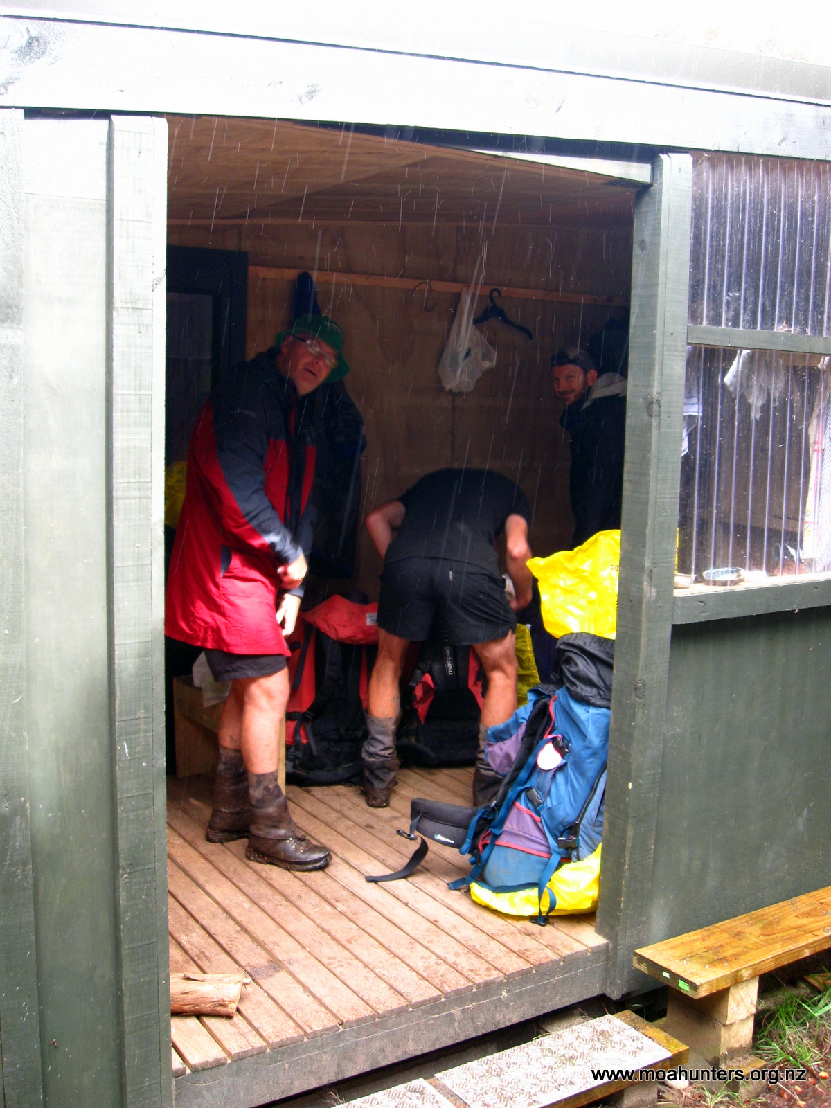
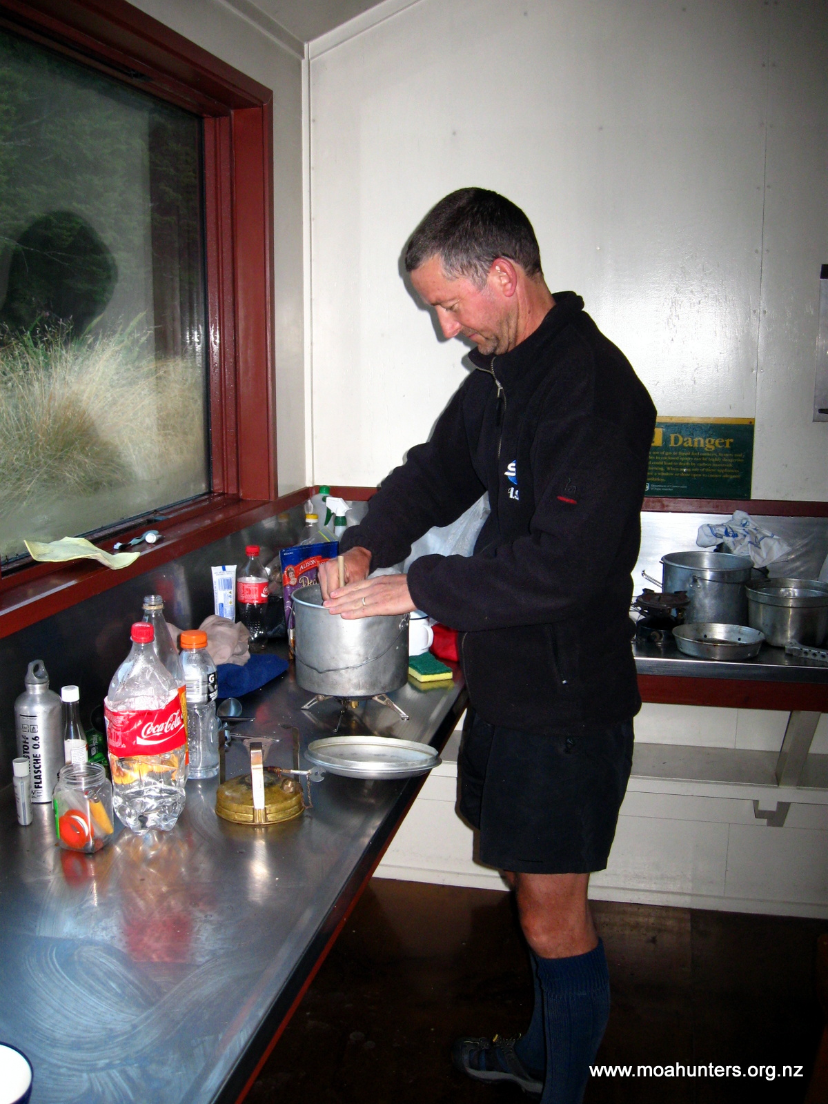
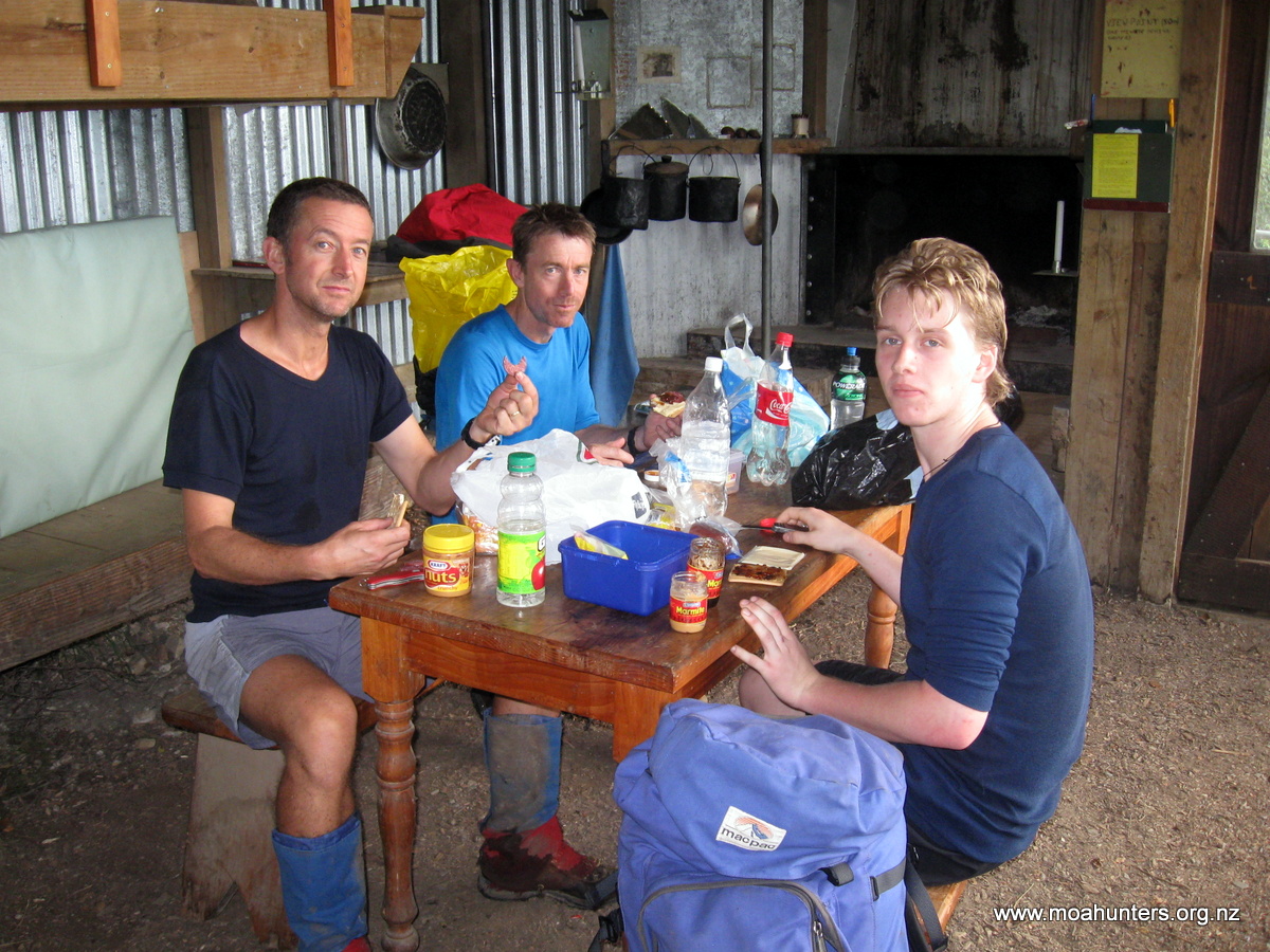
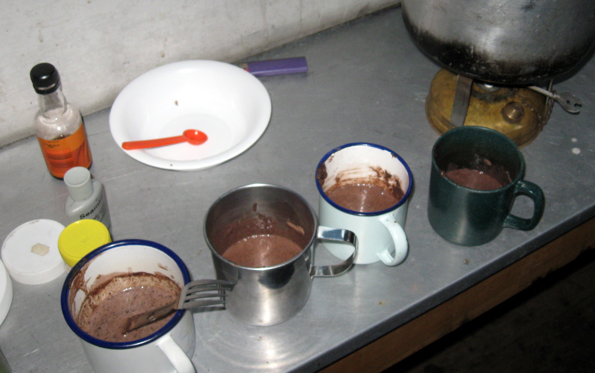
Dinner was expertly fried by Paul, and as always, was a superb warming feed, and one we were going to need if the weather forecast of snow was accurate! During the process we discovered that the white Spirits brought for fuel had a too high flash point to work on either of the cookers. Magnus spent a good 30 minutes trying to get the fuel to work in his museum piece (sorry Magnus, it was entertaining!)
Paul’s Whisperlite, with a pre-heating coil battled and produced a black sooty flame. Who are the rookies? Luckily Paul had filled up on Fuel Lite which we decided to nurse through the trip. The cooker fuel was to become a fixation for Chris who could never quite figure out how to use it!
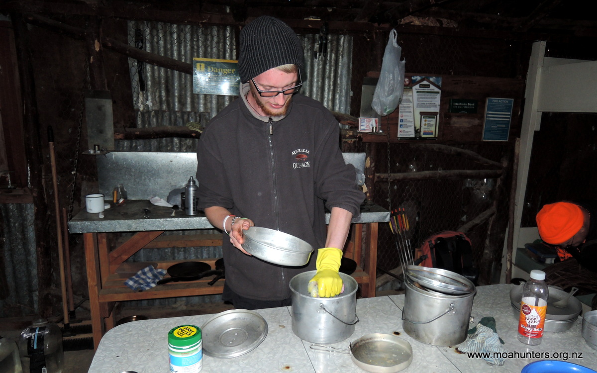
Dishes time produced “The Glove”! A trial device designed to make back-country dish washing a whole lot easier, and entertaining(!) eh Logan?
The ultra-modern glove welded by Logan with a rustic framing backdrop.
Two Belgian youngsters – Yannick and Aline appeared after dinner, just as it started to rain. They were absolute beginner trampers on holiday in NZ. Carrying a lot they didn’t need, they were a little damp, but in good spirits. They were learning a hell of a lot, and were to be our companions on and off for the next 4 days of quite frankly grotty and great weather. Welcome to tramping in New Zealand! These guys were great company and we hope the trail didn’t put them off tramping for life.
That night it poured down. The swiss-cheese iron roof of the old hut afforded us an unpleasant damp night. It wasn’t just wet, but cold too. The lack of insulation meaning we made full use of our warm sleeping bags!
Day 2
Sunday 22nd January – Crooked Spur hut to Stone hut
Dawn was cold and damp, with breath showing in the hut. A quick glance out of the window told us the snow level was not far above us. It sounded like steady heavy rain outside, but the noise can be deceiving in a tin hut. As usual Paul was first up and cranking out a billy load of porridge, which was scoffed down with liberal dollops of brown sugar, the staple start to any Moa hunt.
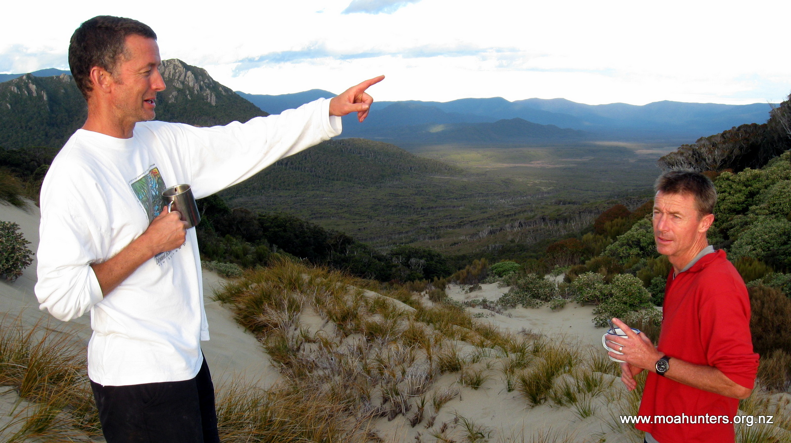
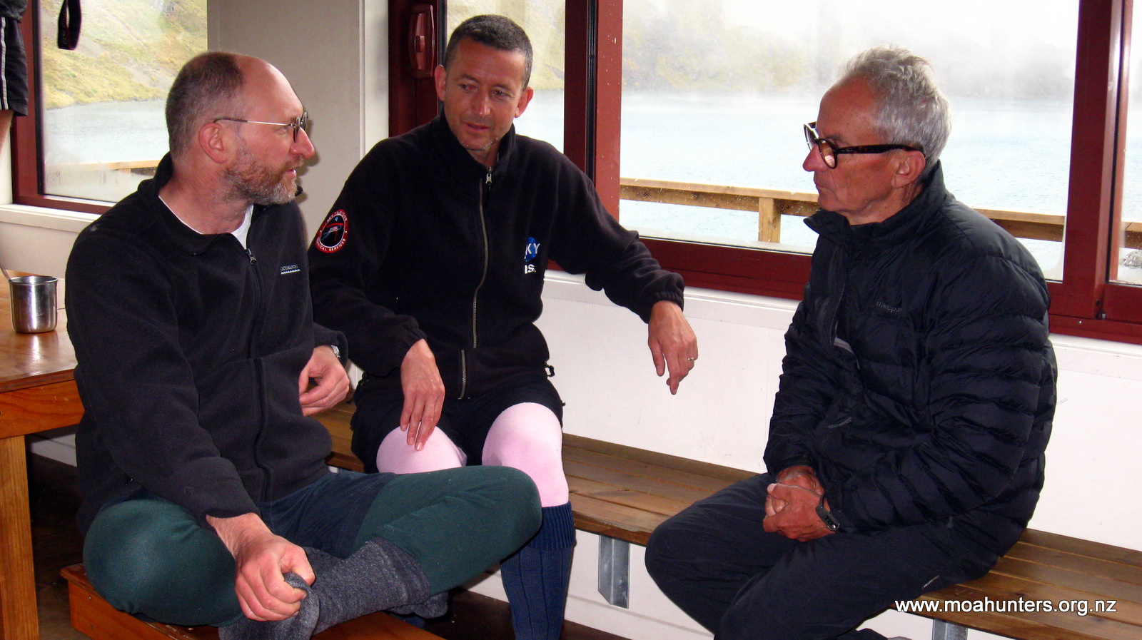
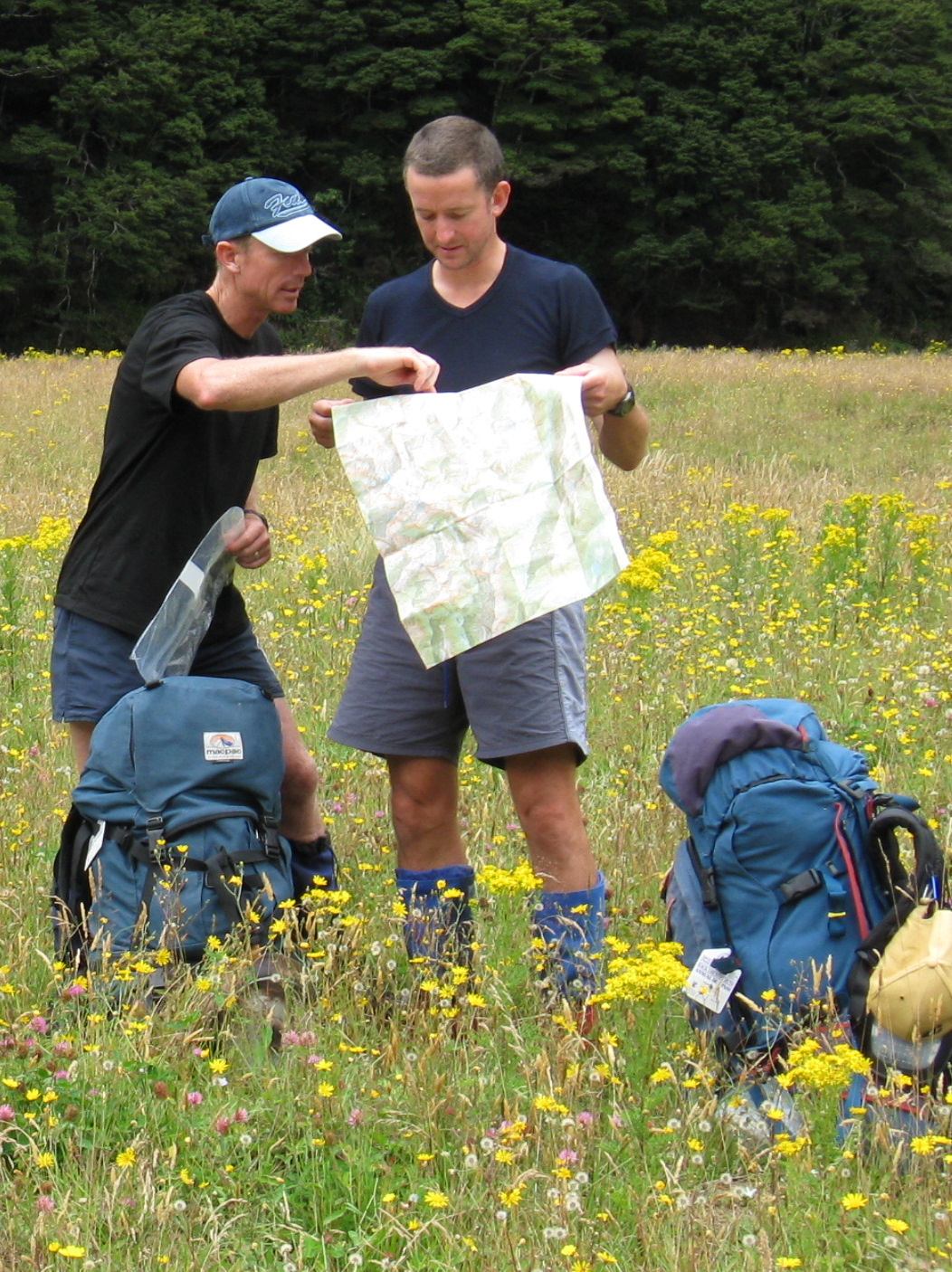
Chris and Paul discussing the plan of attack – note the dusting of snow on the hills behind.
In rather quick time we were ready to depart by 8.40am, eager to hit the trail and check out the conditions. Yannick and Aline we much less keen, only just starting to stir as we departed. Their choice turned out to be the better one…
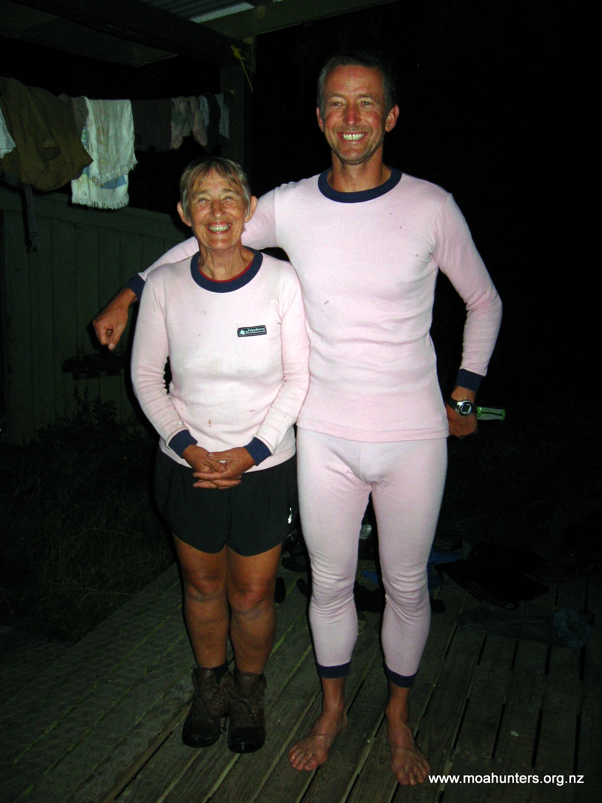
The team ready to depart, one of us is wearing no pants…
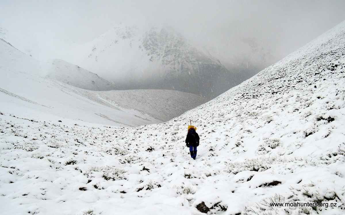
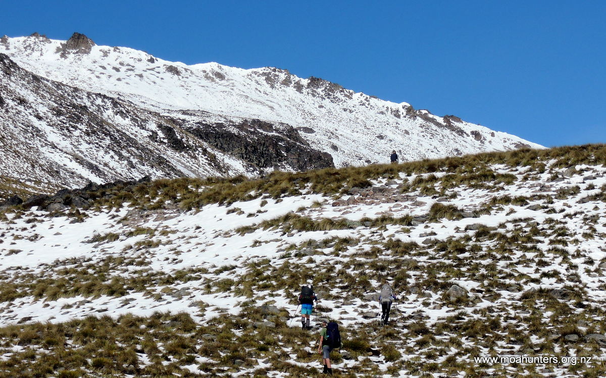
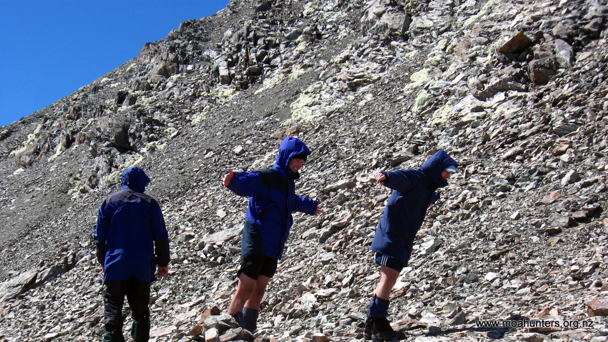
We bid farewell to Crooked Spur hut in persistent, but not heavy rain. Climbing steadily up a lovely gradient kept us warm for the next 30 minutes. Around this point the ground was becoming a little slushy, the temperature significantly colder, and the rain was getting a little harder. We decided to don some warmer gear. Twenty minutes further on, we were walking through steady snow with a good inch underfoot. We kept fairly warm on the climb, apart from wet chilled hands and feet. Those of us with wind proof gloves fared better.
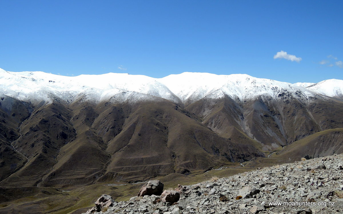
At the top we stopped briefly to get the lay of the land and snap the odd photo, but conditions were brutal and we didn’t linger. Apparently we were at 1500m in high summer – could have fooled us! Lewis was finding his choice of a light jacket less than adequate, but he has always had a high threshold for coping with cold conditions.
Paul looking toasty warm, not far from the unnamed saddle
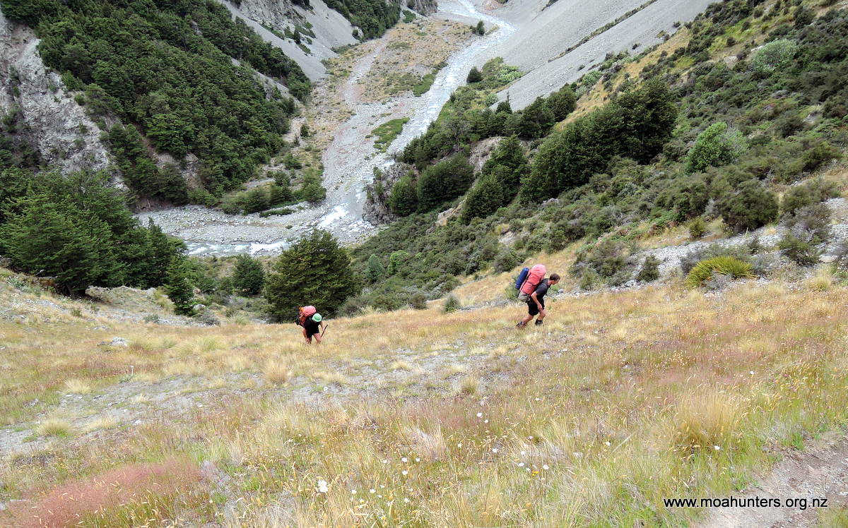
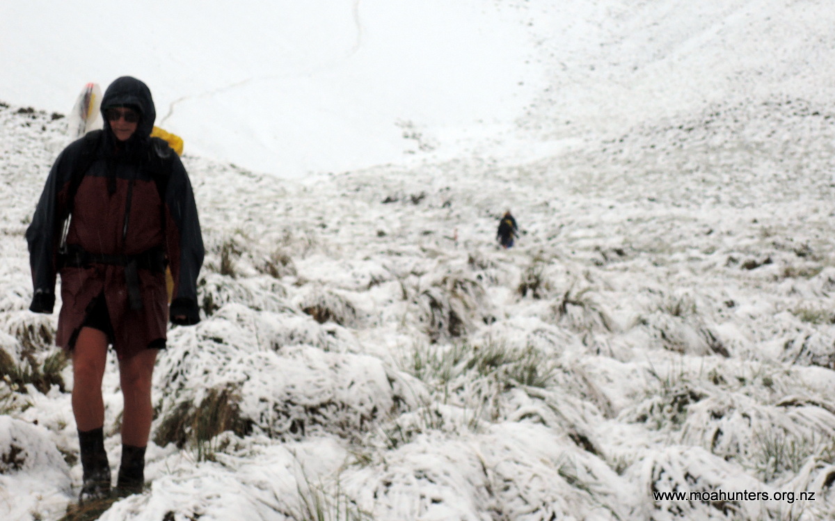
Fortunately, Chris had been on this track in better conditions and was able to point out the way forward down the right side of the valley. So, in a mixture of glissading and walking, we high-tailed it down, noting very quickly that the lack of exertion in descent was not so warming. This was especially the case for Logan. He quickly started to shiver and wasn’t keen to stick around. The lack of water-proofing in his jacket proving to be his undoing. He was also not wearing all of his warm underlayers, having chosen to keep it in his pack as a dry reserve. We persuaded him to stop, and gave him another polypropylene top to put on. For a brief moment his torso was pretty exposed to the elements, but a dry first-layer helped keep some body heat in when he was fully dressed again.
Chris proving shorts are for all seasons.
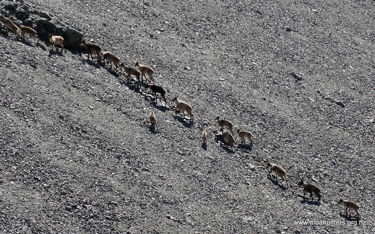
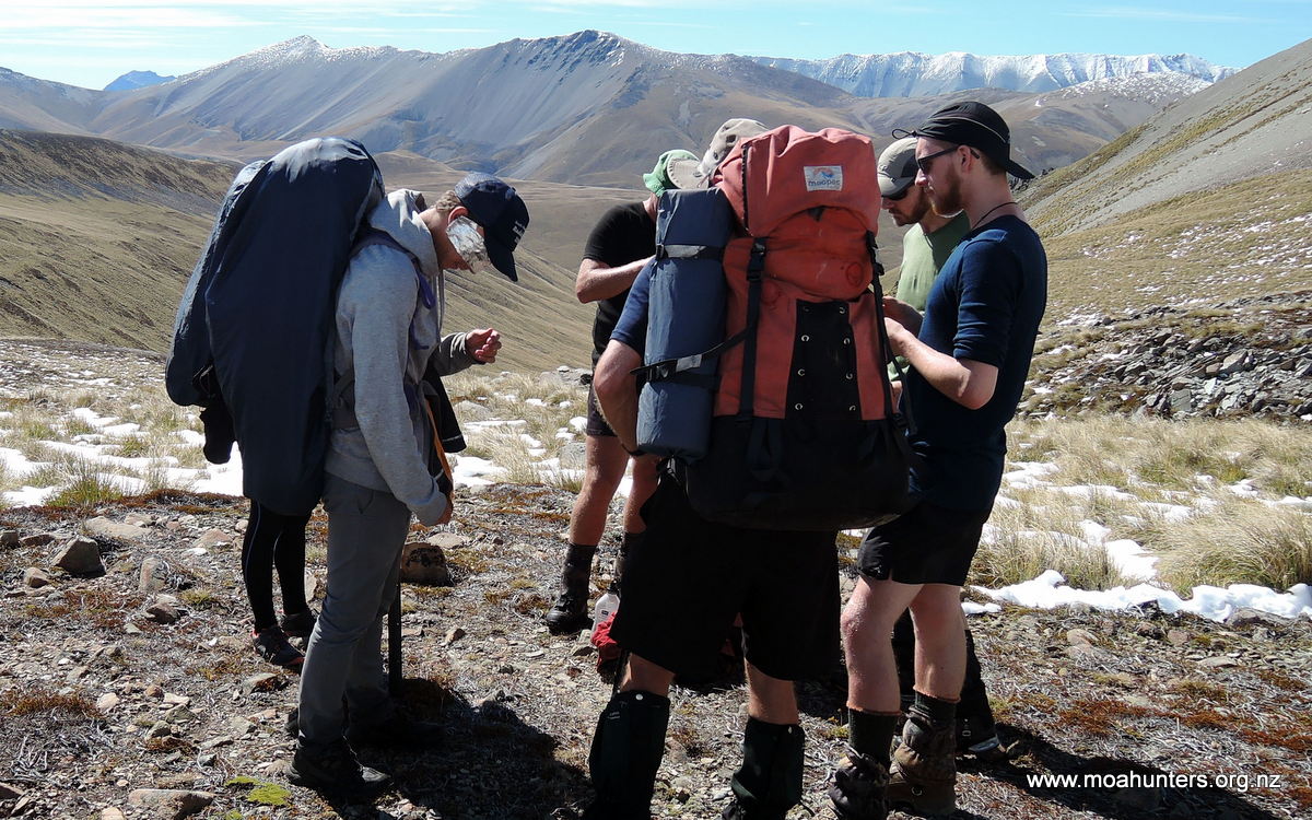
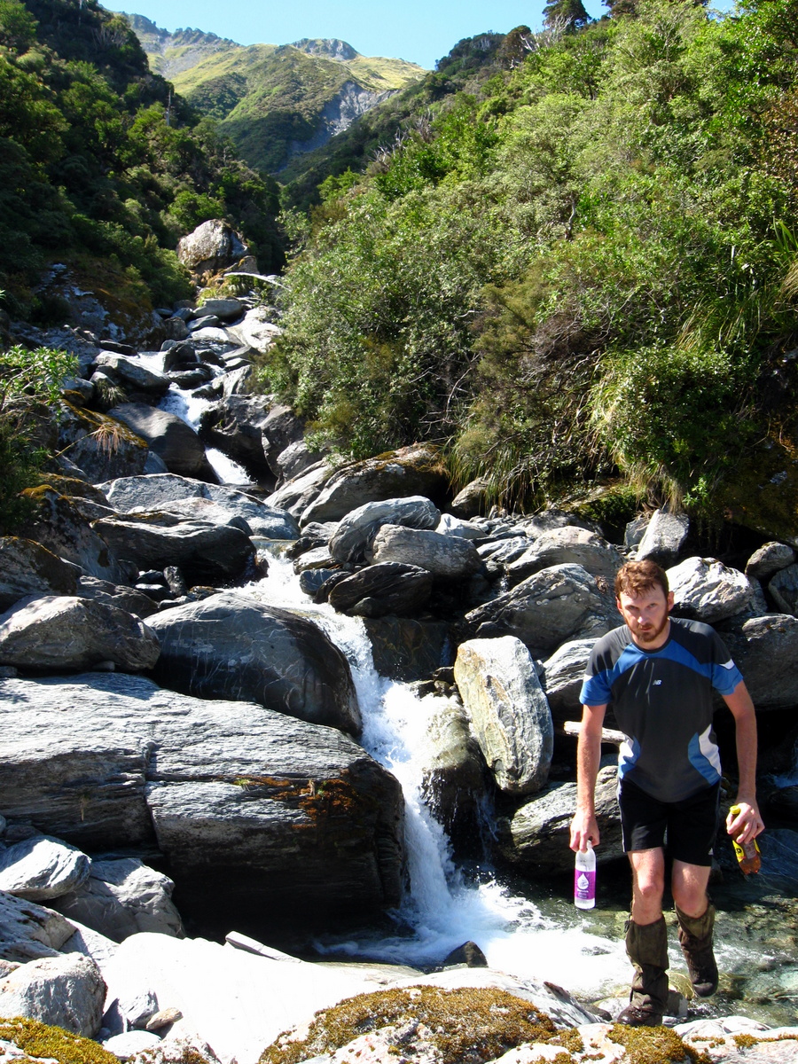
Once out of the heavy snow, we stopped briefly by the first stream crossing for a nutritious scroggin energy hit. We decided those who were cold should push on fast to keep warm and get to shelter. It was still raining hard. The next section was a steady climbing sidle to the right of another saddle. In the end Logan and Richard pressed on while the rest were distracted by the locals (Tahr) who seemed to be quite numerous. At this point Chris, who had packed his hunting bow, became fairly excited. He began planning a couple of hunting excursions immediately!
We arrived at Stone Hut about 12.30pm, just in time for lunch. Conditions had improved. It was a little breezy with the odd smatter of drizzle between welcome sunny patches. The Hut offered dilapidated but usable camp chairs for outdoor use. There were a couple of trampers enjoying the sun on these when we arrived, looking to head to Crooked Spur hut in improving conditions.
Stone hut was of a similar construction to Spur Hut, with the exception of a large stone wall on the south west end. The corrugated iron seemed only 2nd hand rather than 3rd hand, with far less holes! It featured a largely useless open fire place, and the available fuel was no more than scrub. That didn’t stop us trying to get a warming blaze going though. It was going to be a chilly night…
After lunch Paul and Chris set off on a hunting expedition that would prove to be a learning experience. The rest of us pottered about taking in the serenity and wildness of the central south. The hunters returned empty handed but with tales of seeing Tahr either too high or too far away across rivers. Plans were conceived to have another go tomorrow.
Magnus and Lewis taking in the last of the summer wine.
By 6pm the snow had gone from the pass and our Belgian friends had arrived, having had a better time crossing the saddle than us.
Another option for using the stubborn white spirits –blackening Billies!
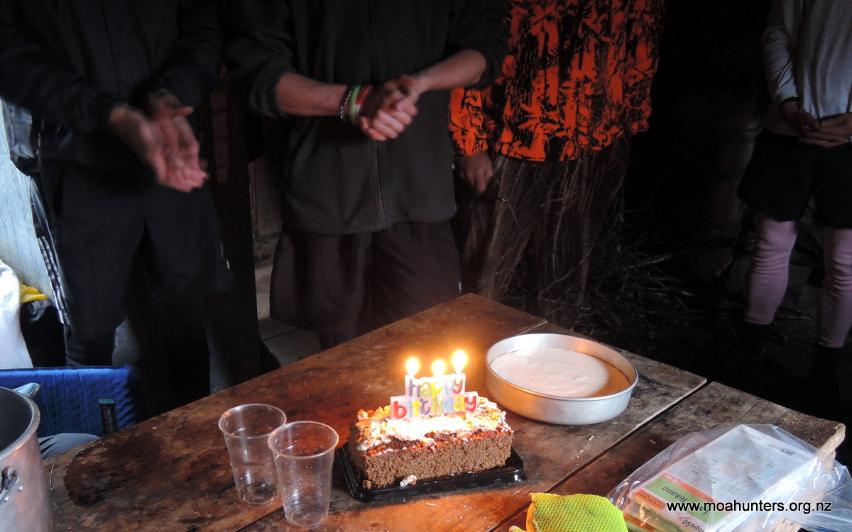
Patience (or tardiness) had paid off. Dinner at Stone hut was a magnificent affair featuring fabulous nachos incorporating home-made dehydrated beans, full of flavour. The sour cream was a little dodgy, but overall, the meal was judged a great success…
Surprise!! Happy 50th, Richard.
A big surprise was the second dessert (always a good thing) of birthday cake complete with candles! You only turn fifty once, Richard!!
We cranked up the fire, which did a good job of drawing cool air into the hut for the hour it was burning! It gave off little heat but provided some entertainment, in a black-humour sort of way. We all hit the sack once the entertainment had subsided to embers. With all the bunks full and two on the floor, any night movement was tricky.
Day 3
Sunday 23rd January – Stone hut to Royal hut
Dawn broke after a windy and wet night, but temperatures had risen meaning no more snow. Today was the short day with only two hours walking to Royal Hut. The plan first thing was for Chris to venture down Bush stream on the true right, using his learnings from the previous day to bag us some dinner with his bow! The rest of us big stompy footed noisy trampers agreed to move in the opposite direction, meandering up the nearest gentle slope in search of snow and a good view. The weather was cool but clearing for what looked like a great day.
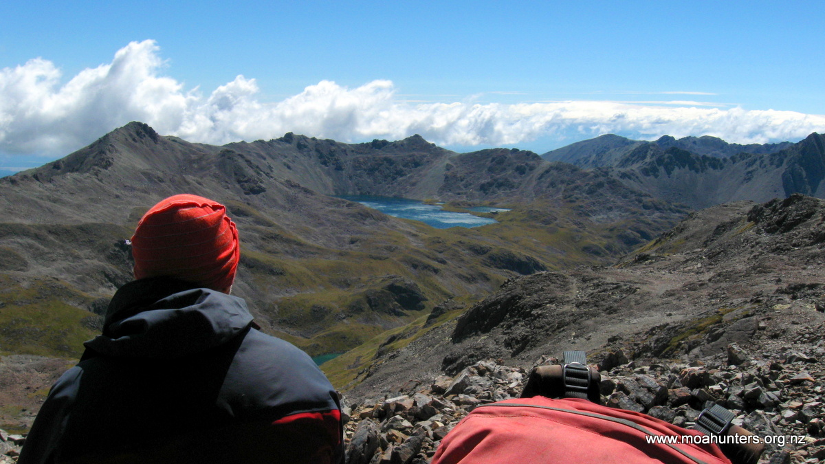
Stunning conditions…
Some of the locals…
On the climb we counted 24 Tahr moving up scree, obviously expecting improving weather. They were too far away for bow hunting, the only shots taken were with cameras. We made the top of the lump we were climbing in now fairly blustery conditions. Magnus’s well-loved hat got caught in a gust and vanished over the side at a fair rate of knots. Paul, forever the innovator, immediately setup a direction indicator so we knew which way to search.
What a view – Stone hut way down below by the stream.
We took off in the direction the hat had vanished, discussing the rather slim possibility of finding a stone coloured hat on a mountain of stones! The search proved a long one with us losing the direction because of the steepness of the slope and the swirling nature of the wind in the hills. Some of the scree proved to be quite a lot of fun, with frequent stops to scan for the hat. Having given up of reuniting Magnus with his hat, it miraculously appeared on the edge of the scree at least one kilometre away from where it had first taken flight. Magnus’s sharp eyes picking it out!
Magnus on right with Hat – well chuffed!
The remaining descent was uneventful, but the spectacular scenery made for an enjoyable walk. We arrived back at Stone not long before Chris, having not been able to spot him on the other side of the valley. He found Tahr. Unfortunately they also found him. Chris had fired an arrow in their direction, but had to settle with hitting the rock beside one. After a spectacularly sunny lunch at Stone hut we assembled our gear from all points of the hut, posed for a photo and left for Royal Hut.
Well posed, beautiful close-up of the grass.
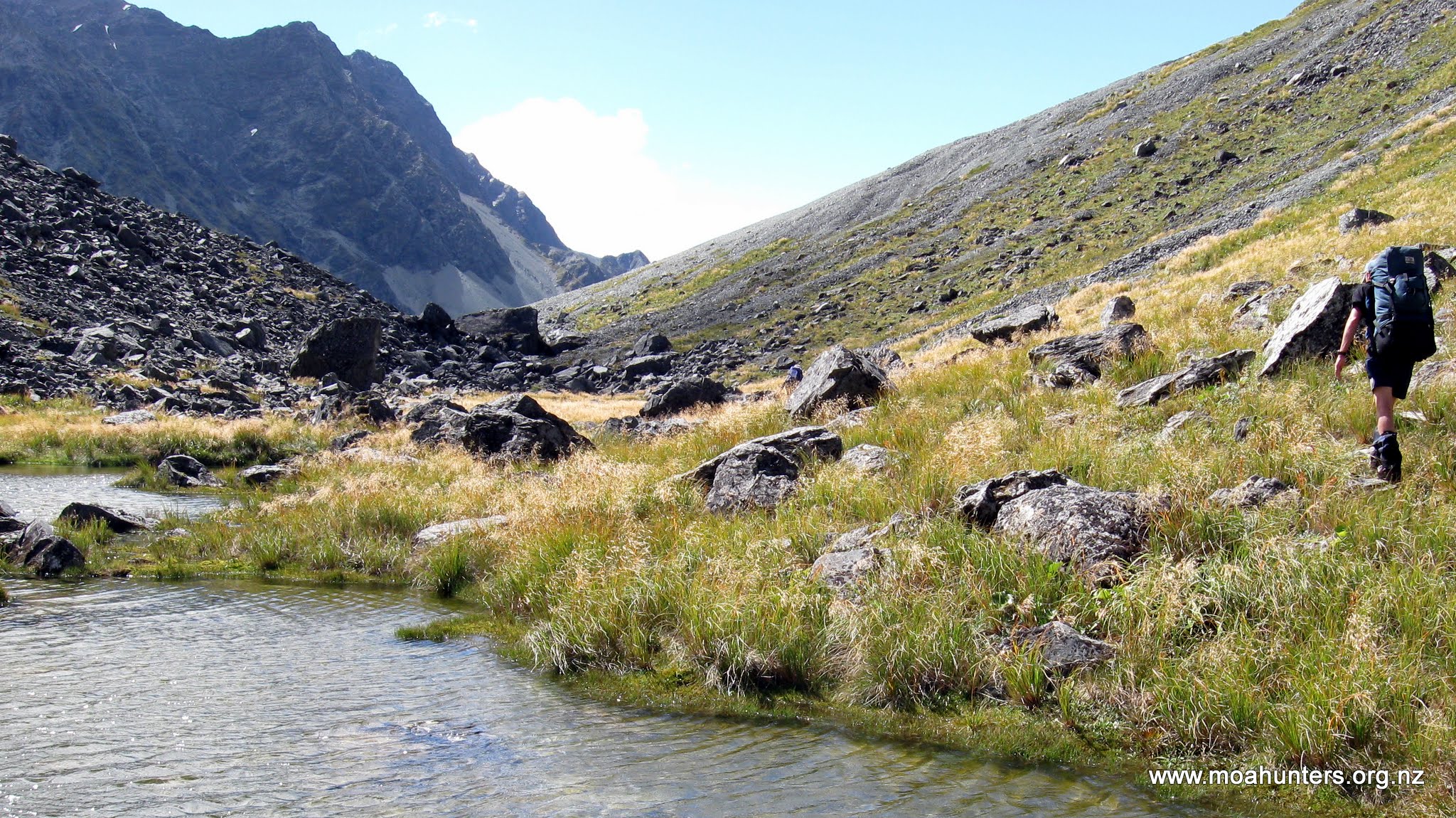
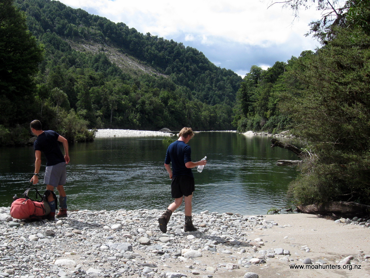
With sun block and hats slapped on, we set off, steeling ourselves for the first chilly stream crossing. After a few minutes of debate we decided to sidle around on the true right of the stream. It was a bit of a clamber but certainly the dryer and safer option! This turned out to look like a well-trodden route and relatively easy. We did venture into the water briefly, but no further than a metre from the bank. Doing this missed two crossings and the higher we got the less flow there was in the ever present Bush steam. Logan seemed the only one disappointed as he continued to carry a large wooden pole for the purpose of propping against in fast water.
Lewis taking a close look at the river.
When we finally got to the point making a crossing was unavoidable, we were actually rather keen for a dip as it was now quite warm. The stream was still swift and around high thigh deep, made more difficult by the large slippery boulders. Richard, Paul and Logan were the first there and linked up to get across. Paul couldn’t understand our difficulties on foot placement until he realised he has polarised sunglasses making the water far more transparent. Note to self – get some! Chris, Lewis and Magnus soon followed with Lewis taking an unplanned refreshing dip.
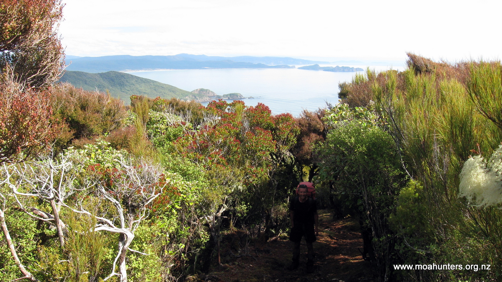
From there the track became quite well formed on the true left of Bush stream and was a pleasant amble. For a while we watched a Tahr family higher up on the other side of the stream. They were moving slowly in the same direction as us and were really hard to spot amongst the grass. Eventually we re-crossed Bush stream, now a much smaller version of its former self.
Easy walking.
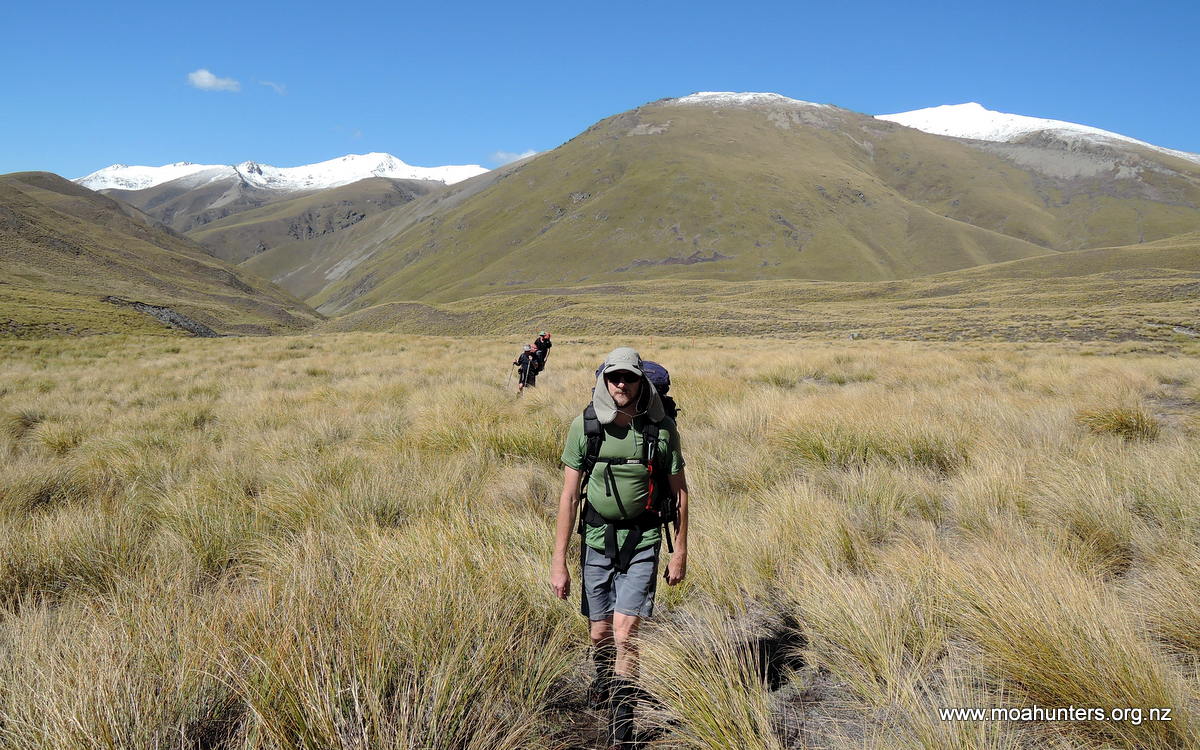
We then came to Forest Creek track and turned right to stroll up to Royal Hut in a very open valley with a flat base. This was high country now, with snow on the tops it seemed like late winter early spring, not mid–summer! The scenery seemed to get more spectacular, helped by the superb weather conditions.
As Royal hut came into view it looked like there was a party going on! We knew Yannick and Aline were ahead of us but there seemed quite a crowd sitting out in the sun. As we got closer the numbers reduced as we realised some of what we thought were people were in fact, packs. But there was a great get together, fellow walkers being full of chat about their experiences of Te Araroa and the various obstacles, highs and lows. We sat down for a good chin wag, getting the tourist point of view, and giving our local take on the experience.
Lewis enjoying the scenery.
A party going on!
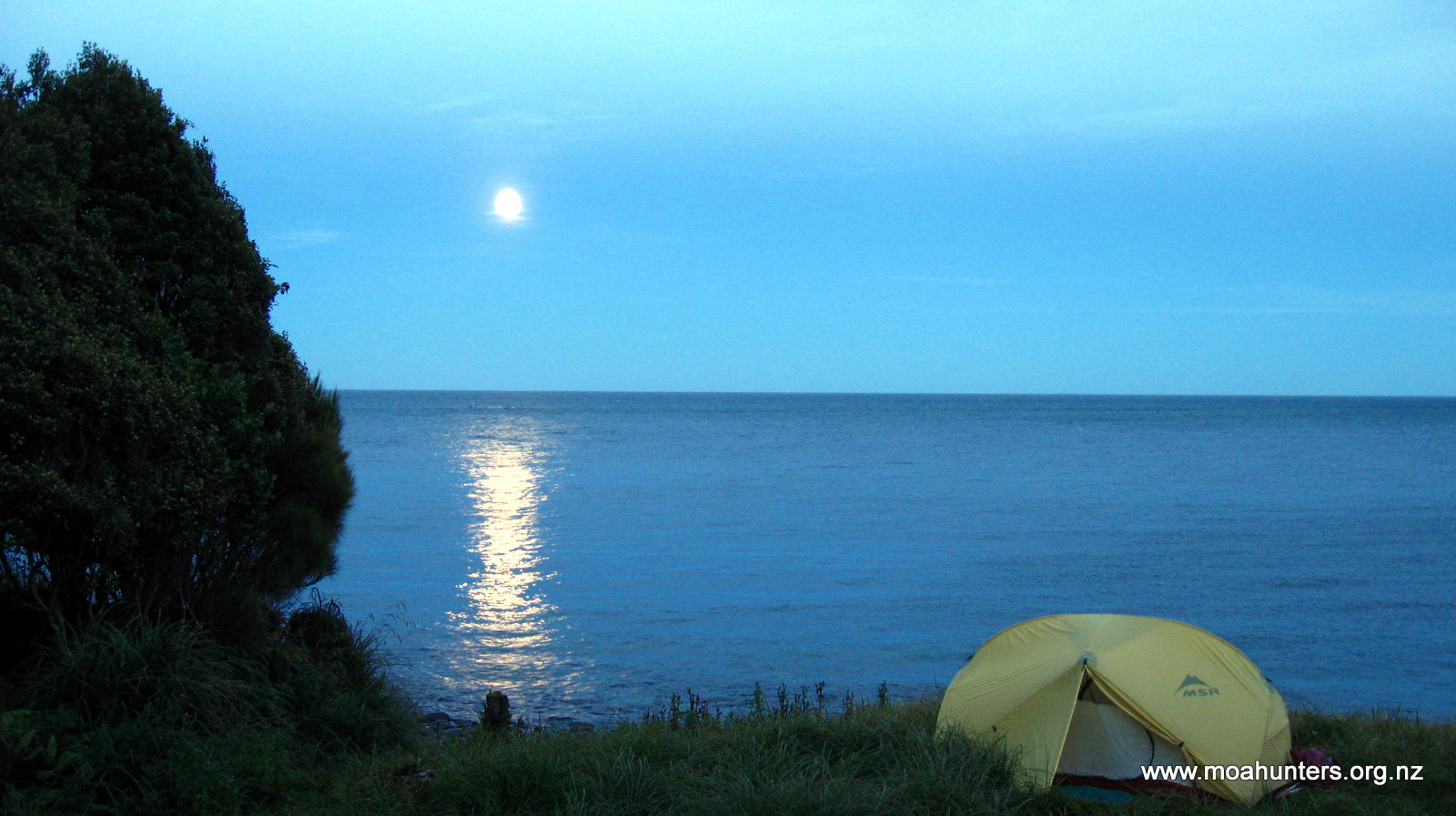
A couple of the most amiable people we have met were Matt and Jo who were well through their Te Araroa trip and were loving it at day 6o something! All had learned along the way and refined their kit to be efficient and very fit walkers. They certainly made good pace as we were to find out. Royal hut is situated in a very pleasant river valley devoid of trees, which just serves to enhance the stark beauty of the spot. The sunset was spectacular with a few trying to get some shots – here’s my take with a sunglass filter!
Sun Ray(Ban)s…
The evening saw us retreat into the hut and the party followed. There were two tramping chaps unable to move due to snow blindness. They had been bunked up all day waiting for it to subside, which it did, but not before significant headaches and very little vision. One had tried to move off in the morning but found it impossible to see the track. This was a warning to us to use our sunglasses on the pass, which we all luckily carried. Yannick did not have any but Chris offered an ingenious solution……. Again the dinner formed the entertainment and conversation!
Ambrosia – Fab food.
After a jolly evening, we folded ourselves into the 8 bunk hut with some difficulty… Four on the floor with Matt and Jo topping and tailing, content with having experienced an enjoyable, easy day of variety and scenery.
Day 4
Monday 24th January – Royal hut to Rex Simpson hut
A Royal Hut with light frost and a Central Otago feel!
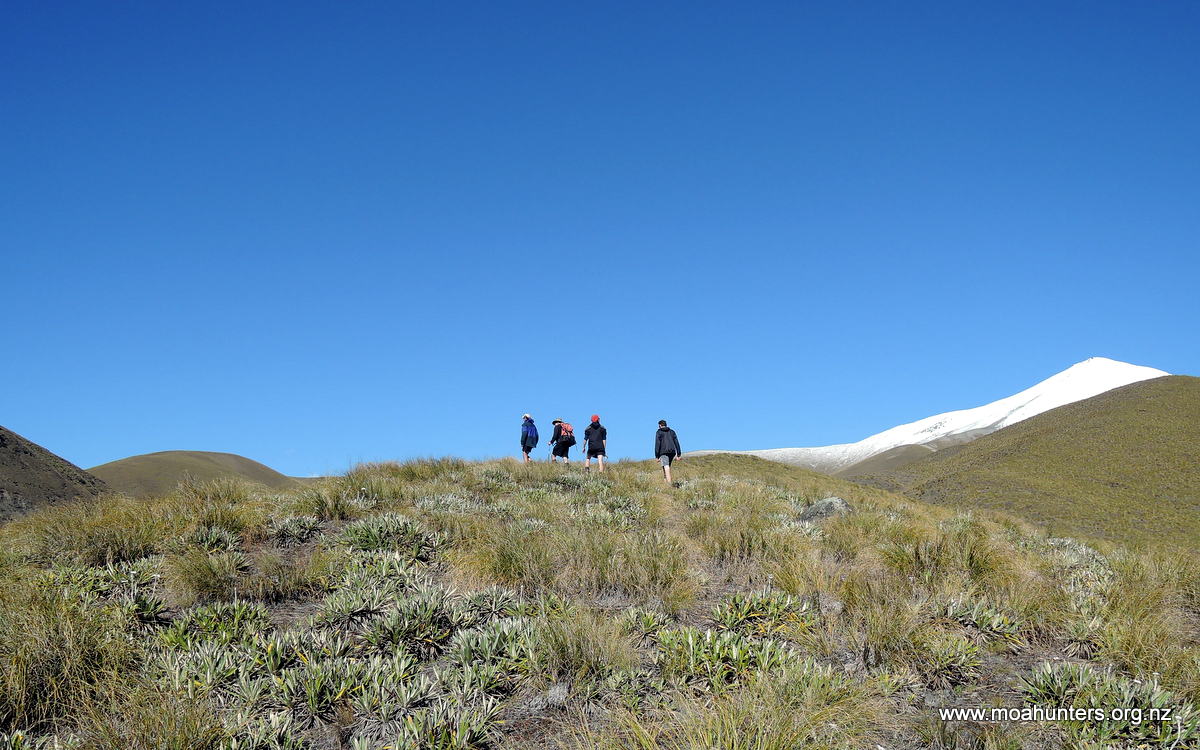
We woke to a late January, mid-summer frost! The unexpectedness of the temperature helped to highlight the snowy mountain tops and general scenery. A bowl of steaming porridge put us in great shape to tackle Stag pass. There was much chatter as we got our stuff assembled and took the obligatory photos.
Team photo – note the last remaining mushroom and sunnies.
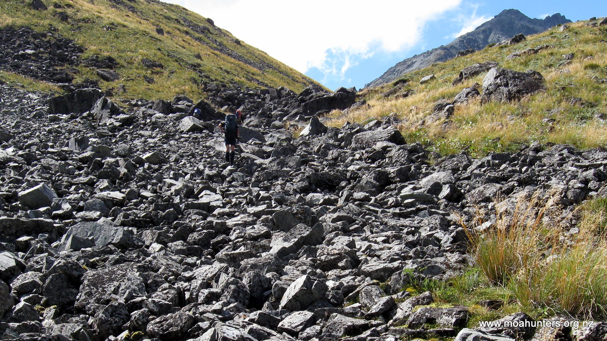
Yannick and Aline were first out the door, we weren’t far behind intending to catch them before making it into the snow. The first task was crossing Bush stream for a final time before heading up a side valley. The track was a steady climb following a stream that was crossed with regularity. Before long we had warmed to our task. Matt and Jo caught us at our first scroggin break.
The start of the real climb to Stag Saddle!
They were cruising effortlessly up the climb, showing off the conditioning they had built over their many weeks on the Te Araroa trail. Not to be outdone, we Moa hunters tagged along making conversation like it was easy! Lucky there was 6 of us so we could rotate the talk while others got their breath back.
Before long the track left the stream to ascend the left side of the valley, initially quite steeply, before settling back into a steady climb. After about 45 minutes we caught Yannick and Aline on a plateau amongst scattered snow, stunning views and wispy cloud. We stopped to make and don sunglasses.
Yannick donning Chris’s inventive “back to the future” pinhole sunnies!
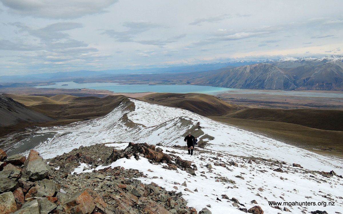
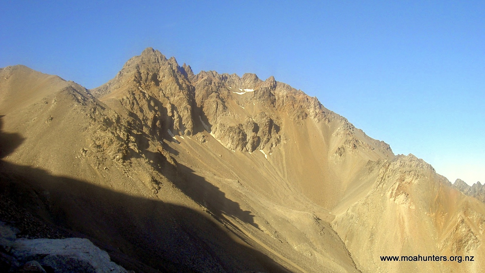
From here the steady climb continued, following a snowy boot channel track to the highest point of the Te Araroa trail, Stag Saddle. The abrupt view from the top was breathtaking, with a sweeping vista of nearly all of Lake Tekapo. There was a small DOC sign on the saddle proclaiming it to be at 1925m.
A happy bunch at the top – mostly downhill from here.
It was fairly breezy on the saddle, the view only spoiled by an annoying ridge to the North West hiding what had to be a view of Mount Cook! After a quick lunch we traversed to the ridge to find the promised view and what looked like an easier ramble down to the hut for the night. On reaching the ridge, sure enough Mt Cook was there to see, plus other outstanding snow covered peaks.
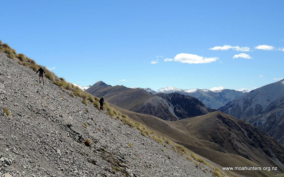
Looking up the ridge, Beuzenberg Peak beckoned… in fact it demanded to be climbed! So we ambled up to the 2066m peak and took in the 360deg views from Tekapo through to the headwaters and the mountains beyond. We lingered for a time on the peak not wanting to leave such a magical spot. Logan planted his walking pole into the pile of rocks on the peak which looked a fitting place. But when the time came to leave he took it with him, the attachment too great to leave behind. The descent was very straight forward, follow the ridge all the way down on a constant decline. The trail seemed well trodden and clean, with the perspective of the view morphing as we descended. We caught up with Matt & Jo, Yannick & Aline about half way down the ridge towards Rex Simpson hut.
Magnus nearly at the top struggling with the view.
Hello Mt Cook!
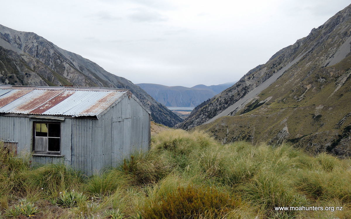
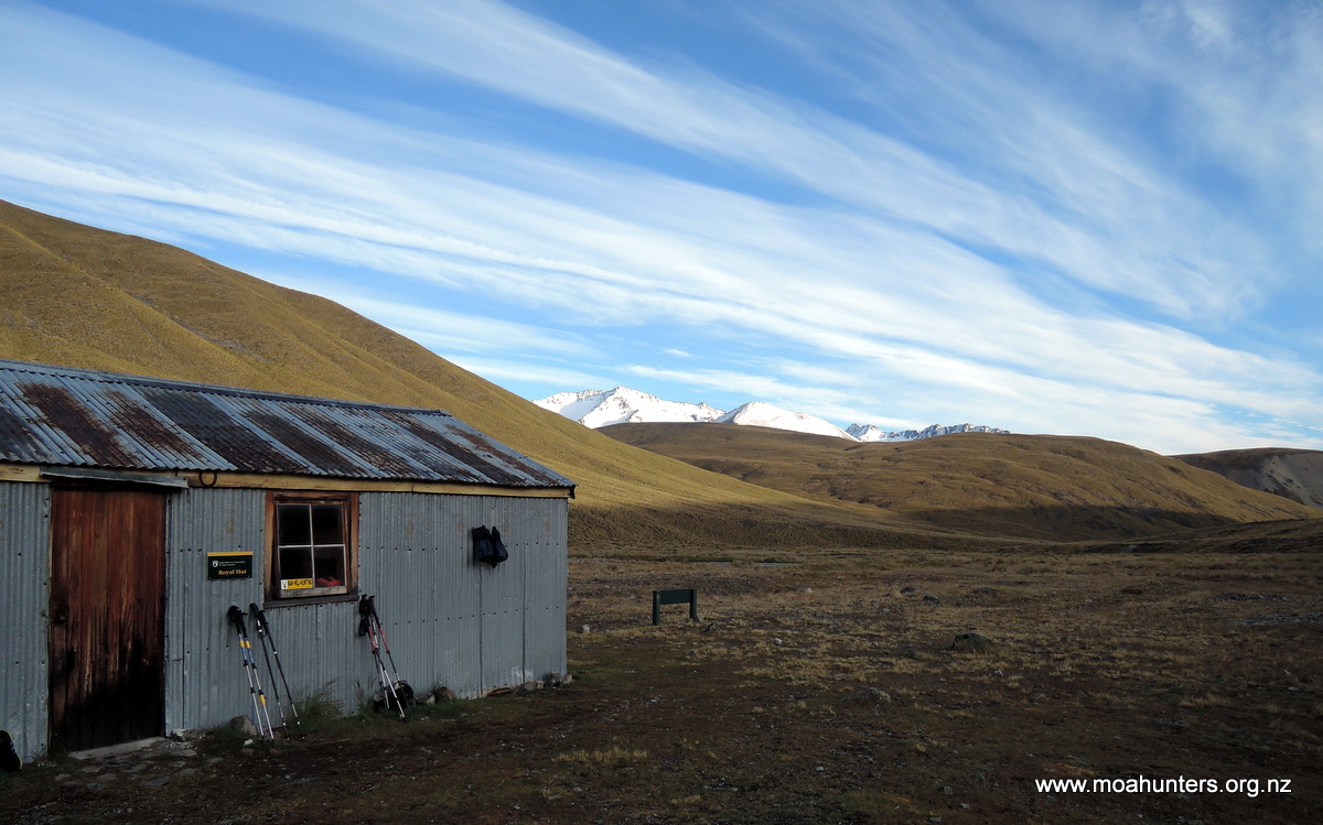
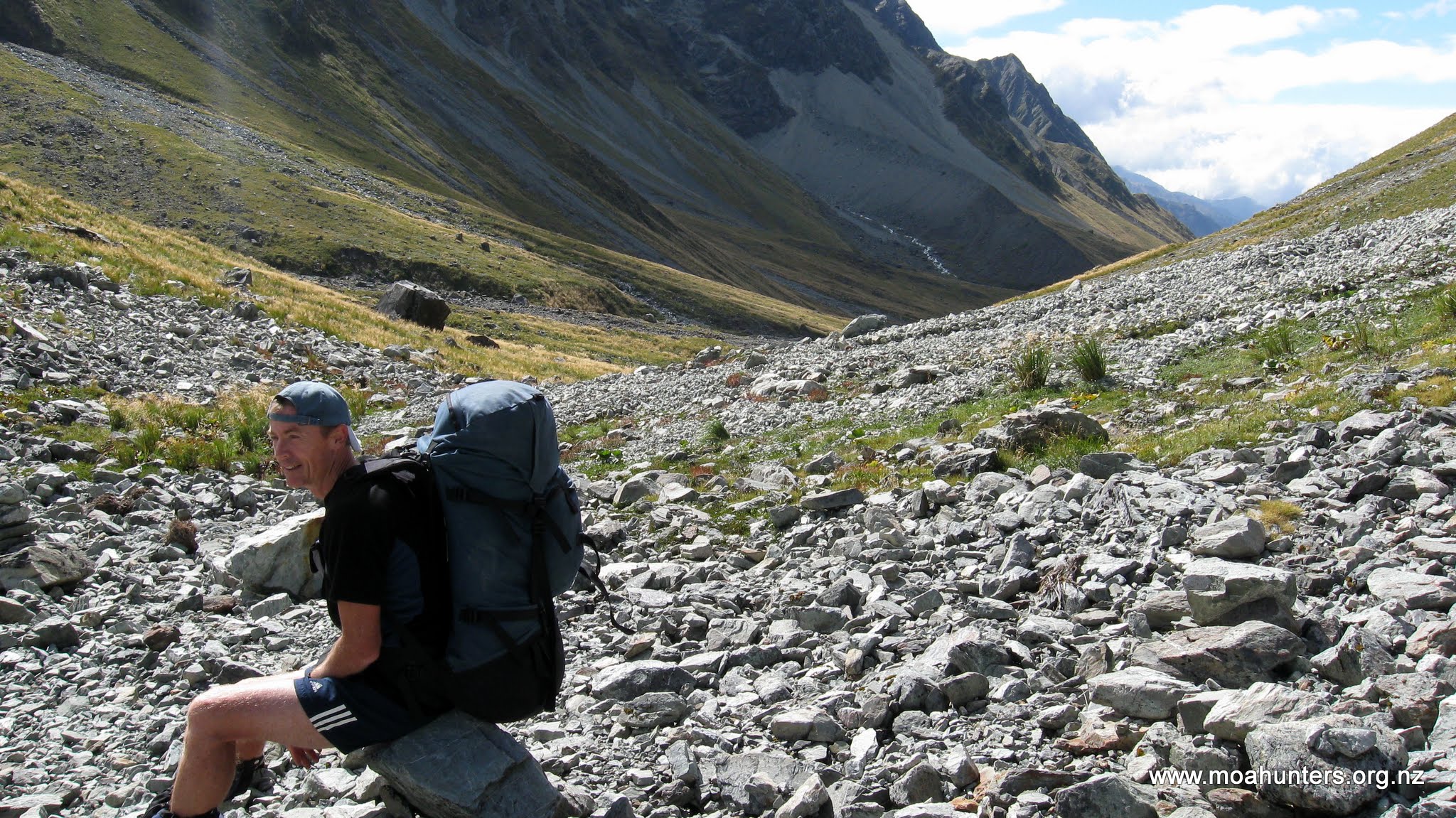
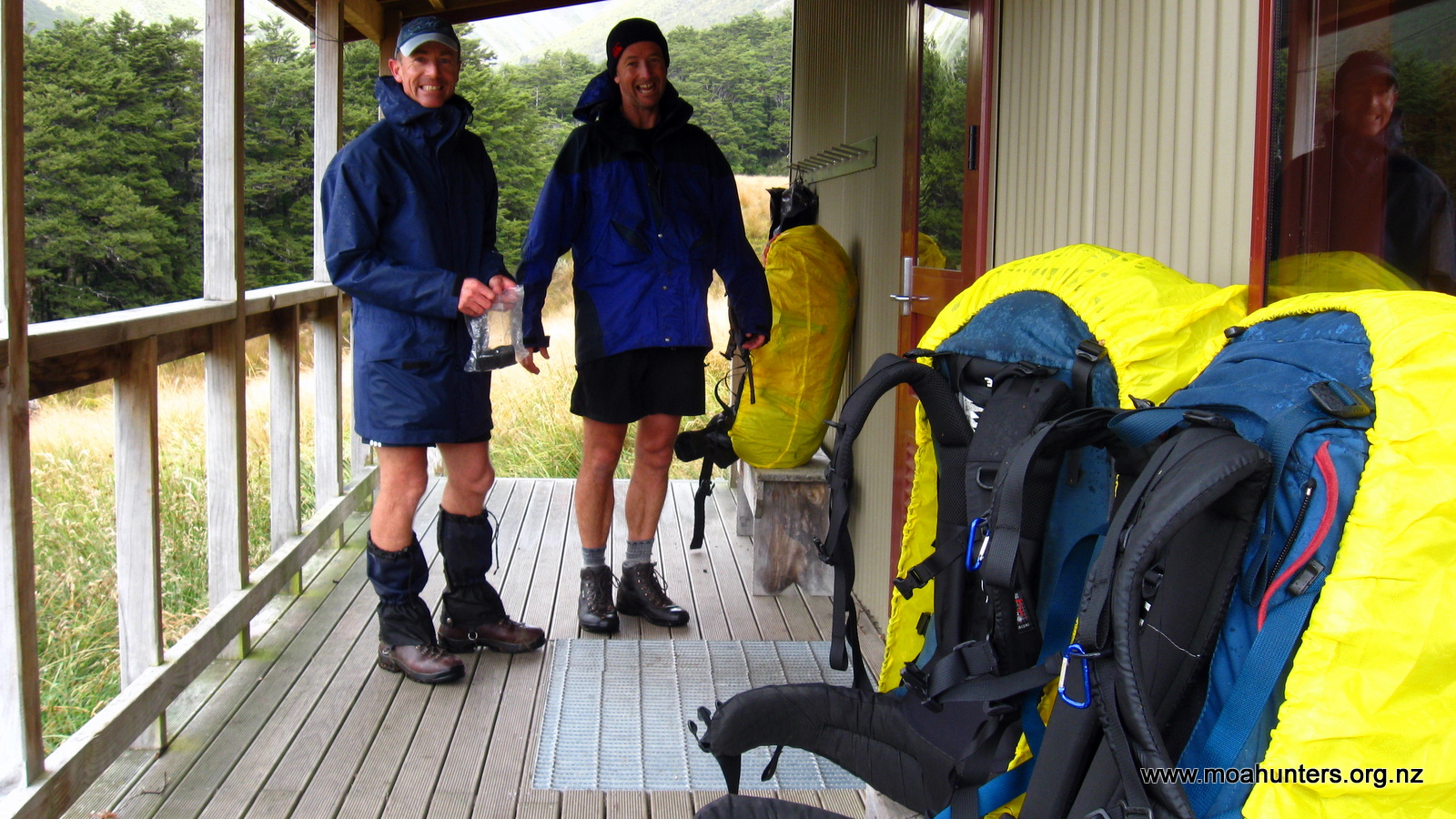
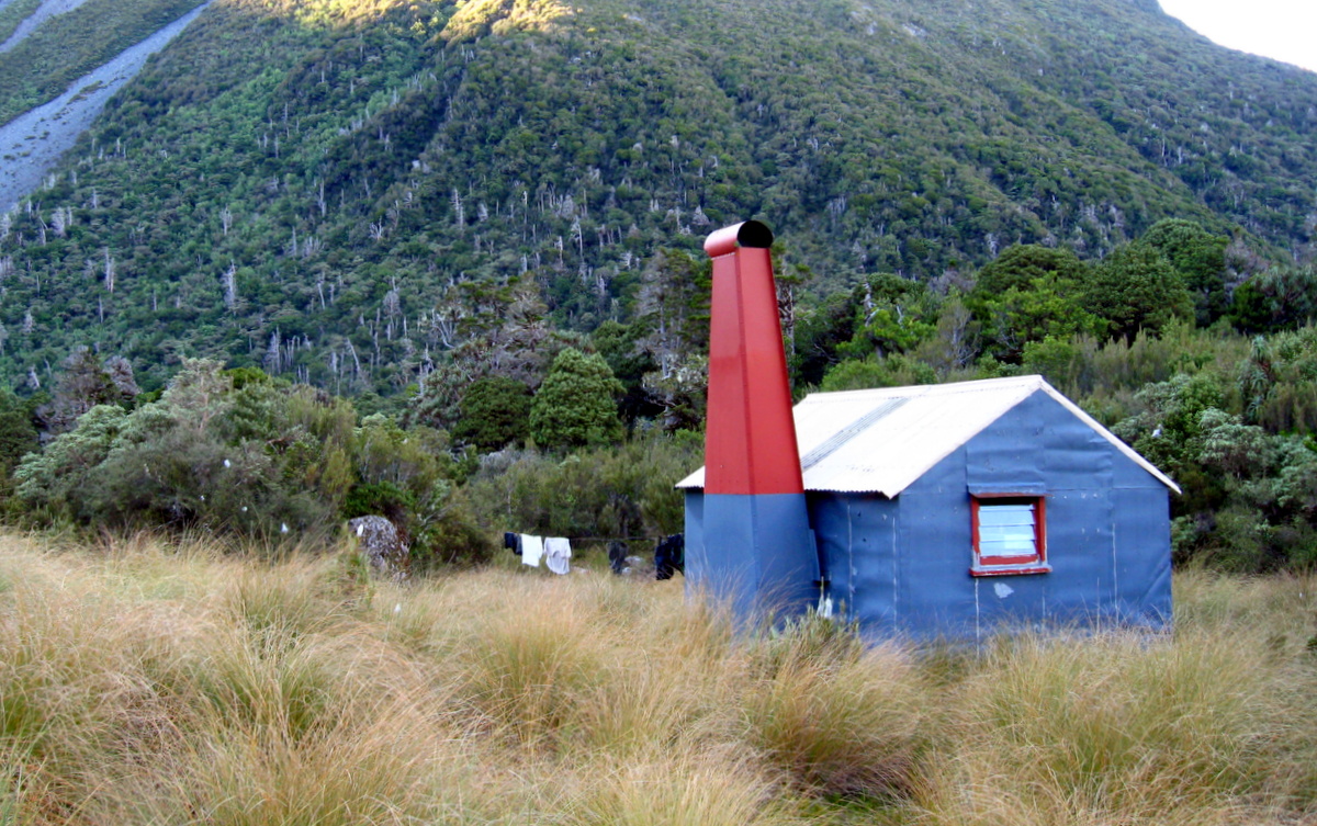
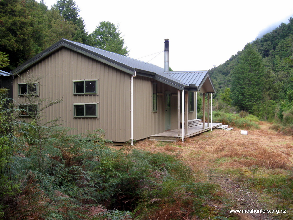
After fond goodbyes we parted company above the Rex Simpson Hut. They were heading to Camp Hut, probably to sleep on the floor. In the space of three and a half days we had forged strong connections with strangers as is often the case in the back country. Good times, shared experiences and a lot of laughs; must be all the fresh air! We were stopping at the Alpine Recreation Rex Simpson hut, which we were very lucky to get the use of. It is a far more modern affair compared to other huts on the Two Thumb track, built on a strong semi A-frame design, to take the strong winds its exposed position would subject it to. It has tremendous views, a wooden floor and even insulation! The only drawback being the water supply was a fair trek away.
Alan Stevens greeted us as we arrived. He had camped up near the hut for two hours waiting for us, obviously making good time up from the carpark having driven from Christchurch. Around an hour after we arrived a couple of extreme cross country mountain bikers appeared looking for a place to stay. We had no room (the floor space is minimal) but there was an outside access snug on the hut designed for shelter which they decided to use. Richard took time out to discuss their bikes, turning slightly green with envy! They were heading to Queenstown and had traversed the Two Thumb track, obviously very fit as pushing those bikes through that sort of country would not be easy.
Sun setting on the edge of the Rex Simpson hut – spectacular vista.
Day 5
Tuesday 25 January – Rex Simpson hut to road end
After a very blustery night and what sounded like horizontal rain, Paul was first up as usual to get the porridge on the go. During the usual pack and clean up and after a first class coffee and porridge, three girls arrived on the Te Araroa trail. Two through walkers and one in and out, keen for advice on central Otago trails. It’s safe to say she was in the right place for advice on that area and left keen on paradise! We hope she found it.
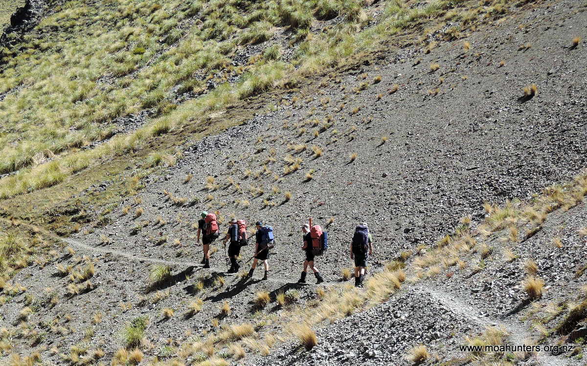
Alan hit the trail while we gave the hut an extra going over and re-stocked water supplies to make sure it was as pristine as we found it. The walk out was pretty straight forward, downhill through farm land but with views of the upper Tekapo area a constant. We were surprised to see a wallaby bounce through the scrub. From there it was a gentle stroll down to the car park where Alan and John Bowers were waiting with vehicles for the trip home.
Leaving that place for home, we all reflected on the incredible country right on our doorstep. The scenery was so unexpected, and made more striking by the hugely changeable weather we experienced.
Of course the hot pies bought in Fairlie on the way home were great too!
Moa Hunters on this trip: Chris, Richard, Adam, Magnus, Logan, Paul
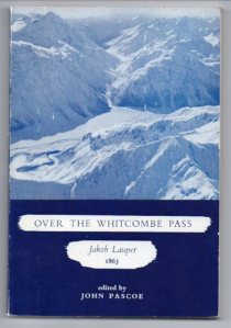
Crossing the main divide 150 years ago proved to be difficult and perilous for surveyors John Whitcombe and Jakob Lauper. Their goal was to map an East – West route, suitable for constructing a road link between Christchurch and the West Coast. Starting their journey in the upper reaches of the Rakaia, they struggled through increasingly challenging terrain for three weeks, until they finally reached the Tasman Sea on the West Coast.
It was there that Whitcombe tragically lost his life when the explorers attempted to cross the flood swollen Taramakau River. Their makeshift raft capsized and the men were swept out to sea. Lauper, the stronger swimmer made it to shore. Whitcombe succumbed to the pounding waves of the Tasman sea.
Well aware of the history of Whitcombe Pass, The Moa Hunters knew this was going to be a tough trip. We had read enough of Lauper and Whitcombe’s account of the route to know it would be challenging. Just as the two explorers before us had underestimated the crossing, we did not anticipate just how brutally tough it would be…
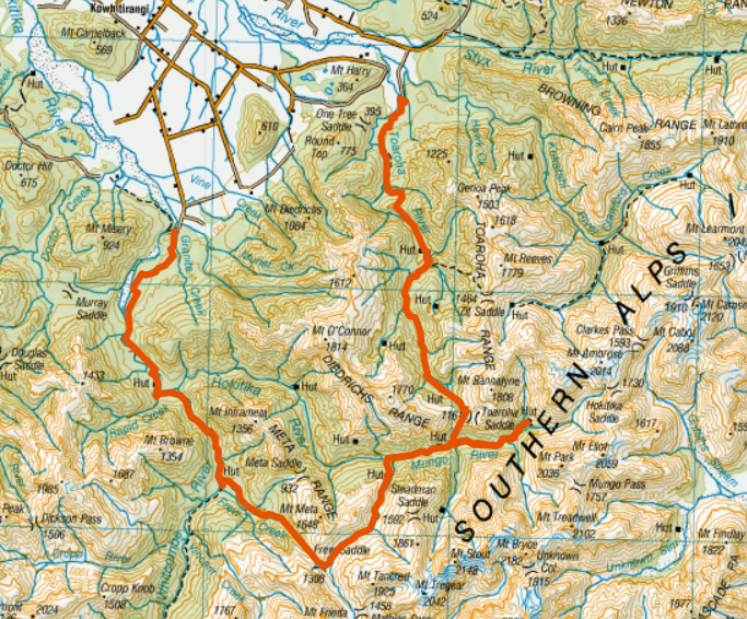
The Trip:
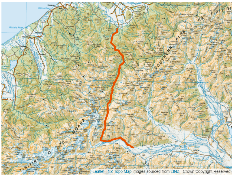
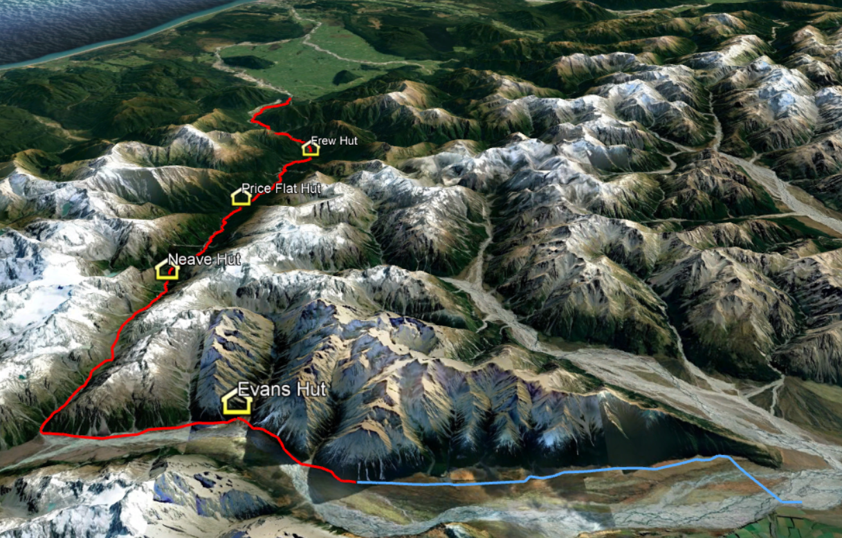
Day 1: 4WD to the headwaters of the Rakaia. Walk to Evans Hut (2hrs / 3km) Day 2: Evans Hut to Neave Hut (13hrs / 19km) Day 3: Neave Hut to Price Flat Hut (8hrs / 10km) Day 4: Price Flat Hut to Frew Hut (6hrs / 8km) Day 5: Frew Hut to Road End (7hrs / 16km)
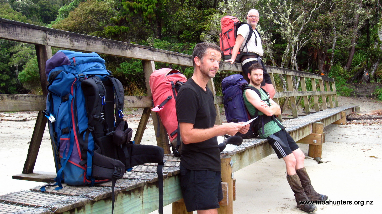
Our day started early. By 6:30am the Moa Hunters had converged on Adam’s house in Rolleston and we were busily loading packs into two utes. Yet again, Paul had worked his organisational magic and convinced Alan (his father), and two-metre Peter (a work colleague), to drive us to the upper reaches of the Rakaia. According to Paul, the two hadn’t taken much convincing. Alan fancied a bit of fishing, and two-metre Peter had his rifle stowed in the ute. His plan was to bring back some venison for the freezer.
From Rolleston the two utes drove out to Mt Hutt township and up Blackford Road, which becomes Double Hill Run Road at the point the seal ends. Along the way we met up with George, a good mate of two-metre Peter’s. Under a hot February sun, we now had a three vehicle convoy.
Big country
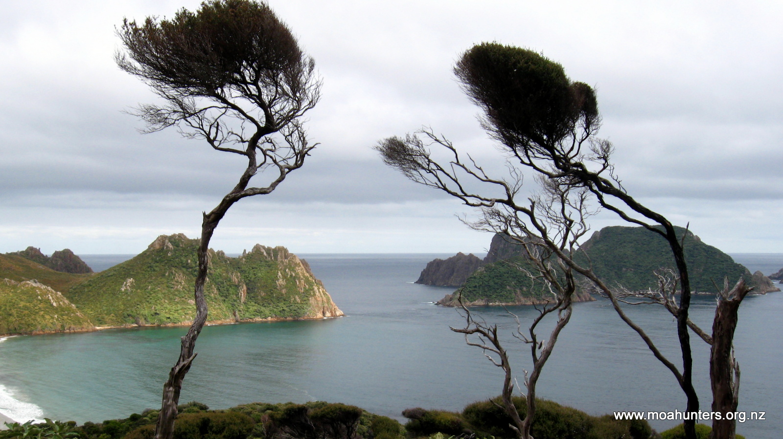
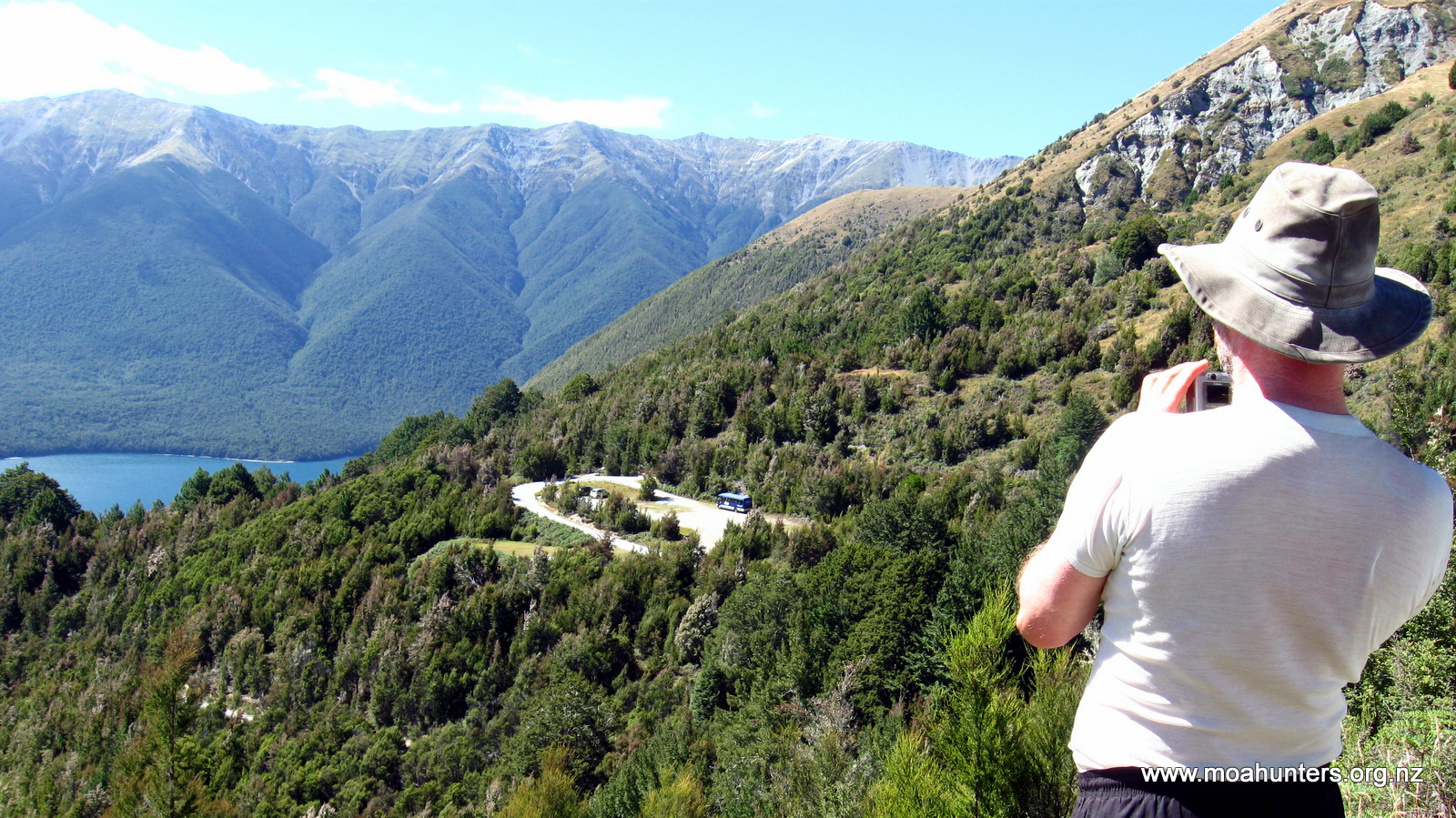
From the meeting point it was a long but not entirely unpleasant drive along 40km of unsealed road, to a junction at Glenfalloch Station. The scenery around us was barren and beautiful. At the junction we turned right onto the short track to the edge of the Rakaia where we stopped. Across the river we could see dust clouds being whipped up and blown down the valley by the increasingly boisterous nor’westerly wind. An ominous sign.
Moa Men prepped and ready for battle
Fortunately on our side of the river we were relatively sheltered, making it a perfect spot for a cooked breakfast. Cooking gear was quickly assembled, and before long bacon, liver, kidneys, hash browns and mushrooms were sizzling. Alan broke out his Thermette and brewed a welcome cuppa to chase down our hearty breakfast.
The next challenge was crossing the Rakaia. It was agreed Alan’s ute had the least ground clearance and he should go in first. A good choice because Alan knew what he was doing… He drove out slowly and confidently forded the deepest channel, showing the way for the rest of us. For those of us not used to 4WDing, there were a few sphincter-tightening seat clutching moments when the utes nosed into deep water. But the crossings were made without incident.
Once on the other side we found a 4WD track which lead to Manuka Point Station, an impressive hunters lodge complete with grass airstrip. Out of the lodge strode a familiar figure to Adam. Dave Reese, a Rolleston local and hunter guide, greeted us as we pulled up to a stop. He suggested we could drive as far as Totara Point, and from there walk to Evans Hut, about 5km farther on the same side of the river. Our original plan was to walk from Totara Point, crossing back over the Rakaia to the Reischek Hut, quite a bit farther up the valley. But Dave’s suggestion of staying dry and not walking as far held a lot of appeal.
Following Dave’s directions we drove the 4WD track until it petered out at Totara Point. An attempt was made to drive further, but we quickly reached terrain too difficult for the utes to navigate. The Moa Hunters piled out, said our goodbyes to Alan, two-metre Peter and George, and struck out into the savage nor’wester.
Stunning surroundings
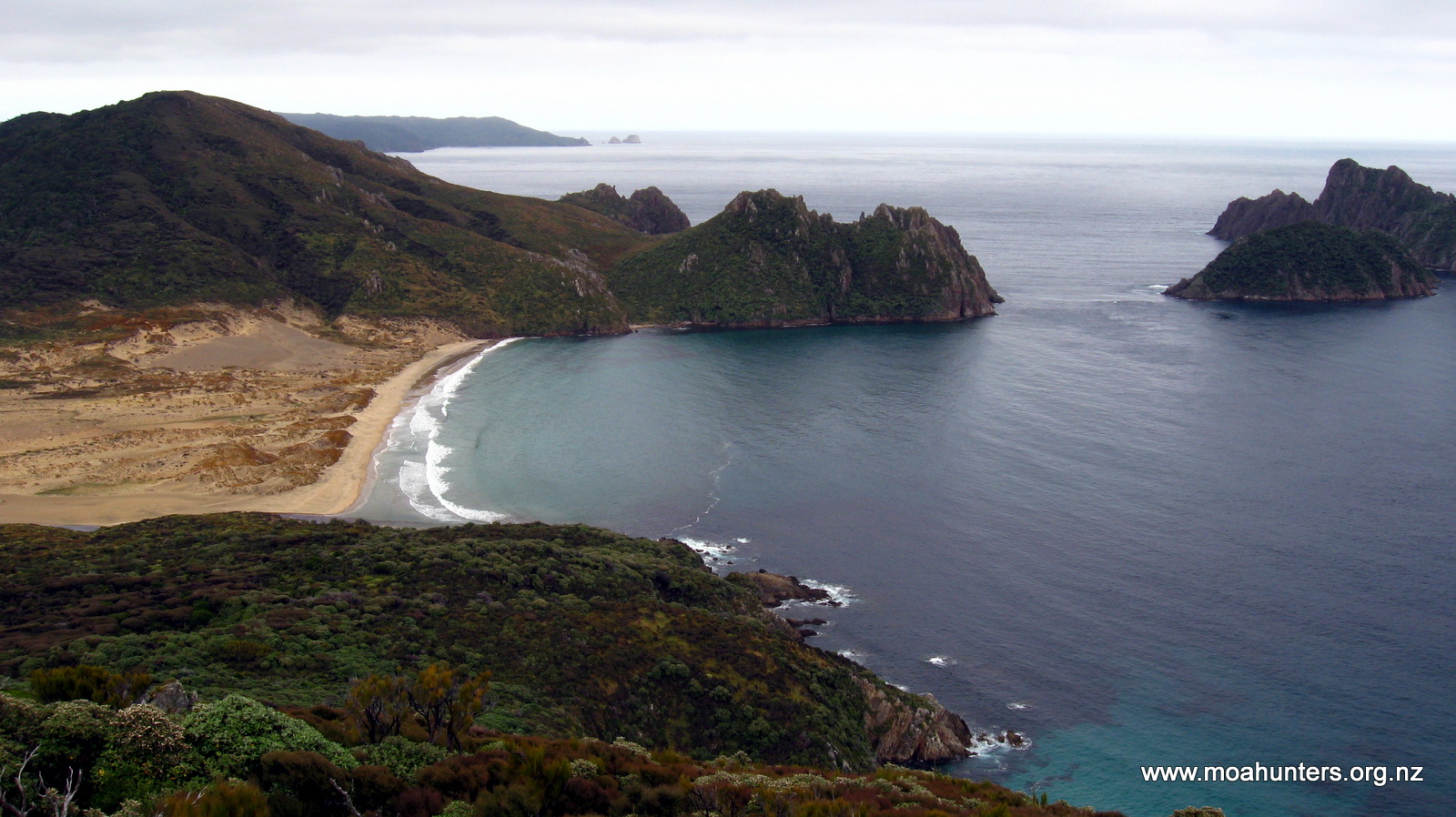
Apart from the wind, the first kilometre was easy walking. The valley here is open and flat, with grassy areas providing islands of smooth walking among the rockier terrain. The wind was wild. At times we walked into a strange quiet lull, with no breeze at all. Those moments were short lived, as the gale would soon howl down the valley again, buffeting us backwards, whipping sand into our legs and dust into our faces. Not pleasant at all.
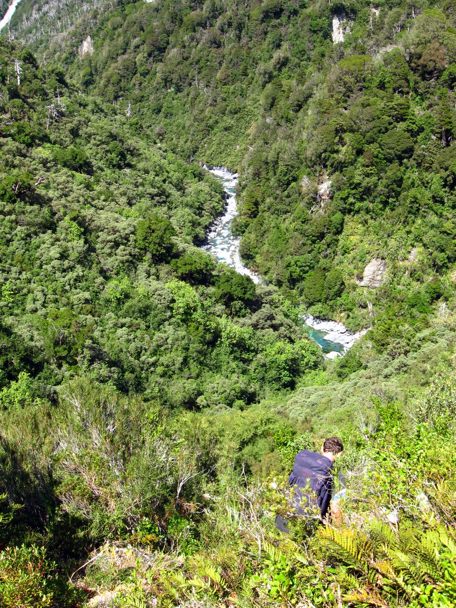
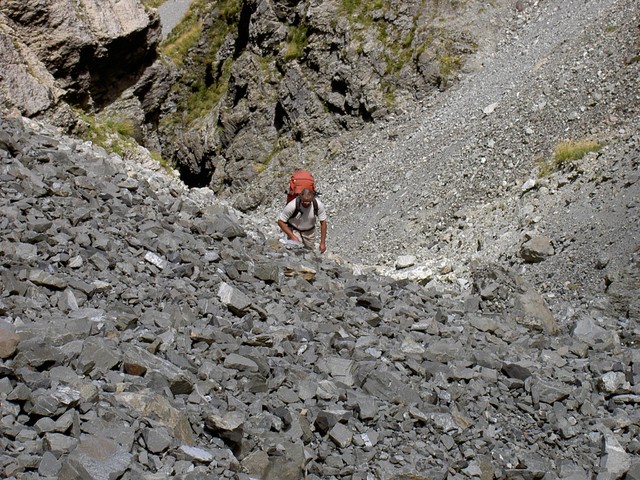
The relatively flat riverbed walking inevitably came to an end. Ahead of us the river’s course took it hard up against a steep bluff: Duncan’s Face. We had two options at our disposal: Crossing the river twice to skirt around the bluff, or some bush bashing over the bluff. The river looked deep, swift and cold, so we chose the uphill route, which looked steep, scratchy and nasty.
Battling the bush
We began picking our way through the stunted vegetation, looking for an easy route up the bluff. We knew that others would have done the same before us and were on the lookout for obvious tracks. Unfortunately not many people walk the Whitcombe, so any previously walked track would be far from obvious. We never really found a track as such. Occasionally we found ourselves on what were probably deer tracks, which disappeared as fast as they appeared.
Through the eye of a needle…
As we picked our way through the scrub, we could see that we had not one, but two bluffs to find a route over. We climbed higher and spotted a marker pole. Maybe there was a track! We made our way to the pole and scanned the next ridge for another. The poles were few and far between with very little in the way of formed track between them.
We eventually found ourselves over the last ridge with clear inviting gravel riverbed in sight below us. With no reason to still be up in the bush, we hunted forward and back for an easy route down. But found nothing. Feeling frustrated and completely over battling awkward terrain and scratchy bush, we decided to go down regardless. So we began smashing our way down through thick bush, tall trees, flax, and every other awkward obstacle you care to imagine.
One of many crossings
After a grovelly and generally unpleasant descent, we finally burst out of the bush into the windswept Rakaia valley. From there we had a blustery 1km walk to Evans Hut, which we reached at 2pm.
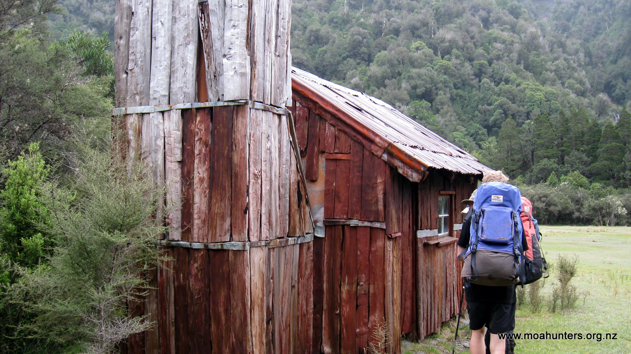
Nestled snugly in a sheltered clearing at the base of tall peaks flanking Cattle stream, Evans hut was built and is maintained by the NZ Deerstalkers Association. We immediately liked it. While the modern DOC huts are comfortable and well designed, old huts like Evans are full of character. Sitting inside you can’t help but feel a sense of history emanating from the old timbers and time-worn furniture.
Light footed with heavy packs off.
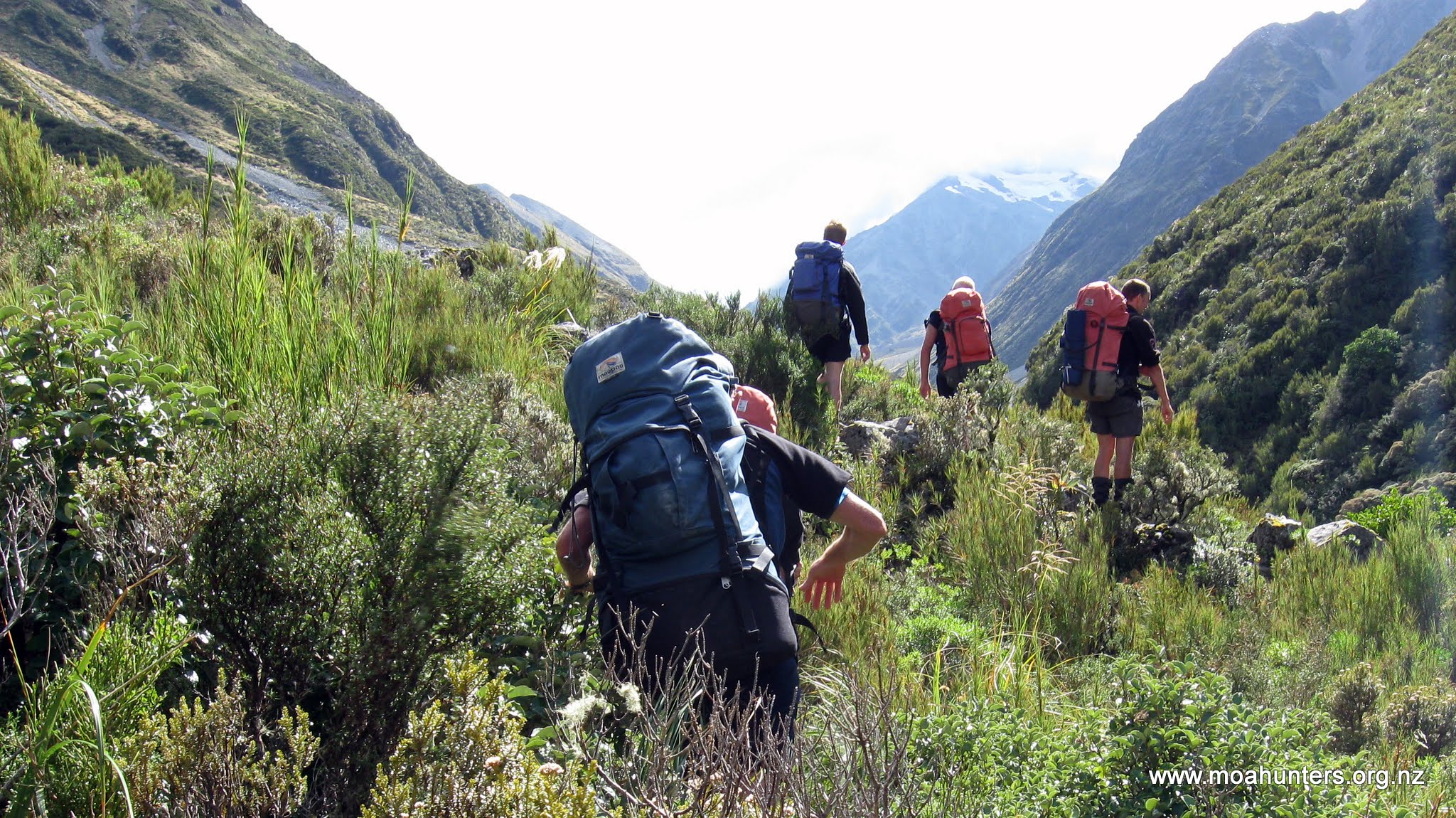
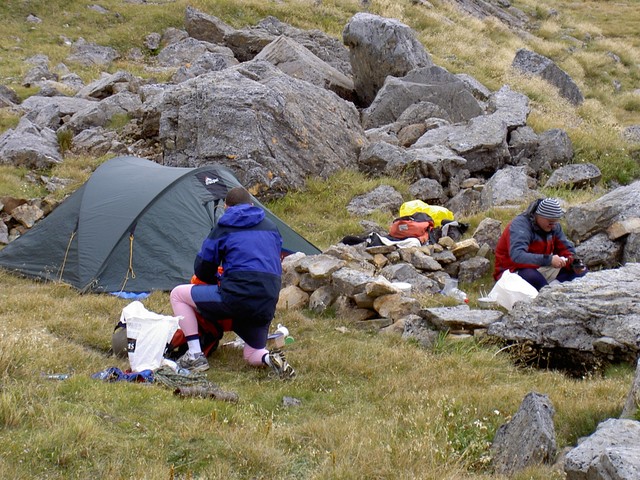
As it was still early in the day, we agreed a wander up the valley past Lauper creek and up towards the Lyell Glacier would be worth a nudge. Even without backpacks on, the strongest wind gusts howling down the valley buffeted us backwards. Apart from mother nature’s best attempts to blow us back to Christchurch, the walk up to Lauper Biv was on the whole fairly easy. Only a couple of boulder strewn fans proved to be challenging, briefly forcing us off the riverbed and up into the bush.
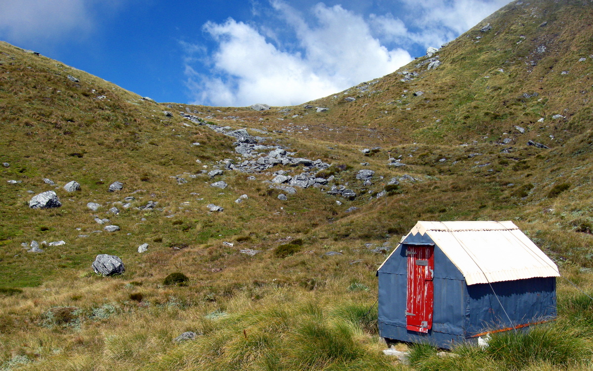
Lauper Biv. (Spelled wrong on the door!)
After two hours we had reached Lauper Biv. Sheltering on the leeward side, we enjoyed a very pleasant break lying on the soft grass in the warm afternoon sun. Given it was now after 4pm, we abandoned any thought of walking further up the Rakaia, and agreed to head back to Evans Hut. The walk back being slightly downhill and wind assisted, with a generous tailwind, took us just an hour and a half.
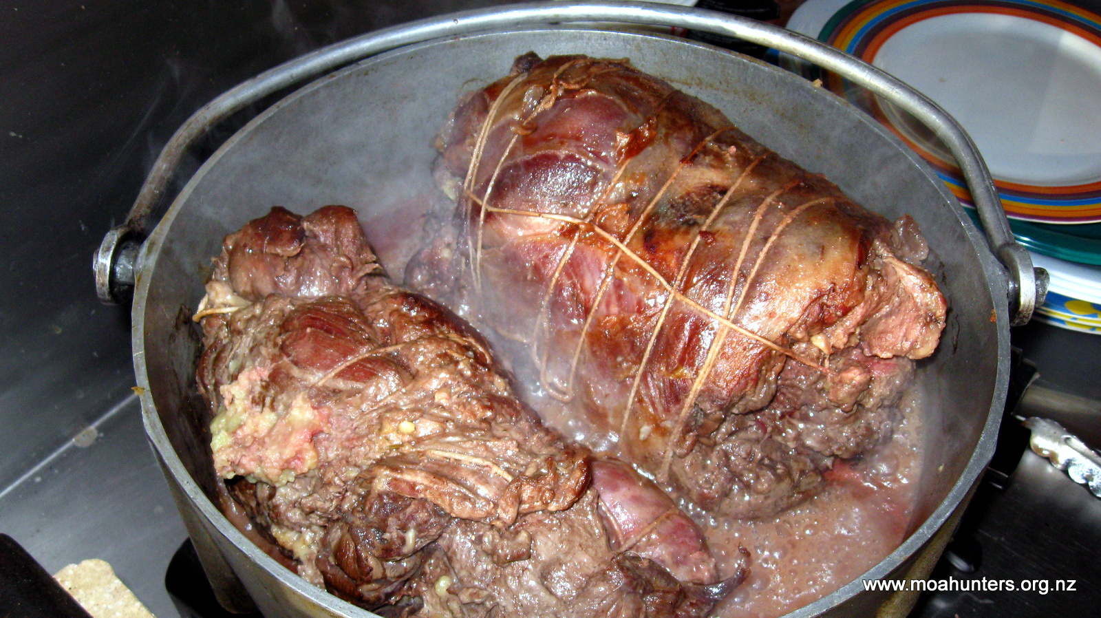
Back at Evans hut Paul immediately began preparations for dinner. As has become something of a tradition on recent Moa Hunts, our first meal on the track was decadent steak fry-up. This years steak was not as tender as previous cuts, but equally tasty thanks to the special marinade Paul has been perfecting over the years. Chris put together a stodgy apple uncrumble and custard for dessert, which landed nicely on top of the beef already in our stomachs.
Logan tucks into the marinated steak
Day 2
Saturday 28th February – Evans Hut to Neave Hut
A damp start to the day
Knowing the day ahead of us had the potential to be a fairly big one, we dragged our creaky carcasses out of our sleeping bags fairly early. By 8:20am the Moa Hunters had wolfed down a hearty porridge breakfast, washed up, warmed up, thrust bags of gear back into backpacks and cleaned the hut. Outside, wind blown drizzle was falling fairly steadily. But on a brighter note, above us the cloud appeared to be breaking up.
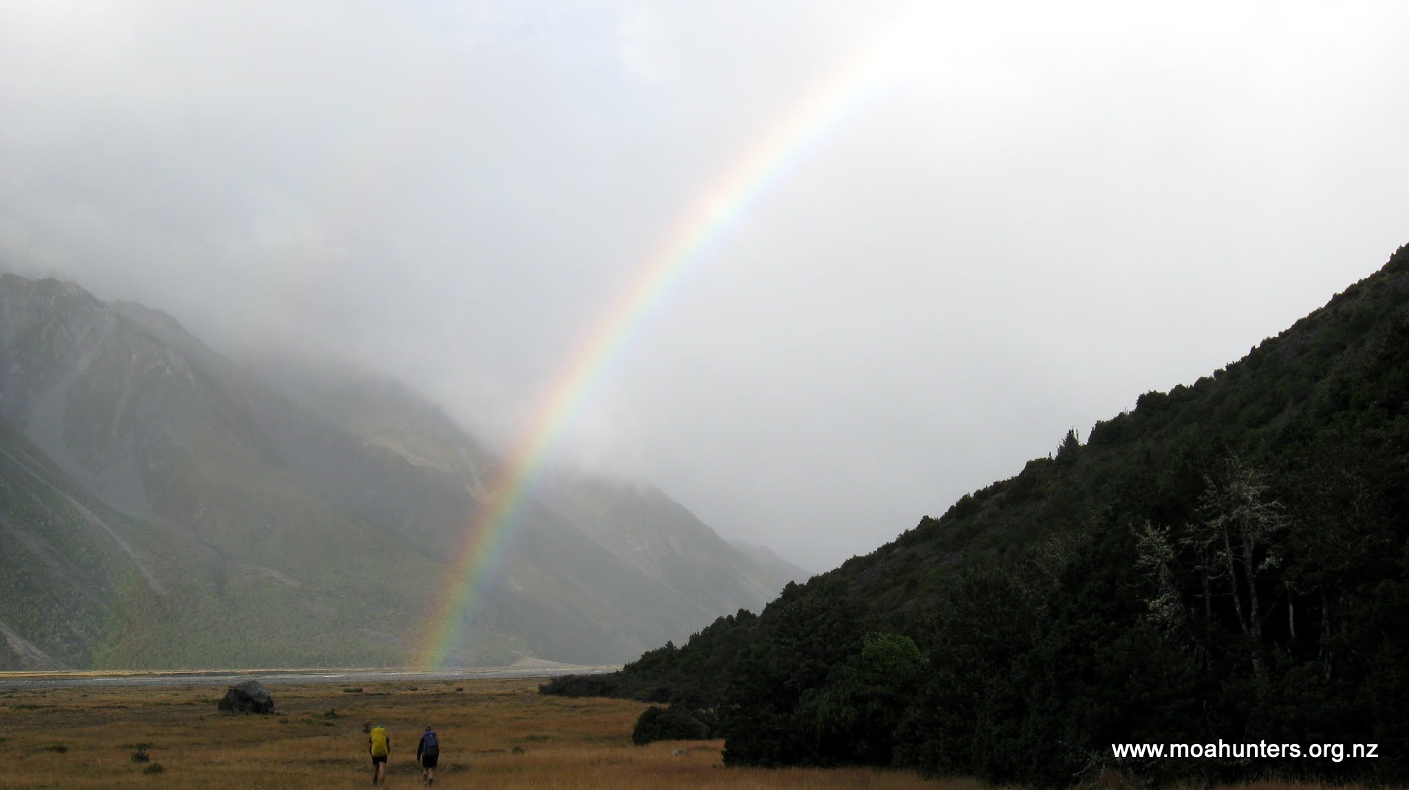
Having already walked the route to Lauper Biv, we knew what was ahead and made good progress. It didn’t take long to leave the drizzle behind and before long we were treated to a spectacular rainbow ahead of us. One end of it seemed just a few hundred metres away to our right at the foot of the hills flanking the valley. We all secretly fought the urge to drop our packs and make a dash for it to lay claim to the pot of gold.
Headed for the pot of gold
We reached Lauper Biv at 10:30 and from there turned into the Lauper valley and uncharted territory. The terrain quickly become more challenging. Crossing the stream to avoid an inconvenient bluff happened frequently. Where a bluff couldn’t be avoided, we were forced to skirt high up the valley side, usually through scrubby bush riddled with nasty spear grass and scratchy matagouri.
There is no marked route between Lauper Biv and Neave Hut. We did spot the occasional cairn at river crossings, and over one bluff, a couple of track markers. But being an infrequently walked route, there are no obvious tracks, no tried and tested well worn paths to follow.
Ascending the Lauper
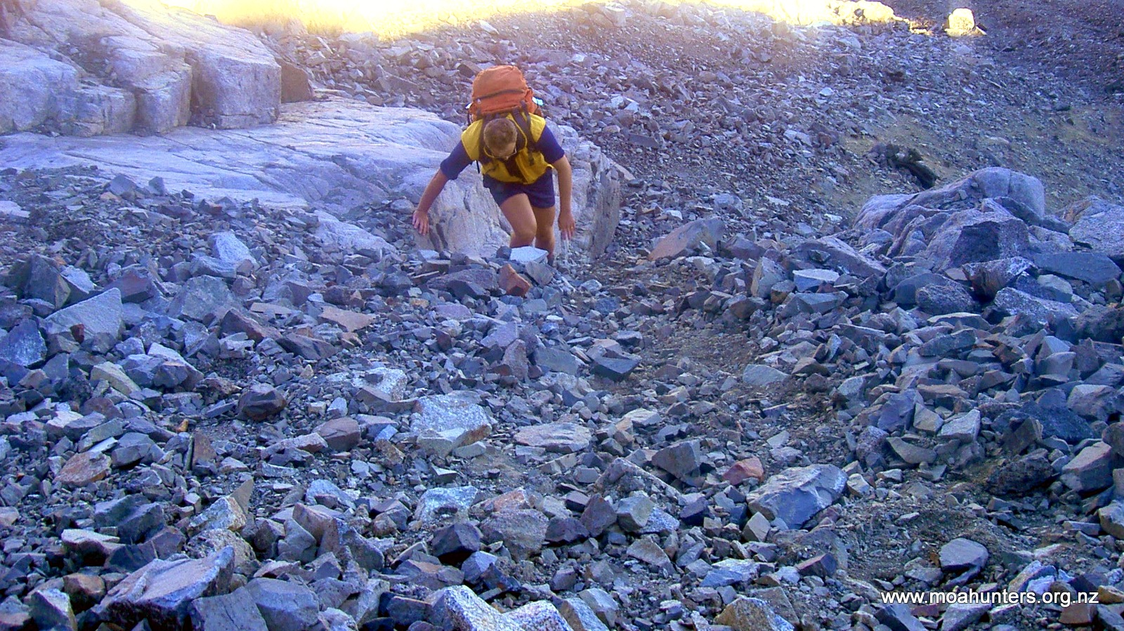
Wherever possible we stuck to the riverbed where walking was easiest, boulder hopping where that became necessary. However, the higher we got, the larger the boulders became, the tighter the valley got, and progress grew steadily more difficult. Longer periods were spent picking our way through scrub above the river. When we dropped back down, tricky river crossings were often necessary to avoid bush bashing.
By mid afternoon we hit what were probably some of the gnarliest section leading up to the pass. Progress was slow and the amount of energy expended to travel short distances was high.
Some scrub bashing
However, with increased altitude came some reprieve. The higher we climbed, the more the bush thinned, and the more stunted it became. About two and a half kilometres from Lauper Biv, where a significant tributary stream joins the Lauper on the true right, the valley flattens considerably. After a careful crossing, we found ourselves moving into more open country, strewn with shattered sharp edged rock and rubble. Only scrubby low grass and beds of moss cling to what passes for soil in this windswept hostile terrain.
Numerous tricky crossings
The gradient also eased and we made much faster and more consistent progress. By 4pm we found ourselves at a large cairn that marked the top of Whitcombe Pass. We were happy to be there, but any elation was tempered by the knowledge that the hardest part of the day was yet to come. All accounts we had read prior to the trip described the descent down the Whitcombe as being particularly arduous.
It was quite a bit later than we had anticipated and a cold wind was blowing over Whitcombe Pass, chilling us rapidly as we congregated at the cairn. The temperature was not conducive to socialising…. We took a few quick photographs before continuing on.
Heading down from the saddle, the Whitcombe stream rapidly swells to a significant river. At least six glacial melt tributaries feed into it over the course of the first kilometre.
One of the few cairns on the route
Tarns below Whitcombe pass
Barren and exposed landscape
Whitcombe Pass
It is important to cross to the true right of the Whitcombe at the earliest opportunity, before it becomes too swift and deep. Failure to do so will result in an undesirable slog back up the valley to find a safe place to cross.
As we left the pass, it was agreed we would split into two groups: Adam, Richard, Paul and Logan in the advance party, with Magnus and Chris following behind. This seemed practical as it meant the faster moving group would get to the hut first and could get food preparation underway. By the time Chris and Magnus arrived, dinner would be all but ready.
In hindsight, this was not a great decision…
Inhospitable terrain
Heading down from the pass, the terrain was much the same as we had seen on the eastern climb.
Crossing to the true right.
Large rocks punctuated the rubble which filled the shallow valley. Low tussock and patches of hardy grass clung to whatever soil they could find.
The advance party, including Adam, Paul Richard and Logan took an early opportunity to cross to the true right of the Whitcombe. From that point we knew we would not cross the Whitcombe again until just before Collier Gorge, two days later.
The five kilometres between Whitcombe Pass and Neave Hut were as tough as any we had encountered in the ten years of Moa Hunting. With nearly eight hours walking under our belts already, every few hundred metres we gained was hard won.
Fatigue combined with difficult terrain proved challenging. Whether we were in the riverbed, or bush bashing above it, the going was tough. Pushing through bush in our modern tramping gear, we often commented on the toughness of the early explorers who struggled through this country with their heavy equipment, hobnail boots, little food and inadequate clothing. They were truly amazing.
At times the dense bush forced us to crawl, resorting to an exhausting push and shove through thick scratchy brush that showered dead leaves and twigs down our collars. Other times we were grunting our way through waist high bush, heaving it aside to get a glimpse of the uneven ground below and a good place for the next footstep.
More time crashing through vegetation
As we dropped altitude, the bush grew more dense on either side of the Whitcombe. We were now on the West Coast and the vegetation was looking more like the sub-tropical rain-forest, interspersed with ferns.
Shortly before 7:30pm the advance party arrived at the Gateway – a kink in the Whitcombe river where it bends sharply around a very large and hard rocky knob. We skirted around the edge of the river, wading at times as it diverted around the knob, thankful that this significant landmark signaled we were near the hut, but also very aware that daylight was beginning to fade.
Just on 8pm our advance party arrived at the Neave hut, pretty much buggered.
Light is fading as the first group arrive at Neave hut
Quick thinking Paul suggested that unless a couple of us went back up the river to find Chris and Magnus, their chances of making it to the hut were slim. We all agreed. With the light fading rapidly and a couple of tricky bush bashing diversions between them and the hut, they would need guidance to avoid camping out overnight.
Richard’s recently repaired ankle was far from 100%, and Logan was all but spent, so Adam and Paul grabbed some scroggin, headlights and a warm layer of clothing. They left the hut at a good pace without heavy backpacks, heading back up the Whitcombe in search of Chris and Magnus.
In hindsight we realised this was a very badly planned rescue mission: There was no agreement as to how long Adam and Paul would search for Magnus and Chris before returning to the hut. The Personal Locator Beacon was forgotten completely, left at the hut in a pack. Not much use in there!! So Adam and Paul charged up the valley, leaving Logan and Richard getting more and more worried about everyone with every minute that passed.
Fortunately Magnus and Chris were both fine, but had been delayed by traveling too far down the true left of the Whitcombe. They had been forced to make a costly backtrack to locate a safe crossing, piling close to an hour onto their journey.
It would be an understatement to say Adam and Paul were pleased to spot them ahead, after 40 minutes of increasing worry. That relief probably paled into insignificance to that which Logan and Richard felt an hour later when the four weary Moa Hunters finally stumbled into Neave Hut, well after dark. The Whitcombe is unforgiving country, and Richard and Logan had understandably begun to think the worst…
Knackered Moa Men inside Neave Hut
However, an hour or so later, we had all eaten a hearty curry and were feeling somewhat better about the day. It had been truly epic. Over thirteen hours on the track is hard work any day. And on this day we had rock hopped, bush bashed, waded and crawled through some of the toughest terrain we had ever encountered.
Day 3
Sunday 29th February – Neave Hut to Price Flat Hut
We all awoke from a good nights sleep feeling slightly less than refreshed. Tired muscles and lingering fatigue clung to our sad and generally old carcasses (Logan excepted!). A not unexpected legacy of our previous days exertions.
However, hot porridge and a more than leisurely start to the day left us feeling somewhat more energised, and almost ready to tackle the track. And for a change, that is exactly what we would be tackling: a formed track leading us away from Neave Hut to Prices Flat which would be our next accommodation.
Following a period of general fart-arsing about, cleaning the hut, and some more concerted fart-arsing about, we stood with packs on ready to start the days walk at just after 10:00am.
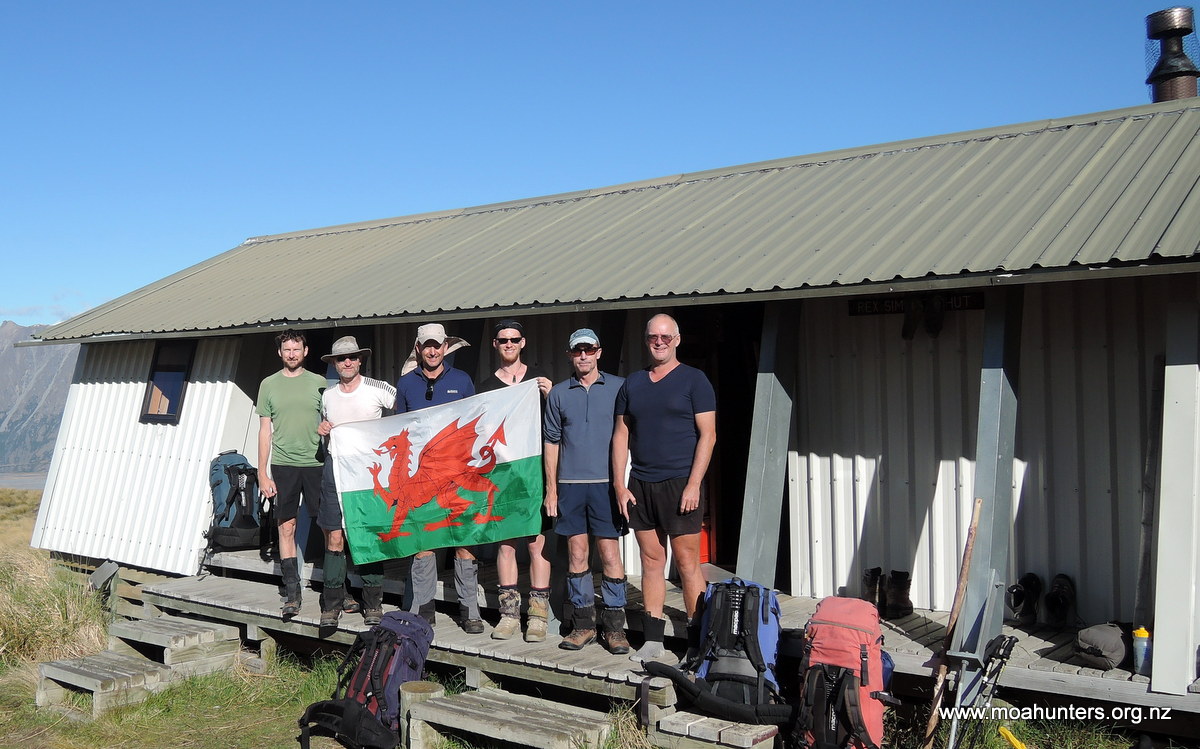
A traditional photo between the Welsh flag and Neave hut…
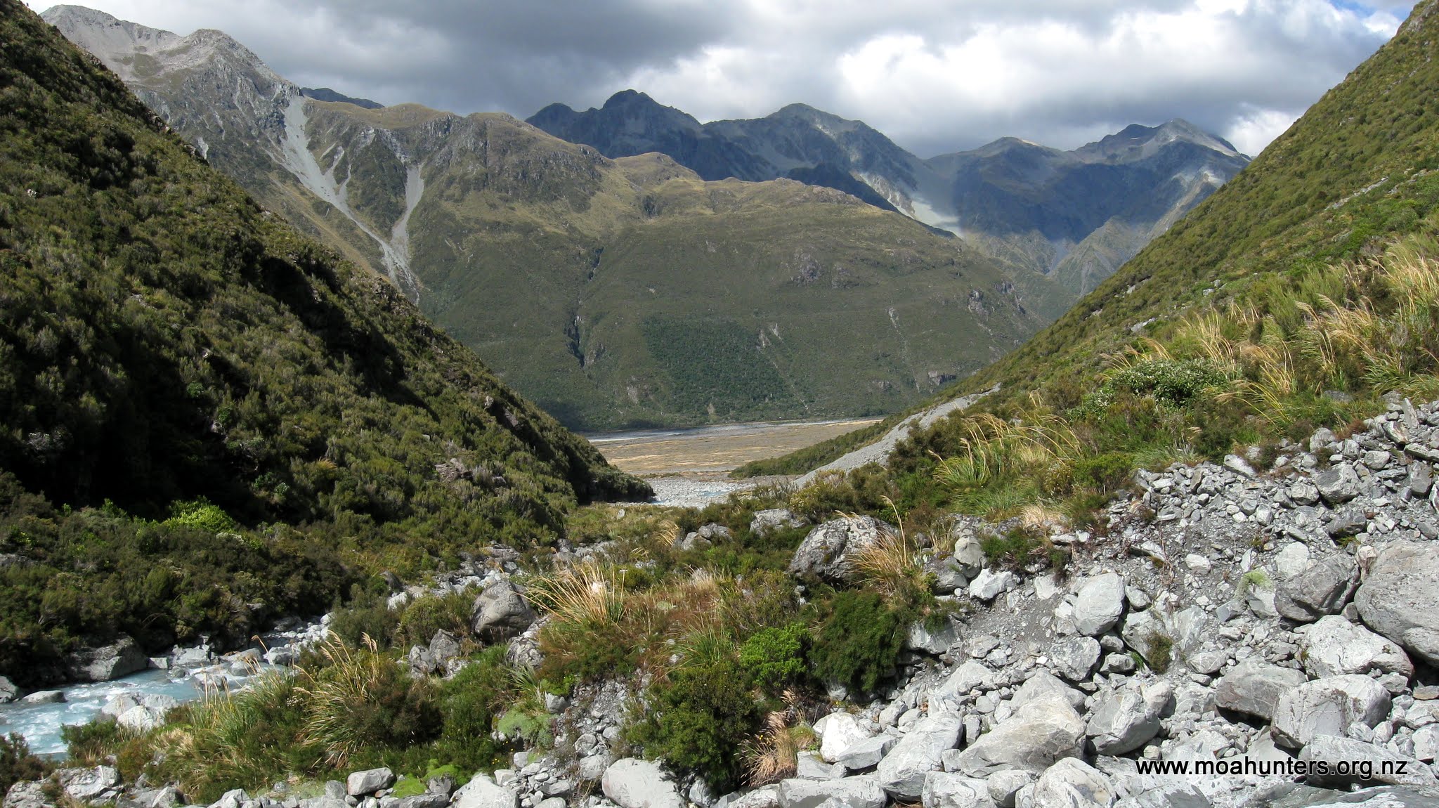
The track away from Neave hut is quite flat, sticking fairly close to the true right of the Whitcombe as it descends towards an expansive flat created by its
Marvellously gnarled old trunk
confluence with the Wilkinson River which joins on the true left.
We reached the confluence at 11:30am and took the opportunity to drop bags where the track dropped into the riverbed. We hadn’t been walking for long, but the legacy of our exertions the previous day weren’t far below the surface. We felt fatigued far more quickly than normal, and energy levels were lower than usual. Dropping packs was a welcome relief.
Even partially obscured by cloud, the sheer cliffs at the head of the Wilkinson valley were an awesome sight. Sliced by a dramatic waterfall, they hold back the vast Bracken snowfield, allowing only the Wilksonson glacier to grind past their southern flank.
We willed the cloud to break up completely, but never got a clear view of the cliffs and glacier. Rather, as the cloud shifted, we got jigsaw puzzle of views, which put together would have made a completed scene.
Massive buttress cliffs soar into the clouds
Willing the clouds to break
The group consensus was to push on a bit longer and have lunch farther up the track. Just in case the cloud sneakily cleared, we regularly glanced over our shoulders, hoping to trick the weather and see the cliffs in their full splendour. Unfortunately our cunning tricks tricks didn’t fool the clouds.
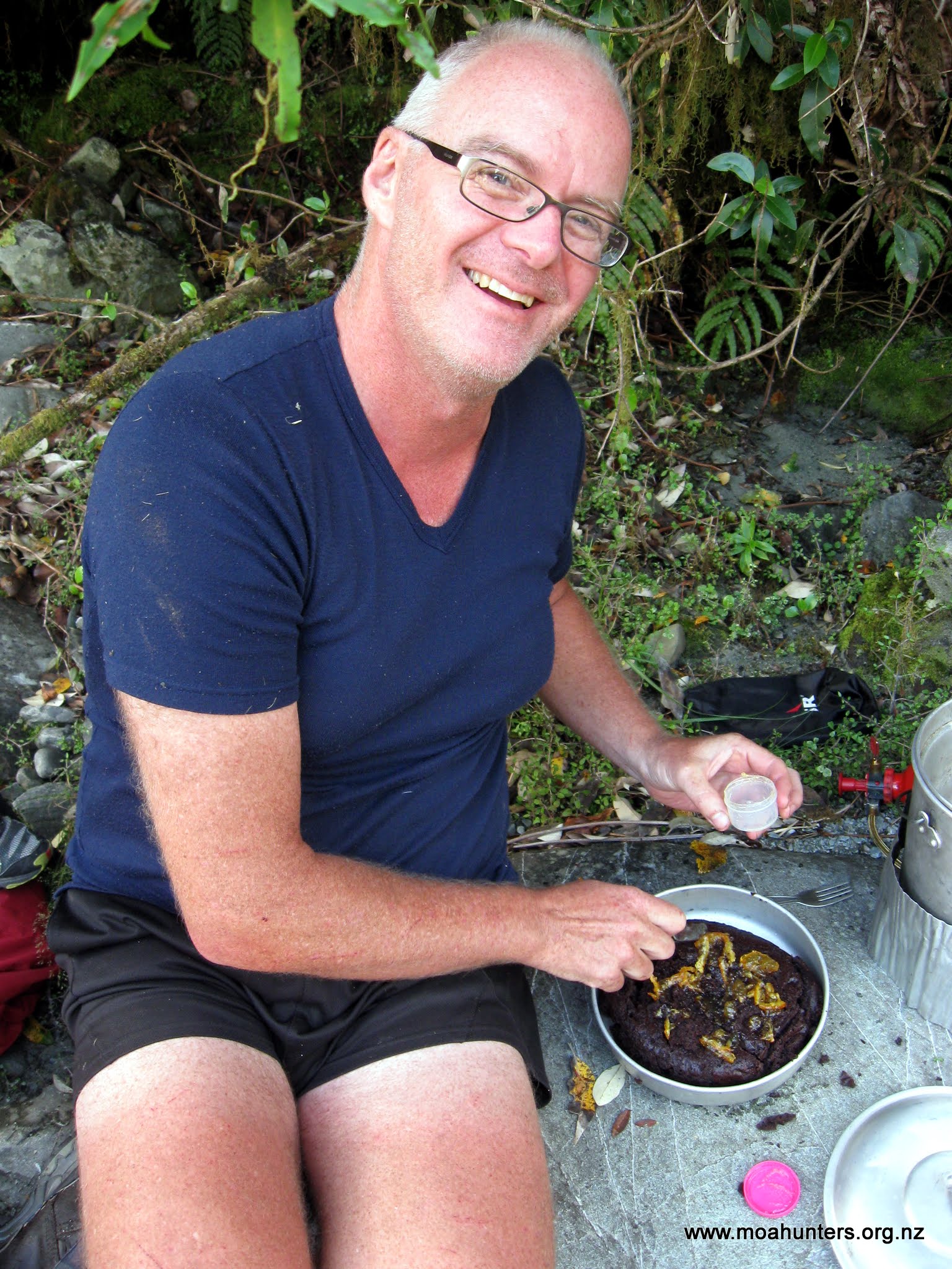
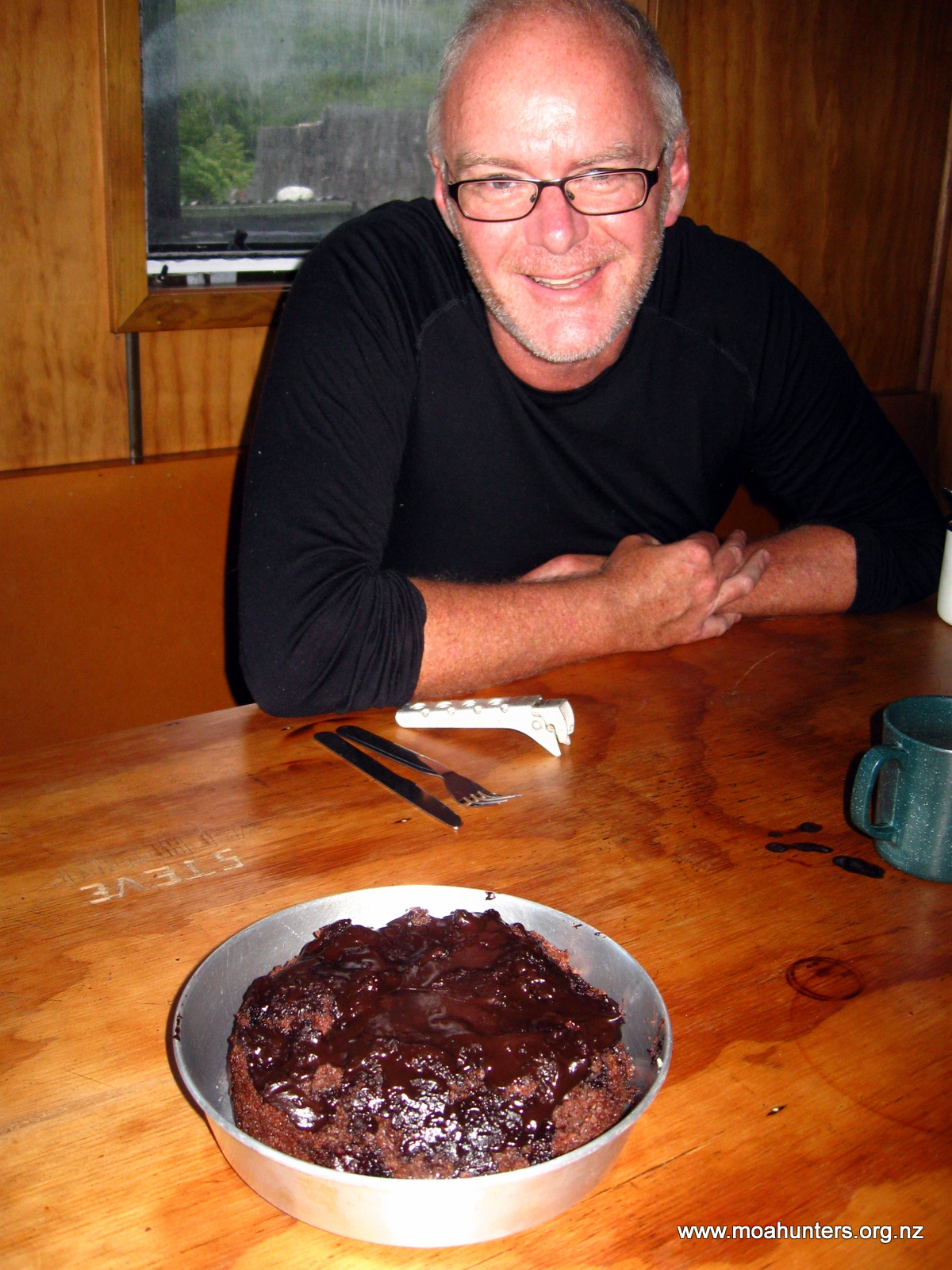
By 12:30pm we had reached a perfect spot for lunch. It was either Crack creek or Bond creek – whichever of the two has the aluminium ladder. Chris took one look at the surroundings and declared it was the ideal location for cooking a chocolate cake. We looked about and couldn’t disagree. It was definitely cake country.
Chris set about preparing the cake while the rest of us lazily got on with lunch. The sun shone pleasantly and we all felt very relaxed, a million miles from anyone and anywhere.
Lining the billy…
In goes the cake mix…
With regular expert adjustments to the burner under the cake, it was cooked to perfection in just over an hour. “Perfection” being a relative term… It may not have won a beauty award at the Lincoln Farmer’s Market, but without doubt it was one of the best cakes ever cooked on a tramping trip. Topped with marmalade and chocolate icing, the cake went down rather well, and rather quickly.
An hour or so on the burner…
Success!
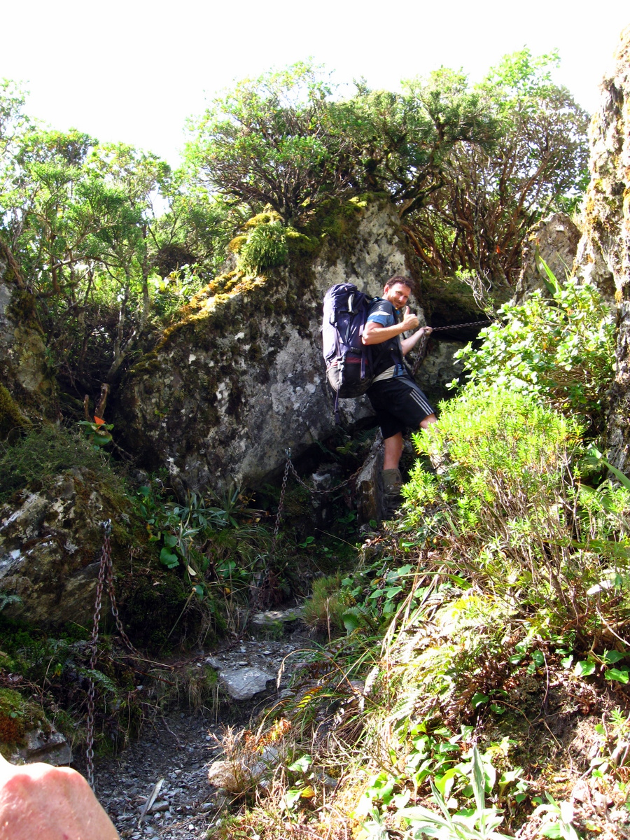
From our lunch spot the track climbed slowly but steadily to some 50 metres above the Whitcombe river, then descended sharply down a steep face back to the river. Chains attached to the rocks by DOC assisted us as we picked our way down.
Up the ladder, full of cake
In the dry conditions we were enjoying, the chains were hardly necessary, but on a miserable wet day they would certainly provide a welcome handhold.
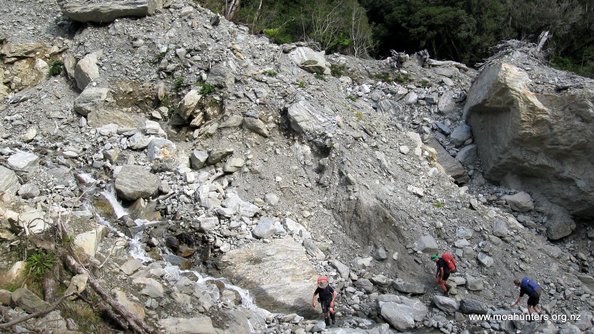
Two large slips are shown on the topomap for this route. However, there are many that are not shown at all. We soon learned these were challenging to traverse. At 5:30 we came across a significant and very recent slip which took some time to navigate. The steep drop combined with loose rock and rubble encouraged extra care. We chose to start high and remain high. Dropping to the bottom of the slip as we traversed it would have been an easy option, but climbing back up to the track again would have been nasty. Our decision turned out to be a good one. We picked a path on the high side of a very large boulder and were able to scamper up to the track on the other side of the slip without too much trouble.
Traversing a large slip
Beyond the slips, the track remained high, skirting along the hillside some 50 metres above the Whitcombe. While the terrain across the river was steep, the bush clad hillside to our right in contrast sloped much more gently.
We were very pleased to arrive at the Cataract creek footbridge by 6.30pm, as this marked the end of our day, with Price Flat hut just a stones throw away on the other side. It had been a long day on the back of a very long day, and we were all still feeling quite fatigued.
Moa Men repairing their battered carcasses
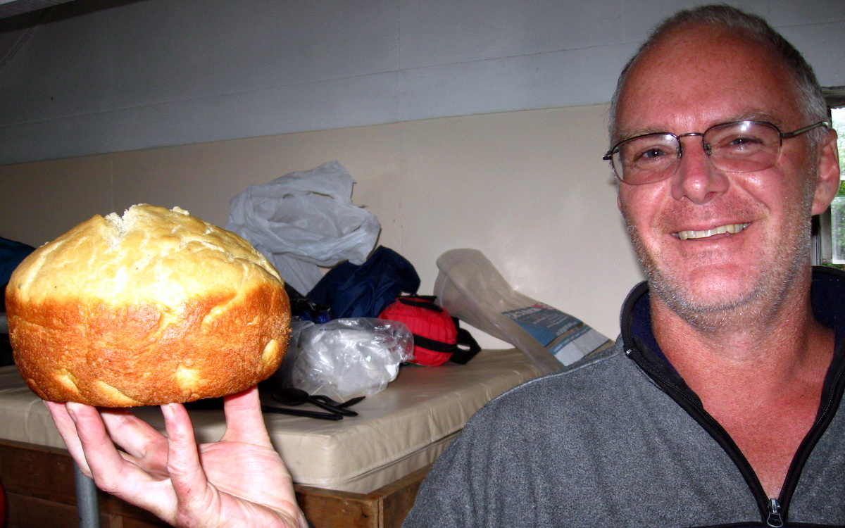
Fortunately Chris still had enough energy and enthusiasm to whip up some naan bread. This was a tasty addition to the mince and pasta dish, which may have raised an eyebrow or two in India, but not where we were. Knowing that food is essential for muscle recovery and repair, we wisely made a cheesecake for dessert.
Day 4
Monday 1st March – Price Flat Hut to Frew Hut
We all slept soundly and woke up early, feeling considerably more refreshed than the previous morning, which had been somewhat of a struggle.
Posing outside Price Flat hut
Chris was strutting, triumphant, having successfully producing yoghurt on a tramping trip. Previous efforts in Stewart Island had produced flavoured milk. A larger longer burning candle turned out to be the key. Keeping the mixture warmer for longer produced a nicely set product that was most definitely yoghurt.
Slopped on top of a rich bircher muesli, the yoghurt made a very nice change of pace from the traditional porridge brekkie. Those in the group still aged below thirty and endowed with a voracious appetite, even ventured to add leftover cheesecake to their helping.
Shortly after 9 we had taken out traditional Moa Men outside the hut photo, and were wandering off down the track.
We stopped briefly to admire the wonderfully restored slab hut at the far end of the flat. It is a lovely example of an old construction technique used by early setters in Australia and New Zealand.
Price Flat slab hut
Beyond the Price Flat footbridge that leads to the Steadman Brow access route, the track enters a long section of steep and particularly unstable hillside.
Chris decided that in this area there were two kinds of track: Track that has fallen into the river, and track that is falling into the river.
And it was true. Short sections of slightly stable track were interspersed by quite long sections with no track at all.
Track falling in the river, and track that’s fallen in the river…
We picked away across roughly two kilometres of this fairly awkward terrain, negotiating a number of tricky river crossings along the way, including one through a small waterfall, just to keep things interesting.
Wet willy in the waterfall
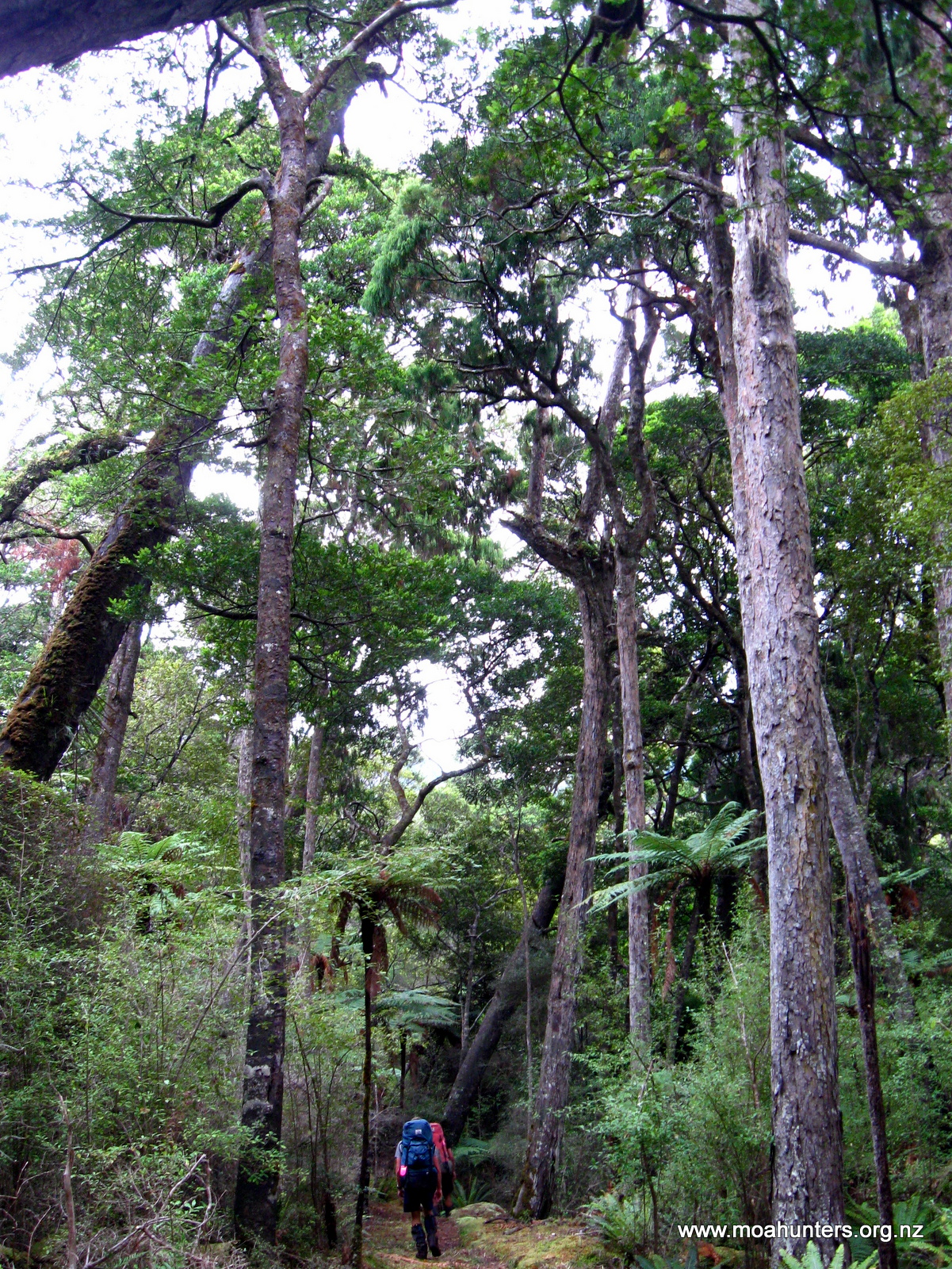
Beyond Hopeful creek, the valley opens out and we gratefully walked out into a flat forested section which required a lot less care to walk. We enjoyed the rich damp smell of the west coast forest. Twisted trees, covered with moss and lichen, rose above the fern dominated understorey. Sunlight that found its way through the branches above created a dappled colour effect.
Beautiful west coast bush
The pleasant walking conditions continued for the next half hour or so, until we broke out of the bush onto the log strewn rocky bed of Vincent Creek. Evidence of recent heavy rain was everywhere. Uprooted trees, branches and debris littered the ground, and the banks of the creek were deeply scoured out.
We made our way up the bed of the creek to a large rock which anchored a swing-bridge that spans the creek. The lack of track at the far bank was slightly interesting. Before the latest flood, we assumed it had followed the bank of the creek down towards the Whitcombe. But now that bank was gone, swept away by a raging Vincent Creek. So we were once again forced to go bush bashing in search of the track. As it turned out, we didn’t have to go far to locate it and continue on our merry way.
Vincent creek
Magnus hovering above Vincent creek
Hunting for a washed out track…
Beyond the Vincent creek bridge is the even more impressive Cropp foot-bridge which stretches across the Whitcombe. We stopped to take photos but had no need to cross it.
Cropp foot bridge
Less than an hour later we were basking in the warm afternoon sunshine at Frew hut. The lazy afternoon felt well earned after the rigours of our first couple of days on the track.
Mighty Moa Men inside Frew hut
Day 5
Tuesday 2nd March – Frew Hut to Road End
Like so many huts in the South Island, Frew hut is situated to take full advantage of the surrounding scenery. We were fortunate to arrive during a spell of lovely weather and enjoyed spectacular views up the Whitcombe on a crisp clear blue sky morning. Watching the dawn sun slowly spreading its glow across the surrounding mountains certainly takes brushing your teeth after breakfast to a whole new level.
A brilliant blue sky morning at Frew hut.
In true Moa Hunter fashion we broke no speed records that morning. It wasn’t until after 9am that we assembled outside the hut for some posed photos before hitting the track.
Magnificent Moa Men
Our day on the track started with a nice section of open riverbed – a mix of fine sand tracts flanked by lichen covered rocks.
Wise Moa Men
After little more than an hour walking we arrived at a swing-bridge which would take us across to the true left of the Whitcombe. The bridge starts high, with chains and a ladder in place to assist with the climb up damp and fairly slippery moss covered rocks.
Magnus climbs to the swingbridge
Adam quickly learned just how slippery the rocks were. Attempting to pivot his body sideways to swing under the suspension cable, his foot slipped. Sliding sideways, protruding bolts raked down his thigh leaving behind some nasty looking gashes. Fortunately the wounds weren’t deep, but they did look spectacular, weeping claret down his leg. Paul expertly patched Adam’s leg up with some stick on stitches and plenty of tape and bandage, and we were on our way again.
From the bridge the track stays in the bush above the river through Collier gorge. Shortly before midday we emerged from the gorge into a more open section of track. Very large boulders lay strewn all about in the riverbed and the sun continued to shine down on us. We were definitely enjoying the West Coast weather more than the howling nor’wester that had pummeled us on the Eastern side of the main divide.
Walking down the side of the river towards Rapid Creek, we watched a helicopter fly overhead several times.
Each time it passed there was a large net containing kayak’s dangling below it. We all agreed that the kayaking group were heading into gorgeous weather and that the timing of their trip down the river would be stunning. Little did we know that one of those kayakers would lose his life on that trip, drowned in a terrible tragedy that ended a young life far too soon. West Coast rivers are unforgiving, even in beautiful seemingly benign conditions.
The confluence of the Whitcombe and Hokitika rivers
We stopped short of Rapid creek for a bite of lunch, just past the confluence of the Hokitika river and the Whitcombe. Despite the Hokitika looking like the younger brother of the larger Whitcombe, from this point the river is called the Hokitika.
Eating lunch in that place was extremely pleasant. Under a clear blue sky with barely a breath of wind wafting up the valley, we munched through the last of our rations, enjoying the solitude and beautiful west coast scenery.
With lunch finished, we had just one challenging obstacle left to negotiate – Rapid Creek. Even in dry conditions, it is a fairly swift little waterway with the water level reaching up to the thighs at times. It is easy to see how this can quickly become impassable when it rains.
Magnus crosses Rapid creek
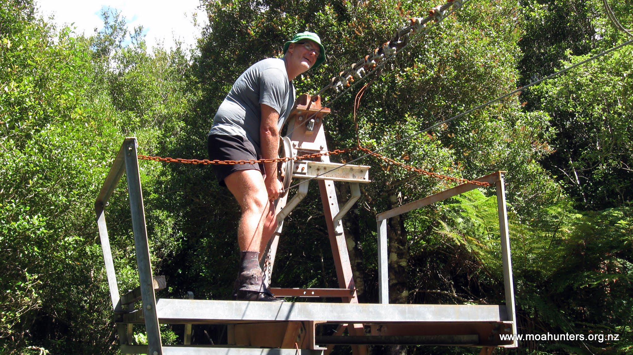
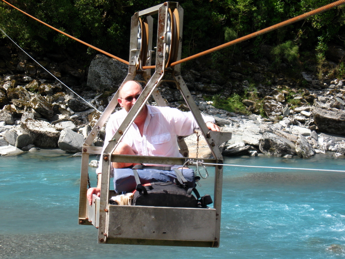
After carefully picking our way across, we continued down the Hokitika to the cableway which would take us over to the true right of the river and the final section of the walk out.
Crossing the cableway was not a new experience for the Moa Hunters who did the Whitcombe – Toaroha trip in 2013. But that doesn’t make it any less fun! We all enjoyed our ride across the river in the little cablecar.
Chris in the cableway engine room
I… can…. fly….!
Beyond the cablecar, the terrain becomes fairly benign as it leaves the steeper mountainous country and heads for the more open flats of Kowhitirangi. Walking was easy and we made brisk progress, reaching the 4WD track that joins the Whitcombe Valley road shortly after 3pm. An hour later we were at the carpark and the official start of the Whitcombe track.
The beginning of the end
After a couple of quick photos, we continued up the road for another 45 minutes, when a familiar vehicle rounded a corner ahead of us. Paul’s father Alan, superbly organised as always, handed out sandwiches and fired up his Thermette to brew up a cuppa.
Journey over…
Our crossing from East to West was complete. We had done the Whitcombe Pass route. It was a very satisfying feeling. The trip was certainly one of the most challenging we have undertaken, and certainly not one that anyone should take lightly. But as always, the spectacular New Zealand scenery was more than enough reward for our efforts.
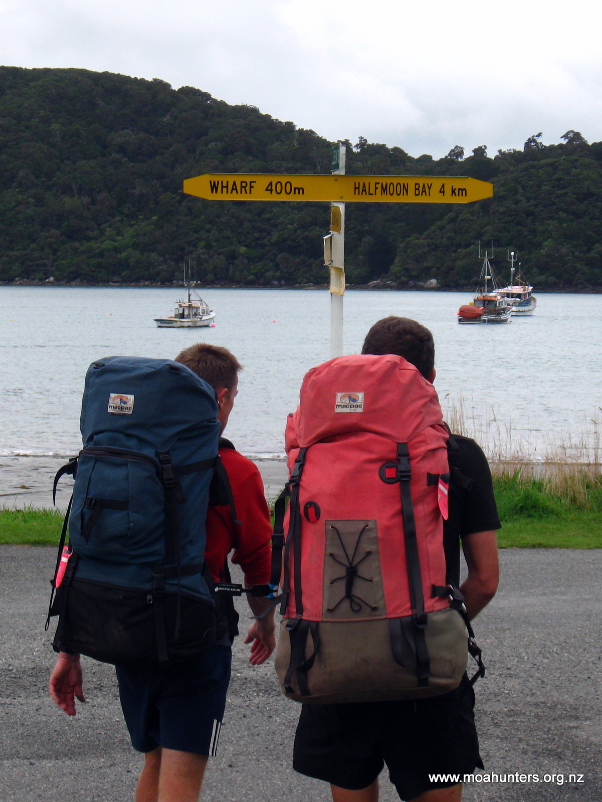
Moa Hunters on this trip: Chris, Paul, Adam, Lewis, Richard
Just days before departure, Magnus was forced to pull out of this trip. We missed you Magnus, and really hope you can make the next one!
The Trip:
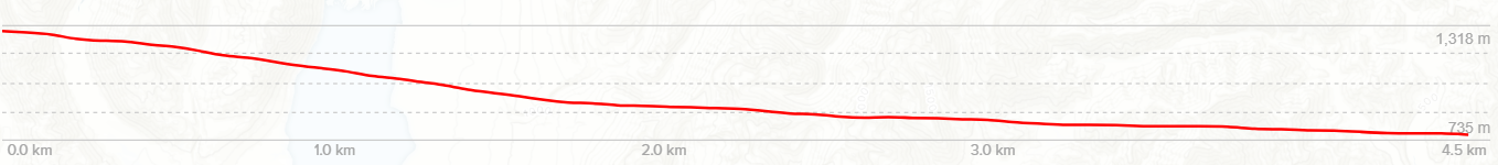
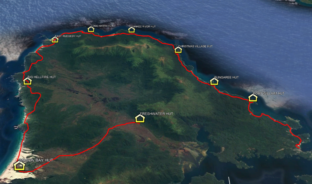
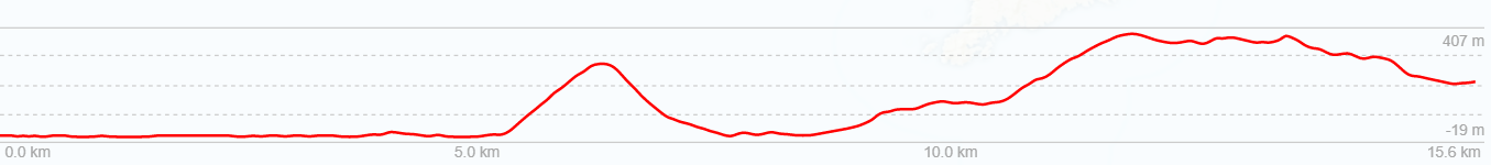
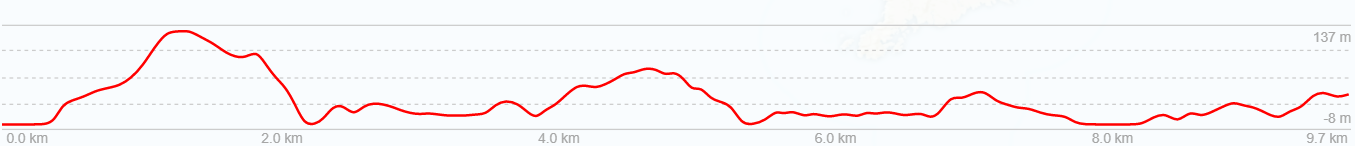
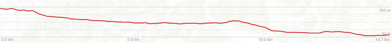
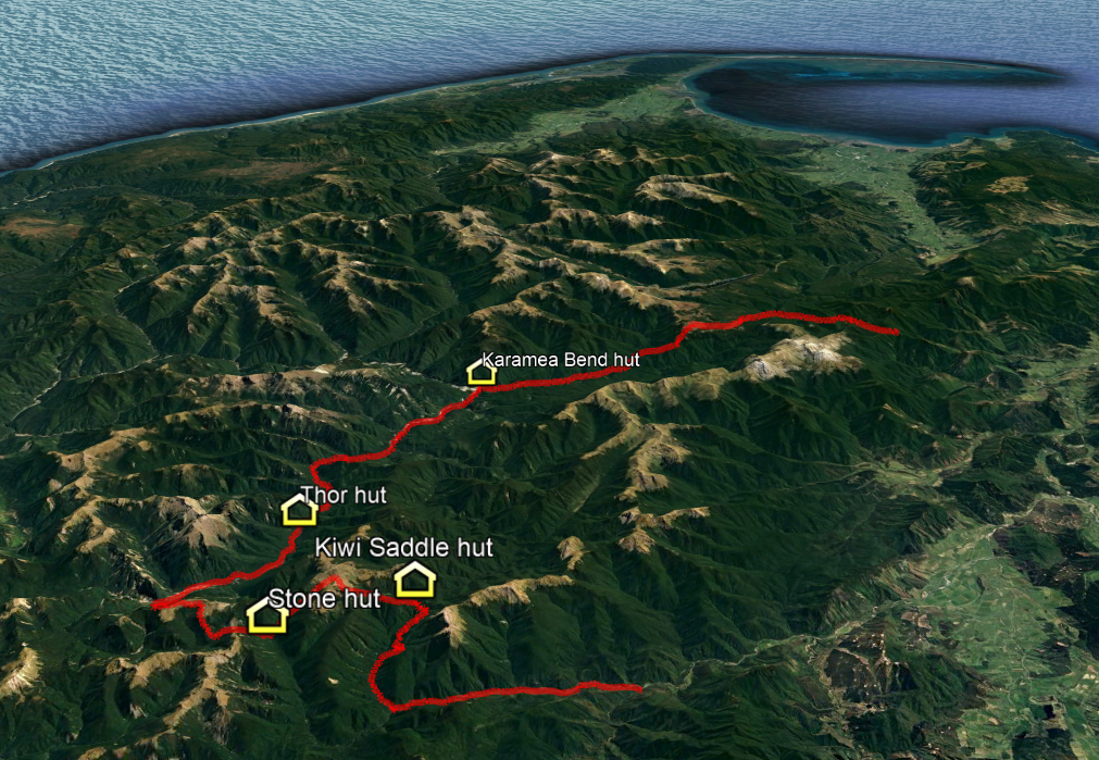
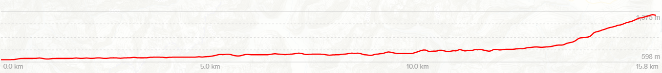
Day 1: Fly to Invercargill, Ferry to Oban, Stewart Island. Day 2: Water Taxi to Freshwater Hut, walk to Mason Bay Hut (3hrs / 15km) Day 3: Mason Bay Hut to Big Hellfire Hut (7hrs / 15km) Day 4: Big Hellfire Hut to East Ruggedy Hut (7-8hrs / 14km) Day 5: East Ruggedy Hut to Long Harry Hut (5-6hrs / 10km) Day 6: Long Harry Hut to Yankee River Hut (5hrs / 9km) Day 7: Yankee River Hut to Christmas Village Hut (6hrs / 12km) Day 8: Christmas Village Hut to Bungaree Hut (6hrs / 12km) Day 9: Bungaree Hut to Port William Hut (3-4hrs / 6km) Day 10: Port William Hut to Oban (4hrs / 12km). Fly home.
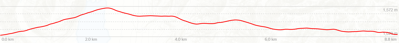
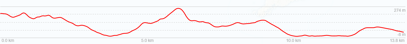
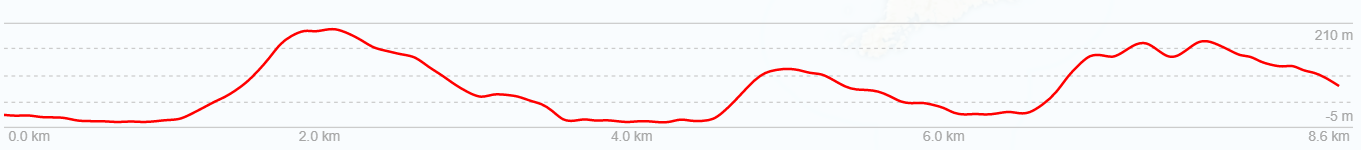
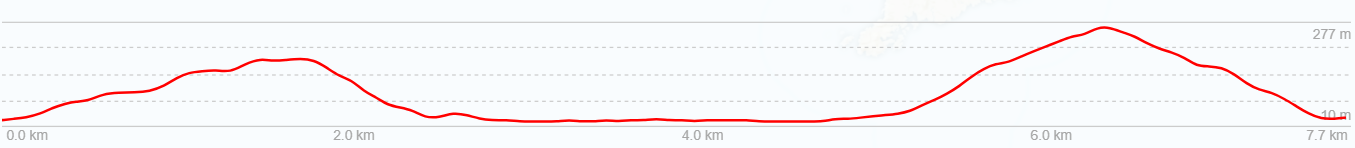
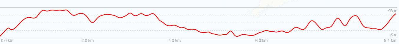
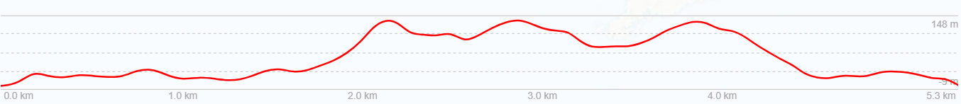
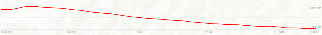
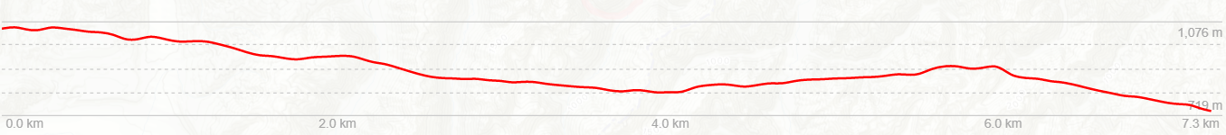
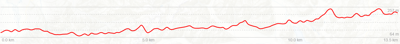
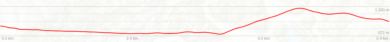
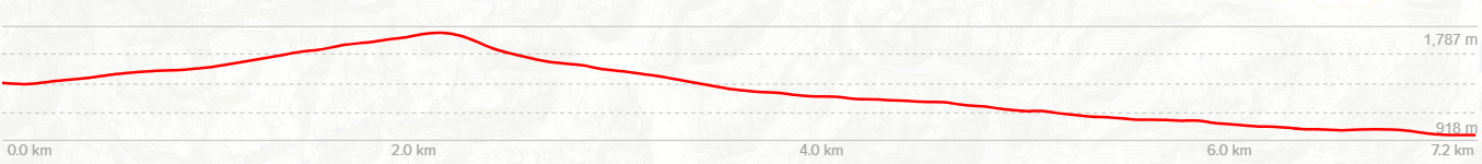
Above is an altitude profile of this route. Click to enlarge. Note: The horizontal scale divisions are roughly 1km. The transition from green to brown does not accurately represent the bushline. The horizontal scale to vertical scale is not 1:1
Day 1
Friday 27th February – Destination Oban
Aboard various flights from all around the country, the Moa Hunters converged on Christchurch Airport. By mid morning, we were reunited, just over a year since completing our last trip in the Nelson Lakes. Ahead of us was our most ambitious trip yet. Ten days on Stewart Island. We all felt a mix of emotions: Excitement at what the next days would hold for us, mixed with anxiety at being away from family for so long.
Shortly after lunch we boarded the flight to Invercargill. As we winged our way south, those on the west side of the plane were treated to spectacular views of the southern alps and interior of the South Island. Once on the ground in Invercargill, we had a short wait outside the airport before our shuttle bus collected us. Forty minutes later we were standing in light drizzle outside the Bluff ferry terminal. We boarded the Stewart Island ferry just before 5pm and were in Oban just after 6pm. Thankfully Foveaux Strait was in a benign mood, and the crossing was a smooth one.
Light rain greeted us in Oban
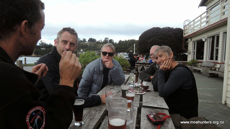
As it was raining lightly in Oban, we grabbed our backpacks as soon as they were unloaded from the ferry and walked briskly up to the South Sea Hotel. Full of locals and visitors, the pub was noisy and vibrant. We booked ourselves a table in the adjoining restaurant for 7pm, then filled in time downing a few ales.
Wetting our whistles at the cosy South Sea Hotel
After a very good feed of locally caught cod, chased down with cheesecake, we left the South Sea Hotel. With our jackets back on we headed up Main Street to the “Harris House” holiday home we had booked for the night.
Once settled in, we distributed food evenly between our packs (which now weighed around 22KG on average) and headed for bed, whereupon rather a lot of farting ensued.
Day 2
Saturday 28th February – Freshwater Hut to Mason Bay Hut
After a night which allegedly featured snoring loud enough to drown out a large Stihl chainsaw, the Moa Hunters arose from their slumber soon after 7am. Once the house was tidied, we locked up and left about 9am. With heavy packs on our backs, we wandered down Main Street in light spotty rain to the South Sea Hotel.
Yes, again! But this time for a delicious cooked breakfast of hash browns, bacon, eggs and mushrooms.
With full tummies we left the hotel, made a quick stopover at the DOC Office to buy hut tickets, then wandered up Argyle Street for Golden Bay. It was easy to enjoy the peaceful and lazy ambiance of Oban. Nobody seemed in a hurry to get anywhere. Tui flitted about in nearby flowering tree fuchsias, and cheeky Kaka called raucously from the trees above us.
With backpacks at maximum weight we walked into Oban
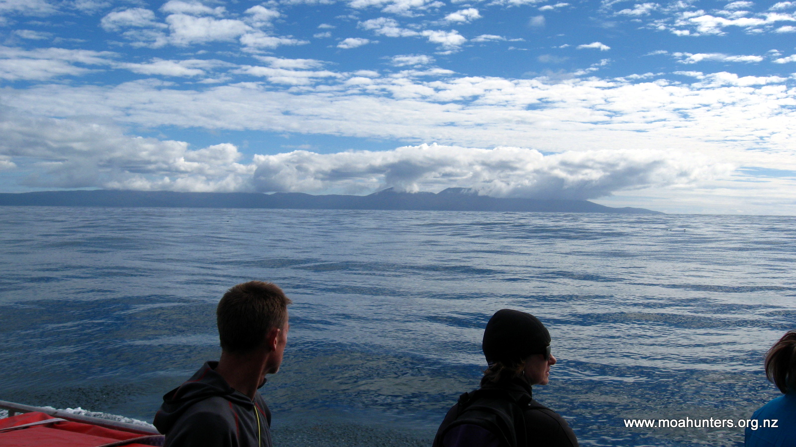
Golden Bay is a lovely sheltered little harbour with a small wharf shared by a number of local water taxi operators. Not long after our arrival, Ian Wilson from Stewart Island Water Taxis showed up in his ute. Before long we were aboard his boat and under way.
Lewis waves goodbye to Golden Bay as we head for Freshwater River
Headed for freshwater river at the top of Paterson Inlet, we made a quick detour into beautiful Ulva Island to drop off some Australian sightseers. 30 minutes later we were cruising along in very shallow waters near the mouth of Freshwater river. Its banks overgrown by thick vegetation, the river snakes its way into the heart of Stewart Island. Ian skilfully piloted us up to the narrow waterway to the small jetty at Freshwater Hut, where we disembarked with our packs.
Finally, we were at the official start of our Moa Hunt. Not wanting to rush our adventure, we took some time to take in our surroundings. After a look around inside Freshwater Hut we hefted our packs onto our backs and struck out down the track to Mason Bay Hut.
Boardwalks make travel over boggy terrain very easy
The track was hard and fast. Walking through low a mix of low scrubby vegetation and taller Kanuka, we encountered our first muddy patches, but nothing too deep or difficult. After about an hour the track was boardwalked and ran dead straight for more than a kilometre, following an old logging tramway. After that section the terrain opens out dramatically with the boardwalking taking us through a wide expanse of grassy marshland flanked by low bush covered hills. The different coloured grasses creating a spectacular natural tapestry on either side of the track.
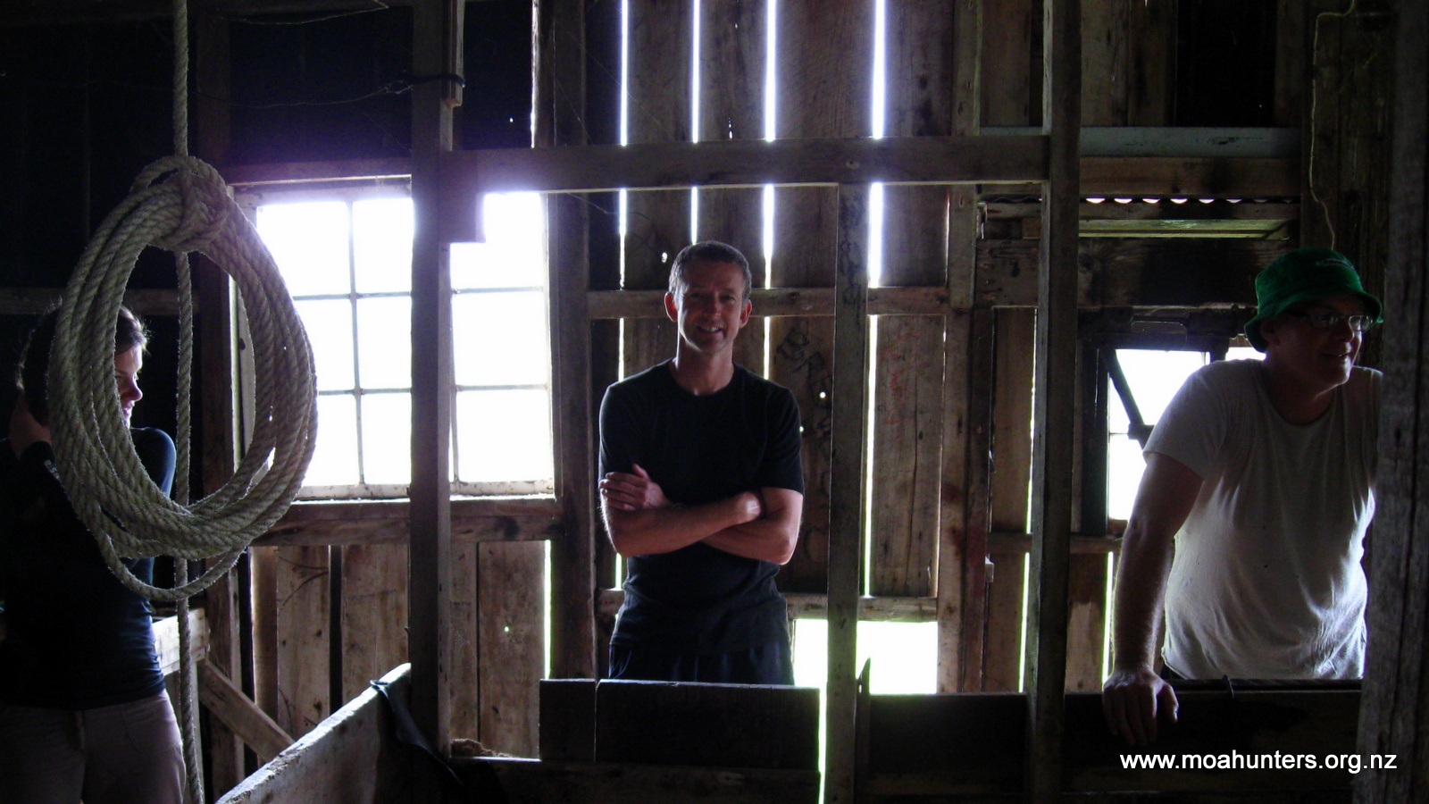
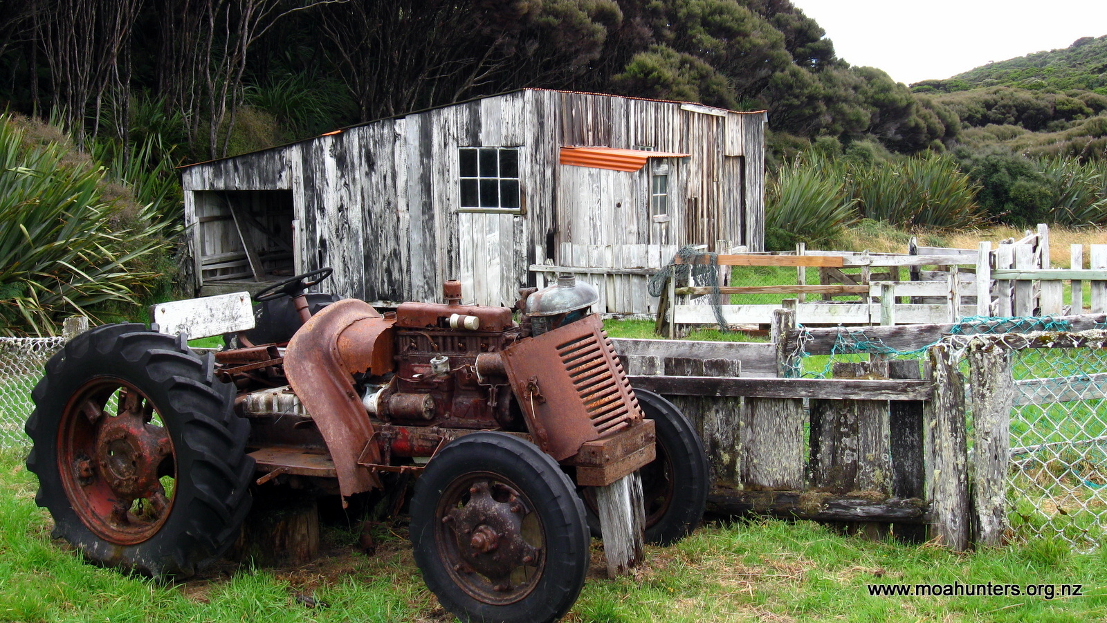
Along the way we bumped into two lovely young ladies, Inge and Katrina, who had paired up for the walk. We walked with them for the last half hour of track to Mason Bay hut, stopping for fifteen minutes or so to explore some historic farmstead buildings. Mason Bay was relatively unproductively farmed for decades, before being finally abandoned in the mid 1980’s when the NZ Government purchased the land and incorporated it into the Rakiura National Park.
Inside the old woolshed
A rusting old tractor whose working days are over
The Mason Bay hut was already bustling with trampers when we arrived. We quickly secured ourselves some bunks and then acquainted ourselves with the area.
Paul was very pleased to remove two kilos of marinated steak from his pack and cook it up for our dinner. It was superbly tender and expertly cooked – well done Paul and Chris! There was more than we could eat, and some leftovers were donated to some starving trampers we had befriended. In particular, Nancy, who had seriously underestimated how much food she would need for her trip. She is a Stewart Island local and promised us extra chips at the Kai Kart if we dropped in after our walk. We said we would hold her to that promise!
From the hut there is a track through the dunes out to the spectacular 12 km sweep of white sand that forms Mason Bay.
Hefty logs line the river at Mason Bay
From the sky to the dunes, everything is spectacular at Mason Bay
Accompanied by Inge and Katrina we walked out as the sun sank towards the horizon, hoping to witness one of Stewart Islands legendary sunsets.
Inge and Katrina
We weren’t disappointed. Blazing reds and orange hues set the horizon on fire, while the sky above turned shades of azure, purple and pink. We stood on top of a high dune soaking up the splendour of Stewart Island.
Clouds on fire above Mason Bay
After a long walk along the beach, we returned to the hut slightly damp from a passing shower of rain that had arrived unexpectedly. Apparently a not unusual phenomenon on Rakiura!
Day 3
Sunday 1st March – Mason Bay Hut to Big Hellfire Hut
Despite Mason Bay Hut being a busy place, we all got a fairly good sleep. Not only do trampers frequent the hut from both the North West and Southern circuits, but tourists also arrive regularly in small planes that land on the beach. Kiwi spotting is the main reason for the tourist flights – Mason Bay is allegedly a great spot to see them. So this hut is often filled with an eclectic mix of tired trampers on their last rations, in sharp contrast to well provisioned tourists with large quantities of food, wine and beer.
Still fresh looking, about to depart Mason Bay hut
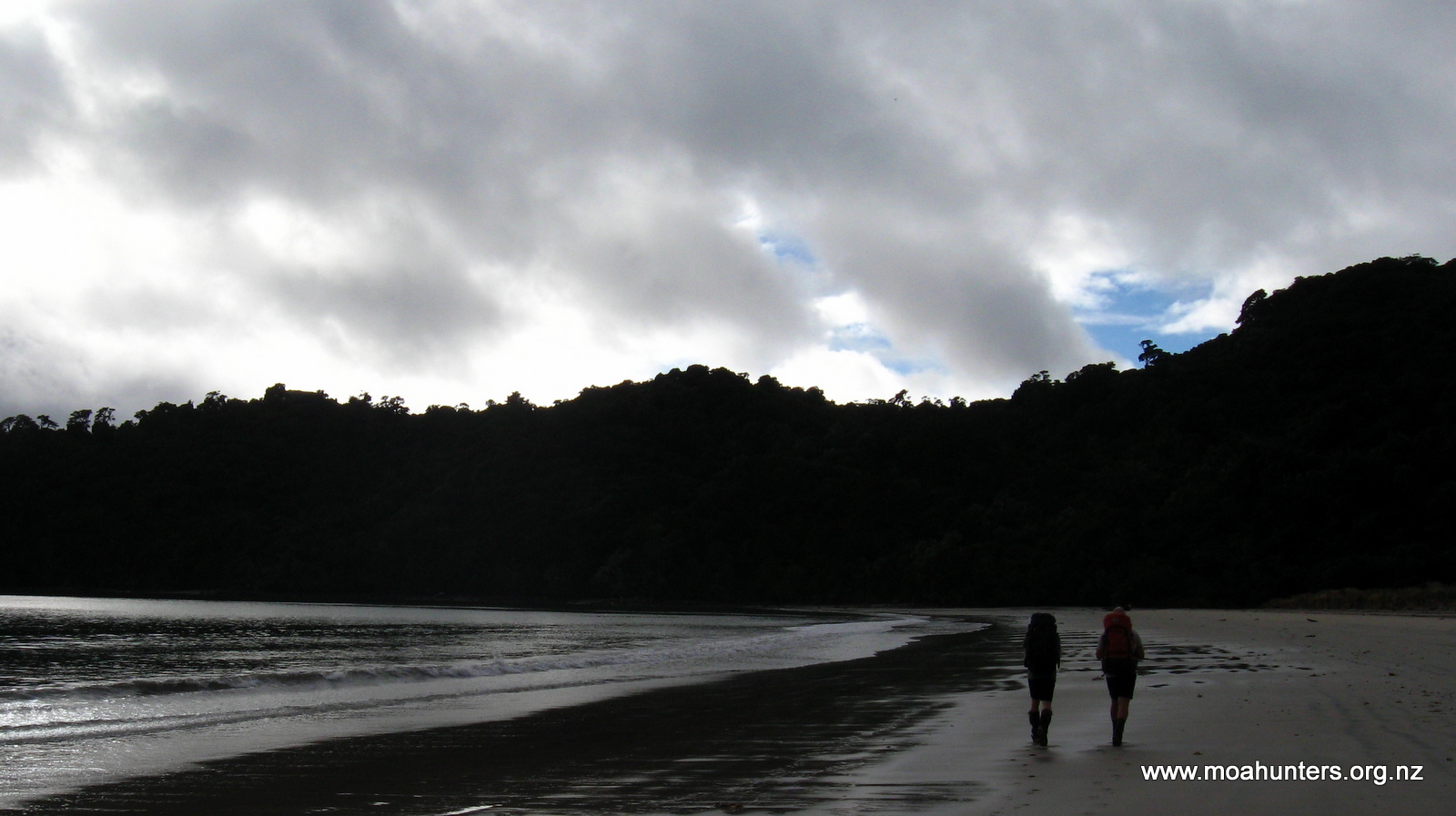
As we had a fairly big day ahead of us, we left the hut relatively early. Under blue skies streaked with hazy high cloud, we followed the well walked track through the sand dunes out onto the beach.
Endless Mason Bay…
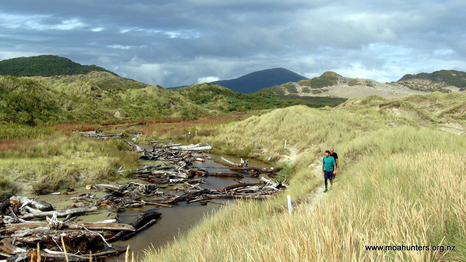
The first four kilometres of the beach was a doddle. Firmly packed sand made for express progress. We enjoyed the scenery and the opportunity to walk as a group, chew the fat, and generally put to rights all the wrongs of the World.
Halfway down the beach, a rocky outcrop protrudes past the high tide mark. We arrived there at the tidal midpoint. This left us with the opportunity to dash round the point between waves, avoiding an onerous diversion inland on the high tide track.
Paul and Lewis size up our options round a rocky outcrop…
As we approached the end of the bay, flat sand made way for more rocky terrain. The rocks there are an annoying size. Not big enough to rock hop, but just large and loose enough to be a nuisance. The last couple of kilometres to the end of the beach did drag on somewhat. Consequently we were all relieved to spot the track marker leading us off the irksome rocks and into the bush.
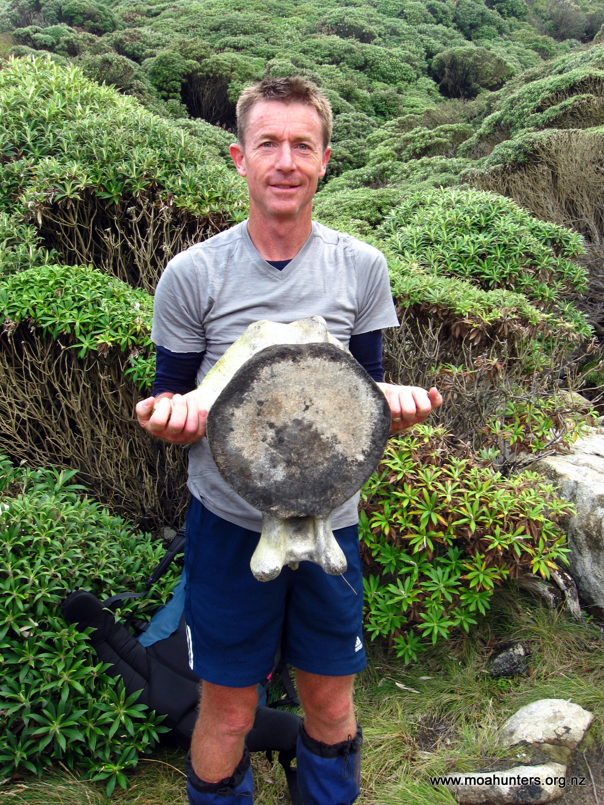
Richard holding a whale vertebrae
From the beach we began a 250 vertical metre climb over a headland that separates Little Hellfire beach from Mason Bay. The bush here is fairly scrubby, with some taller windswept Kanuka forming a low canopy in places. The climb was hot work and parts of the track were quite muddy.
Some of us adopted a skirting round the edges policy when confronted by large mud troughs. Others (Chris!) preferred an “up the guts” approach, straight through the middle. There is definitely not a single best approach to the mud. Some areas are easily and quickly skirted around. Others are not, and simply spludging through the middle makes the most sense. The reality of Stewart Island is you are regularly going to get wet and muddy.
We stopped at the top of the climb for a welcome breather and a bite of scroggin. From our high vantage point we had good views up the coast to Codfish Island, a few days walk ahead.
Westerly winds blow almost constantly across Stewart Island.
Cooling off at the high point between Mason Bay and Little Hellfire bay.
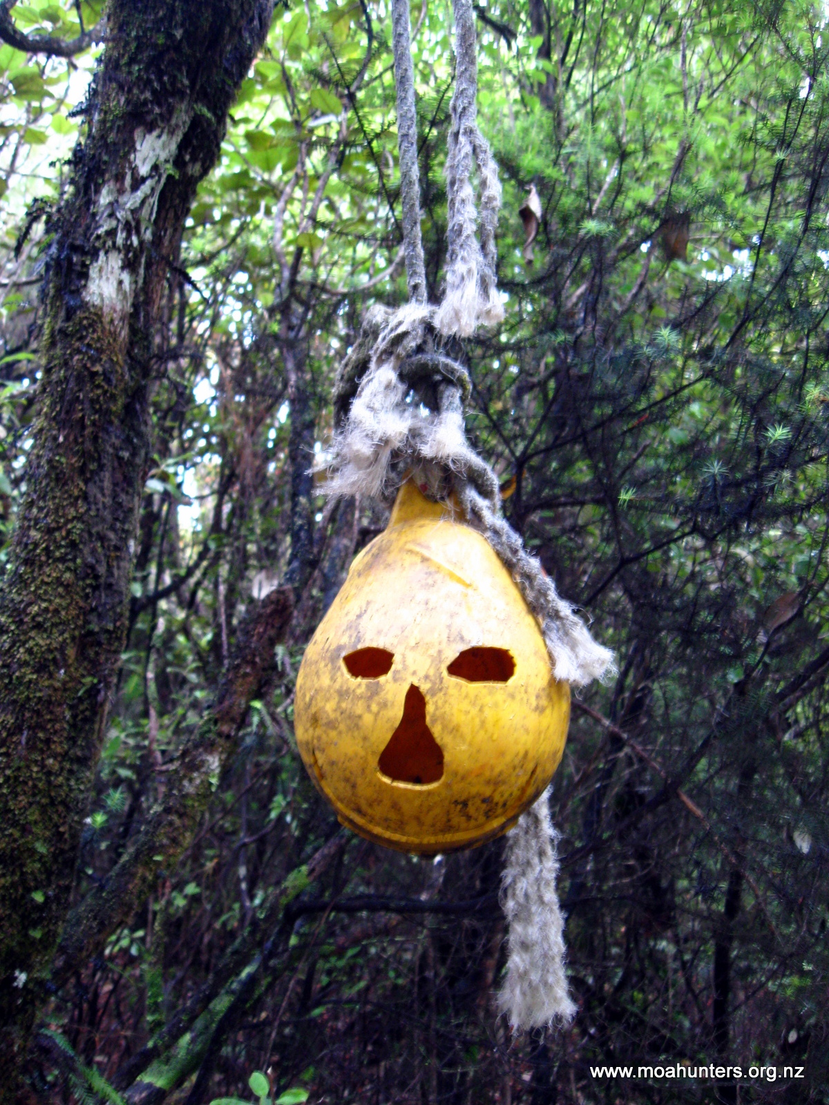
The drop to Little Hellfire was fairly sedate, the track marked by ghoulish looking buoys with faces carved into them. It was also much less muddy than the more shaded ascent we had just made on the south facing hillside. This was a trend we noticed throughout the walk: South facing hillsides tend to be much more muddy than the northerly facing ones.
Little Hellfire is a short stretch of pebbly sand flanked at each end by low rocky granite cliffs. We stopped at the North end of the beach and had lunch.
Looking south back towards Mason Bay
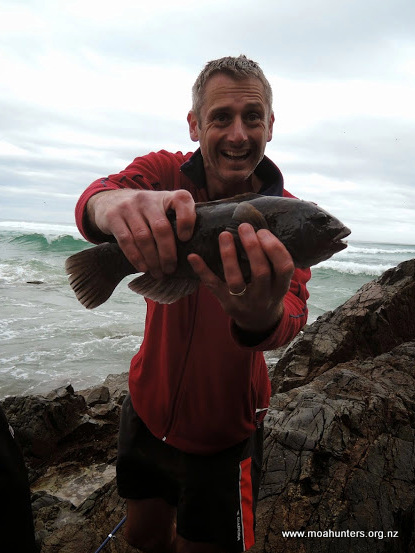
Having packed a telescopic fishing rod, Adam eagerly headed out over the rocks at the edge of the beach looking for a good spot to try some fishing. Using a plastic softbait and a small rock tied in fabric for a sinker worked quite well.
Fish caught! A wrass.
His first cast was a snag which took some time to free. The shallows all around Stewart Island are thick with rubbery kelp. Not ideal for surf casting. However, the second cast was much more successful – a bite! Two minutes later, a fairly fat looking fish with vicious pointy teeth was landed. After a couple more snags and only half a dozen casts, a pair of these murderous looking mystery fish had been caught.
Once the fish were gutted, filleted and bagged, we hefted our packs and headed up off the beach for the second big climb of the day. Between us and Big Hellfire Hut lay 399 vertical metres of climb. We slogged our way up an extremely muddy and fairly steep section of track. We marveled at how such steep terrain could be so wet and boggy! It turned out that this section would be one of the muddiest of the whole trip. And probably the hardest.
At 350 metres above sea level the track flattens out somewhat, rising and falling more gently as it bends from North to West following a long prominent ridge. It is also much drier along this section making for relatively swift progress. After a short sharp climb to 399 metres the track drops off the main ridge onto a smaller one.
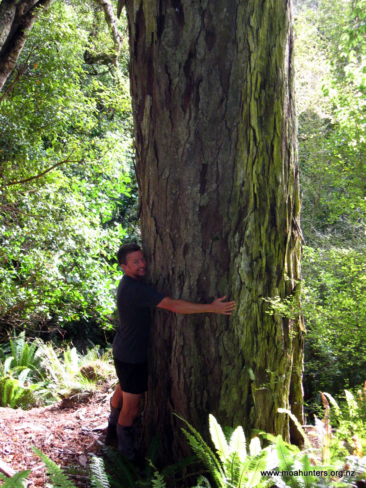
The bush in this area is beautiful – a mix of massive rimu, occasional totara and spectacular red flowered rata.
The view from Big Hellfire hut towards the Ruggedy Range
We arrived at Big Hellfire hut just after 6pm. We agreed the day was probably half an hour too long. An hour out from the hut we had reached some board-walked sections of track that fooled us into thinking we were nearly there. And we weren’t.
Fish for dinner!
There were four other occupants at the hut: three people from Waikato University, there to do some survey work on an unusual nearby stand of Pink Pine trees, and a Canadian dude named Andrew.
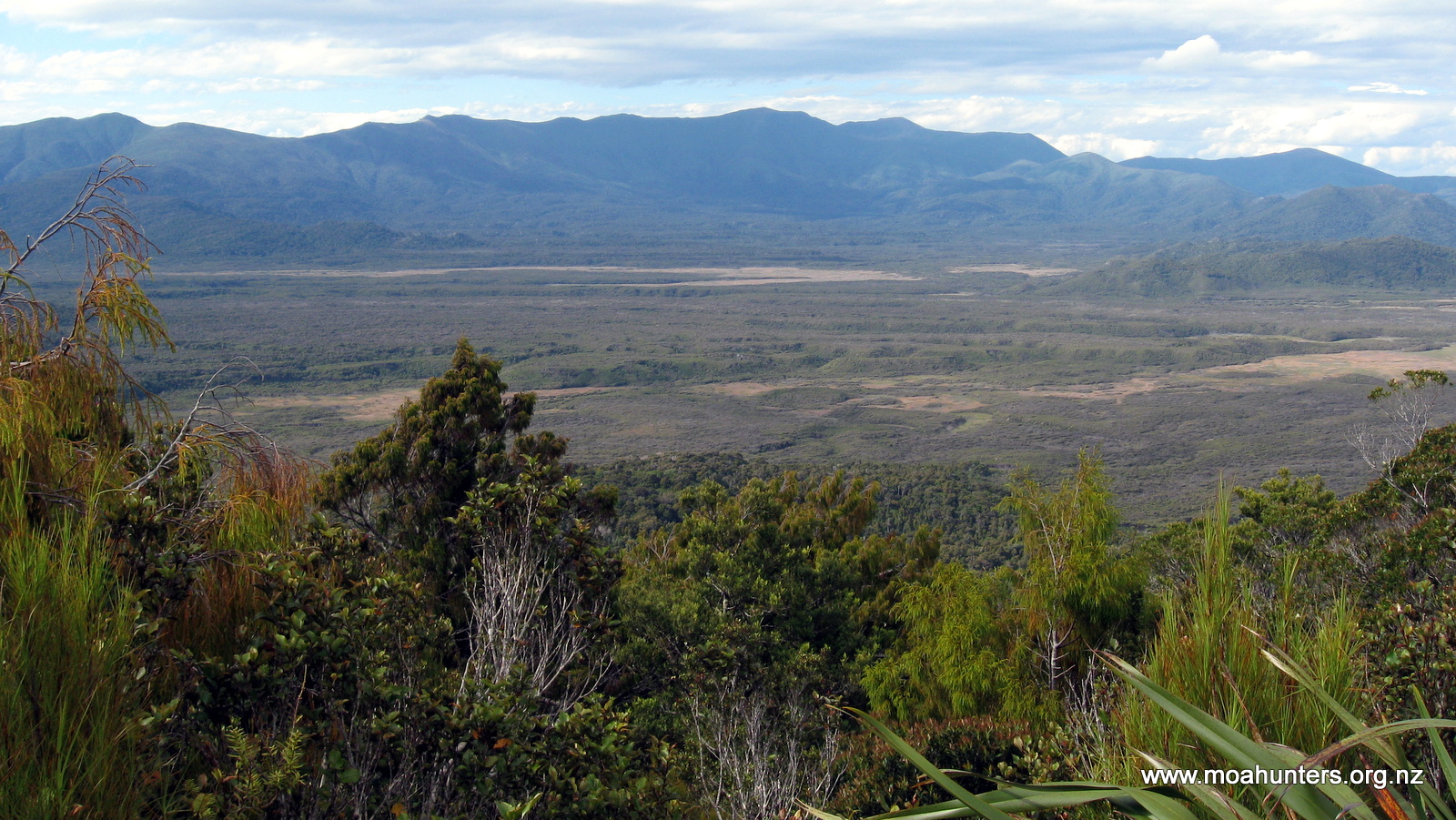
Big Hellfire Hut appears to be perched at the top of a massive sand dune. At over 250 metres above sea level, there is a steep sandy chute all the way down to the beach. But to be fair, it isn’t a true sand dune… In reality it is a lot of sand (wind blown we presume?!) on a steep rocky hillside. Looking east from the hut there is a magnificent view across a huge flat expanse of the Island’s interior, framed by the Ruggedy Range in the misty distance.
After enjoying a lemon pepper fish entree and curry main, we walked out from the hut to the top of the “dune” to watch the sunset. Sitting together on the warm sand, we watched the sun blaze its way through a conflagration of flaming orange crimson and red hues as it sank into the Tasman Sea. Absolutely breathtaking.
Atop the mighty Hellfire dune
Looking north from Big Hellfire towards Codfish Island
Sunset at Big Hellfire
Day 4
Monday 2nd March – Big Hellfire Hut to East Ruggedy Hut
By 9am we were packed up and ready to hit the track. The three from Waikato University had left earlier that morning, so silently that most of us didn’t even hear them pack their belongings and go as we slept.
Mighty Moa Men posing it up at Big Hellfire
The track leaves the hut to the North heading steeply up a dune of deep loose sand. A warm breeze was blowing in from the North West, meaning we immediately broke into a healthy sweat as we struggled upwards.
The steep climb out from Big Hellfire
Once out of the dunes, we dropped down an easy section of much firmer ground into a valley, before spludging up another very muddy south facing climb.
At the top of this section we dropped packs next to a small stream, taking a break for a drink and some snacks. The water on this side of the Island is quite drinkable, but not exactly crystal clear. Ranging from slightly brown to quite brown, water from streams and creeks on Stewart Island generally tastes a little musty, but not so strongly that it is off-putting.
The descent down to Waituna bay was steady and fairly dry, with only a few muddy sections. As we progressed northwards, the bush became progressively taller with large stands of towering rimu and totara. However, as we descended to the bay, the trees thinned out and the bush became more stunted.
Though the air was still warm, the sky was growing darker and we felt a few errant drops of rain.
The extended forecast we had read a few days earlier had suggested a Southerly front was due this day. It was certainly beginning to look threatening. We decided to take a moment to get some wet weather gear on, just in case. Jackets and pack covers were quickly put on.
And not a moment too soon. Literally the moment we stepped out of the bush onto the beach, the front hit. A strong wind whipped up and lashed rain across the beach. With heads down we set out into the nastiness. It wasn’t especially cold yet, but every hint of the earlier pleasant morning was blown away.
Mighty rimu flank the track
Once back in the bush we were sheltered from the worst of the wind, but the heavy rain still cascaded down through the canopy and ran off large tree boughs in torrents. It was easy to see how the track gets so muddy!
From Waituna Bay the track climbs steadily to just over 200 metres above sea level. The rain was unrelenting, so we spludged onwards up a very muddy and increasingly waterlogged climb. We passed two trampers heading the other direction. They were also very wet and muddy. We surmised conditions weren’t going to get any better.
Close to the top of the ascent we found a relatively flat section of track with no mud in sight. Chris pulled the tent fly from his pack and after a short debate on how and where to attach it, we had a makeshift shelter set up. Huddled under it, we ate our lunches as the rain came down.
While we were hunkered down, a couple appeared round the corner ahead of us. The bloke had a semi decent jacket, but his lady friend was poorly equipped for the weather, wearing a puffer jacket with a plastic poncho over it. Both looked like drowned rats. She looked pissed off. The kind of pissed off that men dread. The man asked us how far to Waituna Bay. Paul told him it was a good two hour walk. He stared at us in horror, then said just one word… “Fuck”. Ducking under our shelter he headed off down the track, with her not far behind. There was a dark angry thundercloud over her head. That poor bastard…
After what seemed like a long afternoon in the rain and mud, we dropped down onto East Ruggedy beach. It is a nice beach and we would have probably had another go at fishing… if it wasn’t absolutely pissing down.
Part way along the beach we came across a marker. Mistaking this for the start of the track, we followed the steep route up off the beach, only to drop back down onto the beach again some distance later. It was the high tide track – an unnecessary and irksome diversion. The lady at the DOC Centre had advised us that the tracks are always at the end of the beaches. We should have had more faith in her good advice!
Ghoulish buoys mark the track near the coastline
At the end of the beach we did find the correct marker and ascended up a sandy slope onto some very interesting rocky terrain.
Just before 5pm we reached East Ruggedy Hut nestled amongst the bush. We were very wet and glad to be there. The hut had a single resident, a quiet Englishman called John. To be fair, he didn’t look especially pleased to see five noisy Moa Men arriving.
After hanging up all our wet gear and getting the log fire blazing, we sat round the table and enjoyed a hearty tomato soup followed by some very good spaghetti bolognese.
Feeling quite weary we were all in bed fairly early that night.
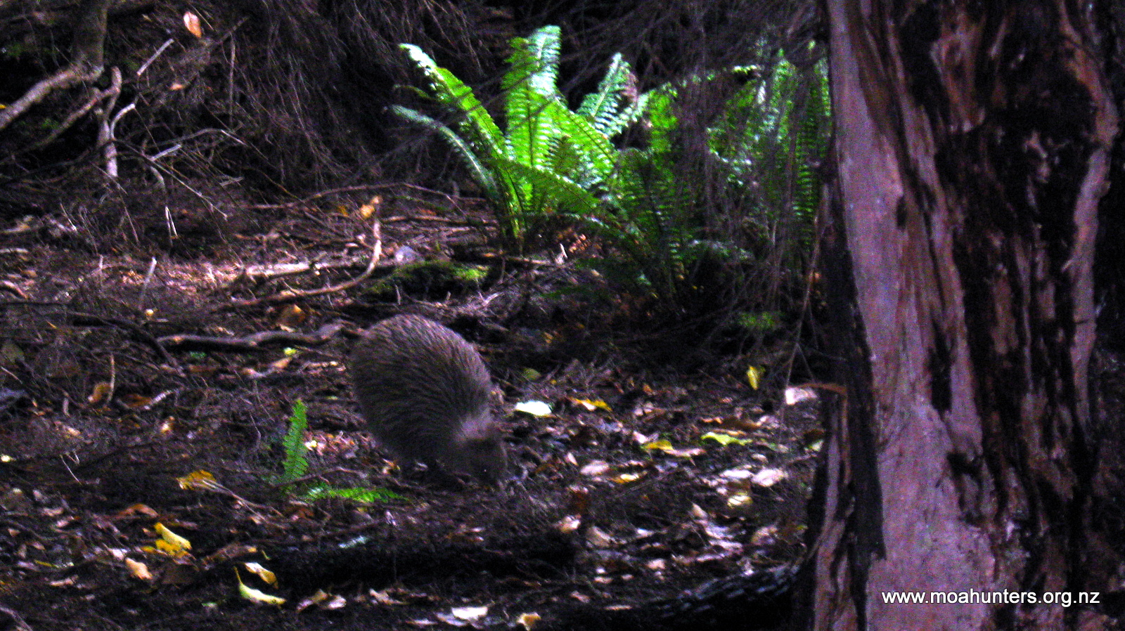
Just as well, because at 2am Lewis woke us all with news he had met a kiwi on the track to the long drop! We all quickly pulled on some warm clothes and sneaked outside with torches to try and spot it. Fortunately the rain had stopped. Unfortunately the kiwi didn’t. By the time we got outside it had scuttled off into the ferns. We could hear it scratching about, but that was as close as we got.
Day 5
Tuesday 3rd March – East Ruggedy Hut to Long Harry Hut
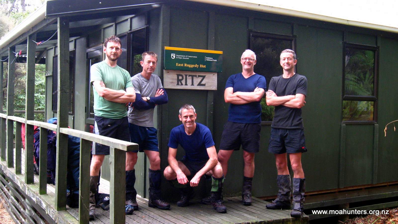
East Ruggedy hut is a nice hut, so far as huts go, but lacks any kind of view. Surrounded by fairly thick bush it has been christened the ‘Ritz’ by previous visitors.
This morning John seemed to have warmed to us a little. Well quite a lot actually. Perhaps his realisation that most of the Moa Hunters are in fact engineers in disguise helped. We certainly found the accounts of his deep sea diving work on oil rigs fascinating.
To break the monotony of porridge for breakfast, Chris prepared us some bircher muesli. Loaded with dried fruit, nuts, oats and other mystery ingredients, it was bloody delicious.
Ready to depart the ‘Ritz’, East Ruggedy hut
When we had finally packed our backpacks and generally tidied up, we said goodbye to John and left the hut.
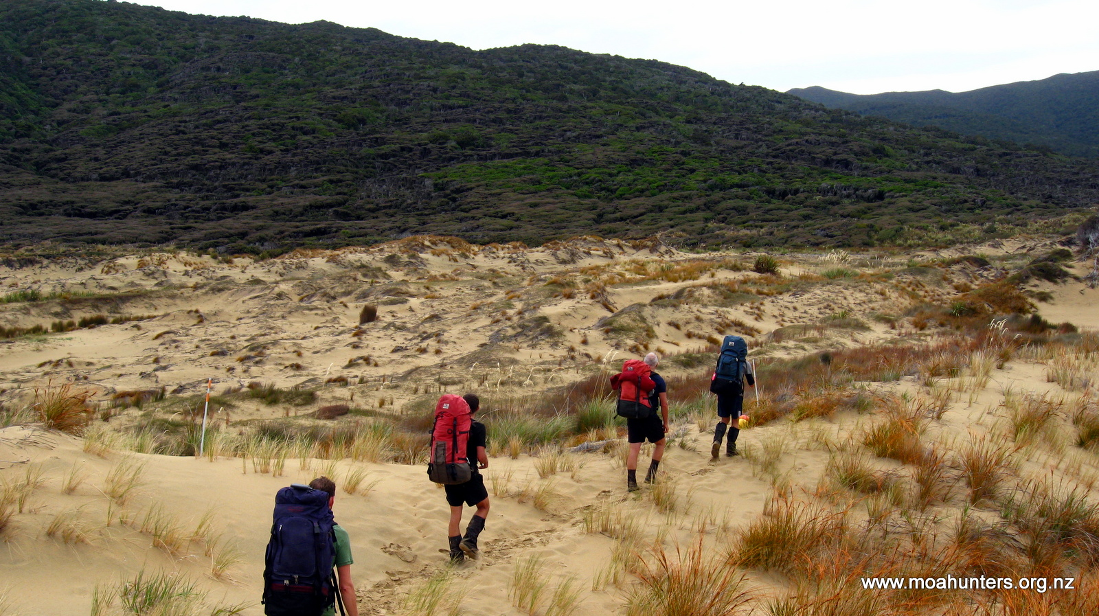
Initially the track meanders off easily through low scrubby bush. But it isn’t long before it emerges into a wide expanse of sand dunes. Signs of animal activity were everywhere. Possum footprints were common. So were kiwi tracks. Their distinctive three-toed footprints wandered across the sand, punctuated by little holes they had excavated with their beaks in search of grubs. White-tailed deer hoof prints were also spotted along the way.
Adding MoaMen footprints to the kiwi, possum and deer tracks we spotted on the dunes…
We marveled at the diverse landscapes we were encountering. It seemed that every few hours we were being treated to a new experience. Stewart Island is without doubt the jewel in New Zealand’s scenic crown.
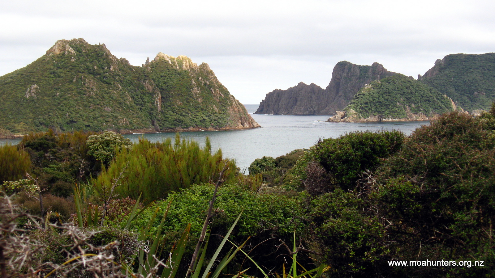
After a quick river crossing near the coast we began a stiff climb up to a ridge. Looking out we were able to enjoy wonderful views of the Ruggedy Islands, clustered just off the coast. Little did we know this was just a preview of even better to come.
Steep sided granite islands rise sharply from the sea just off the coast
A short walk further up the track, we reached a sign for a lookout. Being a shorter day on the track, we had enough time for a quick diversion. We dropped packs and followed the very muddy and well walked track for five minutes out to the lookout.
Dealing with the mud (and dead feral cat!) was totally worth it.
Words and photos probably don’t do the view justice. In front of us the bush clad Ruggedy Islands rose sharply out of the ocean, their hard granite cliffs almost vertical. They seem so very different from islands seen off the mainland, reminding us more of Thailand than New Zealand. In the far distance we could make out the southern coast of the South Island. To our left, the golden sands of the dunes we had walked across that morning stretched out to the ocean. Even from our height we could clearly make out the kelp beds through the near crystal clear water.
Wind sculptured kanuka and the Rugged Islands
We stood in awe, thinking the view was perfect in every way. Just to prove us wrong, a pod of dolphins appeared and swam slowly across the bay, demonstrating that it was possible to improve on that perfection.
The view back to East Ruggedy beach
From the lookout the tracks drops steadily towards the sea. At that point we would officially start following the Northern coast of Stewart Island. We walked back to our packs and began the descent to the coast.
We had a relaxing lunch break on a rocky West Ruggedy beach looking out across Foveuax Strait to the South Island.
Steep!
A steep (near vertical!) climb off the beach had us back in the bush.
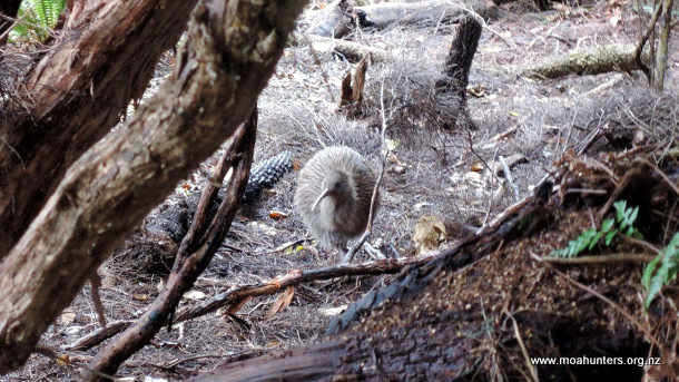
Walking under a canopy of tall gnarly old kanuka, Adam glanced to his left and spotted movement on the ground amongst the ferns. A kiwi! We had agreed that rather than shouting “Kiwi!” and scaring them off, anyone who saw one would throw their arms out wide to let the group know. So Adam threw his arms out wide, and Chris, Richard and Lewis ground to a halt behind him. Unfortunately Paul was in front of Adam and had no way of seeing the signal. He walked on oblivious to the mute excitement.
The elusive Kiwi
Does he see us?
The Kiwi very kindly hung around for quite some time, pottering about probing the leaf litter for food morsels. Thankfully, after a few minutes Paul twigged that he was alone, and returned in time to join us watching our National icon doing its thing. It was mesmerising watching such an odd creature going about its daily activity in front of us. We felt extremely privileged to be watching it.
Mud became less and less frequent the further we nudged round the northern coast of the Island. It became a bit like walking through a beautiful garden on this part of the Island. Pleasant grassy areas amongst tall trees, flax, toi toi and flowering rata gave our surroundings an idyllic feel. Tui, wood pigeons and other smaller birds were prolific, and the bird song was constant.
Our final hour into Long Harry hut did however become a bit torturous. The track plunged into four deep gullies, and back out again. Each gully is a sharp descent followed by a grunt up the other side.
Descending into the first gully we were surprised by a hunter. Dressed in camo gear complete with camo face paint, he suddenly popped out of a large fern with a compound bow on his back. Dan was his name. We had been told by various other trampers along the way that Long Harry Hut was occupied by a group of hunters, so it wasn’t a total shock to meet Dan. We had a short yarn to him then carried on for Long Harry.
Looking down on Long Harry hut
Reaching the hut at about 4:30pm we were welcomed by Steve. Steve is an all round good bloke, and was the self-appointed spokesperson for the hunters. He immediately made us very welcome, and cleared space for our gear. That was necessary because they had a colossal amount of supplies which had been choppered in with them!
The hunters had a little more gear than us
We had a great evening chatting to the five hunters, made especially great due to the fact they shared their roast venison with us. Absolutely magnificently cooked, golden brown, tender and delicious. It wasn’t until after 10:30pm that we eventually crawled into our sleeping bags. Quite a late night by our usual standards…
Slow cooked roast venison, courtesy of the Long Harry hunters
Day 6
Wednesday 4th March – Long Harry Hut to Yankee River Hut
Long Harry hut has powerpoints…
Not long after 7am we were all up and about. Not so our hunting friends… They had obviously decided there was no need to be out at the crack of dawn and were all still tucked up in their sleeping bags.
After a feed of porridge, we were ready to attack the day. For Lewis, that meant paua hunting. Steve had generously offered to head down to the coast with us to point out the best spots to find them. Low tide was about 9am, so just before then we all walked down the short track to the coast. Steve sensibly had a wetsuit on. Lewis who seems strangely immune to freezing temperatures was not wearing much more than a rash suit and long-johns.
It didn’t take much more than half an hour of groping under rocks in the shallows to hit the jackpot. Lewis was extremely happy to have a bag of four very nice sized (well above legal minimum!) paua.
Lewis prepared for battle…
To our surprise, Steve gave us the four he had gathered. We had assumed he was collecting for himself, but apparently he had always planned to give them to us. Top bloke.
Once back at the hut, Steve proceeded to give us expert lessons on preparing the shellfish. Before long we had eight paua removed from their shells, guts and teeth discarded. Steve then insisted on tenderising them all for us, using his trusty manuka club. We stood in the hot morning sun and watched him deftly pummeling the paua flesh into submission with it. When he had finished, we estimated our plastic bag contained a couple of kilos of paua meat. Wow.
Shortly after 10am we were ready to leave Long Harry. We thanked the hunters for their hospitality and said our goodbyes. We were especially grateful to Steve, who had been so generous with his time, expertise and roast venison!
Victory!!!
Steve expertly demonstrates paua preparation
Ready to depart Long Harry
We stopped in a sheltered bay not far from the hut for a brief unsuccessful fishing attempt before hitting the track again. From Long Harry the track drops slightly before a steepish and relatively muddy climb up to a ridge. From that point the track was very pleasant, winding its way under a very tall forest canopy of rimu and kotukutuku (tree fuchsia).
A gorgeous cove just east of Long Harry hut
High above us the sun was shining brightly from a cloudless sky. We were thankful of the shade the trees provided. As we neared the coast, the track got steadily steeper until we suddenly emerged from the bush onto Smoky beach.
And what a beach! It is absolutely stunning. Bright white sand contrasts with clear blue ocean and the deep greens of the surrounding bush to paint a breathtaking view.
Smoky Beach
Smoky creek flows into the west end of the beach where we stood. It is fairly deep when the tide is high. We looked for a spot to get across it, but couldn’t find anywhere shallow enough. So we backtracked and followed a high tide track which took us ten minutes upstream to a bridge over the waterway.
After a brief chat to a group of builders who were constructing a new hunters hut on the edge of the bush, we made our way back down to the white sands of the beach. A large and enthusiastic sandfly population resident in the shelter of the trees left us with little choice but to eat lunch out on the sand. Which wasn’t an altogether bad thing… unless you dropped your salami.
Not the worst place in the World for lunch….
After liberal applications of sunblock, we sat, ate, and marveled at the scenery. Smoky beach is a pristine paradise, which anywhere else in the World would be seething with people. But on Stewart Island, five Moa Hunters could have it all to themselves.
Backpacks sunning themselves on pristine Smoky beach
We all enjoyed the walk to the far end of the beach. To our right, low dunes capped with tussocks and low grasses crouched below tall dramatically windswept kanuka. Across the ocean, the South Island was again plainly visible.
Brilliant blue water at Smoky beach
The South Island clearly visible across Foveaux Strait
We encountered three hunters at the eastern end of Smoky beach. They hadn’t bagged anything, and were returning to their camp.
From the beach the track climbs up through the dunes, then drops very steeply down a loose sandy face to a small creek. We were very happy to be going down and not up!
A land of contrast
From the creek we followed the track up a long and at times quite steep climb through old gnarly kanuka. An hour and a half later, at the top of what is effectively a knob, we stopped for some scroggin. By this time the kanuka had given way to taller trees with a low fern understorey, common around this part of the island.
On the way up, Adam and Lewis had a chance encounter with another kiwi.
The descent from the knob was gentle and fairly dry. In less than an hour we were at the bridge over the Yankee River which is just a stones throw from the side track which leads to Yankee River hut. From that point it is a short walk through bush beside the hut.
Yankee River hut is a lovely old hut sitting on a small grassy rise overlooking the river as it flows slowly past and out to sea less than one hundred yards away. Old wooden windows and a rustic deck in front are part of the hut’s charm. Already at the hut were Sam and Keran. Sam, a lobster fisherman from the Northeast of the United States was visiting New Zealand to escape the winter freeze in his hometown. Keran was there to collect a food drop. She and her partner were intending to walk the whole circuit together, but an unfortunate back problem had left her partner stranded at Christmas Village hut. Keran would be walking back there the next day to reunite with her partner and arrange a water taxi rescue mission.
Yankee River hut
After a wash in the icy waters of the Yankee river, we sat on the deck and soaked up the last of the days sunshine. It was all incredibly pleasant. Sam and Keran were great company. We shared some of our paua with them. Steve had given us some cooking tips. Half of the paua was thinly sliced into a garlic white sauce, and the others were fried as steaks. Any misgivings we had about paua were gone in a flash. It was absolutely delicious and wonderfully tender. Well done Lewis collecting it!
Looking out to the coast from Yankee River hut
We finished the evening with a round of hot chocolates fortified with whisky, and our traditional toast to Magnus, who’s company we were all missing. Tired but contented, and with full bellies, we headed off to bed with the light of the full moon casting a silver light into the hut.
Day 7
Thursday 5th March – Yankee River Hut to Christmas Village Hut
Paul found a kindred spirit!
During the night, high tide pushed up the Yankee river sending waves rolling past the hut. Those Moa Hunters with insufficient bladder capacity to see them through the night marveled at this phenomenon as they walked in the light of a full moon from the hut to the toilet.
The following morning Adam’s backside bore the cost of insufficient planning. A leisurely trip to the toilet turned into an exercise in frantic swatting as his posterior was immediately and ferociously attacked by sandflies as he seated himself on the long drop. Insect repellant before the toilet, not afterwards Adam!
Being young and keen, Sam left bright and early, headed for Long Harry hut and the prospect of a large feed of venison courtesy of the friendly hunters. Keran, keen to check how her partner was faring also left early for Christmas Village hut. That left the Moa Hunters to go about their usual long leisurely tidy up before hitting the trail.
Knowing we had a fairly short day ahead of us with no challenging climbs, we were in no hurry to leave the very pleasant surroundings at Yankee River. However, by 9am…ish we were on the track headed for Christmas Village hut. Our backpacks finally feeling significantly lighter, we met the day with a spring in our steps.
Yankee River hut
The track sidled along the northern coast of the island through tall forest which shaded a dense fern understory. Sensing that this would be ideal kiwi spotting territory, we kept our eyes wide open for the elusive birds, but predictably saw none. It seems you only see kiwi when you least expect it.
Just after midday we reached Lucky Beach. Flanked by toi toi and windswept kanuka, it is a short stony stretch of coastline littered with driftwood. We found ourselves a nice big log to sit on and sat down for some lunch. Even though the skies were overcast, the day was still pleasantly warm. It was easy to close our eyes, lie back listening to the waves and feel generally sleepy.
After lunch we continued along the beach, surprised to find the sign for the track halfway down. So it seems not all tracks start at the end of the beach!
A beached Chris
Climbing up from the coast we soon found ourselves in an absolutely magnificent jaw-droppingly massive stand of rimu. In all directions we were surrounded by enormous ancient rimu giants.
Monster rimu
On the mainland, Fiordland is probably the only place likely to have anything comparable. Evenly spaced, each rimu rose up straight as a skyscraper dwarfing everything around them. We felt small and insignificant in that place.
It seemed that each time we assumed we had seen all the amazing wonders of Stewart Island, yet another would unexpectedly be unveiled.
Not long after 4pm we arrived at the short stretch of beach that leads to Christmas Village hut. Situated on grassy flat just above the beach, the hut has lovely views out over the ocean. After dropping our packs, we gratefully removed our boots, gaiters and packs and headed into the hut to escape the sandflies.
Keran was already inside and introduced us to her partner, Mathea. The only other resident was John, a young fit New Zealand teenager who was charging round the track at a phenomenal pace.
Christmas Village beach
After a spot of unsuccessful paua hunting in the shallows and equally unsuccessful fishing, we settled into the hut for the evening.
Another Chris masterpiece
Chatting to Keran, Mathea and John was exceptionally pleasant. The two ladies are very experienced trampers and we enjoyed swapping information and tall tales from various tramping trips around the South Island. They gave us some great ideas for tramping food and had some tips for tracks in the Northern South Island. John’s youthful vigour and bullet-proof enthusiasm was lovely, but made us all feel a little old!
Dinner was soup, then a spicy enchilada mix followed by chocolate cake. Yet another brilliant effort by Chris, the chocolate cake cooked beautifully in his billy oven. There was plenty to go around…
Being social animals, we spent the rest of the evening yarning with our new friends before curling up into our sleeping bags just before 10pm.
Dusk at Christmas Village hut
Keran and Mathea
Day 8
Friday 6th March – Christmas Village Hut to Bungaree Hut
Day eight dawned overcast with occasional light drizzle and plenty of low cloud. Looking back over Christmas Village Hut towards the Island’s interior, we could see thick foggy cloud blanketing the surrounding hills. This meant an ascent of Mount Anglem would be nothing more than a workout in the fog. So we canned that idea, without too much hesitation. In truth, we were all fairly happy to have a few easy days ahead rather than a steep climb followed by a long day jumping a hut. Having made that decision quickly, we were under no pressure to leave the hut at an early hour.
Christmas Village Hut
Ever the experimental chef, Chris made a couple of attempts at creating yoghurt on this trip. Unfortunately not completely successful… In theory it should have worked. Easi-Yo yoghurt powder dissolved in water and kept nice and hot for a number of hours produces thick creamy yoghurt. Perhaps Chris’s small billy nestled in a larger billy simply lost too much heat through the night, despite having a small candle burning under it. Whatever the cause, the end result was yoghurt flavoured milk. Which wasn’t at all bad added to bircher muesli!
Following a leisurely tidy-up and customary photos outside the hut, we were finally prepped and ready to hit the track by 10am. Disgracefully late!
That night, Keran and Mathea had managed to contact the water taxi and arrange a pickup. Just as we said our goodbyes and left the hut, we spotted the water taxi in the distance headed straight at the hut, ready to ferry them to Oban. We all hoped Mathea’s sciatica would improve so she could enjoy the remainder of her holiday with Keran on Stewart Island.
Light drizzle kept things cool as we wandered back down the beach and away from Christmas Village hut. Our packs were now marvelously light and our shoulders were accustomed to the straps of our backpacks. It was an easy mostly flat walk to Murray beach, with little mud and only the occasional heavy drizzle making this leg anything outside of the usual.
Engineers talking engineering stuff
As we approached the river, Paul made an astute observation about the bush in this part of the island. There was a distinct lack of large trees. He surmised that the presence of a large waterway and relatively flat terrain would have made this area particularly conducive to logging. And clearly it was, because there are no big rimu, or any other large trees for that matter, anywhere near the river. No doubt they were all felled, floated out down the Murray to the Island’s sawmills long ago.
Lunch in a hunters hut porch
Before we reached the Murray, the weather packed in somewhat and we were forced to don our waterproof jackets. A quick look at the map informed us that there was a hunters hut not far away, and given it was close to lunchtime, we planned on stopping there for lunch. We were pleased to find it had a covered porch, perfect for five wet trampers to squeeze into and eat their lunches out of the rain.
Sitting in that porch, we didn’t do much more than eat and talk. But it was strangely memorable. Moa Hunting trips are all about camaraderie, the simple things in life, and immersing yourself in the moment. Even if that moment is huddled in a small porch on a rainy day in the middle of nowhere.
When we had finished lunch, polar fleeces and jackets were donned as we set out into the rain for Murray Beach.
Murray beach, beautiful even in the rain…
As it turned out, polar fleeces and jackets were not required. We crossed the bridge over the river and dropped down onto yet another pristine sandy beach in clearing conditions as the sun broke through the scattered cloud. The sand on this part of the island is a lovely deep gold colour, dotted with occasional white sea shells.
Clearing skies on Murray Beach
At the end of the beach the track inevitably heads up into the bush. We passed as odd barbed wire enclosure which had clearly been built many years ago judging by how deeply embedded the wire was in the trees it had been stapled to.
A tree eating barbed wire
The track from Murray beach to Bungaree hut is relatively flat and dry and we made quick progress despite being in no particular hurry. Close to the hut the track climbs briefly to a flat bowl like area filled with ferns and moderate sized trees covered in climbers, moss and lichens. From there it drops in an easy descent to the hut.
As we made our way down the last stretch of track towards the beach we were unexpectedly hailed by another tramper who suddenly emerged from the bush on the track ahead of us carrying a large dry log. “You must be the Moa Hunters…!” he called out in a strong American accent. His name was Mark. Apparently our reputations had preceded us! John had passed through quite some time earlier and alerted him to our impending arrival.
After a brief chat with Mark, we descended the last section of the track to the beach and the hut. And what a beach! Bungaree Hut overlooks a stunning sandy beach with a tiny bush covered island creating a natural separation between that beach and another equally gorgeous beach. The sun was still high and the temperature quite warm. A quick dip in the ocean to freshen up was irresistible.
Idyllic Big Bungaree beach
A small cove at Bungaree
Back at the hut we met Sagacouchi, a Japanese traveler who spoke just a little English but smiled a lot. Mark had returned with his firewood and we settled in for a series of long and interesting philosophical discussions with him.
Bungaree Hut
Shortly after 7pm we were joined by a Dutch couple, Anya and Hans who had walked to the hut from Oban. It had been a long day for them and they looked quite tired and very happy to have finally reached the hut after a 9 hour walk. We speculated that they were perhaps carrying a little too much weight in their packs as their time was somewhat on the slow side.
As the evening drew into dusk, we spotted two seals tumbling and flopping about amongst the thick brown kelp out in the bay. Yet another moment where we thought a place couldn’t get better, and then it did!
Day 9
Saturday 7th March – Bungaree Hut to Port William Hut
What a difference ten hours can make!
Stormy Big Bungaree bay
We awoke to find the pristine sandy bay in front of the hut transformed into a tempestuous stormy scene. A strong southerly which arrived through the night was whipping the bay into a cauldron. Wave after wave swept relentlessly up onto the sandy beach, the wild wind sweeping white spray off their crests. Driving rain rattled against the windows of the hut. It wasn’t a pleasant looking day and we were in no hurry to head out into it.
Not a swimming day at Bungaree
So, we spent a lazy morning solving the Worlds problems with Mark, discussing everything from home insulation, energy efficient design, to religion and war.
John, still bulletproof and full of youthful vigour, set off mid morning into the teeth of the Southerly, bound for Oban.
Mark, being an ex-teacher had a joke for us:
Q. What’s the difference between an extrovert Math teacher and an introvert Math teacher?
A. An extrovert Math teach walks about looking at other peoples feet.
Nice.
We ate a leisurely lunch and were ready to hit the track by 12:30. Probably not a Moa Hunter record for tardiness, but not far off it!
Hat confusion amongst the Moa Men
Out into the cold across Big Bungaree beach
Again we walked in generally easy conditions. The short walk down the beach was quite exposed and not especially pleasant. But once we entered the bush, we were sheltered from the wind and the thick tree canopy kept us surprisingly dry.
The track climbs fairly steadily up to 130 metres or so, drops back to 100, and then rather rudely climbs back to 130 metres again. After that it is a steady descent to Port William Hut. The closer we got to the hut, the more mud we encountered. It would be fair to say that the mud on this side of the island, while not the deepest, is definitely the stickiest. Thick, gloopy, deep brown gloopy mud soon completely coated out boots and gaiters.
Mud, glorious Rakiura mud!
When we hit the coast just short of the hut, we took the opportunity to wash the mud off our our boots in the ocean at Magnetic Beach. It was surprisingly hard to get the sticky mess off them!
Formed track leads to Port William Hut
From Magnetic Beach we hit a shingled wooden edged track. A sure sign we were getting closer to civilisation and the end of our epic Moa Hunt. Just one hut left…
When we arrived at Port William hut, we found it was fairly empty with just a handful of travelers in residence. We bagged ourselves a bunk room, dropped packs and slung our sleeping bags out on the mattresses before heading through to the common room.
Or perhaps “The Morgue” would have been a better term. There were half a dozen trampers in there, all completely silent, reading books or just sitting quietly minding their own business. They briefly acknowledged our presence then went back to being totally quiet.
Moa Hunters don’t really do “quiet”…
So we proceeded to break the ice by force. We plonked ourselves at strategic points about the hut and started conversations with the little groups. Before long everyone in the hut was enjoying telling tall stories and getting to know one another.
Tall gums outside Port William Hut
Mission accomplished! At one point we jokingly asked a Swiss tramper called Adrian whether he was a banker, or a pocket knife manufacturer. It turns out he actually was a banker – who would have thought – a Swiss banker!
We had a rather tasty dinner of Salami Shepherds Rice Bolognaise. Yes, a mix of all the leftover food we had!
After a quick wander out the the Port William wharf, we settled in back in the common room for an evening chatting and generally chewing the fat. It was nice to see the previously silent and solitary occupants were now enjoying a noisy card game together when we returned.
A heavily decorated instant pudding finished off the evening before we headed off to bed and our final night on the track.
Day 10
Sunday 8th March – Port William Hut to Oban
Our last hut team photo. Outside Port William hut
It was with mixed feelings that we left Port William hut. Ten days is a long time to be away from family, and we were all thinking of home. We also knew that our time on Stewart Island was coming to an end, and that it would be a long time before we were likely to return to that magic place.
The track away from Port William is very much a formed path, with timber retaining and compacted shingle inside. We strolled along at a very decent pace, while soaking in every sight smell and sound around us. The tracks climbs easily enough through quite dense forest for about 1.5 kilometres and then descends a little more steeply to a swingbridge which spans a small river a the northwestern end of Maori beach.
Dusky skies above Maori beach
Under a mottled sky we meandered along the sandy beach, chased by a number of enthusiastically hungry sandflies.
Resting up at the end of Maori beach
At the end of the beach the track stays low following the coast to Lee bay. An enormous rust coloured chain sculpture spans the track here, forming an archway marking the official start of the Rakiura track.
The chain sculpture at Lee Bay
The “other end” of the chain is on the coast at Bluff. The symbolic chain linking the two islands is from the Maori legend of Maui, in which the South Island is Maui’s waka (canoe) and Stewart Island is its anchor. The North Island is a great fish he pulled from the oceans depths with his magic fishhook..
We spent some time at Lee bay reading the information boards which tell the history of the area. From there we walked out onto the road, the final leg of our journey back to Oban. We followed the unsealed road over a low brow and down to beautiful Horseshoe bay. Sheltered by two large headlands, the bay is a peaceful spot dotted with houses commanding spectacular views.
Walking along the road we were surprised to hear a car approaching from behind tooting its horn. “Alright, alright!”, we all thought, “give us a chance to get off the road, mate…”
The car stopped beside us, and a familiar face smiled out at the open window. It was Mathea!
The final leg, on sealed roads
She couldn’t fit us all in, but she offered to take our backpacks to Oban. There was room for one Moa Hunter in the car, so Chris joined her for the trip. They would swing by the holiday house and pick up the day packs we had left there, relieving us of having to walk that detour later. The remaining Moa Hunters, unencumbered by packs, legged it for Oban at great pace.
45 minutes later we were all sitting at a picnic table outside the Kai Kart. Our journey was complete.
We wolfed down a delicious feed of blue cod fish and chips from the Kart before heading to the South Sea Hotel for a final drink. Who should we find at a table outside the hotel, but Mathea and Keran. Again!
We sat down with them and spent a very pleasant last hour on Stewart Island, chatting in the sun.
Return to the South Sea Hotel. Wake up Paul!
Paul explains why he fell asleep earlier…
The ferry trip to Bluff was beautiful. Flat calm seas, dramatic clouds, swooping albatrosses and hundreds of sooty shearwater (muttonbirds) on the water created a spectacular sendoff for us.
Stunningly calm conditions in Foveaux Strait
The other end of the chain in Bluff
Our bus was waiting in Bluff and before long we were back at Invercargill Airport awaiting our flight. This Moa Hunt had been an absolute epic, enjoyable in every way.
Rakiura Stewart Island is absolutely stunning, with new gobsmackingly beautiful wonders seemingly around every corner.
We didn’t see any Moa, but seeing his distant cousin the kiwi was an unforgettable privilege.
February 2005 was the Moa Hunters second attempt to ascend the 2885m Mt Tapuae-o-Uenuku, after being foiled in 2004 by inclement weather.
Mt Tapuae-o-Uenuku is the highest point in the Kaikoura Ranges. It is also 80m higher than any North Island peak. As it is a “walking” climb with well travelled routes, we decided visiting Moa may find the view worthwhile and thought why not take a look?
We started with the usual long drive up the Coast, with Chris taking a different route to be met in Seddon in the evening. His pre-packed pack was dropped off to travel with us. All went well with Chris joining us at Seddon and then the long winding trip up the Awatere Valley to shearing quarters near the Hodder River.
After extensive searching Chris finally came to the red-faced conclusion that he had left his sleeping bag out of his pack! When we had finally stopped laughing, we started to comprehend the gravity of the omission. The Hodder River huts are at over 4000 feet and being without a sleeping bag would not be an option.
A quick trip to Gladstone Downs to inform them of our trip yielded a borrowed sleeping bag for Chris. Lucky boy! We will not forget this incident!
Day 1
Gladstone Downs to Hodder huts
The day was gorgeous. Bright blue and sunny. Perfect for the required 68 crossings of the Hodder river. Gladstone downs informed us of two parties ahead of us.
A gorgeous day heading up Tapuae-o-Uenuku
The first was a couple. Him the spitting image of Rod Stuart, and her, similar to Yoko Ono. As we passed pleasantries we noticed he also sounded exactly like Rod. Interesting. Further up stream we encounter three blokes with ancient packs and long beards walking out. These two very similar to ZZ Top… Clearly it was going to be a good trip! (It is a bugger didn’t get a picture. but in our minds eye they were definitely ZZ top!)
Ascending through rock, occasional speargrass and low tussock
We passed the 2nd party who planned on going in further up, with teenagers in tow. This was excellent as it meant we were going to get the choice of huts! We had the usual rocky walk up the Hodder in excellent sunblock-required conditions, enjoying the water crossings to cool off hot feet. Goats were the ever present “smell before you see them” companions that seem to thrive in the Kaikoura’s seemingly barren landscape.
There is a spear grass infestation on the route, around the nearly impassable gorge that made for some painful scrambling. We made the huts in around 7 hours including the trudge up to the bluff, always tough. We chose the older smaller hut as we were a party of three, leaving the larger hut for the youngsters. The two warm and well constructed huts are wired down within 10m of each other. Obviously it gets fairly breezy at times!
Paul whipping up a Moa Meal
We setup camp drying socks and boots for the impending climb tomorrow. News paper in boots and a stiff breeze made for good drying weather, although the temperature drops fairly quickly as the sun goes down at these altitudes. The larger group were not far behind and setup in the larger hut. Rod and Yoko appeared on the track below traveling very slowly late in the day. She was struggling, and obviously worn out, devastated by the impending climb to the hut. So off we went, down the steep slope. One person on each arm and relieved her of her pack. We had “Yoko” up to the hut in a jiffy and a revived with a hot cuppa to get her back on her feet! She didn’t look pleased to be there though! Oh well the view down the valley was awesome, with the sea just visible in the distance. Great end to the day.
Chatting with the locals
Day 2
Hodder Huts to Summit, and out
The next day looked good to make the summit. Paul decided that runners were the climbing footwear of choice due to a sore toe. We lightened our packs to just lunch and warm clothes. So, with dry feet we set off across the Hodder to climb the never ending scree. There was a rough track initially on the true right of a stream and then Zig zag up scree/rocks. As we passed our maximum height from the year before we realised we were a long way off the top on the last attempt! Cloud had restricted our view.
Stunning weather for the ascent
The steady sidle to the right passed a stream where we topped up our bottles. We then came across the same stream when sidling left above the bluffs we were skirting. The water appeared out of the rocks on the slope and was noticeably colder. Fresh melt out of the mountain. Lovely stuff!
Chris grunting up a steep rocky slope
As is normal in a long climb, we separated when each of us took slightly different routes. There were mini bluffs to work around, loose areas to avoid. Chris managed to give himself a scare when he dislodged a large rock at head height which narrowly missed him. He looked a little pale and shaken but okay. The steep slopes slope tested our sphincter muscles at times during the ascent. The last part of the climb was 3 steps breathe, breathe some more and repeat.
Higher…. Steeper….
The summit in my mind felt like a Himalayan mountain top, with little flags blowing in the breeze and huge views from Banks Peninsula to Wellington Harbour entrance. Once we had stopped breathing, we started cool down. It was a great place to have lunch and watch the other group make their way to the top and take in the views.
Picturesque phone call
We made a few phone calls to release the euphoria of making the top and generally show off! I was amazed to see blow flies cruising around up there. You just can’t escape them!
The descent was a relatively fast boot destroying scree run that went on forever. That was followed by uneventful walk out, by the end of which we were totally used to wet feet. But walking down was much easier to deal with. It did drag on towards the end. The bareness of the Kaikoura mountain is a bit unrelenting. Finally we reached the bottom and made a quick stop at Gladstone Downs to return the SLEEPING BAG (not forgotten!) and let them know we were out.
Lunch spot with a million dollar view.
Satisfaction….
Mt Tapuae-o-Uenuku conquered. A fantastic Blast in the hills.
Moa Hunters on this trip: Magnus, Adam, Richard, Chris, Paul
The Trip:
A much shortened Travers-Sabine circuit, reaching the Angelus hut via a lesser trod path up Hopeless creek and over Sunset saddle.
Day 1: Drive to St Arnaud. Fish and Chips. Walk to Coldwater hut. Day 2: Coldwater hut to Hopeless hut Day 3: Hopeless hut to Angelus hut via Sunset saddle Day 4: Angelus hut to Speargrass hut Day 5: Speargrass hut to Road end
Our Master-plan was in place. Chris would make the four hour drive from Dunedin to Christchurch and Richard would fly south escaping the rat race that is Auckland. Adam would sweep by in his mighty Caldina late Thursday morning to collect them both. By lunchtime the majority of the Moa Hunters would be at Paul’s house, ready for the drive North to St Arnaud. Magnus would hop on a plane in Wellington that morning, fly home to Nelson,drive himself to St Arnaud and meet us all there for fish and chips. Simple.
Except there was thick fog in Wellington that morning. Very thick. And Magnus was going nowhere.
After investigating every possible option, we agreed Magnus couldn’t possibly get to St Arnaud in time to walk into Coldwater hut that night. With luck he would fly into Nelson that evening, drive to St Arnaud the following morning and get a water taxi to the hut.
With four Moa Hunters, four packs and other assorted paraphernalia jammed inside, a heavily laden Caldina departed Christchurch at 1.30pm. Two and a half hours later we rolled into a searingly hot Springs Junction for a quick toilet stop and leg stretch.
Shortly after 6pm we were sat outside the St Arnaud General Store tucking into a delicious feed of fish and chips. Shortly after that we were at the car-park and preparing to walk in to the Coldwater hut.
4/5 of the Moa Hunters ready to hit the track
While not quite as baking hot as Springs Junction had been, it was still very warm despite being early evening. It didn’t take long at all to break into a healthy sweat as we marched off down the well trod track. The sun set quickly and as the daylight waned, the track ahead became indistinct in the murk. We dropped packs and fished out headlights for the remainder of the walk. Paul enthusiastically clicked his new Kathmandu headlight on and lit the surrounding area with the power of an industrial searchlight. Squinting into the intense glare, Chris commented that he might need a layer of sunblock if he walked ahead of Paul!
Set in a lovely little bay with a tidy wooden jetty reaching out into the lake, Coldwater hut is nestled into a picturesque spot. A sneaky peek though a window revealed the hut was occupied. There seemed to be just one person inside, already tucked up into a sleeping bag. We did our best to be quiet, but it is nearly impossible to haul gear out of a pack in complete silence. I don’t think the occupant slept through our arrival!
As it wasn’t especially late, we wandered out onto the jetty and trained our headlights into the water. Much to our delight a large number of extremely substantial eels curiously snaked their way over to investigate the disturbance. Paul dashed back to his pack and grabbed a roll of salami. It turns out Lake Rotoiti eels really enjoy a little salami.
Day 2
Friday 21st February – Coldwater hut to Hopeless hut
Dawn at Coldwater hut
We all slept well and awoke around 7am to a crisp beautiful morning. Layers of fog still clung to the edges of the lake. Ducks paddled quietly across the mirror surface, rippling through reflections of the surrounding trees and bush covered hills. Trout regularly flopped out the water, rising for flies. The fishermen amongst us wished we had a rod and tackle on hand.
Our hut companion turned out to be a DSIR version of Slim Whitman. Sporting a scientific beard, wearing reading glasses that were missing a leg, he was a studious man of few words. Whilst friendly enough, sort of, we got the feeling he was keen to depart and enjoy solitude in the bush, without the company of four rowdy Moa Hunters. He said his goodbyes and left us to our ostentatious bacon, eggs and mushroom fry up.
Magnus arrives!
Shortly before 11am we saw a powerboat cutting across the lake towards the hut. Within minutes Magnus was climbing out, clearly delighted to finally be with us. It was great to see him again. Paul and Chris gave up trying to work out what was wrong with the hut water supply and joined Magnus, Adam and Richard getting ready to hit the trail.
A lazy departure from Coldwater Hut.
By 11.15am we were on the track following the Travers river up an easy valley. With barely a cloud in the sky, the temperature soared and it was soon extremely hot. We were relieved to discover far less wasps on the track than we were led to believe there might be. Certainly nothing like the plague we encountered on our Wangapeka trip.
The wide valley, carpeted with tall grasses and random clumps of scrubby vegetation reminded us of the Rees and Dart valleys we had walked through in Mt Aspiring National Park some years ago.
The wide expanse of the Travers valley
At one point we rounded a bend and came upon a young couple cooling off in the river. They were fully clothed and slightly flustered. We guessed that might not have been the case had we approached less noisily.
Heading up to Hopeless Hut.
Around 3.30pm we came to a swing bridge close to the confluence of Hopeless Creek and the Travers River. Heading off up the Hopeless valley on the true right of the creek we were glad of the shade offered by the surrounding beech forest. Being out of the sun offered some respite, but it was still hot work as we sweated our way up the valley towards the Hut.
While less walked than the main Travers Sabine circuit, the track was still easy to follow as it wound its way up through the beech forest. We arrived at the hut around 5.00pm. It was a relief to drop our packs and take the chance to cool off. Hopeless Hut is one of the older generation of huts, the kind Moa Hunters like. Lots of character, offering plenty of history and generally quaintly cramped conditions.
Magnus prepared his traditional delicious hot chocolate for us all while Paul set about searing some superbly tender marinated steak for dinner. Apple crumble drizzled liberally with evaporated milk finished off the evening. All in all, a bloody magnificent meal.
A hopeless Moa Hunter clutter in Hopeless Hut
Day 3
Saturday 22nd February – Hopeless hut to Angelus hut
After a very warm night spent more on our sleeping bags than in them, we awoke to a change in the weather. Blue skies and blistering heat had been replaced by low cloud, rain and an increasingly strong wind.
Paul was up first and had some porridge heating in a large billy. He has perfected his porridge preparation technique over many Moa hunts. Soaking the oats overnight makes for a shorter preparation time and a sublimely smooth result.
By 9am we were on the track. Not exactly early, but early enough for the day ahead.
The first 500 metres of our day was in the bush where we were relatively sheltered from the rain and wind, which was now blowing like a bastard. After that point the track left the bush climbing onto exposed and rocky terrain. The wind howled, buffeting us mercilessly, driving rain into our faces and attempting to throw us off balance. We picked our way slowly and carefully over the rocky landscape, following a line of cairns up the valley.
The route skirts up the left side of the valley (true right of the river) before cutting back across the top of a waterfall.
Above the falls, conditions didn’t improve. In fact they got significantly worse. Thick cloud descended on us, reducing visibility to no more than 20 metres through a swirling mist and rain. Spotting the next cairn became increasingly difficult. Some time earlier we had naturally drifted into two groups, but with the thick mist was increasing our risk of getting lost or injured. The lead group stopped and waited so we could all walk together.
As we approached Sunset Saddle, the cloud lifted and rapidly broke up. Within 15 minutes we were on the top of the saddle in relatively sunny conditions, enjoying spectacular clear views of Lake Angelus and the surrounding peaks. A treat we were not expecting!
The view from Sunset Saddle towards Lake Angelus.
Ducking over the crest of the saddle, we found ourselves a nice spot amongst the large rocks out of the wind and in the sun. We dropped our packs and broke out the lunch rations, laying our jackets out in the sun to dry.
Above us stood Angelus Peak. We all agreed it would be rude not to climb the couple of hundred metres to the top. Well, to be fair, all but Chris, who took the opportunity for an early afternoon siesta, sheltered from the wind in a sunny nook amongst the rocks.
“Climb” is probably not quite the right word for our ascent. It was more a half hour scramble up loose scree, following any route that looked decent. Halfway up, the wind accelerated over an exposed rocky shoulder, rising to near gale force. Exhilarating!
Extremely windy!
Awesome views from the summit of Angelus Peak.
Angelus peak offers majestic 360 degree views of the surrounding ranges. In the distance we picked out the inland Kaikouras, including Mt Tapuae-o-Uenuku (Tapuaenuku). It was an absolutely stunning vista and well worth the extra energy expended getting there. The cloud started to lower again, so Adam, Magnus Richard and Paul charged back down the scree slope to Chris – great fun!
Tarn above Angelus Hut
Friendly trampers at Angelus Hut
The fairly quick descent from Sunset saddle to Angelus Hut skirts round a series of tarns, Hinapouri being the largest. Rather rudely, the track drops below the level of the hut before climbing back up again. A rather unnecessary deviation we thought!
We reached the very large and modern Angelus Hut at 3.30pm, finding it bustling with other trampers. While we particularly enjoy the splendid isolation of true back country huts, swapping tales with other trampers in a busy thoroughfare like Angelus is also lot of fun, and we quickly made some new friends.
Dinner was a simple three course affair consisting of spicy laksa soup, a nice curry and delicious freshly baked red velvet cake for dessert, proudly cooked in Chris’s billy oven.
Three more friendly trampers at Angelus Hut
After dinner we sat and chatted to other trampers, enjoying the guitar and harmonica playing. Chris swapped food drying techniques with another guy called Chris. Nobody we talked to had spotted any food suitable for Moa around the Angelus Hut. We naturally assume a large group of Moa had arrived, eaten it all, and left.
Day 4
Sunday 23rd February – Angelus hut to Speargrass hut
Trampers should always prepare for any weather, no matter what the season or location. The Nelson Lakes on this day proved that to be very wise advice.
Paul samples the weather outside Angelus Hut.
We awoke to fairly nasty weather at the Angelus Hut. Low cloud obscured the surrounding peaks and a howling cold wind whipped rain squalls with vicious power across the lake. This was a far cry from two days earlier when we were sweating our way up Hopeless Creek under a blazing summer sun.
Amongst the rain, hailstones started to pepper the deck of the hut. Before long, the deck was coated in a wintry white blanket. When the hail transitioned to something resembling snow, the Moa Hunters couldn’t resist the opportunity for a lightly clad romp out in the unseasonably icy weather!
Not a pretty sight at all….
Trampers prepared to leave the hut. One group were determined to tackle the very exposed Robert Ridge route back to Lake Rotoiti, despite the awful weather. We suggested it would be extremely unpleasant at best, and likely dangerous in the strong winds, but they set off regardless. We watched them head out from the hut into atrocious conditions.
Being a staunch and battle-hardened group of back country trampers, the Moa Hunters settled in for a lazy morning, waiting for better weather so we could execute our revised exit strategy via Speargrass Hut. Earlier we had debated the merits of this option vs our original much longer route to Sabine Hut. Given the the hideous conditions, we had decided on the appealingly shorter Speargrass Hut option.
Chris occupied himself preparing and baking a loaf of bread for lunch. The rest of us relaxed in front of the big hut windows watching groups of trampers disappearing into the wild weather. Rather than using paid DOC staff, Angelus Hut (as do many others) has a volunteer warden system . Paul and Juliana were the resident volunteers and we had an interesting time chatting to them. They had come down from Wellington and tramped into the hut for a couple of weeks to do the job.
Volunteer warden Paul politely pretending he hasn’t seen our Paul’s hideous pink longjohns….
By late morning the only life forms left at the hut were five Moa Hunters, two volunteer wardens and approximately 10,000 sandflies.
We ate an early lunch supplemented with delicious fresh baked bread and by 12.30pm were ready to hit the track.
Richard rugged up and ready to hit the track
The weather hadn’t improved much at all. The first section of track climbs steeply away from the hut onto an exposed ridge, where we felt the the windchill’s full effect. Cold conditions encouraged good speed and we moved quickly to get ourselves off the tops and into a more sheltered valley.
Descent into Speargrass valley
The scrubby valley was certainly more sheltered from the wind, but not from the snow, which fell steadily as we descended. The tops of our packs soon wore icy white hats. We hopped back and forwards across the muddier sections of the increasingly steep track.
Close to the bushline the snow eased off and the sky brightened slightly, then closed in again just as we made the edge of the beech forest.
We arrived at Speargrass hut not long after 3pm. The hut is located at the top of a grassy clearing which slopes relatively gently down towards Speargrass creek. DOC have installed boardwalks leading up to the hut, cutting an easily walked path through the long grass, hinting that in wetter conditions it may get boggy underfoot.
Packs off at Speargrass Hut
The hut was unoccupied, so we dumped our packs and proceeded to make a hell of a mess of gear in true Moa Hunter fashion. Jackets were hung on hooks to dry, gaiters spread on the deck, and boots under the platform seats which run across the front of the hut. The wind was still keen, but the cloud began to break and the sun made its warming presence felt.
Being good back country citizens, we cut some dead branches from the surrounding beech forest and hauled them back and left them to dry properly in the woodshed near the hut.
Later in the afternoon we were joined by an Israeli couple. Eran and Anna were heading up the Speargrass creek for Angelus Hut, hoping to make it there before dark. Given it was close to 5pm and they had a fairly solid climb ahead of them in cold conditions, we advised them against the attempt. They seemed happy with that, and we made some space for them amongst our clutter.
Eran and Anna
Eran and Anna, like almost every tramper you will meet, were lovely people. We enjoyed hearing their answers to our questions about Israel, their religion and culture. And in return, they quizzed us for advice on what adventures New Zealand has to offer.
Later that evening Eran and Anna taught us an intriguing card game called ‘fool’. Apparently the game is of Russian origin and is quite popular in Israel. None of us had heard of it before, but very much enjoyed learning the subtleties of the new game. After playing cards we had a shared dessert. Chocolate mudcake provided by the Moa Hunters, and cheesecake by Eran and Anna.
Day 5
Monday 24th February – Speargrass hut to Road end
Frost melt drips off the roof of Speargrass hut
Paul at the helm of a gas burner.
Given the light day ahead of us, we were up and about surprisingly bright and early. Not long after 7am Paul had porridge heating, and even Chris was beginning to stir in his sleeping bag.
Overnight the temperature had dropped, and under a brilliant blue morning sky there was a hint of a frost in the air. We spent the next hour unhurriedly packing and tidying the hut ready for the next arrivals. Eran and Anna said their goodbyes and set off up the valley together.
By 9.30am we had everything packed and were assembled outside the hut for the usual group photos. The early morning sun was already quite hot and sunblock was slapped on a few noses. We we were pleased to know from our trusty topomap that most of the days walk would be in the shade of the beech forest that clads much of the Nelson Lakes ranges.
Mighty Moa Hunter Chris in front of Speargrass hut.
The walk out is an easy track following Speargrass creek as it descends towards Lake Rotoiti. The creek never makes it to the lake directly. With a long ridge in its path, it turns north and joins the Buller river on its long trip to west across the South Island to Westport. The track leaves the creek about 2.5km from its end, climbing lightly all the way to Mt Robert road.
We stopped for a mid morning break at a nice clearing beside the creek at 10.30am. Or as hobbits would prefer to name it, second breakfast.
Magnus and Chris telling each other engineering tall stories
Just before midday we emerged from the track to a bright sunny afternoon and spectacular views over Lake Rotoiti.
Magnus snaps a pic of the gorgeous lake vista
Another most enjoyable tramping trip, if perhaps a little lightweight by Moa Hunter standards. But still with its share of uphill grunts, and definitely with the most varied weather we have encountered on such a short trip.
Moa Hunters on this trip: Paul, Magnus, Adam, Lewis, Richard, Chris
The trip
Day 1: Hokitika Gorge to Frew hut Day 2: Frew hut to Bluff hut Day 3: Bluff hut to Mungo hut Day 4: Mungo hut to Top Toaroha hut Day 5: Top Toaroha hut to Road end
For this adventure, the Toaroha – Whitcombe circuit, six Moa Hunters converged on Hokitika from all four corners of the country. Chris and Lewis came from Dunedin and Wellington respectively and joined the Christchurch crew for a Thursday evening road trip to Hokitika. Richard had flights booked from Auckland to Hokitika via Christchurch, scheduled to arrive 9.30am Friday.
Above is an altitude profile of this route. Click to enlarge. Note: The horizontal scale divisions are roughly 1km. The transition from green to brown does not accurately represent the bushline. The horizontal scale to vertical scale is not 1:1
Day 1
Friday 22nd February – Hokitika Gorge to Frew Hut
Inside our cosy motel unit in Hokitika, the now ritual Moa Hunter enormous and extremely delicious breakfast of bacon, eggs, hash browns and mushrooms was expertly fried up. We did feel a little guilty that the room would likely smell strongly of that delicious fry up for some days to come. But it was worth it.
The breakfast of champions!
Looking out the window, we could see the day had dawned quite foggy in Hokitika. A text from Richard confirmed our fears that this might be a problem. His connecting flight from Christchurch had been delayed until Hokitika airport cleared. Bugger. Later that morning, worse news. Another text from Richard informed us that the flight had finally been cancelled.
Luckily he had sweet talked his way into sharing a ride with two West Coasters in a hire car. He would arrive in Hokitika just before lunchtime.
While not catastrophic, the delay meant we would have to walk fairly briskly to make the Frew hut before dark.
So, after whiling away an hour or two on a now brilliantly sun-drenched Hokitika beach and in a nearby park, Richard was collected and we were all finally together and ready to start the Moa Hunt proper.
Shortly before 1pm we were standing at the head of the Whitcombe track. The DOC sign listed Frew hut a mere 7 hours walk away. On the bright side, the weather looked great and the day didn’t involve any big climbs.
The start of the Whitcombe Track
The initial section was an easy mix of grassy flats and rock hopping. By 2.30pm we had reached the cableway over the Hokitika River. One by one we were hand winched over the cold looking but strikingly sky blue water of the river in the little cablecar. Quite a fun diversion from walking.
From the cableway, the track fairly lazily follows the relatively open flats on the true left of the Whitcombe River, until it rounds a bluff and leads into the much steeper terrain that forms Collier Gorge. It turned out that the Gorge was a bit of a bastard.
Magnus on the cableway
Following the track as it cut its way through the tall trees and ferns, we suddenly hit what appeared to be a dead end. Behind us everything seemed well formed and well walked, but in front there appeared to be no obvious path. We quickly fanned out, pushing deeper into dense tangled vegetation looking for signs of the missing track. Looped fern roots grabbed and snagged our legs and packs making progress awkward and frustrating.
After half an hour of fruitless and fairly exhausting bush bashing, we all agreed this was no way to proceed, and backtracked. Walking back along the track we each found a way down to the river and from there rock hopped our way up the gorge until we met the track again some way further upstream. From our riverbed vantage point it was clear the reason the track had disappeared was the bank it was on had been scoured away by the river during recent heavy rains.
The Collier gorge track continued on the true left of the Whitcombe river snaking incessantly up and down through the short bush on the steep slope. As mentioned earlier it’s a bit of a bastard. Nevertheless, not long after 5pm we had reached a swing bridge across the Whitcombe, signaling the end of the gorge and the start of more open terrain.
A stop to catch our breath and nibble a few peanuts was rapidly cut short by the incredible swarms of sand-flies. Note: at the end of a long warm summers day, on the West Coast of NZ, next to a river, while lower than 500m, do not stop for longer than 2 minutes, no matter how tired you are, or how beautiful the spot, you will get eaten alive.
Less than an hour later we reached the large and relatively modern 10 bunk Frew hut, which meant we had completed the 7 hour section in just over 5 hours. We tip-toed in quietly as it appeared the hut might already be occupied by someone already tucked up for the night – however it was just a sleeping bag and gear left by a local possum hunter who had left his kit behind.
Moa Hunters lurking outside the Frew Hut
On paper, the day’s walk was an easy one. But the extra hour spent battling the bush through Collier Gorge had turned it into a long and difficult one. Conscious we had to make good time, we had pushed the pace a bit and only taken short breaks along the way.
Upon reaching the hut, it would be fair to say we were all pretty damn tired. Naturally we all blamed Richard for being late. Richard had been gracious enough to compensate for his late arrival by carrying an extra 1.5kgs of fruit cake that had been added to the trips food cache by Magnus’s good friend Johanna from Kowhitirangi. The fruit cake and steak that Paul had marinated and frozen 2 weeks prior were scoffed with great appreciation at the end of a good first day.
Day 2
Saturday 23nd February – Frew Hut to Bluff Hut
Frew hut is nestled in against the base of a hill where Frew creek flows into the Whitcombe River. We awoke there to an overcast day, but the cloud cover wasn’t threatening and we were all looking forward to a big day on the trail.
After downing a traditional Moa Hunter porridge breakfast, complete with the remnants of the fruit cake as a tasty condiment, we tidied the hut and were on the track by 8.30am. Not our earliest start, but not the latest either!
Since being deluged by rain in January, the West Coast had been in the grip of a “drought”. By their standards the land was parched, with barely any rain for a month or so. The effect of the drought was obvious on the track. Our previous experiences on the West Coast were of greasy rocks, slippery roots and generally demanding conditions. Well not so in 2013. Most places were quite dry and finding reliable footing was easy.
Hot work heading up the the Frew Saddle
Consequently, we made pretty good progress on the first section of the track, which sidles along above Frew creek on the true right. The first 4km of the track gains altitude steadily, but not viciously. From the first footbridge the slope is increasing, and at the second, the track gets decidedly steeper as it follows the creek up a deep valley.
By 12.30pm the sun was shining brightly and we were just getting our noses out of the bushline, close to the final grunt which would take us to Frew Saddle and a well earned lunch break. The final ascent is a poled route through snowgrass, tussocks and our favourite grass of all, Spaniard (spear) grass.
Just below the saddle sits the Frew Biv, with a cheerful red door. Wired to the ground, it has two bunks and looks like a handy shelter to spend the night in if you got caught on the tops.
Friendly Frew Biv
The saddle itself has fantastic views back down the Frew valley we had walked up, and in the other direction across the Hokitika river to Mount Tancred. We had a nice long lunch, after the 1200m climb, taking in the splendid vista. While we enjoyed the view, it was obvious to all that the track down to the Hokitika river looked brutally steep.
And it was. Not only was the way down steep, it was also fiendishly difficult to stay on the regularly walked paths as they were overgrown with tussock. This meant frequent wandering off the beaten trail, regular plunging into erosion holes hidden by tussock and painful encounters with Spaniard grass.
Seriously steep…
With the 200 vertical metre descent behind us we headed off in fairly murky conditions down the Hokitika river. Low cloud became mist, which wasn’t unpleasant, but did limit our enjoyment of the view a little.
The track follows the river for a bit over 3km where it leaves the riverbed. This marks the start of a fairly long sidle which climbs gently, but rapidly leaves the river which drops away below as it flows down the valley. Plenty of awkward roots and the ever present spaniard grass made this section a little more demanding than the earlier rock hop.
The final kilometre to Bluff hut is less of a sidle and follows a now very open track through sparse vegetation until the hut itself comes into view, perched impressively on a large rocky bluff with huge views in all directions. No surprises there really. But what a magic setting for a hut! And high enough to be above the sand-flys. Another bonus for Bluff hut is the location of the privy, whose open door faces unnervingly, directly across a gorge in the Hokitika river.
With an arrival time of 5.30pm, it had been a good solid days walk again, but we were all feeling in slightly better nick than the night before. A good number of generous stops during the day had kept our energy levels higher and allowed us to enjoy the day immensely.
Alpine gangster
Sitting on the deck in the late afternoon sun, we enjoyed the company of a troop of cheeky Kea that had swooped in to investigate the new arrivals. We were intrigued at their fearlessness as they hopped up and pecked at our boots and clothes, assessing them for vandalism opportunities. This would definitely not be a hut to leave items outside overnight!
Nestor notabilis
Day 3
Sunday 23nd February – Bluff Hut to Mungo Hut
Sunday dawned beautifully sunny, with perfect views in all directions. We were ready to hit the trail a little earlier than usual at 8am. On such a lovely morning it was very tempting to just sit in the sun and soak it all in. But the Upper Mungo and its fabled hot springs was calling us. After the obligatory group photo outside the hut, we hefted our packs onto our backs and set off.
Mighty Bluff Hut
Fellow trampers with similarly dodgy knees will know that steep downhill sections with a heavy pack are no fun. Especially first thing in the morning when the old joints are a bit cold. Unfortunately that is how Day 3 started for the Moa Hunters.
View from the Bluff swing bridge
After just a few minutes of easy walking, the track plummeted straight down a very steep hillside to the Bluff swing bridge some 500 vertical metres below where it spans the Hokitika river. Fortunately the way down wasn’t too slippery and there were plenty of available branches to use as handholds / brakes. Needless to say we made it down the 500 metres significantly quicker than we would have going up it! (We did note in the Hut visitors book that a group of over 60’s had come up that way. Hats off to them… impressive effort!)
From the swing bridge the track winds along on the true right of the Mungo River, dipping in and out of gullies where small streams come down and cut across the track. Cutting between two fairly high peaks, this section is fairly shaded and probably quite wet under normal conditions.
Our pace along the fairly easy 2.5 km stretch to Poet hut was perfect, and we arrived right on 12.30pm. Lunchtime! Like Bluff before it, Poet is in a magic setting. Nestled in a grassy clearing protected by surrounding trees, and just a stones throw from the river, it is an idyllic spot. Lunch was eaten sunning ourselves in front of the hut, enjoying the pleasant day. Again it would have been very easy to have stayed longer, but still the Mungo called us on.
Idyllic Poet Hut
Continuing from Poet hut, the track was much as before, skirting along the hillside further and further into deepest darkest Mungo. Once past the junction of the track that drops from Top Toaroha hut, the track climbs steadily, before dropping again quite steeply into the Mungo riverbed. What goes up must come down!
Dropping steeply to the Mungo
From here we clambered up the true right of the Mungo before crossing where the river cuts in against some bluffs. Then continued up the true left, regularly inhaling promising sulphurous smells in the air, no doubt venting from hidden hot springs along the river. The directions we had found online referred to the best hot springs being both above and below the confluence of the Brunswick Creek, on the true left of the Mungo, so we soldiered on.
Luckily it didn’t take us long to locate the fabled springs. We found them about 100m below the Brunswick and approximate 300m upstream from a large slip on the true left of the Mungo. From our experience the easiest way to find them is to walk along the river bed close to the edge of the bush, the best spring was found flowing out beside a large rock, right on the bush edge. The spring left tell-tale yellow-white sulphur deposit on the rocks. We also noted large mats of rubbery green algae growing in the hot sand and on the rocks. Without thinking it over too much, we downed packs and started an attempt to dig ourselves a bath where it flowed out of the bush.
We quickly discovered that keeping any of the hot water contained was going to be very difficult. It just soaked away into the coarse sand. Even our tarpaulin looked an unlikely solution.
Fortunately Lewis found the answer. He wandered down to the rivers edge and discovered that the hot water which was disappearing into the sand higher up the bank where we were digging was re-emerging next to the river. The perfect spot to make a bath. Hot and cold water readily available!
Digging out hot bath was hot work
Half an hour later we had dug out a large bath area, walled it with rocks, and were blissfully soaking our weary carcasses in the hot rejuvinating waters of the Mungo… New Zealand’s (allegedly) most remote hot springs had been found again. Mission accomplished.
For the third time that day we were tempted to stay in one place longer than was wise. Reluctantly we left our hot bath and headed up the Mungo towards the confluence of with the Brunwick
Brunswick Stream can be difficult to cross, even in good weather, but we were fortunate. The lack of any real rainfall for weeks meant it was running relatively low. While still swift, the deepest point wasn’t much above knee height and not especially dodgy to cross.
A second much smaller hot pool was found a few tens of meters above the Bruswick, we were glad we had put the time and effort into the civil engineering works to develop the lower pools.
Soon after the Brunswick it is necessary to cross the Mungo again then Park Stream and storm the final climb up to Mungo hut.
That last push turned out to be fairly steep and something of a late afternoon grunt, but we made the hut by 6pm where we were more than happy to dump our packs and set about preparing a mighty Moa Hunter meal.
Remote Mungo Hut
Day 4
Monday 24th February – Mungo Hut to Top Toaroha Hut
Goodbye Mungo
From the Mungo hut we had a few options. The boldest involved heading straight up Park stream into a difficult looking rocky fan, picking the correct gut and climbing out between Mt Bannatyne and Mt Chamberlain.
From the pleasant grassy doorstep of the Mungo Hut, it was difficult to assess exactly how difficult that route would be. At best it would be tricky. At worst, treacherous and fraught with hazards for a group of six, on what appeared to be a loose and frost shattered rocky slope.
Somewhat tempted as we were, in the end and after some debate, we opted for the more conservative option of backtracking down the Mungo and climbing to the Toaroha saddle and up to the Top Toaroha hut.
Saying a last goodbye to the awesome Mungo hut, we set off down the steep slope back to the Mungo River. Paul asked if anyone had signed the visitors book. No. We hadn’t….
Paul, a well-balanced Moa Hunter
Mungo hut is visited by a half a dozen groups per year at best. It was unthinkable to leave without adding our names to that list. Richard volunteered to run back up to the hut. The rest of us headed on down, carrying his pack for him as we went.
Regrouping at the river we filed off back to the start of the climb to Toaroha Saddle. And some climb it was. While never excessively steep, it never let up either.
For the first time in many days we passed some other travellers heading down the track. We said some hello’s and swapped a few tips about the tracks ahead.
Conditions were good and the track well and recently maintained. We made pretty good progress up through the varying bush towards the saddle, stopping part way up for a bite of lunch.
The last few hundred metres to the top are in open country with splendid views of the surrounding ranges, until the biv and its surrounding tarns is reached.
Approaching Toaroha Saddle
At the top we dropped packs and ploppped onto the grassy saddle to enjoy the views. Paul, with a sly smile on his face, reached into his pack and produced a pack of toffee pops chocolate biscuits. Wow! After a hard climb of 600 vertical metres, they were an unexpected treat. We polished them off in short order! Paul is a great guy.
Magnus on Toaroha Saddle
From the saddle, the track follows the Toaroha river down a valley until it reaches the relative flats where the Toaroha hut is situated. We made a simple mistake and charged down the river following the orange DOC markers, enjoying the relative ease of downhill rock hopping river bed travel. What we didn’t pay attention to was where the track actually went.
Soon enough we were entering awkward and seemingly untravelled sections of the river, filled with very large boulders, difficult drops and unlikely looking squeezes.
We stopped. It didn’t seem right.
Richard… stopped!
Finally, Magnus noticed a bright orange DOC track marker well above us on the true right of the stream we were standing in. Some way behind us we had missed a marker where the track left the river. Backtracking we found the deviation and followed the trail along a much higher route well above the steeply descending and increasingly narrow stream below.
Lewis descends the chain
From there the track followed much easier terrain for a while, before dropping fairly steeply in parts. In some of those places DOC have attached chains for handholds to help travellers down some particularly gnarly sections.
Finally the track opened out into the boggy flats which precede Top Toaroha hut. We wandered across them feeling like we were greeting an old friend, having stayed at this hut on our previous attempt at the circuit in 2012.
As is becoming a bit of a Moa Hunt custom, Chris excelled himself in the cooking department again and produced a superb loaf of bread. A day spent carrying the raising dough in a billy was well worth the effort. Well the rest of us thought so anyway!
Another superb Chris creation. (He could do with a shave though)
Day 5
Monday 24th February – Top Toaroha Hut to Road End
For our final day on the track we were up and organised in record time. With a fairly long but not overly arduous day ahead of us, followed by a drive back to Christchurch, we didn’t want to muck about. By 8.05am we were on the track. Not exactly the break of dawn, but not bad for a bunch of creaky old Moa Hunters.
A Moa Hunter Top Toaroha pose
Having walked the stretch of track between Top Toaroha hut and Cedar Flat huts previously, we thought knew what to expect. And this time round conditions would be noticeably easier due to the dry track conditions.
An unexpected hurdle was locating the track out from the hut. We had frequently come across weather damage along the circuit, caused by the torrential rains in January. Large scars on the landscape carved by what would normally be small creeks had cut massive washouts down hillsides, scouring them deep and wide, leaving debris and rocks strewn everywhere.
Departing Top Toaroha
The grassy track we had previously followed ten minutes out from the hut was gone. In its place was a very wide stretch of battle scarred riverbed, mostly shingle, but littered with large rocks, broken branches and logs. It was almost unrecognisable from three years previous.
After a frustrating ten minutes search, we located the track right at the bottom end of the bush on the opposite bank. To find it, follow the bushline down the slope until you locate the DOC marker. Perhaps by now a few more cairns have been left by other trampers.
Following the true right of the Toaroha river down the valley, the track was generally relatively easy going and we made good time to the turnoff to Crystal Biv. We continued on a little farther before calling a break. Knowing it was going to be a long day, like hobbits, we stopped beside the river for “second breakfast” at 11.30am. Sitting in the sun was more than pleasant.
Second breakfast by the river. Mostly sandfly free.
Beyond our lunch stop, the track was very much more of the same until at 1.30pm we reached the open grassy flats where the Cedar Flats huts are located.
The “new” Cedar Flat hut
The newest of the two huts there had undergone something of a transformation. Now ‘L’ shaped, it had twice as many bunks as before and a separate kitchen area. Obviously the popularity of the hot pools here warranted a bit of investment in the facilities since our previous visit in 2010. We settled in for a third breakfast. Or was it a second lunch?
Cedar Flat swing bridge crosses the Toaroha
Keen to get home, we blasted down the last section of riverbed and track. By 5.30pm we had emerged from the bush and were walking across grassy meadow towards the Kokatahi river. As on our last trip, we would cross the river, nip across some farmland and phone to be picked up.
As we approached the river, we were greeted by a German couple looking wet and slightly flustered. They appeared to have dressed rapidly and recently after a likely skinny dipping session. Good on them! After advising them that walking off into the Toaroha valley with their scant supplies and poor footwear was ill advised that late in the day, we said goodbye and forded the river.
No, it isn’t milking time, ladies….
When we reached the opposite bank, two problems arose. Mobile phone reception was almost non-existent, and the sandflies had found us. Not wanting to hang around and be eaten alive, we marched across the farm and out onto Lake Arthur road. There after quite a walk, we finally found both reliable mobile phone reception and the phone number for our transport. A few mouthfuls of wild blackberries later, we were picked up by the lovely Johanna and whisked back to her house.
Road End
We all agreed the trip was one of the best, if not the best Moa Hunt yet. Every day was tough, but rewarding. The weather had been magic, the scenery stunning, (the company reasonably tolerable) and we had finally pulled it off. New Zealand’s most remote hot pools had been ticked off the list!
Moa Hunters on this trip: Adam, Paul, Richard, Logan
The Trip:
Day 1: Drive to Murchison. Stay night at River View Holiday Park. Day 2: Drive to east end Wangapeka Track. Walk to Kiwi Saddle Hut Day 3: Kiwi Saddle Hut – Stone Hut Day 4: Stone Hut – Biggs Tops – Thor Hut Day 5: Thor Hut – Karamea Bend Hut Day 6: Karamea Bend Hut – Flora Carpark
After the usual week of emails flying in all directions, we were as ready as we would ever be. The Moa hunters converged on Paul’s house at 6pm ready for a fairly long drive to Murchison and a night in a tourist flat at the Riverview Holiday Park.
Despite some dribbly West Coast rain, we made good time and rolled into Murchison at 10.15 pm. The camp manager at Riverview initially looked pissed off that we had arrived so late. However, when we reminded him that we had booked and arranged to be late, he transformed quickly into a laid-back friendly camp manager and gave us the key to our accommodation.
Delicious bacon…
Our tourist flat turned out to be a fairly decent sized three bedroom house. By 7am the following morning we had successfully filled it with the delicious aroma of bacon, eggs, tomato and hash browns. By 8am the fried goodness was all gone and we were out the door and on the road again.
Day 2
Friday 24th February – East end Wangapeka Track to Kiwi Saddle hut
10.00am arrived and we were finally standing at the East end of the Wangapeka track. The skies were overcast, but not threatening. Bellbirds chimed their welcome from the surrounding bush, and we were keen to get under way. None more so than Logan who took off at something close to escape velocity. We blasted down the extremely easy track, reaching the Kiwi saddle track in two hours… A good 30 minutes quicker than the listed time on the DOC information board.
Leaving the Wangapeka, we set off up the somewhat more challenging Kiwi track. With far less foot traffic than the Wangapeka, this track was quite overgrown in places, and considerably more uneven. Hook grass quickly became the bane of our lives. Reaching across the track, hungry seed heads were constantly tugging at the hairs of our legs, decorating them with hundreds of annoying jangling little seeds. Pulling them off was a futile endeavour. Each seed removed had a thousand mates waiting in ambush round the next corner.
Damn hookgrass!
As we climbed higher, the hook grass thinned out and we started to enjoy the surroundings. The Beech forest slowly gave way to more unusual looking vegetation, including the mountain neinei, looking like a twisted and contorted cabbage tree. Three hours later the superbly graded track had led us easily up to the Kiwi Saddle Hut. Nestled in a small grassy clearing with great views of Mt Luna, the hut is a fantastic old relic. Inside we quickly spread the contents our packs in all directions and made ourselves at home. The open fire was almost completely useless for heating the hut, but standing outside and leaning on the metal flue was a great way to warm tired backsides!
With the prospect of a fairly big day ahead, we hauled our aching carcasses off the hut bunks at the fairly crisp hour of 6am and set about heating some porridge. It was very cold in the hut, but the weather outside looked promising. If we were to get over the Mount Luna route, we would need clear skies.
Kiwi Saddle Hut
Day 3
Saturday 25th February – Kiwi Saddle Hut – Stone Hut
By 8.40am we were packed and out the door. Heading up the track through large stands of mountain neinei, we made an easy ascent to the bushline. Once clear of the vegetation, we followed a fairly well trodden route up an increasingly narrow ridgeline. An hour later we had a clear view of what lay ahead. We could see a potential route across the tops to Mt Luna, but also had significant doubt about one section in particular which looked especially steep and gnarly.
Paul and Richard made a quick descent to a tarn some 50 metres below to stock up on water. By the time they returned, the wind had picked up considerably and cloud was building on nearby peaks. Things were starting to look ominous.
A razorback ridge
We picked our way up the ridge, which at times was a real razorback with severe dropoffs on either side. A mistake here would be serious. The wind gusts were now strong enough that we all took it into account on narrow sections, making sure we had room to step to the right, should we be blown off balance. Just to make things even more unpleasant, the cloud descended, a bitterly cold rain began to pelt us and visibility dropped to less than 100m.
Upon reaching a high point, we stopped and made a key decision. Attempting the tops route would be dangerous and foolish. We opted for Plan B, and pointed ourselves down a fairly steep grassed slope leading to the head of the Stone valley.
We quickly located the familiar large orange triangular DOC track marker at the edge of the treeline and began our descent down the sheltered track. Two and a half hours later we emerged from the forest. A quick river crossing later and we were at the Stone Hut.
Stone Hut is a big modern DOC built hut, with ten bunks and a proper log burner. We settled in, lit up the gas burners and prepared ourselves the traditional enormous Moa Hunter meal with a hot chocolate entree.
Day 4
Sunday 26th February – Stone Hut to Thor Hut
Day four dawned overcast, but not unpleasant. We had effectively lost half a day by bailing out on the Mt Luna high route, so had to make good time to our next goal – over Biggs Tops and down to the Trevor Carter Hut.
We hit the track at 8.10am and made our way up the track, which meanders along just above a sleepy trickling creek. Located well below the bushline, the Wangapeka Saddle was reached in less than an hour. We stopped briefly and took the opportunity to fill our water bottles, before setting off up the side track. Half an hour later we broke out of the bushline into the bright warm sunshine. It was all too pleasant, so we took the chance to find a sheltered spot on the rocky slope for a snack.
Following a poled route that traverses two thirds of the way up the side of a large basin, we were able to enjoy some excellent views of the mostly bush covered surrounding ranges. After a quick side trip to the top of a rocky knob, we stood at the top of an extremely steep looking track leading to the Karamea river far below.
Open country of Biggs Tops above the Wangapeka Saddle
And true enough, the descent was brutal. A benign looking layer of fallen leaves on the track masked treacherous slippery beech roots. Stepping on a concealed root meant an instant loss of traction, feet, body and pack sent careering down the steep slope. During the two hour drop to the valley we ended up on our sorry arses at least a half a dozen times.
Aside from numerous falls on the way down, the only other point of interest was Richard’s close encounter with a fawn, which was heading up the track as he rounded a corner. He wasn’t sure who was more startled at their chance meeting!
The elevated “throne” at Trevor Carter Hut
The Trevor Carter hut is a big one. As it was only mid afternoon, we decided to press on to the Thor Hut. After grabbing a quick bite to eat, we were soon on the track again. The walk along the Karamea river was lovely, with beautiful crystal clear pools revealing large rainbow trout, swimming lazily in the current.
Like the Kiwi Saddle Hut, Thor Hut is a quaint little six bunk setup with an open fire and not much more. We arrived to find it empty and well stocked with firewood. We dumped packs, removed boots and made ourselves at home.
Before long we heard voices outside, and a quick look out the window confirmed we would likely be sharing the hut that night. Four French tourists on a fishing trip had joined us. This left us with the slightly awkward situation of having eight people and only six bunks. Richard opted to kip on a pile of Thermarests and we loaned some bedrolls to one of the Frenchmen.
The tourists had been choppered in to the Crow Hut, complete with all their supplies. They had made their way along the Karamea to Thor Hut, fishing as they went, hooking some very nice trout along the way. They had released them all.
We spent the evening with them next to the river watching eels swim into the bank, temped by the empty tuna tins the tourists had put in the water. Later we shared our cheesecake and what conversation we could, given the language barrier. Our French friends were polite and friendly, like us enjoying the beauty of the Kahurangi National Park. Despite that, we felt they were somehow not quite from the same planet as us.
Day 5
Tuesday 27th February – Thor Hut to Karamea Bend Hut
Superb scenery all around
Just before sunrise the following morning we attempted to eat breakfast and depart as silently as possible. I don’t think we succeeded at all, but hopefully our French hut-mates appreciated our efforts.
At 8am we said Goodbye. Richard, having traveled recently to Vietnam demonstrated his multiculturalism by bidding the friendly French fishers, ‘Adios’. Hopefully one of them knows a little Spanish, Richard!
Unfortunately the Kahurangi National Park is home to a few nasty pests… Wasps are pretty much everywhere. We had been aware of their presence the whole trip, and were always careful not to stray from the beaten track. But on this day our luck ran out when Paul and Richard accidentally disturbed a nest. Shouts of warning and pain from each of them had all four of us sprinting down the track, packs and all, to escape the unseen enemies.
Richard and Paul copped two fiery stings each. Later in the day Adam grabbed one of his own and later still, Logan joined the stung club. Each incident was accompanied by a 50 metre wind sprint. While we saw the funny side, the wasp attacks really did take the gloss off what are spectacular natural surroundings.
While most of the route was easy walking, a short greasy rocky section below a steep bank was a bit more interesting. Fortunately DOC had attached a series of cables for handholds, and we made our way along the slippery sloped surface without incident.
Walking a sandy corridor
Two hours after setting out, we arrived at the Venus Hut. Unlike her much older brother Thor, Venus is a shining example of the new DOC hut style. While lacking in any kind of charm, they do have smart features, effective heating and insulation.
Between the Venus Hut and the Karamea Bend Hut the track occasionally followed some interesting dry steam beds which formed sandy corridors through the beech forest. Following one of these corridors, we we came to a section of the Karamea river where it eddied out on a bend, forming a broad glassy lake. It was irresistible. We stopped to skim stones and generally soak up a little sun. When the sandflies found us we hefted our backpacks and set out down the track again.
A pristine stone skimming surface
About half an hour before the Karamea Bend Hut our hopes that the day was done were raised when we came upon the DOC staff quarters. Perched in a clearing high on the hillside, DOC staff are able to enjoy great views of the river below.
Karamea Bend Hut
The sandfly population at the Karamea Bend Hut were brutal. Savage, persistent and voracious. Even the stiff breeze outside the hut wasn’t deterring them. We very quickly dropped our packs, removed our boots and bolted into the relative safety of the hut. As if the sandflies outside weren’t enough, we quickly discovered that wasps have built a nest in the ventilation chimney of the toilet outside too.
Day 6
Wednesday 28th February – Karamea Bend Hut to Flora Carpark
We had a comfortable night in the enormous new hut, an exact replica of the Venus Hut we passed earlier in the day. After an early breakfast, we were packed and on the trail shortly after 8. The Leslie track was idyllic to say the least. With the river flowing sedately on our left, and ancient massive totara, rimu, kahikatea, matai flanking the track on our right, we were surrounded by New Zealand’s finest. It was a magic start to what would be a long day.
After a couple of hours, the track leaves the river, beginning a long but steady climb through the forest to the tablelands. By midday we reached Spludgeons Shelter, a rustic and atmospheric place which had surely has seen a lot of interesting people come and go. We would have loved to have spent a night there, but by this time we had agreed we would attempt to walk out and drive home that night. We ate a hearty lunch, and after a worthwhile scamper up to the lookout above the shelter, we were back on the track.
Rustic Spludgeons Shelter
Lunch at Spludgeons
From Spludgeons, it is an hour and a half’s walk up to the tablelands, a unique setting of flat moor-like grasslands above the bushline. From this high open vantage point, we could see a weather change was on the way. Grey clouds were snaking around the surrounding hills and a cool damp wind started to blow.
We increased our pace, stopping a couple of times to chat to a the mostly elderly day walkers we encountered who had walked in from the Flora carpark or one of the many huts in the area.
The moor-like Tablelands
Just as the walk up to the tablelands was steady uphill, our walk for the rest of the day was a steady descent. We made good time and by mid afternoon we were sitting at the Growler shelter having “second lunch”. A few spots of rain were starting to fall, and it seemed inevitable we were going to get wet.
The lower we got, the wider and more well worn the track became, until finally at the Dry Rock Shelter it turned into a 4WD track. If the rain hadn’t been so persistent we would have spent more time exploring what is an amazing shelter built on and around an enormous boulder beside the track.
When we reached the Flora Hut, the rain was still falling steadily and we were walking through misty cloud. A final snack of scroggin was eaten before we walked the final section to the Flora carpark where the ute was waiting for us. It had been a ten hour day, and to put it bluntly, we were all fairly knackered and happy to be finished.
On the downhill slide to Flora Carpark
On the way back to Christchurch we all reflected on what had been a great walk, through spectacular country.
Day 1: Klondyke Corner – Carrington Hut – Harman Pass (Ariel’s Tarns) Day 2: Harman Pass – Whitehorn Pass – Park-Morpeth Hut Day 3: Park Morpeth Hut – Browning Pass – Grassy Flats Hut Day 4: Grassy Flats Hut – Road End
Google Earth flyover of the approximate Three Passes route
This was to be the third Moa Hunt, and after the two excursions to Mt Tapuaenuku, the team were looking forward to a different destination this time.
The regular February tramp had now been elevated to a required item on each of the Moa Men’s calendars and was eagerly anticipated.
Indestructable go-anywhere Moa Men delivery vehicle
This year it was time to try out a true classic trip – “The Three Passes”: Harman, Whitehorn and Browning Passes, crossing the main divide thrice. Taking in the headwaters of the Waimakariri, Taramakau, Rakaia and Hokitika Rivers in just 4 days.
Paul suggested the route this year, heartily agreed upon by Chris and Richard.
Day 1
Klondyke Corner to Carrington Hut
An 5:30am start was achieved from Chris’s place, with Paul’s very obliging father Alan, providing transport to the start line at Klondyke Corner. Alan also provided a stomach lining, artery hardening, breakfast from a BBQ perched on the tailgate of his 4WD.
Breakfast consisted of eggs, bacon, tomatoes, sausages and lamb’s liver all well fried and served on toast. Alan had heard of healthy, fibre filled breakfasts and didn’t put much faith in them when it came to kick-starting and 4 day tramp. (Many thanks Alan)
Carrington Hut
Powered by the high calorie breakfast, the stoney stroll up the Waimakariri Riverbed to the Carrington Hut was soon dispatched, in just under 4 hours.
An early lunch at Carrington Hut also seemed somewhat unnecessary with the breakfast still sustaining all of us, even Chris a true food lover only managed a light nibble.
The day remained dry but clouded over as we crossed the White River and ascended Harman Creek to Harman Pass, the first of the 3 Passes.
Chris on Rocky Terrain
While climbing we met several small parties on day return trips from Carrington Hut to the pass, all enjoying the rugged beauty of the Harman River.
The Harman creek is a narrow waterway of average steepness with very little vegetation. Chris and Paul had traveled the same route many years before, during a Labour weekend trip to the Julia Hut Hot Pools. Conditions on this trip were noticeably lacking the 10 feet of packed avalanche snow filling the narrow ‘V’ of the valley that we had last time. It is debatable if the ascent is easier on firm snow or broken rock streambed.
Harman Pass was reached about 3:30pm and Ariel’s tarns soon after, with a glimpse or two obtained, between the hills, of tomorrow’s route up the valley leading to the Whitehorn Pass. Camp was pitched in a picturesque location on the edge of the largest tarn. The tent was positioned in the lee of a pile of rocks constructed by previous tramping parties. Ariel’s tarns are sparsely surrounded by a quite a number of rock monoliths, the tallest of which are about 4m tall, this creates a strangely prehistoric landscape that is well worth the visit.
Camping at Ariel’s Tarns
The water in the large tarn is drinkable and not the mud flavoured offering found in many other smaller tarns in the mountains, so drinking and cooking water is conveniently handy.
The climb up to the Harman Pass had proven strenuous and we were all glad to climb into our sleeping bags that night. The weather forecast for the following day was for the clouds to close in and light rain to infiltrate the mountains around the main divide. Unfortunately this prediction was uncannily accurate.
During the night the wind and rain started and the temperature dropped. Paul and Richard found themselves “snuggling” back to back to keep warm (I would like to stress here that both were still in their separate sleeping bags, no ‘Broke Back Mountain’ for the Moa Hunters!)
Misty Ariel’s Tarns
Pea soup at Ariel’s Tarns
Day 2
Harman Pass – Whitehorn Pass – Park-Morpeth Hut
Morning dawned with drizzle and thick cloud down to ground level, creating an otherworldly, barely discernible landscape through the murk. The large tarn was no longer completely visible and the rock monoliths loomed ominously out of the low cloud, often disappearing completely as pockets of thicker cloud swirled and obscured them. Traveling up the valley to the Whitehorn Pass in the disconcertingly thick cloud proved to be a very challenging navigational experience. With visibility down to 20m at best, all three of us were soon totally disorientated and forced to rely completely on the map and compass. All of us found that our internal direction finders were thoroughly scrambled and would have had us traveling in the wrong direction. This was, needless to say, very disturbing and had us quite worried about whether we were making a sensible decision to keep going. Thank goodness for the compass!!
On the Whitehorn Glacier
After a couple of anxious hours in the clouds, we emerged out of the clag onto the lower reaches of the Whitehorn Glacier (right on track). Guide books and DOC at Arthur’s Pass had advised that ice axes, crampons and possibly rope could be required on the Whitehorn Glacier. We found the snowy slope to be gentle and benign and another hour without the use of any specialist equipment had us basking in full sun on Whitehorn Pass and lunch was soon spread about on convenient rocks. The Cronin Glacier provided the mid-day entertainment with regular chunks of ice breaking off the terminal face and crashing 100’s of meters into the valley below.
Awesome glacial terrain
The descent off Whitehorn Pass into the valley is long, steep and rocky, do not attempt it unless you have good knees and at least reasonable visibility to see safely ahead, as some of the scree paths finish abruptly in bluffs. Our advice is to traverse uphill towards the Cronin glacier for a few hundred metres until you could see safely to the river at the bottom.
From the pass it took a good 3 hours to reach the Park-Morpeth Hut, which was bathed in warm sunshine. We were all glad to spread our sleeping mats on the grass and soak up the sun’s rays, a pleasant end to a day that had started with a fair sized serving of navigational unease in the clouds at Ariel’s Tarns.
Moa Hunter solar panels
We were soon joined by 2 hunters from Ashburton, who later went out for an evening shoot. They returned with some reasonable photos of deer, but had not actually fired a shot, as their freezers at home were already full and they were after trophy heads.
Day 3
Park Morpeth Hut – Browning Pass – Grassy Flats Hut
Next morning dawned cool and cloudy and the ascent of Browning Pass began. The hunters had said it was about 2 hours from the hut to the top of the Pass, the 500m climb took us 2 ½.
Browning Pass
The track over Browning pass was originally surveyed in the late 1800’s as an alternative to the Arthur’s Pass route. Considerable effort has been invested in the distant past to build a 1 metre high by 2 meters wide stone path that zig-zags through several switch backs while ascending the slope towards Browning Pass. We were somewhat perplexed by the massive effort invested to construct this wall by hand, as the obvious destination is the near cliff-like final climb to Browning Pass, where no road or track could ever be formed and certainly no cart or horse could ever travel.
The last 50 meters or so to the top of Browning Pass is very steep and requires considerable care. Do not rush this bit! It was at this stage that Chris and Richard decided they were outside their comfort zone and renamed the pass Brown-Trousers pass.
Impressive valley views from Browning ‘Brown Trousers’ Pass
Reaching the top of Browning Pass sees a spectacular change in terrain from a steep almost cliff-like scramble in a rock chute, to the large, level vista that is Lake Browning and the tussock meadow that surrounds it. We had read that many summer parties have a quick dip in the lake, but today the overcast sky and strong cool wind put pay to any temptation for a quick splash.
Lake Browning
The rest of the day passed uneventfully and pleasantly, descending to the Arahura River, passing by the Harman Hut, crossing the lofty swing-bride over the Harman River, then through the Styx Saddle to the new Grassy Flats Hut. The only tricky bit is the chest high tussock in the Styx saddle which completely obscures your foot placements and therefore often has you stumbling. A turned ankle at this stage, on the easy going low lands would not be a good way to end the trip.
Grassy Flats Hut
We joined 2 other trampers at the Grassy Flats Hut. The day had been about 9 hours walking and the 3 of us were glad to get the boots off and get a hot cup of Milo in hand. The Milo was of course liberally spiked with whiskey, this medicinal additive soon helped numb the sore feet and stiff shoulders. The new Grassy Flats Hut is well constructed and well sealed against sand-fly penetration (thank goodness).
Day 4
Grassy Flats Hut – Road End
An early start the next day had us comfortably through the easy 12kms to the end of the track by noon, hampered only by about 1 million hook grass seeds attaching themselves to the hair on each of our legs. Luckily at the road end we found a couple of car loads of kayakers waiting for the rain promised later that day, to bring the river level up. One of these kayakers was happy to give Paul a lift to a local farm to phone cousin Raymond in Hokitika, who had been pre-arranged to pick us up.
A lush green stream
Raymond soon arrived and whisked us away to Hokitika, where with time-honoured West Coast hospitality, he laid on large steaks, beer and a shower for each of us. (God-bless the Coasters)
In New Zealand, heading off into the wilderness with a backpack and boots on is called tramping. In the States and Canada its hiking, and in Britain its rambling. No matter what you call it, spending time tramping and camping in remote areas should never be taken lightly.
If you are planning a trip anywhere in the World, here’s a gear list the Moa Hunters recommend you take, regardless of the season and weather forecast.
Intentions and Weather
Before you set foot on the track, you must leave a record of your intentions: where you are going and for how long. In New Zealand the expectation is you would leave these with family and/or close friends. If you are visiting New Zealand, the Department of Conservation AdventureSmart website has an online intention recording system. If you use huts on your trip, sign in on the visitor book and note your intended route if plans have changed.
Check the weather forecast before you leave. Have alternative routes pre-planned should the weather close in while you are away.
Backpack and liner
Always check your backpack is in sound condition before you leave the house. In particular check the main shoulder straps, zips and waist belt.
A pack liner is a large tough plastic bag which fits inside the main compartment of your pack and protects everything inside it from the elements. Stuffing all your gear into the pack liner ensures it stays dry even in a worst weather, or more importantly, if you fall making a river crossing.
Footwear
Obviously you need a decent pair of boots. The more rugged the terrain you are going to tackle, the more rugged your boots need to be. Above all, make sure they have good ankle support and fit snugly. Having spare shoelaces with you isn’t a bad idea.
If you are worried about blisters, apply sports strapping tape before you start walking. Stick it anywhere you think a blister could form. Prevention is better than cure!
While not essential, having a pair of lightweight shoes in your pack is handy. You get to put your feet into warm dry footwear at the end of the day. You also have a second option should a boot unexpectedly and catastrophically fail you.
Wearing gaiters will protect your lower legs from sharp grasses and branches. They also prevent shingle getting into your boots during river crossings or while on scree.
Wet Weather Gear
If you are heading out for any length of time, keeping your upper body warm and dry is vital. Your jacket must be waterproof and must protect your trunk from the elements. Wearing a cap under the hood when it is raining works well. The hood keeps your head dry and the peak of the cap keeps the rain off your face. If you are tramping in winter, you might consider waterproof over-trousers.
Warm Clothing
When packing clothes, plan for the worst case scenario.
Ensure you have a full change of clothes and plenty of layers. Polypropylene thermals are excellent for wearing while walking. Even when wet they keep you warm and retain their thermal properties quite well. Woolen thermals such as merino provide more warmth, and are great in the hut or tent when you are dry, but not so good if there is a risk of getting wet. Polar-fleece is an excellent top layer that dries quickly, and works well even when wet.
For more information on base layers and fabric choice, check out our Base Layers post.
Avoid large bulky items if you can. Taking plenty of lighter layers gives you more options for staying warm in all conditions.
Don’t forget your head and hands. Always pack a wool or polar-fleece beanie for your head and some warm mittens or gloves for your hands.
Emergency Equipment
Don’t leave home without a personal locator beacon (PLB). In New Zealand they can be hired from the Department of Conservation for a modest cost. We repeat, don’t leave home with out one – it is a vital piece of kit! Weather conditions change unexpectedly and rapidly. Accidents happen.
Carry a comprehensive first aid kit.
Emergency thermal blankets are lightweight and take up very little space in your backpack.
Even if you plan on sleeping in huts, carry a nylon tent fly. If you don’t make a hut, you will need some form of shelter overnight.
Navigation
Don’t rely on guesswork or a well marked track. Always take a good topographic map of the area and an orienteering style compass. Make sure someone in your group knows how to use them.
They need to be able to locate your position on the map, take bearings to significant features on the map, and to features around you.
Carrying a GPS is useful, but don’t be 100% reliant on it.
Food
Always take extra food. If the weather turns grim, you may be on (or off!) the track for several days longer than anticipated. When planning your food, factor in at least an extra days rations.
Take lightweight freeze-dry packs for main meals, and high energy foods (nuts, chocolate, salami etc) for lunches and snacks.
Other Items
In no particular order, you will also need the following:
sleeping bag
sleeping bedroll (inflatable most comfortable, foam rubber most durable)
gas or white spirit cooker
matches or lighter
long rope or cord
plate, cup, cutlery, dish-washing gear
torch and headlamp
sunblock
insect repellent
water bottle, water purification tablets
toilet roll
toiletries
camera
sewing kit
mobile phone (maybe!)
whisky (definitely!)
Have we forgotten something? If you have any comments on what should/should not be taken tramping, we’d love to hear them. Leave a comment below.
After a hard day walking, there’s nothing like a nice big mug of steaming hot cocoa drink.
Not satisfied with the easy-mix commercial hot chocolate varieties, Magnus has come up with his own hot chocolate recipe, using real cocoa.
Real cocoa powder retains some of the natural cocoa oils. Because they inhibit mixing with water, they are removed from off the shelf hot chocolate powders. Knowing those oils carry much of cocoa’s flavour and add a nice smooth texture to the drink, Magnus set about creating his own hot chocolate mix.
And here it is, free for all. While it is obviously more effort, the result is a rich, smooth and authentic flavoured drink.
Ingredients
Per 330ml mug final drink mix
45g full-milk powder
7g real cocoa powder
6.6g sugar
E.g. for 12 portions mix up
540g full-milk powder
84g real cocoa powder
80g sugar
extras: vanilla essence, whisky
To prepare a delicious hot cocoa drink:
Put about 110ml (59g or about 6 or 7 teaspoons) of the premix into a mug.
Pour in a little bit of cold water and mix with the handle end of a teaspoon until you have a nice smooth homogeneous thin paste.
Add hot water (not too full!) and stir thoroughly. Finally, top the cup up with half a teaspoon of vanilla essence and a generous volume of whisky or similar suitable spirit (optional, but recommended).