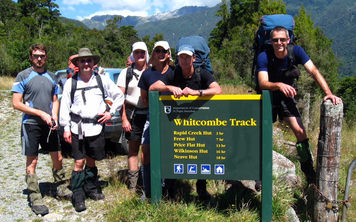
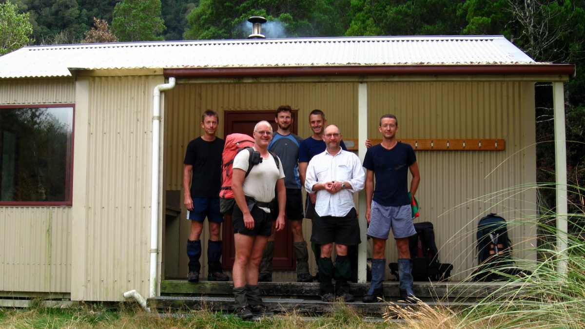
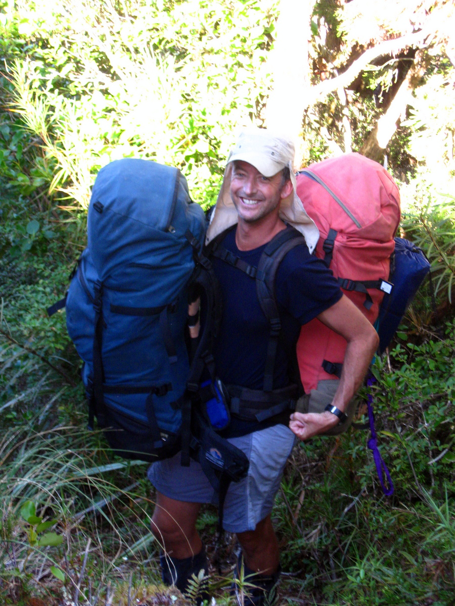
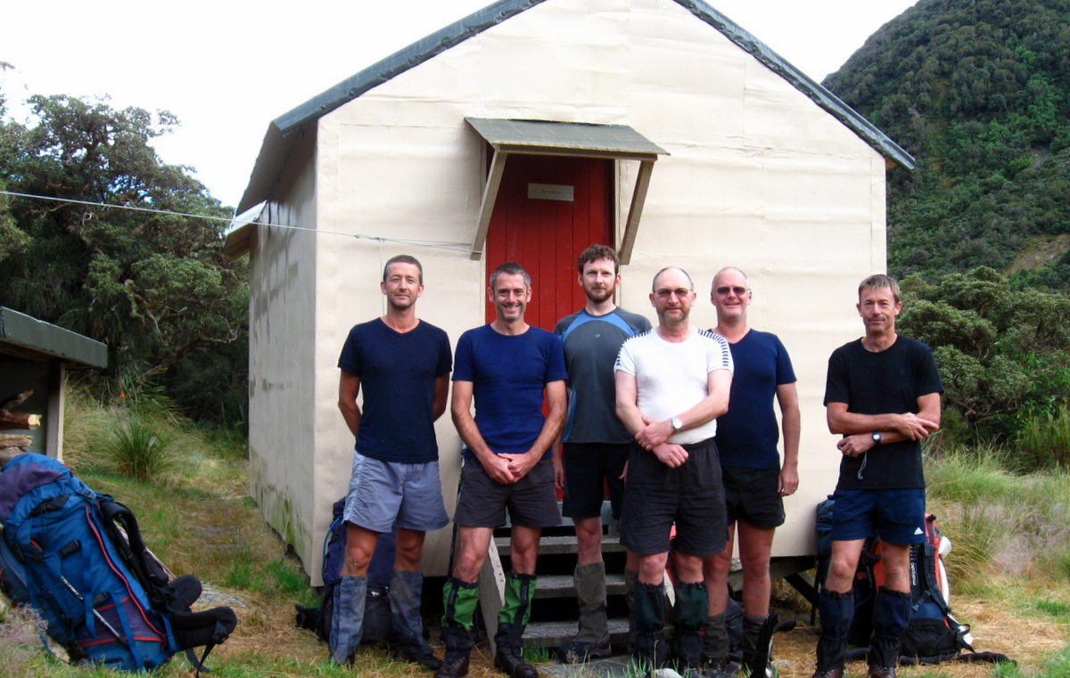
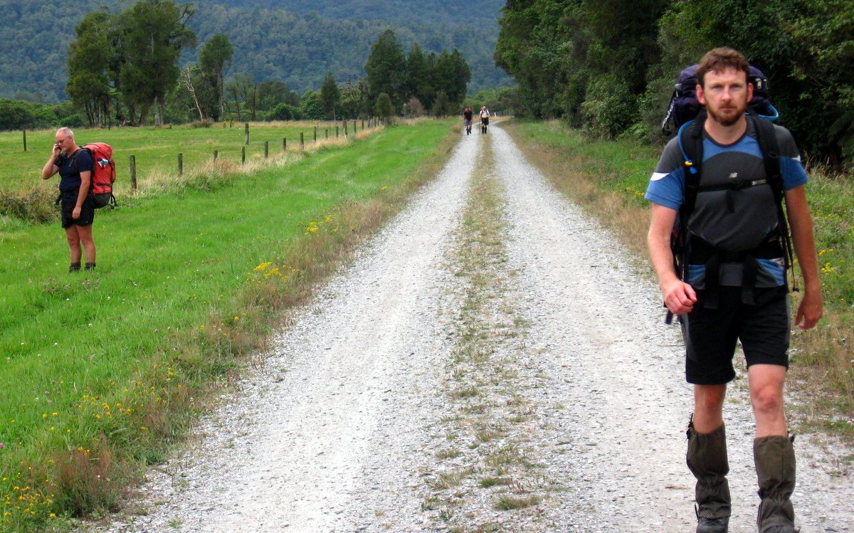
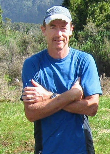
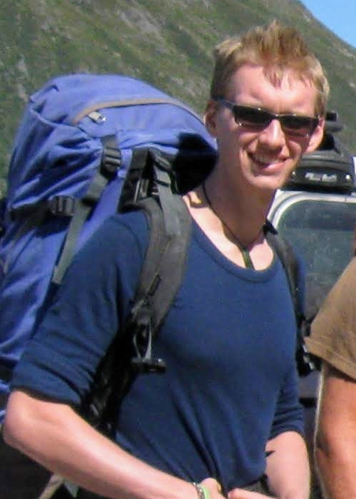
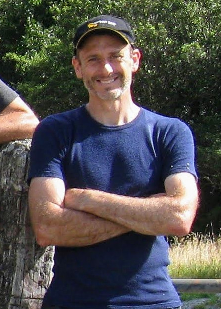
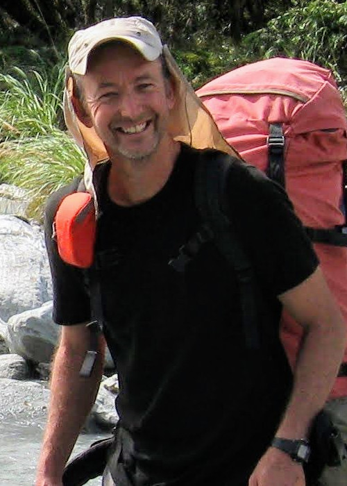
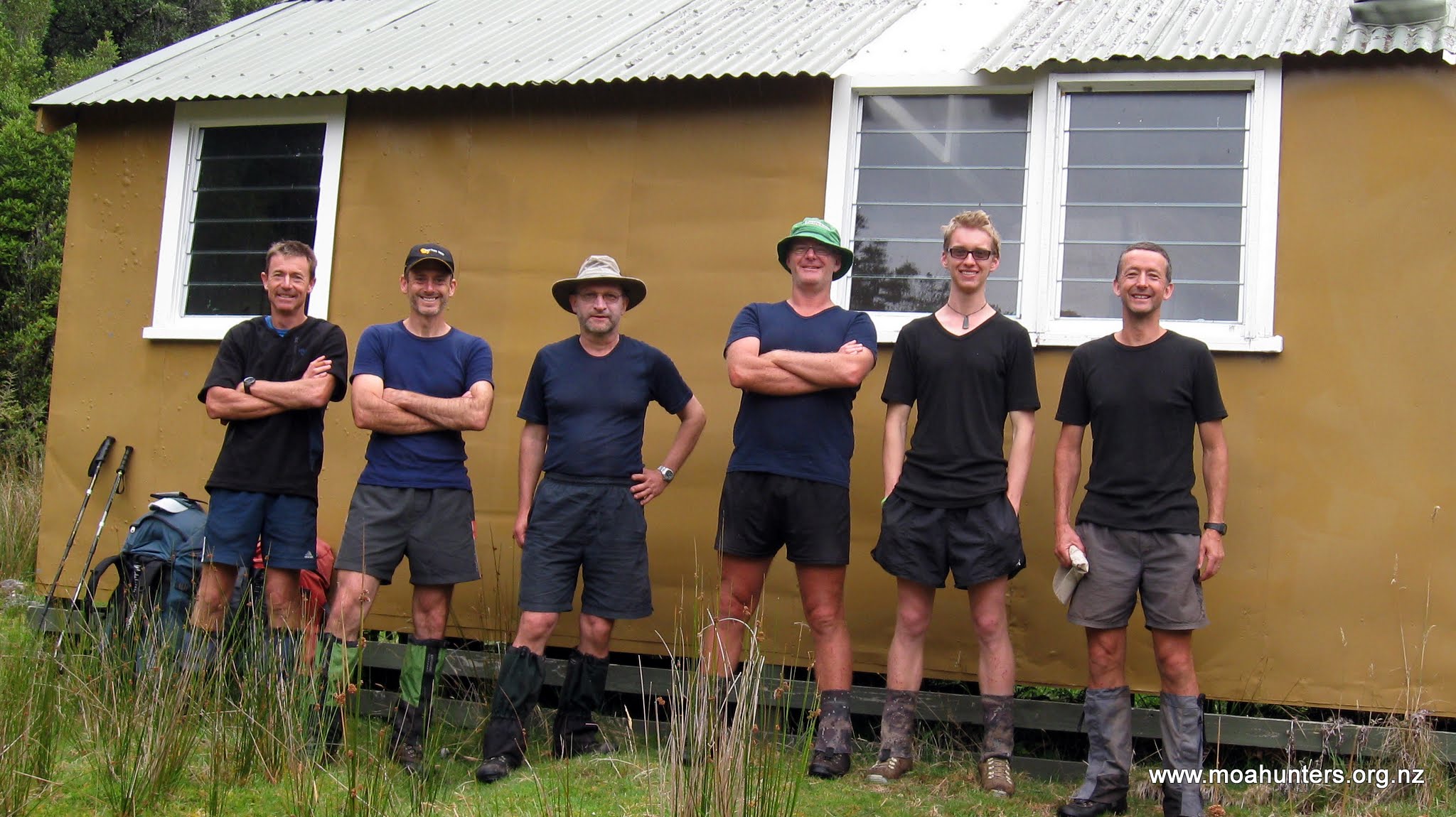
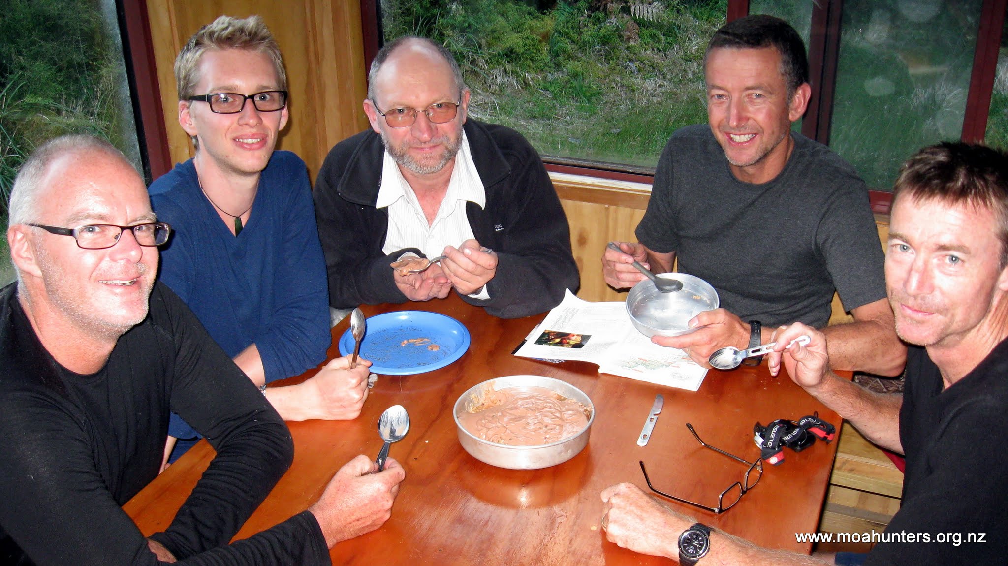
Moa Hunters on this trip: Chris, Richard, Adam, Magnus, Logan, Paul


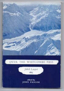
Crossing the main divide 150 years ago proved to be difficult and perilous for surveyors John Whitcombe and Jakob Lauper. Their goal was to map an East – West route, suitable for constructing a road link between Christchurch and the West Coast. Starting their journey in the upper reaches of the Rakaia, they struggled through increasingly challenging terrain for three weeks, until they finally reached the Tasman Sea on the West Coast.
It was there that Whitcombe tragically lost his life when the explorers attempted to cross the flood swollen Taramakau River. Their makeshift raft capsized and the men were swept out to sea. Lauper, the stronger swimmer made it to shore. Whitcombe succumbed to the pounding waves of the Tasman sea.
Well aware of the history of Whitcombe Pass, The Moa Hunters knew this was going to be a tough trip. We had read enough of Lauper and Whitcombe’s account of the route to know it would be challenging. Just as the two explorers before us had underestimated the crossing, we did not anticipate just how brutally tough it would be…
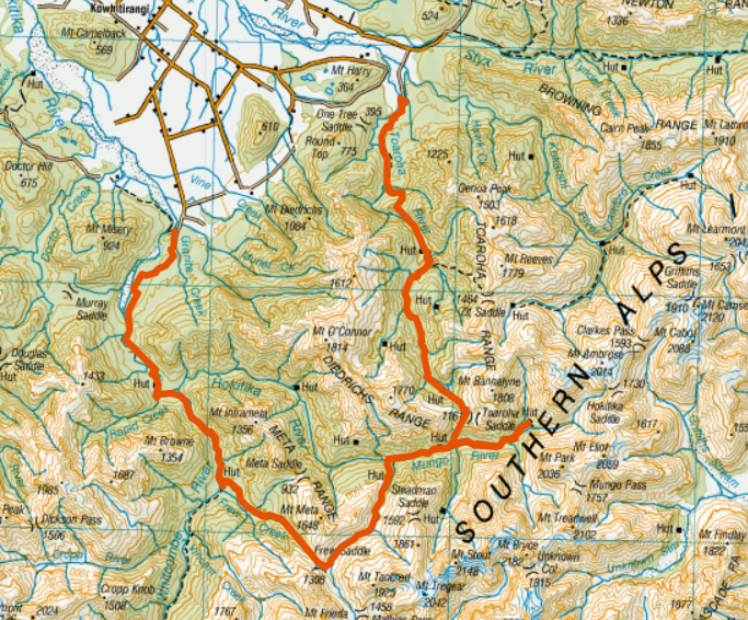
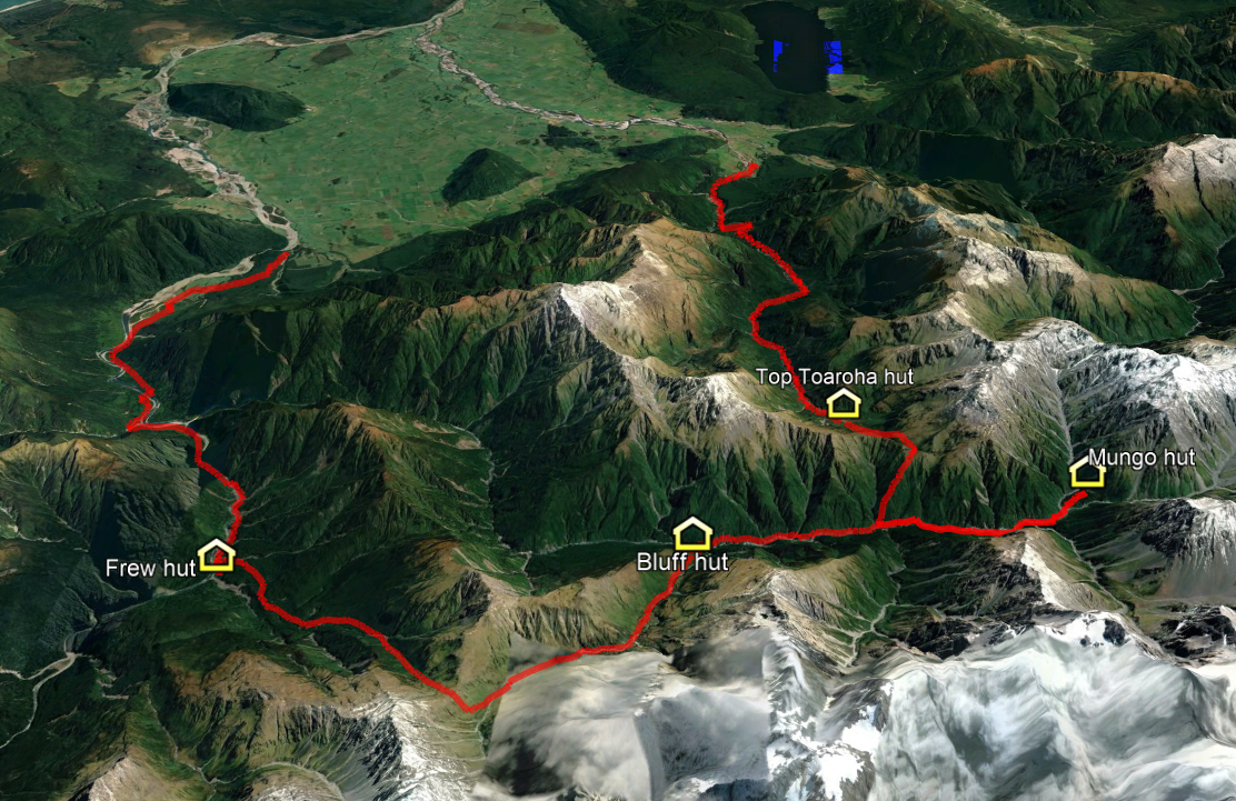
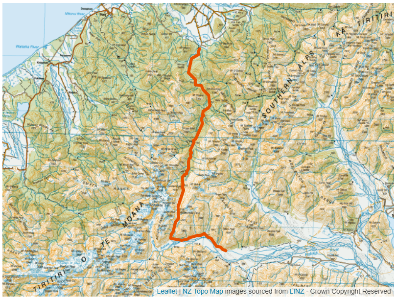
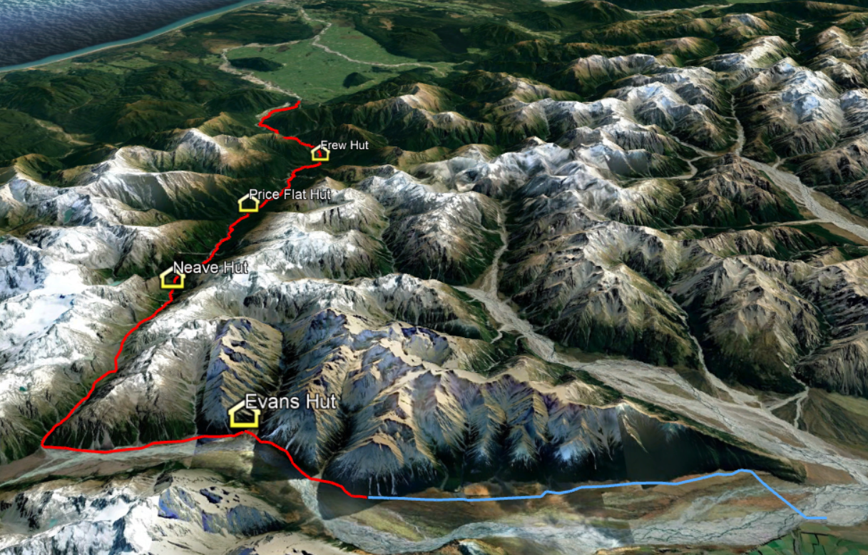
The Trip:
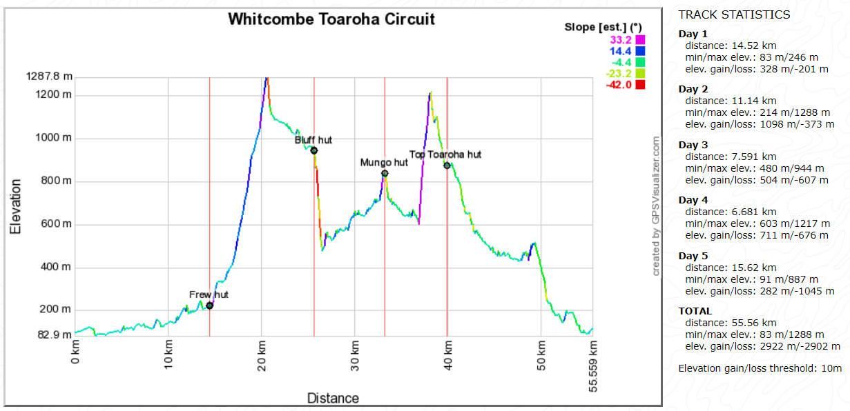
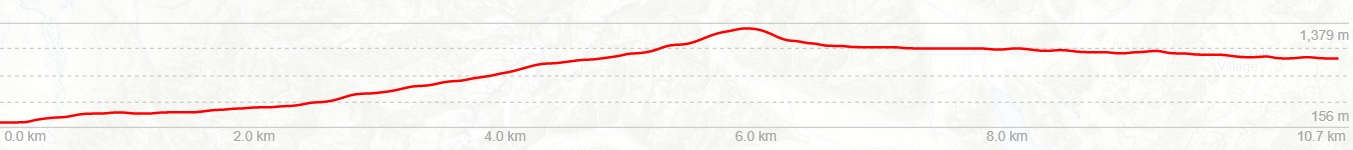
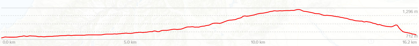
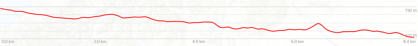
Day 1: 4WD to the headwaters of the Rakaia. Walk to Evans Hut (2hrs / 3km)
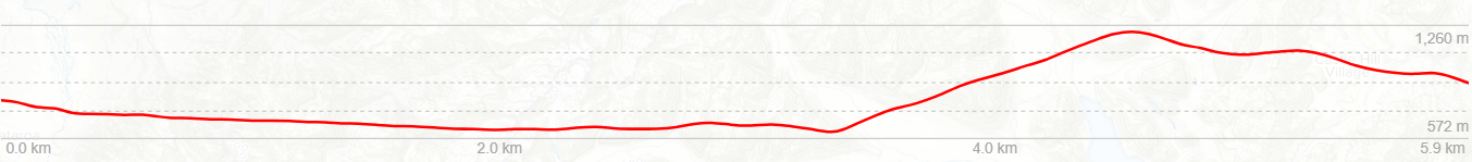
Day 2: Evans Hut to Neave Hut (13hrs / 19km)
Day 3: Neave Hut to Price Flat Hut (8hrs / 10km)
Day 4: Price Flat Hut to Frew Hut (6hrs / 8km)
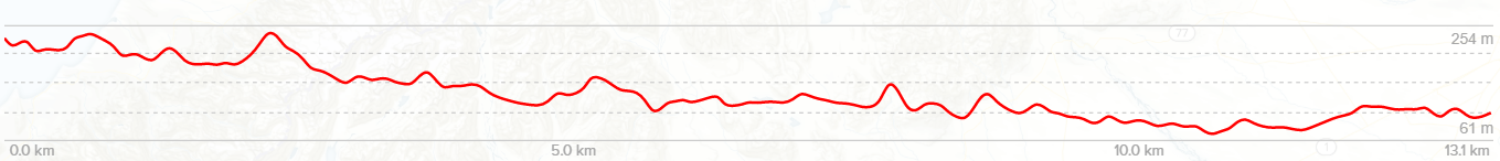
Day 5: Frew Hut to Road End (7hrs / 16km)

Day 1
Friday 26th February – Evans Hut
Our day started early. By 6:30am the Moa Hunters had converged on Adam’s house in Rolleston and we were busily loading packs into two utes. Yet again, Paul had worked his organisational magic and convinced Alan (his father), and two-metre Peter (a work colleague), to drive us to the upper reaches of the Rakaia. According to Paul, the two hadn’t taken much convincing. Alan fancied a bit of fishing, and two-metre Peter had his rifle stowed in the ute. His plan was to bring back some venison for the freezer.
From Rolleston the two utes drove out to Mt Hutt township and up Blackford Road, which becomes Double Hill Run Road at the point the seal ends. Along the way we met up with George, a good mate of two-metre Peter’s. Under a hot February sun, we now had a three vehicle convoy.

From the meeting point it was a long but not entirely unpleasant drive along 40km of unsealed road, to a junction at Glenfalloch Station. The scenery around us was barren and beautiful. At the junction we turned right onto the short track to the edge of the Rakaia where we stopped. Across the river we could see dust clouds being whipped up and blown down the valley by the increasingly boisterous nor’westerly wind. An ominous sign.

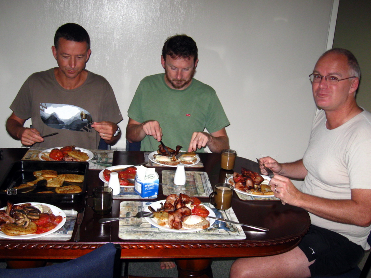
Fortunately on our side of the river we were relatively sheltered, making it a perfect spot for a cooked breakfast. Cooking gear was quickly assembled, and before long bacon, liver, kidneys, hash browns and mushrooms were sizzling. Alan broke out his Thermette and brewed a welcome cuppa to chase down our hearty breakfast.
The next challenge was crossing the Rakaia. It was agreed Alan’s ute had the least ground clearance and he should go in first. A good choice because Alan knew what he was doing… He drove out slowly and confidently forded the deepest channel, showing the way for the rest of us. For those of us not used to 4WDing, there were a few sphincter-tightening seat clutching moments when the utes nosed into deep water. But the crossings were made without incident.
Once on the other side we found a 4WD track which lead to Manuka Point Station, an impressive hunters lodge complete with grass airstrip. Out of the lodge strode a familiar figure to Adam. Dave Reese, a Rolleston local and hunter guide, greeted us as we pulled up to a stop. He suggested we could drive as far as Totara Point, and from there walk to Evans Hut, about 5km farther on the same side of the river. Our original plan was to walk from Totara Point, crossing back over the Rakaia to the Reischek Hut, quite a bit farther up the valley. But Dave’s suggestion of staying dry and not walking as far held a lot of appeal.
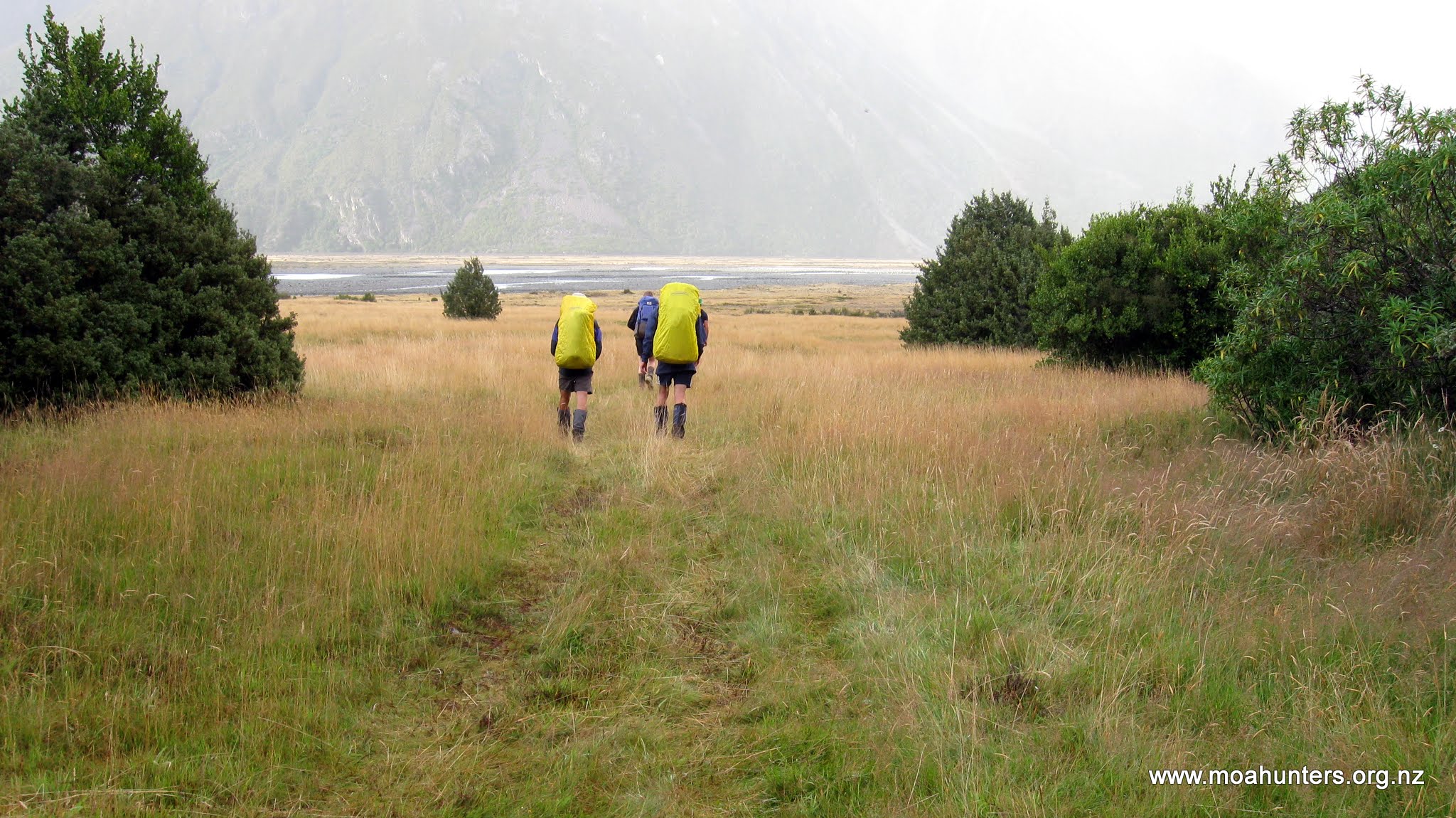
Following Dave’s directions we drove the 4WD track until it petered out at Totara Point. An attempt was made to drive further, but we quickly reached terrain too difficult for the utes to navigate. The Moa Hunters piled out, said our goodbyes to Alan, two-metre Peter and George, and struck out into the savage nor’wester.
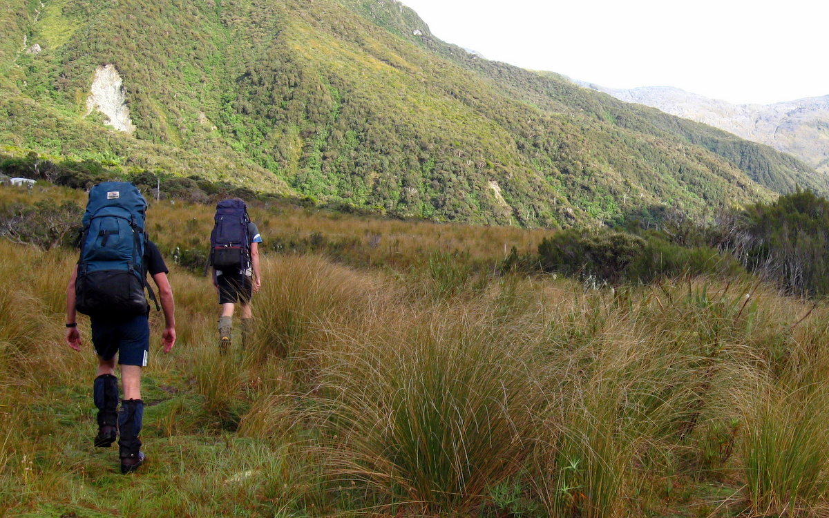
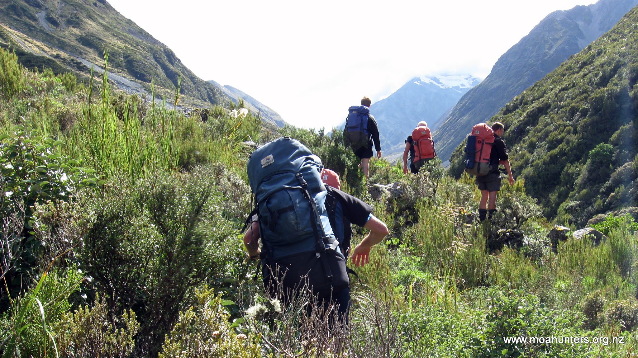
Apart from the wind, the first kilometre was easy walking. The valley here is open and flat, with grassy areas providing islands of smooth walking among the rockier terrain. The wind was wild. At times we walked into a strange quiet lull, with no breeze at all. Those moments were short lived, as the gale would soon howl down the valley again, buffeting us backwards, whipping sand into our legs and dust into our faces. Not pleasant at all.
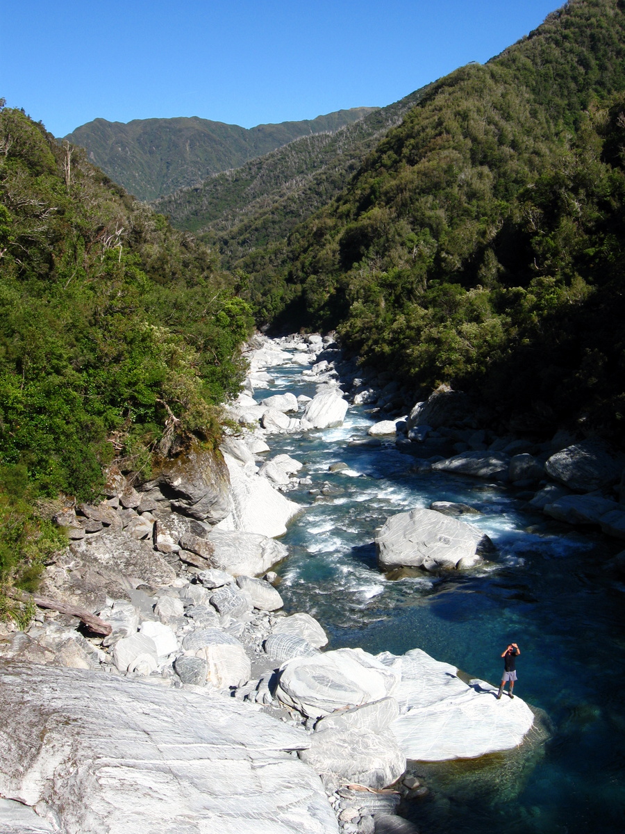
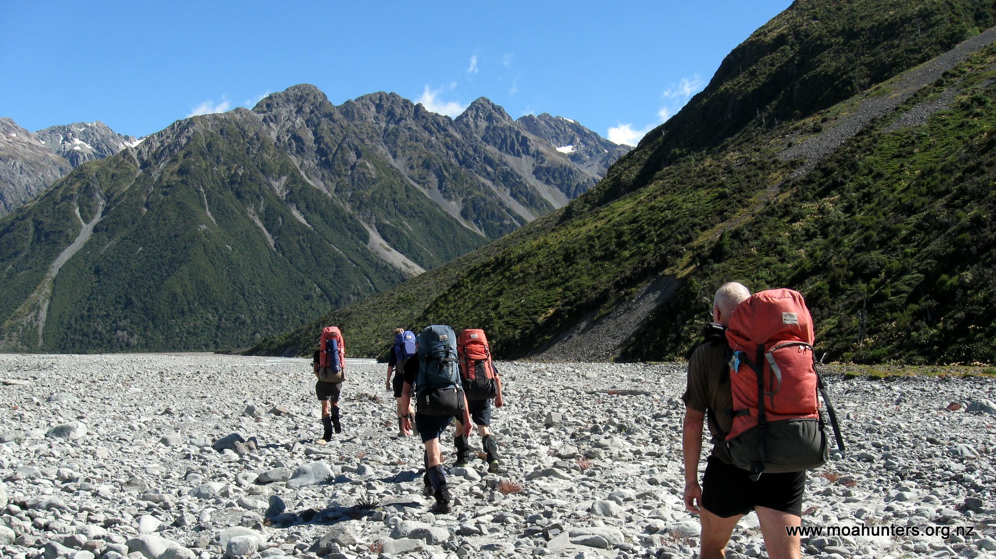
The relatively flat riverbed walking inevitably came to an end. Ahead of us the river’s course took it hard up against a steep bluff: Duncan’s Face. We had two options at our disposal: Crossing the river twice to skirt around the bluff, or some bush bashing over the bluff. The river looked deep, swift and cold, so we chose the uphill route, which looked steep, scratchy and nasty.
We began picking our way through the stunted vegetation, looking for an easy route up the bluff. We knew that others would have done the same before us and were on the lookout for obvious tracks. Unfortunately not many people walk the Whitcombe, so any previously walked track would be far from obvious. We never really found a track as such. Occasionally we found ourselves on what were probably deer tracks, which disappeared as fast as they appeared.
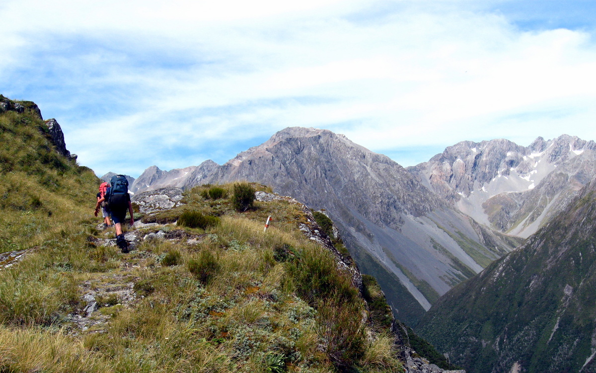
As we picked our way through the scrub, we could see that we had not one, but two bluffs to find a route over. We climbed higher and spotted a marker pole. Maybe there was a track! We made our way to the pole and scanned the next ridge for another. The poles were few and far between with very little in the way of formed track between them.
We eventually found ourselves over the last ridge with clear inviting gravel riverbed in sight below us. With no reason to still be up in the bush, we hunted forward and back for an easy route down. But found nothing. Feeling frustrated and completely over battling awkward terrain and scratchy bush, we decided to go down regardless. So we began smashing our way down through thick bush, tall trees, flax, and every other awkward obstacle you care to imagine.

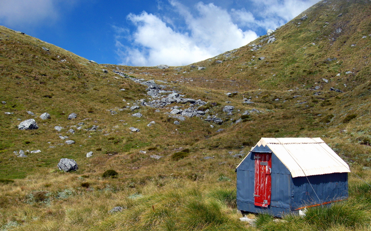
After a grovelly and generally unpleasant descent, we finally burst out of the bush into the windswept Rakaia valley. From there we had a blustery 1km walk to Evans Hut, which we reached at 2pm.
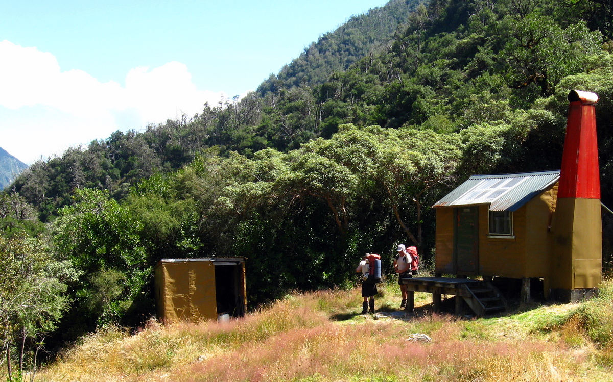
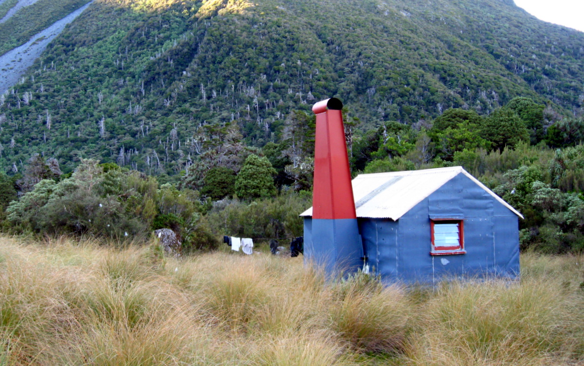
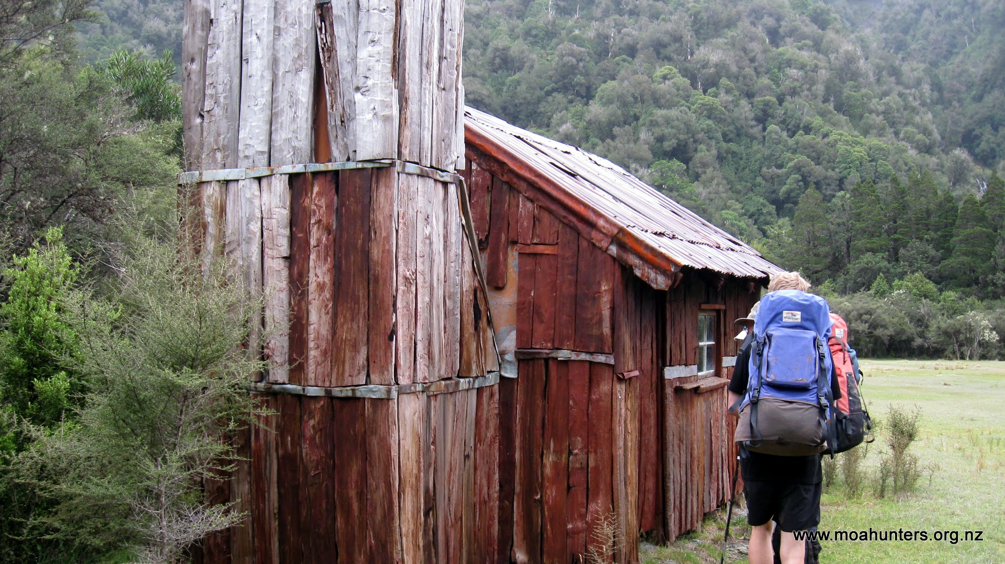
Nestled snugly in a sheltered clearing at the base of tall peaks flanking Cattle stream, Evans hut was built and is maintained by the NZ Deerstalkers Association. We immediately liked it. While the modern DOC huts are comfortable and well designed, old huts like Evans are full of character. Sitting inside you can’t help but feel a sense of history emanating from the old timbers and time-worn furniture.

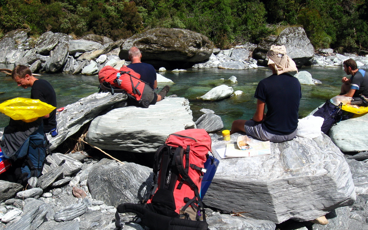
As it was still early in the day, we agreed a wander up the valley past Lauper creek and up towards the Lyell Glacier would be worth a nudge. Even without backpacks on, the strongest wind gusts howling down the valley buffeted us backwards. Apart from mother nature’s best attempts to blow us back to Christchurch, the walk up to Lauper Biv was on the whole fairly easy. Only a couple of boulder strewn fans proved to be challenging, briefly forcing us off the riverbed and up into the bush.

After two hours we had reached Lauper Biv. Sheltering on the leeward side, we enjoyed a very pleasant break lying on the soft grass in the warm afternoon sun. Given it was now after 4pm, we abandoned any thought of walking further up the Rakaia, and agreed to head back to Evans Hut. The walk back being slightly downhill and wind assisted, with a generous tailwind, took us just an hour and a half.
Back at Evans hut Paul immediately began preparations for dinner. As has become something of a tradition on recent Moa Hunts, our first meal on the track was decadent steak fry-up. This years steak was not as tender as previous cuts, but equally tasty thanks to the special marinade Paul has been perfecting over the years. Chris put together a stodgy apple uncrumble and custard for dessert, which landed nicely on top of the beef already in our stomachs.

Day 2
Saturday 28th February – Evans Hut to Neave Hut
Knowing the day ahead of us had the potential to be a fairly big one, we dragged our creaky carcasses out of our sleeping bags fairly early. By 8:20am the Moa Hunters had wolfed down a hearty porridge breakfast, washed up, warmed up, thrust bags of gear back into backpacks and cleaned the hut. Outside, wind blown drizzle was falling fairly steadily. But on a brighter note, above us the cloud appeared to be breaking up.
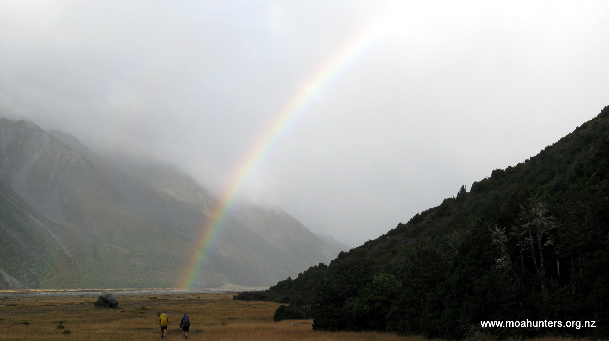
Having already walked the route to Lauper Biv, we knew what was ahead and made good progress. It didn’t take long to leave the drizzle behind and before long we were treated to a spectacular rainbow ahead of us. One end of it seemed just a few hundred metres away to our right at the foot of the hills flanking the valley. We all secretly fought the urge to drop our packs and make a dash for it to lay claim to the pot of gold.
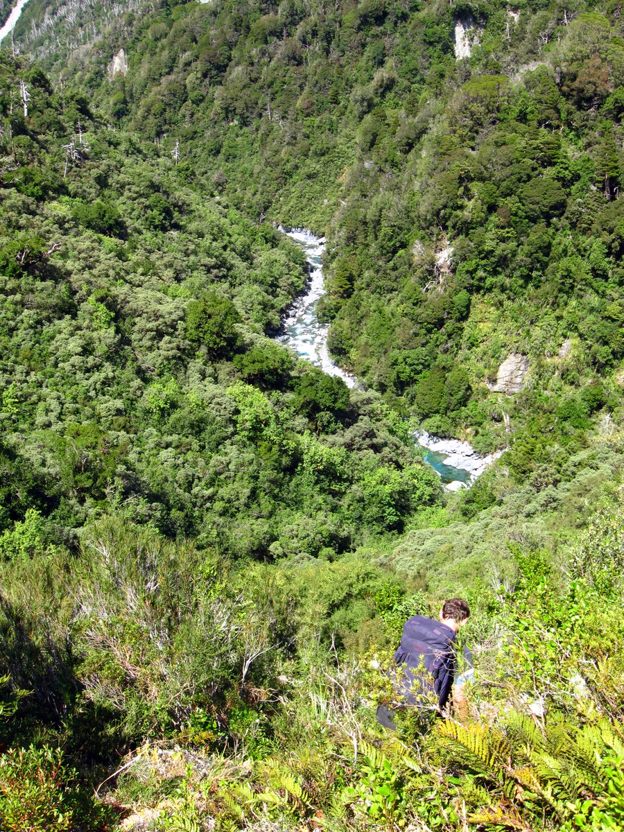
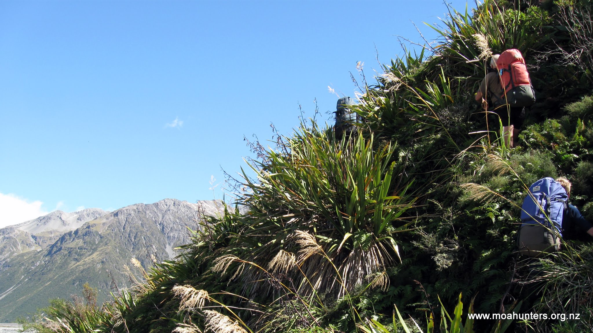
We reached Lauper Biv at 10:30 and from there turned into the Lauper valley and uncharted territory. The terrain quickly become more challenging. Crossing the stream to avoid an inconvenient bluff happened frequently. Where a bluff couldn’t be avoided, we were forced to skirt high up the valley side, usually through scrubby bush riddled with nasty spear grass and scratchy matagouri.
There is no marked route between Lauper Biv and Neave Hut. We did spot the occasional cairn at river crossings, and over one bluff, a couple of track markers. But being an infrequently walked route, there are no obvious tracks, no tried and tested well worn paths to follow.
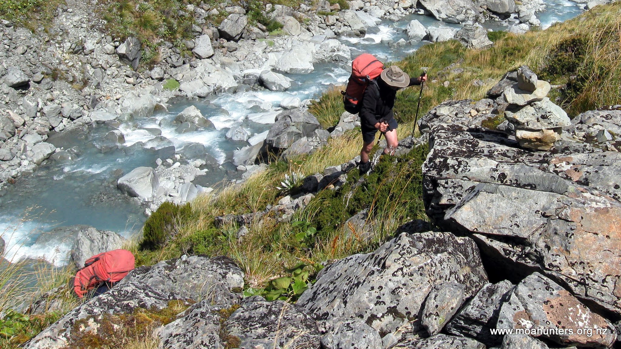
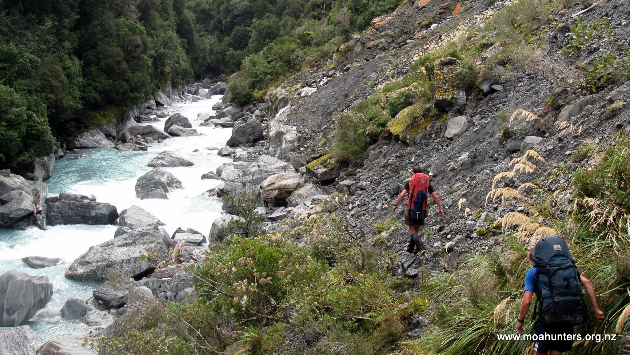
Wherever possible we stuck to the riverbed where walking was easiest, boulder hopping where that became necessary. However, the higher we got, the larger the boulders became, the tighter the valley got, and progress grew steadily more difficult. Longer periods were spent picking our way through scrub above the river. When we dropped back down, tricky river crossings were often necessary to avoid bush bashing.
By mid afternoon we hit what were probably some of the gnarliest section leading up to the pass. Progress was slow and the amount of energy expended to travel short distances was high.
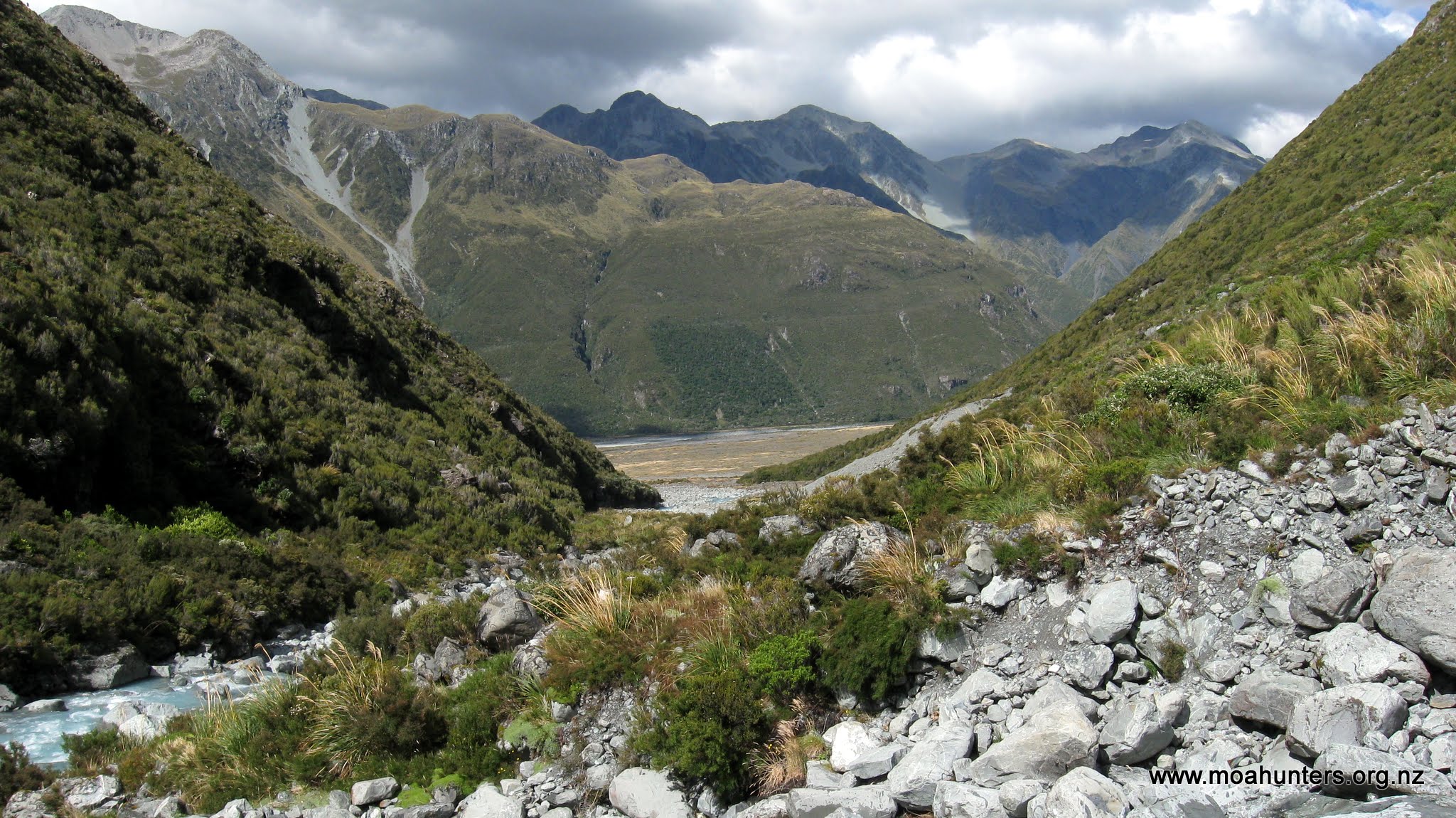
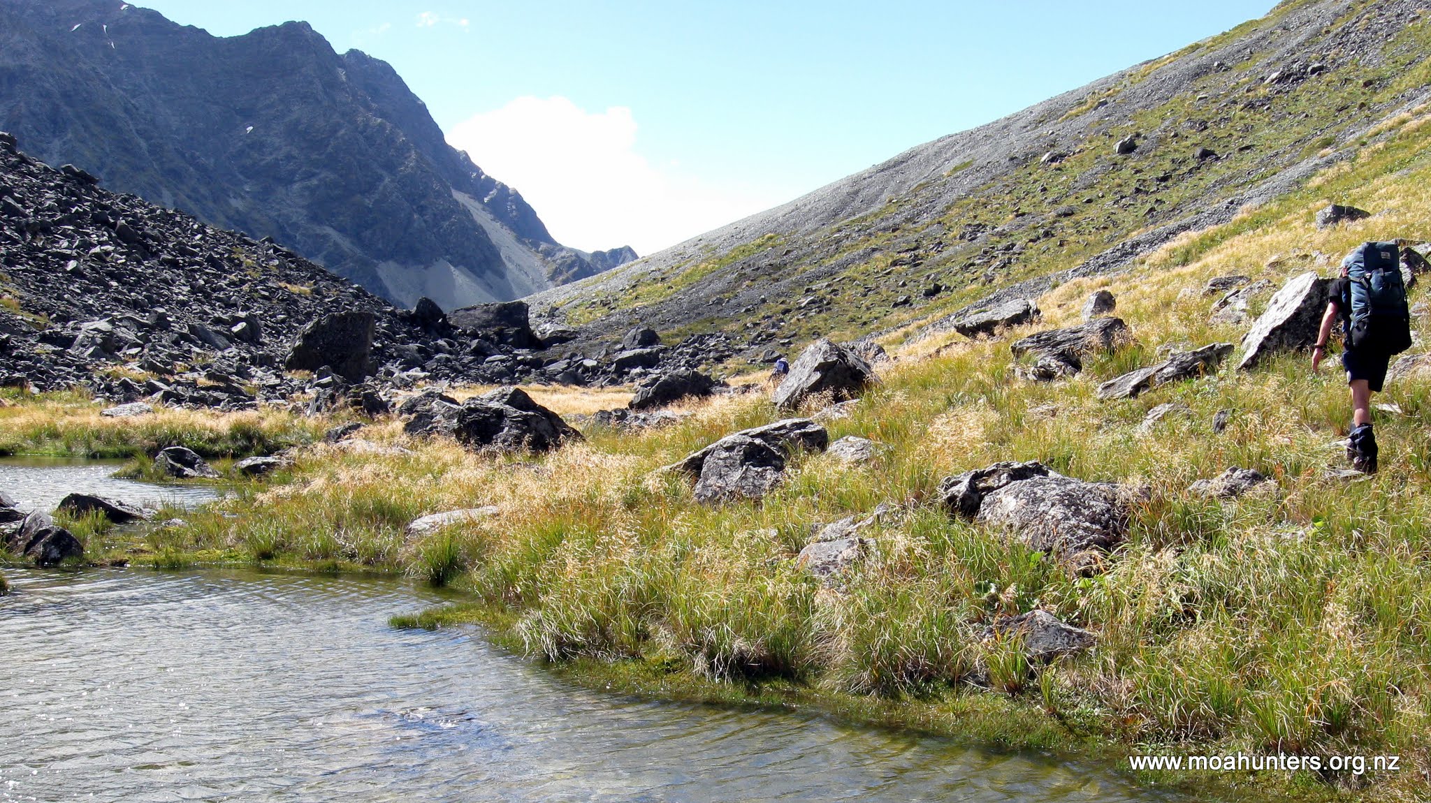
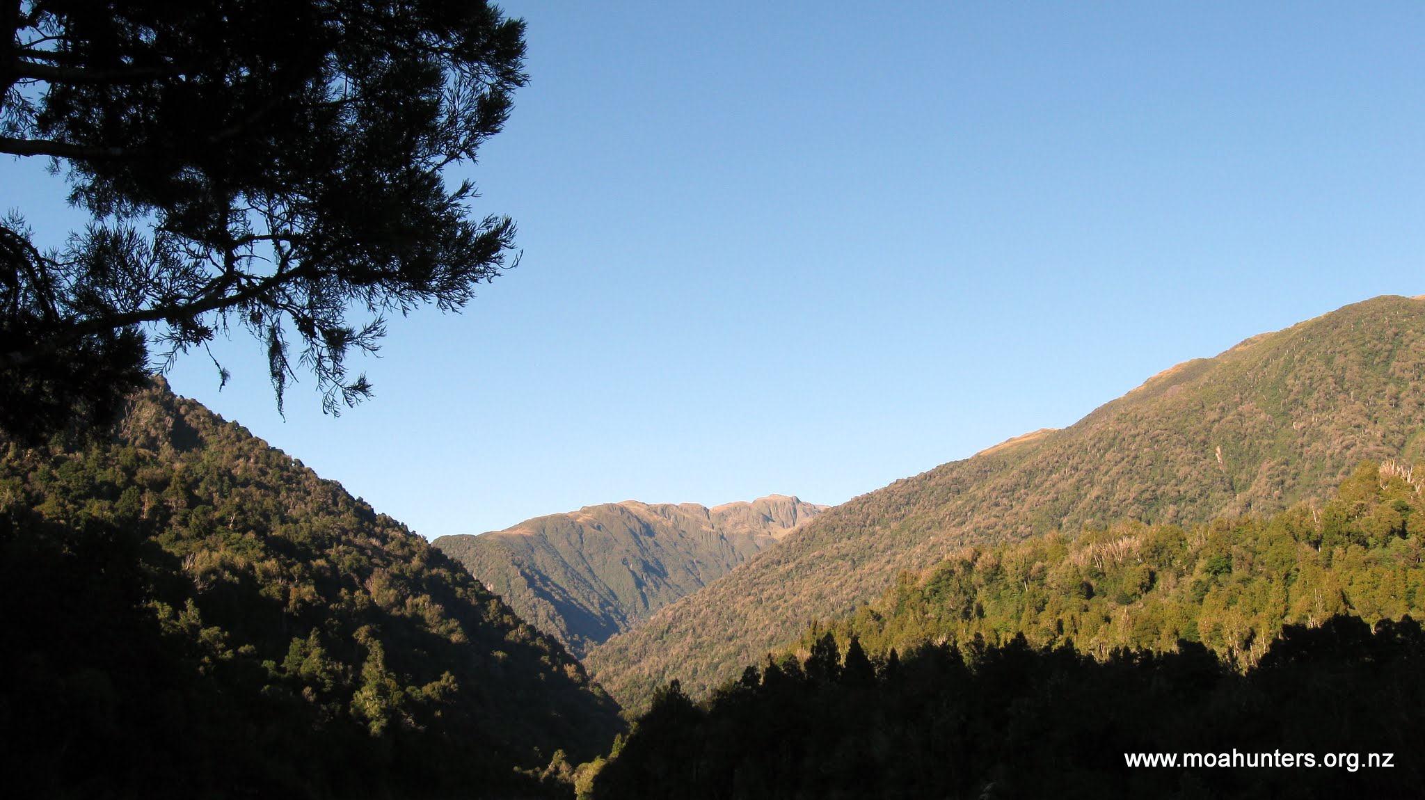
However, with increased altitude came some reprieve. The higher we climbed, the more the bush thinned, and the more stunted it became. About two and a half kilometres from Lauper Biv, where a significant tributary stream joins the Lauper on the true right, the valley flattens considerably. After a careful crossing, we found ourselves moving into more open country, strewn with shattered sharp edged rock and rubble. Only scrubby low grass and beds of moss cling to what passes for soil in this windswept hostile terrain.

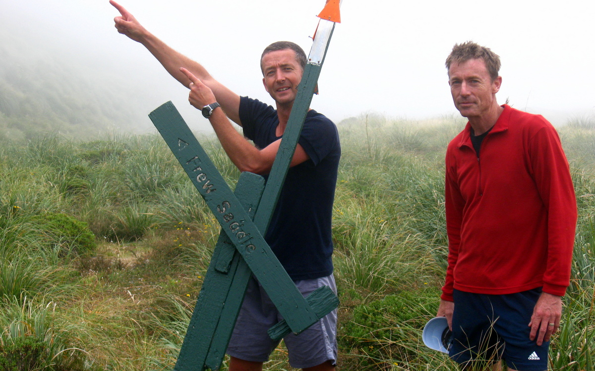
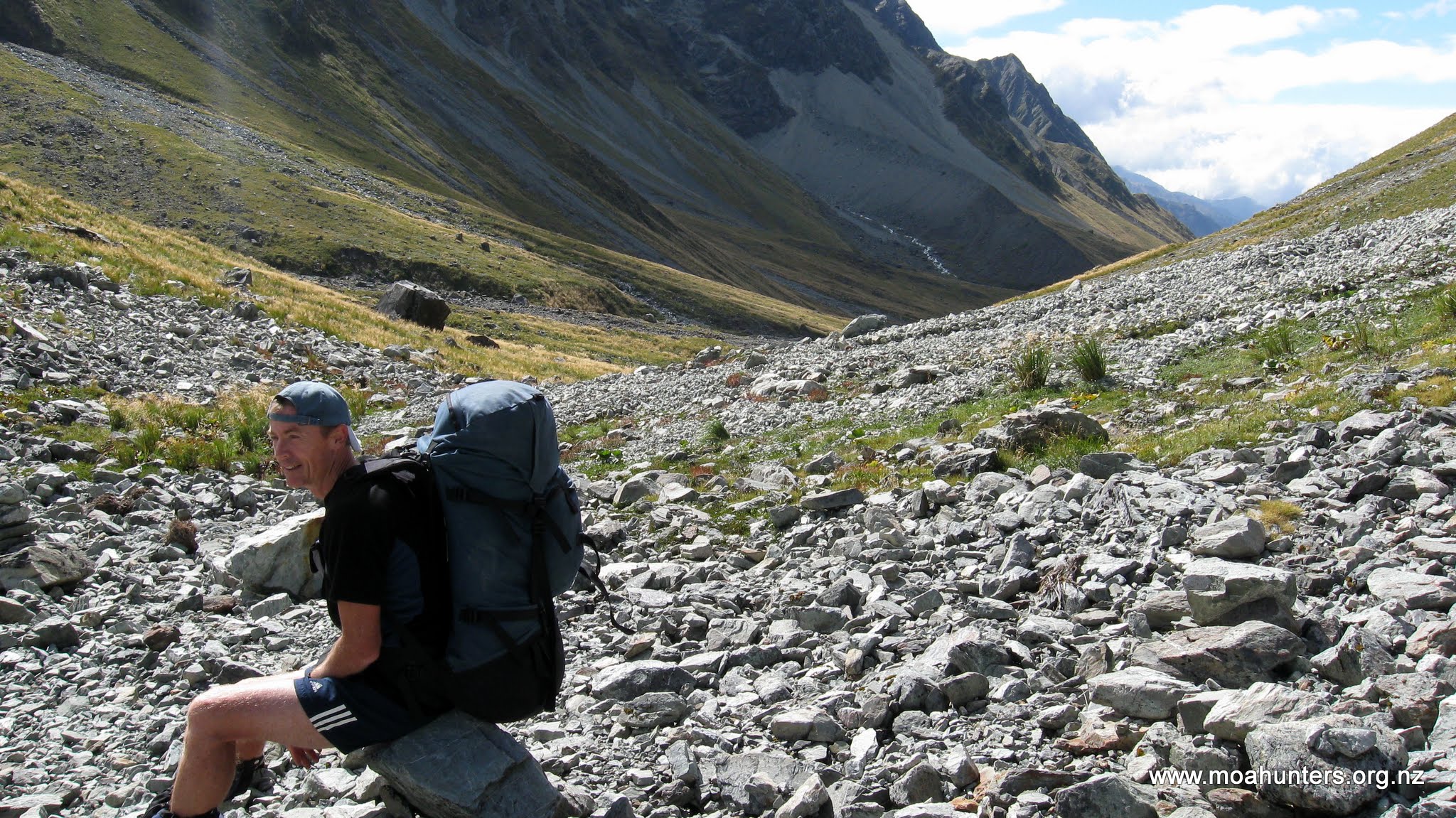
The gradient also eased and we made much faster and more consistent progress. By 4pm we found ourselves at a large cairn that marked the top of Whitcombe Pass. We were happy to be there, but any elation was tempered by the knowledge that the hardest part of the day was yet to come. All accounts we had read prior to the trip described the descent down the Whitcombe as being particularly arduous.
It was quite a bit later than we had anticipated and a cold wind was blowing over Whitcombe Pass, chilling us rapidly as we congregated at the cairn. The temperature was not conducive to socialising…. We took a few quick photographs before continuing on.
Heading down from the saddle, the Whitcombe stream rapidly swells to a significant river. At least six glacial melt tributaries feed into it over the course of the first kilometre.
It is important to cross to the true right of the Whitcombe at the earliest opportunity, before it becomes too swift and deep. Failure to do so will result in an undesirable slog back up the valley to find a safe place to cross.
As we left the pass, it was agreed we would split into two groups: Adam, Richard, Paul and Logan in the advance party, with Magnus and Chris following behind. This seemed practical as it meant the faster moving group would get to the hut first and could get food preparation underway. By the time Chris and Magnus arrived, dinner would be all but ready.
In hindsight, this was not a great decision…
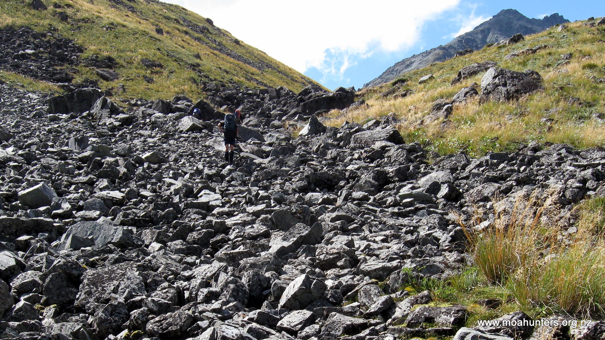
Heading down from the pass, the terrain was much the same as we had seen on the eastern climb.

Large rocks punctuated the rubble which filled the shallow valley. Low tussock and patches of hardy grass clung to whatever soil they could find.
The advance party, including Adam, Paul Richard and Logan took an early opportunity to cross to the true right of the Whitcombe. From that point we knew we would not cross the Whitcombe again until just before Collier Gorge, two days later.
The five kilometres between Whitcombe Pass and Neave Hut were as tough as any we had encountered in the ten years of Moa Hunting. With nearly eight hours walking under our belts already, every few hundred metres we gained was hard won.
Fatigue combined with difficult terrain proved challenging. Whether we were in the riverbed, or bush bashing above it, the going was tough. Pushing through bush in our modern tramping gear, we often commented on the toughness of the early explorers who struggled through this country with their heavy equipment, hobnail boots, little food and inadequate clothing. They were truly amazing.
At times the dense bush forced us to crawl, resorting to an exhausting push and shove through thick scratchy brush that showered dead leaves and twigs down our collars. Other times we were grunting our way through waist high bush, heaving it aside to get a glimpse of the uneven ground below and a good place for the next footstep.
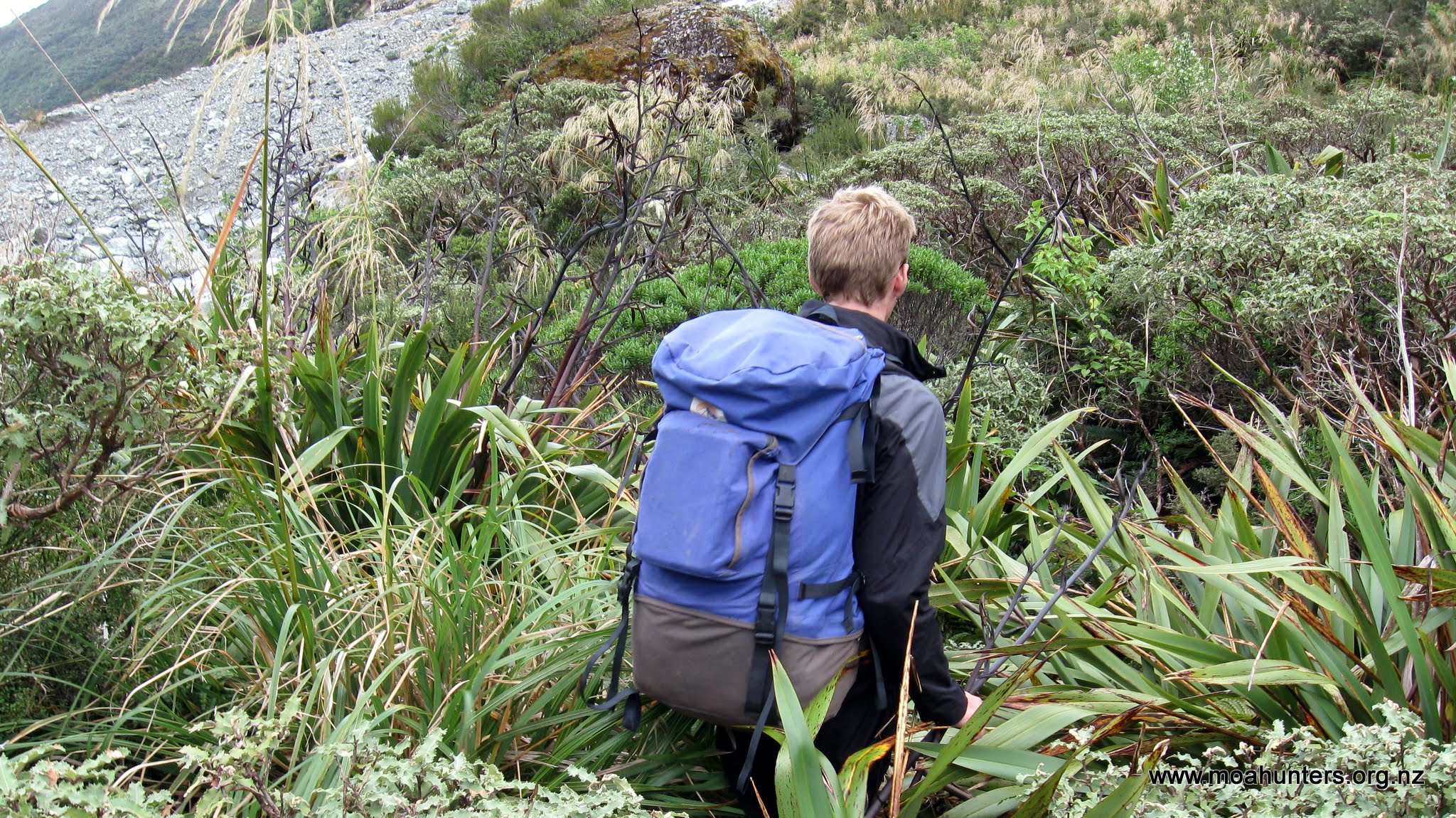
As we dropped altitude, the bush grew more dense on either side of the Whitcombe. We were now on the West Coast and the vegetation was looking more like the sub-tropical rain-forest, interspersed with ferns.
Shortly before 7:30pm the advance party arrived at the Gateway – a kink in the Whitcombe river where it bends sharply around a very large and hard rocky knob. We skirted around the edge of the river, wading at times as it diverted around the knob, thankful that this significant landmark signaled we were near the hut, but also very aware that daylight was beginning to fade.
Just on 8pm our advance party arrived at the Neave hut, pretty much buggered.

Quick thinking Paul suggested that unless a couple of us went back up the river to find Chris and Magnus, their chances of making it to the hut were slim. We all agreed. With the light fading rapidly and a couple of tricky bush bashing diversions between them and the hut, they would need guidance to avoid camping out overnight.
Richard’s recently repaired ankle was far from 100%, and Logan was all but spent, so Adam and Paul grabbed some scroggin, headlights and a warm layer of clothing. They left the hut at a good pace without heavy backpacks, heading back up the Whitcombe in search of Chris and Magnus.
In hindsight we realised this was a very badly planned rescue mission: There was no agreement as to how long Adam and Paul would search for Magnus and Chris before returning to the hut. The Personal Locator Beacon was forgotten completely, left at the hut in a pack. Not much use in there!! So Adam and Paul charged up the valley, leaving Logan and Richard getting more and more worried about everyone with every minute that passed.
Fortunately Magnus and Chris were both fine, but had been delayed by traveling too far down the true left of the Whitcombe. They had been forced to make a costly backtrack to locate a safe crossing, piling close to an hour onto their journey.
It would be an understatement to say Adam and Paul were pleased to spot them ahead, after 40 minutes of increasing worry. That relief probably paled into insignificance to that which Logan and Richard felt an hour later when the four weary Moa Hunters finally stumbled into Neave Hut, well after dark. The Whitcombe is unforgiving country, and Richard and Logan had understandably begun to think the worst…

However, an hour or so later, we had all eaten a hearty curry and were feeling somewhat better about the day. It had been truly epic. Over thirteen hours on the track is hard work any day. And on this day we had rock hopped, bush bashed, waded and crawled through some of the toughest terrain we had ever encountered.
Day 3
Sunday 29th February – Neave Hut to Price Flat Hut
We all awoke from a good nights sleep feeling slightly less than refreshed. Tired muscles and lingering fatigue clung to our sad and generally old carcasses (Logan excepted!). A not unexpected legacy of our previous days exertions.
However, hot porridge and a more than leisurely start to the day left us feeling somewhat more energised, and almost ready to tackle the track. And for a change, that is exactly what we would be tackling: a formed track leading us away from Neave Hut to Prices Flat which would be our next accommodation.
Following a period of general fart-arsing about, cleaning the hut, and some more concerted fart-arsing about, we stood with packs on ready to start the days walk at just after 10:00am.

The track away from Neave hut is quite flat, sticking fairly close to the true right of the Whitcombe as it descends towards an expansive flat created by its

confluence with the Wilkinson River which joins on the true left.
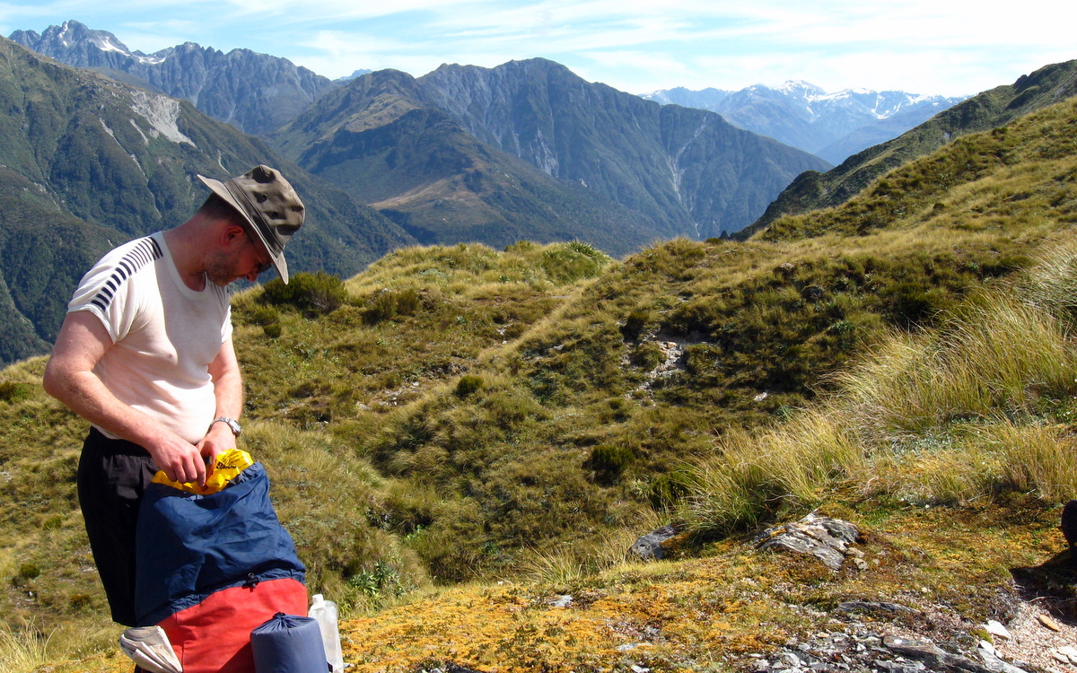
We reached the confluence at 11:30am and took the opportunity to drop bags where the track dropped into the riverbed. We hadn’t been walking for long, but the legacy of our exertions the previous day weren’t far below the surface. We felt fatigued far more quickly than normal, and energy levels were lower than usual. Dropping packs was a welcome relief.
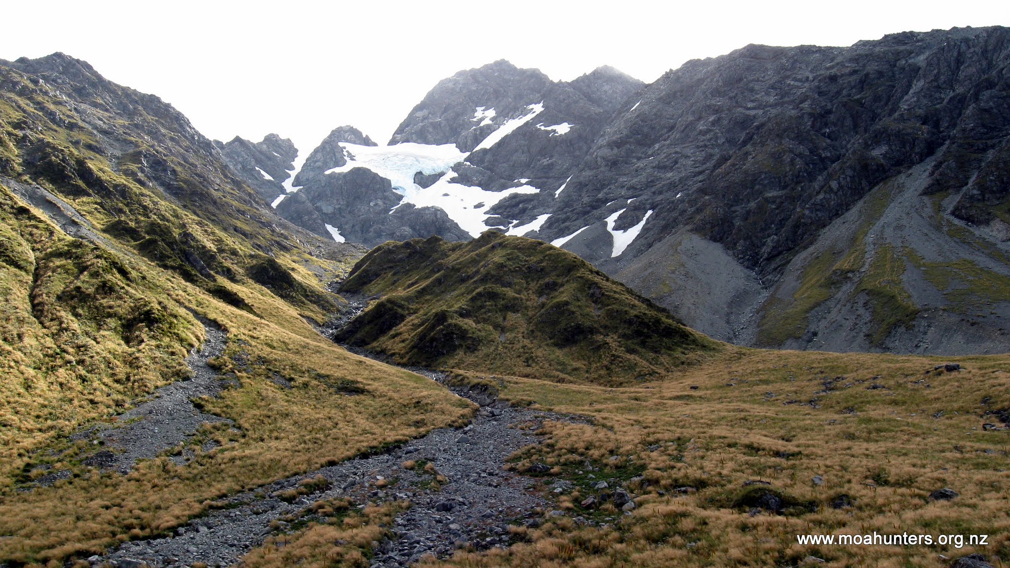
Even partially obscured by cloud, the sheer cliffs at the head of the Wilkinson valley were an awesome sight. Sliced by a dramatic waterfall, they hold back the vast Bracken snowfield, allowing only the Wilksonson glacier to grind past their southern flank.
We willed the cloud to break up completely, but never got a clear view of the cliffs and glacier. Rather, as the cloud shifted, we got jigsaw puzzle of views, which put together would have made a completed scene.


The group consensus was to push on a bit longer and have lunch farther up the track. Just in case the cloud sneakily cleared, we regularly glanced over our shoulders, hoping to trick the weather and see the cliffs in their full splendour. Unfortunately our cunning tricks tricks didn’t fool the clouds.
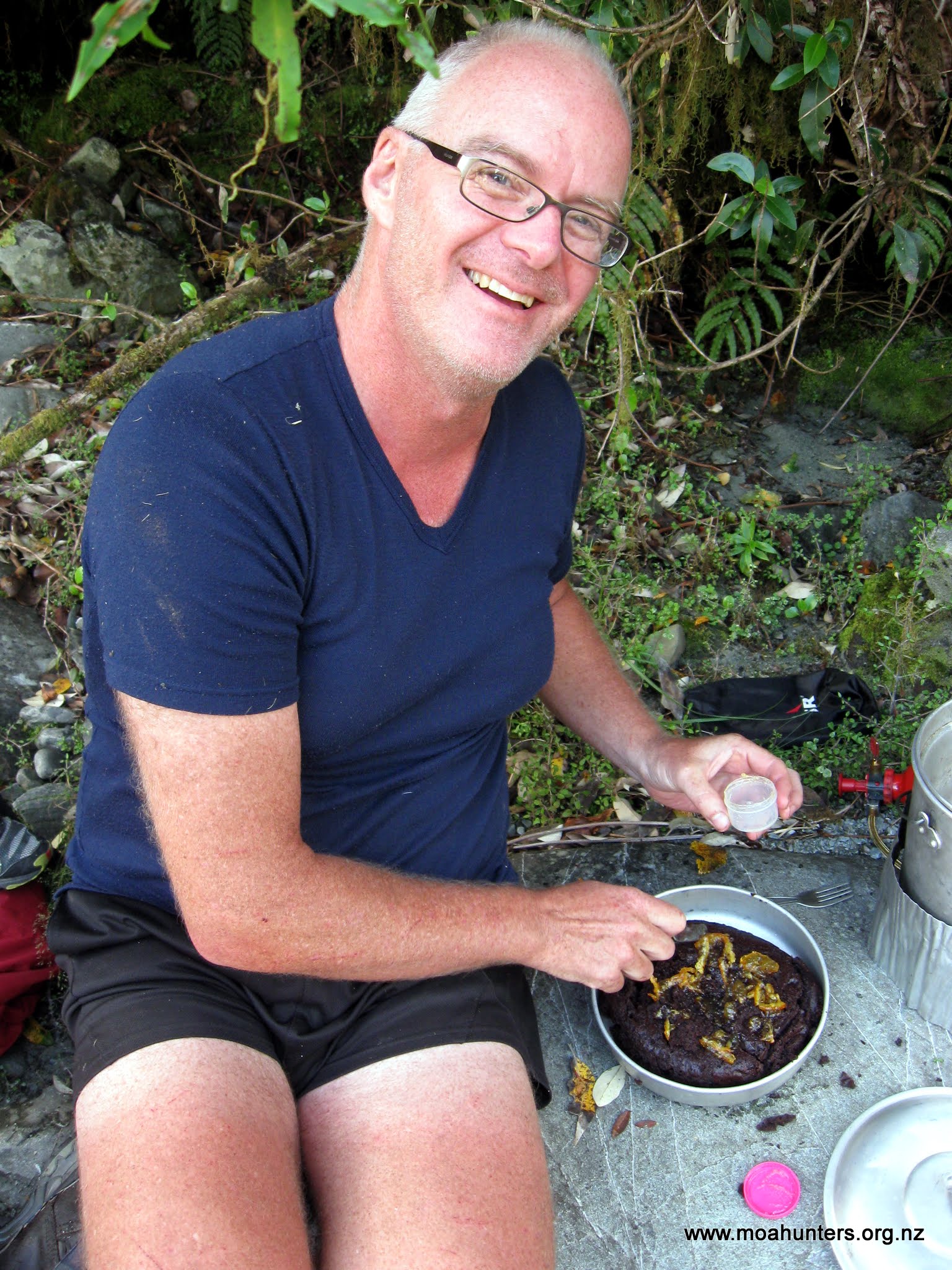
By 12:30pm we had reached a perfect spot for lunch. It was either Crack creek or Bond creek – whichever of the two has the aluminium ladder. Chris took one look at the surroundings and declared it was the ideal location for cooking a chocolate cake. We looked about and couldn’t disagree. It was definitely cake country.
Chris set about preparing the cake while the rest of us lazily got on with lunch. The sun shone pleasantly and we all felt very relaxed, a million miles from anyone and anywhere.


With regular expert adjustments to the burner under the cake, it was cooked to perfection in just over an hour. “Perfection” being a relative term… It may not have won a beauty award at the Lincoln Farmer’s Market, but without doubt it was one of the best cakes ever cooked on a tramping trip. Topped with marmalade and chocolate icing, the cake went down rather well, and rather quickly.

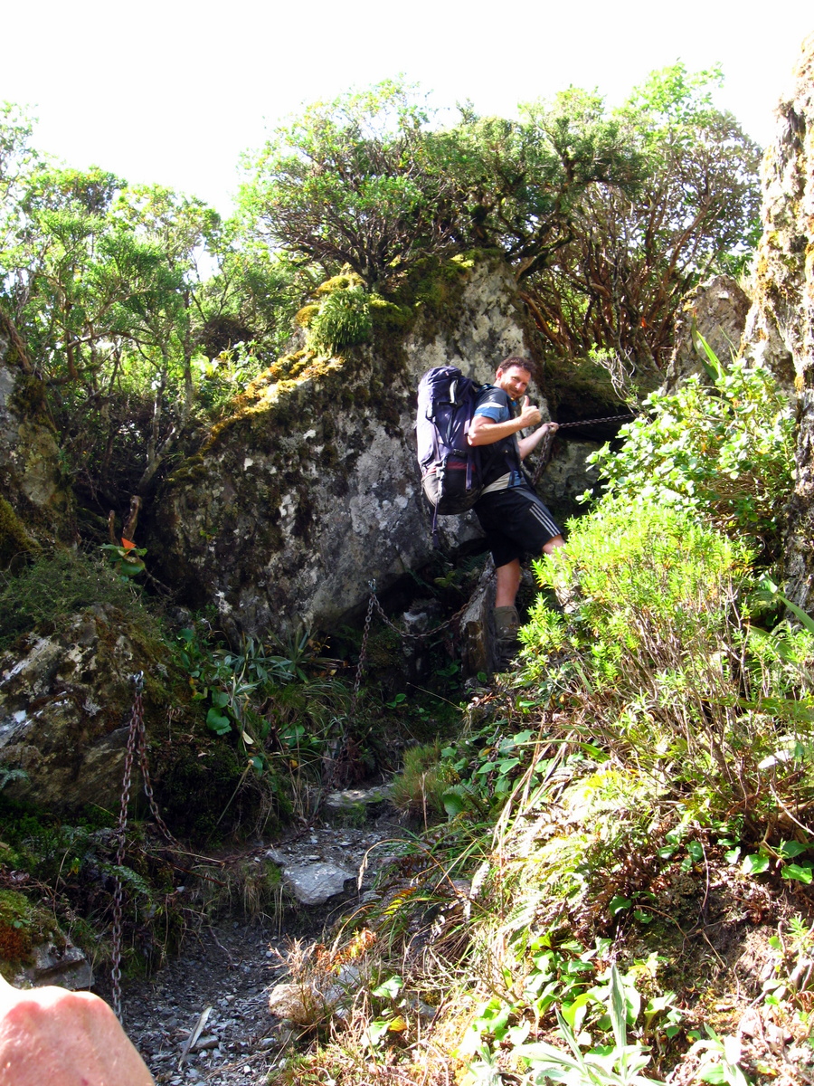
From our lunch spot the track climbed slowly but steadily to some 50 metres above the Whitcombe river, then descended sharply down a steep face back to the river. Chains attached to the rocks by DOC assisted us as we picked our way down.
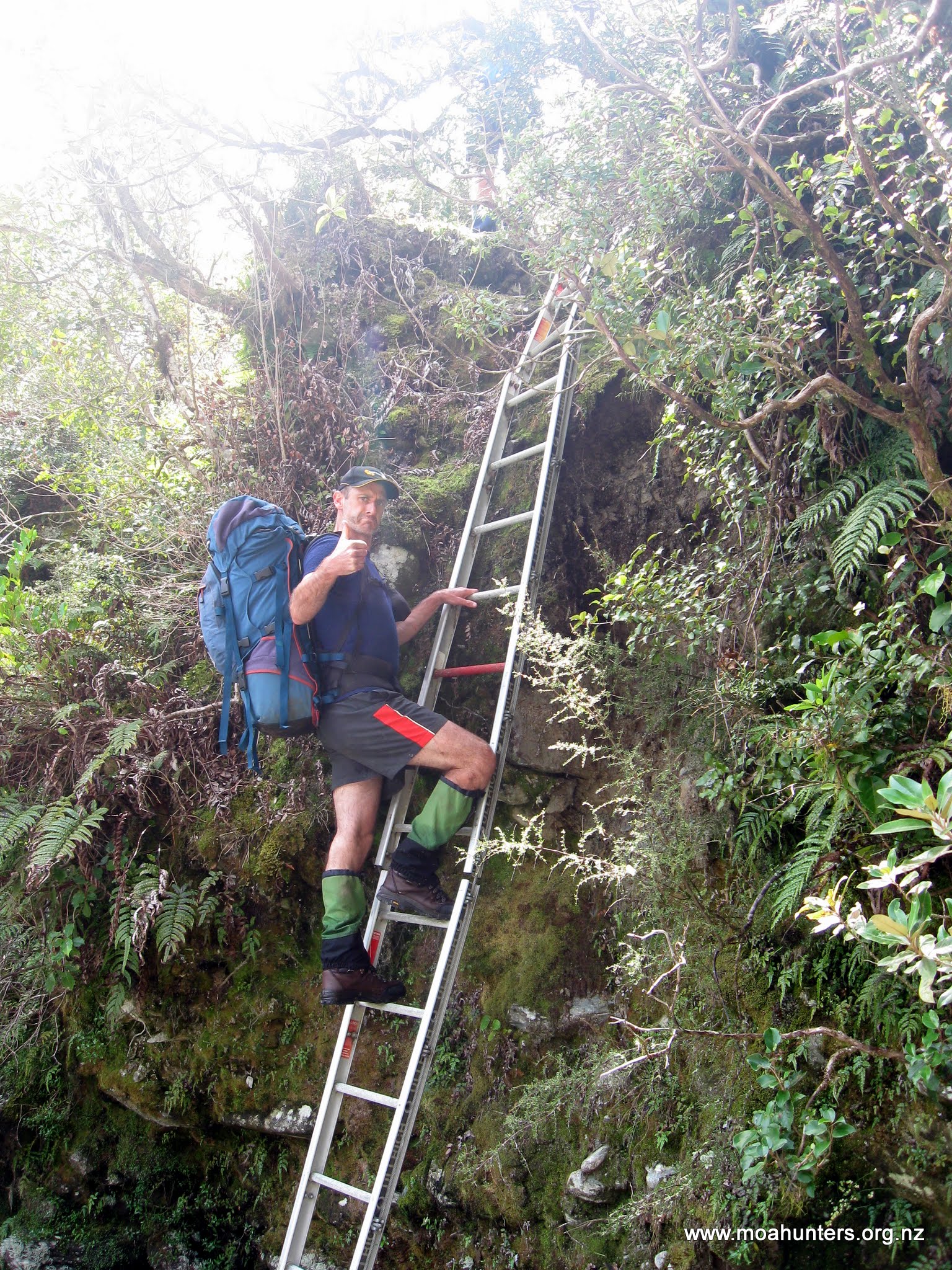
In the dry conditions we were enjoying, the chains were hardly necessary, but on a miserable wet day they would certainly provide a welcome handhold.
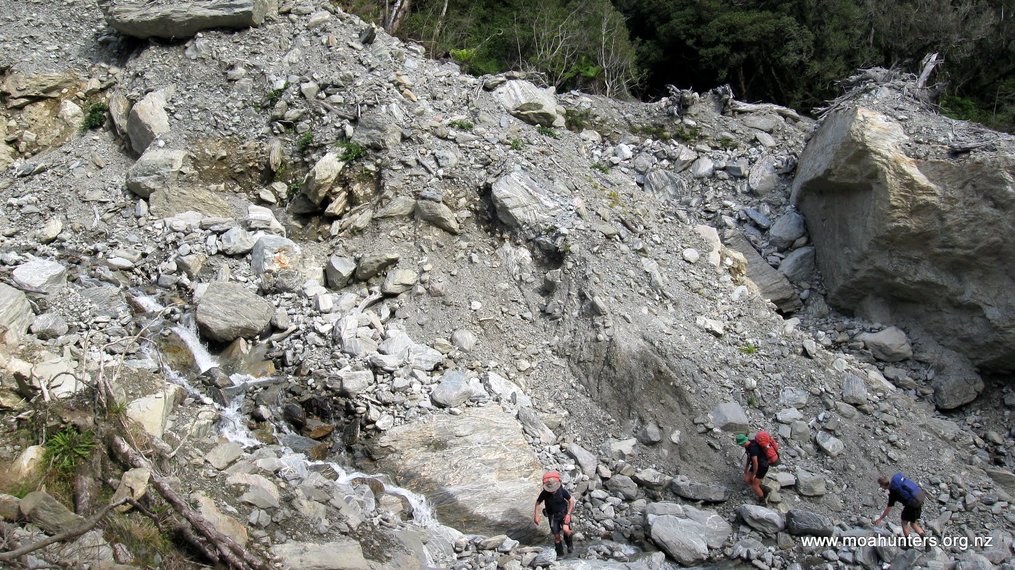
Two large slips are shown on the topomap for this route. However, there are many that are not shown at all. We soon learned these were challenging to traverse. At 5:30 we came across a significant and very recent slip which took some time to navigate. The steep drop combined with loose rock and rubble encouraged extra care. We chose to start high and remain high. Dropping to the bottom of the slip as we traversed it would have been an easy option, but climbing back up to the track again would have been nasty. Our decision turned out to be a good one. We picked a path on the high side of a very large boulder and were able to scamper up to the track on the other side of the slip without too much trouble.
Beyond the slips, the track remained high, skirting along the hillside some 50 metres above the Whitcombe. While the terrain across the river was steep, the bush clad hillside to our right in contrast sloped much more gently.
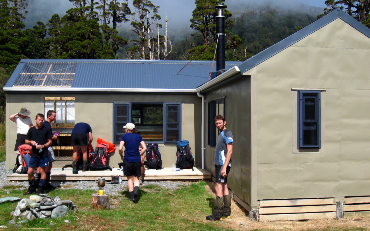
We were very pleased to arrive at the Cataract creek footbridge by 6.30pm, as this marked the end of our day, with Price Flat hut just a stones throw away on the other side. It had been a long day on the back of a very long day, and we were all still feeling quite fatigued.

Fortunately Chris still had enough energy and enthusiasm to whip up some naan bread. This was a tasty addition to the mince and pasta dish, which may have raised an eyebrow or two in India, but not where we were. Knowing that food is essential for muscle recovery and repair, we wisely made a cheesecake for dessert.
Day 4
Monday 1st March – Price Flat Hut to Frew Hut

We all slept soundly and woke up early, feeling considerably more refreshed than the previous morning, which had been somewhat of a struggle.
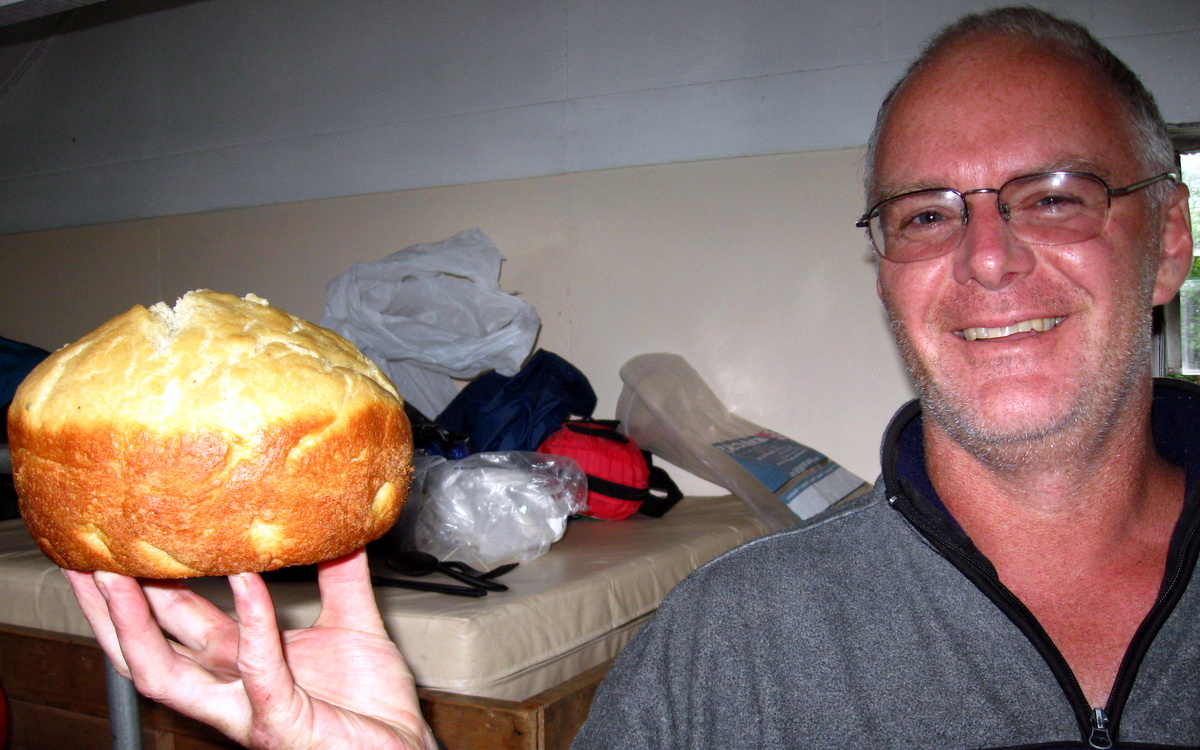
Chris was strutting, triumphant, having successfully producing yoghurt on a tramping trip. Previous efforts in Stewart Island had produced flavoured milk. A larger longer burning candle turned out to be the key. Keeping the mixture warmer for longer produced a nicely set product that was most definitely yoghurt.
Slopped on top of a rich bircher muesli, the yoghurt made a very nice change of pace from the traditional porridge brekkie. Those in the group still aged below thirty and endowed with a voracious appetite, even ventured to add leftover cheesecake to their helping.
Shortly after 9 we had taken out traditional Moa Men outside the hut photo, and were wandering off down the track.
We stopped briefly to admire the wonderfully restored slab hut at the far end of the flat. It is a lovely example of an old construction technique used by early setters in Australia and New Zealand.
Beyond the Price Flat footbridge that leads to the Steadman Brow access route, the track enters a long section of steep and particularly unstable hillside.
Chris decided that in this area there were two kinds of track: Track that has fallen into the river, and track that is falling into the river.
And it was true. Short sections of slightly stable track were interspersed by quite long sections with no track at all.
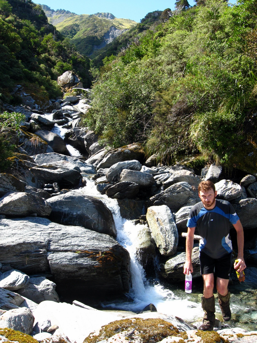
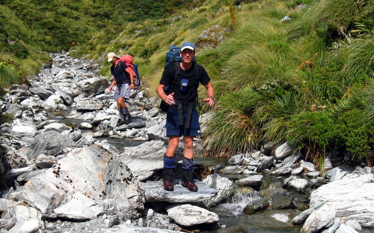
We picked away across roughly two kilometres of this fairly awkward terrain, negotiating a number of tricky river crossings along the way, including one through a small waterfall, just to keep things interesting.

Beyond Hopeful creek, the valley opens out and we gratefully walked out into a flat forested section which required a lot less care to walk. We enjoyed the rich damp smell of the west coast forest. Twisted trees, covered with moss and lichen, rose above the fern dominated understorey. Sunlight that found its way through the branches above created a dappled colour effect.

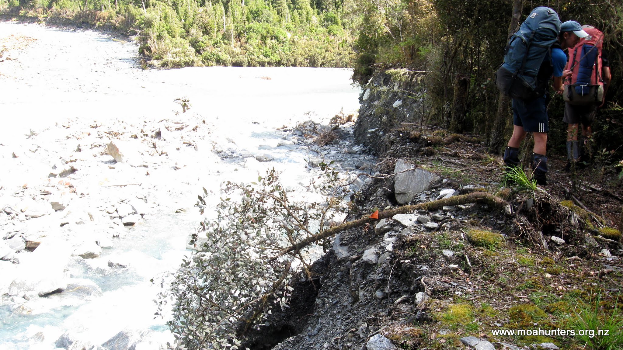
The pleasant walking conditions continued for the next half hour or so, until we broke out of the bush onto the log strewn rocky bed of Vincent Creek. Evidence of recent heavy rain was everywhere. Uprooted trees, branches and debris littered the ground, and the banks of the creek were deeply scoured out.
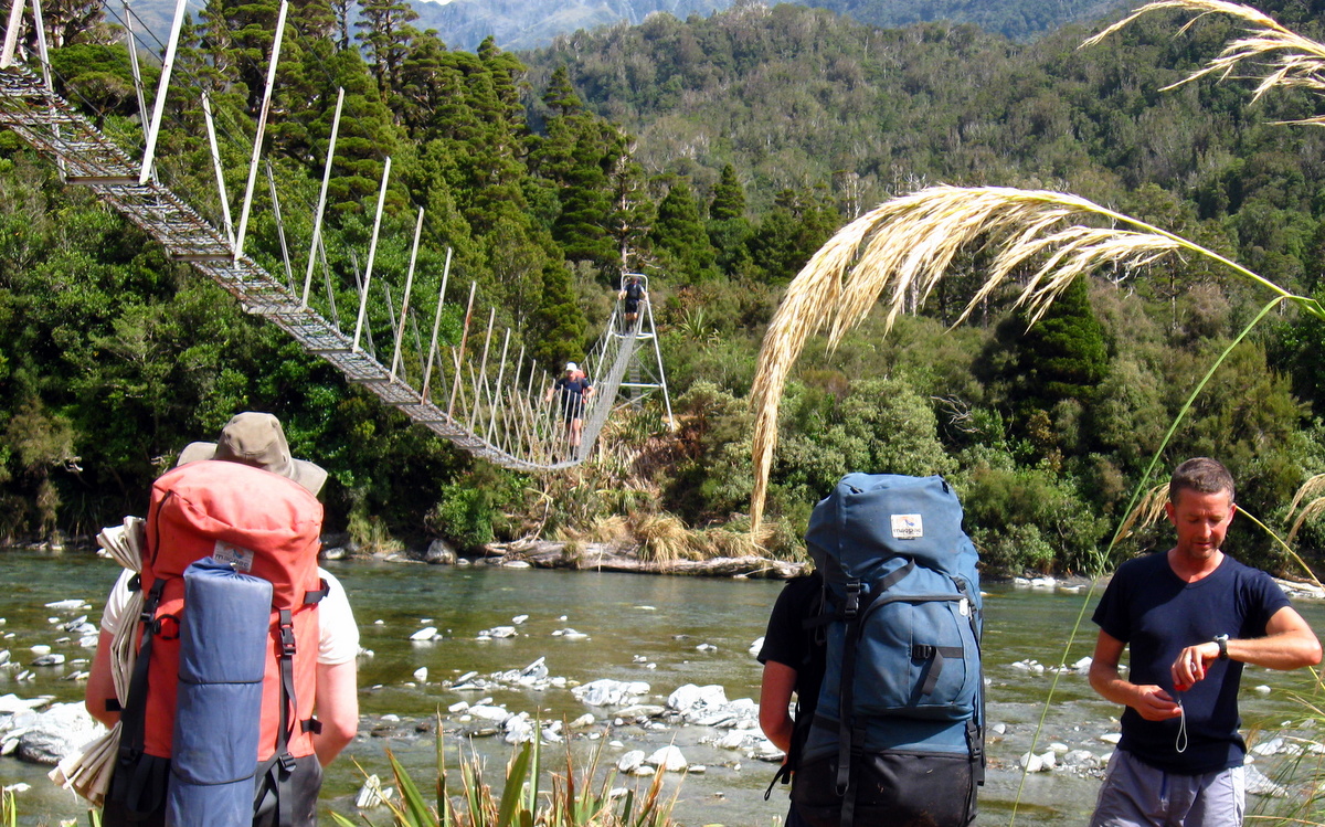
We made our way up the bed of the creek to a large rock which anchored a swing-bridge that spans the creek. The lack of track at the far bank was slightly interesting. Before the latest flood, we assumed it had followed the bank of the creek down towards the Whitcombe. But now that bank was gone, swept away by a raging Vincent Creek. So we were once again forced to go bush bashing in search of the track. As it turned out, we didn’t have to go far to locate it and continue on our merry way.


Beyond the Vincent creek bridge is the even more impressive Cropp foot-bridge which stretches across the Whitcombe. We stopped to take photos but had no need to cross it.

Less than an hour later we were basking in the warm afternoon sunshine at Frew hut. The lazy afternoon felt well earned after the rigours of our first couple of days on the track.
Day 5
Tuesday 2nd March – Frew Hut to Road End
Like so many huts in the South Island, Frew hut is situated to take full advantage of the surrounding scenery. We were fortunate to arrive during a spell of lovely weather and enjoyed spectacular views up the Whitcombe on a crisp clear blue sky morning. Watching the dawn sun slowly spreading its glow across the surrounding mountains certainly takes brushing your teeth after breakfast to a whole new level.
In true Moa Hunter fashion we broke no speed records that morning. It wasn’t until after 9am that we assembled outside the hut for some posed photos before hitting the track.

Our day on the track started with a nice section of open riverbed – a mix of fine sand tracts flanked by lichen covered rocks.

After little more than an hour walking we arrived at a swing-bridge which would take us across to the true left of the Whitcombe. The bridge starts high, with chains and a ladder in place to assist with the climb up damp and fairly slippery moss covered rocks.

Adam quickly learned just how slippery the rocks were. Attempting to pivot his body sideways to swing under the suspension cable, his foot slipped. Sliding sideways, protruding bolts raked down his thigh leaving behind some nasty looking gashes. Fortunately the wounds weren’t deep, but they did look spectacular, weeping claret down his leg. Paul expertly patched Adam’s leg up with some stick on stitches and plenty of tape and bandage, and we were on our way again.
From the bridge the track stays in the bush above the river through Collier gorge. Shortly before midday we emerged from the gorge into a more open section of track. Very large boulders lay strewn all about in the riverbed and the sun continued to shine down on us. We were definitely enjoying the West Coast weather more than the howling nor’wester that had pummeled us on the Eastern side of the main divide.
Walking down the side of the river towards Rapid Creek, we watched a helicopter fly overhead several times.
Each time it passed there was a large net containing kayak’s dangling below it. We all agreed that the kayaking group were heading into gorgeous weather and that the timing of their trip down the river would be stunning. Little did we know that one of those kayakers would lose his life on that trip, drowned in a terrible tragedy that ended a young life far too soon. West Coast rivers are unforgiving, even in beautiful seemingly benign conditions.

We stopped short of Rapid creek for a bite of lunch, just past the confluence of the Hokitika river and the Whitcombe. Despite the Hokitika looking like the younger brother of the larger Whitcombe, from this point the river is called the Hokitika.
Eating lunch in that place was extremely pleasant. Under a clear blue sky with barely a breath of wind wafting up the valley, we munched through the last of our rations, enjoying the solitude and beautiful west coast scenery.
With lunch finished, we had just one challenging obstacle left to negotiate – Rapid Creek. Even in dry conditions, it is a fairly swift little waterway with the water level reaching up to the thighs at times. It is easy to see how this can quickly become impassable when it rains.

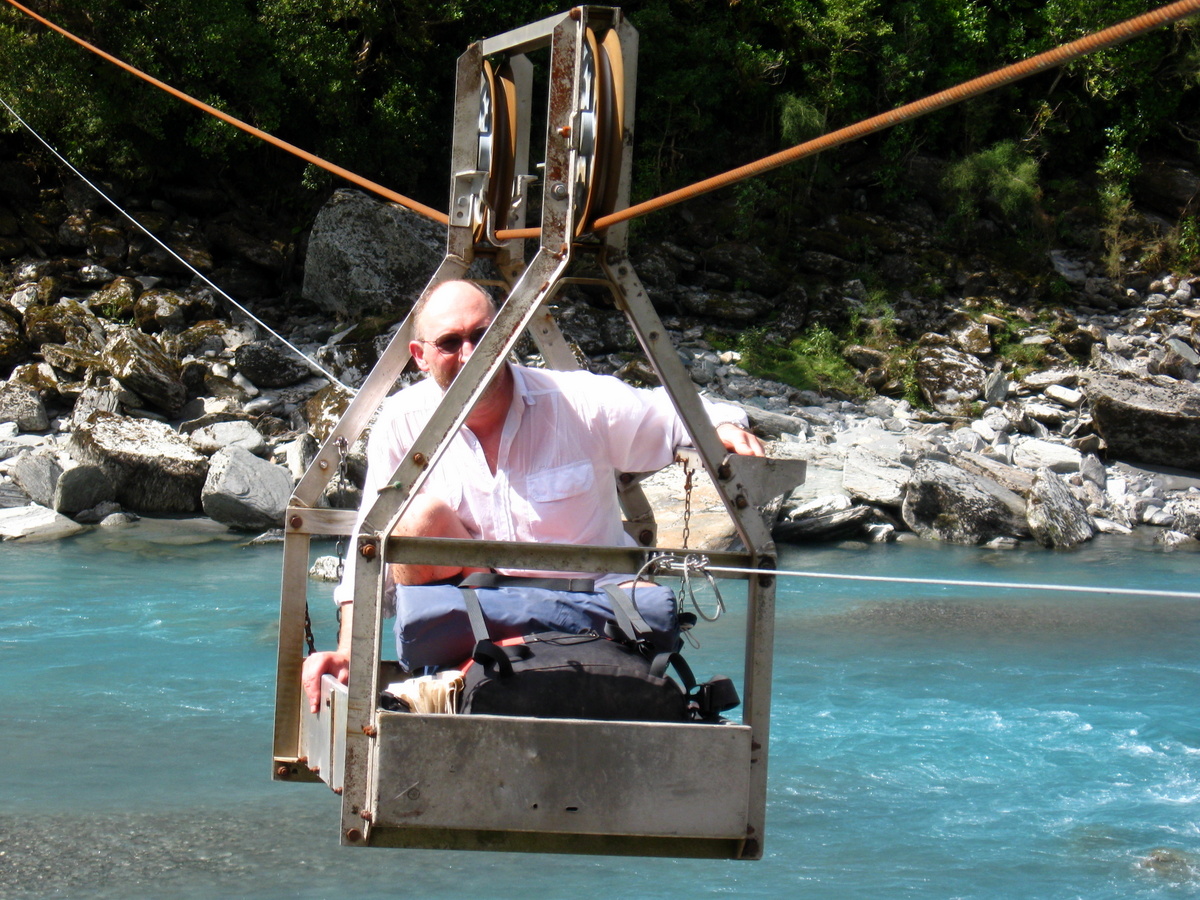
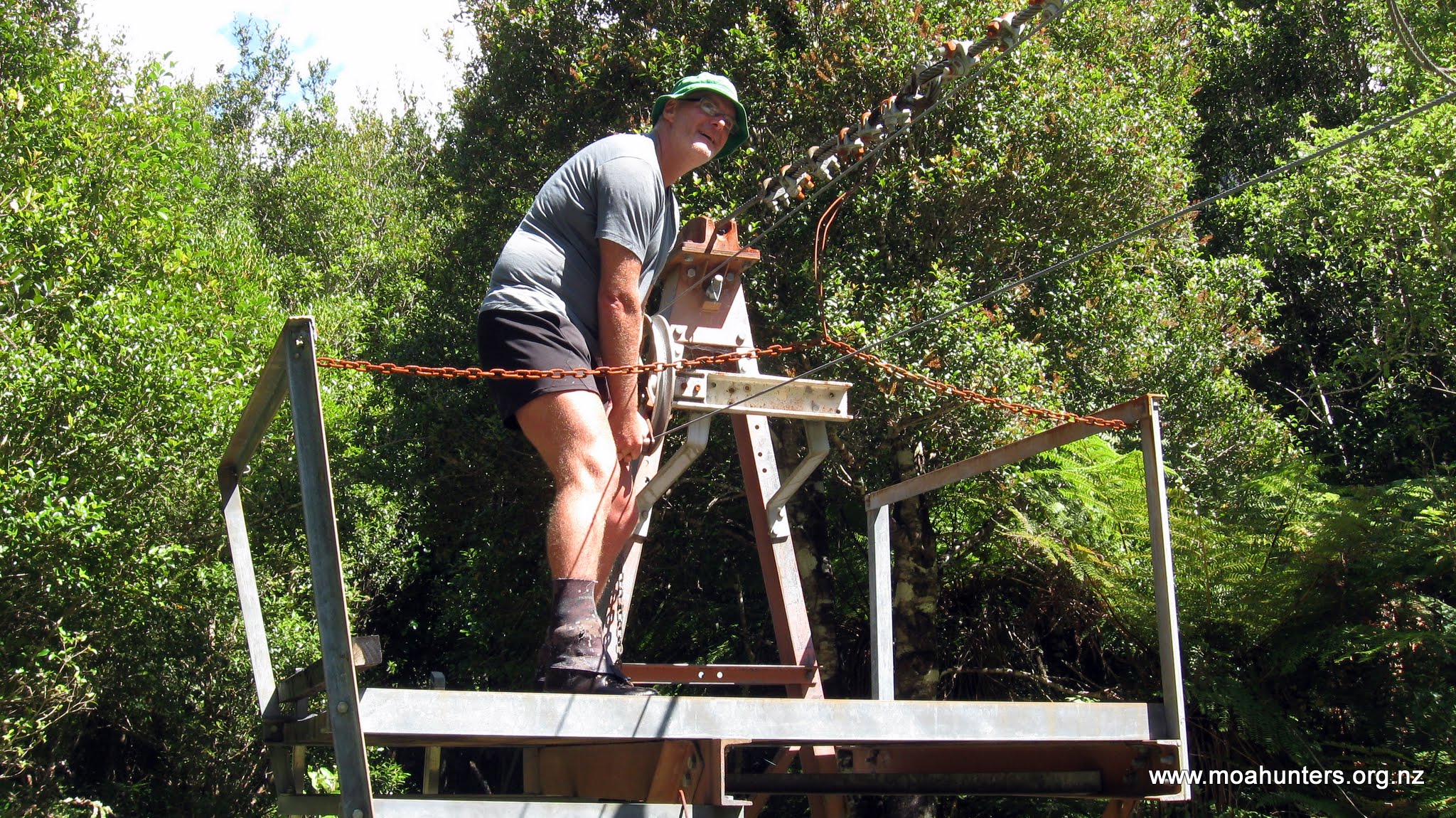
After carefully picking our way across, we continued down the Hokitika to the cableway which would take us over to the true right of the river and the final section of the walk out.
Crossing the cableway was not a new experience for the Moa Hunters who did the Whitcombe – Toaroha trip in 2013. But that doesn’t make it any less fun! We all enjoyed our ride across the river in the little cablecar.

Beyond the cablecar, the terrain becomes fairly benign as it leaves the steeper mountainous country and heads for the more open flats of Kowhitirangi. Walking was easy and we made brisk progress, reaching the 4WD track that joins the Whitcombe Valley road shortly after 3pm. An hour later we were at the carpark and the official start of the Whitcombe track.

After a couple of quick photos, we continued up the road for another 45 minutes, when a familiar vehicle rounded a corner ahead of us. Paul’s father Alan, superbly organised as always, handed out sandwiches and fired up his Thermette to brew up a cuppa.

Our crossing from East to West was complete. We had done the Whitcombe Pass route. It was a very satisfying feeling. The trip was certainly one of the most challenging we have undertaken, and certainly not one that anyone should take lightly. But as always, the spectacular New Zealand scenery was more than enough reward for our efforts.