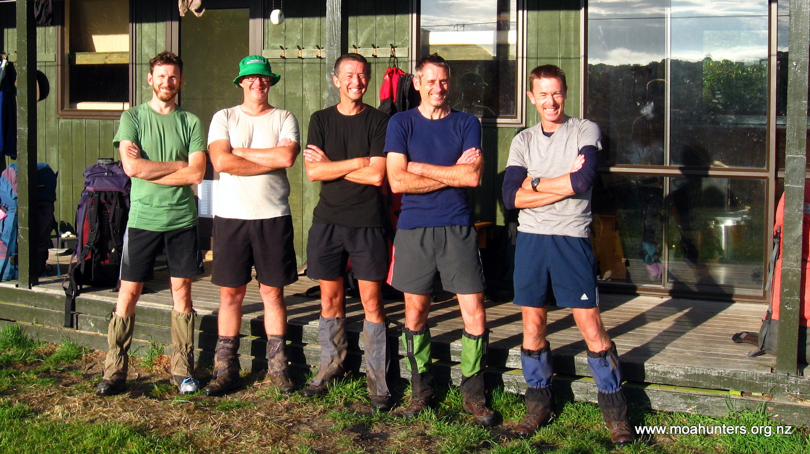
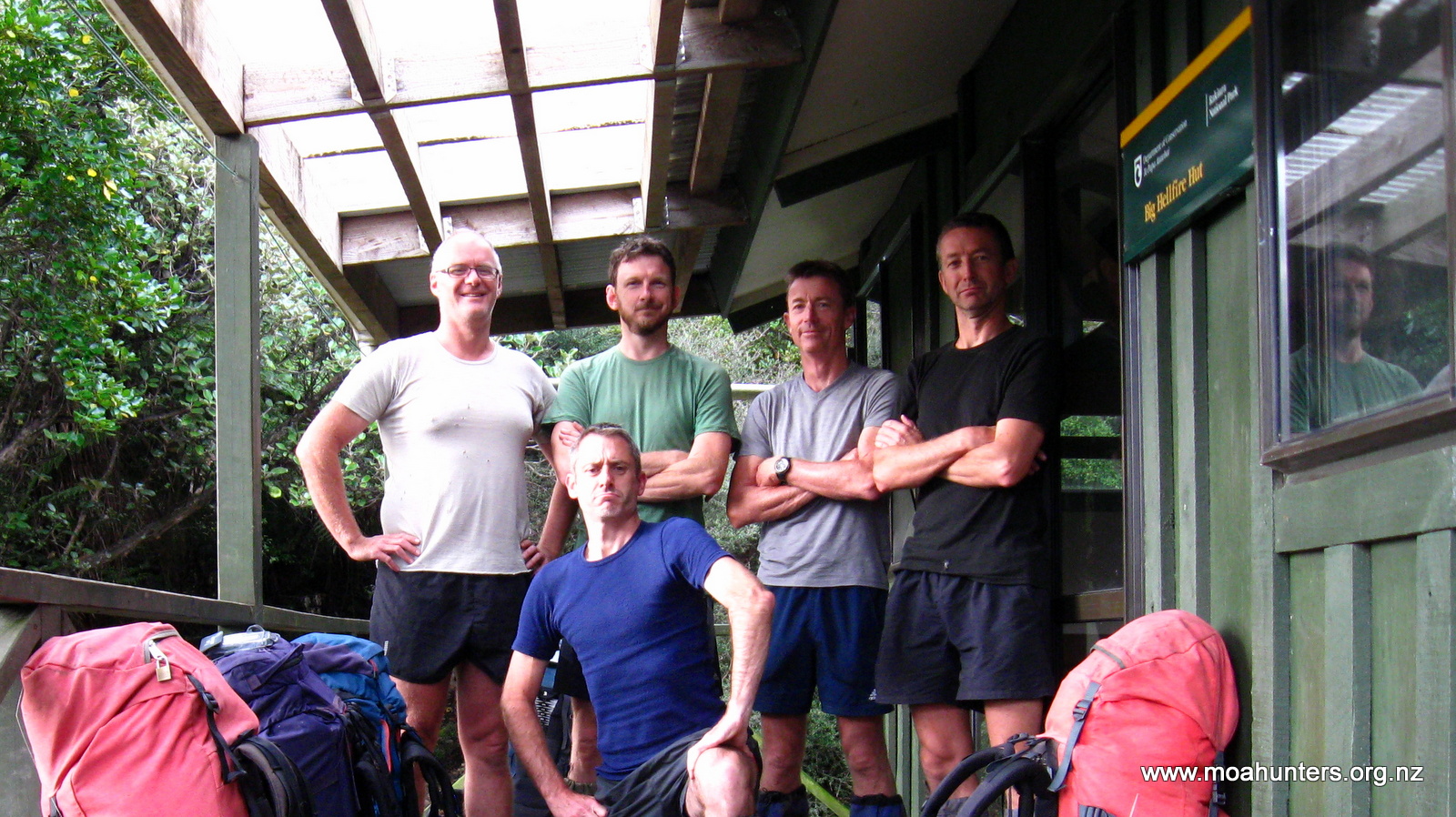
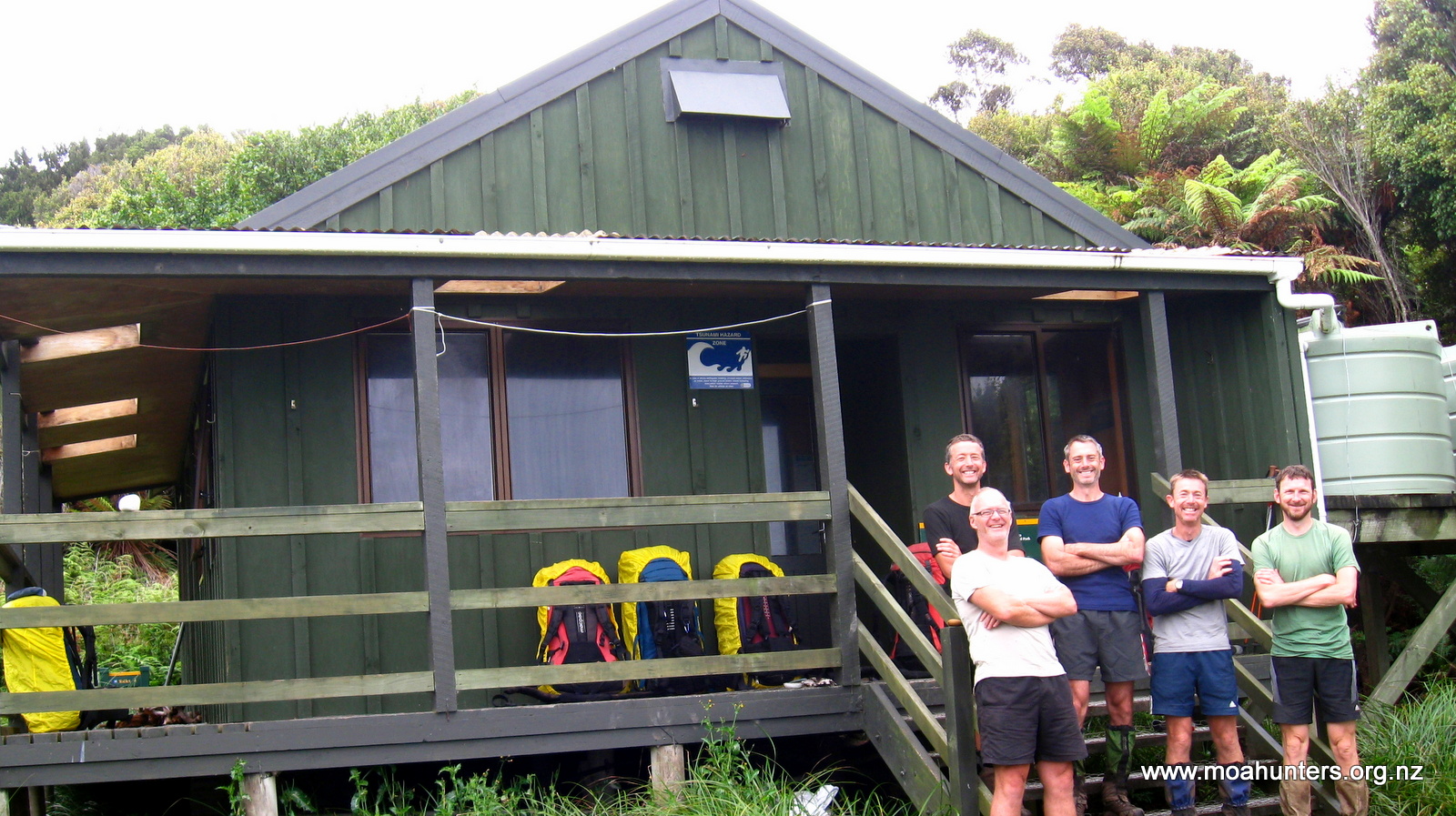
Moa Hunters on this trip: Chris, Paul, Adam, Lewis, Richard
Just days before departure, Magnus was forced to pull out of this trip. We missed you Magnus, and really hope you can make the next one!
The Trip:
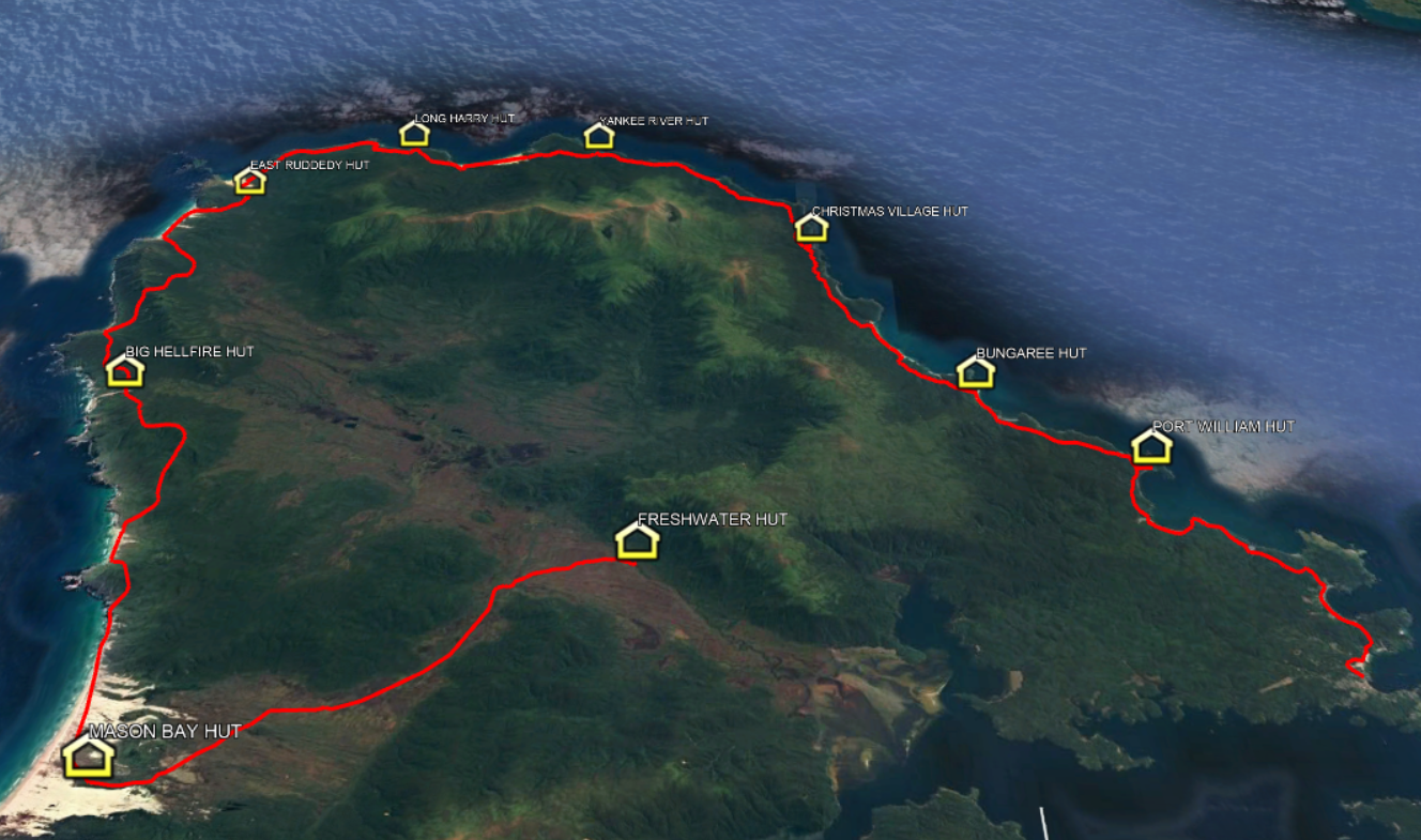
Day 1: Fly to Invercargill, Ferry to Oban, Stewart Island.
Day 2: Water Taxi to Freshwater Hut, walk to Mason Bay Hut (3hrs / 15km)
Day 3: Mason Bay Hut to Big Hellfire Hut (7hrs / 15km)
Day 4: Big Hellfire Hut to East Ruggedy Hut (7-8hrs / 14km)
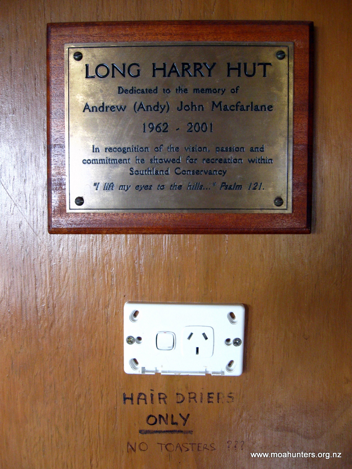
Day 5: East Ruggedy Hut to Long Harry Hut (5-6hrs / 10km)
Day 6: Long Harry Hut to Yankee River Hut (5hrs / 9km)
Day 7: Yankee River Hut to Christmas Village Hut (6hrs / 12km)
Day 8: Christmas Village Hut to Bungaree Hut (6hrs / 12km)
Day 9: Bungaree Hut to Port William Hut (3-4hrs / 6km)
Day 10: Port William Hut to Oban (4hrs / 12km). Fly home.


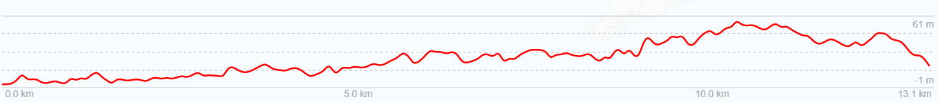
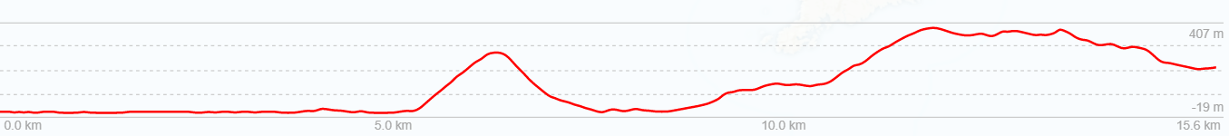
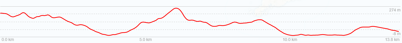
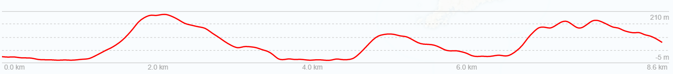
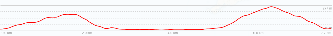
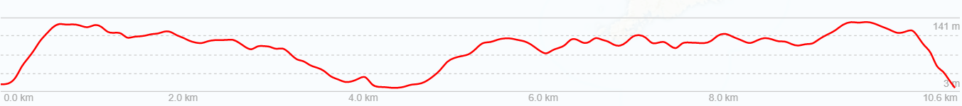
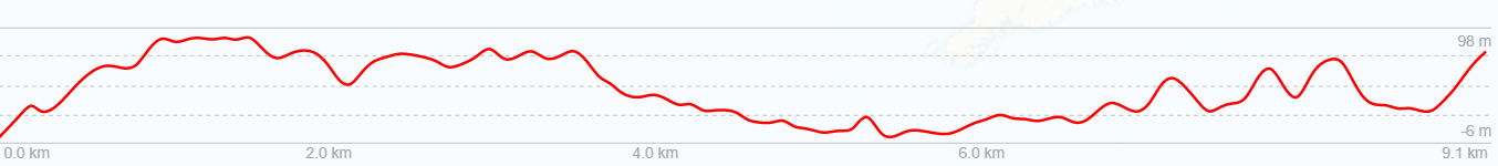
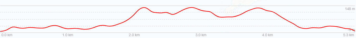
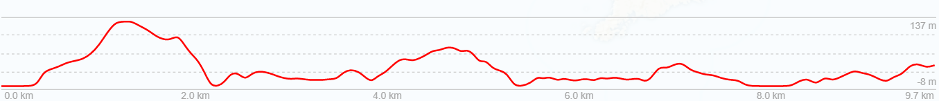
Above is an altitude profile of this route. Click to enlarge. Note: The horizontal scale divisions are roughly 1km. The transition from green to brown does not accurately represent the bushline. The horizontal scale to vertical scale is not 1:1
Day 1
Friday 27th February – Destination Oban
Aboard various flights from all around the country, the Moa Hunters converged on Christchurch Airport. By mid morning, we were reunited, just over a year since completing our last trip in the Nelson Lakes. Ahead of us was our most ambitious trip yet. Ten days on Stewart Island. We all felt a mix of emotions: Excitement at what the next days would hold for us, mixed with anxiety at being away from family for so long.
Shortly after lunch we boarded the flight to Invercargill. As we winged our way south, those on the west side of the plane were treated to spectacular views of the southern alps and interior of the South Island. Once on the ground in Invercargill, we had a short wait outside the airport before our shuttle bus collected us. Forty minutes later we were standing in light drizzle outside the Bluff ferry terminal. We boarded the Stewart Island ferry just before 5pm and were in Oban just after 6pm. Thankfully Foveaux Strait was in a benign mood, and the crossing was a smooth one.

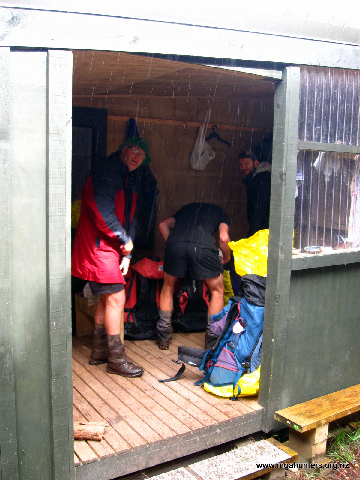
As it was raining lightly in Oban, we grabbed our backpacks as soon as they were unloaded from the ferry and walked briskly up to the South Sea Hotel. Full of locals and visitors, the pub was noisy and vibrant. We booked ourselves a table in the adjoining restaurant for 7pm, then filled in time downing a few ales.
After a very good feed of locally caught cod, chased down with cheesecake, we left the South Sea Hotel. With our jackets back on we headed up Main Street to the “Harris House” holiday home we had booked for the night.
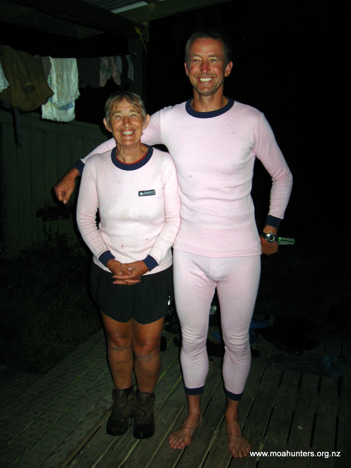
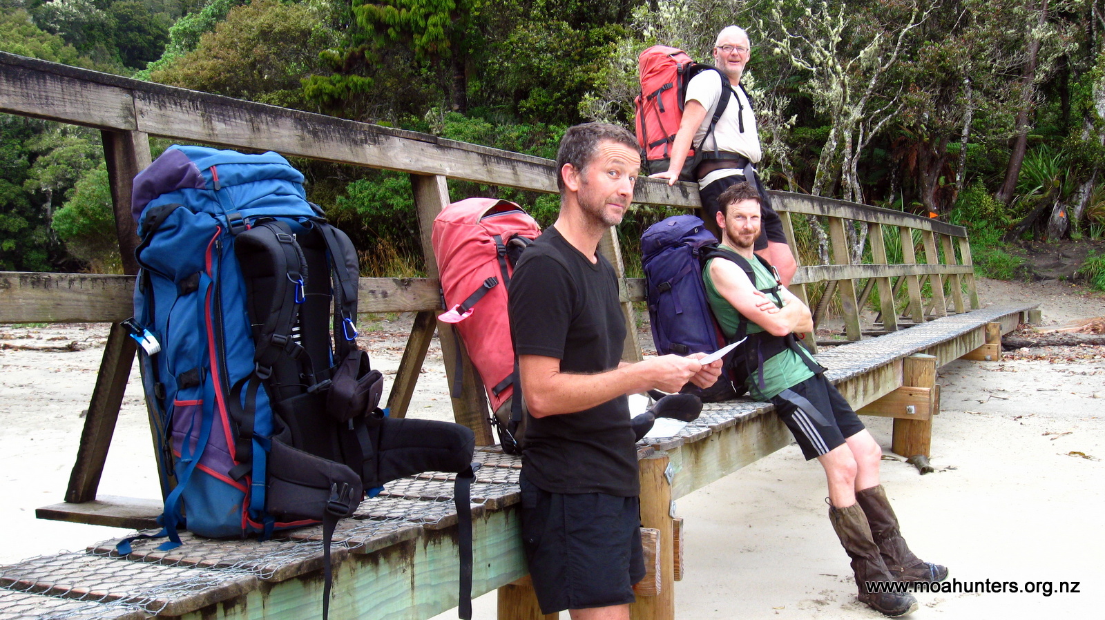
Once settled in, we distributed food evenly between our packs (which now weighed around 22KG on average) and headed for bed, whereupon rather a lot of farting ensued.
Day 2
Saturday 28th February – Freshwater Hut to Mason Bay Hut
After a night which allegedly featured snoring loud enough to drown out a large Stihl chainsaw, the Moa Hunters arose from their slumber soon after 7am. Once the house was tidied, we locked up and left about 9am. With heavy packs on our backs, we wandered down Main Street in light spotty rain to the South Sea Hotel.
Yes, again! But this time for a delicious cooked breakfast of hash browns, bacon, eggs and mushrooms.
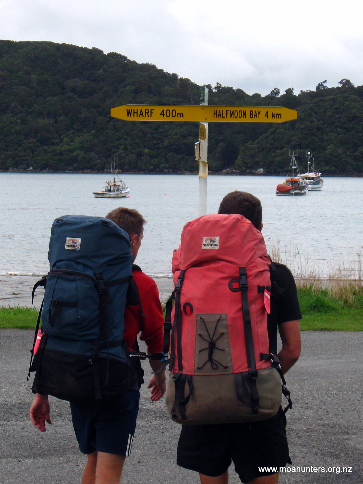
With full tummies we left the hotel, made a quick stopover at the DOC Office to buy hut tickets, then wandered up Argyle Street for Golden Bay. It was easy to enjoy the peaceful and lazy ambiance of Oban. Nobody seemed in a hurry to get anywhere. Tui flitted about in nearby flowering tree fuchsias, and cheeky Kaka called raucously from the trees above us.
Golden Bay is a lovely sheltered little harbour with a small wharf shared by a number of local water taxi operators. Not long after our arrival, Ian Wilson from Stewart Island Water Taxis showed up in his ute. Before long we were aboard his boat and under way.
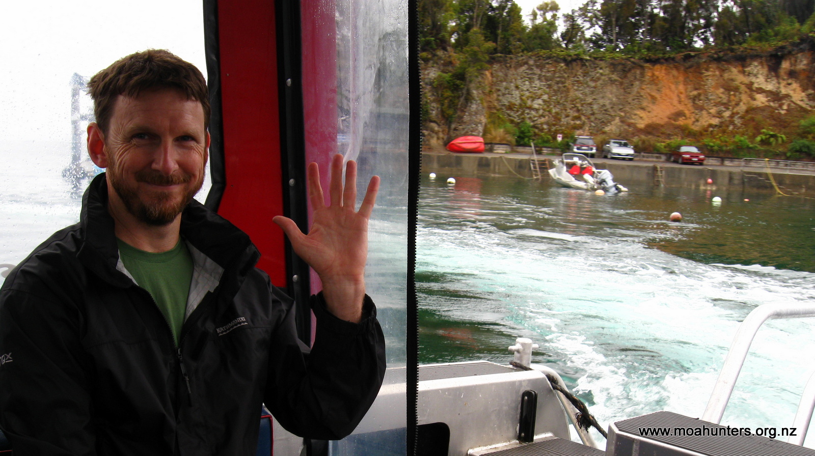
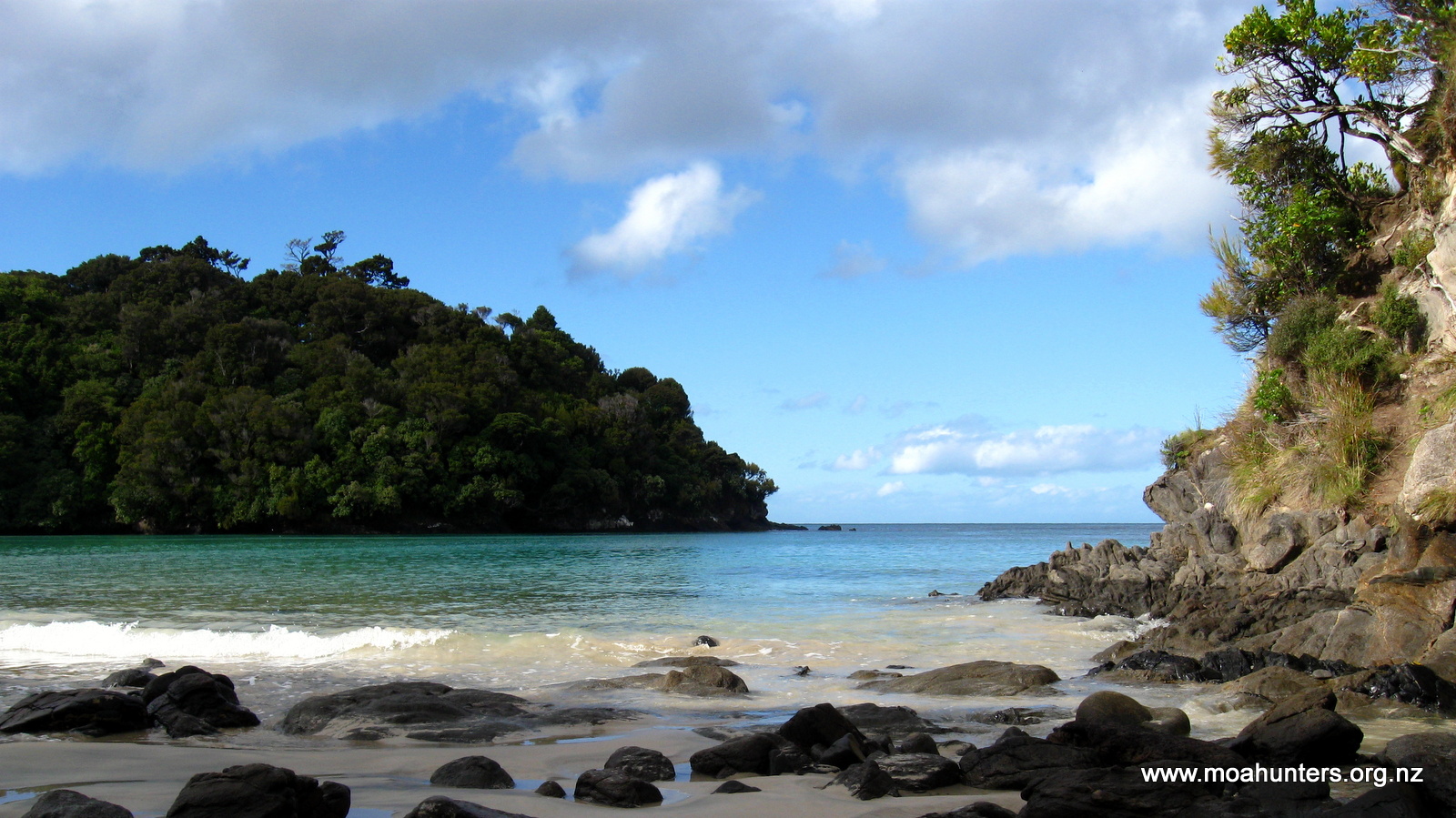
Headed for freshwater river at the top of Paterson Inlet, we made a quick detour into beautiful Ulva Island to drop off some Australian sightseers. 30 minutes later we were cruising along in very shallow waters near the mouth of Freshwater river. Its banks overgrown by thick vegetation, the river snakes its way into the heart of Stewart Island. Ian skilfully piloted us up to the narrow waterway to the small jetty at Freshwater Hut, where we disembarked with our packs.
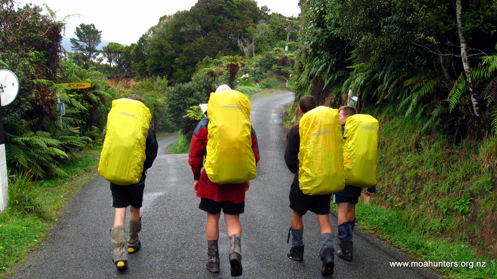
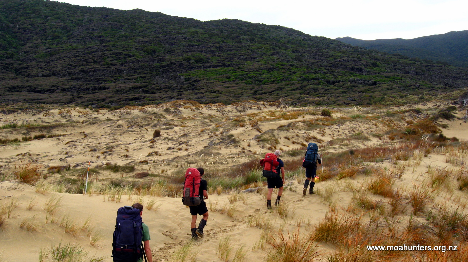
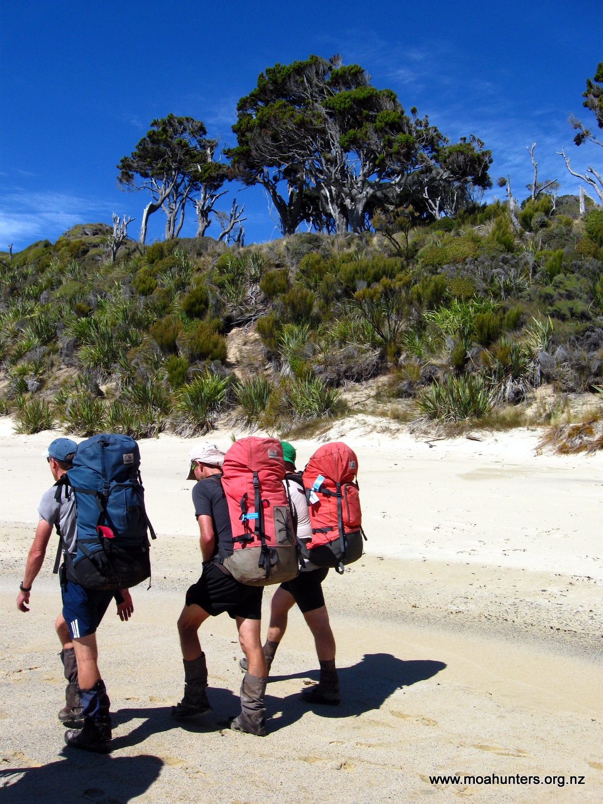
Finally, we were at the official start of our Moa Hunt. Not wanting to rush our adventure, we took some time to take in our surroundings. After a look around inside Freshwater Hut we hefted our packs onto our backs and struck out down the track to Mason Bay Hut.
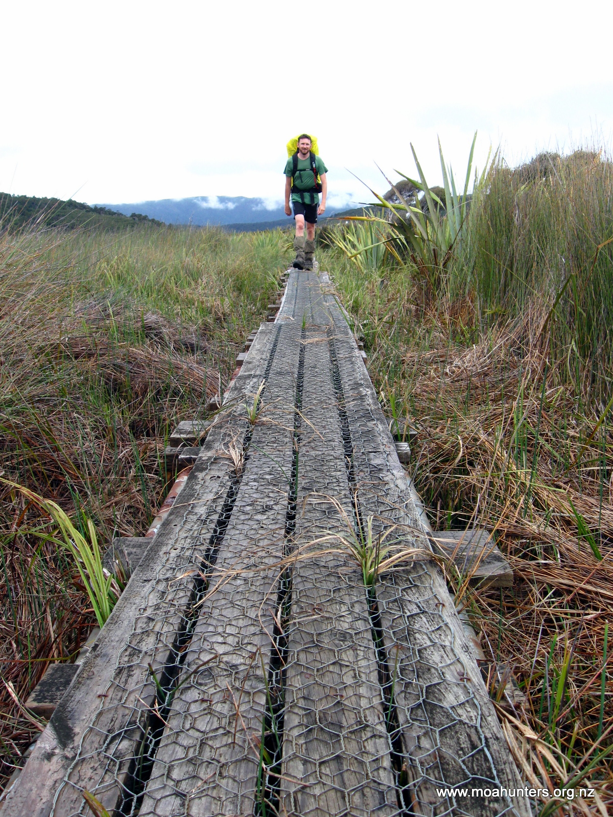
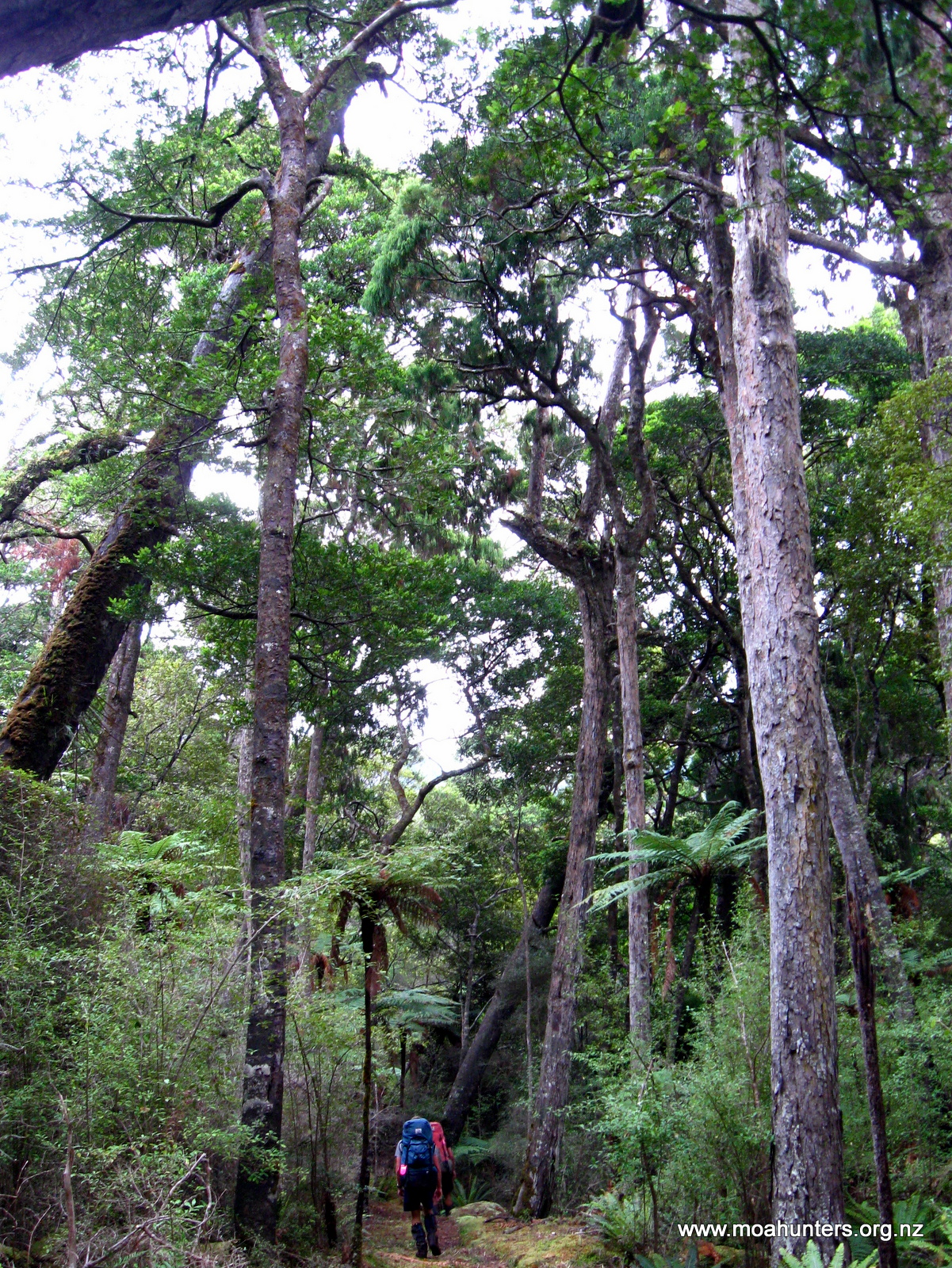
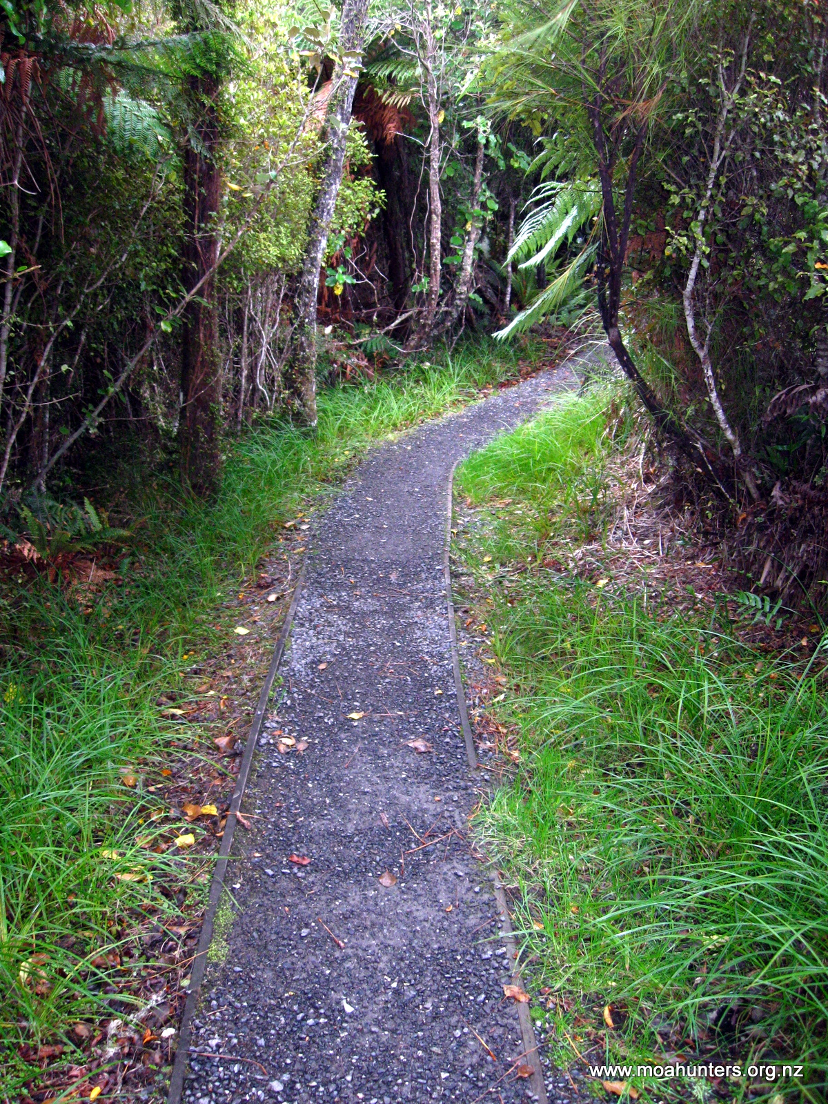
The track was hard and fast. Walking through low a mix of low scrubby vegetation and taller Kanuka, we encountered our first muddy patches, but nothing too deep or difficult. After about an hour the track was boardwalked and ran dead straight for more than a kilometre, following an old logging tramway. After that section the terrain opens out dramatically with the boardwalking taking us through a wide expanse of grassy marshland flanked by low bush covered hills. The different coloured grasses creating a spectacular natural tapestry on either side of the track.
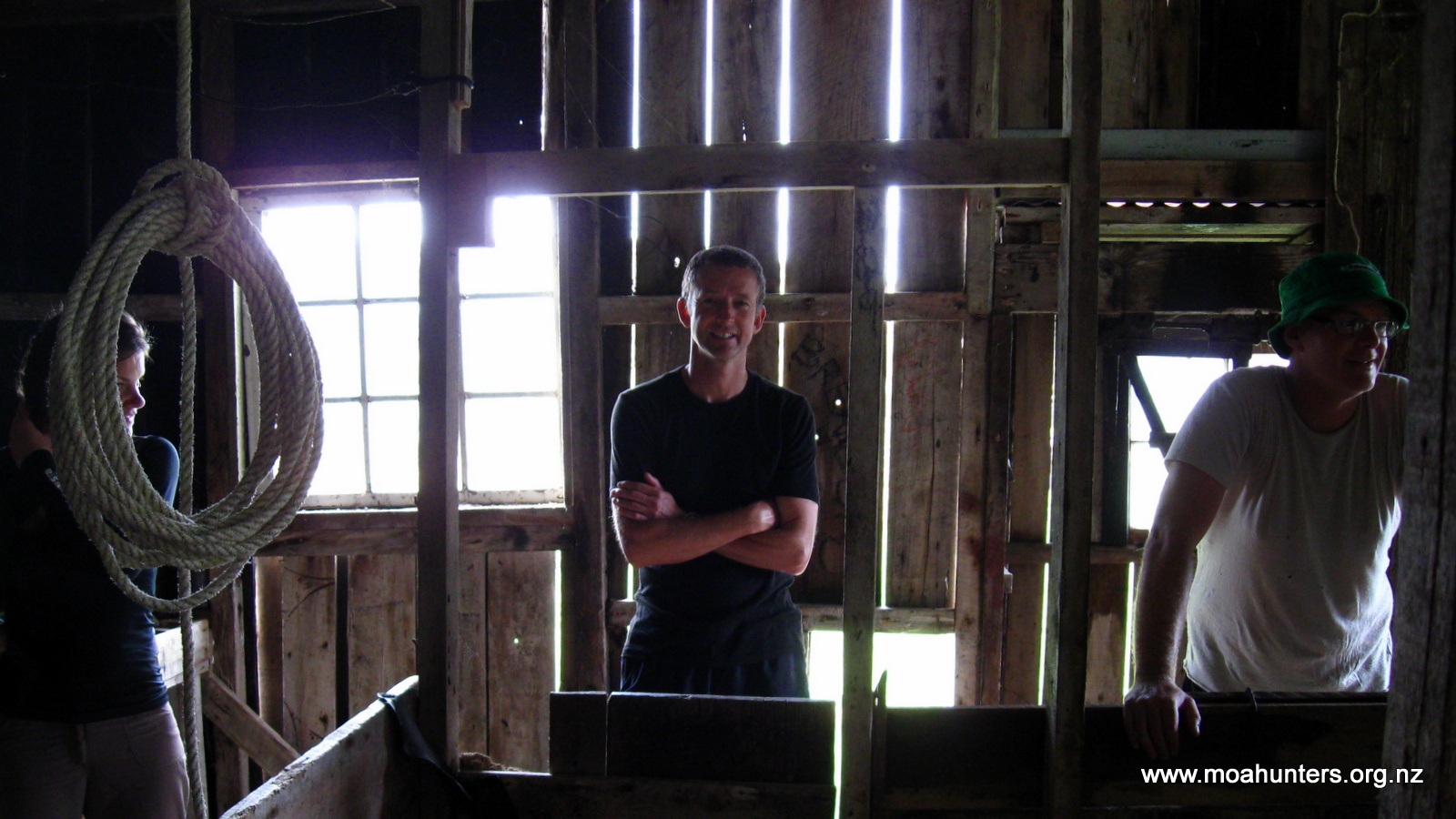
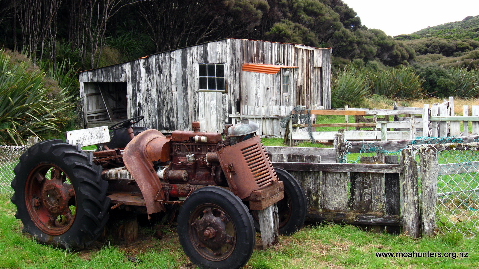
Along the way we bumped into two lovely young ladies, Inge and Katrina, who had paired up for the walk. We walked with them for the last half hour of track to Mason Bay hut, stopping for fifteen minutes or so to explore some historic farmstead buildings. Mason Bay was relatively unproductively farmed for decades, before being finally abandoned in the mid 1980’s when the NZ Government purchased the land and incorporated it into the Rakiura National Park.
The Mason Bay hut was already bustling with trampers when we arrived. We quickly secured ourselves some bunks and then acquainted ourselves with the area.
Paul was very pleased to remove two kilos of marinated steak from his pack and cook it up for our dinner. It was superbly tender and expertly cooked – well done Paul and Chris! There was more than we could eat, and some leftovers were donated to some starving trampers we had befriended. In particular, Nancy, who had seriously underestimated how much food she would need for her trip. She is a Stewart Island local and promised us extra chips at the Kai Kart if we dropped in after our walk. We said we would hold her to that promise!
From the hut there is a track through the dunes out to the spectacular 12 km sweep of white sand that forms Mason Bay.
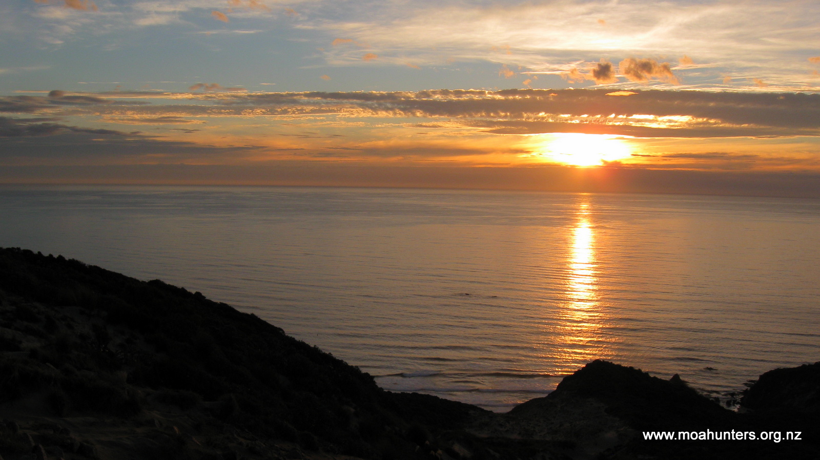
Accompanied by Inge and Katrina we walked out as the sun sank towards the horizon, hoping to witness one of Stewart Islands legendary sunsets.
We weren’t disappointed. Blazing reds and orange hues set the horizon on fire, while the sky above turned shades of azure, purple and pink. We stood on top of a high dune soaking up the splendour of Stewart Island.
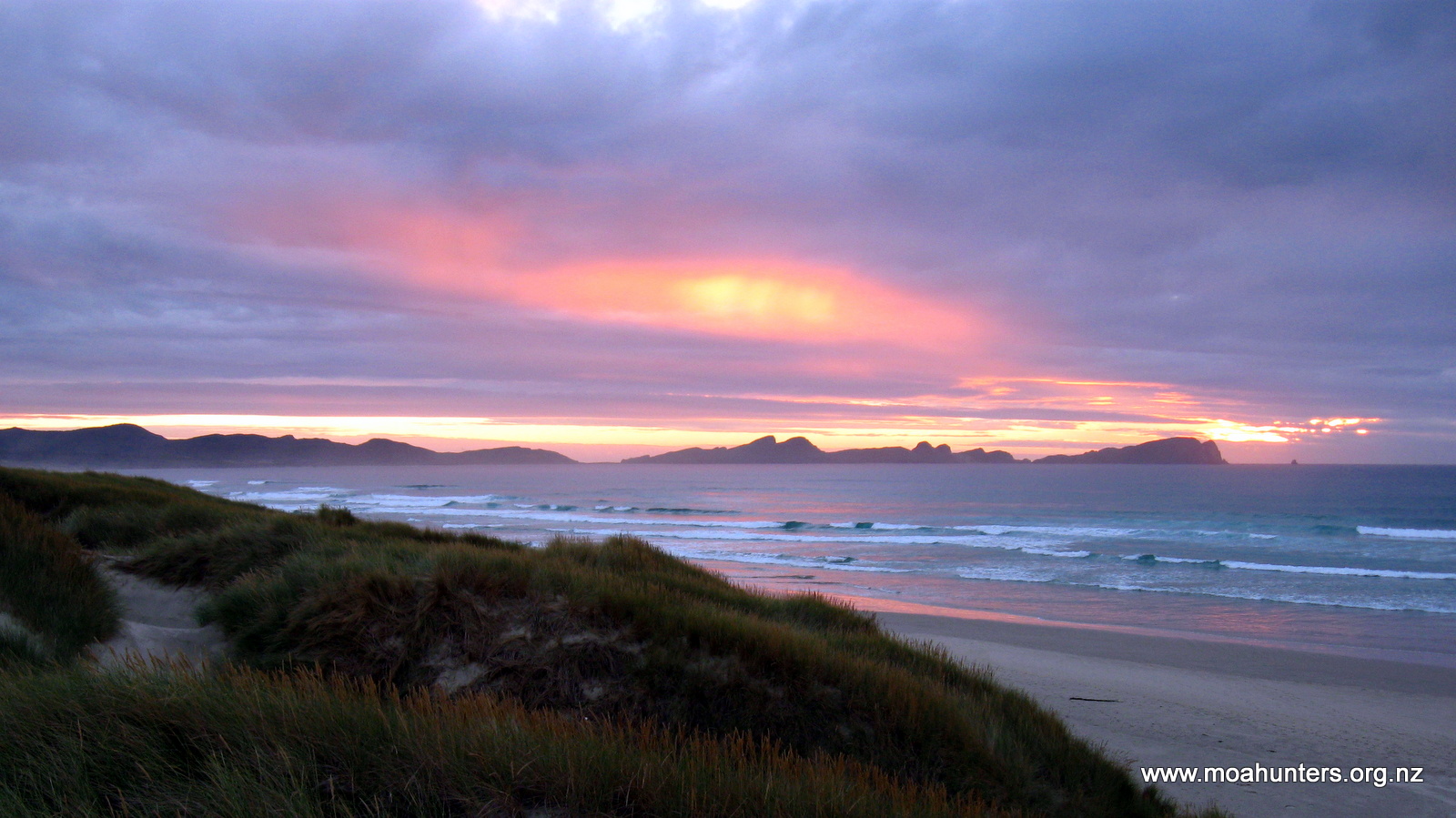
After a long walk along the beach, we returned to the hut slightly damp from a passing shower of rain that had arrived unexpectedly. Apparently a not unusual phenomenon on Rakiura!
Day 3
Sunday 1st March – Mason Bay Hut to Big Hellfire Hut
Despite Mason Bay Hut being a busy place, we all got a fairly good sleep. Not only do trampers frequent the hut from both the North West and Southern circuits, but tourists also arrive regularly in small planes that land on the beach. Kiwi spotting is the main reason for the tourist flights – Mason Bay is allegedly a great spot to see them. So this hut is often filled with an eclectic mix of tired trampers on their last rations, in sharp contrast to well provisioned tourists with large quantities of food, wine and beer.
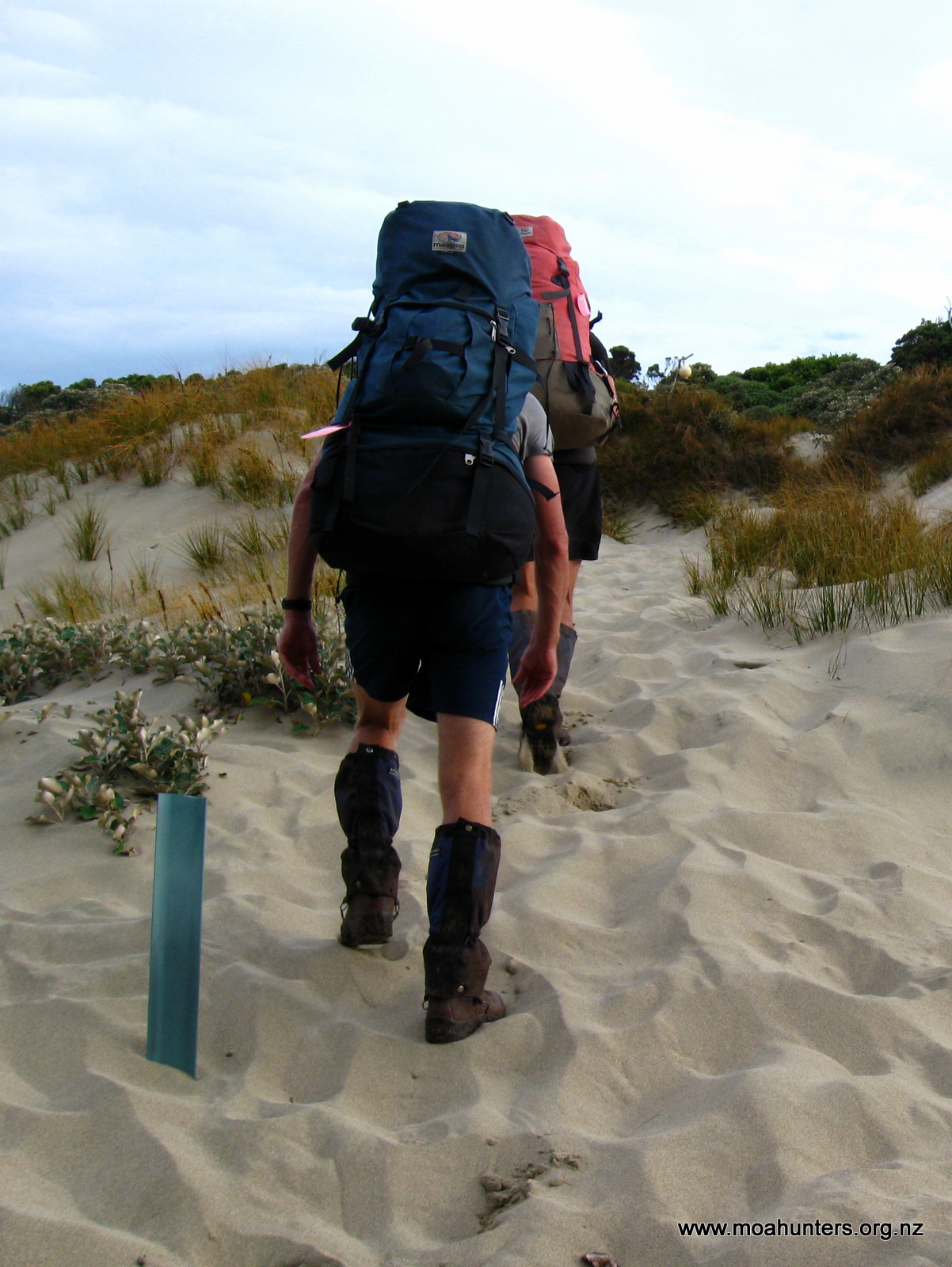
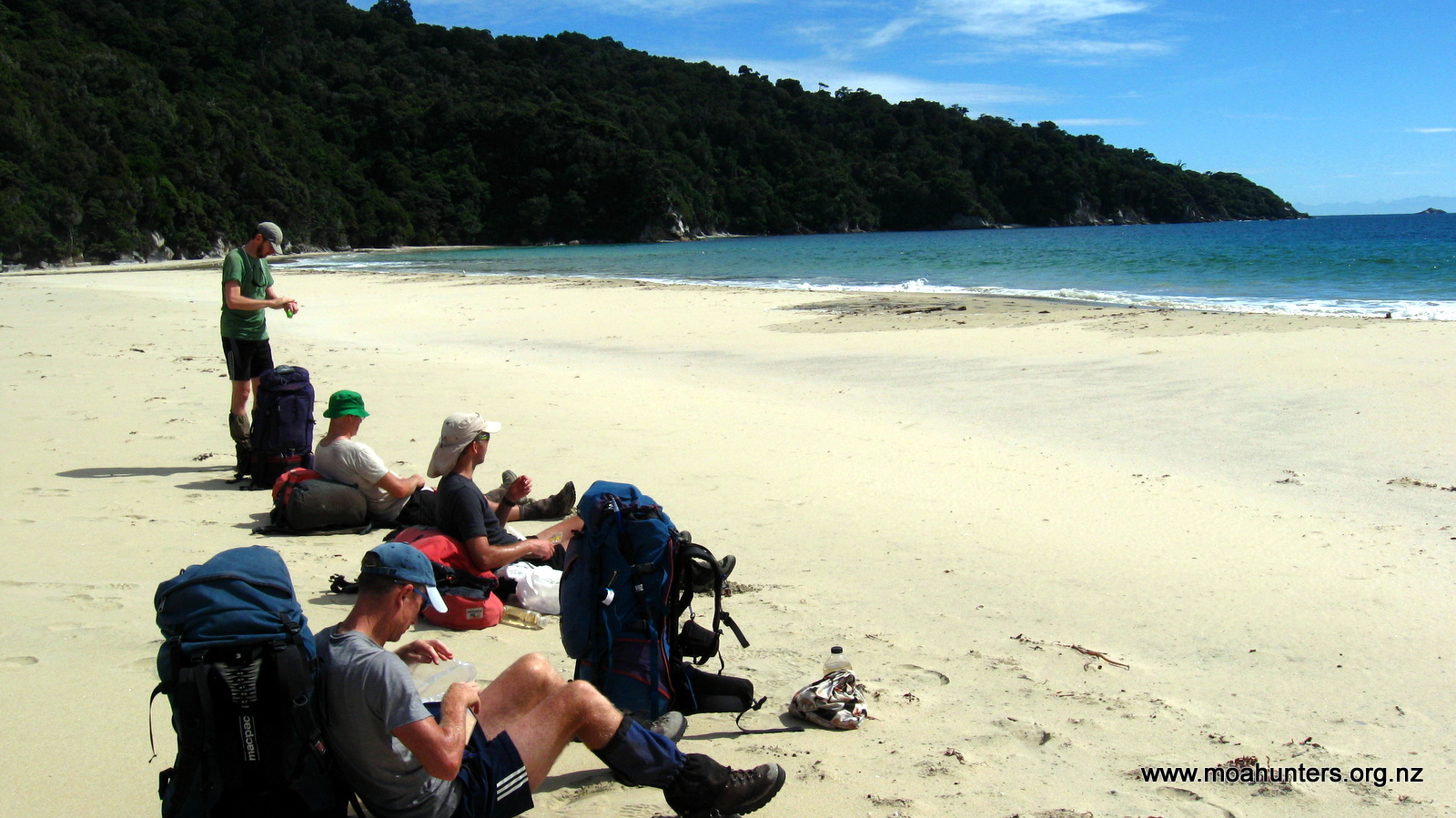
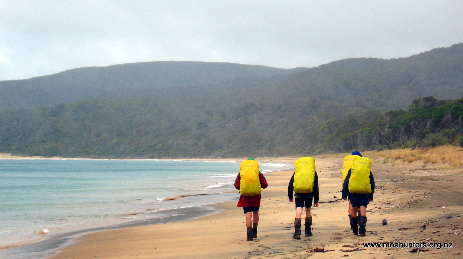
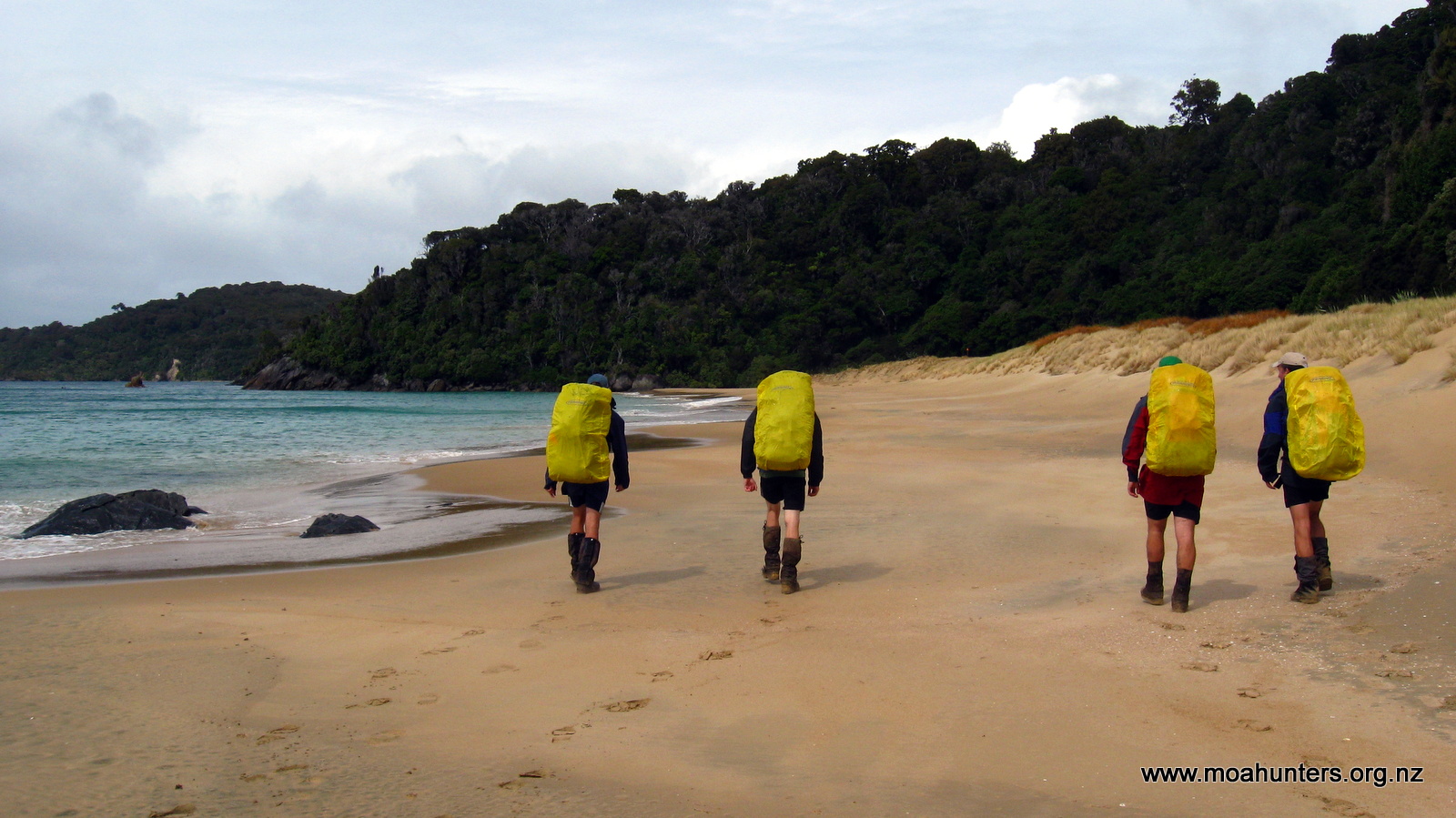
As we had a fairly big day ahead of us, we left the hut relatively early. Under blue skies streaked with hazy high cloud, we followed the well walked track through the sand dunes out onto the beach.

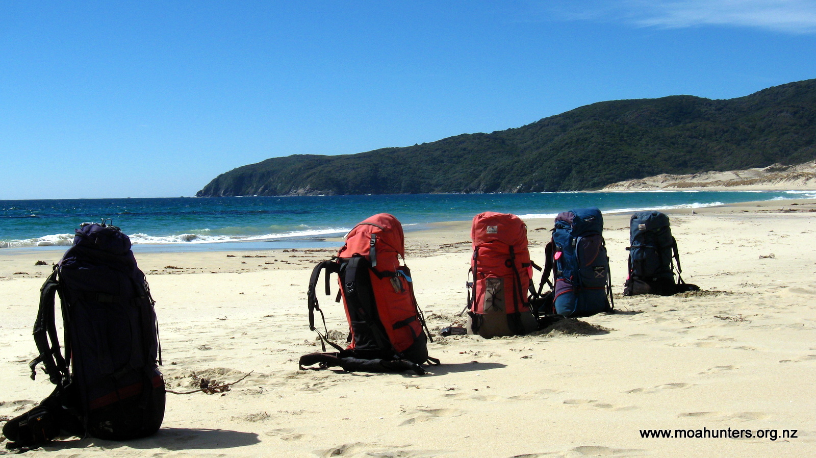
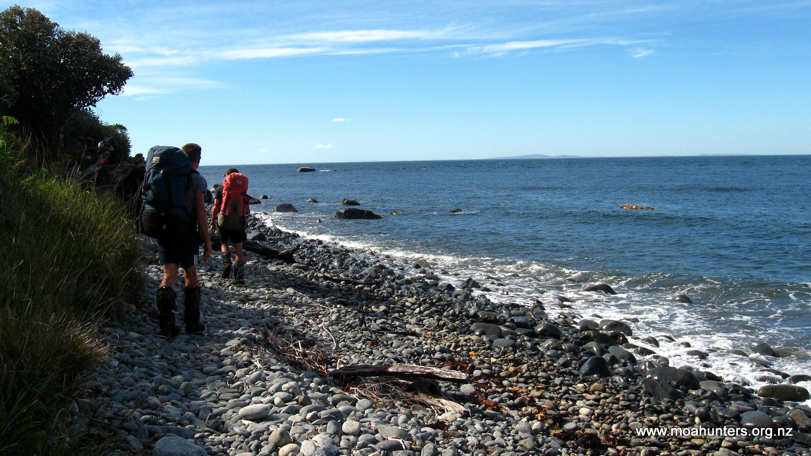
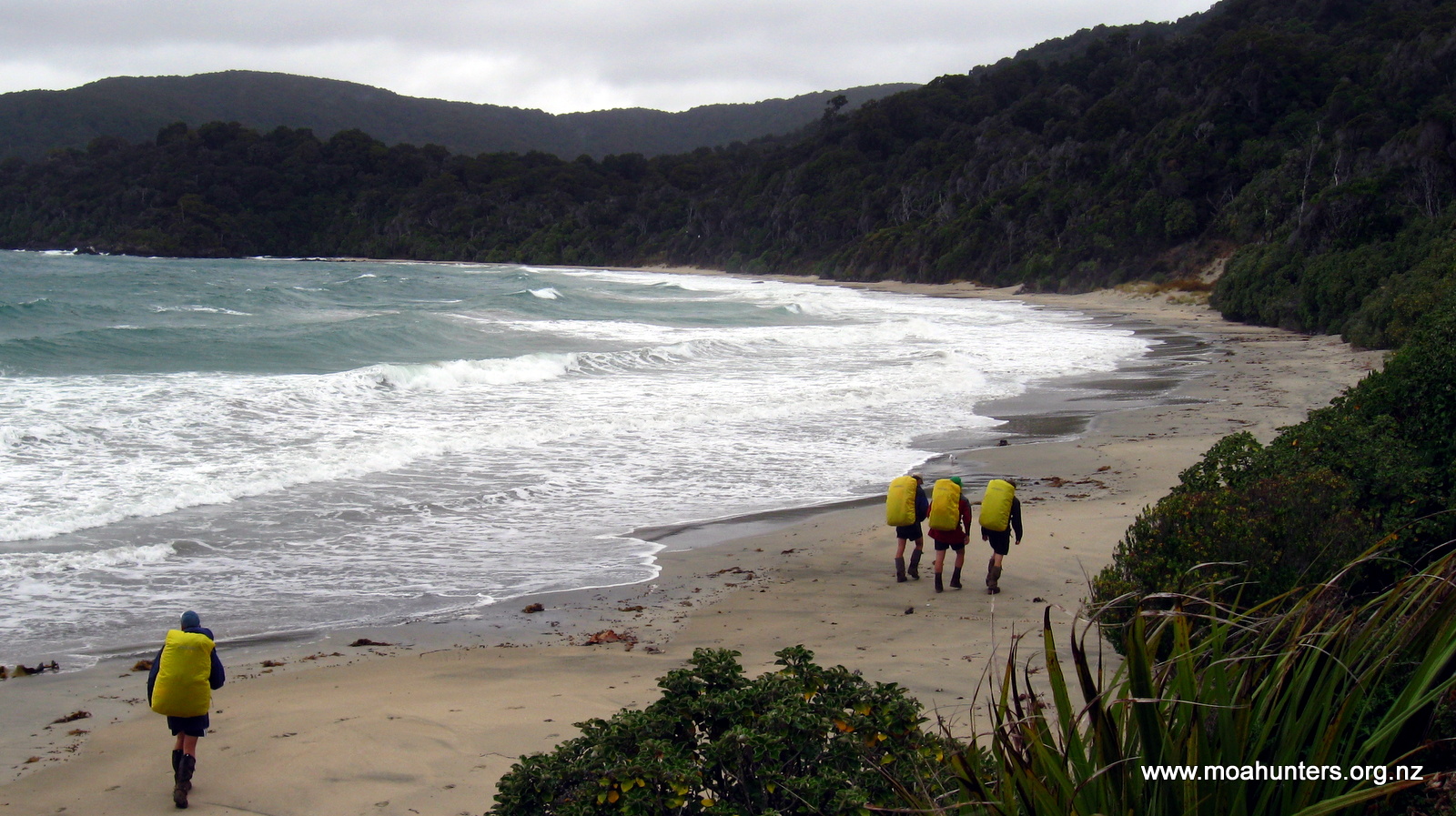
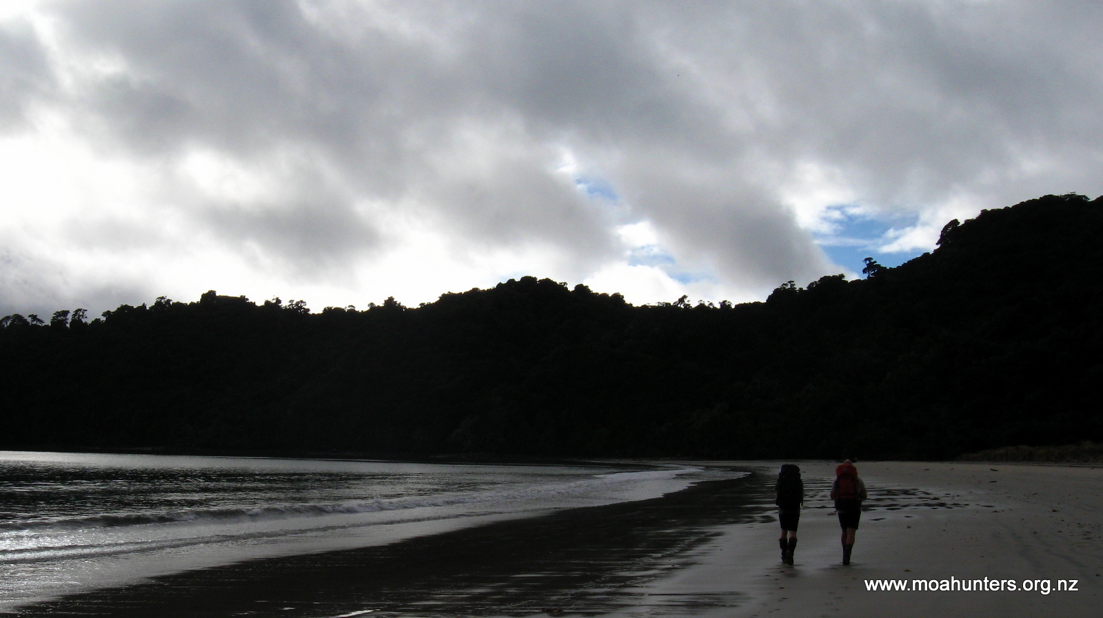
The first four kilometres of the beach was a doddle. Firmly packed sand made for express progress. We enjoyed the scenery and the opportunity to walk as a group, chew the fat, and generally put to rights all the wrongs of the World.
Halfway down the beach, a rocky outcrop protrudes past the high tide mark. We arrived there at the tidal midpoint. This left us with the opportunity to dash round the point between waves, avoiding an onerous diversion inland on the high tide track.
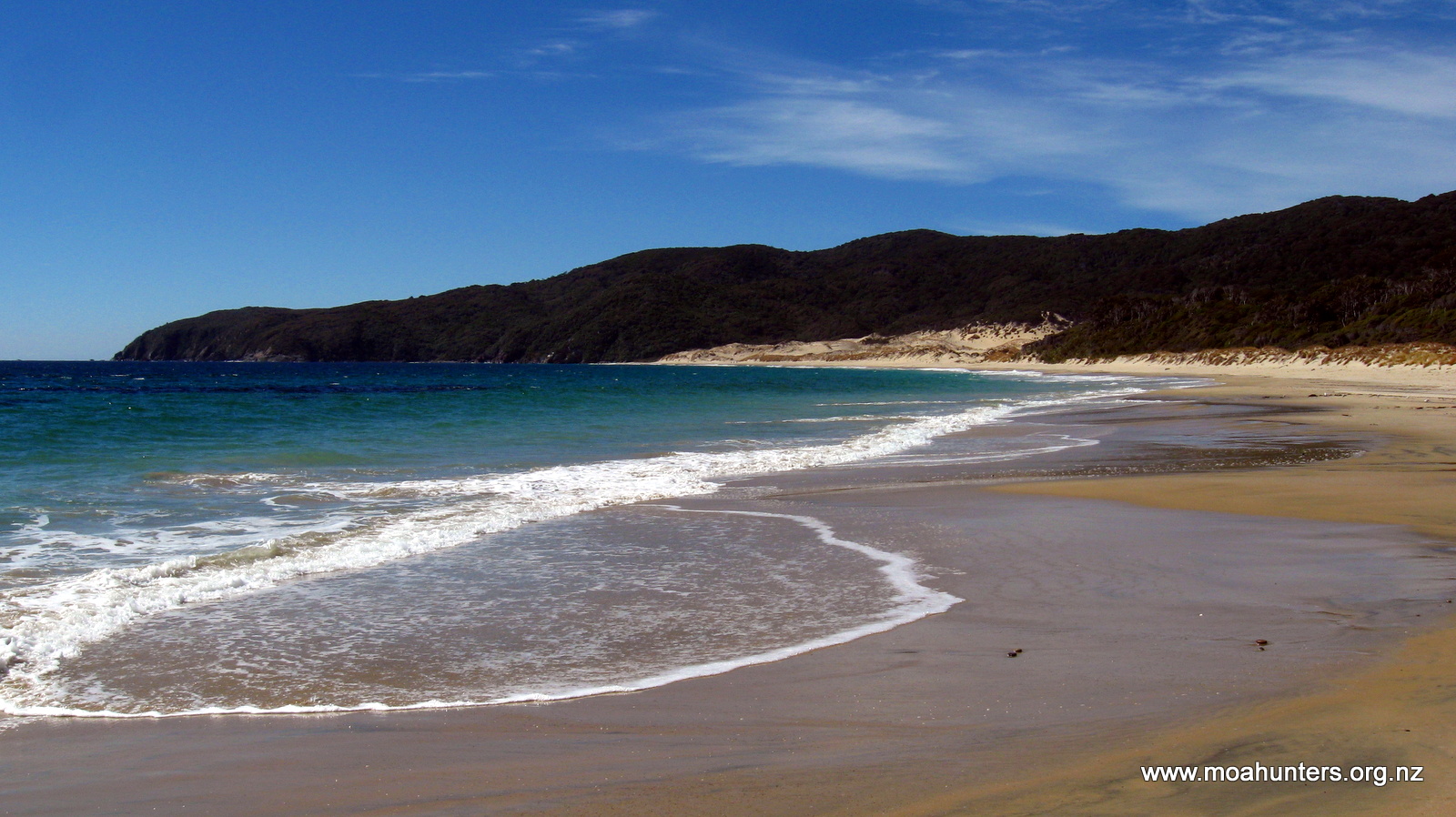
As we approached the end of the bay, flat sand made way for more rocky terrain. The rocks there are an annoying size. Not big enough to rock hop, but just large and loose enough to be a nuisance. The last couple of kilometres to the end of the beach did drag on somewhat. Consequently we were all relieved to spot the track marker leading us off the irksome rocks and into the bush.
From the beach we began a 250 vertical metre climb over a headland that separates Little Hellfire beach from Mason Bay. The bush here is fairly scrubby, with some taller windswept Kanuka forming a low canopy in places. The climb was hot work and parts of the track were quite muddy.
Some of us adopted a skirting round the edges policy when confronted by large mud troughs. Others (Chris!) preferred an “up the guts” approach, straight through the middle. There is definitely not a single best approach to the mud. Some areas are easily and quickly skirted around. Others are not, and simply spludging through the middle makes the most sense. The reality of Stewart Island is you are regularly going to get wet and muddy.
We stopped at the top of the climb for a welcome breather and a bite of scroggin. From our high vantage point we had good views up the coast to Codfish Island, a few days walk ahead.
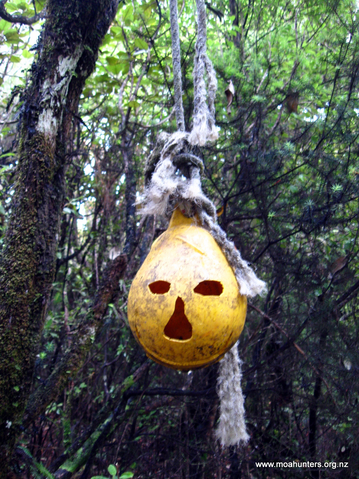
The drop to Little Hellfire was fairly sedate, the track marked by ghoulish looking buoys with faces carved into them. It was also much less muddy than the more shaded ascent we had just made on the south facing hillside. This was a trend we noticed throughout the walk: South facing hillsides tend to be much more muddy than the northerly facing ones.
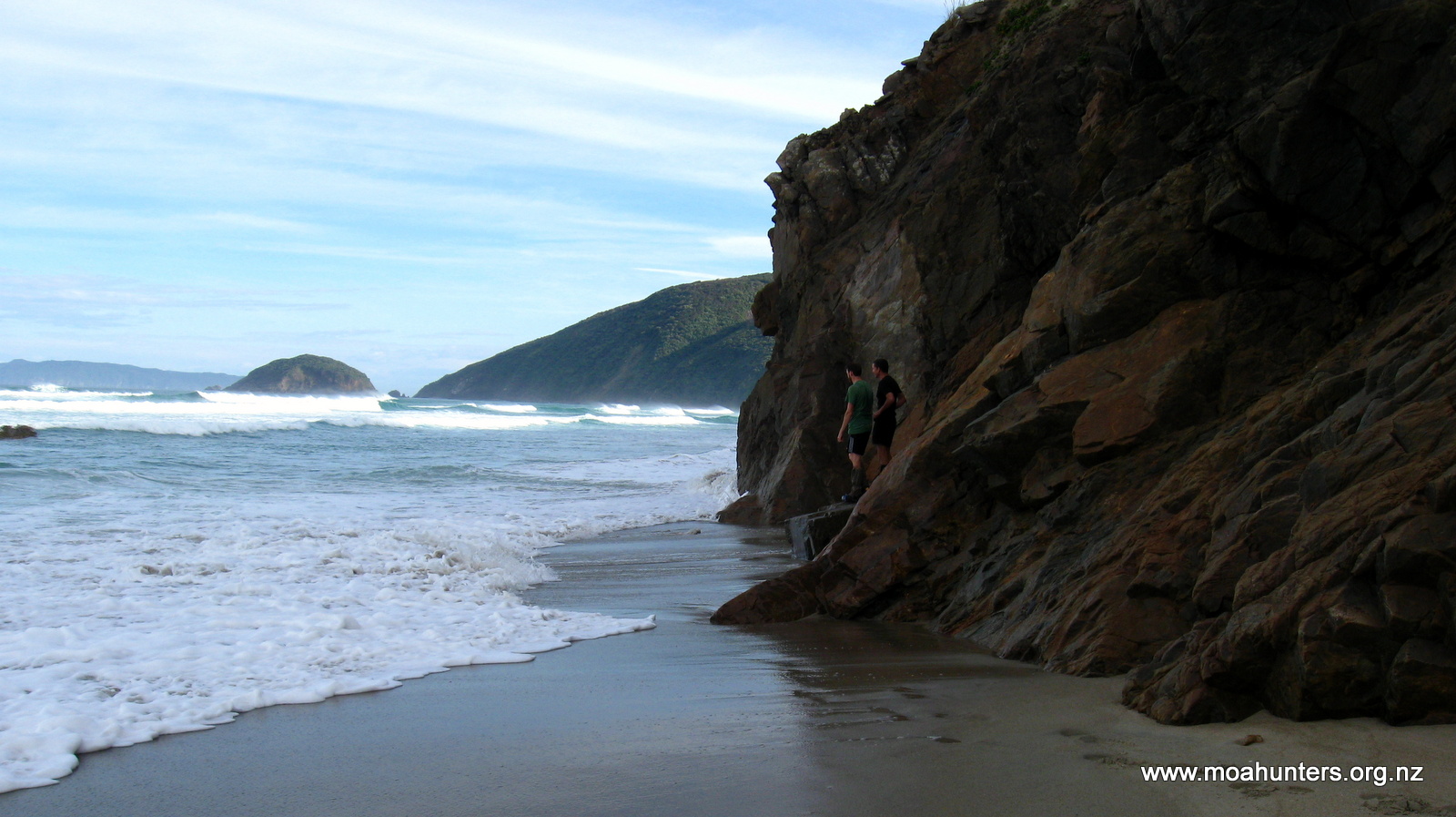
Little Hellfire is a short stretch of pebbly sand flanked at each end by low rocky granite cliffs. We stopped at the North end of the beach and had lunch.
Having packed a telescopic fishing rod, Adam eagerly headed out over the rocks at the edge of the beach looking for a good spot to try some fishing. Using a plastic softbait and a small rock tied in fabric for a sinker worked quite well.
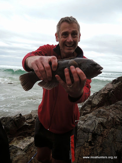
His first cast was a snag which took some time to free. The shallows all around Stewart Island are thick with rubbery kelp. Not ideal for surf casting. However, the second cast was much more successful – a bite! Two minutes later, a fairly fat looking fish with vicious pointy teeth was landed. After a couple more snags and only half a dozen casts, a pair of these murderous looking mystery fish had been caught.
Once the fish were gutted, filleted and bagged, we hefted our packs and headed up off the beach for the second big climb of the day. Between us and Big Hellfire Hut lay 399 vertical metres of climb. We slogged our way up an extremely muddy and fairly steep section of track. We marveled at how such steep terrain could be so wet and boggy! It turned out that this section would be one of the muddiest of the whole trip. And probably the hardest.
At 350 metres above sea level the track flattens out somewhat, rising and falling more gently as it bends from North to West following a long prominent ridge. It is also much drier along this section making for relatively swift progress. After a short sharp climb to 399 metres the track drops off the main ridge onto a smaller one.
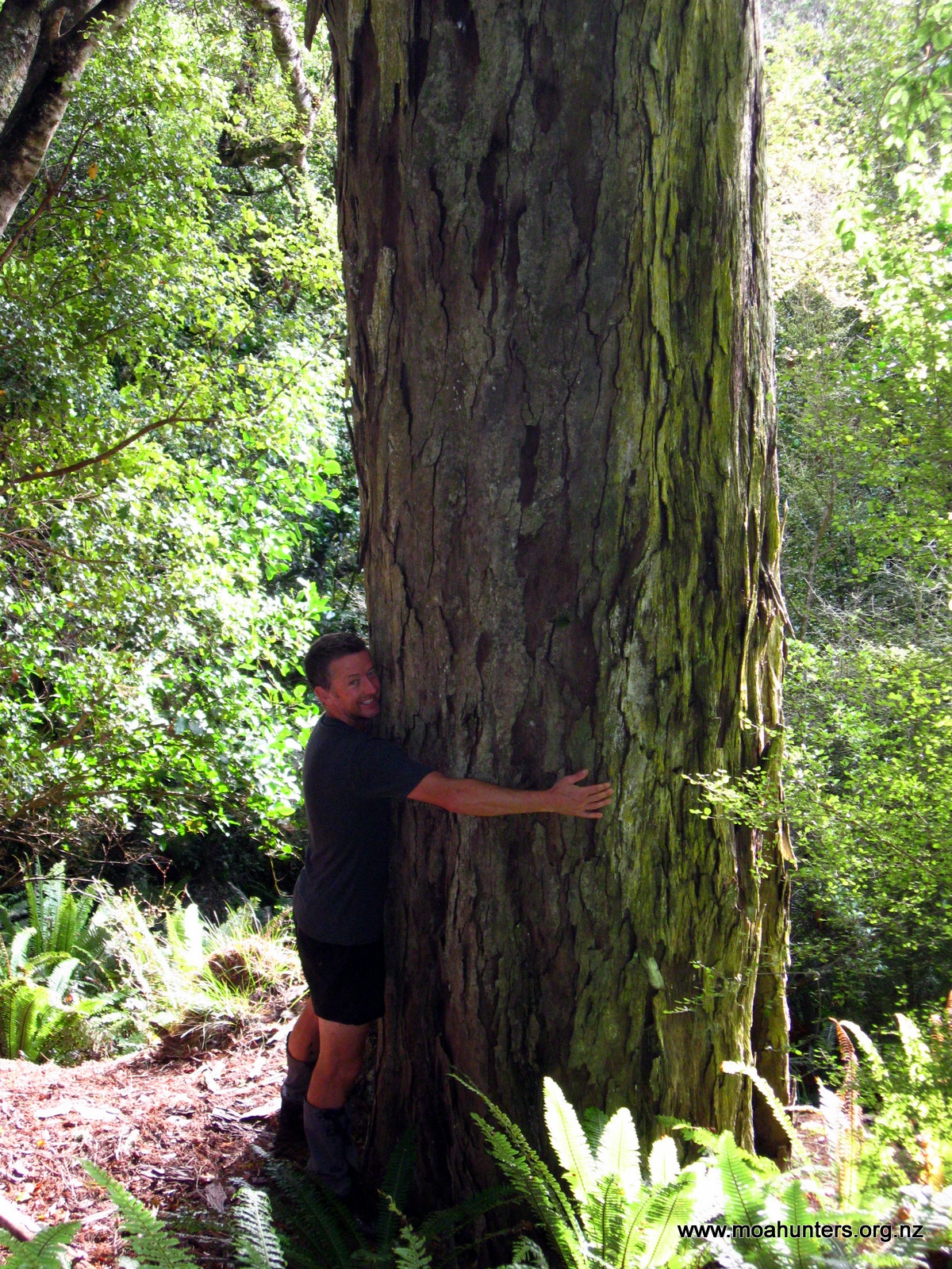
The bush in this area is beautiful – a mix of massive rimu, occasional totara and spectacular red flowered rata.
We arrived at Big Hellfire hut just after 6pm. We agreed the day was probably half an hour too long. An hour out from the hut we had reached some board-walked sections of track that fooled us into thinking we were nearly there. And we weren’t.

There were four other occupants at the hut: three people from Waikato University, there to do some survey work on an unusual nearby stand of Pink Pine trees, and a Canadian dude named Andrew.
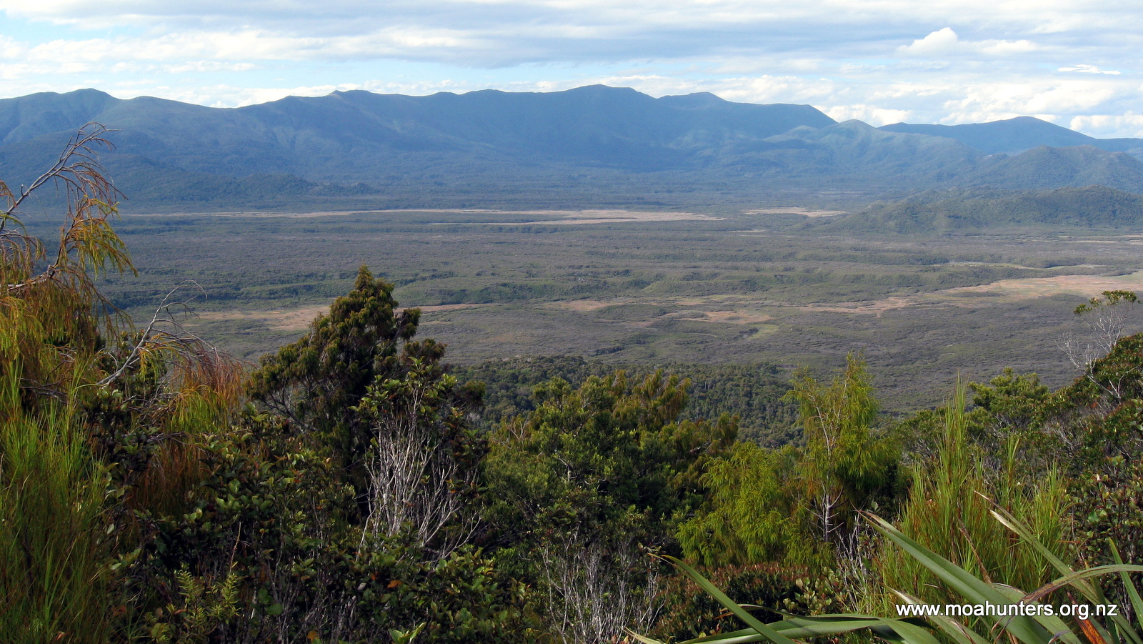
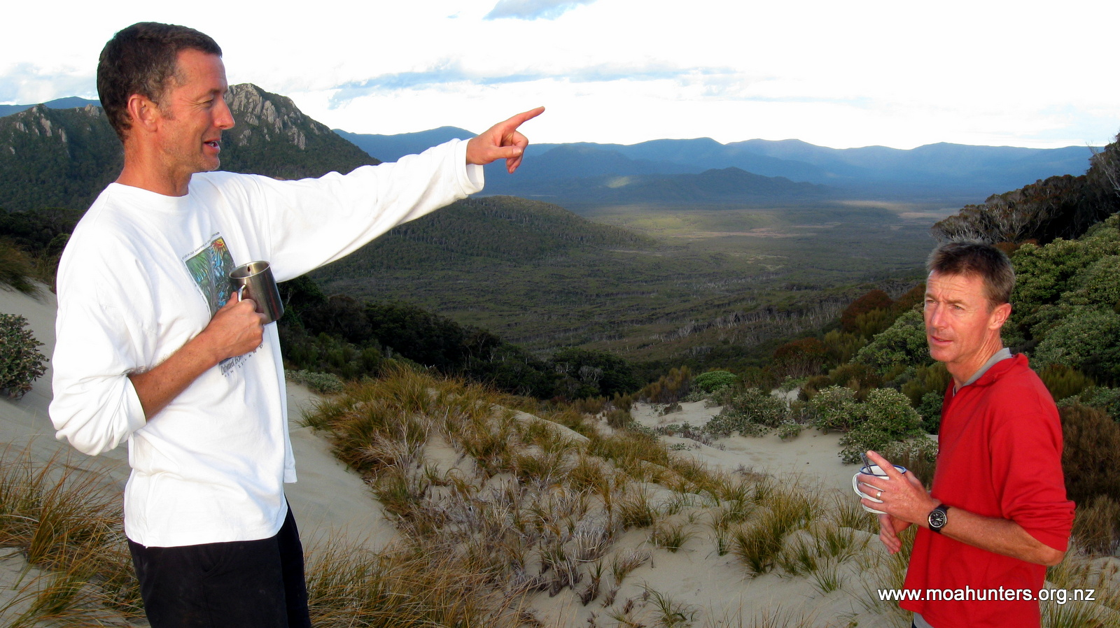
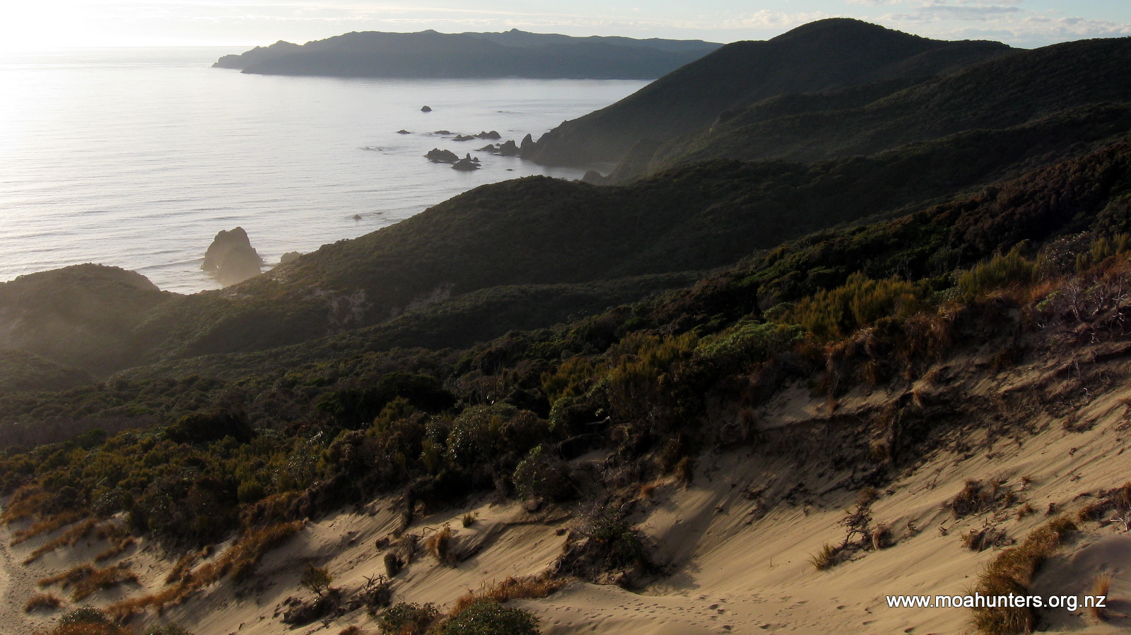
Big Hellfire Hut appears to be perched at the top of a massive sand dune. At over 250 metres above sea level, there is a steep sandy chute all the way down to the beach. But to be fair, it isn’t a true sand dune… In reality it is a lot of sand (wind blown we presume?!) on a steep rocky hillside. Looking east from the hut there is a magnificent view across a huge flat expanse of the Island’s interior, framed by the Ruggedy Range in the misty distance.
After enjoying a lemon pepper fish entree and curry main, we walked out from the hut to the top of the “dune” to watch the sunset. Sitting together on the warm sand, we watched the sun blaze its way through a conflagration of flaming orange crimson and red hues as it sank into the Tasman Sea. Absolutely breathtaking.
Day 4
Monday 2nd March – Big Hellfire Hut to East Ruggedy Hut
By 9am we were packed up and ready to hit the track. The three from Waikato University had left earlier that morning, so silently that most of us didn’t even hear them pack their belongings and go as we slept.
The track leaves the hut to the North heading steeply up a dune of deep loose sand. A warm breeze was blowing in from the North West, meaning we immediately broke into a healthy sweat as we struggled upwards.
Once out of the dunes, we dropped down an easy section of much firmer ground into a valley, before spludging up another very muddy south facing climb.
At the top of this section we dropped packs next to a small stream, taking a break for a drink and some snacks. The water on this side of the Island is quite drinkable, but not exactly crystal clear. Ranging from slightly brown to quite brown, water from streams and creeks on Stewart Island generally tastes a little musty, but not so strongly that it is off-putting.
The descent down to Waituna bay was steady and fairly dry, with only a few muddy sections. As we progressed northwards, the bush became progressively taller with large stands of towering rimu and totara. However, as we descended to the bay, the trees thinned out and the bush became more stunted.
Though the air was still warm, the sky was growing darker and we felt a few errant drops of rain.
The extended forecast we had read a few days earlier had suggested a Southerly front was due this day. It was certainly beginning to look threatening. We decided to take a moment to get some wet weather gear on, just in case. Jackets and pack covers were quickly put on.
And not a moment too soon. Literally the moment we stepped out of the bush onto the beach, the front hit. A strong wind whipped up and lashed rain across the beach. With heads down we set out into the nastiness. It wasn’t especially cold yet, but every hint of the earlier pleasant morning was blown away.
Once back in the bush we were sheltered from the worst of the wind, but the heavy rain still cascaded down through the canopy and ran off large tree boughs in torrents. It was easy to see how the track gets so muddy!
From Waituna Bay the track climbs steadily to just over 200 metres above sea level. The rain was unrelenting, so we spludged onwards up a very muddy and increasingly waterlogged climb. We passed two trampers heading the other direction. They were also very wet and muddy. We surmised conditions weren’t going to get any better.
Close to the top of the ascent we found a relatively flat section of track with no mud in sight. Chris pulled the tent fly from his pack and after a short debate on how and where to attach it, we had a makeshift shelter set up. Huddled under it, we ate our lunches as the rain came down.
While we were hunkered down, a couple appeared round the corner ahead of us. The bloke had a semi decent jacket, but his lady friend was poorly equipped for the weather, wearing a puffer jacket with a plastic poncho over it. Both looked like drowned rats. She looked pissed off. The kind of pissed off that men dread. The man asked us how far to Waituna Bay. Paul told him it was a good two hour walk. He stared at us in horror, then said just one word… “Fuck”. Ducking under our shelter he headed off down the track, with her not far behind. There was a dark angry thundercloud over her head. That poor bastard…
After what seemed like a long afternoon in the rain and mud, we dropped down onto East Ruggedy beach. It is a nice beach and we would have probably had another go at fishing… if it wasn’t absolutely pissing down.
Part way along the beach we came across a marker. Mistaking this for the start of the track, we followed the steep route up off the beach, only to drop back down onto the beach again some distance later. It was the high tide track – an unnecessary and irksome diversion. The lady at the DOC Centre had advised us that the tracks are always at the end of the beaches. We should have had more faith in her good advice!
At the end of the beach we did find the correct marker and ascended up a sandy slope onto some very interesting rocky terrain.
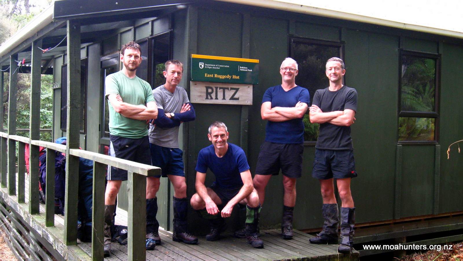
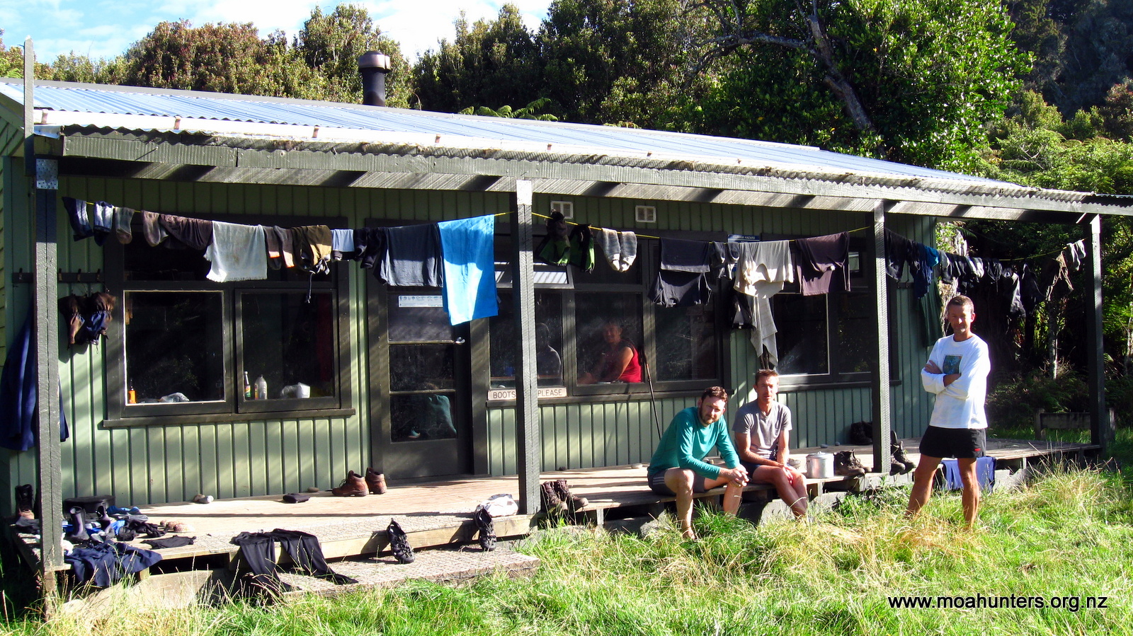
Just before 5pm we reached East Ruggedy Hut nestled amongst the bush. We were very wet and glad to be there. The hut had a single resident, a quiet Englishman called John. To be fair, he didn’t look especially pleased to see five noisy Moa Men arriving.
After hanging up all our wet gear and getting the log fire blazing, we sat round the table and enjoyed a hearty tomato soup followed by some very good spaghetti bolognese.
Feeling quite weary we were all in bed fairly early that night.
Just as well, because at 2am Lewis woke us all with news he had met a kiwi on the track to the long drop! We all quickly pulled on some warm clothes and sneaked outside with torches to try and spot it. Fortunately the rain had stopped. Unfortunately the kiwi didn’t. By the time we got outside it had scuttled off into the ferns. We could hear it scratching about, but that was as close as we got.
Day 5
Tuesday 3rd March – East Ruggedy Hut to Long Harry Hut
East Ruggedy hut is a nice hut, so far as huts go, but lacks any kind of view. Surrounded by fairly thick bush it has been christened the ‘Ritz’ by previous visitors.
This morning John seemed to have warmed to us a little. Well quite a lot actually. Perhaps his realisation that most of the Moa Hunters are in fact engineers in disguise helped. We certainly found the accounts of his deep sea diving work on oil rigs fascinating.
To break the monotony of porridge for breakfast, Chris prepared us some bircher muesli. Loaded with dried fruit, nuts, oats and other mystery ingredients, it was bloody delicious.
When we had finally packed our backpacks and generally tidied up, we said goodbye to John and left the hut.
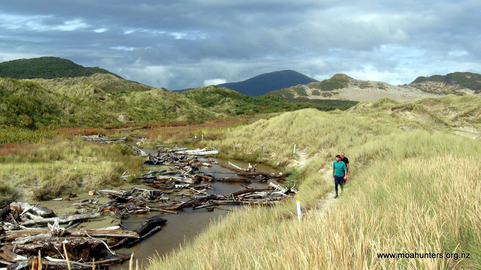
Initially the track meanders off easily through low scrubby bush. But it isn’t long before it emerges into a wide expanse of sand dunes. Signs of animal activity were everywhere. Possum footprints were common. So were kiwi tracks. Their distinctive three-toed footprints wandered across the sand, punctuated by little holes they had excavated with their beaks in search of grubs. White-tailed deer hoof prints were also spotted along the way.
We marveled at the diverse landscapes we were encountering. It seemed that every few hours we were being treated to a new experience. Stewart Island is without doubt the jewel in New Zealand’s scenic crown.
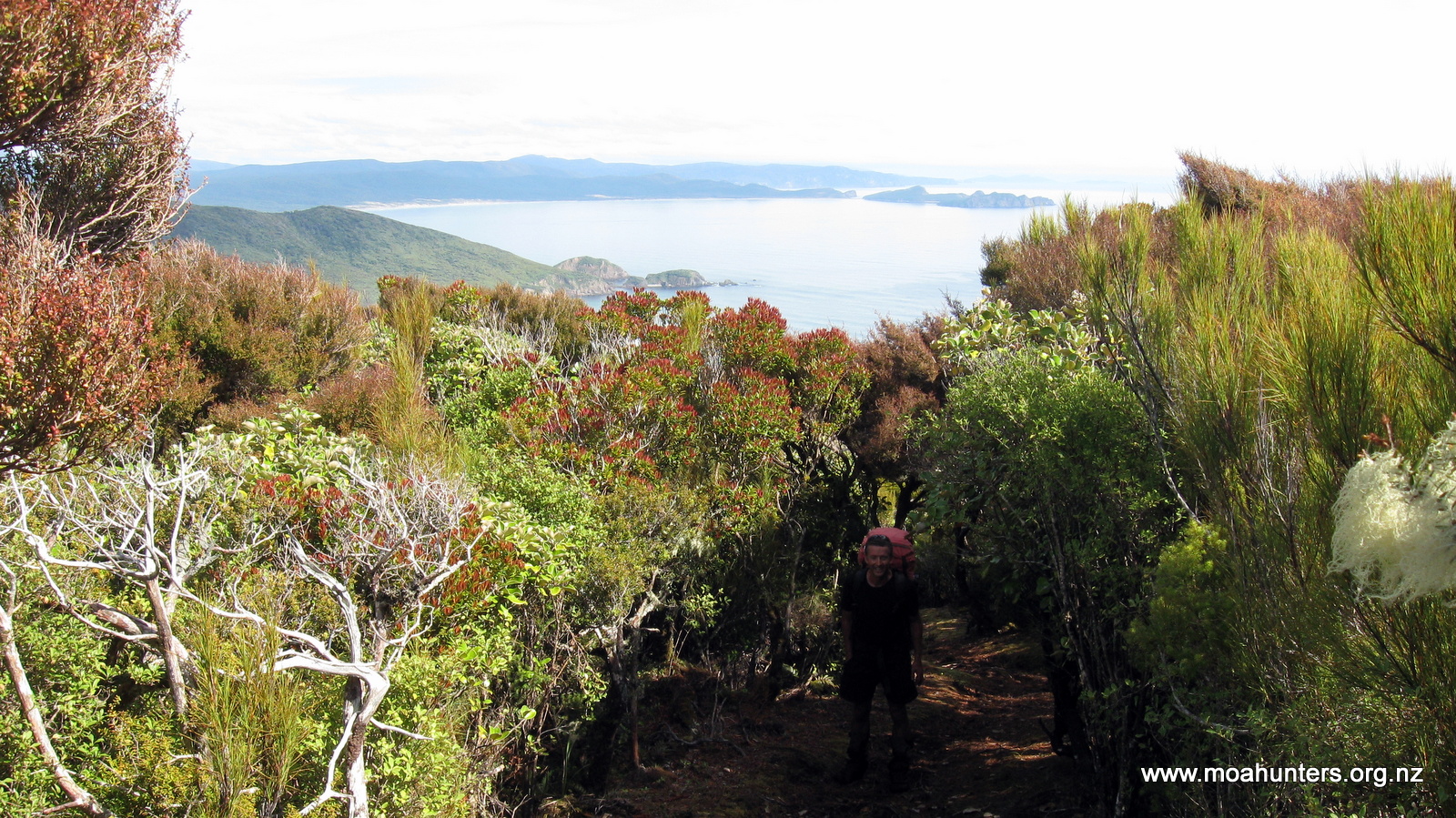
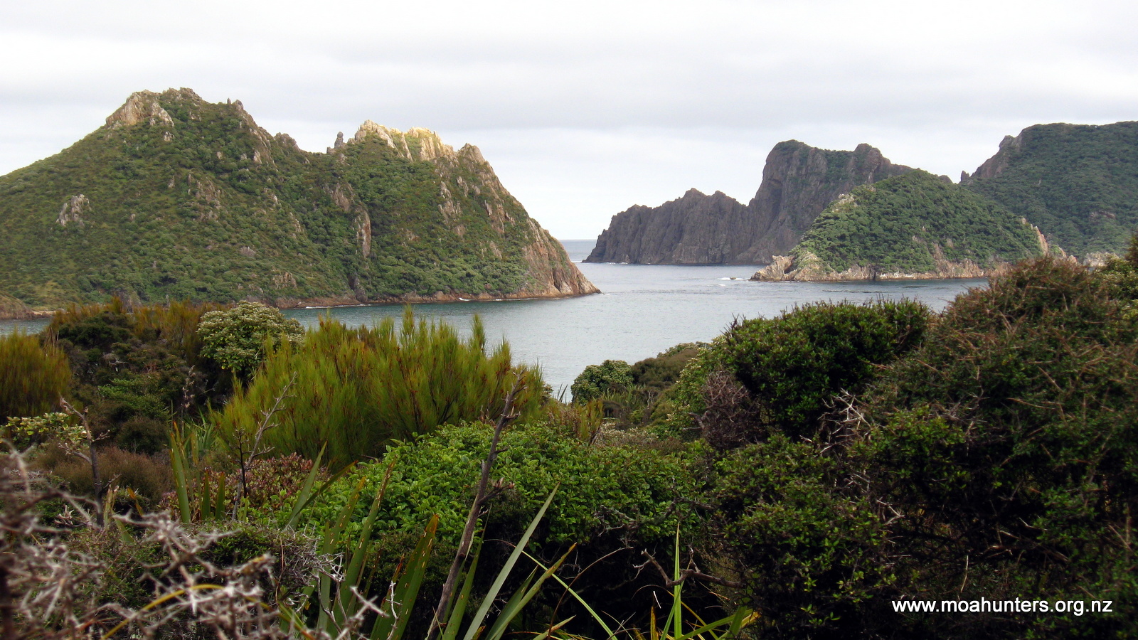
After a quick river crossing near the coast we began a stiff climb up to a ridge. Looking out we were able to enjoy wonderful views of the Ruggedy Islands, clustered just off the coast. Little did we know this was just a preview of even better to come.
A short walk further up the track, we reached a sign for a lookout. Being a shorter day on the track, we had enough time for a quick diversion. We dropped packs and followed the very muddy and well walked track for five minutes out to the lookout.
Dealing with the mud (and dead feral cat!) was totally worth it.
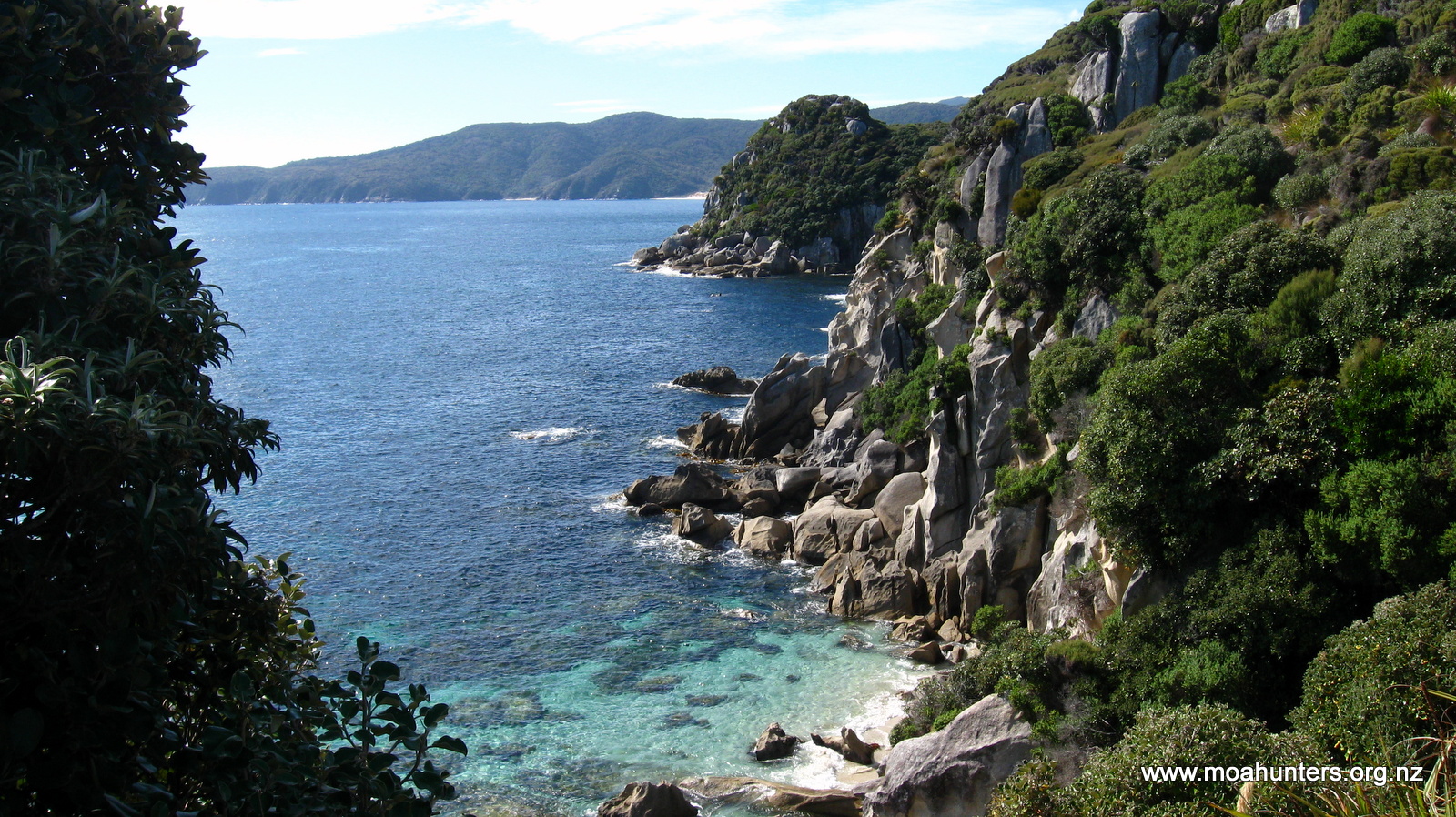
Words and photos probably don’t do the view justice. In front of us the bush clad Ruggedy Islands rose sharply out of the ocean, their hard granite cliffs almost vertical. They seem so very different from islands seen off the mainland, reminding us more of Thailand than New Zealand. In the far distance we could make out the southern coast of the South Island. To our left, the golden sands of the dunes we had walked across that morning stretched out to the ocean. Even from our height we could clearly make out the kelp beds through the near crystal clear water.
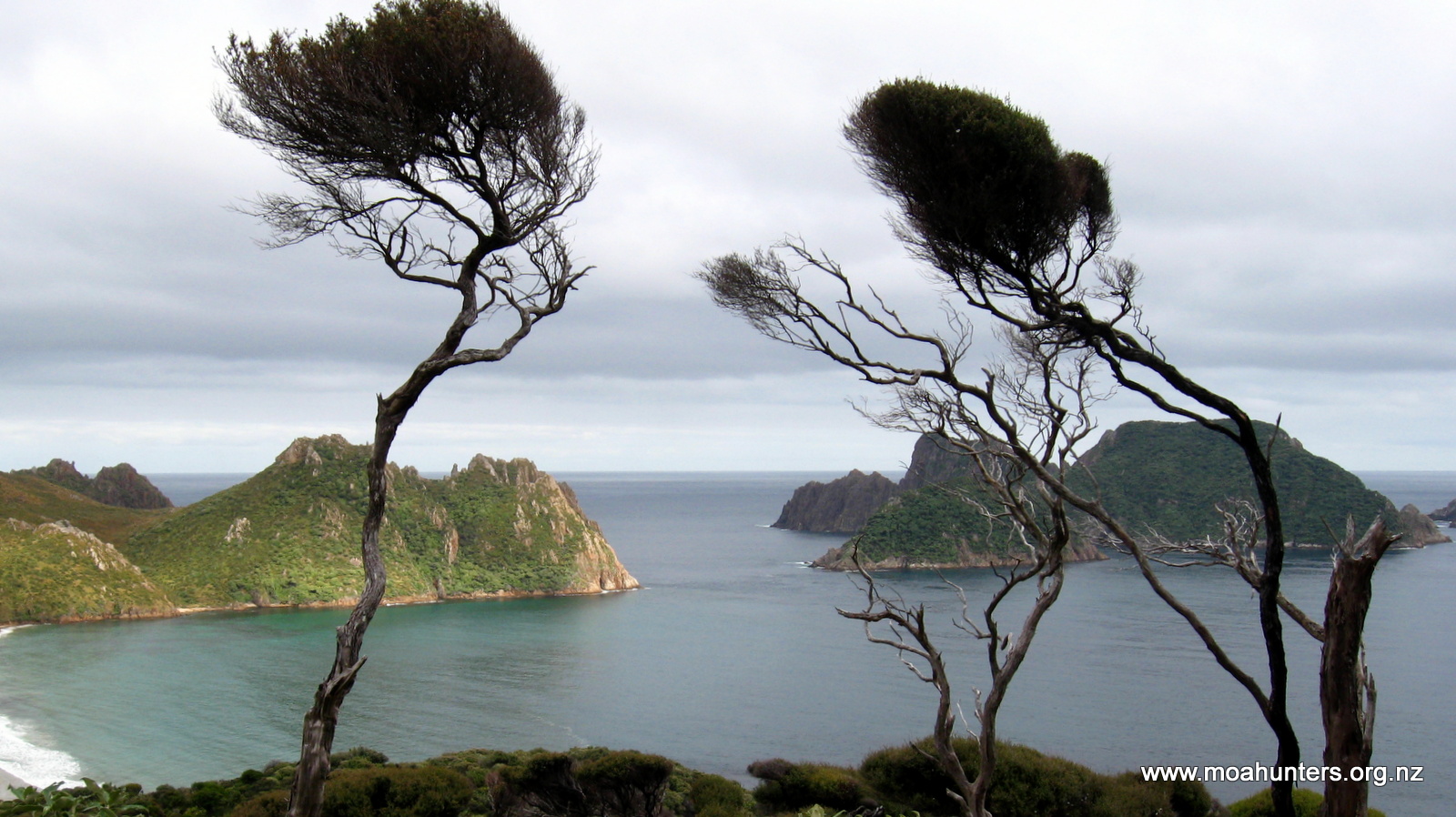
We stood in awe, thinking the view was perfect in every way. Just to prove us wrong, a pod of dolphins appeared and swam slowly across the bay, demonstrating that it was possible to improve on that perfection.
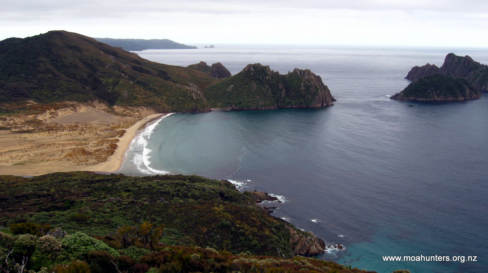
From the lookout the tracks drops steadily towards the sea. At that point we would officially start following the Northern coast of Stewart Island. We walked back to our packs and began the descent to the coast.
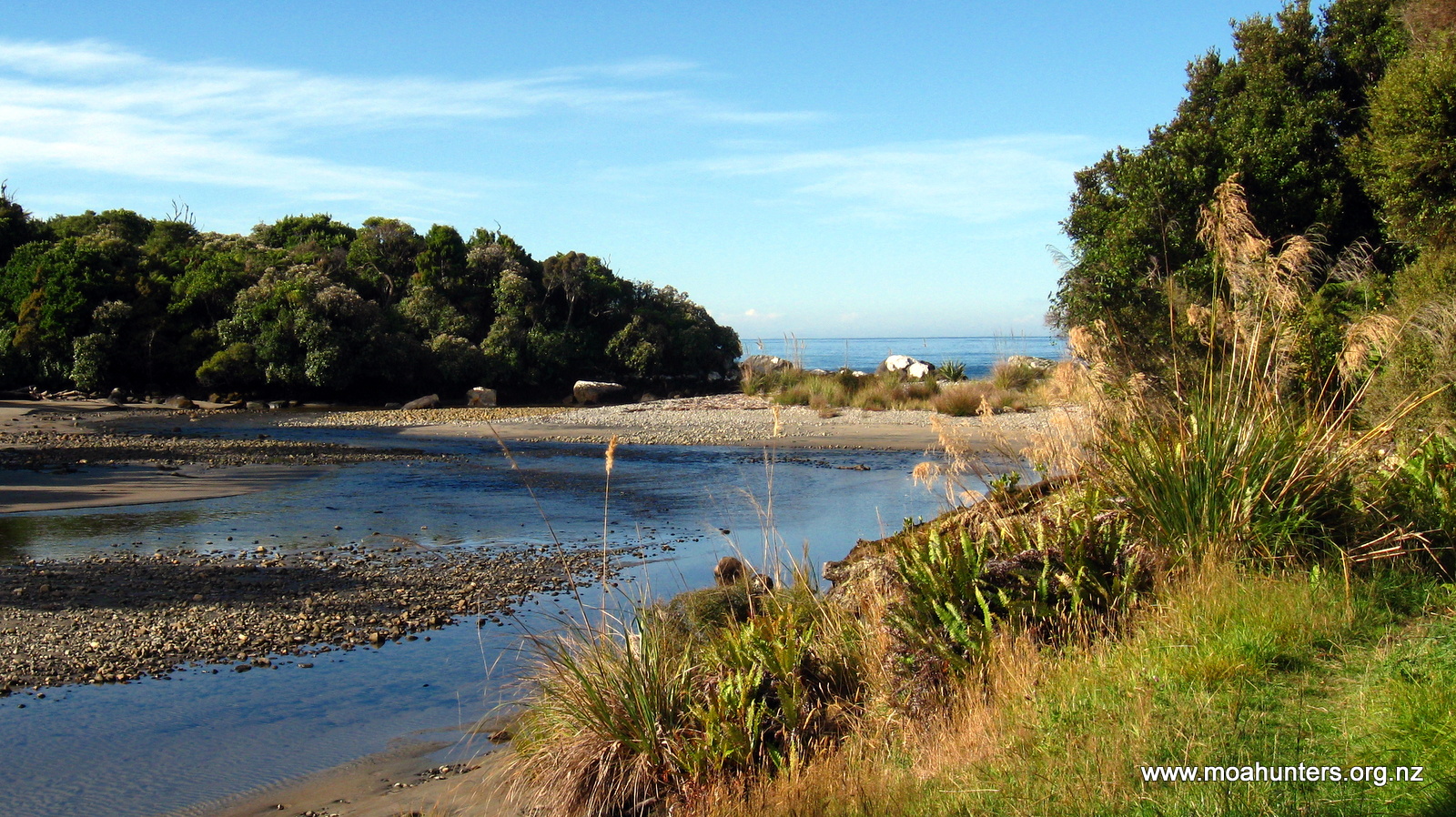
We had a relaxing lunch break on a rocky West Ruggedy beach looking out across Foveuax Strait to the South Island.
A steep (near vertical!) climb off the beach had us back in the bush.
Walking under a canopy of tall gnarly old kanuka, Adam glanced to his left and spotted movement on the ground amongst the ferns. A kiwi! We had agreed that rather than shouting “Kiwi!” and scaring them off, anyone who saw one would throw their arms out wide to let the group know. So Adam threw his arms out wide, and Chris, Richard and Lewis ground to a halt behind him. Unfortunately Paul was in front of Adam and had no way of seeing the signal. He walked on oblivious to the mute excitement.
The Kiwi very kindly hung around for quite some time, pottering about probing the leaf litter for food morsels. Thankfully, after a few minutes Paul twigged that he was alone, and returned in time to join us watching our National icon doing its thing. It was mesmerising watching such an odd creature going about its daily activity in front of us. We felt extremely privileged to be watching it.
Mud became less and less frequent the further we nudged round the northern coast of the Island. It became a bit like walking through a beautiful garden on this part of the Island. Pleasant grassy areas amongst tall trees, flax, toi toi and flowering rata gave our surroundings an idyllic feel. Tui, wood pigeons and other smaller birds were prolific, and the bird song was constant.
Our final hour into Long Harry hut did however become a bit torturous. The track plunged into four deep gullies, and back out again. Each gully is a sharp descent followed by a grunt up the other side.
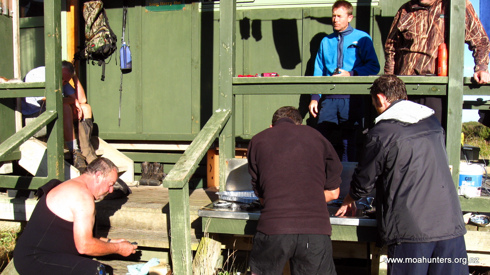
Descending into the first gully we were surprised by a hunter. Dressed in camo gear complete with camo face paint, he suddenly popped out of a large fern with a compound bow on his back. Dan was his name. We had been told by various other trampers along the way that Long Harry Hut was occupied by a group of hunters, so it wasn’t a total shock to meet Dan. We had a short yarn to him then carried on for Long Harry.

Reaching the hut at about 4:30pm we were welcomed by Steve. Steve is an all round good bloke, and was the self-appointed spokesperson for the hunters. He immediately made us very welcome, and cleared space for our gear. That was necessary because they had a colossal amount of supplies which had been choppered in with them!
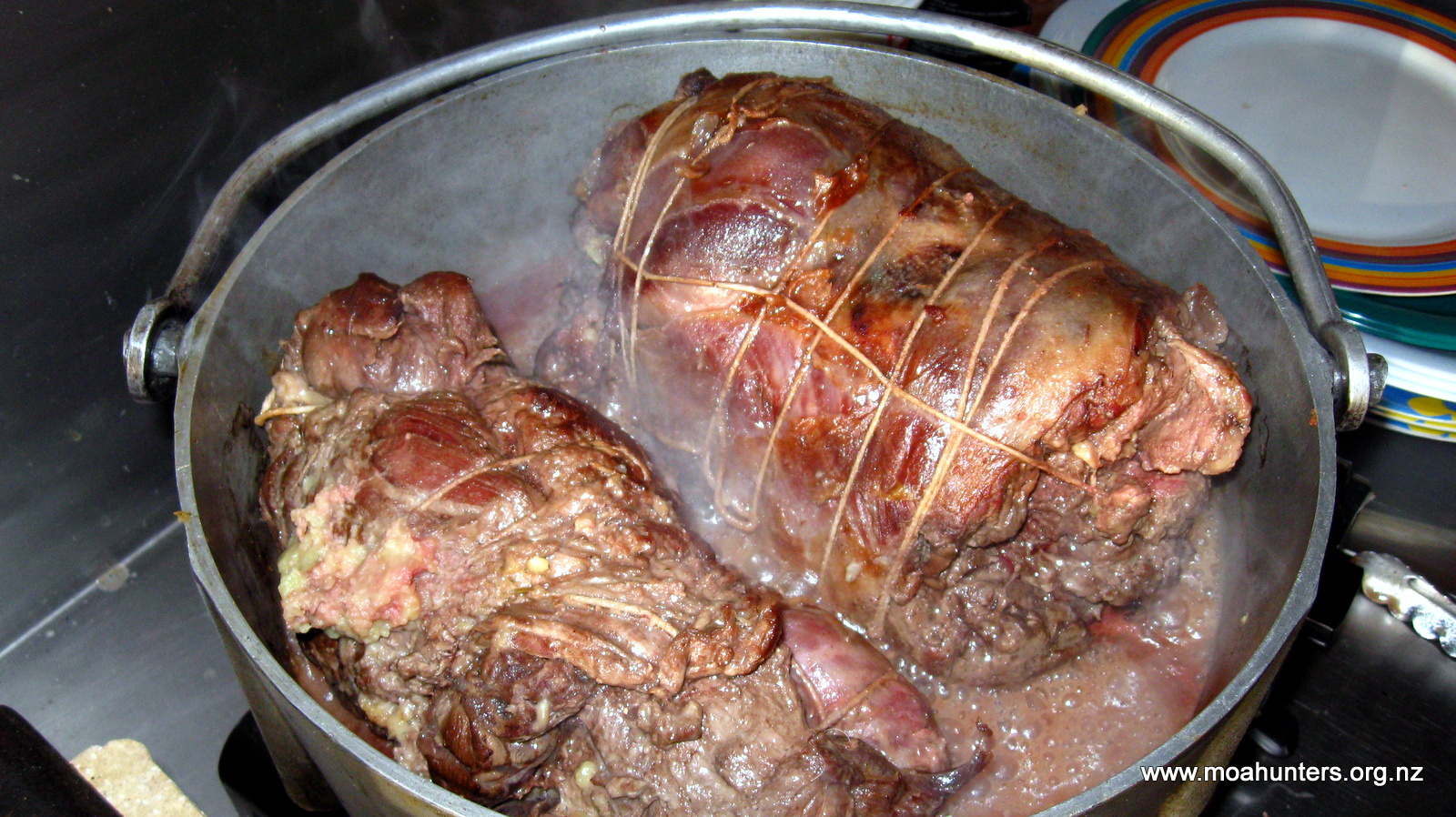
We had a great evening chatting to the five hunters, made especially great due to the fact they shared their roast venison with us. Absolutely magnificently cooked, golden brown, tender and delicious. It wasn’t until after 10:30pm that we eventually crawled into our sleeping bags. Quite a late night by our usual standards…
Day 6
Wednesday 4th March – Long Harry Hut to Yankee River Hut
Not long after 7am we were all up and about. Not so our hunting friends… They had obviously decided there was no need to be out at the crack of dawn and were all still tucked up in their sleeping bags.
After a feed of porridge, we were ready to attack the day. For Lewis, that meant paua hunting. Steve had generously offered to head down to the coast with us to point out the best spots to find them. Low tide was about 9am, so just before then we all walked down the short track to the coast. Steve sensibly had a wetsuit on. Lewis who seems strangely immune to freezing temperatures was not wearing much more than a rash suit and long-johns.
It didn’t take much more than half an hour of groping under rocks in the shallows to hit the jackpot. Lewis was extremely happy to have a bag of four very nice sized (well above legal minimum!) paua.
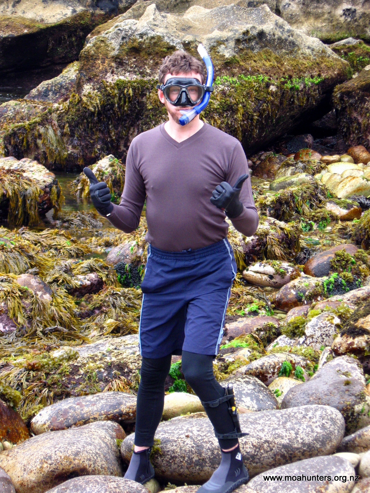
To our surprise, Steve gave us the four he had gathered. We had assumed he was collecting for himself, but apparently he had always planned to give them to us. Top bloke.
Once back at the hut, Steve proceeded to give us expert lessons on preparing the shellfish. Before long we had eight paua removed from their shells, guts and teeth discarded. Steve then insisted on tenderising them all for us, using his trusty manuka club. We stood in the hot morning sun and watched him deftly pummeling the paua flesh into submission with it. When he had finished, we estimated our plastic bag contained a couple of kilos of paua meat. Wow.
Shortly after 10am we were ready to leave Long Harry. We thanked the hunters for their hospitality and said our goodbyes. We were especially grateful to Steve, who had been so generous with his time, expertise and roast venison!

We stopped in a sheltered bay not far from the hut for a brief unsuccessful fishing attempt before hitting the track again. From Long Harry the track drops slightly before a steepish and relatively muddy climb up to a ridge. From that point the track was very pleasant, winding its way under a very tall forest canopy of rimu and kotukutuku (tree fuchsia).
High above us the sun was shining brightly from a cloudless sky. We were thankful of the shade the trees provided. As we neared the coast, the track got steadily steeper until we suddenly emerged from the bush onto Smoky beach.
And what a beach! It is absolutely stunning. Bright white sand contrasts with clear blue ocean and the deep greens of the surrounding bush to paint a breathtaking view.
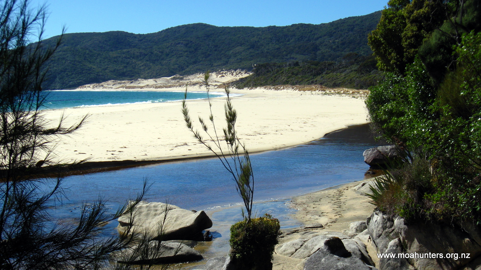
Smoky creek flows into the west end of the beach where we stood. It is fairly deep when the tide is high. We looked for a spot to get across it, but couldn’t find anywhere shallow enough. So we backtracked and followed a high tide track which took us ten minutes upstream to a bridge over the waterway.
After a brief chat to a group of builders who were constructing a new hunters hut on the edge of the bush, we made our way back down to the white sands of the beach. A large and enthusiastic sandfly population resident in the shelter of the trees left us with little choice but to eat lunch out on the sand. Which wasn’t an altogether bad thing… unless you dropped your salami.
After liberal applications of sunblock, we sat, ate, and marveled at the scenery. Smoky beach is a pristine paradise, which anywhere else in the World would be seething with people. But on Stewart Island, five Moa Hunters could have it all to themselves.
We all enjoyed the walk to the far end of the beach. To our right, low dunes capped with tussocks and low grasses crouched below tall dramatically windswept kanuka. Across the ocean, the South Island was again plainly visible.
We encountered three hunters at the eastern end of Smoky beach. They hadn’t bagged anything, and were returning to their camp.
From the beach the track climbs up through the dunes, then drops very steeply down a loose sandy face to a small creek. We were very happy to be going down and not up!
From the creek we followed the track up a long and at times quite steep climb through old gnarly kanuka. An hour and a half later, at the top of what is effectively a knob, we stopped for some scroggin. By this time the kanuka had given way to taller trees with a low fern understorey, common around this part of the island.
On the way up, Adam and Lewis had a chance encounter with another kiwi.
The descent from the knob was gentle and fairly dry. In less than an hour we were at the bridge over the Yankee River which is just a stones throw from the side track which leads to Yankee River hut. From that point it is a short walk through bush beside the hut.
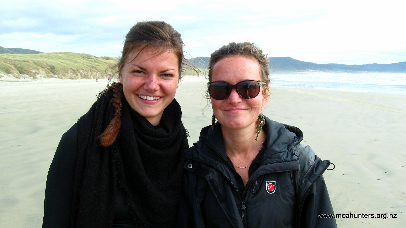
Yankee River hut is a lovely old hut sitting on a small grassy rise overlooking the river as it flows slowly past and out to sea less than one hundred yards away. Old wooden windows and a rustic deck in front are part of the hut’s charm. Already at the hut were Sam and Keran. Sam, a lobster fisherman from the Northeast of the United States was visiting New Zealand to escape the winter freeze in his hometown. Keran was there to collect a food drop. She and her partner were intending to walk the whole circuit together, but an unfortunate back problem had left her partner stranded at Christmas Village hut. Keran would be walking back there the next day to reunite with her partner and arrange a water taxi rescue mission.
After a wash in the icy waters of the Yankee river, we sat on the deck and soaked up the last of the days sunshine. It was all incredibly pleasant. Sam and Keran were great company. We shared some of our paua with them. Steve had given us some cooking tips. Half of the paua was thinly sliced into a garlic white sauce, and the others were fried as steaks. Any misgivings we had about paua were gone in a flash. It was absolutely delicious and wonderfully tender. Well done Lewis collecting it!
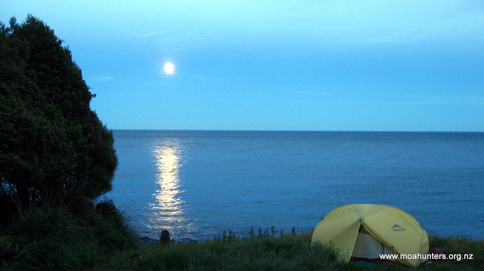
We finished the evening with a round of hot chocolates fortified with whisky, and our traditional toast to Magnus, who’s company we were all missing. Tired but contented, and with full bellies, we headed off to bed with the light of the full moon casting a silver light into the hut.
Day 7
Thursday 5th March – Yankee River Hut to Christmas Village Hut
During the night, high tide pushed up the Yankee river sending waves rolling past the hut. Those Moa Hunters with insufficient bladder capacity to see them through the night marveled at this phenomenon as they walked in the light of a full moon from the hut to the toilet.
The following morning Adam’s backside bore the cost of insufficient planning. A leisurely trip to the toilet turned into an exercise in frantic swatting as his posterior was immediately and ferociously attacked by sandflies as he seated himself on the long drop. Insect repellant before the toilet, not afterwards Adam!
Being young and keen, Sam left bright and early, headed for Long Harry hut and the prospect of a large feed of venison courtesy of the friendly hunters. Keran, keen to check how her partner was faring also left early for Christmas Village hut. That left the Moa Hunters to go about their usual long leisurely tidy up before hitting the trail.
Knowing we had a fairly short day ahead of us with no challenging climbs, we were in no hurry to leave the very pleasant surroundings at Yankee River. However, by 9am…ish we were on the track headed for Christmas Village hut. Our backpacks finally feeling significantly lighter, we met the day with a spring in our steps.

The track sidled along the northern coast of the island through tall forest which shaded a dense fern understory. Sensing that this would be ideal kiwi spotting territory, we kept our eyes wide open for the elusive birds, but predictably saw none. It seems you only see kiwi when you least expect it.
Just after midday we reached Lucky Beach. Flanked by toi toi and windswept kanuka, it is a short stony stretch of coastline littered with driftwood. We found ourselves a nice big log to sit on and sat down for some lunch. Even though the skies were overcast, the day was still pleasantly warm. It was easy to close our eyes, lie back listening to the waves and feel generally sleepy.
After lunch we continued along the beach, surprised to find the sign for the track halfway down. So it seems not all tracks start at the end of the beach!

Climbing up from the coast we soon found ourselves in an absolutely magnificent jaw-droppingly massive stand of rimu. In all directions we were surrounded by enormous ancient rimu giants.
On the mainland, Fiordland is probably the only place likely to have anything comparable. Evenly spaced, each rimu rose up straight as a skyscraper dwarfing everything around them. We felt small and insignificant in that place.
It seemed that each time we assumed we had seen all the amazing wonders of Stewart Island, yet another would unexpectedly be unveiled.
Not long after 4pm we arrived at the short stretch of beach that leads to Christmas Village hut. Situated on grassy flat just above the beach, the hut has lovely views out over the ocean. After dropping our packs, we gratefully removed our boots, gaiters and packs and headed into the hut to escape the sandflies.
Keran was already inside and introduced us to her partner, Mathea. The only other resident was John, a young fit New Zealand teenager who was charging round the track at a phenomenal pace.
After a spot of unsuccessful paua hunting in the shallows and equally unsuccessful fishing, we settled into the hut for the evening.
Chatting to Keran, Mathea and John was exceptionally pleasant. The two ladies are very experienced trampers and we enjoyed swapping information and tall tales from various tramping trips around the South Island. They gave us some great ideas for tramping food and had some tips for tracks in the Northern South Island. John’s youthful vigour and bullet-proof enthusiasm was lovely, but made us all feel a little old!
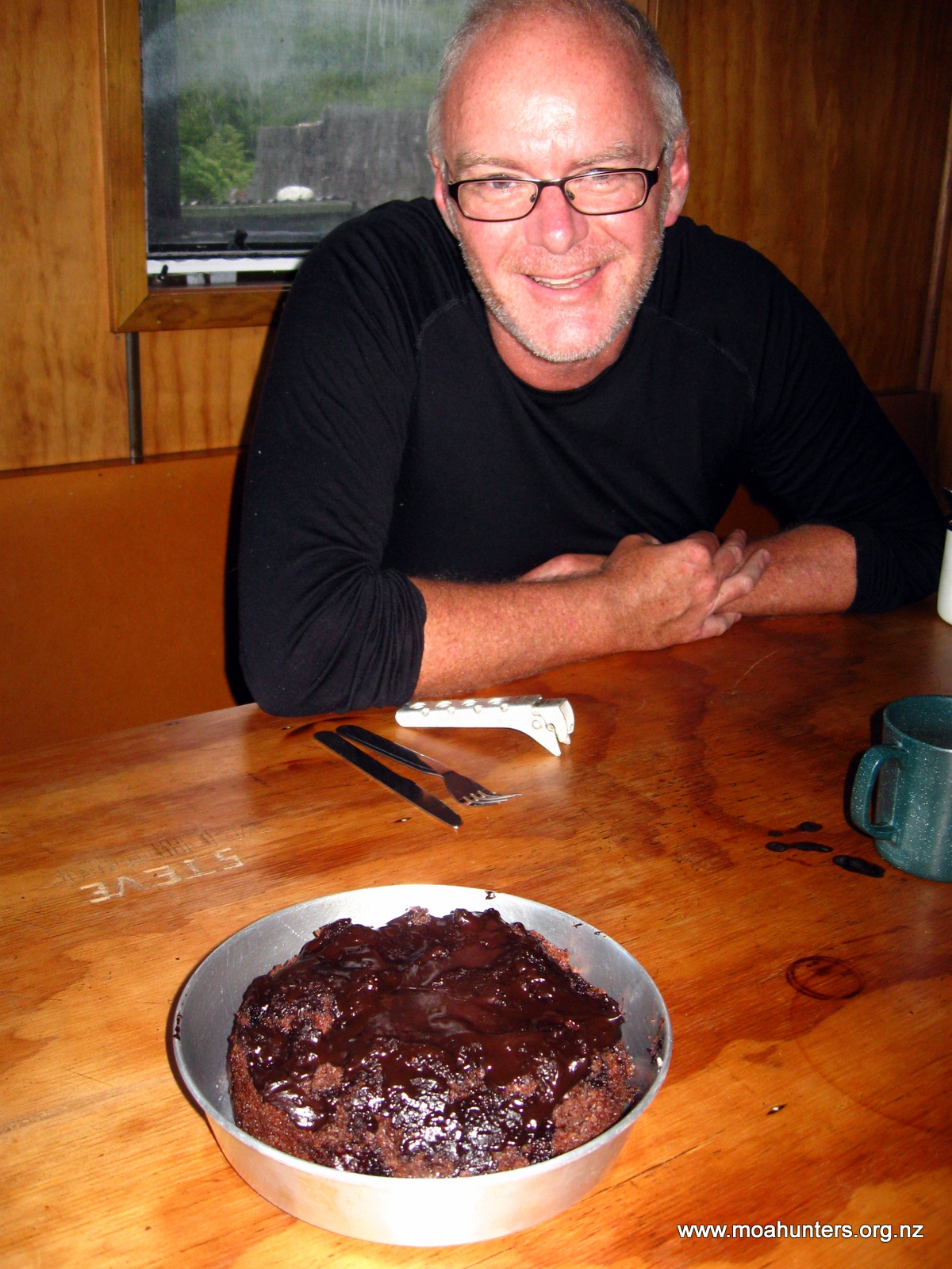
Dinner was soup, then a spicy enchilada mix followed by chocolate cake. Yet another brilliant effort by Chris, the chocolate cake cooked beautifully in his billy oven. There was plenty to go around…
Being social animals, we spent the rest of the evening yarning with our new friends before curling up into our sleeping bags just before 10pm.
Day 8
Friday 6th March – Christmas Village Hut to Bungaree Hut
Day eight dawned overcast with occasional light drizzle and plenty of low cloud. Looking back over Christmas Village Hut towards the Island’s interior, we could see thick foggy cloud blanketing the surrounding hills. This meant an ascent of Mount Anglem would be nothing more than a workout in the fog. So we canned that idea, without too much hesitation. In truth, we were all fairly happy to have a few easy days ahead rather than a steep climb followed by a long day jumping a hut. Having made that decision quickly, we were under no pressure to leave the hut at an early hour.
Ever the experimental chef, Chris made a couple of attempts at creating yoghurt on this trip. Unfortunately not completely successful… In theory it should have worked. Easi-Yo yoghurt powder dissolved in water and kept nice and hot for a number of hours produces thick creamy yoghurt. Perhaps Chris’s small billy nestled in a larger billy simply lost too much heat through the night, despite having a small candle burning under it. Whatever the cause, the end result was yoghurt flavoured milk. Which wasn’t at all bad added to bircher muesli!
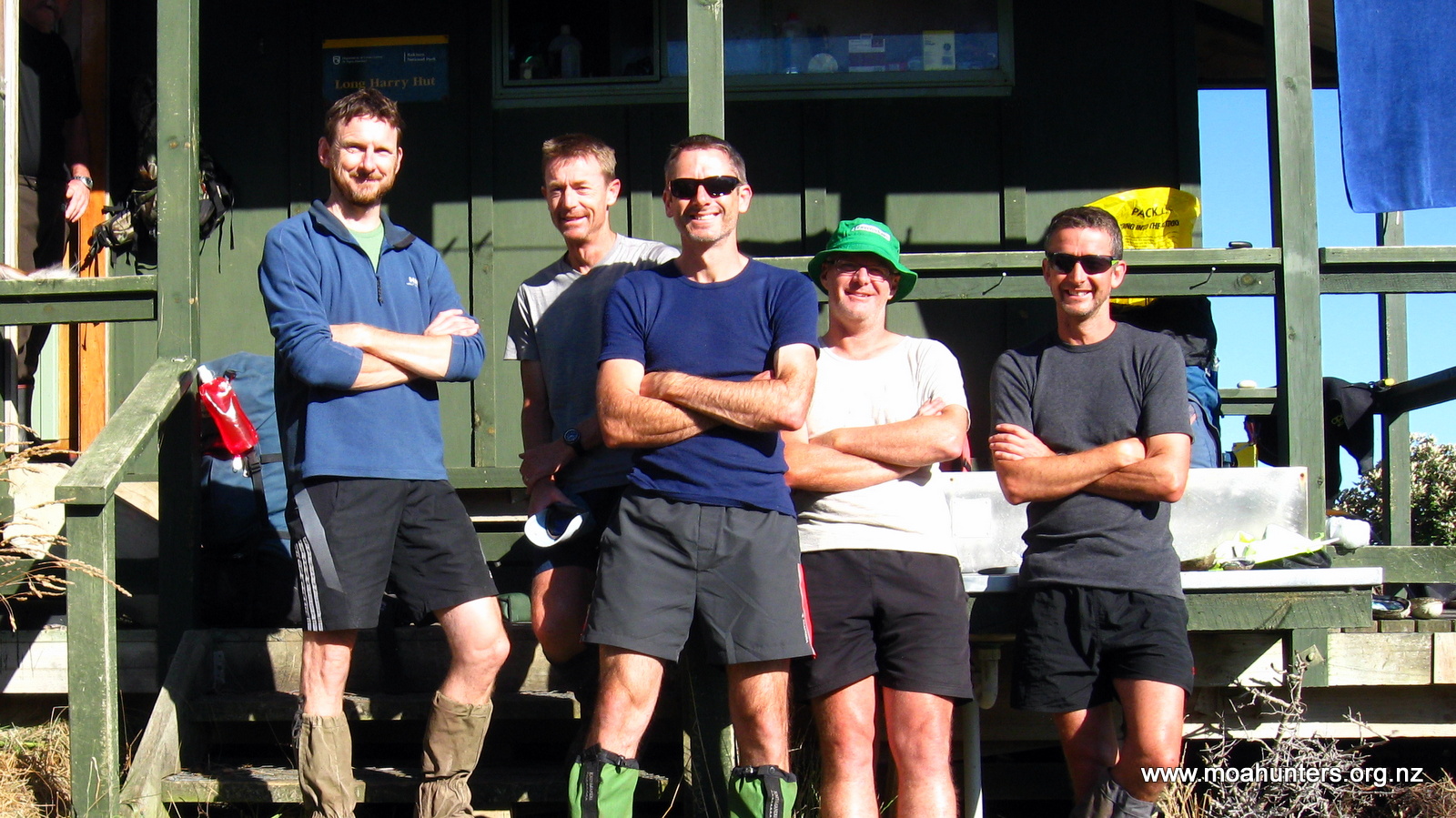
Following a leisurely tidy-up and customary photos outside the hut, we were finally prepped and ready to hit the track by 10am. Disgracefully late!
That night, Keran and Mathea had managed to contact the water taxi and arrange a pickup. Just as we said our goodbyes and left the hut, we spotted the water taxi in the distance headed straight at the hut, ready to ferry them to Oban. We all hoped Mathea’s sciatica would improve so she could enjoy the remainder of her holiday with Keran on Stewart Island.
Light drizzle kept things cool as we wandered back down the beach and away from Christmas Village hut. Our packs were now marvelously light and our shoulders were accustomed to the straps of our backpacks. It was an easy mostly flat walk to Murray beach, with little mud and only the occasional heavy drizzle making this leg anything outside of the usual.

As we approached the river, Paul made an astute observation about the bush in this part of the island. There was a distinct lack of large trees. He surmised that the presence of a large waterway and relatively flat terrain would have made this area particularly conducive to logging. And clearly it was, because there are no big rimu, or any other large trees for that matter, anywhere near the river. No doubt they were all felled, floated out down the Murray to the Island’s sawmills long ago.
Before we reached the Murray, the weather packed in somewhat and we were forced to don our waterproof jackets. A quick look at the map informed us that there was a hunters hut not far away, and given it was close to lunchtime, we planned on stopping there for lunch. We were pleased to find it had a covered porch, perfect for five wet trampers to squeeze into and eat their lunches out of the rain.
Sitting in that porch, we didn’t do much more than eat and talk. But it was strangely memorable. Moa Hunting trips are all about camaraderie, the simple things in life, and immersing yourself in the moment. Even if that moment is huddled in a small porch on a rainy day in the middle of nowhere.
When we had finished lunch, polar fleeces and jackets were donned as we set out into the rain for Murray Beach.
As it turned out, polar fleeces and jackets were not required. We crossed the bridge over the river and dropped down onto yet another pristine sandy beach in clearing conditions as the sun broke through the scattered cloud. The sand on this part of the island is a lovely deep gold colour, dotted with occasional white sea shells.
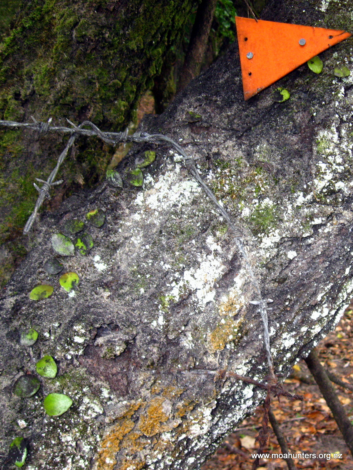
At the end of the beach the track inevitably heads up into the bush. We passed as odd barbed wire enclosure which had clearly been built many years ago judging by how deeply embedded the wire was in the trees it had been stapled to.
The track from Murray beach to Bungaree hut is relatively flat and dry and we made quick progress despite being in no particular hurry. Close to the hut the track climbs briefly to a flat bowl like area filled with ferns and moderate sized trees covered in climbers, moss and lichens. From there it drops in an easy descent to the hut.
As we made our way down the last stretch of track towards the beach we were unexpectedly hailed by another tramper who suddenly emerged from the bush on the track ahead of us carrying a large dry log. “You must be the Moa Hunters…!” he called out in a strong American accent. His name was Mark. Apparently our reputations had preceded us! John had passed through quite some time earlier and alerted him to our impending arrival.
After a brief chat with Mark, we descended the last section of the track to the beach and the hut. And what a beach! Bungaree Hut overlooks a stunning sandy beach with a tiny bush covered island creating a natural separation between that beach and another equally gorgeous beach. The sun was still high and the temperature quite warm. A quick dip in the ocean to freshen up was irresistible.

Back at the hut we met Sagacouchi, a Japanese traveler who spoke just a little English but smiled a lot. Mark had returned with his firewood and we settled in for a series of long and interesting philosophical discussions with him.

Shortly after 7pm we were joined by a Dutch couple, Anya and Hans who had walked to the hut from Oban. It had been a long day for them and they looked quite tired and very happy to have finally reached the hut after a 9 hour walk. We speculated that they were perhaps carrying a little too much weight in their packs as their time was somewhat on the slow side.
As the evening drew into dusk, we spotted two seals tumbling and flopping about amongst the thick brown kelp out in the bay. Yet another moment where we thought a place couldn’t get better, and then it did!
Day 9
Saturday 7th March – Bungaree Hut to Port William Hut
What a difference ten hours can make!
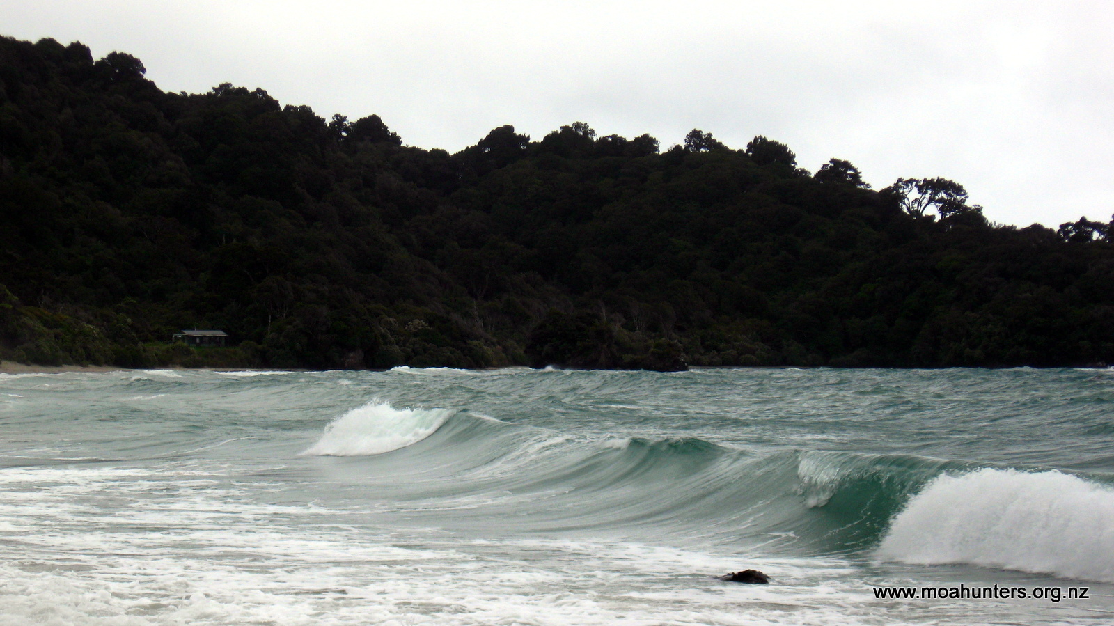
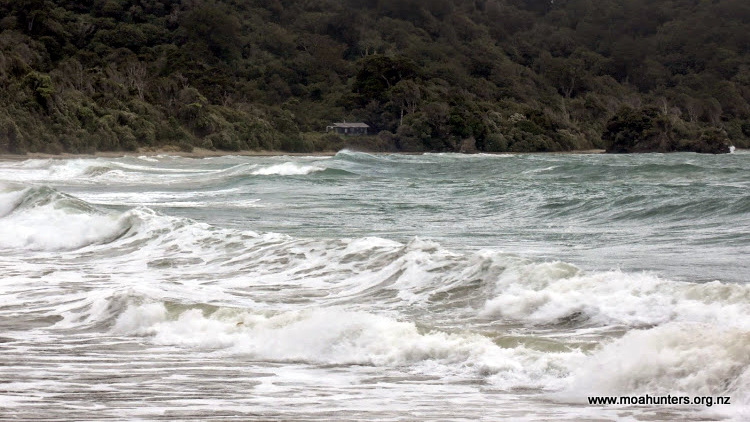
We awoke to find the pristine sandy bay in front of the hut transformed into a tempestuous stormy scene. A strong southerly which arrived through the night was whipping the bay into a cauldron. Wave after wave swept relentlessly up onto the sandy beach, the wild wind sweeping white spray off their crests. Driving rain rattled against the windows of the hut. It wasn’t a pleasant looking day and we were in no hurry to head out into it.
So, we spent a lazy morning solving the Worlds problems with Mark, discussing everything from home insulation, energy efficient design, to religion and war.
John, still bulletproof and full of youthful vigour, set off mid morning into the teeth of the Southerly, bound for Oban.
Mark, being an ex-teacher had a joke for us:
Q. What’s the difference between an extrovert Math teacher and an introvert Math teacher?
A. An extrovert Math teach walks about looking at other peoples feet.
Nice.
We ate a leisurely lunch and were ready to hit the track by 12:30. Probably not a Moa Hunter record for tardiness, but not far off it!

Again we walked in generally easy conditions. The short walk down the beach was quite exposed and not especially pleasant. But once we entered the bush, we were sheltered from the wind and the thick tree canopy kept us surprisingly dry.
The track climbs fairly steadily up to 130 metres or so, drops back to 100, and then rather rudely climbs back to 130 metres again. After that it is a steady descent to Port William Hut. The closer we got to the hut, the more mud we encountered. It would be fair to say that the mud on this side of the island, while not the deepest, is definitely the stickiest. Thick, gloopy, deep brown gloopy mud soon completely coated out boots and gaiters.

When we hit the coast just short of the hut, we took the opportunity to wash the mud off our our boots in the ocean at Magnetic Beach. It was surprisingly hard to get the sticky mess off them!
From Magnetic Beach we hit a shingled wooden edged track. A sure sign we were getting closer to civilisation and the end of our epic Moa Hunt. Just one hut left…
When we arrived at Port William hut, we found it was fairly empty with just a handful of travelers in residence. We bagged ourselves a bunk room, dropped packs and slung our sleeping bags out on the mattresses before heading through to the common room.
Or perhaps “The Morgue” would have been a better term. There were half a dozen trampers in there, all completely silent, reading books or just sitting quietly minding their own business. They briefly acknowledged our presence then went back to being totally quiet.
Moa Hunters don’t really do “quiet”…
So we proceeded to break the ice by force. We plonked ourselves at strategic points about the hut and started conversations with the little groups. Before long everyone in the hut was enjoying telling tall stories and getting to know one another.
Mission accomplished! At one point we jokingly asked a Swiss tramper called Adrian whether he was a banker, or a pocket knife manufacturer. It turns out he actually was a banker – who would have thought – a Swiss banker!
We had a rather tasty dinner of Salami Shepherds Rice Bolognaise. Yes, a mix of all the leftover food we had!
After a quick wander out the the Port William wharf, we settled in back in the common room for an evening chatting and generally chewing the fat. It was nice to see the previously silent and solitary occupants were now enjoying a noisy card game together when we returned.
A heavily decorated instant pudding finished off the evening before we headed off to bed and our final night on the track.
Day 10
Sunday 8th March – Port William Hut to Oban

It was with mixed feelings that we left Port William hut. Ten days is a long time to be away from family, and we were all thinking of home. We also knew that our time on Stewart Island was coming to an end, and that it would be a long time before we were likely to return to that magic place.
The track away from Port William is very much a formed path, with timber retaining and compacted shingle inside. We strolled along at a very decent pace, while soaking in every sight smell and sound around us. The tracks climbs easily enough through quite dense forest for about 1.5 kilometres and then descends a little more steeply to a swingbridge which spans a small river a the northwestern end of Maori beach.
Under a mottled sky we meandered along the sandy beach, chased by a number of enthusiastically hungry sandflies.
At the end of the beach the track stays low following the coast to Lee bay. An enormous rust coloured chain sculpture spans the track here, forming an archway marking the official start of the Rakiura track.
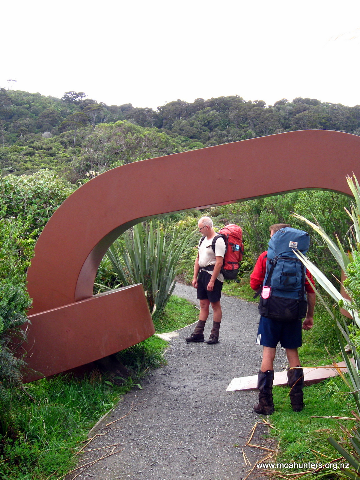
The “other end” of the chain is on the coast at Bluff. The symbolic chain linking the two islands is from the Maori legend of Maui, in which the South Island is Maui’s waka (canoe) and Stewart Island is its anchor. The North Island is a great fish he pulled from the oceans depths with his magic fishhook..
We spent some time at Lee bay reading the information boards which tell the history of the area. From there we walked out onto the road, the final leg of our journey back to Oban. We followed the unsealed road over a low brow and down to beautiful Horseshoe bay. Sheltered by two large headlands, the bay is a peaceful spot dotted with houses commanding spectacular views.
Walking along the road we were surprised to hear a car approaching from behind tooting its horn. “Alright, alright!”, we all thought, “give us a chance to get off the road, mate…”
The car stopped beside us, and a familiar face smiled out at the open window. It was Mathea!
She couldn’t fit us all in, but she offered to take our backpacks to Oban. There was room for one Moa Hunter in the car, so Chris joined her for the trip. They would swing by the holiday house and pick up the day packs we had left there, relieving us of having to walk that detour later. The remaining Moa Hunters, unencumbered by packs, legged it for Oban at great pace.
45 minutes later we were all sitting at a picnic table outside the Kai Kart. Our journey was complete.
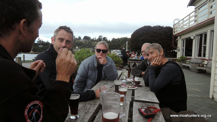
We wolfed down a delicious feed of blue cod fish and chips from the Kart before heading to the South Sea Hotel for a final drink. Who should we find at a table outside the hotel, but Mathea and Keran. Again!
We sat down with them and spent a very pleasant last hour on Stewart Island, chatting in the sun.

The ferry trip to Bluff was beautiful. Flat calm seas, dramatic clouds, swooping albatrosses and hundreds of sooty shearwater (muttonbirds) on the water created a spectacular sendoff for us.
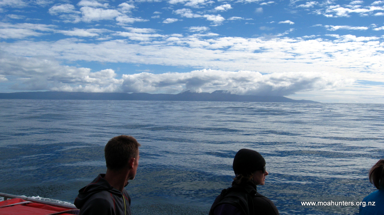

Our bus was waiting in Bluff and before long we were back at Invercargill Airport awaiting our flight. This Moa Hunt had been an absolute epic, enjoyable in every way.
Rakiura Stewart Island is absolutely stunning, with new gobsmackingly beautiful wonders seemingly around every corner.
We didn’t see any Moa, but seeing his distant cousin the kiwi was an unforgettable privilege.
