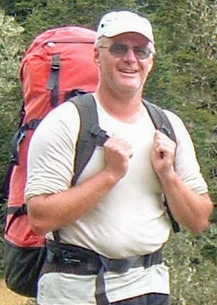
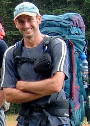
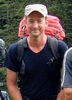
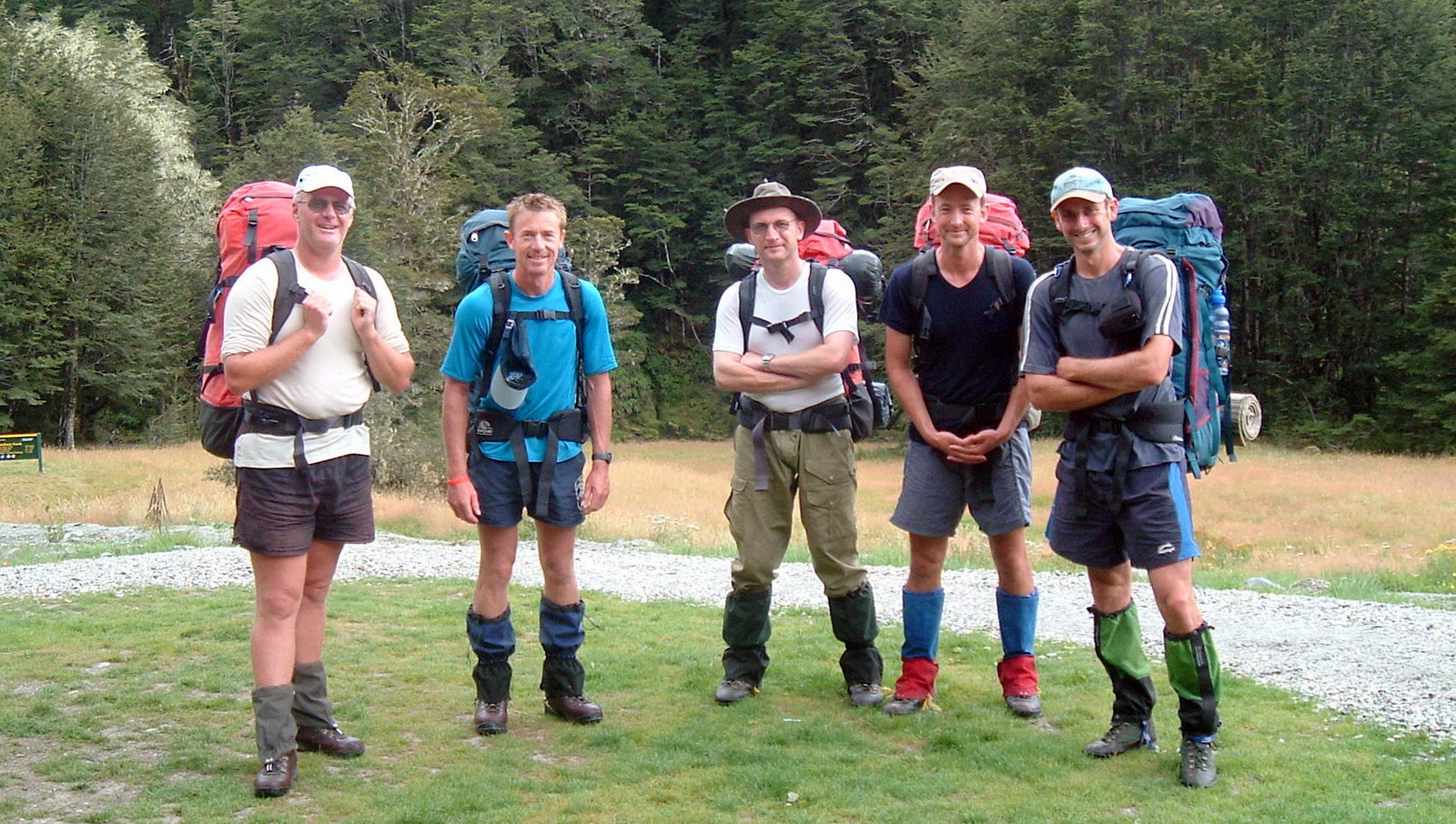
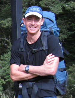
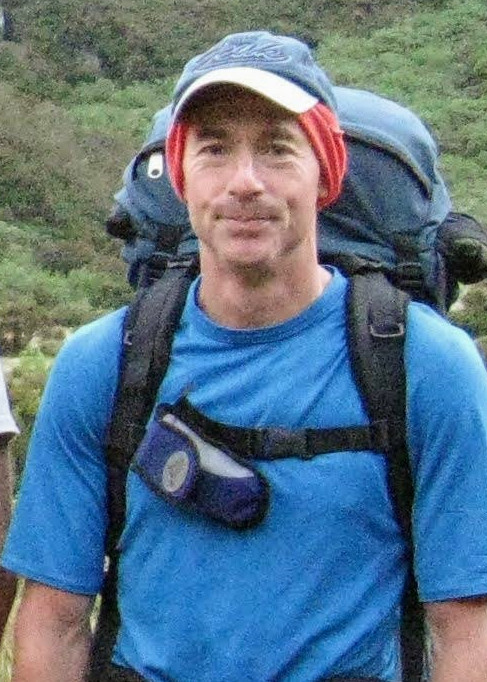
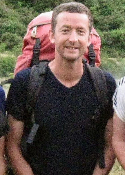
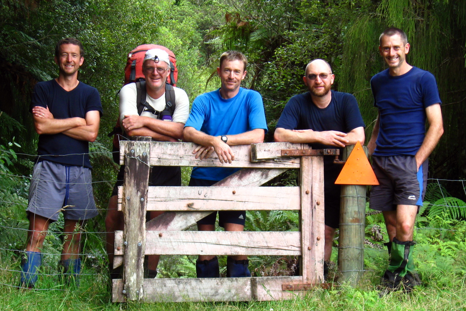
Moa Hunters on this trip: Chris, Adam, Paul, Magnus, Richard, Lewis


The trip:
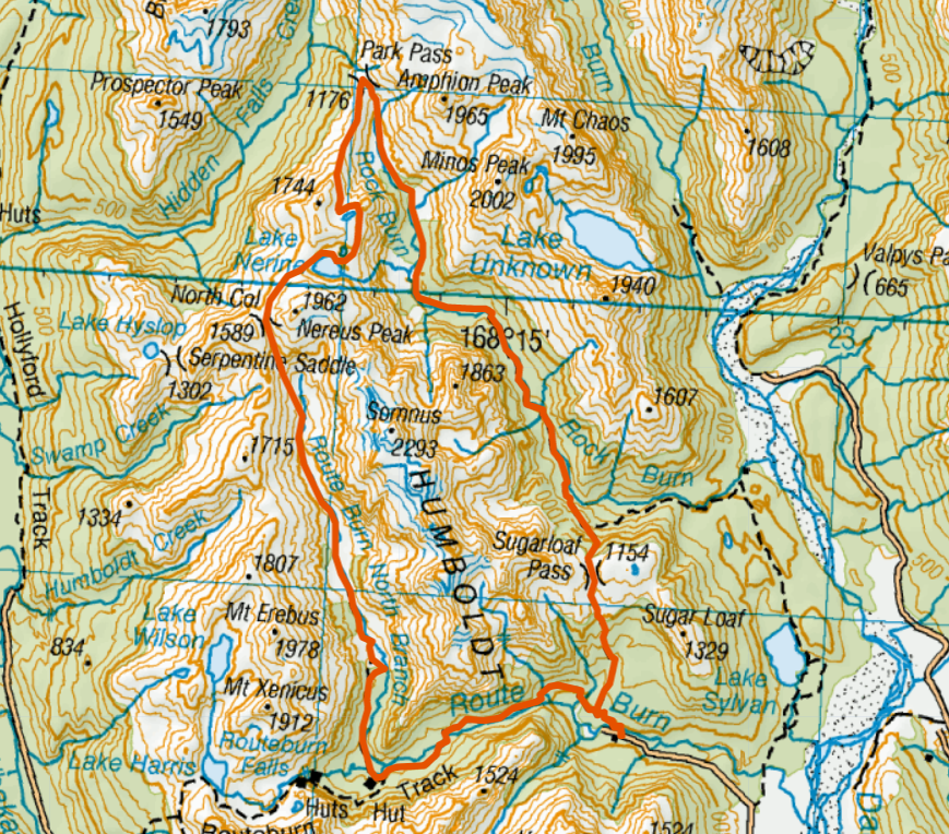
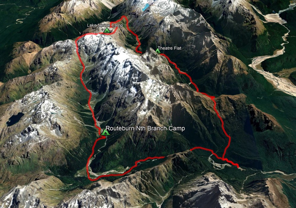
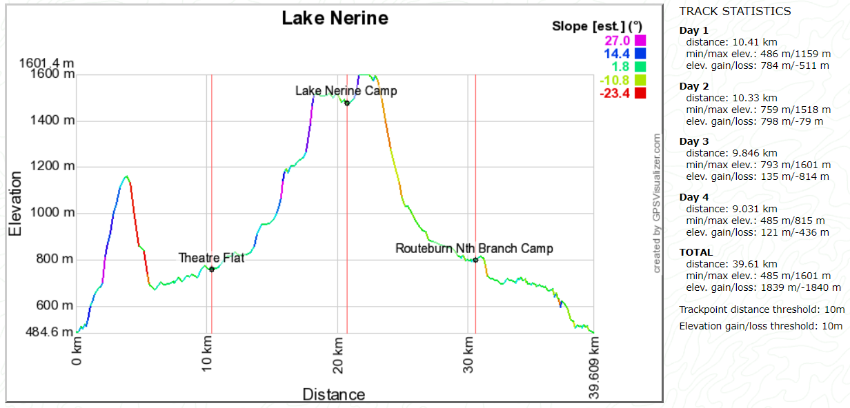
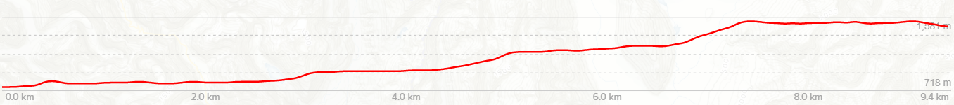
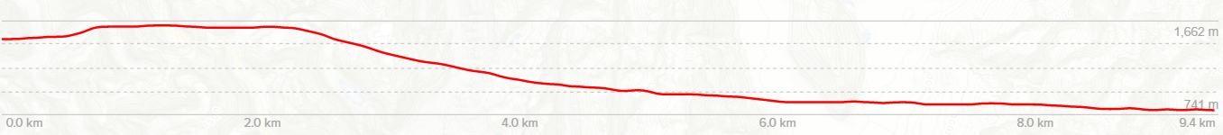
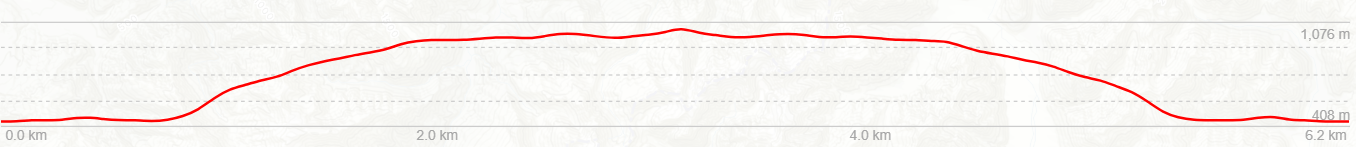
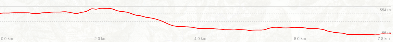
Day 1: Klondyke corner to Barker hut
Day 2: Barker hut to Carrington hut
Day 3: Carrington hut to Klondyke corner


Our original plan for 2011 was a longer trip than this. However, in February a large earthquake devastated central Christchurch killing many people and leaving thousands in seriously damaged houses. Going tramping and leaving our families just weeks after such a traumatic event was not an option. We cancelled the trip and agreed to organise a smaller walk later in 2011.
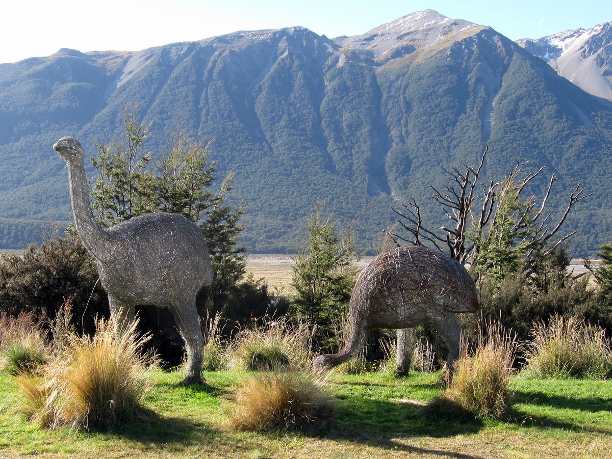
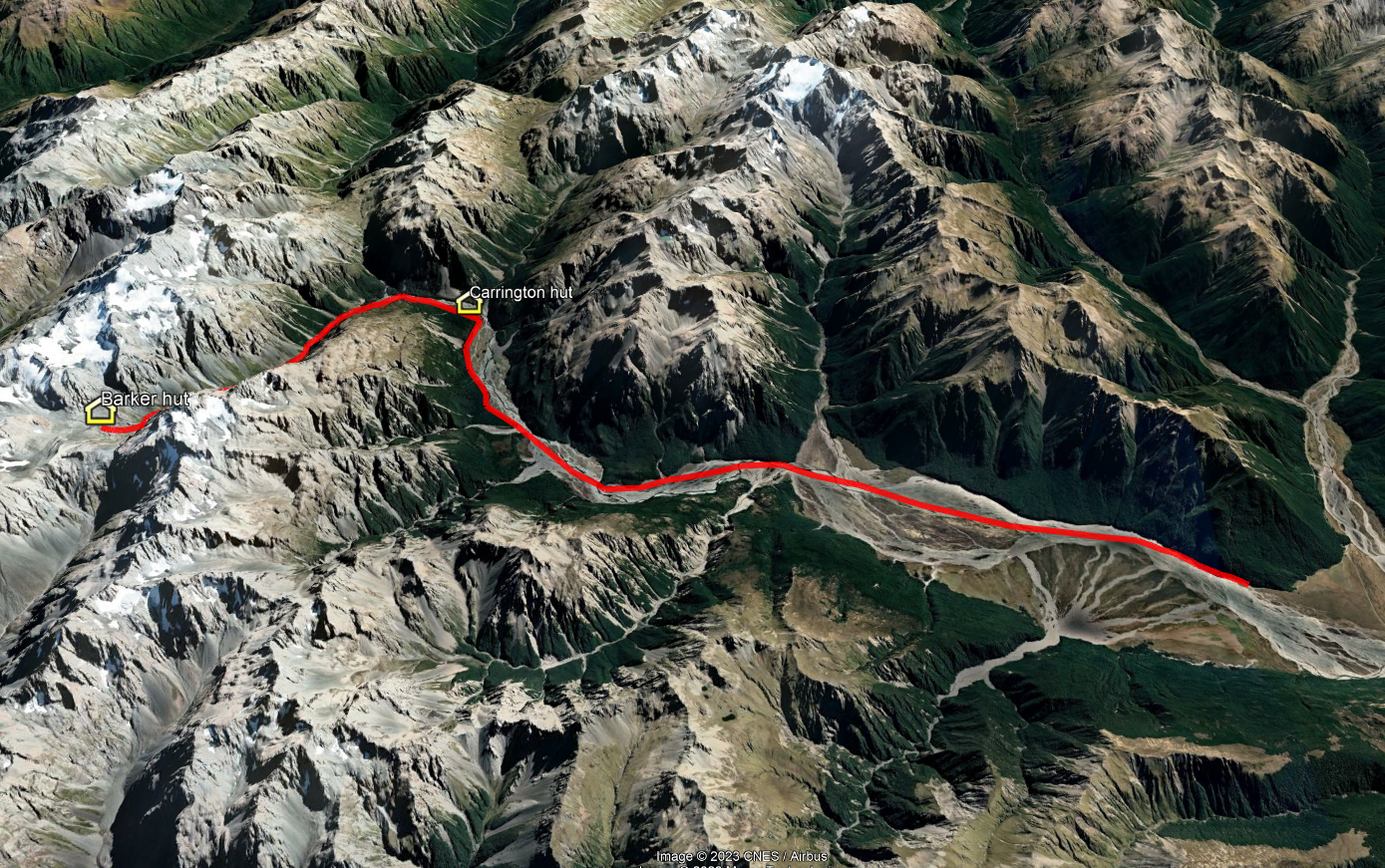
April arrived and we agreed it would be OK to head out for a short walk close to Christchurch. We would walk up the Waimakariri river past the Carrington hut, then up the White river to Barker hut.
Day 1
Friday 8th April – Klondyke corner to Barker hut
Early in the week, weather forecasts for Arthur’s Pass looked dire. A strong southerly blast arrived on the Tuesday and initial predictions showed the cold wet weather persisting into the weekend. This prompted Adam to head out and save a large amount of money on a sale price gore-tex jacket at Kathmandu.
It turned out the forecasts were a little pessimistic. Friday morning dawned cold but relatively clear. The strong cold southerly wind had died away and looking out to the alps in the west, things looked very promising.
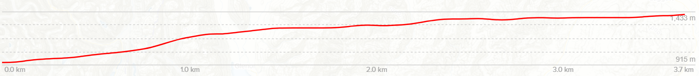
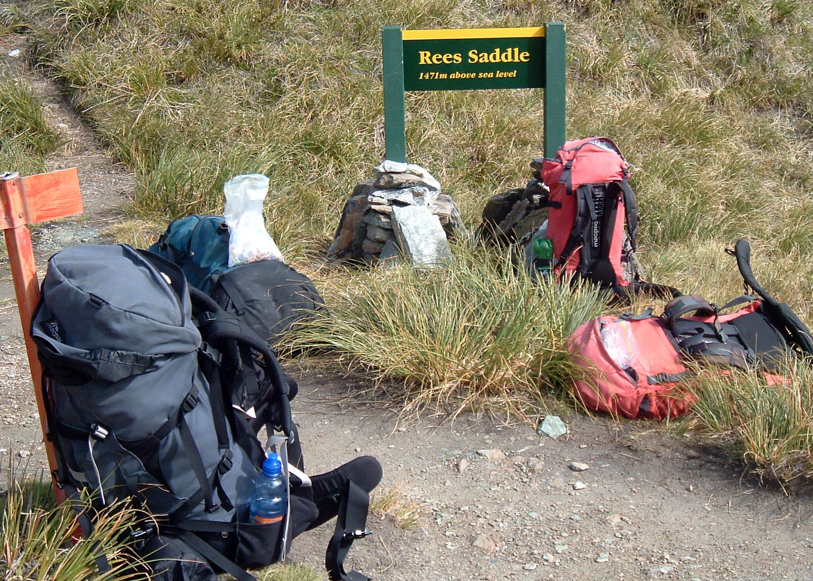
To make Barker Hut while it was still light, Paul calculated we would need to be on the track by 9am. Factoring in the drive time to Klondyke corner, dropping a car at Otira and the usual farting about, we would need to meet at Adam’s house at 5.30am. Ouch.
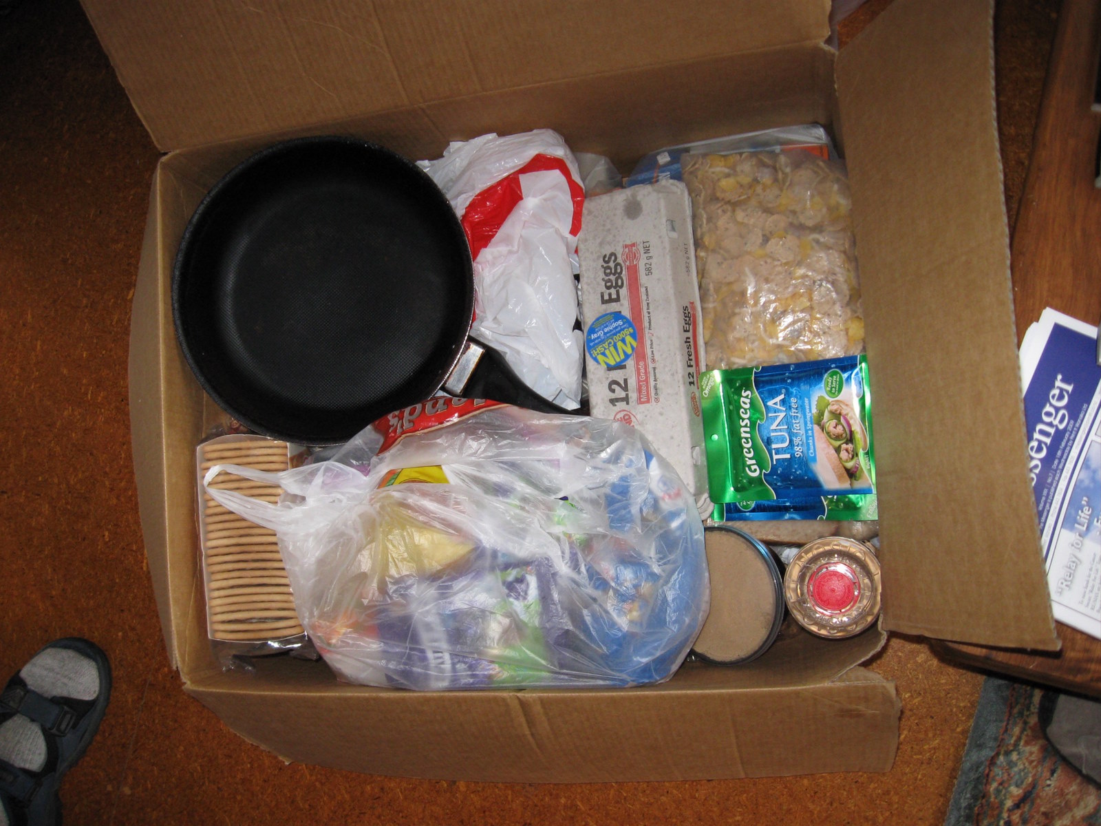
Everyone arrived on time, and somewhat against the odds, we set off in two cars not long after 6am. Adam had made a breakfast bag for each car. Filled with bacon and cheese croissants, muffins and bananas, it was more than enough food for the moa hunters.
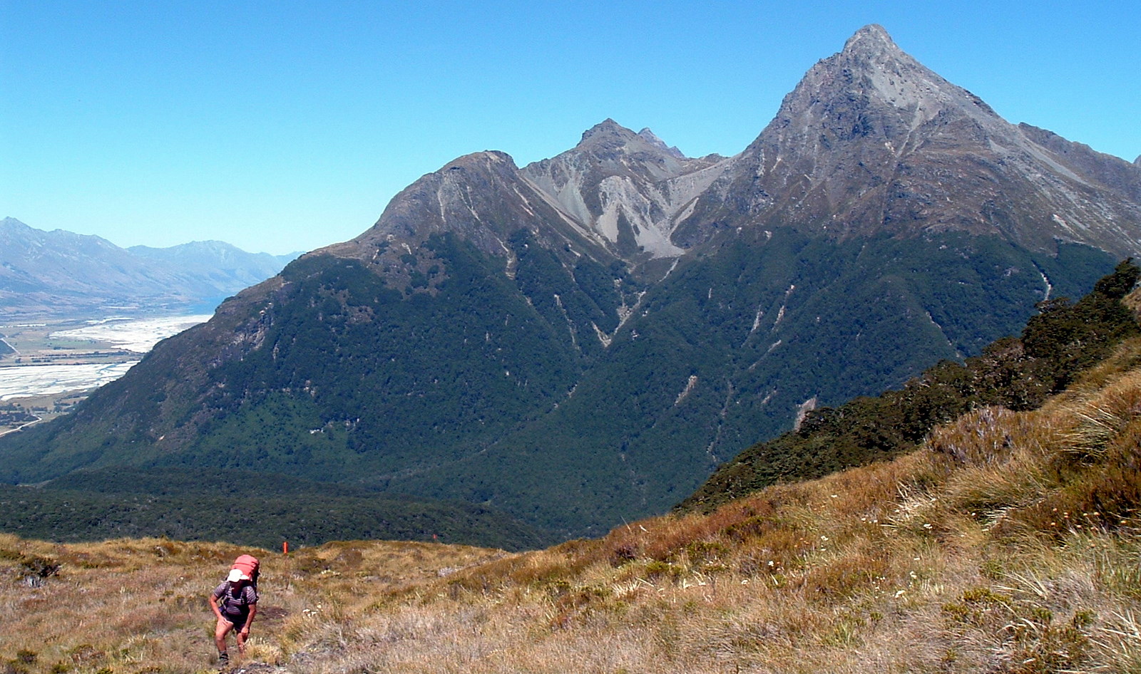
At precisely 9.02 am we were ready. With packs on and generous amounts of sandfly repellant applied, we strode manfully into the rocky Waimakariri river valley.

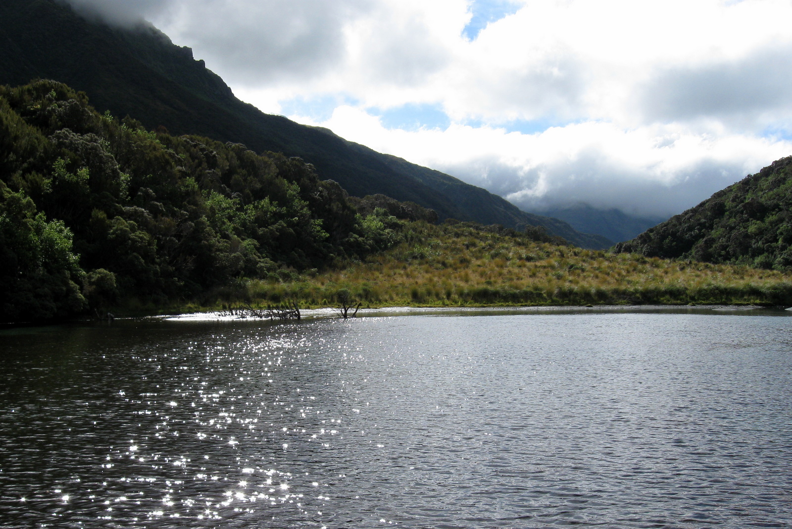
Wide flat valleys make for meandering rivers. The section of the Waimakariri we were walking is a classic example, with the river weaving from one side of the valley to the other. Consequently it wasn’t long before we had to make our first river crossing. We steeled ourselves for ankle achingly cold water, but were surprised and generally happy to discover it was only very cold.
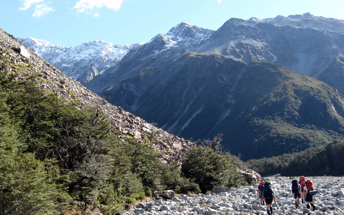
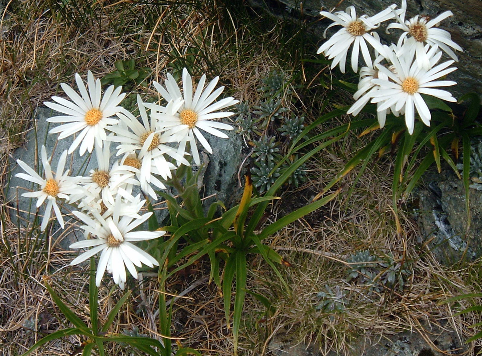
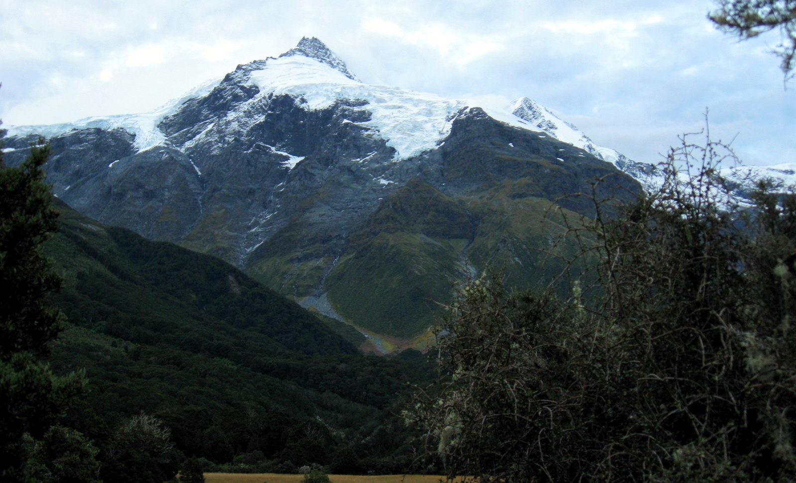
Some people complain that the Waimakariri valley is boring. From a walking point of view, that’s probably true. The large number of difficult sized and often loose rocks make walking a bit of a chore, and it doesn’t change much from hour to hour. But on the day we were there, the snow topped mountains surrounding us were absolutely stunning. Pristine and magnificent against the bright blue sky, they more than made up for the mundane valley floor.
By mid morning we had made good progress and as the day warmed, sunscreen and hats were slapped on. Adam’s new jacket looked destined to stay deep in his pack this day.
A badly timed dose of diarrhea in the few days leading up to the trip had Paul worried he may have to pull out. Fortunately by Friday, things “down below” had settled enough for him to feel confident about the walk in, though not quite confident enough to fart.
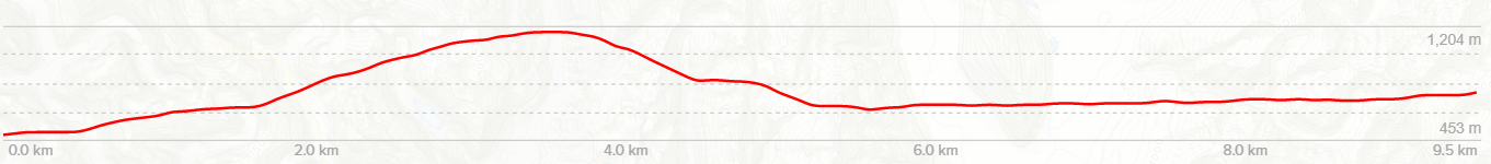
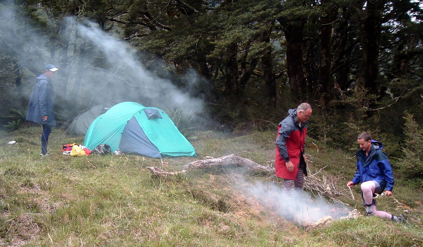
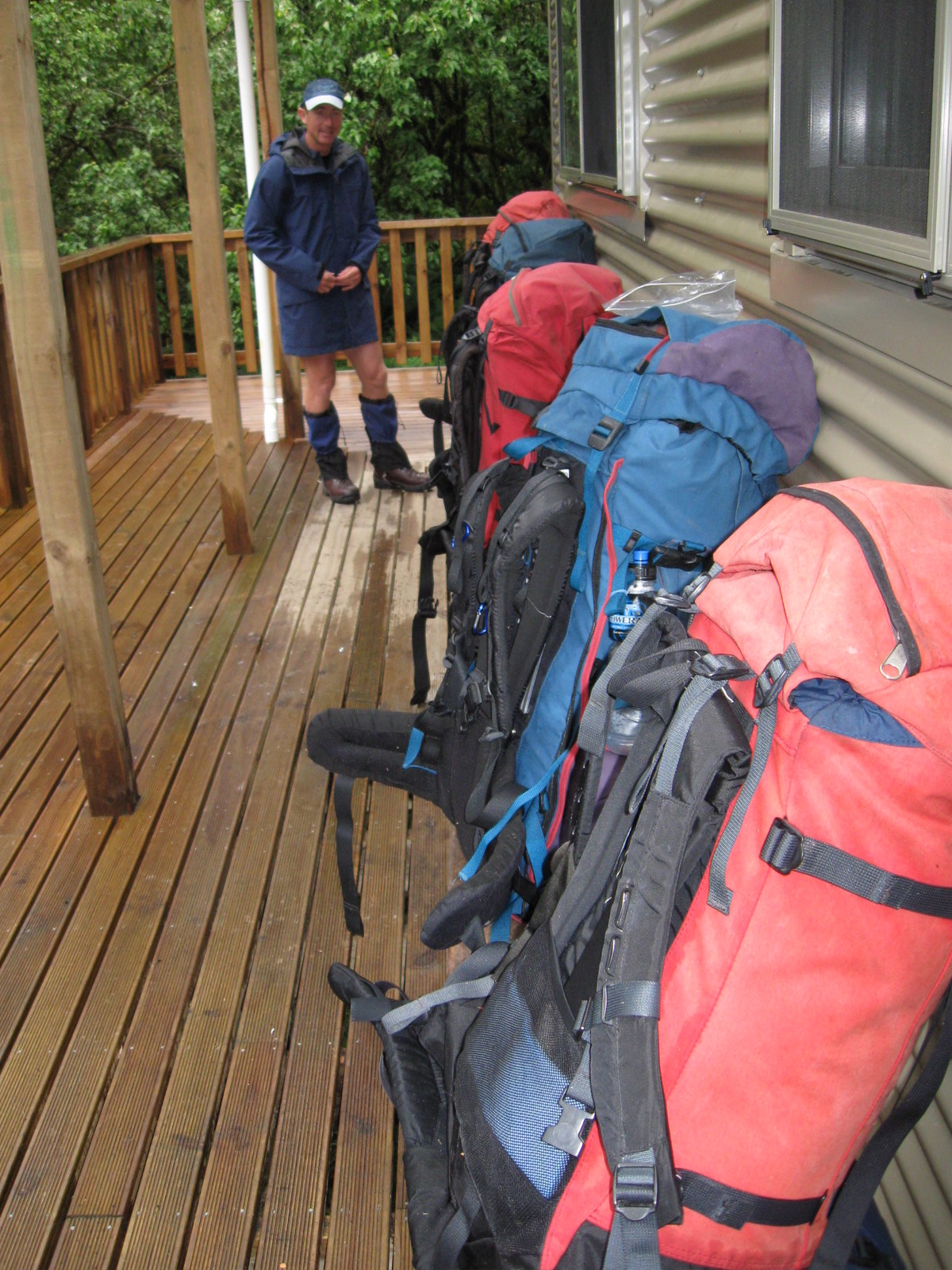
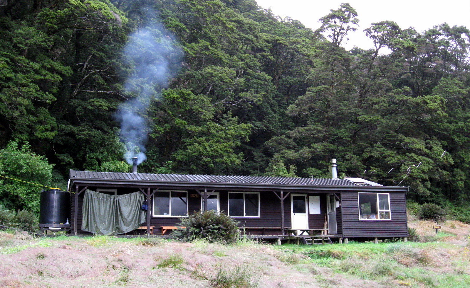
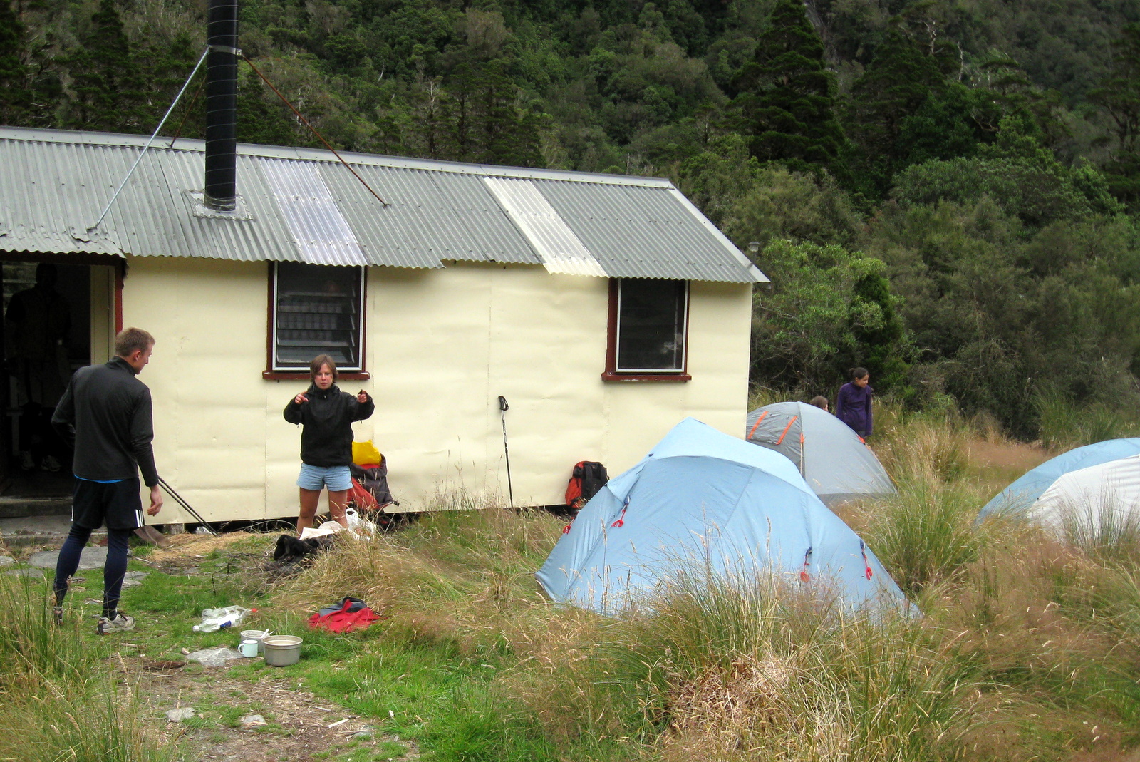
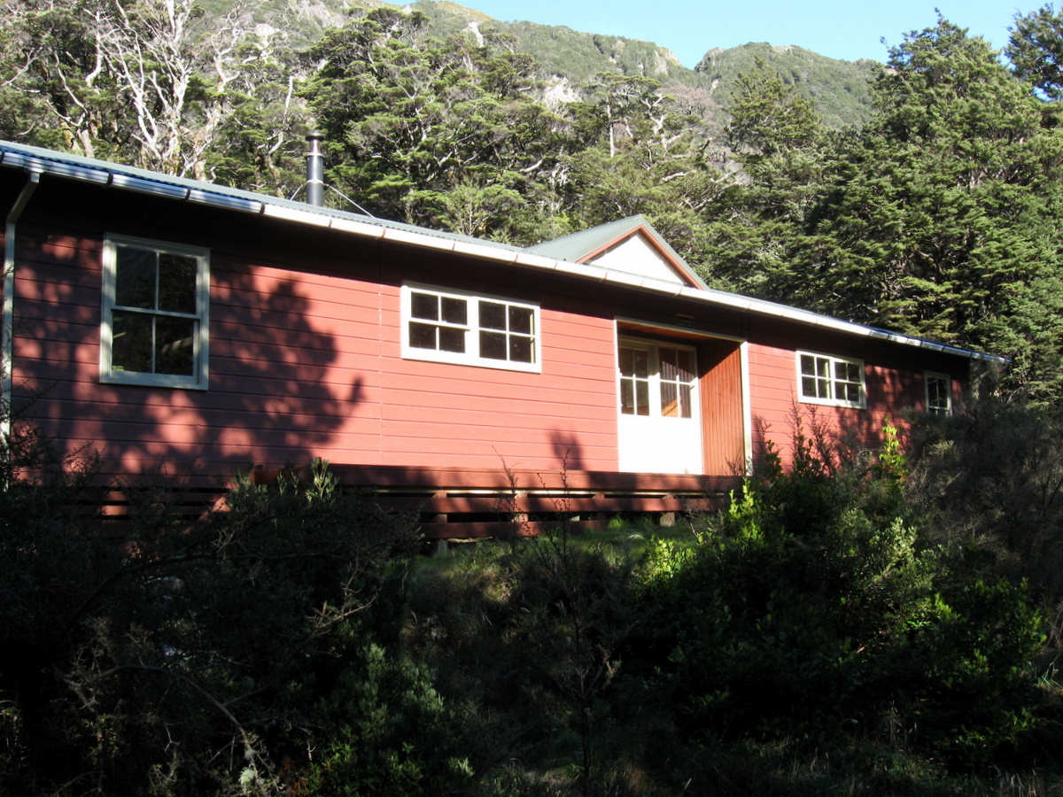
Four hours of relatively easy walking saw us arrive at the Carrington Hut. Big enough to sleep 36 people in bunks, it’s more of a hotel than a hut. Our arrival coincided with lunchtime. While it was tempting to sit on the deck in the sun and eat, the thousands of extremely enthusiastic sandflies outside the hut forced us inside to eat at one of the many tables.
After lunch we braved the sandflies on the deck and pulled on our wet socks and boots. Food and anything else thrown out of packs were systematically stuffed back in. “Bugger, what the hell have I done with my glasses,” muttered Adam, rifling through some bags. Paul, with a smirk on his face, replied “…your glasses?” At which point Adam realised he was in fact wearing them. A sure sign he has joined the over 40′ (12.2 m)s club in body and in mind!

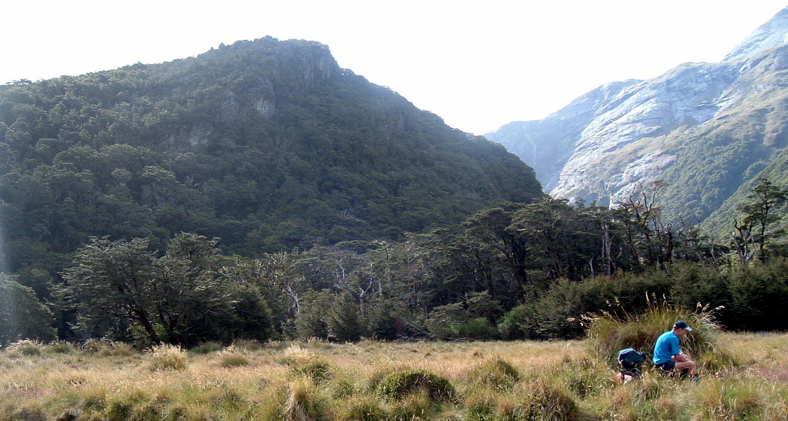
Leaving the Carrington Hut, we also left the Waimakariri valley, turning southwest into the rather similar White River valley.
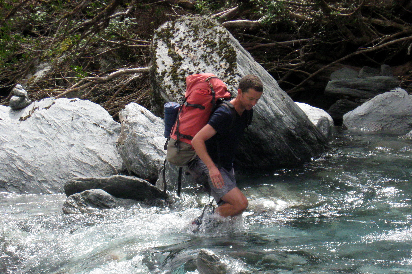
The route guide suggested that it was best to cross to the true left of the White River close to the Carrington Hut. We dutifully did this, only to have to cross back five minutes later as the river swung across the valley in front of us. None of us minded too much though. By this time the afternoon was getting hot, the cold water was refreshing and not particularly deep.
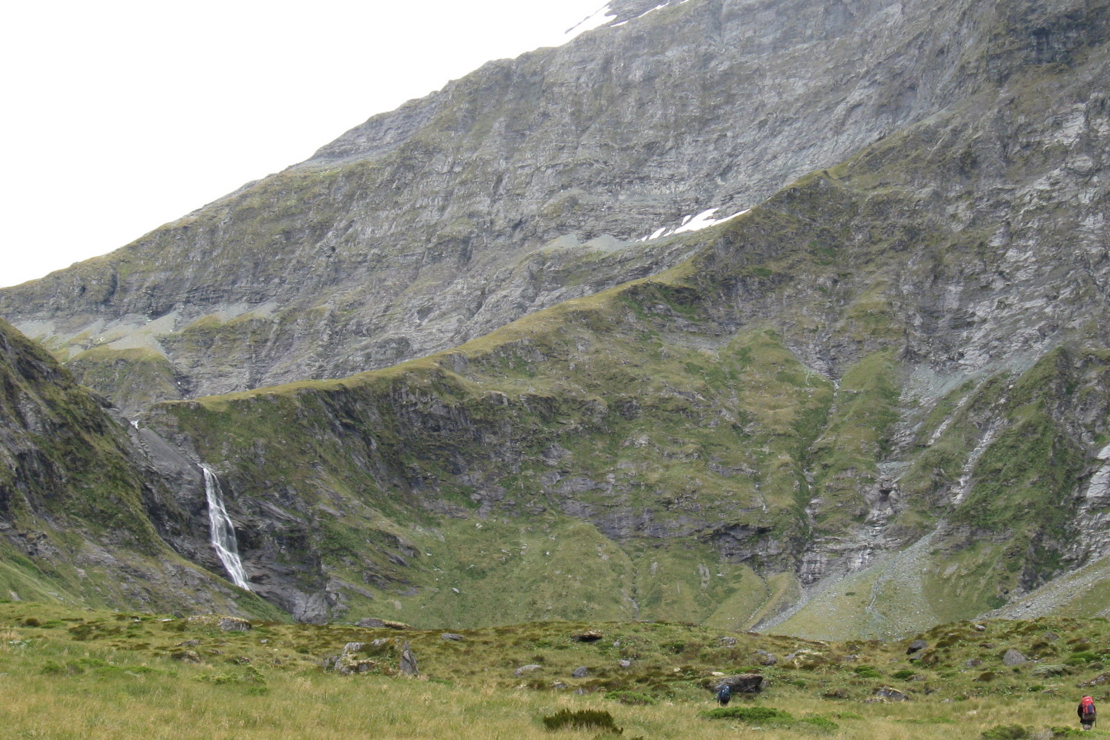
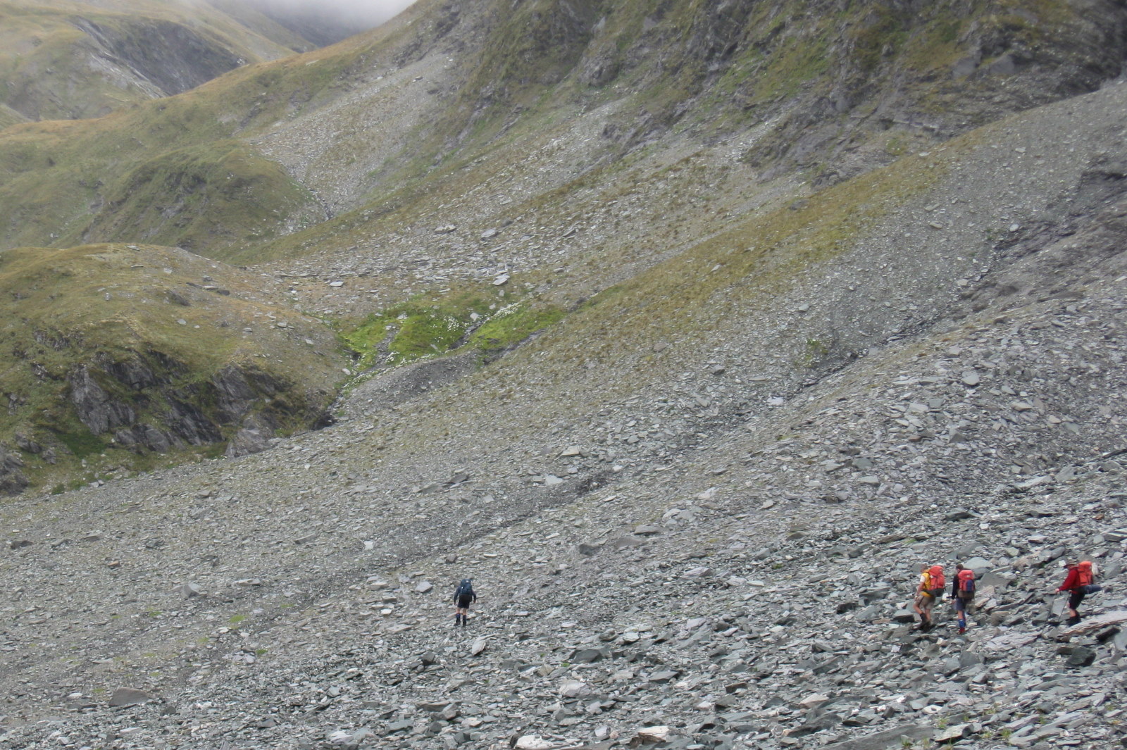
Walking up the valley became steadily more challenging. In a couple of places the river gorged and we had to leave the valley floor, picking our way higher up the side of the valley for a time.
In other places rock slides had left steep chutes of loose shingle. For Lewis this was new territory. Traversing these tricky slopes and learning to “go with the flow” when you start to slide on loose material earned a “five on the sphincter scale” from him. He was assured that loose rock and scree would quickly be mentally downgraded as he did more of them.
Without doubt the most “interesting” moment of the trip for Magnus was when a slab of rock suddenly cut loose above him, sliding towards him. A warning shout from Chris, and a neat sidestep from Magnus saw the slab go past him harmlessly. When asked what he said when the rock came to a rest below him, Magnus assured us it was “scheissdreck!!”

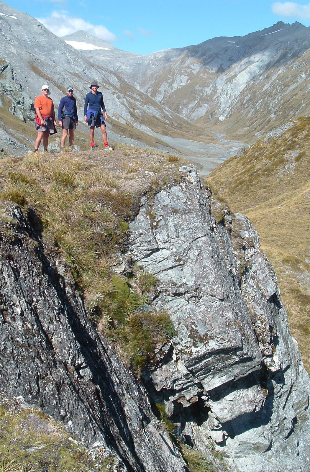
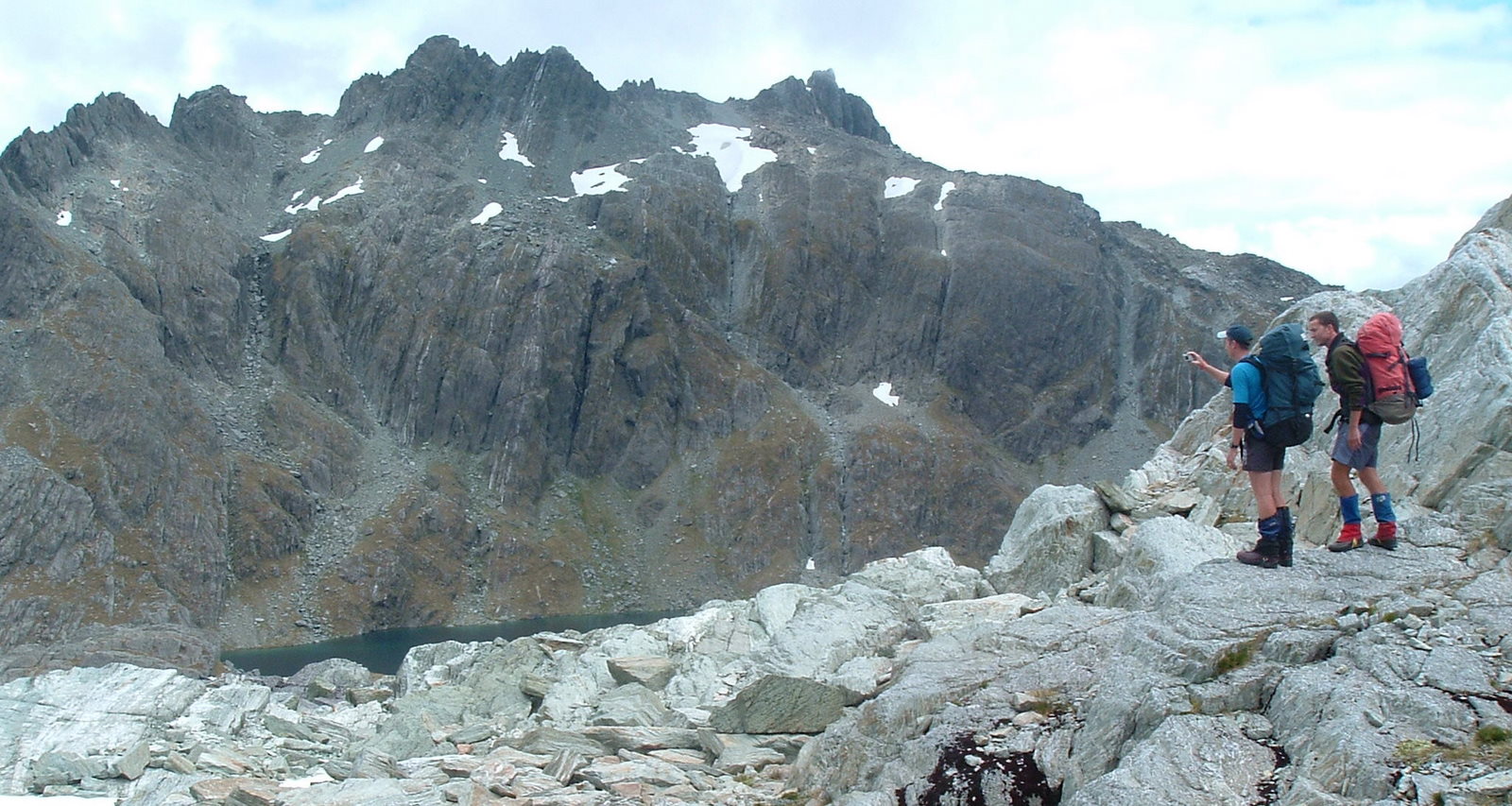
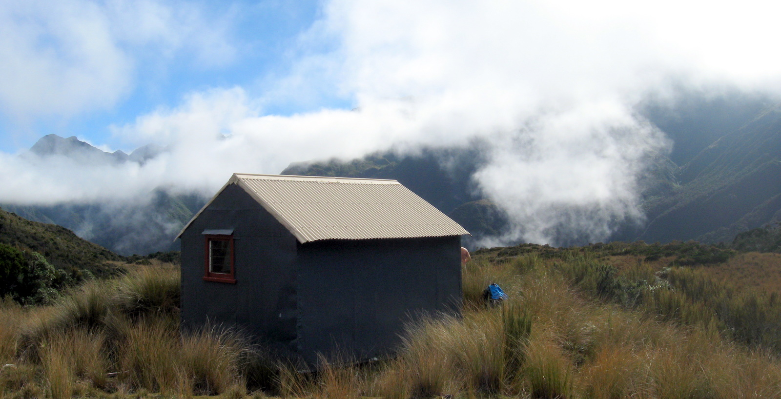
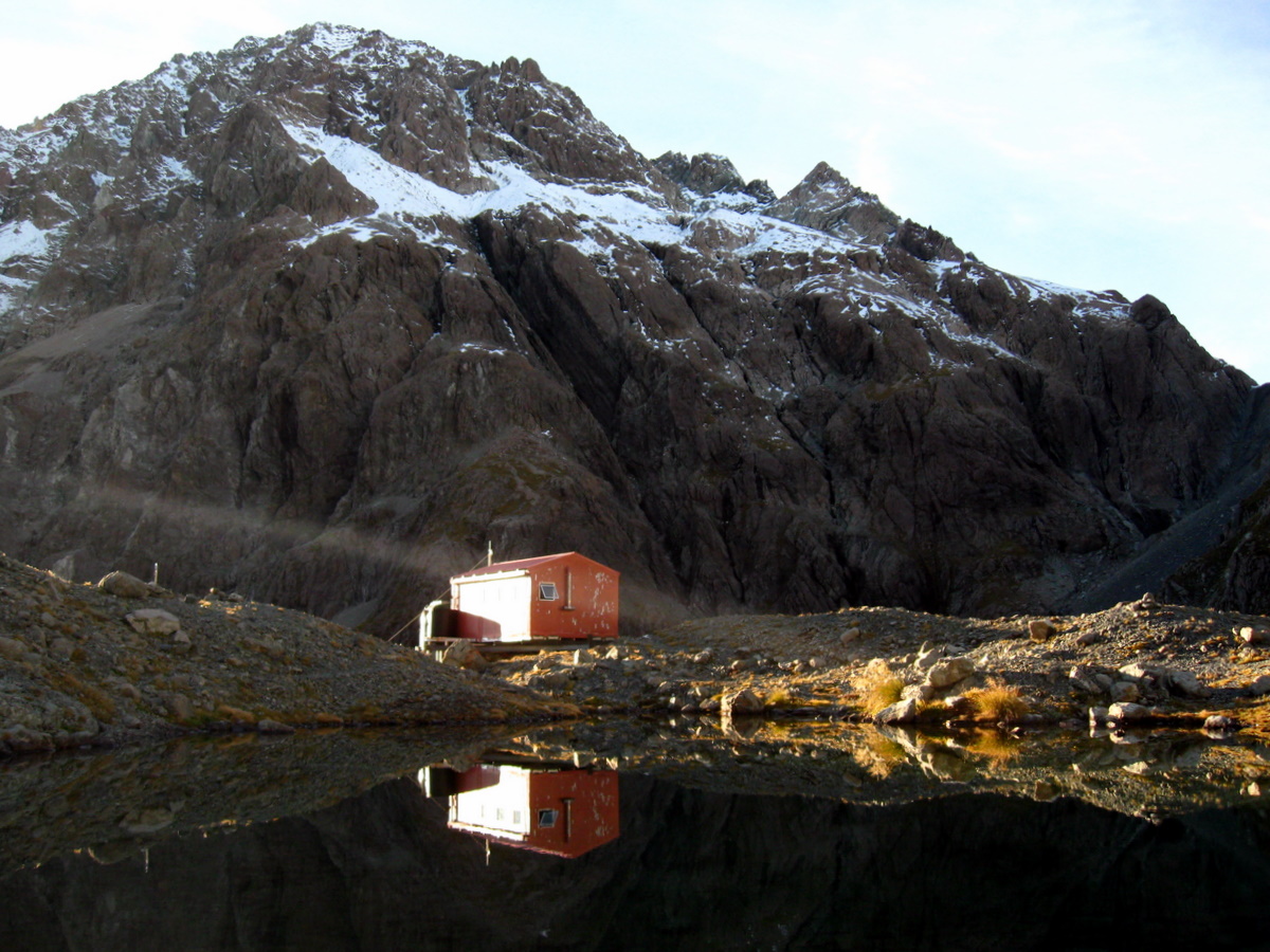
As we rounded a spur, the Barker Hut showed itself for the first time. High up on a rocky outcrop at the head of the valley, it looked small and rather distant.

In fact, a good three hours away. The valley clearly became increasingly steep heading towards the hut, with a final brutal looking grunt round and up the left side of the outcrop.
The route guide mentioned a “high track” could be used. If we had seen where it started, we might have. As it was, we boulder hopped our way up the valley making steady progress.
Somehow though, we all had the feeling we were being quietly taunted by the Barker Hut. Throughout the afternoon it always seemed a lot higher than us, and never as close as anticipated when a new corner was rounded.
We did eventually reach the base of the outcrop, and were relieved to find the final section around it wasn’t nearly as gnarly as it had looked from a distance. Footholds were sure and while it was relatively steep, it wasn’t in any way precarious. One by one we made the top where the cheerful orange coloured Barker Hut welcomed us.
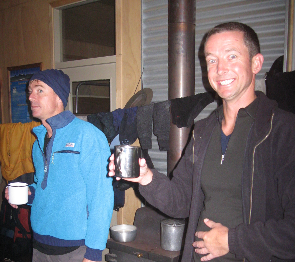
As always, we quickly turned an orderly hut into a mess of packs and gear strewn in all directions. The mountain radio and interior light were both non-operational. We found out later that a lightning strike had munted the solar panels / lead acid battery setup. A regular occurrence apparently.
Being autumn, dusk arrived quickly and it wasn’t long before we had to turn on our own battery operated lights to see what we were doing. Dinner smelled damn good and the hut quickly warmed up. Constructed from the same materials you would use for a coolstore, it is incredibly well insulated. Even with no heating, it got remarkably toasty inside.
Day 2
Saturday 9th April – Barker hut to Carrington hut
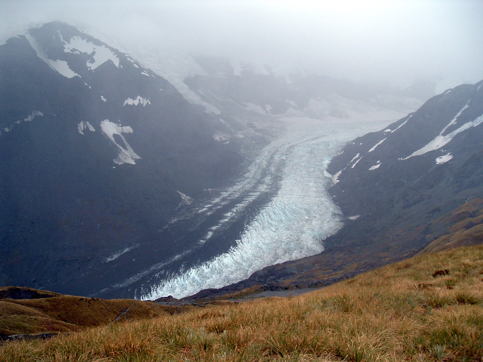
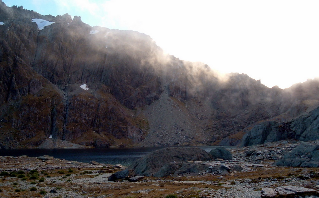
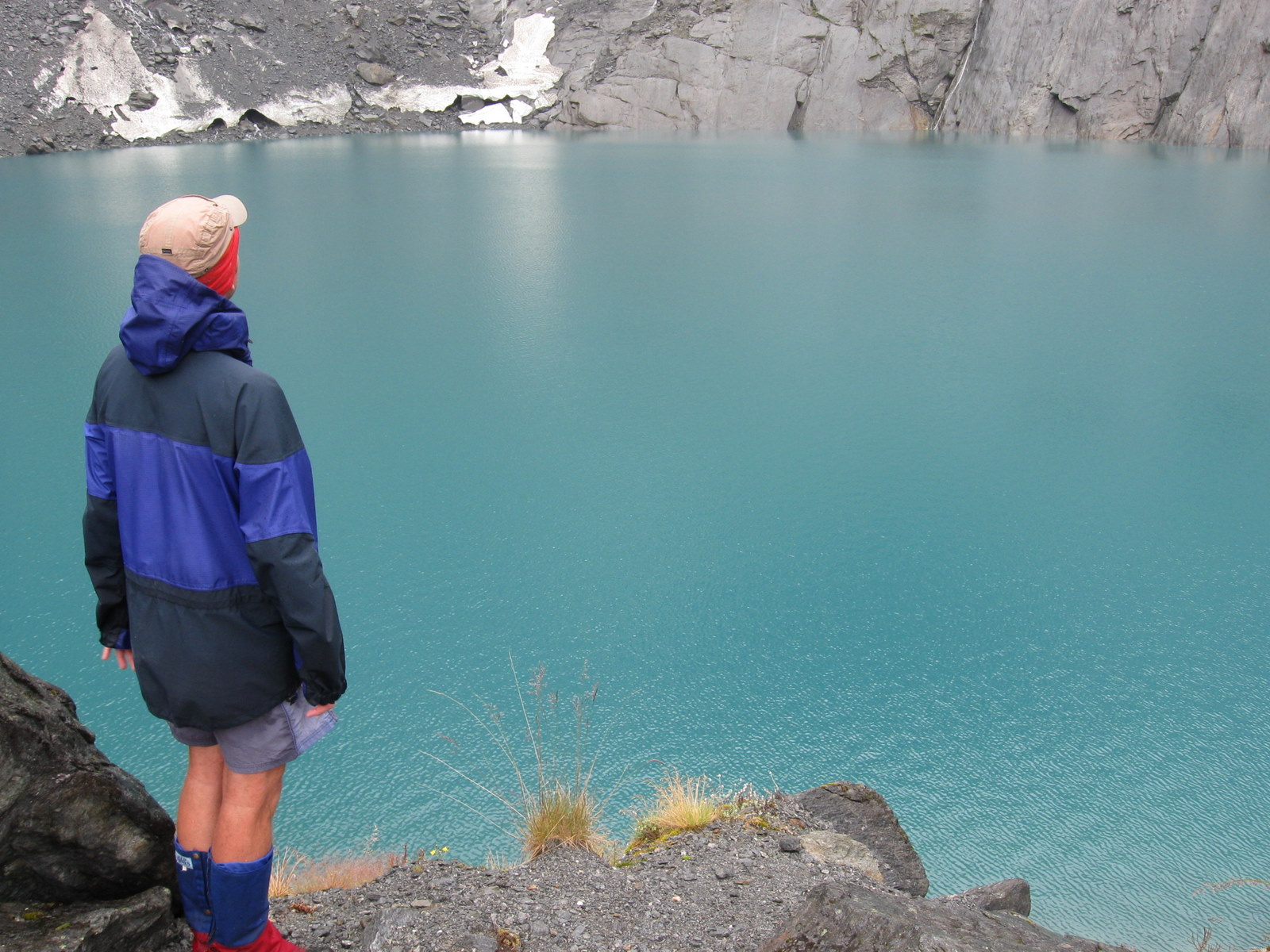
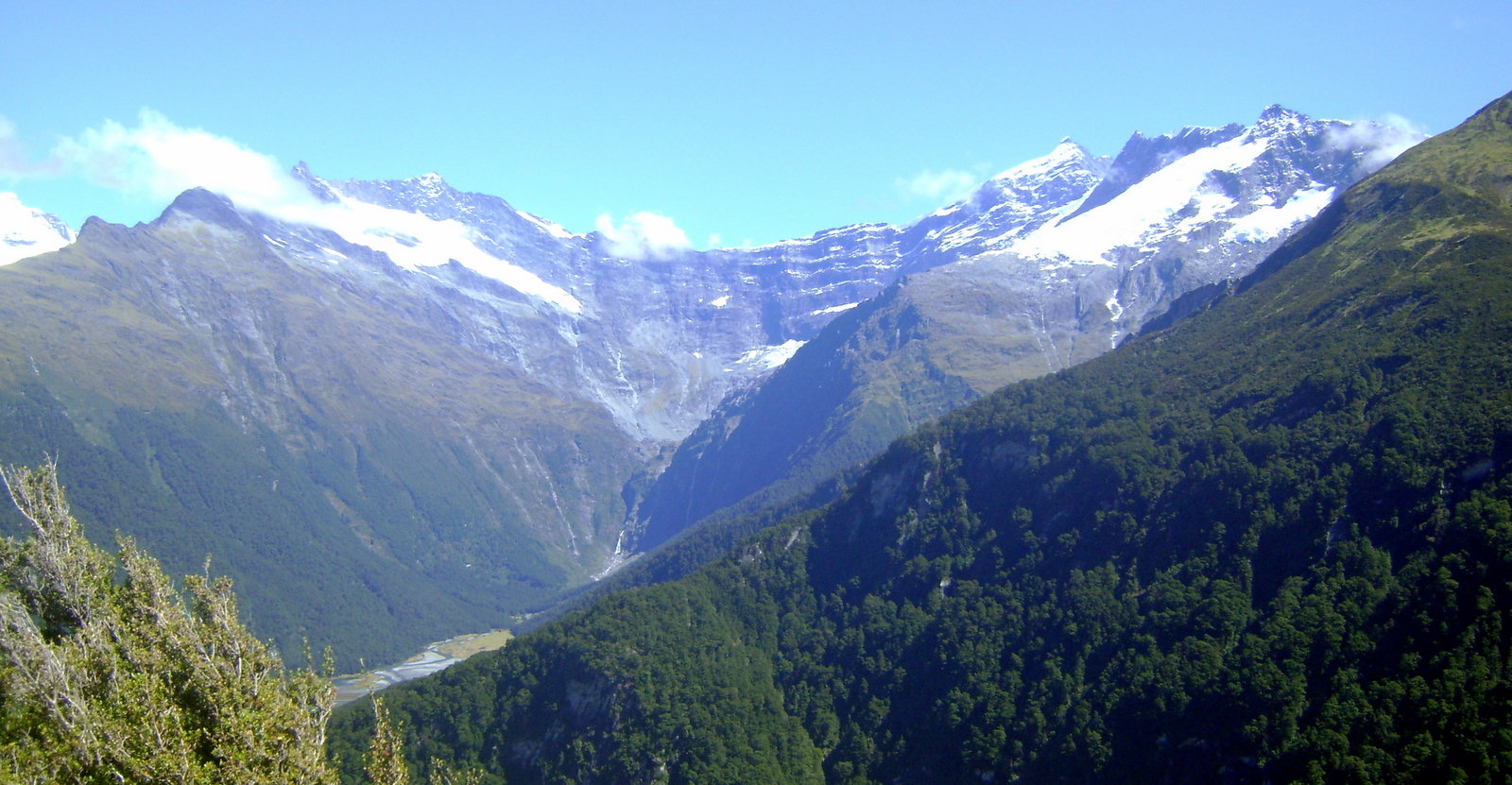
The next morning was a stunner. Patches of low cloud and fog drifted in the valley below, but where we were the air was icy clean and crisp. There was not a breath of wind and the first rays of sun were glancing orange and pink across the nearby glaciers.

Eating breakfast inside the hut would have been a crime, so we carried a bench seat up a small rise beside the hut. There we stood or sat and enjoyed our hot porridge while taking in spectacular views that money can’t buy.
Another criminal activity would have been to leave that place on such an amazing day. It didn’t take long to agree on a new plan. The morning would be spent exploring the ridges above the hut. After lunch we would walk four hours back to the Carrington Hut and spend the night there. The Waimakariri Falls Hut would have to wait for another trip.

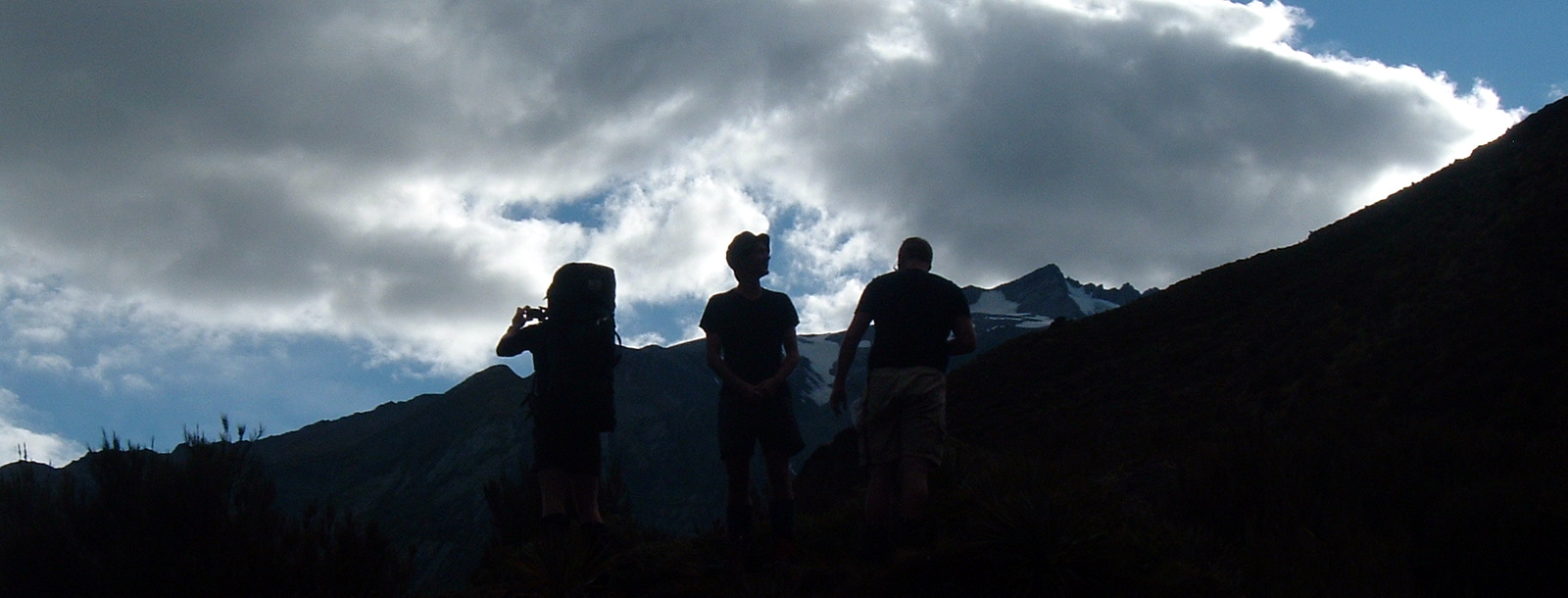
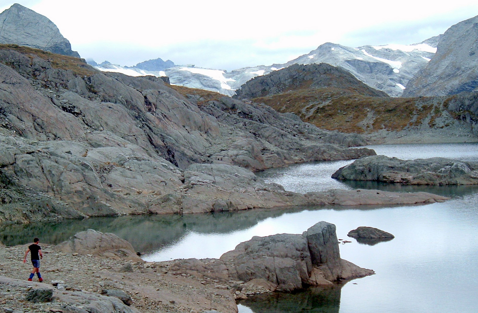
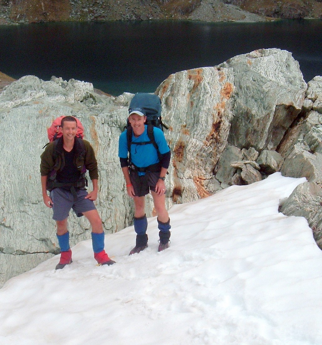
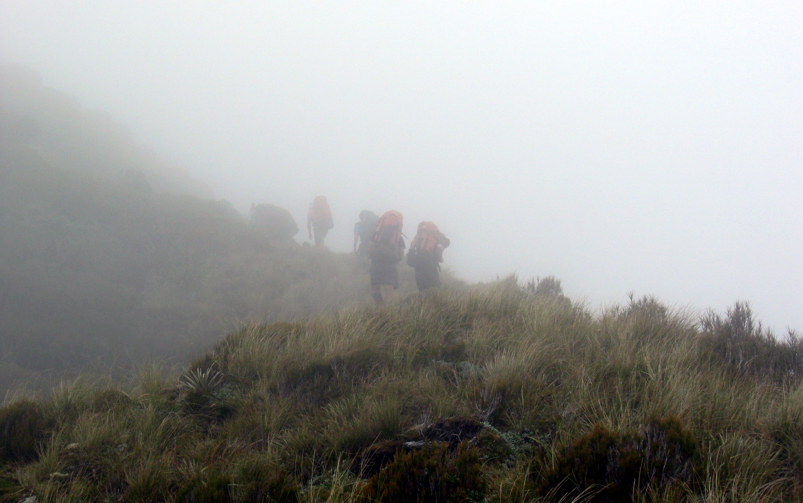
With a couple of daypacks we set off up an obvious looking route behind the hut. It was very interesting terrain. Shingle and rock rubble piled high long ago by glacial activity had weathered away on both sides, forming it into a fairly narrow steep-sided razorback ridge. Walking across it, we were all careful to stay central as the drop off on both sides didn’t look like a fun way to fall.
Stopping at the top of a rise, we sat down for a bite of scroggin. Looking down on glaciers, it felt we were pretty high up. Spotting a group of seven chamois below us confirmed the feeling. Being above chamois means you have achieved a respectable altitude. Unfortunately they didn’t stay in sight for long. Scampering at amazing pace across a rocky face then up and over a steep outcrop, they were gone in a matter of twenty seconds. It would have taken us a good couple of hours to cover the same ground.
Paul, being something of a mountain goat himself, decided a nearby peak was irresistible, and for the next half hour he entertained the rest of us by climbing it. We sat lazily in the sun watching him picking his way up to the top, betting on which route he might take. The view from the top was, according to Paul, an order of magnitude more spectacular than from where we were.

Feeling privileged to be there in such spectacular surroundings in such extraordinary weather conditions, we headed back down to the hut. It was approaching lunchtime, and still there was barely a breath of wind and not a cloud in the sky.
When we reached the hut, the sun was hot and the tarn looks crystal clear and inviting. One by one the Moa Hunters stripped off and launched into the freezing water. Apart from Lewis, the exit from the tarn was almost as rapid as the entry!
Despite a few hunger pangs, we agreed to walk some way down to the valley before breaking into our lunch rations. We started packing our gear. Paul mentioned he “smelled different”… A curious thing he put down to not being 100% the past few days. We agreed this was probably the case. That was until Chris wandered in asking if anyone had seen his polyprop top, then pointed out the one Paul had on was remarkably like his. This observation explained two mysteries: where Chris’s top was, and why Paul thought he smelled more pungent than usual.
When we had all stopped rolling about laughing, we finished our tidy up, hefted our packs on and set off down into the valley below.

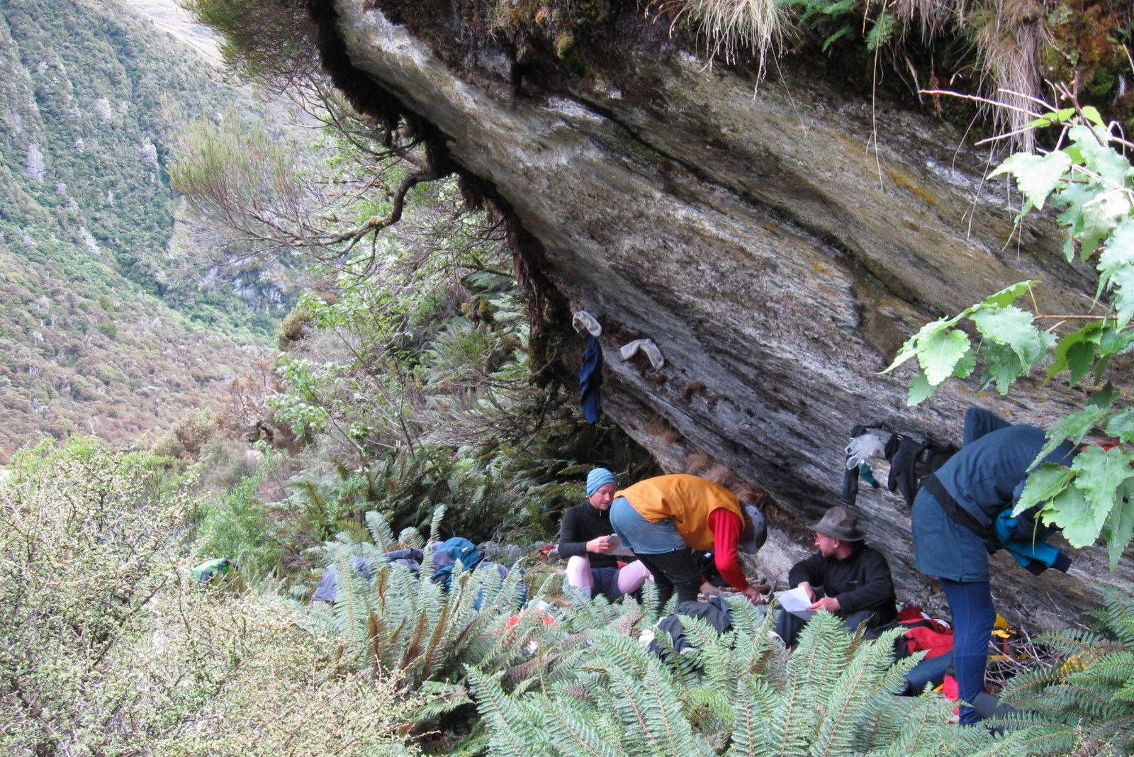
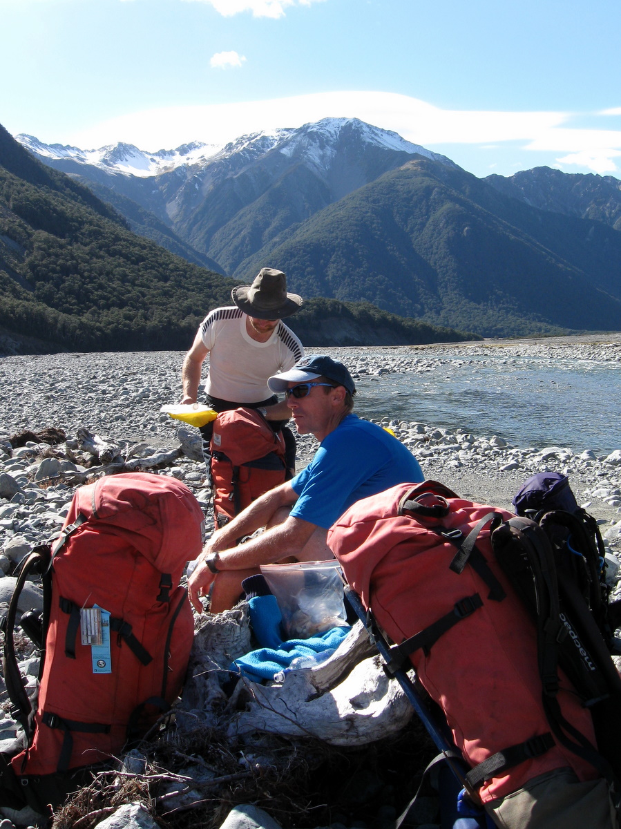
After an hour or so on the track, we called a break on the other side of a steep little ravine. It was once spanned by a bridge, but now crossing requires a sharp descent and an equally sharp climb up a narrow gut.
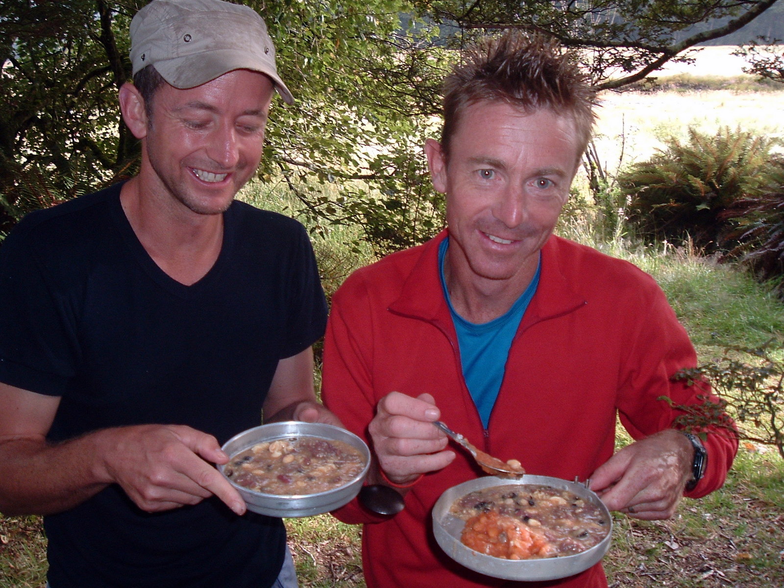
We unpacked salami, cabin bread and other goodies, sat in the sun and yarned about everything and nothing.
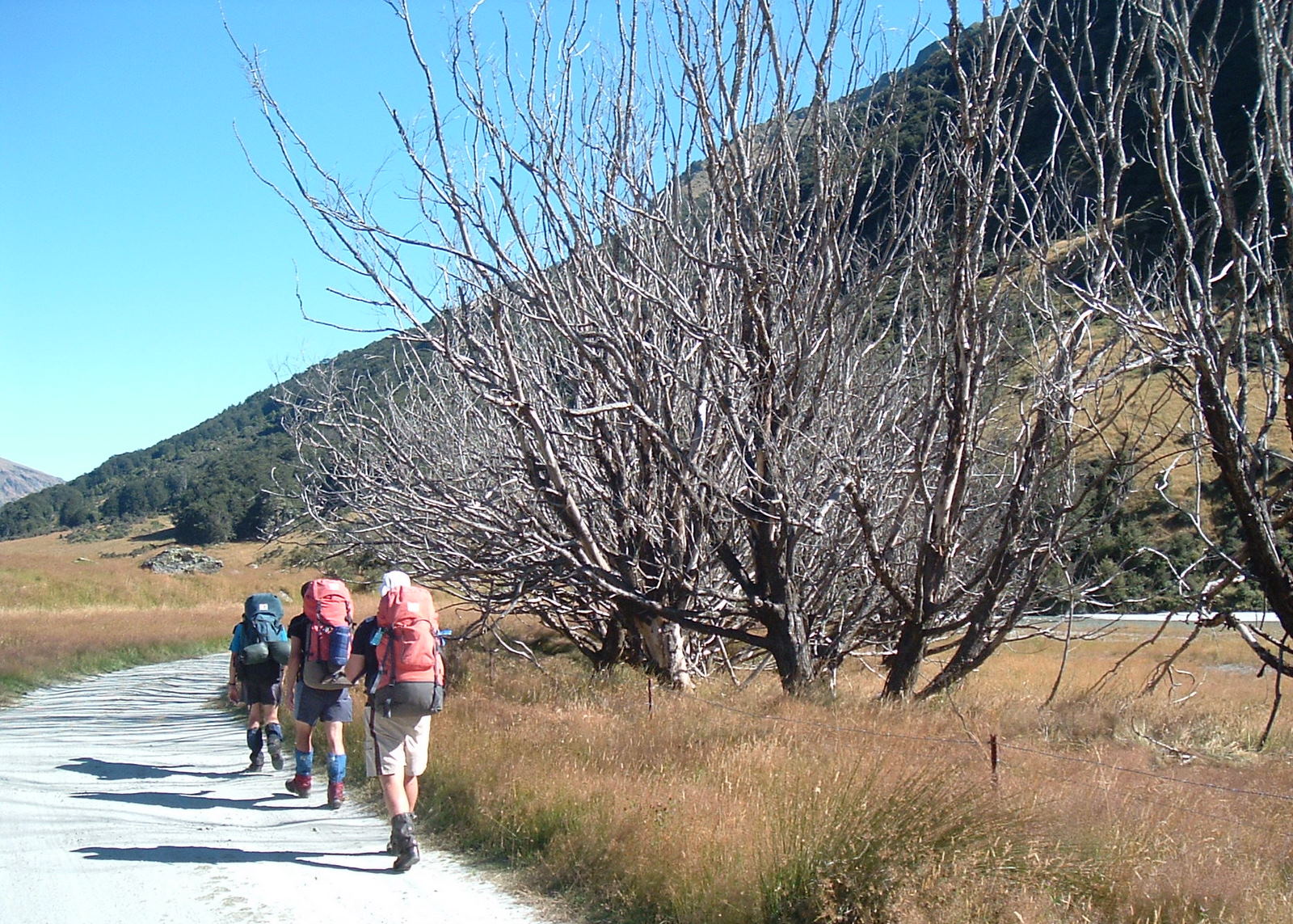
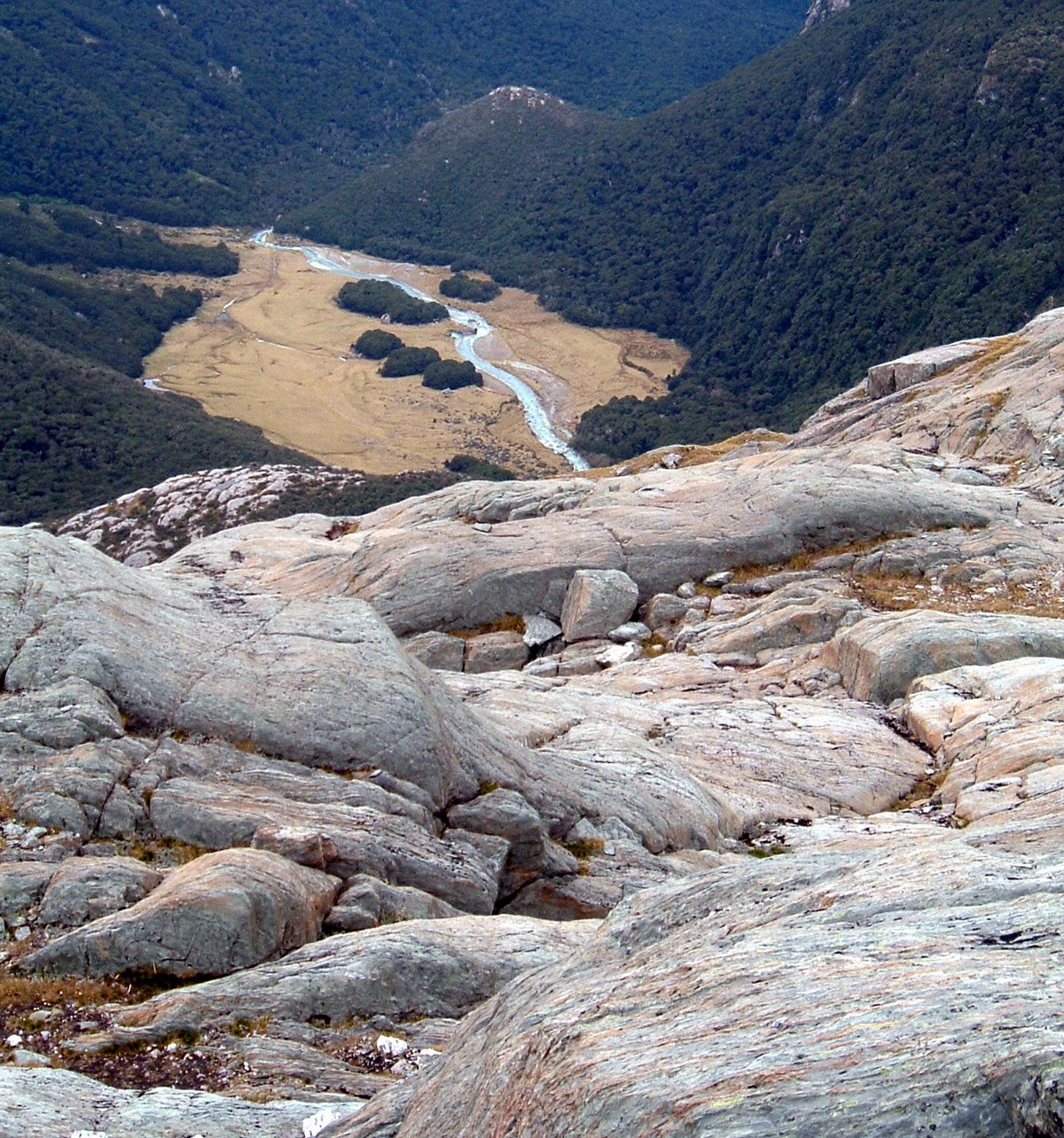
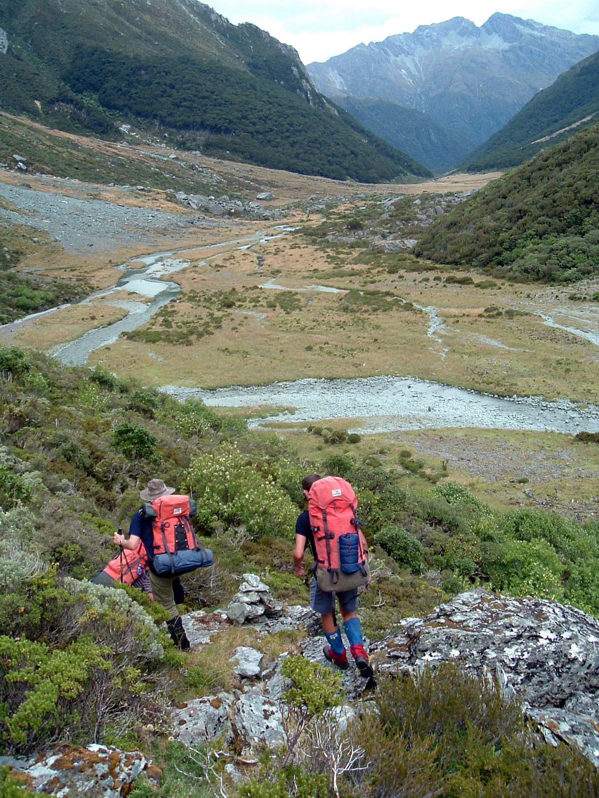
Heading down a valley you see more. You don’t have to look up far from your feet to see a long way ahead. Maybe that’s why we spotted a marker pole up the valley side on the true left of the river we hadn’t noticed on our way up the previous day. Following a fairly well walked track which sidled down the valley we made good progress.
Well, for about half an hour anyway. That’s when we came to a section of track littered with rocks left there by a large and relatively recent slip. They were difficult to spot in amongst the tall tussocky grasses and were almost always loose and unstable. The track was also very easy to lose and it was becoming generally ugly going.
It was at this point that Richard and Paul decided the high track was no fun at all and the river bed looked far more pleasant. We bashed and slid our way down the hillside scrub to the river, coming out not far from the “official” start of the track we had just abandoned. Somehow we had missed the marker pole at the bottom of the track on the way up.
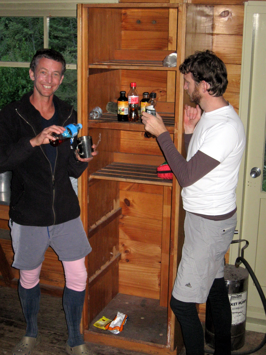
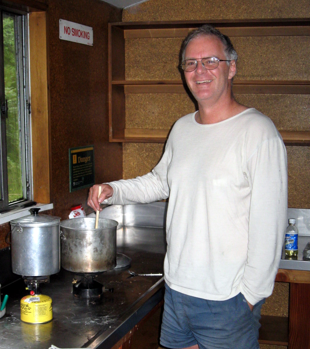
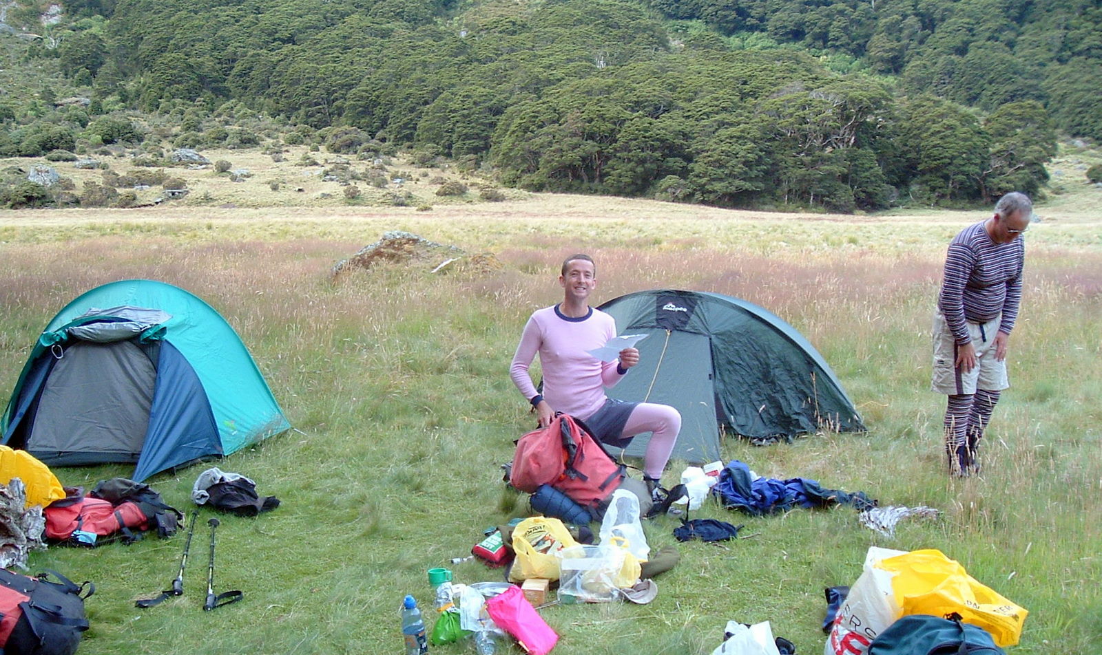
Once in the riverbed again we covered ground quickly, and by late afternoon the Moa Hunters were pulling off their boots at the Carrington Hut. A group of three others had claimed the coveted left-wing of the hut which has a log burner fire in it. We didn’t mind. Our side felt cosy enough once we filled it with the smells of cooking and had another of Magnus’s delicious whisky infused hot chocolate drinks in our bellies.
Later, Chris confessed to joining a yoga class. The rest of the Moa Hunters were suspicious his motives were just as much about viewing lycra-clad women as improving suppleness and flexibility. However, there soon followed an unexpected session of yoga stretching, contortion and other bizarre looking activities such as the Carrington Hut has never seen before.
Sitting at a table later in the evening, we were discussing the relative merits of sleep and how much is required. Chris noted that after 9 hours sleep he generally wakes up invigorated, feeling like an 18-year-old, runs outside, and can never find one! From there the level of conversation predictably deteriorated and Richard started singing the wonky donkey song…
Day 3
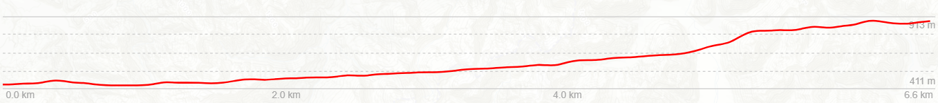
Sunday 10th April – Carrington hut to Klondyke Corner
The following morning was yet another stunningly clear crisp autumn day. Frost sparkled on the grass, and the hut in contrast to the Barker, was decidedly chilly. We all rugged up warmly as the porridge cooked. As there was no particular rush to get organised, we didn’t rush at all. It wasn’t until mid morning that we walked out the hut and struck out for the Waimakariri valley.

We bumped into two other groups as we wandered our way down. The first were a couple of experienced looking dudes heading out on a multi day expedition to the Julia Hut.
The others were a young hunter and (we assume) his girlfriend. He was decked out in expensive Swazi camo hunting kit. She was wearing a camo top, shorts and gumboots. Both had a leg of venison poking out their backpacks. It turned out she was in fact right at home in her gumboots, being a country gal from the UK, now working on a West Coast dairy farm. She assured us there’s nothing more comfortable!
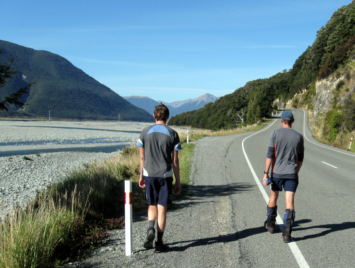
The walk out to the car was an easy stroll and we were dropping packs beside the car by early afternoon. Chris and Paul headed over to Otira to fetch the other car we had left at that end. Rather than stay and be consumed by sandflies, Magnus, Adam, Richard and Lewis started wandering up the 4WD track to the road. By the time Paul and Chris completed their return trip and caught them up, they were in the Bealey Pub a few km up the road ordering the first round of beers.
It had been a fantastic weekend. At the Dept of Conservation Office in Arthur’s Pass the ranger had remarked to Paul and Chris that he had never seen weather so clear and calm. We felt pretty damn lucky to have been there to enjoy it.