2007 – Cascade Saddle – A tale of two valleys

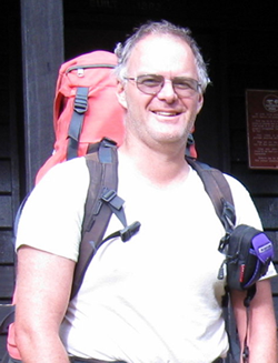
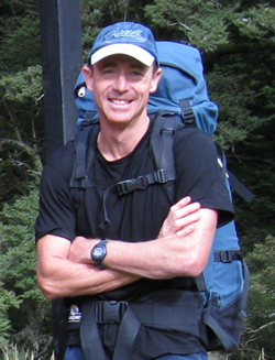
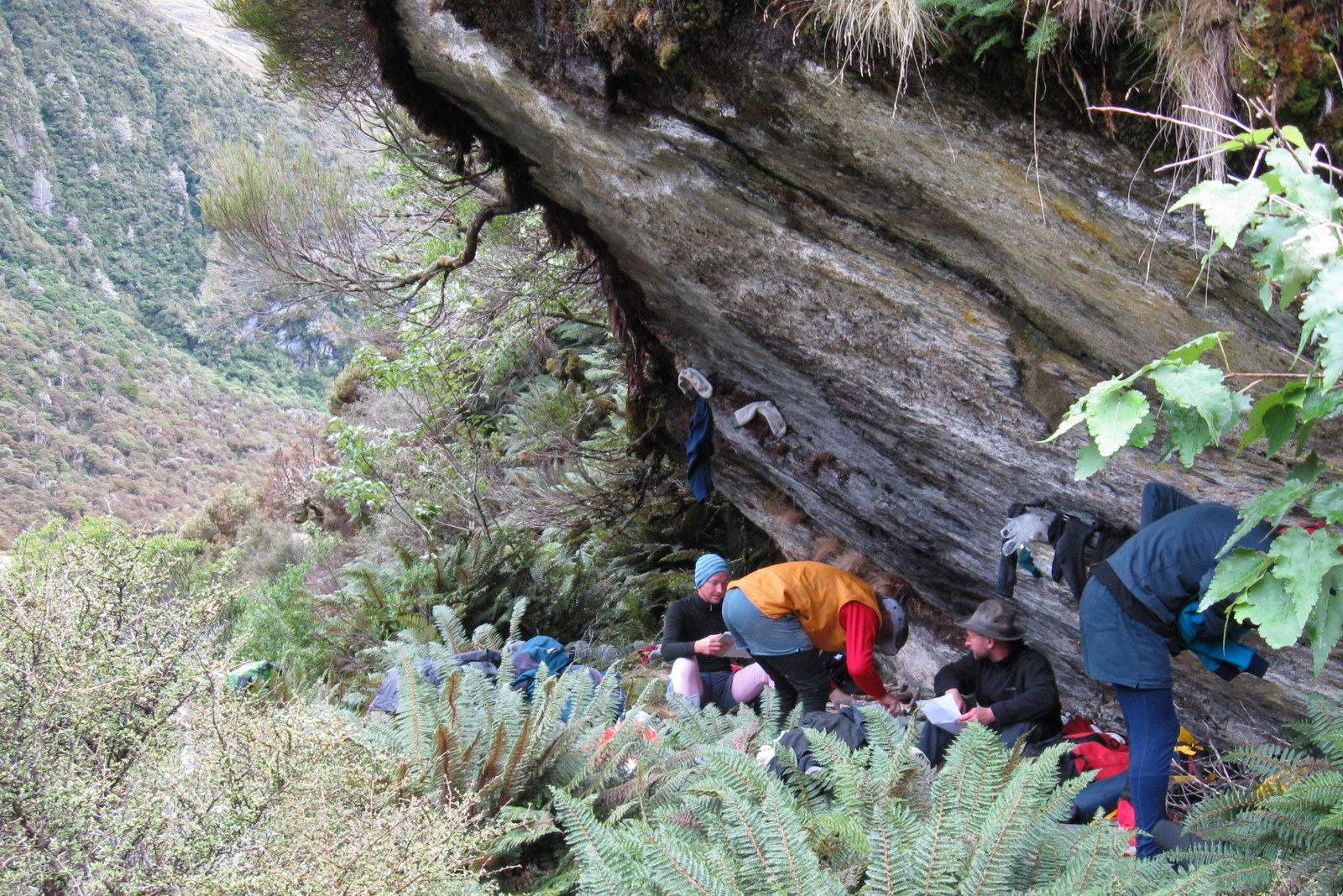
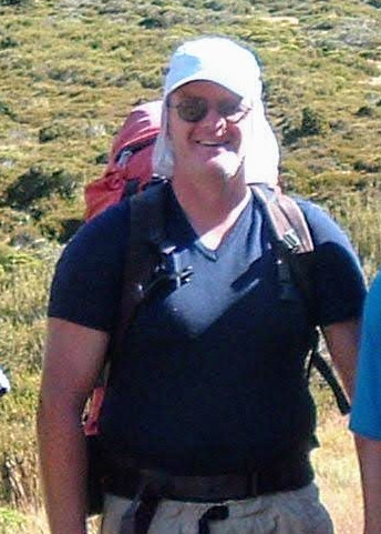
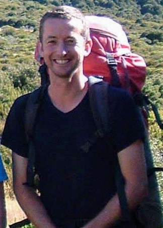
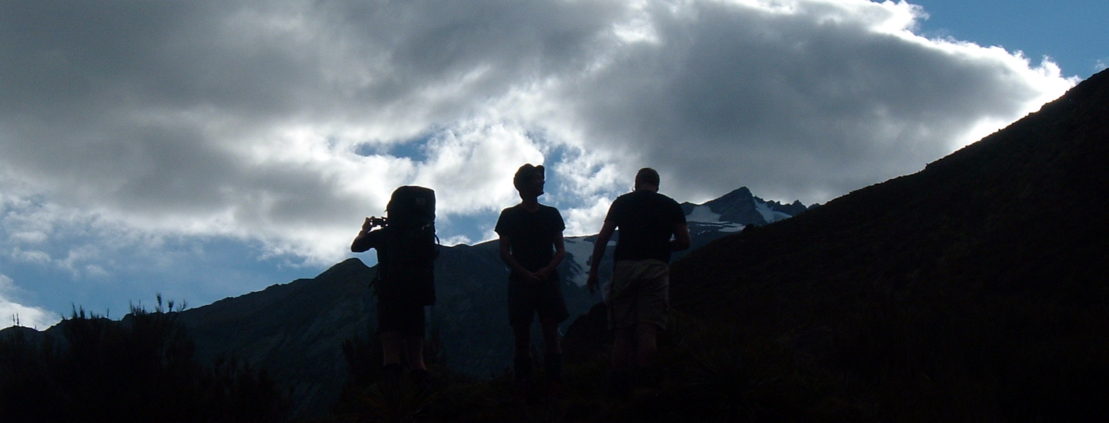
Moa Hunters on this trip:  Chris, Adam, Richard, Paul

If the Department of Conservation was to elevate another track to Great Walk status, the Rees Dart track would be a strong contender.  The Rees and Dart valleys are surrounded by spectacular mountains.  The huts are large and the tracks well graded and maintained.  If anything it is verging on slightly mainstream for Moa Hunters.  But the magnificent surroundings make it one not to be missed.
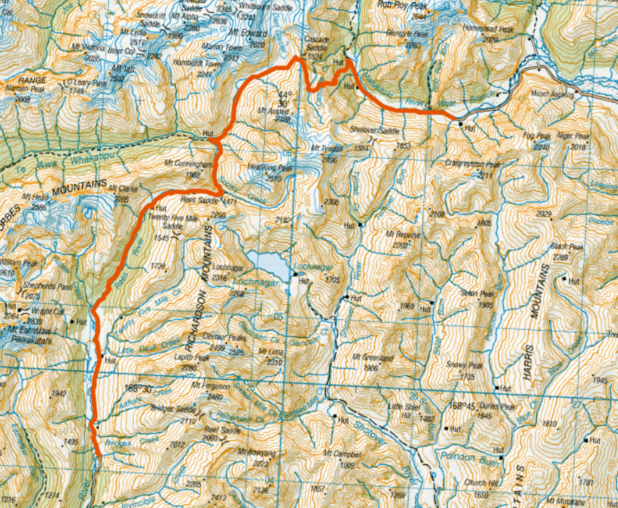
Our itinerary:

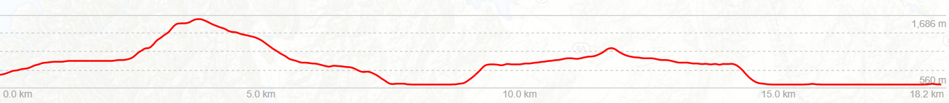
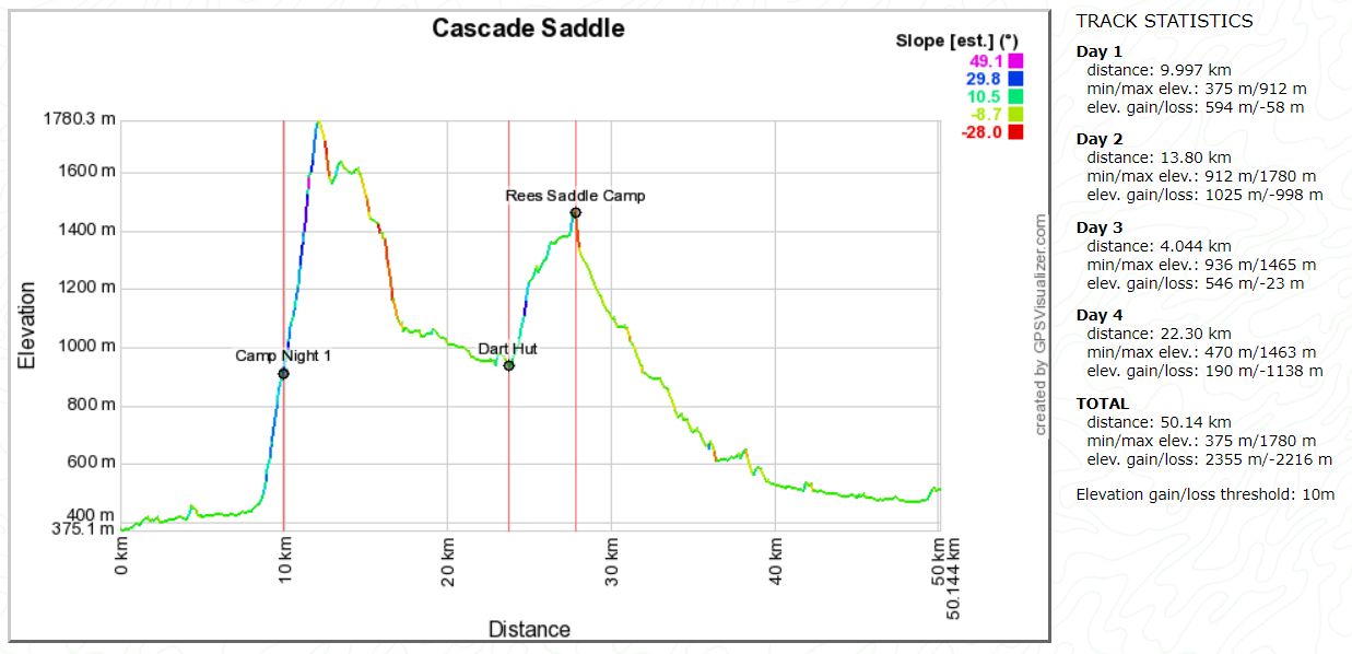
Day 1: Raspberry Creek up Matukituki, past Cascade Hut, past Aspiring Hut, camp somewhere.
Day 2: Camp to Pylon, to Cascade Saddle (1524m) to Dart Hut
Day 3: Dart Hut to Rees Saddle
Day 4: Rees Saddle to Rees Valley Road End (Muddy Creek)

Topomap of our route

Google map of our route

Google Earth flyover of the approximate Cascade Saddle route

Day 1

Saturday 24th February – Raspberry creek to campsite

Little did Sonya know when she agreed to put us up for the night at her house in Wanaka that we would be back regularly for a few years to come!  Neither did we back then, but nonetheless we still very much appreciated her hospitality and kind offer to drive us to the start of the track and collect us a few days later.

From Wanaka we were driven to Raspberry Flat, at the end of a long shingle road which follows the  West Branch of the Matukituki River.  It was a day for hats and plenty of sun block.  Even though it was only mid morning, we soon worked up a sweat as we trundled along following the track up the true right of the river.

Wandering up the Matukituki West Branch

There were numerous small creeks to rock hop across along the way.  Well, unless your name is Chris.  In which case you avoid the rocks and plunge in boots and all at the first opportunity.  “It doesn’t feel like real tramping if my feet are dry,” he assured us.

Easy walking up the Matukituki valley

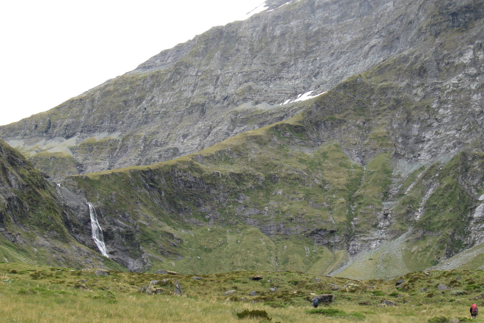
Walking up the valley was very pleasant and the surrounding mountains were more and more spectacular the deeper we got into it.  There were no nasty bluffs to grunt over.  Just a long flat grassy valley floor.  In fact it was all too easy.  Which suited Paul very well.  He was, in his own words, feeling a little under par.

When we reached a fork in the track, Paul no doubt took a couple of deep breaths.  The right fork continues gently up the valley.  The left one, which we took, launches immediately into a steep climb.

Starting at 450 metres above sea level, the climb is continuous. Towards the end, it becomes brutally steep.  At around 1780 metres there is a pylon which marks the highest point of the ascent.

As we climbed through the beech forest we kept an eye out anywhere suitable to set up camp.  The route guide mentioned there are a couple of well used flat areas beside the track.  Paul did amazingly well considering he wasn’t feeling great.  He certainly didn’t slow us down, despite feeling considerably more buggered than he normally would for the level of exertion.

Camping en route to Cascade Saddle

When we finally came upon it, the first camp site was fairly obvious, with two flat cleared areas next to the track.  We decided to stop and set-up camp for the night.  Jobs were split.  A couple of us put up the tents while Richard cranked up a burner and set about frying kransky sausages.  Strong flavoured and full of fat, kranskies are fantastic tramping fodder.  That night they tasted better than ever.

As the light faded, we sat in a small group and talked about nothing in particular.  Without a pack on his back, and a belly full of food, Paul was feeling a lot better.  While we swapped tall stories, each of us at different times noticed small movements out of the corner of an eye.  Before long we worked out what those movements were.  The campsite was alive with mice!  They were clearly seasoned campaigners and knew that a group of trampers like us were bound to leave a few tasty crumbs about.  They were also confident we were no threat, being so bold as to nip out on reconnaissance runs while we sat there watching.  Tiredness eventually overcame our interest in the little rodents, and we all wriggled into sleeping bags for the night.

Day 2

Sunday 25th February – Campsite to Dart hut
Looking down the Matukituki from the pylon
Looking down the Matukituki.

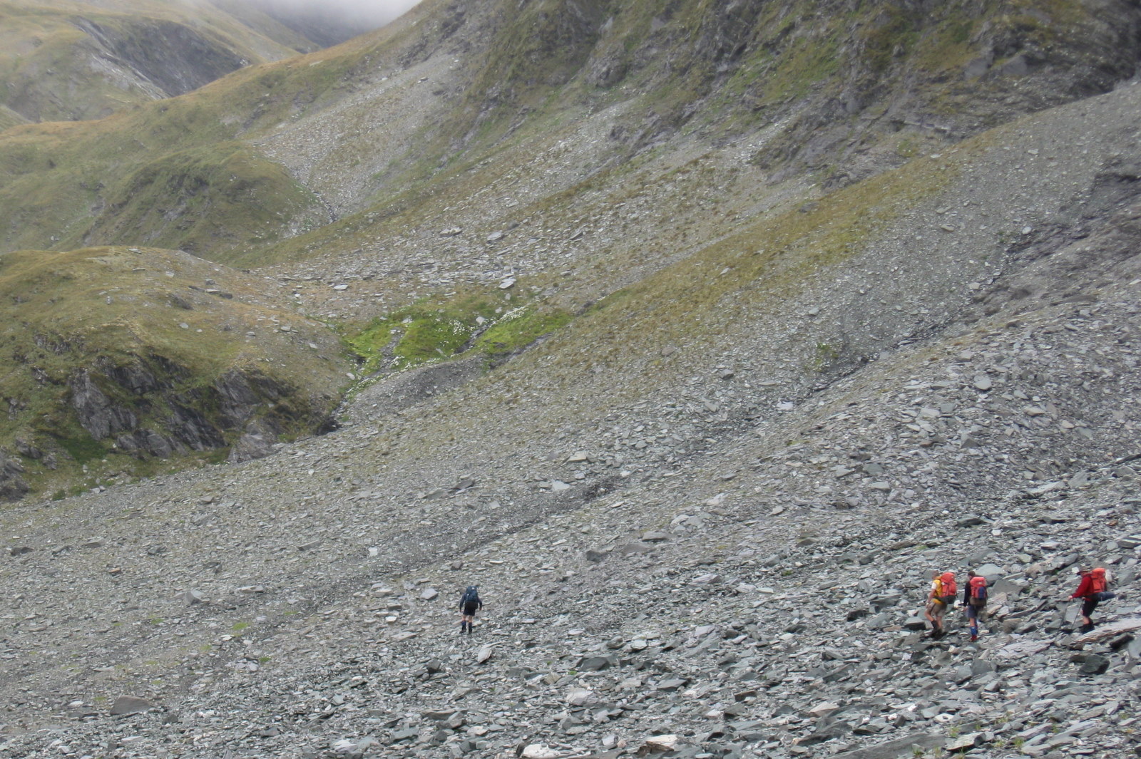
The next morning dawned overcast. After a hearty feed of porridge, we stuffed all our gear back into our packs and were ready to continue up to the pylon and Cascade Saddle.  Heading straight up a hill from the first step is always a bit of a rude awakening for leg muscles.  But it didn’t take long to warm them up and get into our strides.  We made good progress despite the track becoming steadily steeper the higher we climbed.

About 300 vertical metres from the pylon the track clears the bushline.  It is at about that point that we felt the first smatterings of rain.  From this point we did get some nice views back down the Matukituki valley we had walked the previous day.

We stopped and briefly dropped packs to pull on our jackets.  The higher we climbed, the worse the weather became.  Cresting the final rise we had our heads in the low cloud and the rain was becoming more persistent.

In sunny conditions we probably would have stopped at the pylon to enjoy the view and savour the moment.  It wasn’t sunny, and we didn’t.  Beyond the pylon, there is a descent of about 200 metres leading into a long flat basin.  It was there we found what little shelter there was and had a break for some lunch.  With a moderately strong wind blowing across the tops and cold rain falling, this particular lunch break was short, and only memorable for being generally crappy.

A wet walk down from Cascade Saddle

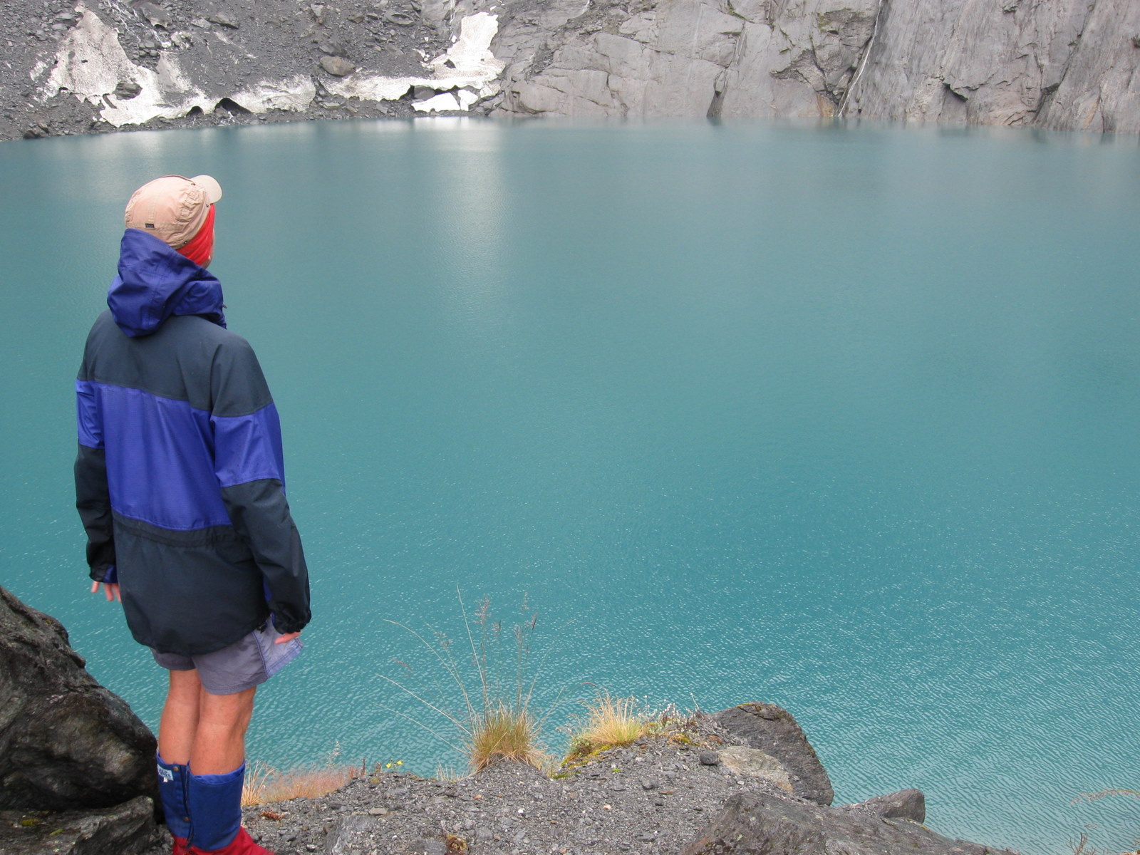
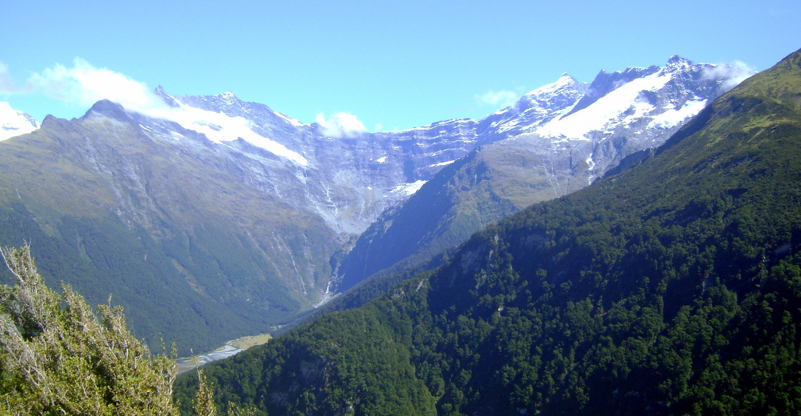
The views from Cascade Saddle are allegedly spectacular, with Mt Aspiring in particular being a highlight.  Not so on the day we walked through.  Little did we know that this would be the first of many times Mt Aspiring would cover it’s face with cloud as we passed by.

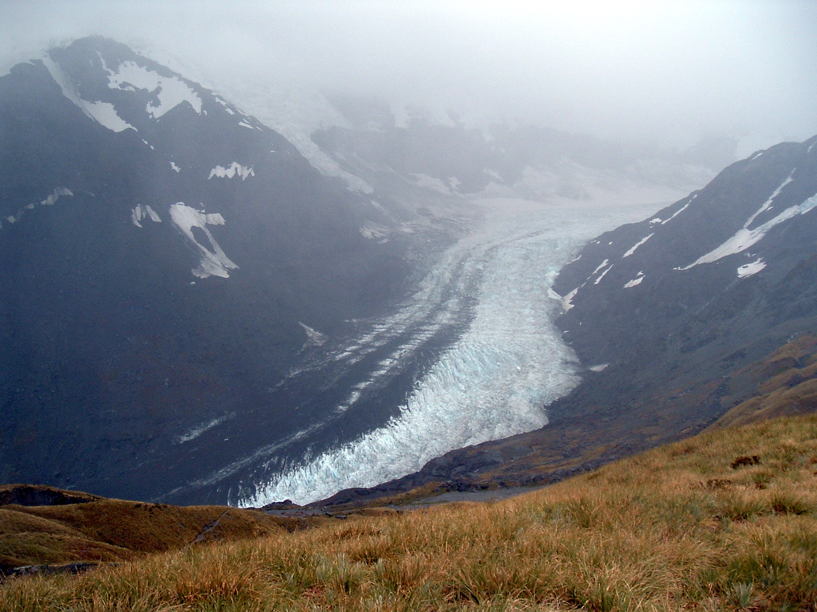
We hit the saddle soaking wet, but in good spirits and started the descent into the Dart Valley.  Despite the cloud, we enjoyed what terrain we could see.  In particular the Dart Glacier, which was a highlight of the afternoon’s exertions.

Southern tip of the Dart Glacier

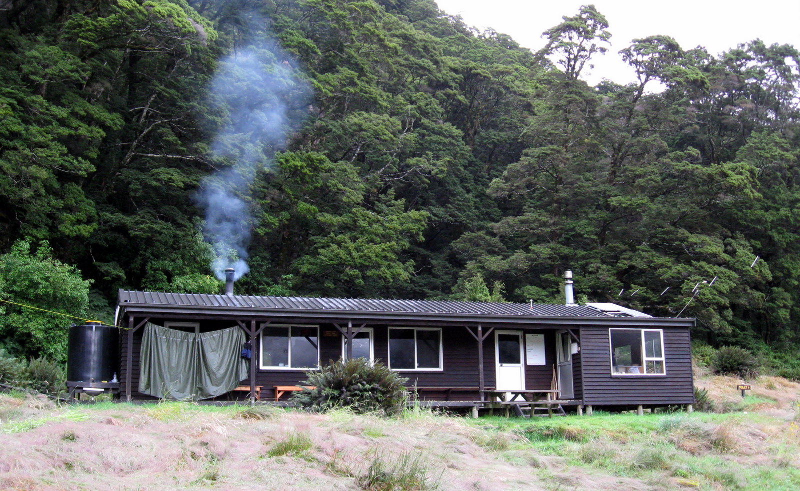
By late afternoon we were in sight of the Dart Hut.  It had rained on and off most of the day, but not enough to dampen our spirits.  That said, seeing the Hut down the valley, and imagining how warm and dry it might be inside was a welcome thought.

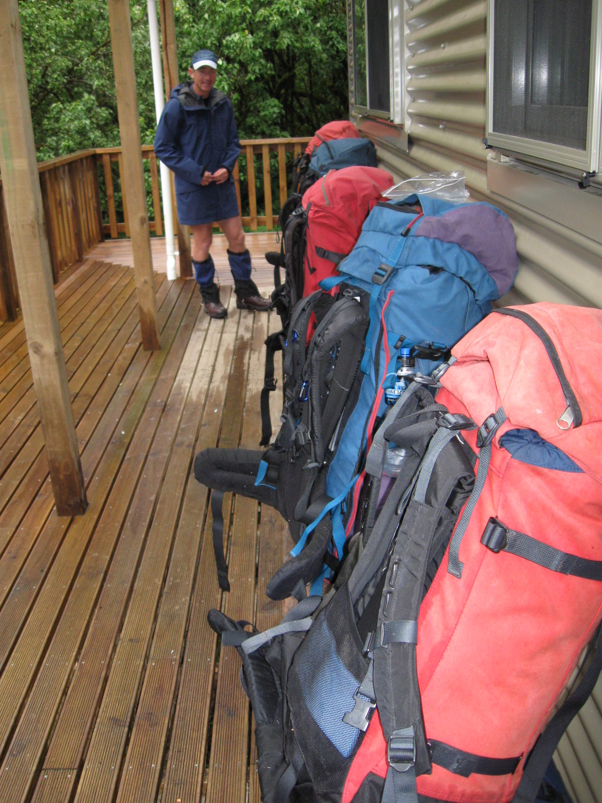
One by one we made our way across the wire swing bridge that crosses Snowy Creek, just ahead of the Hut.  From there it was a short hop skip and a jump down to the hut and an end to a damp but rewarding day on the track.  It always feels great to take off your backpack for the last time after a days walking.  We dumped them on the timber decking of the Hut, hung out jackets up and moseyed on inside for a look around.

A damp Richard contemplates the Young Hut
A damp Richard contemplates the Dart Hut

There were a few groups there already, mostly getting their food prepared for an evening meal.  There were plenty of bunks still available, but we threw our sleeping bags onto some to ensure we didn’t miss out on a bed, should there be a late influx of trampers.

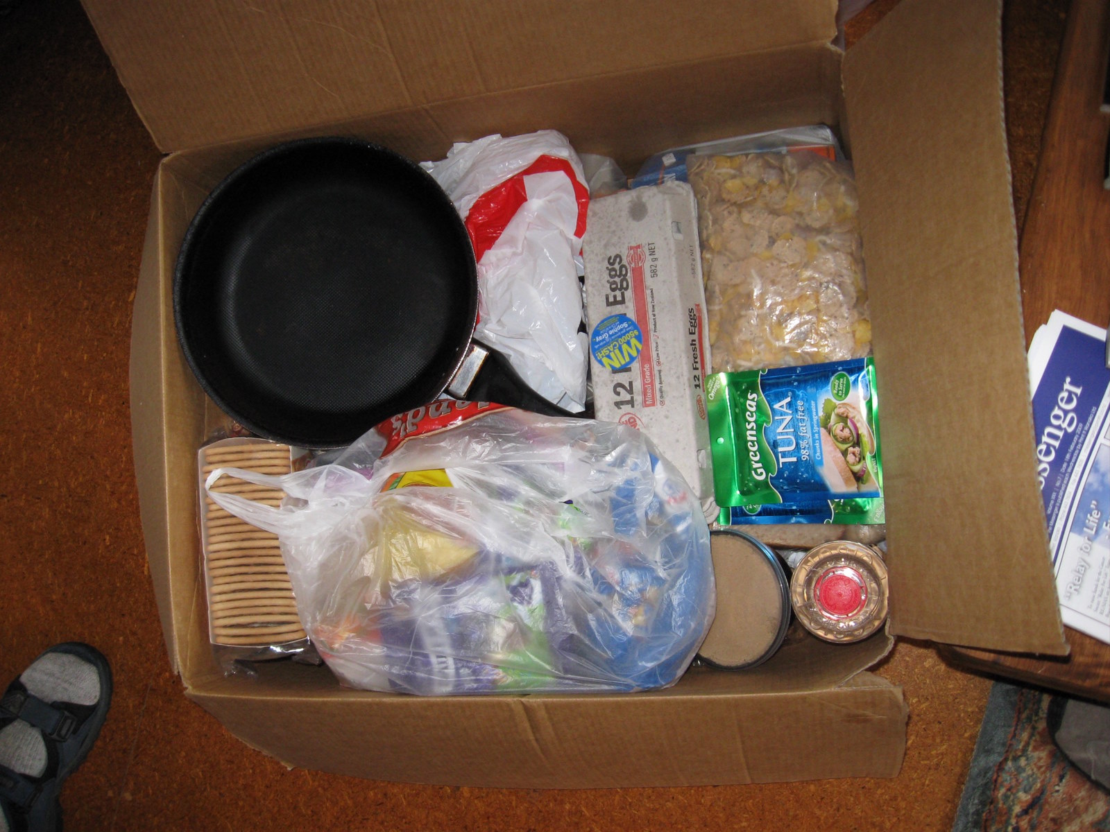
That nights meal was two courses.  A spiced up mince dish from memory, followed by cheesecake.  It turns out that making cheesecake from a packet mix is very straightforward, easily done even on a tramping trip.  Once we had everything cooked up, we found a free trestle table and began wolfing down the mince.  It was bloody fantastic.  Perhaps if you were served it at a restaurant you would raise an eyebrow.  But where we were, it was fit for a King.

We got talking to a lone tramper while we ate.  Learning he was walking the length of the South Island solo impressed us.  Starting in the South, he planned to finish in Nelson.  Given he had been eating freeze dried food three times a day for quite a few days, we offered him some cheesecake.  And a hot chocolate.  Initially he politely declined, but after some gentle encouragement, succumbed to the temptation.  His stomach didn’t know what had it it with all that rich food arriving.  We suspect nor did his head… as is the Moa Hunter tradition, a generous tot of whiskey had been added to his hot chocolate!

Mid-morning silhouettes

Day 3

Monday 26th February – Dart hut to Rees Saddle

Next morning we were on the trail again, headed for the Rees Saddle and the Rees Valley beyond.  The weather had perked up significantly and we set off with jackets stowed in the tops of our packs.

Chris exchanges pleasantries with some Kea

Walking in dry conditions made for a pleasant change and we all enjoyed the chance to take in the surrounding scenery while discussing the World’s problems and how to solve them.

A few Kea followed us up the track for a while, perhaps optimistic we might throw them something tasty.  We spent a little time wondering if they were a family group or not, and marveling at their cheekiness as they hopped about so close to us.  They were good company, but clearly didn’t feel the same affection toward us.  They left as soon as it became apparent we weren’t going to feed them.

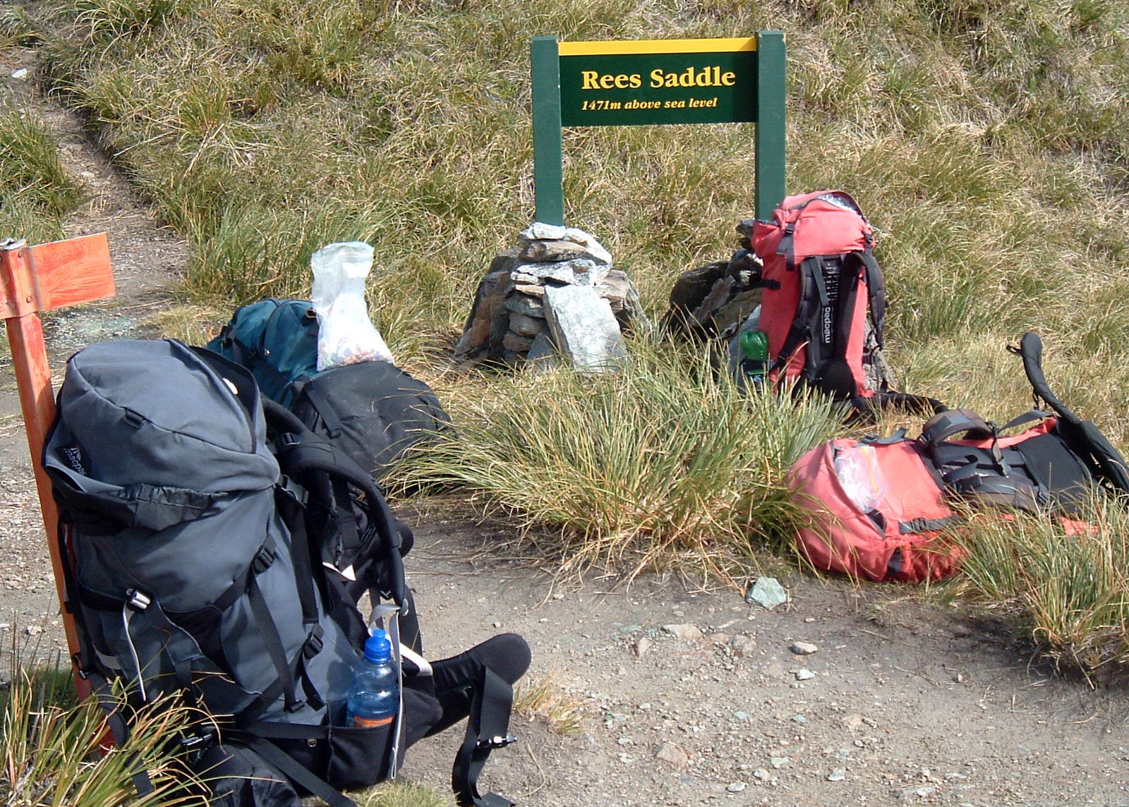
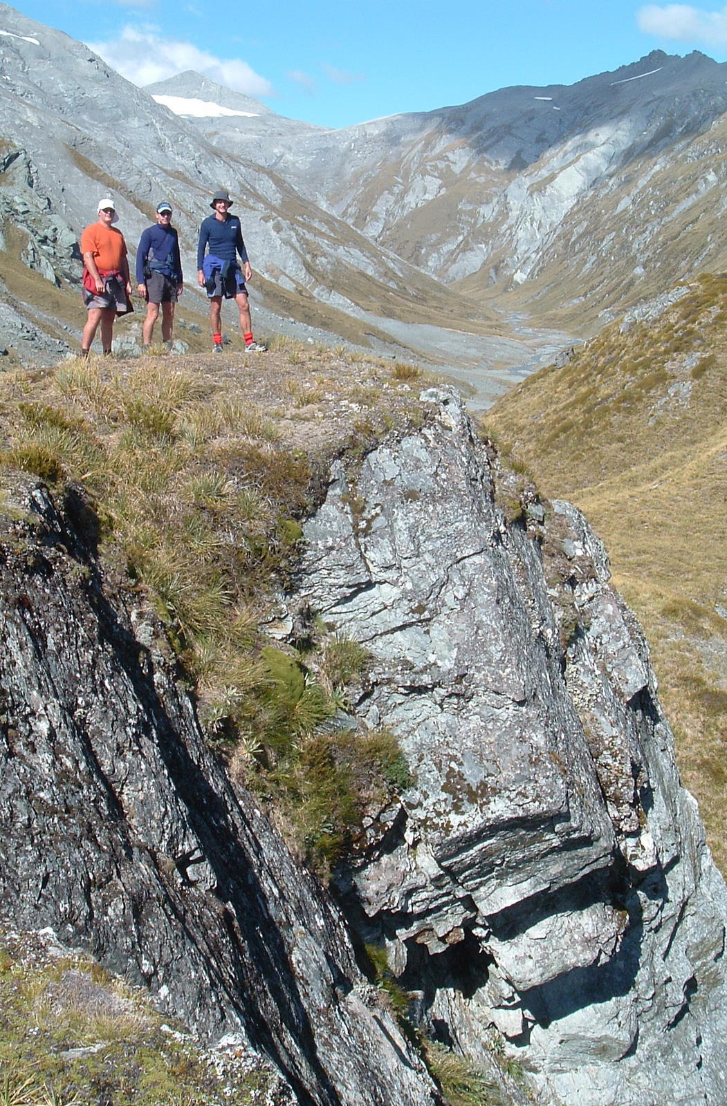
We reached Rees Saddle just before midday.  At just below 1500 metres above sea level, there were some good views to be had.  We dropped our packs and had a quick munch on some scroggin and whatever other goodies were in our pack pockets.

Packs ditched at the top of Rees Saddle

An unofficial track to our right headed up to what looked like a great vantage point.  We scrambled up and were not disappointed.  Being at the junction of three valleys, the scenery in all directions was stunning.

Paul, thinking ahead as always, came up with a suggestion.  Studying his topomap of the area, he proposed a change of plan.  Rather than carry on down into the Rees Valley, why not camp right where we were standing.  A night in tents at 1500 metres appealed to Paul.  It would leave us a long walk the following day.  But after a light day, no problem at all for four Moa Men.  We all agreed it was a bloody fantastic idea.

Our Campsite above Rees Saddle

An hour later we had put up the tents, sorted out some day packs and were heading up a ridge to do some exploring.  The higher we walked, the better the view became.  Before long our tents were small below us and the valley stretched out magnificently beyond them.

Our plan was to climb quite a bit higher than we actually got.  It turns out that what looks possible on a map and from below, can be an entirely different prospect when you reach it.  The steep rocky bluff we had considered climbing looked difficult and slightly dangerous.

Luckily, just below it was a grassy area which faced the afternoon sun.  Each finding a comfy spot, we lay back, talked a bit, and soaked up the occasion.  Being out in the mountains so far from anything and anyone else is a great feeling.  When we stopped chatting, there was not a sound except those of nature itself.

Exploring around Rees Saddle

The remainder of the afternoon was spent exploring the immediate area around Rees Saddle and rustling up some food for dinner.  A few small tarns were the only nearby water sources we found.  While tarn water is generally drinkable, it doesn’t rate highly with Moa Hunters.  We used as little of it as possible, relying on the water we had in our drink bottles in preference.

After we had eaten, the sun gradually dropped below a hill and we were left in its cool shadow.  We couldn’t help but notice that not far from us at the East end of the Rees valley was a large flat rock, bathed in sunshine.  Ten minutes later we were on that very rock, soaking up the last rays of sunshine and sipping whiskey.  It was a fitting end to a very good day in the hills.

Day 4

Tuesday 27th February – Rees Saddle to road end

With a long day ahead of us, we were up bright and early the next morning.  It had been a cold one.  There was frost on the tents.  We laid the flys out in the sun while we ate breakfast, then quickly packed our kit and kaboodle.

Heading down to the Rees Valley

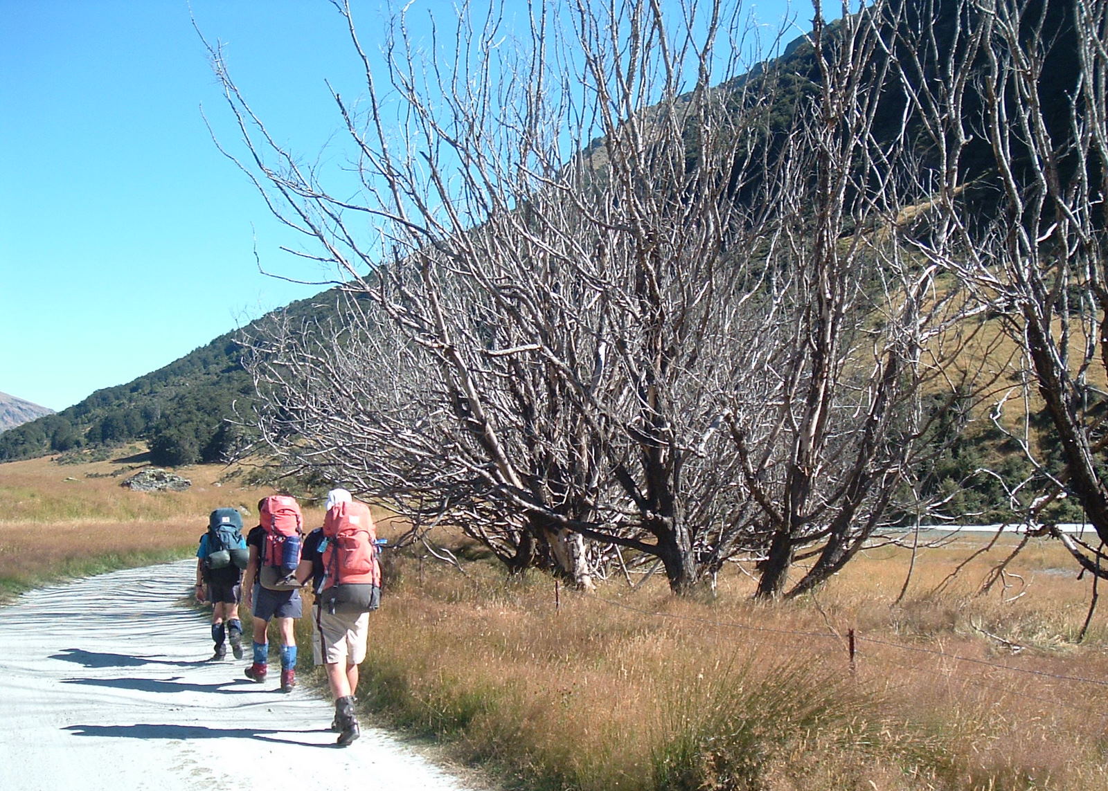
The descent from Rees Saddle into the valley was short and sharp, following a rock strewn path that cuts down the side of a steep hillside.

We quickly got into our stride and were soon making good progress from the narrow head of the valley down to the wider open grassy flats below.

As the morning wore on, any remaining cloud burned off and the temperature climbed quickly.  A benefit of walking down a long river valley is there is always water at hand.  On that day we drank plenty of it.

While on the Rees Saddle we had seen a number of helicopters and light planes flitting back and forwards, no doubt flying tourist over the spectacular glaciers and peaks in the area, then back to Queenstown or Wanaka.  There were less this day, but we still heard the occasional sound of a choppers rotors from somewhere among the surrounding mountains.

Late in the morning we reached the Shelter Rock hut and stopped there for a break and some food.  It looked like a nice enough hut, but not nearly as interesting a place to spend the night as on top of the Rees Saddle.

The Moa Hunters outside Shelter Rock Hut

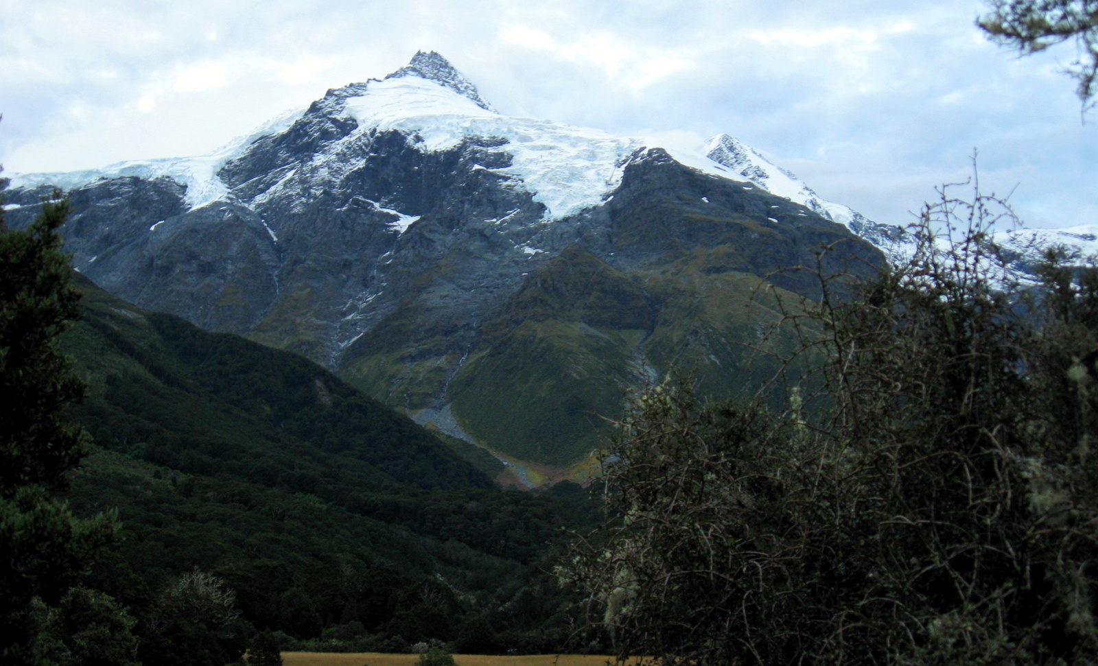
From there we carried on down the valley.  When eventually Mt Earnslaw came into view, it was a stunning sight.  Somehow it seemed compulsory that we all stop to photograph it.

Magnificent Mount Earnslaw

As the afternoon wore on, the Rees valley seemed endless.  While the mountains to our left and right changed as we progressed, the valley remained much the same.  After many hours of walking it, we were growing ever so slightly weary of the never ending grassy track.

A sundrenched Rees Valley

Reaching road end at around 6.30pm, we were all tired, but happy to be able to drop our packs and loosen the boots from around our hot feet.

Rees Valley Road End

Sonya showed up in Paul’s car to collect us.  She confirmed her status as the most awesome gal in the Deep South by producing a coolie bag containing cold beers and a couple of bags of chips.  Mt Aspiring National Park is a magnificent part of New Zealand.  There was no doubt we would return there for more Moa Hunts in years to come.

2009 – Rabbit Pass – 9.9 on the Sphincter Scale

Moa Hunters on this trip:  Chris, Paul, Magnus, Adam, Richard

We had intended to walk this route in 2008…  right up until a rather large and rather inconsiderate landslide plunged into the north branch of the Young River, creating a significant dam.  Behind which formed a significant lake.  Both of which made the Dept of Conservation so nervous that they closed the Young Valley track indefinitely.  Late in 2008, the natural dam hadn’t disintegrated, people hadn’t died, and the Valley was opened again.

Our itinerary:

Day 1:  Jetboat trip to start of Young Valley track. Walk up the Young Valley to the Young Hut.
Day 2: Cross from Young Valley to Siberia valley via Gillespie Pass.  Possible sidetrip to Crucible Lake. Stay night at Siberia Hut
Day 3: Siberia Hut to Kerin Forks Hut
Day 4: Kerin Forks Hut to Top Forks Hut
Day 5: Top Forks Hut over Rabbit Pass to Ruth Flat rock biv
Day 6: Ruth Flat to Road End

See our route on topomap.co.nz

See our route on Google Maps

Google Earth flyover of the approximate Rabbit Pass route

Sonya of Wanaka is an amazing gal.  She lets Moa Hunters sleep on her lounge floor.  She drives them to the start of the track.  She picks them up at the end of the track.  She never mentions they smell worse than a rugby club changing shed.  Sonya, the Moa Hunters agree you are simply the best.

Day 1

Sunday 22nd February – Young Valley track start to Young Hut.

Sunday morning looked good in Wanaka.  High overcast skies and a mild temperature.  Sonya was right though.  At Makarora, the start of our tramp, it was pissing down.  We negotiated a deal with the local jetboat operator and after a short wait, were transported at a great rate of knots up the Makarora river to the start of the Young Valley track.  Interesting fact: In heavy rain it takes about four seconds in a speeding jet boat to become completely soaked.

Wet packs lined up at the Young Hut

The Young Valley track winds through Beech forest, climbing steadily.  On a nice day it would be a very pleasant walk.  Unfortunately Sunday 22nd February wasn’t such a day.  Generally the first few hours of persistent rain can be shrugged off.  But by mid afternoon we had all pretty much had enough of it.  We don’t mind getting rained on in particular.  After all, once you are wet, you are wet.  What the rain does do though, is isolate you.  With a jacket hood up your peripheral vision is reduced.  The constant pattering sound of rain on it makes conversation difficult.  Sharing a joke, pointing out interesting features, or sharing idle chatter isn’t easy.

Reaching the Young Hut earlier than expected was a pleasant relief.  The newly built hut isn’t as far up the valley as the original one which was marked on our map.  The chance to ditch jackets, have a laugh and relax after a very damp day of walking was most welcome.

We were all impressed with the new hut.  Nice design feautures like insect screens on the windows and flush door jambs show that DOC are still refining their back country hut construction.

Day 2

Monday 23rd February – Young hut to Siberia Hut
A misty and wet Young Valley

Mist still clung to the surrounding hills the following morning.  Rain was falling, perhaps a little less heavily than the day before.  It wasn’t quite the day we had hoped for, but we all felt refreshed after a comfortable night, with the very large hut all to ourselves.  We were keen to get moving.

Gillespie Pass awaited us.  At 1501 metres above sea level, it would be a significant climb.  Throughout the morning we gained altitude steadily with the track being generally very walkable. It rained off and on but not continuously.  The chance to pull our jacket hoods back from time to time, tell tall stories and generally talk bollocks made time pass quicker.

As we closed in on the top of Gillespies Pass, the temperature dropped markedly.  We stopped only very briefly at the top to pull on an extra layer or two of clothing.  It was very cold and there was definitely sleet among the heavy rain drops.  Chris pulled out a bag of Cookie Time cookies from his pack and we munched gratefully on one each as we descended from the pass into the Siberia valley.

Reaching the bottom we had a quick discussion.  Crucible Lake lay to the West – a worthwhile side trip, according to Sonya.  It was agreed we would do it, without our packs.  Walking without all that extra weight on our backs felt awesome, and we made good time up the valley to the lake.  It was indeed a worthwhile diversion.  The circular lake lies behind the terminal moraine rubble of a glacier which hangs high above the lake at the top of a cliff.  Apparently in winter there are often large chunks of ice floating in the lake.  A fact that wasn’t hard to believe on the day we were there!

Crucible Lake

When we reached our packs again we had been walking more than ten hours.  There was at least two hours walk ahead to the Siberia Hut.  Carrying the packs again.  At least the rain had cleared.  It would be fair to say we were all totally and utterly knackered when we finally reached our destination.

The Siberia Hut

It was at the Siberia Hut we met a rather unique DOC Hut Warden.  Dove was his name.  From Israel, pacifist and vegetarian, he was far from a typical warden.  We immediately liked him and we think he liked us.  According to Sonya he practices transcendental meditation…  often naked, near the huts!  To put his pacifism into perspective, killing sandflies was something he did do.  But he felt guilty about it.  We spent a nice evening chatting to him while stretching our aching leg muscles.

Day 3

Tuesday 24th February – Siberia Hut to Kerin Forks Hut

The following day we had a short walk to the Kerin Forks Hut.  Almost embarrassingly short. Along a veritable highway.  It turns out the Siberia Valley is a tourist destination, with regular light plane flights landing on the grass airstrip not far from the Hut.  Tourists fly in, walk between the huts, and get a jetboat ride out.  Consequently, the track between the huts is well  maintained, beautifully graded and smooth.  Dove walked some way with us to greet a group of tourists who had just arrived in a yellow Cessna.  We bid him Shalom and moseyed along the track.

A double treat awaited us near the Kerin Forks hut.  Not only had we only walked for three hours, we had also arranged for a jetboat ride across the river.  Crossing to the hut would have been tricky given the river conditions.  The boat arrived on time, dropping us on the hut side of the river along with our big box of goodies.  Bacon, eggs, and other luxuries!  Almost worth the extortionate fee the jetboat guy charged us for the 15 second ride across the river.

Extra supplies. Mmmmmm bacon!

In case you are wondering, no we didn’t carry that frying pan out.  It is still at the Kerin Forks Hut.

Probably the most notable event at Kerin Forks was an astounding night of exhibition snoring. A group of four women were also at the hut.  They were very polite and put up with our mess and noise as we settled in.  That night shortly after we had all wriggled into our sleeping bags, a most incredible noise began.  One of the women, lying on her back we presumed, began to snore. The kind of sound that a Stihl chainsaw with a 29″ bar would produce.  Thunderous, snorting , snarling and rumbling.  We suspect she may have damaged the hut with the incredible din she produced.

Day 4

Wednesday 25th February – Kerin Forks Hut to Top Forks Hut

The next morning we packed up and wandered out into the Wilkin valley, our legs quickly soaked by the long dew covered grass.  It was a nice day.  Little wind, no rain and pleasant temperatures.  The valley was idyllic.  Most notably Jumboland – an area Paul had been looking forward to reaching, just for its name!  Apparently Jumbo was a very large horse a farmer brought into the valley to work for him.  Jumbo lived out his days in that valley.

After a good days walk, we reached the Top Forks Hut, our last stop before tackling Rabbit Pass.  The hut was busy, but not full. Situated where two river valleys meet and surrounded by mountains, most notably Mount Pollux, the setting was spectacular.  Even the long drop had incredible views.

Mount Pollux from the longdrop
Mount Pollux catches the morning sunrise

To reach Rabbit Pass, you must first make a difficult climb up what is known as the Waterfall Face.  An extremely steep grassy face which should only be attempted in dry weather conditions.  The weather report for the next day mentioned rain after lunch.  So we planned to rise with the sun and hit the track as early as possible to reach the pass before any rain.

Day 5

Thursday 26th February – Top Forks Hut to Rabbit Pass to Ruth Flat rock biv

We rose early, ate our traditional porridge with generous amounts of brown sugar on top, packed up with minimal clattering of billies , and set off.

Shortly before 11am we reached the Waterfall face.  It looked a little daunting from below.  As we stood in a group munching on scroggin, we debated the route up.  We could see the first few marker poles, but not a clear route to the top.

The waterfall face

We took a few deep breaths and started out, following the markers up the face.  It didn’t take us long at all to make our first mistake.  Heading left instead of right, we followed a false trail.  Continuing up wasn’t possible, and retracing our steps down was not easy.

Chris, having chosen a different (also wrong) route below us, suddenly slipped on loose rock.  Instantly he was sliding out of control on his side down a steep rocky chute. Very fortunately he came to a halt some metres below, where the slope leveled out.  It was a scary and sobering moment.  He had been lucky.  Elsewhere on the face, such a slip could have resulted in a significant fall and almost certain serious injury.

It was time to take stock and proceed with a lot more thought.  We regrouped and this time were careful to find the correct route before charging forward.  Richard discovered the poled route, and we moved up slowly but more surely.

The grassy face was incredibly steep.  Not vertical, but close to it.  Chris was clearly shaken by his fall, and all our hearts were pounding as we picked our way to the top.  The last few metres were particularly challenging, following a very narrow series of footholds above a sheer and steep rocky face.  I still remember Chris exclaiming upon reaching the top, “What the f*ck are we doing coming up here?!”  No-one answered.

Descending the shattered rock below Rabbit Pass

The climb has been rated a 9.9 on the Moa Hunter’s sphincter scale, a notch above Browning (Brown Trousers) Pass.  Chris is sure his was clenched so tight during the ascent that it was two days before he could fart again.

Getting down the other side of the pass was gnarly too, but considerably lower on the Sphincter Scale than the waterfall face.  A steep climb down a rocky gut led us out onto an expanse of shattered rock.  We picked our way down it on a fairly well trod path into a grassy valley.

Following the valley we descended rapidly until we reached the river flats where the terrain became more placid and the walking more even.  Ruth Flat wasn’t far ahead, and we had numerous stops studying a topo map to determine exactly where the rock bivvy we planned to spend the night at was.  After a couple of false positives, we found the genuine article.  An impressively large rock shelter with a resident sandfly population of approximately 403 billion.  All hungry.

The Ruth Flat rock biv

Enormous quantities of Paul’s possibly radioactive, certainly diesel infused, super tropical strength insect repellent were used right up until night fell. Chris chose to sleep under a nylon fly which gave us all a little more space to wriggle.

Day 6

Friday 27th February – Ruth Flat to Road End

Blue skies greeted us the following morning.  We packed up at a leisurely pace following our standard breakfast fare and wandered out of Ruth Flat, following the Matukituki East Branch toward road end.  The only significant feature between us and that destination – the Bledisloe Gorge.

After grunting and sweating up the side of a steep bluff for more than an hour, we understood why Sonya referred to it as the Bloodyslow Gorge.  That said, the exertions were well worth it.  After many trips into the area, we finally got a clear view of Mt Aspiring.  A breathtaking sight.

Awesome Mt Aspiring and friends
Swingbridge across the Matukituki

The descent down the Bledisloe Gorge was just as steep as the climb.  Not nice for those of us who dislike descents, especially on the last day of a walk!

A couple of hours later we hit road end.  It had been an excellent expedition.  All kinds of weather, danger, surprises.  Something for everyone.