2024 – Travers Sabine v2 – Moss Pass

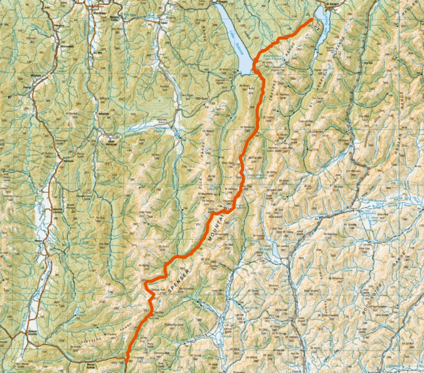
In 2024, for just the second time in Moa Hunting history, we ventured out in April rather than our usual January or February. Hoping moa prefer cooler conditions, we made our way to the beautiful Nelson Lakes to see if we could spot one.

Walking the hills in autumn was predictably a little more damp and cold than we were used to, but also offered up a few nice surprises…

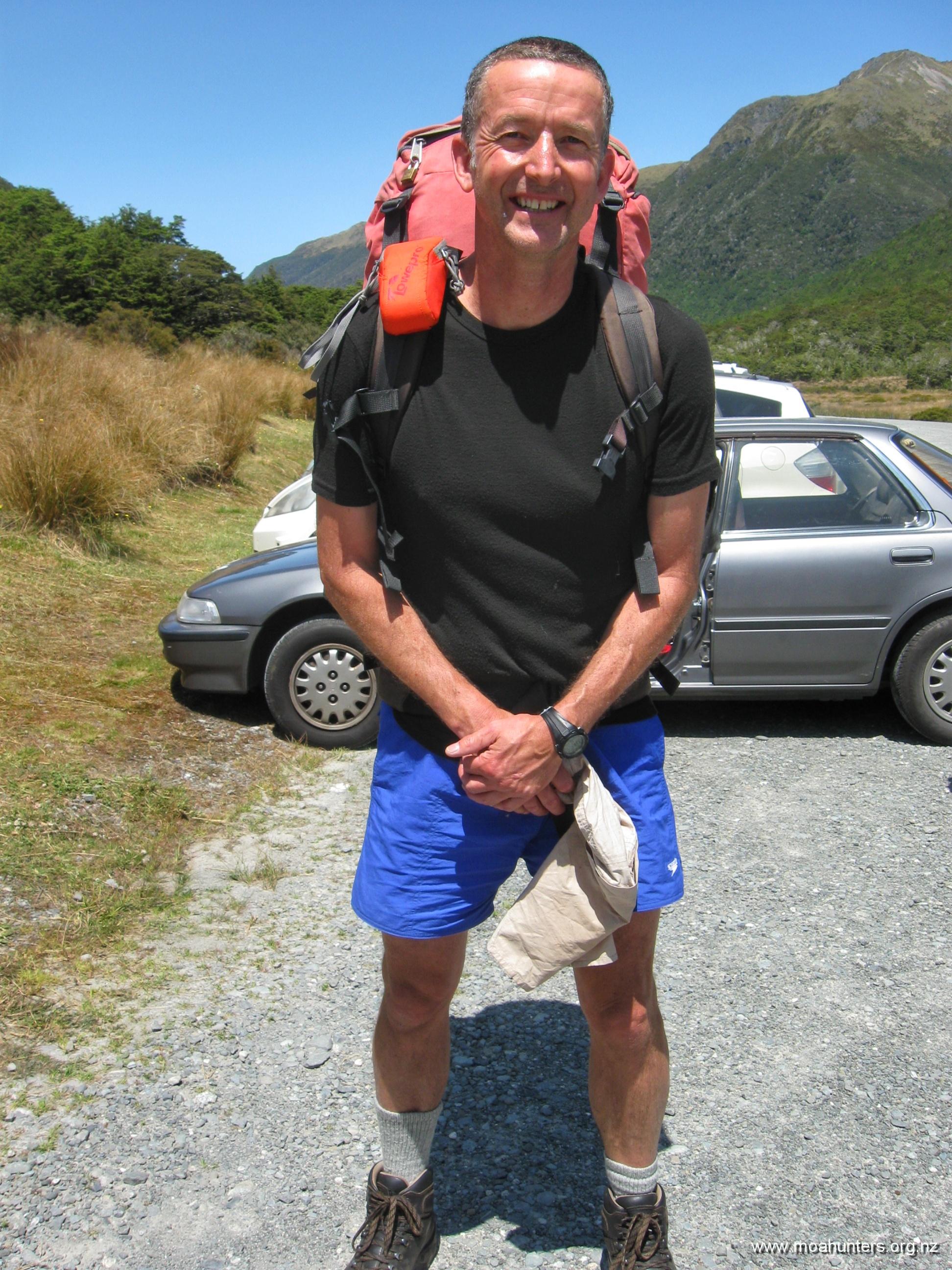
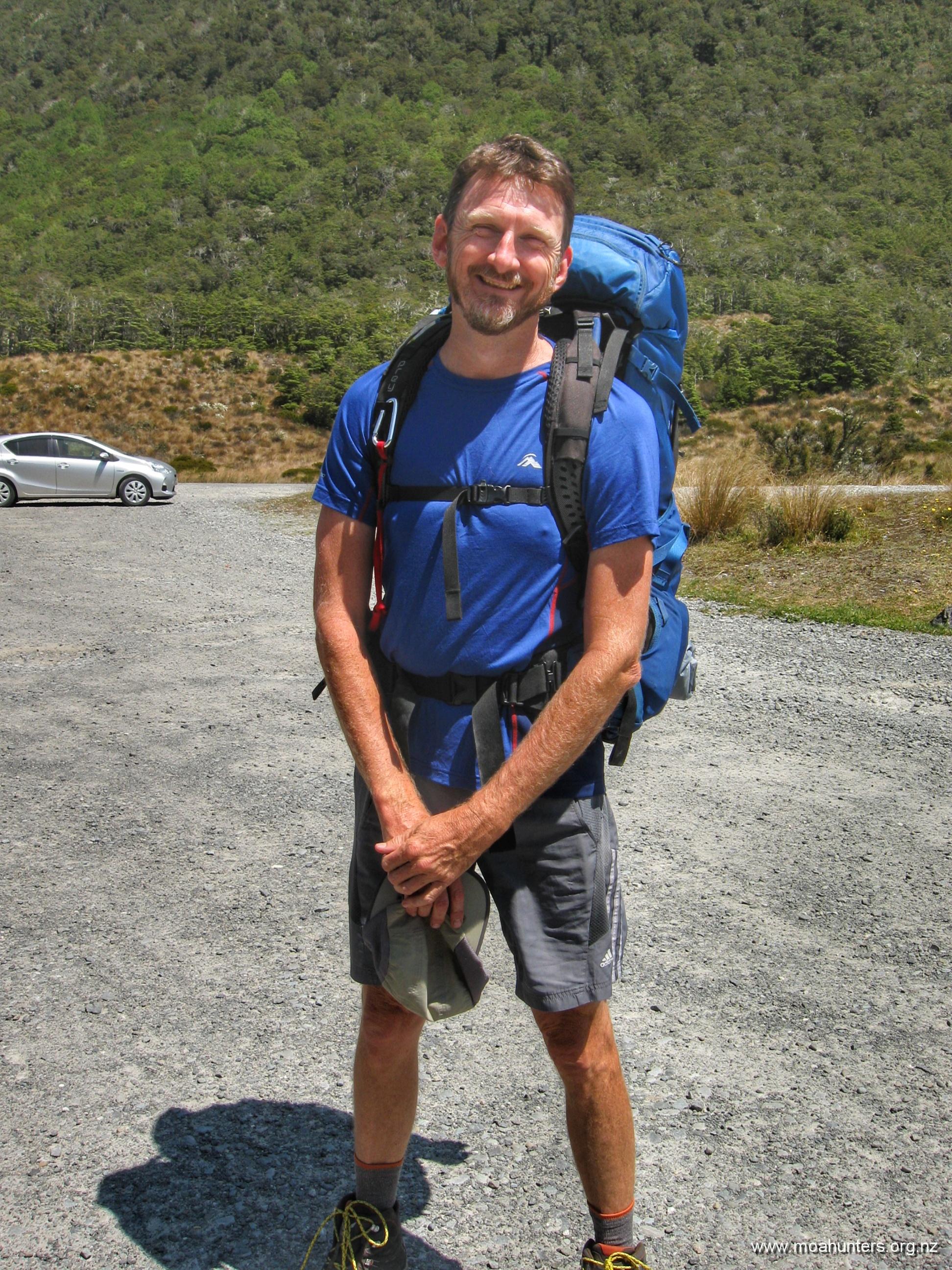
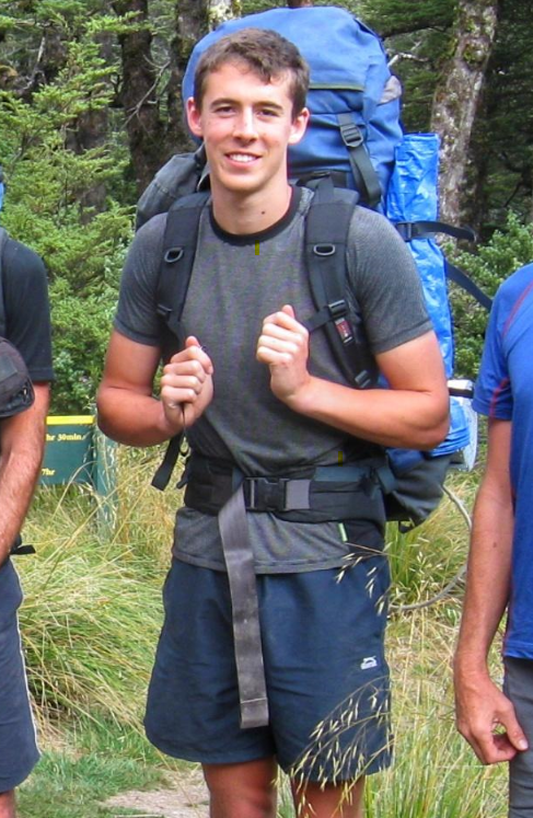
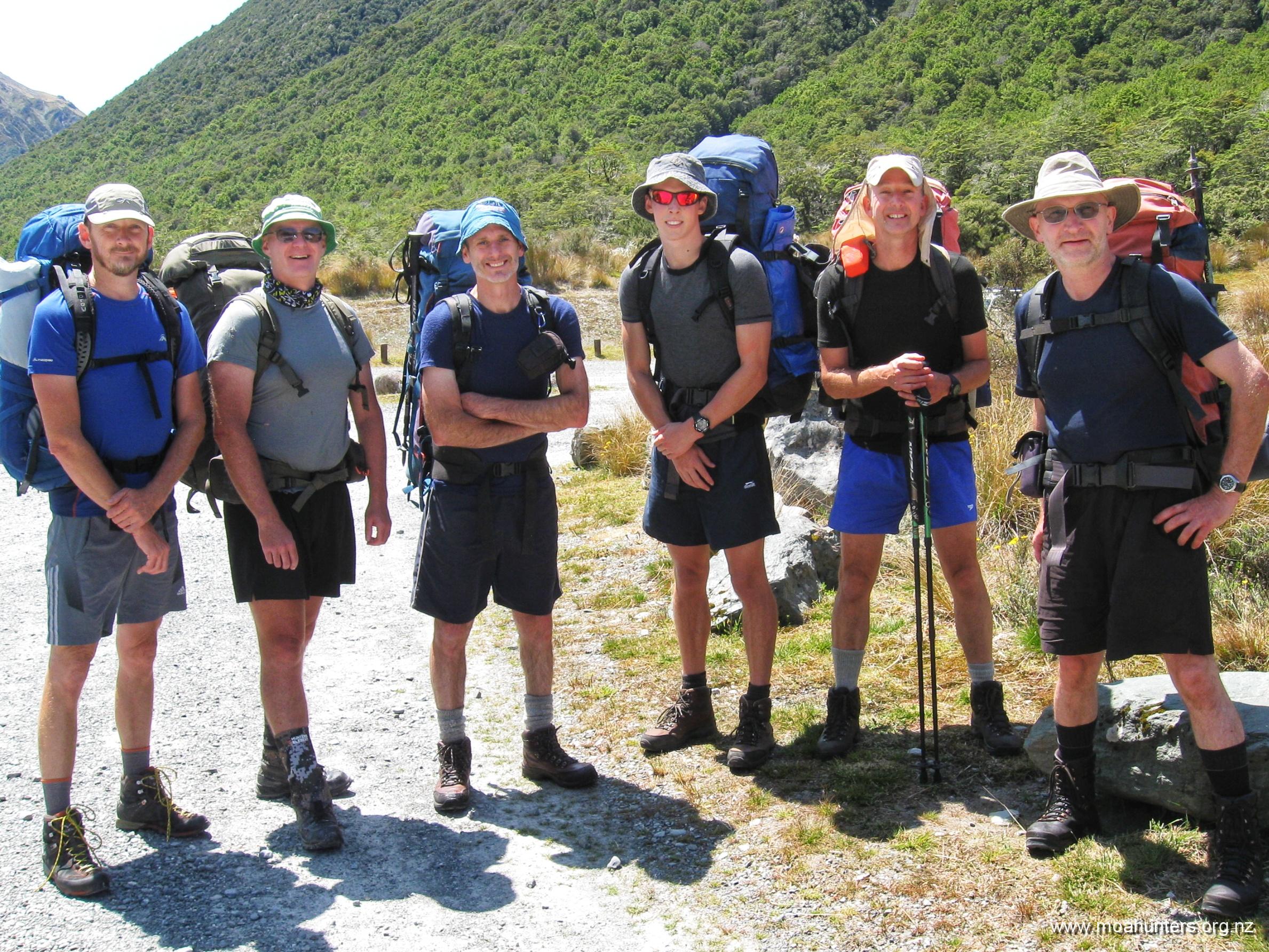
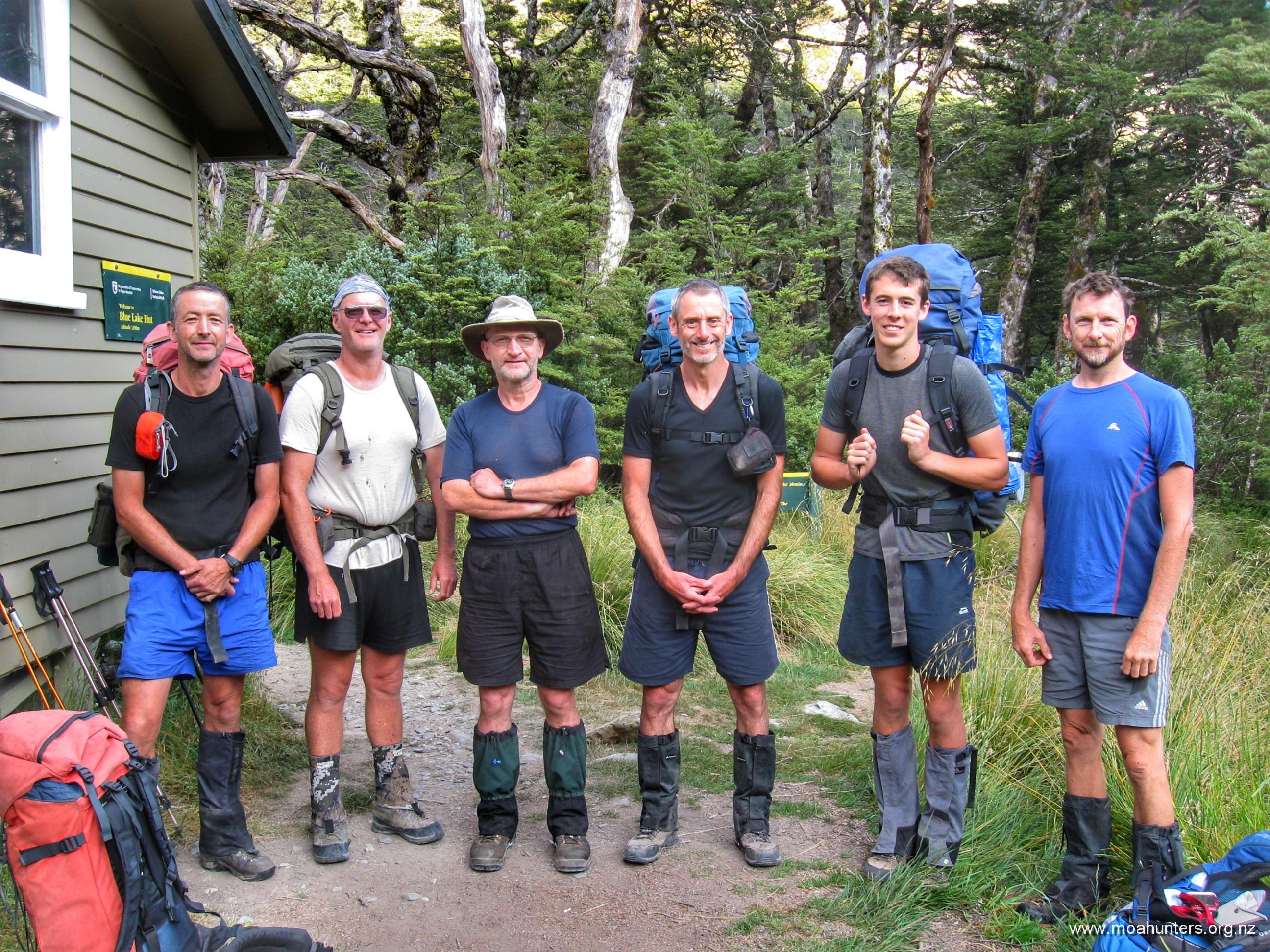
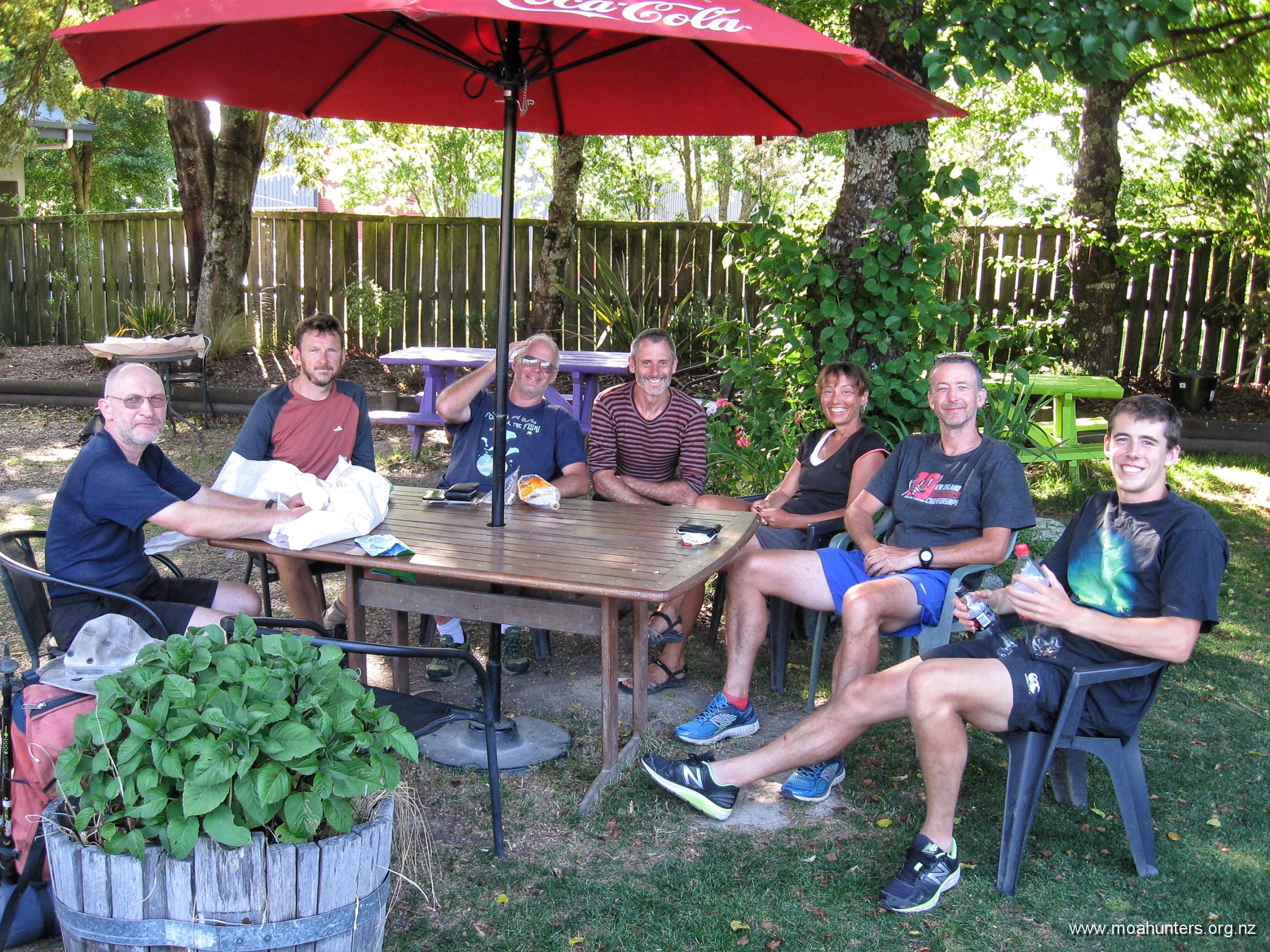
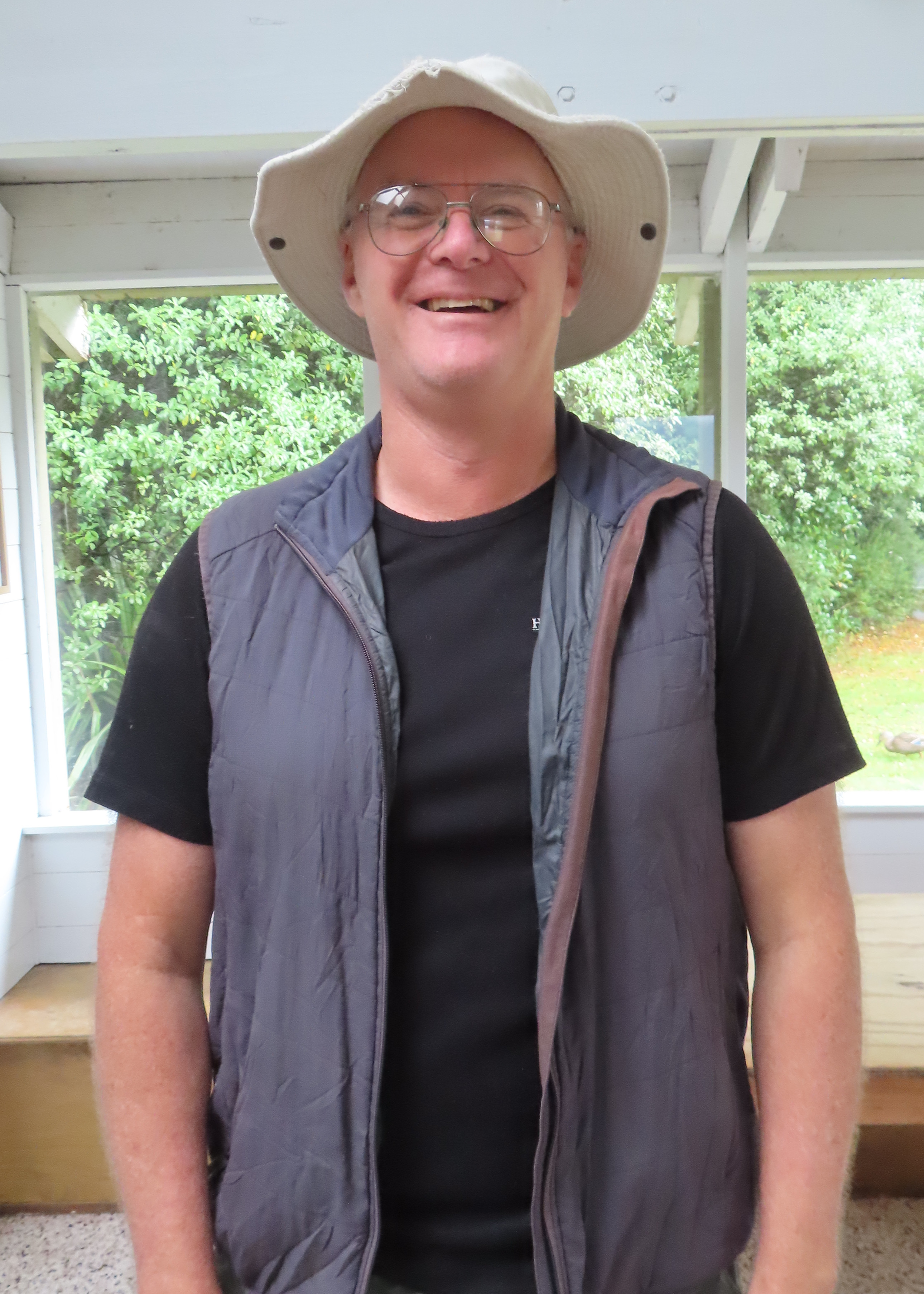
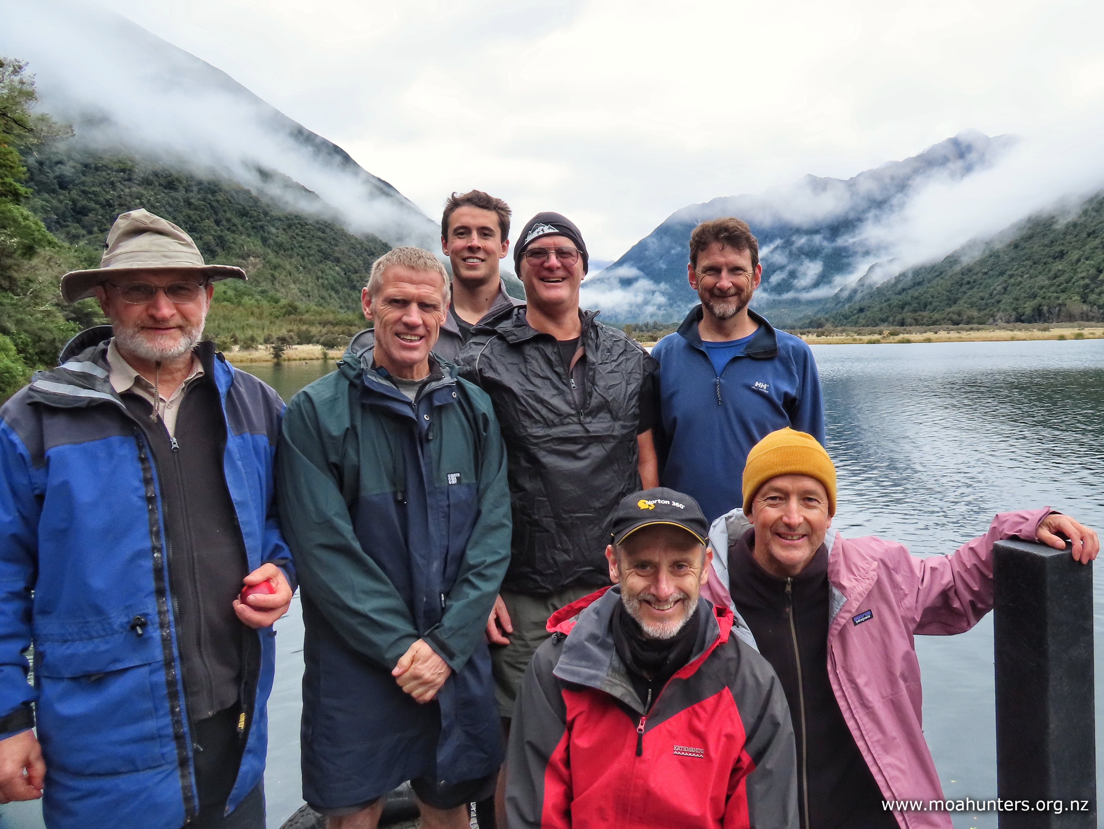
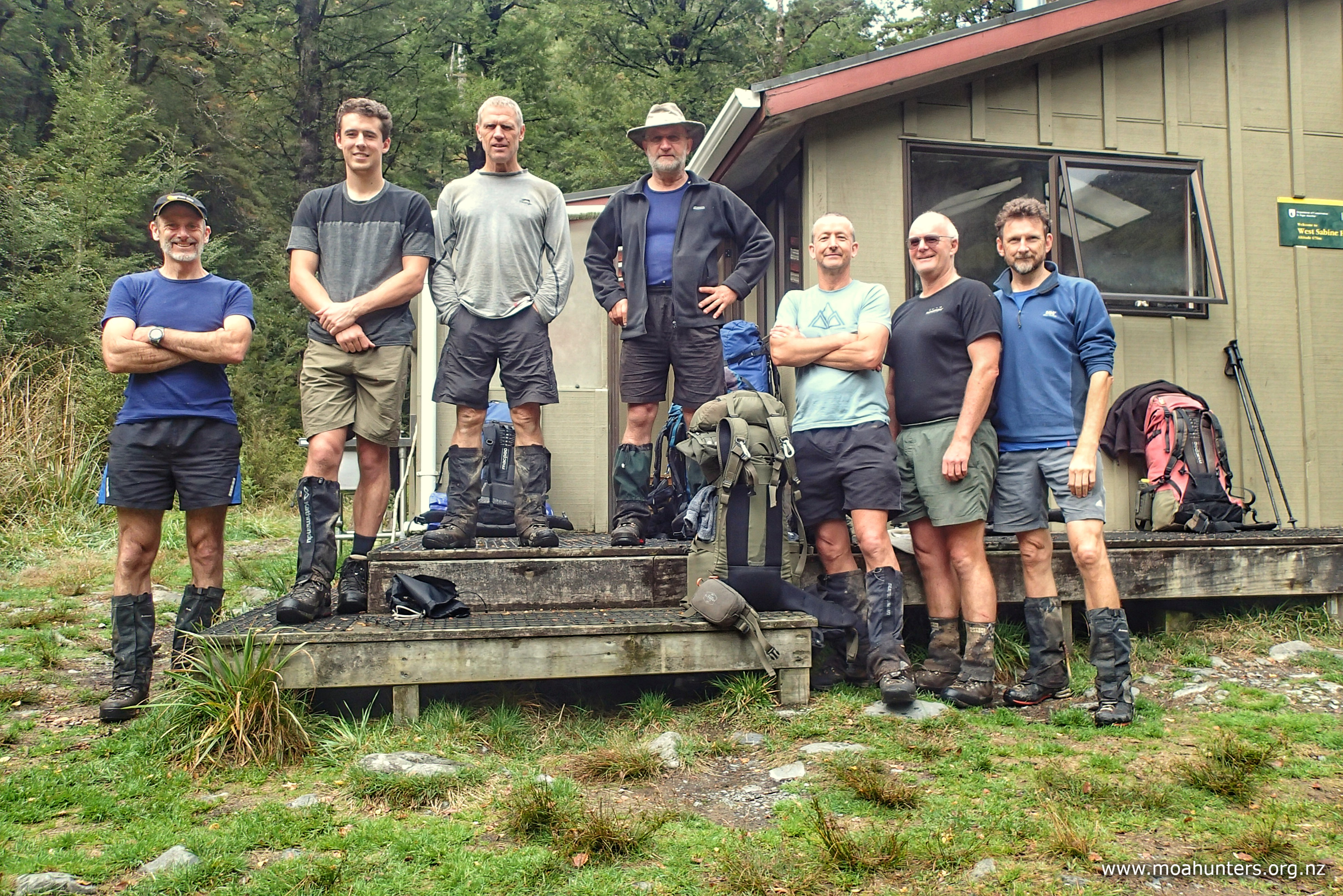
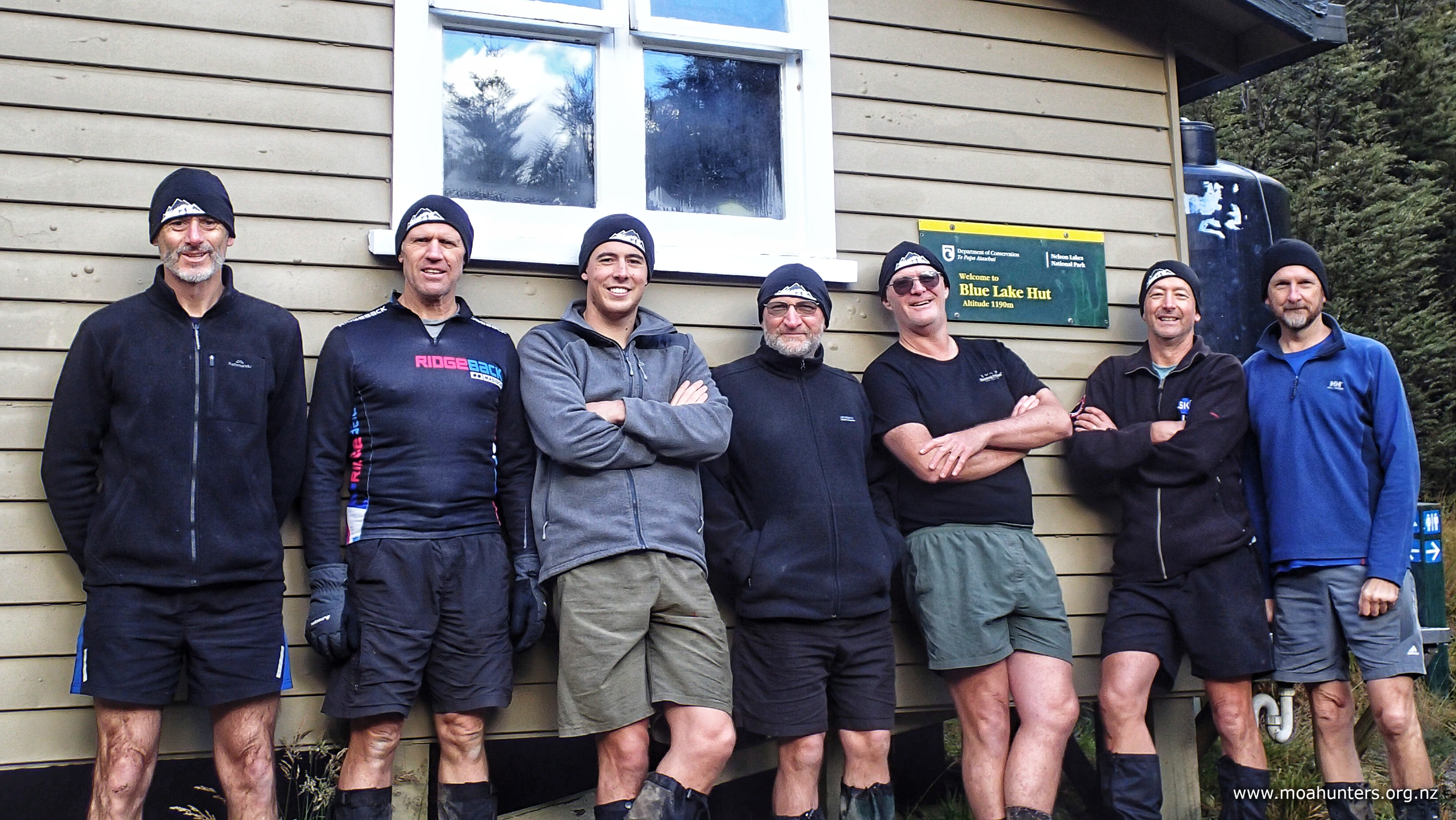
Moa Hunters on this trip:  John, Lewis, Luke, Magnus, Paul, Adam, Chris.

The Trip:

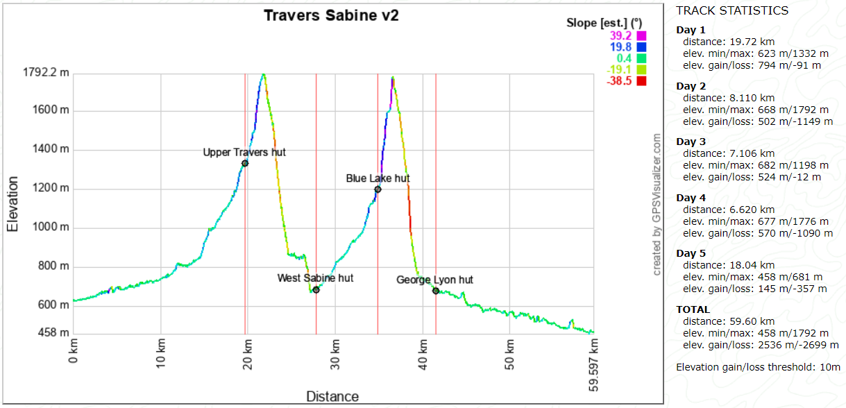
Day 1: Lakehead hut to Upper Travers hut
Day 2: Upper Travers hut to West Sabine hut
Day 3: West Sabine hut to Blue Lake hut
Day 4: Blue Lake hut to George Lyon hut
Day 5: George Lyon hut to D’Urville hut

Topomap of our route

Google map of our route

Day 1

SaturDay 13th April – Lakehead hut to Upper Travers hut

Despite this trip starting and finishing at the southern end of two different lakes, transport logistics were surprisingly straightforward.

Lake Rotoroa Water Taxi have accommodation suitable for large groups snugged in the small settlement at the top of Lake Rotoroa. Six of us had a comfortable stay there on Friday night. Bright and early next morning, we drove the 40 minutes to St Arnaud to meet Magnus for an over-indulgent fry-up breakfast at the Kerr Bay campsite.

With our bellies bulging with way too much deliciousness, we boarded the Lake Rotoiti Water Taxi, bound for Lakehead jetty at the southern end of Rotoiti.

From there we would spend the the next five days walking the Nelson Lakes, our final waypoint being the D’Urville hut jetty, where Dudley from Lake Rotoroa Water Taxi would pick us up. Once back at the north end of the lake, Charlene would shuttlebus us back to St Arnaud. Easy peasy, lemon squeezy!

But hold on! Back up the truck a little…. all that is getting way ahead of ourselves.

Let’s turn back time to Saturday morning, when the affable Hamish from Lake Rotoiti Water Taxi’s welcomed us onto his boat and wedged our seven heavy packs into the luggage area at the bow.

It took just twenty minutes for him to run us down the lake to the Lakehead jetty. We all soaked up the surroundings, enjoying the scenery and Hamish’s commentary along the way.

Standing on the jetty, we all felt the tingle of anticipation. Another moa hunt was beginning. Five days in beautiful back-country Aotearoa awaited us. If you are a regular tramper, you know that feeling.

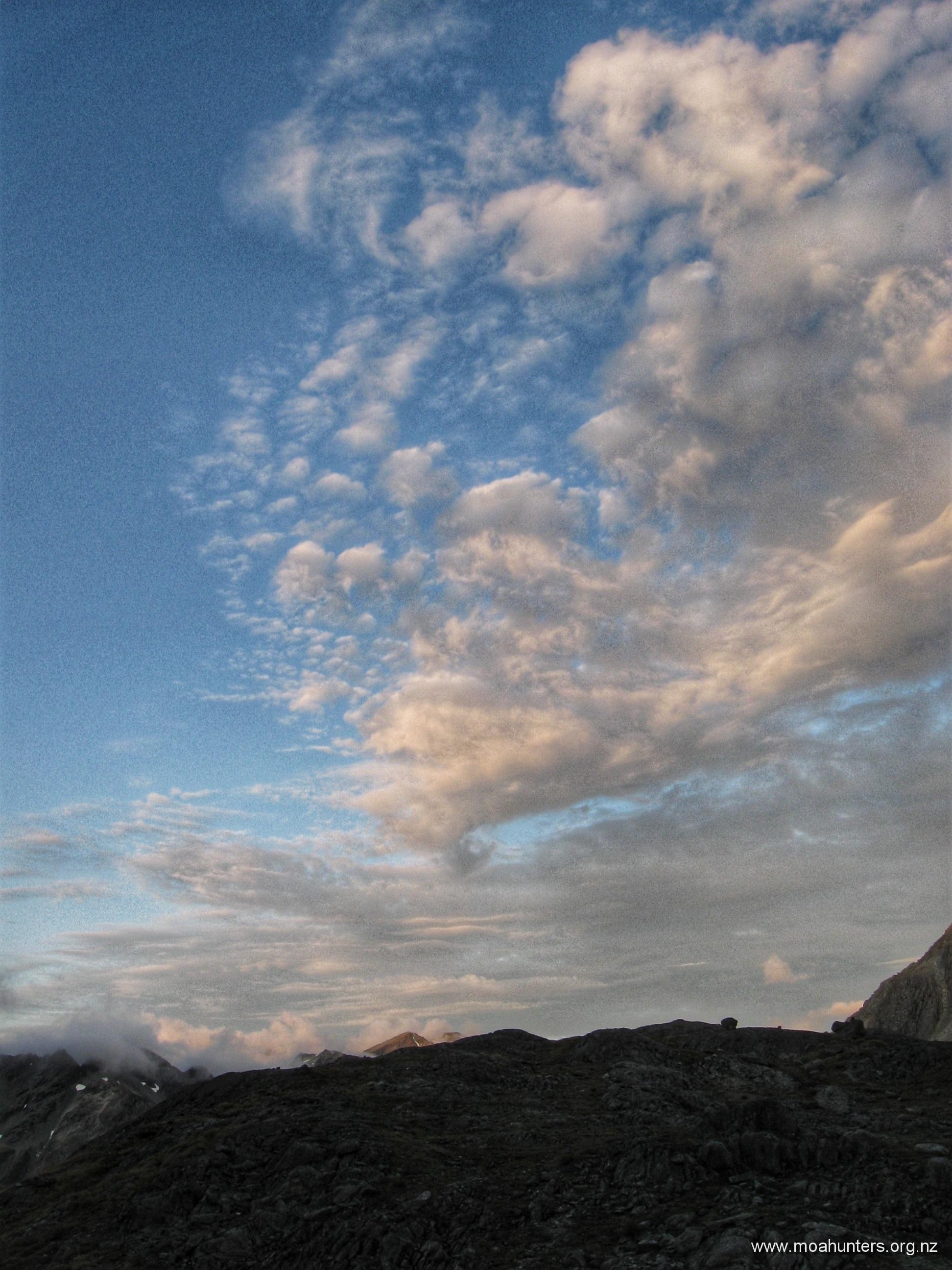
Weather conditions were cool and overcast. Low cloud clung to the sides of the ranges like stretched lambs wool. Overhead the clouds looked heavy. Rain would not be a surprise, but none of us really cared. It felt great to be standing at the start of a new adventure.

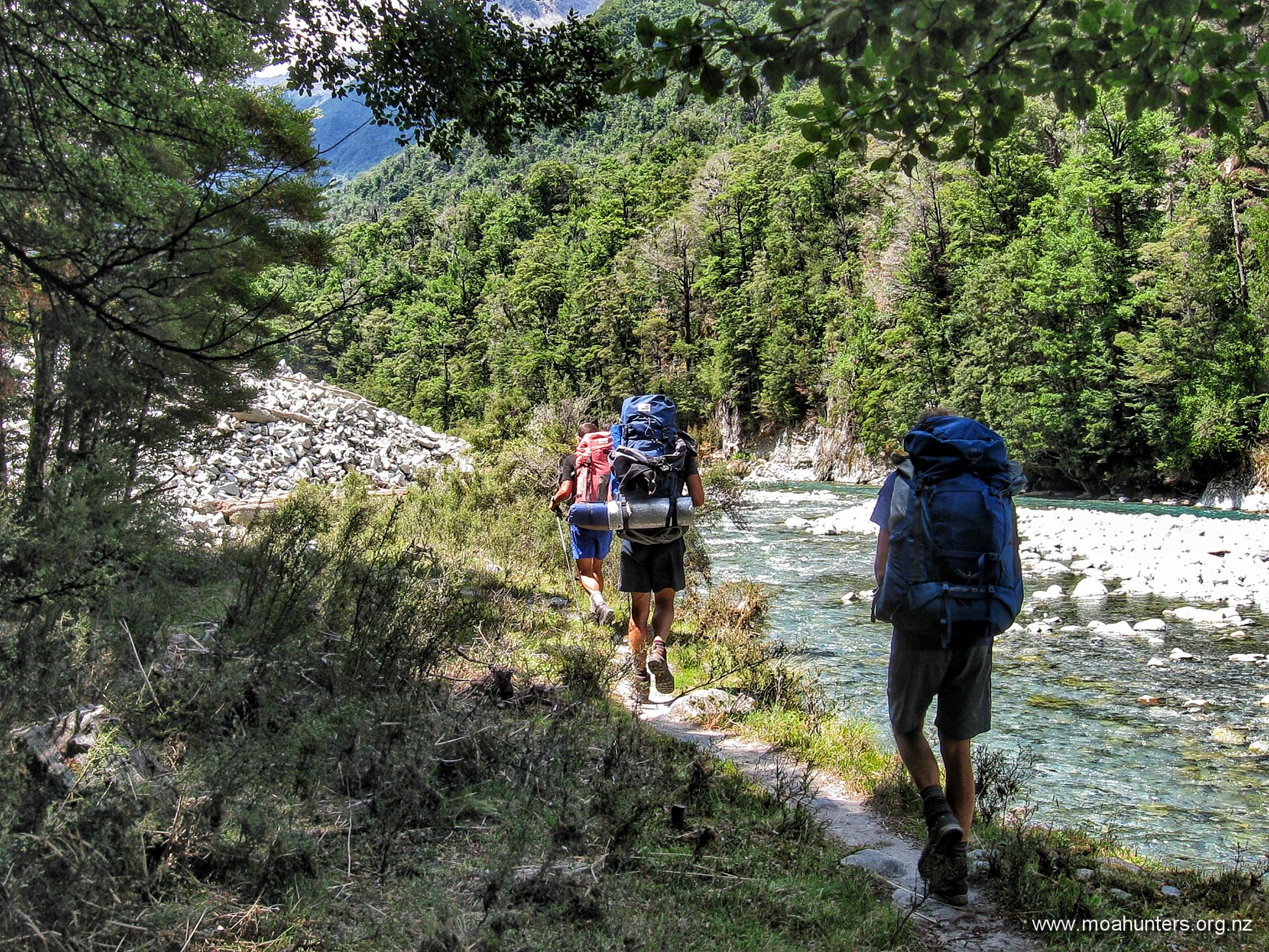
Breathing in the distinctive musty sweet smell of the beech forest, we thanked Hamish, then marched up the track towards Lakehead hut, a mere fifteen minutes away.

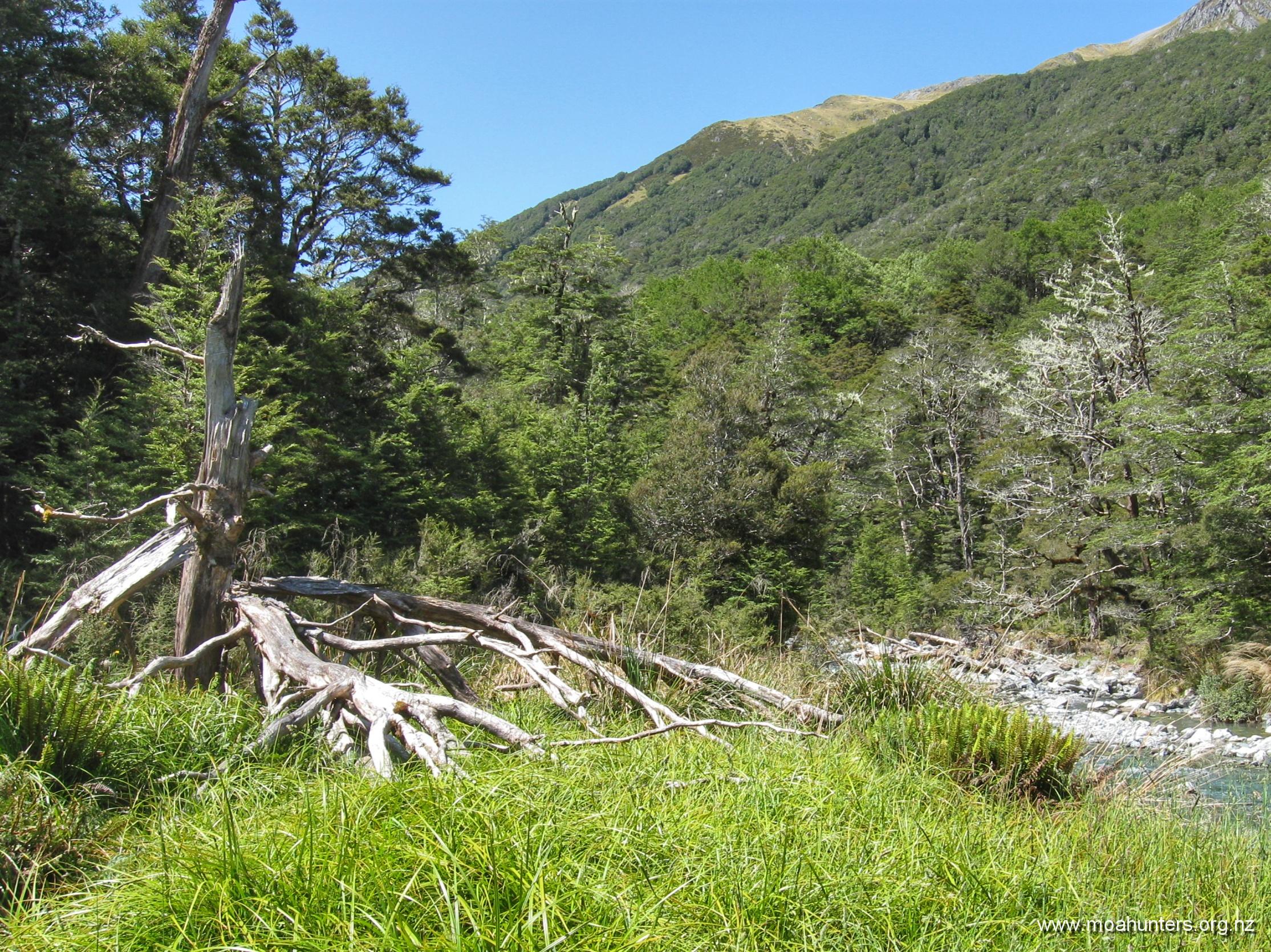
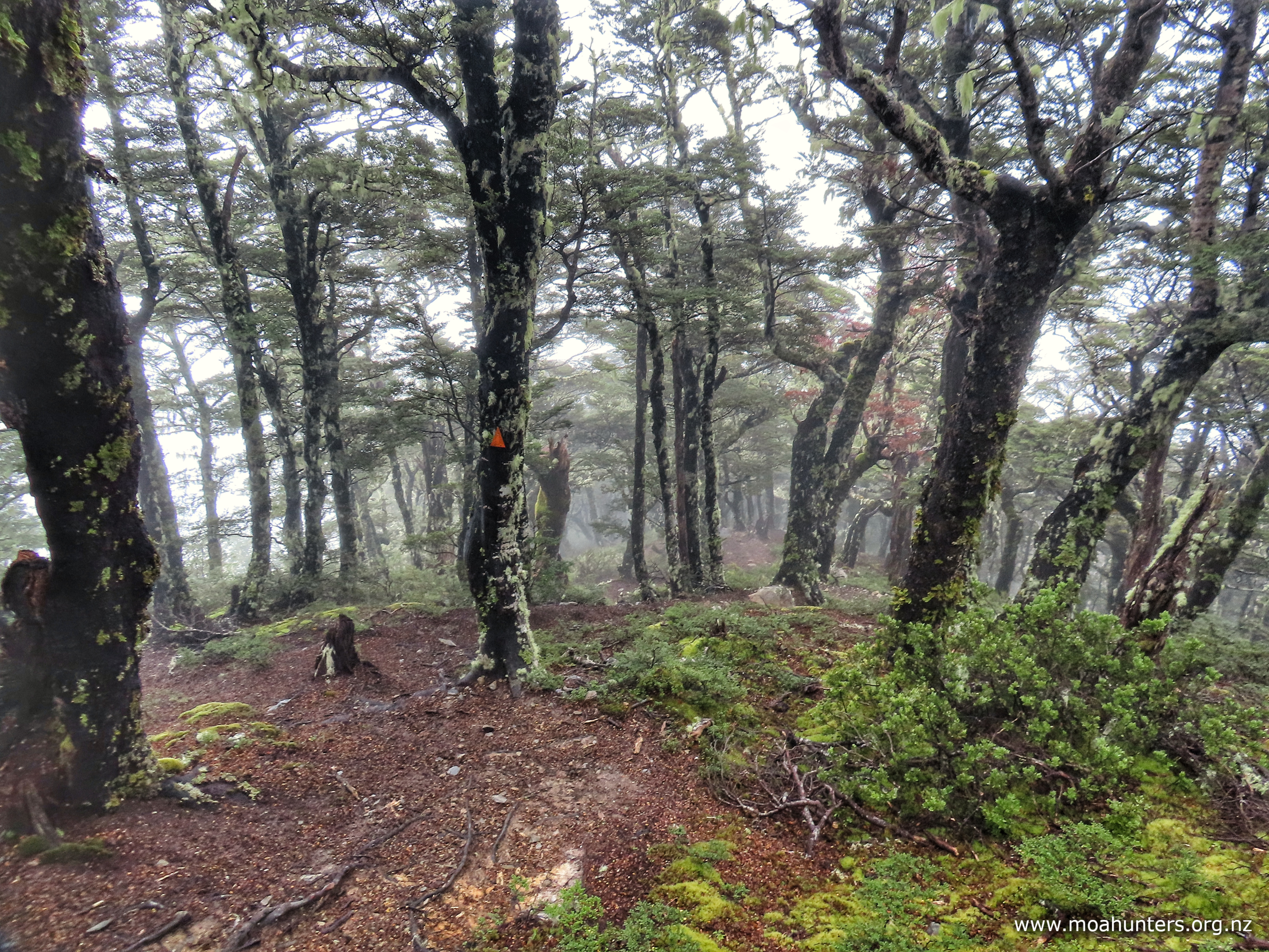
Near the lake, Travers valley is wide and flat. The track meanders across open expanses of straw coloured grasses, occasionally ducking into damp beech forest where it is lightly carpeted in fallen leaves, turned golden by autumn’s cool hand.

We anticipated the track may be a bit wet. The Nelson lakes had received very little rain over the summer. But earlier in the week, a low pressure system that drenched the west coast didn’t spare the Nelson / Tasman area. Quite a bit of rain had fallen onto fairly dry ground. We wondered if streams may still be running high. Beside us the Travers river was lively, but not swollen. Perhaps the rain had already washed through to the lake?

As we walked, the first thing we noticed was the abundant bird life. Bellbird song rang out through the forest from all directions. Fantails looped and dived acrobatically, tweeting excitedly as we passed. South Island robin flitted from branch to branch, deftly shadowing us as we walked the track. A MASSIVE thumbs up to the Friends of Lake Rotoiti and DOC for all their mahi, setting and clearing predator and wasp traps in the area.

We paused briefly at Lakehead hut to check it out, before continuing up the easy track that weaved pleasantly through a mix of grassy flats and damp beech forest.

At these low levels near the lake, damage from wild pigs was quite evident. Significant chunks of grassed areas beside the river had been rooted up and damaged.

Due to the enormous breakfast enjoyed earlier that morning, we were not especially hungry when we stopped for a break on a convenient grassy terrace beside the Travers river. It was 1:30pm, and just a few mouthfuls of scroggin was all any of us needed to keep going. While we sat there, a light drizzle started falling, which was a little irksome. We hefted our packs and marched onward.

By 3:00pm however, our stomachs finally informed us we had earned a proper feed. The moa men congregated inside the spacious John Tait hut for lunch, enjoying a well earned break.

With three hours walking ahead and daylight hours in short supply, that happy break was sadly not a long one. With our bellies full again, we were quickly back on the track.

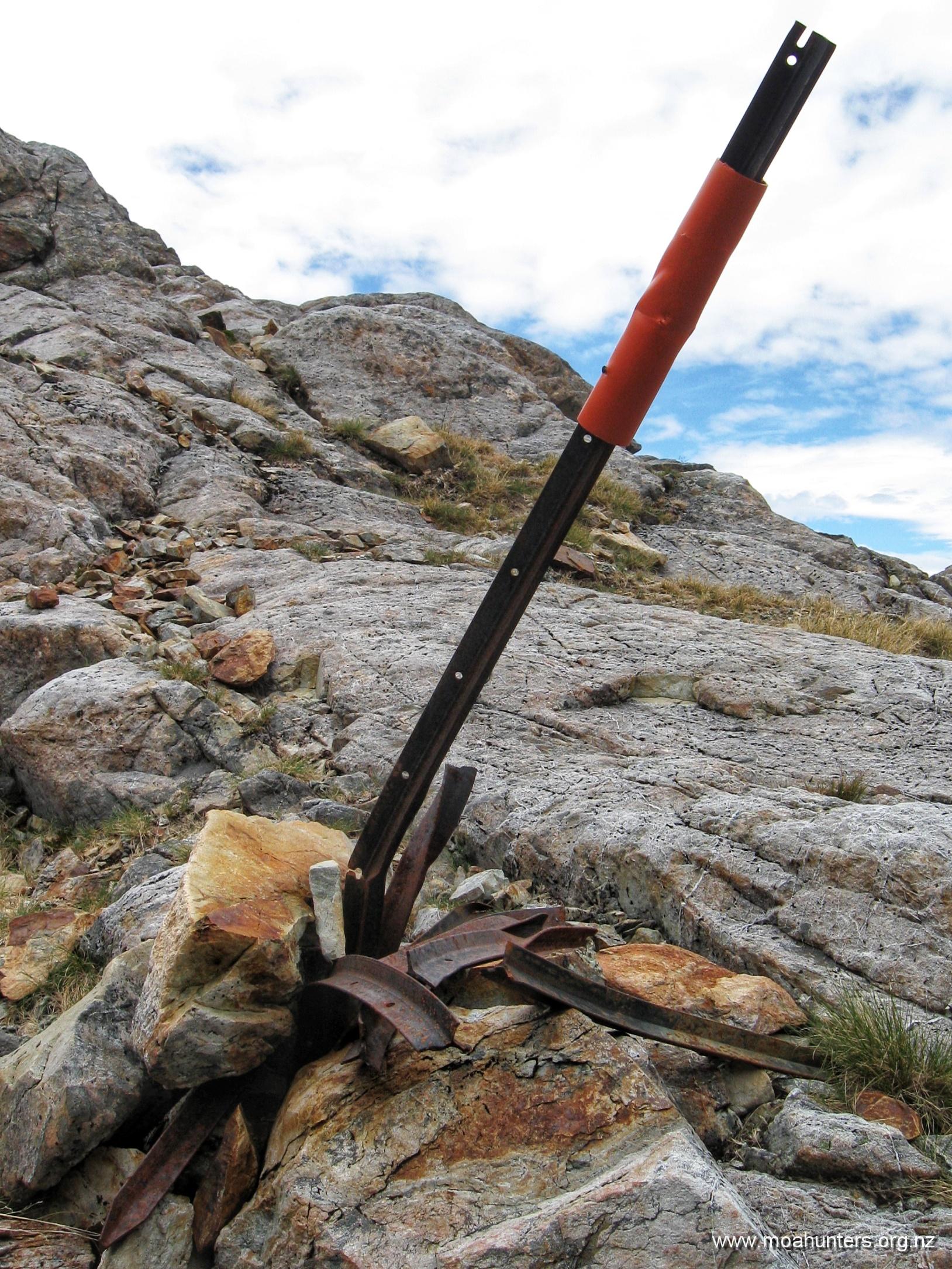
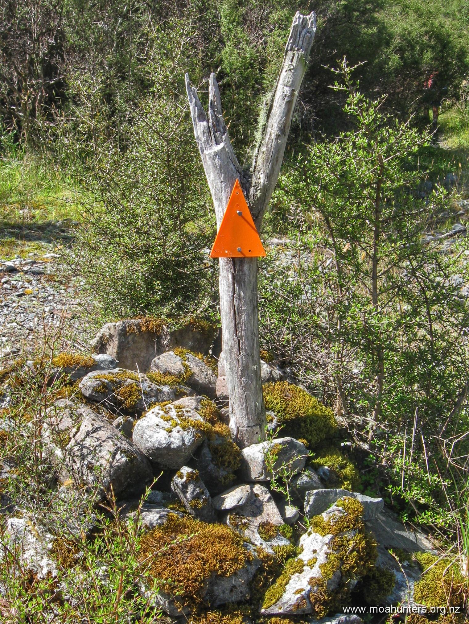
There are predator traps placed along the length of the track from Lakehead to Upper Travers hut. Each is labelled with the track section and a number. We worked out they are around 100 metres apart. Trap JT1 is 100 metres from the John Tait hut, and JT24 would be 2.4 kilometres from the hut.

Seeing the trap numbers as we walked was a double edged sword. Sometimes it’s nice to know how much walking you have ahead and how much you had done. Other times, when the number is large, you’d prefer blissful ignorance!

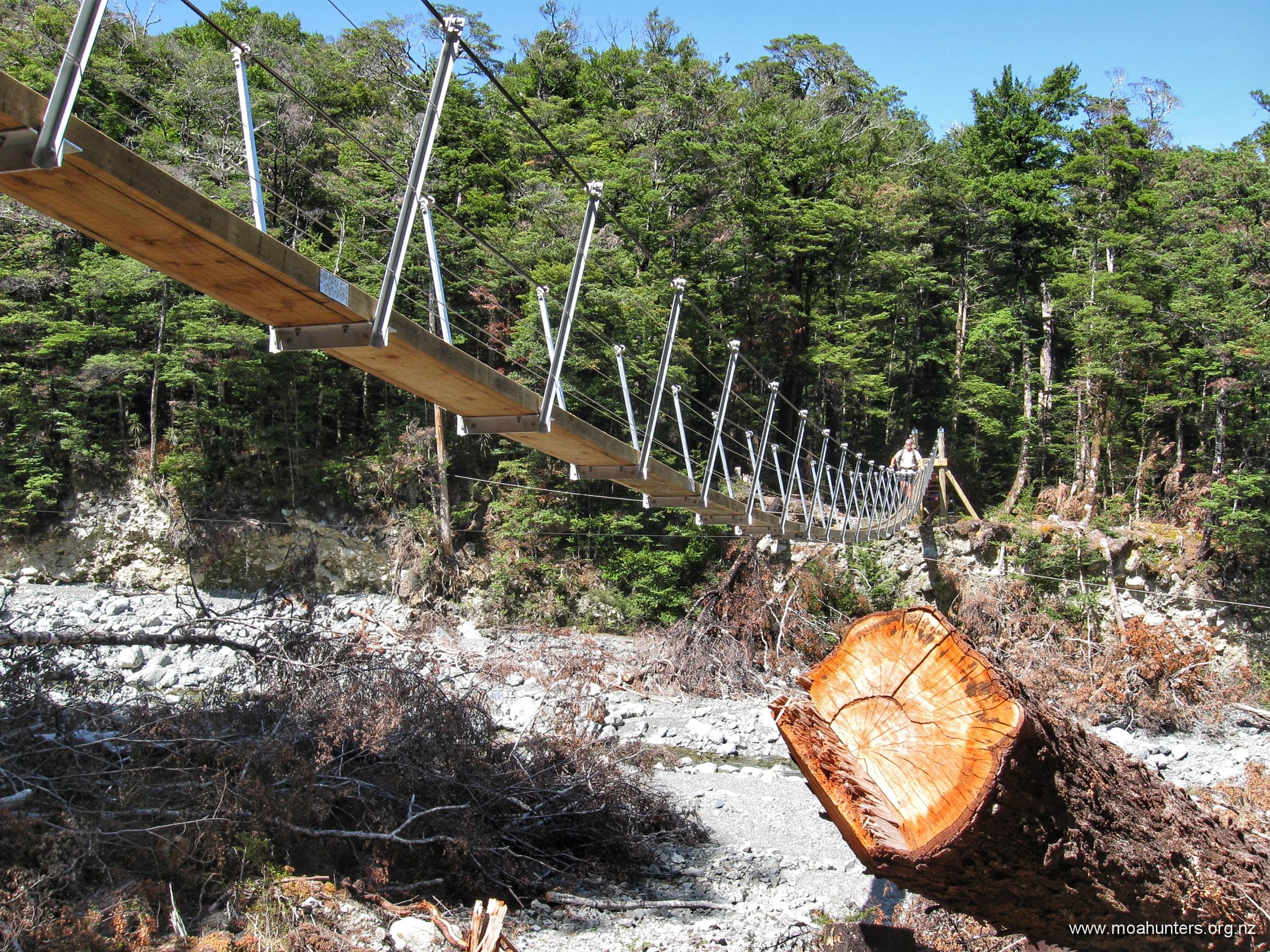
Pushing on from the hut, we followed the Travers river through pleasant beech forest until we came upon a junction. The main track continues steeply uphill to the right. To the left, it snakes down to Travers falls… Given the large amount of rain the area had received in the past week, we knew it would be a travesty to omit the five minute diversion to check out the roar below. We were not disappointed.

Not far up the track from the falls we reached a side stream, which was once bridged. The river in flood has completely destroyed the DOC structure, sweeping the mangled remains aside, mounding tons of mud and shingle on them. Fortunately for us, the stream was easily crossable, despite the recent rain. Given the rust on the remains of the bridge, it had been that way for some time. There is a sign saying a replacement bridge exists upstream about 15 minutes..

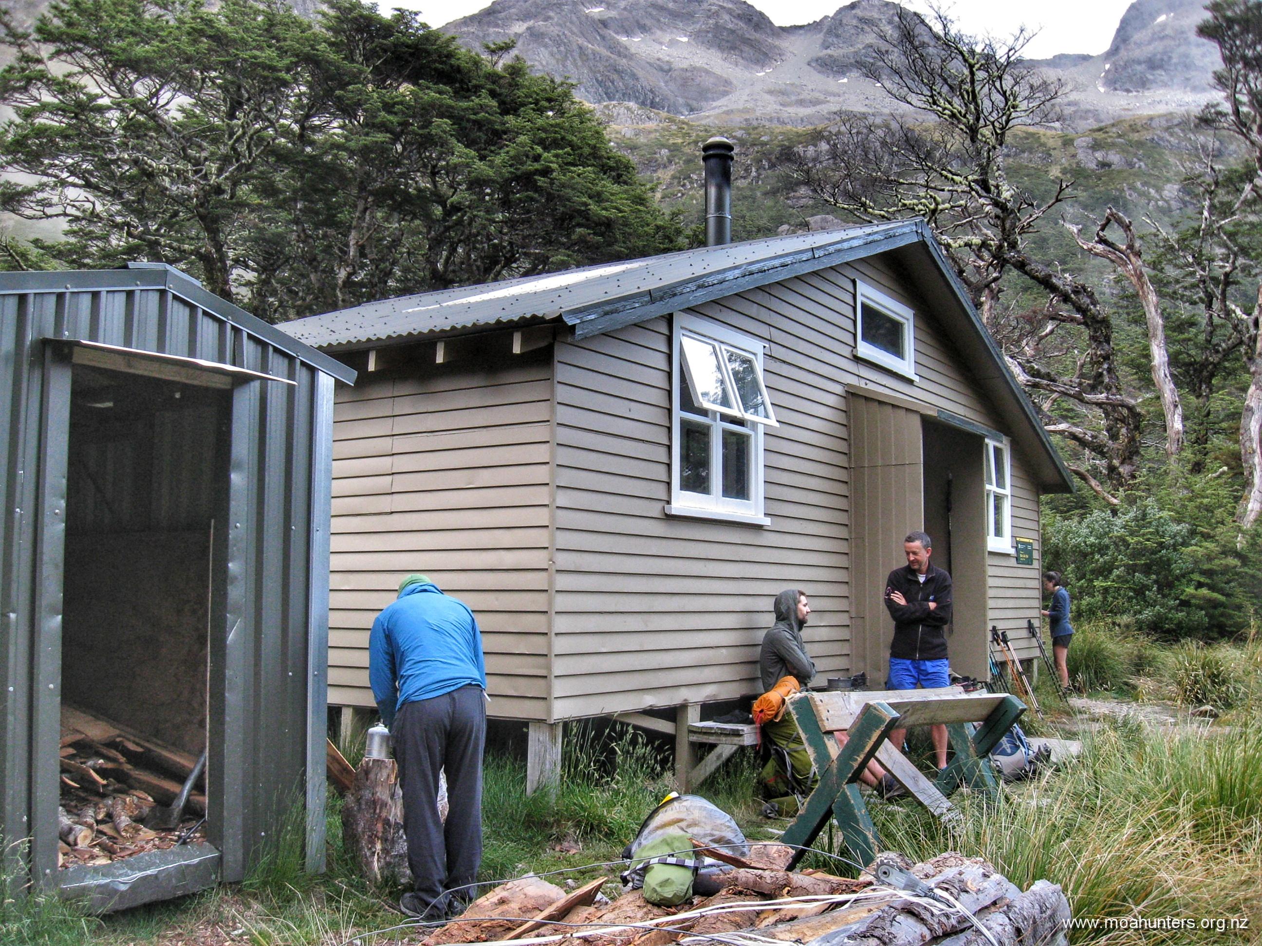
Over the next hour, daylight faded. By 6:00pm we had our headlights on, and save for their light, the last hour to Upper Travers hut was walked in darkness.

The track gets a little gnarly before the hut. The valley becomes tight, rocks are large and slippery as the track skirts close to the river. Darkness and fatigue accentuated the trickier conditions, making the last section feel more challenging than it probably was. When we rolled into the hut sometime after 7:00pm, the moa hunters were feeling more than a little bit knackered.

Dinner was prepared as we got to know the other occupants of the hut: Grant and Herbie were there – a pair of similar aged blokes to us, with a similar route plan. The resident warden gave us the increasingly nice weather forecast for the next few days. An American/Aussie couple popped in, but were tenting on the peaceful grassy flats below the hut. Another couple inside seemed to be hut wardens in-training.

Upper Travers hut has two separate sleeping areas – ten bunks each side. Grant and Herbie had suggested to the other occupants that we be allocated the one on the right, with everyone else on the other side.

After a warming Christmas pud dessert, we climbed into our sleeping bags. It was nearly 10:00pm, and were all asleep within minutes. It had been quite a long and tiring day for a bunch of (mostly!) old moa hunters…

Day 2

SunDay 14th April – Upper Travers hut to West Sabine hut

Not too many clicks after 6:00 am, the first moa men were stirring. Paul was busy heating water for coffee. Adam wandered past slightly bleary eyed.

Quite a few of us had experienced leg cramp overnight, particularly in the calves or hamstrings. This was usually when attempting to exit sleeping bags for a nighttime visit to the long-drop. We all agreed extra electrolyte drinks would be on the menu today!

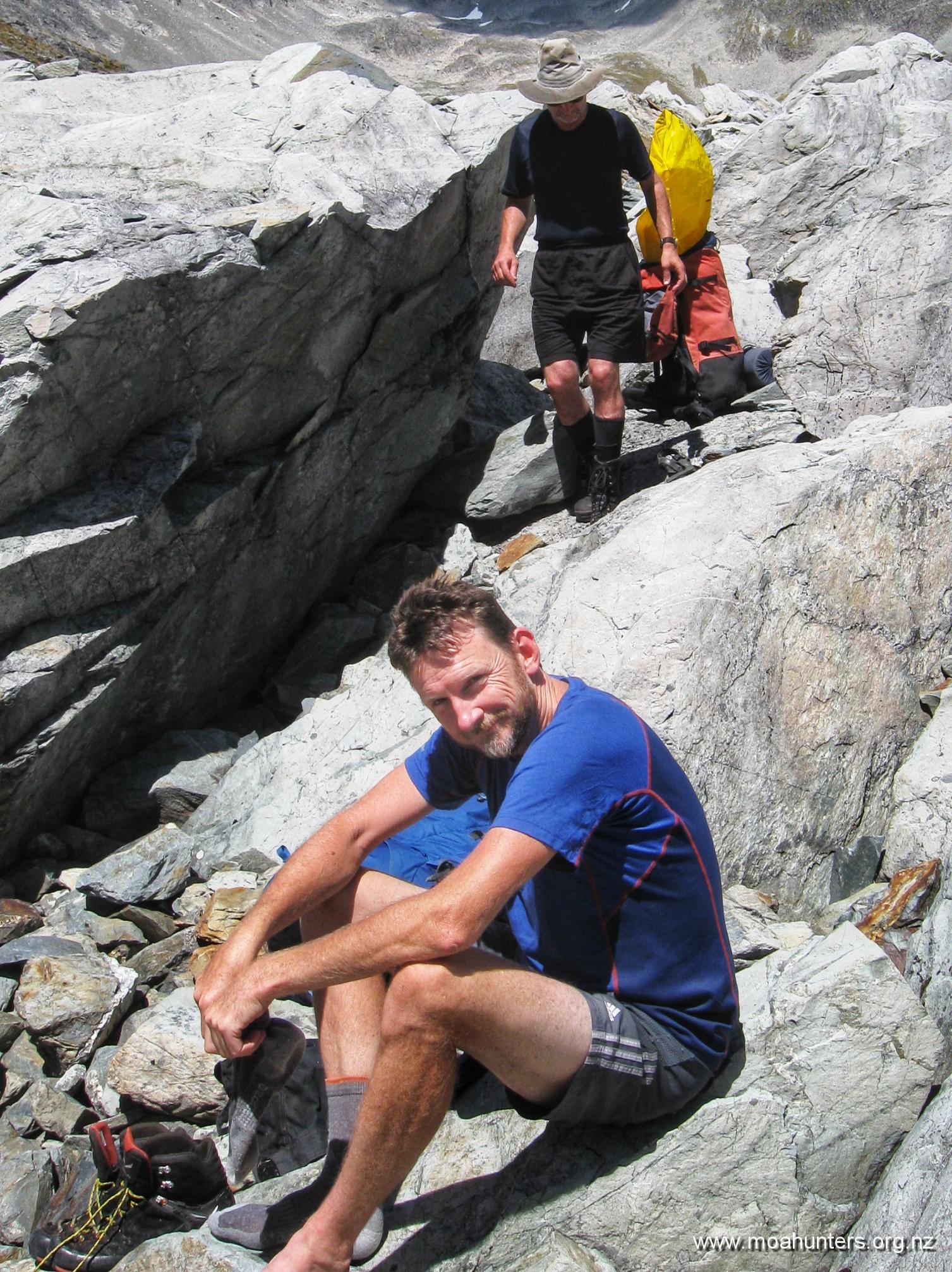
Grant and Herbie were also up bright and early. As Grant walked out the bunk room, he plopped an amazing old relic down on the floor beside the door.

You don’t see many packs with external frames still in service… you see even less with a retrofitted hip belt made from the seat belt of a 1982 Ford Laser, or similar! What an awesome piece of kit. While it is not the world’s most comfortable pack, it is definitely one of the most quirky and unique.

Outside, the weather was a mixed bag. Thick low cloud clung to the surrounding hills, but overhead patches of bright blue sky were evident – enough to sew a pair of pants for a sailor, apparently (ask Chris!).

Paul and Chris awarded Upper Travers hut the auspicious and much sought-after “hut with the best water pressure, ever” accolade. Rather than being fed from a rain-filled tank, water from a stream above is piped directly to the hut, generating a pleasingly strong flow-rate from the taps inside. (Engineers like Paul and Chris are easily pleased)

Shortly after 8:30am, the hut warden gave us an updated weather forecast: Mostly cloudy, occasional drizzle, but steadily improving over the next few days. Still good, and good enough for us!

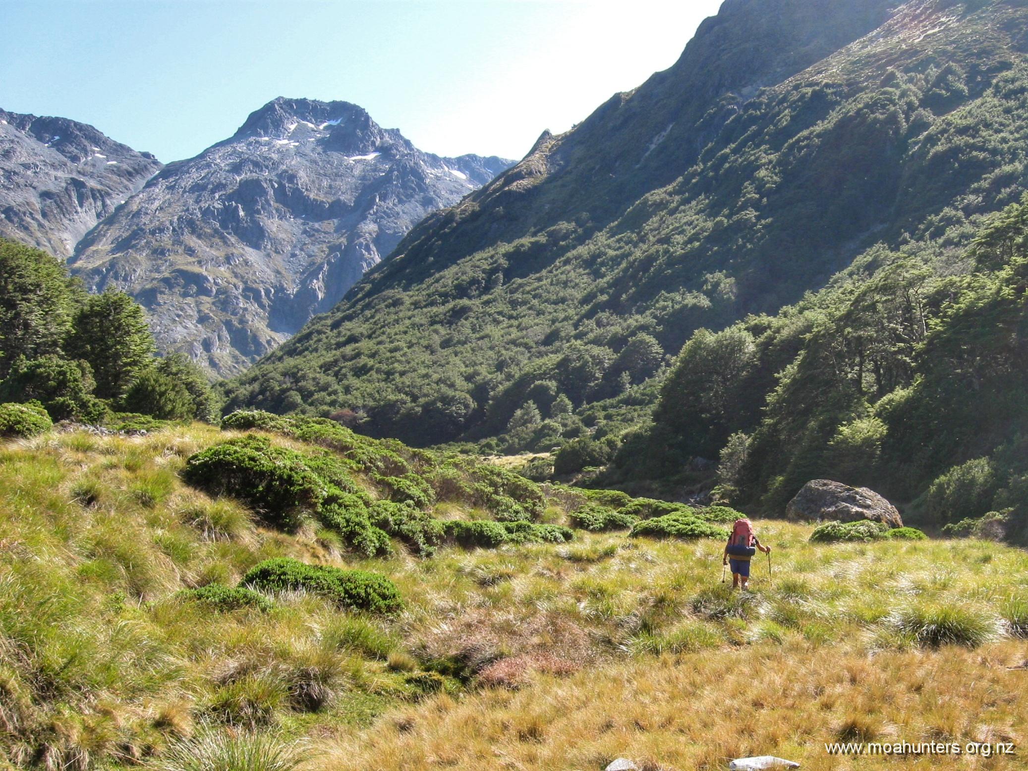
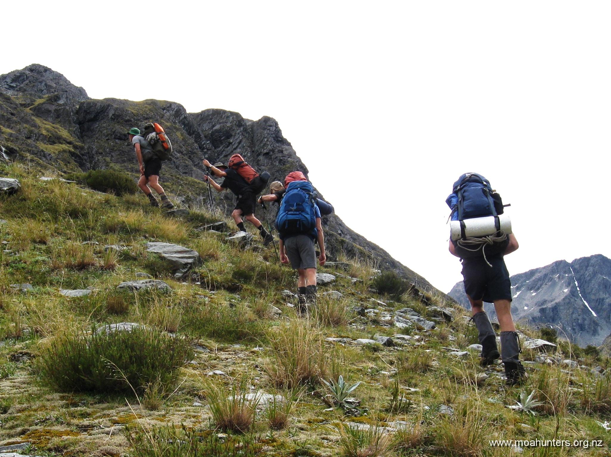
We heaved our still weighty packs onto our backs, and set off from the hut, knowing we had another big day ahead. Above us awaited the 450 vertical metre climb to Travers saddle. Beyond the saddle, we had an 1,100 vertical metre descent into the Sabine valley. My knees hurt just typing that.

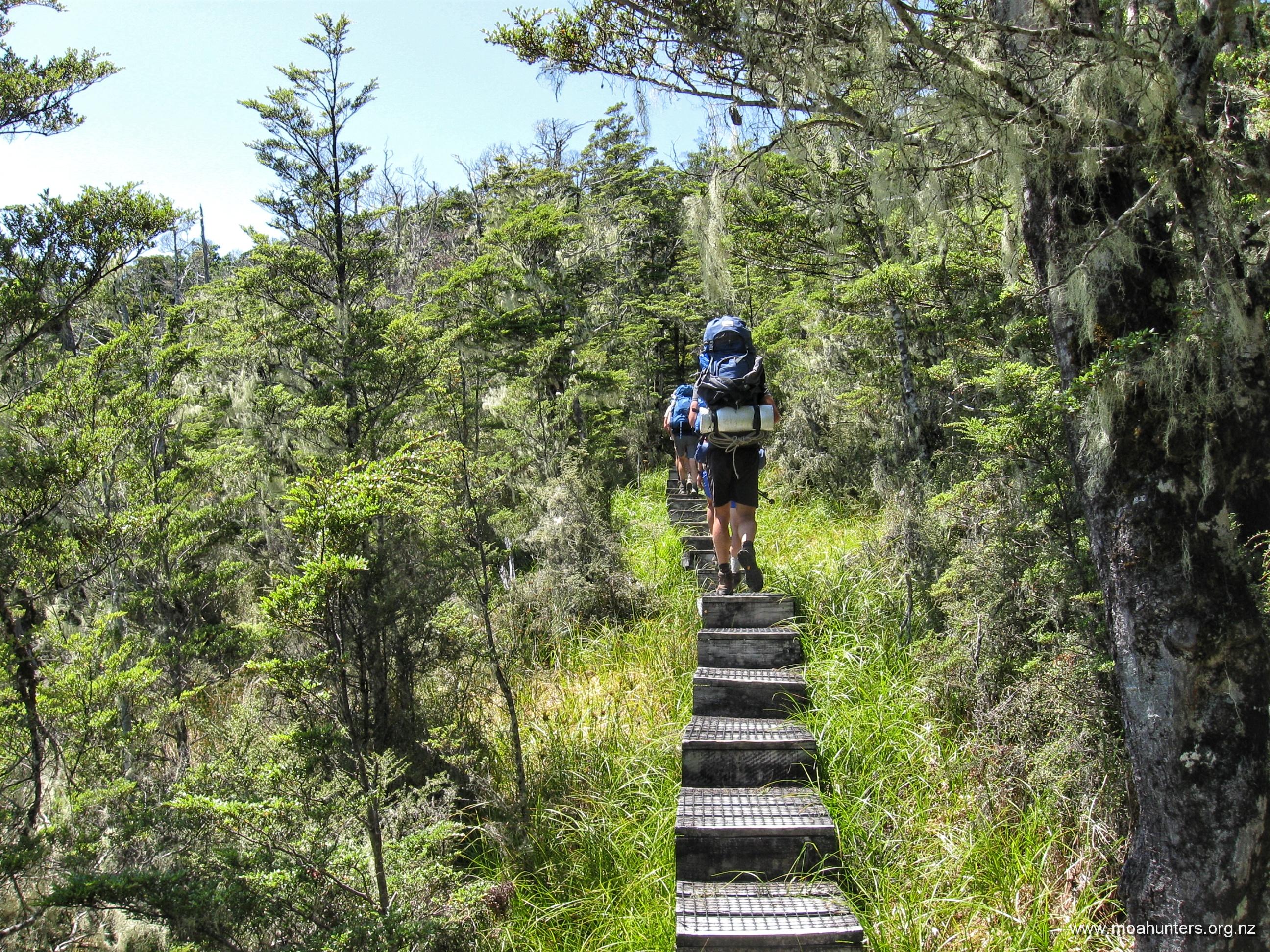
Quickly above the bush line, the track led us out onto a lovely dew-soaked alpine meadow environment. Weaving a pleasant path through medium sized rocks, flax-like astelias, tussock, hebe bushes and the occasional spaniard grass, we all enjoyed the start of the climb.

Almost as if scripted, the low cloud played its part perfectly, creating atmospheric drama all morning. Swirling slowly across the hills it obscured the terrain around us, occasionally thinning enough to offer tantalising glimpses of what might lie ahead.

Looking back, we were briefly shown the steep flank of a mountain looming large out of the mist. Some kind of optical illusion made it look impossibly high, the summit hidden by yet more cloud.

At 9:30am we had gained enough altitude to notice the vegetation thinning out, leaving us treading a path through the remaining snowgrass, tussock and low scrub in increasingly rocky terrain.

Half an hour later we were breathing a fair bit harder. We had entered the final steep section of the climb. To be fair, we have grunted up much harder climbs, but this was enough to bead a brow with perspiration despite the cool morning air.

It was 10:15am when we reached Travers saddle – approximately 90 minutes after departing the Upper Travers hut. There was a shallow tarn in a basin just below the saddle. We wondered if in summer it would be nothing more than a dry bowl.

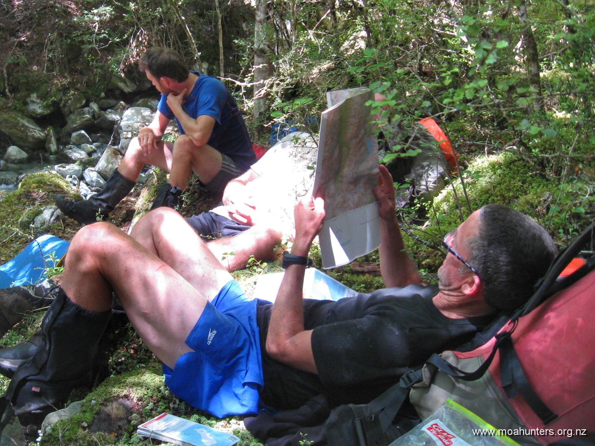
There was no massive panorama to enjoy from the saddle, but it was still a lovely spot to have a nibble of scroggin and take a drink of cool tarn water. Paul and Luke scampered up the rocky knob to the right of the saddle for a higher vantage point.

As we relaxed on the grass, cloud steadily lowered until a damp mist was swirling around us, dropping the temperature quickly and considerably. That signalled time to start our long descent to the Sabine valley below.

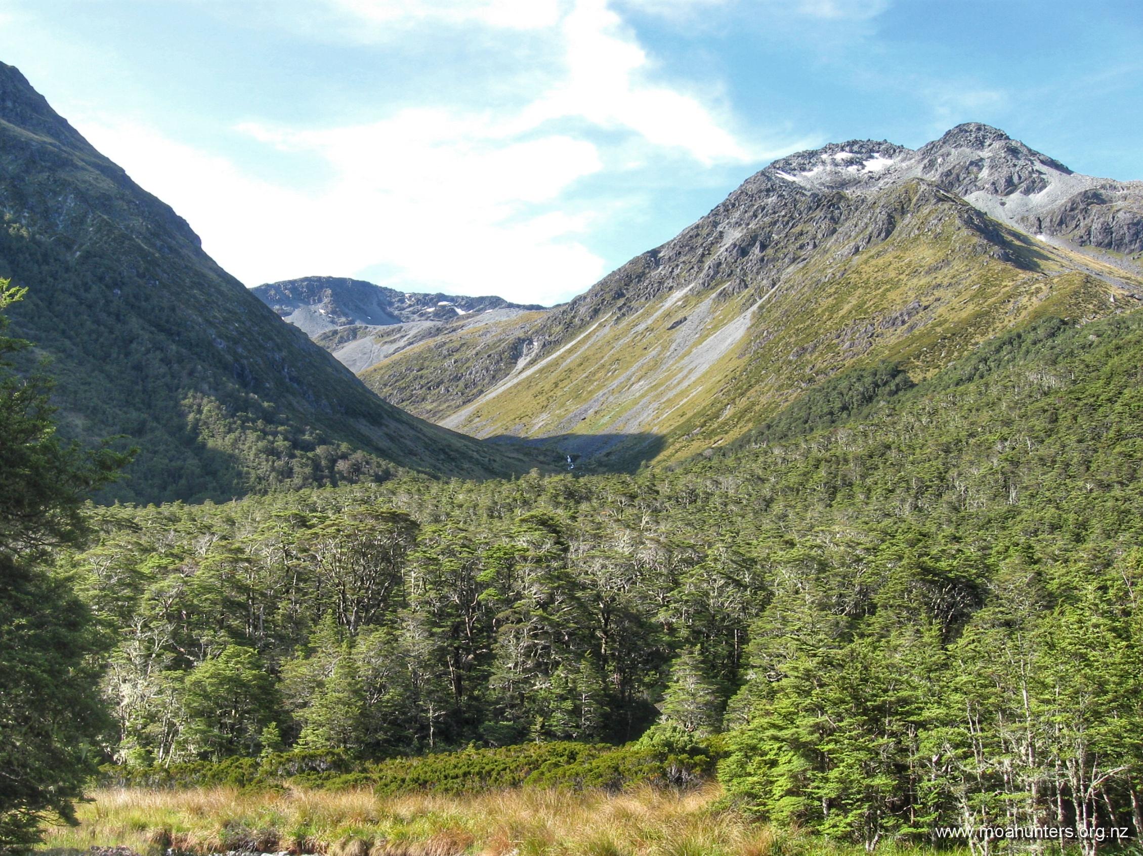
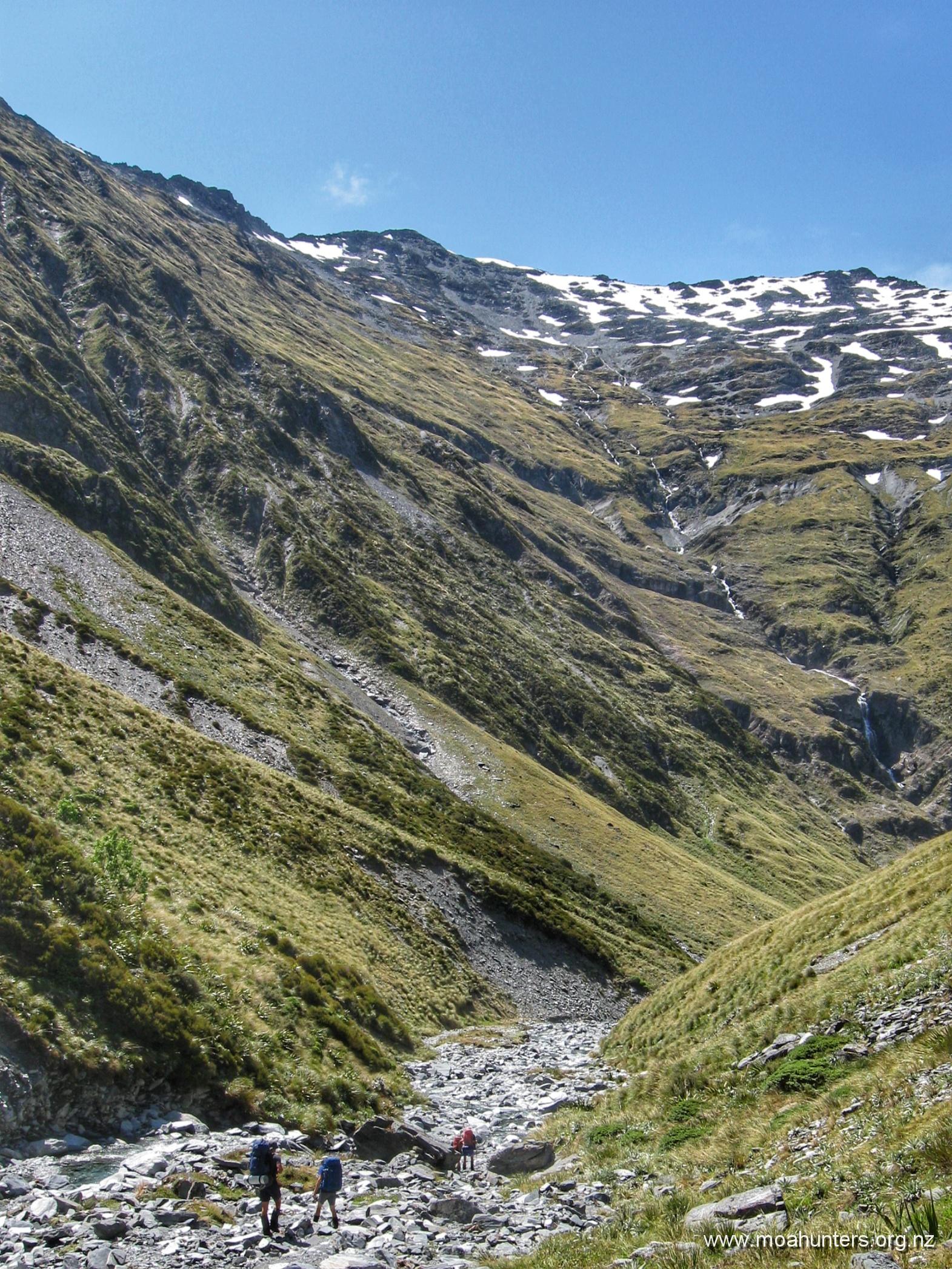
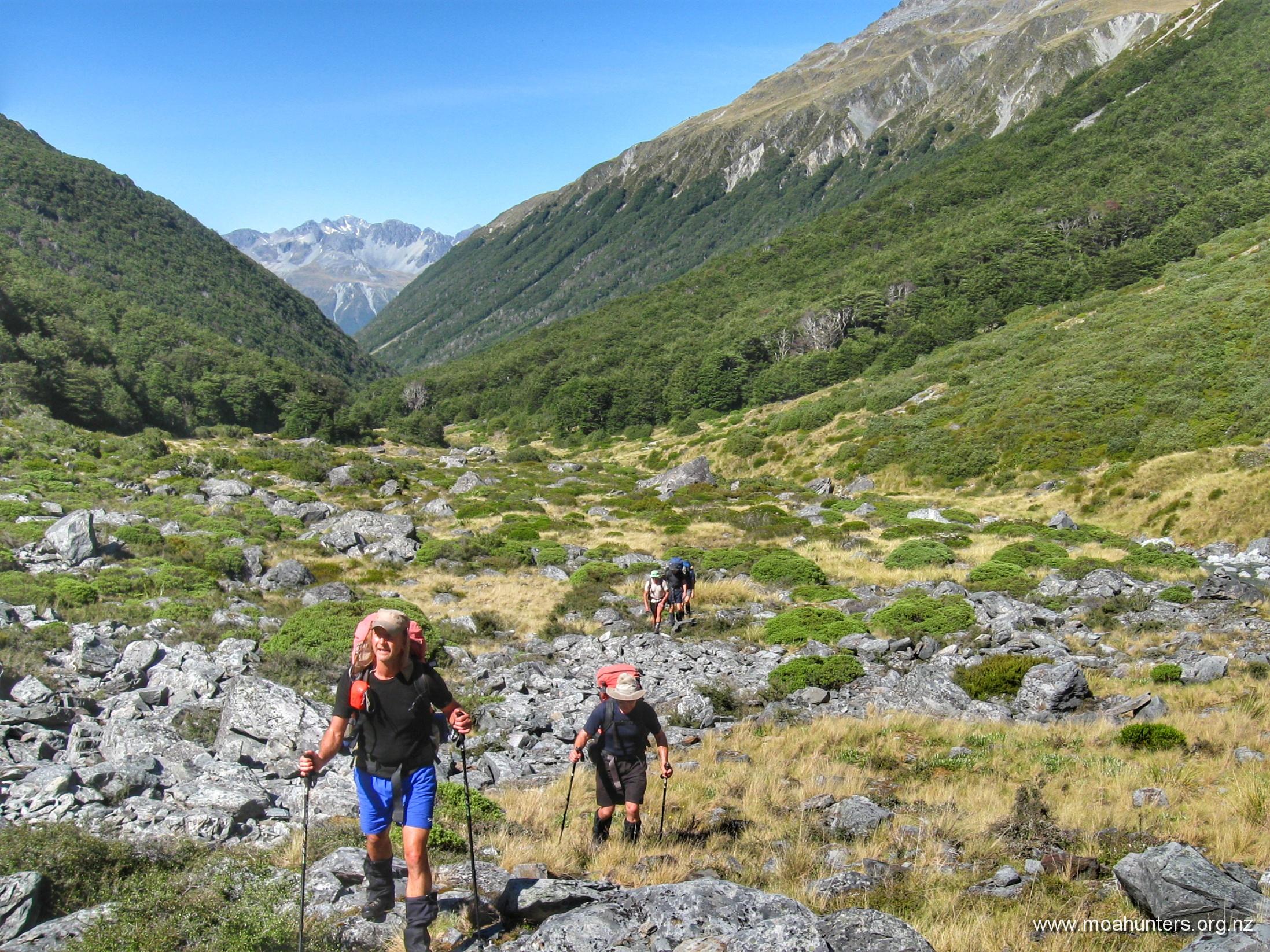
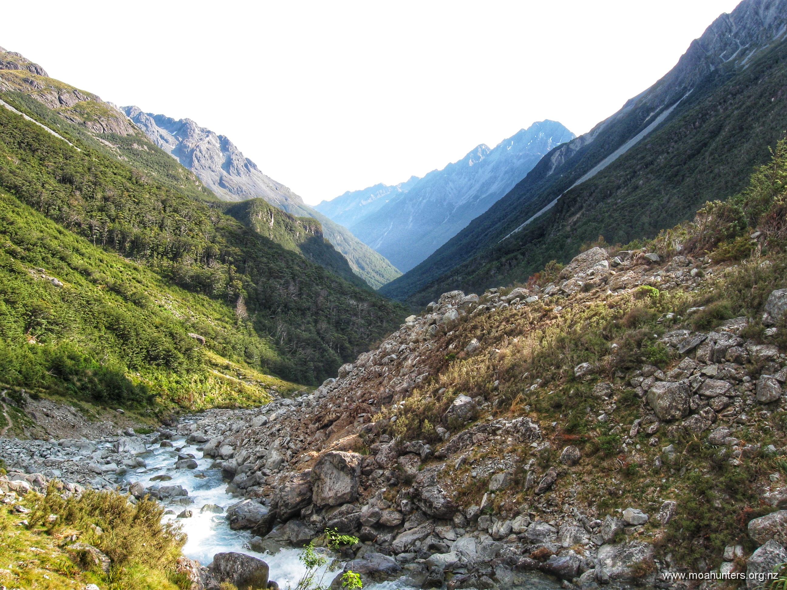
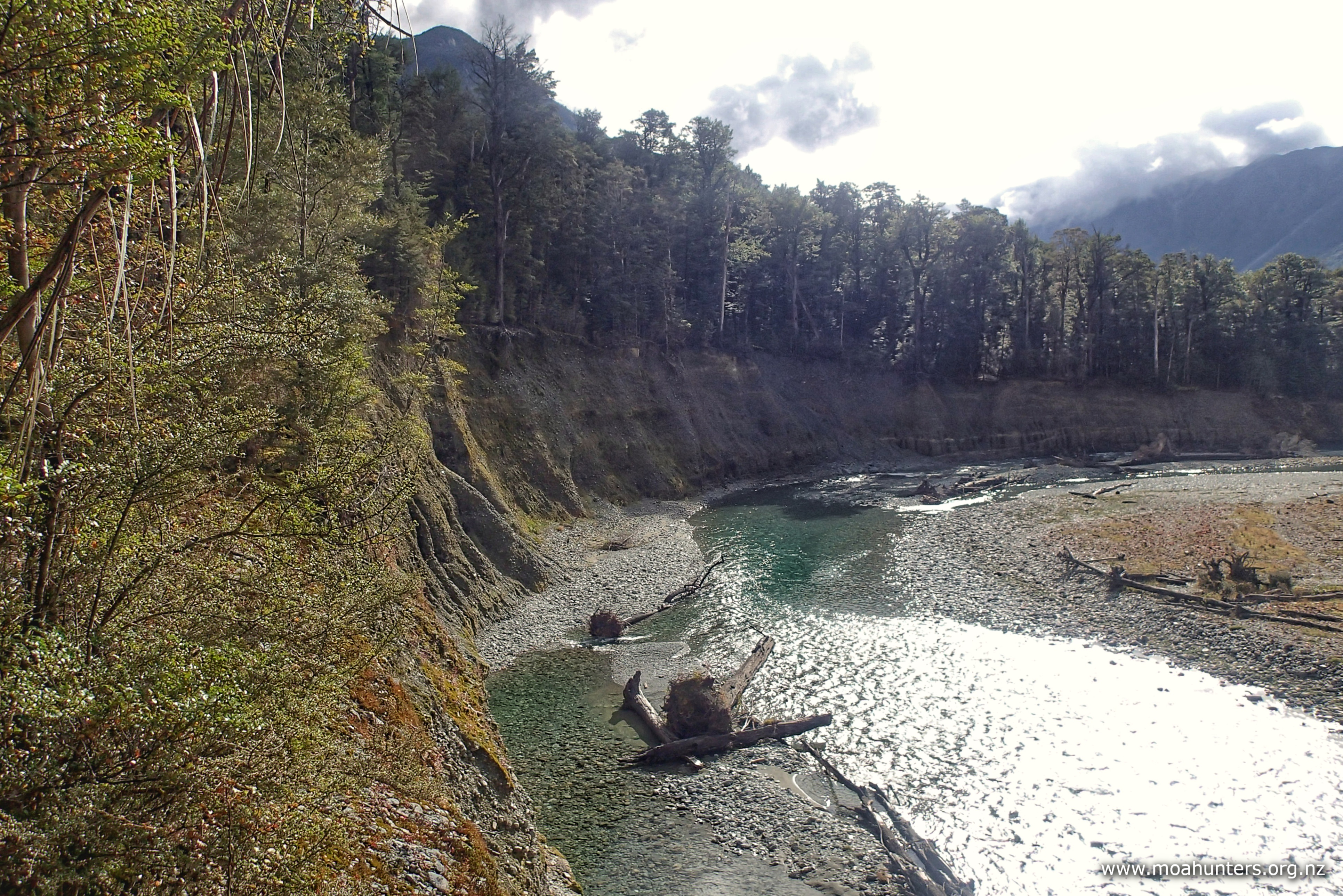
From the saddle, the track drops into a small but interesting valley. One side is completely covered in rocks and rubble that ends in a weirdly uniform curve at the valley floor. It looks for all the world like someone has collected any stray boulders from the valley floor and arranged them tidily.

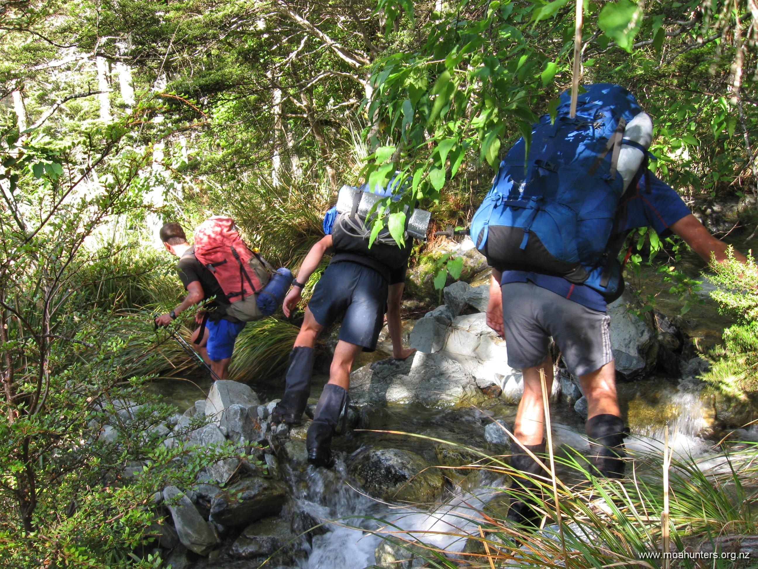
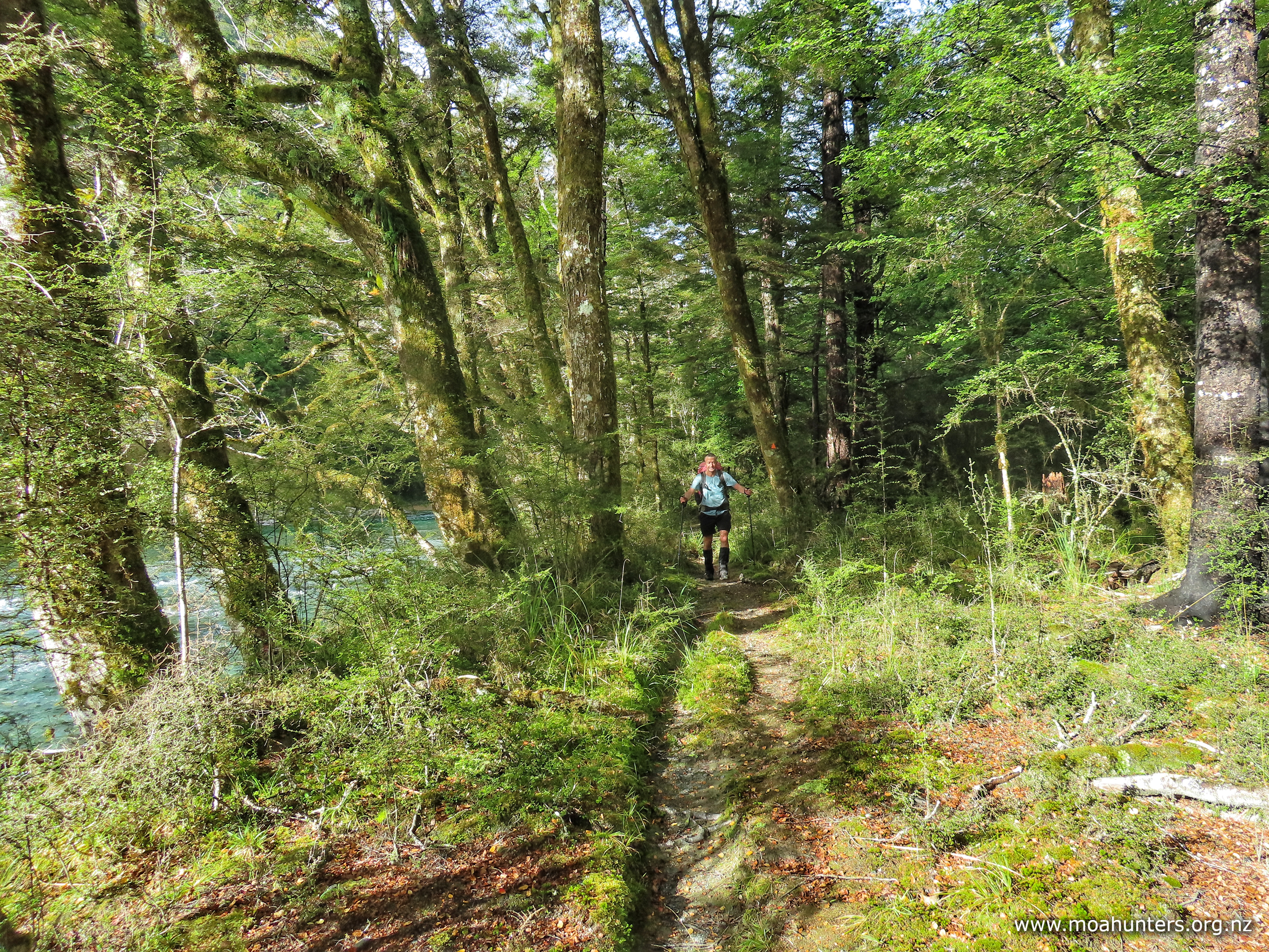
Beyond the boulder slide, a poled route leads down easy grassed slopes onto what becomes a prominent ridge that heads leads into the bush. It was around 11:30am when we entered the beech forest once again, knowing we still had a very long descent ahead of us.

Through misty conditions, Paul and Luke led the way, with the rest of us making our way down at our own pace. The track descends steadily down the sharp ridge through the forest for quite some time. After roughly an hour, it hooks right at a rocky outcrop and drops off the ridge into a much steeper section.

Note that our topo map shows the track following a stream down to the Sabine. This is not the case anymore. The track runs down a ridge some distance to the true-left of the stream, dropping back in the direction of the stream at the rocky outcrop. However, the track doesn’t actually meet the stream, so you should carry some water for this descent in hot conditions.

With the odd spot of drizzle finding its way through the beech canopy, we picked our way down the increasingly gnarly track. Awkwardly long step downs, slippery beech roots, occasional muddy patches and greasy rocks made for slow going. Slipping on a root and ending up firmly on one’s arse was not an uncommon occurrence.

From a branch above us, we received a stern and prolonged scolding from a Bellbird. It was clearly very unhappy with us passing through its territory, and made that displeasure loudly known. Perhaps we had ruined a love-song serenade to a potential partner? Usually these pretty green birds have a delightful resonant song, but this was most definitely an expletive-filled rant!

Sadly, in general we noticed much less bird song on this side of the saddle. Also, no predator traps – almost certainly a link there…

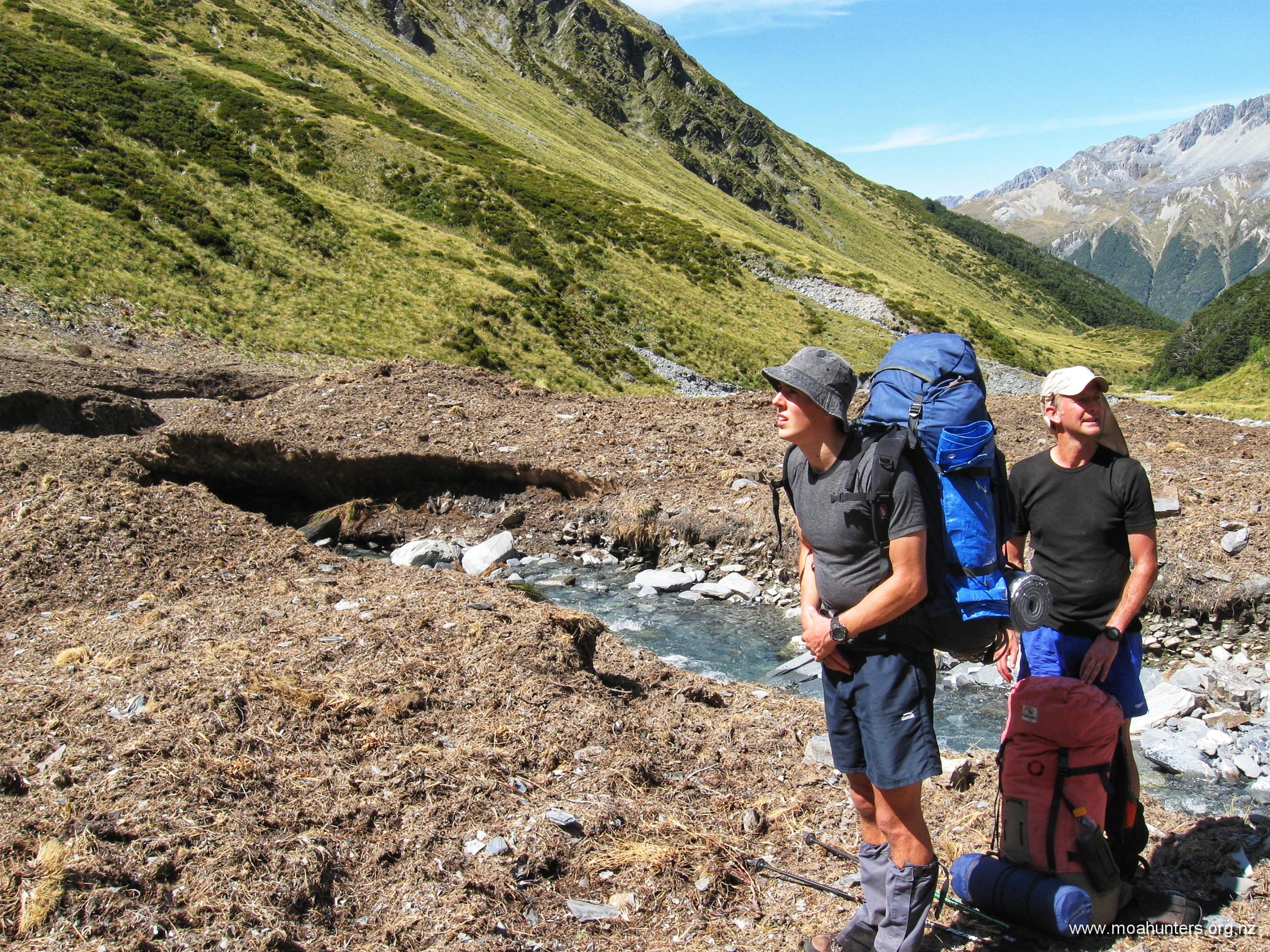
It is a long descent, and after an hour we were all feeling quite fatigued. Far below we could hear the Sabine river. To our right we could discern the distant babbling of a stream. We kept walking in the hope the track would meet it at a pleasant place for lunch break.

Finally at 12:50pm, we gave up on hitting the stream and stopped for a well-earned break. Paul did a quick check to see if the stream was close enough to the track to grab a water bottle refill. Unfortunately, it wasn’t.

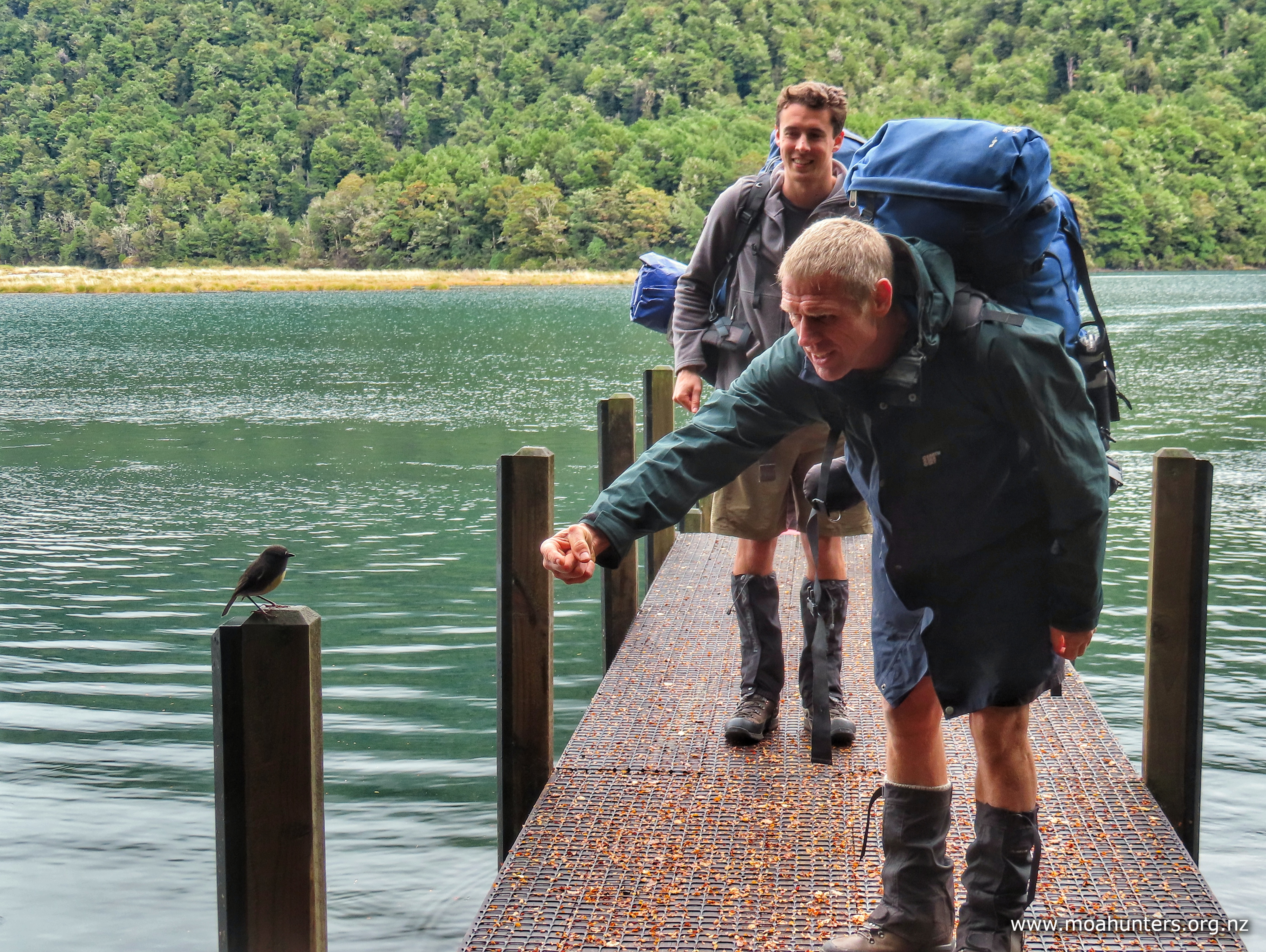
Despite no water, we enjoyed a very pleasant rest and refuel. A South Island Robin came by to say hello. It spent a happy minute hopping on and off the toe of Luke’s boot, before very deliberately pooping on it, then flitting off.

With plenty of time available to get to the hut, we were in no rush to get started again. For those who enjoy tramping in a group, these are cherished times. Resting against the trunk of a tree, sharing the experience of a challenging descent, enjoying every aspect of our surroundings, laughing and chatting about everything and nothing.

From our lunch stop we walked another hour, then took another break. The downhill by now wasn’t overly difficult, but it felt relentless. Old knees do not like big downhills. To combat a building fatigue, we took more regular breaks – tired legs make more mistakes.

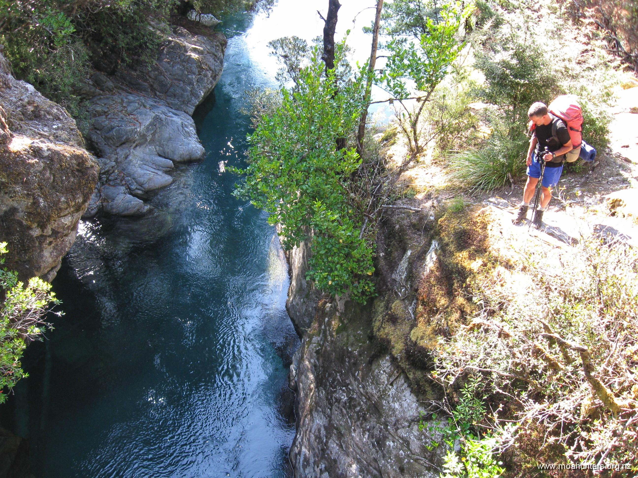
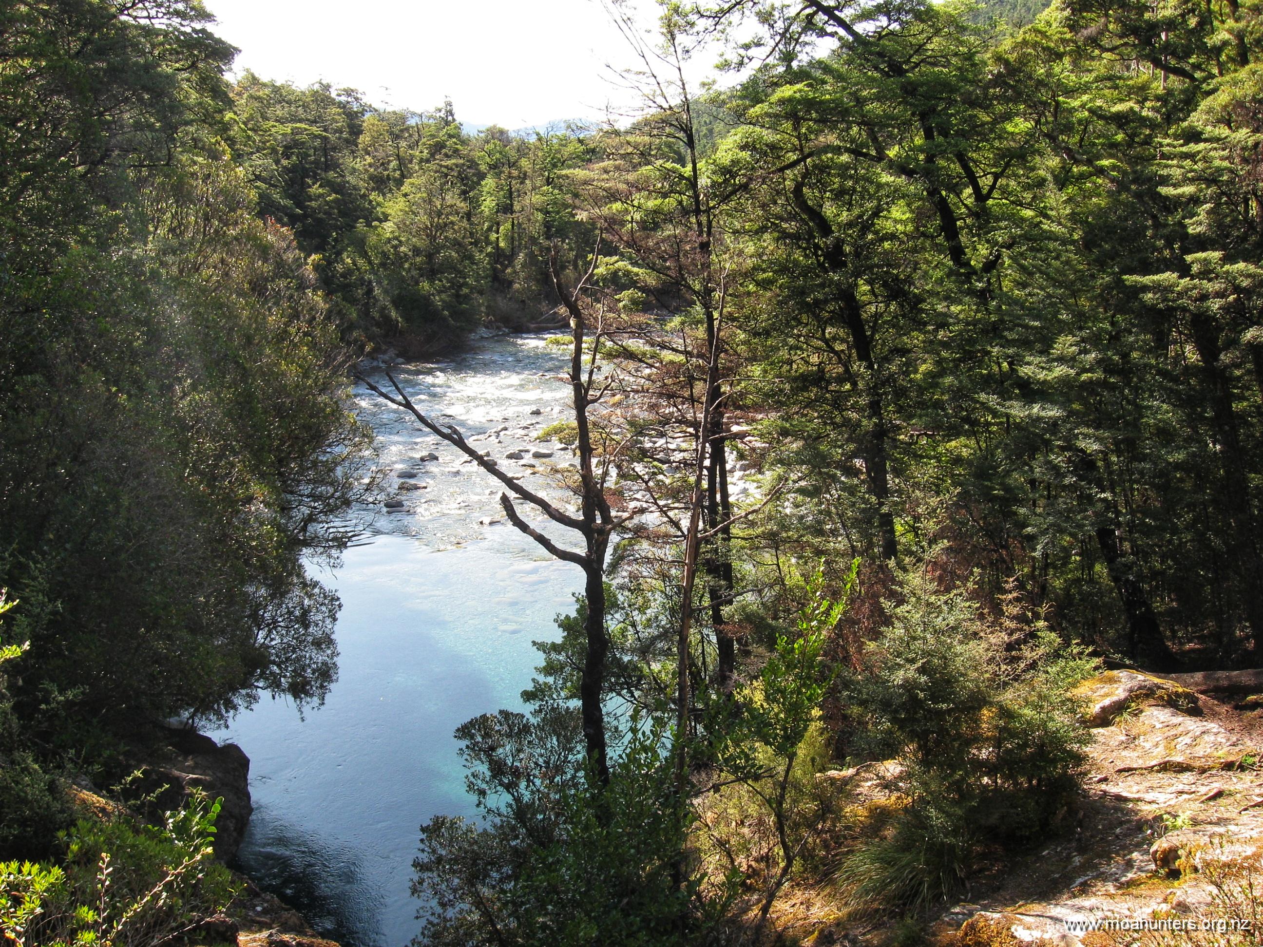
Along the way we crossed a short wooden bridge that spans a surprising and impressive chasm. It is not until the middle of the bridge that you realise you are above a narrow and startlingly deep rocky slot with the river quite some distance below.

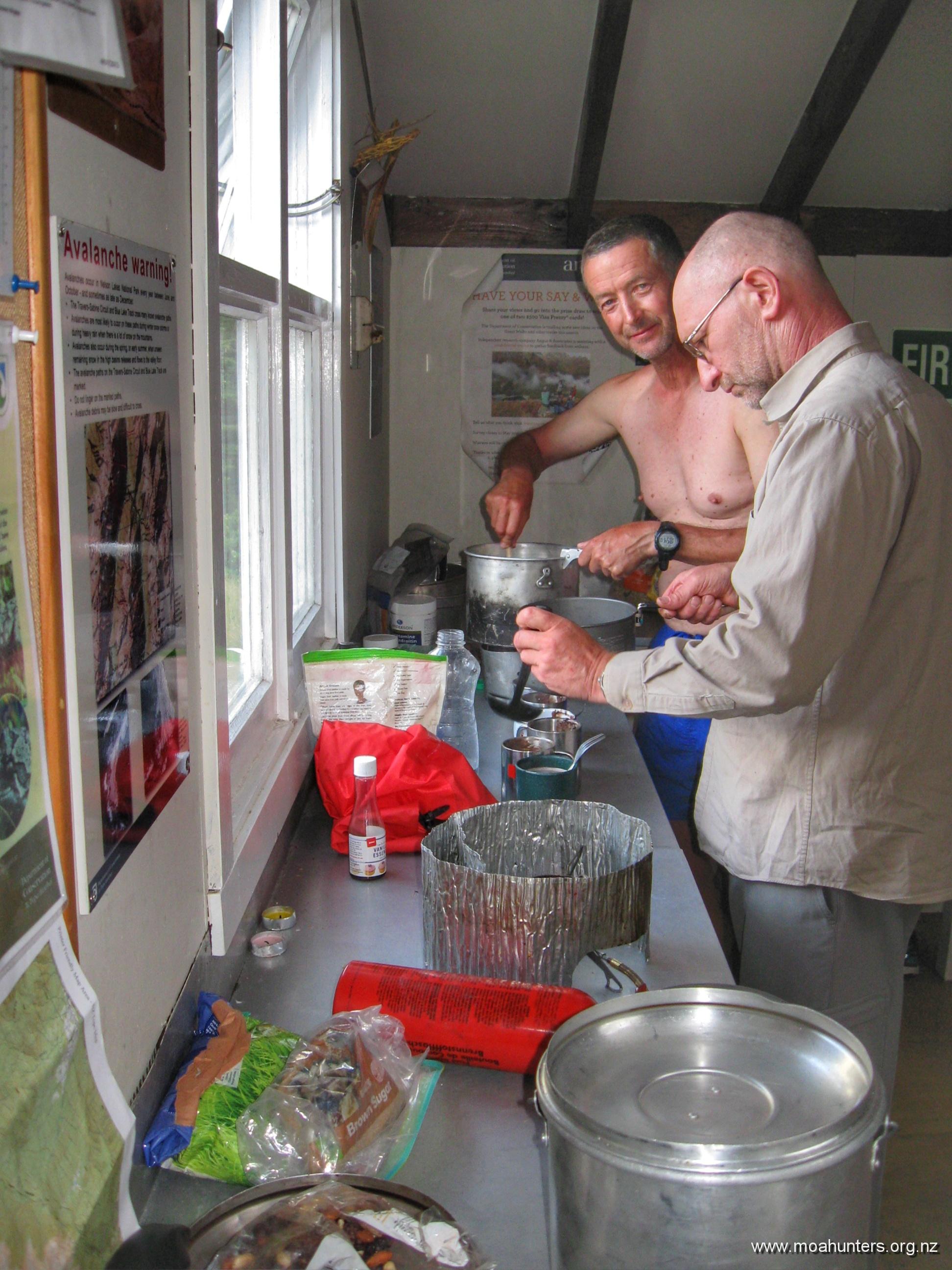
We rolled up to the West Sabine hut around 4:00pm, very pleased to finally be there. Lewis sparked up the wood stove while Paul set about getting dinner organised. Magnus prepared seven cups of steaming hot chocolate, generously topped up with whisky. Just the tonic after a solid day wandering in the hills…

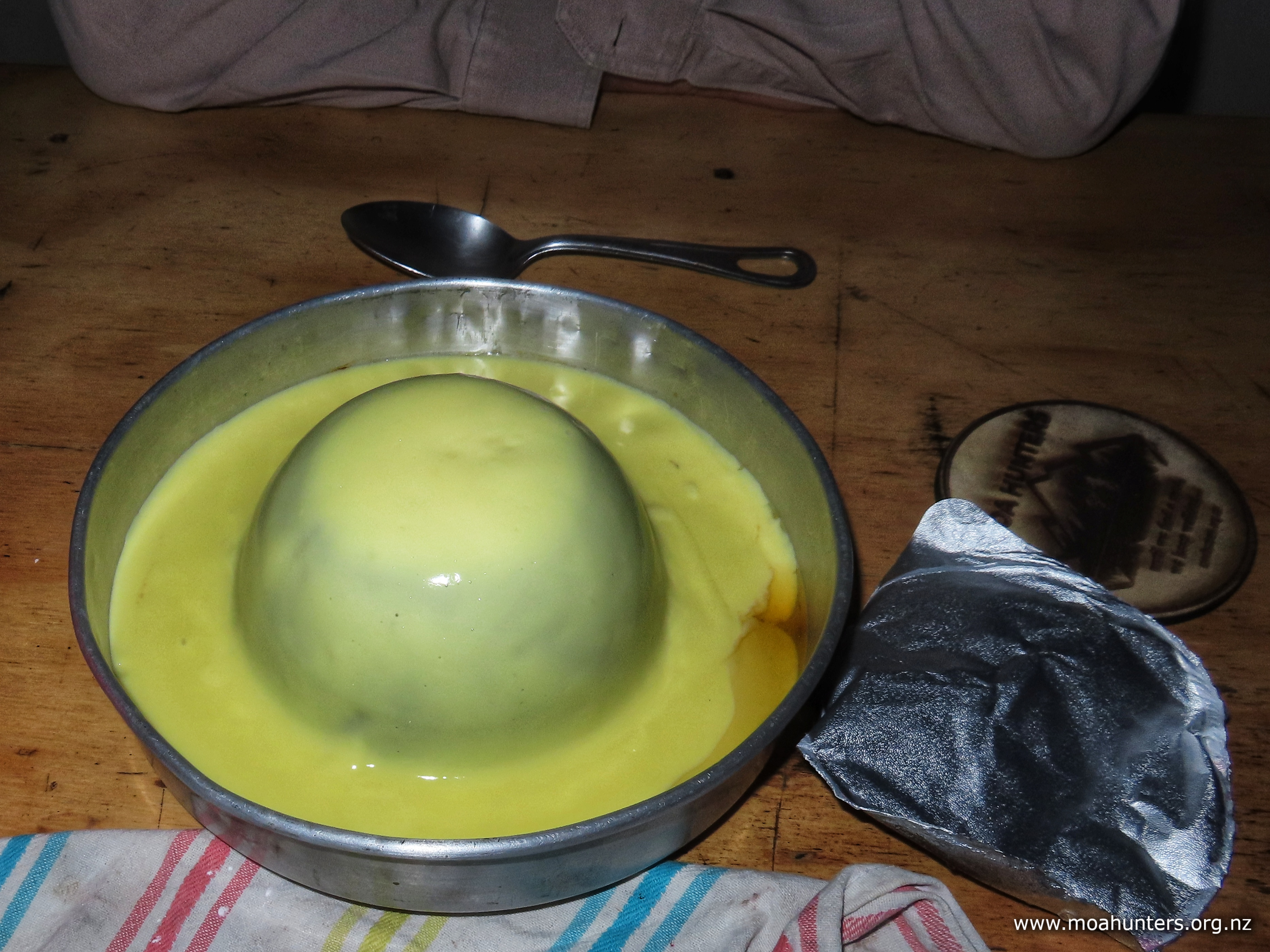
Chris parked himself at a table and busied himself assembling his famous ‘grog log’: Gingernut and chocolate-chippie biscuits are dipped in whisky, then stuck together with whipped cream. The whole lot is covered in more whipped cream and decorated with crumbled flake chocolate. And if you are wondering, yes it does take quite a lot of effort to hand whip cream!

The West Sabine hut sees plenty of action. Being on the Te Araroa trail, hundreds, possibly thousands of walkers either stop by or stay in it over the warmer months. April is a little late for T.A. walkers to be in the Nelson Lakes, so we didn’t meet any this trip, but the hut book was 3/4 full after just four months use!

Grant and Herbie arrived at the hut around 5:00pm. We offered them some hot water for a cuppa and left them space to get settled in.

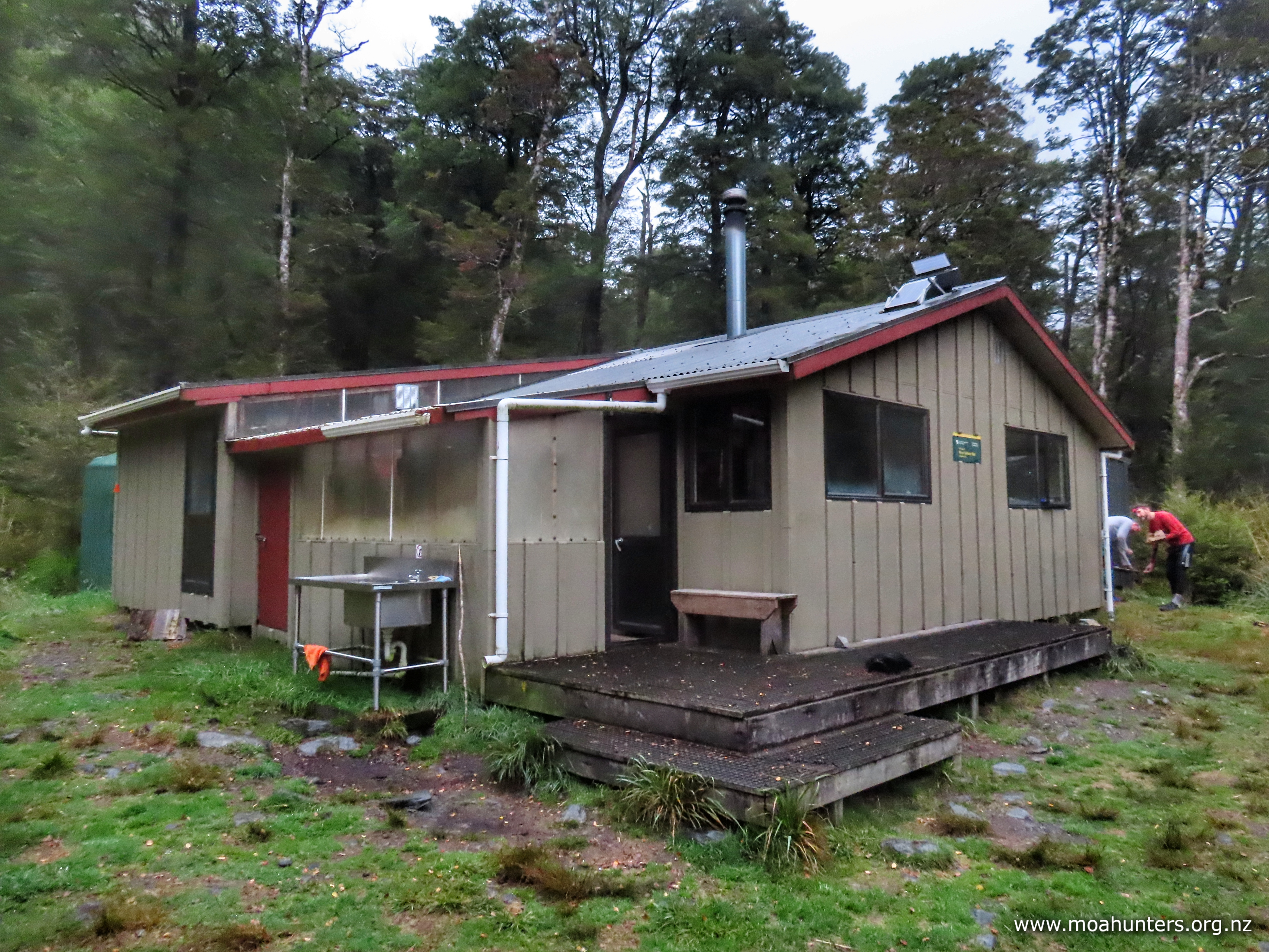
West Sabine hut is the “one big space” design. No separate bunkrooms like Upper Travis. We took the large platform of bunks at the rear, leaving Grant and Herbie their own area on the smaller sleeping area. We enjoyed chatting with our two hutmates – a couple of good blokes.

The Aussie-American couple arrived a little later and spent some time in the hut with us before heading out to camp the night in their tent. We enjoyed hearing about their travels and learned about tramping and tenting in Australia. Apparently it is actually possible to do this without being killed by local wildlife…

That evening, John made an interesting observation: “Moa Hunting is a bit like child birth – you forget how much your legs hurt last time, and keep doing it all again!

With that sage thought still in our heads, and our bellies full of curry and grog log, we pulled ourselves into sleeping bags. The hut went quiet just a tad before 9:00pm.

Day 3

MonDay 15th April – West Sabine hut to Blue Lake hut

According the DOC, the walk from West Sabine hut to Blue Lake hut is just four hours. Given we only had half a day of walking and a full day to knock it off, the moa hunters eased lazily into day three of the Nelson Lakes v2 adventure.

While we enjoyed a hot breakfast seated at one of the large tables in the hut, Grant and Herbie prepared (with quite a bit more urgency than us) to hit the track. Their plan was a ‘there and back’ mission to Blue Lake hut. With lightweight day packs, they said spotya later, and were out the door before the last mouthfuls of moa hunter porridge were gone.

We were in no particular hurry to leave our breakfast table. The world had many problems to solve, and we had some time on our hands…

Comfortable in each others company, even potentially contentious political issues are not off limits. It is nice to be part of a group where all opinions are respected and heard. That said, we all seem to stand mostly on the same side of the political divide.

Having solved climate change, current world conflicts and future energy requirements, we set about solving a more immediate crisis: getting the hut ship-shape and spick and span. Floors were swept, benches wiped, bunks tidied and windowsills cleaned. Many months of dead sandfly accumulation on the sills leads to a nasty pile of mouldy muck. We did our best to leave the hut in great shape for the colder months ahead.

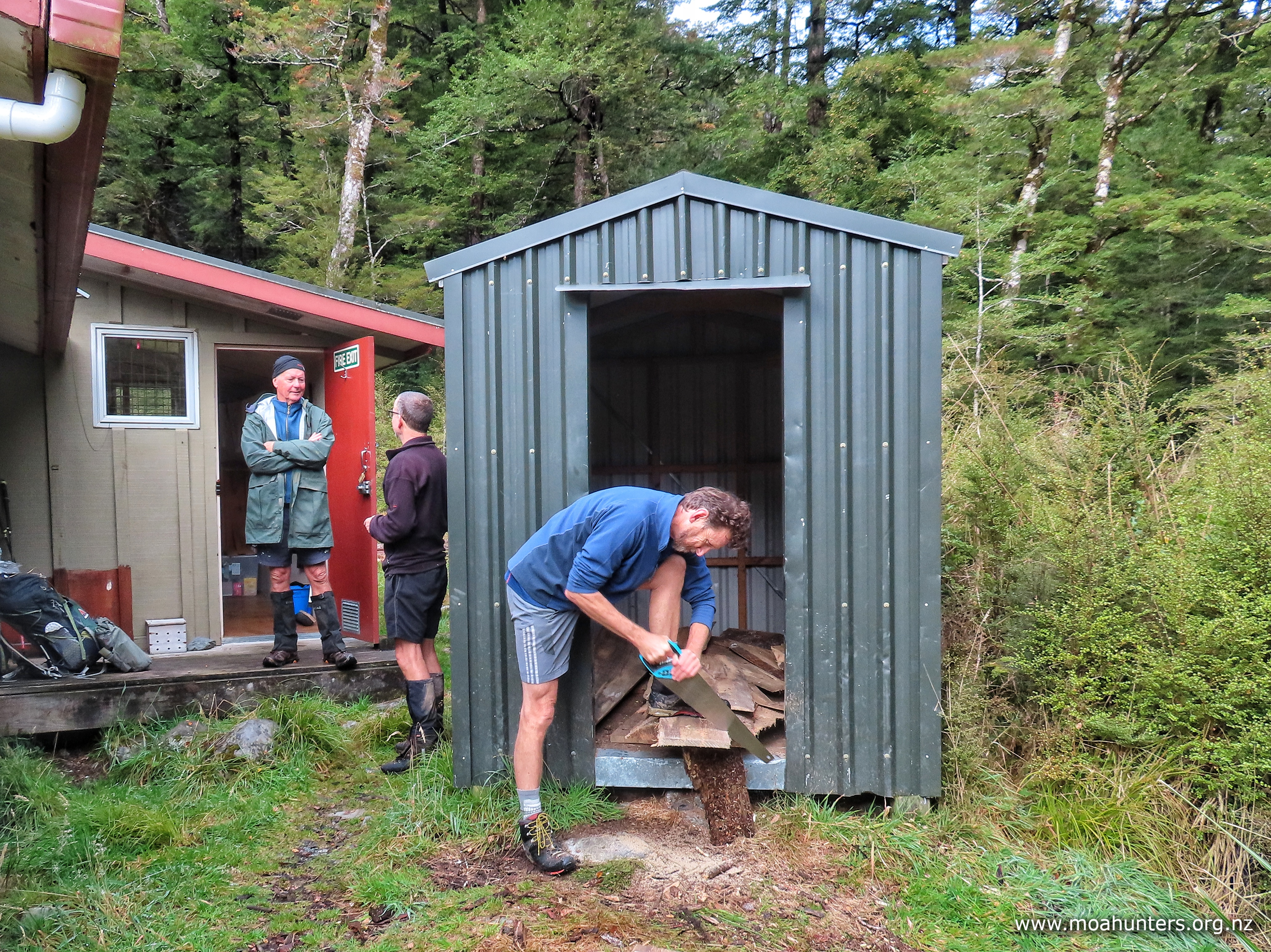
Outside, Chris and Lewis attacked the woodshed. Lengths of wood cut by DOC had been left in the shed, but they were protruding out the door and getting wet. These were cut into burnable lengths and stacked back out of the weather. Back inside, the wood burner was tidied and prepped for future duties.

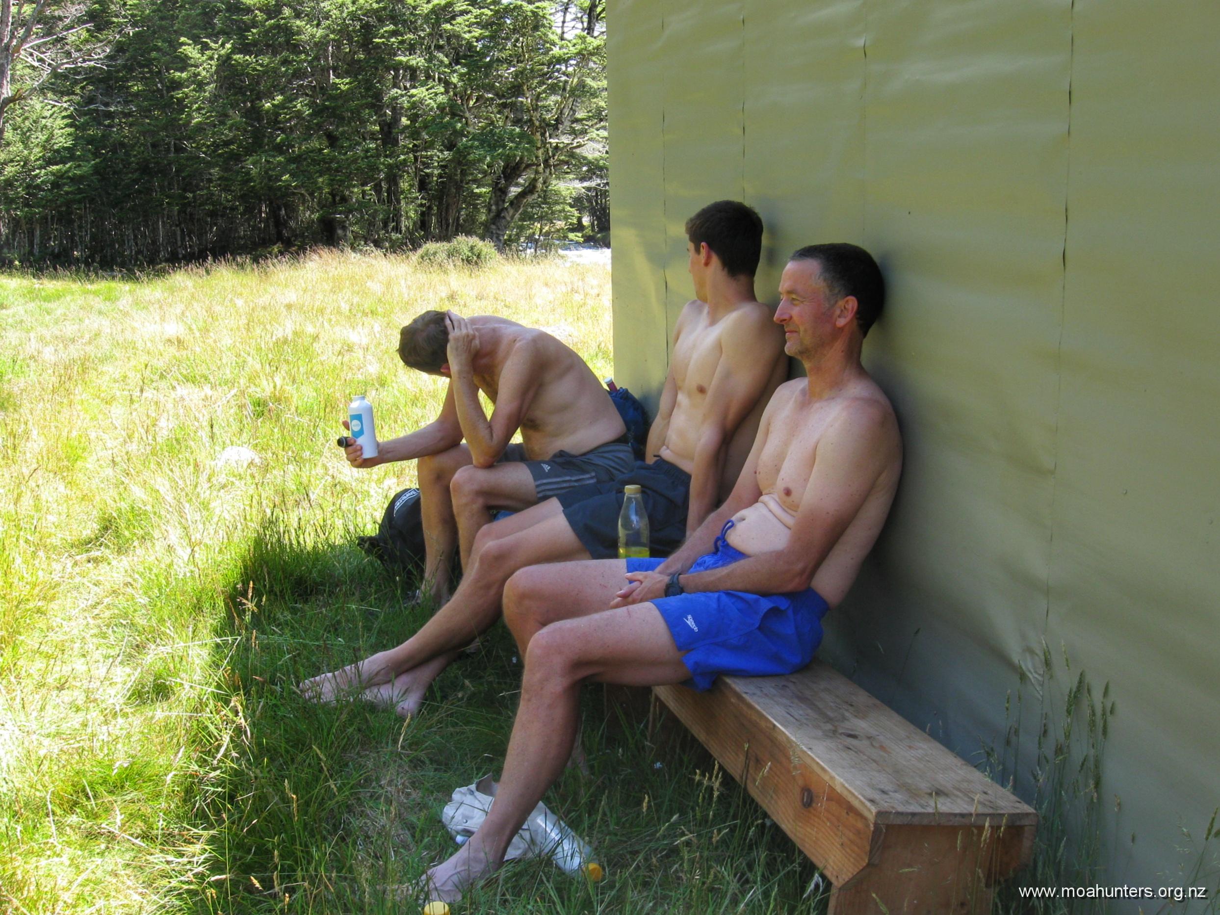
Being outside West Sabine hut in April is a more pleasant experience than during the summer months, for one specific reason: the lack of sandflies. Where they all go when it gets cold, none of us knew or cared. We were just very pleased to be outside with no repellent on, being hardly bothered by the little biters.

West Sabine is a nice hut, but has an unbalanced design in terms of utility. There is sleeping space for thirty people, but just one stainless steel corner bench. If the hut was packed, which likely happens often in summer, occupants would definitely need to use the wooden tables for food preparation and cooking. Not ideal, really.

Our aim was to depart the hut at precisely mid-morning, and we absolutely nailed it. Shortly after sometime around a bit after ten o’clockish, we were striding through the beech forest, bound for Blue Lake hut.

Unfortunately the day didn’t start well for Chris. Not far from the hut, Adam at the front of the group noticed wasps exiting from between the roots of a large beech beside the track. The wasps noticed Chris, and he received three nasty stings for being in the wrong place at the wrong time.

If there’s any kind of silver lining to wasp stings, the sharp pain does make you forget the other aches you may have. Hmmm – perhaps that’s more of a cheap tin foil lining…

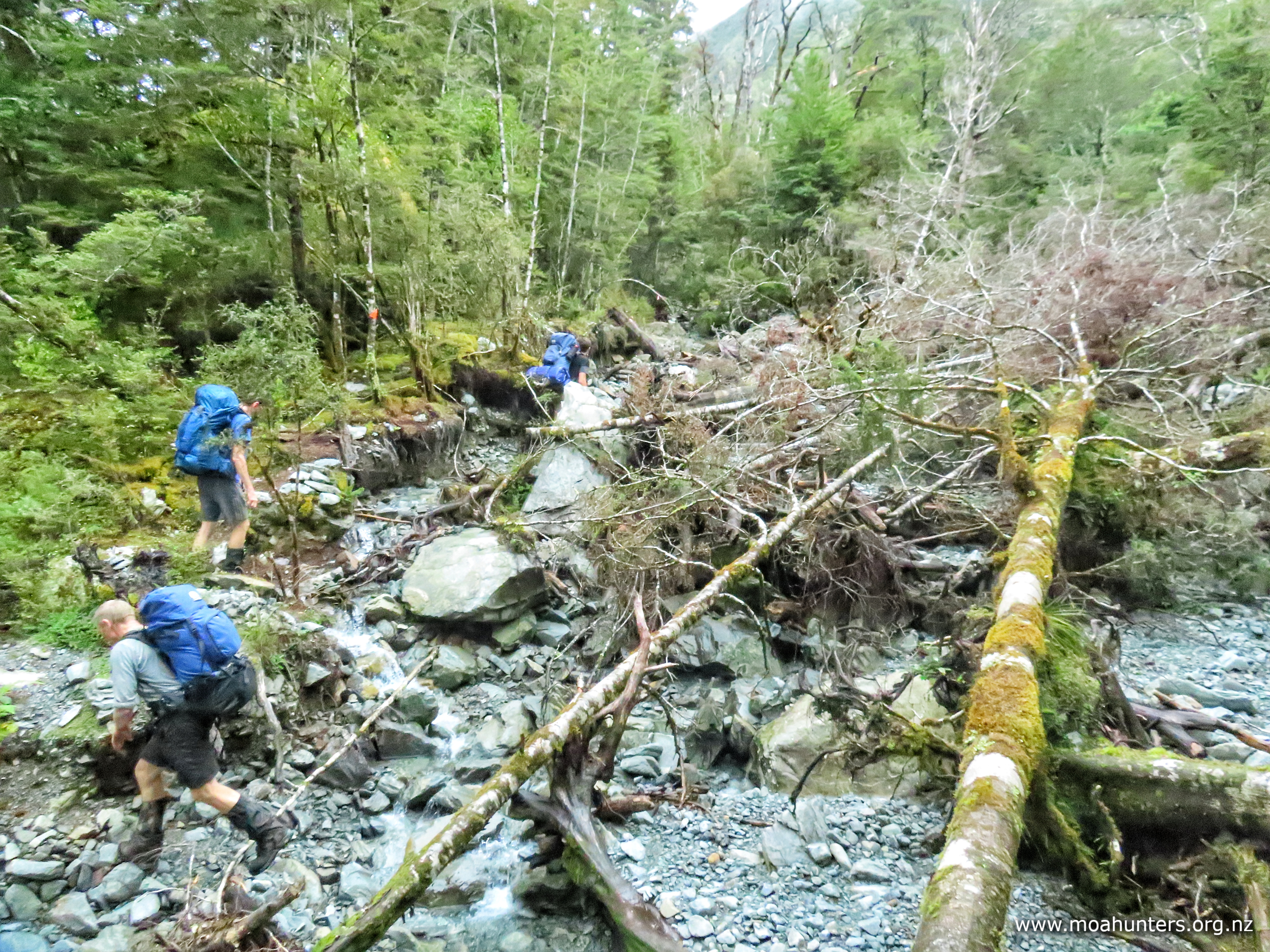
Between the hut and our first scroggin stop an hour later we encountered quite a bit of track damage. Washouts and tree falls made for interesting times along what would usually be a fairly benign section of track.

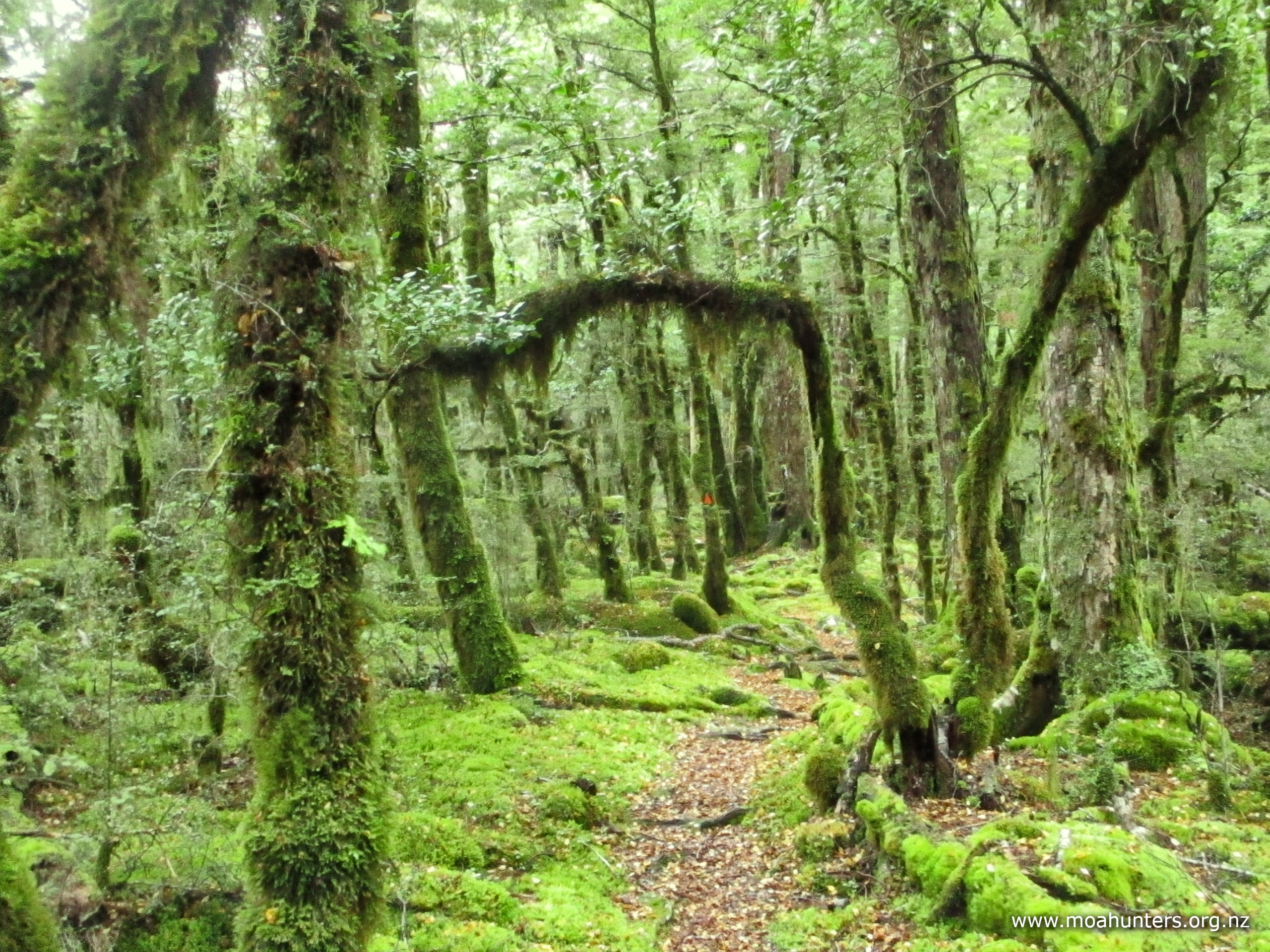
Thick moss covering everything painted our surroundings with a surreal vivid green. Aside from yellow and brown fallen leaves, the forest was a gorgeous fifty shades of green.

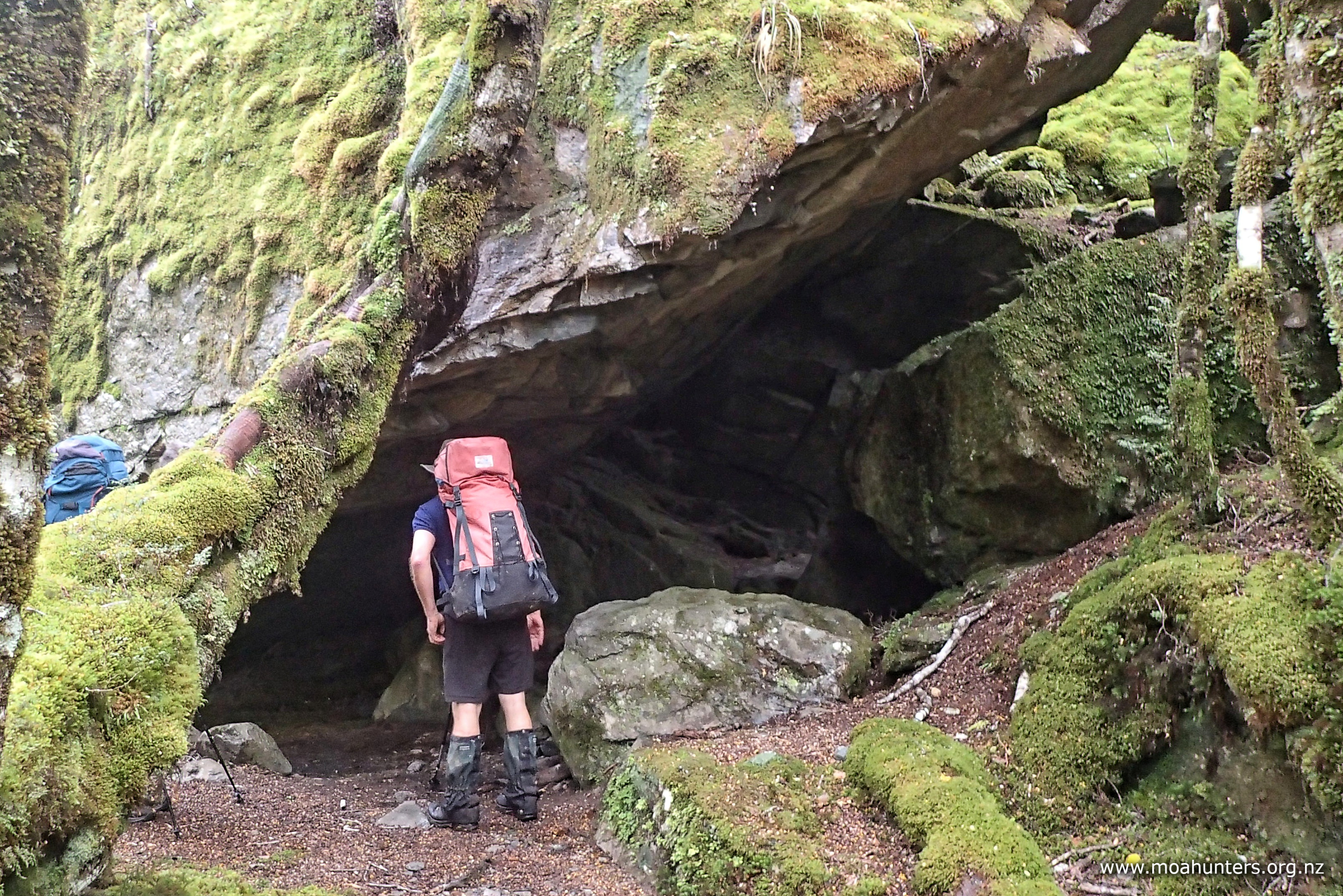
Farther up the track, the valley was filled with enormous rocks. An impressive avalanche had obviously pummelled the area many many years ago. Nature has mostly healed the scars, with moss and vegetation now working hard to cover and hide the rocks completely. It would have been an immense event to have witnessed – but best from quite some distance!

There is also an impressive rock shelter along the track. Impossible to miss and well used, it would make for a nice dry refuge in bad weather. That said, no doubt there are plenty of people have slept under the gigantic rock slab in clear weather just for the experience. We briefly poked our noses in before wandering on. Many of us had previously seen and explored the shelter when we walked this bit of track (in the opposite direction) on our 2020 Lewis Pass to St Arnaud adventure.

Our pre-departure plan was to stop for lunch along the way, preferably at an idyllic spot beside the river, where we would enjoy a long languid lunch. Unfortunately, whoever is in charge of the weather had different and rather irksome ideas. Misty low cloud became light drizzle, deteriorating to heavy and very wetting drizzle. With no discussion or debate necessary, we all walked the track in our own little worlds, knowing lunch would be had at Blue Lake hut.

As the valley narrowed and the hillsides became steeper, a few rock slides had to be traversed. They make a nice change of pace from the beech forest, but the extra exposure to the elements did prompt a few moa hunters to stop and take a moment to fit waterproof pack covers. It felt too warm to wear jackets, but preventing old-school canvas packs getting waterlogged and heavy is always a worthwhile time investment.

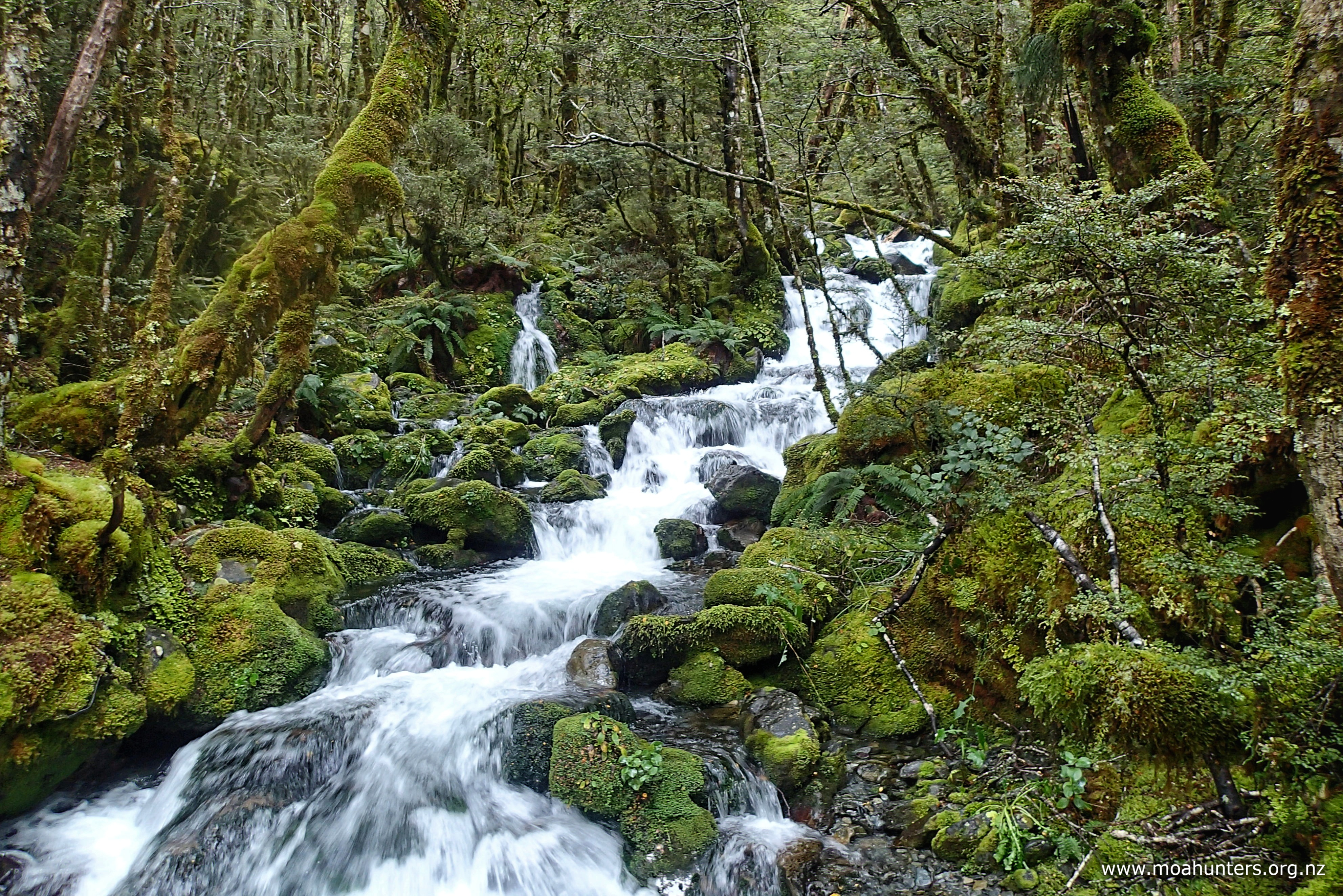
Below the lurking mist on the steep hillsides above us, we spotted numerous fairly large waterfalls. Fuelled by previous heavy rain and lightly topped up by recent precipitation, they were impressive despite mischievous swirling cloud doing its best to hide them.

The last 45 minutes before the hut is an intriguing mix of terrain. For a while things get a bit steep. The Sabine river is boisterous through here as it tumbles down the valley, fighting its way past large rocks in its path.

Above the rapids, the track leaves the river. There is a short, sharp, and quite steep climb from there onto some absolutely gorgeous flats beside a now sleepy Sabine. Easy sections of boardwalk spanning sections of boggy ground and spongy sphagnum moss seemed a good indicator the hut was close by.

But don’t be fooled, the hut is not just round the corner… There is a final ten minute climb through the forest to the hut. To be fair, nothing onerous on a very short day. But if I was writing the script, the hut would have been back on those lovely river flats. Just sayin’!

Outside the hut, we dropped packs and began stripping off wet gear, muddy boots and gaiters. A young woman wandered up the track from the direction of Blue Lake.

As is almost always the case with people we meet on the track, she was a friendly like-minded tramper out enjoying the beauty of Aotearoa. That morning she had walked over Moss pass from George Lyon hut in just five and a half hours, and was continuing on to West Sabine hut. Wow. We thanked her for making us old fellas feel even more inadequate than usual, and wished her well for the onward journey!

Grant also showed up from the direction of the lake. He asked if we had passed Herbie as we walked up. We had not, and Grant immediately looked a little concerned. Herbie’s knee had been getting quite sore during the morning, so he wisely elected to turn back rather than push his luck. Somehow we had missed him as he walked back to West Sabine. Grant learned later that Herbie had been sighted close to West Sabine hut. No doubt he was very relieved to have that news as he set off back.

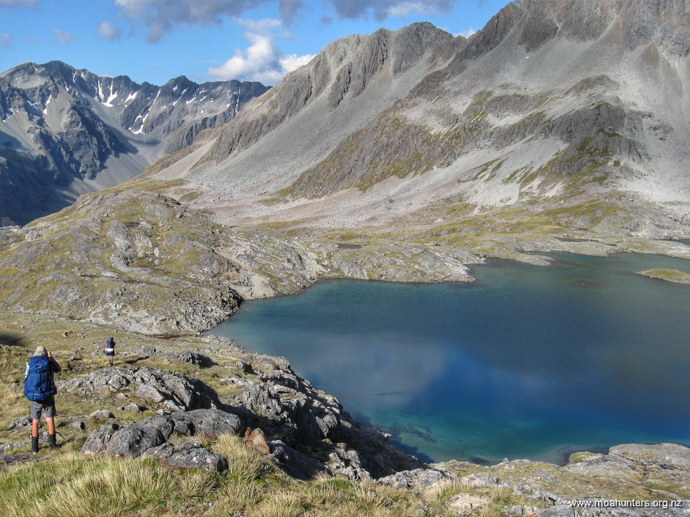
With plenty of the afternoon ahead of us, we enjoyed some leisure time at Blue lake. Lunch was eaten inside.

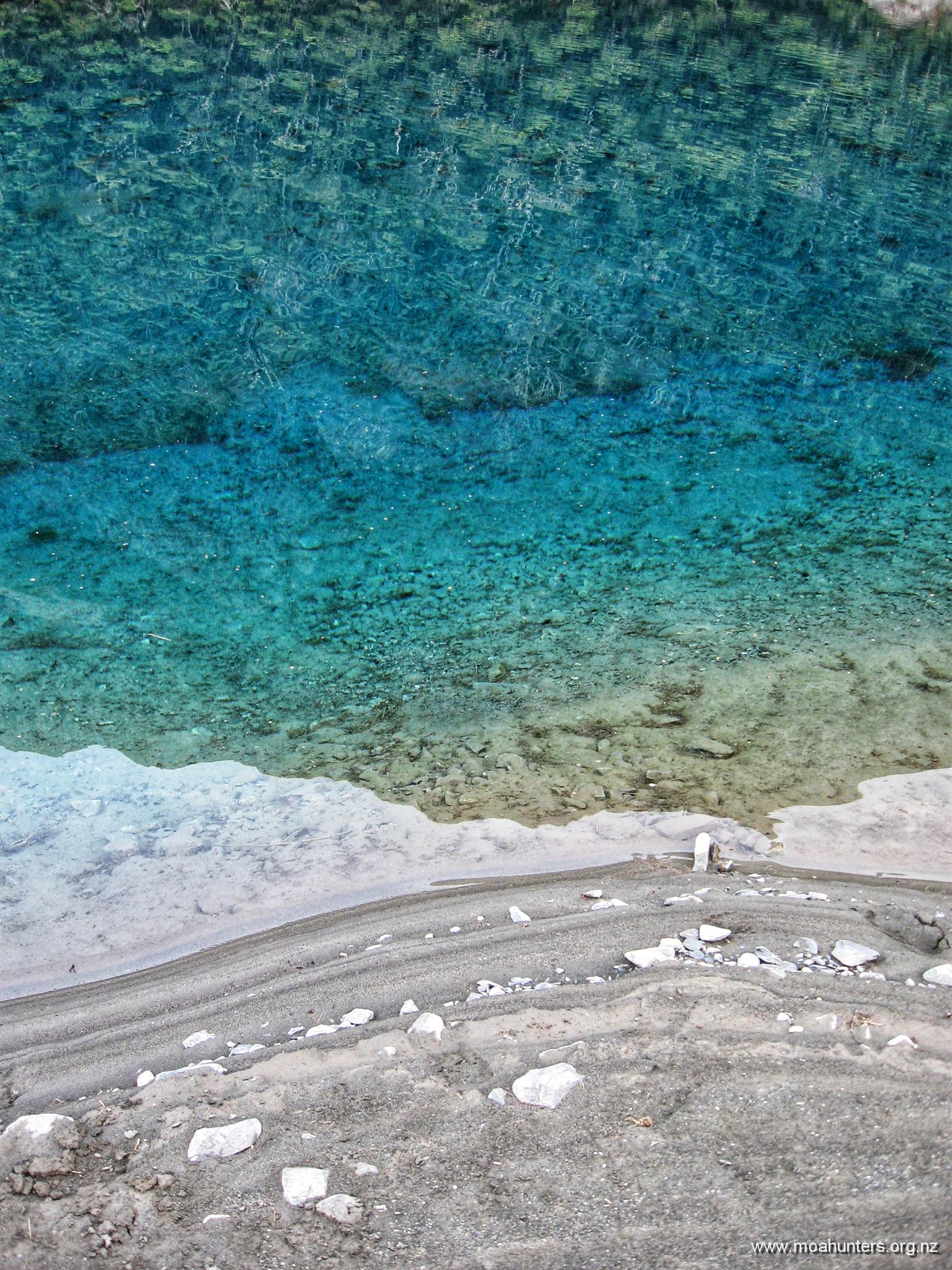
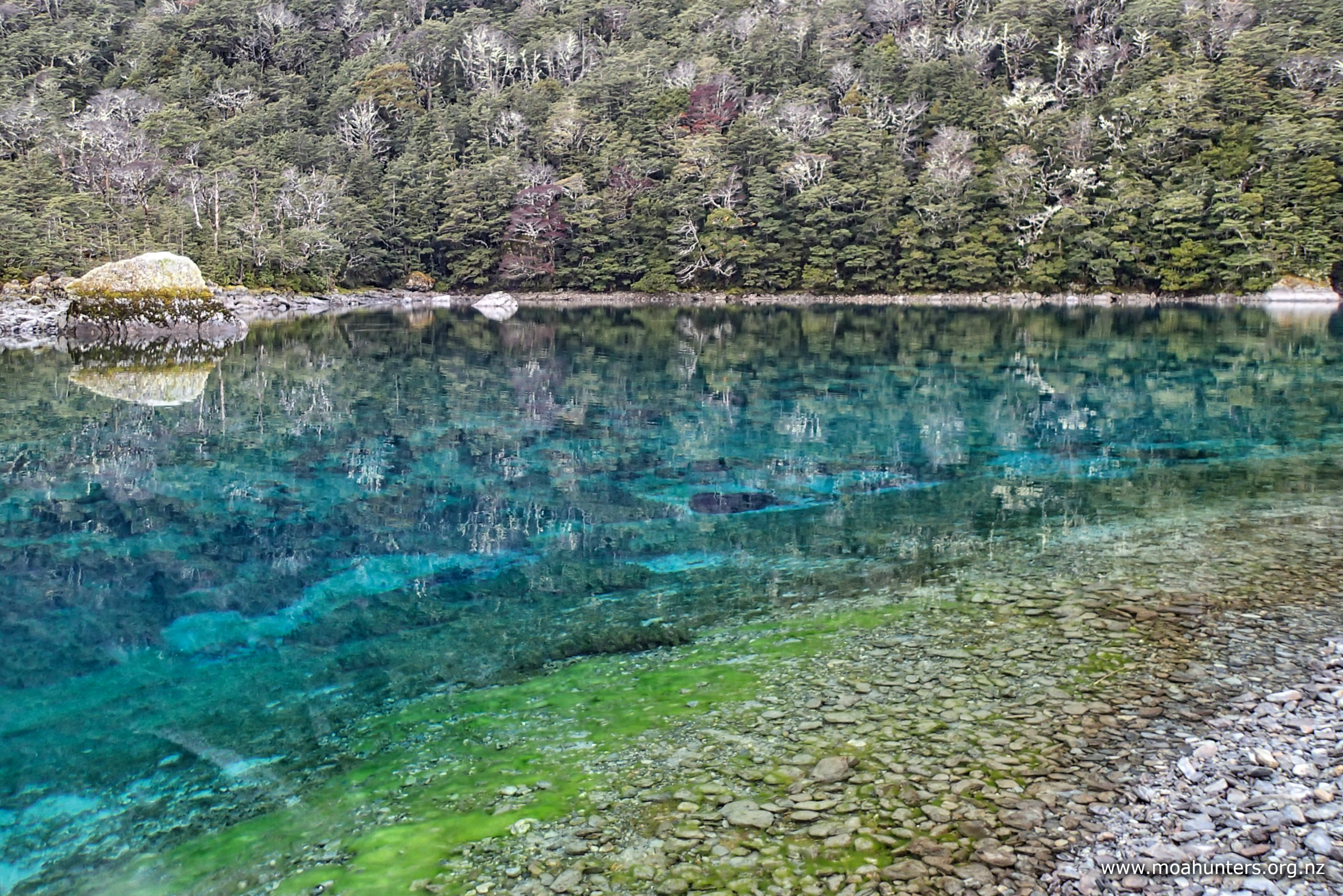
Despite persistent light drizzle, Blue Lake itself was still a surreal place, well worth the wet wander down to take a look.

A game of Pass the Pigs whiled away some time, as did sparking up the log burner and enjoying some idle chitchat or a snooze on a bunk.

Later than afternoon, another solo tramper arrived at the hut. Judging by her accent, Rachel was from the UK. We got the vibe that spending the night in Blue Lake hut with seven moa hunters was probably not her ideal scenario, so we did our best to make her feel as welcome and at ease as possible.

We cleared space for her at the tables and on the drying rack above the logfire. She was also very accommodating, and sat chatting to us in the evening.

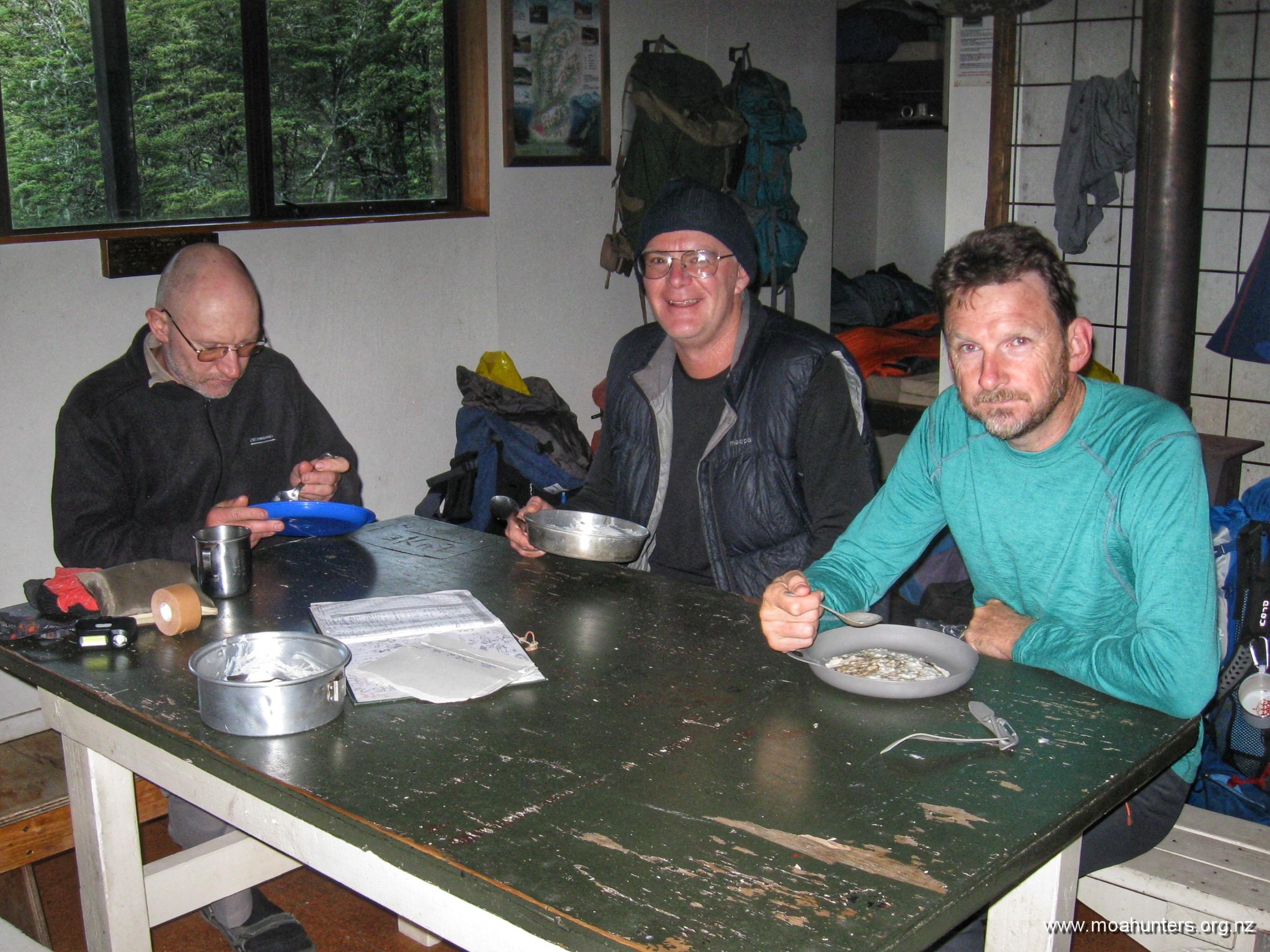
Dinner was a three course meal – hooray for Chris! Shiitake mushroom soup followed by a well seasoned cottage pie were headline acts. Sweet Tiramisu dessert drizzled with decadent Glayva was the triumphant finale of a mighty feast. Surprisingly, this extraordinary menu was all dispatched before 7:30pm.

Not many minutes before 8:00pm we were snugged up in our sleeping bags with lights out. Luxury!!

Day 4

Tuesday 16th April – Blue Lake hut to George Lyon hut

We woke to a very cold Blue Lake hut. Outside, there was slightly more than a hint of white frost on sheltered patches of grass, explaining why we could clearly see our breath inside. We all rugged up with plenty of thermal layers. Knowing we had damp firewood and a long lead time before the wood stove would warm the hut (even with dry wood), we decided not to spark it up.

Hot porridge this morning was especially welcome, along with a steaming cuppa. While we understand that many trampers like to travel light, sacrificing heated food and drinks to go ultralight is a step too far in our book!

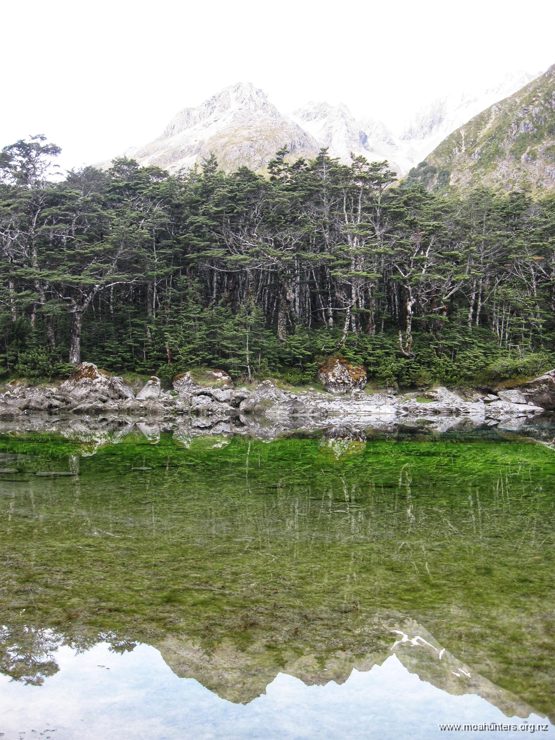
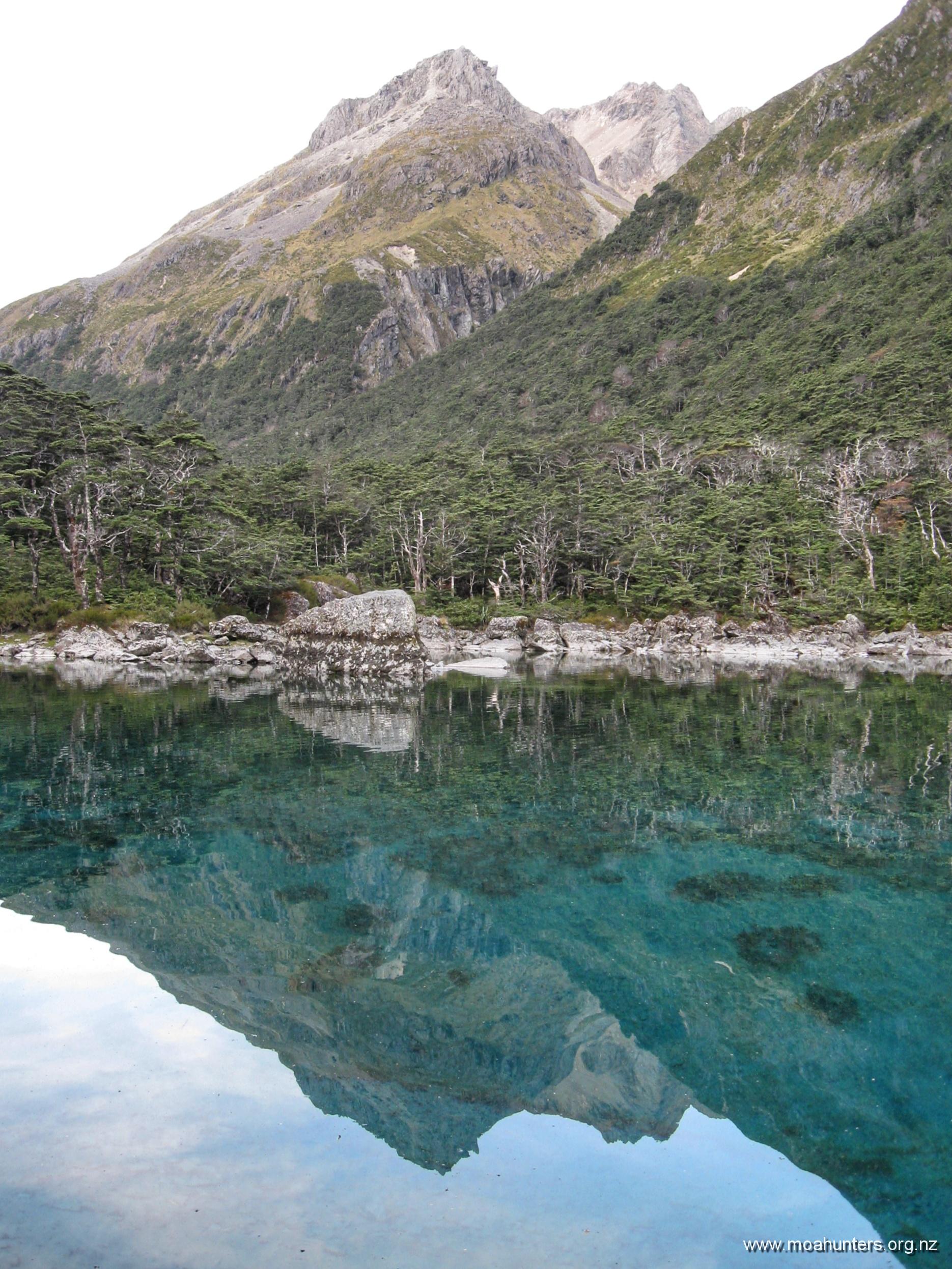
Once we were packed and the hut tidy and swept, we nipped down the track to check out Blue Lake on a better day with no rain falling.

It really is an amazing body of water. Vivid stripes of lake weed and algae create bright bands of colour, visible with amazing clarity through the glassy water. Vivid green in the shallows transforms to gently glowing blue in deeper water.

We wandered up the length of the lake taking plenty of photos we knew would not do it justice.

According to a DOC notice in the hut, some plonkers had been playing Frisbee near the lake, and unsurprisingly an errant throw had landed in the water. To the credit of those involved, they heeded all the signs and stayed out of the water rather than going in to fetch it. DOC must have devised an environmentally and culturally acceptable way to retrieve the Frisbee, because we saw no sign of a plastic disc.

We wondered how much that little rescue mission had cost the taxpayer… Perhaps it’s best we remain ignorant.

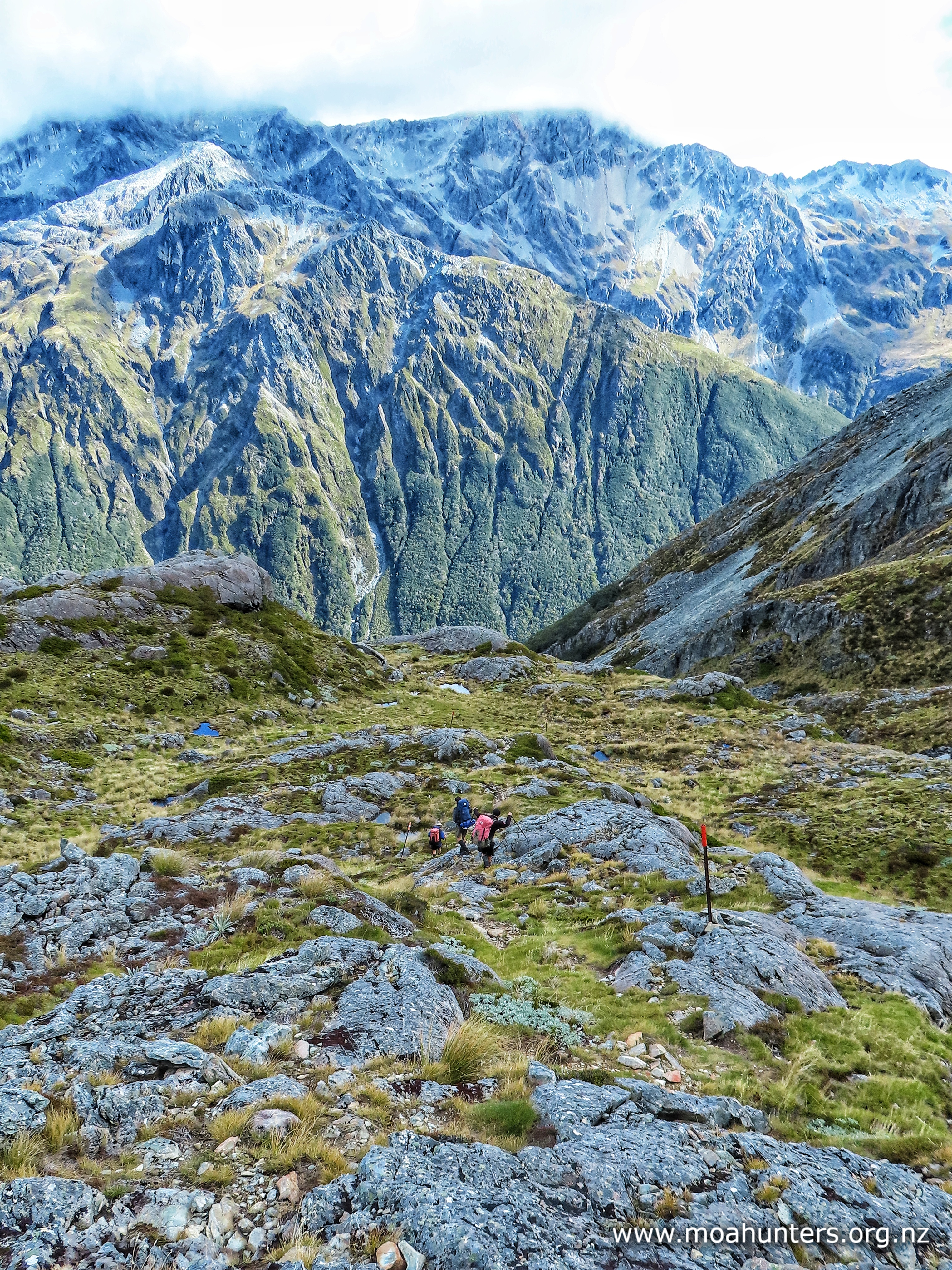
From Blue Lake hut, the track enters a short section of beech forest then emerges onto steep open scrubby snowgrass country. The day had not warmed up much, and we were all well rugged up with thermal layers. But twenty minutes of solid ascent had us unzipping polarfleeces and stripping down.

Behind us, increasingly epic views back to Blue Lake opened up. We took plenty of opportunities to pause and enjoy them… and catch a quick breather! Cloud clung to ridges in the valleys well below us, confirming we had indeed been climbing.

Taking in deep breaths of the icy fresh mountain air reminded us we were very much alive. There’s something magic about being on the tops, focusing on your senses one by one to really experience the moment. Inhaling the sharp cool air, feeling its chill in your lungs. Hearing a distant bird and casting your eyes out to the valleys and peaks where it might be… then looking in close, noticing the delicate alpine plants beside your boot.

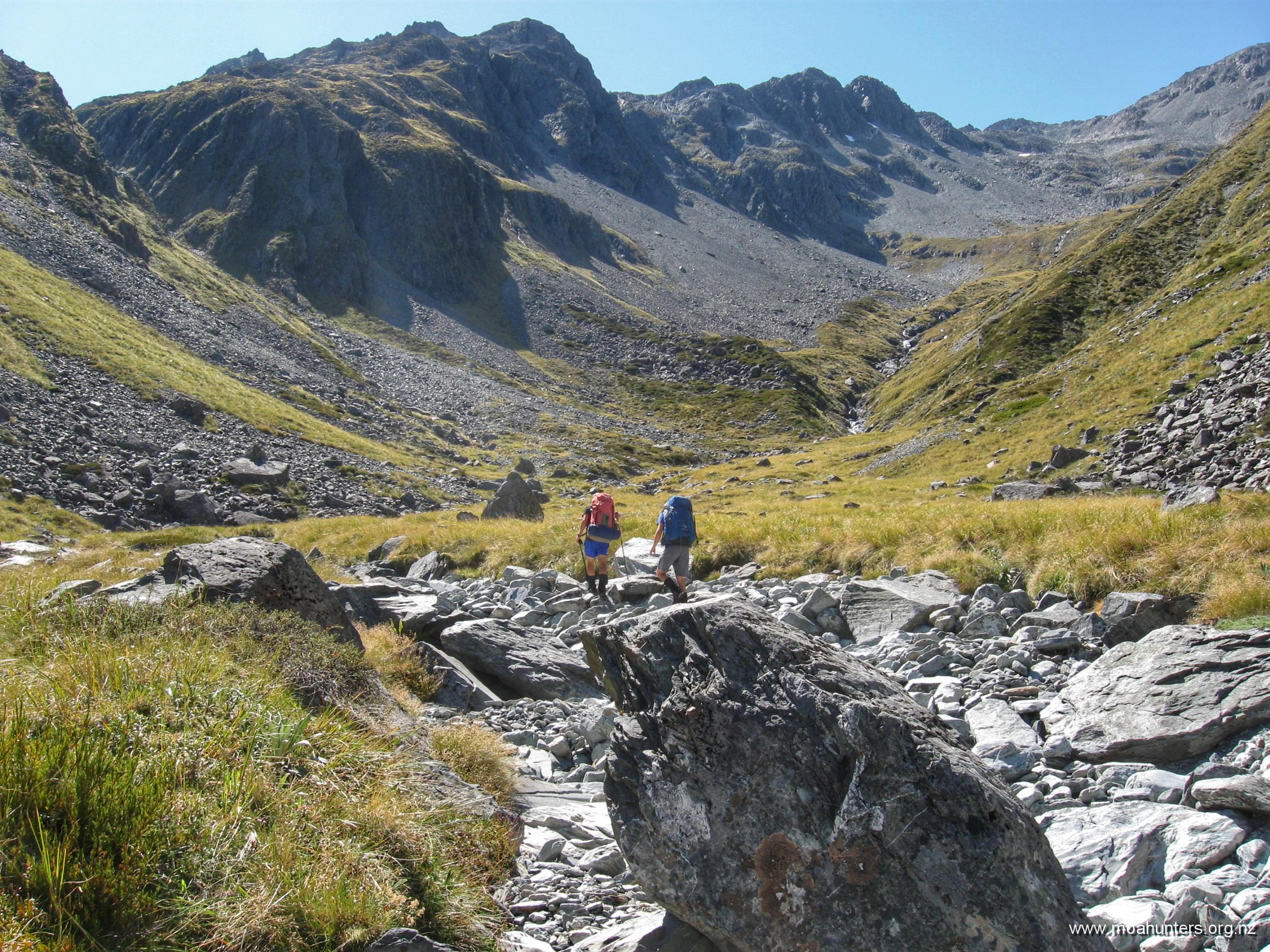
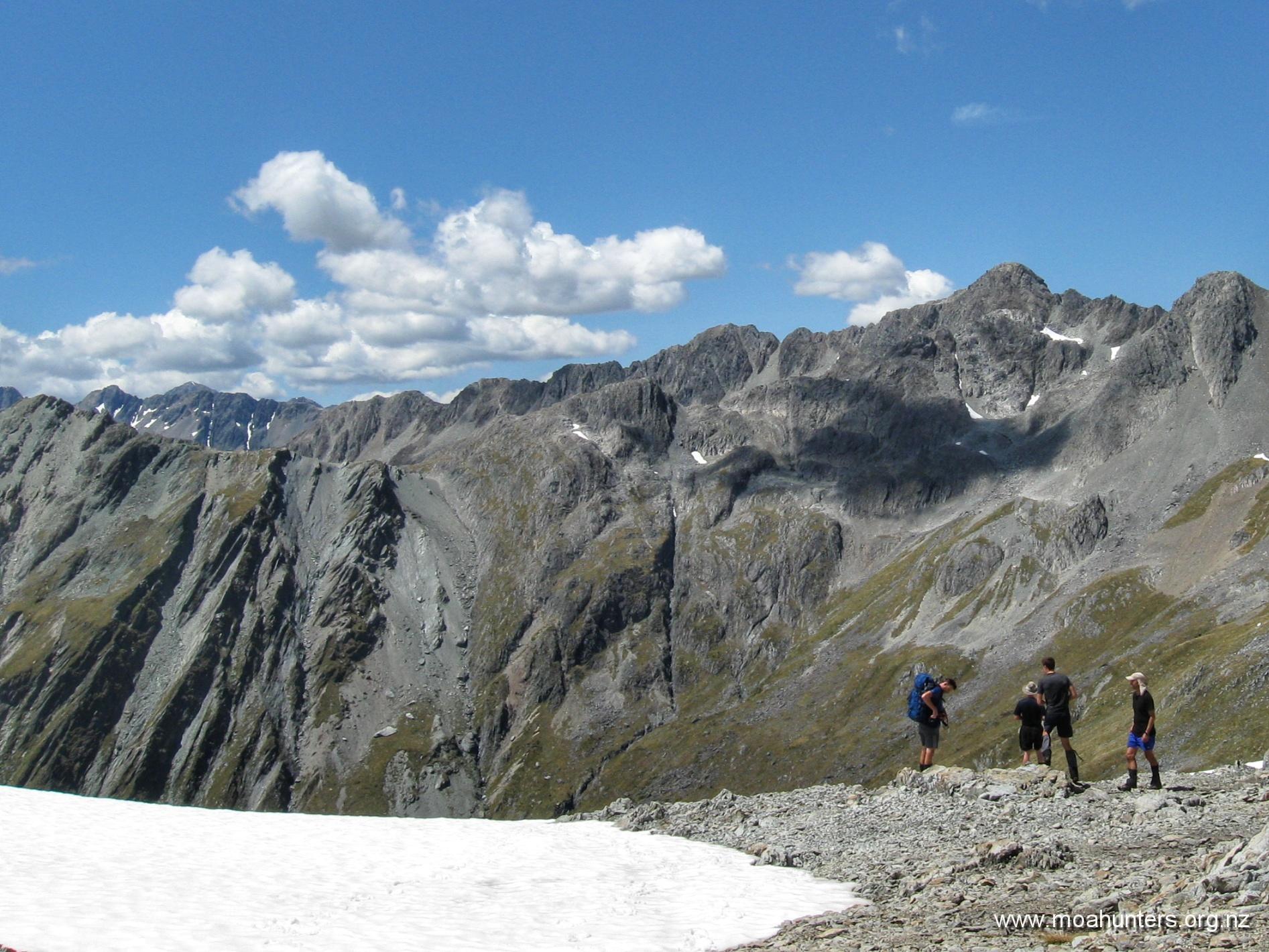
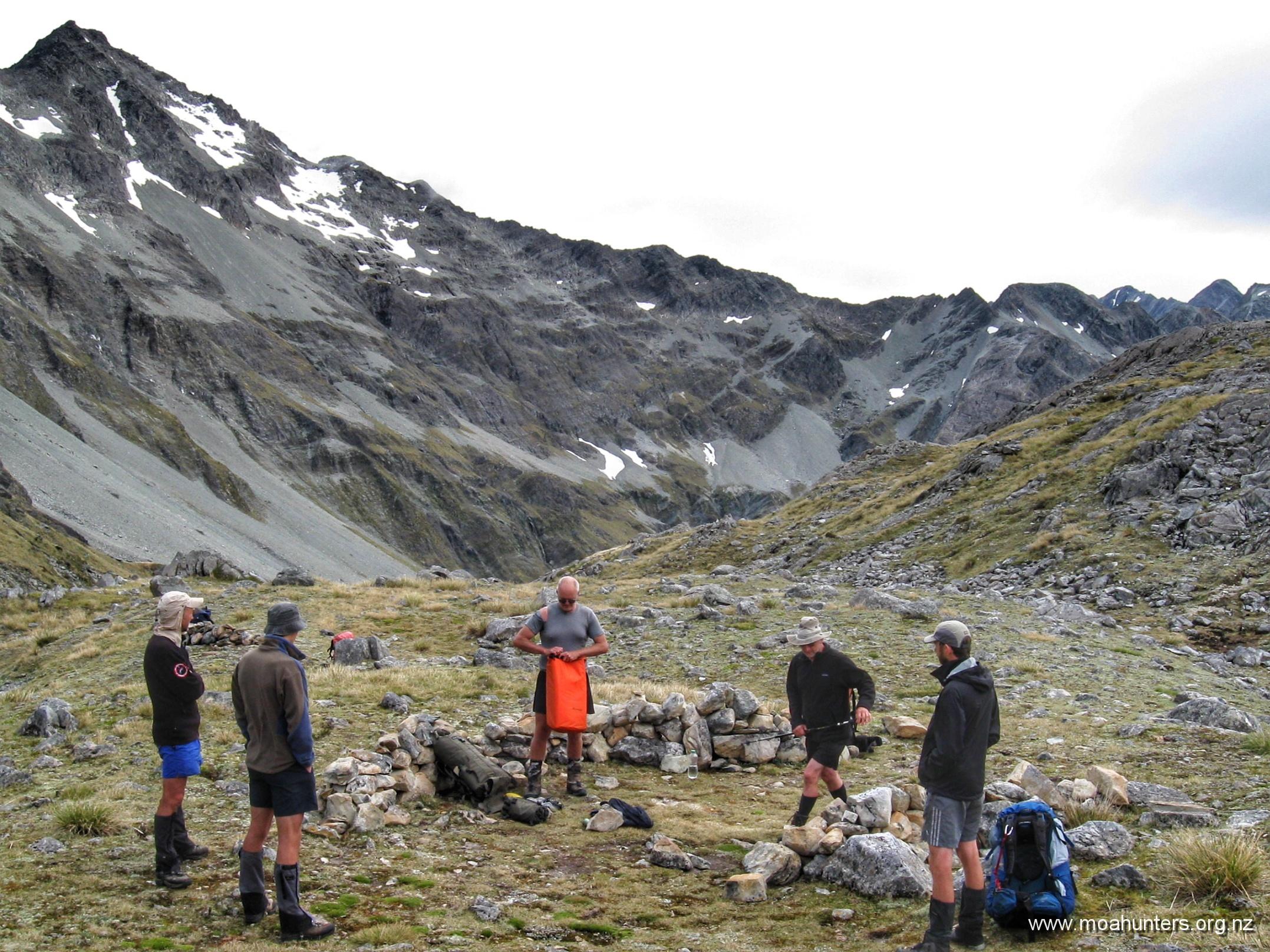
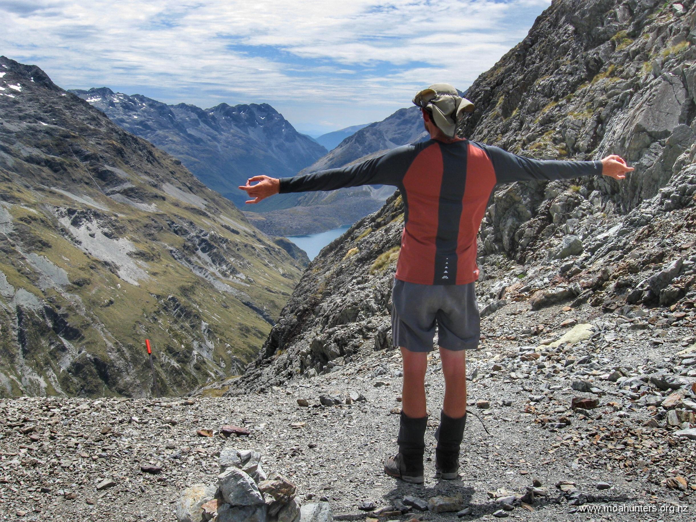
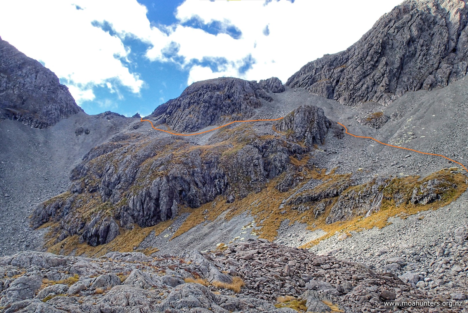
An hour into the climb there are some nice spots to take a break. We dropped our packs at one of these pleasant flats and spent some time checking out the view below and the route above. We could now see rocky Moss Pass awaiting us at the top of a steep shingle strewn climb.

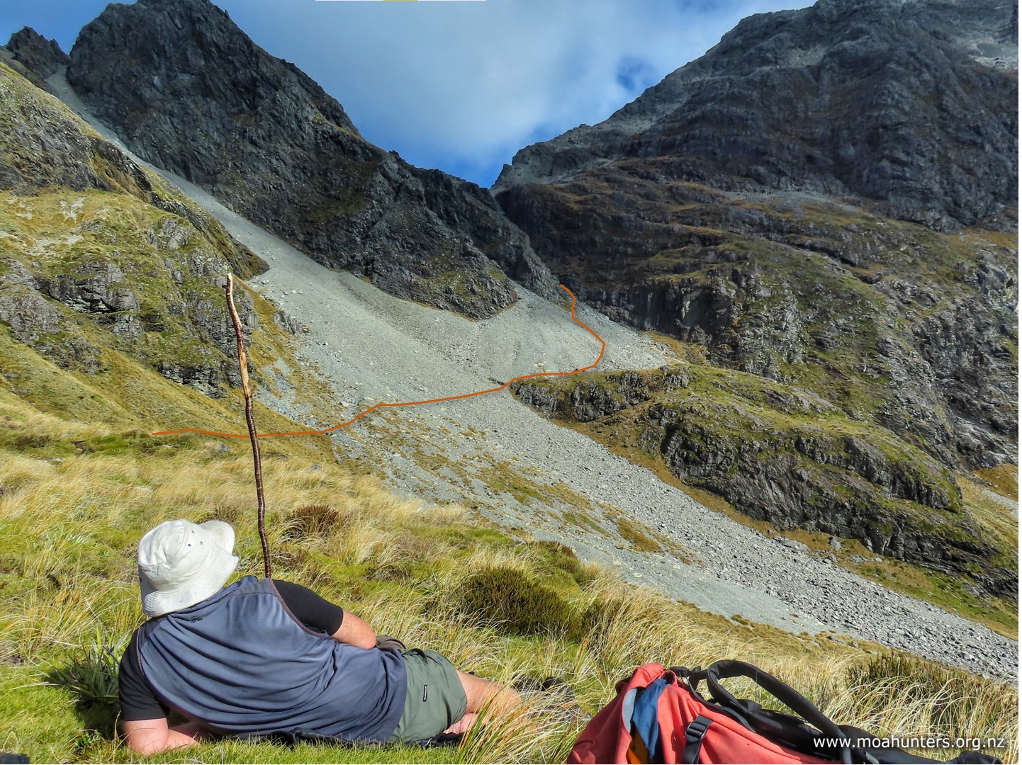
From our scroggin stop we made our way across a shingle fan and onto the upper fringe of a rocky outcrop. There are many marker poles here and choosing a route is not required – we just followed the well walked track.

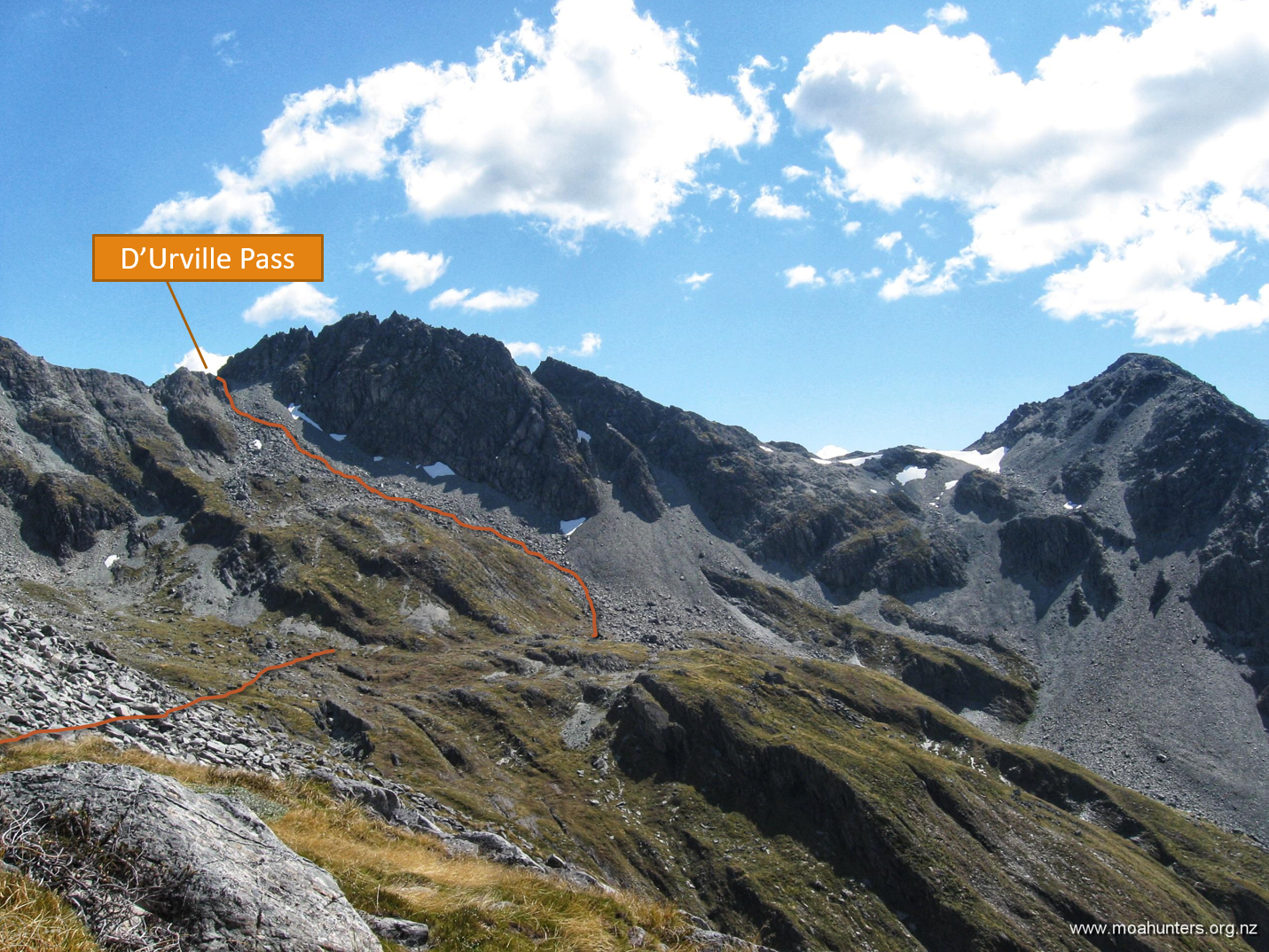
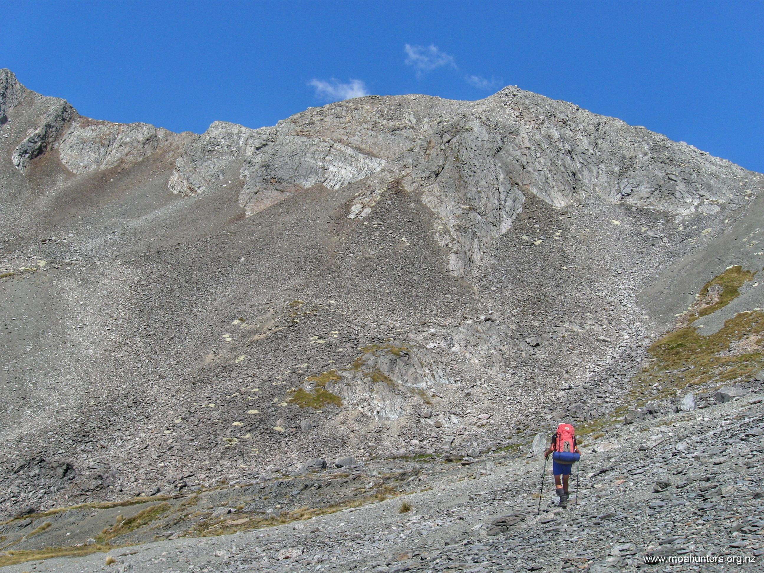
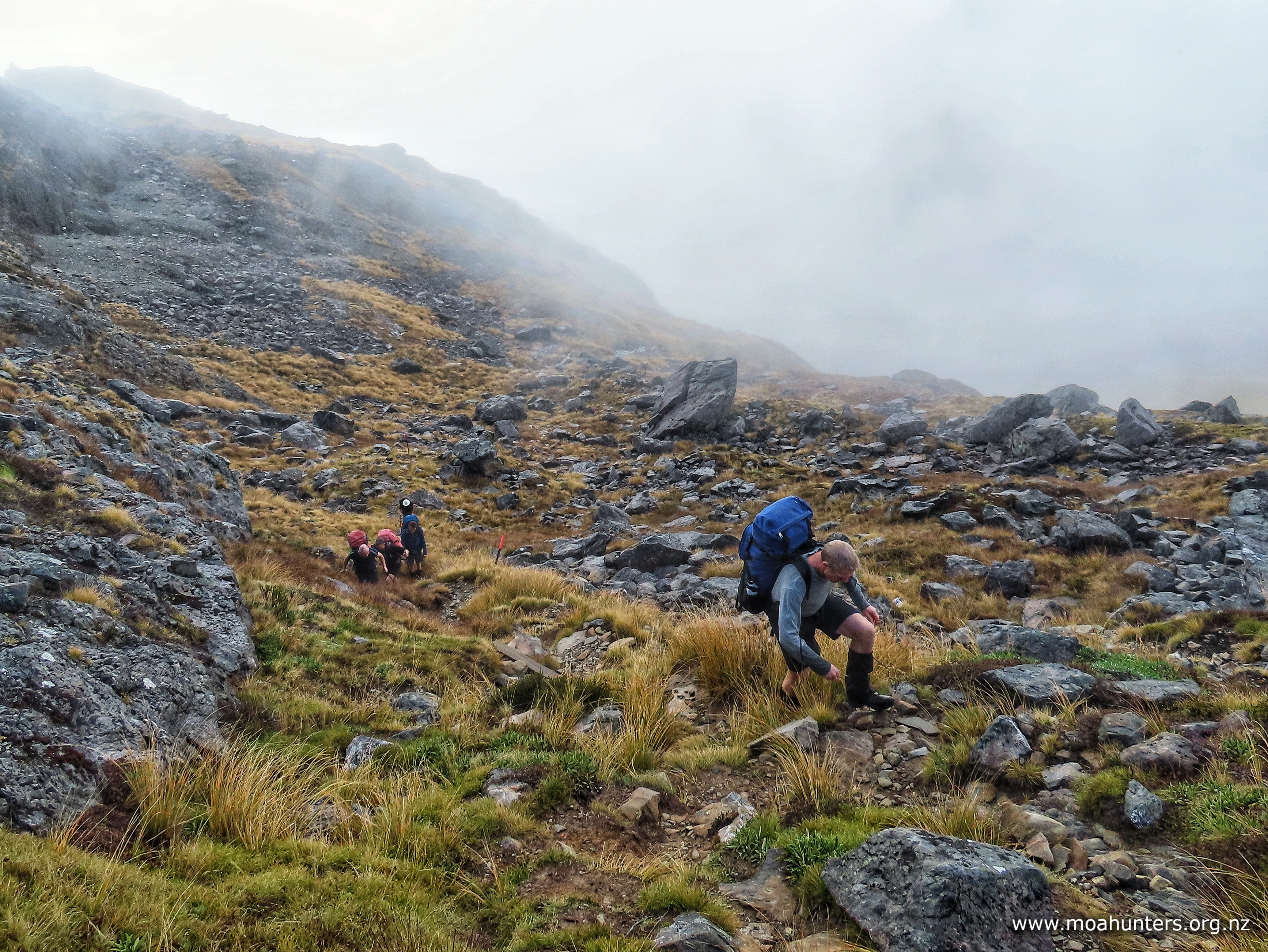
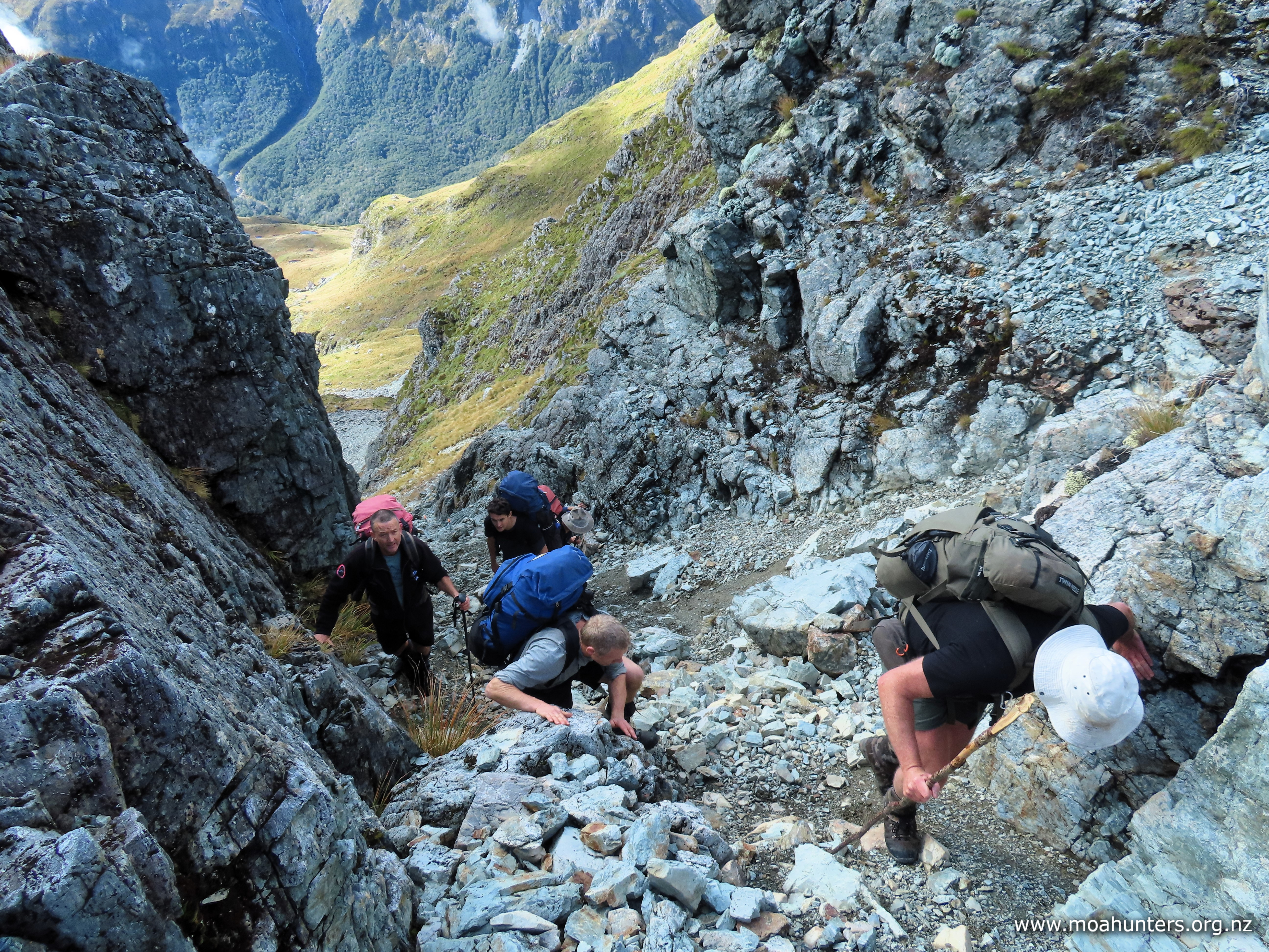
Beyond the outcrop, the track turns left and the seriously steep section begins. There are lots of photos of the Moss pass rock chute online, and we knew it would be a steep grunt up to the top. We were not disappointed.

The higher we got, the smaller and less stable the rock debris underfoot became. If you chose the wrong path up, it was one step forward, then slide one step back. Sticking very close to the rock wall on the right of the chute was a winning strategy. Locked on one side against the hard rock face, shingle tended to slide less and footholds were much more stable.

While the climb was tricky and steep, we wouldn’t rate it as particularly dangerous, provided you take your time and follow the well trod route. Walking in a large group, our main concern was accidentally dislodging rocks onto our mates below. To manage that risk, we stayed close as we ascended, maintaining awareness of those above and below at all times.

The rock chute is the highlight of the climb to Moss pass, but it is not the finale. Emerging through a narrow gap the chute leads to a comparatively flat rocky basin. Beyond that is a 10 minute grunt up a moderately steep rock-strewn face to the pass.

Scaling these mountain tops gave us a sense of the massive power of nature. We were picking our way through a landscape of shattered rock. The combined forces of wind, rain, sun and ice inexorably crumble mighty granite peaks to rubble.

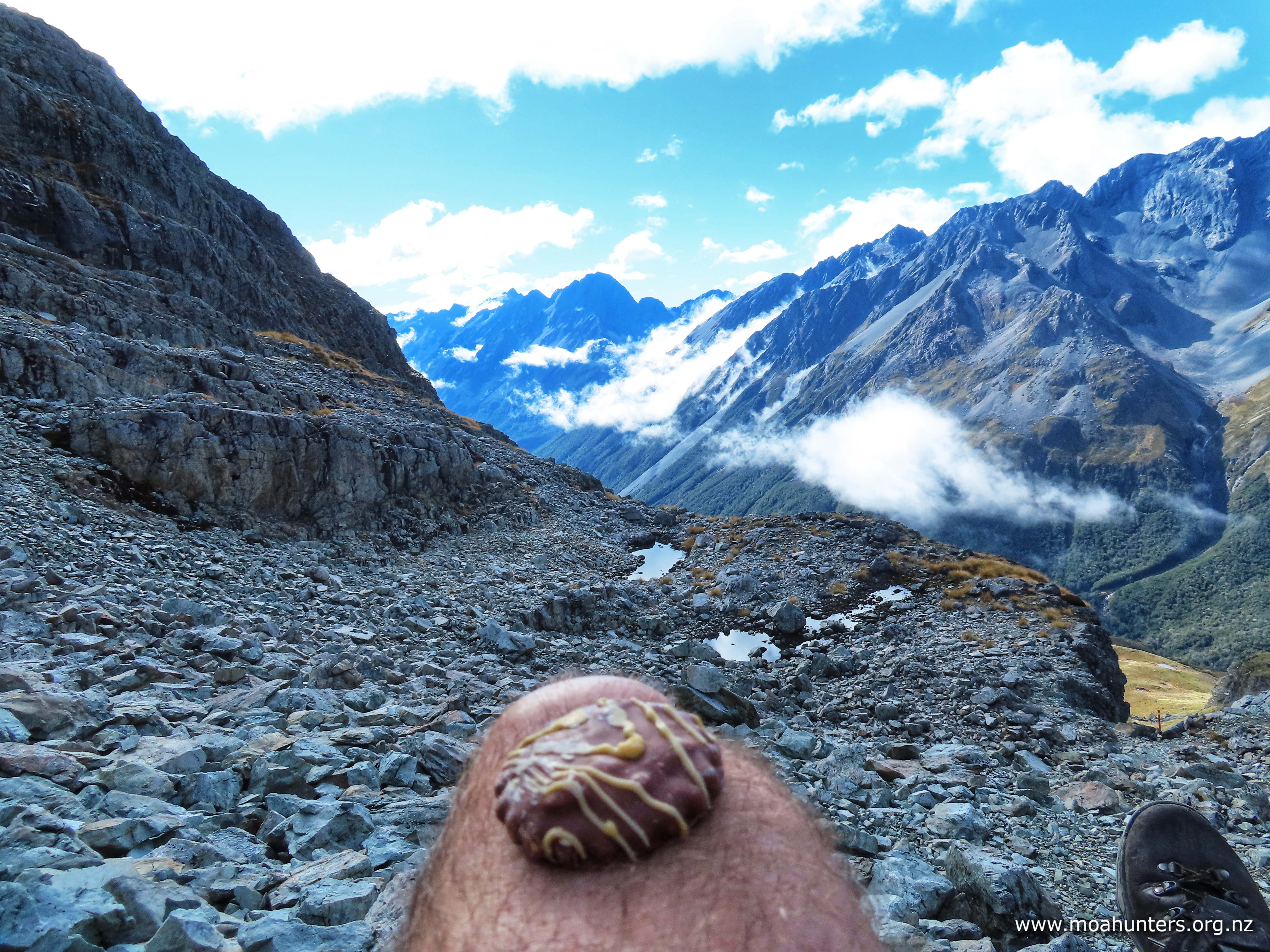
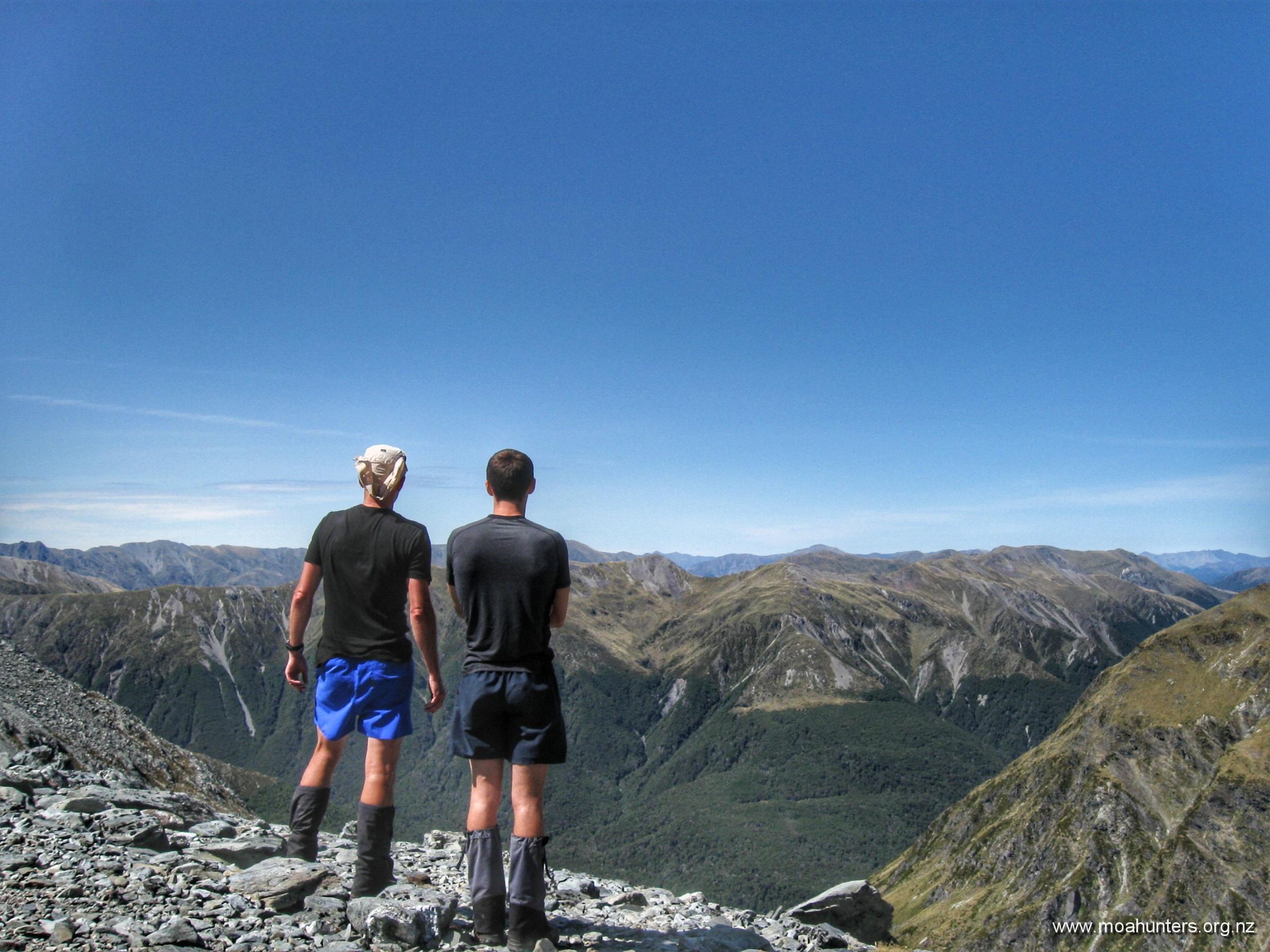
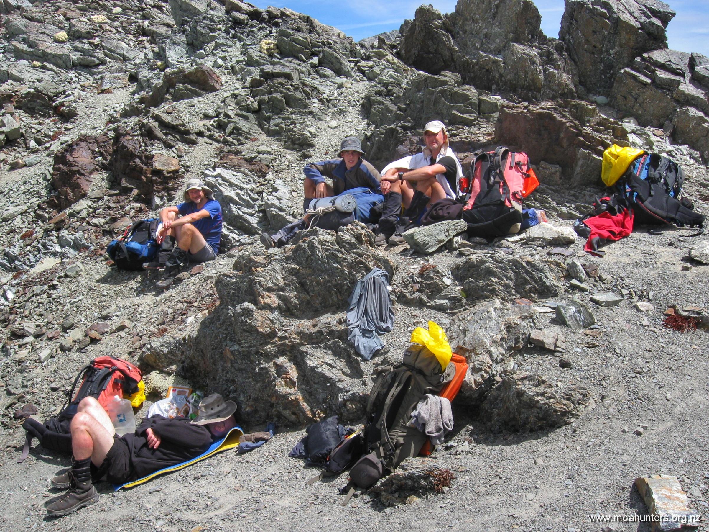
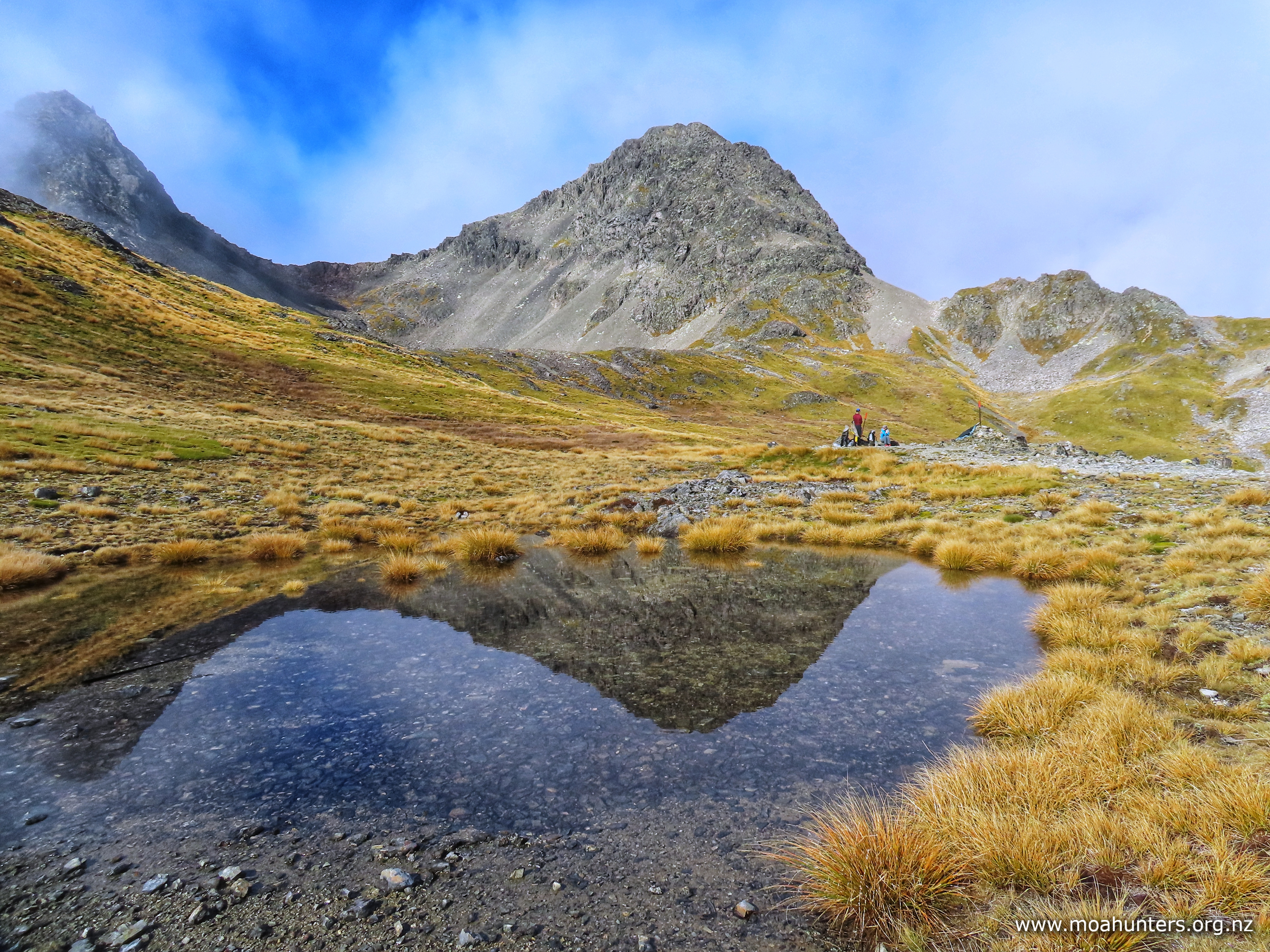
At the top of Moss pass, we took a moment to celebrate. Sitting in a long row on the rocky pass, we all enjoyed the feeling of being on top of the world. A very satisfying feeling indeed, improved immensely by scrummy squiggle top biscuits.

In what has become a very happy “top of the pass” tradition, Luke produced a battle-worn packet from the depths of his backpack, and threw a squiggle to each of us. Bliss…

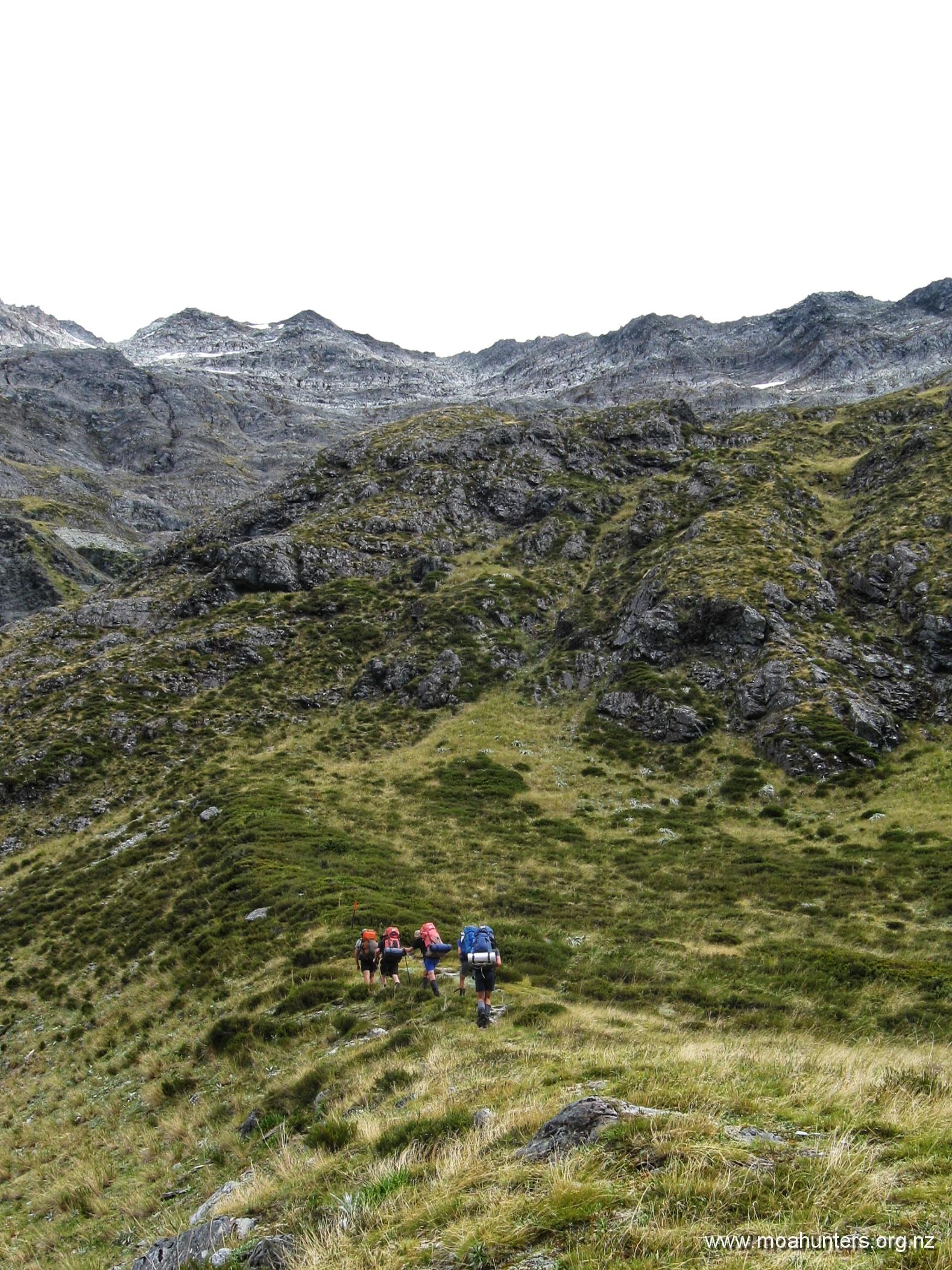
Fuelled by chocolatey goodness, we dropped off the pass making our way through similar terrain encountered on our ascent – rocks and rubble. However, this soon gave way to flatter country with patches of grassy tussock.

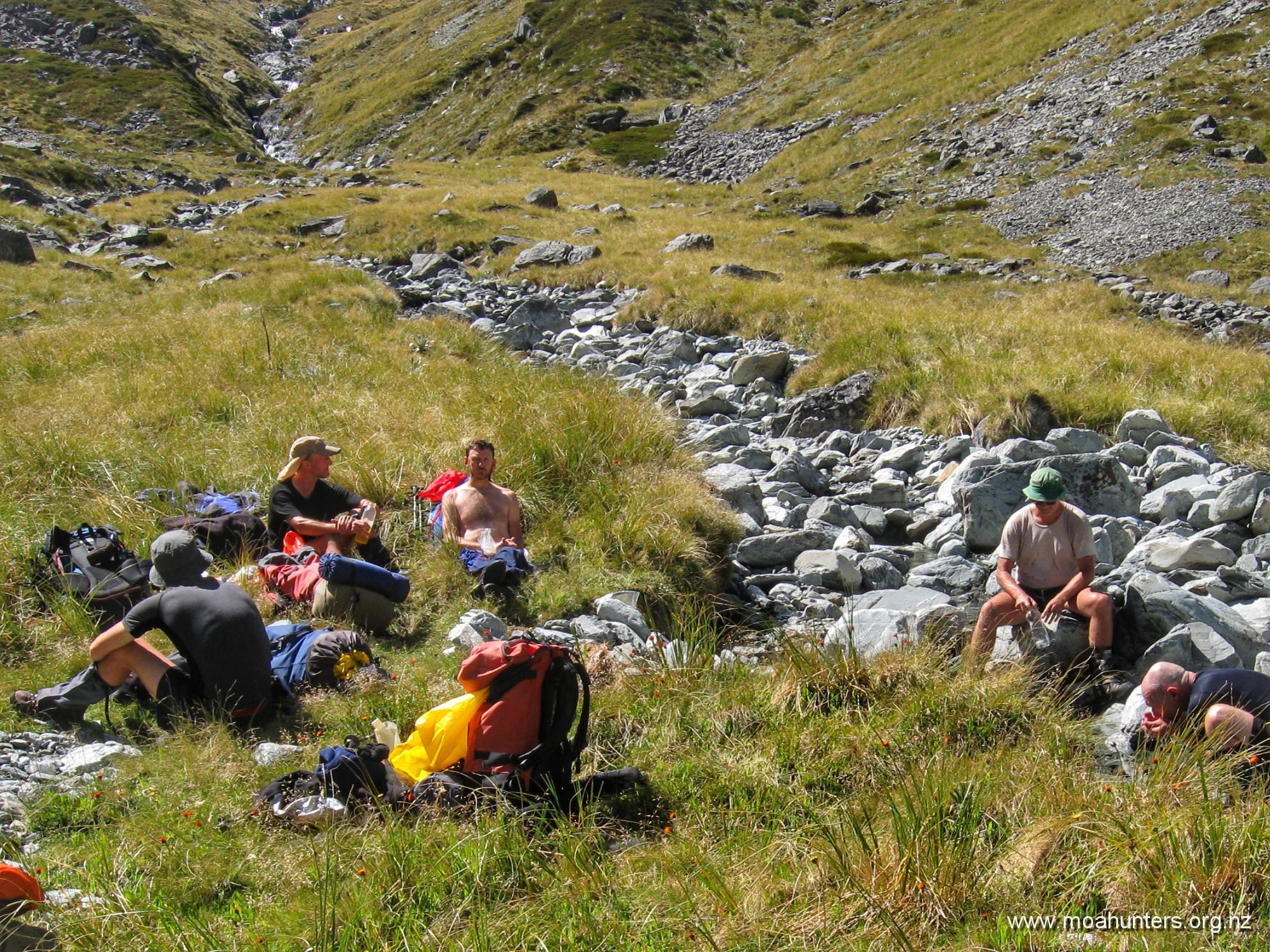
It didn’t take an expert to pick out our ideal lunch spot. Below us lay a good sized tarn, surrounded by large rocks that would provide good shelter from the cool breeze. We made our way down, dropped packs, and settled in for a very enjoyable lunch break.

Looking back, the traverse off Moss Pass appeared more challenging than when we were walking it!

The sun made a few brief but welcome appearances, but in general it was a little cool on the tops. With annoying regularity, the sneaky breeze found ways to swirl around the rocks we had chosen to hide behind, keeping a lid on the temperature.

From our lunch spot at the tarns, the track descended fairly steeply down a grassy slope, with views across the valley of an epic, steep, water-sculpted hillside.

At our feet, damp rocks protruding from the dirt were coated with a slightly greasy algae. Alongside the well worn path, tough grasses were slippery and sometimes treacherous on the steep slope. We had to watch our step as we descended off the tops.

When the track heads into the beech forest, it doesn’t ease up. Just as steep as on the tops, we descended the tricky and often slippery track for an hour and a half until it eased out and we reached a stream.

Once off the steep section, the track slides round to the north through gorgeous mossy forest. We enjoyed the easier walking and lovely surroundings, arriving at the bridge over the D’Urville river at 3:30pm – bang on two hours from when we left the lunchtime tarn stop.

Between the bridge and George Lyon hut, there is a fifteen minute section where the valley gets quite tight and the track a bit harder going. Aside from that, it is a pleasant wander to the hut.

When we reached the hut, our legs were telling us we had done a solid day of walking. Not fully trusting what our legs tell us, we consulted the map. Topomap tells us we had made a 580 metre climb followed by an 1100 metre descent. That, my friends, is more than enough downhill for one day.

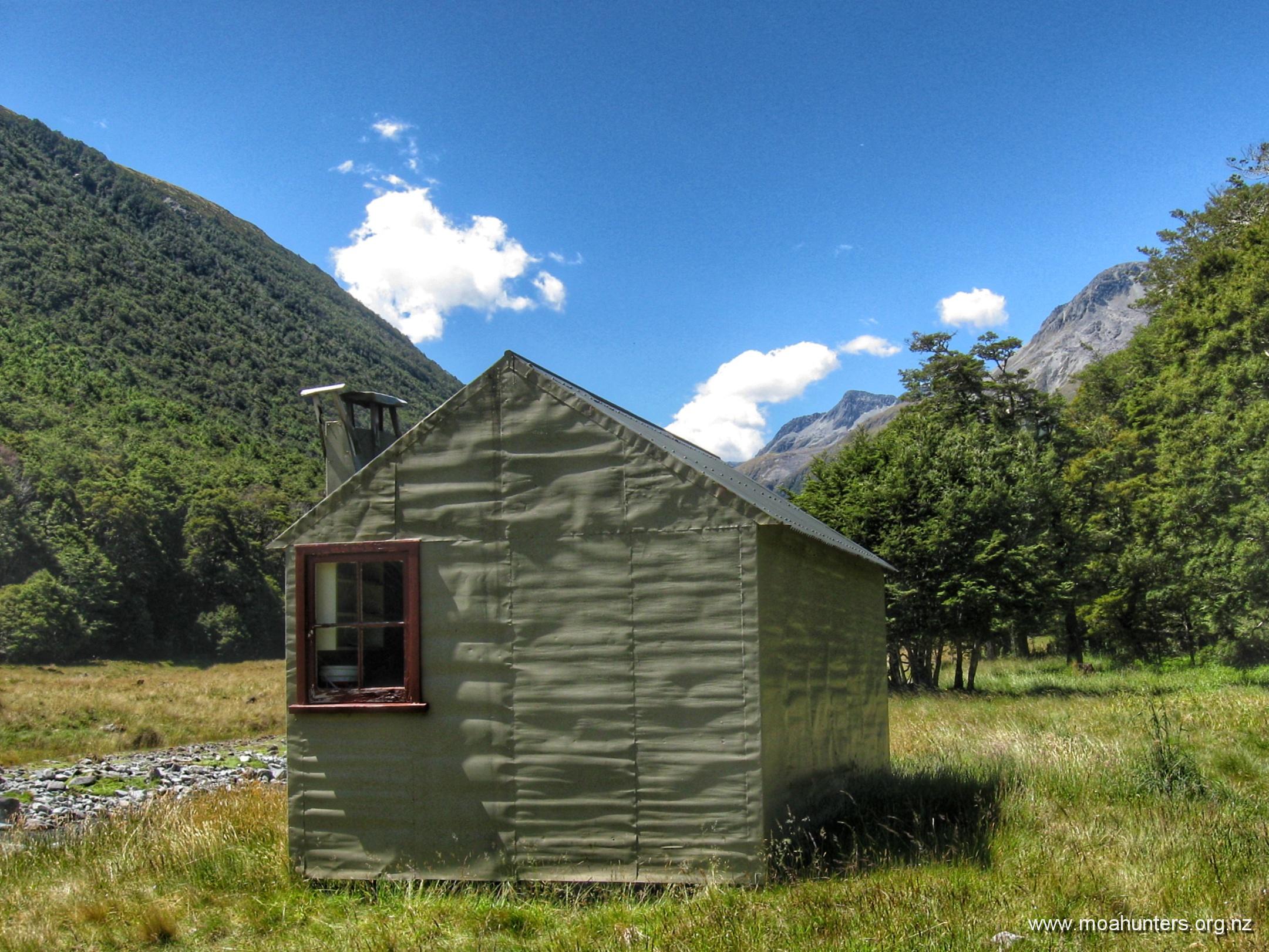
George Lyon (formerly Ella) hut is an interesting design. Two completely separate spaces are accessed left and right from the small entrance vestibule. Oddly, the two sides are not identical. One side has a small log burner, the other gets a skylight. Or maybe that’s not so odd… Anyhow, if you go there, it is worth reading the story of George Lyon at the hut. He seems to have been an influential and dedicated fella in his day.

Happily, there were almost no sandflies at this hut either, despite being at low altitude and right beside a river. For those who react in an itchy way to their nasty little bites, April is a great time of year to wander the back country.

Something to note if you do walk later in the season is the extra requirement for lighting. You will be using your headlamp and other lighting for longer periods. The sun sets early in April and many huts are gloomy inside at the best of times. Pack a few extra batteries.

The long drop at George Lyon is an interesting relic. For some reason this rickety wood and corrugated iron structure hasn’t been replaced by the modern fibreglass toilets we see at most huts these days. Still attached to a wall inside is an old metal candle holder – a fixture that hints at the venerable age of this small building. Maybe the Historic Places Trust will put a protection order on it!

Day 5

WednesDay 17th April – George Lyon hut to D’Urville hut

They say time flies when you are having fun. That definitely applies when you are out amongst it on a tramping trip. Waking up and realising this was our last day of Moa Hunting seemed unfair. How had four days gone by so fast?

As we had a long day ahead, activity in the hut started early. Not long after 6:00 am, porridge and water were already steaming on the cookers. Hearty Scottish sustenance and life-sustaining coffee are always a priority in the morning.

Our aim was to be on the track no later than 8 o’clock. The DOC sign outside the hut stated 4 hrs walking to Morgan hut, and another 4 hrs after that to D’Urville hut, where we would call our water taxi. We expected/hoped to knock half an hour off the DOC times…

The track to Morgan hut is a bit of a mixed bag. While generally flat and easy, we did encounter a few places where mother nature had other ideas.

Significant bank erosion along one section beside the river had gobbled up the track. New markers and fairly fresh scrub cutting has in parts moved the track away from the dangerously undercut bank. DOC will likely need to move the track quite a bit farther to prevent further washouts.

Unfortunately, about 30 minutes from the hut we ‘found’ another wasp nest. Smack in the middle of the track, it was highly inconvenient. Despite Adam spotting wasps exiting the hole without stepping on the entrance, and those behind following suit, clearly our passing had annoyed the wasps inside. By the time Chris and Magnus arrived, the wasps were seriously pissed off and out looking for trouble. Because they looked like trouble, Chris and Magnus got stung. Chris one sting, and poor Magnus copped four.

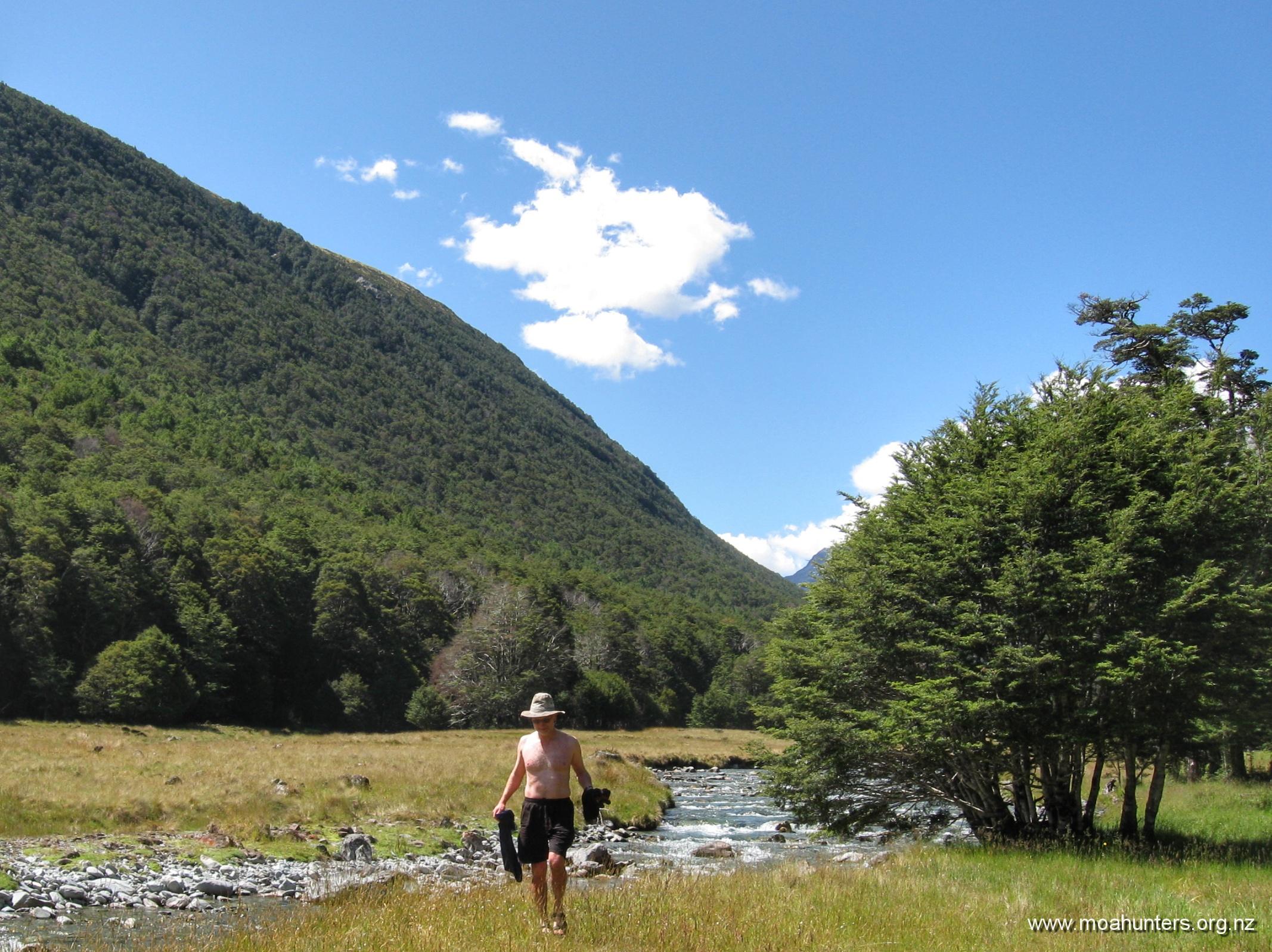
We stopped for a scroggin break beside the river, again unbothered by sandflies. Hooray for autumn weather!

Aside from those effing wasps, the track was very lovely. We enjoyed easy walking across open grassy meadows (with plenty of deer sign), beautiful mossy forest, and easy riverbed sections.

Our pace today was a few notches above the usual Moa Hunter amble. After three hours walking we rolled up to a sun-drenched Morgan hut, and for the first time this trip were welcomed by an enthusiastic team of sandflies.

Those of us who prefer to avoid being bitten retreated into the the hut for an early lunch. The rest sat outside on the deck soaking up the sun while eating their rations.

After half an hour, the outside crew joined the inside crew. Apparently a few local wasps that had been slightly pesky hanging had become persistently pesky. It seems they had got a whiff of salami and biltong, and looking to harvest protein for their nest, had become disconcertingly aggressive.

Morgan hut is frequently used by hunters, and even has a gun rack just inside the door. Shells of various gauges decorate a window sill. With a large and inviting expanse of grassy flats in front of the hut, we wondered if any hunters had been lucky enough to bag an animal from the comfort of the deck.

It was high noon when we left Morgan hut to complete the last leg of our Moa Hunt. Destination D’Urville hut.

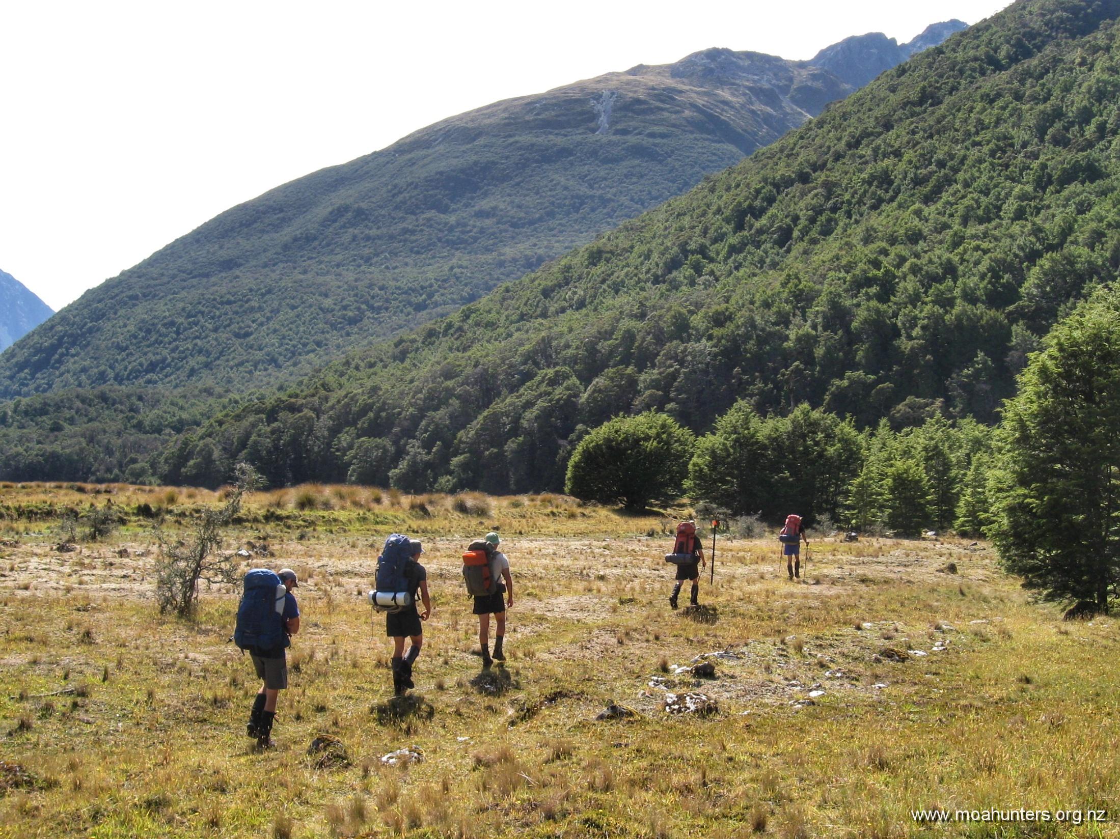
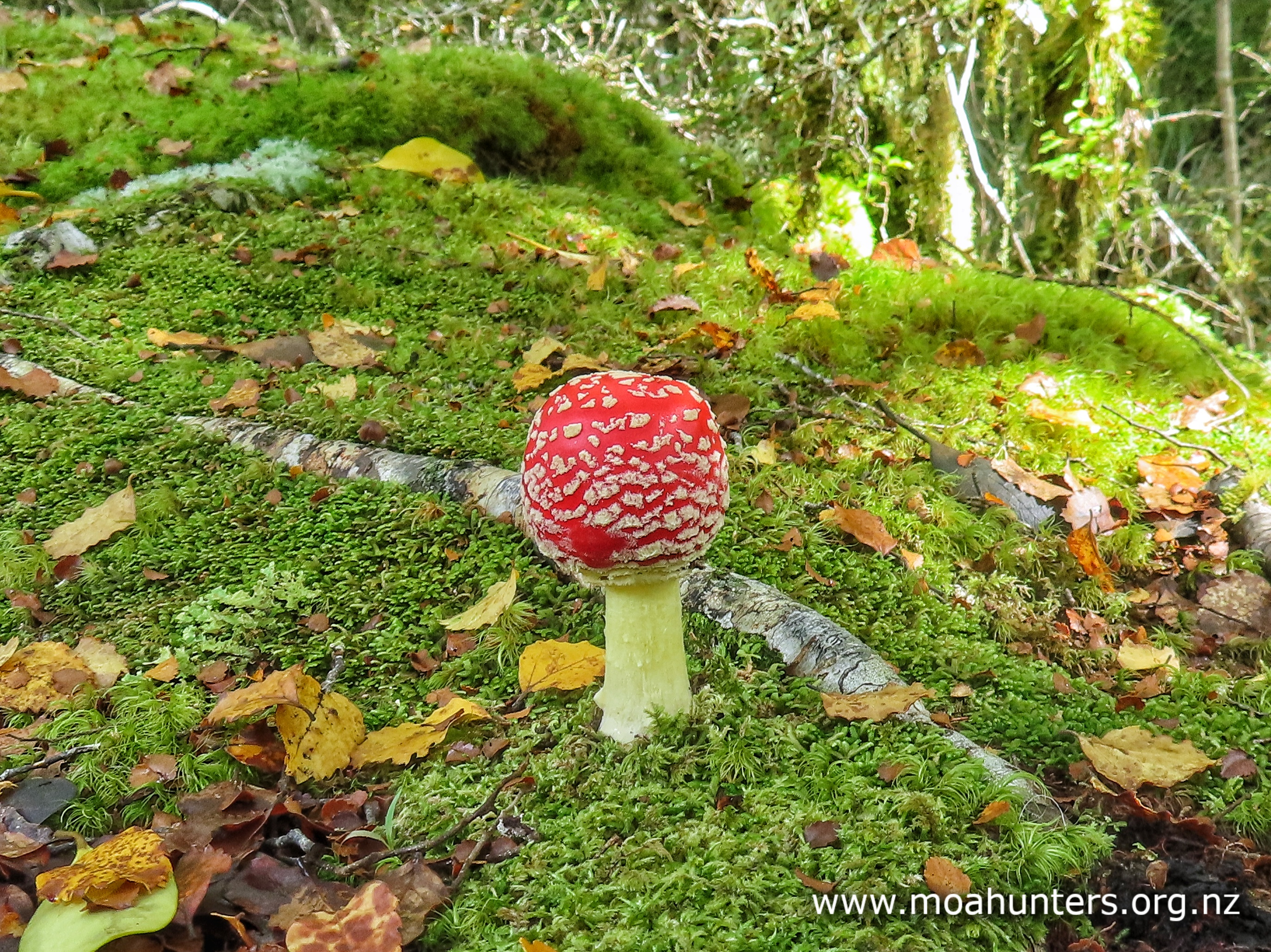
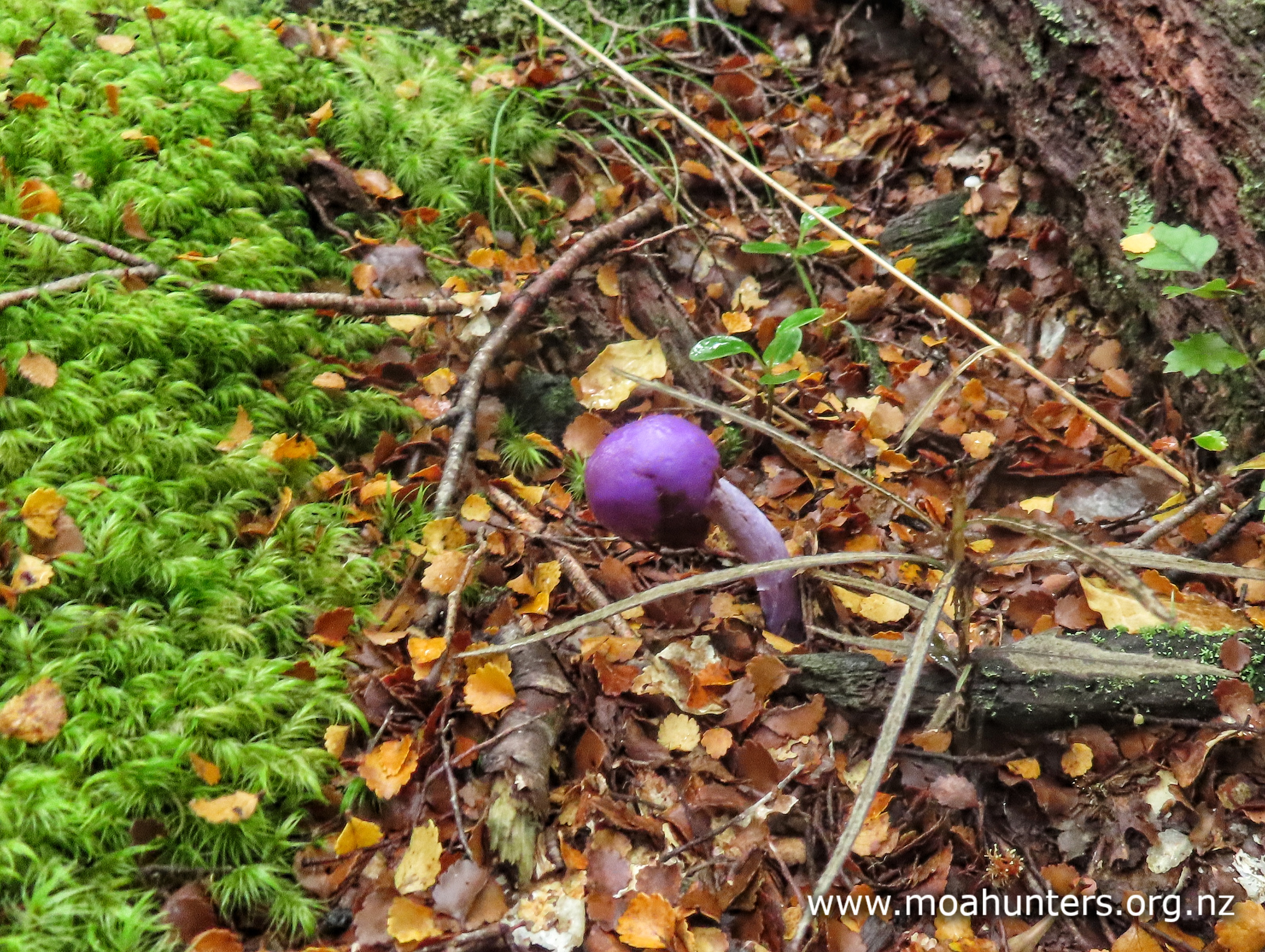
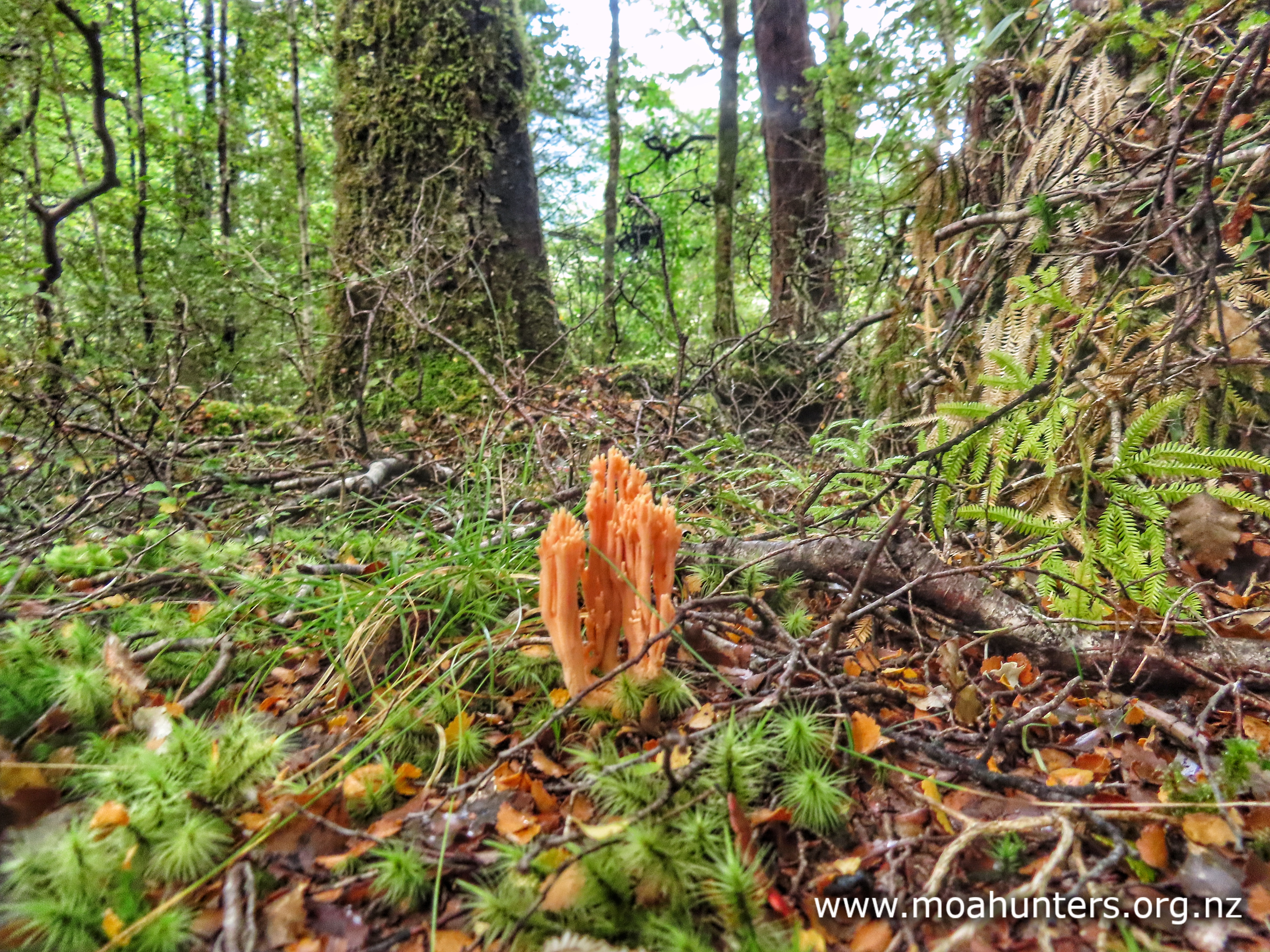
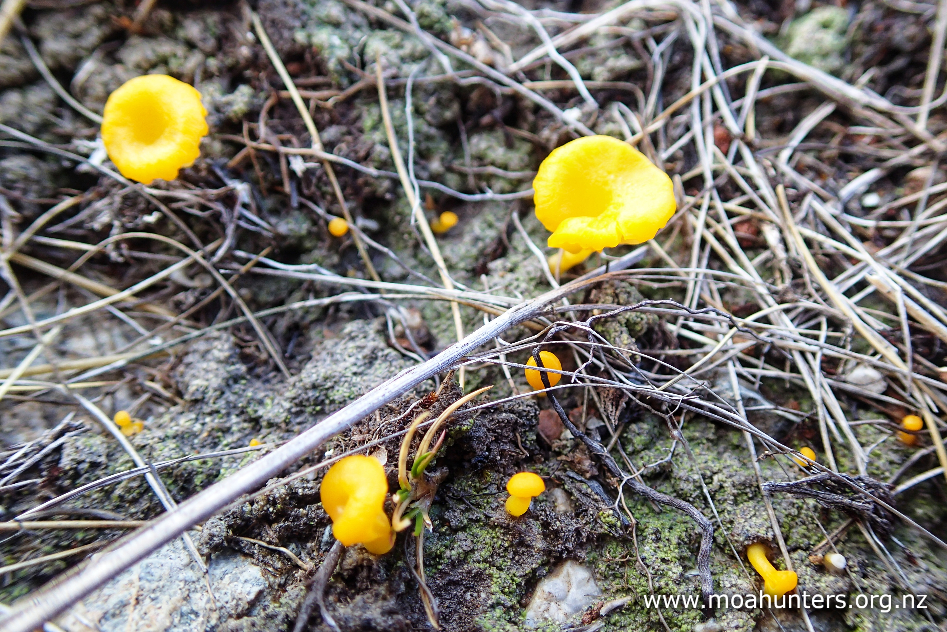
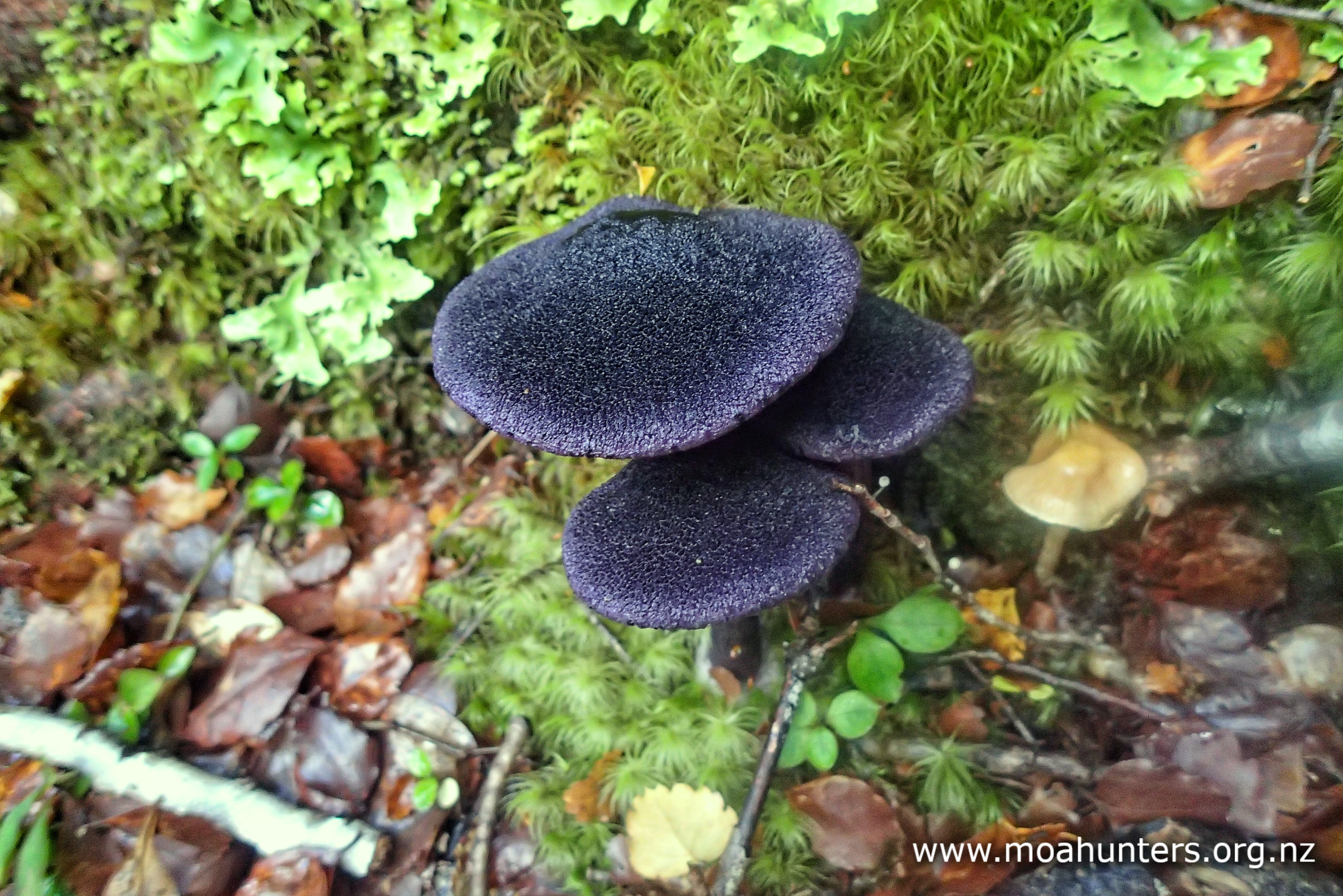
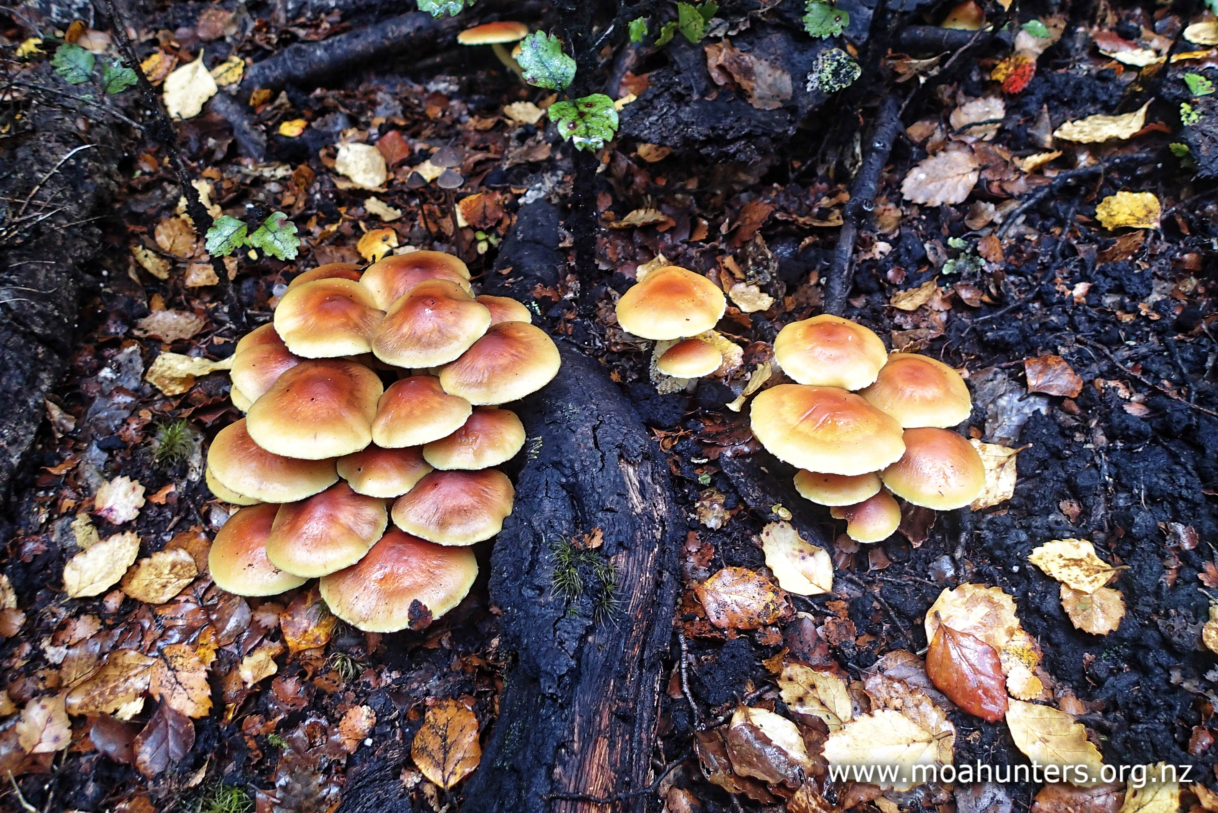
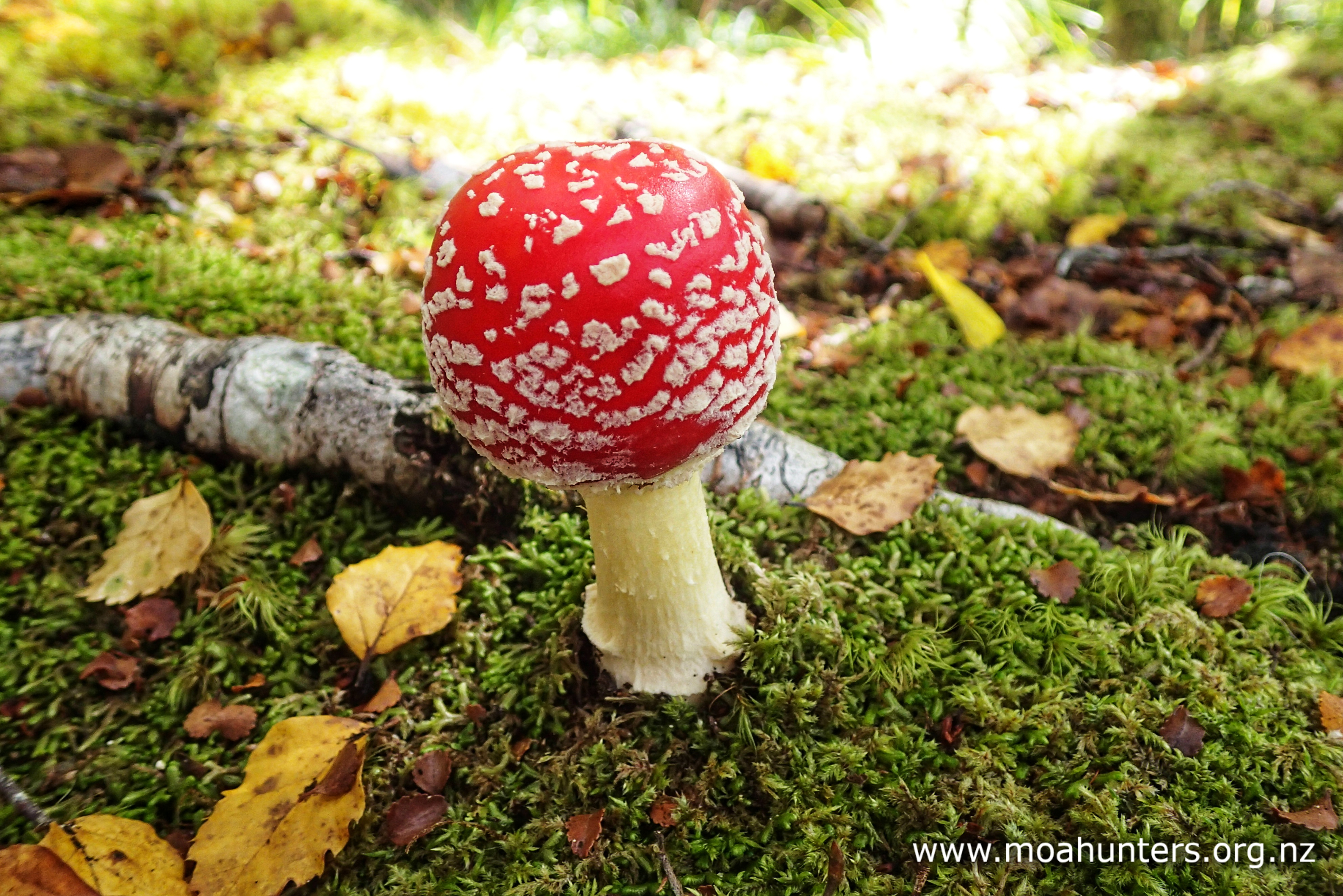
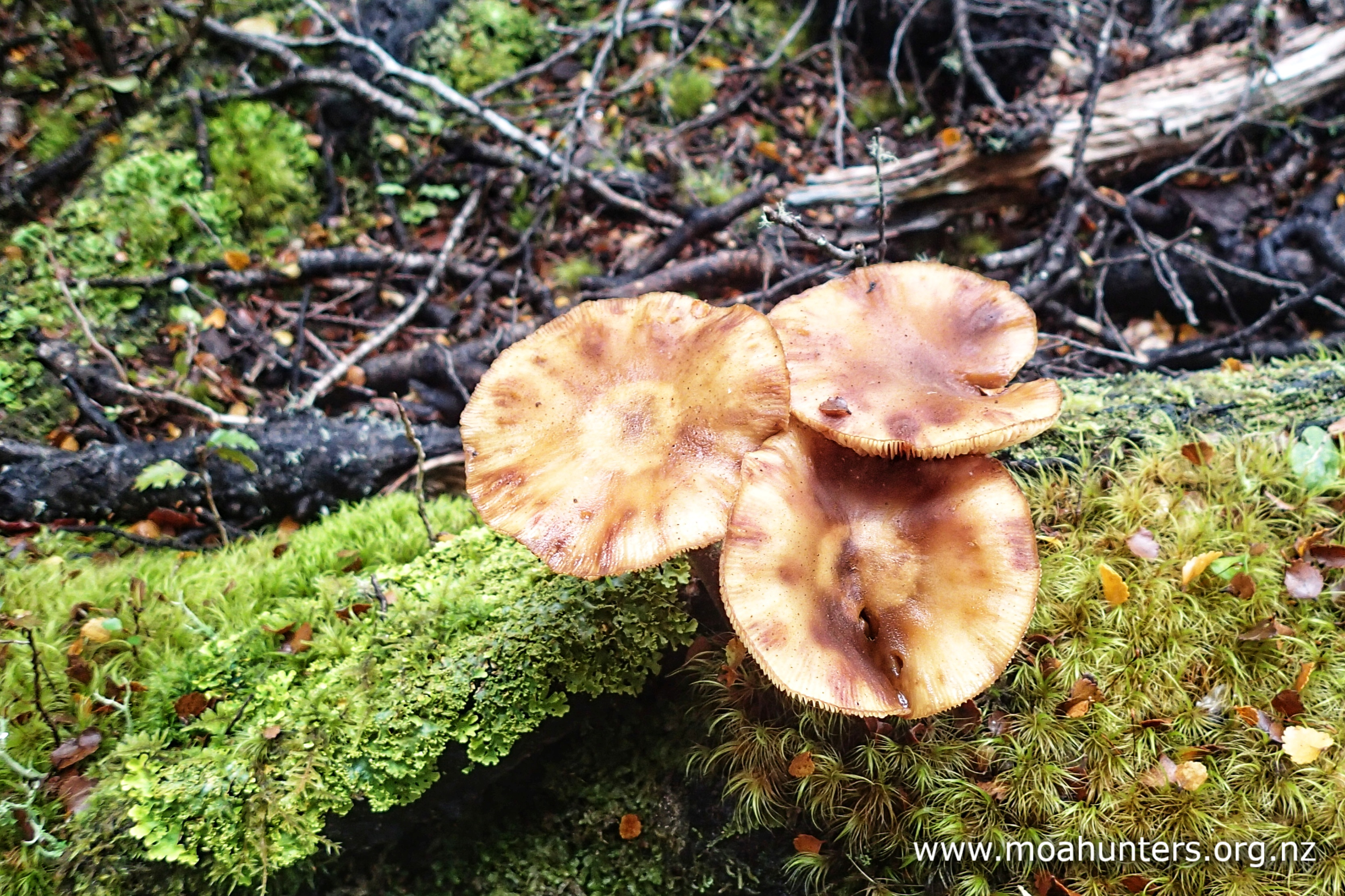
Walking across the grassy flats was a very pleasant experience. The sun was shining and winds were light. Inevitably the track did enter the forest, where we were treated to probably the best array of fungi we had seen on the trip.

Being autumn, amazing fungi were growing everywhere. We enjoyed spotting toadstools of all shapes, sizes and colours growing along the track. It was certainly a mycologists paradise.

The track did climb annoying high over a bluff about half an hour away from the hut. Chris and Magnus inadvertently missed a turn in the track and rather pleasingly for them, ended up in the riverbed instead. With flows low, they were able to cross back and forwards across the river braids and avoid the uphill grunt. If flows are low, you could probably walk a fair chunk of the trip between Morgan and D’Urville along the river.

We had a couple of short scroggin stops along the way. One beside a small creek that joined the D’Urville below, and one on a large expanse of shingle river bed.

As the valley opened out, we spent more time walking grassy flats and easy beech forest track. Enjoying the easy walking conditions, our pace picked up a little as we neared Lake Rotoroa.

It was 4:00pm when we arrived at D’Urville hut. Tied up to the jetty were two boats. Lounging back in one was Dudley, our water taxi captain. Anticipating our arrival time, he had motored across the lake to meet us. What an awesome guy, and what a great service. We had expected a thirty minute wait at the hut, but were able to board the boat shortly after arriving.

Dudley pointed the water taxi north and eased forward on the throttle. We all felt the usual mixed emotions. Happiness that we were heading back to see our families, but a little sadness to be leaving a beautiful part of New Zealand. Another Moa Hunt was done and dusted.

Just before we reached the far shore of the lake, the weather gods gave us one last little gift; as we looked back, a shower of rain caught some sun rays creating a pretty goodbye.


2020 – Lewis Pass to St Arnaud – Five…ish Passes

As we walked this route, we debated just how many passes we could claim to have conquered. Ada pass, Three Tarn pass, D’Urville pass, Thompson pass, Waiau pass. We all agree the last four are legitimate passes. But Ada pass barely even raises a sweat. So lets call this trip “four and a bit passes”. or “Five…ish”, for the optimists out there.

Moa Hunters on this trip:  Magnus, Adam, Paul, Lewis, Chris, Luke

The Trip:

Day 1: St James walkway carpark to Ada Pass hut
Day 2: Ada Pass hut to Bob’s hut
Day 3: Bob’s hut to East Matakitaki campsite
Day 4: East Matakitaki campsite to Lake Thompson
Day 5: Lake Thompson to Blue Lake hut
Day 6: Blue Lake hut to Sabine hut
Day 7: Sabine hut to road end

Topomap of our route

Google map of our route

Day 1

Saturday 18th January – St James walkway carpark to Ada Pass hut

Day one of this trip was technically day two for Paul and Chris. They left Christchurch together on Friday afternoon to perform some convoluted car shenanigans that are far too complicated to explain here. The summary of it all is that with the help of Magnus and his wife Vanessa, and Paul’s mother-in-law Eleanor, they conspired to leave a car at the St Arnaud end of the track and then get to the Lewis Pass end for high noon on Saturday.

And that’s where and when the rest of the Moa Hunters met them. It was a hot sunny afternoon with only a light breeze drifting in from the north. The carpark was very warm indeed. Even the local sandflies seemed listless and lacking full commitment in the afternoon heat. While we apportioned food and equipment evenly into our six backpacks, lunch-on-the-run including delicious homemade sausage rolls and scones was eagerly consumed. Thanks Eleanor!! We all knew that the next seven days meals would not include quite such yummy treats.

By 1pm we had all eaten more than we should, and with rather heavy packs on our backs we were ready to make a start. Lewis had weighed them with his little portable scale, and we all clocked in around 19-20 kg. Luke topped the scales at 22 kg.

The track away from the carpark leads past a pretty pond surrounded by grasses and low vegetation. Sweeping picturesque views of the valley open up ahead. It all looked very beautiful and inviting in the clear conditions. Occasional boardwalks across boggy sections remind us we are on the St James walkway at this point, a well walked and well maintained piece of track.

After half an hour easy walking, we are well into the beech forest and reached the first swing bridge across the river – a strongly constructed one with a solid deck and healthy bounce as we crossed it in pairs. It’s not often you find a back country bridge that takes more than one person at a time.

We did find a couple of places where the track was washed out near the river, but well-worn diversions were easily followed round these and back to the main track.

There are plenty of lovely spots to stop beside the main river or side streams along the way. We took the opportunity to drink plenty of cool fresh water from them roughly every hour. With sunset not until 9:00 PM, there was plenty of time to reach Ada Pass hut. The afternoon heat and heavy packs were certainly causing us to lose a lot of fluids to perspiration. Keeping well hydrated and enjoying the surroundings was one aim of our first days walking.

We reached Cannibal Gorge hut at 4pm. Almost exactly three hours walking the easy track, and right on the DOC time. It is a fantastic place, and quite unlike most back country huts you will come across. Built taller and grander than the average hut, it dominates the end of a flat grassy meadow that has somehow kept the beech forest pushed aside. We stopped for a short break to grab some scroggin and take a sneaky peek inside. Chris remembered the last time he walked this park of the track the hut was still being built. I will make no comment here on whether that makes the hut quite young, or Chris quite old!

Keeping cool was our main difficulty as we walked the last hour to Ada Pass hut. With no cloud to temper the blazing sun’s heat, and an almost complete lack of breeze in the beech forest, we were walking in extremely hot conditions. Fortunately this was a short day on the track. We all hoped for cooler conditions in the days to follow, but knew the forecast was for the clear sunny weather to stick around for quite some time.

We reached Ada Pass hut at 5pm. Only one person was inside, with everyone else enjoying the lovely afternoon sitting on the deck, or in a shady area under some trees below the hut. Once we got our packs and boots off, we were able to cool off a bit and do the same.

The hut has fantastic views up to Three Tarn pass, our major obstacle for the next day. We chose to cook outside and take the opportunity to enjoy the vista. There were a few keen sandflies about, but not enough to drive anyone inside. Magnus commented that they are somewhat like the New Zealand hospitality industry – bleeding the tourists for everything they can get!

The late afternoon was changing from hot to mild, and it was all extremely pleasant.

There were seven others at the hut that evening. A father and two teenage girls we guessed were his daughters, and a group of two young women and two young men. To be fair, almost everyone we see on the track seem “young” these days!

Looking up the valley towards Three Tarn pass from Ada Pass hut

We made conversation with the other trampers, and quizzed two in particular who had run up to the pass that afternoon. They had done it in two hours, but had badly scratched legs from bush bashing to show for it. They said it is was not especially hard to find a way to the top, but it is steep. Granted they only wore daypacks, but two hours was impressive – and certainly not a time we expected to get remotely close to!

After downing a well-earned meal of marinated steak (thanks Paul!!), we listened to the latest bedtime story from Richard. Unfortunately he was unable to join us this year due to a slight mishap involving a training walk, a pothole, and a broken ankle. Richard had recorded a kiddies story for us before we left, which Paul played on his phone. It was a worthy sequel to the Wonky Donkey classic he recorded for us prior to the Dusky track Moa hunt.

Day 2

Sunday 19th January – Ada Pass hut to Bob’s hut

With a long day ahead of us, we were up bright and early, with the aim of reaching Three Tarn pass by lunchtime, before the full heat of the afternoon kicked in. With others still sleeping in the hut, we did our best to be as quiet as possible. We ate breakfast outside, then packed ready for the days walking.

It was 7:55 AM when we set off back down the track we had walked up the previous day. It was a short five minutes back to a wooden bridge over the Maruia river. From here we would head off the main track up the valley to Three Tarn pass. It would be the end of following any kind of maintained track for the next few days.

Just ahead was the terrain Paul had borrowed Richard’s walking poles for… His knees had been complaining a little during his training runs, and he had decided walking poles were good insurance for a week on the trail.

Over the bridge, we turned hard right and pushed through a thin stand of Manuka and began walking up the true right of the stream that would lead us most of the way to Three Tarn pass. There is a lightly trod track of sorts to follow, but a little bush bashing is required.

Big dragonflies buzzed up and down the river, darting quickly from left to right, going about whatever their important business was. With their twin sets of wings and chunky bodies, they are amazingly prehistoric looking creatures.

After following the main stream for approximately 100 metres, a side-stream cuts in from the left. At this point the bush ahead on the main stream gets very thick and nasty. Don’t try and go through it. Follow the side stream up for 100-150 metres, keeping an eye out for where the bush opens out on the true left. There are a few cairns up this moderately steep climb, and in parts it is obvious where others have walked before. When the bush opens out on the TL, traverse across an open grassy meadow and rejoin the main stream.

Back on the main stream we entered some fairly thick and at times messy beech forest. The route through here is for the most part fairly easy to follow, but does involve a bit of scrambling under and over fallen logs and branches. We met a man and woman through this section who we had seen go past Ada Pass hut the previous day. They were tracking Kea. The woman had a large aerial on her pack which we presumed was to locate signals from collars on the birds.

As we ascended, the forest thinned out and by 9:00 AM we were well out of the bush and into low scrub, snowgrass and tussock. It was still early, but the sun was already feeling hot, so we stopped to apply a layer of sunblock.

Picking a way through this section was not hard, and we all enjoyed the surroundings which were becoming increasing pretty as the valley tightened. There was little wind, with just the occasional blowfly buzzing past. Well ahead of us we could thee the rubble-strewn peaks surrounding Three Tarn pass. They still looked a long way off.

Climbing higher, we entered a nasty section with lots of Spaniard grass. No matter how carefully we attempted to dodge these vicious plants, we all received some painful stabs on our hands, arms and legs. Ahead of us we spotted two figures making their way down the valley towards us.

Andrew and Matai

Ten minutes later, we were saying hello to Andrew and his son Matai. They had camped on the other side of Three Tarn pass that night, and were heading out today. Andrew assured us there was less Spaniard higher up, and gave us some excellent information on our route ahead. He also mentioned there was “some wind throw” on the track through to Bob’s hut.

Some?! We beg to differ, Andrew! But more on that later…

We had a great chat, and were just about to part company when Paul mentioned the Moa Hunter website… Andrew took a step backwards and said, “wait… are you guys the Moa Hunters?”. He was excited to find out that we were indeed the Moa Hunters. It turns out he had read quite a few of our trips on the website.

After getting photos of each other, we parted company. Because Andrew and Matai were so friendly and gave us such good info, we agreed they should be officially bestowed the title of “Associate Moa Hunters”.

At the top of a steepish section, we stopped for scroggin. It was now about 9:45 AM and ahead of us we could see the vegetation thinning out. Beyond that is the start of the rubble and scree that signal a much steeper and tougher ascent.

Energised by our short break, we pushed on into the messy rubble below the pass. The rocks here are amazing. Large slabs of varying colours and textures are strewn all about. Red, green, silver, brown, blue. Some glitter, others have unusual patterns and markings.

There are a number of options when ascending the steep rubble. Most of us took an “up the guts” approach, trudging up what looked like the most direct route. Chris chose to head off to the right and avoid the more unstable sections of rubble. In hindsight this is probably the best option. Going straight up the loose rock was a real grind. Chris followed up the true left of the valley to a small spur between two streams, then at a knob, traversed left.

The sun beat relentlessly down on us from a cloudless sky. Occasional breezes wafted up the valley, briefly refreshing, but not enough to properly cool us. We were all sweating profusely as we slogged up the steep and tricky terrain, weighed down by our still rather heavy packs.

After a hard climb, we reached a basin which holds two cool clear tarns. It was 11:30 AM, but we decided this was a good spot for an early lunch. We still had a significant climb ahead to Three Tarn pass, and we were in no hurry to battle up it. We dropped our packs next to the smaller of the two tarns and stretched out to enjoy some lunch. Boots came off to let hot feet recover and cool off a little.

Adam and Lewis took the opportunity for a quick dip in the tarn. The water was cold, but not freezing cold, and it was deliciously refreshing. Sunblock was again applied liberally. There was no natural shade to escape the intense sun in this terrain. At this altitude the sky seemed incredibly blue and clear. Some of us draped jackets over our arms or legs to shelter from the burning UV rays.

It was 12:45 PM when we somewhat reluctantly hefted our packs on to begin our final ascent to the pass.

Just like the climb we had battled up to the basin, this last section up to the pass was brutally steep and quickly had us grunting and dripping sweat again. It took us 45 minutes to reach Three Tarn pass from the basin. We passed some small pockets of snow on the way up. It seemed amazing the snow could persist so long in such warm temperatures.

The drop off from the pass to the three tarns below is a short steep scramble down scree into another wide rubble filled basin. We each chose different routes to slide our way down. Once in the basin we wandered over to the tarns, took a few photos and enjoyed the feeling we had knocked off our first big climb of the trip.

From Three Tarn pass, the route descends a rather steep valley beside a stream that will eventually grow into the Matakitaki river. Initially we found the best walking was not in the streambed itself, but up on grassy ridges that ran down the valley at an angle beside it.

However, as we lost altitude, the snowgrass and spaniard got bigger and nastier. The grassy ridges became less and less desirable and more and more prickly. We were forced to spend our time close to the river, which was fine. Occasional boulder hopping was all that was required.

The descent is a long one, and the skies were still brilliant blue and clear. The sun was beating down on us mercilessly. When we stopped for a scroggin break at 3:30 PM it was very warm indeed, with just an occasional light breeze wafting past to cool us.

Prior to this break, Lewis had stepped into a rut hidden by snowgrass and went over heavily on his ankle. We gathered around him, quite worried as he lay on the ground rubbing it and wincing. It didn’t look good and he didn’t look happy. After spending some time to gather himself, he was able to stand and take weight on it, albeit gingerly. He took a few paces back and forwards, and gave a little nod. It seemed he would be able to continue. A Voltaren and ibuprofen were swallowed with water as a little insurance. Adam offered Lewis the use of his walking poles, which he took up.

It was mid afternoon when we reached a sweeping right hand bend in the valley and came upon a remarkable sight. A very large area of ground on the true left of the river was churned up like a massive herd of bison had charged across it, pulverising it with their hooves.

Standing amongst the carnage, we worked out the cause of the destruction. A massive quantity of snow and ice had avalanched off the mountains above and crashed down into the valley. Much of the ground we were standing on was in fact thick ice covered in debris. The avalanche must have initially dammed the river, which had by now eroded a path through it. It was a fascinating and awe inspiring sight.

We took lots of photos before wandering on down the valley again. We still had a long walk to Bob’s hut ahead of us.

It was 4:40 PM when we reached the first scraps of forest. It felt like we had been in the grassy river valley forever, and it was nice to have a change of scenery. The bush also signaled a significant flattening out of the terrain, and we soon found ourselves in a pleasant wide valley with much easier walking ahead.

Four and a half hours walking from the top of the pass and nine hours since we left Ada Pass hut, we reached a big friendly triangular orange marker on a tree. The start of the final section of track that leads to Bob’s hut. Unfortunately this marker lead nowhere. A stream had washed out the track, and we couldn’t find where it continued beyond. We did however spot a second marker 200 metres further up the river and walked to that one instead.

From the second marker we had about two and a half kilometres of walking through beech forest to Bob’s hut. This was the section Andrew had warned us had some wind throw. Well holy hell, we reckon there were large areas where there were more trees blown over than left standing!

It was a real mess and quite hard going. Frustrating awkward stuff. Endlessly climbing over, under and around large quantities of large logs was tiring and slow going. At the start of the day it would have been easier, but our energy levels were certainly at a low ebb after nine hours walking to this point.

We had estimated two hours to Bob’s hut from the start of the track, but it was a solid three. We lost the track countless times as we grovelled through that hideous messy section.

It was just ticking past 8pm when we walked the last few hundred metres up a side stream on the true left of the Matakitaki to the hut. We were all feeling pretty buggered. A curry was hastily prepared, as was a cheesecake. Uncharacteristically, we didn’t finish the curry and nobody felt like eating the cheesecake. Fatigue had killed our appetites. More than anything, we all just wanted to go to sleep.

We climbed into our sleeping bags and were soon snoring.

Soon… but not for long! Mice, bloody mice, everywhere! Adam and Paul were woken by them noisily getting into food bags. They each wearily crawled out of their sleeping bags. Adam more than once. Food items were all stuffed randomly into packs which were closed tight. A rubbish bucket was put outside the door. The cheesecake was covered with a plate.

After a series of mouse-proofing exercises we could finally get some well earned shut eye.

Day 3

Monday 20th January – Bobs hut to East Matakitaki campsite

It was nice to have a leisurely start to day three of our Moa Hunt. We had agreed the night before that there was no rush to get out of the hut in the morning. The plan was to start walking mid morning and get to the East Matakitaki hut mid afternoon. After dinner, we would walk on and camp up the valley.

Paul was first up, making porridge, and making the most of being in “Bob’s hut”. Before the trip he had said that he liked the name of the hut, and wanted to spend a night there. Just because it has an odd name. It is definitely a quirky and unusual name for a hut. None of us know the background of it. There is a mock grave outside with a cross on it. We presumed this is perhaps in honour of “Bob”.

After our exertions the day before, and a light dinner, our appetites had returned. We were all very ready for breakfast. A large billy of porridge was gobbled up in short order, and the uneaten cheesecake was dispatched equally quickly for morning tea.

It was extremely pleasant spending time together in the hut that morning, chatting about everything and nothing. Solving the world’s biggest and smallest problems. These times are what make our trips so special. We could have spent hours there. Actually we did! But the time had come to leave. Shortly after 10:00 AM we were outside the hut with our packs on ready to hit the trail.

From Bob’s hut, we followed an easy track on grassy flats up the Matakitaki river. A large orange DOC orange triangle on the edge of the beech forest was spotted, marking the start of a well trod track through the trees. Adam and Lewis also saw what they thought was a Tui flitting about high on the branches above the triangle. The flash of a white tuft on its breast confirmed it was indeed a Tui. A somewhat rare and exciting treat.

We didn’t encounter anything especially difficult in terms of terrain that morning. There was some wind throw here and there, but not on the scale that we had encountered the day before.

Shortly before midday we came to a wire bridge that appeared to have been recently renovated. It was perhaps a little slack and had a bit more wobble and sway than was entirely comfortable. But not a problem for the mighty Moa Men.

Shaded by the forest, we were sheltered from the full power of the sun. But the warm air temperature and lack of breeze still left us overheated at times.

We stopped for lunch in the forest beside a small stream. Leaning back against a tree or mossy bank was a wonderfully relaxing. The sun was shining brightly on the beech canopy above us, illuminating it a brilliant verdant green.

This deep in the forest, sandflies were few and far between, as were the wasps. In fact, we had seen very few at wasps at all thus far, which was pleasing. We did however expect there would be more farther north.

Following lunch, we were back on the track again. There were some boggy patches along the way, which we either skirted around, or carefully picked our way through, hoping not to step in any deep muddy spots. Often these sludgy sections were immediately followed by bone dry ground, literally a few steps over a rise.

Occasionally the track popped out of the forest onto grassy flats beside the river, keeping the scenery interesting and making for a very pleasant day walking.

We reached East Matakitaki hut at 3:15pm. Situated on a grassy terrace right beside the river, it was copping the full intensity of the afternoon sun. With a metal walls and roof, it was just like a great big oven. Inside the hut it felt well over 30 degrees. We pulled the bench seats outside and sheltered from the sun on the shady side of the hut.

As we had some extra time on our hands, walking tops and socks received a wash in the hut’s nice new stainless steel bucket. We even had some laundry powder and liquid with us! They were hung on a wire on the sunny side of the hut and rapidly began to dry in the afternoon heat.

A dinner of spaghetti bolognese was prepared, substituting rice for spaghetti. It was very good indeed.

As we sat together in the shade finishing our meals, a figure appeared out of the forest on the track we had walked in on. She was a German woman, walking alone. We all said a friendly hello and she introduced herself as Grit. We asked where she was heading, and she said she was planning to follow basically the same route as us – over D’Urville, Thompson and Waiau passes. She looked quite fit and judging by her tan, had spent plenty of time walking in the great outdoors. We suspected she might pass us in the next day or two!

Unfortunately we didn’t get much time to chat as our plan was to get walking again. We guessed Grit would have been a little pleased we were going as this meant she didn’t have to squeeze into a six bunk hut with six smelly Moa Hunters! But, she would also not get to talk with anyone that evening, which may have been a slight disappointment.

We slung our packs onto our backs and said goodbye and see you later to Grit. It was likely we would see her again.

Following up the river, we were able for the most part to stay on an old track up the valley. While quite overgrown, it was easiest to spot if we looked at the ground rather than the vegetation, where the once well worn track was still visible. It did require regular pushing through brush, but was surprisingly quick going all the same. Note that the track, if you happen to be following it, switches sides of the river a couple of times.

Pretty much bang on an hour and a half from the hut we came upon an open grassy spot that looked perfect for camping. A large flat-topped rock would make a perfect cooking bench, and there was plenty of flat ground for shelter and sleeping. We discovered the next day as we walked further up the valley that this was virtually the last decent camping spot aside from a marginal grassy area an hour farther on.

It didn’t take long for approximately one million sandflies to find us. We quickly applied dimp and/or covered up with long sleeved tops and long-johns to limit the damage!

With shelters pitched, Magnus set about making us his famous hot chocolate recipe while Chris made dessert. It was a creme brulee instant dessert, cooled in the river. With both those delicious treats in our bellies, and twilight descending on us, we were ready for bed and crawled into our three shelters.

Day 4

Tuesday 21st January – East Matakitaki campsite to Lake Thompson

It was sandflies buzzing about of faces that woke us in the morning. We crawled out of damp sleeping bags onto wet grass. It had been a heavy dew overnight, and the air temperature was quite cool. Beanies and polarfleeces were pulled on. After so much hot weather, it was kind of nice to wear the thermals. At least it justified carrying them this far!

After breakfast and a lovely hot cup of coffee, we took down our shelters, shaking as much water as we could off them. Quite a lot of fairly wet gear was stowed into packs, adding some unwanted additional weight.

Today promised to be a very interesting one. Ahead was another tough climb up to D’Urville pass. From there a tricky looking traverse to Thompson pass before dropping to Lake Thompson. There was an air of anticipation about our camp. Perhaps mixed with a little nervousness. We all knew the traverse in particular could be quite a challenging one…

Shortly before 8:30 AM we were on our way up the river again. Much like the evening before, the way ahead was a real mix of varied terrain. Lush grassy flats beside the river lead us into darker tracts of beech forest or scrub. Occasional river crossings were required, or sloshing through the rocky shallows along a bank.

Our first hour of walking was all in the shade, with the sun still below the high ridges to the east. When we dropped out of the forest to a sun drenched bank beside the river at 9:45am, we accepted natures invitation to take a break. Wet and damp gear was spread out to dry. Even at this early hour, the intensity of the sun was enough to visibly dry them in just a few minutes.

Twenty minutes later and with our now crisp dry gear re-packed, we struck out up the valley again. As we gained altitude, the bush was thinning, offering us unobstructed views of David Saddle, a distinctive angled gut up the mountain ahead. It looked nasty, but we had read that while steep and challenging, it isn’t as bad as first impressions are from the valley.

The valley swings round to the east under David Saddle, and from there the Matakitaki river gradually dwindles to a small stream before abruptly disappearing completely under the rocks. Initially we were a little concerned. We didn’t want to tackle the climb over D’Urville pass without a decent drink of water in our bellies. Far ahead we could see the river above ground. We took a punt that it would be accessible from where we would start our ascent of the pass, and carried on walking.

Just over three hours since we left our campsite, we dropped packs at the foot of D’Urville pass. As luck would have it, the river was still flowing above ground here. We all enjoyed the cold refreshing crystal clear mountain water.

At Bob’s hut we had seen a possible route up the pass drawn on a map. It matched what we were looking at from our spot beside the river. The drawn route zig-zagged from right, to left, and then right again. The right hand edge of the scree above us was just that shape.

After muching down some scroggin, we took the chance to wet our hats and walking tops in the river. This had become a regular activity to combat the heat. Pulling on a wet top just before grunting up a steep slope definitely helps keep the body cool. That said, it was surprising how quick the wet hat and top dried in the sun.

We struck out up the slope shortly after 11:30 AM. Again we were under clear blue skies, and the sun was relentless. We were just halfway through our walk, but worryingly, well over halfway through our sunblock! Some of us had applied almost all we had. Even with heavy use of sunscreen, we all were showing some signs of sunburn in various places.

The initial 300 vertical metre climb felt steeper than Three Tarn pass, but the rubble was generally more stable. The late morning heat was brutal. There were a few stray fluffy white clouds about, but they rarely drifted across the sun to create any welcome respite from its full force.

Above the scree/rubble face, the terrain got a little easier. A rocky ridge provided stable walking at a slightly less demanding angle of attack. This was a relief as it had been a steep grunt to that point. As we approached a basin with a tarn at its centre, the rubble was replaced by rocks that quickly grew from large to very large. We picked our way through the maze of granite to the tarn, and gratefully dropped our packs at its edge.

A few of us were feeling quite shattered. Probably all of us, to be fair… A combination of the heat and pushing too hard too fast up the hill left Adam and Chris in particular feeling a bit under the weather. Despite the clock saying it was lunchtime, neither felt particularly hungry. But knowing you can’t run an engine without fuel, they both ate as much as they could.

There were very few places to escape the sun at the tarn, which was by now almost directly overhead, meaning even the largest rocks offered little shade. Lewis again took the chance for a cool dip in the tarn, but no-one else felt motivated or energetic enough to strip down for a swim.

As we were eating our lunch, we spotted a lone figure across the tarn. It was Grit, and she gave us a friendly wave. As expected she had overtaken us. After a much shorter lunch break than ours, she started the steep climb to the pass. We watched her increasingly distant figure became smaller and smaller as she steadily picked her way up the 200 vertical metres to the top. It took her forty minutes.

The route up to Three Tarn pass

The top of the pass wasn’t getting any closer while we were sitting by the tarn… We pushed our remaining lunches and other gear back into our packs and started the final ascent. As with the climb up to the tarn, getting up to the pass was a steep grunt. Slow and steady wins the race, and this time we all paced ourselves a bit better. The route up is fairly obvious, aiming for a prominent rocky outcrop below the pass, swinging up and to right on top of it, then up the last scree to the lowest visible brow above.

A quick check of Paul’s watch at the top confirmed we had made the climb at the same pace as Grit – 40 minutes.

We spent a bit of time at the top assessing where to next… Prior to the trip we had done a fair bit of research on potential routes that traverse from D’Urville pass to Thompson pass. But hadn’t considered how to drop off D’Urville pass and begin that sidle. We had assumed it would be obvious, and it wasn’t. We could see Grit in the distance skirting round a small tarn, but didn’t know the path she had taken to get there.

Eventually we agreed that the safest descent that was least likely to end in an impassable bluff was down a chute some distance to the left as we looked down – away from Thompson Pass. Once low enough and clear of potential bluffs, we could cut back right towards the distant tarn. It turned out to be the correct choice. The slide down the chute was very manageable, and there were rocky bluffs farther to the right that would have been awkward..

Travel to the tarn was bumpy to say the least. Large boulders and rocks fallen from the peaks above fill the flatter terrain below. Where we could, we walked across grassy flats, but these were few and far between. A lot of boulder hopping was required. It was tough on the boots.

From the tarn, the route ahead was a bit clearer. We would need to traverse across a rubble slope, aiming fairly high to a grassed area just under a rocky outcrop. From there a more challenging looking scree slope would await. This would require us to gain some altitude as we picked our way across to the top of another rocky outcrop. Possibly not easy on loose material. From there we could sidle evenly over what looked like less unstable terrain to an unusual rust coloured scree slope.

Looking ahead, planning a possible route to Thompson Pass.

Our assessment again proved correct. The scree slope beyond the rock outcrop was indeed the tricky. In fact, it was the most demanding section of the whole traverse. We each kicked out flat footholds for the next Moa Hunter, hopefully making life easier for them. Again, slow and steady was the winner here. Only fools rush in.

Crossing the rust coloured rubble was easier than the fine scree, but we did need to remain conscious of altitude. Ahead was an obvious rock outcrop which we needed to go over. We each took care to push up the slope as we trudged across the interesting red-brown feature.

Above the rocky outcrop, travel got a bit easier. Despite being unable to escape the full intensity of the sun, continuing to carefully ration what sunblock we had left, we enjoyed the magnificence of the surroundings. We were in rugged, unforgiving country. Few people get here, standing in wonder as we did, at the massive scale and rugged beauty of the towering craggy mountains and the majestic sweep of the plunging valleys below. It is massive country. This is what Moa Hunting is all about…

Beyond the first small outcrop we traversed up and across to a gravel chute that lead up the right hand side of a very large rocky feature to a little pocket of snow. It’s possible some people may choose to sidle carefully below it. But the route across the top is easy and flat, and most definitely less dangerous than below. A large cairn at a high point of this outcrop confirmed we were on the right path. Lewis found some antlers nearby, and added them to the rock pile.

We dropped off the rocky bluff, across more rubble, then up and over another large outcrop of rock. From this we chose to skirt across to a very climbable looking rockface which would take us up and over a final bluff and onto Thompson pass. Lewis scampered up it like a mountain goat, with the rest of us a little farther back. From the top of the rockface it was mostly grassy, with an awkwardly steep descent down to the pass.

It was a little before 6:00 PM when we all stood atop the pass. It had taken the best part of three hours to traverse from D’Urville pass to Thompson pass. It had been a challenging section, but very rewarding both in terms of the views and the satisfaction of knocking it off.

We dropped off the pass into a narrow valley. As soon as we had cleared the end of the knob on the true right, we climbed up and out onto a grassy plateau that sloped down to the shore of Lake Thompson. It was a beautiful view, reminiscent of Lake Angelus in many ways. If it was more accessible, a big hut would certainly attract a lot of visitors, given the gorgeous aspect of the lake.

We spotted Grit’s green tent already erected some way round the lake, well beyond what was clearly a well used camping area ahead of us. There were two stone walls that had been put up for shelter from the wind, and what looked like a couple of flat spots for tents or shelters.

Chris and Magnus put up their shelter inside the stone walls. Paul and Luke grabbed a spot down the slope a little. Lewis and Adam, after much to-ing and fro-ing, finally decided on a spot that was no better or worse than anywhere else. From above the camp area looked flat, but at close quarters, it was dotted with lots of rocks and lumpy ground.

Dinner was prepared and devoured, hot chocolate fortified with whisky was downed, and we were all feeling pleased with ourselves after a very good day in the hills. It had been another long day, with a lot of ground covered. Very satisfying.

As the sun disappeared behind the surrounding peaks, the air chilled down rapidly. The thought of tackling yet another steep pass tomorrow encouraged us to grab an early night to recharge our batteries as much as possible.

As 9:00 PM ticked past, low cloud started to blow over the pass behind us, dropping steadily lower into the lake basin. We decided we would rather be tucked into our sleeping bags when the cold misty cloud finally arrived.

We said our goodnights and slid into sleeping bags, anticipating we may be waking up to damp conditions again the next day…

Day 5

Wednesday 22nd January – Lake Thompson to Blue Lake hut

We awoke to an unexpectedly dry morning. A light breeze through the night had prevented any dew from forming. The low foggy cloud was gone, but high cloud was building. Given the amount of sun we had been exposed to over the past few days, this was a welcome change.

As we ate breakfast, we debated our exit strategy. A valley right in front of us was one obvious option, although there looked to be a steep section with a waterfall to get round. Farther round the lake where Grit was camping a second valley follows the stream that drains the lake, and that could also be taken.

Just as we were thinking the second option seemed best, Grit appeared over a rocky rise and wandered down. She was using a route planner GPS for her journey, and was following option 1, the valley below us. The planner showed a route that leaves the river to follow a terrace above the true left of the river. We wished her all the best for the days walking, and watched her head down the valley as we finished packing our gear.

We decided to go with the valley below. It was 8:50 AM when we headed off down the valley. The terrace arrived a little sooner than we expected, and we had to make a short but steep climb up to it, having missed an easier walk onto it back up the valley.

Once on the terrace, walking was very pleasant. Particularly lower down as we were treated to sweeping views down the valley. To our right the river had left an impressive sculpted wall of rock. Distinct vertical grooves an indication of the massive tectonic forces that have been thrusting and distorting these rocks. There were some steep snow grass sections on the terrace that would not be fun at all in slippery wet conditions. We were thankful for another fine day.

As we dropped off the terrace into the river valley again, we could see another option for the descent would have been to follow the spur down the true right of the river. Given the steep cliffs dropping away into the river, you wouldn’t want to attempt it in low visibility, but it looked no better or worse than the terrace on a good day.

Once in the valley, it didn’t take us long to swing round the corner to the foot of Waiau Pass. It had taken us an hour to walk here from Lake Thompson. Luke’s eagle eye spotted the orange top of a snow pole high up to our left. We walked up the river little more to a good spot for a break, before heading up to the pole.

From where sat munching on scroggin, the ascent ahead looked steep, but not brutal. The track obviously headed up left, then back right onto a rocky bluff. But after that, we weren’t sure. We couldn’t see enough of the higher terrain from the riverbed.

Our sitting assessment of the initial climb was correct. It was certainly steep. But not viciously steep. And because the pass sees plenty of traffic, it has well worn steps making the climb easier. Waiau pass is part of the Te Araroa trail, an increasingly popular 3000 km walk from the top of North Island to the bottom of the south. In the summer of 2018/2019, it is estimated 1200 people walked the trail. Most of them would have crossed Waiau pass.

There is a stream that flows over the top of the bluff and it is possible to fill water bottles at this point. We took the opportunity to take a drink and replenish ours. From the bluff, the track follows a narrow grassy ridge to a steeper increasingly rocky climb. On this section, grass and soil rapidly disappear and the walking is pretty much all on rock. Very grippy and abrasive rock. Your boots certainly grip them well, but their sandpaper-like surface is hard on the hands when climbing steep sections.

It was at the bottom of one of the first steep rocky climbs that we met the first of many walkers we would see that day. Three women heading down stopped briefly to say hello. They had obviously started their day very early indeed, and were headed to Waiau hut. No doubt there would be many more heading that way, and they were keen to score a bunk each!

Climbing the steep rocky sections was straightforward in the dry conditions. Even in the rain the rocks would likely be very grippy, but we were pleased to be walking in lovely conditions again. High cloud was taking the edge off the sun’s power, but it was still fairly warm.

Bent, buckled and broken snow poles were testament to just how much snow and ice accumulates in the pass over winter.

Beyond the steep rocky section, the track levels out and the last 700 metres to the top of the pass is across an scree slope. By this time we had passed a few more Te Araroa walkers, and we could see there were three more people sitting at the pass. They were two young American women, and another who wasn’t with them as such, and didn’t say a word! They were very pleased to be atop the pass, which is possibly the hardest climb of the whole Te Araroa trail. Although Stag Saddle further south would likely be on a par…

We dropped our packs and got our lunches out. It was just a shade after 1pm and we were rather peckish. The views from the pass were spectacular, and for the first time on our journey, we were exposed to a strong breeze. Sitting in the sun with rocks at our back was lovely and hot, and standing on the pass in the path of the breeze was bracingly cool. A nice contrast.

Lake Constance was visible to the North, and to the South we had big views of the rugged towering ranges of mountains we had weaved a path through over the past days. Lake Thompson was also easily spotted, nestled in a basin among the peaks.. We were clearly at a much higher altitude here on the pass.

From the pass, the descent is quick and fairly easy. It is almost all loose scree. Sliding our way down, we were happy to be doing the pass in the direction we did. Climbing up this loose material would be a tough exercise, and down-climbing backwards down the steep rock sections we had ascended on the other side would not be especially fun with a heavy pack on.

Scampering down we passed a lone English woman heading up the pass, and at the bottom another two Te Araroa walkers just about to take on the pass. All in all we said hello to 13 people on the track that day.

While the descent was easy, it was also loooong. There were fabulous views of a brilliant blue Lake Constance as we descended, but we were certainly pleased to finally be on flat ground next to the small stream at the bottom. It had taken an hour to get down, and that’s more than enough steep descent in any old Moa Hunter’s books!

The walk to Lake Constance was lovely, meandering through grasses and flowering shrubs across flat terrain. Following the shore of the lake was just as idyllic. It is an absolutely lovely lake, surrounded by steep grassy slopes rising into rugged rocky mountain peaks.

Near the head of the lake, the track detours inland and climbs a couple of hundred metres to skirt around the back of a bluff that extends into the lake. We hoped that the low lake level would mean we could get around the bluff and avoid the climb. But no such luck.

At the end of a fairly tough day, this diversion seemed overly long and overly high. But in hindsight it wasn’t particularly nasty. It did climb steeply at times, and continued to climb higher and higher for what seemed like a fair while. But at the start of a day it would be a doddle.

We finally reached the point in the track where it descended off the bluff. Below we could see the track winding across a grassy flat that sits behind an enormous mass of rock and rubble that spans the valley. Apparently the rock dam is the result of a massive rockfall which dammed the river and created Lake Constance. Not a glacial moraine as we originally surmised.

As we started down, we spotted a group of three trampers walking across the flats. We met them just before we reached the flat. They had not long left Blue lake hut, planning on walking to Lake Constance and finding somewhere to camp. We told them there were plenty of good camping spots, particularly at the far end of the lake.

We wandered on, weaving across the grassy flat. It is dotted with large rocks, and we chose a spot beside a particularly large one just above the bushline to stop next to for a break. While the rock was indeed a nice rock, the real reason for our stop were some excellent views of Blue Lake below us. We snapped some photos and nibbled on some snacks, enjoying the beautiful late afternoon conditions, and the knowledge that we were almost at the hut.

From our snack spot, the walk down through the scrub that led us into beech forest was easy and very pleasant. This close to the hut, the track was very well worn by the many feet that walk it every day.

It was 6:30 PM when we rolled up to a busy hut. There were seven bunks free, so we claimed six of them quickly. It was very likely quite a few more people would arrive before dark, or after! Inside was a hive of activity and conversation. People of all ages and walks of life were standing, sitting, lying, enjoying discussion about their day, and the days to come. We got talking to a number of them, and made friends with the hut warden, Bruce… Always a good thing to do!

The Te Araroa walkers were almost all headed south, and at this point were approximately 2/3 of the way through their long journey. Blue Lake hut is about 2000 km from their start point, and most had been travelling for about 90 days. They tended to fit two demographics. Either young, with no responsibilities, or old with no responsibilities. So, an interesting mix of twenty-somethings and retirees. Each walking the trail independently, but also making life long friendships along the way through their shared experience. Most of them chatted familiarly with each other. But others, more introverted, sat off to one side, listening and enjoying the energy, but choosing to not actively participate.

Dinner was a big stodgy (in a good way!) curry followed by chocolate instant pudding.

We all took the opportunity to walk down to the lake and wonder at the incredible clarity of the water. It is allegedly the clearest water in the World, and that claim is not hard to believe when you stand on its shore. Every detail on the lake bottom is visible is stark detail through the crystal clear water. It would be wonderful to dive in and experience that clarity from below the surface, but the lake is tapu (sacred) to maori, and doing so would be offensive. It would also introduce unwanted impurities to the water and spoil what is an incredible natural phenomenon.

Lewis and Adam popped into the camping area and said hello to Grit. Her tent was tucked neatly into the corner of one of the flat designated camping areas. Adam asked her what other trips she had done in New Zealand. As we had guessed, she is an experienced tramper. She had recently been down to Gillespie pass and Rabbit pass. Rabbit pass is not a climb for the faint hearted!

Adam also got talking to a friendly American chap who was clearly a keen photographer, given he was carrying a large SLR camera the length of Aotearoa. He said that when he read about the Te Araroa back in the States, he decided he had to do it. So he quit his job, flew to New Zealand, and started walking! If you are interested in walking the Te Araroa trail, he has an awesome photo blog which will give you a preview of what to expect

http://gonetrekking.net/

By the time we climbed into our sleeping bags, Blue Lake hut was more than full. Two walkers were sleeping on mattresses on the floor, thanks to Bruce for digging out a couple of spares. The camping areas outside were also pretty much full.

Day 6

Thursday 23rd January – Blue Lake hut to Sabine hut

Blue Lake hut was a busy place on Thursday morning. Some Te Araroa walkers had risen and left very early, but most were hauling themselves out of sleeping bags about the same time we were. It was a hubbub of noise and activity. Breakfasts being made, bags being packed, tall tales being told.

One of the most notable and unusual features of the hut is a massively over-engineered exterior door handle. About a foot long and weighing at least a kilogram, the enormous handle wouldn’t look out of place in a nuclear submarine… We certainly found it quite amusing, and wondered what madman had decided it would be an appropriate installation on a remote back country hut.

After a quick photo outside the hut, we were on our way at 8:30 AM. Our expectations of the day were that the track would be generally good. There had been washouts due to very heavy raid in December 2019, but conversations with others in the hut reassured us the track had been re-routed around the messy areas and was now well walked and easy going.

Between Blue Lake hut and West Sabine hut the track was indeed in very good condition. It was a pleasant change to be on an easily followed track again. There had been some mention of bush bashing being required, but this didn’t eventuate. The worst it got was walking a little closer to saplings and scrub than was usual.

Along the way we passed some enormous boulders the size of small houses in the river valley. One in particular formed a fantastic natural shelter under it, which had obviously been used by many walkers in the past.

We also noted that a new orange track marker was in use by DOC. Numerous sections of the track are prone to avalanches and the start of each has a sign warning trampers not to stop along them when there is significant snow. The orange triangle markers that mark these sections of track have a large black exclamation mark on them to emphasise the risk.

There was about 1km of track that had been washed out by the Sabine river. It must have been a scary sight when the river was in flood. It had scoured out a wide path, dumping shingle and rocks well into the forest. Very large trees had been ripped out the ground and were piled up in tangles of broken branches and logs.

Along this section we did have to climb over some fallen trees and weave through generally messy terrain. But it was no where near as bad as the wind throw near Bob’s hut.

The thick cloud we had hoped would keep the day cool had evaporated as the morning wore on, and by the time we reached a swing bridge to the West Sabine hut just on 11:30 AM, the skies above were clear and hot.

We had been hearing chainsaw noise for quite a while as we walked down the valley. The source of the noise was half a dozen DOC workers at the West Sabine hut. In very hot conditions indeed, they were working hard cutting up fallen trees and logs around the hut. We waved hello and gave them a thumbs up and thanks for their fantastic work clearing the track, then ducked inside the hut for an early lunch.

West Sabine hut

There were already a few trampers inside, and quite a few more arrived while we were there eating our days lunch rations. The Te Araroa trail descends to the West Sabine hut from Travers saddle. The walkers arriving from that direction were looking hot and tired having already done a nearly 400 metre climb followed by a steep descent that morning.

Shortly before 1:00 PM we were on the track again. There were a few lovely waterfalls viewable from the track below West Sabine hut. The farther we got from the hut, the flatter and wider the valley became. Walking was very pleasant. The beech forest here seemed exceptionally lush, with a vivid green canopy almost glowing as the sun shone through the leaves.

As we got closer to the Sabine hut, we became aware of the first wasps. Unfortunately the Travers Sabine area is a bit notorious for these nasty insects. We weren’t bothered by them, but did take extra care to stay on the track and watch where we put our hands on trees.

All in all, it is an easy amble between the two Sabine huts. We did feel the last climb over a bluff which dropped us gently down onto flat land before the hut was unreasonably high. But perhaps we were getting a little lazy with such easy track before it.

We stopped to take some photos from a swing bridge that crosses the Sabine not too far from the hut. Below it the river gorges spectacularly, with inviting jumps off rocks into very deep water. None of us were keen to give it a go, but likely many people have.

Apart from the sandflies and wasps, Sabine hut is lovely. Situated on the lake edge, the windows offer beautiful views of the lake. If you can see past the million sandflies that throng outside on the glass!

Some of us did brave them to take a dip in the lake. Jumping off the jetty into pleasantly warm water was bliss. Two days sweat and toil were washed off and we felt refreshed and invigorated after our splash.

Lake Rotoroa

After dinner, we asked Grit and the other trampers at the hut if they would like to join us feeding eels out on the jetty. They looked a little puzzled, but agrees to come along. We had some leftover salami and figured it would probably attract some hungry eels. Before long we had at least twenty of them snaking around in the clear water under the jetty. It was a lovely time. Watching the eels in the fading evening twilight was hypnotic. Their effortless serpentine gliding through the clear water to catch the slowly falling salami chunks delighted us all. Some of the trampers had not seen eels before and absolutely loved the experience.

Sabine hut at dusk

We went to bed with smiles on our faces. It had been a thoroughly pleasant day on the track, capped off with a mesmerising eel feeding on the jetty.

Day 7

Friday 24th January – Sabine hut to Mt Robert carpark

Our final day of the Moa Hunt dawned sunny and clear. Lake Rotoroa was sparkling in the morning sun. Billions of sandflies thronged outside the window, awaiting our exit from the hut.

Beyond the sandfly cloud, wasps were flying back and forwards from the ventilation chimneys of both long drop toilets. Harvesting protein in the form of you-know-what from the toilets for their hives, they were a nasty blight on an otherwise magic place. None of us fancied sitting on either toilet seat with wasps with spiked bottoms just below our bare bottoms. An email was sent to DOC after the trip asking them to replenish the bait stations around the hut.

We said goodbye to Sabine hut at 8:30 AM and set out along the track, which initially meanders along a few metres from the lake edge. Black swans were gliding across the silky surface of the lake, undisturbed by any wind at this early(ish) hour. The fishermen in our group would have loved to have spent some time angling from the shore.

The track is still lovely after it leaves the lake. Weaving through sparse beech forest, gentle ferns and soft moss covered logs and rocks, it isn’t steep and presents no awkward challenges. We all enjoyed the chance to chat as we walked. Our backs and shoulders had been hardened by much heavier weights on the first days of the trip. By day seven our packs now felt light and comfortable.

We walked for an hour and a half before stopping for a break in the dappled shade of the beech forest. The air temperature was warm, but not hot… yet! We all knew it was shaping to be yet another scorcher on the trail. A South Island Robin dropped in to say hello. They are delightful friendly birds, always interested in a chance tasty insect stirred up by passing humans.

Walking on from our stop we came to a very new bridge. Built to a higher specification than DOC bridges of old, this one spanned a now much wider side stream that had removed the previous bridge during flood conditions.

Our lunch stop farther up the trail was at the site of another former bridge across a side stream. This one was yet to be replaced, but fortunately for us, the stream it once crossed was non-existent due to recent dry conditions. No doubt DOC have plans for a fancy new one at that point too. Very little evidence of the bridge remained. It must have been a mighty surge of water that swept it away.

Beyond our lunch spot, the track climbed lazily up through the thinning beech forest. We encountered more wind throw along this section. But nothing as nasty as near Bob’s hut. The sun was now high overhead and just as intense as previous days. We had mentioned more than once on this trip how lucky we had been with the weather. For seven days barely a cloud had blotted the sky and the chance of bad weather thwarting our plans had remained firmly at 0%.

There is a long section of boardwalk that takes the track up to a flat plateau at the track high point. It extends for at least a kilometre – the longest boardwalk we have seen anywhere outside Rakiura Stewart Island. It was a little awkward heading up so many evenly spaced steps, but fast going. We barreled up the hill to the impressive plateau.

The view from the plateau on a clear day was spectacular. Beyond the stunted beech trees, range after range of mountains stretched out to the horizon, each one a lighter shade than the previous. It was so vivid we felt we were looking out into a vast oil painting.

We left the plateau and walked yet another lovely section of track to Speargrass hut. Meandering through mostly flat beech forest, it was idyllic and a very enjoyable walk. Out of the sun it wasn’t scorching hot, and with no difficult obstacles to tackle, we chatted about everything and nothing. Time passed quickly and just before 2:00 PM we popped out of the forest onto a grassy flat with Speargrass hut sitting in the middle.

We stopped for a scroggin break in the shade of the huts large covered deck. The hut was familiar to the Moa Hunters who had stayed here on the final night of our Travers Sabine walk in 2014.

Speargrass hut

From Speargrass hut, we had less than two hours walking ahead of us. Much like the walking to this point, it was lovely and posed no challenges.

At 5pm we were all in the Roberts carpark, loading packs into Paul’s car. We drove the short gravel road to St Arnaud and stopped at the shop/cafe for some much needed junk food – fizzy drink and bags of chips all round! Inside the shop we bumped into Grit. After sharing the track with her for the past few days, and finally getting to chat properly at Sabine hut, we now seemed like friends. We all gave her a hug and agreed to sit outside and share an iceblock and talk about our adventures. We were going to be home late, so what difference an extra half hour!

The Moa Hunters, and Grit!