Many years ago, perhaps a few days after the dawn of time, or if not, shortly after the dinosaurs went extinct, Chris, Paul and Richard walked the Three Passes in what is now regarded by historians as the third official Moa Hunt.
Somewhat more recently, oldish Paul and somewhat younger Luke tackled the Three Passes together. A father and son adventure.
However, rather than walking out to the West Coast, they side-stepped the Arahura and Styx, opting to nip over Pope’s Pass into the Taipo, opening up a multitude of alternative and possibly more convenient exit points.
This little bonus write-up is not a full Moa Hunt article, but nicely covers off what to expect if you choose to follow in their footsteps.
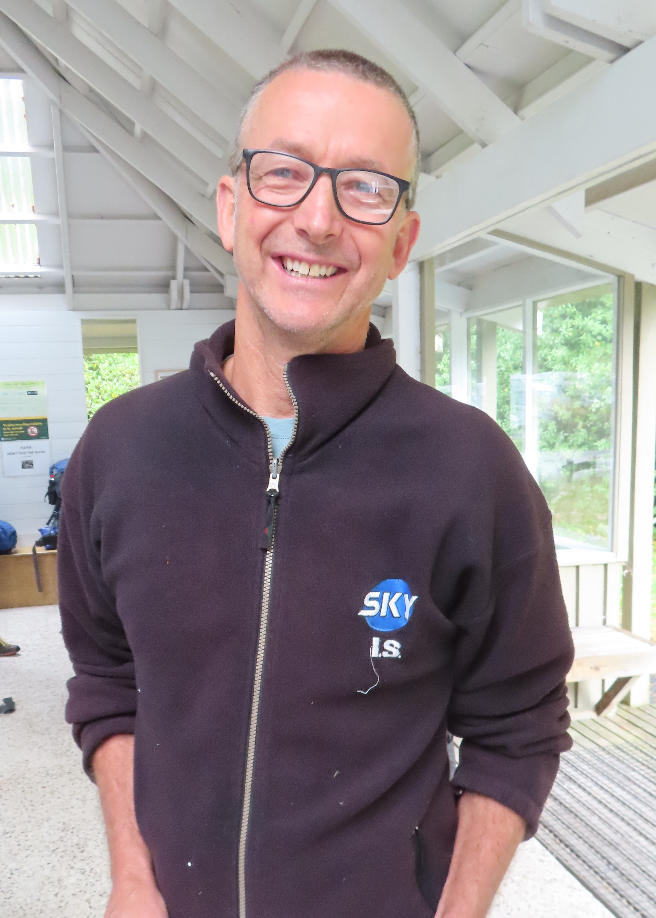
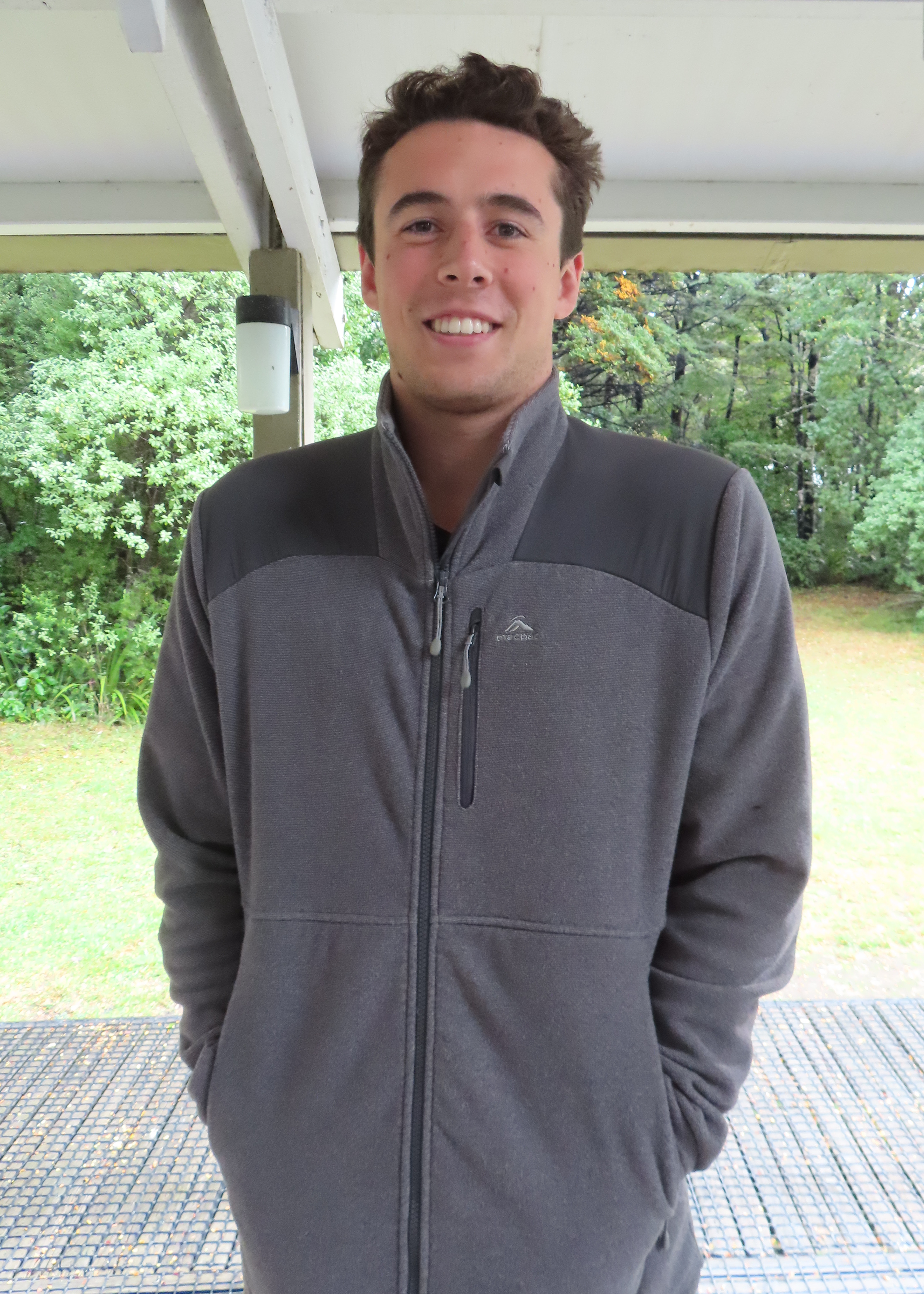
Moa Hunters on this trip: Paul, Luke
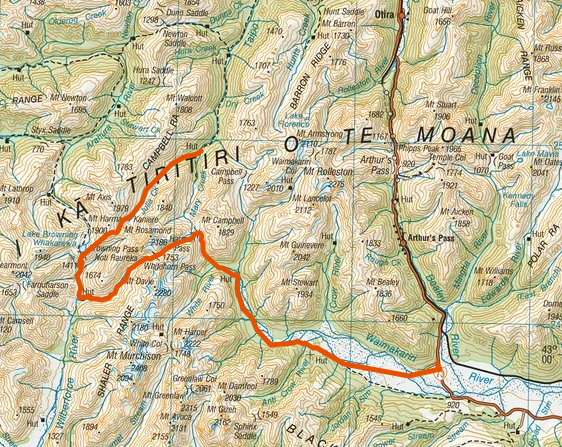
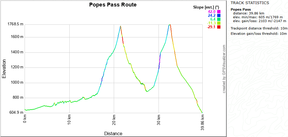
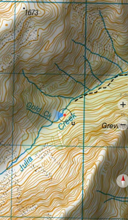
Topomap of the route into the Taipo
Introduction
This route makes an interesting variation to the classic 3 Passes trip, with the added bonus feature of being able to return to your vehicle at Klondyke corner, if you choose to return over Harman Pass.
There are many descriptions of the Three Passes trip available, so I won’t add much here, except to say that after dropping off Whitehorn pass into the Cronin Stream, at the point where the valley opens a little, there is a small shelf on the true left, about 10-20 metres above the stream. It is well worth climbing onto this shelf, as there is a well-trodden path that makes the journey down the Cronin considerably faster and more pleasant.
For experienced route trampers, the crossing of Pope’s Pass is not too arduous, however the walk from Lake Browning to Julia Hut is a lengthy day. There are a number of accounts of people arriving at Julia Hut well after dark or, not arriving at all and having to camp is the scrub. So be advised, it is a looong way.
You don’t need to rush, just start early and don’t underestimate how long the Julia river portion takes.
Browning Pass to Julia Hut
There had been little rain for about 4 days before this account, so streams were low and easy to cross.
We had a very pleasant night camped at Lake Browning (1360m) where there are plenty of spots to tent. The water in the lake is drinkable and you are high enough that the sandfly concentration is low. Other parties avoid carrying a tent and stay at Park-Morpeth hut, but this adds time and as mentioned before it is a long day already.
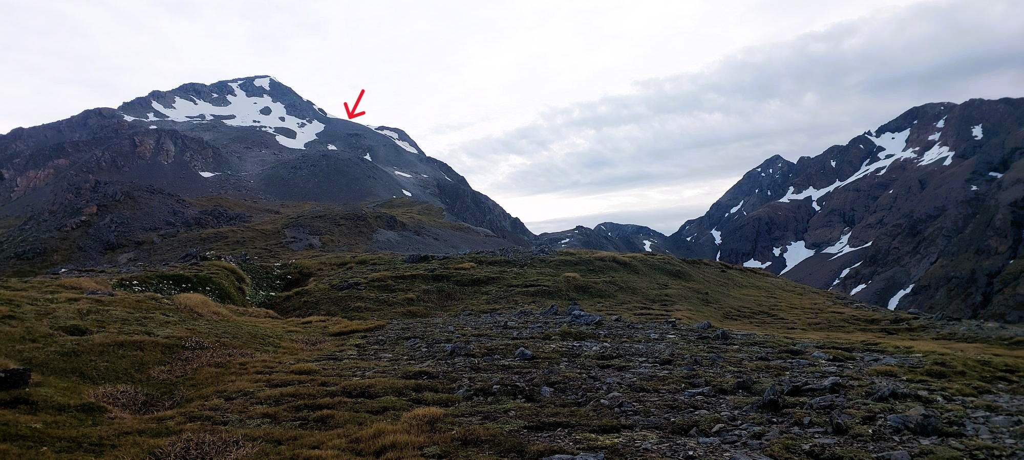
The route takes you approximately 200m above and 500m to the West of Pope’s Pass, as the pass itself is surrounded by steep loose bluffs and cliffs. From Lake Browning travel North-East up the obvious shoulder that leads in the direction of Pope’s Pass and Mt Harman.
Weather conditions were mild with little wind, so travel for us was easy. As you ascend the shoulder a cliff forms and drops away on your right, if you this keep this in sight for the start of your climb you are on the correct path.
The climb is about 400m from Lake Browning, and if you have had a good sleep and breakfast, it can be completed without undue huffing and puffing. We found a satisfying large cairn just before the highest point of the route, confirming we were on track and removing any doubts we might have had regarding our navigational skills.
At the highest point you should have Pope’s Pass to your East, a steep, short climb to Mt Harman to the West and a snow cover bench gently descending to the North.
If weather allows, it is worth dropping packs and making the short side trip to the ridge line that leads to Mt Harman. The views are fantastic views and mobile phone coverage there allows a quick call home to reassure the nearest and dearest that you are on track and doing well (and you can get a weather report).
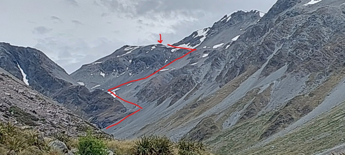
After returning to your Packs, continue almost due North along 400m to the end of the gently descending 50m wide snow bench. The bench takes you above several bluffs that drop to your right into Pope’s pass. Once past the end of the bench turn east and break out your walking poles for the 200m steep descent (it feels like a lot further) down the sparsely covered scree ALL the way to the stream at the end.
Note: there are dark and slightly ominous looking small cliffs rising where the scree ends. Worry not, the stream runs along the base of these cliffs and is relatively easy to follow. When you reach the stream, travel downstream until it makes a significant right turn, at this point, leave the water course and climb north up and over the small bluff, thus avoiding dropping over a waterfall.
Descend the final steep part from the bluff into the main Julia Creek valley floor. If you are running to time, this is the perfect spot to stop, take the boots off, rest the feet and knees from all the descending and enjoy lunch as the steep section is now complete.
However, the long river bed trek is about to begin…
Follow the Julie creek downstream for 2-3 hours. The river regularly disappears for long sections into the rocks of the valley floor, so if the water disappears, back track and fill your water bottles, as it may be sometime before you get another chance.
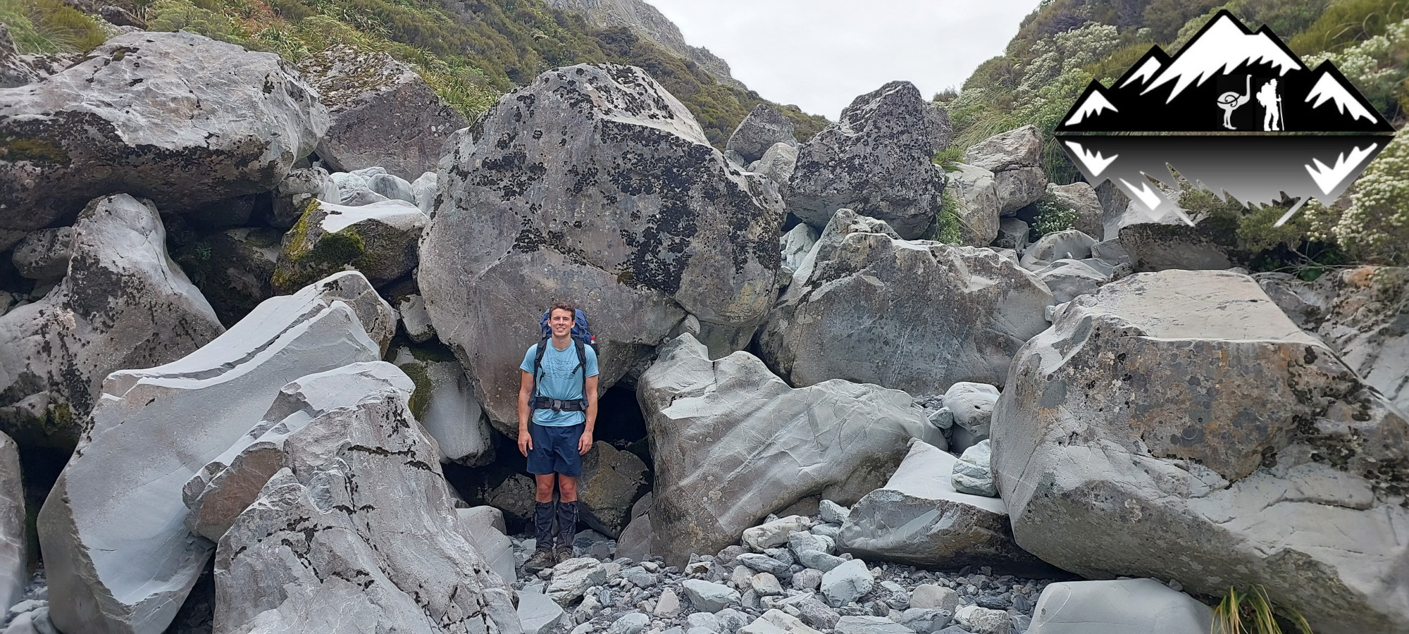
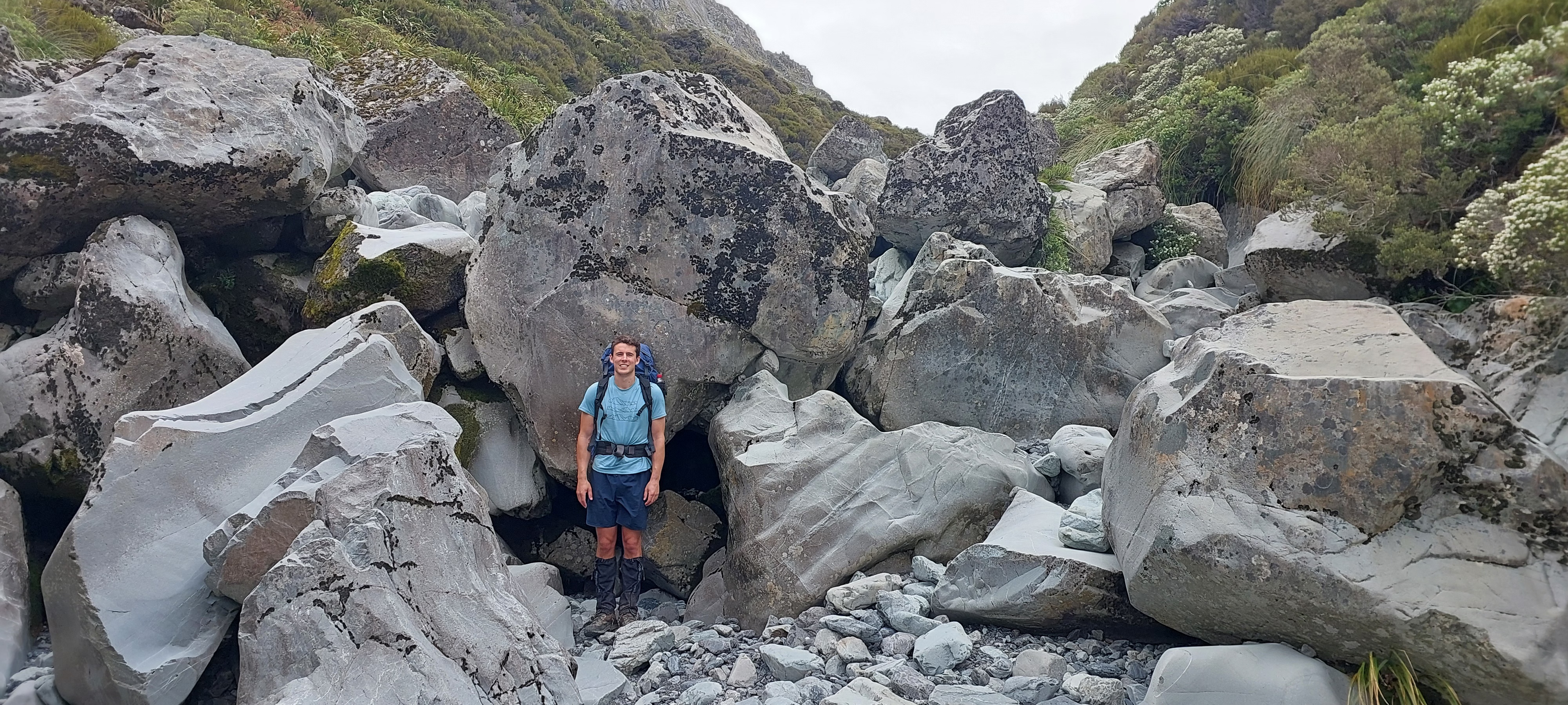
Luke at 190cm very tall, made relatively speedy work of the river-bed boulder hopping and progress was quick until Julia creek permanently re-emerged from the rocks and the surrounding scrub thickened and closed into the banks of the creek. It is at this point you need to keep an eye out on the true right for the marker that indicates the start of the old track to the Julia Hut.
The track may be poorly formed and in need of maintenance, but it is well worth finding as Julia creek eventually fills the riverbed and would make for difficult, slow and wet travel. The track starts up a very mossy overgrown tumble of rocks where a small side stream enters from the true right. Follow the track for about 1.5 hours across old scree, slips and through scrubby vegetation. Often climbing and dropping in short bursts through tangled scrub on the steep slope. Not fast travel, but highly preferable to the now closed in and full Julia creek.
Near the hut the scrub gets taller and full-sized trees appear. The track drops into down into the now wider riverbed for sections. While in the river-bed keep an eye out on the right bank for markers that show the track to the swing bridge over Mary creek, as you will need to use the swing bridge to get across. Once at the swing bridge you are but minutes from the Julia Hut and another 10mins to the soothing hot pools.
SUMMARY
Our trip took nine hours: 07:00 to 16:00.
Top tips:
- Walking poles are very useful in the snow at the top and on the steep scree decent.
- Wear good strong boots. A party of three arrived at Julia hut at midnight after crossing Pope’s pass behind us. Two of them were wearing trail runners that were by this time pretty much destroyed!
- Start early, give your self plenty of hours. Find a pace that covers the distance efficiently without being in a hurry.
From Julia Hut you have multiple options for the next days:
- Return over Harman Pass to your Vehicle
- All the way down the Taipo to SH73
- Follow the Taipo partway, then up to Carroll Hut and down to SH73 closer to Otira. We have had good luck hitching a ride from here back to Klondyke corner.

I have recently been tramping in the top half of the south island and seen your sticker so here I am among the Moa Hunters reading your reports and photos. Excellent name. I was all the more intrigued as last year as I proceeded from Theatre Flat (Five Passes route )through a scrubby section to a meadow of long golden grass from which the early morning sun was conjuring a layer of mist, I felt as if I had approached the ultimate sanctuary of the Moa. I did not dear to continue fearing disturbing them. Perhaps they once lived there causing these thoughts to appear, never the less it was a powerful emotion and a treasured experience.
You have a wonderful list of tramps, some I have done and more I hope to do next summer. Thanks for the tips
regards, Eddy
Hi Eddy.
Thank you for taking the time to leave a comment – we always enjoy hearing from fellow trampers.
From what you say, you followed in our tracks in the North of the South Island, and now we are about to follow in yours. In less than a week, we will be down in Mt Aspiring National Park for our 2026 Moa Hunt doing the Five Passes. Fingers crossed for fine weather!
Cheers,
Adam and the Moa Hunters.